Jordan Atomic Energy Commission Site Selection and Characterization for Nuclear Power Plant in JORDAN By Dr. Kamal Khdier IAEA Technical Meeting on Common Challenges on Site Selection for Nuclear Power Plant Vienna, Austria, July 6-9, 2010
Transcript
Jordan Atomic Energy Commission
Site Selection and Characterization for Nuclear Power Plant in JORDAN
ByDr. Kamal Khdier
IAEATechnical Meeting
on Common Challenges on Site Selection for Nuclear Power Plant
Vienna, Austria, July 6-9, 2010
INTRODUCTIONThe Objective of Site Survey and Selection;To ensure, on the basis of available international standards
and guidance, stability and protection for the nuclear power plant facilities and adequate protection of site personnel, public and the environment from the effects of ionizing radiation arising from nuclear installations
Phases of Site Survey;– Phase 1 – Regional analysis to identify potential sites– Phase 2 – Screening of potential sites to select candidate sites
– Phase 3 – Screening, comparison and ranking of candidate sites to obtain the preferred candidate sites
Site Selection Criteria
A preliminary regional analysis were carried out for identification of potential sites.
The analysis were based on the following criteria:
1. The suitability of the site for highly cost, heavy construction, were the following parameters have been studied:A. The topography, morphology, and ground stability.B. The geology, structural geology, and soil mechanics.C. The seismology of the area.
2. The availability of water for steam generation, cooling, and other uses.
3. The possible impact on public health and environment under normal operation and in case accident.
4. The distance from the electrical transmission network.5. The economical feasibility of the site
4
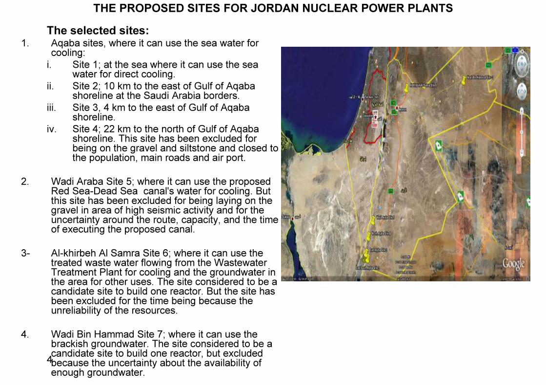
The selected sites:1. Aqaba sites, where it can use the sea water for cooling:
i. Site 1; at the sea where it can use the sea water for direct cooling. ii. Site 2; 10 km to the east of Gulf of Aqaba shoreline at the Saudi Arabia borders. iii. Site 3, 4 km to the east of Gulf of Aqaba shoreline. iv. Site 4; 22 km to the north of Gulf of Aqaba shoreline. This site has been excluded for being on the gravel and siltstone and closed to the population, main roads and air port.
2. Wadi Araba Site 5; where it can use the proposed Red Sea-Dead Sea canal's water for cooling. But this site has been excluded for being laying on the gravel in area of high seismic activity and for the uncertainty around the route, capacity, and the time of executing the proposed canal.3- Al-khirbeh Al Samra Site 6; where it can use the treated waste water flowing from the Wastewater Treatment Plant for cooling and the groundwater in the area for other uses. The site considered to be a candidate site to build one reactor. But the site has been excluded for the time being because the unreliability of the resources. 4. Wadi Bin Hammad Site 7; where it can use the brackish groundwater. The site considered to be a candidate site to build one reactor, but excluded because the uncertainty about the availability of enough groundwater.
THE PROPOSED SITES FOR JORDAN NUCLEAR POWER PLANTS
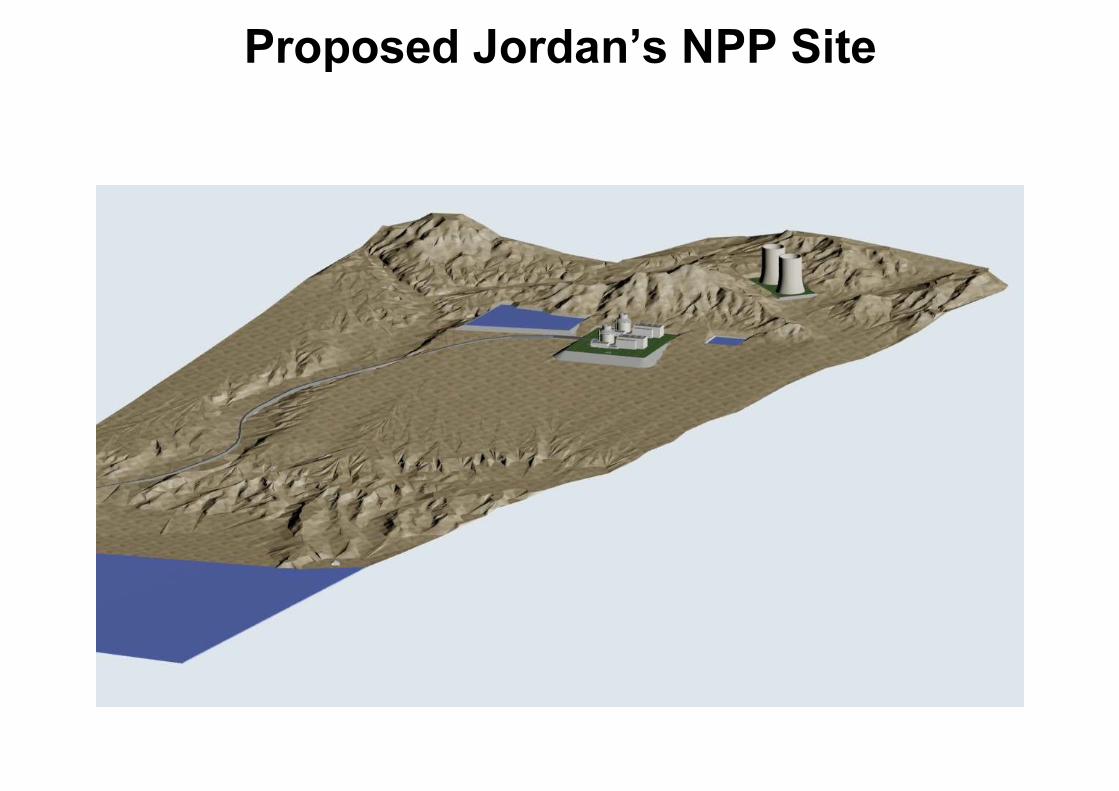
The Preferred SiteThe Preferred Site is located approximately 9 km east of the Gulf of Aqaba coast line, at an elevation of 450 meters above sea level. It lies at the foothill of the eastern mountain ridge which consists of granite igneous rock and gravel sediments of weathered granite debris, sandstone, siltstone and marl clay.A desalination plant, pumping station and other related facilities, will be located on the coast of the Gulf of Aqaba, where Reverse Osmosistechnology will be used to supply the NPP with the required amount of fresh water. The desalinated water will be pumped from the plant to the NPP.
Site Selection and Characterization Milestones� Step 1 : Regional survey. Aqaba selected as a suitable location.� Step 2 : Site selection & characterization which entails all the necessary studies needed for the preparation of Chapter 2
of the Preliminary Safety Analysis Report (PSAR) and the Environmental Report, which will include:� The suitability of the site;
� Geological, structural geology, geophysical and geo-technical engineering,� Meteorology� Hydrology
� Human induced events;� Geography and demography� Nearby industries, transportation, and military facilities
� Environmental report;� Public health� Terrestrial environment� Marine and aquatic environment� Air pollution
� Water requirement and cooling water options including desalination plant� Grid connections� Emergency and evacuation plan� Conceptual layout� Risk assessment.
Scales of investigations
Site area(~1 km2)
25 km(maps scale 1:50 000)
>150 km(maps scale 1:500 000)
5 km(maps scale 1:5 000)
Regional scaleNear regional scaleSite vicinityObjectives:•Neotectonic fault history•Potential for surface faulting
A need for application of increased effortsA need for application of increased efforts
Geological, geophysical and geotechnical databases
Objectives:•General geodynamic setting•Characterization of geological features•Delineation of seismogenic sources
Objectives:•Permanent ground displacement•Dynamic properties of foundation materials
Regional Tectonics
The Geology and Structure in the Study Area
Detailed Geological Map for the Study Area
The seismic Activity in the Region including the Instrumental Earthquakes (Ms more than 4) of the Dead Sea Transform region for the period 1900-
2008. Data from the Jordan Seismological Observatory (JSO).
The seismic activity in the last 20 years could be characterized by the incident of swarm earthquakes. Among the most significant are:
• The 1983 swarm with a maximum magnitude of 5.3 with the epicenters concentrated in the northern tectonic block of the Gulf of Aqaba.
• The 1993 swarm with a maximum magnitude of 5.6 with the epicenters concentrated in the middle tectonic blocks.
• The 1995 swarm which had a maximum magnitude of 7.2 where the epicenter of the main event was located 80 km to the south of Aqaba City. This earthquake was the main shock of the earthquake sequence that possibly extended up to 1998 (Figure 8).
Probabilistic Seismic Hazard Analysis (PSHA)• Probabilistic Seismic Hazard Analysis (PSHA) is carried out using the most recent earthquake
catalogue of both historical and the instrumentally recorded events for Jordan and conterminous area and employing well known international attenuation equations, including a locally derived ground acceleration (PGA) attenuation model, the Peak ground acceleration (PGA) is determined for the NPP site project.
• The determined PGA is based on a return period of approximately 475 years, i.e., the Operating-Basis Earthquake ground motion (OBE) representing a probability of exceedance of 10% with 50 years exposure time, and for a return period of approximately 10000 years, i.e., the Safe Shutdown earthquake ground motion (SSE) representing a probability of exceedance = 0.5% with exposure time of 50 years. The analysis is extended further to include the results of PGA for a return period of 975 and 2475 years.
• Based on the analysis performed in this study, the following conclusions may be drawn:
• The operating basis earthquake (OBE), with a return period of approximately 475 years, calculated for the Aqaba NPP site is 0.167g.
• The Safe Shutdown earthquake ground motion (SSE) will produce the maximum level of ground motion according to which the NPP should be designed or analyzed. The resulting SSE bedrock acceleration applicable to this exceedance range between 0.33- 0.5g
• The determined PGA value for both OBE and SSE represents the mean peak ground acceleration using the three different attenuation equations used in this study, i.e., Ambraseyes et al. (1996); Boore-Joyner-Fumal (1997) and Malkawi and Fahmi (1996).
Ground motion prediction equation plot
0.001
0.01
0.1
1
10
1 10 100 1000Distance (km)
Peak
Gro
und A
ccele
ration
(g)
Malkawi-Fahmi (1996) Combined, Magnitude: 5 MsMalkawi-Fahmi (1996) Combined, Magnitude: 6 MsMalkawi-Fahmi (1996) Combined, Magnitude: 7 MsAmbraseyes et al (1996), Magnitude: 5 MsAmbraseyes et al (1996), Magnitude: 6 MsAmbraseyes et al (1996), Magnitude: 7 MsBoore-Joyner-Fumal (1997), Magnitude: 5 MsBoore-Joyner-Fumal (1997), Magnitude: 6 MsBoore-Joyner-Fumal (1997), Magnitude: 7 MsStrong Motion Value (4.9<Ms<6)Strong Motion Value (5.9<Ms<7)
Uniform Hazard Spectra using Ambraseyes et al. (1998)
15
Locating the NPP
Emergency PlanningIn order to minimize health and safety risks, a buffer and emergency zones should be identified around the NPP:1.Exclusion Zone (the NPP site);
extends to 1 km from the plant.
1.Protective Zone (low population zone); extends to 5 km from the plant.
1.Emergency Planning Zone;extends to 20 km from the plant.
Cooling Water Options• Construction a desalination plant at the see shoreline (area 1,2 &3 in the map) to provide required amount of water (approximately 200MCM/a) for cooling purposes and other uses. In this case the desalinated water has to be pumped from the desalination plant to the NPP site at 9km to the east and at elevation of about 450 meters above sea level ( area 4&5 in the map).• Using the area 1,2 &3 as an intake site for sea water to be pumped to the NPP site and the desalination plant which will be constructed at the NPP vicinity and the rejected water has to be discharged back to the sea. • Using desalinated water from a the Jordan Read Sea Project Central Desalination Plant at 15 km to the north of Aqaba. In this case the desalinated plant will be pumped to the NPP site along the rout as shown in the map.
Proposed Jordan’s NPP Site
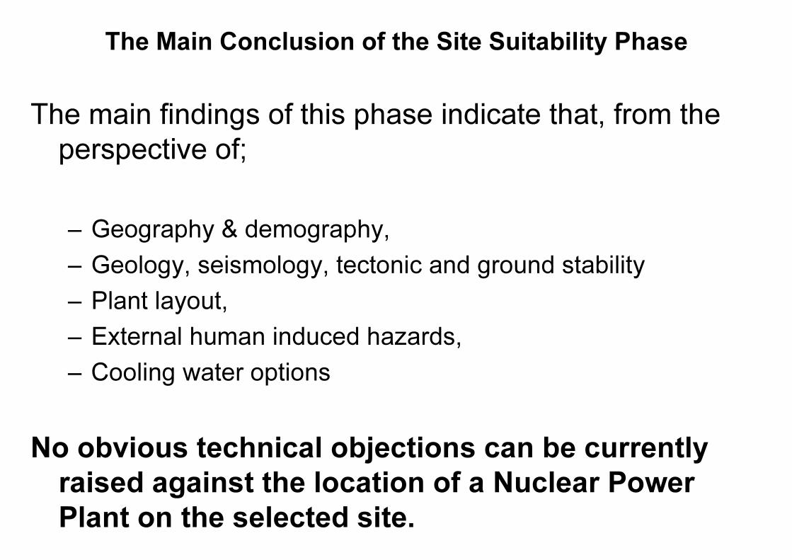
The Main Conclusion of the Site Suitability Phase
The main findings of this phase indicate that, from the perspective of;
– Geography & demography,– Geology, seismology, tectonic and ground stability– Plant layout,– External human induced hazards, – Cooling water options
No obvious technical objections can be currently raised against the location of a Nuclear Power Plant on the selected site.
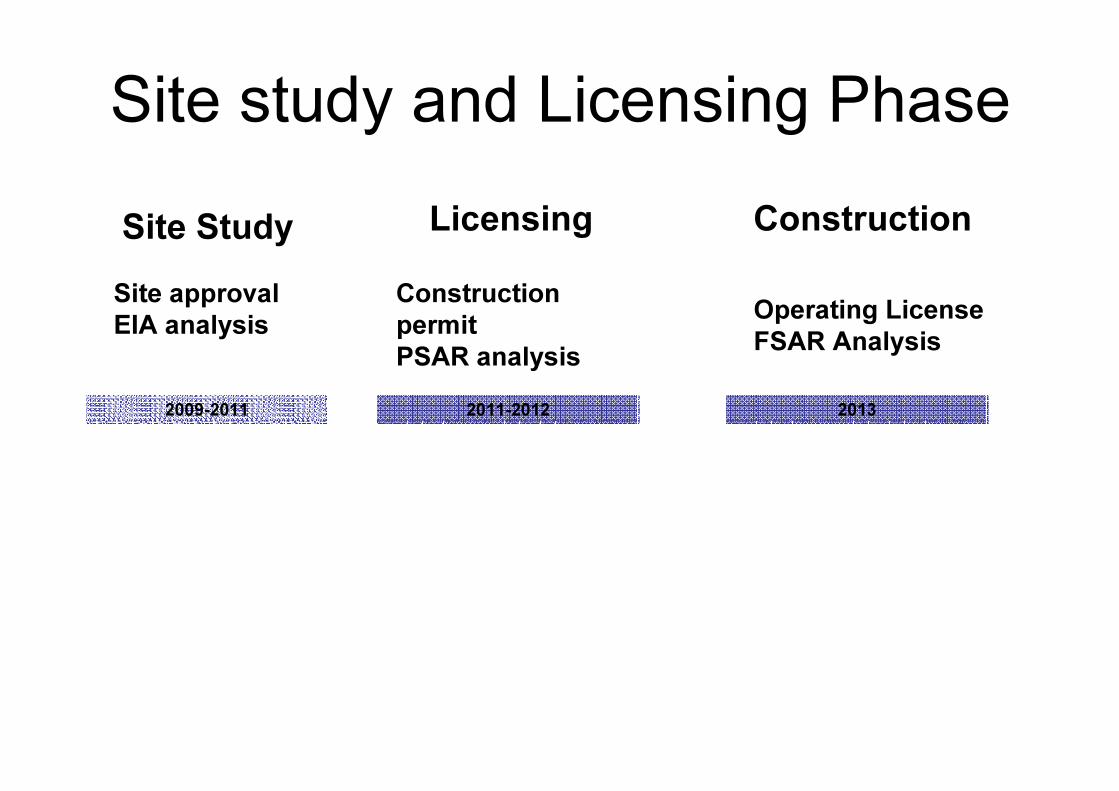
Site study and Licensing PhaseLicensing ConstructionSite Study