56
Ke Kula Wela La o Pahua The Cultural and Historical Significance of Pahua Heiau, Maunalua, O‘ahu
Ke Kula Wela La o Pahua The Cultural and Historical Significance of Pahua Heiau, Maunalua, O‘ahu
2
Research Division
Land, Culture, and History
May 2014
Holly Coleman, M.A.
Research Analyst
Front and Back Cover: Pahua Heiau, Maunalua, O‘ahu. Source: OHA, 2014.
3
Executive Summary
Executive Summary OHA received its first landholding, Pahua Heiau, in 1988. Pahua sits on a small
1.15 acre parcel of land located in southeastern O‘ahu in a residential neighbor-
hood of Maunalua (which is now known as Hawai‘i Kai).
This report seeks to explore the cultural and historical narratives of Pahua Heiau.
It is hoped that this effort will renew a modern, collective understanding of Pahua
as a wahi pana (storied place) and will guide stewardship practices within OHA.
Pahua remains a vital cultural and historical resource for Native Hawaiians and
the broader community. The goal of this report is to make important ‘ike ‘äina
(intimate and nuanced knowledge about a place) about Pahua Heiau more readily
available to the public, and will hopefully inform future decisions about the site.
OHA seeks to steward Pahua in a way that fulfills OHA’s kuleana to Native Ha-
waiians, honors Pahua as a wahi pana (storied, noted, legendary place), and ac-
tively involves the community in care of the site. In particular, Pahua represents
an important opportunity to develop and implement strategies that are rooted in
traditional Native Hawaiian cultural practices and informed by Native Hawaiian
epistemologies in ways that cultivate meaningful, impactful, and long–term stew-
ardship.
4
Table of Contents
Table of Contents
EXECUTIVE SUMMARY 3
INTRODUCTION 7
OHA AND PAHUA HEIAU 7
REPORT FRAMEWORKS AND METHODOLOGIES 9
WAHI PANA AS A FRAMEWORK FOR MANAGEMENT 9 PAHUA HEIAU AS A WAHI PANA 10 HISTORICAL SOURCES AND MATERIALS 10
PAHUA HEIAU 13
SIGNIFICANCE OF HEIAU IN NATIVE HAWAIIAN CULTURE AND SOCIETY 13 THEORIES OF THE USE AND SIGNIFICANCE OF PAHUA HEIAU 14 INOA WAHI AND INOA ‘ÄINA: THE IMPORTANCE OF PLACE NAMES 16 PAHUA AS A PLACE NAME 17
PAHUA AS A REFERENCE TO DRUMS 18 PAHUA AS A REFERENCE TO RANCHING 18 PAHUA AS A REFERENCE TO HULA 19 PAHUA AS A REFERENCE TO WATER CHARACTERISTICS 19 PAHUA AS A REFERENCE TO GODS AND PEOPLE 20
MAUNALUA AND THE SURROUNDING AREAS 23
MAUNALUA AS A PLACE TO SUSTAIN LIFE 24 KEAHUPUA O MAUNALUA 25 MO‘OLELO ‘ÄINA OF MAUNALUA 26
DEVELOPMENT AND URBANIZATION IN MAUNALUA 29
ARCHAEOLOGICAL STUDY, PRESERVATION AND RESTORATION OF PAHUA 31
WAHI PANA AND ‘IKE ‘ÄINA IN STEWARDSHIP OF PAHUA 35
HISTORICAL PHOTOGRAPHS OF MAUNALUA AND PAHUA 41
REFERENCES 51
5
List of Figures FIGURE 1. THE ISLAND OF O‘AHU AND MAUNALUA 24 FIGURE 2. EXCERPTS FROM THE HAWAIIAN LANGUAGE NEWSPAPER KE AU OKOA 27 FIGURE 3. ARCHAEOLOGICAL DRAWING OF PAHUA HEIAU FROM A BIRD’S EYE VIEW 33 FIGURE 4. ARCHAEOLOGICAL DRAWINGS OF PAHUA HEIAU SHOWING WALL AND 34
TERRACE PLACEMENT
Table of Contents
6
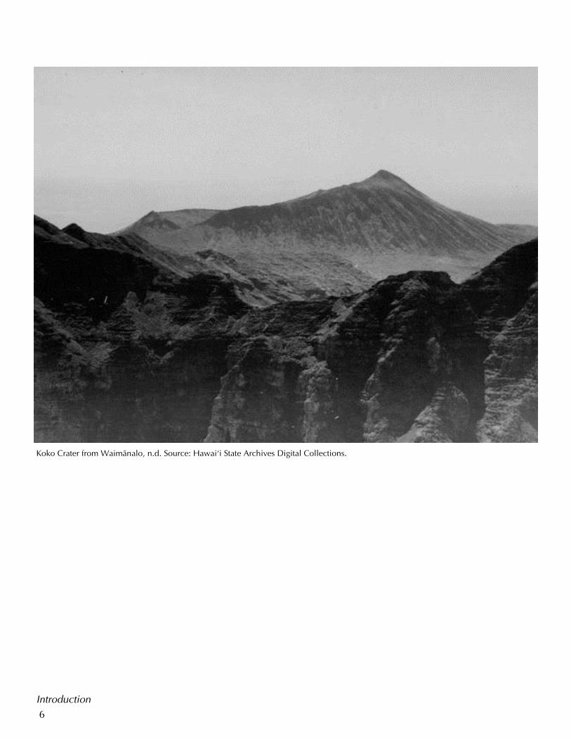
Introduction
Koko Crater from Waimänalo, n.d. Source: Hawai‘i State Archives Digital Collections.
7
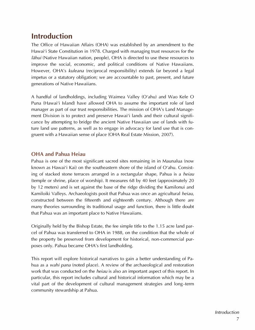
Introduction The Office of Hawaiian Affairs (OHA) was established by an amendment to the
Hawai‘i State Constitution in 1978. Charged with managing trust resources for the
lähui (Native Hawaiian nation, people), OHA is directed to use these resources to
improve the social, economic, and political conditions of Native Hawaiians.
However, OHA’s kuleana (reciprocal responsibility) extends far beyond a legal
impetus or a statutory obligation; we are accountable to past, present, and future
generations of Native Hawaiians.
A handful of landholdings, including Waimea Valley (O‘ahu) and Wao Kele O
Puna (Hawai‘i Island) have allowed OHA to assume the important role of land
manager as part of our trust responsibilities. The mission of OHA’s Land Manage-
ment Division is to protect and preserve Hawai‘i lands and their cultural signifi-
cance by attempting to bridge the ancient Native Hawaiian use of lands with fu-
ture land use patterns, as well as to engage in advocacy for land use that is con-
gruent with a Hawaiian sense of place (OHA Real Estate Mission, 2007).
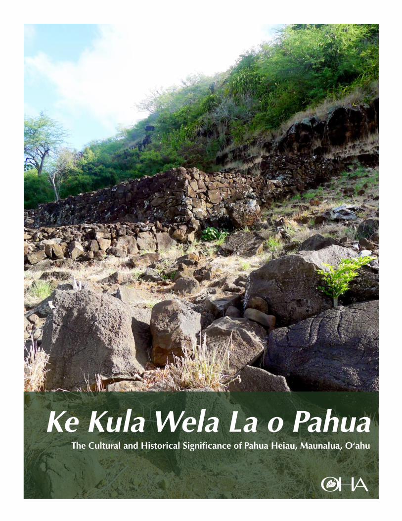
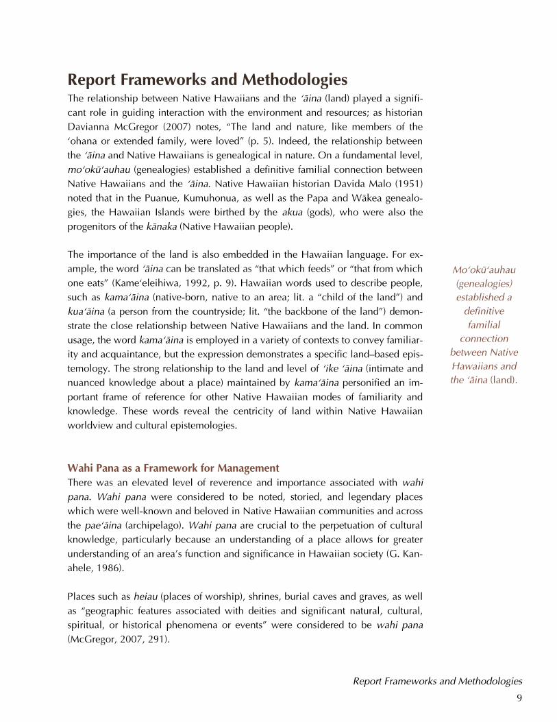
OHA and Pahua Heiau Pahua is one of the most significant sacred sites remaining in in Maunalua (now
known as Hawai‘i Kai) on the southeastern shore of the island of O‘ahu. Consist-
ing of stacked stone terraces arranged in a rectangular shape, Pahua is a heiau
(temple or shrine, place of worship). It measures 68 by 40 feet (approximately 20
by 12 meters) and is set against the base of the ridge dividing the Kamilonui and
Kamiloiki Valleys. Archaeologists posit that Pahua was once an agricultural heiau,
constructed between the fifteenth and eighteenth century. Although there are
many theories surrounding its traditional usage and function, there is little doubt
that Pahua was an important place to Native Hawaiians.
Originally held by the Bishop Estate, the fee simple title to the 1.15 acre land par-
cel of Pahua was transferred to OHA in 1988, on the condition that the whole of
the property be preserved from development for historical, non-commercial pur-
poses only. Pahua became OHA’s first landholding.
This report will explore historical narratives to gain a better understanding of Pa-
hua as a wahi pana (noted place). A review of the archaeological and restoration
work that was conducted on the heiau is also an important aspect of this report. In
particular, this report includes cultural and historical information which may be a
vital part of the development of cultural management strategies and long–term
community stewardship at Pahua.
Introduction
Koko Crater from Waimänalo, n.d. Source: Hawai‘i State Archives Digital Collections.
8
Report Frameworks and Methodologies
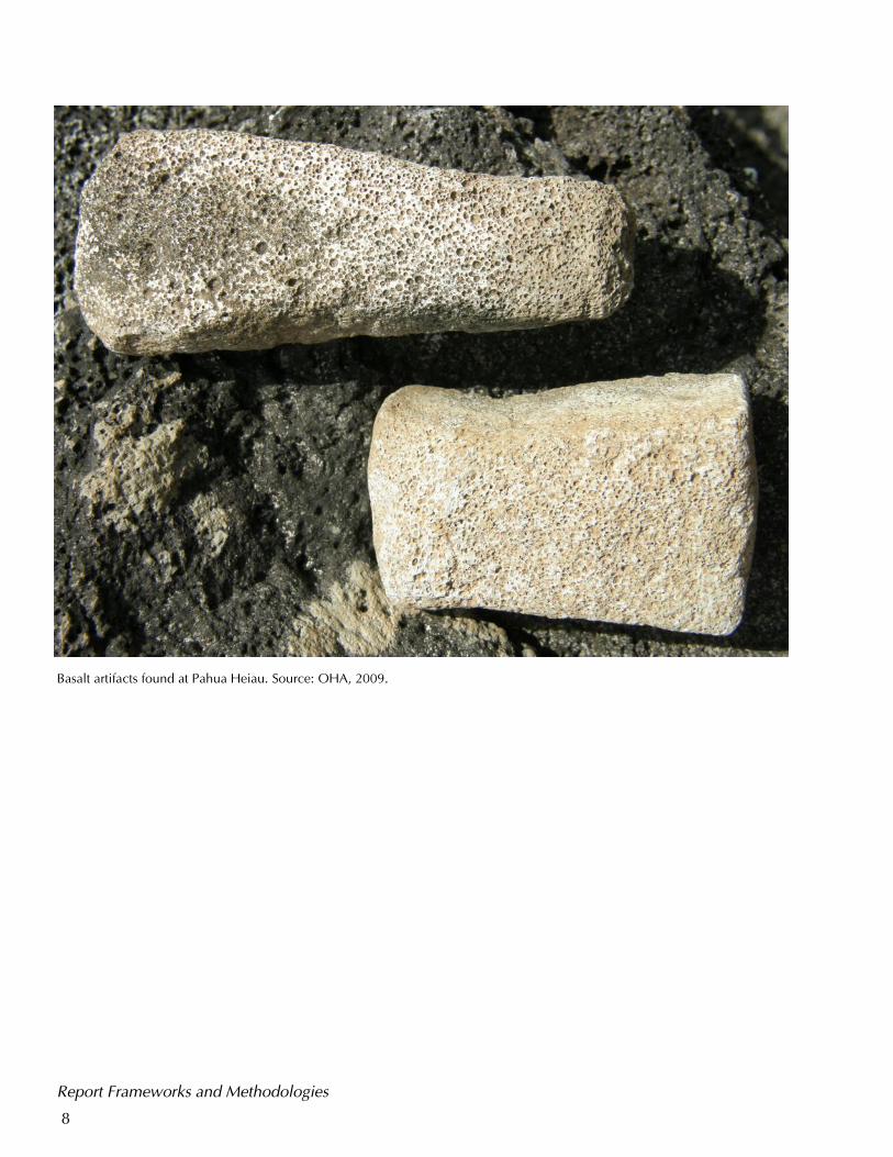
Basalt artifacts found at Pahua Heiau. Source: OHA, 2009.
9
Report Frameworks and Methodologies The relationship between Native Hawaiians and the ‘äina (land) played a signifi-
cant role in guiding interaction with the environment and resources; as historian
Davianna McGregor (2007) notes, “The land and nature, like members of the
‘ohana or extended family, were loved” (p. 5). Indeed, the relationship between
the ‘äina and Native Hawaiians is genealogical in nature. On a fundamental level,
mo‘okü‘auhau (genealogies) established a definitive familial connection between
Native Hawaiians and the ‘äina. Native Hawaiian historian Davida Malo (1951)
noted that in the Puanue, Kumuhonua, as well as the Papa and Wäkea genealo-
gies, the Hawaiian Islands were birthed by the akua (gods), who were also the
progenitors of the känaka (Native Hawaiian people).
The importance of the land is also embedded in the Hawaiian language. For ex-
ample, the word ‘äina can be translated as “that which feeds” or “that from which
one eats” (Kame‘eleihiwa, 1992, p. 9). Hawaiian words used to describe people,
such as kama‘äina (native-born, native to an area; lit. a “child of the land”) and
kua‘äina (a person from the countryside; lit. “the backbone of the land”) demon-
strate the close relationship between Native Hawaiians and the land. In common
usage, the word kama‘äina is employed in a variety of contexts to convey familiar-
ity and acquaintance, but the expression demonstrates a specific land–based epis-
temology. The strong relationship to the land and level of ‘ike ‘äina (intimate and
nuanced knowledge about a place) maintained by kama‘äina personified an im-
portant frame of reference for other Native Hawaiian modes of familiarity and
knowledge. These words reveal the centricity of land within Native Hawaiian
worldview and cultural epistemologies.
Wahi Pana as a Framework for Management
There was an elevated level of reverence and importance associated with wahi
pana. Wahi pana were considered to be noted, storied, and legendary places
which were well-known and beloved in Native Hawaiian communities and across
the pae‘äina (archipelago). Wahi pana are crucial to the perpetuation of cultural
knowledge, particularly because an understanding of a place allows for greater
understanding of an area’s function and significance in Hawaiian society (G. Kan-
ahele, 1986).
Places such as heiau (places of worship), shrines, burial caves and graves, as well
as “geographic features associated with deities and significant natural, cultural,
spiritual, or historical phenomena or events” were considered to be wahi pana
(McGregor, 2007, 291).
Mo‘okü‘auhau
(genealogies)
established a
definitive
familial
connection
between Native
Hawaiians and
the ‘äina (land).
Report Frameworks and Methodologies
10
Places that were the subject of mo‘okü‘auhau, ka‘ao (legends), mo‘olelo
(historical narratives), mele (songs and chants), and other forms of traditional liter-
ature were also considered to be wahi pana (Ho‘omanawanui, 2008). Native Ha-
waiians maintained strong connections to these specific places, which was the
result of living and working directly on the land. Individuals who were native to
an area also carried unique ‘ike ‘äina that had been passed from one generation
to the next (McGregor, 2007).
Native Hawaiian beliefs and practices relating to wahi pana represent a particu-
larly appropriate framework for this report, and also provide a solid foundation for
the development of stewardship strategies at Pahua.
Pahua Heiau as a Wahi Pana
When the archaeologist J. Gilbert McAllister (1933) first documented Pahua as a
field site in the 1930s, the heiau had been abandoned for some time; he was una-
ble to definitively ascertain its function and significance, either from previously
published works or from interviews with kama‘äina living in the area. According
to noted Hawaiian language scholar Larry Kimura (1983), the loss or absence of
mo‘olelo connected to a place is often due to a disruption in the transmission of
knowledge. This seems to be the case for Pahua; the diffusion of ‘ike ‘äina sur-
rounding Pahua was likely affected by the social, political, and economic trans-
formations in Hawaiian society over time. In particular, Maunalua has been the
site of intensive urban residential development in the past fifty years.
Nonetheless, historical evidence suggests that Pahua Heiau was recognized as an
important wahi pana at one time. This study seeks to explore the cultural and his-
torical contexts of Pahua in an effort to regain a better understanding of the ‘ike
‘äina associated with the site in order to renew a modern, collective understand-
ing of Pahua as a wahi pana.
Historical Sources and Materials
The extensive research conducted for this report included the incorporation of
historical sources ma ka ‘ölelo Hawai‘i (in the Hawaiian language). Original Ha-
waiian language material published in the nüpepa (Hawaiian language newspa-
pers) which were written by prominent Native Hawaiian historians of the nine-
teenth century, such as J. K. Mokumaia, J. H. Kanepuu, Joseph Poepoe, John Papa
Ii, Davida Malo, and Samuel Kamakau, were utilized to provide general back-
ground information on Hawaiian culture and history. These accounts also provide
Individuals who
were native to an
area carried
unique ‘ike ‘äina,
cultural and
historical
knowledge, that
had been passed
from one
generation to
the next.
Report Frameworks and Methodologies
11
specific social commentary on issues facing the Native Hawaiian community.
Translations of these materials completed by scholars like Mary Kawena Pukui,
Nathaniel Emerson, Lahilahi Webb, Martha Beckwith, John Wise, and Abraham
Fornander were also utilized. Research conducted for this report was necessarily
constrained to an examination of written accounts of Pahua; although the author
attempted to include diverse source material in this report, it should be noted that
additional ‘ike may still exist in other written sources, oral histories, and special-
ized familial knowledge of the site.
Native Hawaiian mo‘olelo and archaeological surveys of Pahua, as well as the
surrounding areas in Maunalua, also provided important regional contexts for the
site and illuminated the changing ways Pahua may have been understood over
time in Hawaiian society; incorporation of these narratives in a discussion of Pa-
hua aligns with traditional Native Hawaiian understandings of place.
Report Frameworks and Methodologies
12
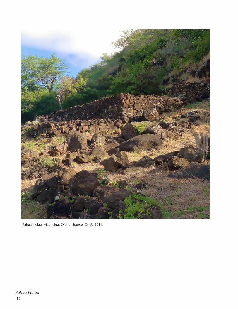
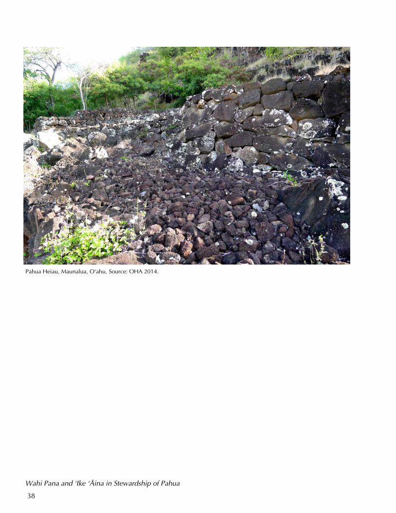
Pahua Heiau, Maunalua, O‘ahu. Source: OHA, 2014.
Pahua Heiau
13
Pahua Heiau Pahua is one of dozens of recorded archaeological sites and one of four confirmed
heiau sites in Maunalua (McAllister, 1933; Takemoto et al., 1975). The heiau sits
near the end of the ridge dividing Kamilonui and Kamiloiki Valleys. Archaeolo-
gists estimate the heiau was constructed in either 1485–1665 CE or 1760–1795
CE (Davis, 1985c). After visiting the site in the early 1930s, archaeologist J. Gilbert
McAllister (1933) noted, “The heiau is 68 by 40 feet in extent and is primarily a
built-up rock terrace with several low division walls,” (p. 65). Commenting that it
could be considered a smaller heiau, McAllister postulated that Pahua was likely
an agricultural heiau “of the husbandry type”; a native informant had told him the
name Pahua was associated with the heiau (p. 65). However, McAllister was una-
ble to learn any other cultural or historical information about the site.
Significance of Heiau in Native Hawaiian Culture and Society
The antiquarian Thomas Thrum (1906) noted that the subject of heiau “is interwo-
ven with the history, tradition, and legends of the people,” (p. 51). Indeed, heiau
represent some of the most complex religious and political structures in traditional
Native Hawaiian society, and were usually considered to be wahi pana (E. Kana-
hele, 1991). This section contains a general discussion of heiau and examines
their function in Native Hawaiian society in order to gain a better understanding
of the possible significance of Pahua.
Commonly understood to be a temple or shrine, heiau can consist of simple earth-
en terraces as well as elaborately constructed platforms. Heiau were set aside by
Native Hawaiians for specific and often elevated forms of worship. McAllister
(1933) noted that although many of his Native Hawaiian informants used the term
loosely, there was a distinction between heiau and other shrines and places of
worship. Anthropologist Valerio Valeri (1985) asserted that the term heiau “can
sometimes refer to a simple natural object or to an element in a landscape where
the god manifests himself and where sacrifices are offered to him,” (p. 173). Writ-
ing in the nineteenth century about traditional Native Hawaiian cultural practices
and beliefs, the Native Hawaiian historian Samuel Kamakau (1976) described ko‘a
(fishing shrines) as a type of heiau.
An examination of the word heiau illuminates some aspects of the function and
significance of these sites with particular consideration of Native Hawaiian episte-
mologies. The word hei was spoken and used in place of the word hai, which
means “sacrifice”; au in this sense refers to a specific region or place. Therefore,
one understanding associated with heiau/haiau is a place for sacrifices. Sacrifices
could be offerings of prayer, crops, fish and other oceanic yields, as well as hu-
Heiau (temples or
shrines) represent
some of the most
complex religious
and political
structures in
traditional
Native Hawaiian
society.
Pahua Heiau
14
man lives. As discussed, archaeologists have postulated that Pahua was an agri-
cultural heiau, suggesting that crops and other foodstuffs were used as sacrifices
at the site.
The intended function of a heiau determined its location, methods of construc-
tion, the complexity of religious–political ceremonies that would performed, as
well as the sacred nature of the site (Kamakau, 1976, pp. 129–144). Heiau repre-
sented different levels of social complexity and political power because of the
inherent demands on natural resources and labor (G. Kanahele, 1986). Malo not-
ed that while any ali‘i (chief) was free to construct a variety of agricultural heiau
and those dedicated to Lono, only an ali‘i nui (high chief) was able to build
luakini (sacrificial war temples) (1951). Native Hawaiian historian Kepelino
(2007) observed:
Aole i like ke ano o na heiau o na aoao hoomana o ka wa kahiko.
He heiau huinahalike kekahi, a o ko Kane heiau ia. He heiau
poepoe kekahi, he heiau kii ia. O koa no hoi na heiau nui, a me
ka hanohano: na na ‘lii ia e hana.
Not all heiau belonging to the different branches of worship in old
times were built alike. Some were square, as were Kane’s heiau;
rounded heiau were built for images. Large heiau varied in the
honor in which they were held: they were built by the chiefs. (pp.
58–59)
Furthermore, the function and type of heiau dictated the observation of different
sets of ceremonies and kapu (regulations and restrictions) (Malo, 1951). For ex-
ample, the number, stringency, and rarity of kapu and ceremony associated with
a heiau reflected, protected, and enhanced the mana of the place; therefore,
heiau used for elevated political and religious purposes were often associated
with kapu that were strict in nature and rigorously observed.
Theories of the Use and Significance of Pahua Heiau
If Pahua was an agricultural heiau, it is likely that the kapu surrounding it were
not exceedingly strict, and it is possible that low-ranking ali‘i of the area may
have constructed the site and worshiped there. Modern Native Hawaiian scholars
and cultural practitioners have also postulated that the other meanings evoked in
the word heiau illustrated the significance and function of heiau in Hawaiian so-
ciety. The word hei can refer to the act of “netting or snaring” (Pukui & Elbert,
1986). According to Kanahele et al. (2011), Native Hawaiians understood the
movement of the universe and the earth in various layers, realms, planes, or foun-
The intended
function of a
heiau informed
its location,
construction, the
complexity of
religious–
political
ceremonies
performed, as
well as the
sacred nature of
the site.
Pahua Heiau
15
dations; therefore, heiau were places that enabled Native Hawaiians to snare and
pull down part of the lewa (atmospheric layer associated with the akua, or gods) to
the realm of känaka.
Because heiau were places of significance, great care was taken in the processes
surrounding their construction. Kuhikuhipu‘uone (one who draws in the sand)
made up a dedicated cadre of professionals who were involved in every aspect of
heiau construction, including site selection, proposed layout and orientation, and
management of the building process. Malo noted that kuhikuhipu‘uone were
“acquainted with the heiau which had been built from the most ancient times,
from Hawaii to Kauai,” (1951, p. 161). According to Kamakau, these individuals
were kahuna hulihonua (experts of studies concerning the earth) and “their
knowledge was like that of the navigator who knows the latitude and longitude of
each land, where the rocks are, the deep places and the shallow, where it is cold
and where warm, and can tell without mistake the degrees, east or west, north or
south,” (1992, p. 154).
While working on the restoration of Pahua in the late 1980s, the archaeologist Ber-
tell Davis (1985b) noted,
The heiau sits high on the hillside above the far inland head of Kua-
pä Pond, also known as Keahupua–o–Maunalua Fishpond... In for-
mer times one could look out from this vantage point over the
broad plain surrounding the pond below and stretching eastward
across the “saddle” behind Koko Crater to Kalama and Wäwämalu
beyond. (pp. 1–3)
As Davis observed, Pahua offered strategic views of the vastness of Maunalua, a
location that was likely significant for Native Hawaiians, given the care that was
given to the placement, orientation, and construction of heiau in ancient Hawaiian
society.
The use of heiau was not always continuous, depending on its type and function.
For example, use of an agricultural heiau may have mirrored planting seasons,
while heiau dedicated to politics or war may have shifted in or out of ceremonial
use which likely coincided with the ascension of an ali’i and recognition of a new
akua (Johnson, 1983, p. 232). Heiau that had been abandoned for long periods of
time could also be reconditioned and put into use (Buck, 1957). However, regard-
less of whether a site was in use, the presence of a heiau in a particular wahi
demonstrated the sacred nature of place. Heiau were built on places that were
considered to be important; likewise, these places become consecrated and im-
bued with mana by the presence of the heiau, as well as the ceremonies and kapu
Pahua Heiau
Pahua offered
strategic views of
the vastness of
Maunalua, a
location that was
likely significant
for Native
Hawaiians.
16
associated with it. Although Pahua was no longer actively used by the nineteenth
century, it remains a wahi pana.
Inoa Wahi and Inoa ‘Äina: The Importance of Place Names
Inoa wahi or inoa ‘äina (place names) were significant in all aspects of Hawaiian
culture and epistemology. In Hawaiian society, places were named regardless of
their size, location, and environment (Bacchilega, 2007). As with personal names,
place names could also honor significant individuals and events. Intimate
knowledge of physical and spiritual characteristics of a place usually informed its
naming, and place names often contained ancestral knowledge accumulated over
generations (McGregor, 2007).
Descriptions of place and inoa wahi are ubiquitous and multifunctional in tradi-
tional literature (in both oral and more recently written mediums), purposefully
deployed as devices to evoke emotions and to trigger collective and cultural his-
torical memory (Bacchilega, 2007; Ho‘omanawanui, 2008). Therefore, considera-
tion of “Pahua” as an inoa wahi represents an important research methodology
which may result in greater understanding of the site as a wahi pana; it may also
contribute additional knowledge about the function and significance of Pahua
Heiau. In particular, Hawaiian language words contain multiple allegorical
meanings and were deliberately deployed in ways that allowed for varied inter-
pretation, depending on the intent of the speaker and the context under which it
was spoken (Kimura, 1983). A word could have different meanings depending on
its segmentation, as well as its pronunciation (marked with diacriticals in modern
Hawaiian language writings). The same was true for place names.
There is a degree of uncertainty in determining factors like date and origin that
can complicate attempts to understand the most probable contexts and meanings
of a place name, which were not static over time. Additionally, the perpetuation
and passage of knowledge that was specific to a place, particularly pertaining to
inoa wahi for certain communities, was largely interrupted by the deep societal
transformations that occurred in Hawai‘i beginning in the late eighteenth century.
For example, in an article that was published in the May 1, 1856 issue of Ka Ho-
ku o ka Pakipika, J. H. Kanepuu wrote of the loss of population in Niu, Ku-
li‘ou‘ou, Koko, Keäwawa, and other places in Maunalua during a ten-year period
between 1852 and 1862, from more than 300 people to less than 150 people.
Commenting on the general depopulation experienced by Native Hawaiians dur-
ing the mid nineteenth century, Kanepuu also noted:
Ua make ka nui o na kanaka, ua hele kekahi poe. No ka hookau-
maha o na konohiki, no ka nele kekahi i kahi ole e kanu ai na wa-
Consideration of
“Pahua” as an
inoa wahi (place
name) represents
an important
research
methodology
which may result
in greater
understanding
of the site.
Pahua Heiau
17
hi pue ai mala o keia kaha, no ka puapa i na holoholona. A he nui
no ka poe e aea wale nei o na kanaka o keia huina i koe, no ka imi
ana i wahi ola no lakou ma kahi e ae. (p. 2)
The majority of people have died, some have left. As for the bur-
dening of the konohiki (land managers), it is because some do not
have a place to plant in the sweet potato mounds of this place,
which are overrun by animals. Many of those who remain just
wander about aimlessly, seeking a means of livelihood elsewhere.
As suggested by Kanepuu, the rapid depopulation of Maunalua during the nine-
teenth century would complicate the transmission of ‘ike ‘äina pertaining to specif-
ic places, and was likely a significant factor in the loss of historical and cultural
knowledge surrounding Pahua.
Pahua was the only name recorded for the heiau as given by a Native Hawaiian
informant to McAllister in the early 1930s. Despite the possibility that Pahua was
not the original or proper name for the site, limited historical evidence suggests
that it was. For example, Pahua is also documented as a name for the area in
nüpepa (Hawaiian language newspapers) during the early and mid-1800s. Refer-
ence to Pahua as a place is found in one of the first kanikau (chant of mourning)
ever printed in the nüpepa. In the August 8, 1834 issue of Ka Lama Hawai‘i, David
Malo used the phrase “noho anea kula wela la o Pahua,” (tarrying in the vibrating
heat of the hot plains of Pahua) in a kanikau he composed for Queen Ka‘ahumanu;
based on the context of the rest of the kanikau, which mentions important place
names in a literary circuit of the island of O‘ahu, the line was clearly referring to
the area in Maunalua as Pahua. The kanikau was reprinted in its entirety in the
October 28, 1835 issue of Ke Kumu Hawai‘i and the April 29, 1857 issue of Ka
Hae Hawai‘i, reflecting the fact that the area was still known as Pahua during the
mid–1800s. Reference to the plains of Pahua is also found in a kanikau written for
the ali‘i Abner Kahekili in the August 8, 1843 issue of Ka Nonanona. Articles in Ka
Hae Hawai‘i and Ka Nupepa Kuokoa also continued to mention Pahua as a place
name for the general area during the 1860s.
Pahua as a Place Name
Some academic study has been devoted to an analysis of the word Pahua. McAllis-
ter and other scholars have posited that Pahua may have been an agricultural
heiau; the interpretation of the word pä–hua as “an enclosure of fruits” has been
used as a support for this point. Indeed, the word hua not only has meanings asso-
ciated with fruit, ovum, and seeds, but also with general fertility and fruitfulness
(particularly as applied to a high agricultural yield; the verb hua means to sprout,
Pahua Heiau
The rapid
depopulation of
Maunalua during
the nineteenth
century would
complicate the
transmission of
‘ike ‘äina.
18
to bud, and to bear fruit). Hua is also the name for a lunar phase; Native Hawai-
ians believed Hua to be the first of four full moons, and was considered to be an
especially auspicious and important time for planting and fishing. Additionally,
Maunalua was formerly famous for intensive sweet potato production. Archaeo-
logical work at Pahua has revealed that the heiau was built over smaller stone
formations that may have been part of the agricultural infrastructure used to pro-
duce sweet potatoes, which may indicate that Pahua was indeed used for agricul-
tural purposes.
Pahua as a Reference to Drums
The word pahu can refer to a drum. Häwea and ‘Öpuku were two of the most
famous and sacred drums in Hawaiian history, and were prominent in many im-
portant religious ceremonies on O‘ahu; the use of Häwea and ‘Öpuku has been
recorded at Kükaniloko, a birthing place of the ali‘i (McKinzie, 1986). Both drums
were said to have strong ties to the Maunalua area. According to Kamakau
(January 12, 1867), a man named Ha‘ikamälama from the Maunalua area heard a
drum as the chief La‘amaikahiki and his retinue landed their canoes at Kawahao-
kamanö in Waihaukalua. Pretending the people of O‘ahu were familiar with the
pahu, Ha‘ikamälama was able to inspect the drum ‘Öpuku; it was from this en-
counter that Ha‘ikamälama learned to make pahu, which subsequently spread
throughout Hawai‘i (Kamakau, January 12, 1867). It has been speculated that
Häwea Heiau, which is located to the west of Pahua, once housed the sacred
drum Häwea (McKinzie, 1986). Although it is not known whether there was an
association between Häwea Heiau and Pahua, there is a possibility that Pahua
was a heiau that once housed the sacred drum ‘Öpuku. Additionally, the word
pahua can be understood as pahu–‘ä, meaning the fiery drum. The cultural asso-
ciation of fire with the kapu and status of high ranking ali‘i, as well as akua, may
also be significant, considering the use of Häwea and ‘Öpuku in chiefly religious
ceremonies and the description of Pahua as kula wela in the kanikau composed
for the ali‘i Ka‘ahumanu and Abner Kahekili (Mckinzie, 1986; Malo, August 8,
1834; Ka Nonanona, August 8, 1843).
Pahua as a Reference to Ranching
One meaning of the word pahua is “down–trodden,” which can be used to de-
scribe grass that has been flattened (Pukui & Elbert, 1986). Although rare, this un-
derstanding of pahua correlates to the description of Pahua as a kula (plain) that is
found in the kanikau (laments) printed in the nüpepa. Although pahua likely held
meanings that evoked the concept of “a relatively flat expanse” that was particu-
larly applied to land, it also held meanings that were strongly associated with cat-
tle, cattle grazing, and cattle ranching. Cattle were introduced to Hawai‘i in the
late 1700s, while the first written reference to Pahua appears in the nüpepa in
1834. Maunalua was also known for cattle in the 1880s. Other variations of pa-
Archaeological
work at Pahua
has revealed that
the heiau was
built over smaller
stone formations.
Pahua Heiau
19
hua also suggest a link to cattle; the meaning of the word pähu‘a is similar to that
of kïpuka (a clearing, an oasis, a change in form) and especially refers to an area
that is free of brush and vegetation, such as a pasture where it was easy to rope
cows (Pukui & Elbert, 1986). The word pahu‘ä , (pahu, to push; ‘ä, to drive, as in
cattle) also suggests a strong association with cattle (Pukui & Elbert, 1986).
Pahua as a Reference to Water Characteristics
Other findings may provide additional insight into the meanings of the name Pa-
hua. The word pahu can convey a pushing or thrusting force or motion (as with a
spear or javelin), while the word pahü can refer a bursting forth or an explosion
(Pukui & Elbert, 1986). It is possible that the place name Pahua could have re-
ferred to a characteristic of the water in the area; for example, the place name
Waipahu or Waipahü (O‘ahu) also suggests water pushing or busting forth. Prior to
development and despite historical descriptions of the area as dry, portions of
Maunalua were known for freshwater springs and marshy environs (Stump, 1981).
In the course of the restoration of Pahua in the 1980s, archaeologist Bertell Davis
found that the rear portion of one of the heiau platforms had once been saturated
by ground water seeping from the cliff, as evidenced by the presence of a gleyed
horizon (a layer of soil that is typical of pond or wetland conditions). Davis
(1985b) noted:
One can easily imagine from this, and from the frequent appear-
ances of the many small seeps that still emerge after extended rains
(even on the slopes of Koko Crater), that in former times the whole
ridge line behind Pahua Heiau must have presented one spring af-
ter another. (p.11)
Pahua as a Reference to Hula The word Pahua is also associated with a type of hula (dance), as well as with its
dancers. Known as hula pahua, the dance was “a kind of fast hula that increases to
a frenzy said to have been named originally for a mele ma‘i [genital chant] named
Pahua (shoved),” (Pukui & Elbert, 1986). In the early 1900s, the ethnologist Na-
thaniel Emerson wrote that the hula pahua was a spear or stick dance and that it
was “a dance of the classical times that has long been obsolete. Its last exhibition,
so far as ascertained, was in the year 1846, on the island of O’ahu,” (Emerson,
1998, p.183). In fact, Bartimus Puaaike, one of the most famous early Native Ha-
waiian converts to Christianity, had been renown as an accomplished dancer of
the hula pahua prior to his conversion (Ka Nonanona, January 9, 1844). The Rev-
erend D. S. Kupahu wrote an article on various types of hula and ha’a (a dance
with bent knees) in the December 16, 1865 issue of Ka Nupepa Kuokoa, and de-
scribed the hula pahua.
Pahua Heiau
Other findings
may provide
additional
insight into the
meanings of the
name Pahua.
20
Hula pahua. O keia hula, he hula keia na ka poe kane, ina he umi
a emi mai paha, a i ole ia, e oi aku ana paha, a me kekahi wahine
hookahi. I ka manawa e hana ai o na kane, alaila, ku mai ka mea
haa, oia hoi ka olapa imua o ka poe kane, a haa mai no i o a ia
nei; a pela mau aku no e hana ai a pau na mele.
Spear Hula. This dance, it is a dance for males, perhaps ten or
less, or if not, more perhaps, and a single female. When the men
are performing, the one who is in the ha’a position (with knees
bent) will stand, the one who is a dancer in front of the men, and
that person will bend here and there; and that is how the perfor-
mance continues until the songs are finished. (p. 1)
Pahua as a Reference to Gods and People It is also possible that Pahua had been named for particular people and akua. For
example, Pahua was the name of one of eight famous warriors of the ‘Ewa and
Waialua districts of O‘ahu during the reign of the ali‘i ‘aimoku (chief over a dis-
trict or island) Kahahana in the late 1700s (Westervelt, March 30, 1906). These
warriors were known for their bravery and deft skill while defending against the
invading forces of Kahekili, the ali‘i ‘aimoku of Maui in 1783; instead of joining
the Kahahana’s gathering forces in Nu‘uanu, the group traveled to ‘Äpuakëhau
near Waikïkï to fight the Maui warriors alone. According to Kamakau ( March 30,
1867): “E hiolo ana na pololu e like me na paka–ua, aka, aohe nae he wahi mea
e poino o keia poe ahikananana, aka o kela poe koa o Maui, ua pau i ka
make,” (“The spears tumbled like raindrops, but there was not one indeed that
could harm these fierce warriors, and it was those warriors of Maui who perished
in death,”) (p.1). Although the O‘ahu forces were eventually defeated and a hand-
ful of the eight continued to fight against Kahekili, Kamakau does not mention
Pahua again.
Käne–i–ka–pahu‘a and Käne–kü–pahu‘a were also the names of an important
akua. In an interview with the anthropologist Edward Smith Craighill Handy,
Pu‘uheana (an aunt of Mary Kawena Pukui) noted;
The owl–body (kino pueo) is the body that gives a person protec-
tion from any impending harm. Because of the sacredness of his
name (the owl’s name) our forebears named him Kane–ku–pahu‘a
(Man–standing–at–the–forest–border), because his bird–body (kino
–manu) had its place at the edge of the forest. (Handy, 1941 in
Emory, 1942, pp. 200–207)
Käne–i–ka–pahu‘a is the name of the akua that is mentioned in a series of prayers
It is also possible
that Pahua had
been named for
particular
people and akua
(gods).
Pahua Heiau
21
used in the worship of Käne recounted by Robert Luahiwa (a Native Hawaiian
man from Kaua‘i) to the scholar Theodore Kelsey. According to Luahiwa, Käne–i–
ka–pahu‘a was one of the akua invoked in the “Pule Oli i ka Nähele,” which was
chanted when gathering plants for a heiau (Beckwith, 1970). According to Beck-
with (1970), “The address to Kane–i–ka–pahu‘a (Kane the thruster) is said to be to
Kane in the guise of an owl, which thrusts with wings and talons at the enemies of
his worshippers in time of battle and turns aside their weapons,” (p. 52).
The references to Käne–i–ka–pahu‘a and Käne–kü–pahu‘a may be especially sig-
nificant. The translation of the name Kane–kü–pahu‘a given by Pu‘uheana suggests
that “forest border,” was one of the meanings associated with the word pähu‘a; in
this instance, the word hu‘a refers to a “rim, border or edge.” As noted by Luahi-
wa, Käne–i–ka–pahu‘a was invoked in prayer as an akua associated with the
nähele (forest, grove). In considering the probability of these associations with Pa-
hua Heiau, it is important to note that the site is located on the bluff of a ridge be-
tween Kamilonui and Kamiloiki Valleys, which are areas that may have formerly
been the site of significant milo (Thespesia populnea ) forests (Davis, 1984). In fact,
ka milo may be literally translated as “the milo tree,” while nui and iki refer to size
of the land sections (large and small, respectively) (Maly & Wong, 1998). The for-
mer presence of milo forests in the area may be one of the reasons the heiau was
named Pahua; it may even suggest a direct affiliation of the heiau with the akua
Käne–i–ka–pahu‘a/Käne–kü–pahu‘a, who was known to take the form of an owl
and stand at the edge of the forest.
Indeed, other mo‘olelo link the areas surrounding Maunalua to akua pueo (owl
gods). According to the nineteenth century Native Hawaiian scholar Joseph M.
Poepoe (July 22, 1865) the owls of Hawai‘i, Läna‘i, Maui, and Moloka‘i gathered
at Kalapueo (near Makapu‘u) before waging war on the ali‘i ‘aimoku Kakühihewa
in order to save a man who was under the protection of the akua pueo.
The placement of Pahua near the easternmost end of the island of O‘ahu may also
indicate an affiliation between the heiau and Käne, since the east, the rising sun,
and sunlight were all traditionally associated with Käne (Handy & Pukui, 1972).
Although not all meanings associated with the word Pahua and its variations have
been examined, the exploration of possible contexts and associations was an im-
portant aspect of research conducted for this report, and represents a new analysis
in the scope of literature pertaining to this place. In particular, the recognition of
the importance of Pahua as an inoa ‘äina and the mo‘olelo that are associated with
it represents an attempt to utilize research methodologies that reflect a greater
awareness of Hawaiian epistemologies in understanding the possible function and
significance of Pahua Heiau to Native Hawaiians.
Pahua Heiau
Mo‘olelo link the
areas
surrounding
Maunalua to
akua pueo
(owl gods).
22
Maunalua and the Surrounding Areas
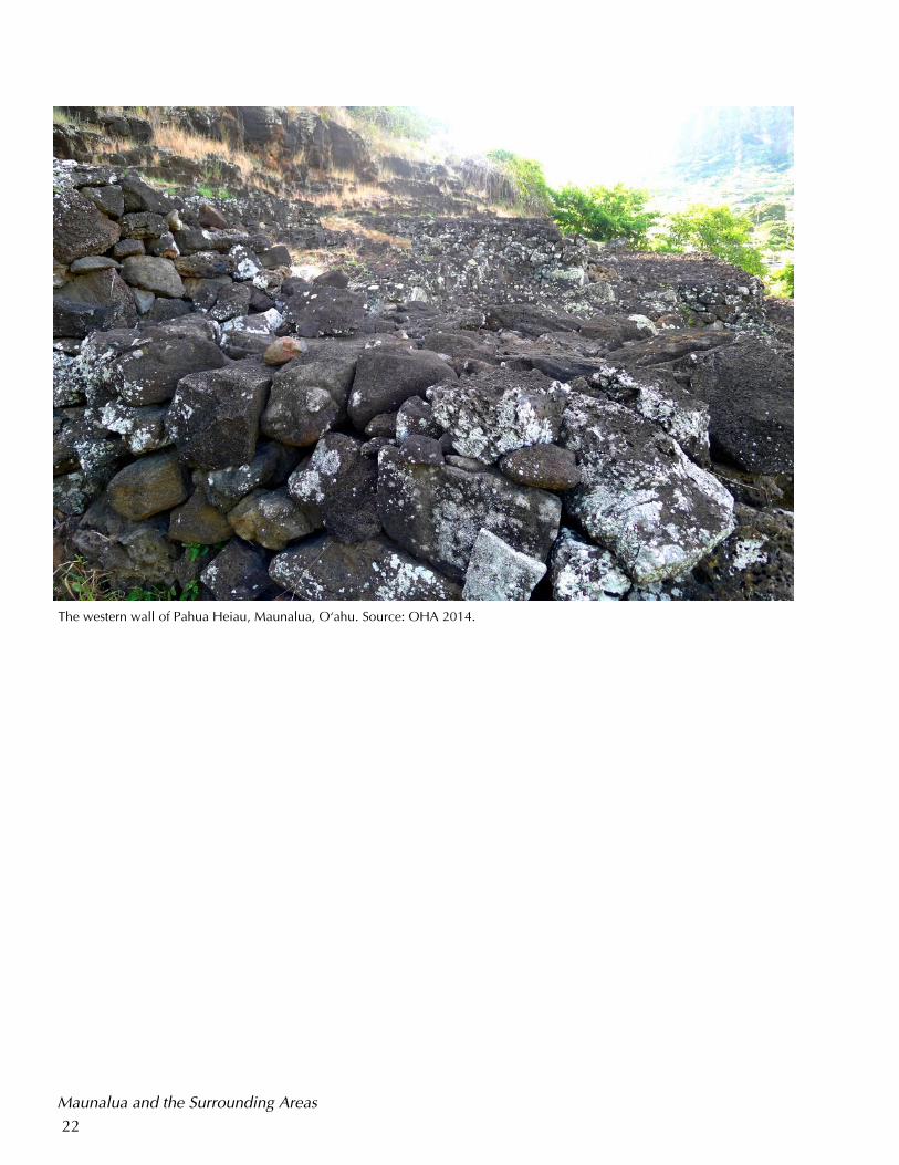
The western wall of Pahua Heiau, Maunalua, O‘ahu. Source: OHA 2014.
23
Maunalua and the Surrounding Areas
Maunalua and the Surrounding Areas When conducting a survey of the heiau on O‘ahu in the early 1900s, Thrum
(1906) noted that the there was much less information about heiau in the moku
(district) of Ko‘olaupoko than in other areas on the island; this assertion certainly
seems to be true for Pahua Heiau.
However, historical and archaeological evidence suggests that Maunalua was an
important area for Native Hawaiians. This section contains an examination of the
mo‘olelo ‘äina (stories of the land) and historical narratives connected to Mau-
nalua, which will augment an understanding of cultural significance and also
provide an enhanced regional context of Pahua in a way that emphasizes the re-
lationships and linkages between wahi pana in Hawaiian society over time.
The name Maunalua (two mountains) is said to have been attributed to Ka Lae o
Koko, also known as Kuamo‘okäne (today known as Koko Head), and Kohele-
pelepe (today known as Koko Crater). Traditionally, land divisions in Hawaiian
society reflected shifting resource use and availability; it is likely that the areas
which were considered to be part of Maunalua changed over time. Historical rec-
ords suggest that Maunalua was alternately considered an ahupua‘a (land divi-
sion) and an ‘ili (small land parcel) of Waimänalo or Honolulu (Maly & Wong,
1998). In the late 1700s, Maunalua was considered to be an ‘ili of the ahupua‘a
of Waimänalo in the moku (district) of Ko‘olaupoko. In 1859, Maunalua was in-
corporated as an ‘ili of Honolulu (Sterling & Summers, 1978). Although these
boundaries may have changed over time, Maunalua was generally considered to
include the mauka (inland) valleys of Kuli‘ou‘ou, Haha‘ione, Kamilonui, Kami-
loiki and Kalama, as well as the coastal areas of Koko, Hanauma, Wäwämalu and
Kaiwi, which ran to Makapu‘u.
Today, the landscape and environment of Maunalua are predominantly that of a
leeward coastal plain. The journals and observations of foreigners recorded in the
late 1700s also characterize Maunalua as a dry and arid area. While in the midst
of a voyage meant to determine the feasibility of augmenting the British maritime
fur trade on the northwest coast of North America, the English explorers Nathan
Portlock and George Dixon stopped in the Hawaiian Islands, anchored at Mau-
nalua twice in 1786 (Portlock, 1789; Cartwright, 1922). Although Portlock (1789)
remarked on the lack of abundant water and the relative scarcity of foodstuffs in
Maunalua as compared to other areas in the Sandwich Islands where he had pre-
viously anchored, he also noted that the residents of the area were kind and
brought coconuts, bananas, sugarcane, pigs, and other necessities to the crew.
Native Hawaiians settled and populated places in Maunalua; this may have oc-
It is likely that
the areas which
were considered
to be part of
Maunalua
changed over
time
24
Maunalua and the Surrounding Areas
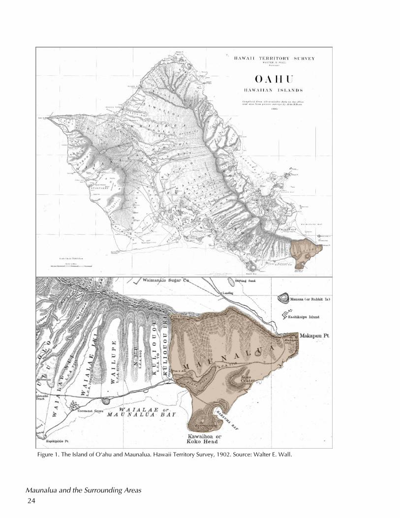
Figure 1. The Island of O‘ahu and Maunalua. Hawaii Territory Survey, 1902. Source: Walter E. Wall.
25
curred between 1100 and 1400 CE (Maly & Wong, 1998). On a tour of O‘ahu tak-
en in 1821, the English traveler Gilbert Mathison (1825) described a settlement in
Maunalua, noting, “We soon passed a village mostly inhabited by fishermen and
containing perhaps one hundred huts.” (p. 387). In an 1826 circuit of O‘ahu that
was undertaken to assess the progress of English literacy among Native Hawaiians
(and which was accompanied by the ali‘i nui Ka‘ahumanu), the American
Protestant missionary Levi Chamberlain (1828) wrote of a village named Kea-
waawa of approximately 100 houses in Maunalua, noting that it was the last im-
portant settlement on the south side of the island.
Maunalua as a Place to Sustain Life Indeed, despite having the appearance of an unforgiving and arid landscape to
many foreign explorers, other historical accounts suggest that there was a ready
availability of water and food in the area. These lands were known for marshy are-
as where there were coconut groves, water holes and springs (Stump, 1981). Other
European and American explorers noted the growth of wauke (paper mulberry;
Broussonetia papyrifera) in Maunalua. Native Hawaiians also grew kalo (taro; Col-
ocasia esculenta) in the inner valleys of Maunalua, where there were also springs
with freshwater food resources, such as ‘öpae (shrimp) and i‘a (fish) (Goss, April
23, 1962). The ocean at Maunalua was also well–known for the abundance and
availability of fish; an article that appeared in the December 1918 issue of the Par-
adise of the Pacific noted, “The bay is skirted by extensive coral beaches, mud
flats, and reefs. Since the earliest times it has been a famous fishing grounds for the
Hawaiian fishermen who excelled in reef and inshore fishing,” (MacCaughey, De-
cember 1918). Hanauma and surrounding lands were known as a fishing and re-
laxation area for the ali‘i (Sterling and Summers, 1978), and Makapu‘u was famous
for “ka uhu ka‘i,” travelling Parrotfish (Pukui, 1983, #1531). The shark ‘aumakua
(ancestral god), ‘Ouha was also known to live in the waters of Koko (Westervelt,
1915). Into the early twentieth century, mullet were known to stop seasonally in
Maunalua Bay on their way to Kahuku from Pu‘uloa to spawn (Krauss, March 27,
1966).
Native Hawaiians worked to carefully manage resources in the area. Although
most areas were too dry to support the extensive growth of wetland kalo as in oth-
er areas of O‘ahu, the inland coastal regions of Maunalua were known to be an
intensive ‘uala (sweet potato) agricultural complex that supported the populations
of Native Hawaiians in Maunalua and in other areas (Goss, 1962; McAllister,
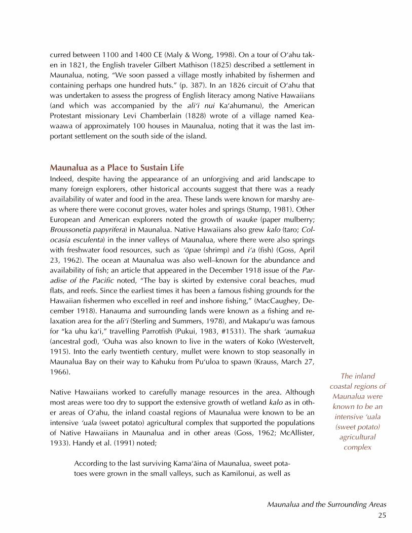
1933). Handy et al. (1991) noted;
According to the last surviving Kama‘äina of Maunalua, sweet pota-
toes were grown in the small valleys, such as Kamilonui, as well as
Maunalua and the Surrounding Areas
The inland
coastal regions of
Maunalua were
known to be an
intensive ‘uala
(sweet potato)
agricultural
complex
26
on the coastal plain. The plain below Kamilo‘iki and Kealakïpapa
[the narrow pass that ascends to the present–day Makapuÿu over-
look] was known as Ke–Kula–o–Kamauwai. This was the famous
potato–planting place from which came the potatoes traded to
ships that anchored off Hahaÿione in whaling days. The village at
this place, traces of which may still be seen, was called Wäwäma-
lu. (p.155)
Keahupua o Maunalua Maunalua was also the site of a remarkably large loko i‘a (fishpond) known as
Keahupua o Maunalua (the shrine of the baby mullet) which was called Kuapä or
Maunalua Pond in later years (Sterling & Summers, 1978). In 1821, Mathison de-
scribed the pond, noting “here is a large salt–water lake... It was divided from the
sea by a large embankment of sand, which on extraordinary occasions is proba-
bly overflowed by the tide,” (p. 386). Fishponds were considered a crucial ele-
ment of traditional Native Hawaiian resource management, and the use of use of
fishponds often went back centuries (Cobb, 1901).
Although O‘ahu was known for having more fishponds than any other island, the
fishpond at Maunalua was rather unique because of its enormous size; in 1851,
Keahupua o Maunalua was said to have covered 523 acres, and it stretched near-
ly two miles inland. It was believed to have been the largest fishpond ever con-
structed in Hawai‘i and possibly the Pacific (Thrum, 1906). It is thought that Kea-
hupua o Maunalua, which was considered a loko kuapä (a type of pond named
for the stone wall structures that were used in its construction), was created by
blocking off part of a naturally existing arm of the bay (MacCaughey, December
1918). The brackish waters of the pond supported many varieties of fish and sea
life, but Keahupua o Maunalua was especially known for the ‘ama‘ama (mullet)
and awa (milkfish). Archaeologist William Kikuchi (July 23, 1974) postulated that
fishponds were symbols of chiefly power because they required intensive labor to
construct and maintain, which only chiefs could command. Historical narratives
suggest that the fish of Keahupua o Maunalua may have been reserved for the ali‘i
at times, though it was a common practice among the chiefs to redistribute re-
sources among the maka‘äinana (Kamakau, 1991).
Despite the appearance of an inhospitable landscape, the resources of Maunalua
supported significant populations of Native Hawaiians over time, suggesting that
the area was an important component of Native Hawaiian society. For example,
Kamehameha, the ali‘i nui who was famous for unifying the Hawaiian Islands
through military conquest and diplomacy in the early 1800s, was known to have
lived in Maunalua for a time. According to Kamakau, Kamehameha worked to
The fishpond at
Maunalua was
rather unique
because of its
enormous size;
in 1851, Kea-
hupua o Mau-
nalua was said to
have covered
523 acres, and it
stretched nearly
two miles inland.
Maunalua and the Surrounding Areas
27
restore parts of Keahupua o Maunalua in the early 1800s, at various fishponds and
other worksites on O‘ahu in the early 1800s as part of a peaceful campaign to pro-
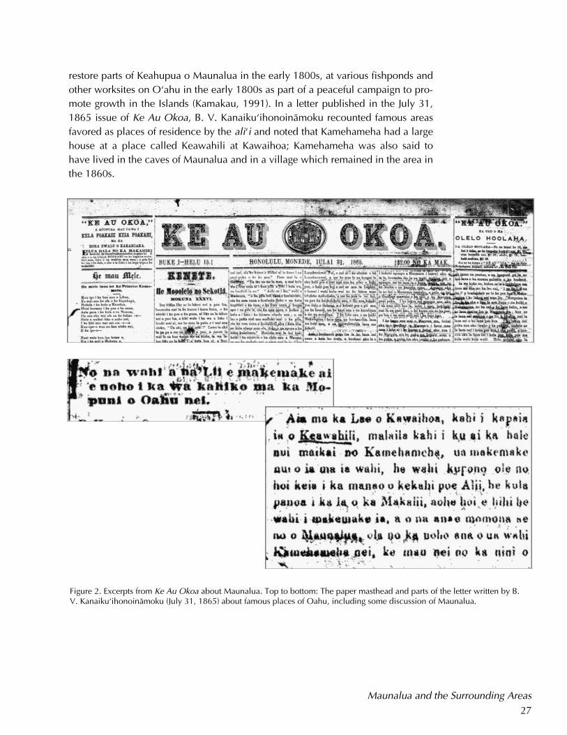
mote growth in the Islands (Kamakau, 1991). In a letter published in the July 31,
1865 issue of Ke Au Okoa, B. V. Kanaiku‘ihonoinämoku recounted famous areas
favored as places of residence by the ali‘i and noted that Kamehameha had a large
house at a place called Keawahili at Kawaihoa; Kamehameha was also said to
have lived in the caves of Maunalua and in a village which remained in the area in
the 1860s.
Maunalua and the Surrounding Areas
Figure 2. Excerpts from Ke Au Okoa about Maunalua. Top to bottom: The paper masthead and parts of the letter written by B. V. Kanaiku‘ihonoinämoku (July 31, 1865) about famous places of Oahu, including some discussion of Maunalua.
28
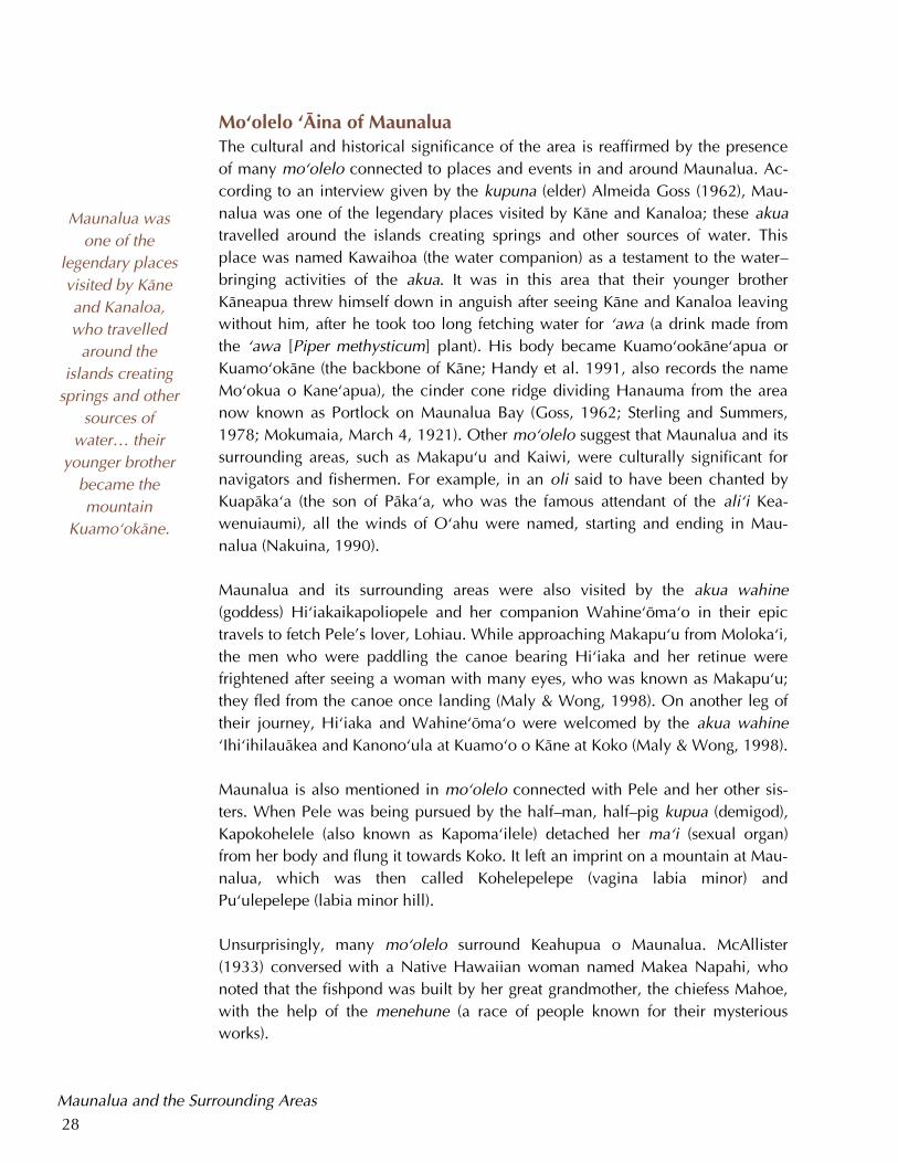
Mo‘olelo ‘Äina of Maunalua The cultural and historical significance of the area is reaffirmed by the presence
of many mo‘olelo connected to places and events in and around Maunalua. Ac-
cording to an interview given by the kupuna (elder) Almeida Goss (1962), Mau-
nalua was one of the legendary places visited by Käne and Kanaloa; these akua
travelled around the islands creating springs and other sources of water. This
place was named Kawaihoa (the water companion) as a testament to the water–
bringing activities of the akua. It was in this area that their younger brother
Käneapua threw himself down in anguish after seeing Käne and Kanaloa leaving
without him, after he took too long fetching water for ‘awa (a drink made from
the ‘awa [Piper methysticum] plant). His body became Kuamo‘ookäne‘apua or
Kuamo‘okäne (the backbone of Käne; Handy et al. 1991, also records the name
Mo‘okua o Kane‘apua), the cinder cone ridge dividing Hanauma from the area
now known as Portlock on Maunalua Bay (Goss, 1962; Sterling and Summers,
1978; Mokumaia, March 4, 1921). Other mo‘olelo suggest that Maunalua and its
surrounding areas, such as Makapu‘u and Kaiwi, were culturally significant for
navigators and fishermen. For example, in an oli said to have been chanted by
Kuapäka‘a (the son of Päka‘a, who was the famous attendant of the ali‘i Kea-
wenuiaumi), all the winds of O‘ahu were named, starting and ending in Mau-
nalua (Nakuina, 1990).
Maunalua and its surrounding areas were also visited by the akua wahine
(goddess) Hi‘iakaikapoliopele and her companion Wahine‘öma‘o in their epic
travels to fetch Pele’s lover, Lohiau. While approaching Makapu‘u from Moloka‘i,
the men who were paddling the canoe bearing Hi‘iaka and her retinue were
frightened after seeing a woman with many eyes, who was known as Makapu‘u;
they fled from the canoe once landing (Maly & Wong, 1998). On another leg of
their journey, Hi‘iaka and Wahine‘öma‘o were welcomed by the akua wahine
‘Ihi‘ihilauäkea and Kanono‘ula at Kuamo‘o o Käne at Koko (Maly & Wong, 1998).
Maunalua is also mentioned in mo‘olelo connected with Pele and her other sis-
ters. When Pele was being pursued by the half–man, half–pig kupua (demigod),
Kapokohelele (also known as Kapoma‘ilele) detached her ma‘i (sexual organ)
from her body and flung it towards Koko. It left an imprint on a mountain at Mau-
nalua, which was then called Kohelepelepe (vagina labia minor) and
Pu‘ulepelepe (labia minor hill).
Unsurprisingly, many mo‘olelo surround Keahupua o Maunalua. McAllister
(1933) conversed with a Native Hawaiian woman named Makea Napahi, who
noted that the fishpond was built by her great grandmother, the chiefess Mahoe,
with the help of the menehune (a race of people known for their mysterious
works).
Maunalua was
one of the
legendary places
visited by Käne
and Kanaloa,
who travelled
around the
islands creating
springs and other
sources of
water… their
younger brother
became the
mountain
Kuamo‘okäne.
Maunalua and the Surrounding Areas
29
A number of mo‘o (water spirits) were associated with Keahupua o Maunalua.
Mo‘o were usually described as female ‘aumakua (Poepoe, n.d.). Mo‘o were often
associated with fishponds and were said to have reptilian features. According to
Kamakau (1976),
They were the guardians who brought the blessing of abundance of
fish, and of health to the body, and who warded off illness and pre-
served the welfare of the family and their friends… When the chiefs
or their agents abused the poor and fatherless, the mo‘o guardians
took the fish away until the wrongdoers showed penitence and
made restitution to their victims. (pp. 84–85)
A mo‘o known as Luahine was said to have traveled from Keahupua o Maunalua
to Pali Luahine in Mänoa (Sterling and Summers, 1978). The mo‘o Laukupu was
known to be the guardian and caretaker of Keahupua o Maunalua (Kamakau,
1976; McAllister, 1933).
Keahupua o Maunalua was strongly associated with Kä‘elepulu in Kailua, O‘ahu,
which was known for being a favored fishpond and source of ‘o‘opu (a type of go-
by fish) of the ali‘i ‘aimoku (chief of a district or island) Peleiöhölani in Kailua
(Kanaiku‘ihonoinämoku, July 31, 1865). Schools of ‘ama‘ama were said to have
vanished from Keahupua o Maunalua while massive schools of awa would ap-
pear; the opposite was true for Kä‘elepulu; many felt that there was a subterranean
lava tube or tunnel connecting the two ponds (McAllister, 1933). The associations
between Keahupua o Maunalua and Kä‘elepulu were likely significant to Native
Hawaiians, who may have understood these wahi pana to be linked in other ways.
The historical narratives included in this section are mo‘olelo ‘äina about Mau-
nalua and allow us to gain a better understanding of how Pahua Heiau may have
fit into the historical and cultural landscapes of in Hawaiian society.
Maunalua and the Surrounding Areas
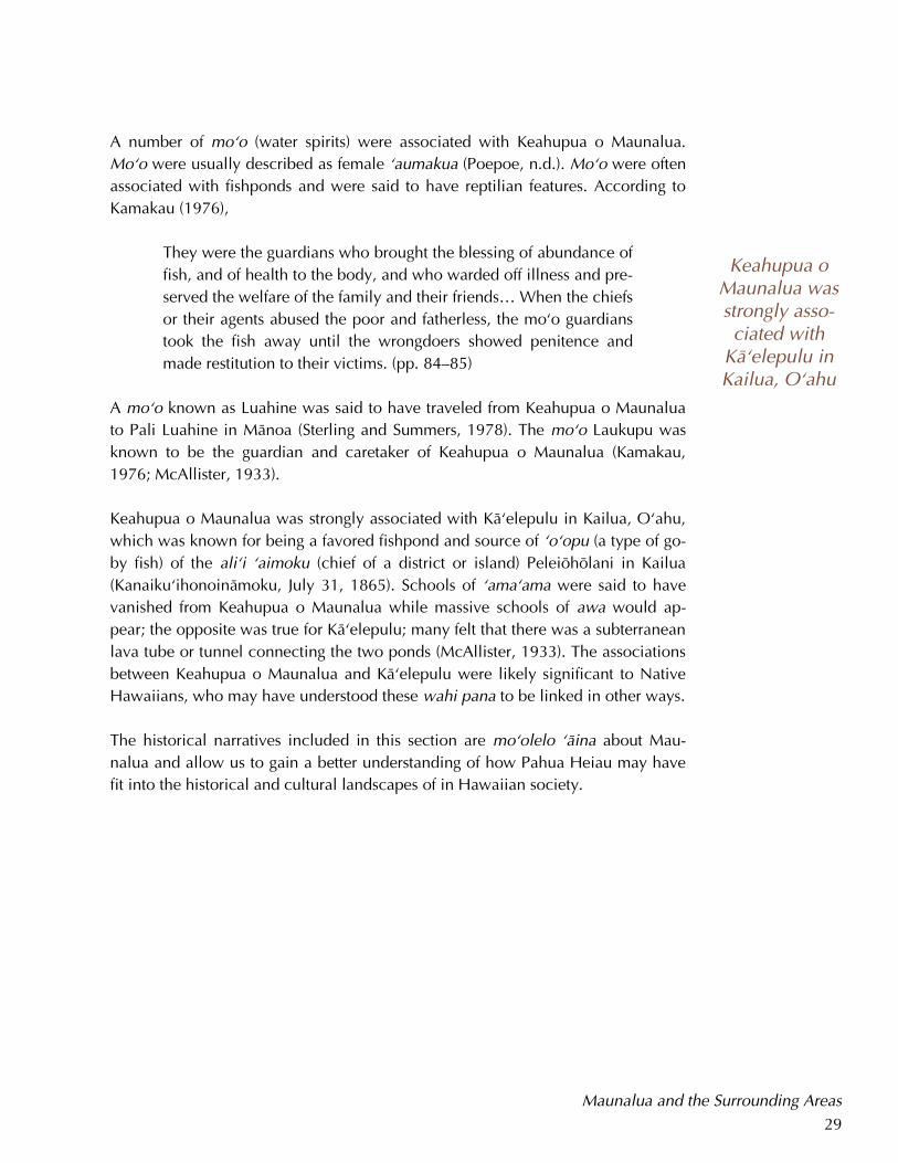
Keahupua o Maunalua was strongly asso-ciated with
Kä‘elepulu in Kailua, O‘ahu
30
Development and Urbanization in Maunalua
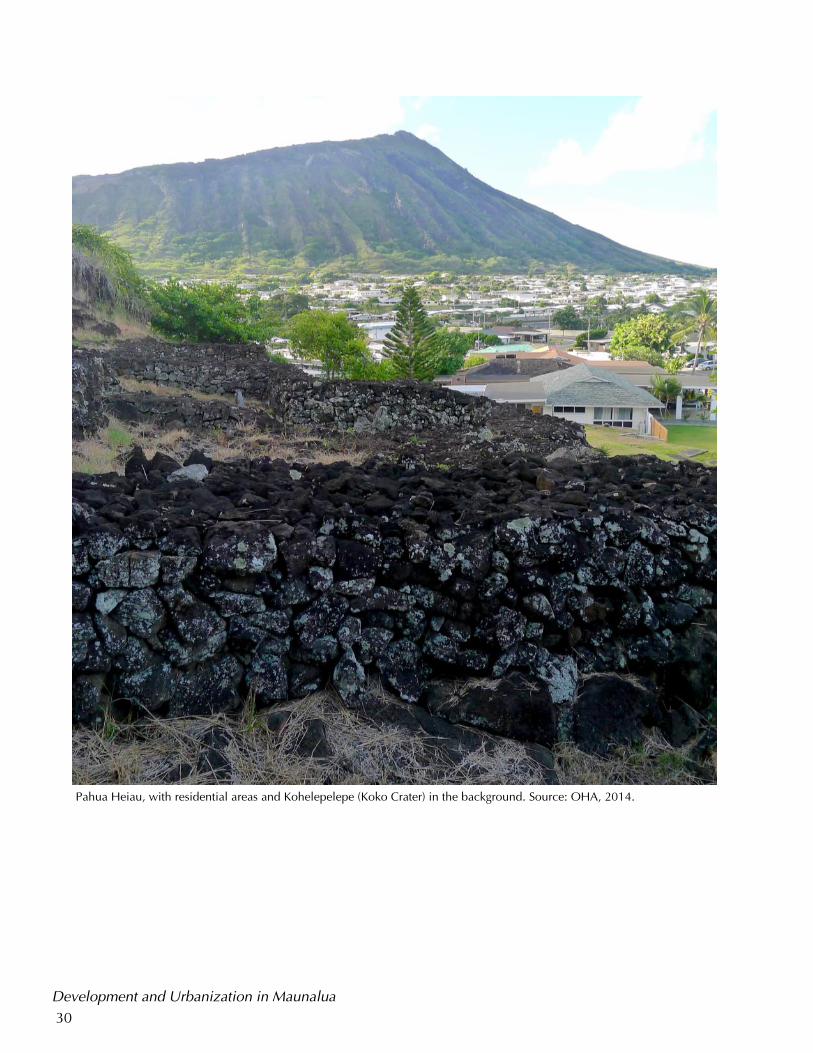
Pahua Heiau, with residential areas and Kohelepelepe (Koko Crater) in the background. Source: OHA, 2014.
31
Development and Urbanization in Maunalua
According to Davis (1985b), the lowland areas of Maunalua supported vast sweet
potato gardens “to which, at least during the early post–contact years, an apparent-
ly sizeable population was devoted. Much of this population was also apparently
resident in the neighborhood of Pahua Heiau,” (p. 1).
Yet, despite the presence of extensive sweet potato agriculture and the availability
of resources from Keahupua o Maunalua, historical records indicate that occupa-
tion of certain villages in Maunalua was not always sustained or permanent, and
that Maunalua likely had a shifting population. For example, Wäwämalu is said to
have been abandoned by the end of the 1840s, and whaling ships stopped fre-
quenting Maunalua when an 1852 law required all whaling ships to anchor at
Mämala in Honolulu (Takemoto, et al. 1975). As previously discussed, the dra-
matic loss of population in the Maunalua area was the result of massive death and
migration. These population shifts are sometimes evident in the historical record;
for example, although oral accounts suggest there was once a village in Ha-
ha‘ione, a map drawn by William Webster in 1851 does not indicate the presence
of a village, perhaps suggesting that the area was vacated before 1851.
As noted previously, archaeological estimates place the construction of the heiau
between 1485—1665 CE or 1760—1795 CE. However, because of the difficulty of
locating oral histories and other accounts for Pahua, scholars have had problems
determining which ali‘i was responsible for building Pahua. Records of which ali‘i
controlled Maunalua are also scarce, although Kamakau (1992) notes that during
the reign of the O‘ahu ali‘i ‘aimoku Peleiöhölani (approximately 1737—1770) the
ali‘i Kanahaokalani, the son of Kapi‘iohookalani defended Koko in a battle with
the Hawai‘i Island ali‘i Alapa‘i. Takemoto et. al. (1975) hypothesizes that
Kanahaokalani was likely entrusted with the area.
General control over the lands of Maunalua is much easier to ascertain beginning
in the 1800s. In the mid–nineteenth century, Maunalua was retained by Kamämalu
under Royal Patent Grant 4475 and Land Commission Award 7713 during the
Mähele, which was a series of laws creating legal mechanisms for land privatiza-
tion in Hawai‘i initiated by King Kauikeaouli (Kamehameha III) beginning in the
mid and late 1840s (Maly & Wong, 1998). In 1856, Kamämalu leased all of Mau-
nalua, except for Keahupua o Maunalua, to William Webster (a lawyer and land
agent for the Kingdom), who held it until his death in 1864 (Dye, 2005; Takemoto
et al., 1975). From 1864 to 1867, Maunalua was leased by Manuel Paiko and in
1867, Maunalua was leased to J. H. Kanepuu for a term of six years (Takemoto et
al., 1975). Upon her death in 1866, Kamämalu’s lands were passed to her father,
Mataio Keküanäo’a. Upon his death in 1868, his lands passed to his daughter,
Development and Urbanization in Maunalua
Historical
records indicate
that the
occupation of
certain villages
in Maunalua was
not always
sustained or
permanent, and
that Maunalua
likely had a
shifting
population.
32
Ruth Ke‘elikölani. When Ke‘elikölani died in 1883, her extensive landholdings
passed to her cousin, Bernice Pauahi Bishop, and Maunalua became a part of the
Bishop Estate.
Unfortunately, the social, political, and economic transformations within Hawai-
ian society during the nineteenth and twentieth centuries would result in the in-
creased loss of Native Hawaiian rights and access to natural resources in Mau-
nalua. For example, Webster used much of the lands he held to ranch cattle. Fish-
ing rights to Keahupua o Maunalua were also leased, and leaseholders often pro-
hibited the free use of resources in the pond. For example, advertisements ap-
peared in the nüpepa in the late 1800s warning people not to trespass and fish in
the pond (Lee, January 9, 1894). Hunting was prohibited on ranch lands in Mau-
nalua (Damon, 1905, October 7). And, when a cholera epidemic hit O‘ahu in
1895 and again in 1900, all the fish from Keahupua o Maunalua were put under
quarantine; fish and other seafood from the pond were prohibited for sale and
consumption (Hawaiian Gazette, October 11, 1895; Hawaiian Star, January 3,
1900).
Over time, rice paddies, kukui (Aleurites moluccana) farms, coconut plantations,
pigeon runs, apiaries, poultry farms, cattle ranching and other agro–commercial
endeavors were initiated in Maunalua (MacCaughey, December, 1918). In the
late nineteenth and early twentieth century, increasing numbers of Chinese and
Portuguese immigrants moved to the area. In the 1960s, the areas immediately
surrounding Pahua were occupied by pig farms and rural homesteads (Davis,
1985b).
Extensive residential and commercial development of Maunalua began in the
1970s. Henry J. Kaiser, an industrialist who had worked to build the Hoover and
Grand Coulee Dams in the U.S., arrived in Hawai‘i in 1954 and began several
development projects on O‘ahu. Kaiser envisioned a post–world war suburb that
could house 75,000 people, a place in the islands where people from the U.S.
could establish residence prior to statehood (Ali & Patrinos, 1995). With the per-
mission of the landowners, Bishop Estate, Kaiser was able to initiate extensive
residential development which would dramatically alter Maunalua in many ways;
for example, large parts of Keahupua o Maunalua were dredged, farmers and oth-
er leaseholders in the area were forcibly removed, and Maunalua was renamed
Hawai‘i Kai (the Kai was meant to be a subtle reference to Kaiser himself) (Ali &
Patrinos, 1995). These projects transformed Maunalua into a place that was in-
creasingly removed from associations with traditional Native Hawaiian culture
and history (Trask, 1987).
Transformations
within Hawaiian
society during
the nineteenth
and twentieth
centuries would
result in the
increased loss of
Native Hawaiian
rights and access
to natural
resources in
Maunalua.
Development and Urbanization in Maunalua
33
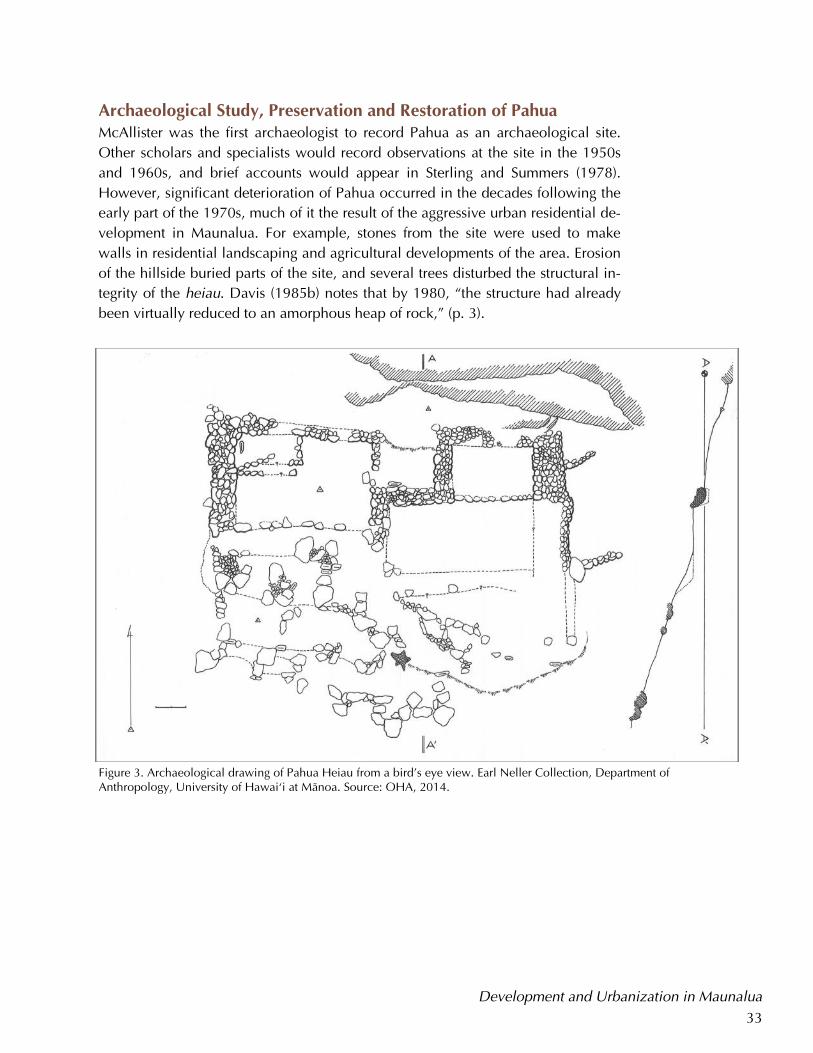
Archaeological Study, Preservation and Restoration of Pahua McAllister was the first archaeologist to record Pahua as an archaeological site.
Other scholars and specialists would record observations at the site in the 1950s
and 1960s, and brief accounts would appear in Sterling and Summers (1978).
However, significant deterioration of Pahua occurred in the decades following the
early part of the 1970s, much of it the result of the aggressive urban residential de-
velopment in Maunalua. For example, stones from the site were used to make
walls in residential landscaping and agricultural developments of the area. Erosion
of the hillside buried parts of the site, and several trees disturbed the structural in-
tegrity of the heiau. Davis (1985b) notes that by 1980, “the structure had already
been virtually reduced to an amorphous heap of rock,” (p. 3).
Development and Urbanization in Maunalua
Figure 3. Archaeological drawing of Pahua Heiau from a bird’s eye view. Earl Neller Collection, Department of Anthropology, University of Hawai‘i at Mänoa. Source: OHA, 2014.
34
Development and Urbanization in Maunalua
Figure 4. Archaeological drawings of Pahua Heiau showing wall and terrace placement. Earl Neller Collection, Anthropology Department, University of Hawai‘i at Mänoa. Source: OHA, 2014.
35
Modern restoration of Pahua Heiau has been the result of concerted community
efforts. The first impetus for restoration came from the Hawai‘i Kai Lion’s Club,
which cleared the site of vegetation in 1980. Four years later, on September 17,
1984, the Hawai‘i Kai Outdoor Circle identified Pahua for its 1984—1985 volun-
teer community service project. The goal of the project was to “clear the dense
scrub overgrowth, restore the structure to its probable original form, and then land-
scape the property with Native Hawaiian plants, preserving a valuable cultural/
historical resource for the benefit of the entire community,” (Davis, 1985a). The
Circle invested over $25,000 to implement a phased restoration, landscaping, and
maintenance plan for Pahua. Other financial contributions to the project were giv-
en by the Bishop Estate, Kaiser Development, the Outdoor Circle, Sandwich Isle
Construction, the Tree People, and Waimea Falls Park (Hawaii Kai Sun Press, Feb.
21, 1985).
Restoration efforts engaged volunteers of diverse backgrounds, and included com-
munity members, tradesmen, and professionals. Students from Kamehameha
Schools and the University of Hawai‘i at Mänoa, the Boy and Girl Scouts, volun-
teers from the Lions Club and National Job Corps, the Hawai‘i National Guard, as
well as the community service work force from the O‘ahu Community Correction-
al Facility all contributed to these efforts (Davis, 1985b). The restoration process
was overseen by Earl Neller, an archaeologist with the State of Hawai‘i Depart-
ment of Historic Preservation, and Bertell Davis, an archaeologist with the Bishop
Museum; Davis served as principal investigator in the project.
Restoration of the heiau was coordinated through the Bishop Museum Department
of Anthropology. Archaeological excavations for the restoration of Pahua began in
1984. From 1984 to 1985, work was concentrated in the eastern half of the heiau,
and was focused on identifying the extent of the walls and terraces. Workers
cleared vegetation off the site from October to December of 1984. A research de-
sign and excavation plan were formulated using data that had been collected from
archaeological mapping conducted by volunteer archaeology students from UH
Mänoa. A number of excavations were completed by students from Ohio Universi-
ty, UH Mänoa students, and Bishop Museum staff during February and March of
1985 (Davis, 1985b). Two UH Mänoa archaeological field schools were also held
at Pahua between 1985 and1986.
Restoration of the terraces on the eastern half of the site, which were distinguished
by complex construction, was completed by June 1985. Four large platforms and
associated free-standing walls were rebuilt during this phase of the project. Ac-
cording to Davis, the reconstructed height of the walls was based on “the width of
their foundations, the gradient of the floors on which they stood, and the height of
the upper platform from which they extended,” which provided a reasonable
Development and Urbanization in Maunalua
Restoration
efforts engaged
volunteers of
diverse
backgrounds,
and included
community
members,
tradesmen, and
professionals.
36
Although coral is
commonly found
in other kinds of
coastal and
inland
archaeological
sites, the amount
of coral found in
Pahua was more
than what had
been reported for
other heiau
located in
coastal areas.
Development and Urbanization in Maunalua
guide for restoration efforts (Davis, 1985b, p. 5). Additionally, five stages of con-
struction were identified in the eastern half of the site, which “are thought to rep-
resent three distinct phases in the establishment and expansion of Pahua Heiau,”
possibly suggesting a change in the function of the site and the heiau over time
(Davis, 1985b, p. 7).
Archaeological work and restoration of the western half of Pahua was postponed
until late 1985 and 1986 (Davis, 1985b). While the eastern platforms were filled
and paved with basalt cobbles, most of the western platforms had primarily earth-
en floors. Several internal stone alignments believed to be the same rough terrac-
ing that had been identified in the area around the heiau were also found in the
excavations of the western platform; these may have been a part of the extensive
field system for sweet potato cultivation that was known to be in Maunalua, and
the western terraces may have been built over existing agricultural structures. Ex-
cavations also uncovered a small detached platform with evidence of hearths,
which suggest that it had been a house site, possibly for the kahu (caretaker) of the
heiau (Davis, 1985c).
Overall, the excavations for the project revealed the heiau had an uphill-downhill
width of 11 meters and length of 22 meters, “with a total accumulative height of
roughly 5 meters from the lowest foundation to the highest floor,” (Davis, 1985b).
Five dry stacked terraces and seven free standing walls were completed during the
project.
Radiocarbon dating conducted on wet wood charcoal from a large fire pit adja-
cent to the heiau allowed archaeologists to determine that the hearth was used
during 1485—1665 CE or 1760—1795 CE. Based on soil disturbance caused by
the restoration efforts, archaeologists felt it was reasonable to infer that the eastern
platforms of Pahua predate the use of the hearth. Therefore, the western platforms
are thought to be older than the eastern platforms. Davis noted “the first of at least
three major construction phases at Pahua likely dates at least as far back as the
mid-sixteenth century,” (Davis, 1985b p. 19)
Only four pre-contact artifacts were found during excavations of the heiau, which
Davis (1985b) notes is uncharacteristic for sites of Pahua’s size and age. Although
few artifacts were found, the excavations revealed that a significant amount of
coral was incorporated in the foundation and the walls of the heiau. Moreover,
archaeologists found a very large coral limestone block built into the base of one
of the heiau walls. A few other smaller examples of coral blocks were also found
in other intact wall sections. Although coral is commonly found in other kinds of
coastal and inland archaeological sites, according to Davis (1985b), “the amount
of coral found in the rubble of Pahua Heiau appears to be considerably more than
37
what has been reported to date for other heiau located in coastal areas,” (pp. 14–
15). Davis offered no theories on the significance of the large coral deposits at Pa-
hua, although he noted that future archaeological research may illuminate the rea-
sons for its incorporation in the heiau.
Other findings resulting from the work at Pahua have had broader scholarly impli-
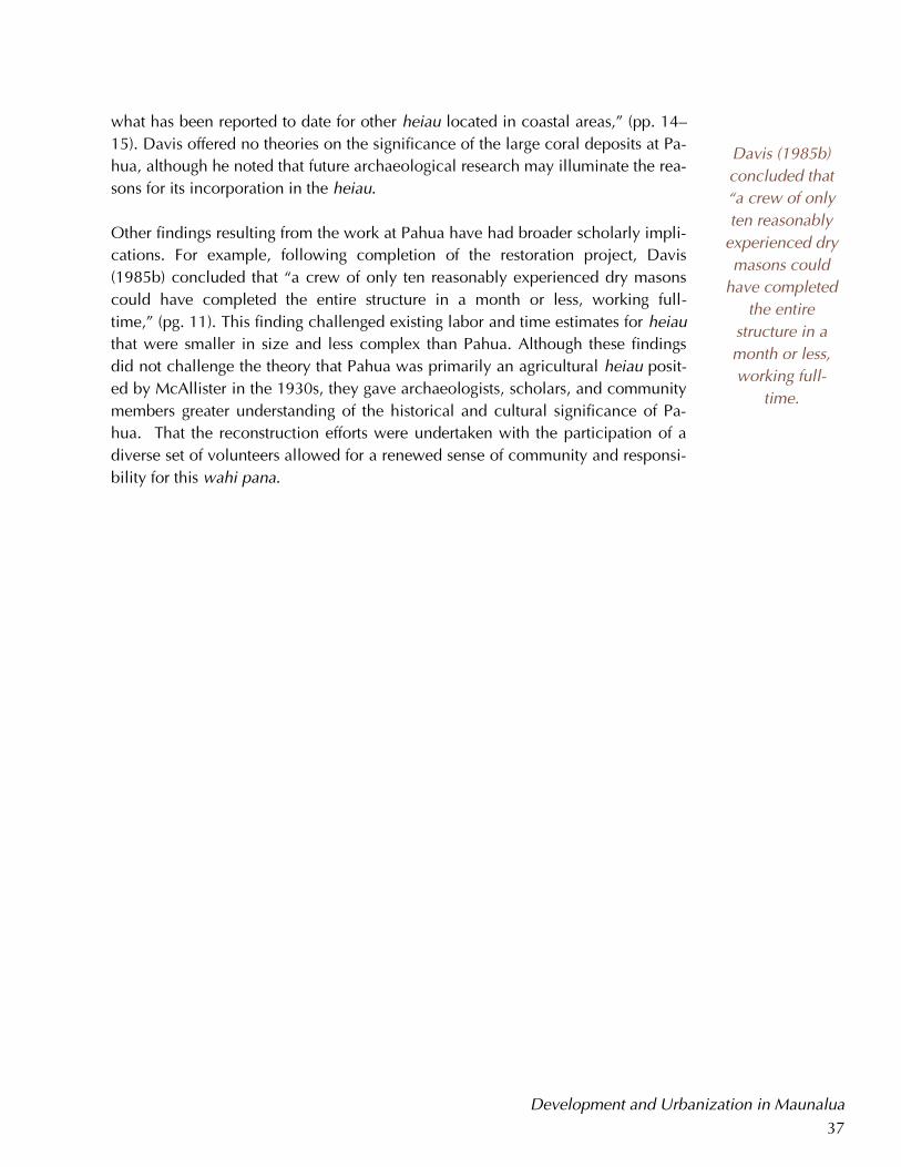
cations. For example, following completion of the restoration project, Davis
(1985b) concluded that “a crew of only ten reasonably experienced dry masons
could have completed the entire structure in a month or less, working full-
time,” (pg. 11). This finding challenged existing labor and time estimates for heiau
that were smaller in size and less complex than Pahua. Although these findings
did not challenge the theory that Pahua was primarily an agricultural heiau posit-
ed by McAllister in the 1930s, they gave archaeologists, scholars, and community
members greater understanding of the historical and cultural significance of Pa-
hua. That the reconstruction efforts were undertaken with the participation of a
diverse set of volunteers allowed for a renewed sense of community and responsi-
bility for this wahi pana.
Development and Urbanization in Maunalua
Davis (1985b)
concluded that
“a crew of only
ten reasonably
experienced dry
masons could
have completed
the entire
structure in a
month or less,
working full-
time.
38
Wahi Pana and ‘Ike ‘Äina in Stewardship of Pahua
Pahua Heiau, Maunalua, O‘ahu. Source: OHA 2014.
39
Wahi Pana and ‘Ike ‘Äina in Stewardship of Pahua One of the goals of this report was to renew an understanding of Pahua as a wahi
pana within the broader community. In particular, a brief examination of heiau, an
exploration of mo‘olelo about Pahua and Maunalua, an analysis of “Pahua” as a
place name, and a review of findings resulting from archaeological study and res-
toration were some of the ways this report sought to enhance contemporary under-
standings of the cultural and historical significance of Pahua Heiau.
As noted previously, Native Hawaiians traditionally maintained strong connections
to specific wahi pana that were shaped and also informed by unique ‘ike ‘äina.
This intimate, nuanced knowledge of a place conveyed a sense of community re-
sponsibility among Hawaiians, and informed stewardship practices which main-
tained careful balance between people, resources, and the land. Appropriate, cul-
turally–based stewardship of Pahua that is based on important Native Hawaiian
concepts like ‘ike ‘äina and wahi pana could provide a strong example for land
management strategies among OHA’s other landholdings and could also positively
influence stewardship of other significant historical and cultural sites in Maunalua,
such as Häwea Heiau, and throughout of Hawai‘i.
It is hoped that this report will foster the transmission of Native Hawaiian cultural
and historical knowledge within the general community and to future generations
in ways that will inspire long–term stewardship of Pahua Heiau as a wahi pana, a
noted and celebrated place.
Wahi Pana and ‘Ike ‘Äina in Stewardship of Pahua
40
Historical Photographs of Maunalua and Pahua
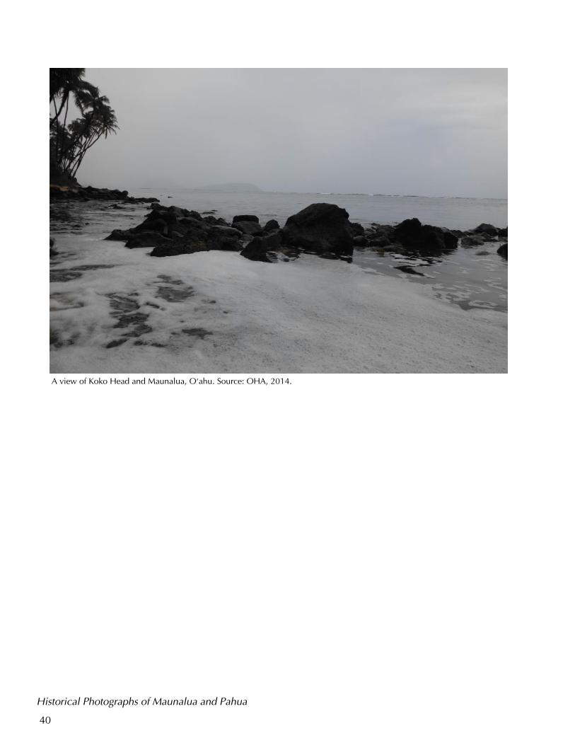
A view of Koko Head and Maunalua, O‘ahu. Source: OHA, 2014.
41
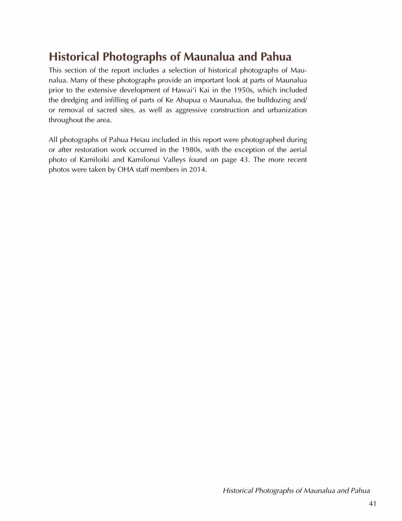
Historical Photographs of Maunalua and Pahua This section of the report includes a selection of historical photographs of Mau-
nalua. Many of these photographs provide an important look at parts of Maunalua
prior to the extensive development of Hawai‘i Kai in the 1950s, which included
the dredging and infilling of parts of Ke Ahupua o Maunalua, the bulldozing and/
or removal of sacred sites, as well as aggressive construction and urbanization
throughout the area.
All photographs of Pahua Heiau included in this report were photographed during
or after restoration work occurred in the 1980s, with the exception of the aerial
photo of Kamiloiki and Kamilonui Valleys found on page 43. The more recent
photos were taken by OHA staff members in 2014.
Historical Photographs of Maunalua and Pahua
42
Historical Photographs of Maunalua and Pahua
Top: Maunalua looking towards Kohelepelepe (Koko Crater) from Hanauma near Portlock, n.d. Middle: Maunalua coastline and mudflats, near Niu Valley and Haha‘ione (Paiko Lagoon). Bottom: Elizabeth Kahanu Kalaniana‘ole (right) with unknown companion in Maunalua with Koko Crater (Kohelepelepe) and Koko Head(Kuamo‘okäne), 1900. Sources: Hawai‘i State Archives Digital Collections.
43
Historical Photographs of Maunalua and Pahua
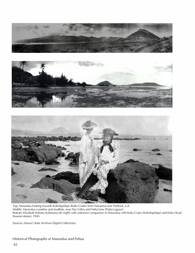
Left: Koko Crater (Kohelepelepe) and Koko Head (Kuamo‘okäne), 1915. Source: Hawai‘i State Archives Digital Collections.
Right: Aerial of Kamiloiki Valley. Pahua is approximately bottom center. Source: OHA, 2014.
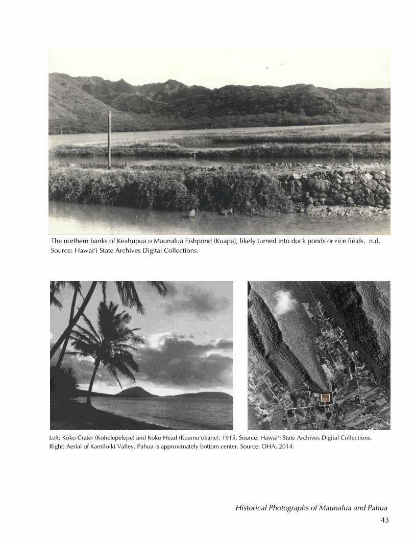
The northern banks of Keahupua o Maunalua Fishpond (Kuapa), likely turned into duck ponds or rice fields. n.d.
Source: Hawai‘i State Archives Digital Collections.
44
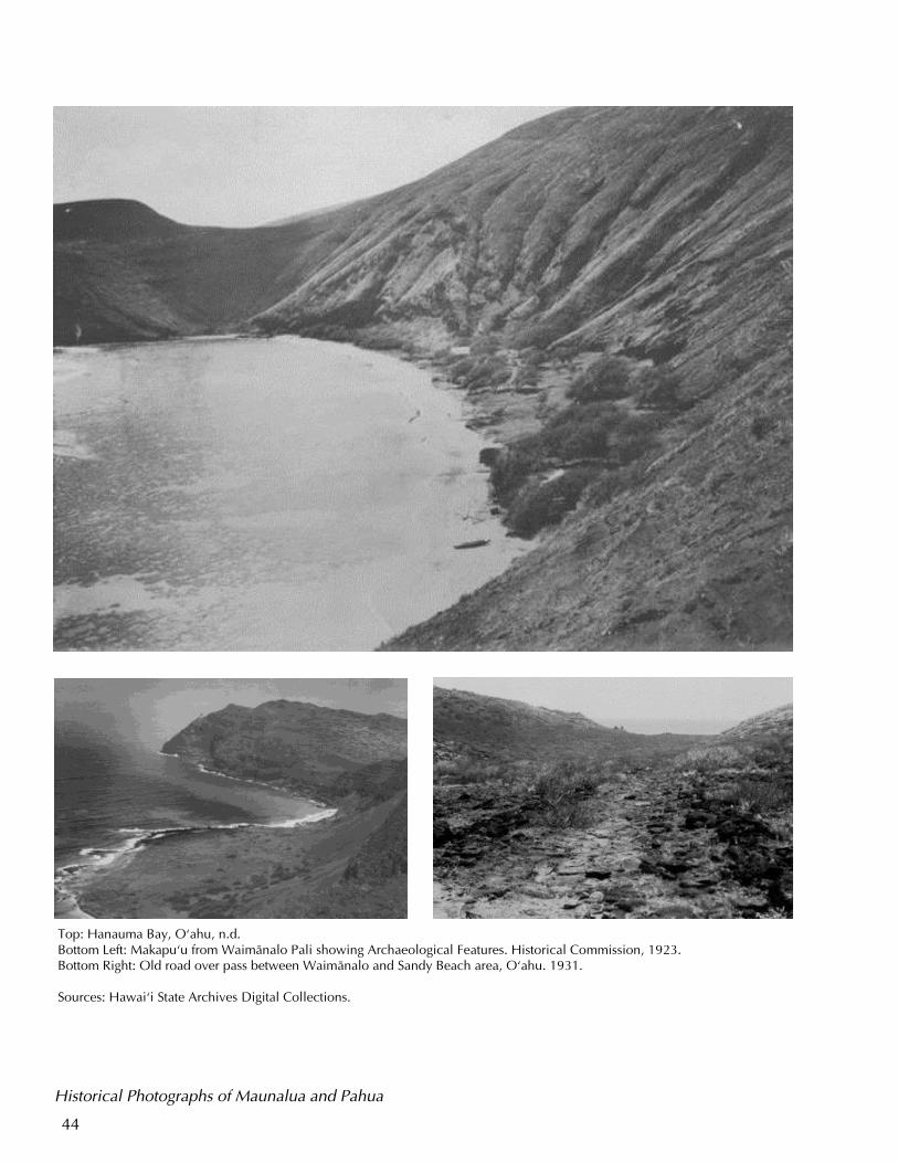
Top: Hanauma Bay, O‘ahu, n.d. Bottom Left: Makapu‘u from Waimänalo Pali showing Archaeological Features. Historical Commission, 1923. Bottom Right: Old road over pass between Waimänalo and Sandy Beach area, O‘ahu. 1931. Sources: Hawai‘i State Archives Digital Collections.
Historical Photographs of Maunalua and Pahua
45
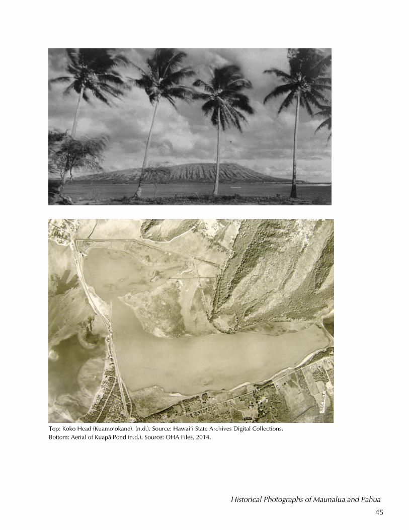
Top: Koko Head (Kuamo‘okäne). (n.d.). Source: Hawai‘i State Archives Digital Collections.
Bottom: Aerial of Kuapä Pond (n.d.). Source: OHA Files, 2014.
Historical Photographs of Maunalua and Pahua
46
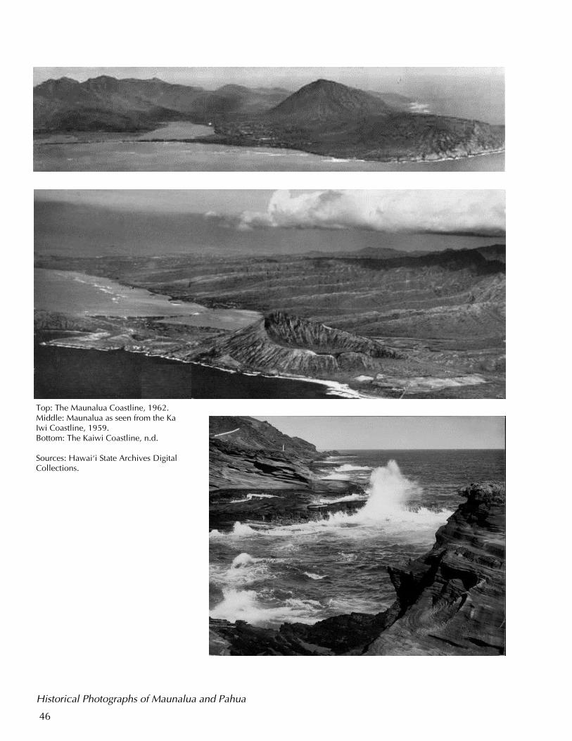
Top: The Maunalua Coastline, 1962. Middle: Maunalua as seen from the Ka Iwi Coastline, 1959. Bottom: The Kaiwi Coastline, n.d. Sources: Hawai‘i State Archives Digital Collections.
Historical Photographs of Maunalua and Pahua
47
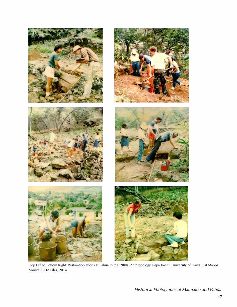
Top Left to Bottom Right: Restoration efforts at Pahua in the 1980s. Anthropology Department, University of Hawai‘i at Mänoa.
Source: OHA Files, 2014.
Historical Photographs of Maunalua and Pahua
48
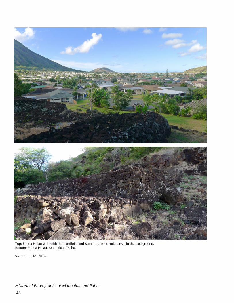
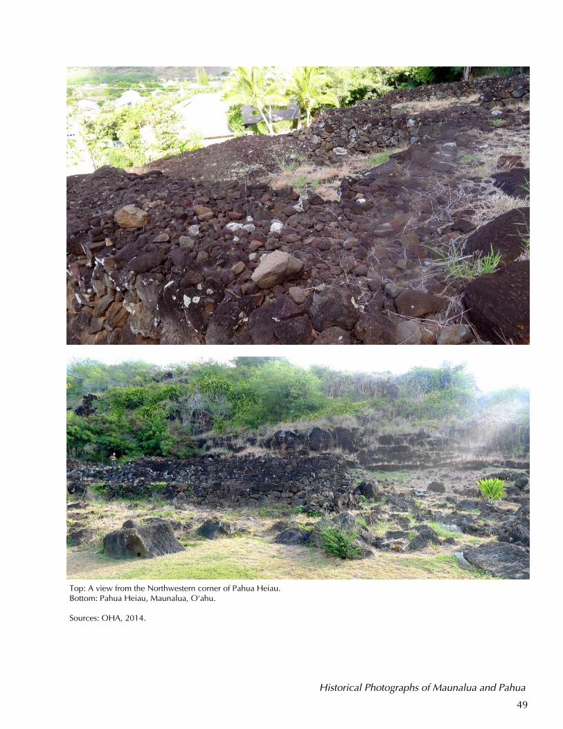
Top: Pahua Heiau with with the Kamiloiki and Kamilonui residential areas in the background. Bottom: Pahua Heiau, Maunalua, O‘ahu. Sources: OHA, 2014.
Historical Photographs of Maunalua and Pahua
49
Top: A view from the Northwestern corner of Pahua Heiau. Bottom: Pahua Heiau, Maunalua, O‘ahu. Sources: OHA, 2014.
Historical Photographs of Maunalua and Pahua
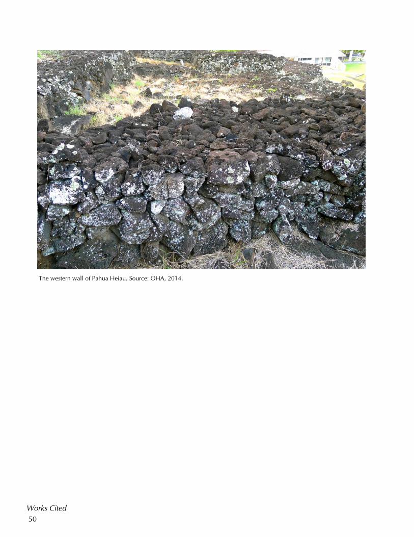
50
The western wall of Pahua Heiau. Source: OHA, 2014.BRight
Works Cited
51
Works Cited Ali, M. & Patrinos, N. (1995). Na Hu‘a Haole: Suburbia as a Cultural Imposition.
In Silver M. L. and Melkonian, M. eds. (1993, March). Contested Terrain: power, politics, and participation in suburbia, Hofstra University Confer-ence. Westport, CT: Greenwood Press.
Aluli, N. E. & McGregor, D. P. (2007). ‘Aina: Ke Ola O Na Kanaka ‘Oiwi; Land
the Health of Native Hawaiians. Available at: http://www.nlm.nih.gov/exhibition/avoyagetohealth/pdf/LandandHealth.pdf
Bacchilega, C. (2007) Legendary Hawai'i and the Politics of Place: Tradition,
Translation, and Tourism. Philadelphia, PA: University of Pennsylvania Press.
“Batimea Puaaiki.” (1844, Ianuali 9). Ka Nonanona, 3, (17) 78. Beckwith, M. W. (1970). Hawaiian Mythology. Honolulu, HI: University of Ha-
waii Press. Buck, P. H (Te Rangi Hiroa). (2003). Arts and Crafts of Hawai‘i. Honolulu, HI:
Bishop Museum Press. Cartwright, B. (1922) “The first discovery of Honolulu Harbor.” Hawaiian Histori-
cal society Annual Report, pp. 21–38. Chamberlain, Levi. (1828). Tour Around Oahu. In Judd, B. ed. (1957). Sixty-Fifth
Annual Report of the Hawaiian Historical Society, for the year 1956. Hon-olulu, HI: Hawaiian Historical Society.
Cobb, J. N. (1905). “Commercial Fisheries of the Hawaiian Islands” Bulletin of
the US Fish Commission, XXIII for 1903, Washington, D.C.
Damon, S. M. (October 7, 1905). Shooting Notice. The Hawaiian Star, 13, (4227) 8.
Davis, B. D. (1984). A Research Design for Pahua Heiau at Kamilo–nui in Mau-
nalua, Southeastern O’ahu. Honolulu, HI; Ms., Department of Anthropol-ogy, Bishop Museum.
Davis, B. D. (1985a). Preliminary Report on the Excavations at Pahua Heiau,
Maunalua (Hawaii Kai), Southeastern O’ahu. Honolulu, HI: Ms, (Anthro Group 6 Box 116). Department of Anthropology, Bishop Museum.
Davis, B. D. (1985b) A Report on the Stabilization and Partial Restoration of Pa-hua Heiau, Maunalua (Hawaii Kai), Oahu. For Hawaii Kai Outdoor Cir-cle. Honolulu, HI: Ms, (Anthro Group 6 Box 116). Department of Anthro-pology, Bishop Museum.
Works Cited
52
Davis, B. D. (1985c). Pahua Heiau Restoration- Continuation: Scope of Work for the West Platforms. Honolulu, HI: Ms, (Anthro Group 6 Box 116). Depart-ment of Anthropology, Bishop Museum.
Emerson, N. B. (1998) Unwritten Literature of Hawaii: The Sacred Songs of Hula.
Honolulu, Hi: Mutual Publishing. Emory, K. P. (1942). The Hawaiian God ‘Io. Journal of the Polynesian Society, 51,
(3) pp. 200-207. Goss, A. (April 23, 1962). Tape Recorded Interview with Almeda Goss, inter-
viewed by Mary Kawena Puku‘i. Honolulu: Bishop Museum Archives. Handy, E. S. C. (1941). The Hawaiian Cult of Io. Journal of the Polynesian
Society, 50 (199) pp. 134–159. Handy, E. S. C., Handy E. G. & Pukui, M. K. (1991). Native Planters in Old Ha-
waii: Their Life, Lore, and Environment. Honolulu, HI: Bishop Museum Press.
Hawaiian Gazette. (October 11, 1895). Fish caught outside Honolulu District al-
lowed to be sold. The Hawaiian Gazette, 30, (81)2. Hawaiian Star. (January 3, 1900). Whole City Quarantined. The Hawaiian Star,
30, (2445) 1. Heiau Ceremony. (February 21, 1985). Hawai‘i Kai /East Oahu Sun Press, 25,
(39). Ho‘omanawanui, K. (2008). ‘Ike ‘Äina: Native Hawaiian Culturally Based Indige-
nous Literacy. Hülili: Multidisciplinary Research on Hawaiian Well–Being, 5. Honolulu, HI: Kamehameha Schools.
Johnson, R. K. (1983). Native Hawaiian Religion. Native Hawaiians Study Com-
mission Report, 1. US Department of the Interior, 225–250. Honolulu, HI: Office of Hawaiian Affairs.
Kalanikuihonoinamoku, B. V. (July 31, 1865). No na wahi a na’lii e makemake ai
e noho i ka wa kahiko ma ka mokupuni o Oahu nei. Ke Au Okoa, 1, (15) 4.
Kamakau, S. M. (January 12, 1867). Ka moolelo o Kamehameha I, Helu 10.
Nupepa Kuokoa, 6, (2) 1. Kamakau, S. M. (March 30, 1867). Ka moolelo o Kamehameha I, Helu 21.
Nupepa Kuokoa, 6, (13) 1. Kamakau, S. M. (1976). Na Hana a ka Po‘e Kahiko: The Works of the People of
Works Cited
53
Old. Honolulu, HI: Bishop Museum Press. Kamakau, S. M. (1992). Ruling Chiefs of Hawaii, (Rev. Ed.) Honolulu, HI: Kame-
hameha Schools Press. Kame‘eleihiwa, L. (1992). Native Land and Foreign Desires: Pehea Lä E Pono Ai.
Honolulu, HI: Bishop Museum Press. Kanahele, E. The significance of wahi pana in Hawaii. Introduction to James, V.
(1991). Ancient Sites of O‘ahu. Honolulu, HI: Bishop Musuem Press. Kanahele, G. H. (1986). Ku Kanaka, Stand Tall: A Search for Hawaiian Values.
University of Hawaii Press. Honolulu, HI. Kanahele, P. et al. (2011). Papaku Makawalu Workshop, November 2011. Hilo,
HI: Edith Kanaka‘ole Foundation. Kanepuu, J. H. (May 1, 1862). Ka emi ana o na kanaka. Ka Hoku O Ka Pakipika, 1
(32) 2. Ka Nonanona. (August 8, 1843). He Kanikau no Abenera Kahekili, kekahi alii o
keia pae aina I make aku nei. Ka Nonanona, 3 (6) 30. Ka Nonanona. (January 9, 1844). Batimea Puaaike. Ka Nonanona, 3, (77) 78. Kepelino, Z. (2007). Kepelino’s Traditions of Hawai‘i. Honolulu, Hi: Bishop Muse-
um Press. Kikuchi, W. K. ( July 23, 1976). Prehistoric Hawaiian Fishponds. Science, New
Series, 193 (4250) 295–299. Kimura, L. (1983). The Hawaiian Language. Native Hawaiians Study Commission
Report, 1. US Department of the Interior, 173–224. Honolulu, HI: Office of Hawaiian Affairs.
Krauss, B. (March 27, 1966). “Mr. Lukela of Maunalua Bay: A Fisherman—and An
Era—Die.” Honolulu Advertiser, 8. Kupahu, D. S. (December 16, 1865). Ka Hoÿomana Kahiko: Helu 31, No Ka Hula
A Me Ka Haÿa Ana. Ka Nupepa Kuokoa, 4 (50) 1.
Lee, Y. (January 9, 1894). Notice. Hawaii Holomua, 2, (7) 2. MacCaughey, V. (December 1918). Easternmost Oahu. Paradise of the Pacific, 31,
(12) 48–51.
Malo, D. (August 8, 1834). He Kanikau no Kaahumanu. Ka Lama Hawaii, 1, (17) 3.
Works Cited

54
Malo, D. (October 28, 1835). Kahi mele, he kanikau no Kaahumanu. Ke Kumu Hawaii, 1, (22) 169.
Malo, D. (April 29, 1857). He Kanikau no Kaahumanu. Ka Hae Hawaii, 2(5)20. Malo, D. (1951). Hawaiian Antiquities. Honolulu, HI: Bishop Museum Press Mathison, G. F. (1825). Narrative of a visit to Brazil, Chile, Peru and the Sand-
wich Islands during the Years 1821 and 1822 with Miscellaneous Re-marks on the Past and Present, and Political Prospects of those Countries. London: Charles Knight.
Maly, K. & Wong, H. S. (1998). Historical Documentary Research: Kawaihoa-
Kuamo‘okane, Hanauma, and Kohelepelepe—The Koko Head regional Park and Nature Preserve. Honolulu, HI: Kumu Pono Associates, prepared for Group 70 International.
McAllister, J. G. (1933). Archaeology of Oahu. Bernice Pauahi Bishop Museum
Bulletin 104. Honolulu, HI: Bishop Museum Press. McElroy, W. K. (November 30, 2005). Archaeological Assessment of Portions of
TMK:3–9–010:001 and 3–9–104:004, Kalama Valley, Maunalua Ahupua‘a, O‘ahu. Honolulu, HI: T. S. Dye & Colleagues, Archaeologists, Inc.
McGregor, D. P. (2007). Nä Kua‘äina: Living Hawaiian Culture. Honolulu, HI:
University of Hawai‘i Press. Mckinzie, E. (1986). Hawaiian Genealogies: Extracted from Hawaiian Language
Newspapers, 2. Honolulu, HI: University of Hawai‘i. Mokumaia, J. K. (March 4, 1921). Ka Aakai o Maunalua a me kona Mare Kuhinia.
Ka Nupepa Kuokoa, 59, (9) 3.
Nakuina, M. (1990). The Wind Gourd of La‘amaomao. Honolulu, HI: Kalamukü Press.
Office of Hawaiian Affairs. (2007). Real Estate Vision, Mission, and Strategy. Hon-
olulu: Office of Hawaiian Affairs. Poepoe, J. (July 22, 1865). Ka Moolelo o Hawaii Nei, Helu 5, No ke kaapuni
makaikai i na wahi kaulana a me na kupua, a me na’lii kahiko mai Hawaii a Niihau; no Kapoi. Ka Nupepa Kuokoa, IV, (29) 1.
Poepoe, J. (n.d.). Ka Oihana Kahuna Ma Mua. Pukui, M. K. (trans). Order of Sor-
cery Priesthood. Hawaiian Ethnographic Notes, Ms. HI.K. 6.2. Poepoe Collection. Honolulu, HI: Bishop Museum Archives.
Portlock, N. (1789). Voyage Round the World; But More Particularly to the
Works Cited
55
Northwest Coast of America: Performed in 1785, 1786, 1787, and 1788, in the King George and Queen Charlotte, Captains Portlock and Dixon. Lon-don: John Stockdale and George Goulding.
Pukui, M. K. (1983) ‘Ölelo No‘eau: Hawaiian Proverbs and Poetical Sayings. Hon-olulu, HI: Bishop Museum Press.
Pukui, M. K. & Elbert, S. H. (1986). Hawaiian Dictionary. Honolulu, HI. University
of Hawai‘i Press. Pukui, M. K., S. H. Elbert, & E. T. Mookini. (1976), Place Names of Hawai‘i. Hono-
lulu, HI: University of Hawai‘i Press. Stannard, D. (1989). Before the Horror: The Population of Hawai‘i on the Eve of
Western Contact. Honolulu, HI: University of Hawai‘i Press. State of Hawai‘i. Hawai‘i State Archives Digital Collections. Photo Collection. De-
partment of Accounting and General Services. Honolulu, HI. Available online at http://archives1.dags.hawaii.gov/gallery2/main.php
Sterling, E. P., and C. C. Summers. (1978). Sites of Oahu. Department of Anthro-
pology and Education, Bernice Pauahi Bishop Museum. Stump, J. B. (1981). Our Hawaii Kai: A History of Hawaii Kai and Maunalua, 1.
Honolulu, HI: Jane Barr Stump. Takemoto, A.H., Joerger, P. K., Fong Mitchell, M., Bareng E., & Ewaliko, H. P.
(1975). Historical/ Cultural Essay Report on the Kuapa Pond Area. Submit-ted to the United states Army Corp of Engineers. Honolulu, HI.
Trask, H. K. (1987). Birth of the Modern Hawaiian Movement: Kalama Valley,
O‘ahu. Hawaiian Journal of History, 21, 126-153. Honolulu, HI: Hawaiian Historical Society.
Thrum, T. G. (1906). Heiaus, Heiau sites throughout the Hawaiian Islands. Hawai-
ian Almanac and Annual for 1907, 36-48. Valeri, V. (1985). Kingship and Sacrifice: Ritual and Society in Ancient Hawaii.
Chicago, IL: University of Chicago Press. Wall, W. E. (1902). Oahu Hawaiian Islands. Registered Map 2374. Hawaii Territo-
ry Survey. Westervelt, W. D. (March 30, 1906). “The Eight of Oahu.” Hawaiian Gazette. 41
(26) 7. Westervelt, W. D. (1915). Legends of Old Honolulu. Boston, MA: Geo. H. Ellis Co.
Works Cited
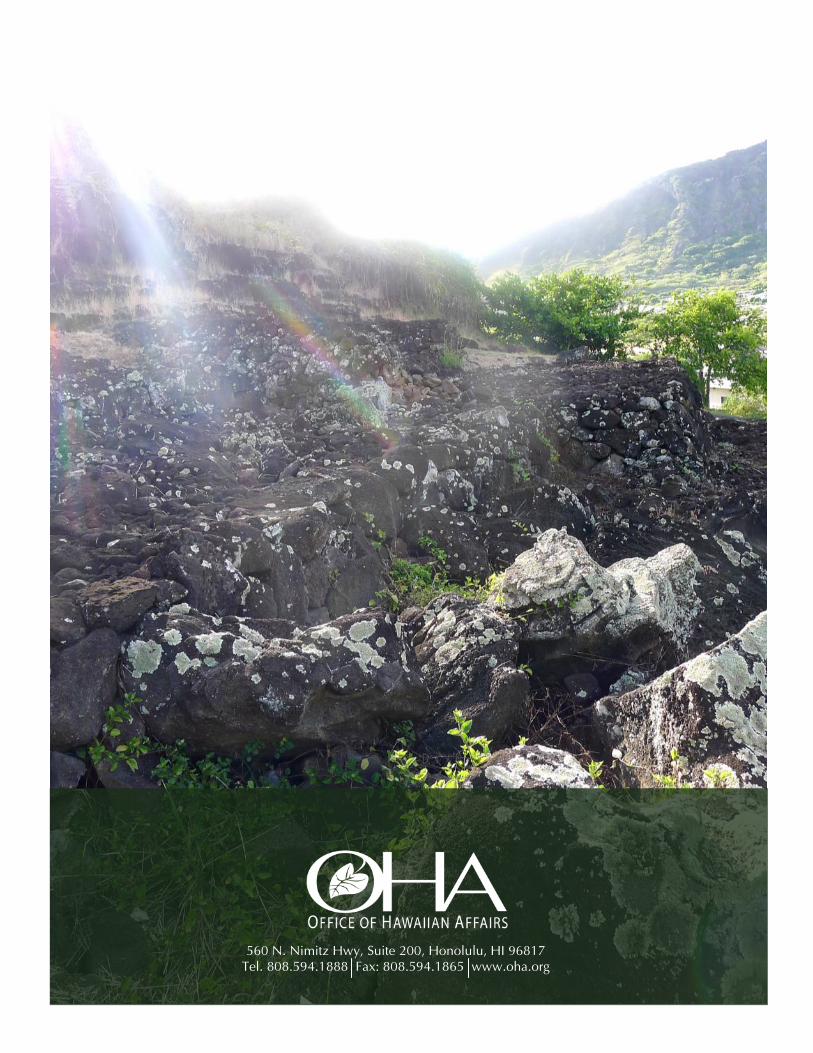
56
560 N. Nimitz Hwy, Suite 200, Honolulu, HI 96817 Tel. 808.594.1888 Fax: 808.594.1865 www.oha.org


