Page 1
ESB National Grid
Kingscourt – Woodland 400kV Feasibility Study
ESBI Report No. PE687-R142-002-001-001
Engineering, Design, Systems and Resources, ESBI Engineering and Facility Management Ltd Stephen Court 18/21 St Stephen’s Green Dublin 2 Ireland Telephone+353-1-703 8000 Fax+353-1-661 6600 www.esbi.ie
DATE 02/12/09
Page 2
Page i
File Reference:
Falcon/DMS
Client:
ESB National Grid
Project Title:
Kingscourt – Woodland 400kV
Report Title:
Feasibility Study
Report No.:
PE687-R142-002-001-001
Rev. No.:
2
Volume 1 of 1
APPROVED: J.Doyle TITLE:
DATE: 02/12/09
COPYRIGHT © ESB INTERNATIONAL LIMITED (1998) ALL RIGHTS RESERVED, NO PART OF THIS WORK MAY BE MODIFIED OR REPRODUCED OR COPIES IN ANY FORM OR BY ANY MEANS - GRAPHIC, ELECTRONIC OR MECHANICAL, INCLUDING PHOTOCOPYING, RECORDING, TAPING OR INFORMATION AND RETRIEVAL SYSTEM, OR USED FOR ANY PURPOSE OTHER THAN ITS DESIGNATED PURPOSE, WITHOUT THE WRITTEN PERMISSION OF ESB INTERNATIONAL LIMITED.
Page 3
Page ii
Summary
ESB National Grid commissioned ESBI to carry out a feasibility study for a potential 400kV line linking
the existing Woodland 400kV station in South County Meath to a proposed 400kV station in the
vicinity south of Kingscourt in either counties Cavan or Meath. The new 400kV station would also be
a termination point for a possible North – South 275/400kV interconnector This report details the
options considered for potential overhead line route corridors between the above termination points.
Potential route corridors developed during the desktop study were verified with an on-site
investigation of driving the route options to check all road and river crossings and to note any
potential conflicts with the desktop study. Route modifications and alternative options were
investigated and are included in this report as a result of the information found during the site study.
The overall route corridors linking Woodland to Kingscourt generally follow the shortest path but are
bound by the major designated constraints particularly pertaining to County Meath and the expanding
environs adjacent to Navan, Trim, Athboy and Kells. The potential route corridors were selected
based on achieving a balance between environmental, technical and economic criteria.
Site studies were also undertaken to assess potential sites suitable for a 400kV station in a study
area south of Kingscourt. It found that a number of potential sites are available and these sites are
evaluated under various headings.
BGE gas pipelines were noted in the study area. It is recommended that a detailed study to determine
the most effective mitigation measures be performed prior to design stage.
The Woodland 400kV station has spare bay capacity to facilitate any proposed transmission line in
the future but it may be more efficient to swap a new bay with an existing bay.
The report concludes that overhead line route options currently exist and are technically feasible at
the time of this study. However, crossing points are limited in some areas and projected population
growth will continue to impact on route selection at road crossings.
The report recommends that further detailed route investigation be undertaken to fully assess the
route options in order to develop a preferred route.
Page 4
Page iii
Contents
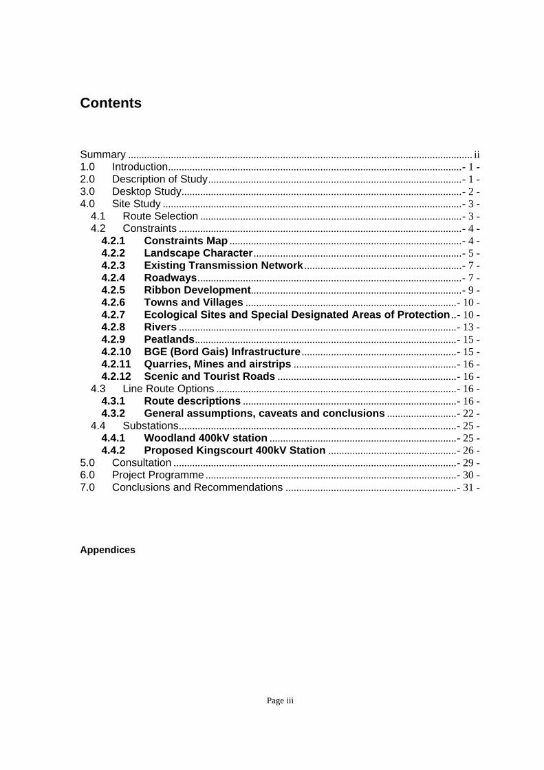
Summary ................................................................................................................................. ii 1.0 Introduction..............................................................................................................- 1 - 2.0 Description of Study...............................................................................................- 1 - 3.0 Desktop Study.........................................................................................................- 2 - 4.0 Site Study ................................................................................................................- 3 -
4.1 Route Selection ..................................................................................................- 3 - 4.2 Constraints ..........................................................................................................- 4 -
4.2.1 Constraints Map .......................................................................................- 4 - 4.2.2 Landscape Character ..............................................................................- 5 - 4.2.3 Existing Transmission Network ...........................................................- 7 - 4.2.4 Roadways...................................................................................................- 7 - 4.2.5 Ribbon Development...............................................................................- 9 - 4.2.6 Towns and Villages ...............................................................................- 10 - 4.2.7 Ecological Sites and Special Designated Areas of Protection ..- 10 - 4.2.8 Rivers ........................................................................................................- 13 - 4.2.9 Peatlands..................................................................................................- 15 - 4.2.10 BGE (Bord Gais) Infrastructure ..........................................................- 15 - 4.2.11 Quarries, Mines and airstrips .............................................................- 16 - 4.2.12 Scenic and Tourist Roads ...................................................................- 16 -
4.3 Line Route Options ..........................................................................................- 16 - 4.3.1 Route descriptions ................................................................................- 16 - 4.3.2 General assumptions, caveats and conclusions ..........................- 22 -
4.4 Substations........................................................................................................- 25 - 4.4.1 Woodland 400kV station ......................................................................- 25 - 4.4.2 Proposed Kingscourt 400kV Station ................................................- 26 -
5.0 Consultation ..........................................................................................................- 29 - 6.0 Project Programme ..............................................................................................- 30 - 7.0 Conclusions and Recommendations ................................................................- 31 -
Appendices
Page 5
Page - 1 -
1.0 Introduction
ESBI study focused on the potential for a 400kV single circuit feasibility study between
the existing Woodland 400kV substation in Co. Meath to a proposed substation in the
general vicinity south of Kingscourt in the counties of Meath or Cavan.
2.0 Description of Study
The objective of the report is to assess the feasibility of obtaining an overhead 400kV
line route between Woodland 400kV substation, Co. Meath and a potential 400kV
substation in the vicinity south of Kingscourt. The outline scope of this study is based on
ESBI Report PE687-R142-001-01-000: Constraints Study. The location of a 275kV inter-
connector route from Northern Ireland will be a contributing factor in the final location of
the proposed new station. Overhead line route will be selected based on achieving a fine
balance between environmental, engineering and economic criteria.
The study area covered an area of 67,000 hectares. The affected counties are Co.
Meath and a small area of Co. Cavan (Kingscourt area). There are options of terminating
in either Co. Meath or Co. Cavan which will be dependent on the site chosen for the
proposed substation which is linked to the terminating point of the proposed 275kV inter-
connector line from Northern Ireland.
The Scope of Work is defined to include:-
Constraints map
Desktop study
Field study
Page 6
Page - 2 -
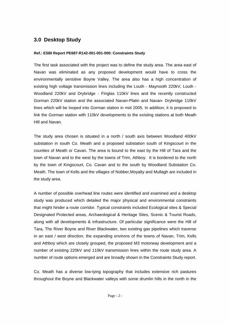
3.0 Desktop Study
Ref.: ESBI Report PE687-R142-001-001-000: Constraints Study
The first task associated with the project was to define the study area. The area east of
Navan was eliminated as any proposed development would have to cross the
environmentally sensitive Boyne Valley. The area also has a high concentration of
existing high voltage transmission lines including the Louth - Maynooth 220kV, Louth -
Woodland 220kV and Drybridge - Finglas 110kV lines and the recently constructed
Gorman 220kV station and the associated Navan-Platin and Navan- Drybridge 110kV
lines which will be looped into Gorman station in mid 2005. In addition, it is proposed to
link the Gorman station with 110kV developments to the existing stations at both Meath
Hill and Navan.
The study area chosen is situated in a north / south axis between Woodland 400kV
substation in south Co. Meath and a proposed substation south of Kingscourt in the
counties of Meath or Cavan. The area is bound to the east by the Hill of Tara and the
town of Navan and to the west by the towns of Trim, Athboy. It is bordered to the north
by the town of Kingscourt, Co. Cavan and to the south by Woodland Substation Co.
Meath. The town of Kells and the villages of Nobber,Moyalty and Mullagh are included in
the study area.
A number of possible overhead line routes were identified and examined and a desktop
study was produced which detailed the major physical and environmental constraints
that might hinder a route corridor. Typical constraints included Ecological sites & Special
Designated Protected areas, Archaeological & Heritage Sites, Scenic & Tourist Roads,
along with all developments & infrastructure. Of particular significance were the Hill of
Tara, The River Boyne and River Blackwater, two existing gas pipelines which traverse
in an east / west direction, the expanding environs of the towns of Navan, Trim, Kells
and Athboy which are closely grouped, the proposed M3 motorway development and a
number of existing 220kV and 110kV transmission lines within the route study area. A
number of route options emerged and are broadly shown in the Constraints Study report.
Co. Meath has a diverse low-lying topography that includes extensive rich pastures
throughout the Boyne and Blackwater valleys with some drumlin hills in the north in the
Page 7
Page - 3 -
area of the proposed new station. The land is mainly of good agricultural quality with
tillage and pasture being the main uses. There are small pockets of peat, mixed quality
land and marsh scattered throughout the extent of the study area but these should not
impact on the construction of the proposed line.
The study area encompasses approximately 67,000 hectares predominately in Co.
Meath and a small area situated in Co. Cavan. It was concluded that the area chosen
would be sufficient in size to accommodate possible overhead line route options from
Woodland to Kingscourt.
Ref.: Appendix 1: Study Area (A1)
4.0 Site Study
4.1 Route Selection
The Constraints Study Report and constraints map was the foundation for selecting
suitable route options to enable a field study to take place. Site verification was the next
phase to access the route options shown for suitability to plan a 400kV overhead
transmission line between the designated terminating points. It should be noted that the
constraints map was a desk top study and that the route corridors were bound by the
major designated areas of protection and other obvious constraints.
A study of aerial photography for the entire study area to a scale of 1:10,000 in
conjunction with the constraints map was carried out. Using the route corridors from the
constraints study a detailed line route selection process was carried out on the aerial
photography (flown mid 2004) with due reference to ribbon development at all crossing
points, large country homes and any other obvious infrastructure that was visually
apparent. These routes were placed simultaneously on the digitized constraints map
taking into consideration all designated areas of protection. All archaeological and
heritage sites were added to the constraints map at this stage and were taken into
consideration for route options. Route options were refined and verified using a
combination of information from both the aerial photographs and constraints data base.
Page 8
Page - 4 -
All route options were driven and all crossings points on roads were checked for
sufficient clearances from existing dwellings or other possible constraints. In the event of
tight crossings the distances were taken between dwellings. Also noted were any
developments that were in progress or had been constructed since the date of issue of
the aerial photography or of any planning site notices placed. In the event of the initial
crossing point proving to be unavailable due to new developments alternative crossing
points were investigated in the immediate vicinity and details noted. This process was
also applied to crossing points that may have appeared feasible on the photography and
constraints mapping but could prove to be contentious from an environmental
perspective when viewed on the ground. Particular examples are the crossing of the
River Blackwater adjacent to the scenic village of Donaghpatrick, the valley crossing at
Kilmainhamwood and the vicinity around the village of Nobber. Visual inspections were
also taken at the River Boyne crossing points, general areas of high visibility, potential
substation sites and from the Hill of Tara.
After evaluating the information collected from the site visits, further modifications and
route alternatives were added in conjunction with the aerial photography and constraints
data base.
Constraints are discussed more fully in the specific section 4.2 and a description of the
line route options are given in section 4.3.
The revised Route Options and Constraints Map is included as Appendix 1.
4.2 Constraints
4.2.1 Constraints Map
With the limits of the study area defined a constraints map was prepared to capture all
constraints within the area that would impact on route selection. This included all existing
transmission lines, designated Special Protection Areas (SPA’s), Special Areas of
Conservation (SAC’s), National Heritage Areas (NHA’s) and FIPS (Forrestry) Ref.:
Department of the Environment, Heritage and Local Government (DoEHLG) Records. All
Sites and Monument Records (SMR’s) were added to the constraints map prior to the
final routing for this report.
Page 9
Page - 5 -
The constraints included:
Landscape character
Land zoning, towns and rural dwellings
Electrical Infrastructure
General Infrastructure
Ecological Sites and Special Designated Protected Areas
Archaeological & Heritage sites
Quarries, Mines and Airstrips
Scenic and Tourist roads
Defined route options were chosen and placed on the constraints map taking all of the
above factors into consideration. This was done in conjunction with a detailed study of
aerial photography which gave clear indicators for road crossings, farm buidings and the
myriad of country homes and estates prevalent in Co. Meath.
The associated sections of this chapter give a more detailed account of the constraints.
Ref.: Appendix 2: Line Route Options and Constraints Map (A0)
4.2.2 Landscape Character
The landscape character is perhaps the single most important area when routing a
transmission line. All natural parks and areas of high scenic value were avoided along
with open expanses of water and marshland. Where possible the overhead line should
avoid approaching the shores of rivers or natural lakes. Towers should be positioned a
minimum of 15 meters away from navigable waterways. Moderately open valleys with
woods were selected where possible, especially where the apparent height of structures
might be reduced. It should be noted that the vast majority of lands in the study area are
of a flat and open nature encompassing two river valleys and changing to gentle rolling
hills and drumlins in the northern part.
Where possible the line routes follow natural lines created by topographic change,
geology, and vegetation that will help to minimise the visual impact. Where possible, the
overhead line route was located on the middle slopes rather than siting them along the
Page 10
Page - 6 -
dominant axis and at the base of small valleys. It is preferable to avoid breaking the
skyline.
Where possible, towers should be placed near to the most vertical elements in the
landscape, such as tree group or hill slopes. Where the landscape has a complex
character, a great number of towers can be visually absorbed.
Landscape Character Areas were interpreted by utilizing the contour lines. The
landscape character of the study area is mainly flat and open with a more pronounced
drumlin nature at the northern end of the routes. The ideal line of corridors in these
areas would follow as much as possible the valleys between these drumlins. An area
that could pose problems was flat terrain around rivers which would indicate the
probability of flood plains and associated silt deposits. The proposed line would be
steered away from these areas as they could entail complex foundations and possible
objections at planning stage. High density contours would indicate steep hills and
awkward future siting of mast positions.
Typical drumlin terrain landscape close to Kingscourt
Page 11
Page - 7 -
4.2.3 Existing Transmission Network
All proposed route options within the study area will have to cross the Louth – Maynooth
220kV line situated to the east and north of Woodland station and the Arva- Navan
110kV line which is running in an east – west direction just north of Navan town. The
Flagford- Louth 220kV line runs in an east-west direction south of Kingscourt and will be
looped into the new substation. Crossings would be ideally close to 90 degress.
North view of existing Flagford - Louth 220kV near Kingscourt
Potential substation sites are directly behind the transmission line
4.2.4 Roadways
The N3 National Primary road extends northwards from Dublin via Navan and Kells on to
Cavan. All route options within the defined study area will have to cross this road.
The NRA (National Roads Authority) has permission to construct a new motorway to be
designated the M3 (Bord Pleanala approval Aug. 2003). The NRA plan for construction
to commence in 2006 with a target completion date of 2010 but expected legal
Page 12
Page - 8 -
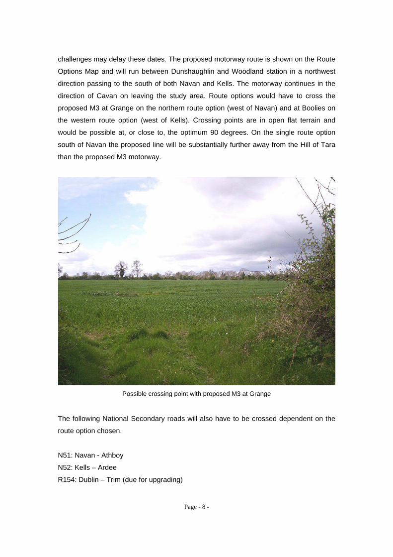
challenges may delay these dates. The proposed motorway route is shown on the Route
Options Map and will run between Dunshaughlin and Woodland station in a northwest
direction passing to the south of both Navan and Kells. The motorway continues in the
direction of Cavan on leaving the study area. Route options would have to cross the
proposed M3 at Grange on the northern route option (west of Navan) and at Boolies on
the western route option (west of Kells). Crossing points are in open flat terrain and
would be possible at, or close to, the optimum 90 degrees. On the single route option
south of Navan the proposed line will be substantially further away from the Hill of Tara
than the proposed M3 motorway.
Possible crossing point with proposed M3 at Grange
The following National Secondary roads will also have to be crossed dependent on the
route option chosen.
N51: Navan - Athboy
N52: Kells – Ardee
R154: Dublin – Trim (due for upgrading)
Page 13
Page - 9 -
R161: Navan – Trim
R162: Navan – Kingscourt
R163: Slane – Kells
R164: Kingscourt - Moyalty
R165: Kingscourt – Ardee
R194: Kells – Mullagh
Possible line route crossing point on R154 (Batterstown – Trim Road)
4.2.5 Ribbon Development
There is a high level of ribbon development in place which limits crossing opportunities
on the major link roads and on the substantial network of smaller roads and lanes within
the study area particularly within the Navan – Trim – Kells – Athtboy area. All road
crossings were inspected on site to ensure adequate clearances existed at the present
time. Most minor road crossings could accommodate a route corridor of 200m. Crossing
the major roads linking Navan and Kells (N3), Navan and Athboy (N51) and Navan and
Trim (R161) was more problematic and a number were in the minimum 100 to 200m.
range. During the course of the site inspection it was found that developments not
shown on aerial photography were in progress and modifications to initial route
Page 14
Page - 10 -
selections as well as new route options were investigated and are included on the
mapping.
It is reasonable to assume that given the population growth rate predicted for Co. Meath
(Section 4.2.6: Towns and Villages) that crossing opportunities will diminish even further
in the relatively near future. A further factor that will impact in the future is the
publication of ‘’Guidelines on Sustainable Rural Housing’’ published mid April 2005
which represents a presumption in favour of quality one off housing.
Ref.: Appendix 3- Aerial photograph showing density level of ribbon development at River
Blackwater crossing west of Navan.
4.2.6 Towns and Villages
The study area encompasses the towns of Navan, Trim, Kells and Athboy and the
villages of Nobber and Mullagh. Population growth in Co. Meath has been increasing
substantially over the past ten years with a last census figure of 130,000. Present
density levels vary considerably from the very rural areas in the northwest (less than 25
persons per square kilometer in a substantial number of DED’s) to more than 50 in the
districts containing the main urban centres of Navan, Trim and Kells. Projections for the
Meath County Development Plan and County Housing Strategy indicate that substantial
increases are likely with projected totals of 161,000 in 2006 and rising to 180,000 in
2011. The population of Navan has doubled in the years 1996-2001 to over 22,000 and
has continued this growth pattern in the interim 4 years. All of the main towns indicated
above are within a relatively close distance to each other and a higher than normal level
of ribbon development is prevalent. The routes chosen were generally equi-distant
between these main towns unless dictated by areas of protection.
4.2.7 Ecological Sites and Special Designated Areas of Protection
County Meath has an extremely rich cultural heritage. There are five Special Areas of
Conservation (SAC’s) within the county, one Special Protection Area for Birds (SPA), the
Boyne Estuary and 22 National Heritage Areas (NHA’s). The landscape contains an
extensive number of national monuments as well as a number of significient historical
Page 15
Page - 11 -
sites adjacent to Trim and Kells. All these areas are included on the Route Options Map
showing their proximity to all route options examined.
Ecological areas of interest were highlighted by the Department of Environment,
Heritage and Local Government. These include NHAs (Natural Heritage Areas), SPAs
(Special Protection Areas) and pcSACs (proposed candidate Special Areas of
Conservation). These areas should be avoided as crossing them would be contrary to a
future planning permission acquirement.
Extract from Cavan County Development Plan:
‘These sites are areas of importance to birds and other wildlife. The EU Birds Directive
(79/409/eec) requires designation of Special Protection areas. Special Protection Areas
along with Special Areas of Conservation collectively form part of ‘Natura 2000’, a
network of protected areas throughout the European Union.
It is the policy of the Planning Authority to conserve and protect Special Protection Areas
through the regulation of all development. Development that may threaten the integrity
and value of the designated sites will not be allowed. Development that is close to a
designated Special Protection Area will be assessed rigorously and where it is deemed
that it negatively impacts on a site such development may require an Environmental
Impact Statement.’, Cavan County Development Plan 2002.
Designated Areas for Flora and Fauna (SAC, SPA & NHA)
Proposed candidate Special Area of Conservation (pcSAC)
This is a statutory designation which has legal basis in the EU Habitats Directive
(92/43/EEC) as transposed into Irish law through the European Communities (Natural
Habitats) Regulations, 1997 (S.I. 94 of 1997). The main implication of this designation
is that any project likely to have a significant adverse impact on the integrity of the
pcSAC may only be carried out for “imperative reasons of overriding public interest,
including those of a social or economic nature”. Where a pcSAC includes a “Priority
Habitat” or a “Priority Species”, as indicated in Annex I and Annex IV of the Directive,
then “the only considerations which may be raised are those relating to human health or
Page 16
Page - 12 -
public safety or, further to an opinion from the Commission, to other imperative reasons
of overriding public interest”.
Designated Special Protection Area (SPA)
This is a statutory designation, which has legal basis in the EU Wild Birds Directive
(79/409/EEC) as transposed into Irish law through the European Communities
(Conservation of Wild Birds) Regulations, (various dates). Most, though not all, of these
sites are located in wetlands or coastal areas, which have significant concentrations of
birds. The implications of this designation are similar to the pcSAC but there is a
provision in the statutory regulations to prevent “pollution or deterioration of habitats or
any disturbance whatsoever” affecting the birds which use a SPA.
Proposed Natural Heritage Area (pNHA)
This is presently a non-statutory designation which replaced the previous designation,
Area of Scientific Interest (ASI), about 1994. It becomes a statutory designation when
the Wildlife (Amendment) Bill, 2000 becomes law. Most local authority development
plans include an objective to protect pNHAs within their jurisdiction so this gives the
designation some legal status under the Planning and Development Act, 2000. An
application for planning permission for any development, which may have impacts on a
pNHA, will be referred by the planning authority to the Department of Environment,
Heritage and Local Government (D.o.E.H.& L.G.) for comment.
Statutory Nature Reserve (SNR)
This is a statutory designation which can cover either state or private land which is of
scientific interest. Reserves are designated under the Wildlife Act, 1976. There is an
obligation to manage the land in accordance with the objectives for which it was
designated. Most nature reserves are in state ownership and are managed by Dúchas,
the Heritage Service. Any state agency which is involved in activities that may affect a
reserve is required to consult with D.o.E.H.& L.G. and to take all practical steps to avoid
or minimise any damage.
Page 17
Page - 13 -
Archaeological & Heritage Sites
All Sites and Monuments Records are shown on the Route Options and Constraints Map
covering the study area (Appendix 2).
Archaeological heritage sites are administered by the Department of the Environment,
Heritage and Local Government, (D.o.E.H.L.G.). The most recent boundaries of these
designated areas were obtained from the department’s website. These include protected
buildings, heritage sites including megalithic monuments earthworks, ringforts and other
types of enclosures, ecclesiastical remains, crosses, holy wells and burial grounds,
stone fortresses, castles, towers, bawns and forts.
Although archaeological sites are not considered a major constraint due to the high
degree of flexibility in locating overhead line structures all route options shown take due
notice of these sites and line distance from them was kept to 50m approximately where
possible.
4.2.8 Rivers
Any route options taken within the study area will have to cross the River Boyne and
River Blackwater which are designated SAC’s. Both rivers also have many tributaries in
the catchment area which would have to be crossed.
The points at which the line route options cross the River Boyne and the River
Blackwater are at the narrow points of the rivers and with the narrowest area of
designated protection. Adjacent Existing developments on either side of the rivers
impacted on crossing points to a small degree.
It can be assumed that there may be opposition to crossing these designated SAC’s by
both Planning Authority and / or pressure groups highly active in the county due to the
proposed M3 motorway plans.
The River Dee in the northeast of the study area (adjacent to the village of Nobber)
would also be crossed if the eastern option is taken but this is unlikely to generate the
same degree of adverse reaction.
Page 18
Page - 14 -
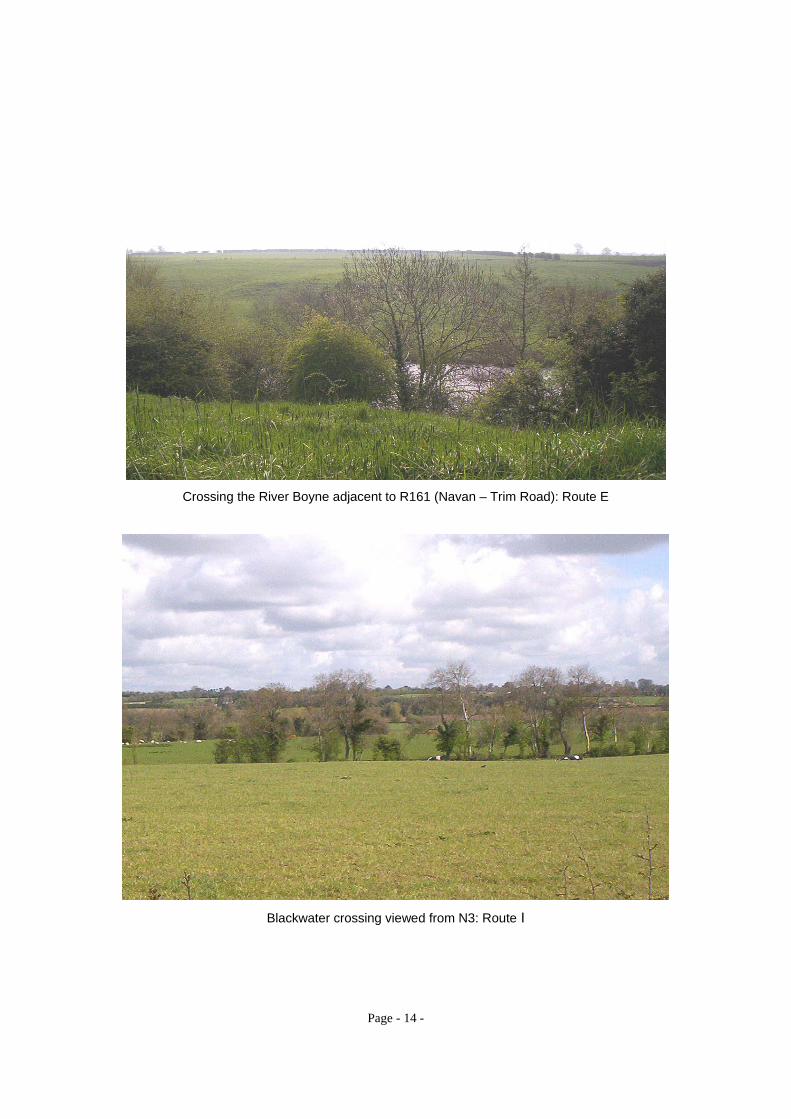
Crossing the River Boyne adjacent to R161 (Navan – Trim Road): Route E
Blackwater crossing viewed from N3: Route I
Page 19
Page - 15 -
4.2.9 Peatlands
Jamestown Bog is a designated NHA and is situated approximately 7km west of Navan.
Major route options do not infringe on this peatland.
4.2.10 BGE (Bord Gais) Infrastructure
Two major gas pipelines cross the study area in an east – west direction and any
proposed line route options will have to cross the pipelines. One pipeline is situated
4.3km north of Woodland Station and the second line is situated 3.5km south of
Kingscourt and is in the vicinity of the proposed substation sites. The northern pipeline
has two tee - off points in the vicinity of the substation sites. This pipe line may not have
to be crossed depending on substation site chosen.
All proposed routes options cross the pipelines at or as close to 90 degrees as is
possible. This is necessary to minimise inductive coupling but is only effective if the line
remains at, or close to, this angle to the pipeline for a distance of approx. 3km either side
of the pipeline crossing point (400kV development). Whilst it is reasonably possible to
cross at 90 degrees it is difficult to maintain this angle for distances of 3km beyond the
crossing points given the density of ribbon development and the high number of
archaeological sites and designated areas of protection to be avoided. However, line
routes chosen ensured that parallelism (between transmission line and gaspipe line) was
avoided which lessens the likelihood of significant voltage induction.
In order to reduce the effects of conductive coupling during a fault the pipeline will have
to be crossed as close to the mid-span as possible and the particular span at the
crossing will be increased to the maximum allowable to ensure that towers are
positioned as far away as possible from the pipeline.
It is recommended that a detailed study to determine the most effective mitigation
measures be performed prior to design stage. This would include soil resistivity
measurements and full technical details of both the proposed transmission line and the
gas pipelines.
Appendix 4: Bord Gais pipe line north of Woodland
Appendix 5: Bord Gais pipe line south of Kingscourt
Page 20
Page - 16 -
4.2.11 Quarries, Mines and airstrips
There is no evidence to date, either from inspection of aerial photography or from onsite
visual observance, that there are any quarries, mines or airstrips that would impact on
the routes chosen.
4.2.12 Scenic and Tourist Roads
The Meath County Development Plan - Areas of Visual Quality (AVQ) was referenced
and designated areas were examined and avoided in corridor route selections.
4.3 Line Route Options
4.3.1 Route descriptions
Ref.: Appendix 2: Route Options and Constraints Map
Route options for the purpose of this study are given alphabetical designations and are
as follows:
Woodland Station to the Townland of Cruminstown
Section A: Directly out of the western face of Woodland 400kV station heading in a
north-east direction to Derrypatrick. Section length 6.8 km.
Section B: Use the unstrung northern side of the Oldstreet – Woodland 400kV line in a
westerly direction out to the first angle mast (a distance of 3km approx.) before turning in
a northwest direction to a common angle position at Derrypatrick. Advantages are less
construction of steel masts and in all probability less direct negotiations with landowners
given the shorter new line construction length. Both sections A & B cross the southern
gas pipe line at as close to 90 degrees as is possible. Section length 7.5km (inc. 3km.
carried on existing line).
Page 21
Page - 17 -
Station interface implications are given in Section 4. Substations, 4.1.1. Woodland
400kV Station.
Section C: Northwest and crossing the R154 (Dublin – Trim) road southeast of
Batterjohn crossroads and proceeding to Cruminstown. This option has to pass behind
the Grange Research Centre and is adjacent to the EU VET Centre. Because of the
proximity to both centres and to Batterjohn crossroads a second option (D) was
investigated. Section length 5km.
Section D: North- west behind Batterjohn crossroads and crossing R154 2km. north-
west of Batterjohn and proceeding to a common angle mast at Cruminstown. Section
length 5.6km.
Crumlintown to Dunderry:
Section E: Single route option which crosses the River Boyne at a narrow crossing point
that is not viewable from any adjacent roads. A photograph is included in section 4.2.8
Rivers. The route crosses the R161 (Navan - Trim) immediately to the north of the river
crossing. This route is also sensitive in that it is the closest point of the line route to the
Hill of Tara. The distance is approximately 6km and would not be viewable from the Hill
of Tara. In comparison, the proposed M3 moterway will be less than 2km from the Hill
and the existing Louth – Maynooth 220kV line is approximately 1km away. Section
length 8.5km.
Page 22
Page - 18 -
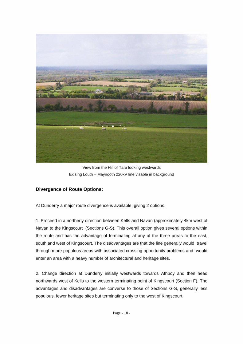
View from the Hill of Tara looking westwards
Exising Louth – Maynooth 220kV line visable in background
Divergence of Route Options:
At Dunderry a major route divergence is available, giving 2 options.
1. Proceed in a northerly direction between Kells and Navan (approximately 4km west of
Navan to the Kingscourt (Sections G-S). This overall option gives several options within
the route and has the advantage of terminating at any of the three areas to the east,
south and west of Kingscourt. The disadvantages are that the line generally would travel
through more populous areas with associated crossing opportunity problems and would
enter an area with a heavy number of architectural and heritage sites.
2. Change direction at Dunderry initially westwards towards Athboy and then head
northwards west of Kells to the western terminating point of Kingscourt (Section F). The
advantages and disadvantages are converse to those of Sections G-S, generally less
populous, fewer heritage sites but terminating only to the west of Kingscourt.
Page 23
Page - 19 -
The major infrastructural constraints in the study area, ie. main roads, proposed M3
motorway, the second gas pipe line and the River Blackwater all traverse in an east –
west direction, and all would have to be crossed by either option.
Dunderry to west of Kingscourt
Section F: Proceed initially westwards south of Jamestown Bog for approximately
7.5km before turning in a more northerly direction with Athboy 4km to the west and
passing Kells to the west by 3km. The line would pass adjacent to the Peoples Park
west of Kells. It also crosses the River Blackwater at this point which dictated the
crossing point. It then proceeds towards the small town of Mullagh which is 1.5km to the
west. Terrain at this point is of a more Drumlin character. The line would then have to
cross the northern gas pipe line and one of its tees (2 crossings) before heading directly
into the station site option approximately 6km west of Kingscourt. Crossings with
pipelines were kept as close to 90 degrees as possible given the more difficult terrain in
this area and the ribbon and farm developments. The line has the option of terminating
either north or south of the existing Flagford – Louth 220KV line dependent on station
site choice.Section length 39km.
Total length from Woodland station approximately 60km.
Dunderry to station sites east, south and west of Kingscourt:
Sections G – S:
These routes proceed directly northwards from Dunderry to the south of Nobber. At this
point there are options for routes to stations situated in areas to the east, south and
west of Kingscourt.
Dunderry – Phoenixtown Cross Roads
Section G: Proceed in a single route option northwards crossing the N51 (Navan –
Athboy) and the proposed M3 motorway before terminating at a common angle mast
approximately 1km east of Phoenixtown cross roads. This is a sensitive and potentially
problematic area as the line now must cross the River Blackwater and the very scenic
Page 24
Page - 20 -
and picturesque village of Donaghpatrick in a designated Gealteacht area. Section
length 7.8km .
Phoenixtown Cross Roads - Stone Cross Roads
Section H: As per corridor in the Constraints Study but would pass to the east of
Donnaghpatrick village and would then navigate through dense ribbon development
before terminating at Stone Cross roads. As the proposed line could be viewed from
Donaghpatrick Bridge an alternative route option is given below (I). Length 6km.
Section I: Route alternative to the west of Donaghpatrick. Crosses the River Blackwater
at a narrow crossing point which is not as visible from any public roadways as route H
would be. It continues to the common angle mast at Stone Cross roads. As for route H
there are many houses in the area but roads may be marginally easier to cross. Section
length 6km.
Stone Cross Roads to South of Nobber
Section J: Single route option proceeding northwards passing to the west of Ermlagh
Forrestry. Generally good crossing opportunities on flat terrain and not viewed from
roads until crossing the N52 (Kells – Ardee). Terminates on an common mast (option
divergence) approximately 2km south of the village of Nobber. Section length 8.3km.
South of Nobber to station site east of Kingscourt:
South of Nobber to east of Nobber
Section K: Proceed in a northeast direction bypassing the village of Nobber to the east
and crossing the R162 ( Navan – Kingscourt) and the River Dee. Section length 3.8km.
Page 25
Page - 21 -
East of Nobber to station site
Section L: Continues in a northeast direction crossing the northern gas pipeline and
R165 (Kingcourt – Drumcondra) at approximately 90 degrees and terminating at station
sites to the east of Kingscourt and south of the existing Flagford – Louth 220kv line. The
village of Drumcondra is 1.5km to the east. Terrain is of a drumlin naturew. Station site is
approximately 5km east of the existing Meath Hill 110kV station. Section length 7km.
Section M: Similar to option L. The general area has ribbon development and may give
alternative crossing options. Section length 6.4km
Section N: Continues from a common angle mast into substation site. Section line
length 1km.
Total line length from Kingscourt station 56km. approximately.
South of Nobber to station site south of Kingscourt
Section O: Proceed in a northwest direction bypassing the village of Nobber to the west
by approx. 2.5km. This area around Nobber is heavily populated by ringforts, crannogs
and enclosures. The route is also bound by protected forest areas, Whitewood Lough
and some substantial ribbon development. Section length 3.7km
Section P: Proceeds due east for crossing the R165 (Kingscourt – Drumcondra).
Section length 2.9km.
Section Q: After the road crossing it runs relatively unhindered in a northerly direction
towards a potential station site south of Kingscourt. Station site is approximately 4km
southwest of the existing Meath Hill 110kV station. This route would not cross the
northern gas pipe line. Section length 4km.
Total line length from Woodland station 55 km approximately.
Link
Section R: A line route is available linking the route to the east of Nobber to the route
west of Nobber and is situated to the north of Nobber. Section length 2.6km.
Page 26
Page - 22 -
South of Nobber to station site west of Kingscourt:
Sections 0 / S:
Section O: Single route option proceeding in a northwest direction bypassing the village
of Nobber to the west by approximately 2.5km.This section is common to route heading
to station south of Kingscourt. Section length 3.7km.
Section S: It continues in the same direction for 3.2km bound to the east by Whitewood
Lough and to the west by hilly terrain. A slight detour takes place in order to by-pass the
village of Kilmainham and to ensure a good crossing point of the Kilmainham River
which has a substantial valley profile as it gets close to the village. Crossing points were
hampered by developments along the links roads to the village. The northern gas pipe
line was also in this area and ensuring a crossing point of 90 degrees was a further
constraining factor. On crossing the valley it continues in a northwest direction crossing
the R164 (Kingscourt – Moynalty) and then travels relatively unimpeded through very
hilyl terrain towards the potential station sites west of Kingscourt. The proposed line may
or may not cross the existing Flagford – Louth 220kK line depending on the site station
chosen. Section length 10km.
Total line length from Woodland station 58km approx.
4.3.2 General assumptions, caveats and conclusions
At this stage no preferred line route option has been chosen primarily due to the inbuilt
flexibility provided in the final stage of the route as several potential substation sites
were examined. Once the terminating point of the 275Kv North – South line has been
agreed a preferred line route corridor can be established.
All potential route corridors were identified from the initial desktop constraints mapping
exercise. These corridors were identified by the avoidance of major constraints, areas of
high population density and because the landscape generally has the ability to
incorporate such a development with minimal impact on landscape.
The initial routes corridor options were modified after site studies and defined crossing
points have been established. However it should be noted that these potential route
Page 27
Page - 23 -
corridors have only been supported by drive though surveys and not detailed on-site
investigations or reference to environmental consultants.
It is accepted that the scale of a proposed 400kV development, where towers can be in
excess of 30m high, will mean that the line will be visible in the landscape but with
careful route selection and mast placement its impacts can be reduced. The countryside
through which the proposed route would pass is generally of a high quality where
landscape character and visual amenity are potentially sensitive to change from a
development of this nature. In the southern route area where the topography is very flat
the proposals were routed away from main roads in so far as was practical and road
crossings were kept as close to 90 degrees as possible. In the northern part of the study
area use was made of the natural screening potential of the drumlin topography and will,
with careful placement, reduce the visual impact of the masts. However drumlin
landscape can create difficulties in route selection due to the nature of changes in levels
and maintaining straight lines over distances with a resultant higher number of angle
masts. Numerous hedgerows, individual trees and pockets of woodland can help to
create intermittent screening in the landscape which can be exploited for route selection.
Higher ground was avoided to ensure that masts and lines are not seen on the skyline.
Masts whould not generally be placed adjacent to road crossings.
There are numerous dwellings along all roads along with substantial farm buildings
throughout the area. Potential routes were chosen to avoid these. There is also a high
proportion of county houses with long access avenues throughout the study area. All line
route options endeavored not to cross these avenues.
No survey took place of the proposed routes nor was it walked. Only a drive by survey of
all road crossings was carried out to check as to the feasibility of the corridor along with
ensuring adequate clearances from existing developments.. Rights of way, historical
trails etc. were not marked up on the constraints maps. It is assumed walking routes can
be crossed without wayleave / planning problems. Apart from the M3 It is assumed that
no future major developments will come on stream in the near future.
It is recommended that crossings of existing HV transmission lines be investigated as
part of detailed routing. Crossing angles are at, or close to, the optimum 90 degrees.
Page 28
Page - 24 -
Conflicts with existing distribution network including 38kV, 10kV and LV or with existing
communication lines including Eircom have not been investigated or quantified.
The route options and crossing points vary in width dependent on relative proximity to
urban centres but are reduced in some locations to pinch points of approx 100m. Scope
for modifications is generally more flexible on the western option route (F) and as the
routes move closer to the proposed new substation site study area.
It is assumed that the route options will not be further encroached by:
Major developments not known at this time including major roads, transmission
lines etc
No additional areas are added to the NHA’s, SAC’s listings.
No additional archaeological sites/monuments are added to listings.
Urban commercial/residential zones are not expanded beyond present limits in
towns e.g. Navan, Trim, Kells, Athboy, Nobber etc.
Additional scenic viewing points, scenic drives etc are not added by County
Councils etc.
Proximity to Secondary Amenity Areas will not incur planning restrictions e.g.
minimum distance in sight lines etc.
No planning restrictions on routing close or adjacent to Designated Areas of
Protection
Dismantled railways are not refurbished and used commercially again on or near
the proposed route corridor.
No other commercial/industrial developments will take place in or near route
corridor e.g. wind-farms, manufacturing plants, etc.
Local or private airfields.
Page 29
Page - 25 -
4.4 Substations
4.4.1 Woodland 400kV station
There are two route options out of Woodland station and these are discussed in Line
Route Options section 4.1.3.
Line interface and Bay capacity implications for an incoming 400KV line are as follows:
Switchgear:
Although space is available on the 400kV side of the Substation to cater for a busbar
with 6 feeders, the busbar, as constructed, can only accommodate three 400kV feeders.
Bay E6 on the A2/B2 section of the busbar: In service as Oldstreet 400kV Line
bay
Bay E2 on the A2/B2 section of busbar : Spare
Bay E3 on the A1/B1 section of busbar: Spare and partially equipped.
Both of the spare bays are to the south of the Oldstreet Feeder bay.
As the proposed Kingscourt feeder will be to the north side, two possible options exist to
cater for this new connection.
Option 1:
Relocate the existing Oldstreet Feeder bay to bay E2 or E3. Within the Substation this
would require equipping bay E2 or E3 and relocation of the shunt reactor on the
Oldstreet bay. Bay E6 would then be available for the proposed Kingscourt feeder.
Option2:
Extend the busbar on the north side and install a new line bay.
Control/Protection: Sufficient space exists within the Relay room for the required Protection Cabinets. The
existing 400kV busbar protection was designed to cater for bay E3 so it should be
possible to re-use this for the proposed Kingscourt bay.
Ref.: Appendix 6: Woodland 400kV Station: Line Bay Layout
Page 30
Page - 26 -
Potential use of unstrung northern phase on existing Oldstreet - Woodland 400kV line (tee off
point from angle mast visible in background)
4.4.2 Proposed Kingscourt 400kV Station
Site studies were carried out in the general vicinities of the three main route terminating
points which covers an area of approx. 70,000 hectares (70sq.km) and spanning a linear
length of approximately 15km south of Kingscourt.
A total of 23 potential sites and 12 flexible areas for site placement were located. All the
potential sites are evaluated and rated in the context of general topography, access,
sightlines, proximity of housing and any potential conflicts in terms of archeology. This
study was carried out by on – site evaluations and did not involve any dealings with
landowners. However, there is a good spread of sites with excellent screening potential
in the study area and it is assumed that a final site could be found from the range given
once the final terminating point of the line routes (400 and 275kV) is established.
Page 31
Page - 27 -
Site No.
General Housing Archeology Access Sightlines Potential
1-10
1 Low-Lying. Easily
screened. No obvious overlook.
No No Conflict Good Good 9
2 Easily screened. No obvious difficulties. 38kV line crossing.
Minimal No Conflict Good Good 8
3 Easily screened. No obvious difficulties.
Minimal No Conflict Good Good 8
4
Good. Existing farm road would need to
be upgraded to facilitate access.
No
Minor - Kilboyne hill to south of
site
Good Good 8
5 Good. Full access road would need to
be constructed. Minimal
Minor - Kilboyne hill to south of
site
Good Good 8
6
Good. Station access road off existing farm access which would need upgrade. 38kV
line crossing.
Minimal In vicinity but
no conflict Good Good 7
7 Good. Full access road would need to
be constructed. No
In vicinity but no conflict
Good Good 8
8
Good. Existing farm road would need to
be upgraded to facilitate access. *North of 220kV.
No No Conflict Fair Cul-de-sac
location 7
9
Fair. Existing farm road would need to
be upgraded to facilitate access. Low lying and potentially
wet. *North of 220kV.
No No Conflict Fair Cul-de-sac
location 7
10
Geographically OK but overlooked by housing on several
fronts. Heavy screening required
and full access road to be constructed. *North of 220kV.
Heavy No Conflict Poor To be
determined 4
11 Attractive overall Minimal No Conflict Good Good 9
12 Attractive overall Minimal No Conflict Good Good 9
13
Low-Lying. Easily screened. No obvious
overlook. *North of 220kV.
Minimal In vicinity but
no conflict Good Good 7
Page 32
Page - 28 -
14 Low-Lying. Easily
screened. No obvious overlook.
Minimal In vicinity but
no conflict Good Good 8
15
Low-Lying, natural screening on three
sides. Close to 220kV.
Minimal In vicinity but
no conflict Good Good 8
16
Good. Existing farm road would need to
be upgraded to facilitate access. Easily screened.
No No Conflict Fair Good 8
17
Good. Existing farm road would need to
be upgraded to facilitate access. Easily screened.
No No Conflict Fair Good 8
18 Attractive overall,
access would have to be constructed.
No No Conflict To be
constructed
Good 8
19
Low-Lying, some natural screening. Station could be
easily hidden. Close to 220kV.
Minimal No Conflict To be
constructed
To be determined
7
20
Good. Existing farm road would probably
cater for Station access. Easily
screened.
Minimal In vicinity but
no conflict Good Good 9
21
Good. Existing farm road would need to
be upgraded to facilitate access. Easily screened.
Minimal In vicinity but
no conflict Good Good 8
22
Attractive overall, access would have to be constructed and extensive screening would be necessary.
No In vicinity but
no conflict Fair Good 8
23
Low-Lying, Good natural screening from main road. Station could be
easily hidden. Close to 220kV. Access would have to be
constructed.
No No Conflict To be
constructed
To be determined
7
Note: The areas shown as polygons
on the map provide a level of flexibility with the Station location
and are suitable overall.
All sites are outside of the gas pipeline
exclusion zone of 1kM.
Page 33
Page - 29 -
Typical station site option with flat terrain and good screening potential
It is assumed Planning permission will be received for a proposed Kingscourt
Substation.
Appendix 7: Preliminary Site Selection: Locations Map
5.0 Consultation
Consultation took place with BGE with regards to existing infrastructure within the
defined study area. Pipeline routes shown on all maps are as obtained from an Bord
Gais.
No consultations or meetings were held with any Local Authority Planners at this stage
as per scope.
Page 34
Page - 30 -
6.0 Project Programme
Ref.: Appendix 8: Outline Programme
Page 35
Page - 31 -
7.0 Conclusions and Recommendations
If a decision is made to proceed with a transmission line connection between the existing
Woodland 400kV station and a proposed station in the vicinity of Kingscourt it is
recommended that detailed site investigation and route evaluation with environmental
consultants be undertaken if these route corridors are to be proceeded with. Other
alterative route corridors may also be available.
Overhead line crossing points on main roads are found to be generally tight and it can
be assumed that route corridors will remain under threat from expanding infrastructural
development and one off housing in the near future. This will be particularly prevalent
around urban areas such as Navan, Trim and Kells where development is influenced by
the opportunities and pressures emanating from Dublin metropolitan area.
There is spare bay capacity at Woodland 400kV station to accommodate the overhead
line. The study area for a new station in the region of Kingscourt has many suitable sites
in all locations where route options may terminate.
In terms of environmental issues it is concluded that Co. Meath is an area very rich in
cultural heritage sites with a higher than average number of designated areas of
protection. The proposals have routed away from these sites but will entail the crossing
of the River Boyle and River Blackwater whose valleys are designated as areas of
protection. This may prove contentious with planners or other groups dedicated to the
protection of the environment such as those opposed to the building of the M3.
All alternative route corridors cross BGE gas pipelines. It is recommended that a detailed
study be carried out as part of the phase 1 project to assess coupling issues of the
proposed development and the BGE pipelines.
Routes have not been agreed with any planning authorities, public bodies or landowners
at this stage.
Page 36
Page - 32 -
This feasibility report concludes that route corridors between Woodland and a proposed
substation south of Kingscourt are currently available as detailed in this report and
shown on the Route Options and Physical Constraints Map: Appendix 2.
Page 37
Page - 33 -
Appendices
1. Study Area Map (A3)
2. Route Options and Physical Constraints Map (A0)
3. Arial Photography: Typical Ribbon Development (A3)
4. BGE gas pipeline north of Woodland (A3)
5. BGE gas pipeline south of Kingscourt (A3)
6. Woodland 400kV Station: Line Bay Layout
7. Preliminary Site Selection: Locations Map (A3)
8. Programme