Lantmäteriet National Land Survey of Sweden Christina Kempe, Bo Jonsson, Gunnar Hedling and Peter Wiklund [email protected]www.swepos.com SWEPOS™ – a Multi-purpose National Network of Reference Stations
Transcript
LantmäterietNational Land Survey of Sweden
Christina Kempe, Bo Jonsson, Gunnar Hedling and Peter Wiklund
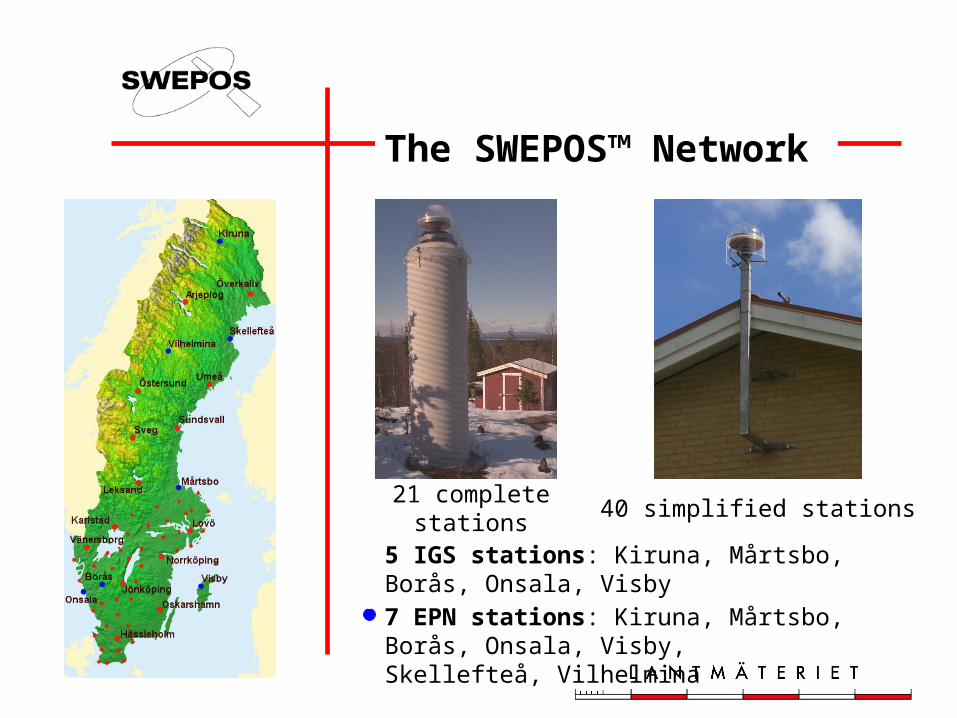
• Mounted on bedrock• Power backup for 48 hours• 64 kb leased lines for data
communication and 19.2 kb lines for back-up
• Redundant GPS receivers, back-up computers and communication equipment
• Temperature and power monitoring
• Burglar alarm
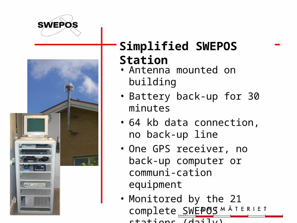
Simplified SWEPOS Station
• Antenna mounted on building• Battery back-up for 30
minutes• 64 kb data connection, no
back-up line• One GPS receiver, no back-
up computer or communi-cation equipment
• Monitored by the 21 complete SWEPOS stations (daily)
Monitoring of SWEPOS
• Data• In-door temperature• Power supply• Data connections• Visitors
SWEPOS Control Centre
SWEPOS Data
Post-processing data• Single-frequency RINEX – metre
accuracy• Dual-frequency RINEX – centimetre
accuracy
Real-time data• L1/L2 data in receiver format• DGPS data RTCM ver. 2.2 – metre
accuracy• Network RTK data (regionally) –
centimetre accuracy
SWEPOS Real-time Services
• EPOS™ (metre accuracy)– DGPS service operated by Cartesia
– RDS channel on the FM radio band
• Omnistar (metre accuracy)– WADGPS service operated by Fugro
– Satellite distribution
• Network RTK service (centimetre accuracy)
– Cellular phone (VRS mode)
Post-processing Service
Post-processingService
Post-processingService
Observation data(RINEX file)
Observation data(RINEX file)
Computed positionQuality parameters
Computed positionQuality parameters
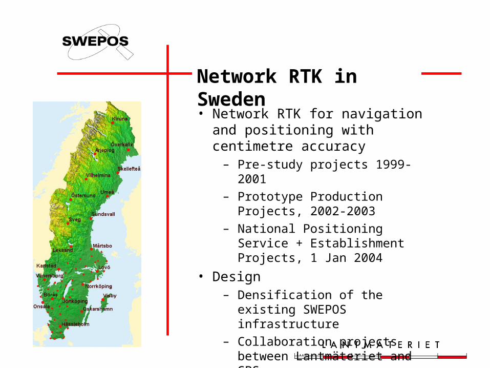
Network RTK in Sweden
• Network RTK for navigation and positioning with centimetre accuracy
– Pre-study projects 1999-2001
– Prototype Production Projects, 2002-2003
– National Positioning Service + Establishment Projects, 1 Jan 2004
• Design– Densification of the existing
SWEPOS infrastructure
– Collaboration projects between Lantmäteriet and GPS users
Experiences from the users • Network RTK is efficient and easy
to use• The “GPS maturity” of the users is
varying• A high availability of the Network
RTK service is required• The coverage of suitable distribution
channels is a bottleneck in some areas
• Standards for data format and GPS receivers are welcome
Prototype ProductionNetworks (2002-2003)
Pos. Stockholm-Mälaren 2
Väst-RTK
SKAN-RTK 2
1 January 2004
• Network RTK service – User fees for operation costs– Starting fee: € 550/connection– Unlimited data amount:
€ 1600 /year and connection– Down-loaded data:
€ 550 /year and connection +€ 0.5 /min
• 180 subscribers 1 Feb 2004
The cost for distribution of data via GSM is not included.
The Future
• Proposal on a National Network RTK service of 112 stations
• Estimated investment cost of 4 million € and a yearly operation cost of 2.5 million €
• The investment is covered by governmental funds and the operation costs mainly by user fees
• The proposal is approved by the Director General
2005
2006
2004
2005
Applications today and in the future
2005
2006
2004
2005
Conclusions
• A multi-purpose network of permanent stations is bene-ficial both for users and for the providers of national infra-structure for positioning and non-safety-of-life navigation.
• Further developments in standardisation, reliability and precision are desirable