Sayyid Suhail Ahmad 1 , Alejandro Escalona 1 , Lisa Bingham 1 , and Ian Norton 2 1 University of Stavanger, Norway 2 The University of Texas Institute for Geophysics, USA Late Cretaceous to Pliocene Paleogeographic Maps of the Gulf of Mexico-Caribbean using PaleoGIS Plate Reconstructions as Basemaps
Transcript
Sayyid Suhail Ahmad1, Alejandro Escalona1, Lisa Bingham1, and Ian Norton2
1University of Stavanger, Norway 2The University of Texas Institute for Geophysics, USA
Late Cretaceous to Pliocene Paleogeographic Maps of the Gulf of Mexico-Caribbean using PaleoGIS Plate Reconstructions as Basemaps
Purpose of talk• Present a data-driven methodology with case study of the Gulf of Mexico
and Caribbean region for creating GIS-based paleogeographic maps
Image removed – For CBTH sponsoring companies only
YesNo
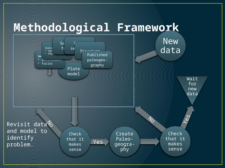
Methodological Framework
Plate model
Well data• Environment• Facies
Radiometric data• Age• Representation
Seismic facies
Cross sections
StructurePublished paleogeo-
graphy
Check that it makes sense
Revisit data and model to identify problem.
Create Paleo-
geogra-phy
No
Yes
New data
Check that it makes sense
Wait for new
data
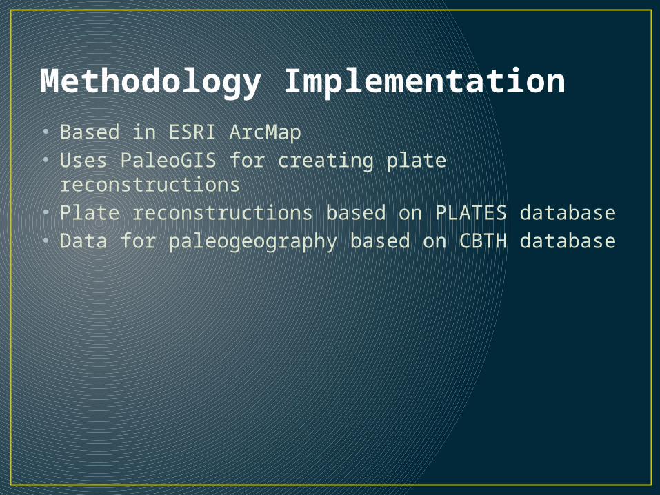
Methodology Implementation• Based in ESRI ArcMap• Uses PaleoGIS for creating plate reconstructions• Plate reconstructions based on PLATES database• Data for paleogeography based on CBTH database
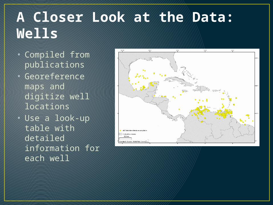
A Closer Look at the Data: Wells• Compiled from
publications• Georeference maps
and digitize well locations
• Use a look-up table with detailed information for each well
A Closer Look at the Data: Wells• Wells have
individual ID acting as table key
• General information• Source• Figure – link
function• Data shown
A Closer Look at the Data: Wells• Wells have
individual ID acting as table key
• General information• Source• Figure – link
function• Data shown
A Closer Look at the Data: Wells• Wells have
individual ID acting as table key
• For period or epoch• Define if present• Depth at bottom• Depth at top• Paleoenvironment• Facies• Description
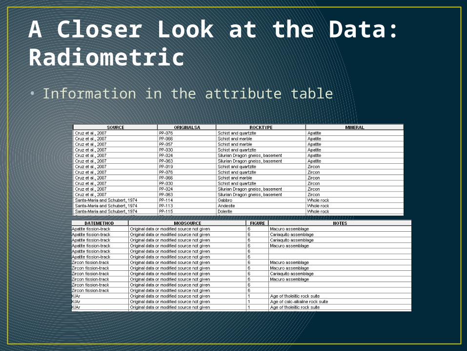
A Closer Look at the Data: Radiometric• Compiled from
publications• Georeference maps
and digitize sample locations
• Use a look-up table with detailed information
A Closer Look at the Data: Radiometric• Information in the attribute table
A Closer Look at the Data: Radiometric• Age information• From publication• Formatted for
PaleoGIS
A Closer Look at the Data: Maps• Paleogeographic
maps from publications
• Structural surfaces from seismic interpretation
• Georeference in present-day
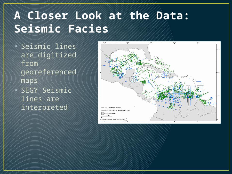
A Closer Look at the Data: Seismic Facies• Seismic lines are
digitized from georeferenced maps
• SEGY Seismic lines are interpreted
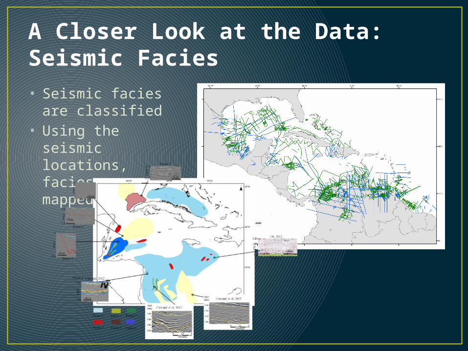
A Closer Look at the Data: Seismic Facies• Seismic facies are
classified • Using the seismic
locations, facies are mapped by age
Create Reconstructions with the Data
Image removed – For CBTH sponsoring companies only
Create Reconstructions with the Data
Image removed – For CBTH sponsoring companies only
Create Reconstructions with the Data
Image removed – For CBTH sponsoring companies only
Create Reconstructions with the Data
Image removed – For CBTH sponsoring companies only
Draft Paleogeography• Be sure to take topology
into account• Consider creating
polylines first and converting to polygons to avoid gaps and overlaps
• After drafting and checking, the lines can be smoothed for more artistic rendering of the area
• Lines are converted to polygons
• A consistent naming and symbology system is applied
Image removed – For CBTH sponsoring companies only
Final Paleogeographic Map
Image removed – For CBTH sponsoring companies only