69
Life, Growth & Development in the Virginia Colony (1700-1760) Virginia History Series – #6-07 © 2007
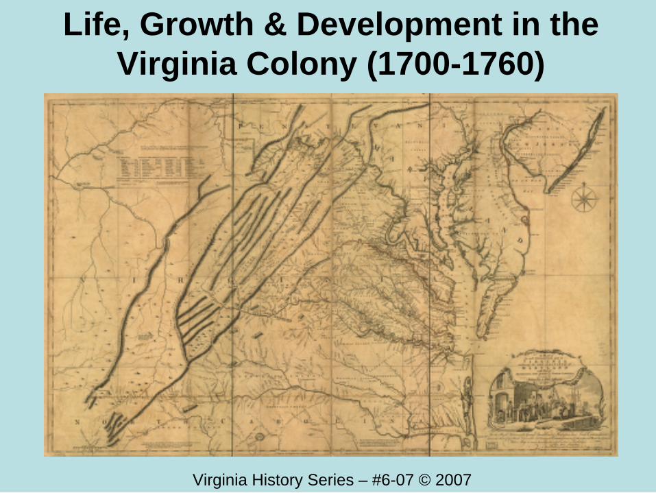
Life, Growth & Development in the Virginia Colony (1700-1760)
Virginia History Series – #6-07 © 2007
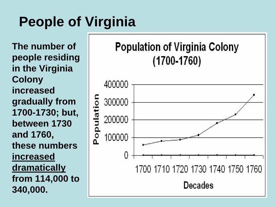
People of VirginiaThe number of people residing in the Virginia Colony increased gradually from 1700-1730; but, between 1730 and 1760, these numbers increased dramaticallyfrom 114,000 to 340,000.
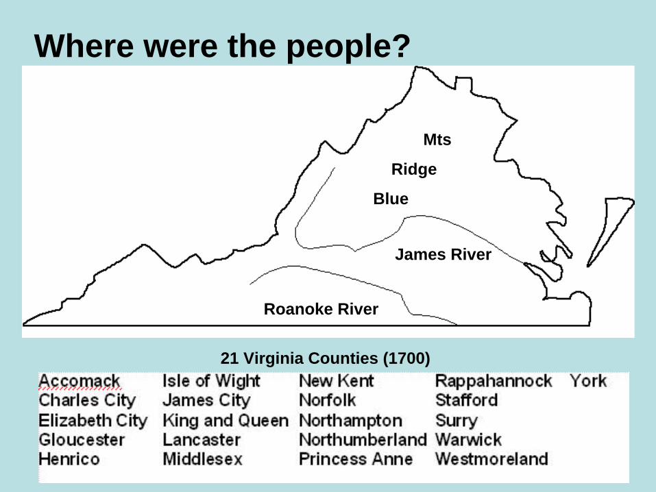
Where were the people?
Roanoke River
James River
Mts
Ridge
Blue
21 Virginia Counties (1700)
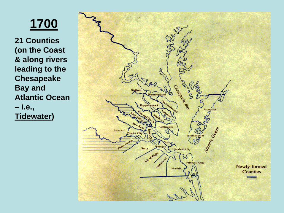
170021 Counties (on the Coast & along rivers leading to the Chesapeake Bay and Atlantic Ocean – i.e., Tidewater)
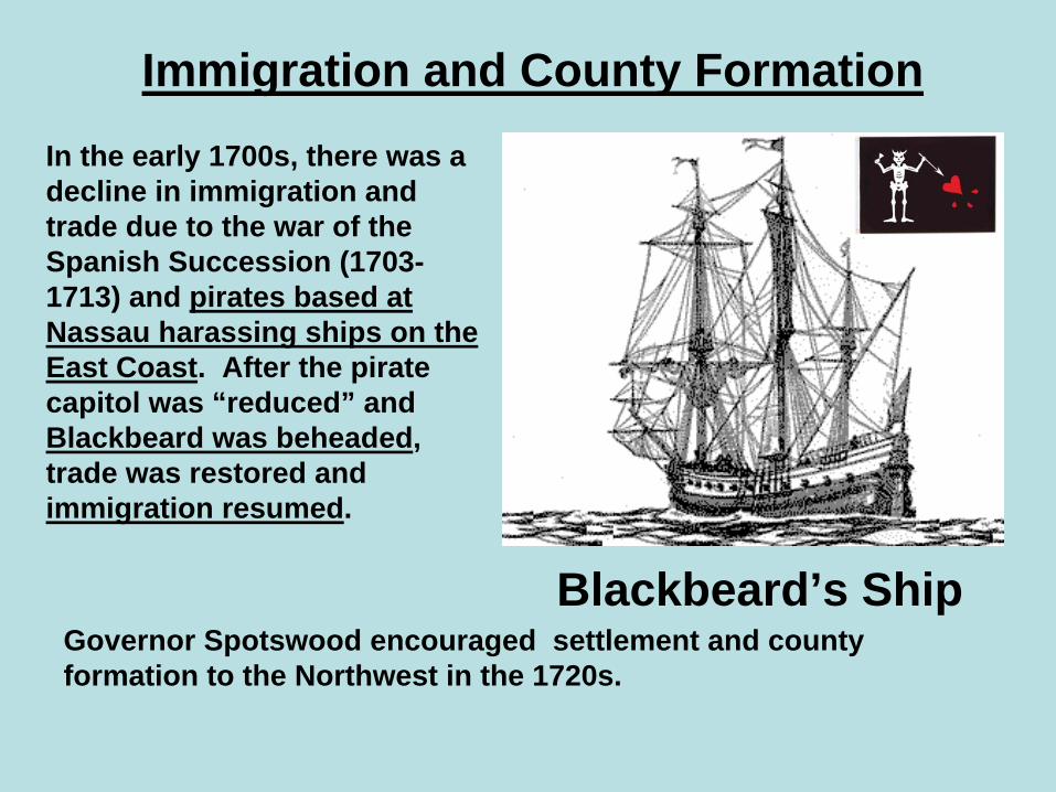
Immigration and County Formation
Governor Spotswood encouraged settlement and county formation to the Northwest in the 1720s.
In the early 1700s, there was a decline in immigration and trade due to the war of the Spanish Succession (1703-1713) and pirates based at Nassau harassing ships on the East Coast. After the pirate capitol was “reduced” and Blackbeard was beheaded, trade was restored and immigration resumed.
Blackbeard’s Ship
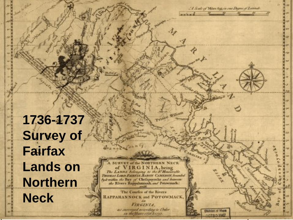
1736-1737 Survey of Fairfax Lands on Northern Neck
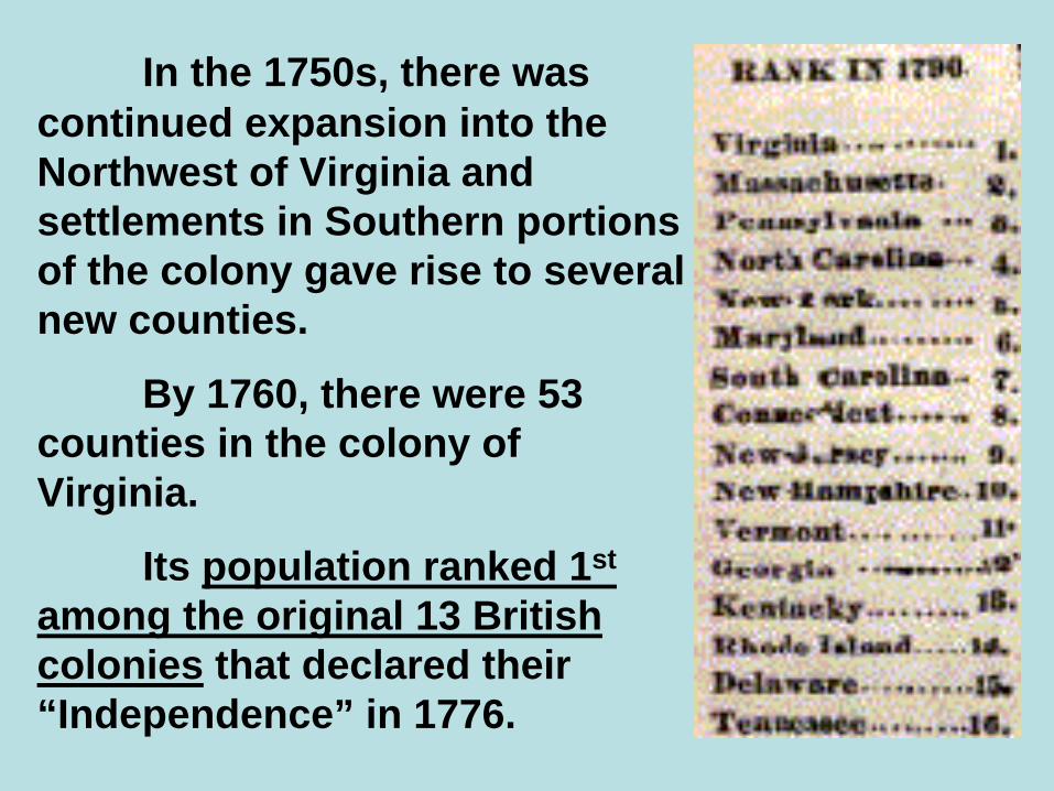
In the 1750s, there was continued expansion into the Northwest of Virginia and settlements in Southern portions of the colony gave rise to several new counties.
By 1760, there were 53 counties in the colony of Virginia.
Its population ranked 1st
among the original 13 British colonies that declared their “Independence” in 1776.

1760VA Counties
on the coast
(i.e., Tidewater)
and inland along rivers like the James, Roanoke, York, Potomac, and Rappahannock (i.e., Piedmont)

The 53 Counties that formed in Virginia by 1760 (Mostly in the Tidewater and Piedmont regions)
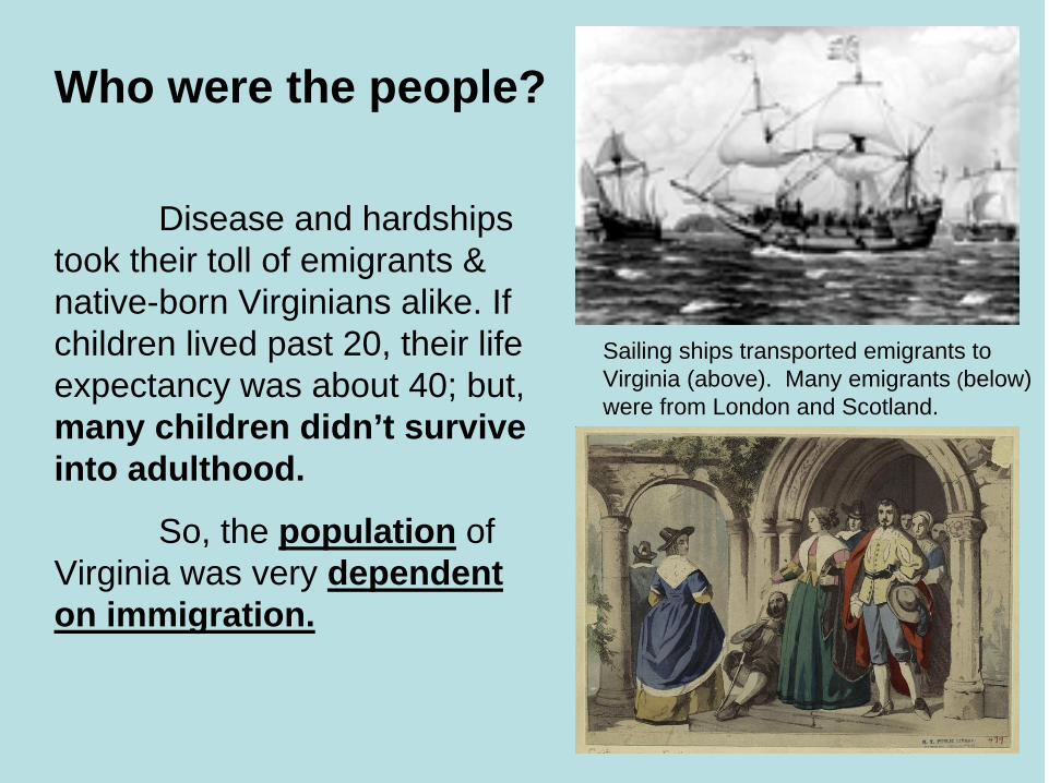
Who were the people?
Disease and hardships took their toll of emigrants & native-born Virginians alike. If children lived past 20, their life expectancy was about 40; but,many children didn’t survive into adulthood.
So, the population of Virginia was very dependent on immigration.
Sailing ships transported emigrants to Virginia (above). Many emigrants (below) were from London and Scotland.
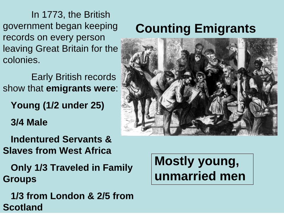
In 1773, the British government began keeping records on every person leaving Great Britain for the colonies.
Early British records show that emigrants were:
Young (1/2 under 25)
3/4 Male
Indentured Servants & Slaves from West Africa
Only 1/3 Traveled in Family Groups
1/3 from London & 2/5 from Scotland
Counting Emigrants
Mostly young, unmarried men
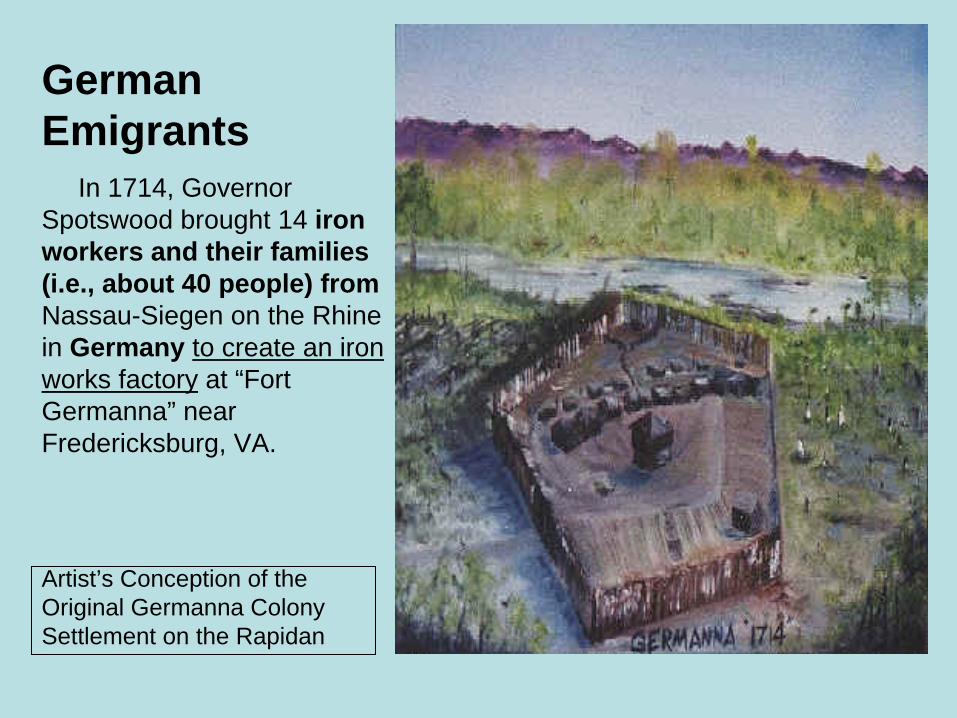
German Emigrants
In 1714, Governor Spotswood brought 14 iron workers and their families (i.e., about 40 people) fromNassau-Siegen on the Rhine in Germany to create an iron works factory at “Fort Germanna” near Fredericksburg, VA.
Artist’s Conception of the Original Germanna Colony Settlement on the Rapidan
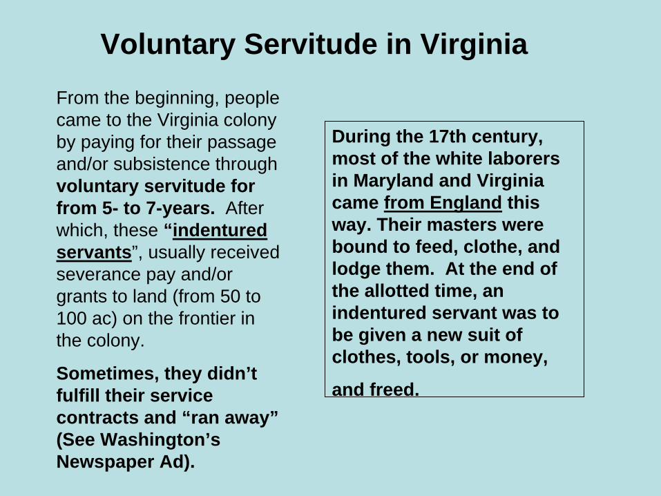
Voluntary Servitude in VirginiaFrom the beginning, people came to the Virginia colony by paying for their passage and/or subsistence throughvoluntary servitude for from 5- to 7-years. After which, these “indentured servants”, usually received severance pay and/or grants to land (from 50 to 100 ac) on the frontier in the colony.
Sometimes, they didn’t fulfill their service contracts and “ran away”(See Washington’s Newspaper Ad).
During the 17th century, most of the white laborers in Maryland and Virginia came from England this way. Their masters were bound to feed, clothe, and lodge them. At the end of the allotted time, an indentured servant was to be given a new suit of clothes, tools, or money,
and freed.

White Involuntary ServitudeSome indentured servants came to the Colony by force of a COURT ORDER with expulsion from England as punishment for their crimes. This turned out to be VERY UNDESIREABLE and was prohibited in Gloucester and Middlesex counties after 1671. Unfortunately, the process continued until the Revolutionary War and was finally prohibited throughout the United States in 1788.
Other indentured servants of the laboring classes came to the Colony because they were kidnapped. They had been “spirited” away from England (usually from Bristol and London); and, were called“spirits”.
All white, indentured servants, regardless of originally coming to voluntary or involuntary service, received about the same social status/treatment in the Colony.
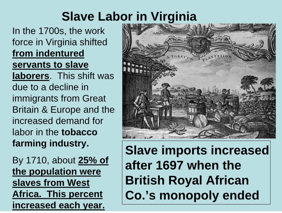
Slave Labor in Virginia
Slave imports increased after 1697 when the British Royal African Co.’s monopoly ended
In the 1700s, the work force in Virginia shifted from indentured servants to slave laborers. This shift was due to a decline in immigrants from Great Britain & Europe and the increased demand for labor in the tobacco farming industry.
By 1710, about 25% of the population were slaves from West Africa. This percent increased each year.

Agriculture
Tobacco farming was the principal activity of Virginians in the 1700s.
This crop produced “cash” income but exhausted land quickly; so, it was necessary to frequently clear new land for cultivation For this reason, settlers kept busy moving further and further inland from the coast.
Manner of picking, curing, and packing tobacco in “hogsheads” for shipment.

Ordinary Farmer
The typical house of an ordinary farmer was a “dark, drafty, dirt-floored, insect-ridden, one- or two-bedroom box made of green wood and scarcely worth maintaining, since it would be abandoned as soon as its adjoining land was exhausted by ruthless tobacco cultivation.”

Shipping Tobacco
Tobacco was packed in barrels called “hogsheads”, rolled or carted down to landings, and shipped from inland farms on rivers down to ports (e.g., Jamestown) for shipment to agents in England.
River boats called “bateaux” were strong and flat-bottomed to navigate shallow water and could carry hogsheads of tobacco that weighted from 500 to 1,300 pounds each depending on their size. In the 1600s, 4 hogsheads weighed a ton.

Hauling Hogsheads of Tobacco to the Landing on a “Rolling Road”
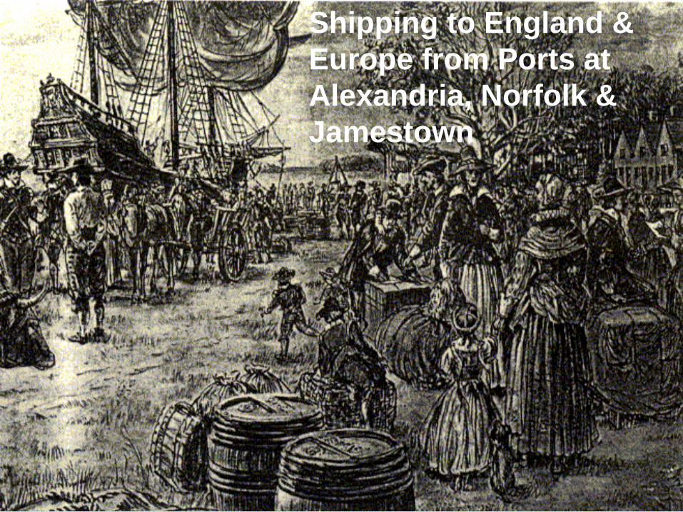
Shipping to England & Europe from Ports at Alexandria, Norfolk & Jamestown
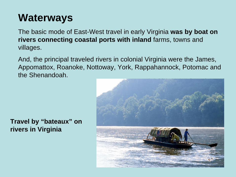
WaterwaysThe basic mode of East-West travel in early Virginia was by boat on rivers connecting coastal ports with inland farms, towns and villages.
And, the principal traveled rivers in colonial Virginia were the James, Appomattox, Roanoke, Nottoway, York, Rappahannock, Potomac and the Shenandoah.
Travel by “bateaux” on rivers in Virginia


Roads of Virginia“King’s Highway” was the principal inland route of the Colonies and it ran from Charleston, SC to Boston, MA.
In Virginia, this Highway ran from Suffolk through Williamsburg and Fredericksburg to Alexandria.

Stage Coaches Traveled Highways & Byways Connecting Towns in Virginia

Stage Coach Travel Was Dusty, Bumpy,and Slow Between Stops at Taverns or“Ordinaries” Along the Routes
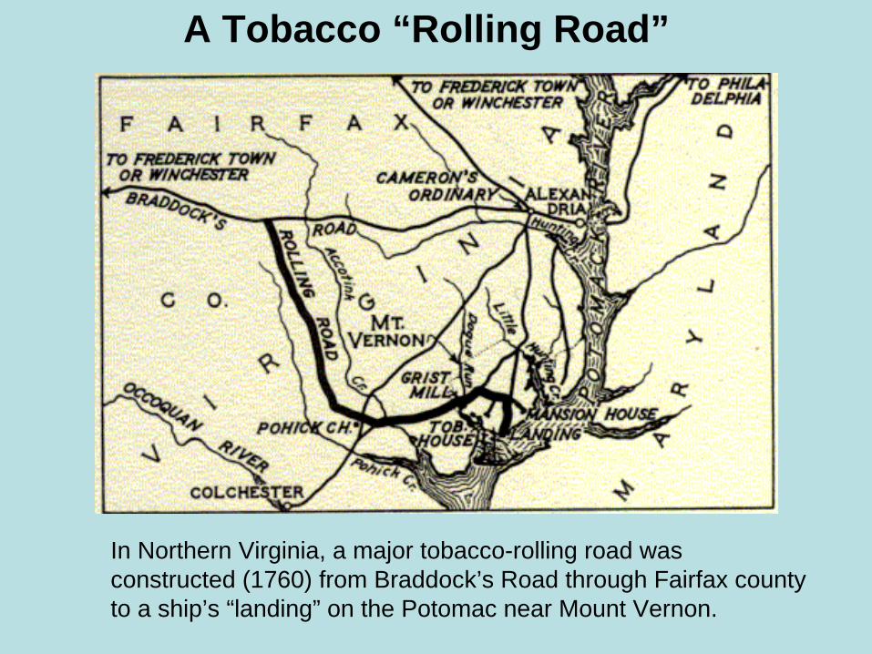
A Tobacco “Rolling Road”
In Northern Virginia, a major tobacco-rolling road was constructed (1760) from Braddock’s Road through Fairfax county to a ship’s “landing” on the Potomac near Mount Vernon.
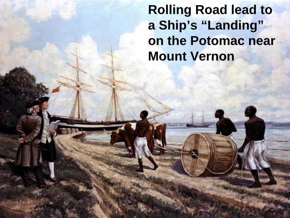
Rolling Road lead to a Ship’s “Landing”on the Potomac near Mount Vernon

A Rolling Road in Southern Virginia
Boydton’s “Plank” Roadcrossed the Meherrin River and connected Petersburg on the James River with Clarksville on the Roanoke River which flows down to North Carolina (this was later maintained as a “stage coach” road)
The use of rolling roads was discontinued in 1850 because the process “injured” the tobacco being transported that way.
James River
Roanoke River
Meherrin River
Boydton’s Plank Road
Clarksville
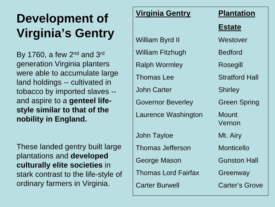
Development of Virginia’s GentryBy 1760, a few 2nd and 3rd
generation Virginia planters were able to accumulate large land holdings -- cultivated in tobacco by imported slaves --and aspire to a genteel life-style similar to that of the nobility in England.
These landed gentry built large plantations and developed culturally elite societies in stark contrast to the life-style of ordinary farmers in Virginia.
Virginia Gentry Plantation
EstateWilliam Byrd II Westover
William Fitzhugh Bedford
Ralph Wormley Rosegill
Thomas Lee Stratford Hall
John Carter Shirley
Governor Beverley Green Spring
Laurence Washington Mount Vernon
John Tayloe Mt. Airy
Thomas Jefferson Monticello
George Mason Gunston Hall
Thomas Lord Fairfax Greenway
Carter Burwell Carter’s Grove
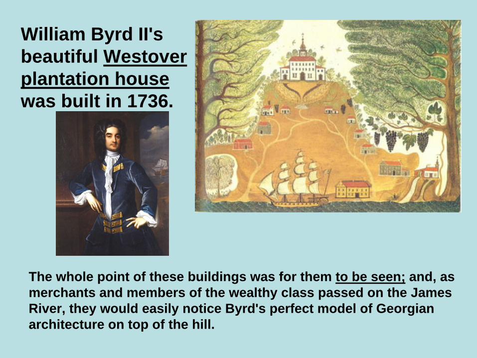
William Byrd II's beautiful Westover plantation housewas built in 1736.
The whole point of these buildings was for them to be seen; and, as merchants and members of the wealthy class passed on the James River, they would easily notice Byrd's perfect model of Georgianarchitecture on top of the hill.

Foxhunting Meet at Westover Plantation
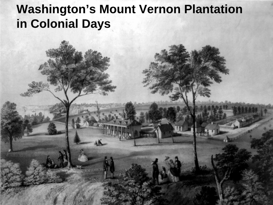
Washington’s Mount Vernon Plantation in Colonial Days

The Genteel Life-style
(Washington with Friends/Family in the Garden)

Thomas Lee built his new home on the Potomac River in 1729, naming it Stratford Hall. Four years later, he was appointed to the Governor’s Council of the House of Burgesses. In 1747, he founded the Ohio Company of Virginia with fellow Virginia colonists who wished to expand Virginia's territory into the Ohio River Valley (e.g., George Mason).

John Carter & (1st wife)
Judith Carter
Shirley Plantation on the James River

Towns and Villages in Colonial DaysEarly towns and villages in Virginia usually consisted of a courthouse, church, and a market of some sort.
Alexandria, founded in 1749, was typical of these early settlements.
George Washington’s Original Survey Plan for the City of Alexandria
(Area now called “Belhaven”)
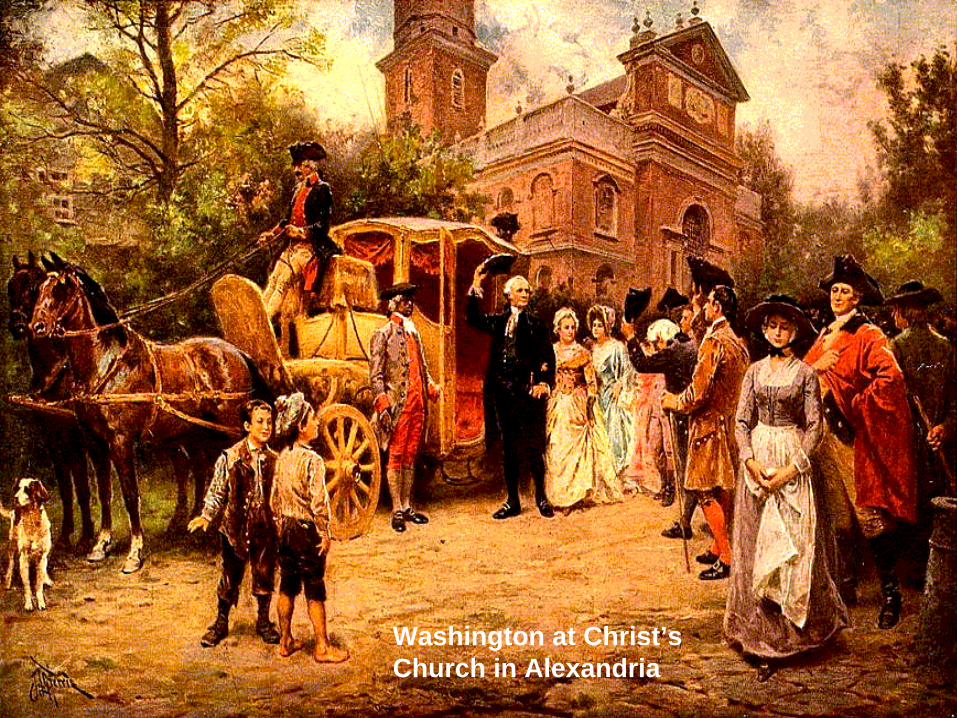
Washington at Christ’s Church in Alexandria

Town Hall on Market Square in AlexandriaOld Town Alexandria's Market Square is thought to be one of the nation's oldest continually operating farmer's markets. Farmers and artists have been selling their products on Market Square since 1753.
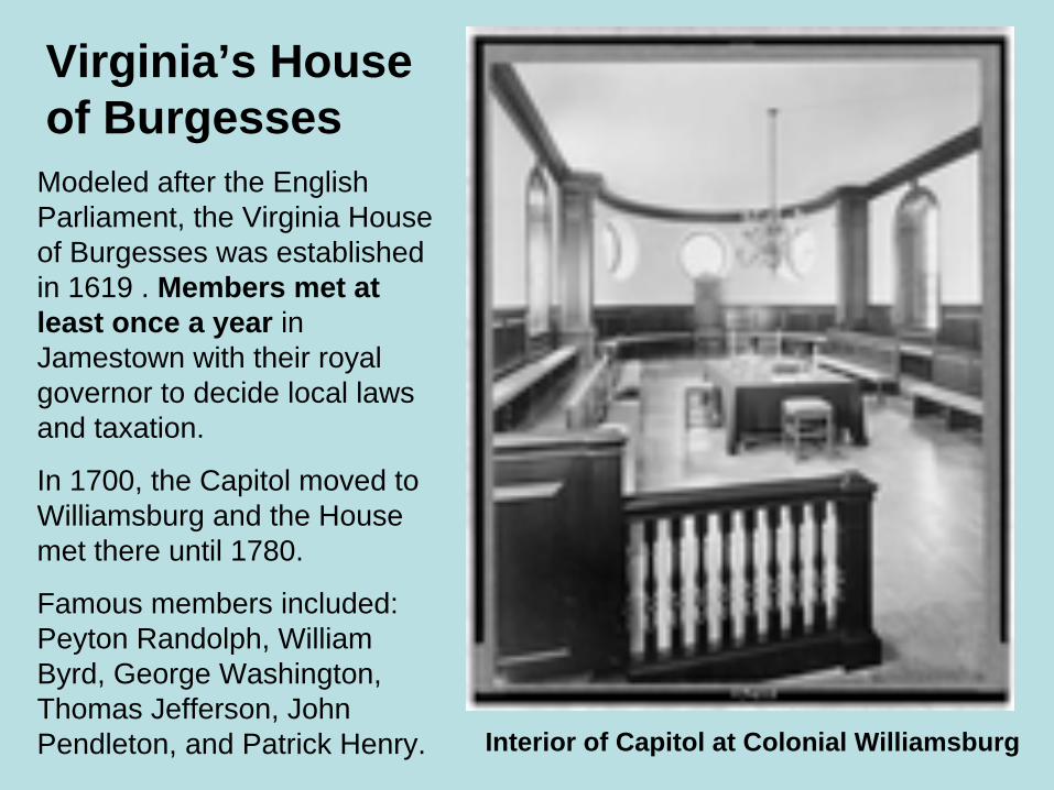
Virginia’s House of Burgesses
Interior of Capitol at Colonial Williamsburg
Modeled after the English Parliament, the Virginia House of Burgesses was established in 1619 . Members met at least once a year in Jamestown with their royal governor to decide local laws and taxation.
In 1700, the Capitol moved to Williamsburg and the House met there until 1780.
Famous members included: Peyton Randolph, William Byrd, George Washington, Thomas Jefferson, John Pendleton, and Patrick Henry.
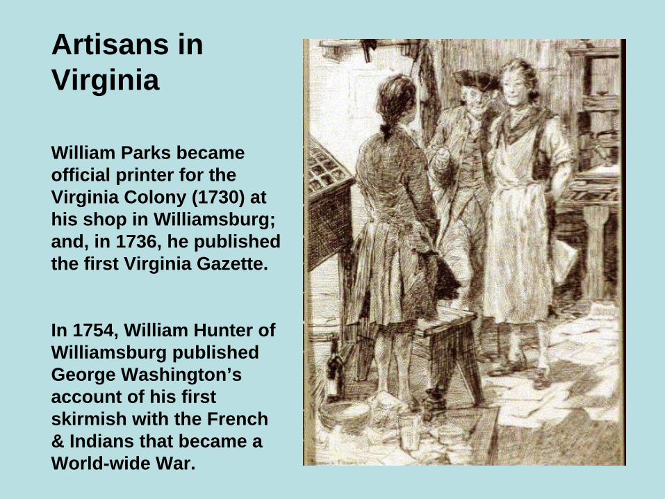
Artisans in Virginia
William Parks became official printer for the Virginia Colony (1730) at his shop in Williamsburg; and, in 1736, he published the first Virginia Gazette.
In 1754, William Hunter of Williamsburg published George Washington’s account of his first skirmish with the French & Indians that became a World-wide War.
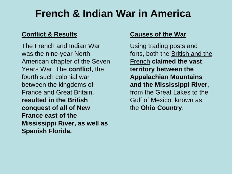
French & Indian War in America
Causes of the War
Using trading posts and forts, both the British and the French claimed the vast territory between the Appalachian Mountains and the Mississippi River, from the Great Lakes to the Gulf of Mexico, known as the Ohio Country.
Conflict & Results
The French and Indian War was the nine-year North American chapter of the Seven Years War. The conflict, the fourth such colonial war between the kingdoms of France and Great Britain, resulted in the British conquest of all of New France east of the Mississippi River, as well as Spanish Florida.
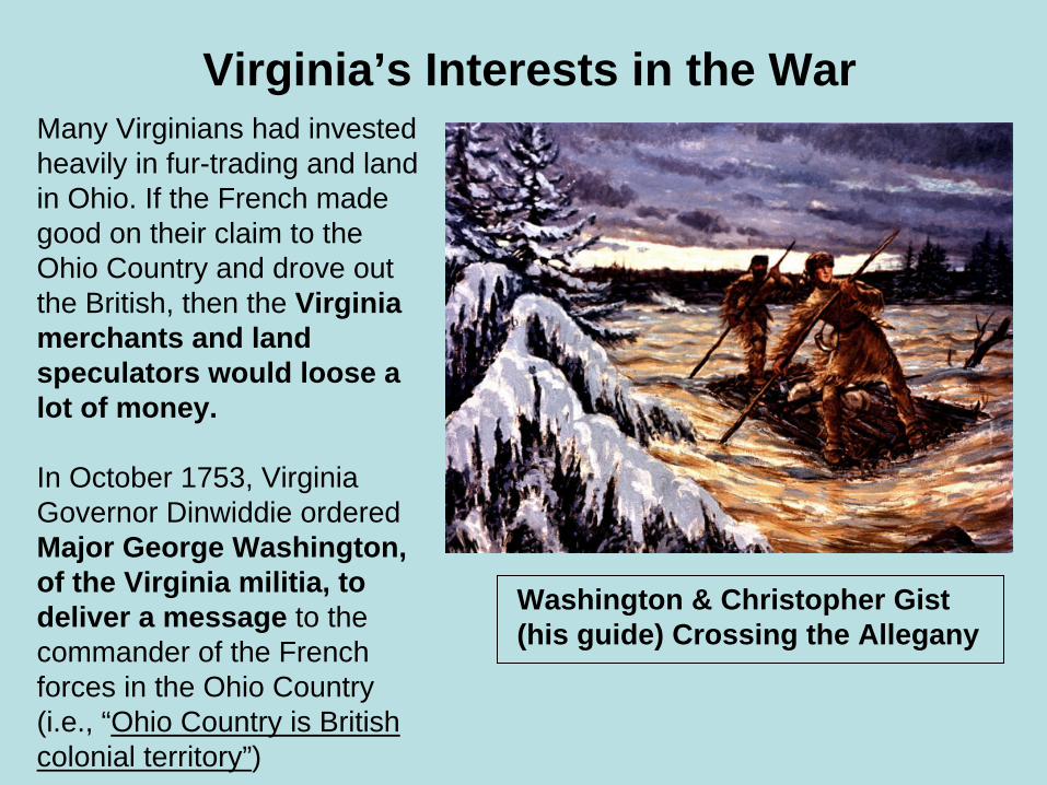
Virginia’s Interests in the WarMany Virginians had invested heavily in fur-trading and land in Ohio. If the French made good on their claim to the Ohio Country and drove out the British, then the Virginia merchants and land speculators would loose a lot of money.
In October 1753, Virginia Governor Dinwiddie ordered Major George Washington, of the Virginia militia, to deliver a message to the commander of the French forces in the Ohio Country (i.e., “Ohio Country is British colonial territory”)
Washington & Christopher Gist (his guide) Crossing the Allegany

French & Indian War (Timeline)

May 28, 1754, young Virginia militia officer Lieutenant Colonel George Washington and the 40 soldiers he commanded attacked the French militia led by Ensign Joseph de Jumonville. The battle lasted little more than 15 minutes and was a complete British victory. Ten French soldiers were killed and 21were captured, including Jumonville, who was wounded.
Jumonville Glen

Battle at Fort Necessity was a battle of the French and Indian War fought on July 3, 1754 in present-day Fayette County, Pennsylvania. It, along with the Battle of Jumonville Glen, are considered the opening shots of the French and Indian War which would spread to the Old World and become the Seven Year’s War in Europe. It marked George Washington’s only military surrender.
Fort Necessity near Farmington, PA(Modern Reconstruction)
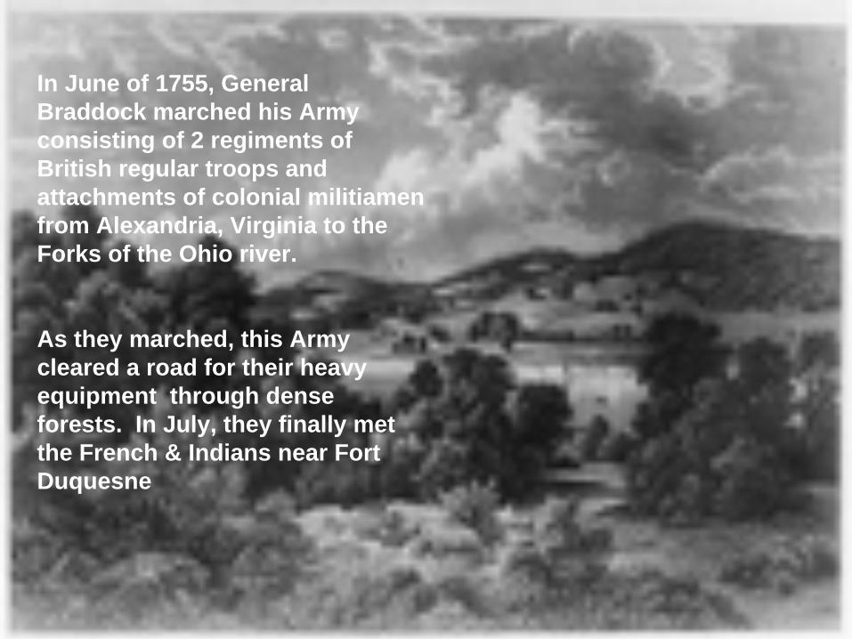
In June of 1755, General Braddock marched his Army consisting of 2 regiments of British regular troops and attachments of colonial militiamen from Alexandria, Virginia to the Forks of the Ohio river.
As they marched, this Army cleared a road for their heavy equipment through dense forests. In July, they finally met the French & Indians near Fort Duquesne


Building Braddock’s Road

French & Indians Attack
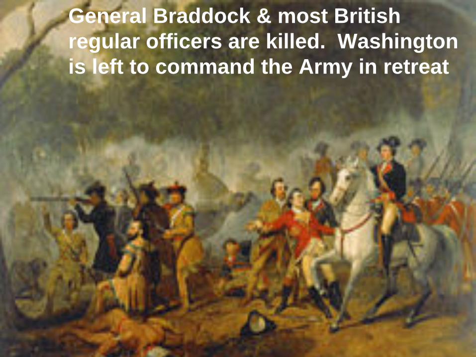
General Braddock & most British regular officers are killed. Washington is left to command the Army in retreat

Fort Duquesne In 1758, Major-General John Forbes’ British-American army (including 2,000 VA and PA militia led by George Washington) return to Fort Duquesne at the forks of the Ohio.


The culmination of a three-month siege by the British, the battle of Quebec (on the Plains of Abraham) lasted less than an hour. British commander General James Wolfe successfully broke the column advance of French troops and New French militia under General Montcalm. Both generals were mortally wounded during the battle; Wolfe died on the field and Montcalm passed away thenext morning.
Death of General Wolfe at Quebec
(Sept. 13, 1759)
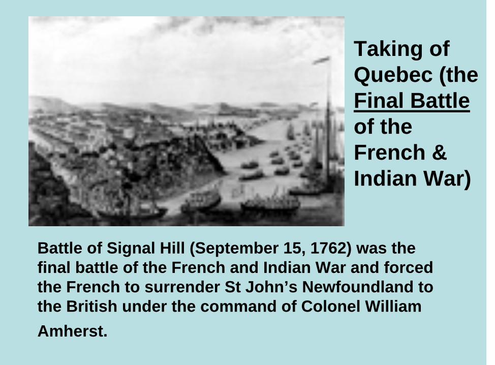
Battle of Signal Hill (September 15, 1762) was the final battle of the French and Indian War and forced the French to surrender St John’s Newfoundland to the British under the command of Colonel William Amherst.
Taking of Quebec (the Final Battleof the French & Indian War)
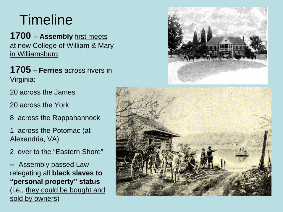
Timeline1700 – Assembly first meetsat new College of William & Mary in Williamsburg
1705 – Ferries across rivers in Virginia:
20 across the James
20 across the York
8 across the Rappahannock
1 across the Potomac (at Alexandria, VA)
2 over to the “Eastern Shore”
-- Assembly passed Law relegating all black slaves to “personal property” status (i.e., they could be bought and sold by owners)

(Timeline Cont.)
1706-1709 Tobacco exports were from 300 ship-loads in 1706 to 29,000,000 pounds per year in 1709
1710 Governor’s Palace on “Palace Green” was completed in colonial Williamsburg
1711 Bruton Parish Church, dating from 1674, was rebuilt in Williamsburg
1714 Lt. Governor Spotswood built several Iron Furnaces on Rapidan River using German emigrant labor
-- Groups of Indian Tribes assigned “hunting preserves” monitored by white officials.
Bruton Parish Church
Governor’s Palace

(Timeline Cont.)
1716 Virginians encouraged to explore and make new settlements in the West (i.e., over the Blue Ridge Mountains)
1718 For harassing shipping on the Atlantic Coast, the pirate “Blackbeard” was caught and beheaded
1720 New Counties Created(i.e., Brunswick, Hanover, King George, Spotsylvania) by dividing parts of existing Counties

(Timeline Cont.)
1723 Treaty with Iroquois League of Nations signedforbidding Indians from crossing the Blue Ridge Mountains
-- Iron smelting plant with air furnace built near Fredericksburg
1724 In “The Present State of Virginia”, Hugh Jones reported that Virginia’s planters loved their horses, riding to Church, Court, and Horse Races (i.e., where they met neighbors and conducted business).
The “Iroquois Trail”
(Timeline Cont.)
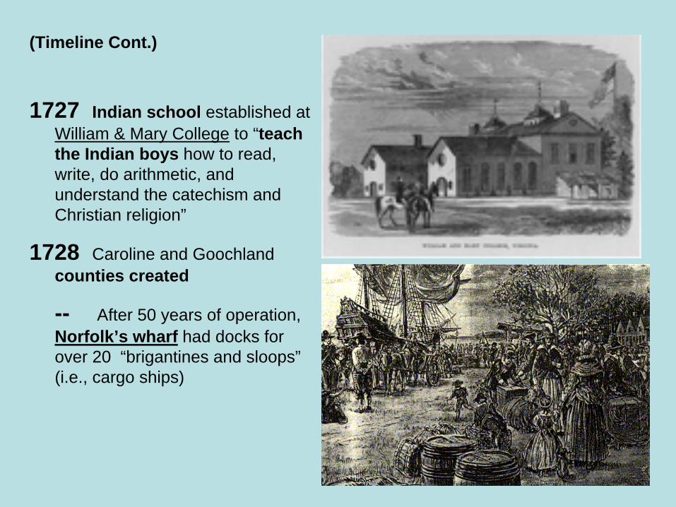
1727 Indian school established at William & Mary College to “teach the Indian boys how to read, write, do arithmetic, and understand the catechism and Christian religion”
1728 Caroline and Goochland counties created
-- After 50 years of operation,Norfolk’s wharf had docks for over 20 “brigantines and sloops”(i.e., cargo ships)

(Timeline Cont.)
1730 Prince William county created
1733 John Randolph went to England with petition for Parliament to “restructure tobacco market with more equitable profits for Virginia’s planters.”
1734 Amelia and Orange counties created
1736 First issue of Virginia Gazette is published. William Byrd II builds Westover plantation on James River
1738 Augusta and Frederickcounties created

(Timeline Cont.)
1741 Lawrence Washington (i.e., George Washington’s ½ brother from whom he inherited Mount Vernon) was decorated for valor by Admiral Edward Vernon in battle with the Spanish – later he renamed his Hunting Creek plantation “Mount Vernon” in honor of the Admiral
1742 Fairfax and Louisa counties created
1744 Albemarle county created
1745 Lunenburg county created
1747 Ohio Company formed with several hundred thousand ac. of wilderness land in Southern and Western Virginia (Many influential Virginians involved – e.g., George Mason)
George Washington “Life of a Farmer”

(Timeline Cont.)
1749 Alexandria City, VA founded (survey and lot plan laid out by young George Washington)
-- Washington & Lee University established as “Augusta Academy” school in Lexington, VA
1750 Cumberland Gap between Virginia and present-day Kentucky discovered by Dr. Thomas Walker (i.e., it later became part of the great Wilderness Road to the West) The Wilderness Road
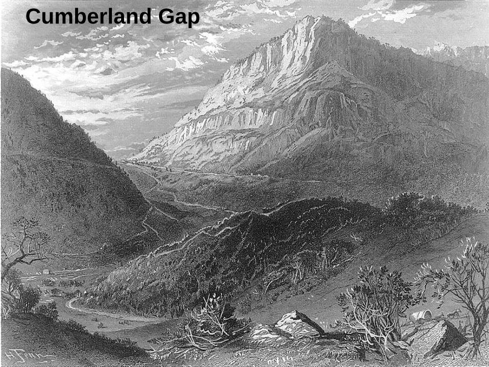
Cumberland Gap

(Timeline Cont.)
1751 Carter’s Grove plantation house built by Carter Burwell along James River
1752 Dinwiddie and Halifax counties created
-- Laurence Washington dies of TB; George Washington inherits Mount Vernon
-- 1st Thoroughbred horse race in North America held at William Byrd III’s Westover plantation in Gloucester. Maryland’s imported mare “Selima” beat 4 of Virginia’s imported horses including Byrd's stallion “Tryal” in a 4 mile long race.
1753 Bedford, Prince Edward, and Sussex counties created
Selima’s Sire
(Timeline Cont.)
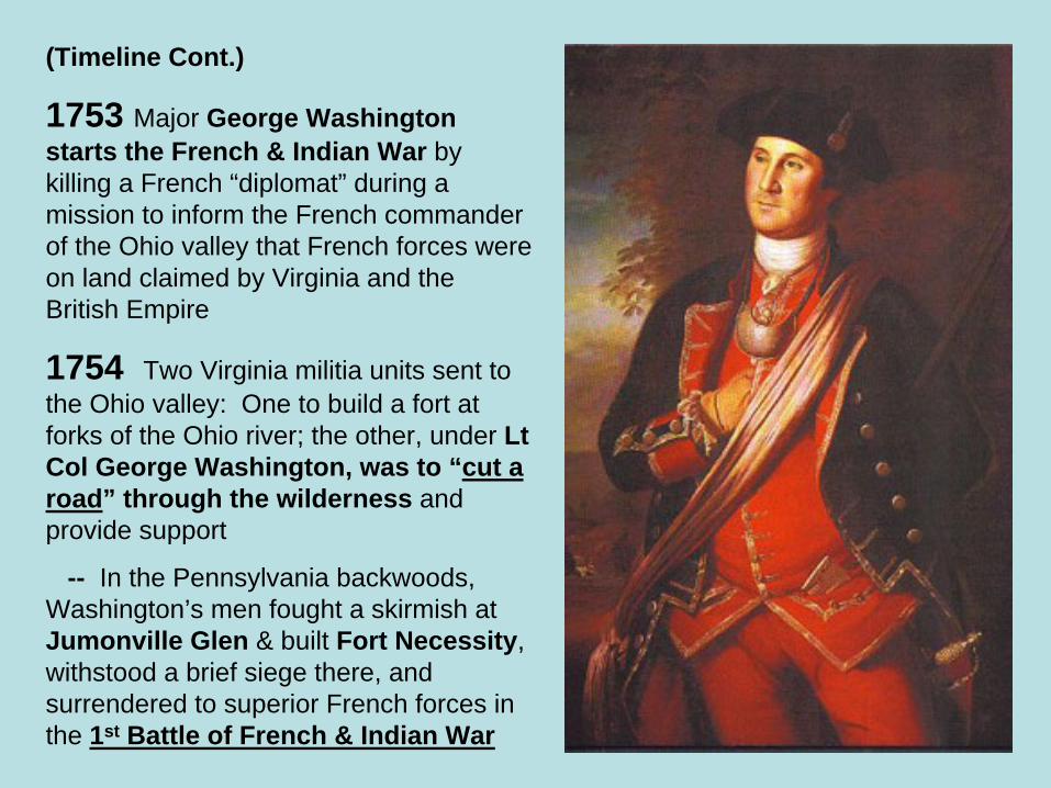
1753 Major George Washingtonstarts the French & Indian War by killing a French “diplomat” during a mission to inform the French commander of the Ohio valley that French forces were on land claimed by Virginia and the British Empire
1754 Two Virginia militia units sent to the Ohio valley: One to build a fort at forks of the Ohio river; the other, under Lt Col George Washington, was to “cut a road” through the wilderness and provide support
-- In the Pennsylvania backwoods, Washington’s men fought a skirmish at Jumonville Glen & built Fort Necessity, withstood a brief siege there, and surrendered to superior French forces in the 1st Battle of French & Indian War

(Timeline Cont.)
1755 General Edward Braddockarrives at Hampton, Virginia with 2 British infantry regiments, assumes command of colonial militia units, moves this Army to Alexandria and prepares to expel the French from North America
-- Braddock’s Army is viciously attacked near Fort Duquesne. Over 1,000 British and colonial militiamen are killed or wounded, 63 of 66 British officers including Braddock himself are killed, and George Washington is left in command of a beaten Army.
Death of General Braddock

(Timeline Cont.)
1757 Loudoun county created
1758 George Washington & militia units under British General John Forbes visited Fort Duquesne (found it had been abandoned), renamed it Fort Pitt, and returned to Virginia
1759 George Washington and Martha (Custis) Dandridge married
-- British Naval & Army forces under General James Wolfe defeated the French under General Montcalm at Quebec(thereby ending French claims to lands in Canada and East of the Mississippi river)
Washington’s Wedding

References:Bailyn, Ernard, The Peopling of British North America: An Introduction, Vintage Books, N.Y., N.Y. (1988)
Ballagh, James Curtis, White Servitude in the Colony of Virginia: A Study of the System of Indentured Labor in the American Colonies, John Hopkins Press, Baltimore, MD (1895)
Crutchfield, James A., The Grand Adventure: A Year by Year History of Virginia, The Dietz Press, Richmond, Virginia (2005)
Doran, Michael F., Atlas of County Boundary Changes in Virginia, 1634-1895, Iberian Publishing Company, Athens, GA (1987)
King, Edward, The Great South: A Record of Journeys (Illustrated by James Wells Chapney), American Publishing Co., Hartford Conn. (1875)
Magill, Mary Tucker, Magill’s First Book in Virginia History, J. P. Bell Company, Lynchburg, Virginia (1908)
Rose, Albert C., Historic American Roads: From Frontier Trails to Superhighways(Including 109 paintings by Carl Rakeman), Crown Publishers, N.Y., N.Y. (1976)
Virginia Department of Game & Inland Fisheries (Watershed Maps) [http://www.dgif.virginia.gov/education/sol]/watersheds/asp]
Wikipedia (The Free Encyclopedia) at Wikipedia.com


