Page 1
Polish Geological InstituteNational Research Institute
Linked Open Data usage in geohazardsystem supporting crisis management
INSPIRE ‐ Aalborg, 16‐20 June 2014
Tomasz Nałęcz Grzegorz Ryżyński Adam Iwaniak
Page 2
Polish Geological InstituteNational Research Institute
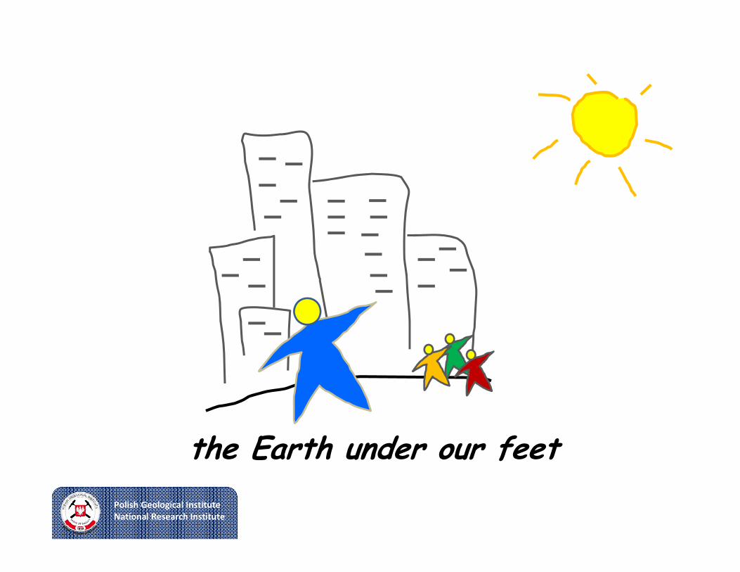
the Earth under our feet
Page 3
Polish Geological InstituteNational Research Institute
Safeinfrastructure
Critical mineral resources
Geohazadrs
Groundwater protection
Geological mapping
Geoinformation
Page 4
Polish Geological InstituteNational Research Institute
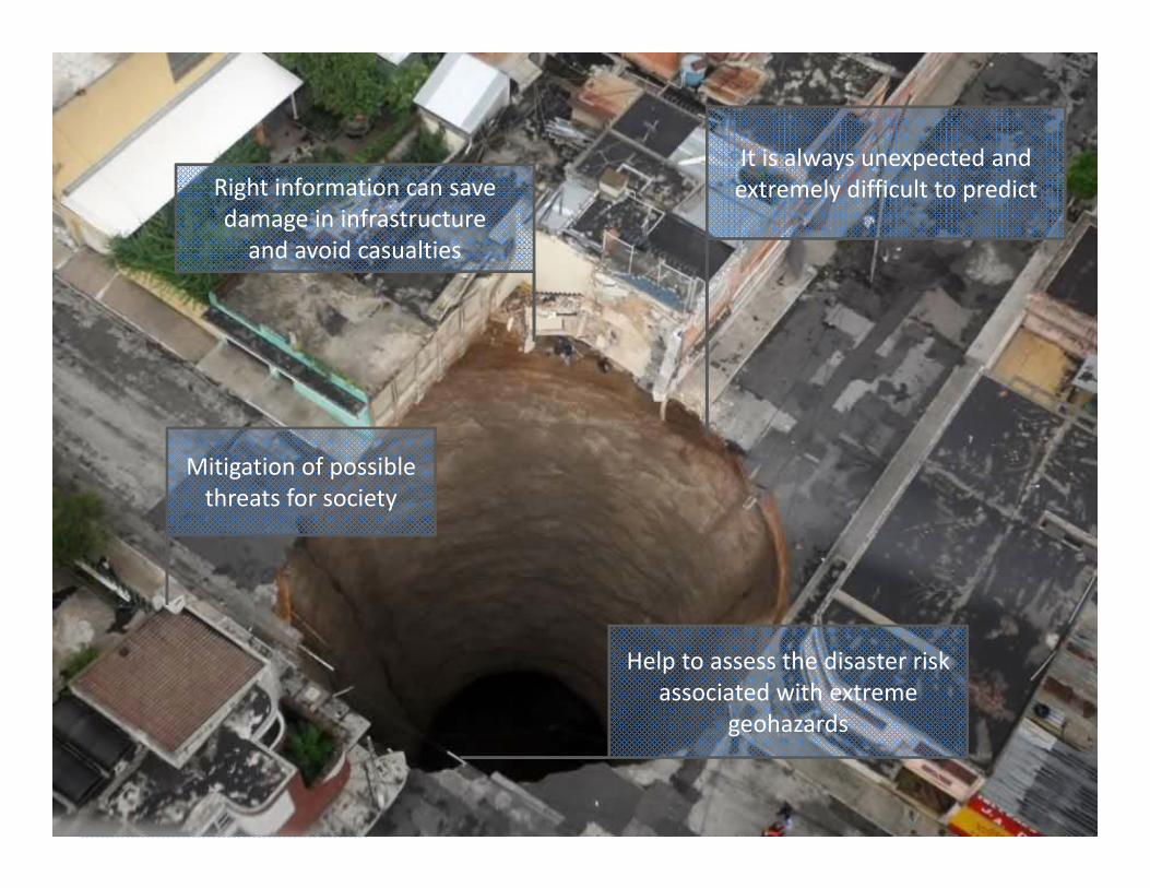
It is always unexpected and extremely difficult to predictRight information can save
damage in infrastructure and avoid casualties
Help to assess the disaster risk associated with extreme
geohazards
Mitigation of possible threats for society
Page 5
Polish Geological InstituteNational Research Institute
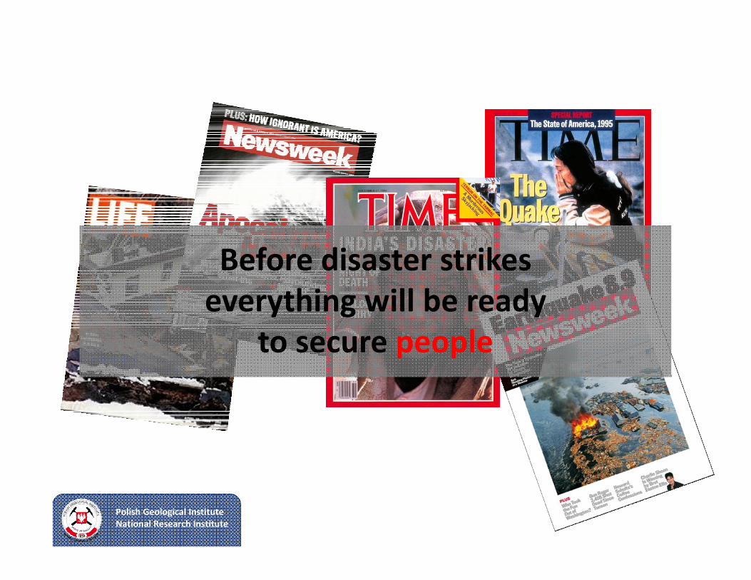
Before disaster strikeseverything will be ready
to secure people
Page 6
Polish Geological InstituteNational Research Institute
Geohazard Information Center
Page 7
Polish Geological InstituteNational Research Institute
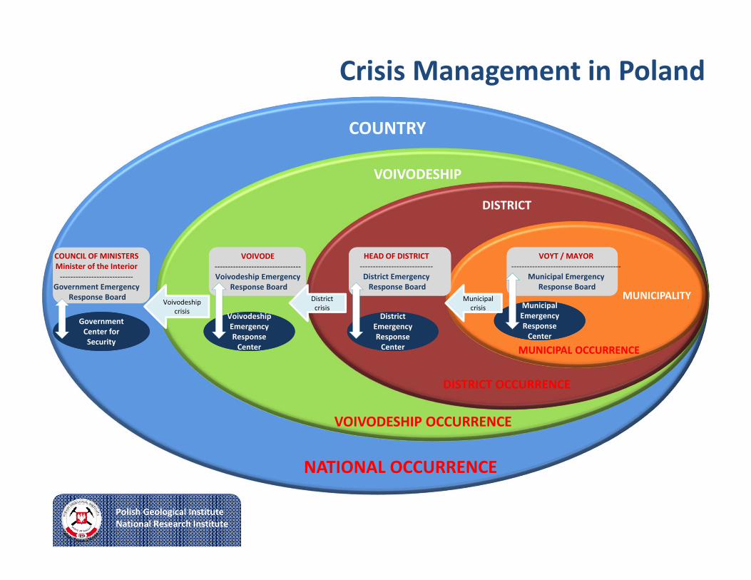
Crisis Management in Poland
COUNTRY
NATIONAL OCCURRENCE
VOIVODESHIP
VOIVODESHIP OCCURRENCE
DISTRICT
DISTRICT OCCURRENCE
MUNICIPALITY
MUNICIPAL OCCURRENCE
VOYT / MAYOR‐‐‐‐‐‐‐‐‐‐‐‐‐‐‐‐‐‐‐‐‐‐‐‐‐‐‐‐‐‐‐‐‐‐‐‐‐‐‐‐‐‐
Municipal EmergencyResponse Board
Municipal Emergency Response Center
Municipal Emergency Response Center
HEAD OF DISTRICT‐‐‐‐‐‐‐‐‐‐‐‐‐‐‐‐‐‐‐‐‐‐‐‐‐‐‐‐District EmergencyResponse Board
District Emergency Response Center
District Emergency Response Center
VOIVODE‐‐‐‐‐‐‐‐‐‐‐‐‐‐‐‐‐‐‐‐‐‐‐‐‐‐‐‐‐‐‐‐‐Voivodeship Emergency
Response Board
Voivodeship Emergency Response Center
Voivodeship Emergency Response Center
Government Center for Security
Government Center for Security
COUNCIL OF MINISTERSMinister of the Interior‐‐‐‐‐‐‐‐‐‐‐‐‐‐‐‐‐‐‐‐‐‐‐‐‐‐‐‐
Government EmergencyResponse Board Municipal
crisisVoivodeship
crisis
District crisis
Page 8
Polish Geological InstituteNational Research Institute
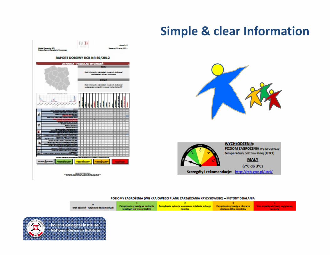
Simple & clear Information
Page 9
Polish Geological InstituteNational Research Institute
General Concept GIC
Coordination Knowledge Communication
Page 10
Polish Geological InstituteNational Research Institute
General Concept GIC
Coordination Knowledge Communication
Page 11
Polish Geological InstituteNational Research Institute
Dispatch Desk
Expert System (GIC)
Video Conference Module
GEOHAZARD INFORMATION CENTER
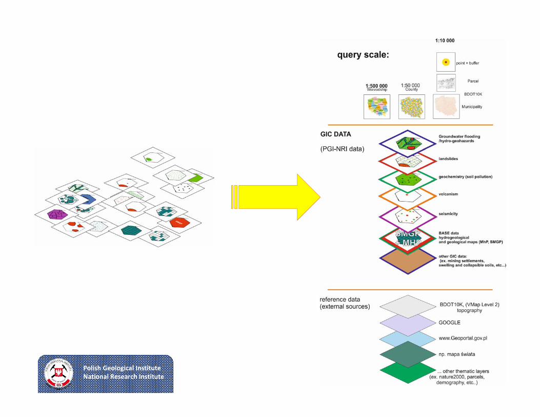
GIC (BI) Data Repository
GIC data
Landslides (SOPO)
Flash floods and Hydrogeohazards
(CBDH)
Seismic risks (Geodynamic monitoring of
Poland)
…others(f.e. geological‐
engineering data – BDGI)
GIC Reportquick reaction (max. 1 day)
General cross‐sectional information on geohazards in the given place
GIC Expertise
performance period from several days to several weeks
Detailed information, advanced analysis carried out by GIC experts, also using information gathered by intervention group
Coordination Knowledge Communication
PGI
them
atic
resources
Page 12
Polish Geological InstituteNational Research Institute
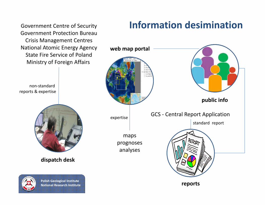
Information desiminationGovernment Centre of SecurityGovernment Protection BureauCrisis Management Centres
National Atomic Energy AgencyState Fire Service of PolandMinistry of Foreign Affairs
dispatch desk
non‐standard reports & expertise
public info
reports
GCS ‐ Central Report Applicationstandard report
web map portal
mapsprognosesanalyses
expertise
Page 13
Polish Geological InstituteNational Research Institute
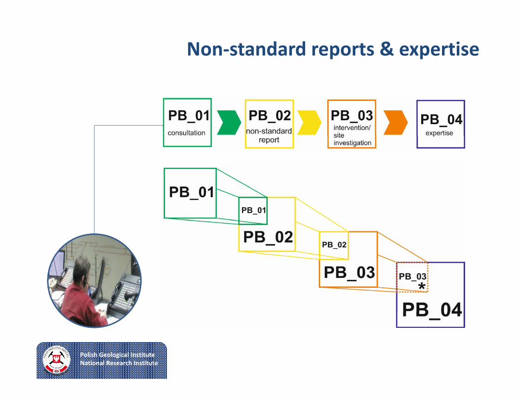
Non‐standard reports & expertise
Page 14
Polish Geological InstituteNational Research Institute
Dispatch Desk & Teleconference System
Government Crisis Management Support Team
Information Technology and Communication Team
Page 15
Polish Geological InstituteNational Research Institute
System Architecture
geohazard analyses systemdespatcher systemteleconference systemexternal systems in PGIexternal systems out of PGI
Page 16
Polish Geological InstituteNational Research Institute
Page 17
Polish Geological InstituteNational Research Institute
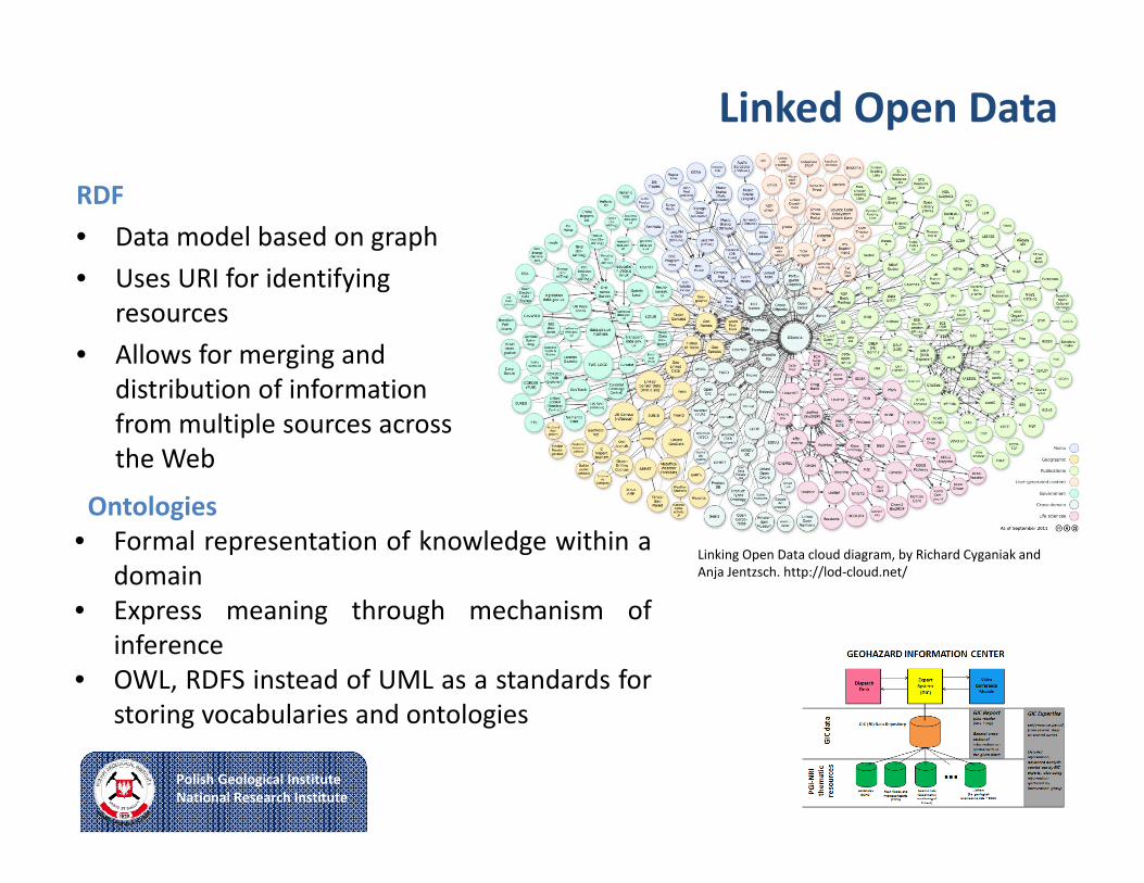
Linked Open Data
RDF • Data model based on graph• Uses URI for identifying
resources• Allows for merging and
distribution of informationfrom multiple sources acrossthe Web
Ontologies• Formal representation of knowledge within a
domain• Express meaning through mechanism of
inference• OWL, RDFS instead of UML as a standards for
storing vocabularies and ontologies
Linking Open Data cloud diagram, by Richard Cyganiak and Anja Jentzsch. http://lod‐cloud.net/
Page 18
Polish Geological InstituteNational Research Institute
Linked Open Data
PGI thematic resources
Triplestore(merging)
SPARQL endpoint
ApplicationInterfaceAnalytics
LOD cloudalignment
converters, wrappers
Ontologies
Local administrationMinistry of Environment
Crisis Management Systems
algorithms
Page 19
Polish Geological InstituteNational Research Institute
Summarise
• Support decision makers in crisis situations
• Standard reports for central application
• Deliver client oriented expertise right in time
• Theme oriented algorithms to build reports
• LOD as a tool for delivering wide range of information from internal resources
• LOD extend scope for expert needs
Page 20
Polish Geological InstituteNational Research Institute
Thank you for @10tion
[email protected]
@tomasznalecz
tomasznalecz