Florida Coastal Office Living Shorelines from A to D in the Florida Panhandle Living Shoreline Workshop May 2014 Zachary Schang 1 , Melody Ray-Culp 2 , Beth Fugate 1 1 Northwest Florida Aquatic Preserves Office, Pensacola, FL 2 Florida Panhandle Coastal Program, US Fish & Wildlife Service, Panama City, FL
Transcript
Florida Coastal Office
Living Shorelines from A to D in the Florida Panhandle
Living Shoreline Workshop May 2014
Zachary Schang1, Melody Ray-Culp2, Beth Fugate1
1Northwest Florida Aquatic Preserves Office, Pensacola, FL 2Florida Panhandle Coastal Program, US Fish & Wildlife Service, Panama City, FL
Escambia to Wakulla
2
Do nothing
US Fish & Wildlife Service, M. Ray-Culp
3
4
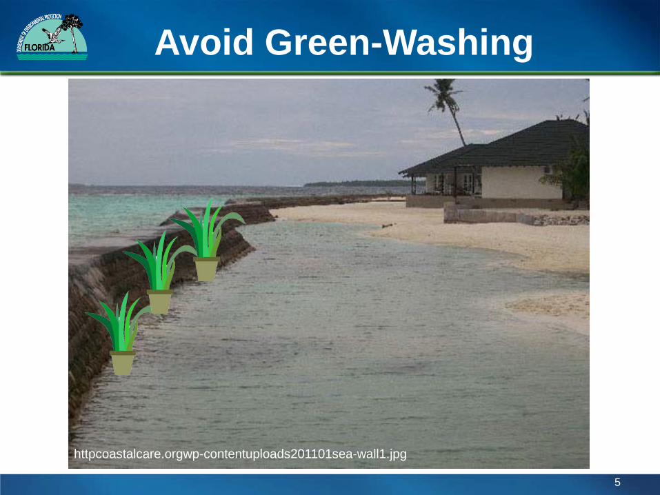
shoreline.noaa.gov/glossary.html#partj “Living shorelines – A shoreline management practice that provides erosion control benefits; protects, restores, or enhances natural shoreline habitat; and maintains coastal processes through the strategic placement of plants, stone, sand fill, and other structural organic materials (e.g. biologs, oyster reefs, etc).”
habitat.noaa.gov/restoration/techniques/livingshorelines.html “NOAA is working to implement a more natural bank stabilization technique called “living shorelines.” This approach uses plants, sand, and limited use of rock to provide shoreline protection and maintain valuable habitat. Living shoreline projects utilize a variety of structural and organic materials, such as wetland plants, submerged aquatic vegetation, oyster reefs, coir fiber logs, sand fill, and stone.”
To establish ‘Living Shorelines’ as the primary means for protecting eroding shorelines in the coastal areas of Northwest Florida where needed and appropriate and where do-nothing is not an option, thereby steering coastal protection towards softer, more natural alternatives, and away from hardening.
6
A - D Do nothing retreat
native plants only native plants + coir fiber
plants + oyster breakwater oyster breakwater
non-oyster breakwater
groins, jettys riprap seawall/bulkhead
7
Rules and Regulations
• Submerged land owned by the State of Florida • Proprietary authorization required to add fill • All applications are forwarded on to US Army
Corps of Engineers
8
Florida Department of Environmental Protection
Florida Department of Environmental Protection
Joint Works Application Dredge/fill vs restoration/enhancement US Army Corps of Engineers Florida Department of Environmental Protection Environmental Resource Permitting NWFL Statewide ERP Exemption General Permit for private landowners General Permit for government landowners
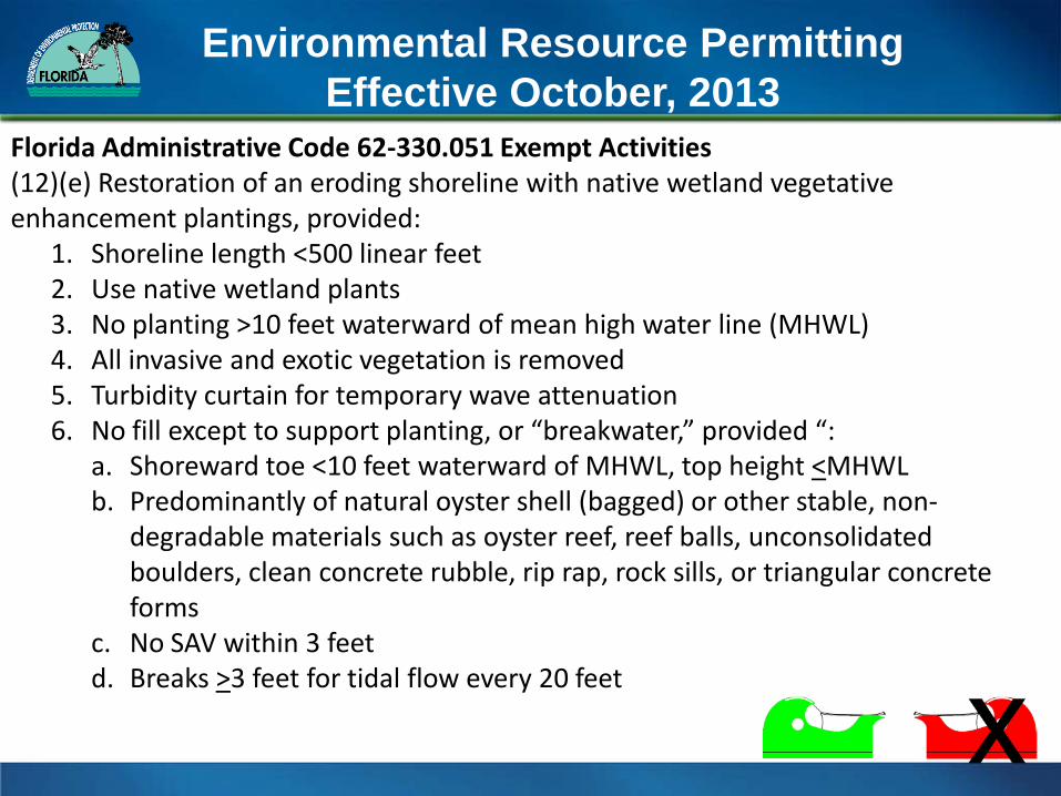
Florida Administrative Code 62-330.051 Exempt Activities (12)(e) Restoration of an eroding shoreline with native wetland vegetative enhancement plantings, provided:
1. Shoreline length <500 linear feet 2. Use native wetland plants 3. No planting >10 feet waterward of mean high water line (MHWL) 4. All invasive and exotic vegetation is removed 5. Turbidity curtain for temporary wave attenuation 6. No fill except to support planting, or “breakwater,” provided “:
a. Shoreward toe <10 feet waterward of MHWL, top height <MHWL b. Predominantly of natural oyster shell (bagged) or other stable, non-
degradable materials such as oyster reef, reef balls, unconsolidated boulders, clean concrete rubble, rip rap, rock sills, or triangular concrete forms
c. No SAV within 3 feet d. Breaks >3 feet for tidal flow every 20 feet
US Army Corps of Engineers
• Projects independently reviewed • National and Regional permits may be applied • Fill requires coordination and approval from
National Marine Fisheries Service • Seagrass, shorebird, and sturgeon habitat
11
Florida Department of Environmental Protection US Fish and Wildlife Service, M. Keys US Fish and Wildlife Service, P. Lang
Facets and Factors
-Shoreline length -Fetch -Orientation -Sediment quality -Sediment transport -Salinity -Existing vegetation -Presence of SAV -Invasive species -Scarping
-Shoreline history -Presence of oysters -Sunlight/tree shade (roots) -Shoreline access -Adjacent property -Stormwater outfalls -Upland erosion influences -Hidden structures -Marine/terrestrial wildlife -Slope of intertidal/upland
12
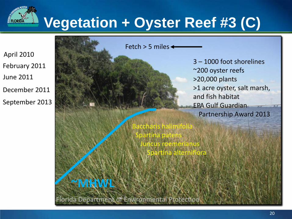
Techniques
Vegetation – PLANTING DEPTH – Timing (season/tide) – Condition of plants – Zonation – Grade – Spacing – Follow up
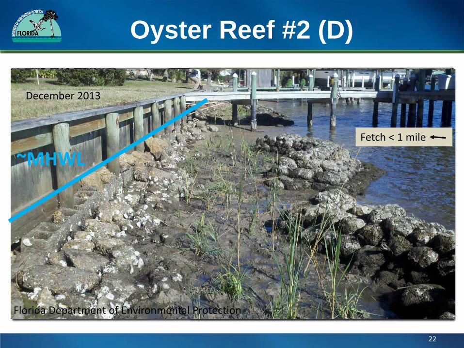
Oyster Reefs – CONSOLIDATION – Size (length/width/ht) – Shape/orientation – Distance from MHWL – Grade – Spacing – Follow up