Environmental and Social Management Plan Municipality of Mavrovo and Rostuse and PE “National Park Mavrovo” "Development of Tourism in the Mavrovo Valley" 1 Local and Regional Competitiveness Project (LRCP) Environmental and Social Management Plan for the sub-project: “Development of tourism in the Mavrovo valley” Mavrovo and Rostuse, 2020
Transcript
Environmental and Social Management Plan Municipality of Mavrovo and Rostuse and PE “National Park Mavrovo”
"Development of Tourism in the Mavrovo Valley"
1
Local and Regional Competitiveness Project (LRCP)
Environmental and Social Management Plan
for the sub-project:
“Development of tourism in the Mavrovo valley”
Mavrovo and Rostuse, 2020
Environmental and Social Management Plan Municipality of Mavrovo and Rostuse and PE “National Park Mavrovo”
"Development of Tourism in the Mavrovo Valley"
2
Introduction
The Local and Regional Competitiveness Project (LRCP) is a four-year investment
operation supported by the European Union with funding from the IPA 2 Competitiveness
and Innovation Program in Macedonia. The LRCP is managed as a Hybrid Fund and
contains 4 components implemented by the World Bank and the Government of the
Republic of North Macedonia
The project will provide funding for investments and capacity building to enable
sectorial growth, investment in prosperous destinations and specific destinations at
regional and local level. The project finances selected tourist destinations in the country
through a combination of technical assistance to improve its management, investment in
infrastructure, connectivity and innovation.
This Environmental and Social Management Plan has been prepared for the
planned activities within the sub-project "Development of tourism in the Mavrovo Valley"
prepared by the Municipality of Mavrovo and Rostushe in partnership with the National
Park “Mavrovo”. The ESMP consists of a description of the sub-project, the technical
details, the area and the location, on the basis of which, makes an assessment of the risks
to the environment. The implementation of mitigation and monitoring measures on
identified potential risks and issues in the ESMP is compulsory.
I. Description of the sub-project: “Development of tourism in the Mavrovo valley”
The main goal addressed through the implementation of this sub-project concerns
removing existing obstacles within the limited or inadequate infrastructure and services
of the National Park “Mavrovo” as a tourist destination.
The performance of the activities as a whole represents investments in improving
the conditions of the visitors of the National Park “Mavrovo”, throughout the year.
The main goal of the proposed sub-project is the development and promotion of
the tourism in the National Park “Mavrovo” as a year-long destination with a diverse offer
for domestic and foreign tourists.
The implementation of the sub-project will create the basis for growth and
development of the local economy using natural and material potentials without reducing
Environmental and Social Management Plan Municipality of Mavrovo and Rostuse and PE “National Park Mavrovo”
"Development of Tourism in the Mavrovo Valley"
3
the development activities in the National Park “Mavrovo” and the Municipality of
Mavrovo and Rostuse.
Enriching new content at this destination where attractions and monuments of
nature of particular historical and cultural significance for the state can also be found, will
additionally increase its value and attractiveness for visitors, as well as the
competitiveness of the destination in regional and national frames.
For the realization of this sub-project, a number of activities have been proposed:
1. Arrangement of three observation points/platforms in the National Park
“Mavrovo;
Location 1: CP.no. 89 - Rah, CM Tanushe;
Location 2: CP.no. 39 - Drezda, CM Selce;
Location 3: CP.no. 116/1 - Zad Rid, CM Trebiste.
2. Arrangement of three picnic places.
Location 1: CP.no. 759 - Pod Prisojnica, CM Prisojnica;
Location 2: CP.no. 80 - Gorna Ledina, CM Velebrodo;
Location 3: CP.no. 162 - Dolni rid, CM Leunovo.
3. Reconstruction of an existing pedestrian path and bridges for the Waterfall Duf
in v. Rustuse,
4. Marking and arrangement of existing pedestrian paths (24 in total) on the
territory of NP “Mavrovo” .
Environmental and Social Management Plan Municipality of Mavrovo and Rostuse and PE “National Park Mavrovo”
"Development of Tourism in the Mavrovo Valley"
4
I.1 The main goal
The main goal of the project is the development of the tourist offer in the Mavrovo valley,
in order to attract domestic and foreign, individual and groups of visitors. In accordance,
to offer better conditions than the existing, with clean air and natural beauties
characteristic for the NP “Mavrovo”.
I.2. Specific objectives of the project:
• To increase the tourist offer by improving the existing and introducing new and unique
content.
• To maintain the existing rate of tourist visits and attract new domestic and foreign
tourists.
• To increase the safety of recreational and adventure tourists.
• To set up picnic places.
• To improve the health of people by promoting outdoor activities.
• Growth of local economic development through indirect impact on catering, hotels and
small businesses.
• To provide new job openings that will secure the maintenance and full functioning of the
National Park “Mavrovo”.
I.3 Location of the project
Geographically, the National Park "Mavrovo" covers an area of 73.088 ha.
The area of the park covers the southern parts of Shara Mountain, the western and central
parts of Bistra Mountain and the complete Korab and Deshat Mountains, which are within
the borders of the Republic of North Macedonia. The park has a favorable geographic
position through which the regional roadway Gostivar - Debar - Struga - Ohrid passes,
connected with Skopje and other parts of the Republic of North Macedonia and the wider
region.
The National Park "Mavrovo" covers part of the Municipality of Mavrovo and Rostusha.
This municipality was established with the Law on Territorial Organization of the Local
Environmental and Social Management Plan Municipality of Mavrovo and Rostuse and PE “National Park Mavrovo”
"Development of Tourism in the Mavrovo Valley"
5
Self-Government in the Republic of Macedonia (Official Gazette of the Republic of
Macedonia No. 55/04), from the two former municipalities: Mavrovi Anovi and the
Municipality of Rostusha.
The area of sub-project activities is connected with the main road - M4, Gostivar-Kicevo-
Struga-Kafasan (border crossing with the Republic of Albania), via the regional road
R1202 Mavrovi Anovi-Debar-border with R. Albania, as well as the Regional Road around
the Mavrovo Lake R2235.
Regional roads, as second-class roadways, are present in the region and play a significant
role. With the network of local roads, all settlements in the municipalities of Mavrovo and
Rostusha are connected with the urban centers, and also with each other, and in this way
the road connection of every inhabitant of this area is provided in all directions in the
Republic and outside of the country.
The current zoning of the Mavrovo National Park (NP Mavrovo Management Plan
from 1988) includes the following zones:
1. Strictly protected area (4.417 ha):
• Lukovo Pole Area - Adzina Reka (South Shara Mountain); an area of 300 ha; significant
hydrographic, geomorphologic and expressive floral values.
• Korab Zone; an area of 1,953 ha; the area of the source of River Ribnichka, floristic rich
meadows above the forest belt; the gorge above Zuzhne in limestone rocks with diverse
and rich arctapalic vegetation, numerous phytocenoses and among them endemic; the
areas between the Golem and the Small Korab Gate - a complex of geological, relief,
hydrographic floristic and landscape values, the source parts Rivers Shtirovica, Dlaboka
Reka and Ribnichka Reka.
• Stresimir Zone; an area of 183 ha; gorge of Upper Radika River with vertical sections,
serrated ridges and spiked peaks; appearance of black pine.
• Zone Bogdevska Reka/River; area 28 ha; a rare appearance of a sedge.
• Senecka mountain and Barich canyon; an area of 1,953 ha; the geomorphological rarity
of the Barich canyon and Senecki rocks; floristic variety (walnut, scallop, black pine,
landscape Ostrovo - biological reserve).
Environmental and Social Management Plan Municipality of Mavrovo and Rostuse and PE “National Park Mavrovo”
"Development of Tourism in the Mavrovo Valley"
6
2. Melioration zone:
• Divided into six spatial units that cover forests and pastures. In this zone scientific
research departments (11 in total) are located, primarily for scientific research in the field
of forestry.
3. Tourist and recreational zones:
3.1. Tourist recreational area Mavrovo Lake
• The area Mavrovi Anovi, Bunec, Mavrovo with the ski slopes, Leunovo, Nikiforovo with
the ski slopes of Sandakhtas and Kichinitsa.
3.2. Tourist recreation zone Radika
• Upper Radika river area with the sites Reč and Adžina Reka.
• The area of Dolna (lower) Radika river and River Mavrovska area with the sites of
Trnitsa, the monastery St. Jovan Bigorski, and villages Janche and Galichnik.
• Area of South Shara Mountain with localities Black Stone and Bogdevo.
• Korab area with the sites of Tanushe, Ribnica, Zuzhne and the ski fields under Golem
Korab and Shilovert to Lukovo Pole.
• Areas of Deshat with the sites Zirovnica and Bitushe.
3.3. Tourist recreation zone Bistra
• The area of Lazaropole.
• The area of Selce, Rosoki, Tresonce.
3.4. Tourist places and areas for shorter tourist visits and school excursions
• Small and Large Korab Gate.
• Kabash with Rossi Rimnits.
• The canyon Guri Vran on the Deep River.
• The canyon Barich.
• The gorge of the Middle and Lower Radika.
• Shadow rocks.
• Styrian Mountain.
• Gorna Radika gorge.
Environmental and Social Management Plan Municipality of Mavrovo and Rostuse and PE “National Park Mavrovo”
"Development of Tourism in the Mavrovo Valley"
7
II. Description of the activities
ACTIVITY 1: Arrangement of three observation points/platforms in the National Park
“Mavrovo” The main goal of this activity is the setting-up of observation points, on the territory
of the NP “Mavrovo”, due to enrichment of the tourist offer by introducing programs for watching wild animals. This activity encompasses three observation points, which will define the area boundaries of the footprint for new-planned contents, their spatial disposition, the way of internal organization and infrastructural handling of the locations with approaches, urban equipment, and the necessary communal infrastructure.
The observation points will be placed on appropriate surfaces (locations without high vegetation, thus enabling open view of the landscape of the National Park "Mavrovo"), with the purpose compatible with the planned activities according to NP "Mavrovo “ zoning, without disturbing the current state of space and safety. All of the observation points are located out of settlements, at locations that have predispositions for locating this type of objects. All three locations are located in the Sustainable Management Zone (according to the new draft Management Plan) and according to the NP Mavrovo Management Plan from 1988 they are located in the tourist and recreational zones in the National Park.
Within the cadastral parcels for the location of three observation points unified objects are planned covered with overhangs and stairs, in order to have greater visibility for observation of the animals and nature in the park.
Unified urban equipment is also planned such as waste bins and information boards.
Detailed description of the planned locations within Activity 1 of the sub-project:
LOCATION No. 1: northwest of the village Tanushe on CP.no.89 place named Rah. The access is through an existing land-forest path that is traced. The geo-referenced point under X and Y is:
COORDINATES POINTS FROM THE GEODETIC REFERENCE NETWORK
AREA / CM TANUSHE Symbol (type)
GEODETIC REFERENCE
Point Number
X
Y
1 1 7464 851.37 4620 131.38 See photo 1 page: 128
Environmental and Social Management Plan Municipality of Mavrovo and Rostuse and PE “National Park Mavrovo”
"Development of Tourism in the Mavrovo Valley"
8
LOCATION No. 2: CP.no. 39 place called Drezda, CM SELCE Location in the area of the village Selce, at no. 39 in the Drezda area. This location is located northeast of the village of Selce. The access is through an existing land-forest path that is traced. Geo-referenced point under X and Y is:
COORDINATES OF POINTS FROM THE GEODETIC REFERENCE NETWORK
AREA / CM SELCE Symbol (type)
GEODETIC REFERENCE
Point Number
X
Y
3 3 7477 452.78 4604 703.40 See photo 2 page: 129
LOCATION No. 3: code no. 116/1 place called Zad Rid, CM Trebishte Location in the village of Trebishte, no. 116/1 in the area Zad Rid. This location is located northeast of the village Trebiste. The access is through an existing land-forest path that is traced. Geo-referenced point under X and Y is:
COORDINATES OF POINTS FROM THE GEODETIC REFERENCE NETWORK
AREA / CM TREBISTE Symbol (type)
GEODETIC REFERENCE
Point Number
X
Y
4 4 7467 493.04 4609 939.61
See photo 3 page: 130
For the observation point there is a planned space with dimensions 5.00 x 5.00m, height of platform 4.0m, and access to a platform with stairs. The platform is enclosed with a wooden fence and it will be placed on a wooden pole 20/20 at a distance of 2.5m, (a total of 8 pillars). The covering the platform is of a wooden roof construction covered with shingles. All sightings at all three locations are identical. For each observation point on the cadastral parcel where the platforms will be located, an installation of 3 garbage bins and 3 information boards (one garbage bin and information board per location) is planned.
Environmental and Social Management Plan Municipality of Mavrovo and Rostuse and PE “National Park Mavrovo”
"Development of Tourism in the Mavrovo Valley"
9
Traffic All planned locations are near to existing accessible forest roads, which include existing paths, pedestrian approaches and roads (as given in text above under description of location of each of observation points). Therefore, no new roads, and parking spaces will be constructed and no rehabilitation or significant upgrades of roads will take place under the sub-project. Green area and open surfaces The green areas within the parcel are represented in a solid relation compared to the other surfaces, yet green area has the primary function in separating the space according to its purpose.
. Picture 1: Design of observation platform, side view.
Environmental and Social Management Plan Municipality of Mavrovo and Rostuse and PE “National Park Mavrovo”
"Development of Tourism in the Mavrovo Valley"
10
ACTIVITY 2: Arrangement of three picnic areas
The main goal of this activity is to promote the tourist infrastructure in the area of picnic locations by fine arrangement of three picnic areas with the necessary infrastructure, which consists of four gazebos, internal access paths with existing parking places, outdoor picnic spaces (16 benches, 8 tables) waste bins, containers and mobile toilets. The picnic area will have a section for entrance and exit, with a paved section for movable toilet cabins and closed containers for separation of waste.
LOCATION 1: CP.no. 759 place called Pod Prisojnica, CM PRISOJNICA; - Location in the vicinity of the village of Prisojnica, near river Radika. This picnic area is located northeast of the village of Prisojnica, close to the Regional road R 1202 (Mavrovi Anovi-Debar - border with R. Albania) on one side and the watercourse of the river Radika from the other side, on the part of CP.759 CM Prisojnica. Access is through an existing dirt road.
Within the Prisojnica picnic area following activities are planned: - minor upgrade of existing dirt road to stone slabs path with width of 2,5 m, length 282.62m, and stone paved path with width of 2.5 m and length of 128.34m (existing paths inside the picnic site), - 8 individual places for seating (16 benches and 8 tables), - 4 gazebos (one gazebo will be 3.0x4.5m, or about 13.5m2 in size) with table bench - waste bins, mobile toilets and waste containers. According to the urban planning documentation picnic site is with a total area of approximately 1.54 ha. See photos 4,5,6,7 page: 136 LOCATION 2: CP.no. 80 place called Gorna Ledina, CM VELEBRDO; - A picnic area near village of Velebrdo (located in the vicinity of the village of Velebrdo). This location is on the south of the village of Velebrdo, on CP 80, on the place called Gorna Ledina. Up to this picnic area you can come through a forest steep road, accessible only by foot or by a terrain vehicle. This picnic area is near also to the villages of Rostushe and Bitushe. With the arrangement of the picnic place, the space will be fully arranged and will receive the character of an organized space for this specific purpose - space for the picnic.
Within the Velebrodo picnic area following activities are planned: - stone paved path with width of 2.5 m, length of 405.21m (the paths inside the picnic site), - 8 individual places for seating (16 benches and 8 tables), - 4 gazebos (one gazebo will be 3.0x4.5m, or about 13.5m2 in size) with table bench - waste bins, mobile toilets and waste containers. The site is with an area of about 1.20ha (12033m2). Access to the location is through a forest path. See photos 8,9,10,11 page: 137
Environmental and Social Management Plan Municipality of Mavrovo and Rostuse and PE “National Park Mavrovo”
"Development of Tourism in the Mavrovo Valley"
11
LOCATION 3: CP.no. 162 place called Dolni Rid, CM LEUNOVO - Location adjacent to the village Leunovo. This location near village Leunovo, on CP. No.162, in CM Leunovo, along the Regional road around the lake marked as R-2235, to a space that is suitable for locating such sites-picnic areas.
Within the Leunovo picnic area following activities are planned: - stone paved path with width of 2.5 m, length 149,28m, and stone paved path with a width of 2.5 m and length of 147,84m (the existing paths inside the picnic site), - 8 individual places for seating (16 benches and 8 tables), - 4 gazebos (one gazebo will be 3.0x4.5m, or about 13.5m2 in size) with table bench - waste bins, mobile toilets and waste containers. With the arrangement through installment of urban equipment within the picnic area, the space will be fully arranged and will receive the character of an organized space for the specific purpose - area for the picnic. The location is about 0.91ha (9118m2). Access to the location is through the Regional road around the Mavrovo lake R 2235. See photos 11,12,13,14 page: 138 Below total number of urban equipment pieces per picnic area is given. Following equipment will be installed at the location of Prisojnica: table with benches, made of wood 8 pieces Wooden bins 21 pieces mobile toilets 2 pieces waste container 4 pieces The equipment that will be installed at the location of Velebrodo is: table with benches, made of wood 8 pieces Wooden bins 21 pieces mobile toilets 1 piece waste container 4 pieces The equipment that will be installed at the location of Leunovo is: table with benches, made of wood 8 pieces Wooden bins 12 pieces Mobile toilets 1 piece Waste container 4 pieces
Environmental and Social Management Plan Municipality of Mavrovo and Rostuse and PE “National Park Mavrovo”
"Development of Tourism in the Mavrovo Valley"
12
Gazebos According to sub-project detail design for the installation of urban equipment in the National Park "Mavrovo" for one gazebo there is a planned space of 3.0x4.5m, of about 13.5m2. Gazebos will be with dimensions of 4.46x2.80m enclosed with a wooden fence, a paved part of a natural stone, a wooden table and 2 seating bench, a wooden roof overhang covered with a roof tile.. In total 12 gazebos (4 per each location - picnic area Prisojnica, picnic area Velebrodo and picnic area of Leunovo) will be constructed. Each gazebo is connected only with existing pedestrian paths. There will be no access path for motor vehicles and no parking spaces inside the picnic areas. Traffic and existing access paths The network of access walking paths within the picnic areas are planned to be tiled also with natural materials-stone slabs, equipped with waste bins to every picnic area. Total length of access paths within the picnic areas is 431, 90m paths with 2.5 m width and 681,39m with 2.50m width (only work on leveling and cleaning existing paths are planned) Each picnic area will have an entrance and exit, with a paved section for movable cabins for two toilets and four containers (1,1m3) for separation of waste per one picnic area. All locations planned for picnic areas are located near existing Regional roads or existing access forest roads, including existing paths and approaches, as well as building internal access paths to each location for a picnic area. Outdoor picnic spaces Within each picnic area, a separate location for 8 outdoor picnic spaces with a paved area with stone slabs of 12,49 m2 each, equipped with 2 benches, tables and waste basket, are planned. Green area and open surfaces Green areas within the plot are dominant in comparison with other areas. Removing trees is not planned, given the fact that the selected locations are in a good position with a solid access to them. Gazebos will be constructed without the barbecue
Environmental and Social Management Plan Municipality of Mavrovo and Rostuse and PE “National Park Mavrovo”
"Development of Tourism in the Mavrovo Valley"
13
Picture 2: gazebo made of stone slabs, wooden construction and covered with clay shingle- (without designated barbecue)
Picture 3: A view of a wooden bench mounted on a stone base
The scheme of the surfaces for laying of gazebos is as follows.
Environmental and Social Management Plan Municipality of Mavrovo and Rostuse and PE “National Park Mavrovo”
"Development of Tourism in the Mavrovo Valley"
14
Picture 4: Pattern on surfaces for placement of gazebos
Wooden table with benches Planning of placing unified urban equipment for wooden table with benches - together with the gazeebo, it is planned to set up, at three sites 4 tables with benches, or 12 in total (at three picnic sites,). - within the section for open picnic places, 8 wooden table with benches on three picnic area locations on three locations - total 24 A scheme for surfaces for setting up a wooden table with benches is given in Annex 1 of the detail design. Situational solution for each location is given separately in Annex 1 of the detail design.
Waste bins A unified urban equipment is planned - waste bins: - within the part of the open picnic places of 16 for each picnic place placed on the
part of the open picnic places. Total baskets for setup for all locations = 54
Environmental and Social Management Plan Municipality of Mavrovo and Rostuse and PE “National Park Mavrovo”
"Development of Tourism in the Mavrovo Valley"
15
Picture 5: waste bin
Containers A unified urban equipment is planned for placing waste containers as a controlled
waste disposal site for separating waste (plastic, paper and glass) in closed containers for each picnic area or 3x4 = 12. Тhe waste will be collected by the public utility company operating under the jurisdiction of the Municipality of Mavrovo and Rostuse
Public sanitary facilities
The Project will finance installation of mobile toilets in all of the picnic areas, one for each location except for picnic area Prisojnica where 2 mobile toilets will be placed or total of 4. Mobile toilets in picnic areas will be cleaned depending on the number of visits to the picnic area. In summer it will be more frequent due to higher attendance. We do not currently have an accurate attendance estimate so the park plans to contract with a mobile toilet company and we will apply cleaning standards recommended by the company.
Environmental and Social Management Plan Municipality of Mavrovo and Rostuse and PE “National Park Mavrovo”
"Development of Tourism in the Mavrovo Valley"
16
ACTIVITY 3: Fine arrangement of an existing pedestrian path and bridges for the Waterfall Duf
in v. Rustuse. The location of the implementation of activity no. 3 is near the village of Rostuse,
in the area of the waterfall Duf, the municipality of Mavrovo and Rostushe. The hiking track extends along the beautiful surroundings along the River Golema
Reka, from the village of Rostushe to the Waterfall Duf. It is 1020 m long.
Pedestrian path starts as a dirt path, while occasionally consisting of remains of a drywall, where sometimes the layers are fixed with mortar. The path is narrow and there is a visible damage from soil erosion. At several places, the path is not safe also due to erosion and unstable rocks. Rarely, the path has wooden protective rails installed. However, these are old and unstable. For most of its length, the path is followed by a stream that seasonally irrigates the fields below. This stream is possibly partly responsible for the erosion of the drystone path.
Picture 6: A pedestrian bridge for the waterfall in Duf, Rostuse
Environmental and Social Management Plan Municipality of Mavrovo and Rostuse and PE “National Park Mavrovo”
"Development of Tourism in the Mavrovo Valley"
17
Environmental and Social Management Plan Municipality of Mavrovo and Rostuse and PE “National Park Mavrovo”
"Development of Tourism in the Mavrovo Valley"
18
Environmental and Social Management Plan Municipality of Mavrovo and Rostuse and PE “National Park Mavrovo”
"Development of Tourism in the Mavrovo Valley"
19
Figure 7: Appearance of an existing fence
Figure 8: Appearance of an existing fence –Duf Track
Environmental and Social Management Plan Municipality of Mavrovo and Rostuse and PE “National Park Mavrovo”
"Development of Tourism in the Mavrovo Valley"
20
Picture 9: current situation on one of the bridges
The activity involves reconstruction of an existing pedestrian path and bridges for the waterfall Duf in the village of Rostuse, the Municipality of Mavrovo and Rostushe in the National Park “Mavrovo”.
Environmental and Social Management Plan Municipality of Mavrovo and Rostuse and PE “National Park Mavrovo”
"Development of Tourism in the Mavrovo Valley"
21
Environmental and Social Management Plan Municipality of Mavrovo and Rostuse and PE “National Park Mavrovo”
"Development of Tourism in the Mavrovo Valley"
22
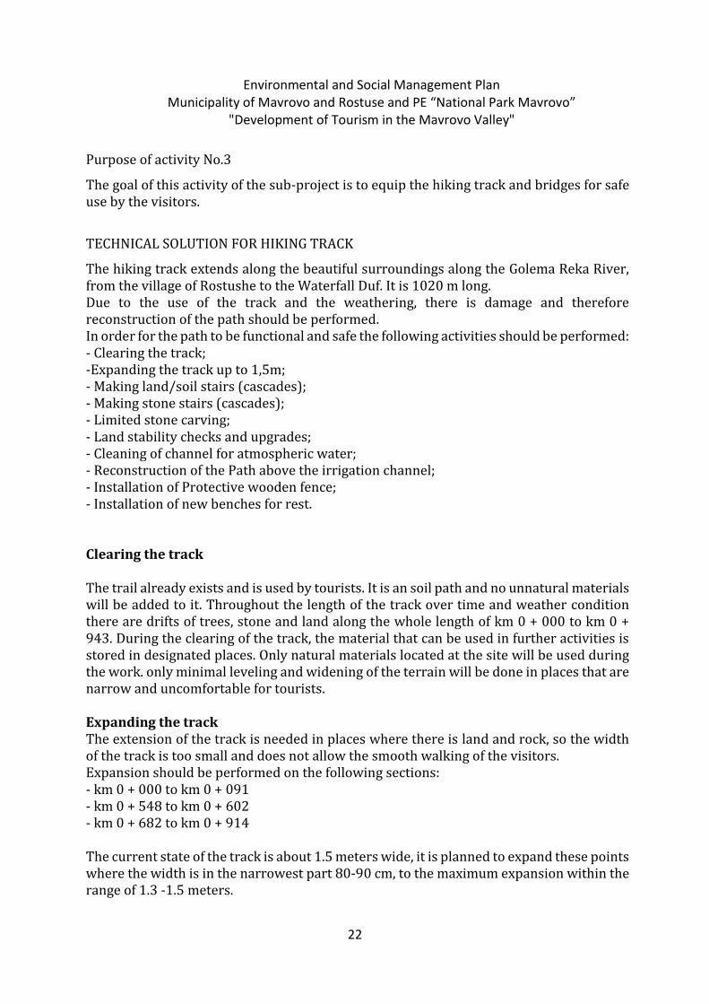
Purpose of activity No.3
The goal of this activity of the sub-project is to equip the hiking track and bridges for safe use by the visitors.
TECHNICAL SOLUTION FOR HIKING TRACK
The hiking track extends along the beautiful surroundings along the Golema Reka River, from the village of Rostushe to the Waterfall Duf. It is 1020 m long. Due to the use of the track and the weathering, there is damage and therefore reconstruction of the path should be performed. In order for the path to be functional and safe the following activities should be performed: - Clearing the track; -Expanding the track up to 1,5m; - Making land/soil stairs (cascades); - Making stone stairs (cascades); - Limited stone carving; - Land stability checks and upgrades; - Cleaning of channel for atmospheric water; - Reconstruction of the Path above the irrigation channel; - Installation of Protective wooden fence; - Installation of new benches for rest. Clearing the track The trail already exists and is used by tourists. It is an soil path and no unnatural materials will be added to it. Throughout the length of the track over time and weather condition there are drifts of trees, stone and land along the whole length of km 0 + 000 to km 0 + 943. During the clearing of the track, the material that can be used in further activities is stored in designated places. Only natural materials located at the site will be used during the work. only minimal leveling and widening of the terrain will be done in places that are narrow and uncomfortable for tourists. Expanding the track The extension of the track is needed in places where there is land and rock, so the width of the track is too small and does not allow the smooth walking of the visitors. Expansion should be performed on the following sections: - km 0 + 000 to km 0 + 091 - km 0 + 548 to km 0 + 602 - km 0 + 682 to km 0 + 914 The current state of the track is about 1.5 meters wide, it is planned to expand these points where the width is in the narrowest part 80-90 cm, to the maximum expansion within the range of 1.3 -1.5 meters.
Environmental and Social Management Plan Municipality of Mavrovo and Rostuse and PE “National Park Mavrovo”
"Development of Tourism in the Mavrovo Valley"
23
Land/soil stairs (cascades) Land/soil stairs (cascades) are made in places where the existing ones are almost completely ruined due to weather conditions and exploitation. Land/soil stairs (cascades) will be reconstructed in the following sections: -km 0 + 000 to km 0 + 023 -km 0 + 894 to km 0 + 928 The Actual dimensions of the stairs are: Width: 1,5 m, Height: 20-30cm. Existing dimensions will be kept.
Figure 10: view of the land stairs - Duf waterfall walking track.
The following activities will be undertaken: - leveling the land area -positioning of wooden boards with thickness of 5cm. Fastened in three places with pegs F 5 cm dug into the ground 30 cm. The entire wood material was previously coated with moisture and wormhole protective agents that are harmless to the aquatic life, environment and human health as a stream that feeds the local irrigation system in summer runs along most of the path and will run under the boards.
Environmental and Social Management Plan Municipality of Mavrovo and Rostuse and PE “National Park Mavrovo”
"Development of Tourism in the Mavrovo Valley"
24
-filling and compacting the ground for the formation of stairs. - land stability works. Stone stairs (cascades) Stone scales (cascades) are to be reconstructed in places where the track passes through places where the substrate is stoned. The current ones have been ruined over time. Stone stairs should be built on the following sections: - km 0 + 179 to km 0 + 228 - km 0 + 594 to km 0 + 602 - km 0 + 620 to km 0 + 695 - km 0 + 812 to km 0 + 894
They will be built according to the given detail in Figure 9 below
Figure 11: Scheme of the stone rock cascade path Duf
The following activities will be undertaken: - placing a riser of a staircase of a pre-processed stone; - filled with natural material (soil and stone); - placement of stone plates for tread. The stone used for this staircase will be taken from the stone of the previous extension of the track.
Environmental and Social Management Plan Municipality of Mavrovo and Rostuse and PE “National Park Mavrovo”
"Development of Tourism in the Mavrovo Valley"
25
Land stability works Soil and land will be stabilized where there is a risk of soil erosion and landslides in a manner that removes adverse risks for visitors as well as preserves landscape values. Several locations need land stability checks, e.g.:
Environmental and Social Management Plan Municipality of Mavrovo and Rostuse and PE “National Park Mavrovo”
"Development of Tourism in the Mavrovo Valley"
26
Stone carving for building stairs (cascades) or installation of stairs structure (e.g. metal or wood) Stone clinging to form stairs will be performed in places with large rock masses where the stone present safety risks, it cannot be bypassed or bridged and no negative effect to landscape will take place. Example of a possible solution (Austria):
Naturally set stairs are already existing. The activity is in full compliance with the management plan of the Mavrovo National Park. Only existing steps with natural material from the terrain will be reconstructed.There will be no construction on new steps. This activity is in line with the management plan of protected areas. This activity doesn’t need a permit from the Ministry of environment and physical planning.
Environmental and Social Management Plan Municipality of Mavrovo and Rostuse and PE “National Park Mavrovo”
"Development of Tourism in the Mavrovo Valley"
27
Cleaning the atmospheric water channel This channel is used for the acceptance of atmospheric water and for protection of the track. Currently it is full of sediment. Cleaning of the channel will be performed on a section from km0 + 228 to km 0 + 360 Wooden path/crossing above the channel for irrigation On the section of the route where the irrigation channel passes, the width of the track is from 40cm to 50cm. In those places, the walking along the track is difficult and dangerous, so it is necessary to extend its width by covering of the channel. Again, the final width will not exceed 1.5m.
The extension is to be performed according to the given detail in Figure 10 below
Figure 12. Details of the channel that passes along the path to the Duf falls
The following activities will be performed: - Installation of wooden beams 6/8 cm in the longitudinal direction anchored in the stone wall with metal anchors. Anchors should be placed at a distance of 1,00 m - Installation of wooden beams 8/10 cm fastened to the longitudinal beams. They should be placed at a distance of 2.5 cm from each other. The entire wood material must be previously coated with agents protective against moisture and woodworms. The protective coatings must be harmless to aquatic life, the environment and human health.
Environmental and Social Management Plan Municipality of Mavrovo and Rostuse and PE “National Park Mavrovo”
"Development of Tourism in the Mavrovo Valley"
28
Protective wooden fence The existing wooden fence is ruined, rotten and almost decomposed. It is a risk to the safety when moving along the track. The existing wooden fence should be replaced with a new one along the entire length of the track from km 0 + 000 to km 0 + 943, with a height of 90 cm.
Picture 13: Protective fence along the path to the waterfall Duf.
Fence will be built from: - Wooden F80 lumber dug in the ground 40 cm and height 90 cm above the ground placed at a distance of 1.50 m from each other. - Wooden handrail from lumber f 80 fastened to the verticals. - Wooden ramp F 60 is placed at half the height of the fence and fixed to the verticals. The fence is planned to be dug into the ground. No concrete will be used. It will be treated with agents and will make sure they are harmless to the human health, environment and aquatic life.
Technical solution for stream crossings The wooden bridges are part of a pedestrian walkway that extends from the village of Rostusha to the Duf waterfall. They are used for crossing the river, in total there are five (5) and are located along the path of the following changes: km 0 + 605, km 0 + 690, km 0 + 745, km 0 + 850, km 0 + 928, and are with a length of L = 5.00 m and a width of 1.50 m.
Environmental and Social Management Plan Municipality of Mavrovo and Rostuse and PE “National Park Mavrovo”
"Development of Tourism in the Mavrovo Valley"
29
Due to weather conditions, they have serious damage on the stone pillars and wings, as well as the wooden bridge construction. This current state of the bridges represents a potential danger to the safety of visitors to the waterfall. Due to the situation, it is necessary to perform a total reconstruction of all five bridges and a detailed design has been prepared. The reconstruction will be carried out approximately within the existing dimensions of the bridge. The following activities will be undertaken: - Dismantling on a wooden fence; - Removal of wooden bridge construction: planks, beams; - Repairing and finishing stone walls and wings; - Purchase and installation of end-to-end beams 16/18 cm; - Purchase and installation of main carriers 16/18 cm; - Purchase and installation on secondary beams 14/16 cm; - Purchase and installation of pavement beams 5/8 cm; - Purchase of material and construction of a protective fence.
ACTIVITY 4: Marking and arrangement of existing pedestrian paths (24 in total) on the territory of NP “Mavrovo” On the territory of the National Park “Mavrovo” there are over 500 km of walking and hiking paths and mountain bike tracks. There is a service for the design, arrangement and maintenance of the tracks, in cooperation with professional mountain leaders/guides, mountaineering associations and citizens' associations. The tracks are spread across the entire territory of the park across all height zones, from 650 meters up to the highest altitudes above 2000 meters. There are paths of all difficulty ranking/categories. The categorization of the footpaths has been made according to the recommendations of the European Ramblers Association (ERA), and on the mountain biking tracks according to the recommendations of the International Mount Biking Association. The subject of activity 4 within this sub-project are 24 existing mountain paths (hiking and mountain biking tracks) that will be arranged for re-marked and promoted by placing QR codes that will lead to information about the tracks and environment. Arrangement of the mountain trails includes: cleaning the corridor of the trails from branches and vegetation, setting new marks, installation of signposts and info boards, as well as info panels with information for the trails, landscape, areas, biodiversity and much important QR codes with links to base of needed information for the exact trail and area of the park. After finishing all works on the field preparing of the final material will be made: corrected GPS records in GPX format, publishing of touristic hiking and biking maps, guide book and update of all information on the web site and mobile application. The activity envisages the re-marking and arrangement of 24 already existing mountain hiking tracks and mountain biking tracks with a total length of 421 km. All of these tracks were used by domestic and foreign mountaineers, but they were labeled more than 7 years
Environmental and Social Management Plan Municipality of Mavrovo and Rostuse and PE “National Park Mavrovo”
"Development of Tourism in the Mavrovo Valley"
30
ago and their re-arrangement is necessary. In general, all tracks will be re-marked and arranged in an identical manner and according to the standards in force and the law on hiking tracks. In the documentation requested by the LRCP, individual elaborates for hiking tracks have been supplied containing maps made in Google Earth, a detailed description as well as GPS and KMZ files for each of the tracks. All hiking tracks are located in the zone of active management and zone of sustainable use. Zone of Active Management. In accordance with Article 105 of the Law on Nature Protection, the Zone of Active Management is defined as follows: (1) Zone for active management shall be a zone of high interest for the protection, in which some major management interventions are needed for the purpose of restoration, revitalization or rehabilitation of the habitats, ecosystems and other elements of the landscape. (2) Within the zone for active management, management activities may be carried out with regard to:
Manipulation with habitats. Manipulation with species.
(3) It shall be allowed to carry out economic activities that have no adverse impact on the primary objective of the protection in the zone for active management, such as ecotourism or traditional extensive agriculture. (4) The successful management of this zone, as well as the further permanent maintenance thereof, may lead to the zone acquiring characteristics of a strict protection zone. Zone of Sustainable Use. In accordance with Article 106 of the Law on Nature Protection, the Zone of Sustainable Use is defined as follows: (1) The zone for sustainable use shall be a significant part of the protected area with no high values for protection, with infrastructure facilities, objects of cultural heritage, and types of forest plantations that are not characteristic for the area, as well as inhabited places with the surrounding agriculture land. (2) Long-term undertaking of interventions and measures may lead to it acquiring the characteristics of zone for active management. Depending of the situation on the field, on some points on some of the trails, previously placed infrastructure will be use and, on some places, signalization will be replaced or upgrade, especially on the places where previous exploitation of the trails show that some improvement is needed. Also, not all of the trails are similar, some trails are with longer distance and more complicated terrain where more signalization is needed. From previous experience of maintaining the trails, real volume of interventions that has to be done is determined by services in national park.
Environmental and Social Management Plan Municipality of Mavrovo and Rostuse and PE “National Park Mavrovo”
"Development of Tourism in the Mavrovo Valley"
31
Quantity of materials to be used to fully regulate all 24 paths: Number of info boards: 33 Number of signposts: 406 Number of signposts carrier: 181 Number of marking frames: 141 Number of markers: 610 Number of QR codes: 147 Marking color in kg: 86 1. Name and mark on the track: DR2 Skudrinje – Mountain peak Krchin - Bituse This is a serious mountain challenge that allows you to move through one of the most beautiful areas of the park. The tracks can start from the villages of Bituse or Skudrinje, depending on the place of residence. In the upper part it extends along the highest parts of the mountain Krchin, where there is an option for climbing the peak Golem Krchin (2341 m). The peak can be climbed in about an hour after a marked track that starts from “the bachilo” and the Church that are at the foot of the top. Very beautiful path, full of landscapes, panoramic places and beautiful natural and relief shapes. For the most part the track is well visible, marked and easy to follow. The substrate is ground, grass and stone and is generally comfortable for walking. In the lower parts, it is set in the forest,
Environmental and Social Management Plan Municipality of Mavrovo and Rostuse and PE “National Park Mavrovo”
"Development of Tourism in the Mavrovo Valley"
32
and from 1700 meters and higher in the zone of pastures. In three to four places there are drinking water sources. Difficulty of the track is moderate. Denivelation: 1791 m Highest point: 2341 m. Start: v.Skudrinje Final destination: Peak Krchin - v. Bituse Length: 27 km (5-8 hours) Location according to the protection zones: The track passes through an active maintenance zone and a sustainable management zone. Following materials will be used for this path: Number of info boards: 2 Number of signposts: 14 Number of signposts carriers: 15 Number of marking frames: 16 Number of markers: 30 Number of QR codes: 8 Paint for marking in kg: 6 some points on some of the trails, previously placed infrastructure will be use and on some places signalization will be replaced or upgrade, especially on the places where previous exploitation of the trails show that some improvement are needed. Also not all of the trails are similar, some trails are with longer distance and more complicated terrain where more signalization is needed. From previous experience of maintaining the trails services in national park know the real volume of interventions that has to be done. Marking frames” are marking wooden pillars colored in the upper part with red and white color to be visible from distance and to have a roll of navigation points – marks. Markers are colored marking points placed on the field (stones or threes). Some marks will be put as applicators (made from forex material) or as a two colors (red and white) marks. 2. Name and mark on the track: DR3 Skudrinje - Kale Multipurpose path for different tourist categories. It is suitable for hiking, running and driving a mountain bike. It contains a combination of sports and cultural historical values. At the end of the track, there is the archaeological site Kale. The first part of the track extends along the streets of the village of Skudrinje, and at the exit of the village, along the sports fields, continues on a wide unpaved road, mainly set in the forest. The path is marked. There is drinking water in the village of Skudrinje and two more places along the track. Obstacles on the track are small, with the exception of the last sequence, the climbing of the Kale site is on a steep rocky terrain. Denivelation: 320 m Highest point: 2341 m.
Environmental and Social Management Plan Municipality of Mavrovo and Rostuse and PE “National Park Mavrovo”
"Development of Tourism in the Mavrovo Valley"
33
Start: v. Skudrinje Destination: Locality - KALE Length: 3.5 km (up to 1 hour) Location relative to protection zones: The track passes through an active maintenance zone and a sustainable management zone Number of info boards: 1 Number of signposts: 6 Number of signposts carriers: 10 Number of marking frames: 0 Number of markers: 10 Number of QR codes: 2 Marking paint in kg: 2
3. Name and mark on the track: DR6- Lazaropole – Vrv Sokolica
The path to the Vrv Sokolica is a light and beautiful path suitable for all categories of tourists. The bulk of the track is set in the forest, so it can be used at any time of the day. Before the Vrv Sokolica (1471 m) there is a small church dedicated to the Holy Savior. The view from the top, leaves the visitor breathless. The substrate is soft and very pleasant for walking as well as the entire path. This is a short tour that must be done. There is drinking water in the village of Lazaropole. The path difficulty is insignificant, with the exception of the last ten meters below the top, where careful walking due to the rocky terrain is necessary.
Denivalation: 136 m / 680 Highest point: 1471 m. Start: village Lazaropole Destination: Peak Sokolica Length: 1.7 km (up to 45 minutes) Location according the protection zones: The track passes through an active maintenance zone(more new information for zoning of the park is annexed above in the text) and a sustainable management zone. Number of info boards: 1 Number of signposts: 8 Number of signposts carriers: 6 Number of marking frames: 10 Number of markers: 30 Number of QR codes: 2 Marking paint in kg: 2
Environmental and Social Management Plan Municipality of Mavrovo and Rostuse and PE “National Park Mavrovo”
"Development of Tourism in the Mavrovo Valley"
34
4. Name and mark on the track: DR 7 - Lazaropole – Elen Skok Old and very beautiful track of historical significance. In the past, this was the main communication of the village of Lazoropole with the valley of the Radika River. Walking through a beautiful beech and oak forest with a pleasant base. Below the Vrteska place at the Garski Bridge, the track merges with the asphalt road for the Boshkov Bridge. From there to the Elen Skok Bridge there is about 20 minutes walk. The track is marked and easy to follow. There are many beautiful springs at the Lipovnik fountain, about fifteen minutes from Lazoropole. Difficulty is moderate.
Denivelation: 136 m / 680 Highest point: 1471 m. Start: village Lazaropolo Destination: Bridge Deer Jump Length: 7 km (up to 3 hours) Location according the protection zones: The track passes through an active maintenance zone and a sustainable management zone. Number of info boards: 2 Number of signposts: 12 Number of signposts carriers: 6 Number of marking frames: 10 Number of markers: 30 Number of QR codes: 4 Marking paint in kg: 2
5. Name and mark on the track: DR8 Lazropole - Rosoki Beautiful track of great historical significance. It passes through the historical sites Glavino village and Kalina dupka. The track is set in the forest. In the upper half of the track, there are historical sites in Glavino village, and fifty meters above Glavino village is the cave Kalina dupka. Many important events in the history of the village of Lazaropole occurred at this location. The track is visible, marked and easy to follow. More attention is needed at the exit of the village Glavino in the direction of Rosoki. Drinking water is found at the sites Glavino Selo and Kalina Dupka. Difficulty rank of the path is moderate.
Denivelation: 120 m Highest point: 1344 m. Start: village Lazaropolo Final objective: S.Rosoki Length: 9 km (2 - 3 hours)
Environmental and Social Management Plan Municipality of Mavrovo and Rostuse and PE “National Park Mavrovo”
"Development of Tourism in the Mavrovo Valley"
35
Location according the protection zones: The track passes through an active maintenance zone and a sustainable management zone. Number of info boards: 1 Number of signposts: 14 Number of signpost carriers: 5 Number of marking frames: 0 Number of markers: 30 Number of QR codes: 5 Marking paint in kg: 2
6. Name and mark on the track: GR1 Trnica - Vrben Very interesting track above the canyon of the Mavrovska river that will take you from Trnica to the village of Vrben or vice versa, depending on the starting point. It can be combined with the paths that lead to Bogdevo, and it makes a round tour with a longer duration and a walk through the wider area of the park. The track is marked and in large part easy to follow. The substrate is a soil, in places stony, but it is generally pleasant for walking. It is partly located in the forest, and partly through the bare lands. Difficulty rank of the path is insignificant. There is drinking water in Trnica and Vrben.
Denivelation: 640 m Highest point: 1289 m. Start: village Trnitsa Destination: v. Vrben Length: 7 km (2-3 hours) Location according the protection zones: The track passes through an active maintenance zone and a sustainable management zone Number of info boards: 2 Number of signposts: 20 Number of signposts carriers: 10 Number of marking frames: 6 Number of markers: 30 Number of QR codes: 10 Marking paint in kg: 4
7. Name and mark on the track: GR2 Trnica - Bogdevo Very beautiful track from Trnica will take you to the village Bogdevo. Through the remains of the old village architecture, you will be able to get acquainted with the cultural heritage and the spiritual wealth of the Upper Reka region. The track starts from the mountain house and the camp of the Mavrovo National Park in Trnica, passes through the asphalt
Environmental and Social Management Plan Municipality of Mavrovo and Rostuse and PE “National Park Mavrovo”
"Development of Tourism in the Mavrovo Valley"
36
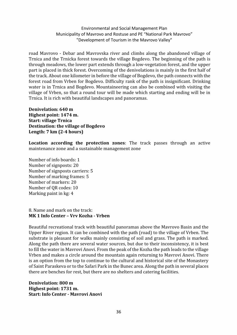
road Mavrovo - Debar and Mavrovska river and climbs along the abandoned village of Trnica and the Trnicka forest towards the village Bogdevo. The beginning of the path is through meadows, the lower part extends through a low-vegetation forest, and the upper part is placed in thick forest. Overcoming of the denivelations is mainly in the first half of the track. About one kilometer in before the village of Bogdevo, the path connects with the forest road from Vrben for Bogdevo. Difficulty rank of the path is insignificant. Drinking water is in Trnica and Bogdevo. Mountaineering can also be combined with visiting the village of Vrben, so that a round tour will be made which starting and ending will be in Trnica. It is rich with beautiful landscapes and panoramas.
Denivelation: 640 m Highest point: 1474 m. Start: village Trnica Destination: the village of Bogdevo Length: 7 km (2-4 hours) Location according the protection zones: The track passes through an active maintenance zone and a sustainable management zone Number of info boards: 1 Number of signposts: 20 Number of signposts carriers: 5 Number of marking frames: 5 Number of markers: 20 Number of QR codes: 10 Marking paint in kg: 4
8. Name and mark on the track: MK 1 Info Center – Vrv Kozha - Vrben
Beautiful recreational track with beautiful panoramas above the Mavrovo Basin and the Upper River region. It can be combined with the path (road) to the village of Vrben. The substrate is pleasant for walks mainly consisting of soil and grass. The path is marked. Along the path there are several water sources, but due to their inconsistency, it is best to fill the water in Mavrovi Anovi. From the peak of the Kozha the path leads to the village Vrben and makes a circle around the mountain again returning to Mavrovi Anovi. There is an option from the top to continue to the cultural and historical site of the Monastery of Saint Paraskeva or to the Safari Park in the Bunec area. Along the path in several places there are benches for rest, but there are no shelters and catering facilities.
Denivelation: 800 m Highest point: 1731 m. Start: Info Center - Mavrovi Anovi
Environmental and Social Management Plan Municipality of Mavrovo and Rostuse and PE “National Park Mavrovo”
"Development of Tourism in the Mavrovo Valley"
37
Destination: Peak Leather - (near the village of Vrben) Mountain Skin Region Mavrovi Anovi Length: 11 km (3-5 hours) Location according the protection zones: The track passes through an active maintenance zone and a sustainable management zone Number of info boards: 3 Number of signposts: 20 Number of signposts carriers: 6 Number of marking frames: 8 Number of markers: 50 Number of QR codes: 10 Marking paint in kg: 4
9. Name and mark on the track: MK2 Round trip above Leunovo
Excellent multipurpose track above the village of Leunovo. It satisfies the appetites of all visitors, from explorers and leisure tourists to sports-oriented recreational and athletes, as well as mountain bike riders. In fact it is a forest road that can be used throughout the year. From April to November, the road is dry and good for hiking, running and mountain biking, and from December to March it can be used for tour and Nordic skiing. The road is marked, and because it is a forest road, orientation is not a problem at all. The base is comfortable for walking both for hiking and cycling. Because it is placed in the forest zone, the walking is pleasant throughout the day. There is sources of drinking water on two places, but the road passes beside many streams. There are no complex obstacles.
Denivelation: 300 m Highest point: 1491 m. Start and destination: v.Leunovo, Bistra Mountain Region v.Leunovo Length: 20 km (3-4 hours) Location according the protection zones: The track passes through an active maintenance zone and a sustainable management zone Number of info boards: 1 Number of signposts: 10 Number of signposts carriers: 2 Number of marking frames: 0 Number of markers: 50 Number of QR codes: 8 Marking paint in kg: 4
Environmental and Social Management Plan Municipality of Mavrovo and Rostuse and PE “National Park Mavrovo”
"Development of Tourism in the Mavrovo Valley"
38
10. Name and mark on the track: MK 3 v.Nikiforovo - Vrv Sandaktash
An old path that forms part of the park's cultural heritage because it is associated with customs, events and legends that originate from the cultural tradition of the local population. The track starts from the center of the village of Nikiforovo and it moves along the Petilepska River to the place Fifth Bread, where the source of the river is located with one of the most beautiful drinking water in the park. From there it continues along the marked path to the top of Sandakhtash (1981 m). The first part of the track, from Nikiforovo to Fifth bread, is in the forest, and the second part of the spring to the top of Sandakhtash is in the zone of pastures where there is a possibility for enjoying beautiful landscapes and panoramas. The track is marked and in large part easy to follow. In fog conditions, the destination from the Fifth Bread to the top of Sandakhtash requires careful walking and tracking of the marking. The substrate along the entire path is soft and cozy for walking. If you find yourself in the park on August 9, the day of Saint Panteleimon and the day when Nikiforovo celebrates the village glory, be sure to pass this tour to enjoy a unique experience and to hear about the traditions of the region directly from the mouths of the local people. Technical difficulties are insignificant, and the beauty and quality of the track are invaluable. There is drinking water in the village and at the spring of the Fifth Bread river.
Denivelation: 714 m Highest point: 1962 m Start: village Nikiforovo Destination: Peak Sandakhtash Mountain Bistra Region v. Nikiforovo - Mavrovo Length: 8 km (2-4 hours) Location according the protection zones: The path passes through a sustainable management area Number of info boards: 1 Number of signposts: 12 Number of support carriers: 4 Number of marking frames: 6 Number of markers: 30 Number of QR codes: 10 Marking paint in kg: 4 11. Name and mark on the track: MK 4 Circular path above Mavrovo
Great ''daily dose'' for moderate recreational people who live in the village of Mavrovo and its surroundings. Most of the track is in the forest, which can be used at any time during the day and during the summer months. It is easy to orient by tracking markings and road
Environmental and Social Management Plan Municipality of Mavrovo and Rostuse and PE “National Park Mavrovo”
"Development of Tourism in the Mavrovo Valley"
39
signs that are placed along the path. In several places the path is crossed by mountain streams, but it is best to get drinking water in Mavrovo.
Denivelation: 200 m Highest point: 1383 m. Start: Parking near the Mavrovo Ski Center Destination: Circular path. It ends at the starting point Length: 5 km (1-2 hours) Location according the protection zones: The path passes through a sustainable management area Number of info boards: 1 Number of signposts: 8 Number of signposts carriers: 3 Number of marking frames: 0 Number of markers: 20 Number of QR codes: 6 Marking paint in kg: 4
12. Name and mark on the track: MK 5 Mavrovo - Chavkarnik
This is a path with interesting historical value because it is related to the traditions and customs of the local population. The track starts from the ski center in Mavrovo and ends at the village of Chavkarnik, near the sheepfold. The beginning extends through the forest zone, and the final part is in the pasture zone where it can be enjoyed in unrepeatable panoramas and landscapes. The substrate is mainly land and its cozy for walking. There is drinking water at the sheepfold. From the sheepfold you can proceed walking to the ski slopes or to the area Fifth Bread or the top Sandakhtash. When combining the track with other routes in the region, it is mandatory to use a map.
Denivelation: 480 m Highest point: 1687 m. Start: Ski Center Mavrovo Destination: Locality Chavkarnik near the sheepfold Length 4 km (1-2 hours) Location according the protection zones: The path passes through a sustainable management area Number of info boards: 1 Number of signposts: 10 Number of support carriers: 4
Environmental and Social Management Plan Municipality of Mavrovo and Rostuse and PE “National Park Mavrovo”
"Development of Tourism in the Mavrovo Valley"
40
Number of marking frames: 5 Number of markers: 20 Number of QR codes: 4 Marking paint in kg: 4
13. Name and mark on the track: MK 6 Mavrovo - Vrv Medenica - Galichnik
Serious challenge for well-prepared mountaineers. The track is located mainly in open space and offers many beautiful landscapes and panoramas above Mavrovo Lake, Bistra Mountain and the valley of the Radika River. The track is marked, however, because it is a walking in the zone of pastures, it is obligatory to use a map. We also recommend engaging a professional mountain guide. The substrate is largely soft and the walking along it is pleasant. In several places, the track is merged with motorways, which gives you the opportunity to differentiate the length of the tour. The denivelation are mainly at the beginning of the track and after cutting the asphalt road for the village Galichnik to the top Medenica (2163m). From the peak to the village Galichnik there is a descent with a height difference of about 750 meters, in large part on a soft base. There is drinking water only in one place (the area of Boshkova fountain), so it is necessary to carry liquids in sufficient quantities (at least two liters per person).
Denevelation: 1162 m Highest point: 2163 m. Start: Ski Center Mavrovo Destination: v. Galichnik Length: 20 km (4-7 hours) Location according the protection zones: The track passes through an active maintenance zone and a sustainable management zone Number of info boards: 1 Number of signposts: 20 Number of signpost carriers: 10 Number of marking frames: 10 Number of markers: 0 Number of QR codes: 8 Marking paint in kg: 4
14. Name and mark on the track: MK 7 Galichnik - Vrv Govedarnik A pleasant path that leads to the top Govedarnik (2011 m). While climbing, you will have the opportunity to enjoy the beautiful panorama above Galichnik and the wider region above Dolna Reka and the Debar valley. To the exit of the rocky gulf, the track is visible and easy to follow, and from there the walking towards the top of Govedarnik is turning
Environmental and Social Management Plan Municipality of Mavrovo and Rostuse and PE “National Park Mavrovo”
"Development of Tourism in the Mavrovo Valley"
41
to the right by following the markings and the mountain slope. The largest denivelations are in front of the rocky strait and in the initial part of the Govedarnik slope. The track is land, rock, stone and alpine grass. Technical weights are moderate. Careful walking is required across the rocky strait. The most reliable drinking water is in the village of Galichnik. Denivelation: 690 m Highest point: 2011 m. Start: village Galichnik Destination: top Govedarnik Length: 6 km (1-2 hours) Location according the protection zones: The track passes through an active maintenance zone and a sustainable management zone Number of info boards: 1 Number of signposts: 10 Number of signpost carriers: 15 Number of marking frames: 5 Number of markers: 0 Number of QR codes: 2 Marking paint in kg: 4 15. Name and mark on the track: MK 8 Galichnik - Janche One of the historical tracks in the region. The track is old, as is the village itself and many things from this track are connected with the history of Galichnik and Janche. During the walking along the track ahead of the tourist, one of the most beautiful panoramas in the region opens. The track is visible, easy to follow and it is marked. On the track there is a water source called the so called Sophie Tchechmiche. A very pleasant track that connects two important historical sites in the region. The substrate is mainly land, in places with a stone. There are no special technical obstacles. Denivalation: 1000 m Highest point: 1470 m. Start: village Galichnik Final objective: v. Janche Length: 5.5 km (1-2 hours) Location according the protection zones: The track passes through an active maintenance zone and a sustainable management zone Number of info boards: 1 Number of signposts: 10
Environmental and Social Management Plan Municipality of Mavrovo and Rostuse and PE “National Park Mavrovo”
"Development of Tourism in the Mavrovo Valley"
42
Number of support carriers: 4 Number of marking frames: 0 Number of markers: 0 Number of QR codes: 4 Marking paint in kg: 4 16. Name and mark on the track: MK 9 Selce – Suvo Pole - Galichnik A beautiful path that connects two beautiful villages and passes through the picturesque Dry Field. The track extends from the village Selce through Suvo Pole to the village Galichnik. In the lower part it is placed above the River of Jadov, and then it climbs towards Suvo Pole, and from there towards the village Galichnik. It is partly located in the forest, and partly in the zone of pastures. The track is visible, marked and easy to follow. It is necessary to pay attention when exiting the first meadows along the river Jadovska, where you need to turn left to the dry field. The substrate is soil and stone, but comfortable for walking. Water is at the sheepfold of Suvo Pole, but it is best to be taken from the taps in Selce or Galichnik, where one of the most beautiful springs of drinking water in the park are located. Difficulty rank of the path is moderate. Denivelation: 750 m Highest point: 1677 m. Start: village Selce Destination: v. Galichnik Length: 10 km (1-2 hours) Location according the protection zones: The track passes through an active maintenance zone and a sustainable management zone Number of info boards: 1 Number of signposts: 10 Number of signpost carriers: 15 Number of marking frames: 4 Number of markers: 20 Number of QR codes: 4 Marking paint in kg: 4 17. Name and mark on the track: MK10 Round trip through the Safari park Bunec This safari park covers a territory of 430 ha that is surrounded by a protective fence. In it visitors will be able to see European deer as well as deer fallow and the walk through it is quite pleasant. The site abounds with beautiful resting places, many sightings, a fountain with cold spring water, and recently an observation tower has been set up - an ideal place for observing the animals from which you can make beautiful photos. Through the photo
Environmental and Social Management Plan Municipality of Mavrovo and Rostuse and PE “National Park Mavrovo”
"Development of Tourism in the Mavrovo Valley"
43
safari park visitors will be led by professionals (Rangers) employed in the national park. The trip through safari park takes from 1 to 2 hours. Safari park Bunec is reproductive center for Balkan Deer. The park itself is fenced space with one hiking education trail and on mountain biking trail. Because of the landscape specifics and some unique views, visitors almost always use it as a place for making a lot of photo stories, what motivate services in the park to reorganize it as a place for hiking, biking, wild life watching with photo shooting. That’s the reason why it is renamed in photo safari park.The children's educational pathway for children from 6 to 12 years is functioning as part of this locality. Denivelation: 100 m Highest point: 1200 m. Start: Inbound port Vessel or children's resort Bunec Destination: Round Tour Length: 9 to 12 km (2 to 4 hours) Location according the protection zones: The track passes through an active maintenance zone Number of info boards: 2 Number of signposts: 10 Number of signpost carriers: 15 Number of marking frames: 4 Number of markers: 20 Number of QR codes: 3 Marking paint in kg: 2 18. Name and mark on the track: MTB 1 Vrvenska path This is one of the paths in the park that must be seen. A perfect layout of the denivelations and quality of the substrate with many beautiful landscapes and panoramas. In addition, the road passes through the beautiful village of Vrben, as well as in the park park of Mavrovo National Park, which means that passing the track will not be just a "normal" ride but also an opportunity to enjoy the cultural and natural values of the park. The road is a combination of asphalt, macadam and an unpaved forest road and it is easy to follow and orient. Along the road there are marked markings and road signs. Part of the road is in the forest belt, and part in the zone of pastures. Drinking water is available in several places, but it is best to use water in the Mavrovi Anovi or the village of Vrben. Difficulty rank of the path ismoderate.
Denivelation: 550 m Highest point: 1775 m. Home: Safari Park Bunker Destination: s.Vrben - Mavrovi Anovi - Bunec Length: 30 km (2-5 hours)
Environmental and Social Management Plan Municipality of Mavrovo and Rostuse and PE “National Park Mavrovo”
"Development of Tourism in the Mavrovo Valley"
44
Location according the protection zones: The track passes through an active maintenance zone and a sustainable management zone Number of info boards: 1 Number of signposts: 20 Number of signpost carriers: 12 Number of marking frames: 10 Number of markers: 30 Number of QR codes: 6 Marking paint in kg: 4
19. Name and mark on the track: MTB 2 Girno Rekanska Track A serious track for physically well-prepared cyclists. The beginning is at the info center of the National Park Mavrovo and it extends through a beautiful scenery with beautiful panoramas above the Gorna Reka region. The track passes through three villages with authentic architecture and wild landscapes rich in diverse biodiversity. The bulk of the track is set up on a wide forest road with a solid base, which is easy to track, marked with signs. Drinking water is available. Catering facilities are located along the Mavrovo Lake and in the village of Trnica. Difficulty rank of the path is moderate.
Denivelation: 850 m Highest point: 1611 m. Start: Mavrovi Anovi Destination: Mavrovi Anovi Length: 51 km (4-8 hours) Location according the protection zones: The track passes through an active maintenance zone and a sustainable management zone
Number of info boards: 2 Number of signposts: 20 Number of signpost carriers: 10 Number of marking frames: 0 Number of markers: 30 Number of QR codes: 6 Marking paint in kg: 4
20. Name and mark on the track: MTB 4 Paths to landscapes One of the most beautiful mountain biking tracks in the Mavrovo National Park. As its name suggests, the track offers a fantastic bicycle experience with enjoying the most beautiful landscapes and panoramas in the park. The starting point is just above the village of Leunovo in the area Studence, where this circular path formally ends. However, since
Environmental and Social Management Plan Municipality of Mavrovo and Rostuse and PE “National Park Mavrovo”
"Development of Tourism in the Mavrovo Valley"
45
there is a network of mountain biking tracks in the park, the start and end of the tour can be adapted according to the wishes and the map data. The largest part of the track extends along a solid and wide dirt road that in the part of the village of Leunovo to the place Batkovica, as well as from the place Carevec to Mavrovo, is located in the forest, and the rest is in the zone of pastures dominated by beautiful landscapes and panoramas. Part of the track is connected with the local asphalt roads. The orientation along the track is easy and along it there are many markings and road signs that clearly show the way. In four to five places along the track there is drinking water. Catering facilities are only by the Mavrovo Lake.
Technical rank - moderate.
Denivelation: 640 m Highest point: 1730 m. Start: Leunovo (Batkovica-Chavkarnik-Carevec-Mavrovo) Destination: Leunovo Length: 45 km (3-6 hours) Location relative to protection zones: The path passes through a sustainable management area Number of info boards: 1 Number of signposts: 20 Number of signposts carriers: 10 Number of marking frames: 10 Number of markers: 30 Number of QR codes: 6 Marking paint in kg: 4
21. Name and mark on the track: MTB 5 Pathway to Batkovica The Path of Batkovica is a short variant of the Path through the Landscape or the Forest Adventure. The beginning is at the place Studenec, above the village of Leunovo and through the locality of Batkovica, it descends downwards towards the asphalt road around the Mavrovo Lake and at the Pejcino Speech site, near the western end of the village of Leunovo, exits the asphalt. The road is categorized as dirt road, wide and easy to follow, marked with markings and signposts. Drinking water is best used at the Student site. Difficulty rank of the path is moderate.
Denivelation: 350 m Highest point: 1571 m. Start: Leunovo (Batkovica) Destination: Leunovo Length: 14 km (2-4 hours)
Environmental and Social Management Plan Municipality of Mavrovo and Rostuse and PE “National Park Mavrovo”
"Development of Tourism in the Mavrovo Valley"
46
Location relative to protection zones: The path passes through a sustainable management area Number of info boards: 1 Number of signposts: 10 Number of support carriers: 4 Number of marking frames: 0 Number of markers: 30 Number of QR codes: 3 Marking paint in kg: 2
22. Name and mark on the track: MTB 7 Path from Mavrovo through Bistra to Lazoropole Another one of the paths that brand Mavrovo National Park as a destination for mountain biking. This is a path that must be tested for both sports and aesthetic reasons. The great landscapes and panoramas, the wide path and the comfortable base, the traditional architecture and the passing along several sheepfolds, which have not only agricultural, but also a cultural and historical significance, give the track an attribute of a "tour that must not be missed". The track starts at the info center in Mavrovi Anovi and along the asphalt road for the village Galichnik extends to the Carevec locality where the asphalt road ends and the drive continues through the pasture area. A few kilometers in front of the village of Lazoropole, the track reaches the forest belt at the Bachiliste locality. The road is wide, easy to follow and marked with well visible signs. Definitely, this is one of the most beautiful paths in the park and in Macedonia in general. Drinking water is available in several places. Difficulty rank of the path is moderate.
Denivelation: 800 m Highest point: 1928 m. Start: Info Center Anovi (Carevec-Bistra Mountain-Cherkezica) Destination: Lazaropole Length: 44 km (3-6 hours) Location according the protection zones: The track passes through an active maintenance zone and a sustainable management zone Number of info boards: 2 Number of signposts: 30 Number of signpost carriers: 15 Number of marking frames: 20 Number of markers: 30 Number of QR codes: 10 Marking paint in kg: 4
Environmental and Social Management Plan Municipality of Mavrovo and Rostuse and PE “National Park Mavrovo”
"Development of Tourism in the Mavrovo Valley"
47
23. Name and mark on the track: MTB 8 roundabout Track from Mavrovo through Leunovo- peak Carevec-Mavrovo
This is one of the paths that are part of the Mavrovo marathon - A small marathon race. It is part of the paths that makes the Mavrovo National Park an ideal destination for mountain biking. This is a path that must be tested for both sports and aesthetic reasons. The great landscapes and panoramas, the wide path and the comfortable base, the traditional architecture and the passing along several sheepfolds, which have not only agricultural, but also a cultural and historical significance, give the track an attribute of a "tour that must not be missed". The track begins in front of the Ski Center in Mavrovo and along the asphalt road for the village Galichnik extends to the Carevec locality where the asphalt ends and the drive continues through the pasture area. Several kilometers before the area Chavkarnik turns in the direction towards the village of Launovo, and goes under the peak Sandakhtash and then the path re-enters the forest belt. The road is wide, country road, easy to follow and marked with well visible signs and markings. Definitely, this is one of the most beautiful paths in the park and in Macedonia in general. Drinking water is available in several places. Difficulty rank of the path is moderate.
Denivelation: 450 m Highest point: 1600 m. Start: Info Center Anovi (Carevec-Planina Bistra-Cherkezica) Destination: the village of Leunovo or the village of Mavrovo, depending on which side you drive. Length: 44 km (3-6 hours) Location according the protection zones: The track passes through an active maintenance zone and a sustainable management zone Number of info boards: 2 Number of signposts: 30 Number of signposts carriers 15 Number of marking frames: 10 Number of markers: 20 Number of QR codes: 4 Marking paint in kg: 2
24. Name and mark on the track: MTB 9 Roundabout around Lazaropole
Nice training for athletes and challenging for the recreation. In the time of about two hours, the most beautiful areas of the Malorekansky region pass. The track starts from the center of Lazaropole and stretches along an unpaved road to the village of Tresonce, than continues along an asphalt road along Tresonechka and Rosochka river to the Garski Bridge, where it turns left to Lazaropole. The track can be combined with other mountain biking tracks in the park, depending on the wishes and possibilities, with mandatory use
Environmental and Social Management Plan Municipality of Mavrovo and Rostuse and PE “National Park Mavrovo”
"Development of Tourism in the Mavrovo Valley"
48
of the map. The road is wide, marked and easy to follow. Drinking water is available in many places. Catering facilities are located in the village of Lazaropole. Difficulty rank of the path is moderate.
Denivelation: 650 m Highest point: 1412 m. Start: Rosoki (Garrick Bridge) Destination: Lazaropole Length: 30 km (2-4 hours) Location according the protection zones: The track passes through an active maintenance zone and a sustainable management zone Number of info boards: 1 Number of signposts: 12 Number of signpost carriers: 6 Number of marking frames: 0 Number of markers: 30 Number of QR codes: 6 Marking paint in kg: 4
Technical specification for marking of hiking trails Planned activities:
1. Cleaning, extension and marking of 24 hiking and mountain biking tracks in a total length of 421 km.
2. Making and installing (installing in ground) marking poles of wood with a dimension of 10cm x 8cm x 20cm (painted red and white in the upper part). Setting up a total of 50 marking poles.
Environmental and Social Management Plan Municipality of Mavrovo and Rostuse and PE “National Park Mavrovo”
"Development of Tourism in the Mavrovo Valley"
49
1. Making and installing 406 wooden signposts (80cm x 20cm) with 181 wooden supports for signposts (with dimension 10cm x 8cm x 250cm).
2. Creating and setting up info boards at the starting point of each of the paths with the dimensions given on the picture. The tables should be made of wood and the informative part of the forex. Total quantity of 24 boards.
Environmental and Social Management Plan Municipality of Mavrovo and Rostuse and PE “National Park Mavrovo”
"Development of Tourism in the Mavrovo Valley"
50
3. Preparation and setting of QR codes for each of the paths and connecting with tourist information data for the paths. 4. Preparation and placement of QR code markers for each of the paths and they are placed at the highest point of the columns, info boards or objects along alignment. No signs, boards, QR markers or other informational objects will be installed to the trees or other natural surfaces (e.g. stone). 5. Engagement of experts who have experience in arranging mountain recreational tourism tracks and arranging or publishing maps and book guides. 6. Using the marking techniques according to the law on mountain paths (Lentons and Knafelts marcation).
Environmental and Social Management Plan Municipality of Mavrovo and Rostuse and PE “National Park Mavrovo”
"Development of Tourism in the Mavrovo Valley"
51
Environmental and Social Management Plan Municipality of Mavrovo and Rostuse and PE “National Park Mavrovo”
"Development of Tourism in the Mavrovo Valley"
52
Environmental and Social Management Plan Municipality of Mavrovo and Rostuse and PE “National Park Mavrovo”
"Development of Tourism in the Mavrovo Valley"
53
3. SCOPE AND GOAL FOR THE ESMP
LRCP is supported by a grant from the European Union and implemented jointly by the Cabinet of the Deputy Prime Minister for Economic Affairs, as an agency for the implementation of funds, and the World Bank. LRCP is classified as a category B project, which means that negative impact can be expected as a result of the implementation, but insignificantly large or long-term. As a result of this classification environmental assessment OP 4.01 is included. CDPMEA Environmental Management Framework (ESMF) to serve as a mandatory guide to the sub-project environmental due diligence, to define eligibility and procedures for screening, evaluating the environment, assessing potential impact and crafting adequate mitigation measures. All project activities (and subprojects) must be implemented in accordance with the ESMF, the procedures and policy of the World Bank and national regulation (the strictest regulation prevails). The sub-project is prepared by the Municipality of Mavrovo and Rostusha in partnership with the National Park “Mavrovo” titled "Development of Tourism in the Mavrovo Valley" and located on the territory of the Municipality of Mavrovo and Rostusha. The ESMP contains a description of the project, technical details, scope and location, on the basis of which the environmental risks have been assessed. The ESMP identifies sustainable and effective measures that can reduce potential negative impacts to an acceptable level on the environment. Implementation of mitigation measures on identified risks and issues is mandatory. The ESMP consists of a set of institutional mitigation and monitoring measures during the implementation of the activities in order to eliminate the negative impacts on the living and social environment, or to reduce them to an acceptable level. The plan also includes the necessary activities to implement these measures. The ESMP gives a description of the technical details of each mitigation measure, including the type of impact along with sketches, description of equipment and procedures for action, as well as potential appropriate impacts, environmental assessments of these measures. The proposed sub-project is classified as B category due to the fact that future environmental impacts are less negative compared to A category projects when considering the nature, size and location as well as the characteristics of potential environmental impacts. ESMP will evaluate potential environmental impacts related to the proposed sub-project, identify potential opportunities for environmental promotion, and recommend measures to prevent, reduce and mitigate adverse effects. The scope and format of the impact assessment will vary with the subproject, but will be smaller in relation to the scope of the Environmental Impact Assessment Study, usually in the form of the ESMP. The scope of the ESMP is defined in Annex D of the ESMF. For small upgrades, rehabilitation and adaptation of buildings, a Checklist for the ESMP will be used (the sample is given in Annex F in ESMF). B category also includes sub-projects: (a) working capital loans involving the purchase and / or use of hazardous materials (eg gasoline) or (b) Improving the project through procurement of equipment / machinery for significant potential health or safety risk. Under Macedonian laws, sub-projects that fall under category B do not require a full EIA.
Environmental and Social Management Plan Municipality of Mavrovo and Rostuse and PE “National Park Mavrovo”
"Development of Tourism in the Mavrovo Valley"
54
The covered activities from the sub-project that can cause negative environmental impacts are related to the infrastructure works. However, these activities are expected to cause only temporary, short-term and limited adverse impacts. 3.1. Institutional framework
GENERAL INFORMATION FOR NP MAVROVO The Protected Area National Park Mavrovo was first proclaimed under the Act of Proclamation by the Parliament of the People’s Republic of Macedonia on the Parliament Session of April 18, 1949 which says: “Act for Proclamation of the Forest Area around the Mavrovo Field as National Park”. According to this Law, the National Park Mavrovo was proclaimed “on basis of outstanding natural beauties, historical and scientific values of the forests and the forest land around Mavrovo Field”. The National Park Mavrovo had an area of 11,750 ha. The Protected Area National Park Mavrovo was re-proclaimed as National Park under the Act for Re-proclamation on the Parliament Session of April 03, 1952. The area of the re-proclaimed Protected Area National Park Mavrovo has been enlarged from 11,750 to 73,088 ha. Thirty seven (37) settlements of four local regions (Mavrovo Valley, Gorna Reka, Mala Reka and Dolna Reka) within the new boundaries of the Protected Area have been included. Geology and Geomorphology. From geological aspect, the basic substrate of the territory of National Park Mavrovo belongs to the Western Macedonian Geotectonic Unit. The bed rocks, which are of various age and mineralogical structure, could be grouped into three geological formations: Paleozoic metamorphic and magmatic rocks; Mesozoic sediment rocks; and Quaternary slates. Under the influence of tectonic movements, larger morpho-tectonic forms including mountains, valleys, mountain peaks, mountain saddles, tectonic shifts, while under the influence of external forces a variety of geomorphologic forms had been created. The Korab Mountain Massif rises from the right side of the Radika River valley, i.e. on the Western side of the National Park Mavrovo, in the far western part of Macedonia, along the Macedonian-Albanian border, from the mountain peak Sherupa (2,092 m) in the North, to the mountain peak Rudina (2,238 m) to the South. The Korab Massif is composed of three mountains that are mutually interconnected in direction from North to the South (Korab, Deshat and Krchin). The Shar Planina Mountain massif rises in the North-east and partly in the Northern part of the Mavrovo National Park. Within the boundaries of the National Park, only the farthermost South-western parts of this massif are included; southward up to the
Environmental and Social Management Plan Municipality of Mavrovo and Rostuse and PE “National Park Mavrovo”
"Development of Tourism in the Mavrovo Valley"
55
Mavrovo Valley and Mavrovska Reka River, westward up to the Radika River and northwardly to the watershed with Sherupska Reka River. The Bistra Mountain rises in the East and South-east part of the National Park Mavrovo, to the South from the mountain pass Vlainitsa (1,310 m); through the Mavrovo Valley and Marvrovska Reka to the mountain pass Yama (1,507 m), the Valley of Mala Reka River and the valleys of its tributaries Garska and Yamska Reka River. Westward the Bistra Mountain stretches to the Radika River and eastwardly to the Kichevo Valley. Altogether, within the boundaries of the National Park Mavrovo, 86 mountain peaks higher than 2,000 m are present, of which on the Mountain Korab 41, on the Mountain Deshat 7, on the Mountain Krchin 7, on the Mountain Bistra 15, and on the Shar Planina Mountain 16. Of the total number, six mountain peaks are higher than 2,500 m, all of them situated on the Mountain Korab. In the National Park Mavrovo, 23 high mountain passes are present, through which the Park with the neighboring areas is connected. Among them, the highest high mountain passes in the Republic of Macedonia are present, like: Golema Korabska Vrata (2,063 m), Mala Korabska Vrata (2,465 m), Deshat (2,020m), and Sveta Nedela/Suva Bara (2,065m). Of the most significant relief forms created as a result of external forces, we shall mention the river beds with canyons and the underground karst relief forms (caves). In the National Park Mavrovo, within the Radika River watershed, altogether 16 canyons and 42 caves have been recorded. Hydrology and Hydrography. The whole territory of the Protected Area National Park Mavrovo basically is included in the watershed of the Radika River. The mean annual flow of the Radika River for a period of 50 years (1961-2010), at the measurement point Boshkov Most is 19.63 m3/s. The headwaters of the Radika River are not composed of a single spring, but of large number of small mountain streams that spring up at the slopes and the bottom of the cirque Gorni Def-Velin Beg. Officially the headwaters of the Radika River are represented by a small mountain stream that is forming North-eastwardly of the mountain peak Golema Vratsa, at an elevation of 2,260 m. The total length of the Radika River course is 64.7 km, while the total length of all water flows (Radika River and its tributaries) in the Radika River watershed is 763.4 km. The Radika River Watershed encompasses an area of 879.8 km2. Larger portion of the watershed surface is on the left side of the river (575.3 km2); while significantly smaller portion is on the right side (304.5 km2). From hydrological point of view, besides the rivers, on the territory of the Park, other hydrological forms are also present, of which as important natural habitat types we shall mention the springs, glacial lakes, temporary pools, as well as the reservoir Mavrovsko Ezero Lake.
Environmental and Social Management Plan Municipality of Mavrovo and Rostuse and PE “National Park Mavrovo”
"Development of Tourism in the Mavrovo Valley"
56
Climate. Due to specific physical-geographic and orographic conditions, related with the altitude, on the territory of the Park, the following types of climate is present:
600-900 m: A belt of warm continental climate, with average annual air temperature from 80C to 100C, and annual average sum of precipitations from 800mm to 900 mm.
900-1,100 m: A belt of cold continental climate, with average annual air temperature from 70C to 80C, and annual average sum of precipitations from 800mm to 900 mm.
1,100-1,300m: A belt of sub-mountain continental climate, with average annual air temperature from 5.50C to 70C, and annual average sum of precipitations from 900mm to 1.250 mm.
1,300-1,650m: A belt of mountain continental climate, with average annual air temperature from 3.00C to 5.50C, and annual average sum of precipitations of 1.250 mm.
1,650-2,250m: A belt of sub-alpine climate, with average annual air temperature from -1.00C to 30C, and annual average sum of precipitations of 1.250 mm.
2,250-2,764m: A belt of alpine climate, with average annual air temperature from -5.00C to -10C, and annual average sum of precipitations of 1.250 mm.
According to the results of the climate scenarios, the average annual rise in temperature on the territory of the Republic of North Macedonia will ranges between 1.2°C up to 2025, 2.3°C up to 2050, 3.5°C up to 2075 and 5.1°C up to the year 2100. On the basis of specific emission scenarios for climate change, on the territory of the Protected Area National Park Mavrovo, by the end of 21st century, an increase of precipitations during the winter period is expecting, which could reach up to 6%, while in all other seasons a decrease of rainfalls is projected. The most prominent decrease of rainfalls of -16% is expecting during the summer period. Soils. In the high mountain climate belt on acid parent material (bedrocks), under the influence of mesophilic-acidophilic grass vegetation, by the process of pedogenesis, the hummus silicate soils - rankers have been formed. In the warm continental climate belt, covered by Austrian and Durmast Oak Forests, rendzinas and cinnamon soils are developed. In the cold continental climate belt, under beech forests, distric brown forest soils are present; under beech-fir forests, distric cambisols, while in beech-fir forests under limestone bedrocks, brown soils are present. Erosion. The terrain in the Western part of the Country is steep, rough, dissected by developed hydrographic network, in which the processes of linear or deep erosion are dominant. The most erosive area on the territory of National Park Mavrovo is the close watersheds of Ribnichka and Valavicharska Reka River basins. Of the River Watersheds, most erosive are: Golema Reka River and Valavicharska Reka River (Zhirovnichka Reka River and Tairovska Reka River). 13 Erosion processes with high category of destruction (I and II category), i.e. coefficient of erosion Z > 0.85 are recorded only in the Dolna Reka River region. Erosion processes of Category II are present in the watershed of Ribnichka
Environmental and Social Management Plan Municipality of Mavrovo and Rostuse and PE “National Park Mavrovo”
"Development of Tourism in the Mavrovo Valley"
57
(Dlaboka) Reka River. The average value of the coefficient of erosion processes for the entire territory of the Protected Area is Z = 0.31, which includes the area in Category IV, i.e. area with low erosion processes. The lowest values of erosion processes (Z = 0.14 до 0.22) are recorded in the watershed of the reservoir Mavrovsko Ezero Lake, while highest value is recorded in the close watersheds of Ribnichka and Valavicharska Reka River basins (Z=0.87). Biogeography. From biogeographical point of view, the high-mountain belt of the National Park Mavrovo is inhabited by a complex of floristic and faunistic elements of Oreo-Tundral (Arcto-Mountain or Arcto-Alpine) biogeographic origin. The Oreo-Tundral Complex is represented by animal and plant species whose distribution range is restricted to the arctic and sub-arctic region and the high-mountain belt (over the forest belt) of the higher mountains, throughout Central and partly Southern Europe. The Sub-complex of Palaeo-Oreal (Palaeo-Mountain) or Relict - Mountain floristic and faunistic elements, within which are included and the glacial endemic species, is also quite well represented in the high-mountain belt of the National Park Mavrovo. Notwithstanding the fact that on the territory of the Protected Area National Park Mavrovo, coniferous forests of taiga type (spruce and fir forests) accompanied with birch and aspen trees covers relatively small areas, the Boreal (Siberian) complex of floral and faunal elements is represented by highest level of species richness and population density compared to all other high mountains in the Republic of Macedonia. The Complex of species of Broadleaved Arboreal origin is mostly represented by the Sub-complex of Ponto-Mediterranean (Eastern-Mediterranean) floristic and faunistic elements, which are dominating on National Level, as well as on the territory of the National Park Mavrovo. Within the Park, these species are present mainly on lower altitudes, represented by more sensitive species, while certain Mediterranean species penetrate up to elevations of 1,700 m asl, where only small number of species with wider ecological valence and distribution range are present. The Complex of Eremial Floral and Faunal Elements are mainly consisted of the Sub-Complex of Species whose origin is from the Ponto Caspian Steppes. The distribution of these steppic faunal and floral elements is related with the grassland ecosystems and goes from the lowland grassland areas up to the high-mountain dry grassland ecosystems. From aspect of aquatic zoogeography, the watershed of the Radika River belongs to the South Adriatic-Ionian Zoogeographic Region, which includes watersheds of the rivers in the South-western part of the Balkan Peninsula, from Montenegro in the North, to Peloponnesus to the South. The origin of the fauna of Temporary waters is identical with the terrestrial fauna. In the aquatic biotopes on lower altitudes dominating is the Complex of Mediterranean Faunal Elements, while in the numerous temporary/semi temporary pools and ponds, including
Environmental and Social Management Plan Municipality of Mavrovo and Rostuse and PE “National Park Mavrovo”
"Development of Tourism in the Mavrovo Valley"
58
the glacial lakes on the higher altitudes, the fauna is of various zoogeographic origin, including: Siberian, Steppic, Caucasian, Arcto-Mountain and Palaeo Mountain. Algae. Hitherto, on the territory of the National Park Mavrovo presence of 79 species of algae has been ascertained. The 79 species of algae are classified into eight Phyla, of which the highest number of species belongs to the Phylum Bacillariophyta (diatom algae) represented by 37 species, followed by the representatives of the Phylum Cyanophyta (blue-green algae) with 13 species, the Phylum Charophyta (charophyte algae) represented by 12 species, the Phylum Chlorophyta (green algae) with nine (9) species, the Phylum Heterokontophyta (heterokont algae) with 4 species, the Phylum Dinophyta (fire algae) with 2 species, while each of the phyla Rhodophyta (red algae) and Euglenophyta (Euglenids) are represented by one species. Most of the ascertained species of algae are the first records for the territory of the National Park Mavrovo. Some of them, like the heterocont alga Tribonema intermixtum and the charophyte alga Nitella capillaris are the first records for the whole territory of Macedonia. Both species are recorded in a small aquatic biotope on the locality Toni Voda. The phytoplankton of the reservoir Mavrovsko Ezero Lake shows a dominancy of only four species of algae, all of which are biological indicators for higher levels of eutrophication. Fungi. During the field investigations of fungi conducted within the project “Environmental protection, economic development and promotion of sustainable eco-tourism in the National Park Mavrovo”, the total number of fungi species on the territory of the National Park has been encircled to 661 species, of which 558 species belong to the Phylum Basidiomycota (mushrooms, puffballs, stinkhorns), 61 species to the Phylum Ascomycota (Sac fungi), 11 species to the Phylum Myxomycota (slime molds) and one species to the Phylum Zygomycota (zygote fungi). Of the total number of fungi ascertained within the territory of the National Park Mavrovo, 267 species have been recorded in beech forests, 128 species in oak forests, 103 species in fir forests, 63 species in spruce forests, 47 species in various forest communities that are developing along the rivers and streams and 51 species in pine plantations. Outside forested areas, 38 species have been recorded on high mountain pastures, as well as 46 species in meadows and along the forest edges. About 20 species of high-quality edible fungi are frequently present within the territory of the Park, which represents a significant part of biological resources in the Country. Lichens. For the territory of National Park Mavrovo, presence of 151 species of lichens has been ascertained. From taxonomic point of view, most of the species (145) are included in the Class Lecanoro-mycetes, while only six (6) species are included in the Class Eurotiomycetes. The lignicolous lichens are represented by 67 species, recorded on branches and trunks (stems), mostly in beech and oak forest communities. The petricolous lichens are represented by 49 species, recorded on limestone and silicate rocks, 25 species of which
Environmental and Social Management Plan Municipality of Mavrovo and Rostuse and PE “National Park Mavrovo”
"Development of Tourism in the Mavrovo Valley"
59
are present exclusively on limestone rocks, 10 species exclusively on silicate rocks, while the rest of 14 species are present on both limestone and silicate rocks. The terricolous lichens are represented by 35 species, which are developing on soil, sand, forest litter and plant debris. Three species of commercial lichens in large quantities are developing within the territory of the National Park, which represent a significant part of biological resources of the Country. Those are the oak lichen (Evernia prunastri), the trunk lichen (Pseudevernia furfuracea) and the Icelandic lichen (Cetraria islandica). All three species are found in large quantities, in particular in oak and beech forests. The oak and the trunk lichen are lignicolous, growing on branches and trunks of various deciduous and coniferous tree species, while the Icelandic lichen is a terricolous species, developing on soil substrates. Flora. The total number of hitherto ascertained species of vascular plants for the territory of National Park Mavrovo is encircled to 1,435 species, 404 of which are included in the category of medical plants. From biogeofraphical point of view, the territory of the National Park Mavrovo, within the frames of the Republic of North Macedonia, represents a core area for development of numerous arcto-mountain and boreal plant species. Besides the high level of species diversity, another striking feature of the flora in the National Park is its high degree of endemism, represented by 13 endemic species, as well as the presence of rare plant species, 29 of which on national level, only on the territory of the National Park Mavrovo have been recorded. Invertebrate fauna. On the basis of hitherto investigations, the invertebrate fauna within the territory of the National Park Mavrovo is represented by 1,172 species, which is 12% of the total number of invertebrate species recorded on National level, represented by 9,823 species. The level of endemism 15 among the invertebrate fauna is also unusually high, represented by 86 endemic species, which is 7.34% of the total number of species recorded on the territory of the Park, 48 of which are local/national endemics, while the remainder 38 species are Balkan endemic species. The high level of species richness, endemism and heterogeneity of the invertebrate fauna is direct reflection of the quality and composition of natural habitats and remaining the area intact. The protected Area National Park Mavrovo thus offers great potential at National and International scale for conserving the untouched wilderness of the Country. Fishes. If we take into consideration the fact that the running waters in the National Park Mavrovo are represented by the upper and the middlemost flow of the Radika River and its tributaries, i.e. mountain rivers and streams with rapid flow, low water temperature and high level of oxygen saturation, which are natural habitats for salmonid fishes (trout), than it is not surprisingly the presence of four trout species.
Environmental and Social Management Plan Municipality of Mavrovo and Rostuse and PE “National Park Mavrovo”
"Development of Tourism in the Mavrovo Valley"
60
All of the three native species of trout: Balkan Brook Trout (Salmo farioides), Montenegro Trout (Salmo montenegrinus) and Glavatitsa (Salmo dentex) are Western-Balkan endemics, i.e. with distribution range restricted to the East-Adriatic watershed. Amphibians and Reptiles. General characteristic of the Amphibians and Reptiles of the National Park Mavrovo is the high level of species diversity. Within the territory of the Park, presence of 11 species of Amphibians has been ascertained, which is 73.3% of the total number of species on National Level, represented by 15 species. Of the Reptiles, 24 species have been ascertained, which is 75% of the total number of Reptiles on National Level, represented by 32 species. Three species of Amphibians, as well as five species of Reptiles are Balkan endemic species. Birds. During the field investigations within the frames of this Project, presence of 129 species of birds has been confirmed, 68 species of which are new records for the ornithofauna of the National Park Mavrovo. The presence of the species Guldenstadt’s Redstart (Phoenicurus erithrogaster) within the territory of the Park is the first record of this species for the ornithofauna of Macedonia. Of the total number of species recorded for the territory of the Park, 19 species are included on the list of Annex I of the EU Birds Directive (Directive 2009/147/EC). Two species of birds are included in the SPEC1 Category, while another seven species of birds are included in the SPEC2 Category. Concerning the European Threat Status (ETS) of the populations of bird’s species, 32 species of birds recorded in the Park are included into one of the three categories of threatened species (V, R, and D). Mammals. The total number of hitherto recorded species of mammals for the territory of the Park is encircled to 50 species, which is 59.5% of the total number of mammal species recorded on National Level, represented by 84 species. Among them, five species of mammals are ascertained as Balkan endemic species. Besides the marked acceleration in environmental degradation on National Level, the Protected Area National Park Mavrovo is outstanding in the degree to which forest ecosystems have survived, even in a modified state, with the largest remaining populations of large mammals: Brown Bear (Ursus arctos), Balkan Lynx (Lynx lynx martinoi), Wolf (Canis lupus) and Balkan Chamois (Rupicapra rupicapra balcanica). Key Ecosystems. A large portion of the Protected Area National Park Mavrovo is covered by forest ecosystems, encompassing an area of 33,179.15 ha*, which is 45.82% of the total area of the Park. The analysis of the structure and covering of various forest types has shown that the broadleaved woodlands are dominant, encompassing 70.72% of the total area under forests, followed by mixed forests with 18.90%, scrublands with 9.37%, coniferous forests with 0.96%, and forest plantations with 0.05%. The mountain ecosystems with 35,604 ha, or 49.17% occupy the largest area of the Park, developing on elevations from 1,800 to 2,764 m asl. The average annual air temperature
Environmental and Social Management Plan Municipality of Mavrovo and Rostuse and PE “National Park Mavrovo”
"Development of Tourism in the Mavrovo Valley"
61
in this belt ranges from 0°C to -4°C, while the average annual sum of precipitations is 1,250 mm. 16 The aquatic ecosystems encompass an area of 1,704 ha, or 2.35% of the total area of the Park. The reservoir Mavrovsko Ezero Lake encompasses 75% of the total aquatic surface in the Park; 10.3% belong to the planned future reservoir Lukovo Pole; 1.1% to the planned future reservoir Boshkov Most; 13.1% of the aquatic surface is covered by the rivers and streams. Summarized, it is 99.5% of the total aquatic surface of the Park. The remainders 0.5% belong to aquatic surfaces covered by glacial lakes and temporary pools. Vegetation. The vegetation of the National Park Mavrovo is represented by 41 plant communities, of which: 23 forest communities, three (3) meadow plant communities and 13 communities of high-mountain vegetation. Forest ecosystems are represented by 25 forest communities, of which: four (4) coastal floodplain forest communities, 15 typical forest communities in the belt of oak and the belt of beech forests, and six (6) forest communities of coppice forests. Meadow plant communities within the territory of the Park are represented by three (3) plant communities, of which two (2) are lowland meadow plant communities and one (1) is mountain to subalpine meadow plant community. Almost 50% of the Park area (356 km2) is covered by high-mountain vegetation. The high-mountain vegetation is composed of 13 clearly defined plant communities. The plant species of high-mountain vegetation are represented by various floral elements, among which, the autochthonous tertiary floral elements are most significant. Landscape. In accordance with the natural features and dominant elements, the following four (4) landscape types on the territory of the Park have been ascertained: Riverside, Forest, High-mountain, and Mavrovo Landscape as a separate landscape type. On the basis of their visual and aesthetic features, landscapes of outstanding natural beauty and landscapes of special scenic quality have been identified. Within the category Landscapes of outstanding natural beauty, 12 landscapes are included, while in the category Landscapes of special scenic quality, 11 landscapes are included. Local Communities and Populations. The territory of the National Park Mavrovo is inhabited by 8,618 citizens. With average population density of 11.9 inhabitants per km2, the territory of the Park is an area with low population density, especially compared to the national level of population density, which are 80 citizens per km2. There are 42 settlements in the Municipality Mavrovo-Rostushe, 37 of which are within the boundaries of the Park. According to the population census of the year 2002, the total number of inhabitants for the Municipality Mavrovo-Rostushe is 8,618 inhabitants, of which 4,297 (49.4%) are males, and 4,323 (50.6%) are females. Concerning the religious affiliation, dominating is the Muslim population, represented by 7,506 inhabitants. The analysis of Population national identity shows that 50% of the inhabitants are declared as Macedonians, 31% Turks, and 17% Albanians.
Environmental and Social Management Plan Municipality of Mavrovo and Rostuse and PE “National Park Mavrovo”
"Development of Tourism in the Mavrovo Valley"
62
Land Cover. The total surface of the Protected Area National Park Mavrovo is calculated on 72,416.8ha or 724.168 km2, of which: 33,179.15 ha (45.82%) are under forests and forest land; 35,604.11 ha (49.17%) are under high-mountain pastures and rocks; 1,703.97 ha (2.35%) are covered by aquatic biotopes (reservoirs, rivers, streams, glacial lakes and temporary pools); 1,526.93 ha (2.1%) are under arable land; and 402.63 ha (0.56%) are settlements. Forest Management. The average annual increase in growing stock (gross increment) of the forests in the National Park Mavrovo is calculated to 114,005 m3, or 3.8 m3 per hectare, per year, which is almost double of the average annual growth rate of the forests on National Level (2.02m3/ ha). The last forest inventory (2010) on the territory of the Park has ascertained an area of *30,248.31ha covered by forests, which is an increase of additional 3,066.43 ha (11.3%) in comparison with the forest cover inventory, conducted in the year 1985. The overall forest growing stock (total stem wood mass of the forests) within the boundaries of the Park is estimated to 7,128,969 m3. Concerning the tree species, largest amount of the growing stock belongs to the beech forests, with 5,374,837 m3 of wood mass or 75.4% of the overall forest growing stock, followed by the fir forests with 804,148 m3 (11.3%), the oak forests with 480,196 m3 (6.7%), and the Hop Hornbeam forests with 178,285 m3 (2.5%). Within the period 1975/1985, the overall forest growing stock of the Park has been increased for 13%, i.e. from 3,674,723 m3 to 4,147,791 m3, while within the period 1985/2010; the overall forest growing stock has been increased for additional 72%, i.e. from 4,147,791 m3 to 7.128.969 m3. Non-timber Forest Products. The only organized collecting of non-timber forest products within the boundaries of the Park is the collecting of fir seeds. Each third or fourth year, 20,000 to 30,000 fir cones are collecting. The largest household income of the local population from non-timber products comes from collecting of mushrooms. Most popular, as well as most frequent, with highest price is the edible mushroom Penny Bun or King Bolete (Boletus edulis), followed by the Chanterelle (Cantharellus cibarius). About 4,000 kg of Penny Bun and 1,000 kg of Chanterelle collected from the territory of the Park are purchased annually. Each third year, about 20,000 kg of seed cones, commonly known as Juniper Berries from the Common Juniper (Juniperus communis) are collecting, while the harvesting rate of the other non-timber forest products like: Wild Forest Strawberries, Red Raspberries, Blackberries and Bilberries (European Blueberries) is not available, since they are mainly collecting for domestic use. Other popular non-timber forest products from the territory of the park are the Hazelnuts, Walnuts, and especially the Chestnuts. In the past, large quantities of chestnuts were collecting from the territory of the Park, and were selling on the markets in the cities of Gostivar and Debar. Currently these amounts of collected are chestnuts are highly reduced and range about 4,000 kg per year.
Environmental and Social Management Plan Municipality of Mavrovo and Rostuse and PE “National Park Mavrovo”
"Development of Tourism in the Mavrovo Valley"
63
Agriculture and Livestock. The agricultural land with 37,131.04 ha encompasses a large portion (51.27%) of the total surface area of the Park. On first sight, it seems a large surface, which can be use for agricultural production. However, because of the mountain relief, the structure of the agriculture land is unfavorable, where the high mountain pastures with 35,604.11 ha are dominating, while the arable land covers an area of only 1,526.93 ha. Of the total surface of arable land, only 44 ha are under orchards, while the remainders 1,483 ha are used for growth of cereal grains. According to data of the year 1981, the local citizens inhabited within the boundaries of the Park, as private property owned 11,823 sheep, 3,927 cattle, 668 horses, and 7,277 chickens and other poultry. The State property sector in the year 1984, within the boundaries of the Park owned 65,600 sheep and 433 horses. Currently, the local citizens inhabited within the boundaries of the Park, as private property own 2,496 sheep, 605 cattle, 212 goats, and 209 horses. The total grazing capacity of the high-mountain pastures within the Park are estimated for about 106,000 sheep, while currently on these pastures are present about 36,000 sheep. Beekeeping and Honey Harvesting. Currently within the boundaries of the Park, about 2,200 honey bee colonies (beehives) are registered, of which about 20,000 kg honey, annually is harvesting. The beekeepers are subsidized by the State with 1,000 denars/ per honey bee colony/ per year, in order to improve and increase the honey harvesting. Road Infrastructure. The road network of the Municipality Mavrovo-Rostushe consisted of the Motorway M4 (Skopje-Kichevo-Ohrid) and the Regional Roads: R409 (Mavrovo-Debar-Struga), R413 (a road that encircles the reservoir Mavrovsko Ezero Lake), R414 (Mavrovo-Galichnik), and R415 (Boshkov Most-Lazaropole). Total length of the Local Roads is 185.6 km, which are with various road qualities. All settlements within the boundaries of the Park are connected by local roads, except the village Zhuzhnye. Electric Energy. All settlements of the Municipality Mavrovo-Rostushe are available for electric energy consumption, except the settlement Nivishte. Nevertheless that all settlements are covered by electric power distribution, most of the local communities (61%) are complaining on the electrical substations and the low quality of the electric power. Water Supply. According to the last population census of the year 2002, in about 67% households of the former Municipality Mavrovi Anovi, and 95.3% households of the former Municipality Rostushe, the water is provided by public utilities. Most of the piped water supplying systems is managing by the Public Communal Enterprise Mavrovo, while the remainders, by Local Self-governments through community endeavours. Wastewaters and Sewerage. Only 9% households of the former Municipality Mavrovi Anovi and 12.5% households of the former Municipality Rostushe are connected to the sewage collection systems. In the area around the reservoir Mavrovsko Ezero Lake, besides the settlements of resident citizens, there are more than 1,000 weekend houses and 18 hotels. The
Environmental and Social Management Plan Municipality of Mavrovo and Rostuse and PE “National Park Mavrovo”
"Development of Tourism in the Mavrovo Valley"
64
wastewater collection, conveyance and disposal from the settlements and the weekend houses are unorganized, through several separate sewage collection systems. The collected wastewaters are discharging in the local river watersheds or directly in the Lake. The houses that are not connected with any sewage collection system use septic tanks for wastewater disposal. Concerning the wastewater treatment, only several hotels possess wastewater treatment plants with low capacity that are using only for their own needs. Water Quality. Pollution of the running and standing waters in the Municipality Mavrovo-Rostushe mainly comes by conveyance and discharge of row sewage directly into the watersheds, as well as from illegal dump sites of solid waste. The water quality is measuring by the State Hydro-meteorological Administration on water samples taken from the Radika River, on the sampling point Boshkov Most, which is within the boundaries of the Park. In accordance with the results of the water quality analyses for the period 2001-2006, the waters of the Radika River in the upper and mid flow, downward to Boshkov Most, through the whole period, belong to the First Class (Category - I), while the waters of the Radika River, from the locality Boshkov Most to its inflow in the reservoir Debarsko Ezero Lake belong to the Second Class (Category - II). Solid Waste. The Public Communal Enterprise Mavrovo is in charge for collecting and disposal of communal solid waste from the settlements around the reservoir Mavrovsko Ezero Lake (former Municipality Mavrovi Anovi), while from December, 2008 and from the village Zhirovnitsa too. As an activity that has significantly strengthened the capacity of the Communal Enterprise was the donation of two tractors with dump trailers, and 61 garbage containers from Oxfam-Italia, within the Project Environmental Protection, Economic Development and Promotion of Eco-tourism in the National Park Mavrovo. Social Infrastructure. The primary education within the Protected Area is conducting into four local primary schools and 11 municipality primary schools located in 15 settlements, as well as one secondary school. Public, primary healthcare centers are present in the villages: Prisoynitsa, Skudrinye, Trebenishta, Zhirovnitsa and Mavrovo, while in the village of Rostushe a Public Health Institution of secondary healthcare level exists. Cultural centers exist in the villages Bitushe and Rostushe. Offices of local self-government exist in the villages: Trebishte, Skudrinye, Zhirovnitsa, and Mavrovi Anovi. Two police stations are located in the villages Mavrovo and Rostushe. There are three postal service offices and 5,469 subscribers of phone services. Cultural Heritage. Local cultural features of the communities: Miyatsi (Malorekantsi), Torbeshi (Dolnorekantsi), Shkreti (Gornorekantsi) and Mavrovtsi in domain of their material, spiritual and social culture, linguistic and religious features. Economic activities and traditional practices, objects of the moveable and non-moveable cultural heritage, spiritual heritage in the sphere of livestock: traditional sheepfolds (sheep barns), traditional practices in production of cheese and other milk products, and wool processing. In the sphere of traditional architecture: architectonic groups of the
Environmental and Social Management Plan Municipality of Mavrovo and Rostuse and PE “National Park Mavrovo”
"Development of Tourism in the Mavrovo Valley"
65
Rekanski Region. Traditional textile manufacturing and traditional folk clothing of Miyatsi, folk clothing of the Mavrovsko Pole and Gorna Reka Regions, and traditional folk clothing of the Torbeshi from Dolna Reka. Traditional architecture of the villages Galichnik, Kichinitsa and Yanche, and individual architectonic objects: family houses in Lazaropole, Galichnik, Kichinitsa, Yanche; village churches, mosques and bridges. The Monastery Complex Sveti Yovan Bigorski (St. John the Baptist) and Galichka Svadba (traditional wedding customs in the village of Galichnik) as special cultural heritage. Folklore traditions and customs of the life cycle, Christmas, Epiphany (voditsi), Letnik (March 1st), St George's Day (Gyurgyovden), Easter, The Assumption of the Blessed Virgin Mary (Bogorodica), Ramazan Bayrami, Curban Bayrami. None of the activities will take place in archeological zones or near cultural heritage monuments. Though no impacts on cultural heritage are expected under the sub-projects, the chance findings clause is built into the management plan. Recreation and Tourism. After Ohrid and the capital city of the Country (Skopje), the National Park Mavrovo is third most popular tourist destination of the Country. Currently, the tourism offer of the Park is based at only two main matrices: the ski center and the weekend houses. The ski center in Mavrovo is the largest one in the country, with high concentration of hotels, which during the winter season is strong element in attraction of tourists from the regional Balkan countries. Notwithstanding the fact that precise statistical data on hotel offers in the Park do not exist, on the basis of elaborated studies, the accommodation capacity of the Park is estimated on 18 hotels, seven resorts, and five motels, with total of 400 rooms and about 2,000 beds, excluding the accommodation in weekend houses of private property. The distribution of weekend houses within the territory of the Park is mainly concentrated around the reservoir Mavrovsko Ezero Lake. In the remainder of the Park, tourist visitors are pretty scarce and tourist movements only during the summer season are present, when emigrated people are coming back into their birth place to spend the summer vacation. The only exception is the Monastery Sveti Jovan Bigorski (St. John the Baptist), a big attraction even at an international scale; a holy place which is frequently visited by religious and cultural purposes. Evaluation of Biodiversity. The most striking feature of Biodiversity in the National Park Mavrovo is its high degree of species diversity. Floral and faunal elements with Ponto-Mediterranean (Eastern-Mediterranean) biogeographic origin are dominant, followed by the Complex of species with Boreal (Siberian) and Oreo-Tundral (Arctic-Mountain) origin, of which the Palaeo-Mountain (relict-mountain) sub-complex is more frequent and abundant in comparison with species of the sub-complex with of Arctic (tundral) origin. The Complex of species with Eremial (steppes, semi deserts/deserts) origin is less represented.
Environmental and Social Management Plan Municipality of Mavrovo and Rostuse and PE “National Park Mavrovo”
"Development of Tourism in the Mavrovo Valley"
66
The assessment and evaluation of Biodiversity are made on the basis of numerous representative taxonomic groups of flora and fauna that include in total 3,757 taxa (species and subspecies) represented by: 78 algae, 661 fungi, 151 lichens, 1,473 vascular plants, 1,172 invertebrates, 8 fishes, 11 amphibians, 24 reptiles, 129 birds and 50 mammal species. Habitats Directive (Directive 92/43/EEC) provides Legal Protection under Annex II for 20 species (eight species of invertebrates, two species of amphibians, three species of reptiles and seven species of mammals), which means that the species are of community interest whose conservation requires designation of special areas of conservation. Habitats Directive (Directive 92/43/EEC) also provides Strict Legal Protection under Annex IV for additional 45 species (one vascular plant, seven invertebrates, six amphibians, 18 reptiles, and 13 species of mammals). The Wild Birds Directive-WBD (Directive 2009/147/EC) of the European Parliament and the Council of the European Union provides Legal Protection for 19 species of birds (listed in Annex I), through the establishment of a coherent network of Special Protection Areas (SPAs) comprising all the most suitable territories for these species. Seven species listed in Annex I and one species listed in Annex II of the WBD are included in Category VU (Vulnerable) concerning the European Threat Status of birds (ETS). Two species of birds are included in the Category SPEC1 and seven species in the Category SPEC2 in accordance with the European Conservation Status of Birds (SPECs). The IUCN Red List of Globally Threatened Species (2011) includes five threatened species, all in the Category VU (Vulnerable), of which three species of invertebrates: Astacus astacus, Austropotamobius torrentium and Parnassius apollo; one species of reptiles: Vipera ursinii; and one species of mammals: Dinaromys bogdanovi. The IUCN European Red List of Butterflies (2010) includes two threatened species, of which the species Phengaris arion is included in the Category EN (Endangered), while the species Euphydryas maturna in the Category VU (Vulnerable). The IUCN European Red List of Reptiles (2009) includes one threatened species: Vipera ursinii in the Category VU (Vulnerable). Within the boundaries of the Park, presence of 115 endemic taxa (species and subspecies) has been ascertained, of which: 13 vascular plants, 86 invertebrates, three fishes, three amphibians, five reptiles and 5 mammals. Of the total number of 115 endemic taxa, 58 taxa are local/national endemics, while the remainder 57 taxa are Balkan endemics. Identification (Evaluation) of Significant Geomorphologic Features. Altogether, within the boundaries of the National Park Mavrovo, 86 mountain peaks higher than 2,000 m are present, of which: 41 on the Mountain Korab, 7 on the Mountain Deshat, 7 on the Mountain Krchin, 15 on the Mountain Bistra, and 16 on the Shar Planina Mountain. Of
Environmental and Social Management Plan Municipality of Mavrovo and Rostuse and PE “National Park Mavrovo”
"Development of Tourism in the Mavrovo Valley"
67
the total number, six mountain peaks are higher than 2,500 m, all of them situated on the Mountain Korab. In the National Park Mavrovo, 23 high mountain passes are present, through which the Park with the neighboring areas is connected. The following passes are distinguished by their special features: Golema Korabska Vrata (2,063 m), Mala Korabska Vrata (2,465 m), Deshat (2,020m), and Sveta Nedela/Suva Bara (2,065m). Sixteen canyons are present within the boundaries of the Park, of which as most significant geomorphologic formations are the following: the canyons Barich, Torbeshki Most, Strezimir and Sostav Reka on the Radika River; the canyon on Adzina Reka River; the canyon Nistrovski Canyon on Dlaboka Reka River; the canyon Tresonechki Canyon on Tresonechka Reka River; and the canyon Tanushayski Canyon on the Ribnitsa River. In the karstified parts of the National park Mavrovo, numerous underground karst relief formations are present, represented by active and fossilized swallow holes, sinkholes and caves. Within the watershed of Radika River 42 caves are recorded, among which as most significant is the Alilitsa Cave which is located in the Tresonechka Reka River Valley, with total length of 590 m. Identification (Evaluation) of Significant Hydrological Features. The river network of the Radika River Watershed is composed of the main water flow (Radika River) and its tributaries of I, II, III and IV-th level. Significant tributaries of first level are the following rivers: Ubav Potok River, Reka Shtirovitsa River, Reka Ribnitsa River, Reka Zhirovnitsa River, Reka Lopushnik River, Trebishka Reka River, Reka Bitushnitsa River, and Rostushka Reka River from the right side, as well as Adzina Reka River, Brodechka Reka River, Bogdevska Reka River, Mavrovska Reka River, Galichka Reka River and Mala Reka River from the left side. In accordance with their discharge capacity, the following most significant karst springs are distinguished: the spring on the Reka Rosoki River (1,800 l/s), Tri Izvori (400-500 l/s), Jadovo (350 l/s), Bela Voda (100 l/s), the Spring of Dlaboka Reka River (100 l /s) and the spring from the Alilitsa Cave (50 l/s). Fourteen Glacial Lakes are recorded within the boundaries of the Park, eight of which are on the Korab Mountain, five on the Deshat Mountain, and one on the Shar Planina Mountain. Among all, the Korabsko Ezero Lake, is situated on highest elevation of 2,470 m, bellow the highest peak Golem Korab, on the Korab Mountain with water surface of 800 m2 and depth of only 20 cm, while the glacial lake Lokuf is situated on a lowest elevation of 1,565 m, on the Deshat Mountain, and with water surface of 4,000 m2 it is the largest glacial lake in the Park. Identification (Evaluation) of Significant Landscapes. On the basis of their values, the landscapes in the National Park Mavrovo are classified into three categories: Landscapes
Environmental and Social Management Plan Municipality of Mavrovo and Rostuse and PE “National Park Mavrovo”
"Development of Tourism in the Mavrovo Valley"
68
of Exceptional Importance, Landscapes of Great Importance, and Cultural (Rural) Landscapes. Landscapes of Exceptional Importance: Riverside Landscape at the headwaters and the upper flow of Radika River with the tributaries Ribnichka Reka River and Dlaboka Reka River (the canyons of Guri Vran on the Dlaboka Reka River; the high-mountain landscape of Korab, Deshat and Krchin Mountains; Riverside landscape of the Mavrovska Reka River and its inflow into Radika River; Headwaters Landscape of Tresonechka and Rosochka Reka Rivers. Landscapes of Great Importance: High-mountain Landscape of the Bistra Mountain; Riverside Landscape of Mala Reka and Mavrovska Reka Rivers. Cultural (Rural) Landscapes: Landscape around the reservoir Mavrovsko Ezero Lake; Rural Landscape of Dolna (Lower) Radika (settlements with the surrounding areas under high nature value pastoralism in the piedmont area of Krchin and Deshat Mountains, the landscape of Volkoviya and Sentse, the Monastery St. Yovan Bigorski, as well as the rural landscape of the villages of Yanche, Lazaropole and Galichnik); and Rural Landscape of settlements on the Shar Planina Mountain (the villages of Brodets, Krakornitsa, Bogdevo and Vrben). Identification (Evaluation) of Significant Archaeological Sites and other Historic-Cultural Monuments. Within boundaries of the National Park Mavrovo, by decision act of the Republic Institute for the Protection of Cultural Monuments of Macedonia (current State Administration for the Protection of Cultural Heritage) altogether 76 Cultural Monuments are designated, of which: four settlements, one archaeological site, one monastery complex, four churches, one bridge and 65 single houses. Three Cultural Monuments are entire rural settlements: Galichnik, Gari and Kichinitsa; one Monument of Culture encompasses only a part of a settlement: Kameno Malo of the village of Kodjadjik, including the house of Kemal Ataturk; one archaeological site: Bor nearby the village of Nikiforovo; one monastery complex: St. Yovan Bigorski; four churches: Saint George the Victorious Church in the village of Lazaropole, Saint Elijah Church in the village of Seltse, Saints Peter and Paul Church in the village of Tresonche, and Saint Nicholas Church in the village of Tresonche; one bridge: the Gorenichki Most Bridge on the Radika River. The remaining 65 cultural monuments are single houses, of which 57 in the Village of Galichnik, seven in the Village of Janche and one in the Village of Rostushe. Identification (Evaluation) of Significant Traditional Landscape. In the case of National Park Mavrovo, the landscape with significant aesthetic value and high biodiversity richness that have been developed by interaction of local people and nature over centuries by traditional high nature value pastoralism are slowly disappearing. The idyllic, flowering wet meadows over the village of Bitushe, as well 22 as along the
Environmental and Social Management Plan Municipality of Mavrovo and Rostuse and PE “National Park Mavrovo”
"Development of Tourism in the Mavrovo Valley"
69
Tresonechka Reka River that were regularly mowing in the past for haymaking now are mainly abandoned. The management of high-mountain pastures by traditional sheep and cattle grazing practices is severely declined. In such situation, the former grasslands have undergoing successional change into scrublands and forests. Contribution of the Protected Area and its Resources to the Local, Regional and National Economy. The economy of the National Park Mavrovo is based almost exclusively to management of forest resources and has modest impact to the community economic development. Therefore, a wide diversifying of economic activities is necessary. In fact, the tourism is already a leading sector for development of the local economy. The location of the National Park Mavrovo in creation of the Macedonian National Tourist product is of high importance. After Ohrid and the capital city of Skopje, the National Park Mavrovo is the third touristic region of the Country. Contribution of the Protected Area and its Resources to the Maintenance of Traditional Economic Activities. The Public Institution National Park significantly contributes to the maintenance of traditional economies of the local community through the practices of sustainable use of forests, sustainable use of non-timber forest products, sustainable use of high-mountain pastures, by support of beekeeping and honey harvesting, sustainable use of hunting game, sustainable use of fish; and through development of mountain, cultural and eco-tourism. Current and Potential Values of the Protected Area for Sustainable Tourism Development. The ecological development component is of priority importance for the whole territory of the Protected Area, especially if we take into consideration the fact that high percentage of the local residents are unemployed. Recently, the activities of the Public Institution National Park Mavrovo are focused on evaluation of certain sites of high importance, concentrating its resources and interventions to these significant sites, avoiding dispersion of the limited financial resources. Consequently, the sites like: Safari Park Bunets, Sharkova Dupka Cave, Duf Waterfalls, Elen Skok Bridge and several other touristic attractions have been amplified upon new informative and educational contents. The Park is especially suitable as an excursion destination of wide range. The mountain peaks, nevertheless relatively high and heavily attainable, they are still a challenge for certain target groups. On the other hand the mountain plateaus and the mountain ridges are easily accessible for ascending and descending with relatively low level of difficulties. That should be a basis for differentiation of the Sustainable Mountain Tourism as a separate rural development form. The reservoir Mavrovsko Ezero Lake and the Radika River represent a good basis for Lake and River Tourism Development. Evaluation of Values and Significance of the Protected Area at National and International Level. The analysis of values and significance of the Site at National, Regional and Global Levels was made on the basis of its designations under international conventions and other legal instruments of national, regional and global relevance. At
Environmental and Social Management Plan Municipality of Mavrovo and Rostuse and PE “National Park Mavrovo”
"Development of Tourism in the Mavrovo Valley"
70
national level, the site was proclaimed as Protected Area of Category II (National Park) by the Parliament of Macedonia in the year 1949. At International level, the Protected Area National Park Mavrovo is designated as: Emerald Site Mavrovo under the code MK0000007; Important Bird Area Radika River Watershed under the code MK002; Important Plant Area Korab-Deshat and Bistra Mountains; Prime Butterfly Area Radika River Gorge under the code MAK-02. Threats. General conclusion concerning threats to Biodiversity of the Protected Area National Park Mavrovo is that within the last few decades, threats to mountain and forest ecosystems with their associated floral and faunal communities are highly reduced, which has been directly reflected in improvement of the quality and composition of natural habitats, as well as on the frequency and population abundance of important floral and faunal species. On the contrary, within the same period, threats to aquatic ecosystems, with their associated flora and fauna have been highly increased, as a result of pollution and unsustainable use of water resources. Strategy and Operational Plan. Following the IUCN recommendations, the Management Plan for National Park Mavrovo is document by which the Public Institution National Park Mavrovo provides a long-term vision for the Protected Area, as well as clear guidance on management activities towards the fulfillment of the Vision. By adoption of the Vision and the management goals through an active participation of stakeholders, the Public Institution has obtained clear objectives that can be represent and uphold, and to focuses its activities on the fulfillment of these objectives. Since, by the Law on Nature Protection the National Parks in Macedonia are proclaimed “for the protection of ecological processes as well as the species and ecosystem features which are complementary to the area”, it should be noted, that there is no significant difference with respect to the internationally accepted guidelines of IUCN where the primary management objective of Category II (National Park) is “To protect natural biodiversity along with its underlying ecological structure and supporting environmental processes, and to promote education and recreation”. Following the conclusions in the Study for Revalorization of the Protected Area Mavrovo, the Primary Management Objective in accordance with the IUCN criteria, the Law on Nature Protection and the Vision of the Park, the Management Category II (National Park) as most appropriate for the Protected Area Mavrovo is recommended. Following the Law on Nature Protection and the Vision of the National Park Mavrovo, five management goals, for the period 2012-2021 are identified. The management objectives for the National Park Mavrovo originate from the management goals. The management goals provide the general management course of
Environmental and Social Management Plan Municipality of Mavrovo and Rostuse and PE “National Park Mavrovo”
"Development of Tourism in the Mavrovo Valley"
71
the Park, while the management objectives are in fact split management goals. Management objectives are the basis for management activities identification and represent indicators which follow the progress of implementation of those activities. A management goal can be divided into two or more management objectives. In the case of National Park Mavrovo, the five management goals have been split into 12 management objectives. The management goals and objectives will be achieved through activities which are grouped in programmes. Following the management goals, six management programmes for the Protected Area Mavrovo have been ascertained. Consequently, each of the first five programmes is related to one of the five management goals while the sixth programme is an all-inclusive, related to the achievement of all management goals. In addition, two or more management sub-programmes for the Protected Area Mavrovo have been identified for each of the management objectives, comprising 88 activities in total, which are intending to achieve the management goals and objectives and ultimately the Vision for the Park. On the basis of the vision, the management goals and the management objectives, the new agreed boundaries of the Mavrovo Protected Area have been ascertained, that cover an area of 72,416.8 ha. The agreed boundaries of the Park are of sufficient size to obtain a large-scale protection and ecological quality so as to maintain natural ecological processes. Primary criterion for the zoning of the Park was the protection of natural biodiversity with special focus on the ecological structure and support of environmental processes, as well as to support compatible economic development, mostly through recreation and tourism, that can contribute to local economy and in particular to local community. The proposed Zone of Strict Protection covers an area of 8,390.5 ha which represents 11.6% of the total area of the Park. Basic criteria for establishment of the Zone of Strict Protection were: concentration of core populations of species included on the IUCN Red list of globally threatened species, IUCN European lists of threatened species, species under legal protection by Directive 92/43/EEC and Directive 2009/147/EC, core populations of endemic species, as well as populations of northern (arcto-mountainous and boreal) species whose bordering populations in the Protected Area Mavrovo are the southernmost of their range. The proposed Zone of Active Management covers an area of од 23,248.1 ha, which represents 32.1% of the total area of the Park. The Zone of Active Management also includes important components of biodiversity, but the populations of important species are less numerous, the natural habitats are partly degraded and traditional management practices (traditional grazing practices and transhumance) are still present.
Environmental and Social Management Plan Municipality of Mavrovo and Rostuse and PE “National Park Mavrovo”
"Development of Tourism in the Mavrovo Valley"
72
The proposed Zone of Sustainable Use covers an area of 40,778.2 ha, which represents 56.3% of the total area of the Park. The zone of sustainable use encompasses the area with infrastructural facilities, cultural objects of cultural heritage, and settlements with the surrounding agricultural land, as well as forest ecosystems that are subject of sustainable use.
GENERAL INFORMATION FOR THE MAVROVO AND ROSTUSA MUNICIPALITY AND NP
“MAVROVO”
The project applicant is the municipality of Mavrovo and Rostuse, which also appoints the coordinator of the project, ie the person Elvira Ejupi, employed in the municipality in the LED office. JUNP Mavrovo is a partner in the project. The Municipality of Mavrovo and Rostuse and JUNP Mavrovo will jointly undertake all the obligations related to the project's co-financing. Both institutions have an active role in the realization of all activities because they are of general interest for the development of tourism on the territory of the park and the municipality. They possess human and material capacity to implement the envisaged activities. Public Enterprise PE NP Mavrovo and the Municipality of Mavrovo and Rostuse will activate and use all available technical and human resources during the implementation of the project. National Park Mavrovo has 75 employees with appropriate education and training. The municipality of Mavrovo and Rostuse is located in the western part of Macedonia, a border municipality, on the west it borders Albania, and in the northwest with Kosovo, it covers an area of 682 km2 and is one of the three territorially large municipalities in Macedonia. The main feature of this municipality is the hilly-mountain structure of the land, with 42 settlements - village settlements, with a relatively small population per km2. The relief, the climate, the location, the cultural and the natural treasures make the municipality a real tourist attraction for the wider region, and all this is the reason to be more visited by both domestic and foreign tourists. Important tourist facilities on the territory of this municipality, and worth mentioning are: Mavrovo lake, Radika river, Duf waterfalls, Bojkov Kladenec, lake Lokuv, Korab, Bistra, Krchin and Desat mountains, caves Sharkova dupka, Alilica, Kalina hole and many other noteworthy tourist attractions. Municipality of Mavrovo and Rostuse have 39 employees. Organizational setup of the Municipality Mavrovo and Rostushe
1. Department for normative-legal affairs and public activities.
2. Department of Financial Affairs.
3. Human Resources Department.
4. Department for urbanism, communal activities, environment and environment.
5. Department for inspection supervision.
6. Department of General Affairs.
7. Internal Audit Department.
Environmental and Social Management Plan Municipality of Mavrovo and Rostuse and PE “National Park Mavrovo”
"Development of Tourism in the Mavrovo Valley"
73
The municipality of Mavrovo and Rostushe has a total of 39 employees.
The municipality has established a public enterprise (JPKD Mavrovo).
NP Mavrovo - Protected Area Status: Category II (National Park). PENP Mavrovo operates under the Law of Nature Protection (Lex specialis) First Proclamation (1949-1952): Based on Art. 73 t. 4 of the Constitution of the Republic of Macedonia in conjunction with Art. 5, and t. 7 of the Law on the Presidium of the National Assembly of the Narodna Republic of Macedonia promulgates the Law on Proclamation of the Forest Landscapes around the Mavrovo Field for a National Park adopted by the National Assembly of the Narodna Republic of Macedonia at the session of 18 April 1949, which reads as follows: "Decree on declaring the forest areas around Mavrovo Pole for National Park "Official Gazette of the Narodna Republic of Macedonia, No. 10 from 05.05.1949). According to this law, the National Park Mavrovo is formed "due to the particular natural beauties, the historical and scientific significance of the forests and forest landscapes around the Mavrovo Field. Proclamation (1952): On 3.07.1952, the boundaries of the Protected Area were completely expanded with the adoption of the Law on Amending the Law on Proclamation of Forest Landscapes around the Mavrovo Field for National Park (Official Gazette of the SFRY, No. 23 from 23.04.1952 year). With thes e changes, the surface of the National Park was increased by as much as six times, ie from 11,750 ha to 73,088 ha. In these new borders, 37 villages were settled in the four localities: Mavrovska Kotlina, Gorna Reka, Mala Reka and Dolna Reka.
Current state (2019): The current external boundaries of the Mavrovo Protected Area are after the re-declaration of 1952, covering an area of 73,088 ha total, according to the old method of calculation, that is, 72,204.1 ha according to the new calculation method. With the change of the state border to Kosovo, in the wider surrounding of the locality Lukovo Pole, there is an area that is not under protection with a total area of 212.7 ha between the current (existing) external border of the Mavrovo Protected Area and the State border to Kosovo.
Current (existing) boundaries of the zones in the protected area Mavrovo
The current (existing) zoning of the Protected Area National Park Mavrovo was developed within the Spatial Plan of the 1988 National Park Mavrovo.
Procedure for Environmental Impact Assessment for Project Development
The procedure for assessment of the impact on the environment is prescribed in the Law on Environment, Official Gazette no. 53/05, 81/05 24/07, 159/08 and 83/09; 124/10, 51/11, 123/12, 93/13, 163/13, 42/14, 129/15 and 39/16 (Chapter XI / Article 76-94) and where EU directives on impact assessments (Directive 85/337 EEC, 97/11 / EC,
Environmental and Social Management Plan Municipality of Mavrovo and Rostuse and PE “National Park Mavrovo”
"Development of Tourism in the Mavrovo Valley"
74
2003/35 / EC and 2009/31 / EC). The procedure starts when the developer (Project Proponent) who intends to realize a project, delivers Letter of Intent in written and electronic version to the Ministry of Environment and Physical Planning (MEPP - Environmental Department), responsible for a complete procedure. The Environmental Department is obliged to give an opinion on the subject whether it is necessary or not to prepare an Environmental Impact Assessment, Environmental Assessment. The checking procedure is a stage in which the MoEPP decides whether an Environmental Elaborate or Environmental Assessment for a specific project is needed. For the development of projects that are not in the list of projects that require Environmental Assessment (small projects), for these projects it is necessary to prepare an "Environmental Impact Assessment Report - Elaborate" (applicable for projects of category B under procedure for Environmental Assessment OAO 4.0.1 of the World Bank).
National Environmental Assessment Procedure for Small Projects
During the stage for checking the Environmental Impact Assessment Procedure, in the event that there is no need for the Environmental Impact Assessment Procedure, the Investor should prepare an Environmental Impact Assessment Report - Elaborate. This procedure is mandatory for small projects (eg Reconstruction of local streets, construction of water supply systems, sewerage, etc.) that cause short-term and minor negative impacts on the environment. There are two Decrees for the preparation of an Environmental Impact Assessment Study: where for the first decree the decision or opinion should be given by the Ministry of Environment and Physical Planning (Official Gazette No. 36/12); and Decree on the list of projects for which an Environmental Impact Assessment Report should be prepared by the Investor and the Elaborate should give a decision or opinion to the Mayor of the municipality or the Mayor of the City of Skopje (Official Gazette No. 32/12). The contents of the Environmental Impact Assessment Report should be in accordance with the Rulebook on the form and content of the Report and the procedures for the adoption of the Environmental Impact Assessment Report (Official Gazette of the Republic of Macedonia No. 12/132). The elaborate contains the main characteristics of the activities, the main negative and positive impacts on the environment. The simple Environmental Protection Program consists of measures to prevent, mitigate and compensate for adverse impacts on all elements of the environment that need to be developed in accordance with national legislation and international environmental practices. During the preparation and adoption of Elaborate there is no need for public debate. PI National Park Mavrovo has prepared an Elaborate on Environmental Protection and has received an positive Opinion on Environmental Protection for all 4 activities, issued by the Ministry of Environment and Physical Planning.
Environmental and Social Management Plan Municipality of Mavrovo and Rostuse and PE “National Park Mavrovo”
"Development of Tourism in the Mavrovo Valley"
75
List of regulations and documents for the proposed measures for environmental
management
1. Law on Environment (Official Gazette of the Republic of Macedonia No. 53/05, 81/05,
10. Law on Protection and Safety at the Workplace ("Official Gazette of the Republic
of Macedonia" No. 92/07, 136/11, 23/13 and 25/13)
11. Decree for proclamation of the forest landscapes around the Mavrovo field for
National Park (Official Gazette of the People's Republic of Macedonia, No. 10/1949);
Environmental and Social Management Plan Municipality of Mavrovo and Rostuse and PE “National Park Mavrovo”
"Development of Tourism in the Mavrovo Valley"
76
12. The Law on Amendments to the Law on the Proclamation of the Forest
Landscapes around the Mavrovo Field for the National Park (Official Gazette of the
SFRY, No. 23/1952).
World Bank Policies - Environmental Category
OP. 4.01 Environmental Assessment - All project activities should be carried out in accordance with OP 4.01 Environmental Assessment and Environmental Management and Social Aspects Framework (RULE) as an environmental guide for projects supported by the grant scheme of the Component 3, World Bank policies as well as procedures and national regulations. The proposed sub-project is classified as category B due to the fact that taking into account its nature, size and location, as well as the characteristics, its potential negative environmental impacts are less negative than those of category A. These impacts are location-specific; several of them are irreversible; and in many cases mitigation measures can be designed beyond those that are in sub-projects of category A. The scope of the impact assessment document for a sub-project of Category B may vary from one sub-project to another sub-project. In this case, the EA examines the negative and positive impacts of the sub-project and recommends the necessary measures to prevent, minimize and mitigate adverse impacts. The category of EA borrowing to assess any potentially negative impact relates to the proposed sub-project, identifying potential environmental improvements and measures needed to prevent, minimize and mitigate adverse impacts. The scale and format of the impact assessment document will vary depending on the sub-project, but typically will be lower than the Environmental Impact Assessment Study, usually in the form of the Environmental and Social Management Plan. For sub-projects of category B +, the user is responsible for the preparation of a complete EIA or in the specific case, reduced EIA or ESMP, which requires a brief description of the impacts and determining well-defined mitigation measures and adopting accepted practices for acting and monitoring). Costs for mitigation measures will be included in the stand alone ESMP or the one that is a part of the EIA and incorporated into the computational calculation.
Purpose of the Environmental and Social Management Plan (ESMP) and Public
Consultations
The objective of the ESMP for the sub-project "Development of tourism in the Mavrovo Valley" of the Municipality of Mavrovo and Rostusha in partnership with the National Park “Mavrovo” is to timely identify the environmental impacts that will arise from the realization of the projected project activities for whose mitigation or minimization measures are proposed measures for environmental protection and the time period for implementation of the measures, with the responsible persons for implementation of the Plan and the foreseen costs. The prepared ESMP for the proposed sub-project will be part of the Contract with the Contractor who is obliged to implement the envisaged measures in accordance with the Mitigation Plan. The supervising engineer is obliged to monitor and
Environmental and Social Management Plan Municipality of Mavrovo and Rostuse and PE “National Park Mavrovo”
"Development of Tourism in the Mavrovo Valley"
77
evaluate the implementation of the proposed measures in accordance with the Monitoring Plan and to inform the investors and the Project Office (the Municipality of Mavrovo and Rostuse and the Local and Regional Competitiveness Project PIU / PLRK). Compliance with the WB public information policies as well as public participation in the Project will be ensured by (i) disclosing the ESMP for at least 14 days on relevant web sites (named below) accompanied by the call for comments and contact addresses (postal and electronic) and (ii) organizing a public consultations meeting in the premises of the National Park “Mavrovo” . The environmental management plan for the sub-project will be available in hard copy in the premises of the Municipality of Mavrovo and Rostusha, the Public Park National Park Mavrovo and the PDRK / KZIPRMMEP and will be published on the website of the PLLK, the Agency for Promotion and Support of Tourism and the website of the Municipality of Mavrovo and Rostusha and the Public Enterprise National Park “Mavrovo”, where it will be available to the public for a period of 14 days. For consultation with the public, a printed form will be available in the premises of the Public Park National Park Mavrovo. Together with the ESMP will be a public call for participation in a public debate at the meeting (with time and place). The public debate meeting will be organized at the end of the consultation period. Actively, the Applicant will inform and invite stakeholders including local NGOs, affected communities and appropriate means. A contact person will be appointed to collect the comments regarding the ESMP and the social aspects submitted during the public inspection period of the Plan, as well as during the public consultation meeting and will include them in the Report from held a public hearing which will be part of the Plan. This will make it possible to make the comments available to the applicants and to take relevant comments into account and to incorporate comments on comments and remarks in the final Environmental and Social Management Plan. 4. ENVIRONMENTAL IMPACTS Within the sub-project "Development of Tourism in the Mavrovo Valley" in the Municipality of Mavrovo and Rostushe, the potential risks and negative impacts are determined: 4.1. ENVIRONMENTAL RISKS AND IMPACTS AND OCCUPATIONAL HEALTH AND SAFETY The following impacts have been identified as a result of the activities of the sub-project “Development of Tourism in the Mavrovo Valley”: 1. Possible negative impacts on the safety and health of the population, drivers and workers (local impacts limited to the locations for carrying out the activities for realization of the sub-project), These are short-term, present only during the implementation) due to: - Lack of precautionary measures during performance of activities, - Injuries to or near the place of work (e.g. lack of equipment and protective clothing and other safety deficiencies), - Non-compliance with safety standards and work procedures,
Environmental and Social Management Plan Municipality of Mavrovo and Rostuse and PE “National Park Mavrovo”
"Development of Tourism in the Mavrovo Valley"
78
2. It is possible to increase the risks of environmental and occupational safety and health risks of citizens due to inadequate or lack of timely maintenance of vehicles for the supply of materials needed for implementation. 3. Emissions from transport vehicles and air quality impacts These are local impacts, limited to the location of the activities for realization of the sub-project present during the implementation of the activities / implementation) and due to: - Emission of dust from transportation of materials, materials management and human works, - Exhaust emissions from mechanization and vehicles, and traffic, as well as causing changes in the existing traffic circulation. 4. Possible vibrations and noise as a result of transport vehicles moving through the national park (These are mostly local impacts limited to the implementation, and present only in phase of implementation). 5. Inadequate waste management and untimely collection and transportation of waste.
Threats from tourism
- Construction or raising of tourist facilities and complexes in areas of significant geographical value (ski resorts, catering and accommodation facilities, cable cars, fish ponds),
- Inappropriate or excessive visit and residence in geomorphological significant objects (due to limited cave capacity, island, denudation form, etc.),
- Inadequate tourist arrangement of important geomorphological objects and sites (i inadequate paths, info boards, fences, telescopes, signposts, etc.),
- Performing tourist activities in geo-sensitive areas (on beaches, river terraces, landslides, erosive terrains, moraines etc.).
In essence, the numerous threats to geodiversity listed above cause the following adverse effects:
- Mechanical disturbance, degradation, immersion or destruction of the natural geo-landscape. In most cases these processes are irreversible, and the loss is permanent. These consequences are mostly related to construction-technical (roads, dams, structures) and exploitation threats (mines, mines), but also to tourism (tourism centers, ski and other trails), landslides, avalanches, floods and ect.
- Acceleration of the erosion intensity and accumulation of eroded sediment, with the appearance of anthropogenic (destructive) relief forms (furrows, valleys, backland terrain, landslides), then loss, degradation, fully conduct or encumbering of soils. These processes are widespread in the Republic of Macedonia, with extremely negative effects on the nature, but also on the socio-economic and demographic conditions.
- Increased occurrence of landslides, which adversely affect nature, but also cause great damage, and in some cases even human losses. In that sense, it is necessary to establish zones of potential landslides, then implement preventive and offensive measures (construction-technical, biotechnical and hydro technical), education and so on.
Environmental and Social Management Plan Municipality of Mavrovo and Rostuse and PE “National Park Mavrovo”
"Development of Tourism in the Mavrovo Valley"
79
- Pollution of geo-valuable sites, whether mechanical, chemical or biogenic (through water, solid waste, landfills, tailings, construction waste etc.) Particularly susceptible to such contamination are carbonate terrains, through which pollutants can easily and almost directly penetrate to the groundwater. The effects of karst contamination can be catastrophic, both for the karst (especially speleo) structures themselves, as well as for groundwater and karst springs, which are often used for water supply.
The end effects include not only the loss of geo-value and geo-succession, but reduced opportunities for using space for any purpose. This diminishes national natural wealth, with numerous long-term negative consequences. The degradation and destruction of geo-heritage, either by natural processes or by anthropogenic influences, permanently changes the landscape Possible side-effects of the environment and adverse health effects can arise as a result of generation and management of waste (primarily waste from construction, wood, metal, glass, plastic, hazardous waste, for example paint residues, used oil). These impacts are local (with the possibility of being regionally dependent on management and the final disposal / processing of sites, limited to the location of the investment, if adequate waste management is not provided in the operational phase, it is possible that these impacts will be long-term and recurrent. 6. Impacts on soil and water from leaks, spillage and inadequate construction and management of hazardous waste. The impact can be produced during construction if the protection agents are applied on the site. In the case coatings and other protecting agents for wood and other materials contain active substances that are hazardous for the environment and aquatic life, it can deteriorate water quality, cause water pollution, increase risks for flora and fauna and even risks for human health. 7. Use of grills increases risk of fire hazards, especially if the hot coal is discarded in the environment or with other waste that can ignite. 8. Risk to landscape pollution. Landscape is one of the reason to protect the area. 4.1.1 EMISSIONS IN AIR Construction phase: Generally, air emissions can be categorized as: · Fugitive emissions. These emissions are not released through the chimney, tube, vent or exhaust system. An example of fugitive emission is the evaporation of waste water, emission of dust from the collapsed earth, emissions during the handling of construction and other materials, vapor evaporation from open containers / container/ tanks and from incidental leakage. Fugitive emissions are also considered as those of openings in buildings (doors and windows). · Spot emission sources. These emissions are discharged into the air through single point sources, for example, from a ventilation hole, from a chimney or from an exhaust system. Sources of fugitive emission will be:
Environmental and Social Management Plan Municipality of Mavrovo and Rostuse and PE “National Park Mavrovo”
"Development of Tourism in the Mavrovo Valley"
80
- When arranging the location during the delivery of the material. In addition to the expected occurrence of fugitive emissions in the course of the planned construction activities, in addition to the above-mentioned fugitive emissions, it is expected that the emissions of exhaust gases from vehicles will increase in the import of materials and equipment. Also, the removal of a construction shot that will be taken out of the location will emit, but we will stress that these shows will be discontinuous and periodic and will not be taken into account for observation (given the manner of their occurrence) and they will have an immediate impact on the ambient air. The impact of toxic gases can leave consequences for people who are exposed to them directly and for a long time through direct action (inhalation) and indirectly. · Smoke, for example, works mostly on the respiratory organs, the skin and the like, and carbohydrate oxides act as strong poisons and antioxidants; · Smoke, like oil and derivatives, have carcinogenic properties, with similar effects like tobacco smoke, and strongly particulate matter as the product of combustion; · There may be incidents of burning out of negligence of the persons present, which would cause the destruction of vegetation and spillage of the area and the incalculable damage to the biodiversity. This is especially characteristic in the period July, September, the period of large droughts and high temperatures. Operational phase: Fire risk 4.1.2. EMISSIONS IN WATER AND SANITATION Construction phase: During the foreseen construction works, the emissions of technological wastewater are not expected to be generated, but we will mention that communal and fecal wastewater generated by the workers should be involved in prefabricated toilets of type (TOI-TOI). Another type of sewage is not expected to be generated. Also, possible negative impacts on groundwater are possible on the spot as a result of: · Inadequate storage of building materials; · Improper disposal of the construction site at the construction site and the surrounding area; · In case of unwanted fuel and oil leaks from the vehicles that will be used for the transport of construction material, as well as in case of possible unwanted spills of chemicals. Operational phase: When using the tourist capacity, it is expected to create sewage from feces, hygiene needs of both visitors and staff and they will be involved in mobile toilets. Mobile toilets will be serviced by PUCs or other legal entities depending on site attendance.
Environmental and Social Management Plan Municipality of Mavrovo and Rostuse and PE “National Park Mavrovo”
"Development of Tourism in the Mavrovo Valley"
81
4.1.3. WASTE GENERATION In the realization of this project, as well as the posting of the sites, waste generation is expected. Construction phase: Waste materials that are expected to be created will mostly be earthen blends, an excess of earthquake, a stone whose quantities will depend on the scope and extent of the works. Another type of waste may occur in the form of mixed communal waste, construction and demolition waste and packaging waste, and small quantities of hazardous waste such as greasy clothes towels and equipment and packaging waste of paints and varnishes, while in the phase of use, it is not expected to create mixed communal waste, packaging waste. Impact is assessed as intermediate, local and temporary as construction activities unfold. Table 4. Types of waste
A Serial Number
Type of waste
Number of the List of types of waste (Official Gazette of the Republic of North Macedonia No. 100/05)
Quantity of waste annually expressed in tons or liters
Manner of treatment of waste (Processing, storage, handing over, removal, etc.)
Name of the legal entity that handles the waste and the site where the waste is disposed (landfill)
1. Remains of building materials
17 06 04 Will be determined during the performance
It will temporarily be stored in a specific location, and then be carried to an appropriate landfill
Contractor works through a licensed company for transport and disposal/processing this type of waste
2. Mixed materials from building unspecified in 17 09 02 and 17 09 03
17 09 04 Will be determined during the performance
It will be stored temporarily at the site, and then be carried to landfill
Contractor works through a licensed company for transport and disposal/processing this type of waste
Environmental and Social Management Plan Municipality of Mavrovo and Rostuse and PE “National Park Mavrovo”
"Development of Tourism in the Mavrovo Valley"
82
3. Wood, glass and plastic
17 08 02 Will be determined during the performance
It will be stored temporarily at the site, and then be carried to an appropriate landfill
Contractor works through a licensed company for transport and disposal/processing this type of waste
4. Paper and cardboard packaging
15 01 01 Will be determined during the performance
It will be stored temporarily at the site until the moment of handing over to an authorized legal entity
It will be regulated by a separate agreement on a market basis with a licensed company for transport and disposal/processing this type of waste
5. Packaging made of plastic
15 01 02 Will be determined during the performance
It will temporarily be stored at the location until the moment of handing over to an authorized legal entity
It will be regulated by a separate agreement on a market basis with a licensed company for transport and disposal/processing this type of waste
6. Wood waste
15 01 03 Will be determined during the performance
It will be stored temporarily at the site until the moment of handing over to an authorized legal entity
It will be regulated by a separate agreement on a market basis with a licensed company for transport and disposal/processing this type of waste
7. Mixed communal waste
20 03 01 0.002 t / person
Lecture It will be regulated by a separate agreement on a market basis with a licensed company for transport and
Environmental and Social Management Plan Municipality of Mavrovo and Rostuse and PE “National Park Mavrovo”
"Development of Tourism in the Mavrovo Valley"
83
disposal/processing this type of waste
8. Packaging of paints and varnishes, greasy towels and other waste
Will be determined during the performance
Lecture It will be regulated by a separate agreement on a market basis with a licensed company for transport and disposal/processing this type of waste
Operational phase: The generation of waste in the functional phase will be the result of all the activities that will be carried out during the stay of tourists on the locations, daily. Impact is assessed as intermediate, local and continuous. 4.1.4. EMISSIONS IN SOIL Construction phase: Consideration should be given to the fact that construction works will take place at a location where previously no picnic sites and adequate infrastructure have been built, and that during the implementation of the activities, good construction practice is planned. Impacts on the soil may arise from inadequate waste water management from mounting toilets, generated waste, and exhaust gases from vehicles, etc. The impact on the soil in the Construction phase was assessed as negatively negligible, locally and temporally. Operational phase: The operation of picnic sites will not cause pollution of the soil. 4.1.5. NOISE, VIBRATION AND NON-IONIZING RADIATION Construction phase The performance of the projects is related to a range of activities that cause noise. It is mainly generated due to the operation of the construction machinery and the equipment to be used. The noise levels will be similar to those typical of construction sites, or similar to activities such as clearing, digging, drilling, setting up a buffer, etc. The noise from the construction activities will be local and temporary, and the levels will be uneven and intermittent. Noisy machinery will not be used in the periods of nesting and breeding of protected species of the area.
Environmental and Social Management Plan Municipality of Mavrovo and Rostuse and PE “National Park Mavrovo”
"Development of Tourism in the Mavrovo Valley"
84
Source of noise noise level (dBA) at 15 m from the
source Concrete mixer 85 Truck 88 Pneumatic tools 85 Saw for metal 90 Strugar 89
Impacts on the workforce to be engaged are not expected to be substantial as noise levels during the construction activities will be short-lived. The impact of the noise in the Construction phase will be of medium size, local and temporary. The limit values are adopted according to the positive legal regulations, (in accordance with the Rulebook on the limit values of the level of noise in the environment, Official Gazette of the Republic of North Macedonia No. 147 dated 26.11.2008). Limit values are as follows:
Area defined by the degree of protection against noise
Noise level expressed in dB (A)
Ld (07-19h) Lv (19-23 hours) Ln (23-07 o'clock)
Area first degree 50 50 40 Second-level area 55 55 45 Area of third degree 60 60 55 Area of the fourth degree
70 70 60
·Legend: - First level area is intended for tourism, recreation, close proximity to health and hospital facilities and national parks and nature reserves. - Second level area is primarily intended for residence or residential area, facilities intended for educational activity, social protection facilities, accommodation for children and the elderly, etc. - Area of third degree is intended for commercial-residential-business area, or mixed area for craft and similar activities and area intended for agricultural activity, commercial services, catering, etc. - Area of fourth degree is an area without residential buildings and primarily intended for industrial and craft production activities. Operational phase Regarding the impact of the human factor, no great influence is expected due to the very nature of the activity to be performed.
Environmental and Social Management Plan Municipality of Mavrovo and Rostuse and PE “National Park Mavrovo”
"Development of Tourism in the Mavrovo Valley"
85
Due to the nature of the activity and activities from the work of the picnic sites, harmful vibrations are not created. There are no sources of non-ionizing radiation around the picnic area and their parts, as well as their location. 4.1.6. BIODIVERSITY (FLORA AND FAUNA) Construction phase Impacts expressed through degradation of biodiversity are not expected due to the sub-project activities. Short-term impacts on biodiversity are possible in terms of performing activities when arranging the locations of the three picnic sites. During the performance, there may be a short-lived increased noise level that may cause temporary migration of the wildlife. Operational phase In the field of nature protection (natural heritage, natural rarities and biological and landscape diversity), the objects should be harmonized in such a way that, based on the protection regime, a schedule of activities that will comply with the requirements that sets the sustainable use of nature and the modern treatment of protection. Particular attention in nature protection is devoted to the manner, type and scope of action envisaged in protected areas to avoid or overcome conflicts with incompatible functions. For this purpose, the following principles were respected: · Optimal protection of areas of exceptional value; · Preservation and restoration of the existing biological and landscape diversity in a state of natural balance; · Ensuring the sustainable use of the natural heritage in the interest of current and future development, without significant damage to the parts of nature and thus minor disturbances of the natural balance; With the realization of these project activities, significant impacts on the area of the locations and the wider environment are not expected. 4.2. Social impacts Overall, the implementation of this sub-project expects positive impacts on the socio-economic development, achieved through: improvement of the business climate, possibility for development of business activities and opening of new jobs. The realization of this project is expected to cause positive impulses and effects on the entire immediate environment from the aspect of a higher level of space and, of course, economic effects for NP Mavrovo as well as for the wider region.
Environmental and Social Management Plan Municipality of Mavrovo and Rostuse and PE “National Park Mavrovo”
"Development of Tourism in the Mavrovo Valley"
86
The project will enable general development of the community in the recreational part through the national park. Improving the infrastructure and performing the activities described in the plan and detail design that will increase the number of domestic and foreign tourists in the region will enable various events and exchange of experiences among people who work and live in the municipality and tourists. For the realization of the activities of the project, there will be no expropriation either conversion of land or the transformation of the current use of land or buildings. New job openings will be created for the purpose of servicing the guests and the smooth functioning of the national park. 5. MEASURES FOR THE AVOIDANCE, MITIGATION AND REDUCTION OF ENVIRONMENTAL IMPACTS The mitigation measures described in this section are general measures; mandatory detailed mitigation measures are provided in the Mitigation Plan chapter and monitoring. The implementation of the measures is mandatory in order to achieve adequate waste management and temporary collection and transportation of waste, avoid risks and mitigate identified impacts on NP Mavrovo environment, nature, local population, visitors and engaged workforce. - The surrounding area should be clean, free of waste. Waste should be collected and immediately transported outside the site subject to reconstruction and construction; - Site clearing schedule should be increased due to additional waste from working activities; - Most of the waste will be classified according to the waste chapter 17 "Construction and demolition" with the waste code 17 01 - Concrete waste, 17 09 04 - Mixed waste from the construction site and management according to the National Inert Law (separation on the spot , collection and temporary storage, transportation to the final destination - Drisla waste); - A small amount of glue residues, together with packaging waste paint, screws and other building materials can be created during the activities and should be managed according to national legislation for handling hazardous waste (collection of hazardous materials in separate containers for that purpose, to be labeled as hazardous waste and surrender to an authorized company); - Excavated soil will be stored in a designated place outside the National Park (NP). The top layers will be reused if possible. - If any regreening takes place, it will be done with native plants only. - NP prepares and implements fire protection plan for the operational phase. - The rehabilitated path to the waterfall will be inspected for soil erosion and soil/rock stability and adequate measures ensuring stability of soil and rocks as well as safety of people using the path.
Environmental and Social Management Plan Municipality of Mavrovo and Rostuse and PE “National Park Mavrovo”
"Development of Tourism in the Mavrovo Valley"
87
- Agents used for protection of wood and other materials will be applied manually in a way that prevents spilling and leakage to the soil and water. The agents will be harmless for the human health, environment and aquatic life. Using creosote is strictly forbidden. - Any intervention that produces permanent changes in the landscape is strictly forbidden. - The contractor will collect and hand over and / or transport the waste according to the concluded contract. Concerning safety and health at the workplace (including the general safety of the community and visitors), the proposed mitigation measures is as follows: - Adequate warning tapes and information boards about the facilities during the construction works; - For workers - To apply the legally prescribed measures for safety and health, such as: a) Use of personal protective equipment and clothing; b) Purchase and possession of health care supplies - first aid at the location of performance; To reduce noise, the following mitigation measures should be implemented: - Because of the national park, the noise level should not exceed 50 dB during the day and 40 dB at night; - It is forbidden construction activities during the evening, construction activities in a location should be limited from 7.00h to 19.00h; - Use of appropriate material for reducing equipment and tools that reduce the noise level. The implementation of the Environmental and Social Management Plan will ensure timely undertaking of the proposed measures that will enable the realization of the project activities to have no significant impacts on the environment. 5.1. EMISSIONS TO AIR Construction phase: Generally, air emissions can be categorized as: · Fugitive emissions. These emissions are not released through the chimney, tube, vent or exhaust system. An example of fugitive emission is the evaporation of waste water, emission of dust from the collapsed earth, emissions during the handling of construction and other materials, vapor evaporation from open containers / container/ tanks and from incidental leakage. Fugitive emissions are also considered as those of openings in buildings (doors and windows). · Spot emission sources. These emissions are discharged into the air through single point sources, for example, from a ventilation hole, from a chimney or from an exhaust system. Sources of fugitive emission will be: - When arranging the location during the delivery of the material. In addition to the expected occurrence of fugitive emissions in the course of the planned construction activities, in addition to the above-mentioned fugitive emissions, it is
Environmental and Social Management Plan Municipality of Mavrovo and Rostuse and PE “National Park Mavrovo”
"Development of Tourism in the Mavrovo Valley"
88
expected that the emissions of exhaust gases from vehicles will increase in the import of materials and equipment. Also, the removal of a construction shot that will be taken out of the location will emit, but we will stress that these shows will be discontinuous and periodic and will not be taken into account for observation (given the manner of their occurrence) and they will have an immediate impact on the ambient air. The impact of toxic gases can leave consequences for people who are exposed to them directly and for a long time through direct action (inhalation) and indirectly. · Smoke, for example, works mostly on the respiratory organs, the skin and the like, and carbohydrate oxides act as strong poisons and antioxidants; · Smoke, like oil and derivatives, have carcinogenic properties, with similar effects like tobacco smoke, and strongly particulate matter as the product of combustion; · There may be incidents of burning out of negligence of the persons present, which would cause the destruction of vegetation and spillage of the area and the incalculable damage to the biodiversity. This is especially characteristic in the period July, September, the period of large droughts and high temperatures. Operational phase: Fire risk 5.2. EMISSIONS IN WATER AND SANITATION Construction phase: During the foreseen construction works, the emissions of technological wastewater are not expected to be generated, but we will mention that communal and fecal wastewater generated by the workers should be involved in prefabricated toilets of type (TOI-TOI). . Another type of sewage is not expected to be generated. Also, possible negative impacts on groundwater are possible on the spot as a result of: · Inadequate storage of building materials; · Improper disposal of the construction site at the construction site and the surrounding area; · In case of unwanted fuel and oil leaks from the vehicles that will be used for the transport of construction material, as well as in case of possible unwanted spills of chemicals. Operational phase: When using the tourist capacity it is expected to create sewage from feces, hygiene needs of both visitors and staff and they will be involved in mobile toilets. Mobile toilets will be serviced by PUCs or other legal entities depending on site attendance.
Environmental and Social Management Plan Municipality of Mavrovo and Rostuse and PE “National Park Mavrovo”
"Development of Tourism in the Mavrovo Valley"
89
5.3. WASTE GENERATION In the realization of this project, as well as the posting of the sites, waste generation is expected. Construction phase: Waste materials that are expected to be created will mostly be earthen blends, an excess of earthquake, a stone whose quantities will depend on the scope and extent of the works. Another type of waste may occur in the form of mixed communal waste, construction and demolition waste and packaging waste, and small quantities of hazardous waste such as greasy clothes towels and equipment and packaging waste of paints and varnishes, while in the phase of use, it is not expected to create mixed communal waste, packaging waste. Impact is assessed as intermediate, local and temporary as construction activities unfold. Table 4. Types of waste
A Serial Number
Type of waste
Number of the List of types of waste (Official Gazette of the Republic of North Macedonia No. 100/05)
Quantity of waste annually expressed in tons or liters
Manner of treatment of waste (Processing, storage, handing over, removal, etc.)
Name of the legal entity that handles the waste and the site where the waste is disposed (landfill)
1. Remains of building materials
17 06 04 Will be determined during the performance
It will temporarily be stored in a specific location, and then be carried to an appropriate landfill
Contractor works through a licensed company for transport and disposal/processing this type of waste
2. Mixed materials from building unspecified in 17 09
17 09 04 Will be determined during the performance
It will be stored temporarily at the site, and then be carried to landfill
Contractor works through a licensed company for transport and disposal/processing this type of waste
Environmental and Social Management Plan Municipality of Mavrovo and Rostuse and PE “National Park Mavrovo”
"Development of Tourism in the Mavrovo Valley"
90
02 and 17 09 03
3. Wood, glass and plastic
17 08 02 Will be determined during the performance
It will be stored temporarily at the site, and then be carried to an appropriate landfill
Contractor works through a licensed company for transport and disposal/processing this type of waste
4. Paper and cardboard packaging
15 01 01 Will be determined during the performance
It will be stored temporarily at the site until the moment of handing over to an authorized legal entity
Contractor works through a licensed company for transport and disposal/processing this type of waste
5. Packaging made of plastic
15 01 02 Will be determined during the performance
It will temporarily be stored at the location until the moment of handing over to an authorized legal entity
Contractor works through a licensed company for transport and disposal/processing this type of waste
6. Wood waste
15 01 03 Will be determined during the performance
It will be stored temporarily at the site until the moment of handing over to an authorized legal entity
Contractor works through a licensed company for transport and disposal/processing this type of waste
7. Mixed communal waste
20 03 01 0.002 t / person
Lecture PUC or an licensed company for transport and
Environmental and Social Management Plan Municipality of Mavrovo and Rostuse and PE “National Park Mavrovo”
"Development of Tourism in the Mavrovo Valley"
91
disposal/processing this type of waste
8. Packaging of paints and varnishes, greasy towels and other waste
Will be determined during the performance
Lecture Contractor works through a licensed company for transport and disposal/processing this type of waste
Operational phase: The generation of waste in the functional phase will be the result of all the activities that will be carried out during the stay of tourists on the locations, daily. Impact is assessed as intermediate, local and continuous. 5.4. EMISSIONS IN SOIL Construction phase: Consideration should be given to the fact that construction works will take place at a location where previously no picnic sites and adequate infrastructure have been built, and that during the implementation of the activities, good construction practice is planned. Impacts on the soil may arise from inadequate waste water management from mounting toilets, generated waste, etc. The impact on the soil in the construction phase was assessed as negatively negligible, locally and temporally. Operational phase: The operation of picnic sites is not expected to cause pollution of the soil in the case of good waste management application. 5.5. NOISE, VIBRATION AND NON-IONIZING RADIATION Construction phase The performance of the projects is related to a range of activities that cause noise. It is mainly generated due to the operation of the construction machinery and the equipment to be used. The noise levels will be similar to those typical of construction sites, or similar to activities such as clearing, digging, drilling, setting up a buffer, etc. The noise from the construction activities will be local and temporary, and the levels will be uneven and intermittent. Noisy machinery will not be used in the periods of nesting and breeding of protected species of the area.
Environmental and Social Management Plan Municipality of Mavrovo and Rostuse and PE “National Park Mavrovo”
"Development of Tourism in the Mavrovo Valley"
92
Source of noise noise level (dBA) at 15 m from the source
Concrete mixer 85 Truck 88 Pneumatic tools 85 Saw for metal 90 Strugar 89
Impacts on the workforce to be engaged are not expected to be substantial as noise levels during the construction activities will be short-lived. The impact of the noise in the construction phase will be of medium size, local and temporary. The limit values are adopted according to the positive legal regulations, (in accordance with the Rulebook on the limit values of the level of noise in the environment, Official Gazette of the Republic of North Macedonia No. 147 dated 26.11.2008). Limit values are as follows:
Area defined by the degree of protection against noise
Noise level expressed in dB (A)
Ld (07-19h) Lv (19-23 hours) Ln (23-07 o'clock)
Area first degree 50 50 40 Second-level area 55 55 45 Area of third degree 60 60 55 Area of the fourth Degree
70 70 60
·Legend: - First level area is intended for tourism, recreation, close proximity to health and hospital facilities and national parks and nature reserves. - Second level area is primarily intended for residence or residential area, facilities intended for educational activity, social protection facilities, accommodation for children and the elderly, etc. - Area of third degree is intended for commercial-residential-business area, or mixed area for craft and similar activities and area intended for agricultural activity, commercial services, catering, etc. - Area of fourth degree is an area without residential buildings and primarily intended for industrial and craft production activities. Operational phase Regarding the impact of the human factor, no great influence is expected due to the very nature of the activity to be performed. Due to the nature of the activity and activities from the work of the picnic sites, harmful vibrations are not created. There are no sources of non-ionizing radiation around the picnic area and their parts, as well as their location.
Environmental and Social Management Plan Municipality of Mavrovo and Rostuse and PE “National Park Mavrovo”
"Development of Tourism in the Mavrovo Valley"
93
5.6. BIODIVERSITY (FLORA AND FAUNA) Construction phase Impacts expressed through degradation of biodiversity are not expected due to the sub-project activities. Short-term impacts on biodiversity are possible in terms of performing activities when arranging the locations of the three picnic sites. During the performance, there may be a short-lived increased noise level that may cause temporary disturbance of the wildlife. This risk will be reduced by careful planning of works where noise generating activities will be avoided in sensitive periods (e.g. breeding) for protected and endangered species. Furthermore, working area will take the minimum space needed. No timber or other forest products will be collected, and no animals disturbed. In the case workers would find animals, young and dens, they will inform the National Park Mavrovo management and experts and follow their instructions. Operational phase Fire-prevention and fire-protection plan and equipment is in place. Waste management plan is in the implementation. Sites are well monitored, and all illegal activities prevented. There are clear instructions and notifications on prohibited and allowed activities including waste management, use of grill, etc. In the field of nature protection (natural heritage, natural rarities and biological and landscape diversity), the objects should be harmonized in such a way that, based on the protection regime, a schedule of activities that will comply with the requirements that sets the sustainable use of nature and the modern treatment of protection. Particular attention in nature protection is devoted to the manner, type and scope of action envisaged in protected areas to avoid or overcome conflicts with incompatible functions. For this purpose, the following principles were respected: · Optimal protection of areas of exceptional value; · Preservation and restoration of the existing biological and landscape diversity in a state of natural balance; · Ensuring the sustainable use of the natural heritage in the interest of current and future development, without significant damage to the parts of nature and thus minor disturbances of the natural balance; With the realization of these project activities, significant impacts on the area of the locations and the wider environment are not expected. 5.7. COMMUNITY SAFETY The measures for avoiding or mitigating environmental impacts, workers, communities and the social aspects of the sub-project that will be received in the sub-project are, but are not limited to, the following:
- Proper marking of the location of construction, - marking of the location for temporary storage of materials, - placement of warning strips, fences and signs,
Environmental and Social Management Plan Municipality of Mavrovo and Rostuse and PE “National Park Mavrovo”
"Development of Tourism in the Mavrovo Valley"
94
- forbidding entrance into the space marked with warning tape, applying the measures for the safety of citizens,
- the machines should be managed only by experienced and trained staff members, - presence of fire extinguishers in case of fire and other damage, - permanent wearing of protective equipment and clothing, - repair of scaffolds and other measures for safety and health, - ignited Witte liquids to be placed and stored exclusively in containers made for
that purpose. All workers should be aware of all hazards and firefighting measures and must be trained to use fire extinguishers, hydrants and other fire-fighting appliances that must be functional. The noise level must not exceed 50 decibels during the day and 40 decibels in the evening, and things will not be performed at night. Identification, classification and separate temporary storage (in separate separately marked bins / containers at a predetermined location in sufficient number) different types of garbage generated from the rehabilitation and handling of garbage. Trash can be transferred and deposited / processed by licensed companies. Establishing a special traffic regime for the vehicles of the contractor during rehabilitation with adequate signalization. Signing a contract with a company for regular maintenance, replacement parts, preventive fuel change, proper maintenance (exhaust and safety, for example. brakes, tires, etc.) as one of the most important safety features, timely cleaning of vehicles and maintenance of the parking location, forbidden oil change on site to avoid pollution of water and soil, conducting an annual approval test during the annual registration of vehicles. These mitigation measures are general, while detailed mitigation measures are described in the tabular form of the Mitigation Plan section 7. EXPECTED POSITIVE IMPACTS Overall, the implementation of this sub-project expects positive impacts on the socio-economic development, achieved through: improvement of the business climate, possibility for development of business activities and opening of new jobs. The realization of this project is expected to cause positive impulses and effects on the entire immediate environment from the aspect of a higher level of space and, of course, economic effects for NP Mavrovo as well as for the wider region.
Environmental and Social Management Plan Municipality of Mavrovo and Rostuse and PE “National Park Mavrovo”
"Development of Tourism in the Mavrovo Valley"
95
6. MONITORING OF APPLICATION FOR MEASURES FOR THE AVOIDANCE, MITIGATION AND REDUCTION OF ENVIRONMENTAL IMPACTS The Environmental and Social Management Plan (ESMP) is a document that defines the measures, procedures and responsibilities of the involved parties in implementation of the project. ESMP consists of a set of measures for risk reduction, monitoring and institutional measures that need to be taken during the implementation as well as operations to eliminate the negative environmental and social impacts, their compensation or reduction to acceptable levels. The mandatory mitigation / mitigation and monitoring activities are described in following Mitigation and Monitoring Tables. The mitigation plan for reducing the environmental impact during construction and in the operational phase prescribes mandatory measures for reduction, costs and responsibilities in the measures for their implementation. The plan finds better ways to undertake activities to reduce or eliminate adverse impacts. The project will implement the environmental monitoring plan: (i) to check the work of the contractor during the implementation of the project in order to verify the contractual agreement with the envisaged mitigation measures, and then (ii) assess the actual environmental impact of the project in the years following the completion of the project. The Supervising engineer, engaged by the Municipality, has an obligation to monitor and evaluate the implementation of the mandatory mitigation measures within the Monitoring Plan and to inform the investor and the LRCP Project Office/Municipality of Mavrovo and Rostusha and PE National Park Mavrovo. The Municipality will report on the state of the environment and implementation of mitigation and monitoring measures in the regular sub-project progress reports and in the separate ESMP Implementation Report on quarterly basis (if not differently arranged with the Environmental Expert, approved by the WB Environmental Specialist) to the Environmental Expert.
Environmental and Social Management Plan Municipality of Mavrovo and Rostuse and PE “National Park Mavrovo”
"Development of Tourism in the Mavrovo Valley"
96
Phase preparatory activities Activity Expected
environmental impacts
Mandatory mitigation measure Responsibility for the implementation of the mitigation measure
Period for the implementation of the mitigation measure
Cost related to the implementation of the mitigation measure
1. All activities
Possible negative social and health impacts for locals and workers as a result of the non-compliance of security measures
- Planning the start of the project activities - The public is informed; - All necessary permits, opinions and decisions are obtained before starting the works; - The Environmental Inspection Services and all other important services are notified of the work before they start; - Work and work activities are carried out safely and disciplined; - Local Construction and Environmental inspectorates have been notified of works before they start. - The Contractor formally agrees that all works will be carried out in a safe and disciplined manner designed to minimize impacts on nearby residents and environment; - Appropriate signposting of the sites will inform workers of key rules and regulations to follow. - Set up a special traffic regime, approved by the competent authority (e.g. traffic police);
Contractor; Supervision of NP staff as well as (municipal communal inspector / inspector of environment).
Before starting the project activities
Included in cost of performance
Environmental and Social Management Plan Municipality of Mavrovo and Rostuse and PE “National Park Mavrovo”
"Development of Tourism in the Mavrovo Valley"
97
- Safety measures for use of urban equipment are included into the design; - Develop Accidental Situation Plan and Procedures with a focus on water contamination risks. - all urban equipment (e.g. rails, gazebos) will be installed in safe manner (certified and attested by the equipment producer); - Pedestrian infrastructure (e.g. paths, bridges) are designed, processed (e.g. surface processing) and constructed to prevent slipping and any other accident. All infrastructure will be designed to be safe for users and community.
All activities
Possible negative social and health impacts for locals and workers as a result of the non-compliance of security measures
- Work and work activities should be carried out safely and disciplined; - Observation points, picnic area and urban equipment will be built in accordance with national safety regulations and international best standards and safety standards. - Contractor and subcontractors have valid operating licenses; - Implementation of Good construction practices during the reconstruction phase including: - Ensure proper marking of the project locations with tapes and warning signs as well as fencing off parts of construction that are dangerous and where necessary;
Contractor; - Supervision of NP staff as well as (municipal communal inspector / inspector of environment and nature).
Before starting the project activities
Included in cost of performance
Environmental and Social Management Plan Municipality of Mavrovo and Rostuse and PE “National Park Mavrovo”
"Development of Tourism in the Mavrovo Valley"
98
- Installation of signs for reducing / limiting of the vehicle speeds near the project location; - Access of non-authorized personnel within the project locations is not allowed; - Ensure good organization of the site and housekeeping; - Special traffic regime is set, approved by the competent authority (e.g. traffic police) for the vehicles of the contractor during the period of construction (together with the municipal staff and police department) and installation of signs to ensure safety, traffic flow and access to site and facilities; - Safe passages are provided for pedestrians; - Set up of vertical signalization and signs at the beginning of the reconstruction site; - Machines will be handled only by experienced and appropriately trained personnel, thus reducing the risk of accidents; - All workers must be familiar with the fire hazards and fire protection measures and must be trained to handle fire extinguishers, hydrants and other devices used for extinguishing fires; - Workers must be adequately trained, certified and experienced for the work they are performing;
Environmental and Social Management Plan Municipality of Mavrovo and Rostuse and PE “National Park Mavrovo”
"Development of Tourism in the Mavrovo Valley"
99
- Devices, equipment and fire extinguishers will be always functional, so in case of need they could be used rapidly and efficiently; - First aid kits will be available on the site and personnel trained to use it; - Procedures for cases of emergency (including spills, accidents, etc.) are available at the site; - Workers’ PPE will comply with international good practice (always hardhats, as needed masks, gloves, and safety glasses, harnesses and safety boots, etc.) - no activities to be undertaken in adverse weather conditions, - provision of emergency (first) aid service at construction site. - provision of safety from fire, fire prevention and safety from other hazards and incidents, - training of workers, in particular those working with electricity; - adopt and apply procedures for prevention of electricity related accidents, and other types if needed; - coordinate works with the competent power company.
2. All activities
Possible negative social and health
- Information by local media for activities related to construction activities
Contractor; - Supervision of NP
During construction
Included in cost of performance
Environmental and Social Management Plan Municipality of Mavrovo and Rostuse and PE “National Park Mavrovo”
"Development of Tourism in the Mavrovo Valley"
100
impacts due to: - Lack of signaling for security measures at the beginning of construction works; - No established standards and work procedures are in line with health and safety at work.
- start and end of work for each day and exact location of activities, duration of work; - Ensure the appropriate designation of the working sites by placing an information board on project locations with general project data, and the contractor's name and supervision; - Mounting of signs and signs must not interfere with traffic safety and visibility; - Proper marking of the location for the storage of construction material at the location of performance; - Providing tapes and warning signs; - Prohibition of the entry of unemployed persons - Ensuring pedestrian safety. A special focus on child safety and older people. - Measures to protect workers at work (first aid, protective clothing and equipment for workers, e.g. helmets, gloves, masks, etc.); - The ambulance equipment will be available on site and workers will be able to use it; - Construction machines will only be operated by experienced and appropriately trained personnel, - All workers must be aware of the dangers of fire and fire protection measures, and they must be trained to operate fire extinguishers, hydrants and other devices used to extinguish a fire; - Devices, equipment and fire extinguishers will always be functional, in case they need
staff as well as (municipal communal inspector / inspector of environment and nature).
Environmental and Social Management Plan Municipality of Mavrovo and Rostuse and PE “National Park Mavrovo”
"Development of Tourism in the Mavrovo Valley"
101
to be used quickly and efficiently; - Workers must be properly trained, certified and experienced for the work they do (e.g. work on heights).
Management and transport and materials
- The new materials to be used will not contain asbestos or lead-based paints; - The bulk aggregate applied in concrete and used will be in accordance with the requirements for longevity and durability; - The aggregate will be new (not used earlier) and recommended to be locally produced; Mineral resources (aggregate, sand, gravel, etc.) are produced only by licensed companies with a valid concession for extraction / exploitation. Stone used in construction must be of the same quality and type as the one in the park. Stone available at the site can be reused (only from the existing path, eroded from the path and removed in widening the path), however, quarrying in the Park and opening new quarries for the purposes of the Project is strictly forbidden. Timber for construction cannot come from the National Park, protected areas and will have a traceable source (no exotic species will be used).
Contractor; Supervised engineer; - Supervision of the employees of the NP as well as the municipal communal inspector / inspector of the environment.
During construction
Included in cost of performance
Environmental and Social Management Plan Municipality of Mavrovo and Rostuse and PE “National Park Mavrovo”
"Development of Tourism in the Mavrovo Valley"
102
Use protective agents will not be harmful for human health, aquatic and other environments.
Emissions into the air (activities will initiate the generation of gases and dust from suspended particles: - dust emissions related to construction activities); - Emissions of exhaust gases from mobile sources (NOx, SO2, smoke) to pollution by using construction machinery; - Fugitive dust emission in the removal of existing concrete and soil removal; -Fugitive emission of dust at loading and transport of excavated material.
- Use standardized fuels for mechanization that will not be older than 15 years and exclude motor mechanics when not in use, to reduce emissions from exhaust gases; - Planning of transport and loading and unloading factor - Using sprayers that do not contain chemicals, but are based on water- Stopping work or reducing the volume of construction work if intense dust emission is recorded in order to determine the cause of the emission and take measures to eliminate it; - The speed of movement of vehicles will be limited to 30km / h; - Vehicles transporting gravel, sand, earth and other construction materials must be covered or closed. - Building materials will be stored in suitable places, covered, to minimize dust; - Use of protective masks for workers is mandatory if dust occurs;
Contractor; Supervision of NP staff as well (communal inspector / inspector of environment); - Ministry of Environment and Physical Planning - MoEPP.
During construction
Included in cost of performance
Environmental and Social Management Plan Municipality of Mavrovo and Rostuse and PE “National Park Mavrovo”
"Development of Tourism in the Mavrovo Valley"
103
Pollution of water, ground water and soil by: - Temporary uncontrolled surface drainage of wastewater due to construction activities; - Pollution of surface and ground waters due to inadequate provision of portable toilets and waste containers, where possible uncontrolled spill / evacuation of liquid and solid wastes; - Pollution of surface and ground water due to traffic accidents and accidents; - pollution of water, groundwater and soil due to leakage of oils and lubricants from
- To install a mobile toilet for workers who will be cleaned and maintained in a timely manner; - The repair and maintenance of vehicles and mechanization will only take place in mechanical services. Vehicles and mechanization will be parked on impermeable surfaces with a drainage and sewage treatment system; - Tanking of fuel to be carried out at gas stations; - If it emerges from the need to supply on-site fuel, this will be done without the possibility of spillage of the derivatives; - In case of storing spare quantities of diesel fuel at the working sites to be provided good quality vessels (with secondary retention sufficient to store leakage) as per conditions prescribed by the standards for the storage and storage of such substances; - In case of oil derivatives spills, the contaminated ground or water will be collected and treated as hazardous waste; - Disposal of any waste and filling of surface watercourses with building materials including stones, concrete waste, timber, plastic packaging that can be scattered is not allowed;
Contractor; Supervision of NP staff as well (communal inspector / inspector of environment); - Ministry of Environment and Physical Planning - MoEPP
During construction
Included in cost of performance
Environmental and Social Management Plan Municipality of Mavrovo and Rostuse and PE “National Park Mavrovo”
"Development of Tourism in the Mavrovo Valley"
104
construction machinery and equipment; - Disposal of construction waste and filling with construction material.
- Water used for construction works and for other purposes (sanitation) will be from existing water supply sources. Other additional water sources will not be used; - The access of construction workers to the river Radika, disposal of construction waste in the river and use of water from the river is strictly prohibited. - Construction materials waste or equipment will not be stored near the water; - Waste water or other water from the site released in nature without prior treatment is also prohibited. - All hazardous materials, such as fuel, lubricants, adhesives, and packaging waste are non-inert waste and must be placed in special suitable containers with secondary containment located at the construction site, protected from extreme weather conditions; - Protection of building materials in conditions of heavy rains; - The area of the construction site will be limited; - All landings of gravel and sand, including places where the excess of the excavated material will be pilled, must possess appropriate permission / approval. There will be no excavation of mineral material
Environmental and Social Management Plan Municipality of Mavrovo and Rostuse and PE “National Park Mavrovo”
"Development of Tourism in the Mavrovo Valley"
105
(gravel, sand, stone, etc.) form the surrounding; - In case of occurrence of contaminated soil from the eventual release of oils from the construction mechanization, polluted soils will be removed and treated as hazardous waste.
Waste management Generation of construction residues and other non-hazardous waste (Packaging of paper and fibers, plastic packaging, earth and stones (pure), concrete, metal)
- To ensure the collection and disposal of waste by an authorized waste manager and a fenced and protected waste storage site. Final collection and disposal will be carried out by a licensed company to a licensed landfill; - Identification of the types of waste that can be created at the site their classification according to the National Waste List (Official Gazette No. 100/05). The different types of waste will be collected separately; - Special containers are provided in sufficient quantities for each type of waste and they are appropriately placed; - The mineral waste from the excavation and reconstruction works will be separated from the general waste, organic, liquid and chemical waste by sorting on site and it will be temporarily stored on appropriate designated areas safe from spillages in to watercourses and erosion. Depending on the origin and the content, the mineral waste
Contractor; Supervision of NP staff as well (communal inspector / inspector of environment); - Ministry of Environment and Physical Planning - MoEPP.
During construction
Included in cost of performance
Environmental and Social Management Plan Municipality of Mavrovo and Rostuse and PE “National Park Mavrovo”
"Development of Tourism in the Mavrovo Valley"
106
will be returned to its location and re-used; - Release and transport records from the waste will be regularly updated and will be kept as evidence of proper management,; - Wherever possible, the contractor will re-use and recycle the relevant materials; - The construction waste will be quickly removed from the site and reused, if possible. - The incineration of waste at the site itself or at sites not provided for is strictly prohibited. - Containers for each identified waste category are provided in sufficient quantities and positioned conveniently; - Waste collection and disposal pathways and licensed landfills/processing plants will be identified for all major waste types expected from demolition and construction activities. For management of hazardous wastes, instructions/guidelines from the Ministry of Environmental Protection and Physical - Planning will be sought and followed; Mineral (natural) construction and demolition wastes will be separated from general refuse, organic, liquid and chemical wastes by on-site sorting and temporarily stored in appropriate containers. Depending of its origin and content, mineral (soil stone,
Environmental and Social Management Plan Municipality of Mavrovo and Rostuse and PE “National Park Mavrovo”
"Development of Tourism in the Mavrovo Valley"
107
etc.) waste will be reapplied to its original location or reused and with approval form the Municipality; - The records of waste disposal will be regularly updated and kept as proof for proper management, as designed; - Collection, transportation and final disposal/processing of the communal waste by a licensed company; - If the waste has one or more hazardous characteristics, the creator and / or owner is obliged to classify the category of hazardous waste and handle it as hazardous waste; - All waste will be collected and disposed adequately by licensed collectors and to licensed landfills; - Reconstruction activities will end (finish) only after all waste materials have been removed (no waste must be left on the construction site)/ collected by authorized company. Historical waste will also be removed; - It is forbidden to burn waste at the construction site; - A waste that is generated during the stay and work of the Contractor employees, applying the best management practices, will be collected, transported and deposited
Environmental and Social Management Plan Municipality of Mavrovo and Rostuse and PE “National Park Mavrovo”
"Development of Tourism in the Mavrovo Valley"
108
in a legal landfill that meets the basic standards in accordance with the legal acts. - The final beneficiary will prepare a Waste Management Plan with timeframe that includes removal of littering, maintenance of bins and coal removal, regular maintenance of chemical toilets, and other. - all installed bins must be resistant to weather conditions (wind and rain) preventing scattering and leaching as well as inaccessible (content) to animals.
Generating hazardous waste (oil, oil, etc.) and handling hazardous materials
- If the waste has one or more dangerous characteristics, the creator and / or the holder are obliged to classify it in the category of hazardous waste and treat it as hazardous waste; - During the temporary storage of dangerous toxic substances will be stored in safe containers containing labels with detailed content, characteristics -and storage information. These vessels will be resistant to leakage to prevent leakage. Containers will be equipped with secondary systems such as double walls and the like. Secondary system to be cracks resistant and fast to empty; - Containers with hazardous waste will be closed except when the
Contractor; Supervision of NP staff as well (communal inspector / inspector of environment); - Ministry of Environment and Physical Planning MoEPP.
During construction
Included in cost of performance
Environmental and Social Management Plan Municipality of Mavrovo and Rostuse and PE “National Park Mavrovo”
"Development of Tourism in the Mavrovo Valley"
109
material is placed or removed. They must not be managed in a way that causes leakage; - Colors with toxic content, especially for the aquatic world, will not be used; - Application of anti-corrosive agents will not be carried out in a construction place but in a workshop. In case of application in the construction site, measures against leakage, spraying and spraying will be carried out; - Regular control of vessels with hazardous and toxic material; - Containers containing flammable or reactive waste must be immediately removed from the location; No large quantities of fuel will be kept on the site. - Providing spill absorbers at the site. In the event of an accident, it is necessary to stop the leakage and repair the site; - Hazardous waste management will be conducted in accordance with the Material Safety Information Charts; - It needs to follow the MSDS (Material Safety Data Sheet) instructions on how to deal with chemicals.
Noise and vibration emissions Noise and construction activities and use of heavy construction machinery,
Since it is a national park i.e. district of first degree area the noise level will not exceed 50 decibels per day and 40 decibels per night; - works is not permitted at night, site activities will be limited from 7.00 am to 7.00 pm; - Use of proper and technically
Contractor; - Supervision of NP staff as well (communal inspector / inspector of
During construction
Included in cost of performance
Environmental and Social Management Plan Municipality of Mavrovo and Rostuse and PE “National Park Mavrovo”
"Development of Tourism in the Mavrovo Valley"
110
vibration from demolition, concrete cracking, construction mechanization and various impacts.
sound equipment and mechanization (using vibrator rollers with low noise machine); - It is necessary to exclude motor vehicles and construction mechanization at times when there is no need for their operation; - During the activities, the engine, generators, air compressors and other electrical equipment will be closed and located as far as possible from the resident area; - Pumps and other mechanical equipment will be effectively maintained.
environment); - Ministry of Environment and Physical Planning - MoEPP.
Protection of nature
- The working site will take minimal space needed;
- Open fires and burning of waste is strictly forbidden. Fire preventing and protective plan is in place;
- Pouching, hunting, logging, fishing and other types of disturbance of animals and plants and forest products is strictly prohibited;
- When replanting or greening the site, only native plants will be used;
- Adjacent wetlands and streams shall be protected from construction site run-off with appropriate erosion and sediment control feature to include but not be limited to hay bales and silt fences.
- Only dyes, paints and protective agents that are not harmful for environment and
Supervision of NP staff as well (communal inspector / inspector of environment);
During construction
NP Mavrovo
Environmental and Social Management Plan Municipality of Mavrovo and Rostuse and PE “National Park Mavrovo”
"Development of Tourism in the Mavrovo Valley"
111
aquatic life can be used. The application will preferable take place outside the NP. In the case there is necessary to apply these agents on the site, it will be done by hand (not sprayed) while taking all precautions to prevent dripping, spilling or leaking.
- Earthworks, especially works on the paths will be carried out manually and with care to prevent damage to tree-roots.
- No quarrying in the Park is allowed. - There will be no felling, cutting or removal
of trees. - No trees can be logged in the Park
specifically to be used in the project. - Works will be planned to avoid sensitive
periods (e.g. breeding) for protected and endangered species. Furthermore, working area will take the minimum space needed. No timber or other forest products will be collected, and no animals disturbed. In the case workers would find animals, young and dens, they will inform the National Park Mavrovo management and experts and follow their instructions.
- Parking and driving outside the existing road infrastructure will be prohibited.
- No new access roads of any type will be made.
Environmental and Social Management Plan Municipality of Mavrovo and Rostuse and PE “National Park Mavrovo”
"Development of Tourism in the Mavrovo Valley"
112
- No signs, posts, boards or equipment will be installed on the trees.
All works, construction of drywalls in particular
Changes in the landscape
- Stone will not be quarried in the National Park
- Stone that was originally used in the drywall can be reused.
- Other stone materials will be supplied form the local licensed quarries. The stone will be the same type and quality.
- All materials are approved by the supervising engineer.
- No exotic wood will be used in construction.
- Wood/timber used in the project is produced in sustainable manner.
- There will be no logging in the park for the purpose of project implementation, or supplying wood for production of rails, gazebos and other equipment and street furniture.
- Origin of materials will be checked.
Beneficiary – NP Mavrovo
Construction Included
Soil stability
At all locations - the site (trail to the waterfall) will be inspected for soil and stone erosion and landslides and adequate prevention and stabilization measures will be applied (e.g. nets, gabions, etc.) to ensure safety of workers and visitors. Picnic areas are not be placed in locations carrying a risk from landslides;
Regularly in the period of project activities, determining the situation with field visits during the
Supervision, staff of the NP as well (Municipal communal inspector and environmental and nature
Included in cost of performance
Environmental and Social Management Plan Municipality of Mavrovo and Rostuse and PE “National Park Mavrovo”
"Development of Tourism in the Mavrovo Valley"
113
implementation of the activities
protection inspector)
All activities
Impact to landscape
- Removal or re-shape of stone is allowed except where the intervention would mean noticeable changes in the landscape appearance. In the latter case, the stone will be bypassed or bridged over.
- No activities causing landscape pollution and permanent changes to the landscape are allowed.
Regularly in the period of project activities, determining the situation with field visits during the implementation of the activities
Supervision, staff of the NP as well (Municipal communal inspector and environmental and nature protection inspector)
Included in cost of performance
Operational Phase mitigation plan Operational phase – all activities
Generating communal waste from visitors
Concluding an agreement with a licensed waste management company for collecting and transporting generated waste to a licensed landfill.
Approved Waste Management Plan is fully implemented.
Chemical toilets are regularly emptied and maintained.
Beneficiary (NP and Municipality)
In the phase of
using the local
road, hiking
trails and
urban
equipment.
Regularly
Included to the
NP/Municipalit
y operational
costs
Maintenance of walking path and gazebos; safety
Walking path is regularly checked for erosion and maintained adequately.
Gazebos, other street furniture and equipment is regularly checked, maintained and safety-attested in line with best safety
Beneficiary (NP and Municipality)
In the phase of
using the local
road, hiking
trails and
Included to the
NP/Municipalit
y operational
costs
Environmental and Social Management Plan Municipality of Mavrovo and Rostuse and PE “National Park Mavrovo”
"Development of Tourism in the Mavrovo Valley"
114
practices, producers’ instructions and national legislation.
Pedestrian infrastructure (e.g. wooden paths) are maintained to prevent slipping and remain safe for use.
All infrastructure will be maintained in a way to prevent all types of accidents and ensure maximum safety for users and the community.
urban
equipment.
Regularly
Fire protection Approved Fire Prevention and Protection Plan is in implementation
Beneficiary (NP and Municipality)
In the phase of
using the local
road, hiking
trails and
urban
equipment.
Regularly
Included to the
NP/Municipalit
y operational
costs
Nature protection Monitor use of forest products – prohibited collection of fire wood, etc.
- Parking and driving outside the existing road infrastructure will be prohibited.
Beneficiary (NP and Municipality)
In the phase of
using the local
road, hiking
trails and
urban
equipment.
Regularly
Included to the
NP/Municipalit
y operational
costs
Environmental and Social Management Plan Municipality of Mavrovo and Rostuse and PE “National Park Mavrovo”
"Development of Tourism in the Mavrovo Valley"
115
MONITORING PLAN Who Parameter should be monitoring?
Where this parameter Should be monitored?
How should this parameter be monitored (what should be monitored and how)?
When this parameter (time and frequency) should be monitored?
From whom should this parameter be monitored (responsibility)?
What is the cost associated with the implementation of the monitoring?
1. All needed permits, opinions and decisions to be procured prior to the start of works Relevant inspectors and responsible institutions to be informed before the start of construction work
Works sites Visual check of documentation; All necessary permissions are obtained before beginning of work (including construction and other).
At the beginning of the construction work (the first day)
Supervision, staff of the NP as well (Municipal communal inspector and environmental and nature protection inspector)
2.Setting the protective fence for accomplishment is the security of the subject location
Around the building site
Visual inspection; The building site is marked and secured; Information board is placed in the construction site; Providing tapes and warning labels is set.
Every working day during the project activities
Supervision, staff of the NP as well (Municipal communal inspector and environmental and nature
Included in cost of performance
Environmental and Social Management Plan Municipality of Mavrovo and Rostuse and PE “National Park Mavrovo”
"Development of Tourism in the Mavrovo Valley"
116
protection inspector)
3. Measures for health protection and Occupational Safety (OH & S)
At the location
Visual inspection Hazardous substances are stored in a spill-resistant container. Containers have a secondary one system. Containers with hazardous substances are closed; Provide information to the local population for the scope and timing of the start and duration of the construction activities with the preparation of a Notice to be posted on the bulletin board and on the website of the Ombudsman and other media, if necessary, to ensure that the local population be well informed; The local construction inspector and environmental inspector have been informed of the work before its start; All work activities will be carried out in a safe and disciplined manner; Personal protective clothing and equipment of workers is available in sufficient quantities and they are warned / used all the time; A n appropriate information board has been provided for marking the site of reconstruction; Marking the temporary storage site reconstruction materials near the site;
Regularly during the project activities, determining the situation with field visits during the implementation of the activities
Supervision, staff of the NP as well (Municipal communal inspector and environmental and nature protection inspector)
Environmental and Social Management Plan Municipality of Mavrovo and Rostuse and PE “National Park Mavrovo”
"Development of Tourism in the Mavrovo Valley"
117
Fixing warning tape, fences and proper warning signaling for hazards, key rules and procedures to be followed; Prohibited access to unemployed persons with warning tapes and fences when / where necessary; Machinery should be managed only by experienced and appropriately trained personnel, which reduces the risk of accidents; All workers should be familiar with the dangers of fires and fire safety measures and should be trained to handle fire extinguishers, hydrants and other devices used to extinguish fires; Devices, equipment and fire extinguishers should always be functional, so in case of need they can be used quickly and efficiently; First aid kits should be available at the location and employees should be trained to use and use; Emergency procedures (including leaks, accidents, etc.) should be available at the site; Mounted toilet should be installed on the construction site and maintained by a certified company; Purchased equipment will be edited and used with respect to all safety measures and best practices prescribed by the equipment manufacturer
Environmental and Social Management Plan Municipality of Mavrovo and Rostuse and PE “National Park Mavrovo”
"Development of Tourism in the Mavrovo Valley"
118
4.Air pollution At the sites foreseen for the performance of project activities
Visual monitoring to determine whether the legal provisions on environmental protection are complied with; The construction site, the transport routes and the material handling sites should be sprayed with water on dry and windy days; Building materials should be stored in suitable places covered to minimize dust; The load on vehicles that can produce dust should be covered; Restriction of the speed of the vehicle to the construction site; Access road to the location for Regularly in the period of project activities, determining the situation with field visits during the implementation of the activities, Contractor staff of the NP (Communal Inspector and Environmental Protection Included in the cost of performance construction should be regularly cleaned at critical points; Keep the upper layers of soil and stocks separately; Protect them with fences in case of windy weather; Keep supplies away from drainage lines, natural waterways and places susceptible to land erosion; All soil loads are covered when taken from the removal site; Ensure that all transport vehicles and machinery are equipped with appropriate emission control equipment, regularly maintained
Regularly in the period of project activities, determining the situation with field visits during the implementation of the activities
Supervision, staff of the NP as well (Municipal communal inspector and environmental and nature protection inspector)
Included in cost of performance
Environmental and Social Management Plan Municipality of Mavrovo and Rostuse and PE “National Park Mavrovo”
"Development of Tourism in the Mavrovo Valley"
119
and attested; Ensure that all transport vehicles and machinery use fuel from official sources (licensed gas stations) and fuel determined by the vehicle manufacturer and mechanization; There should be no excessive idling of construction vehicles on the site
5. Emissions into waters and soils
At the works site
Visual monitoring to installation and maintenance of adequate sanitary facilities for workers. Waste water from these sources should be transported to appropriate wastewater treatment facilities; Prevent dangerous leakage from tanks (compulsory secondary restraint system); Spills in the workplace with the possibility of filling with suspended solids should be filtered out prior to the spillage of natural currents; Water and other components in the mix of concrete should be clean and free from harmful chemicals.
Regularly during the project period activities, determining the situation with field visits during the implementation of the activities
Supervision, staff of the NP as well (Municipal communal inspector and environmental and nature protection inspector)
Included in cost of performance
Documentation/Office; site
Visual monitoring: - No leaking, spilling or spraying of
protective agents and paints; Documentation check: all applied protective agents, coatings and paints are harmless to the environment and aquatic life.
Regularly during the project period activities, determining the situation with field visits during the implementation of the activities
Supervision, staff of the NP as well (Municipal communal inspector and environmental and nature
Included in cost of performance
Environmental and Social Management Plan Municipality of Mavrovo and Rostuse and PE “National Park Mavrovo”
"Development of Tourism in the Mavrovo Valley"
120
protection inspector)
Soil stability Site Soil stability is checked and improved if needed
Regularly during the project period activities, determining the situation with field visits during the implementation of the activities
Supervision, staff of the NP as well (Municipal communal inspector and environmental and nature protection inspector)
Included in cost of performance
6. Waste Management The initial selection and classification of created waste (communal waste, inert waste, construction waste, hazardous waste) in the construction site
At the works site
Visual monitoring and Document verification - identification of the type of waste according to the List of waste of the Republic of North Macedonia; Disposal of waste into the environment is strictly prohibited.
Regularly in the period of project activities, determining the situation with field visits during the implementation of the activities
Supervision, staff of the NP as well (Municipal communal inspector and environmental and nature protection inspector)
Included in cost of performance
7. Generating hazardous waste from
At the works site
Visual monitoring and control of occasional storage of hazardous waste or toxic substances whether it is in safe containers
Regularly in the period of project activities,
Supervision, staff of the NP as well (Municipal
Included in cost of performance
Environmental and Social Management Plan Municipality of Mavrovo and Rostuse and PE “National Park Mavrovo”
"Development of Tourism in the Mavrovo Valley"
121
Liquid fuels (oils, oil, etc.);
with labels with detailed content, features management information; Are containers containing flammable or reactive waste located at least 15 meters (50 feet) from the boundary of the site; Containers for each identified category of waste are provided in sufficient quantities and are set accordingly; Waste collection and disposal trails and licensed landfills / plants for selection and processing of all major types of waste expected from demolition activities and construction works will be identified; Waste from mineral (natural) raw materials and waste from demolition will be separated from general waste, organic, liquid and chemical waste by sorting in the field and temporarily stored in appropriate containers. Depending on its origin and content, the mineral waste will be reused in its original location or reused; The entire construction waste will be collected and disposed of appropriately from licensed collectors and licensed landfills (or licensed processing plants); The record of the removed waste will be regularly updated and will be kept as evidence of proper management, as it is designed; Whenever possible, the Contractor will use appropriately reused,
determining the situation with field visits during the implementation of the activities
communal inspector and environmental and nature protection inspector)
Environmental and Social Management Plan Municipality of Mavrovo and Rostuse and PE “National Park Mavrovo”
"Development of Tourism in the Mavrovo Valley"
122
recycled and sustainable materials; The rejection of any waste (including organic waste) or waste water to the surrounding nature or water bodies is strictly prohibited; Collection, transportation and final disposal / processing of communal waste will be carried out by a licensed company; Construction waste should be immediately removed from the site and re-used if possible; Burning of all waste at the site or in non-licensed factories and locations is prohibited.
8. Annual transport report storage and storage of waste
At the construction site
Review of Documentation / Identification of the Waste List
After fulfilling the task of collection, transport, temporary storage and final storage of various types of waste
Supervision, staff of the NP as well Municipal communal inspector and environmental and nature protection inspector
NP Mavrovo
9. Emissions of noise and vibration - The noise level should not exceed 50 decibels per day and 40
At the construction site
Visual monitoring to determine whether the legal provisions on environmental protection are complied with; In cases of exceeding the permitted limits with appropriate equipment from a licensed organization for performing measurements; Because it is an urban residential area (driving around the city to
If necessary, if there are any complaints, determine the situation with field visits during the implementation of the activities
Supervision, staff of the NP as well Municipal communal inspector and environmental and nature
Included in cost of performance
Environmental and Social Management Plan Municipality of Mavrovo and Rostuse and PE “National Park Mavrovo”
"Development of Tourism in the Mavrovo Valley"
123
decibels at night; Work on the location is limited from 7 am to 7 pm
the location) the level of the noise should not exceed 50dB during the day and night and 40dB at night; Construction activities are not allowed at night; site activities should be limited from 7 am to 7 pm (in accordance with the permit); During operations, generator motors, air compressors and other mechanical equipment must be shut off and equipment should be placed as far away as possible from populated areas; Pumps and other mechanical equipment should be effectively maintained.
protection inspector
Nature protection
Site or Contractor office
Proof has been presented that the wood
used in the project is produced in
sustainable manner.
PIU, Supervising engineer
Before and during works
Included to project
Operational phase 1. Management of communal waste from employees and visitors
NP MAVROVO
Waste is properly collected and delivered to the authorized company;
During visits and walks by visitors to the site
Communal inspector Licensed company / Public communal enterprise PE of the municipality
Environmental and Social Management Plan Municipality of Mavrovo and Rostuse and PE “National Park Mavrovo”
"Development of Tourism in the Mavrovo Valley"
124
2. Safety and health of the beneficiaries of NP Mavrovo
NP MAVROVO
The equipment (e.g. gazebos, rails, etc.) and infrastructure (paths, bridges, etc.) in the NP Mavrovo is regularly maintained, attested and safe.
During the use of the National Park
NP MAVROVO
3. Fire protection
NP MAVROVO
Fire -preventing and fire-protective plan is implemented and equipment regularly maintained. No fire and/or safety risk activities will be allowed that use or relate to the Project financed infrastructure.
During the use of the National Park
NP MAVROVO
Environmental and Social Management Plan Municipality of Mavrovo and Rostuse and PE “National Park Mavrovo”
"Development of Tourism in the Mavrovo Valley"
125
APPENDICES Appendix 1
Location No.1 Observation point in the region of village. Tanushe
Photo 1
Environmental and Social Management Plan Municipality of Mavrovo and Rostuse and PE “National Park Mavrovo”
"Development of Tourism in the Mavrovo Valley"
126
Location No.2 Observation point in the region of village Selce
Photo 2
Environmental and Social Management Plan Municipality of Mavrovo and Rostuse and PE “National Park Mavrovo”
"Development of Tourism in the Mavrovo Valley"
127
Location No.3 Observation point in the region of village Trebište
Photo 3
Environmental and Social Management Plan Municipality of Mavrovo and Rostuse and PE “National Park Mavrovo”
Environmental and Social Management Plan Municipality of Mavrovo and Rostuse and PE “National Park Mavrovo”
"Development of Tourism in the Mavrovo Valley"
129
Photo 1.1.3 Location No.2 Picnic area (Excursion site) - Gorna Ledina s. Velebrdo Photo 2.1.1
Environmental and Social Management Plan Municipality of Mavrovo and Rostuse and PE “National Park Mavrovo”
"Development of Tourism in the Mavrovo Valley"
130
Photo 2.1.2
Photo 2.1.3
Environmental and Social Management Plan Municipality of Mavrovo and Rostuse and PE “National Park Mavrovo”
"Development of Tourism in the Mavrovo Valley"
131
Location No.3 Picnic area (Excursion site) - с. Leunovo Photo 3.1.1
Photo 3.1.2
Environmental and Social Management Plan Municipality of Mavrovo and Rostuse and PE “National Park Mavrovo”
"Development of Tourism in the Mavrovo Valley"
132
Photo 3.1.3
Environmental and Social Management Plan Municipality of Mavrovo and Rostuse and PE “National Park Mavrovo”
"Development of Tourism in the Mavrovo Valley"
133
Photo 4 Picnic area Prisojnica Photo 5 Picnic area Prisojnica
Photo 6 Picnic area Prisojnica Photo 7 Picnic area Prisojnica
Environmental and Social Management Plan Municipality of Mavrovo and Rostuse and PE “National Park Mavrovo”
"Development of Tourism in the Mavrovo Valley"
134
Photo 8 Picnic area Velebrdo Photo 9 Picnic site Velebrdo
Photo 10 Picnic site Velebrdo Photo 11 Picnic site Velebrdo
Environmental and Social Management Plan Municipality of Mavrovo and Rostuse and PE “National Park Mavrovo”
"Development of Tourism in the Mavrovo Valley"
135
Photo 12 Picnic area Leunovo Photo 13 Picnic area Leunovo
Photo 14 Picnic area Leunovo Photo 15 Picnic area Leunovo
Environmental and Social Management Plan Municipality of Mavrovo and Rostuse and PE “National Park Mavrovo”
"Development of Tourism in the Mavrovo Valley"
136
Republic of Macedonia Ministry of Environment and Physical Planning Number.11-6889/2-2018 from 17.01.2019 Subject: Opinion In relation to: Your number 27-1120/1 from 26.12.2018 Dear Sir/Madam, Regarding your notice of intent No. 11-6889 / 1 dated 27.12.2018, for the implementation of a project for development and promotion of tourism through improvement of the tourist infrastructure for greater accessibility of tourists to the National Park Mavrovo, the Management of the Environment at the Ministry of Environment and Physical Planning would submit the following Opinion Pursuant to the Law on Environment ,,(Official Gazette of the Republic of Macedonia’’ no. 53 / 2005,81 / 2005,24 / 2007,159 / 2008,83 / 2009,48 / 2010,124 / 2010,51 / 2011,123 / 2012,93 / 2013,42 / 2014,44 / 2015,129 / 2015 and 39/2016) and the regulation for determining the projects and the criteria on the basis of which the need for the implementation of the procedure for environmental impact assessment is determined (,,Official Gazette of the Republic of Macedonia’’no.74/05,109/2009,164/2012 and 202/2016). The Decree on the activities and activities for which compulsory preparation is made Elaborate for the approval of the authority for carrying out expert activities in the field of environment (Official Gazette of the Republic of Macedonia No. 80/09 and 36/2012) and the Decree on the activities and activities for which an elaborate is compulsory, and for which approval the mayor of the municipality, the mayor of the city of Skopje and the mayor of the municipalities of the city of Skopje(,,Official Gazette of the Republic of Macedonia”no.32/2012.) for the abovementioned project no Environmental Impact Assessment should be prepared. With respect Made by: Dejana Todorovska Controlled by: Biljana Petkoska Director of the environmental administration Xhezmi Saliu
Environmental and Social Management Plan Municipality of Mavrovo and Rostuse and PE “National Park Mavrovo”