22
www.dcnr.state.pa.us

www.dcnr.state.pa.us

www.dcnr.state.pa.us
Agenda
• Welcome
• Project Description
• Project Team
• Project Details & Timeline
• How You can Help
• Q/A

www.dcnr.state.pa.us
Welcome
• Explore PA Local Parks Webinar
• Webinar Purpose
– Introduce the project
– Identify opportunities for you to benefit from the project
– Identify opportunities where you can help
• Groundrules

www.dcnr.state.pa.us
Ground Rules
• Start 5 minutes late
• Someone will be monitoring the chat
• Raise your hand during the Q/A
• We will be recording and will post the webinar on
the project site
www.dcnr.state.pa.us
Project Description: Vision
“Provide a consistent and comprehensive
statewide local parks GIS data layer accessible
to citizens, government entities, and other
organizations in Pennsylvania.”
www.dcnr.state.pa.us
Project Goals
• Create a seamless statewide local park GIS layer using
existing local park data sources.
• Incorporate input from stakeholders to improve the
quality / accuracy of statewide local park data.
• Build a web-based application for citizens and
government employees to explore local park
information.
• Build a mobile-based application for smartphone users
that will enable them to explore and locate park
information, generate driving directions, and submit
comments.

www.dcnr.state.pa.us
“Local Park” - Definition
“A publicly accessible park or natural area that
engages participants of all ages in outdoor
recreational experiences. Local parks provide
opportunities for play and physical activities, and
they promote mental and spiritual well-being and
environmental stewardship.” • Playgrounds, skate parks
• Sports Complexes
• Natural Parks/Open Space Lands with Public Access
• County Parks, etc.
• ATV Parks

www.dcnr.state.pa.us
Why
• Inventory – ID the parks that we have!
– Tool for long-term maintenance of info
• Planning – Statewide
– Local
• Navigation
• Exploration

www.dcnr.state.pa.us
Benefits to You!
• One consistent statewide data repository
• “Free” Data resource and mapping tool
• Local park data will be publicly available
in the web-based applications (desktop
and mobile).
• Exposure for your local parks
www.dcnr.state.pa.us
Project Team
• DCNR
• KCI
• You!
– Counties
– Local Gov
– Recreation Providers
– Open Space/Conservation Providers
– Planning Organizations

www.dcnr.state.pa.us
KCI Technologies • Full Service, Employee-Owned Consulting
Firm
• Serving Mid-Atlantic Area Since 1955
• Headquartered in Sparks, MD
• Four Pennsylvania Locations: – Harrisburg
– Philadelphia
– State College
– Pittsburgh
• Dedicated Geospatial Solutions Practice – 32 GIS / IT Professionals
• ESRI Business Partner
• ESRI Authorized Trainer
• ISO 9001:2008 Certified
• Project Management
• Business Process Consulting
• Data Compilation
• Data Analysis
• Enterprise Architecture
• Web, Desktop & Mobile
Application Development
• Enterprise Implementations
• Systems Integration
• QA/QC Services
• User Training
SERVICES

www.dcnr.state.pa.us
Project Details
• Project Kickoff
• Data Collection/Geodatabase Design
• Development/Compilation
• Validation
• Web App Development
• Acceptance

www.dcnr.state.pa.us
Data Collection & Design
Data Collection • DCNR/BRC Funded Park
Development layer
• Protected Lands
• PAD-US
• County/Regional Parks
– Comprehensive/ Greenway
Plans
• Local Park Inventory
• Parcels
• Commercial Data
Geodatabase Design • Meet with Stakeholders to
discuss parks geodatabase
design (We are here!)
• Create draft design document
• Define attributes, capture rules
and domains
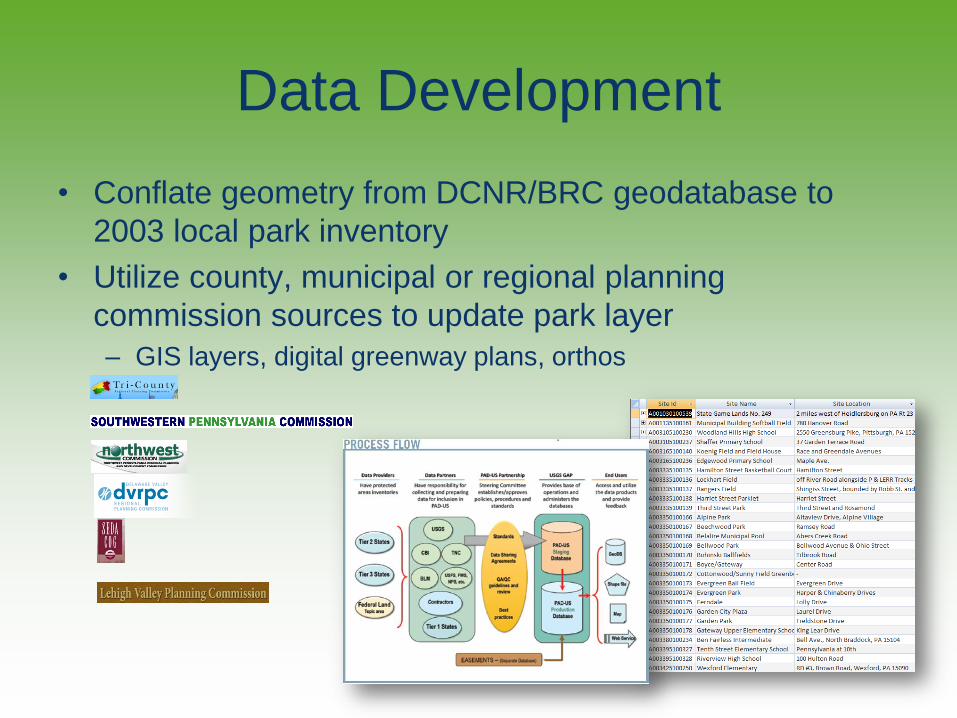
Data Development
• Conflate geometry from DCNR/BRC geodatabase to
2003 local park inventory
• Utilize county, municipal or regional planning
commission sources to update park layer
– GIS layers, digital greenway plans, orthos
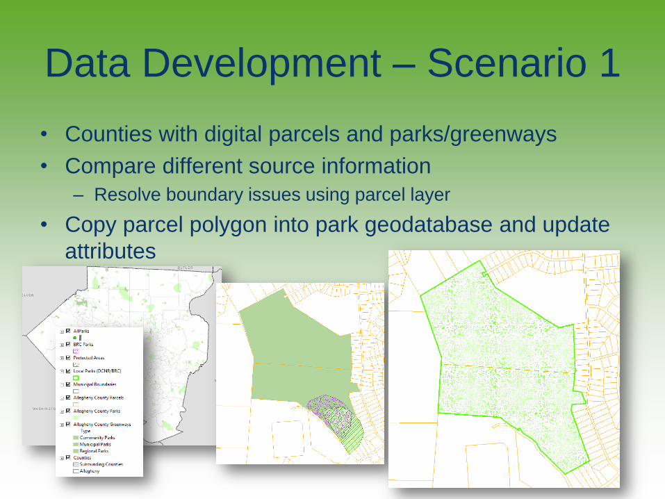
Data Development – Scenario 1
• Counties with digital parcels and parks/greenways
• Compare different source information
– Resolve boundary issues using parcel layer
• Copy parcel polygon into park geodatabase and update
attributes

Data Development – Scenario 2 • Counties with digital parcels
• Copy parcel polygon into park geodatabase and update attributes
• Compare boundary against ortho
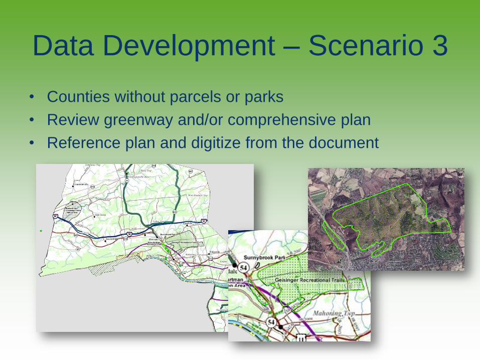
Data Development – Scenario 3
• Counties without parcels or parks
• Review greenway and/or comprehensive plan
• Reference plan and digitize from the document

www.dcnr.state.pa.us
Data Validation
• Interactive webtool
• Contributors and others can:
– Review collected park info
– Edit p
– Add
• This tool will have a lifespan beyond local
park data compilation project

www.dcnr.state.pa.us
App Development
• Develop a web and mobile app
• HTML 5 web and smartphone compatible
• Will make it possible:
– Explore local parks layer
– Find a local park
– Navigate to a local park
www.dcnr.state.pa.us
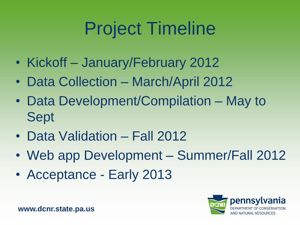
Project Timeline
• Kickoff – January/February 2012
• Data Collection – March/April 2012
• Data Development/Compilation – May to
Sept
• Data Validation – Fall 2012
• Web app Development – Summer/Fall 2012
• Acceptance - Early 2013
www.dcnr.state.pa.us
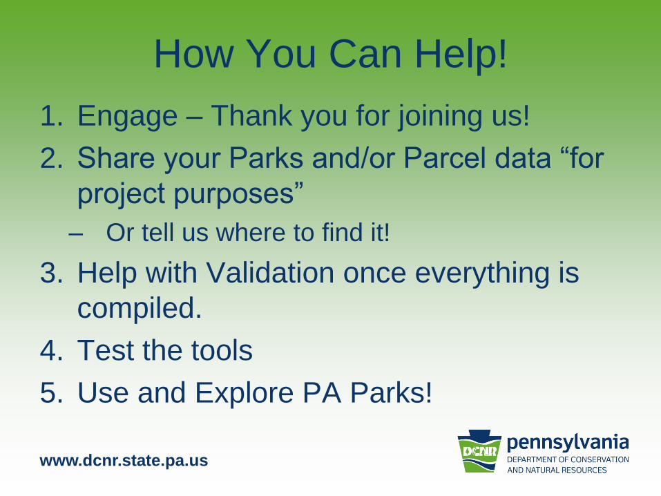
How You Can Help!
1. Engage – Thank you for joining us!
2. Share your Parks and/or Parcel data “for
project purposes”
– Or tell us where to find it!
3. Help with Validation once everything is
compiled.
4. Test the tools
5. Use and Explore PA Parks!

www.dcnr.state.pa.us
Questions and Answers
• What do you think?
• What do we need to know? What have we
overlooked?
• Pitfalls?
• Questions?


