13
Location-Efficient Location-Efficient Mortgages in Mortgages in Albuquerque Albuquerque GIS 110 Lab GIS 110 Lab August 3, 2006 August 3, 2006 Robert Messenger Robert Messenger
| Date post: | 09-Feb-2017 |
| Category: |
Documents |
| Upload: | robert-messenger |
| View: | 17 times |
| Download: | 2 times |
Location-Efficient Mortgages Location-Efficient Mortgages in Albuquerquein Albuquerque
GIS 110 LabGIS 110 LabAugust 3, 2006August 3, 2006
Robert MessengerRobert Messenger
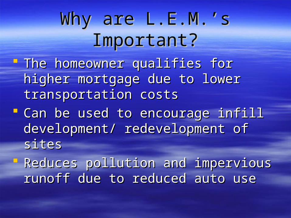
Why are L.E.M.’s Important?Why are L.E.M.’s Important?
The homeowner qualifies for higher The homeowner qualifies for higher mortgage due to lower transportation costsmortgage due to lower transportation costs
Can be used to encourage infill Can be used to encourage infill development/ redevelopment of sitesdevelopment/ redevelopment of sites
Reduces pollution and impervious runoff Reduces pollution and impervious runoff due to reduced auto use due to reduced auto use
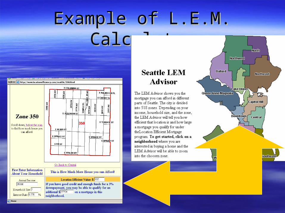
Example of L.E.M. CalculatorExample of L.E.M. Calculator
Goal and AssumptionsGoal and Assumptions
Compare L.E.M. possibilities for each Compare L.E.M. possibilities for each neighborhood against housing costsneighborhood against housing costs
Assumptions:Assumptions:– Each neighborhood has similar family incomeEach neighborhood has similar family income– Census “journey to work” data models travel behaviorCensus “journey to work” data models travel behavior– People more likely to walk, bike or transit if destination/ People more likely to walk, bike or transit if destination/
bus stop < ½ milebus stop < ½ mile– People more likely to use transit if the service is People more likely to use transit if the service is
frequent and dailyfrequent and daily
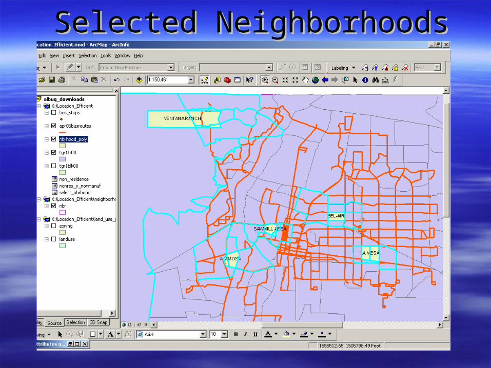
Selected NeighborhoodsSelected Neighborhoods
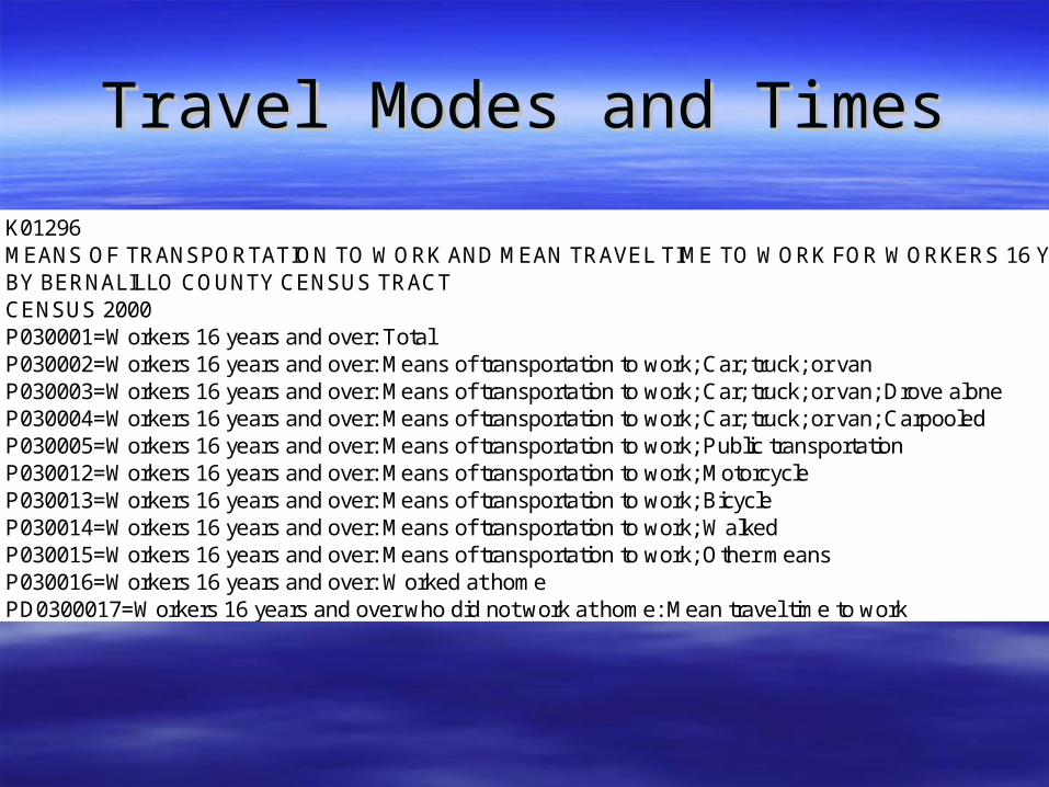
Travel Modes and TimesTravel Modes and Times
K01296MEANS OF TRANSPORTATION TO WORK AND MEAN TRAVEL TIME TO WORK FOR WORKERS 16 YEARS AND OVERBY BERNALILLO COUNTY CENSUS TRACTCENSUS 2000P030001=Workers 16 years and over: TotalP030002=Workers 16 years and over: Means of transportation to work; Car; truck; or vanP030003=Workers 16 years and over: Means of transportation to work; Car; truck; or van; Drove aloneP030004=Workers 16 years and over: Means of transportation to work; Car; truck; or van; CarpooledP030005=Workers 16 years and over: Means of transportation to work; Public transportationP030012=Workers 16 years and over: Means of transportation to work; MotorcycleP030013=Workers 16 years and over: Means of transportation to work; BicycleP030014=Workers 16 years and over: Means of transportation to work; WalkedP030015=Workers 16 years and over: Means of transportation to work; Other meansP030016=Workers 16 years and over: Worked at homePD0300017=Workers 16 years and over who did not work at home: Mean travel time to workNOTE: -1.0=Value is undefined because of division by zeroGEOCODE P030001 P030002 P030003 P030004 P030005 P030012 P030013 P030014 P030015 P030016 PD0300017BERNALILLO 261708 236704 202555 34149 3866 604 2450 6661 1404 10019 21.3
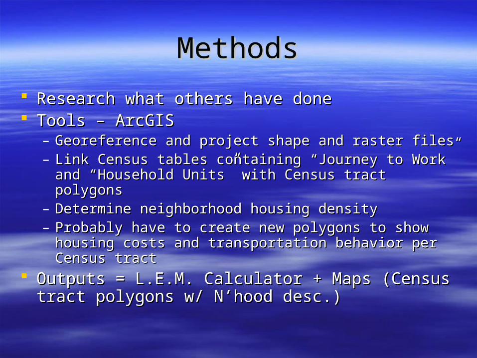
MethodsMethods Research what others have doneResearch what others have done Tools – ArcGISTools – ArcGIS
– Georeference and project shape and raster filesGeoreference and project shape and raster files– Link Census tables containing “Journey to Work” and Link Census tables containing “Journey to Work” and
“Household Units” with Census tract polygons“Household Units” with Census tract polygons– Determine neighborhood housing densityDetermine neighborhood housing density– Probably have to create new polygons to show housing Probably have to create new polygons to show housing
costs and transportation behavior per Census tract costs and transportation behavior per Census tract Outputs = L.E.M. Calculator + Maps (Census tract Outputs = L.E.M. Calculator + Maps (Census tract
polygons w/ N’hood desc.)polygons w/ N’hood desc.)
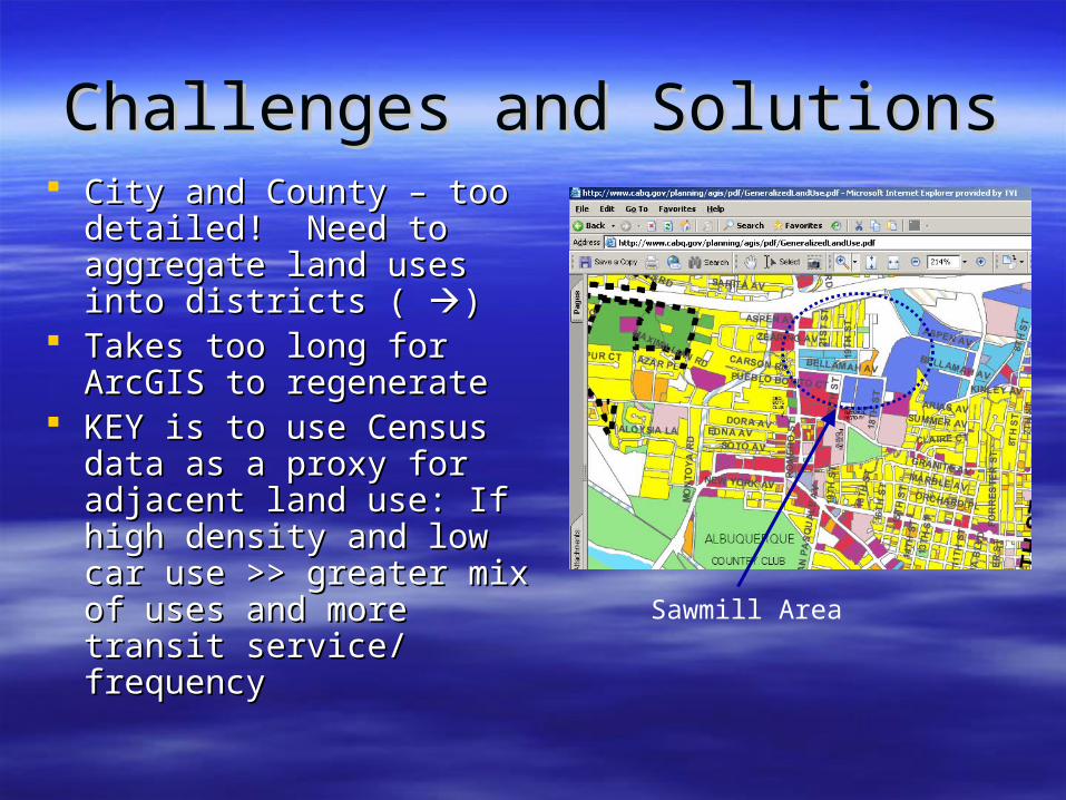
Challenges and SolutionsChallenges and Solutions City and County – too City and County – too
detailed! Need to aggregate detailed! Need to aggregate land uses into districts ( land uses into districts ( ))
Takes too long for ArcGIS to Takes too long for ArcGIS to regenerateregenerate
KEY is to use Census data as KEY is to use Census data as a proxy for adjacent land use: a proxy for adjacent land use: If high density and low car use If high density and low car use >> greater mix of uses and >> greater mix of uses and more transit service/ more transit service/ frequencyfrequency Sawmill Area
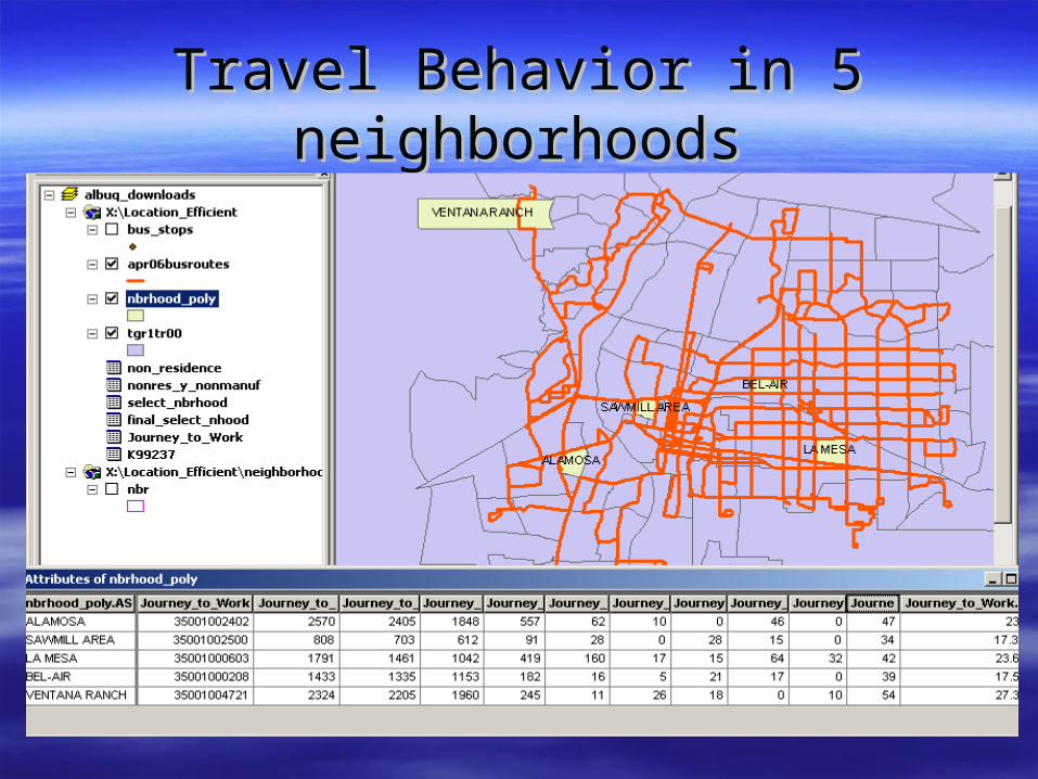
Travel Behavior in 5 neighborhoodsTravel Behavior in 5 neighborhoods
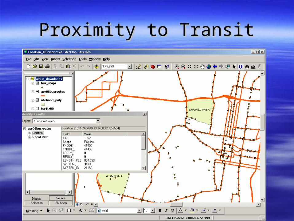
Proximity to TransitProximity to Transit
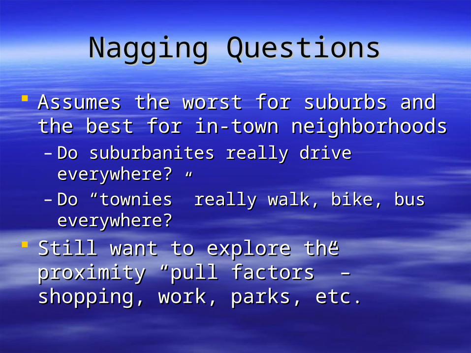
Nagging QuestionsNagging Questions
Assumes the worst for suburbs and the best Assumes the worst for suburbs and the best for in-town neighborhoodsfor in-town neighborhoods– Do suburbanites really drive everywhere?Do suburbanites really drive everywhere?– Do “townies” really walk, bike, bus everywhere?Do “townies” really walk, bike, bus everywhere?
Still want to explore the proximity “pull Still want to explore the proximity “pull factors” – shopping, work, parks, etc.factors” – shopping, work, parks, etc.
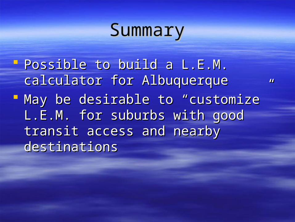
SummarySummary
Possible to build a L.E.M. calculator for Possible to build a L.E.M. calculator for Albuquerque Albuquerque
May be desirable to “customize” L.E.M. for May be desirable to “customize” L.E.M. for suburbs with good transit access and suburbs with good transit access and nearby destinationsnearby destinations
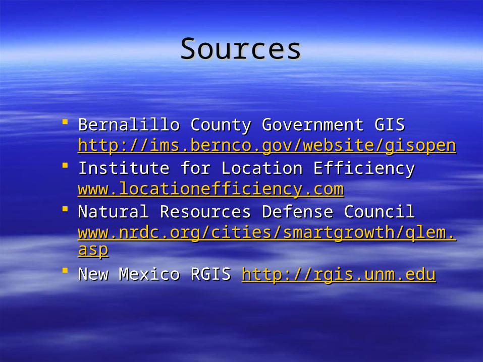
SourcesSources
Bernalillo County Government GIS Bernalillo County Government GIS http://http://ims.bernco.gov/website/gisopenims.bernco.gov/website/gisopen
Institute for Location Efficiency Institute for Location Efficiency www.locationefficiency.comwww.locationefficiency.com
Natural Resources Defense Council Natural Resources Defense Council www.nrdc.org/cities/smartgrowth/qlem.aspwww.nrdc.org/cities/smartgrowth/qlem.asp
New Mexico RGIS New Mexico RGIS http://rgis.unm.eduhttp://rgis.unm.edu


