The Management Plan for Long Forest Nature Conservation Reserve is approved for implementation. Its purpose is to direct the management of the Reserve until the plan is reviewed. A Draft Management Plan was published in October 2001. Seven submissions were received and have been considered in developing the approved Management Plan. Copies This plan may be down-loaded from the Parks Victoria website www.parkweb.vic.gov.au. Copies of the plan may be purchased for $8.80 (including GST) from: Parks Victoria Information Centre Level 10, 535 Bourke Street MELBOURNE VIC 3000 w 13 1963 Information Centre Department of Sustainability and Environment 8 Nicholson Street EAST MELBOURNE VIC 3002 Parks Victoria Office 219A Main Street BACCHUS MARSH VIC 3340 Further information Ranger In Charge Long Forest Nature Conservation Reserve Parks Victoria Office BACCHUS MARSH VIC 3340 w (03) 5367 2922 Chief Ranger Basalt Plains District Parks Victoria Office MACEDON VIC 3400 w (03) 5426 1866
Transcript
The Management Plan for Long Forest Nature Conservation Reserve is approved for implementation. Its purpose is to direct the management of the Reserve until the plan is reviewed. A Draft Management Plan was published in October 2001. Seven submissions were received and have been considered in developing the approved Management Plan.
Copies
This plan may be down-loaded from the Parks Victoria website www.parkweb.vic.gov.au. Copies of the plan may be purchased for $8.80 (including GST) from:
Parks Victoria Information Centre Level 10, 535 Bourke StreetMELBOURNE VIC 3000w 13 1963
Information CentreDepartment of Sustainability and Environment 8 Nicholson StreetEAST MELBOURNE VIC 3002
Parks Victoria Office 219A Main StreetBACCHUS MARSH VIC 3340
Further information
Ranger In ChargeLong Forest Nature Conservation Reserve Parks Victoria OfficeBACCHUS MARSH VIC 3340w (03) 5367 2922
Chief RangerBasalt Plains District Parks Victoria Office MACEDON VIC 3400w (03) 5426 1866
LONG FOREST NATURE CONSERVATION RESERVE
MANAGEMENT PLAN
NOVEMBER 2003
2 Long Forest Nature Conservation Reserve
Published in November 2003 by Parks Victoria
Level 10, 535 Bourke Street Melbourne, Victoria 3000.
National Library of Australia
Cataloguing-in-Publication entry
Parks Victoria.
Long Forest Nature Conservation Reserve management plan.
Bibliography.
ISBN 0 7311 8328 2
1. National parks and reserves - Victoria - Management.2. Long Forest Nature Conservation Reserve (Vic.). I. Title.
333.78309945
Disclaimers
This plan is prepared without prejudice to any negotiated or litigated outcome of any native title determination applications covering land or waters within the plan’s area. It is acknowledged that any future outcomes of native title determination applications may necessitate amendment of this plan; and the implementation of this plan may require further notifications under the procedures in Division 3 of Part 2 of the Native Title Act 1993 (Cwlth).
The plan is also prepared without prejudice to any future negotiated outcomes between the Government/s and Victorian Aboriginal communities. It is acknowledged that such negotiated outcomes may necessitate amendment of this plan.
Every effort has been made to ensure that the information in this plan is accurate. Parks Victoria does not guarantee that the publication is without flaw of any kind and therefore disclaims all liability for any error, loss or other consequence that may arise from you relying on any information in the publication.
Cover: Mallee vegetation in the Long Forest Nature Conservation Reserve.
Printed on 100% recycled paper to help save our natural environment
Long Forest Nature Conservation 3
APPROVED MANAGEMENT PLAN
Long Forest Nature Conservation Reserve, located 50 km west of Melbourne, is of considerable scientific interest, as it includes flora and fauna typical of both the drier north- west of the State and Gippsland. A number of species occur within the Reserve as isolated populations at the limit of their range. The Reserve protects threatened vegetation communities, as well as a number of threatened flora and fauna species.
The Reserve receives strong support from the Friends of Werribee Gorge and Long Forest Mallee and other volunteers. The Friends have undertaken a range of conservation projects including production of educational material and two published books.
Further developments and land uses related to increasing numbers of residents in the vicinity of the Reserve will increase pressures on the Reserve. These pressures will require careful management with close co-operation and involvement of the local community, neighbouring landowners and local government.
PROF LYNDSAY NEILSONSecretary to theDepartment of Sustainability and Environment
This Management Plan is approved for implementation. The Plan provides the basis and direction for the future management of Long Forest Nature Conservation Reserve.
This Management Plan establishes a long-term management framework that provides for the conservation and protection of the Reserve with continued community participation, particularly by the Friends of Werribee Gorge and Long Forest Mallee, and appropriate opportunities for low level passive recreation.
It was finalised following consideration of the seven submissions received on the Draft Management Plan, which was released for public comment in October 2001.
I thank the individuals and groups who commented on the Draft Plan, and look forward to continued community support and involvement in future management of the Reserve.
MARK STONEChief Executive Parks Victoria
4 Long Forest Nature Conservation Reserve
SUMMARY
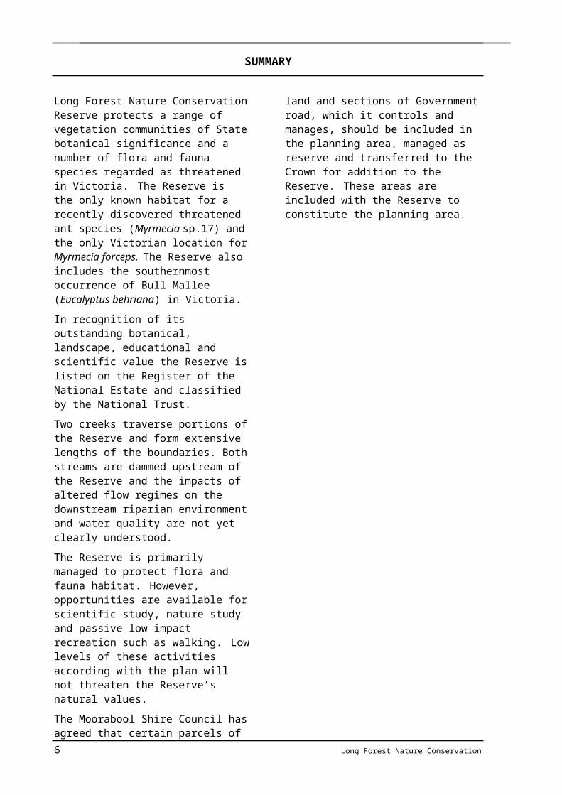
Long Forest Nature Conservation Reserve protects a range of vegetation communities of State botanical significance and a number of flora and fauna species regarded as threatened in Victoria. The Reserve is the only known habitat for a recently discovered threatened ant species (Myrmecia sp.17) and the only Victorian location for Myrmecia forceps. The Reserve also includes the southernmost occurrence of Bull Mallee (Eucalyptus behriana) in Victoria.
In recognition of its outstanding botanical, landscape, educational and scientific value the Reserve is listed on the Register of the National Estate and classified by the National Trust.
Two creeks traverse portions of the Reserve and form extensive lengths of the boundaries. Both streams are dammed upstream of the Reserve and the impacts of altered flow regimes on the downstream riparian environment and water quality are not yet clearly understood.
The Reserve is primarily managed to protect flora and fauna habitat. However, opportunities are available for scientific study, nature study and passive low impact recreation such as walking. Low levels of these activities according with the plan will not threaten the Reserve’s natural values.
The Moorabool Shire Council has agreed that certain parcels of land and sections of Government road, which it controls and manages, should be included in the planning area, managed as reserve and transferred to the Crown for addition to the Reserve. These areas are included with the Reserve to constitute the planning area.
The planning area, being relatively linear and fragmented in shape, is vulnerable to impacts from growth in rural residential developments on adjacent lands. Further development and use of adjoining land will increase impacts on the Reserve. Community awareness of the Reserve and its protection requirements, and the participation by volunteers and the local community in the Reserve’s management, will assist in the conservation and protection of the Reserve.
Major management directions are summarised as follows.
• Significant flora and fauna and other natural and cultural features will be protected.
• Liaison with catchment management and water authorities will be undertaken to maintain and enhance water quality and catchment values.
• Pest plant and animal control programs in the Reserve will be undertaken and their effectiveness monitored.
• Visitation will be maintained around current levels to protect Reserve values.
• Community participation and the continued involvement of the Friends of Werribee Gorge and Long Forest Mallee in the conservation and protection of the Reserve will be encouraged.
Long Forest Nature Conservation 5
CONTENTS
SUMMARY IV
1 INTRODUCTION 1
1.1 Location and planning area 11.2 Creation of the reserve 11.3 Developing the management plan 1
2 BASIS 2
2.1 Regional context 22.2 Reserve values and significance 22.3 Past land use 32.4 Legislation, LCC recommendations and guidelines 3
3 STRATEGIC DIRECTIONS 5
3.1 Vision 53.2 Management directions 5
4 STRATEGIES FOR CONSERVATION 6
4.1 Geological and landform features 64.2 Streams and catchments 64.3 Vegetation 74.4 Fauna 84.5 Landscape 104.6 Fire management 104.7 Pest plants and animals 114.8 Soil conservation 124.9 Aboriginal cultural heritage 134.10 Post settlement cultural heritage 13
5 STRATEGIES FOR VISITORS 15
5.1 Access 155.2 Information, interpretation, education and research 155.3 Passive recreation 16
6 STRATEGIES FOR COMMUNITY USE AND INVOLVEMENT 18
6.1 Friends and volunteers 186.2 Community awareness and Reserve neighbours 18
7 STRATEGIES FOR OTHER ISSUES 20
7.1 Authorised uses 207.2 Boundaries and adjacent uses 20
1 Land tenure, access and visitor facilities End of plan
1 INTRODUCTIO
Long Forest Nature Conservation 1
1.1 Location and planning areaLong Forest Nature Conservation Reserve is 50 km west of Melbourne to the north of the Western Highway between the townships of Bacchus Marsh and Melton (figure 1).
The planning area includes:
• Long Forest Nature Conservation Reserve (the Reserve) (508.8 ha);
• two sections of unused Government road (3 ha in total);
• five parcels of freehold land (19.4 ha in total) controlled by Moorabool Shire Council.
1.2 Creation of the ReserveThe existing Reserve comprises a number of contiguous areas that were reserved for various, discrete conservation purposes in the period 1981–2002 (appendix 1 and figure 1).
All of the contiguous reserves were formerly freehold land, except for a small strip of Crown land along Coimadai Creek (CA 12C, Section 8, Parish of Merrimu). Most of the freehold areas were set aside and acquired by the Moorabool and Melton Shire Councils as part of planning decisions relating to subdivisions, and subsequently transferred to and reserved by the Crown. Four areas of freehold land were purchased for the Reserve by the Crown in the period 1985–86.
Long Forest Nature Conservation Reserve is adopted as the name of the Reserve in keeping with simplified nomenclature adopted by the Department of Sustainability and Environment (DSE) on the basis of public land use categories recommended by the former Land Conservation Council (LCC 1994).
1.3 Developing the management plan
The Management Plan was prepared by Parks Victoria in consultation with key stakeholders, including DSE, Moorabool and Melton Shire Councils, Southern Rural Water, Western Water, Werribee River Catchment Committee, the Friends of Werribee Gorge and Long Forest Mallee and the Victorian National Parks Association. A draft plan was published for public comment in October 2001 and the seven submissions received were considered in developing the final plan.
The support given by the Friends of Werribee Gorge and Long Forest Mallee and the Victorian National Parks Association to the development of the plan is gratefully acknowledged.
2 Long Forest Nature Conservation
2 BASIS
2.1 Regional contextThe Reserve lies within an area known as the Long Forest Mallee, which extends in a band, up to 3.5 kilometres in width between Merrimu Reservoir to the north and the Western Highway to the south.
The Long Forest Mallee is recognised as being of high biogeographical significance. It has an affinity to the dry inland country of northern Victoria, is linked to the damper sclerophyll forests of the Great Dividing Range, and intersects with the fragmented grasslands and grassy woodlands of the Western Volcanic Plains.
The area is dominated by mallee species and supports the southernmost occurrence of Bull Mallee (Eucalyptus behriana) in Victoria (McDougall 1987).
Other public land within the region complements the Long Forest Mallee and the planning area. Wombat State Forest and Macedon Regional Park represent wetter areas along the Great Dividing Range; Lerderderg State Park and Werribee Gorge State Park represent Dry Sclerophyll forests; and Woodlands Historic Park and Organ Pipes National Park are indicative of Grassy Woodlands.
2.2 Reserve values and significanceLong Forest Nature Conservation Reserve makes a valuable contribution to Victoria’s parks and reserves system, which aims to protect viable, representative samples of the State’s natural environments occurring on public land.
The Reserve has been assigned the International Union for the Conservation of Nature (IUCN) Category IA (Strict Nature Reserve) for Natural Reserves and Protected Areas. Category IA protected areas are managed primarily for science.
The Reserve is also listed on the Register of the National Estate, in recognition of the area’s outstanding botanical, scenic, educational and scientific values and its importance as part of our heritage. The National Trust for its
scientific and landscape values has also classified the Long Forest Mallee.
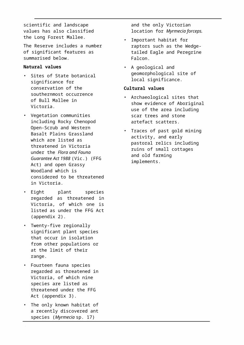
The Reserve includes a number of significant features as summarised below.
Natural values
• Sites of State botanical significance for conservation of the southernmost occurrence of Bull Mallee in Victoria.
• Vegetation communities including Rocky Chenopod Open-Scrub and Western Basalt Plains Grassland which are listed as threatened in Victoria under the Flora and Fauna Guarantee Act 1988 (Vic.) (FFG Act) and open Grassy Woodland which is considered to be threatened in Victoria.
• Eight plant species regarded as threatened in Victoria, of which one is listed as under the FFG Act (appendix 2).
• Twenty-five regionally significant plant species that occur in isolation from other populations or at the limit of their range.
• Fourteen fauna species regarded as threatened in Victoria, of which nine species are listed as threatened under the FFG Act (appendix 3).
• The only known habitat of a recently discovered ant species (Myrmecia sp. 17) and the only Victorian location for Myrmecia forceps.
• Important habitat for raptors such as the Wedge-tailed Eagle and Peregrine Falcon.
• A geological and geomorphological site of local significance.
Cultural values
• Archaeological sites that show evidence of Aboriginal use of the area including scar trees and stone artefact scatters.
• Traces of past gold mining activity, and early pastoral relics including ruins of small cottages and old farming implements.
Long Forest Nature Conservation 3
Basis
2.3 Past land useThe whole of the planning area, except the streambeds and banks, water frontages and Government road, were under freehold title for a period. These areas were used as a source of fence posts and firewood for the district and attempts were made at cultivation and gold mining. There has been widespread regeneration of woodlands in these areas. Some remaining clearings include the ruins of small cottages, traces of unsuccessful gold mining and erosion.
2.4 Legislation, LCC recommendations and guidelines
The contiguous reserves that comprise the Long Forest Nature Conservation Reserve are reserved for various, discrete nature conservation purposes under the provisions of the Crown Land (Reserves) Act 1978 (Vic.) (appendix 1 and figure 1). Executive Orders made pursuant to section 18(1) of the Crown Land (Reserves) Act relate areas reserved prior to 1987 to section 19B of the National Parks Act 1975 (Vic.). Parks Victoria manages the reserves on a day to day basis.
The Moorabool Shire Council has agreed that five parcels/strips of freehold land (variously reserved by the Shire at the time of subdivision) and two sections of unused Government road (appendix 1 and figure 1), which it controls, should be included in the planning area, managed as though reserve and transferred to the Crown for addition to the Reserve. The areas are encompassed by or abut the Reserve and contain conservation values. The sections of unused Government road are managed under the Land Act 1958 (Vic.).
The Long Forest Flora Reserve (Care, Protection and Management) Regulations 1984 expired in 1994. The Crown Land (Reserves) (Molesworth Nature Conservation Reserve) Regulations, which are in preparation for application to Nature Conservation Reserves, are proposed for application to the Long Forest Nature Conservation Reserve. Prior to application of the regulations, it will be necessary to implement several administrative procedures including reversal of the Orders relating control and management of
parts of the Reserve to section 19B of the National Parks Act.
The provisions of the Environment Protection and Biodiversity Conservation Act 1999 (Cwlth) apply to the Reserve with respect to actions that have, will have or are likely to have a significant impact on matters of national environmental significance.
The former Land Conservation Council (LCC) in its Melbourne Area District 1: Final Recommendations (LCC 1987) recommended the Reserve (then 283.7 ha) be used to conserve native plants and animals, and that passive recreation such as nature study and picnicking be permitted. The LCC also recommended that grazing, hunting and the use of firearms not be permitted in the Reserve. These recommendations were accepted by Government on 23 August 1988.
The aims for the planning area, consistent with the Government-approved LCC recommendations and legislation, are as follows.
Planning area management aims
Resource conservation• Preserve, protect, restore and enhance the
natural environment, with particular emphasis on conservation of rare and threatened species and communities.
• Conserve features of archaeological, historical and cultural significance.
• Provide for, and encourage, scientific research, surveys and monitoring that contribute to a better understanding of the ecosystems and their management.
• Encourage school and community education programs to improve understanding of the natural values of the planning area.
• Protect soils and stream environments from degradation.
• Protect human life, the planning area and adjacent lands from injury by fire.
• Eradicate or otherwise control introduced plants, animals and diseases.
Planning area visit• Provide opportunities for and encourage
passive, low impact recreation.
4 Long Forest Nature Conservation
Basis
• Provide for appreciation, understanding and enjoyment of the planning area’s natural and cultural values where this does not adversely affect conservation values.
• Foster a conservation ethic among visitors.
Other• Liaise with local, State and interstate
government authorities, the community and other interested organisations to assist in the management of the planning area, and to improve management of the natural values of the planning area’s catchment.
The whole of the planning area is also managed in accordance with relevant Parks Victoria operational policies, and other relevant plans and guidelines, including:
• Code of Practice for Fire Management on Public Land (CNR 1995);
• Geelong Region Fire Protection Plan (DCE 1987).
Long Forest Nature Conservation 5
3 STRATEGIC DIRECTIONS
3.1 VisionA future visitor finds a consolidated Reserve containing diverse plant communities of State botanical significance including Bull Mallee, Rocky Chenopod Open Scrub, Western Plains Grassland and open Grassy Woodlands. The Reserve protects a co-occurrence of dry inland ‘mallee’ and sclerophyll forest that provides habitat for distinctive, diverse assemblages of threatened fauna in viable populations.
Ongoing research and active management ensure the protection of rare, threatened and regionally significant plant and animal species in the Reserve.
The control of pest plants and animals, in co- operation with adjacent landholders and the local community, and an increased understanding of the role of fire in ecological management, provide a sound basis for excellent management of the Reserve’s natural values.
The Friends of Werribee Gorge and Long Forest Mallee continue to conduct a variety of programs that contribute to the care and management of the Reserve and to community education on the Reserve’s values.
The establishment of habitat corridors along Coimadai and Djerriwarrh Creeks provide linkages to other areas of remnant bushland and to nearby parks and reserves, enhancing the value of the Reserve as habitat.
3.2 Management directionsMajor management directions for the planning area are outlined below.
Resource conservation• Areas of natural and cultural significance,
including threatened species and their critical habitat, will be maintained in an essentially undisturbed condition.
• Flora and fauna listed under the FFG Act will be managed in accordance with approved action statements.
• Investigations will be made with local government into the possibility of adding strategic parcels of land to the Reserve to
further consolidate its boundaries and protect critical areas of natural and cultural significance.
• Previously cleared areas will be restored and revegetated to extend habitat for significant species.
• Planning area values will be protected from potentially damaging processes including wildfire, pathogens and soil erosion.
• Pest plants and animals will be eradicated or controlled in co-operation with adjoining land managers and landowners.
• Further research and monitoring in partnership with higher education and research institutions will be encouraged to enhance knowledge of habitat requirements for significant species and provide a sound basis for future management.
The planning area visit• Appreciation, understanding and enjoyment
of the planning area’s natural and cultural values will be encouraged by providing information and supporting interpretation and education programs that do not adversely affect conservation values.
• Passive recreation will be permitted where compatible with conservation of natural values.
Community awareness and involvement• The Friends of Werribee Gorge and Long
Forest Mallee will be supported and assisted in implementing appropriate Reserve management projects and community awareness programs.
• Programs of Government and other public authorities, community groups and landowners that improve management of the planning area will be encouraged by liaising with the relevant authority or group.
6 Long Forest Nature Conservation
4 STRATEGIES FOR CONSERVATION
4.1 Geological and landform features
The planning area is predominantly on an outcrop of weakly metamorphosed Ordovician rocks (McDougall 1987) that is flanked on the east by basalt plains, and on the west by a long basaltic ridge running from Mount Bullengarook to the north-eastern edge of the Bacchus Marsh valley.
The planning area and surrounding areas in the Long Forest Mallee are drained by two streams, the Djerriwarrh and Coimadai Creeks, which have cut valleys up to 25–30 m deep into the steeply folded Ordovician slates and sandstones. The area between the streams is flat and covered by deposits of lateritized Tertiary gravelly clays. The geology of the southern section of the Long Forest Mallee comprises basalt overlain by Quaternary fluviatile sand clays (Myers et al. 1986).
In the northern section of the Reserve there is a geological and geomorphological site of local significance where the down-cutting of Coimadai Creek has exposed a symmetrical anticline in Ordovician sandstones and slates. The fold is a good example of the deformation structures in the Palaeozoic basement rocks of the Bacchus Marsh area (Rosengren 1986).
Aim• Protect geological and geomorphological
values.
Management strategies• Protect and monitor the geological and
geomorphological site of local significance at Coimadai Creek.
• Liaise with Southern Rural Water to minimise the effects of water flows and management on the significant site at Coimadai Creek.
• Undertake further studies to identify other sites of geological and geomorphological significance in the planning area that require management and protection.
4.2 Streams and catchmentsCoimadai and Djerriwarrh Creeks traverse portions of the planning area and flow into the Werribee River to the south (figure 1).
Coimadai Creek, which originates in the Pyrete Ranges (Wombat State Forest), is dammed immediately north of the planning area at the Merrimu Reservoir (Lake Merrimu). The reservoir is managed by Southern Rural Water as the primary supply of potable water for both Melton and Bacchus Marsh and also as a drought supply for the Werribee Irrigation District. Environmental flows in Coimadai Creek are maintained in accordance with the Werribee Bulk Entitlement Conservation Order 1997, which requires an environmental flow of the lesser of 2ML/d or natural flow. Southern Rural Water monitors use of water from Coimadai Creek under existing private entitlements (section 7.1).
Djerriwarrh Creek, which originates near Mount Gisborne, is dammed north-east of the planning area to form the Djerriwarrh Reservoir. Western Water manages the reservoir. Stream flows through the planning area occur only when the reservoir is full and overflowing.
Impacts of stream flow regimes of Coimadai and Djerriwarrh creeks on the riparian environment and water quality within the planning area are not clearly understood. Alteration to the natural flow regimes of rivers and streams is listed as a potentially threatening process under Schedule 3 of the FFG Act. In the summer months a combination of low water movement, low dissolved oxygen, and excess nutrients may lead to algal blooms that could effect native fauna.
Clearing in the catchment outside the planning area may lead to elevation of the watertable, which in conjunction with reduced water flows in the creeks, has the potential to lead to salt scalding along the alluvial flats. An infestation of Spiny Rush in Coimadai Creek may be linked to increased salinity of the creek waters (Gell et al. 1988).
Strategies for
Long Forest Nature Conservation 7
Aim• Restore, protect and maintain the riparian
and in-stream environment of the Coimadai and Djerriwarrh Creeks.
Management strategies• Liaise with Southern Rural Water and
Western Water to ensure that all water management activities take account of environmental needs including stream flow levels.
• Liaise with Southern Rural Water, Western Water and the Port Phillip Catchment and Land Protection Board to maintain and enhance catchment values that affect the planning area.
• Encourage scientific research into the effects of altered flow regimes in the Coimadai and Djerriwarrh Creeks to protect in-stream habitat for aquatic flora and fauna.
• Develop and implement a long-term restoration and maintenance program for stream habitat of Coimadai and Djerriwarrh Creeks.
4.3 VegetationThe vegetation of the Reserve is of State significance (as is the whole of Long Forest Mallee) and predominantly comprises communities and species more typical of the drier regions of North-western Victoria.
Vegetation communities
Rocky Chenopod Open-Scrub is the predominant vegetation community of the planning area. The community is listed as threatened in Victoria under Schedule 2 of the FFG Act.
Small sections of Western Basalt Plains Grassland, also listed as threatened in Victoria under the FFG Act, occur on the basaltic escarpment along the boundaries of the planning area.
Bull Mallee (Eucalyptus behriana) and Red Box (Eucalyptus polyanthemos) mostly dominate the Rocky Chenopod Open-Scrub community. Some stands of Bull Mallee are believed to be several hundred years old.
The distribution of overstorey species in the planning area is generally a result of soil type
and moisture availability, which usually relate to terrain and aspect. Within the Rocky Chenopod Open-Scrub community, the effect of soils and soil moisture is particularly noticeable in the distribution of Bull Mallee and Red Box. Bull Mallee tends to occupy ridge tops and plateaus with clay soils, while a low form of Red Box dominates sandstone outcrops. Moonah (Melaleuca lanceolata), typically a coastal or semi-arid inland species, occurs with the Bull Mallee in some places throughout the Reserve.
Taller woodlands of Red Box, and Grey Box (a species which is near its southern limit in this area) occur on the skeletal soils of cooler southern and eastern slopes, often in association with Yellow Gum and Yellow Box. These box woodlands support either a diverse chenopod or grassy understorey. Grassy Woodlands are considered to be one of the most threatened ecosystems in Victoria (DCE 1992). A mixture of native and exotic grasslands dominates the north-western area of the Reserve.
The riparian vegetation along Coimadai and Djerriwarrh Creeks in the Reserve is also of particular value and interest since it represents a remnant of a type of vegetation that has been mostly cleared for agriculture in the surrounding area. Small creek flats support either a grassy open-forest of Red Box or Blue Box (Eucalyptus bauerana) and Manna Gum. The understorey consists of Common Tussock- grass or scrub communities of Blackwood, Woolly Teatree, River Bottlebrush and Prickly Moses in gravel deposits. The creek beds support Common Reed and rushes, with sedges occurring on finer swampy deposits (Myers et al. 1986). The occurrence of Blue Box, a species more commonly found in East Gippsland, is considered unusual in this area.
Flora species
A total of 138 indigenous vascular plant species have been recorded for the Reserve (DSE (database) 2003b). Many other indigenous plant species are known for the Reserve but are not yet recorded in the database. Eight of the species recorded are classified as threatened in Australia or Victoria. One species, the Brittle Greenhood is also listed as threatened in Victoria under Schedule 2 of the FFG Act. Threatened flora
Strategies for
8 Long Forest Nature Conservation
species recorded for the Reserve are shown in appendix 2.
Twenty-five flora species occur at the limit of their range or in isolation from their other populations. Desert Wattle, Small-leaf Goosefoot, Bull Mallee, Grey Box, Kidney Saltbush, Turkey-bush, Bassia and Fragrant Saltbush (recorded as rare in Victoria) are more commonly associated with semi-arid regions.
Protection of threatened species and communities, including the minimisation of the impacts of visitor use and management activities, is a high priority in the planning area.
Aims• Conserve native plant communities in their
natural condition, and maintain genetic diversity.
• Provide special protection and conserve significant vegetation communities and species.
• Facilitate regeneration of indigenous vegetation on disturbed areas.
• Encourage and facilitate an increase in knowledge of the distribution and management of significant plant species and communities.
communities and flora according to approved action statements.
• Develop and implement a long-term revegetation program for degraded areas.
• Encourage research into the status, distribution and management requirements of native flora and vegetation communities, particularly significant species and communities in consultation with botanical experts.
• Manage habitat in accordance with Parks Victoria’s operational policies. Ensure all species known for the Reserve are recorded in the Environmental Information System.
4.4 FaunaThe variety of faunal habitats in the Reserve provides refuge for native wildlife in a region largely cleared for agriculture and residential development. Habitats include dry shrublands and woodlands, open grasslands, creek flats with riparian scrubs and reedbeds, and permanent creek pools. The diversity of fauna in the Reserve, particularly bird species, reflects the diversity of habitat.
Mammals
Nineteen native mammal species have been recorded for the Reserve (DSE (database) 2003a). Three of these are considered to be threatened in Victoria (appendix 3). The Brush-tailed Phascogale, which was last recorded from the Reserve in 1986, is considered vulnerable, and is listed as threatened under the FFG Act. The Grey- headed Flying-fox was recorded in the Reserve in 1986 and is considered to have restricted colonial or breeding sites. The species is also considered as vulnerable and listed as threatened in Victoria under the FFG Act. Inadequate data are available to assess the status of the Common Dunnart, which is recorded for the Reserve.
Common mammals in the Reserve include the Short-beaked Echidna, Brown Antechinus, Common Brushtail Possum, Common Ringtail Possum, Eastern Grey Kangaroo, Black Wallaby, Koala, Water Rat and several bat species. Large groups of Grey Kangaroo can often be found grazing on the grasslands and open woodlands of the north-western section of the Reserve.
Birds
Over 130 bird species have been recorded for the Reserve, including several species more generally associated with the mallee and drier woodlands of North-western Victoria (Hewish 1986). Eight bird species are classified as threatened in Victoria (DSE (database) 2003a). A list of the threatened fauna species is shown in appendix 3.
Six species of birds, the Swift Parrot, Barking Owl, Hooded Robin, Speckled Warbler, Diamond Firetail and Crested Bellbird, are listed as threatened in Victoria under Schedule 2 of the FFG Act. The Swift Parrot was recorded in the Reserve in 2001 but its
Strategies for
Long Forest Nature Conservation 9
numbers have declined since 1984 (Hewish 2001).
The Diamond Firetail is identified as a ‘woodland-dependent species’ in the ‘Victorian Temperate-Woodland Bird Community’, which is listed as a threatened community under the FFG Act. The Crested Bellbird is identified as a ‘woodland- associated species’ in this community. Declines and losses of birds of woodland communities have been recorded for the Long Forest.
The Chestnut-rumped Thornbill and Yellow- rumped Pardalote have been recorded from the Long Forest Mallee, but not for elsewhere in the areas west of Melbourne, except as incidental visitors. The North-western Victorian ranges of these birds generally extend southward to the Bendigo - Castlemaine area, approximately 100 km north of the Long Forest Mallee.
The Chestnut-rumped Thornbill, found in the Reserve, is considered to be regionally threatened (Beardsell 1990). This species is characteristic of mallee scrub and box woodlands of Northern Victoria. The population of the species in the Reserve has become isolated as a result of the long history of land clearing in Central Victoria.
Several pairs of Wedge-tailed Eagles have nested in the Reserve over recent years. These birds choose tall trees along the creek gullies, usually utilising Yellow Gum, Manna Gum or Yellow Box. The close distance between the nests of breeding pairs of the Eagles in the Reserve (and in nearby bushland) is considered indicative of the scarcity of suitable nesting habitat in the region (Hewish et al. 1986). The Powerful Owl is recorded for areas north of Long Forest Mallee. The species requires large tracts of bushland and may frequent the Reserve.
Earlier records of some larger waterbirds for the Long Forest Mallee are considered likely to have come from Lake Merrimu immediately to the north of the Reserve (Hewish 1986).
Urbanisation and human recreation activities have placed increased pressure on fauna in the area. In particular, domestic cats and dogs threaten fauna and birds that feed, roost, or nest on the ground or in low bushes, including many species in isolated populations such as
the Crested Bellbird, Chestnut-rumped Thornbill and Yellow-rumped Pardalote (Hewish 1986).
Reptiles and amphibians
Few studies of the reptile and amphibian fauna of the Reserve have been carried out to date. Ten reptile and eight amphibian species have been recorded in the Reserve, including the Warty Bell Frog, which is considered vulnerable in Australia (appendix 3). A further six reptile species are known from the Long Forest Mallee (Baker 1987; Gell et al. 1988). Of these, the Lace Monitor is considered vulnerable in the region.
The most common reptile encountered by visitors is the Eastern Blue-tongue Lizard. The main habitat for amphibian species in the Reserve is around the Coimadai and Djerriwarrh creeks and the dams near the Happy Valley car park.
Invertebrates
Research undertaken on the invertebrate fauna of the Long Forest Mallee indicates that the Reserve supports an ant fauna essentially typical of the semi-arid regions of North- western Victoria (Anderson et al.. 1991).
Bull Ants (Myrmecia spp.), which are generally confined to Australia, are among the world’s biggest and most primitive ants. There are some 150 species altogether and at least ten of these have been recorded from the Long Forest Mallee. A recently-discovered species, Myrmecia sp. 17, which is common in the Long Forest Mallee, is considered vulnerable in Victoria and is listed as threatened in Victoria under the FFG Act. Two other Bull Ant species found in the area are mostly known from further afield: M. nigriceps, which is common in North-western Victoria, and M. forceps, known from Western Australia and South Australia. The Long Forest Mallee represents the only Victorian location of M. forceps.
Several threatened butterfly species and the Jewel Beetle, a species whose conservation status is uncertain, are recorded for the Long Forest Mallee (Gell et al. 1988).
Aims• Protect and conserve native fauna,
particularly rare, threatened and locally significant species.
Long Forest Nature Conservation 1
Strategies for
• Maintain and enhance habitat for significant species.
• Increase knowledge of the Reserve’s native fauna.
Management strategies• Manage Flora and Fauna Guarantee Act
listed fauna according to approved action statements.
• Encourage research into, and survey of, the distribution and ecological requirements of the Reserve’s threatened fauna. Ensure all species known for Reserve are recorded in the Environmental Information System.
• Monitor the impact of visitors on Wedge- tailed Eagle nest sites and populations and investigate options for increasing nesting opportunities in accordance with Parks Victoria’s operational policies.
• Prohibit firewood collection and leave fallen timber as habitat for reptiles and other vertebrates and invertebrates.
4.5 LandscapeThe small-scale cliffs, gorges, gullies, rocky outcrops, gentle slopes, creek and flats along Coimadai and Djerriwarrh creeks present attractive landscapes for visitors.
Recreational activities such as trail bike riding have a detrimental impact on landscape values through the creation of unsightly trails and erosion. Loss of vegetation on eroded sites in the Old House and Gravelly Tracks area also impacts on landscape quality, as do weed infestations and old rubbish piles surrounding old home sites in the planning area.
New housing developments planned for the fringes of the planning area also have the potential to impact on landscape values, particularly where they are to be located on adjacent plateaus where they can be easily seen from within the planning area.
Aims• Protect and enhance landscape quality.
• Minimise, rehabilitate, remove or ameliorate undesirable visual intrusions.
Management strategies• Investigate remedial work required to
improve landscape values, as seen from key viewpoints, through revegetation of degraded areas.
• Liaise with Melton and Moorabool Shire Councils, and DSE regarding planning scheme referrals to minimise the visual impacts on the planning area from adjacent developments (section 6.2).
• Manage fire protection works and other management activities to minimise impact on landscape values.
4.6 Fire managementThe majority of the planning area has not been burnt since early in the last century. Freehold land adjoining the planning area to the south and south-east, which supports Rocky Chenopod Open-scrub including Bull Mallee, was burnt during a wildfire in January 1985.
Liaison with local government and the Country Fire Authority regarding fire protection on adjoining land is important to protect the planning area. Fire entering from adjacent land is perceived to be the greatest threat to the planning area.
No prescribed burning for vegetation management or fuel reduction has occurred in the Reserve to date due to the slow growth rate of the vegetation, generally low fuel loads, the erodibility of the soils and the proximity of rural residential housing. Carefully prescribed burning may be beneficial for both fuel- reduction purposes and ecological considerations in the native grasslands in the north-western section of the Reserve as these are adapted to fire and are also distant from residential areas.
Current fire protection measures are in accordance with the Geelong Region Fire Protection Plan (DCE 1987).
The lighting of fires is prohibited within the Reserve as severe wildfire may threaten the survival of threatened species. In the absence of prescribed burning, adequate maintenance of the current network of management vehicle tracks is critical.
Water for fire fighting purposes is available from hydrants on the domestic mains along roadsides in the area.
Strategies for
1 Long Forest Nature Conservation
Department of Sustainability and Environment/Department of Primary Industries fire fighting equipment is based at Bacchus Marsh. Nearby Country Fire Authority (CFA) brigades are located at Bacchus Marsh, Coimadai, Toolern Vale and Melton.
Aims• Protect human life, property and the
planning area’s values from injury by fire.
• Minimise the adverse effects of fire and fire suppression methods on the planning area’s values.
• Maintain where possible fire regimes appropriate to the conservation of native flora and fauna.
Management strategies• Protect the planning area from wildfire in
accordance with the Geelong Region Fire Protection Plan (DCE 1987) and the Code of Practice for Fire Management on Public Land (CNR 1995).
• Ensure that least-disturbance strategies are used in wildfire suppression including:
• fireline construction by hand crews to minimise the use of earth-moving equipment;
• air attack to drop water or foam in preference to chemical retardants;
• use of existing roads and tracks, or topographic features, as control lines.
• Liaise with local government and the CFA regarding fire protection planning and operations.
• Maintain management tracks to a standard suitable for slip-on unit access for fire protection purposes.
• Encourage research into the fire ecology of the planning area’s vegetation communities and associated fauna, and the role of prescribed burning for vegetation management.
4.7 Pest plants and animalsPest plants
Around 42 pest plant species have been recorded from the Reserve and several species
pose a serious threat to indigenous plant species and communities.
The major infestations of weeds occur along the boundaries shared with adjacent freehold land, around old home sites, along creeks, and on cleared and disturbed areas such as that between Gravelly and Old House Tracks.
Disposal of garden refuse from adjoining private properties and illegal tipping along Long Forest Road has resulted in pest plants colonising some areas.
Introduced plants, generally succulents and cacti, are spreading into the Reserve at some former cottage sites.
In recent years, the Friends of Werribee Gorge and Long Forest Mallee have successfully undertaken a spraying program to contain the spread of Crassula (Crassula tetragona ssp. robusta), a succulent spreading from the old house site near the Happy Valley car park into adjacent Rocky Chenopod Open-scrub.
Parks Victoria has undertaken other weed control activities throughout the Reserve including poisoning of Erect Prickly-pear and mechanical removal of African Box-thorn.
Serrated Tussock (Nassella trichotoma) represents a threat to more open areas. It is invading grasslands of the north-western block, and open grassy woodlands and grasslands of creek flats throughout the planning area.
Carpet Weed (Galenia pubescens), a densely- matted weedy shrub is also invading many open and disturbed areas.
Bridal Creeper, a highly invasive environmental weed, is spreading into native vegetation from disturbed sites. The weed is predominant at the bottom of Old House Track along Coimadai Creek, where extra moisture in drainage lines has allowed this weed to spread upwards through several gullies into relatively undisturbed vegetation.
Other pest plants in the planning area, which pose a threat to the indigenous vegetation, include Paterson’s Curse, Spiny Rush, Horehound, Sweet Briar and Peppercorn.
Pest animals
Six introduced animal species have been recorded from the Reserve: Feral Cat, Red Fox, European Rabbit, Brown Hare, Black Rat,
1 Long Forest Nature Conservation
Strategies for
and House Mouse. Domestic animals, particularly dogs and cats also enter the planning area from neighbouring properties. In places where fencing is poor, horses and cattle occasionally wander into the planning area and graze on the vegetation.
Predators, particularly foxes, wild or roaming domestic dogs, and feral or wandering cats present a major threat to the native wildlife. Predation of native wildlife by cats and foxes is listed as a potentially threatening process under Schedule 3 of the FFG Act.
Rabbits are an ongoing management problem particularly along the creek flats. Severe gullying is evident along sections of the Coimadai Creek. Rabbit-proof fencing along sections of the Reserve’s boundary has reduced the numbers of rabbits entering the Reserve and ongoing control activities are undertaken as required.
Feral honeybees may adversely affect native flora and fauna. The feral honeybees may threaten native fauna by competing with them for tree hollows and nectar resources. There are sites adjoining the Reserve that are periodically utilised for apiculture.
Aims• Monitor, control, and where possible
eradicate, pest plants and animals in the planning area.
• Minimise the impact of control programs on native flora and fauna.
Management strategies• Prepare a pest plant and animal control
strategy that details species and areas to be treated, and methods of control. Give priority to control of new infestations, weeds with a high potential for invasion (particularly Serrated Tussock), areas of high conservation significance and weeds with broad ecological tolerances.
• Monitor the effectiveness of control programs annually and review methods where required.
• Undertake pest plant and animal control on the planning area’s boundary in co- operation with adjacent landholders.
• Liaise with relevant adjacent landowners and managers to ensure the Reserve is
adequately fenced and protected from damage by domestic stock.
• Restore native vegetation to protect soils and prevent the recurrence of weed invasion once weeds are eradicated (section 4.3).
• Investigate the potential use of cage trapping for control of cats.
• Liaise with Melton and Moorabool Shire Councils and DSE regarding planning scheme referrals to minimise impacts on the planning area from garden plants and domestic animals on adjoining land.
• Eradicate feral bee colonies.
4.8 Soil conservationThe soils of the steeper valley-sides in the planning area are skeletal, silty to sandy loams. The deeper soils between the Djerriwarrh and Coimadai Creeks show a gradation in characteristics along a rainfall gradient from south to north. In the south, the soil is a solodized solonetz with a shallow, gravelly sandy loam resting on surface-leached domes of prismatically structured clay. To the north, the soil is solodic and acid throughout (Myers et al. 1986).
Water is slow to infiltrate the solvent soils, especially when dry. This results in sheet run- off during heavy rainfall (Myers et al. 1986). The soils in the planning area are prone to sheet, tunnel and gully erosion, especially where the land slopes or where run-off is focussed. Some poorly sited tracks, past clearing for agriculture and rabbit burrowing have accelerated these problems. Illegal horse riding and trail bike riding also accelerate erosion in susceptible areas.
Track maintenance works, especially drainage works, must be carefully planned in order to minimise erosion. Erosion on Gravelly Track, in the southern section of the Reserve, is of particular concern. The steeper slopes and areas of active tunnel and gully erosion in the north-west block of the planning area require stabilisation and revegetation.
The sodium-rich nature of the solodic and solonetz soils may exacerbate the threat to low-lying areas posed by salinisation due to catchment clearing and the associated elevation of the water table (Gell et al. 1988).
Strategies for
Long Forest Nature Conservation 1
Aims• Prevent and control soil erosion, and
rehabilitate eroded sites.
• Revegetate disturbed areas with indigenous species.
Management strategies• Minimise soil disturbance during all
management activities.
• Ensure tracks are properly formed and adequately drained to minimise erosion whilst ensuring track construction works cause minimum disturbance to vegetation, drainage patterns and landscape values.
• Ameliorate tunnel erosion on, and adjacent to, Gravelly Track and investigate alternative management access between Happy Valley and Old House Tracks.
• Rehabilitate disturbed areas with indigenous species.
• Identify other sites where active erosion is occurring and develop a program to rehabilitate and restore these areas to a stable condition.
• Monitor the effectiveness of erosion control measures to identify the need for follow-up action.
4.9 Aboriginal cultural heritageTwo Aboriginal tribes are thought to have lived in the Bacchus Marsh area—the Wurundjeri (or Woiwurung) and the Wathaurung (du Cros 1989). It is uncertain which of these tribes occupied the planning area. It is likely that it was a meeting area for a number of clans within these tribes (B. Lees, pers. comm.).
The Reserve contains one scarred tree and about six stone artefact scatters and there are several other known sites on freehold land adjoining the Reserve. These sites also contribute towards the broader community understanding of past Aboriginal social, economic and ceremonial life.
All Aboriginal material and sites are protected under the Archaeological and Aboriginal Relics Preservation Act 1972 (Vic.) and the Aboriginal and Torres Strait Islanders Heritage Protection Act 1984 (Cwlth).
Aim• Protect and preserve sites of archaeological
significance, and Aboriginal cultural significance.
Management strategies• Manage and protect Aboriginal cultural
sites in accordance with the relevant legislation and Parks Victoria’s operational policies, and in consultation with the Wurundjeri Tribe Land Compensation and Cultural Heritage Council Inc. and Kulin Nation Heritage Program.
• Liaise with Aboriginal Affairs Victoria, and co-operate with the relevant Aboriginal communities in the identification of sites of significance to the communities.
• Collect and record information relating to sites of Aboriginal cultural significance.
• Support further archaeological studies to identify sites requiring management and protection.
4.10 Post settlement cultural heritageSurveyor Darke first mapped the boundary of Long Forest Mallee in 1839 as a part of the ‘Barren Forest Hills’. The Long Forest Mallee was originally utilised as a source of fenceposts and firewood for the district. The Lifeguard Milk Factory that operated in Bacchus Marsh until the 1960s also harvested firewood from the forest. Some largely unsuccessful attempts were made at cultivation and gold mining.
The location and significance of historic sites have not been studied or documented in any detail.
Aims• Protect and preserve sites of historical
significance.
• Protect other cultural sites and features of interest.
Management strategies• Manage historic and cultural sites in
accordance with Parks Victoria’s operational policies.
Strategies for
1 Long Forest Nature Conservation
• Support further historical studies to identify sites requiring management and protection.
• Develop strategies for conserving, interpreting and maintaining identified historic sites, landscapes and relics.
1 Long Forest Nature Conservation
Strategies for
5 STRATEGIES FOR VISITORS
5.1 AccessThere is good vehicular access to the planning area via Long Forest Road, which links the Western Highway to the south and Coimadai– Diggers Rest Road to the north.
The main car park, which is located off Long Forest Road at Happy Valley, can accommodate about 12 cars. Small parking areas are on road reserve at the entrances to Djerriwarrh Track, Old House and Mallee Tracks, and off Canopus Circuit and Moonah Drive. Vehicles, other than management vehicles, are not permitted to use tracks within the Reserve to protect its values.
Walking access for nature study and educational purposes is available on existing management vehicle tracks and a number of walking tracks (figure 1). The management vehicle tracks are generally well signposted, but some walking tracks are not well defined or linked. Access to the northern part of the planning area through land managed by Southern Rural Water is currently restricted to management vehicles.
Aim• Maintain visitor access facilities that
protect the planning area’s values.
Management strategies• Liaise with Moorabool Shire Council to
improve safety and the access to car parks adjacent to Long Forest Road.
• Maintain the existing car park at Happy Valley.
• Maintain the existing management vehicular tracks for management use and walkers.
• Improve the definition of walking tracks, including sign posting as necessary.
• Investigate walking access through Southern Rural Water managed land from Coimadai Road to Long Point Track.
• Investigate and implement an alternative route along a suitable contour for the
steepest section of Steep Track to provide a safer route to Coimadai Creek.
5.2 Information, interpretation, education and research
The Friends of Werribee Gorge and Long Forest Mallee acting in conjunction with Parks Victoria have erected two information shelters, at the Happy Valley car park and inside the entrance to the Reserve at Canopus Circuit. These shelters provide basic information and display photographs indicating some special features of the Reserve. Vandalism to these shelters is an ongoing problem.
The Reserve presents a range of opportunities for education and research relating to Reserve management, environmental restoration, and geology, geomorphology, hydrology, flora and fauna studies, and historical land use.
School students visit the Reserve regularly to learn about the Long Forest Mallee. Students and other groups often stay for several days at Sunnystones Country Retreat, which borders the western boundary of the Reserve.
The Friends Group have produced educational material for the Reserve (FWG & LFM 1987) which is available for viewing at the local Parks Victoria office in Bacchus Marsh and in the Bacchus Marsh library.
Aims• Provide orientation, information and
interpretation, and support for educational programs, primarily about the natural values.
• Provide opportunities for education and research with minimal disturbance to the planning area.
Management strategies• Provide information outlining the
Reserve’s conservation significance at all walking access points into the Reserve.
• Maintain visitor information and interpretation facilities and investigate display methods that minimise the impact of vandalism.
1 Long Forest Nature Conservation
TABLE 1 SUMMARY OF RECREATION AND OTHER ACTIVITIES
ACTIVITY PERMITTED CONDITIONS
Walking Yes On management vehicle and walking tracks only.
Bird watching Yes -
Picnicking* Yes No facilities are provided.
Camping* No -
Driving No -
Nature study - -
Scenic viewing - -
Dogs No -
Fishing No -
Fossicking No -
Horse riding No -
Hunting No -
Orienteering / Rogaining No -
Bicycle riding No -
Trail bike riding No. -
Commercial tours Yes If compatible with planning area management aims. A permit is required.
Filming Yes If compatible with planning area management aims. A permit is required.
Defence Force Training No -
* Use of solid-fuel fires, collection of firewood, chainsaws and generators are not permitted.
• Provide general interpretive material about the Reserve’s geological and geomorphological features.
• Develop interpretive material on the historical use of the Reserve for display on information boards.
• Support the Friends Group in the evaluation and production of interpretive material for the Reserve.
• Liaise with educational institutions and Sunnystones Country Retreat to encourage appropriate use of the planning area as an educational resource.
• Encourage tertiary and research institutions to undertake research projects to improve the planning area’s management.
5.3 Passive recreationVisitors find the Reserve of great scientific interest. Over the years there have been studies of its botanical, zoological, ecological, historical and evolutionary aspects. Some bird observer organisations and bush walking groups have had a long association with the Reserve.
Numbers of visits are not monitored but are known to be low. Low levels of passive recreational use for nature study, bird watching and walking on tracks are considered to be compatible with the primary aims for the planning area to protect and conserve the flora and fauna.
To limit increases in visit numbers and to protect the Reserve’s high conservation values, no picnic facilities are provided. Picnic
Long Forest Nature Conservation 1
Strategies for visitors
facilities, including tables, barbeques and toilets, are provided at Merrimu Reservoir picnic area adjacent to Coimadai Road by Southern Rural Water.
The Friends of Werribee Gorge and Long Forest Mallee (FWG & LFM 1996) have published details on day walks in the Bacchus Marsh district, including several walks in the Reserve.
Table 1 indicates suitable recreational activities that can be accommodated in the Reserve.
One tour operator is currently licensed to use the Reserve for nature study and education.
Aim• Permit use of the planning area for passive
recreational activities that are compatible with conservation of the planning area’s natural values.
Management strategies• Permit recreational activities in
accordance with table 1.
• Consistent with the LCC recommendations, do not provide picnic facilities.
• Permit special interest tours that accord with the aims for the Reserve and do not compromise the planning area’s values.
• Permit licensed tours for nature study and educational purposes, provided that demand is demonstrated and the planning area’s values are not threatened.
• Encourage all visitors to adopt minimal impact techniques and adhere to codes of conduct appropriate to their activity.
• Encourage visitors seeking wider recreational experiences to use the nearby Wombat State Forest, Lerderderg State Park and Werribee Gorge State Park.
• Monitor the level and impact of visitor use upon the planning area’s values and take appropriate action.
Long Forest Nature Conservation 1
6 STRATEGIES FOR COMMUNITY USE AND INVOLVEMENT
6.1 Friends and volunteersReserve management receives strong support from the Friends of Werribee Gorge and Long Forest Mallee and other volunteers. Projects undertaken by the Friends Group have included the construction of information shelters, revegetation and erosion control, pest plant and animal control, track marking and maintenance, mapping of vegetation and environmental features, and publishing interpretive material.
Aim• Support and/or encourage and assist
volunteer groups to undertake appropriate management tasks in the Reserve.
Management strategies• Continue to support the Friends of
Werribee Gorge and Long Forest Mallee.
• Develop and evaluate a long-term volunteer strategy that incorporates the skills and interests of volunteers in Reserve management activities such as flora and fauna research, vegetation rehabilitation programs, and the provision visitor services such as interpretation and education.
6.2 Community awareness and Reserve neighbours
The Long Forest Road reserve, and many adjoining properties, contains valuable remnants of Bull Mallee vegetation, Rocky Chenopod Open-scrub and Grassy Woodlands, as well as many significant plant species.
Many neighbours, particularly those involved in agriculture, have a mutual interest in management issues such as fire and control of pest plants and animals and some have a general interest in maintaining the bushland character of the area.
The planning area will come under increasing pressure as a result of further development and increases in numbers of residents in the vicinity of the planning area. Threats include dogs, cats, weeds, rubbish dumping, vandalism and recreational activities. Careful
management and the continued co-operation and involvement of the local community and neighbouring landowners will be necessary to avoid damage to the planning area.
The Friends have published a small booklet called ‘Mallee at the Back Door’ (FWG & LFM 1993) to educate local residents on the significance of the Long Forest Mallee environment. This book is currently being updated with Parks Victoria support and will be distributed to residents of the Long Forest Mallee.
A program to educate the local population and encourage its involvement in protecting the planning area would assist in ensuring its long- term protection.
Aims• Increase public awareness of management
activities, including pest plant and animal control and the conservation of threatened species.
• Encourage conservation and sound land management practices on private land adjoining the planning area.
Management strategies• Maintain liaison with local community
groups and landowners, and as appropriate involve them in relevant aspects of planning for and managing the planning area.
• In co-operation with the Friends Group, prepare and distribute to local residents and the wider community information about:
• the values and features;
• weed species and pest animals threatening the planning area;
• indigenous species suitable for local gardens;
• responsible pet ownership.
• Apply the Good Neighbour Policy to management issues on or near the boundary of the planning area.
Long Forest Nature Conservation 1
• Encourage the development of programs that promote the retention or replanting of indigenous species on neighbouring lands.
• Encourage nearby landowners to protect existing indigenous vegetation through mechanisms such as covenants on title, section 173 agreements under the Planning and Environment Act 1987 (Vic.), and the Land for Wildlife Scheme.
• Seek the co-operation of the Moorabool and Melton Shire Councils to minimise disturbance to vegetation along Long Forest Road.
• Liaise with Melton and Moorabool Shire Councils to discourage the dumping of garden refuse into the planning area or onto the roadside verges adjacent to the planning area.
• Liaise with the Moorabool and Melton Shire Councils and DSE and, as appropriate encourage the application of controls under the Planning and Environment Act and the FFG Act to protect the vegetation on adjoining freehold land.
Long Forest Flora and Fauna 2
7 STRATEGIES FOR OTHER ISSUES
7.1 Authorised usesPublic utilities
Powerlines owned and managed by Powercor traverse the planning area adjacent to Djerriwarrh Track and between Long Forest Road and Coimadai Creek. Powercor liaises with Parks Victoria prior to undertaking any work in the Reserve and has a Code of Practice in place for tree clearing under powerlines (OCEI 1996).
Water entitlements
The owners of property adjoining the Coimadai Creek (where there is no public land water frontage) have riparian rights under the Water Act 1989 (Vic.) and are entitled to take water for domestic purposes and for watering stock. A few residents use their riparian rights to take water from the creek for these purposes. Persons holding domestic and stock permits are entitled to divert up to 2.2 megalitres of water per year from the creek.
A domestic and stock water licence was granted to a landholder to allow for the diversion of up to 2.2 megalitres of water per annum between Coimadai Creek and freehold land, across land controlled by Moorabool Shire Council (Municipal Reserve) proposed for addition to the Reserve. None of the water diverted from the creek is used for irrigation purposes.
Grazing
Grazing occurs under a Water Frontage (Primary production) licence within a 3.2 ha section of CA 12C, Section 8, Parish of Merrimu) that extends south of CA 12D. Grazing compromises conservation values and is not compatible with the objectives for the planning area.
Aim• Minimise the impacts of authorised uses
on the Reserve’s natural values.
Management strategies• Ensure that public utilities are formalised
and managed in accordance with relevant legislation.
• Continue the revegetation program below powerlines, which have been cleared of trees in the past using low-growing indigenous shrubs.
• Monitor water diversions from Coimadai Creek and liaise with Southern Rural Water to minimise the impact of water diversions on the Reserve.
• Liaise with the current licensee to minimise the effects of grazing on Reserve values.
7.2 Boundaries and adjacent usesThe planning area is relatively linear and fragmented with a high boundary to area ratio and therefore vulnerable to impacts from adjoining land use. Residential and rural development within the Long Forest Mallee has resulted in habitat fragmentation and invasion by pest plants and animals. Schedule 3 of the FFG Act lists habitat fragmentation as a threatening process for fauna in Victoria.
In recent years, the incidence of illegal activities within the Reserve has increased in conjunction with development in the region.
Overgrazing by rabbits and stock on adjoining rural land has resulted in soil erosion and lack of regeneration of native plant species in many areas (Beardsell 1990).
Land to the north of the planning area, surrounding the Merrimu Reservoir (managed by Southern Rural Water) and surrounding Djerriwarrh Reservoir (managed by Western Water), provide an important natural corridor linking the planning area to the Pyrete Ranges and to the part of Wombat State Forest that is to be added to Lerderderg State Park as a result of the West Victoria Regional Forests Agreement.
The majority of the planning area falls within the Moorabool Shire and Moorabool Planning Scheme area. A small proportion of the Reserve east of the Djerriwarrh Creek lies within the Melton Shire and the Melton Planning Scheme area.
Planning area within the Shire of Moorabool is included in the ‘Public Conservation and Resource Zone’ under the Moorabool Planning
Long Forest Flora and Fauna 2
Scheme. Some other areas of land with conservation values, in the vicinity of the planning area and in private ownership, are also zoned 'Public Conservation and Resource Zone'.
Most of the area adjoining the planning area in the Shire of Moorabool is included in the Rural Living Zone, which provides for residential use in a rural environment or the Environmental Rural Zone, which allows for a density of subdivision that has the potential to be detrimental to values in adjacent planning area.
The remaining areas of freehold land adjacent to the southern boundary of the planning area, and the areas adjoining Long Forest Road, are included in the ‘Rural Zone’, which limits the potential for future subdivision. These areas are used for general farming or as rural retreats.
‘Environmental Significance Overlays’ apply to areas of remnant vegetation on private land near the planning area that have potential for inclusion in natural corridors.
The Moorabool Shire Roadside Management Plan recognises the special conservation values of the vegetation along Long Forest Road and outlines appropriate strategies for its management (Moorabool Shire Council 1999).
The freehold land along the eastern bank of the Djerriwarrh Creek is situated within the Shire of Melton and is covered by the Melton Shire Council’s Harkness Road Local Structure Plan, which aims to ensure future development is sustainable and compatible with the environmental values of the site.
Aims• Enhance protection of conservation values
through consolidation of the Reserve.
• Minimise adverse impacts on the planning area from development on adjoining land.
Management strategies• Liaise with DSE and Moorabool Shire
Council to facilitate transfer and reservation of proposed additions to the Reserve.
• Liaise with the Moorabool and Melton Shire Councils to ensure that planning controls for land adjoining the planning area, and their application, complement management of both the Reserve and wider area’s.
• Liaise with DSE and the Moorabool and Melton Shire Councils to evaluate the potential for the addition of public land water frontage areas of adjoining creeks to the Reserve.
• Liaise with Moorabool and Melton Shire Councils and DSE regarding the future management of land that is designated as Public Conservation and Resource Zone.
• Liaise with adjacent landowners and land managers to address issues that may affect the planning area.
Long Forest Nature Conservation 2
8 IMPLEMENTATION
This plan provides the strategic framework that governs the development and delivery of all management programs and actions affecting the Long Forest Nature Conservation Reserve.
The management programs for the Reserve are prepared annually, in accordance with Parks
Victoria’s Corporate Plan and as a part of statewide, prioritised programs.
The performance of the plan’s implementation will be measured and reported as part of these statewide programs as implemented to June each year.
Amendments may be made to this plan from time to time consistent with an authorised approval process. A partial or complete review of the plan will be considered ten years after its publication.
Long Forest Nature Conservation 2
REFERENCES
Anderson, A.N., Myers, B.A. & Buckingham,K.M. 1991 The ant fauna of a mallee outlier near Melton, Victoria, Proceedings of the Royal Society of Victoria, 103 (1):1- 6.
Baker, M.J.C. 1987 Fauna of the Long Forest, in Friends of Werribee Gorge & Long Forest Mallee Resource Manual (unpub.).
Beardsell, C. 1990 Draft report on sites of faunal significance in the Western Region of Melbourne, Department of Conservation and Environment, Victoria (unpub.).
CNR 1995 Code of Practices for Fire Management of Public Land, Department of Conservation and Natural Resources, Victoria.
DCE 1987 Geelong Region Fire Protection Plan, Department of Conservation and Environment, Victoria.
DCE 1992 Draft Conservation Program for Native Grasslands and Grassy Woodlands in Victoria, Department of Conservation and Environment, Victoria.
DSE (database) 2003a Atlas of Victorian Wildlife, Department of Sustainability and Environment, Melbourne.
DSE (database) 2003b Flora Information System, Department of Sustainability and Environment, Melbourne.
du Cros, H. 1989 The Western Region: Melbourne Metropolitan Area, An Archaeological Survey, Victorian Archaeological Survey & Western Region Commission, Melbourne, Victoria.
FWG & LFM 1987 Resource Manual, Friends of Werribee Gorge & Long Forest Mallee, Bacchus Marsh.
FWG & LFM 1993 The Mallee at the Back Door, Friends of Werribee Gorge & Long Forest Mallee, Bacchus Marsh.
FWG & LFM 1996 Jack’s Track Notes: Day Walks in Werribee Gorge, Lerderderg Gorge, Long Forest Mallee and Bacchus Marsh District, Jack Myers / Friends of
Werribee Gorge & Long Forest Mallee, Bacchus Marsh.
Gell, P., Robertson, M., Cohen, M., Newall, P.
& Werren, G. 1988 The Long Forest Mallee: A Case Study in Reserve Viability Evaluation, Environmental & Educational Services, Melbourne.
Hewish, M. 1986 Birds of the Long Forest: part 1, Geelong Naturalist, 23 (2): 32–46.
Hewish, M. 2001 Long Forest Bird List: 1984-2001 (unpub.).
Hewitt, M., Baker R., Baker M. & Monday D.1986 Birds of the Long Forest: part 2,Geelong Naturalist, 23 (3): 50–78.
LCC 1987 Melbourne Area District 1: Final Recommendations, Land Conservation Council, Melbourne.
LCC 1994 Melbourne Area District 2 Review Final Recommendations, Land Conservation Council, Melbourne.
Moorabool Shire Council 1999 Roadside Management Plan, Baccus Marsh (unpub.)
McDougall, K. 1987 Sites of Botanical Significance in the Western Region of Melbourne, Department of Conservation, Forests and Lands & Western Region Commission, Melbourne.
Myers, B.A., Ashton, D.H. & Osborne, J.A.1986 The ecology of the mallee outlier of Eucalyptus behriana F. Muell. near Melton, Victoria, Aust. J. Bot., 34: 15–39.
OCEI 1996 Code of Practice for Powerline Clearance (Vegetation) 1996, Office of the Chief Electrical Inspector, Melbourne, Victoria.
Rosengren, N.J. 1986 Sites of Geomorphological Significance in the Western Region of Melbourne, Department of Geography, University of Melbourne, Melbourne.
Personal communication
Lees B. 1995 Parks Victoria
2 Long Forest Nature Conservation
Appendices
APPENDIX 1 RESERVATION SCHEDULE
SECTION CROWN ALLOTMENT
PARISH AREA (HA)
DATE GAZETTE DATE
PURPOSE OF RESERVATION / DESCRIPTION
Reserved+
8 20 Merrimu 56.2 20/10/81 28/10/81 Park
8 21 Merrimu 8.2 20/10/81 28/10/81 Park
8 22 Merrimu 83.3 20/10/81 28/10/81 Park
8 13A* Merrimu 16.2 20/11/85 - Conservation of natural interest or beauty or of Scientific, Historical or Archaeological interest
18 J* Merrimu 18.4 20/05/85 - Conservation of natural interest or beauty and the preservation of species of native plants
8 12D* (WAS 9A)
Merrimu 37.6 24/09/86 - Conservation of natural interest and the preservation of species of native plants
8 12D* (WAS 12)
Merrimu 63.8 20/11/85 - Conservation of natural interest or beauty or of Scientific, Historical or Archaeological interest
8 7A Merrimu 65.7 1/10/02 3/10/02 Conservation of an area of natural interest and preservation of species of native plants
No Sec 6A Merrimu 113.9 1/10/02 3/10/02 Conservation of an area of natural interest and preservation of species of native plants
8 12C (PART) Merrimu 7.3 1/10/02 3/10/02 Conservation of an area of natural interest and preservation of species of native plants
8 12C (PART) Merrimu 11.0 1/10/02 3/10/02 Conservation of an area of natural interest and preservation of species of native plants
6 A1 Djerriwarrh 10.8 1/10/02 3/10/02 Conservation of an area of natural interest and preservation of species of native plants
6 D1 Djerriwarrh 16.4 1/10/02 3/10/02 Conservation of an area of natural interest and preservation of species of native plants
Proposed for reservation#
- - MERRIMU 1.3 - - Government Road—between Djerriwarrh Creek and Moonah Drive
- - MERRIMU 1.7 - - Government Road—between Coimadai Creek and Symington Road
- - MERRIMU 11.4 - - Freehold controlled by Moorabool Shire Council abutting CA 6A and CA 22
- - MERRIMU 1.7 - - Subdivision reserve for drainage and resreation —50 link wide , abutting Coimadai Creek and CA 22 Parish of Merrimu
Appendic
Long Forest Nature Conservation 2
Appendix 1 (cont.)
SECTION CROWN ALLOTMENT
PARISH AREA (HA)
DATE GAZETTE DATE
PURPOSE OF RESERVATION / DESCRIPTION
- - MERRIMU 2.0 - - Freehold controlled by Moorabool Shire Council abutting CA J Parish of Merrimu
- - MERRIMU 1.8 - - Freehold controlled by Moorabool Shire Council land abutting CA 12D Parish of Merrimu
- - MERRIMU 2.5 - - Freehold controlled by Moorabool Shire Council land abutting CA 13A
+ All areas are temporarily reserved under Section 4(1) of the Crown Land (Reserves) Act, except for Sec 8 CA12C (part) (11 ha) which is permanently reserved. Crown allotments marked with an asterisk are deemed to be reserved.
# Areas proposed for reservation and managed as reserve with the agreement of the Moorabool Shire Council.
2 Long Forest Nature Conservation
Appendices
APPENDIX 2 THREATENED FLORA
SCIENTIFIC NAME COMMON NAME CONSERVATION STATUS
Austrostipa breviglumis Cane Spear-grass r, R
Austrostipa exilis Heath Spear-grass r
Goodia medicaginea Western Golden-tip r
Pimelea hewardiana Forked Rice-flower r
Pimelia spinescens ssp. spinescens Spiny Rice-flower e, V, L
Pterostylis truncata Brittle Greenhood e, L
Rhagodia parabolica Fragrant Saltbush r
Templetonia stenophylla Leafy Templetonia r
Source: DSE (database) 2003b Key to conservation status:e Endangered in Victoriar Rare in Victoriak Poorly known in VictoriaV Vulnerable in AustraliaR Rare in AustraliaL Listed under Schedule 2 of the Flora and Fauna Guarantee Act 1988 (Vic.)
Appendic
Long Forest Nature Conservation 2
APPENDIX 3 THREATENED FAUNA
SCIENTIFIC NAME COMMON NAME CONSERVATION STATUS
Mammals
Phascogale tapoatafa Brush-tailed Phascogale Vul, L
Pteropus poliocephalus Grey-headed Flying-fox Vul, L
Sminthopsis murina Common Dunnart Vul
Birds
Ninox connivens Barking Owl End, L
Falco subniger Black falcon Vul
Chthonicola sagittata Speckled Warbler Vul, L
Lathamus discolor Swift Parrot End, E, L
Melanodryas cucullata Hooded Robin L
Nycticorax caledonicus Nankeen Night Heron Vul
Stagonopleura guttata Diamond Firetail Vul, L
Oreoica gutturalis Crested Bellbird L
Reptiles and amphibians
Varanus varius Lace Monitor Vul
Litoria raniformis Growling grass frog Vul, V, L
Invertebrates
Myrmecia sp. 17 Bull-ant Vul, L
Source: DSE database (2003a) Key to conservation status:End Endangered in Victoria. Vul Vulnerable in Victoria.DD Inadequate information to assess. E Endangered in Australia.V Vulnerable in Australia.L Listed under Schedule 2 of the Flora and Fauna Guarantee Act. N Nominated for listing under the Act.R Recommended for listing under the Act.
CR
E
N
2 Long Forest Nature Conservation
MERRIMU RESERVOIR
SOUTHERN RURAL WATER LAND
SHIRE
OF
LERDERDERG SP
BALLARATWERRIBEE GORGE SP
Long Forest NCR
ORGAN PIPES
WOODLANDS HP
MELTON
BRISBANE RANGES
NP
STEIGLITZ HP
BacchusMarsh
Werribee
NP
MELBOURNE
COIMADAICREEK TRACK
PORT PHILLIP BAY
GEELONG
LONG FORESTNATURE CONSERVATION RESERVE
MANAGEMENT PLANFigure 1 Land Tenure, Access
and Visitor Facilities
Long Forest Nature Conservation Reserve
Proposed Additions to Reserve (Moorabool Shire Council)
Proposed Additions to Reserve (Unused Road Reserve)
Land Parcels
Major road
Vehicle
track
Management Vehicles
Only Walking track
Carpark
Gate
Park information
Water body
MOORABOOL
SHIRE
0 250 500
M E T R E S Cartography by Spatial Vision 2002 M/6448