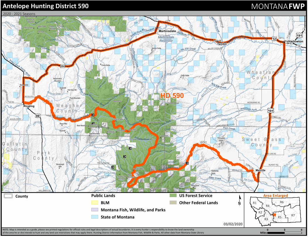
+ All Categories
Home > Documents > M artinsd le C ¬«3 £¤ 19 R es rvoi 12 Harl owt n Tw...

M artinsd le C ¬«3 £¤ 19 R es rvoi 12 Harl owt n Tw...

Date post: 23-May-2020
Category:
Upload: others
View: 1 times
Download: 0 times
Share this document with a friend
2
R7 R6 R4 R3 R5 R1 R2 Area Enlarged ! C ! C ! C ! C ! C ! C ! ! ! ! ! ! ! ! ! ! ! ! ! ! ! ! ! ! ! ! ! ! ! ! ! ! ! ! ! ! ! ! ! ! ! ! ! . ! . ! ( ! ( ! ( Fo urmi l eC ree k W he e ler C r eek L a r s o n C r e e k F o rd s C r e e k No rth A melo ng C reek C oal G u lc h Dre s b a c k C o u l e e To ny C r e ek G i l l i s C r e e k A n t e lo p e Cr e e k M ea d ow C r e e k M e xi c a n J o hn Cr e e k Middle Fork A m e rican For k W e s t Fo rk M ill er C ree k T h om a s C r e e k O'he arn C re e k We s tF o r kC o t to n woo d Cr ee k W i l l i s C o u l e e Blac k ab y Cr e e k R ye Cr e e k E a s t F o r kM i l l e r C r e e k Hens l ey C r e e k D ai s y De a n C r e e k Bo n an za Cree k W oo d s on Creek D ea d Be a v er C reek R o c k C re ek C in n a m on C re e k K a v a n a u g h C r e e k Sa d i e C r e e k Robins on C reek B asi n Cr ee k Loc o C r e e k S o u t h F o r k S h i e l d s Ri v e r M u d C r e e k Sm ith C r e e k L o st H ors e Cr e e k Spr ing C re e k S o u th F o r k E l k C ree k M i lt o n C reek A gne s C r ee k B e a r C r e ek C o m b C r e e k C o le Cr e e k Crooked Creek Mi ller C r e ek Bi l l y C r ee k C o t to n wo o dC re e k W a rm Sp ri n gs Cre e k M uddy Cre e k Alabaug h C re e k L o s t C re e k S o u t h F ork Am e r i can F o r k North F or k Elk Cr ee k A l k a l i C ree k Po rc u p i n e Cr eek D ry C re e k C a y u s e C reek P o t t e r C r ee k L e b o C re ek L eb o Fo rk H ople y Cr e e k H a y m a k e r C r e e k Mi d d l e F or k C o t t o n w o o dC reek B o z e m a n F o r k M us s e ls hell R i ver C o t t o n w o o d C r e e k O tter Creek So u t h F ork S m it h Ri v er L i t tle E l k Cr e ek B i gE l k C re e k Fish Creek Shi el d s Ri v er S ix t e e nm i l eC re e k S o u th F o r k M uss e lsh e l l R iv e r A me r ica n F o rk Sw e et G r a s s C ree k M u s s el s h e l l R i ve r Martinsdale Reservoir t t 294 ¬ « 3 ¬ « 3 £ ¤ 191 £ ¤ 191 £ ¤ 89 £ ¤ 12 E L KC R E EK R D OTTER CRK RD O L D GAP R D TONY CRK R D F O R E S T L A KERD M AUDLO WRD PO R CUPINE BUTTE R D C A STL E T OWN R D T W O D O T H I G H W A Y S HI E L DS RI V E R R D L OD E R D M ELVILLE RD PORCUPINE RD LINCOLN RD C L E A R VIE W R D CR AZY D LN MOONSHINE RD R I E T Z R D C O AL CA M P R D WALL ROCK RD B I G E LK RD CYCLONE COULEE RD ME X I C A N J OHN RD AME R ICA N F O RK RD RED BRIDGE RD N F D 9 9 1 EAST S M IT H C R K U PP ER SI XT E E N M IL E R D L O WE R S I X T E EN M IL E RD COO NE YR D SELKIRK R D BONANZ A C RE E K R D W H E E L E R C R K R D CRAZY MR A N C H R D CREMER R D A N D E R S O N R D H A Y M A K E R R D R E I N L N RUPER TR D C O T T O N WO O D CR E E K RD D ON A L D R D M I LLE R CREEK RD Battleship Butte Scab Rock Mountain Fort Gay Hill Gordon Butte Sunlight Peak Sugar Loaf Mountain Suicide Hill Horse Butte Target Rock Kavanaugh Hills Wapiti Peak Virginia Peak Willow Peak Woodchuck Mountain Punk Mountain Quail Hill Porcupine Butte Rees Hills Reservation Mountain Wolf Hill Bear Mountain Beartrap Peak Billie Butte Black Butte Black Mountain Castle Mountain Coffin Butte Comb Butte Conical Peak Davey Butte Elk Peak Mount Elmo Goat Mountain Lebo Peak Loco Mountain Cinnamon Peak HD 590 Melville Ringling Twodot Harlowton Martinsdale Meagher County Wheatland County Sweet Grass County Gallatin County Park County County Antelope Hunting District 590 MONTANA FWP 0 6 3 Miles NOTE: Map is intended as a guide, please see printed regulations for official rules and legal descriptions of actual boundaries. It is every hunter s responsibility to know the land ownership of the area he or she intends to hunt and any land use restrictions that may apply there. Hunting District information from Montana Fish, Wildlife & Parks. All other data from Montana State Library 03/02/2020 º 2020 - 2021 Seasons Public Lands BLM Montana Fish, Wildlife, and Parks State of Montana US Forest Service Other Federal Lands
Transcript

R7

R6R4

R3 R5

R1

R2

Area Enlarged

!C

!C

!C

!C

!C

!C

!C

!

!

!

!

!

!

!

!

!

!

!

!

!

!

!

!

!

!

!

!

!

!

!

!

!

!

!

!

!

!

!

!

!

!

!

!

!.

!.

!(

!(

!(

Fourmile Creek

W heeler Creek

Larso

n Cree k

Fords Creek

North Amelong Creek

Coal Gulch

Dresback Coulee

Tony Creek

Gilli s Creek

Antelo

p eCr

eek

Mea dowC

reek

Mexican

John Creek

MiddleFork Am erican Fork

West

F ork

Mill erC

ree

k

Thomas Creek

O'hearn Creek

West Fork

Cottonwood Creek

Willi sCoul ee

Black abyCreek

Rye Cree k

East

For k

Mille

r Cree

k

Hensley Creek

Dais y

Dean

Creek

Bonanza Creek

Woods on Creek

Dead B

eaver Creek

Rock Creek

Cinnamon Creek

Kava

n aug

hC

reek Sadie Creek

Robinson Creek

Basin Creek

Loco Creek

South Fork Shi e lds River

Mud

Creek

Smith Creek

Lost Horse Creek

Spring Cre ek

South Fork Elk Creek

Mi ltonC

reek

AgnesC reek

Bear

CreekCo

mb

Cree

k

Cole Creek

Crooked Creek

Miller Creek

Billy Creek

Cottonwood Creek

Warm Springs Creek

Muddy Creek

Alabaugh Creek

Lost

Creek

South Fork American F ork

North Fork Elk Creek

Alkali Creek

Porcupine CreekDry Creek

CayuseC reek

Potter Cr eek

Lebo Creek

Lebo Fork

Hopley Creek

Haymak erCreek

Middle Fork Cott on woo d Creek

Bozeman

Fork Musselshell River

Cottonwo od Creek

Otter Creek

Sout h Fork Smith

River

Little Elk Creek

Big Elk Creek

Fish Creek

Shields River

Six teenmile Creek

South ForkMusse lshell Rive r

American Fork

Sweet GrassCreek

Musselsh ell Rive rMartinsdaleReservoir

tt294

¬«3

¬«3

£¤191

£¤191£¤89

£¤12

ELKCREEK RD

OTTE

R CRK

RD

OLD GA

P RD

TONY CRK RD

FORE

STLAK

E RDMAUDLOW RD

PORCUPINE BUTTE R D

C ASTLE TOWN RD

TWODOT HIGHWA Y

SHIEL

DSRIV

ERRD

LODE RD

MELVILLE RD

PORCUPINE RD

LINCOLN RD

CLEAR VIEWRD

CRAZY D LN

MOONSHINE RD

RIETZR D

COAL CAMP RD

WALL ROCK RD

BIG ELK RD

CYCL

ONE C

OULE

E RD

MEXICANJOHN RD

AMERICANFO RK RD

RED B

RIDGE

RD

NFD 991

EAST SMITH CRK

UPPER SIXTEEN MILERD

LOWERSIXTEEN

M ILE RD

COONEY RD

SELKIRK R D

BONANZACREEK RD

WHEE

LERC

RKRD

CRAZY M RANCHRD

CREMER RD

ANDERSO N RD

HA YMAKERRD

REIN LN

RUPERT RD

COTTONWOOD CREEK RD

DONALD RD

MILLER CREEK RD

BattleshipButte

Scab RockMountain

Fort Gay Hill

Gordon Butte

Sunlight Peak

Sugar LoafMountain

Suicide Hill

Horse Butte

Target Rock

KavanaughHills

Wapiti Peak

Virginia Peak

Willow Peak

WoodchuckMountain

Punk Mountain

Quail Hill

PorcupineButte

Rees Hills

ReservationMountain

Wolf Hill

Bear Mountain

Beartrap Peak

Billie Butte

Black Butte

BlackMountain

CastleMountain

Coffin Butte

Comb Butte

Conical Peak

Davey Butte

Elk Peak

Mount Elmo

Goat MountainLebo Peak

Loco Mountain

Cinnamon Peak

HD 590

Melville

Ringling

Twodot Harlowton

Martinsdale

M e a g h e rC o u n t y

W h e a t l a n dC o u n t y

S w e e t G r a s sC o u n t yG a l l a t i n

C o u n t y P a r kC o u n t y

County

Antelope Hunting District 590 MONTANAFWP

0 63Miles

NOTE: Map is intended as a guide, p lease see p rinted regulations for official rules and legal desc rip tions of ac tual boundaries. It is every hunter’s res p onsibility to know the land ownership of the area he or she intends to hunt and any land use restric tions that may ap p ly there. Hunting Distric t information from Montana Fish, Wildlife & Parks. All other data from Montana State Library

03/02/2020

º

2020 - 2021 Seasons

Public LandsBLMMontana Fish, Wildlife, and ParksState of Montana

US Forest ServiceOther Federal Lands

p2Montana Fish, Wildlife and Parks - Antelope Hunting District 590

03/03/2020

Antelope Hunting District 590

Twodot - Legal Description:Those portions of Wheatland, Sweet Grass, Meagher and Park Counties lying within the following-describedboundary: Beginning at Harlowton, then southerly along US Highway 191 to Sweet Grass Creek, thenwesterly along said creek to Crazy Mountain Divide, then north and west along said divide to the head ofSixteenmile Creek, then west along said creek to US Highway 89, then north along said highway to Route294, then east along said route to US Highway 12, then east along said highway to Harlowton, the point ofbeginning.

Landcover Square Miles Percent

Alpine 13.2 1.8

Forest and Woodland 123.6 16.9

Grassland 261.4 35.7

Human Land Use 66.5 9.1

Open Water / Wetland and Riparian 49.9 6.8

Recently Disturbed or Modified 60.2 8.2

Shrubland, Steppe and Savanna 156.1 21.3

Sparse and Barren 0.8 0.1

Ownership Square Miles Percent

Private 548.2 74.8

Public 182.6 24.9

Reservation 0.0 0.0

Water 2.0 0.3

Public Ownership Square Miles Percent

Local Governments 0.0 0.0

Montana Fish, Wildlife, and Parks 0.4 0.1

Montana State Trust Lands 64.7 8.8

National Park Service 0.0 0.0

Other Federal Lands 0.0 0.0

Other State Lands 0.0 0.0

US Bureau of Land Management 1.5 0.2

US Fish and Wildlife Service 0.0 0.0

US Forest Service 115.9 15.8


Recommended