36
Managing Parcels in ArcGIS 10 Editing Workflows Editing Maps ArcGIS Geodatabase Public Access Value Analysis Basemaps Tim Hensley Esri Solution Engineer Karen Lowrey Esri Geospatial Analyst

Managing Parcels in
ArcGIS 10
Editing Workflows
EditingMaps
ArcGIS Geodatabase
Public AccessValue Analysis
Basemaps
Tim Hensley
Esri Solution Engineer
Karen Lowrey
Esri Geospatial Analyst

ArcGIS 10 Parcel Solution
New Web Maps/Apps
Editing Workflows
Editing Maps
ArcGIS Geodatabase
• Tax Parcels• Assessment Layers
(sales, foreclosures, value info, etc.)• Subs, Blocks, Lots, ROWs• Condos, Units• Survey Control• Basemap Information
• New Tax Parcels• New Subs, Blocks, Lots• New Condos, Units• Survey Adjustment
Basemaps
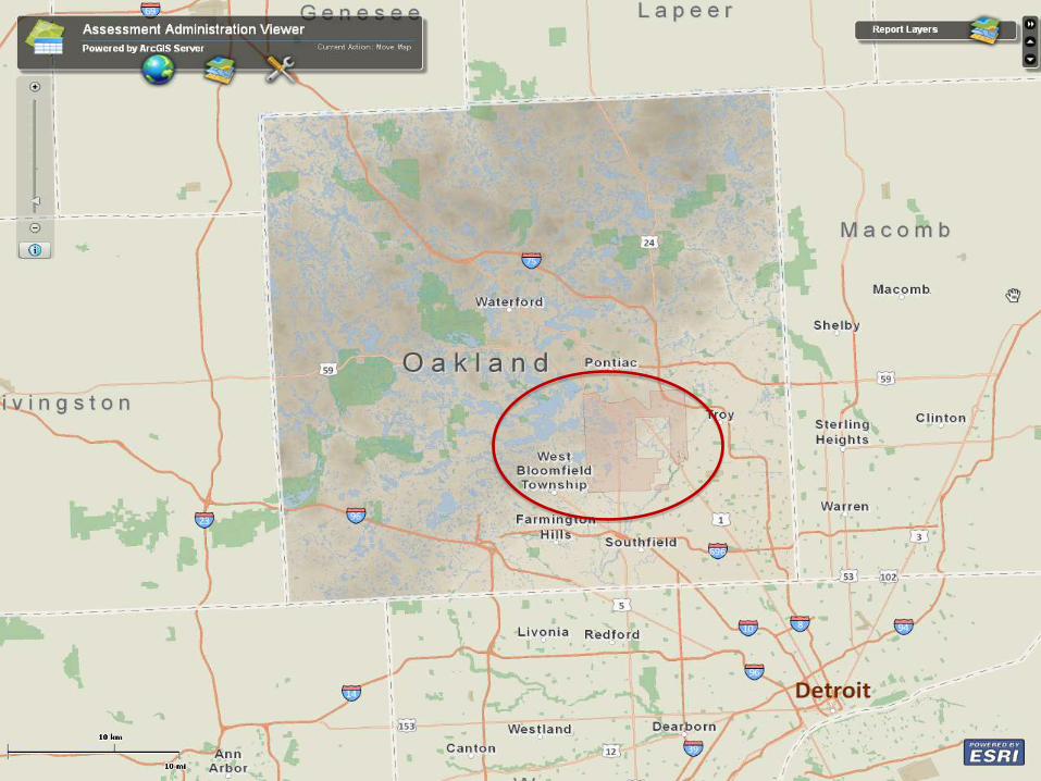
• Workflow Manager• Public Access• Value Analysis

Data
Management
Field
Mobility
Planning &
Analysis
Operational
Awareness
Collect, organize & maintain data
Get information Into and out of the field
Transform data into actionable information
Disseminate knowledge where &
when it’s needed
Mobile Web MapsGeodatabase Geoprocessing
DESKTOP SERVER ONLINE
GIS Patterns
A Complete Integrated System

GEODATABASEArcGIS
Desktops
Web
Mobile
Any
Client
Geodatabase
Open
APIs
Scalable Storage
ArcGIS ServerComprehensive
Information Model
3D Objects
Addresses
Schematics
Topology
Annotation
Dimensions
Terrain
Parcels
Cartography
NetworksAttributes
Vectors
Images

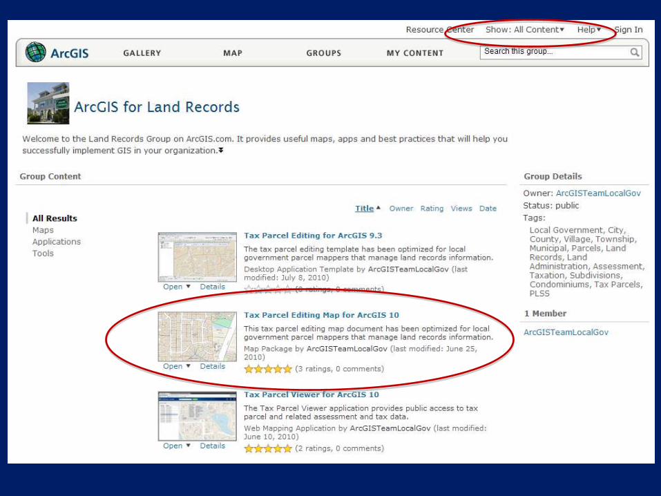
http://resources.arcgis.com/content/local-government/land-records
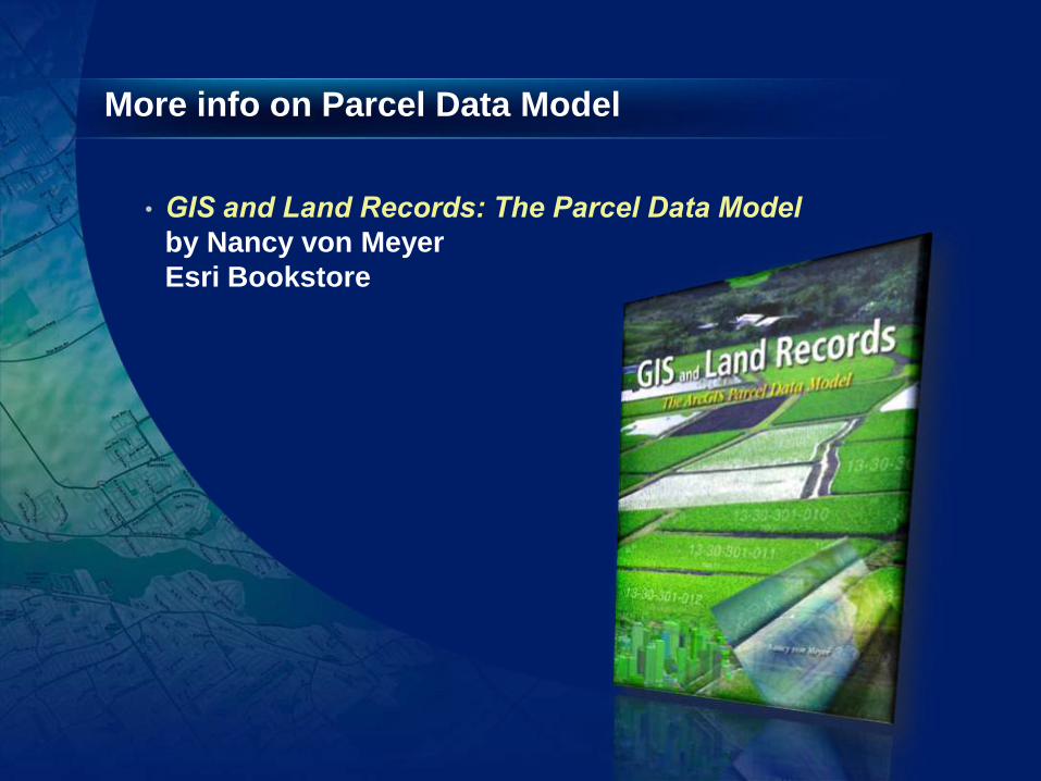
More info on Parcel Data Model
•
by Nancy von Meyer
Esri Bookstore

• Set of related tables and feature classes
stored in a geodatabase
• Forms a parcel boundary network
• Explicit topology
- defined by common parcel corners, no overlaps and gaps between neighboring parcels
What is a Parcel Fabric?

Source: U.S. Department of Interior-Geological Survey, Reston, Virginia -1988

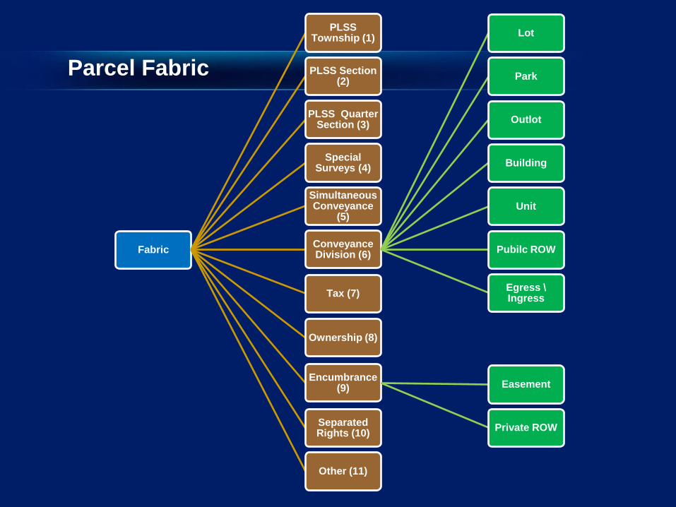
Fabric
PLSS Township (1)
PLSS Section (2)
PLSS Quarter Section (3)
Special Surveys (4)
Simultaneous Conveyance
(5)
Conveyance Division (6)
Lot
Park
Outlot
Building
Unit
Pubilc ROW
Egress \Ingress
Tax (7)
Ownership (8)
Encumbrance (9) Easement
Private ROWSeparated Rights (10)
Other (11)
Parcel Fabric

(SystemEndDate IS NULL) AND ("Type" = 7)

“Type” = 2

“Type” = 6

Scope of Technology
Parcel Fabric
Geodatabase
Land Records Submitted
to Agency
Integrate parcels with the
existing Fabric
Agency Creates Digital
Parcels
The Workflow A Framework for Parcel
Information Management

Data Model : Relationships
Plans
Parcels
1-M
1
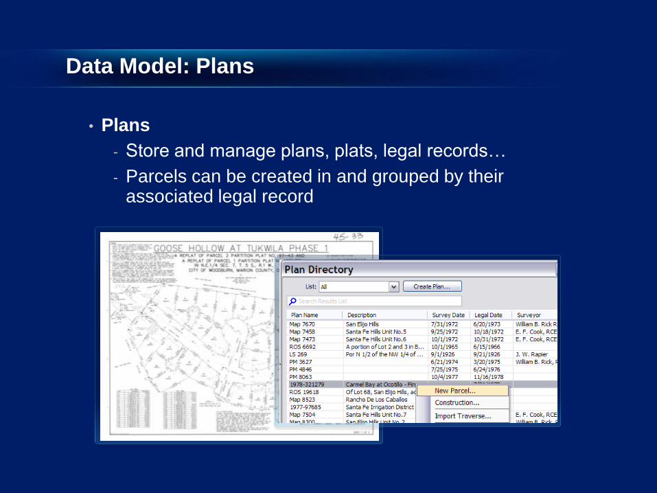
Data Model: Plans
• Plans
- Store and manage plans, plats, legal records…
- Parcels can be created in and grouped by their associated legal record

Data Model : Relationships
Plans
Points Lines
Parcels
1-M
1-M
2-1
1
1
1-M

Data Model : Parcels Record values and Topology
• Parcel lines store (COGO) dimensions
• End points are common
- Topological integrity

Data Model : Redundancy supports Spatial Quality
• Each parcel has its own set of related lines
- Overlapping lines for a common boundary
• Redundant network
- More boundary lines define relatively fewer points
# of lines= 16
# of points = 9

Data Model : Fabric geometry
• Curves
- True, parametric curves
- Radial lines

Data Model : Relationships
Plans
Line Points
Points Lines
Parcels
1-M
1-M
0-M
2-1
1
1
1
1-M
1
0-1

Data Model : Line-points
• Line points preserve data integrity
- A line point is a parcel corner point that sits on an adjacent boundary line but does not split it
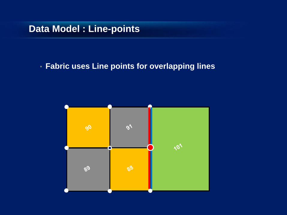
Data Model : Line-points
• Fabric uses Line points for overlapping lines

Data Model
• Fabric allows overlapping parcels
• Natural boundaries
• Donut/island and multipart parcels
• Historic parcels

Data Model : Relationships
Plans
Control Line Points
Points Lines
Parcels
1-M
1-M
0-M
2-1
1
1
1
1-M
0-1
1
1
0-1
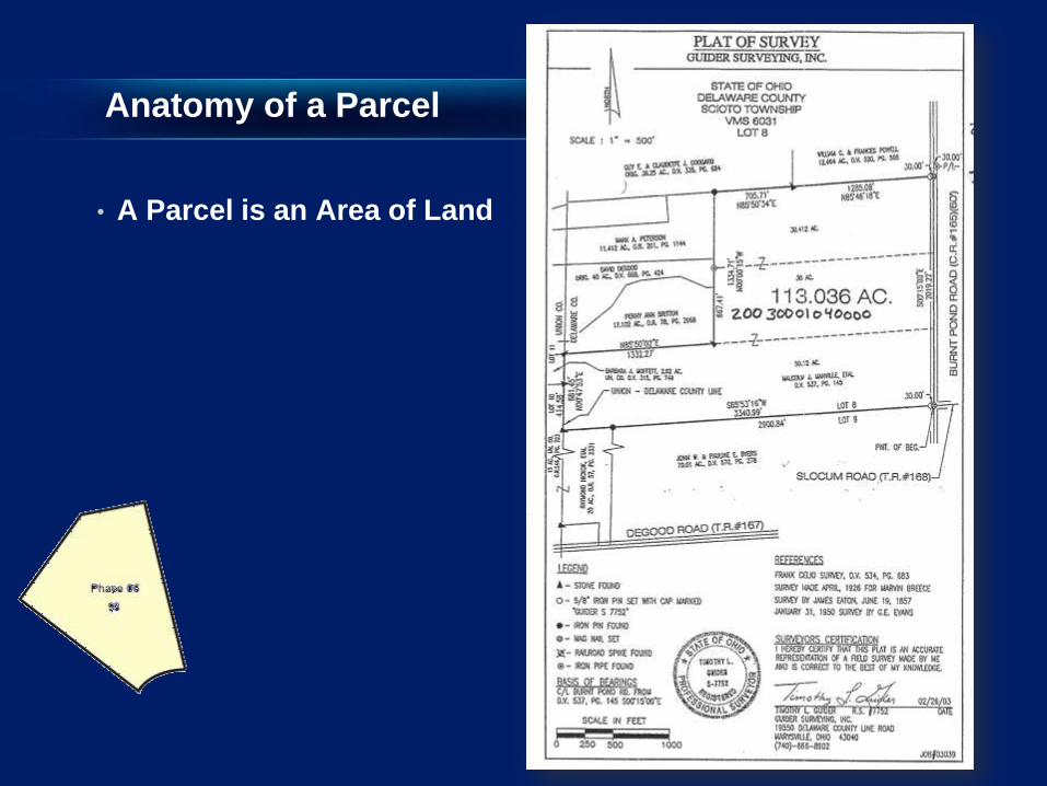
Anatomy of a Parcel
• A Parcel is an Area of Land

Anatomy of a Parcel
• A Parcel is an Area of Land
- Related set of Lines
- Defined by From/To Points
POBXYXY
XYXY
XY
XYXY
XY

Streamlined Workflows
• Merge parcels while maintaining interior lot lines
• Split based on new interior lines or metes & bounds descriptions
• Import digitally submitted data (from CAD files or other sources)
• Update parcel corners to more accurate data
• Number new parcels using “snake” tool

Data Integrity
• Easily and quickly incorporate new data
• Preserve parcel connectivity during incorporation
• Maintain positional relationships with other layers
(easement, right of ways, utilities, etc.)

Scope of Technology
Parcel Fabric
Geodatabase
Land Records Submitted
to Agency
Adjust Fabric
Adjust other GIS Layers
Integrate parcels with the
existing Fabric
Agency Creates Digital
Parcels
The Workflow A Framework for Parcel
Information Management
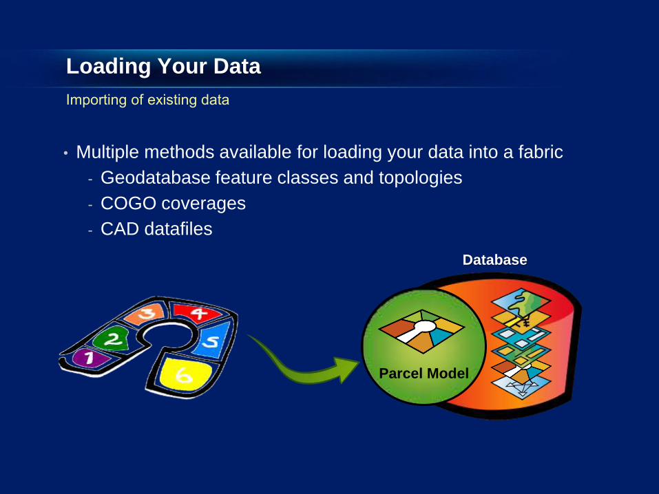
Loading Your Data
• Multiple methods available for loading your data into a fabric
- Geodatabase feature classes and topologies
- COGO coverages
- CAD datafiles
Parcel Model
Database

•Line—Must be Single Part •Line—Must Not Self-Overlap •Line—Must Not Self-Intersect •Line—Must Not Intersect Or Touch Interior •Line—Must be Covered by Boundary Of (polygon) •Polygon—Boundary Must be Covered By (Line)
Loading data into the Parcel Fabric Data Model
Lot_Polygons
Lot_Lines
Lots_Topo
Lots
Parcel Model
Geodatabase
Parcels
Parcel_Lines
Parcels_Topo
Parcels

ArcGIS 10 Parcel Solution
Esri land records solution
- Leverage work published on Land Records Resource Center
- Migrate data storage and maintenance to ArcGIS 10 Parcel Fabric
- Leverage Production Mapping Workflow
Database Design
Data Conversion
Load Data into Parcel Fabric
Train Staff
Professional Services
Technical Support
Parcel Fabric Implementation