+ All Categories
Home > Documents > Manitoba – Minnesota Transmission Project Environmental ......Transmission Project _G\G:S_I...

Manitoba – Minnesota Transmission Project Environmental ......Transmission Project _G\G:S_I...

Date post: 12-Oct-2020
Category:
Upload: others
View: 1 times
Download: 0 times
Share this document with a friend
6
X W X W ³ ² 1 City of Winnipeg St. Malo Riel J ou b e r t C r e e k R o s e a u R i v er United States of America R e d R iv e r WHITEMOUTH LAKE Canada M a n n i n g C a n a l A ssi n iboine River Cook sC r ee k S ei n e R i v e r R a t R iv e r M602F R49R R50M Whiteshell Provincial Park Birds Hill Provincial Park Beaudry Provincial Park ³ ² 1 Dorsey Altona Anola Arbakka Arnaud Aubigny Badger Barkfield Beausejour Brunkild Caliento Carey Carlowrie Carrick Cloverleaf Deacons Corner Domain Dufresne Dufrost Dugald East Braintree Elma Emerson Fredensthal Gardenton Giroux Glass Glenlea Grande Pointe Greenland Green Ridge Gretna Grosse Isle Hadashville Hazelridge Headingley Horndean Ile des Chênes Kleefeld La Broquerie La Coulée La Salle Letellier Linden Lorette Lowe Fa rm Marchand McMunn Molson Morris New Bothwell Niverville Oakbank Oak Bluff Osborne Piney Prairie Grove Prawda Randolph Rennie Richer Ridgeville Roseau River Ross Rosser St.Adolphe Ste. Agathe Ste. Elizabeth Ste-Geneviève Ste.Rita St. Joseph St.Labre St-Pierre-Jolys Sandilands Sanford Sarto Seddons Corner South Junction Sprague Starbuck Steinbach Stony Mountain Stuartburn Sundown Tolstoi Vassar Vita Vivian Whitemouth Woodridge Roseau River Anishinabe First Nation Ste.Anne Ginew Stonewall Selkirk Zhoda Grunthal LAKE OF THE WOODS [ \ 8 [ \ 9 [ \ 89 [ \ 67 [ \ 52 [ \ 30 [ \ 15 [ \ 26 [ \ 59 [ \ 9 [ \ 75 [ \ 14 [ \ 44 [ \ 12 [ \ 12 [ \ 3 [ \ 59 [ \ 12 ¾ À 100 ¾ À 101 0 10 Kilometres 0 10 5 Miles 1:600,000 ± Coordinate System: UTM Zone 14N NAD83 Data Source: MBHydro, ProvMB, NRCAN Date Created: August 11, 2015 Manitoba-Minnesota Transmission Project G:\_GIS_Project_Folder\00_Hydro\111420050_MMTP_EA\Figures\EAChapter\FMUL\MMTP_EA_1FMULBoundaries_600k_B_20150810.mxd Project Infrastructure X W Converter Station (Existing) Final Preferred Route (FPR) First Nations Infrastructure ! ! ! Existing 500kV Transmission Line ! ! Existing 230kV Transmission Line Boundaries Community Interest Zones Treaty Land Entitlement (TLE) Areas Buffalo Point First Nation Peguis First Nation Treaty Area Treaty 1 Treaty 3 Landbase ! Community Railway Trans Canada Provincial Highway Provincial Road City First Nation Lands Ecological Reserve Wildlife Management Area Provincial Park Map 11-1 ³ ² 1 [ \ 12 U V 301 Assessment Area Traditional Land and Resource Use Local Assessment Area Traditional Land and Resource Use Regional Assessment Area
Transcript

XW

XW

³²1

City of Winnipeg

St. Malo

Riel

Joubert Creek

Rose

au River

United States of America

Red

River

WHITEMOUTHLAKE

Canada

Mann ingCanal

Assiniboine River Cooks Creek

Seine Rive r

Rat River

M602F

R49R

R50M

WhiteshellProvincial

ParkBirds HillProvincial

Park

BeaudryProvincial

Park

³²1

Dorsey

Altona

Anola

Arbakka

Arnaud

Aubigny

Badger

Barkfield

Beausejour

Brunkild

Caliento

Carey

Carlowrie Carrick

Cloverleaf

DeaconsCorner

Domain

Dufresne

Dufrost

Dugald

EastBraintree

Elma

Emerson

Fredensthal

Gardenton

Giroux

Glass

Glenlea

GrandePointe

Greenland

GreenRidge

Gretna

Grosse Isle

Hadashville

Hazelridge

Headingley

Horndean

Ile desChênes

Kleefeld La Broquerie

La CouléeLa Salle

Letellier

Linden

Lorette

LoweFarm

Marchand

McMunn

Molson

Morris

NewBothwell

Niverville

Oakbank

Oak Bluff

Osborne

Piney

PrairieGrove

Prawda

Randolph

Rennie

Richer

Ridgeville

Roseau River

Ross

Rosser

St.Adolphe

Ste. Agathe

Ste.Elizabeth

Ste-Geneviève

Ste.Rita

St. Joseph

St.Labre

St-Pierre-Jolys

Sandilands

Sanford

Sarto

SeddonsCorner

SouthJunction Sprague

Starbuck

Steinbach

StonyMountain

StuartburnSundown

Tolstoi

VassarVita

Vivian

Whitemouth

Woodridge

Roseau RiverAnishinabeFirst Nation

Ste.Anne

Ginew

Stonewall Selkirk

Zhoda

Grunthal

LAKEOF THE

WOODS

[\8 [\9

[\89

[\67

[\52

[\30

[\15

[\26

[\59

[\9

[\75

[\14

[\44

[\12

[\12

[\3

[\59

[\12

¾À100

¾À101

0 10 Kilometres

0 105 Miles 1:600,000

±Coordinate System: UTM Zone 14N NAD83Data Source: MBHydro, ProvMB, NRCANDate Created: August 11, 2015

Manitoba-MinnesotaTransmission Project

G:\_G

IS_P

rojec

t_Fold

er\00

_Hyd

ro\11

1420

050_

MMTP

_EA\

Figur

es\EA

Chap

ter\F

MUL\M

MTP_

EA_1

FMUL

Boun

darie

s_60

0k_B

_201

5081

0.mxd

Project Infrastructure

XW Converter Station (Existing)

Final Preferred Route (FPR)

First Nations

Infrastructure! ! ! Existing 500kV Transmission Line! ! Existing 230kV Transmission Line

BoundariesCommunity Interest Zones

Treaty Land Entitlement (TLE) AreasBuffalo Point First NationPeguis First Nation

Treaty AreaTreaty 1Treaty 3

Landbase! Community

RailwayTrans CanadaProvincial HighwayProvincial RoadCityFirst Nation LandsEcological ReserveWildlife Management AreaProvincial Park

Map 11-1

³²1

[\12

UV301

Assessment AreaTraditional Land and Resource Use Local Assessment AreaTraditional Land and Resource Use Regional Assessment Area

HUDSON BAY

Gods L.

Island L.

SplitLake

SouthernIndianLake

LakeWinnipegosis

LakeManitoba

LakeWinnipeg

North Dakota Minnesota

Northwest Territories Nunavut

Sask

atche

wan

Manitoba

Ontario

Winnipeg

3

3A

2A

4 7A

75

86

6A

1112

15A

16

14

1721

1315

13A 14A

2018A

18B

18 19A

21A 17A

19B

18C

2519

22

23A

2625ARMP

23 34B24

3425B 34C

36

2730 34A

35

3832

3328

35A31

31A2929A

9

9A

10

1

2

Metis Natural ResourceHarvesting Areas

G:\_

GIS_

Projec

t_Fold

er\0

0_Hy

dro\

1114

2005

0_MM

TP_E

A\Fig

ures\

EACh

apte

r\FMU

L\M

MTP

_EA_

2Har

vestin

gZon

es_5

M_B

_201

5072

3.mxd

R

evise

d: 20

15-0

7-23 B

y: sg

arne

r

Map 11-2

Coordinate System: UTM Zone 14N NAD83Data Source: MBHydro, ProvMB, NRCANDate Created: July 23, 2015

Source:1. Recognized Areas for Metis Natural Resource Harvesting, 2013, Manitoba Hydro - derived from MLI Game Hunting Areas andhttp://www.gov.mb.ca/conservation/pdf/conserv_recognized_areas_for_harvesting_map.pdf.2. GHA, 2010, Manitoba Department of Conservation, Wildlife Branch.

Manitoba-MinnesotaTransmission Project

Recognized Areas for Harvesting Metis Natural Resource Harvesting Zone 1

Game Hunting Area (GHA) 2±

0 50 100 Kilometres

0 10050 Miles 1:4,000,000

XW

XW

³²1

City of Winnipeg

St. Ma lo

Riel

Joubert Creek

Rose

au River

United States of America

Red

River

WHITEMOUTHLAKE

Canada

ManningCanal

Assiniboine River Cooks Creek

Sein e Rive r

Rat River

Site of Pote ntia lTre a ty La nd Entitle m e nt

UpperZone

LowerZone

Area 3

Area 2Area 1

M602F

R49R

R50M

White she llProvincia lPa rk

Bird s HillProvincia lPa rk

Be a ud ryProvincia lPa rk

³²1

Dorsey

Altona

Anola

Arba kka

Arna ud

Aubigny

Ba d ge r

Ba rkfie ld

Be a use jour

Brunkild

Ca lie nto

Ca re y

Ca rlowrie Ca rrick

Clove rle a f

De a consCorne r

Dom a in

Dufre sne

Dufrost

Duga ld

Ea stBra intre e

Elm a

Em e rson

Fre d e nstha l

Ga rd e nton

Giroux

Gla ss

Gle nle a

Gra nd ePointe

Gre e nla nd

Gre e nR id ge

Gre tna

Grosse Isle

Ha d a shville

Ha ze lrid ge

He a d ingle y

Hornd e a n

Ile d e sChêne s

Kle e fe ld La Broque rie

La CouléeLa Sa lle

Le te llie r

Lind e n

Lore tte

LoweFa rm

Ma rcha nd

McMunn

Molson

Morris

NewBothwe ll

Nive rville

Oa kba nk

Oa k Bluff

Osborne

Pine y

Pra irieGrove

Pra wd a

R a nd olph

R e nnie

R iche r

R id ge ville

R ose a u R ive r

R oss

R osse r

St.Ad olphe

Ste. Aga the

Ste.Eliza be th

Ste-Ge ne viève

Ste.R ita

St. Jose ph

St.La bre

St-Pie rre -Jolys

Sa nd ila nd s

Sa nford

Sa rto

Se d d onsCorne r

SouthJunction Spra gue

Sta rbuck

Steinbach

StonyMounta in

Stua rtburnSund own

Tolstoi

Vassa rVita

Vivia n

White m outh

Wood rid ge

R ose a u R ive rAnishina beFirst Nation

Ste.Anne

Gine w

Stone wa ll Selkirk

Zhod a

Gruntha l

LAKEOF THE

WOODS

[\8 [\9

[\89

[\67

[\52

[\30

[\15

[\26

[\59

[\75

[\14

[\2

[\44

[\12

[\12

[\3

[\59

[\12

¾À100

¾À101

0 10Kilom e tre s

0 105 Mile s 1:600,000

±Coord inate Syste m : UTM Zone 14N NAD83Da ta Source : MBHyd ro, ProvMB, NR CANDa te Cre ate d : August 11, 2015

Manitoba-MinnesotaTransmission Project

G:\_GIS_Project_Folder\00_Hydro\111420050_MMTP_EA\Figures\EAChapter\FMUL\MMTP_EA_3PrelimRoutingExistingConditions_600K_B_20150810.mxd

Proje ct Infra structure

XW Conve rte r Station (Existing)

Fina l Pre fe rre d R oute (FPR )

First Nations Areas of ConcernIdentified During Preliminary Routing

Infr a structure! ! ! Existing 500kV Tra nsm ission Line! ! Existing 230kV Tra nsm ission Line

Asse ssm e nt Are a

La nd base! Com m unity

R a ilwa yTra ns Ca na d aProvincia l Highwa yProvincia l R oa d

CityFirst Nation La nd sEcologica l R e se rveWild life Ma na ge m e nt Are aProvincia l Pa rk

Ma p 11-3

Source :1. R ose a u R ive r, Swa n La ke a nd Long Pla in First Na tions R ound 1 Fe e d ba ck,Ja nua ry 2014, Manitoba Hyd ro Lice nsing a nd Environm e nta l Asse ssm e nt.2. MMTP Aborigina l Enga ge m e nt – Wha t We He a rd R ound 1 a nd 2, 2014,Ma nitoba Hyd ro.

³²1

[\12

UV301

R ound 1 First Nations Fe e d back 1First Nations Are a s of Conce rn – Cultura l SitesFe e d ba ck ZoneAre a 1Are a 2Are a 3

Are a s of Inte re st Along R e fine d Alte rna tive R oute sR ound 2 Fe e d back 2

R ose a u R ive r First NationPeguis First Nation

Traditional Land and Resource Use Local Assessment AreaTraditional Land and Resource Use Regional Assessment Area

XW

XW

!(!(

!(!(!(

!(!(!(!(!(!(!( !( !(!(

!(!(!(!(!(!(!(!(!( !(!(!(!( !(!( !(!(!(!(!(

!( !(!(!( !( !(!(!( !(!( !( !(!(!( !(!(!(!( !(!( !(!( !( !(!( !( !(

!( !(!(

!(!( !(!( !(!(

!( !(!(!(!( !(!(!(!(!(!(!(!( !( !(!( !(!( !( !(!(!(!(!(!(!( !(!(!( !( !(!(!(!(!( !(!(!(!(!( !(!(!(!( !( !( !( !(!(!(!(!(!(!( !(!( !(!(!(!(!(!(!(!( !(!(!(!(!(!( !(!( !(!(!(!( !(!( !(!(!(!(!( !( !(!(!(!(!( !(!( !(!( !(!( !(!(!( !(!(!( !( !(!(!( !(!(!(!( !(!(!(

!(!(!(!( !( !( !(

!( !( !(!(!(!(!( !( !(!(

!( !(!(!(!( !( !(!(!(!(!(!(

!( !(!( !(!( !( !(!( !(!( !(!(!( !(!( !(!(!(!(!( !(!( !( !(!(!(!( !(!( !(!(!(!(!(!( !(!( !( !(!(

!( !(!(!(!( !(!(!( !(!(!(!( !(!(

!(!(

!( !(

!( !(!( !(!( !(!(

!(!(!( !(!( !(!( !( !(!(!(

!(!(!(

!(!(!(!( !(!(!(!( !(!(!(!( !(!( !(!( !(!(!(!(!(!( !(!(!(!( !(!(!(!( !(!( !(!(!( !(!(!(!(!(!(!(!(!(!(!(!(

!(!(!(

³²1

City of Winnipeg

St. Ma lo

Riel

Joubert Creek

Rose

au River

United States of America

Red

River

WHITEMOUTHLAKE

Canada

ManningCanal

Assiniboine River Cooks Creek

Sein e Rive r

Rat River

M602F

R49R

R50M

White she llProvincia lPa rk

Bird s HillProvincia lPa rk

Be a ud ryProvincia lPa rk

BROKENHEAD

WHITEMOUTH

REYNOLDS

SPRINGFIELD

MACDONALD

TACHE

RITCHOTSTE. ANNE

HANOVERLA BROQUERIE

DE SALABERRYMORRIS

PINEY

MONTCALM STUARTBURN

FRANKLIN

ROSSER

ROCKWOODWOODLANDS

ST.ANDREWS

ST. CLEMENTS

RHINELAND

LAC DUBONNET

³²1

Dorsey

Altona

Anola

Arba kka

Arna ud

Aubigny

Ba d ge r

Ba rkfie ld

Be a use jour

Brunkild

Ca lie nto

Ca re y

Ca rlowrie Ca rrick

Clove rle a f

De a consCorne r

Dom a in

Dufre sne

Dufrost

Duga ld

Ea stBra intre e

Elm a

Em e rson

Fre d e nstha l

Ga rd e nton

Giroux

Gla ss

Gle nle a

Gra nd ePointe

Gre e nla nd

Gre e nR id ge

Gre tna

Grosse Isle

Ha d a shville

Ha ze lrid ge

He a d ingle y

Hornd e a n

Ile d e sChêne s

Kle e fe ld La Broque rie

La CouléeLa Sa lle

Le te llie r

Lind e n

Lore tte

LoweFa rm

Ma rcha nd

McMunn

Molson

Morris

NewBothwe ll

Nive rville

Oa kba nk

Oa k Bluff

Osborne

Pine y

Pra irieGrove

Pra wd a

R a nd olph

R e nnie

R iche r

R id ge ville

R ose a u R ive r

R oss

R osse r

St.Ad olphe

Ste. Aga the

Ste.Eliza be th

Ste-Ge ne viève

Ste.R ita

St. Jose ph

St.La bre

St-Pie rre -Jolys

Sa nd ila nd s

Sa nford

Sa rto

Se d d onsCorne r

SouthJunction Spra gue

Sta rbuck

Steinbach

StonyMounta in

Stua rtburnSund own

Tolstoi

Vassa rVita

Vivia n

White m outh

Wood rid ge

R ose a u R ive rAnishina beFirst Nation

Ste.Anne

Gine w

Stone wa ll Selkirk

Zhod a

Gruntha l

LAKEOF THE

WOODS

[\8 [\9

[\89

[\67

[\52

[\30

[\15

[\26

[\59

[\75

[\14

[\2

[\44

[\12

[\12

[\3

[\59

[\12

¾À100

¾À101

0 10Kilom e tre s

0 105 Mile s 1:600,000

±Coord inate Syste m : UTM Zone 14N NAD83Da ta Source : MBHyd ro, ProvMB, NR CANDa te Cre ate d : August 10, 2015

Manitoba-MinnesotaTransmission Project

G:\_GIS_Project_Folder\00_Hydro\111420050_MMTP_EA\Figures\EAChapter\FMUL\MMTP_EA_4PlantHarvesting_600K_B_20150810.mxd

Proje ct Infra structure

XW Conve rte r Station (Existing)

Fina l Pre fe rre d R oute (FPR )

Plant Harvesting

Infr a structure! ! ! Existing 500kV Tra nsm ission Line! ! Existing 230kV Tra nsm ission Line

Asse ssm e nt Are a

La nd base! Com m unity

R a ilwa yTra ns Ca na d aProvincia l Highwa yProvincia l R oa dCityFirst Nation La nd sEcologica l R e se rveWild life Ma na ge m e nt Are aProvincia l Pa rkR ura l Municipa lity

Ma p 11-4

Source :1. Pe guis FN Are a s of Inte re st from Aborigona l Tra d itiona l Knowle ge (ATK)Inte rviews, Octobe r 2014 – Ma rch 2015, Whe la n Enns Associa te s Inc.

³²1

[\12

UV301

Peguis Fist Nations Pla nt Ha rvesting Site s 1!( Gathe ring

Gathe ring

Traditional Land and Resource Use Local Assessment AreaTraditional Land and Resource Use Regional Assessment Area

XW

XW

!(

!( !(!(

!(

!( !( !(!(!(!( !( !( !(!(!(!( !(!(!(

!( !( !(!( !(!(!( !( !(!( !( !(!( !(!( !(!( !(!( !(!(!( !(!(!( !(!( !(!(!( !(!(

!(!(!( !( !( !( !(!( !(!( !(!(!(!( !(!(!(!(!( !(!(!( !(!( !(!(!(!(!( !(!(!(!(!( !(!(!(!( !(!(!(!(!( !( !( !(!(!(!(!(!(!(!(!(!( !(!(!(!(!(!( !( !(!(!( !( !(!( !(!(!( !(!(!(!(!(!(!( !(!(!(

!(!(!(!(

!(!( !(!(!( !(!( !(!( !( !(!( !(!(!( !(!(!( !(!( !(!(!(!(!(!(!( !( !( !(!( !( !( !(!(!(!( !(!(!(!(!(!( !(!(!( !(!(!(!( !( !( !(!( !(!(!( !(!(!(

!( !( !( !(!( !(!( !(!(

!( !( !(!( !( !( !(!( !(!(!( !( !( !(!(!( !(!( !(!(!( !(!(!(!( !( !( !(!( !(!(!( !(!( !(!( !(!( !(!(!( !(!( !(!( !(!( !(!(!(!( !(!(!( !(!( !(!( !(!(!( !(!(!(!( !( !(!(!( !(!(!( !( !(!(!( !( !(!( !( !(!( !( !(!( !(!( !(!( !(!( !(!( !(!( !( !(!( !(!( !(!(!( !( !(!(!( !(!( !(!( !(!( !(!(

!(!(!(!( !(

!(!(!( !(!(

!(!( !(!(!(!(

!(!( !(!(!(

!(!( !(

!(!(!(

!(!(!( !(!(

!(!(

!( !(!(!( !(!(

³²1

City of Winnipeg

St. Malo

Riel

Joubert Creek

Rose

au River

United States of America

Red

River

WHITEMOUTHLAKE

Canada

ManningCanal

Assiniboine River Cooks Creek

Sein e Rive r

Rat River

M602F

R49R

R50M

White she llP rovinc ialP ark

Bird s HillP rovinc ialP ark

Be aud ryP rovinc ialP ark

BROKENHEAD

WHITEMOUTH

REYNOLDS

SPRINGFIELD

MACDONALD

TACHE

RITCHOTSTE. ANNE

HANOVERLA BROQUERIE

DE SALABERRYMORRIS

PINEY

MONTCALM STUARTBURN

FRANKLIN

ROSSER

ROCKWOODWOODLANDS

ST.ANDREWS

ST. CLEMENTS

RHINELAND

LAC DUBONNET

³²1

Dorsey

Altona

Anola

Arbakka

Arnaud

Aubigny

Bad ge r

Barkfie ld

Be ause jour

Brunkild

Calie nto

Care y

Carlowrie Carric k

Clove rle af

De ac onsCorne r

Dom ain

Dufre sne

Dufrost

Dugald

EastBraintre e

Elm a

Em e rson

Fre d e nsthal

Gard e nton

Giroux

Glass

Gle nle a

Grand eP ointe

Gre e nland

Gre e nRid ge

Gre tna

Grosse Isle

Hadashville

Haze lrid ge

He ad ingle y

Hornd e an

Ile d e sChêne s

Kle e fe ld La Broq ue rie

La CouléeLa Salle

Le te llie r

Lind e n

Lore tte

LoweFarm

Marc hand

McMunn

Molson

Morris

Ne wBothwe ll

Nive rville

Oakbank

Oak Bluff

Osborne

P ine y

P rairieGrove

P rawda

Rand olph

Re nnie

Ric he r

Rid ge ville

Rose au Rive r

Ross

Rosse r

St.Ad olphe

Ste . Agathe

Ste .Elizabe th

Ste -Ge ne viève

Ste .Rita

St. Jose ph

St.Labre

St-P ie rre -Jolys

Sand ilands

Sanford

Sarto

Se d d onsCorne r

SouthJunction Sprague

Starbuc k

Steinbach

StonyMountain

StuartburnSund own

Tolstoi

VassarVita

Vivian

White m outh

Wood rid ge

Rose au Rive rAnishinabeFirst Nation

Ste .Anne

Gine w

Stone wall Selkirk

Zhod a

Grunthal

LAKEOF THE

WOODS

[\8 [\9

[\89

[\67

[\52

[\30

[\15

[\26

[\59

[\75

[\14

[\2

[\44

[\12

[\12

[\3

[\59

[\12

¾À100

¾À101

0 10Kilom e tre s

0 105 Mile s 1:600,000

±Coord inate Syste m : UTM Zone 14N NAD83Data Sourc e : MBHyd ro, P rovMB, NRCANDate Cre ate d : August 10, 2015

Manitoba-MinnesotaTransmission Project

G:\_GIS_Project_Folder\00_Hydro\111420050_MMTP_EA\Figures\EAChapter\FMUL\MMTP_EA_5FMULHuntingTrapping_600K_B_20150810.mxd

P roje c t Infrastructure

XW Conve rte r Station (Existing)

Final P re fe rre d Route (FP R)

Hunting and Trapping

Infrastruc ture! ! ! Existing 500kV Transm ission Line! ! Existing 230kV Transm ission Line

Asse ssm e nt Are a

Landbase! Com m unity

RailwayTrans CanadaP rovinc ial HighwayP rovinc ial RoadCityFirst Nation Land sEc ologic al Re se rveWild life Manage m e nt Are aP rovinc ial P arkRural Munic ipality

Map 11-5

Sourc e :1. P e guis FN Are as of Inte re st from Aborigonal Trad itional Knowle ge (ATK)Inte rviews, Oc tobe r 2014 – Marc h 2015, Whe lan Enns Assoc iate s Inc .

³²1

[\12

UV301

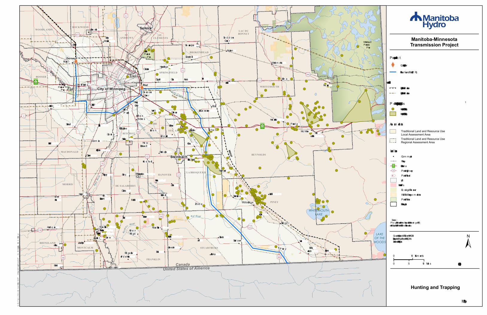
P e guis Fist Nations Hunting and Trapping Site s 1!( Hunting/Hunting Bird s/Trapping

Hunting/Hunting Bird s/Trapping

Traditional Land and Resource Use Local Assessment AreaTraditional Land and Resource Use Regional Assessment Area

XW

XW

!(

!(!(!(!(!( !(!(!(!(!(!( !(!( !( !(!(!(!( !(!(

!(!(!( !(!( !(!( !(!(!( !(!(!( !(!(!(!(!(!( !(!(!(!( !(!(!(!( !(!( !(!(!(!(!(!( !(!(!(!(!(!(!(!(!(!(!(!(!(!(!(!(!(!(!(!( !( !(!(!(!(!(!(!(!(!(!(!(!(!( !(!( !(!(!(!(!(!(!( !(!(!(!(

!(!(!(!(!(!( !(!(

!( !(!(!(!(

!(

!(

!(!(!(

!(

!(

!(

!(

!(

!(!(!( !(!(!(!(!(!(!(

!(!(!(!( !( !(!(!(!(!( !( !(!(!( !(!( !(

!(!(!(

!(!(!(!(!(

!(!( !( !(!(!(

!( !(!(!(!( !(

!(!(!(!( !(!(!(

!(!(!(!(!(!(!( !(!(!(!( !(

!( !(

!(!(!(!(!(!(!(

!(!(!(

!(

³²1

City of Winnipeg

St. Ma lo

Riel

Joubert Creek

Rose

au River

United States of America

Red

River

WHITEMOUTHLAKE

Canada

ManningCanal

Assiniboine River Cooks Creek

Sein e Rive r

Rat River

M602F

R49R

R50M

White she llProvincia lPa rk

Bird s HillProvincia lPa rk

Be a ud ryProvincia lPa rk

BROKENHEAD

WHITEMOUTH

REYNOLDS

SPRINGFIELD

MACDONALD

TACHE

RITCHOTSTE. ANNE

HANOVERLA BROQUERIE

DE SALABERRYMORRIS

PINEY

MONTCALM STUARTBURN

FRANKLIN

ROSSER

ROCKWOODWOODLANDS

ST.ANDREWS

ST. CLEMENTS

RHINELAND

LAC DUBONNET

³²1

Dorsey

Altona

Anola

Arba kka

Arna ud

Aubigny

Ba d ge r

Ba rkfie ld

Be a use jour

Brunkild

Ca lie nto

Ca re y

Ca rlowrie Ca rrick

Clove rle a f

De a consCorne r

Dom a in

Dufre sne

Dufrost

Duga ld

Ea stBra intre e

Elm a

Em e rson

Fre d e nstha l

Ga rd e nton

Giroux

Gla ss

Gle nle a

Gra nd ePointe

Gre e nla nd

Gre e nR id ge

Gre tna

Grosse Isle

Ha d a shville

Ha ze lrid ge

He a d ingle y

Hornd e a n

Ile d e sChêne s

Kle e fe ld La Broque rie

La CouléeLa Sa lle

Le te llie r

Lind e n

Lore tte

LoweFa rm

Ma rcha nd

McMunn

Molson

Morris

NewBothwe ll

Nive rville

Oa kba nk

Oa k Bluff

Osborne

Pine y

Pra irieGrove

Pra wd a

R a nd olph

R e nnie

R iche r

R id ge ville

R ose a u R ive r

R oss

R osse r

St.Ad olphe

Ste. Aga the

Ste.Eliza be th

Ste-Ge ne viève

Ste.R ita

St. Jose ph

St.La bre

St-Pie rre -Jolys

Sa nd ila nd s

Sa nford

Sa rto

Se d d onsCorne r

SouthJunction Spra gue

Sta rbuck

Steinbach

StonyMounta in

Stua rtburnSund own

Tolstoi

Vassa rVita

Vivia n

White m outh

Wood rid ge

R ose a u R ive rAnishina beFirst Nation

Ste.Anne

Gine w

Stone wa ll Selkirk

Zhod a

Gruntha l

LAKEOF THE

WOODS

[\8 [\9

[\89

[\67

[\52

[\30

[\15

[\26

[\59

[\75

[\14

[\2

[\44

[\12

[\12

[\3

[\59

[\12

¾À100

¾À101

0 10Kilom e tre s

0 105 Mile s 1:600,000

±Coord inate Syste m : UTM Zone 14N NAD83Da ta Source : MBHyd ro, ProvMB, NR CANDa te Cre ate d : August 10, 2015

Manitoba-MinnesotaTransmission Project

G:\_GIS_Project_Folder\00_Hydro\111420050_MMTP_EA\Figures\EAChapter\FMUL\MMTP_EA_6CulturalSites_600k_B_20150810.mxd

Proje ct Infra structure

XW Conve rte r Station (Existing)

Fina l Pre fe rre d R oute (FPR )

Cultural Sites

Infr a structure! ! ! Existing 500kV Tra nsm ission Line! ! Existing 230kV Tra nsm ission Line

Asse ssm e nt Are a

La nd base! Com m unity

R a ilwa yTra ns Ca na d aProvincia l Highwa yProvincia l R oa dCityFirst Nation La nd sEcologica l R e se rveWild life Ma na ge m e nt Are aProvincia l Pa rkR ura l Municipa lity

Ma p 11-6

Source :1. Pe guis FN Are a s of Inte re st from Aborigona l Tra d itiona l Knowle ge (ATK)Inte rviews, Octobe r 2014 – Ma rch 2015, Whe la n Enns Associa te s Inc.

³²1

[\12

UV301

Peguis Fist Nations Cultura l Sites 1!(

Traditional Land and Resource Use Local Assessment AreaTraditional Land and Resource Use Regional Assessment Area

Archaeology and CultureArchaeology and CultureArchaeology and Culture


Recommended