24
Map Making Map Making Chapter 2 Chapter 2 Section 1 Section 1

Map MakingMap Making
Chapter 2Chapter 2
Section 1Section 1

ObjectivesObjectives�� CompareCompare and and contrastcontrast latitude and latitude and longitude.longitude.
Latitude and Longitude
�� DescribeDescribe how time zones vary.how time zones vary.
–– cartographycartography
–– equatorequator
–– latitudelatitude
–– longitudelongitude
–– prime meridianprime meridian
–– International Date LineInternational Date Line
VocabularyVocabulary

Worlds Tallest Mountains Worlds Tallest Mountains
On each ContinentOn each Continent
�� Mount EverestMount Everest
�� AsiaAsia
�� 8850 m8850 m

�� CartographyCartography is the science of is the science of mapmaking.mapmaking.
Latitude and LongitudeLatitude and Longitude
�� For thousands of years, people have For thousands of years, people have used maps to define borders and to used maps to define borders and to find places.find places.
Latitude and Longitude

CartographersCartographers
�� Cartographers use an imaginary grid of Cartographers use an imaginary grid of parallel lines and vertical lines to locate parallel lines and vertical lines to locate points on Earth.points on Earth.
�� The The equatorequator circles Earth halfway circles Earth halfway between the north and south poles between the north and south poles separating Earth into two equal halves separating Earth into two equal halves called the northern hemisphere and the called the northern hemisphere and the southern hemisphere.southern hemisphere.
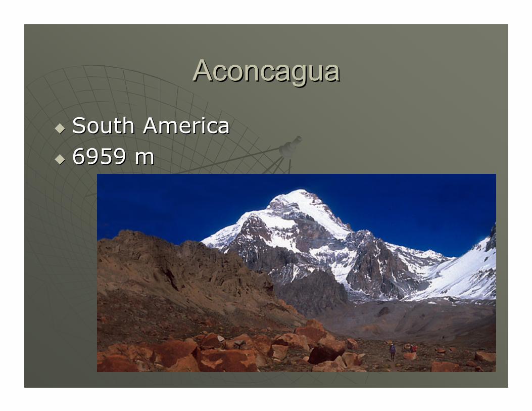
AconcaguaAconcagua
�� South AmericaSouth America
�� 6959 m6959 m

LatitudeLatitude
�� Lines of latitude are lines running Lines of latitude are lines running parallel to parallel to the equator. the equator.
Latitude and Longitude
�� LatitudeLatitude is the is the distance in distance in degrees north or degrees north or south of south of the equator. the equator.

LatitudeLatitude�� Latitude is thus measured from 0Latitude is thus measured from 0°° at the equator at the equator
to 90to 90°° at the poles.at the poles.
Latitude and Longitude
�� Locations north of the Locations north of the equator are referred to equator are referred to by degrees north by degrees north latitude (N). latitude (N).
�� Locations south of the Locations south of the equator are referred to equator are referred to by degrees south by degrees south latitude (S). latitude (S).
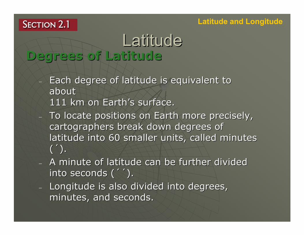
LatitudeLatitudeDegrees of LatitudeDegrees of Latitude
Latitude and Longitude
–– Each degree of latitude is equivalent to Each degree of latitude is equivalent to about about 111 km on Earth111 km on Earth’’s surface. s surface.
–– To locate positions on Earth more precisely, To locate positions on Earth more precisely, cartographers break down degrees of cartographers break down degrees of latitude into 60 smaller units, called minutes latitude into 60 smaller units, called minutes ((´́). ).
–– A minute of latitude can be further divided A minute of latitude can be further divided into seconds (into seconds (´´´´).).
–– Longitude is also divided into degrees, Longitude is also divided into degrees, minutes, and seconds.minutes, and seconds.

Mount McKinley Mount McKinley
�� North AmericaNorth America
�� 6194 m6194 m

LongitudeLongitude�� To locate positions in east and west To locate positions in east and west directions, cartographers use lines of directions, cartographers use lines of longitude, also known as meridians. longitude, also known as meridians.
Latitude and Longitude
�� LongitudeLongitude is the is the distance in distance in degrees east or west degrees east or west
of the of the prime meridian.prime meridian.

Prime MeridianPrime Meridian
�� The The prime meridian,prime meridian, representing representing 00°° longitude, is the reference point longitude, is the reference point for longitude. for longitude.
http://www.nmm.ac.uk/explore/astronomy-and-time/astronomy-facts/history/the-prime-meridian-at-greenwich

Mount Kilimanjaro Mount Kilimanjaro
�� AfricaAfrica
�� 5963 m5963 m

LongitudeLongitude
�� Points west of the prime meridian Points west of the prime meridian are numbered from 0are numbered from 0°° to 180to 180°° west west longitude (W).longitude (W).
Latitude and Longitude
�� Points east of the Points east of the prime meridian are prime meridian are numbered from 0numbered from 0°°to 180to 180°° east east longitude (E).longitude (E).

LongitudeLongitudeSemicirclesSemicircles
Latitude and Longitude
–– Lines of longitude are not parallel; they are large Lines of longitude are not parallel; they are large semicircles that extend vertically from pole to semicircles that extend vertically from pole to pole.pole.
–– The distances covered by The distances covered by degrees of longitude vary degrees of longitude vary with location. with location.
–– One degree of longitude One degree of longitude varies from about 111 km varies from about 111 km at the equator to essentially at the equator to essentially the distance covered by a the distance covered by a
point at the poles.point at the poles.
Degrees of LongitudeDegrees of Longitude
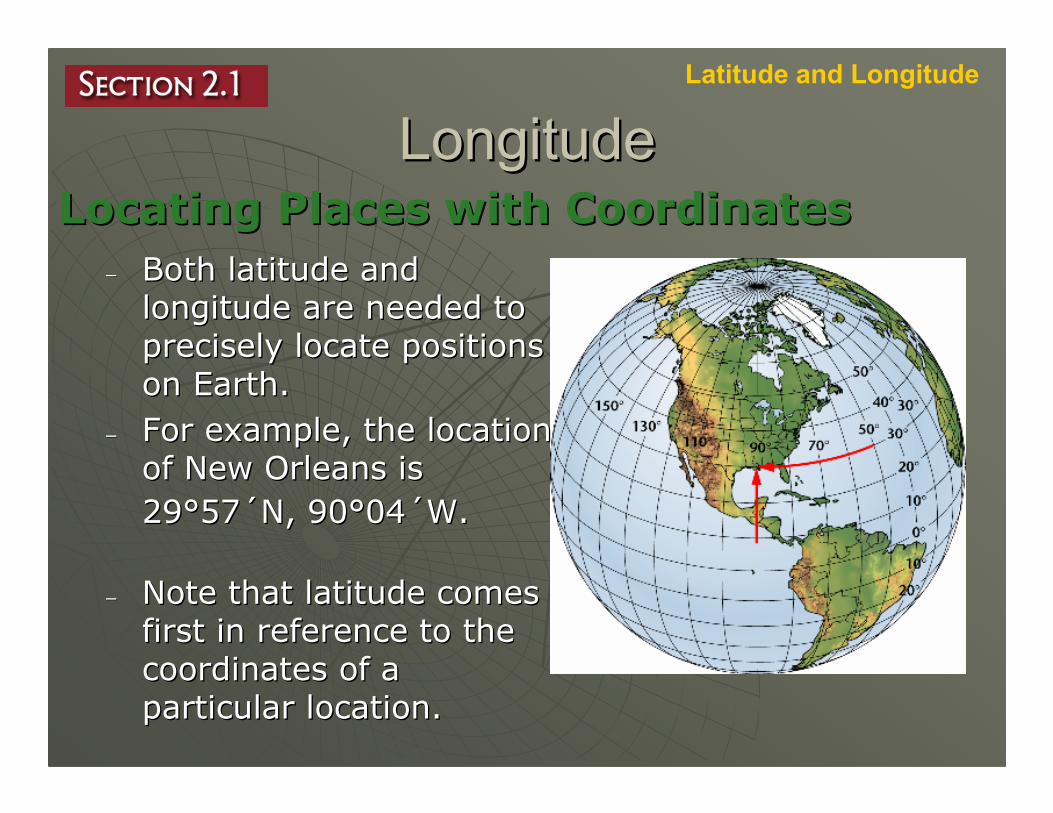
LongitudeLongitudeLocating Places with CoordinatesLocating Places with Coordinates
Latitude and Longitude
–– Both latitude and Both latitude and longitude are needed to longitude are needed to precisely locate positions precisely locate positions on Earth.on Earth.
–– For example, the location For example, the location of New Orleans is of New Orleans is
2929°°5757´́N, 90N, 90°°0404´́W.W.
–– Note that latitude comes Note that latitude comes first in reference to the first in reference to the coordinates of a coordinates of a particular location.particular location.

Mount Mount ElbrusElbrus
�� EuropeEurope
�� 5633 m5633 m

Time ZonesTime Zones�� Because Earth takes about 24 hours to Because Earth takes about 24 hours to rotate once on its axis, it is divided into 24 rotate once on its axis, it is divided into 24 times zones, each representing a different times zones, each representing a different
hour.hour.
Latitude and Longitude

Time ZonesTime Zones
�� Each time zone is 15Each time zone is 15°° wide, wide, corresponding roughly to lines of corresponding roughly to lines of longitude. longitude.
Latitude and Longitude
�� Time zone boundaries have been Time zone boundaries have been adjusted in local areas for adjusted in local areas for convenience. convenience.

Time ZonesTime Zones
�� There are There are six six different different time zones time zones in the in the United United States. States.
Latitude and Longitude

PuncakPuncak JayaJaya
�� OceaniaOceania
�� 4884 m4884 m

Time ZonesTime ZonesCalendar DatesCalendar Dates
Latitude and Longitude
–– Every time zone experiences this Every time zone experiences this transition from one day to the next, with transition from one day to the next, with the calendar advancing to the next day the calendar advancing to the next day at midnight. at midnight.
–– Each time you travel through a time Each time you travel through a time zone, you gain or lose time, eventually zone, you gain or lose time, eventually gaining or losing an entire day. gaining or losing an entire day.
–– The The International Date LineInternational Date Line, or 180, or 180°°meridian, serves as the transition line for meridian, serves as the transition line for calendar days. calendar days.

Time ZonesTime Zones
–– Traveling west across the International Traveling west across the International Date Line, you would advance your Date Line, you would advance your calendar one day. calendar one day.
–– Traveling east, you would move your Traveling east, you would move your calendar back one day.calendar back one day.

Vinson Massif Vinson Massif
�� AntarcticaAntarctica
�� 4897 m4897 m


