13
Map Skills Basics
| Date post: | 26-Dec-2015 |
| Category: |
Documents |
| Upload: | sheryl-moody |
| View: | 219 times |
| Download: | 0 times |

Map Skills Basics

Why we use maps
• Maps help us locate places all over the world.
• Maps are preferred to globes because:– Maps show more detail– Maps are easier to use– Maps are more accurate
Continents
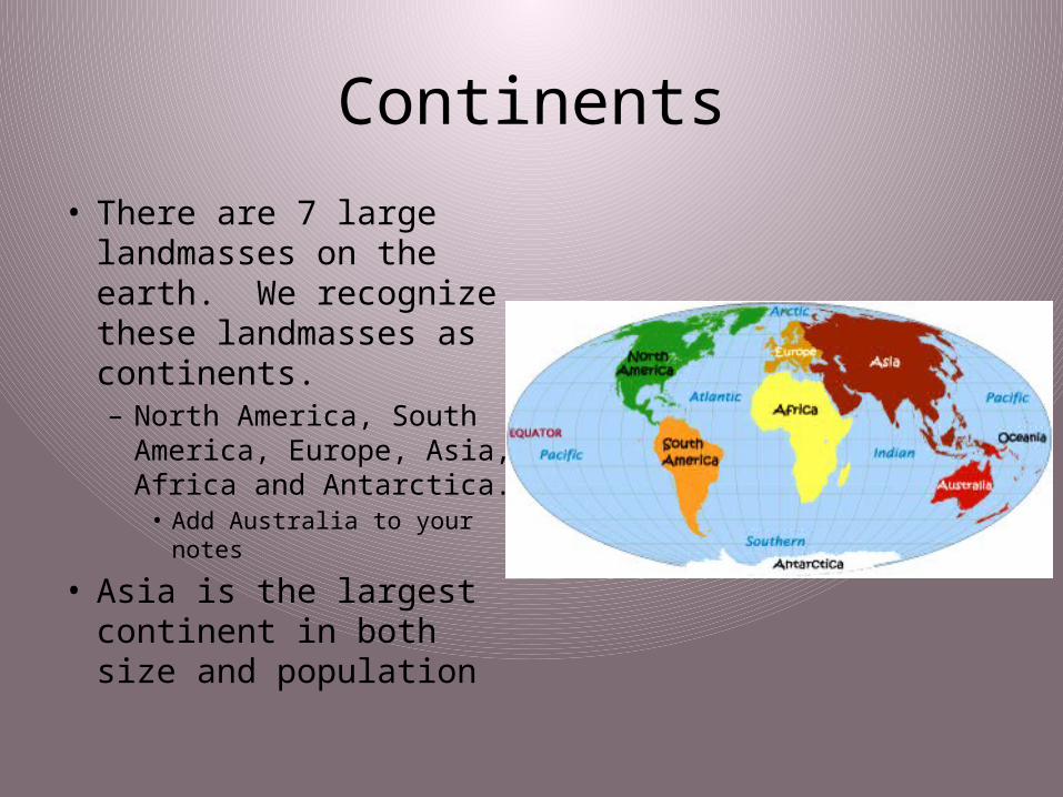
• There are 7 large landmasses on the earth. We recognize these landmasses as continents. – North America, South
America, Europe, Asia, Africa and Antarctica.• Add Australia to your notes
• Asia is the largest continent in both size and population

Oceans
• The Earth has 1 major ocean that we divide into 4. – Pacific Ocean, Atlantic
Ocean, Indian Ocean and Arctic Ocean
• The question of the 5th ocean? – Southern Ocean
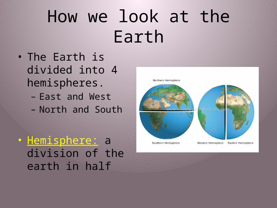
How we look at the Earth
• The Earth is divided into 4 hemispheres.– East and West– North and South
• Hemisphere: a division of the earth in half

Latitude
• Latitude or parallels: east and west circles around the globe
• Equator: 0 degrees latitude~ cuts the earth into Northern and Southern hemispheres

Longitude
• Longitude or meridians: north and south circles around the globe.
• Prime Meridian: 0 degrees longitude- cuts the Earth into Eastern and Western Hemispheres. – Runs through Greenwich,
England.
• Longitude lines meet at the North and South Poles.

BrainPop
• http://www.brainpop.com/socialstudies/geography/latitudeandlongitude/
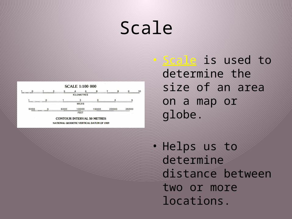
Scale
• Scale is used to determine the size of an area on a map or globe.
• Helps us to determine distance between two or more locations.
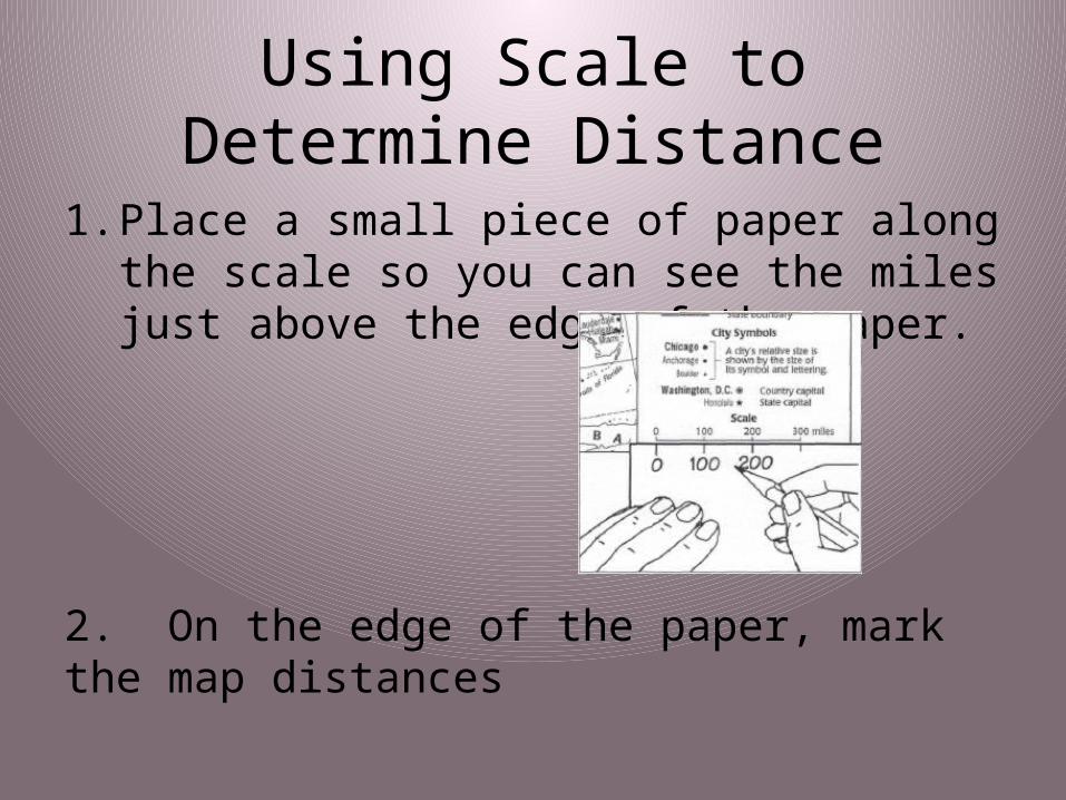
Using Scale to Determine Distance
1. Place a small piece of paper along the scale so you can see the miles just above the edge of the paper.
2. On the edge of the paper, mark the map distances
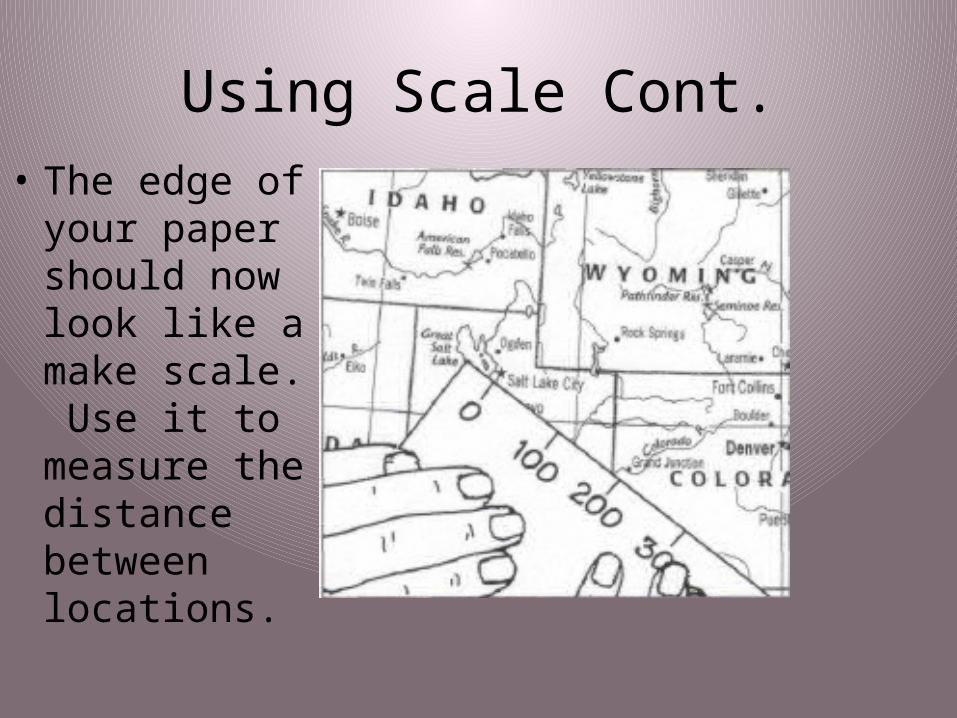
Using Scale Cont.• The edge of
your paper should now look like a make scale. Use it to measure the distance between locations.
Compass Rose
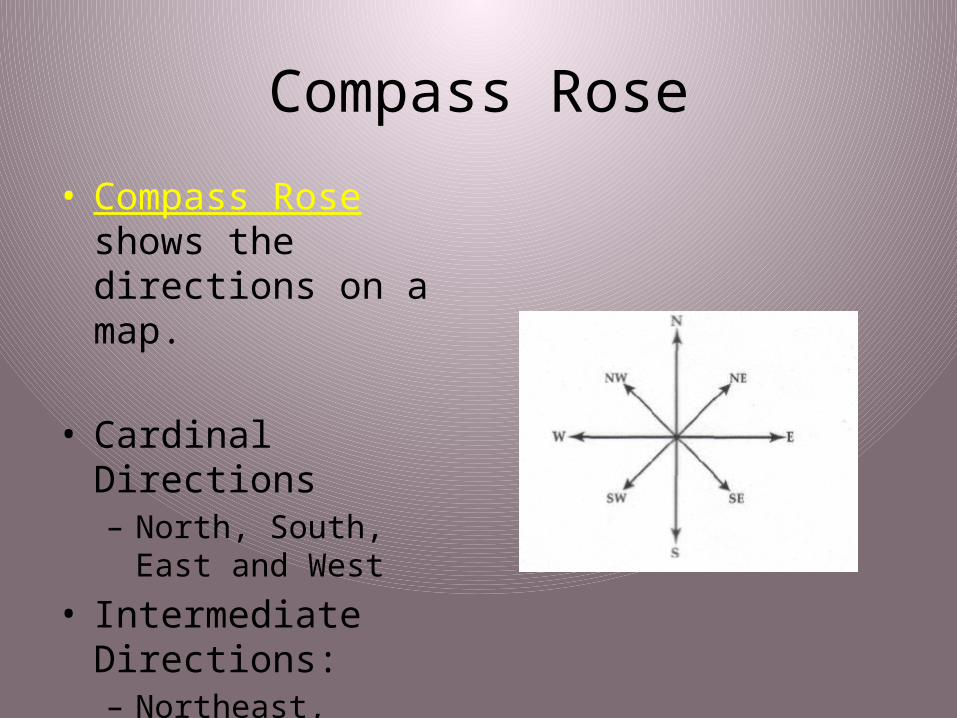
• Compass Rose shows the directions on a map.
• Cardinal Directions– North, South, East and
West
• Intermediate Directions:– Northeast, Southeast,
Southwest and Northwest

Key or Legend
• A map key (also known as a legend) tells what the symbols on a map represent.
• Every map key may be different.


