33
MapInfo Product Update MapInfo Product Update 22nd May, 2002 22nd May, 2002 Simon Armstrong EMEA Desktop Product Manager
| Date post: | 14-Dec-2015 |
| Category: |
Documents |
| Upload: | luis-claggett |
| View: | 217 times |
| Download: | 1 times |

MapInfo Product UpdateMapInfo Product Update
22nd May, 200222nd May, 2002
Simon ArmstrongEMEA Desktop Product Manager

Agenda• MapInfo Discovery • MapInfo Professional v7• MapInfo Professional for SQL Server• MapX 5
MapInfo Discovery- What is it?
• Allows MapInfo Professional Users to publish workspaces– to a web server which are distributed via the Internet or Intranet
– which End users access via a web browser
• End user product not a developer tool like MapXtreme
• Functionality cannot be changed
• Two Components– Publisher Tool added to MapInfo Professional V6.5 or higher
– Server side Component, which creates a catalog to view/select maps and administrate them

+MapInfo
Discovery
Internet or Intranet
MapInfo Professional v7
Web Server

MapInfo Discovery- What is it?
From a menu in MapInfo Professional,data is Published to a web server
MapInfo Discovery- Server Setup
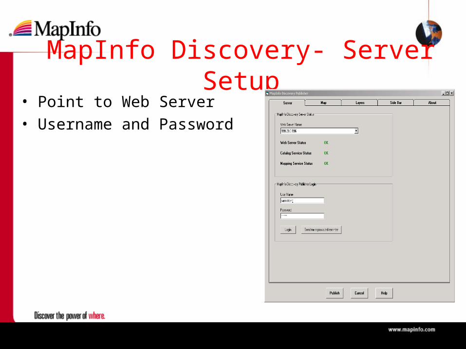
• Point to Web Server• Username and Password

MapInfo Discovery- Publishing Data
• Map Name• Map Description• Thumbnail• Category• Security Options
MapInfo Discovery- Publishing Data
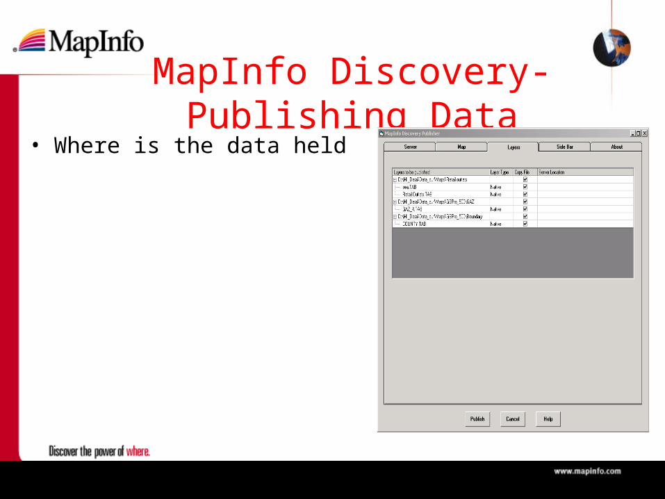
• Where is the data held

MapInfo Discovery- Publishing Data
• Where is the data held• Or specify a different
directory

MapInfo Discovery- Publishing Data
• Web Page• HTML Text
MapInfo Discovery- What is it?
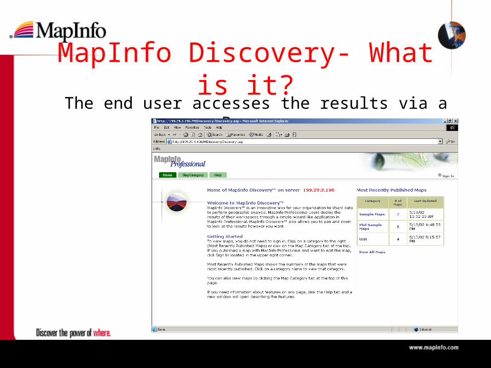
The end user accesses the results via a Browser
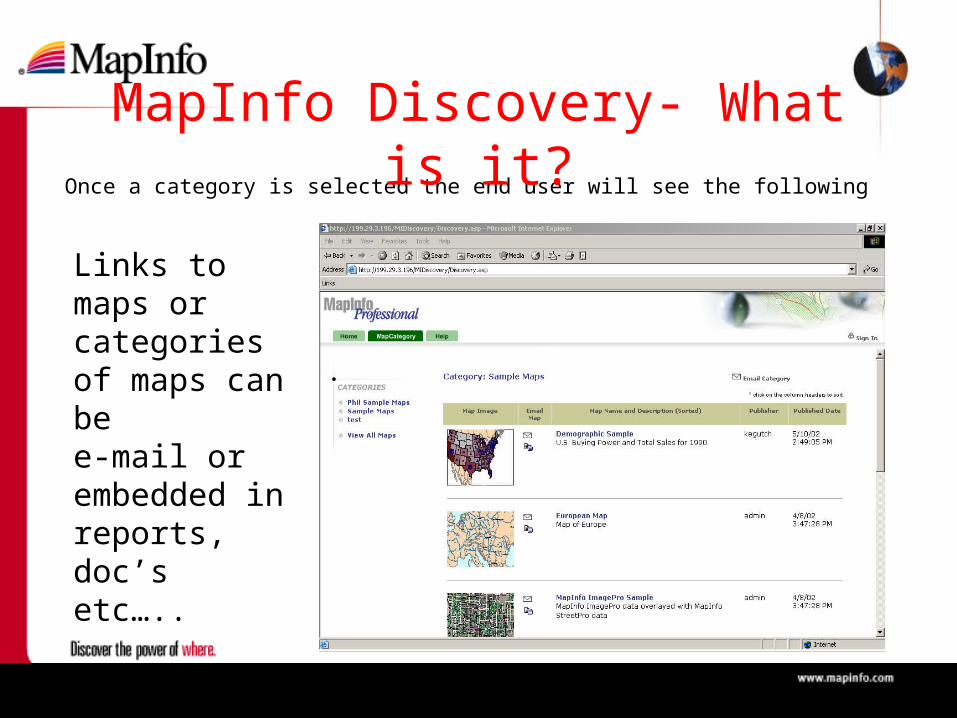
Once a category is selected the end user will see the following
MapInfo Discovery- What is it?
Links to maps or categories of maps can bee-mail or embedded in reports, doc’s etc…..

MapInfo Discovery- What is it?
the user selects the map of interest:•pan•Zoom •Info tool•Layer Control•Distance Tool•Thematic

Features and Benefits• Integrated with MapInfo Professional.
• Minimal learning curve – low cost of adoption
• Intuitive user interface.• Can be used without training and make enterprise
adoption simple and rapid.
• Simple…….but POWERFUL• Decision makers not familiar with mapping tools can
now access information from a URL – no need for downloads, special software, plug-ins or have specialist knowledge.

Features and Benefits (continued)
• Links to related documentation.• You use more than just maps to make decisions.
Discovery allows the integration of maps and supporting documents such as spreadsheets, business briefings, business presentations, links to other web sites.
• Email links to colleagues.• Distributing information is as simple as clicking and
sending an email – anyone on the network can view and use maps.
What you will require• Discovery Catalog System Requirements
– Windows NT with Service Pack 6, Windows 2000, or Windows XP
– The ability to move files to the server using FTP server
– Internet Information Server (IIS) 4 or higher Web server software
– Internet Explorer 5.5 or higher or Netscape 6.0 or higher
– 400 mhz processor, 256 megabytes of RAM

Questions?

Operating System Support• Microsoft Windows XP Microsoft Windows XP
Professional*Professional*• Microsoft Windows XP Microsoft Windows XP
Home*Home*• Microsoft Windows 2000*Microsoft Windows 2000*• Microsoft Windows NT 4.0Microsoft Windows NT 4.0• Microsoft Windows 98Microsoft Windows 98
(*) – MapInfo Professional will be Logo Certified

Access Data…
•Database Connectivity – Oracle (8.16, 8.17 and 9Oracle (8.16, 8.17 and 9ii))– IBM Informix Dynamic Server IBM Informix Dynamic Server
9.219.21– MS SQL Server (7 and 2000)MS SQL Server (7 and 2000)– MS Access 2000MS Access 2000– SpatialWare 4.5 support for SpatialWare 4.5 support for
Informix and MS SQL Server Informix and MS SQL Server 20002000

Access More Data…
– Direct Read of Shape Files– Import OS Mastermap
Independent Polygons (GML)– JPEG 2000 Support – Built in support for: MrSid,
ECW, ADRG, CADRG, CIB, ASRP and NITF raster formats
– Auto detect Projections of Shape files with the updated Universal Translator
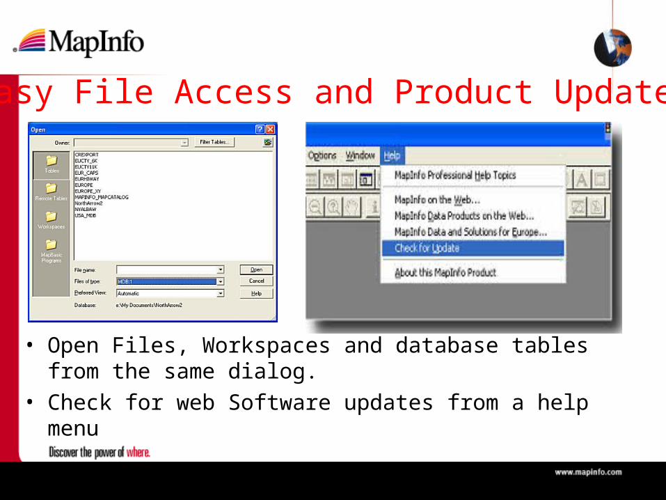
• Open Files, Workspaces and database tables from the same dialog.
• Check for web Software updates from a help menu
Easy File Access and Product Updates

Analyse / Process• Split by Line/PolylineSplit by Line/Polyline
• Voronoi PolygonsVoronoi Polygons
• Rotate Graphical Rotate Graphical
ObjectsObjects
• Move Objects Using Move Objects Using
Arrow KeysArrow Keys
• Undo node Undo node

New and Enhanced tools• New North Arrow New North Arrow
ToolTool• Enhanced Enhanced
Coordinate Coordinate Extractor Extractor
• Enhanced EZ-Enhanced EZ-Loader for loading Loader for loading data in Databasesdata in Databases

Improved Usability• New
– Preferences: Default Projection, Styles and Auto-Scroll
• Improved – File New Table– Combine Tables Using
Column Dialog. Store results in new table
– Labeling Label Partial Objects

Publish
• Updated Crystal Reports - Version Updated Crystal Reports - Version
8.5 8.5
• Discovery Publisher ToolDiscovery Publisher Tool
• Support for MapX MobileSupport for MapX Mobile
• Export Window to User Defined Export Window to User Defined ResolutionResolution
• Enhanced Printing OptionsEnhanced Printing Options

Questions?
MI Pro For SQL Server• Departmental Solution
• Customer who want to share spatial data not just point data
• Centralised Spatial Store
• Leverages SQL Server capabilities– Data security– Multi user editing– Scalability– Processing power

MapX v5.0-New Features• Label Enhancements - Individual labels
are now selectable and editable. • Label Partial Object• VB.Net Sample applications • Dynamic Selection for Radius and
Polygon Selection Tool • Snap to Node

• Translucent Raster Images• Label Thematics • Multi-point and Collection objects support• Improved Object Processing
– combine, erase, erase outside, convex hull, enclose,
• Improved Performance– connecting to remote RDBMS' including
SpatialWare and Oracle Spatial
• Pack Table
MapX v5.0-New Features

Pricing• MapInfo Professional v7.0
– MapInfo Professional €1,795– Annual Maintenance €359– MI Pro Upgrade 6.5 to 7.0 €539
• MapInfo Professional v7.0 Add-On– MapInfo Professional for SQL Server €630
• MapInfo Discovery v1.0– MapInfo Discovery €5,900
• MapX 5.0– MapX SDK €1,482– MapX per User min 10 €147

Next Steps• Beta
– MapInfo Professional www.mapinfo.com/mipro_beta
• Readme.pdf
– MapInfo Professional for SQL Server– MapX www.mapinfo.com/mapx50beta– MapInfo Discovery (Private Beta)
• Launch Dates• EMEA Conference, Cannes, 5th-7th June

Questions?

Thank You


