View Near Angel's Rest HIKING EQUIPMENT Firms listed below for information only: Back Country Ski and Sports, 3710 S. Main St., Blacksburg. Blue Ridge Outdoors, 211 Draper Rd., Blacksburg, and Tangle- wood Mall, Roanoke. Eastern Mountain Sports, Inc., One Vose Farm Road, Peterbo- rough, New Hampshire 03458. Catolog for mail order can be obtained for $1. Recreation Equipment, Inc. 1525-11th Avenue, Seattle, Washing- ton 98122. A co-operative store which offers membership to all persons upon written application and payment of a $5 fee. Members receive dividends on purchases and catalogs for mail order. University Union and Student Activities, Outdoor equipment rental. located at South recreation area on VA Tech campus. Call 231-4982 for info. HI,KES NEAR VIRGINIA TECH Virginia Tech lies in the midst of a mountain system which offers a variety of hikes within a one hour drive of campus. This mountain system, called the Appalachian Mountains, extends from eastern Canada to Alabama. Included in the Appalachians are the Allegheny Mountains to the west of Blacksburg and the Blue Ridge Mountains to the east. "Many beautiful forests, cascading streams and broad vistas await those with a few hours of time to seek them out. The Appalachian Trail, which begins in Maine and follows the Appalachians to Georgia, passes within ten miles of campus. The purpose of this folder is to describe hikes near campus and provide information which will assist in the enjoyment of our outdoors areas. There is no best season for hiking in Virginia since each season has its unique advantage. In the spring the hills become alive with wildflowers and migrating birds. The summer hiker experiences the forests in their full splendor. Fall colors, beginning in October, create scenes which change each week as the season progresses. And in winter, views from mountain tops are expanded by the disappearance of foliage. With proper preparation, a hike can be very enjoyable. As a first step, select a sturdy pair of comfortable shoes or boots with non-slip soles which will offer adequate ankle and foot protection against mud and rocks. In the cooler parts of the year an extra sweater or jacket is recommended. Dehydration is one of the most common and least recognized sources of discomfort in the mountains. Streams away from inhabited areas are usually safe for drinking, however, the purity of any unsupervised water source cannot be guaranteed; to avoid uncertainty, carry a canteen of water from an approved public source. litter on trails can ruin the enjoyment of our natural areas. Each hiker should be considerate of those that follow by carrying out leftover food, wrappers and so forth. It is a good habit to carry out more carried in so as to reduce the litter in our outdoor areas. Pandapas Pond In winter MAPS AND HIKING INFORMATION From the Outing Club of Virginia Tech, P.O. Box 538, Blacksburg, VA 24060 or Appalachian Trail Conference. "Trails in Southwest Virginia, James River to New River," $4.95 reduced topographic maps and trail descriptions. From the US Forest Service, Blacksburg Ranger District, on US 460, 1 mile north of Blacksburg. Map of the jefferson National Forest, about $2. Map of the Blacksburg Ranger District, about $2. From the Virginia Division of Mineral Resources, Box 3667, Charlottesville, VA 22903. Topographic maps, $2.65 each. An index of the maps and a description of topographic maps is free. The Tech library has a collection of these maps. They can also be purchased at Blue Ridge Outdoors. From the Appalachian Trail Conference, P.O. Box 236 Harpers Ferry, W. VA. 25425. Phone (703) 544-7388. "Guide to the Appalachian Trail in Southwest Virsinia." A detailed description of the Trail near Blacksburg. About $12. From the Virginia Department of Transportation, Christiansburg Residency Office, Cambria Street (behind WVVV near US 460) Free Map of Giles, Pulaski and Montgomery Counties giving good detail of secondary roads. From Recreation equipment (address under hiking equipment) or local bookstore Backpacking, One Step at a Time," by Harvey Manning. Describes hiking equipment. Available in paperback. From the Montgomery County Planning Department, P.O. Box 806 Christiansburg, 24073 Topographic Map of Montgomery County, about $3 including postage. Information in this guide has been compiled by the Outing Club of Virginia Tech and published with funds provided by the Student Budget Board. The map was drawn by Mr. Edward Henson under the direction of Prof. Alan M. MacEachren of the Geography Department of Virginia Tech. We hope that the information will prove useful. Comments regarding new trails or other suggestions will be appreciated. David jenkins Outing Club of Virginia Tech March,1991 THE JEFFERSON NATIONAL FOREST Most of the trails in this guide are within the jefferson National Forest which covers 575,000 acres in southwest Virginia. Except where posted, camping is allowed anywhere within the Forest. A fee is charged at some developed recreation areas and these are marked with signs. The Forest is open for hunting and fishing under state regulations. Some of the game species to be found are deer, black bear, turkey, ruffed grouse and fox squirrels while native brook trout are found in the high headwaters, and stream- raised brown and rainbow trout are at lower elevations. larger streams are stocked throughout the season. THE APPALACHIAN TRAIL The Appalachian Trail is a continuous, marked footpath which passes thru the mountains of the eastern Atlantic States. It extends along the crest of the ranges generally referred to as the Appalachians; hence the name of the Trail. The trail begins in the north at Mount Katahdin, in the central Maine wilderness, and reaches south more than 2,000 miles to Springer Mountain in northern Georgia. Eventually the trail will be located, as far as possible, within the National Park and National Forests Systems. A track of land extending on both sides of the Trail will be created in which there will be no roads or other development incompat- ible with the existence of the Trail. Sections of the trail are being relocated as new land is acquired to meet this goal. The Appalachian Trail traverses fourteen states of which Virginia has the longest section with about 500 miles, approxi- mately one-fourth of the total trail mileage. A system of simple shelters is provided along the Trail. It is marked by white paint blazes and side trails are marked by blue paint blazes. Two superimposed blazes, one above the other, constitute a warning sign of a change in the Trail route. Trail markers should appear at least every quarter mile along the Trail, however these marks can be obliterated by local usage and lumbering operations. A guide (see hiking information) can be purchased which gives an exact description of the trail. The Trail can be reached by taking a Trailways Bus to Pearisburg, the point where the Trail crosses US 460. The cost is about $6. Since the bus drivers will stop at passengers request, the bus can be used for transportation to other starting pOints for hikes. EASTERN WILDERNESS The Wilderness Act, passed by Congress in 1964, establishes a National Wilderness Preservation System. The purpose of the act is to set aside land in which the evidence of the past activities of man are "substantially unnoticeable." In these areas nature will be dominant and man will come only as a visitor so that the processes of nature can continue without interference by man. The act recognizes man's need for wilderness, ranging from scientific study to conservation of all forms of life, soil and water and to refreshment of the human mind, body and spirit. Wilderness assures a genetic reserve of plant and animal species which elsewhere we are altering or destroying in a wholesale way. HIKING ADVENTURES AROUND VIRGINIA TECH COMPILED BY OUTING CLUB OF VIRGINIA TECH Two areas near Virginia Tech have been designated as wilderness. The Appalachian Trail passes through both of them. The Mountain lake Wilderness, 8200 acres in size, can be seen by following the directions to the Mountain lake Scenic Areas as given in the description of trails on the reverse side of this brochure. The Peters Mountain Wilderness is 3300 acres in size and can be visited by following the directions for the Peters Mountain Trail. Camping, hunting and fishing are allowed in wilderness areas. However, to minimize man's impact on these areas, roads and off- road vehicles are not allowed. Outing Club members worklng on relocation of Appalachian Trail ORGANIZATIONS The Outing Club of Virginia Tech is organized to promote the enjoyment of wilderness activities. It is a member of the Appalachian Trail Conference and has the responsibility of maintaining a section of trail near Blacksburg. Meetings on Thursdays at 7:30 p.m. in Robeson Hall on the Virginia Tech campus offer programs about the outdoors and an opportunity to exchange information and organize trips. Call 231-6712 or write P.O. Box 538, Blacksburg 24060. The New River Group of the Sierra Club is part of the national organization which seeks to protect and conserve our natural resources. Membership includes a subscription to the Sierra Club Bulletin and a local newsletter. The club meets on the third Monday of each month at 7:30 p.m. in the Blacksburg library. Call 552-4897 for further information. The YMCA conducts afternoon hikes every Sunday. They meet at 1:30 p.m. in the parking lot in front of the Donaldson Brown Center of Continuing Education at College and Otey Streets. Call 231-6448 for a hike schedule.
Transcript
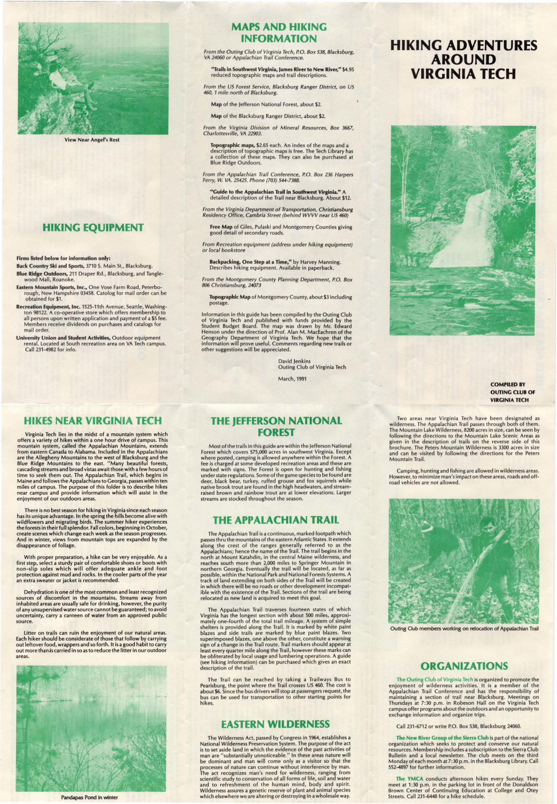
View Near Angel's Rest
HIKING EQUIPMENT
Firms listed below for information only:
Back Country Ski and Sports, 3710 S. Main St., Blacksburg.
Blue Ridge Outdoors, 211 Draper Rd., Blacksburg, and Tangle-wood Mall, Roanoke.
Eastern Mountain Sports, Inc., One Vose Farm Road, Peterborough, New Hampshire 03458. Catolog for mail order can beobtained for $1.
Recreation Equipment, Inc. 1525-11th Avenue, Seattle, Washington 98122. A co-operative store which offers membership toall persons upon written application and payment of a $5 fee.Members receive dividends on purchases and catalogs formail order.
University Union and Student Activities, Outdoor equipmentrental. located at South recreation area on VA Tech campus.Call 231-4982 for info.
HI,KES NEAR VIRGINIA TECHVirginia Tech lies in the midst of a mountain system which
offers a variety of hikes within a one hour drive of campus. Thismountain system, called the Appalachian Mountains, extendsfrom eastern Canada to Alabama. Included in the Appalachiansare the Allegheny Mountains to the west of Blacksburg and theBlue Ridge Mountains to the east. "Many beautiful forests,cascading streams and broad vistas await those with a few hours oftime to seek them out. The Appalachian Trail, which begins inMaine and follows the Appalachians to Georgia, passes within tenmiles of campus. The purpose of this folder is to describe hikesnear campus and provide information which will assist in theenjoyment of our outdoors areas.
There is no best season for hiking in Virginia since each seasonhas its unique advantage. In the spring the hills become alive withwildflowers and migrating birds. The summer hiker experiencesthe forests in their full splendor. Fall colors, beginning in October,create scenes which change each week as the season progresses.And in winter, views from mountain tops are expanded by thedisappearance of foliage.
With proper preparation, a hike can be very enjoyable. As afirst step, select a sturdy pair of comfortable shoes or boots withnon-slip soles which will offer adequate ankle and footprotection against mud and rocks. In the cooler parts of the yearan extra sweater or jacket is recommended.
Dehydration is one of the most common and least recognizedsources of discomfort in the mountains. Streams away frominhabited areas are usually safe for drinking, however, the purityof any unsupervised water source cannot be guaranteed; to avoiduncertainty, carry a canteen of water from an approved publicsource.
litter on trails can ruin the enjoyment of our natural areas.Each hiker should be considerate of those that follow by carryingout leftover food, wrappers and so forth. It is a good habit to carryout more than~scarried in so as to reduce the litter in our outdoorareas.
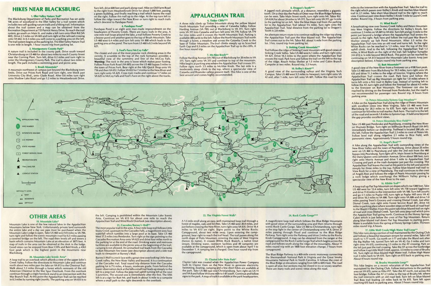
Pandapas Pond In winter
MAPS AND HIKINGINFORMATION
From the Outing Club of Virginia Tech, P.O. Box 538, Blacksburg,VA 24060 or Appalachian Trail Conference.
"Trails in Southwest Virginia, James River to New River," $4.95reduced topographic maps and trail descriptions.
From the US Forest Service, Blacksburg Ranger District, on US460, 1 mile north of Blacksburg.
Map of the jefferson National Forest, about $2.
Map of the Blacksburg Ranger District, about $2.
From the Virginia Division of Mineral Resources, Box 3667,Charlottesville, VA 22903.
Topographic maps, $2.65 each. An index of the maps and adescription of topographic maps is free. The Tech library hasa collection of these maps. They can also be purchased atBlue Ridge Outdoors.
From the Appalachian Trail Conference, P.O. Box 236 HarpersFerry, W. VA. 25425. Phone (703) 544-7388.
"Guide to the Appalachian Trail in Southwest Virsinia." Adetailed description of the Trail near Blacksburg. About $12.
From the Virginia Department of Transportation, ChristiansburgResidency Office, Cambria Street (behind WVVV near US 460)
Free Map of Giles, Pulaski and Montgomery Counties givinggood detail of secondary roads.
From Recreation equipment (address under hiking equipment)or local bookstore
Backpacking, One Step at a Time," by Harvey Manning.Describes hiking equipment. Available in paperback.
From the Montgomery County Planning Department, P.O. Box806 Christiansburg, 24073
Topographic Map of Montgomery County, about $3 includingpostage.
Information in this guide has been compiled by the Outing Clubof Virginia Tech and published with funds provided by theStudent Budget Board. The map was drawn by Mr. EdwardHenson under the direction of Prof. Alan M. MacEachren of theGeography Department of Virginia Tech. We hope that theinformation will prove useful. Comments regarding new trails orother suggestions will be appreciated.
David jenkinsOuting Club of Virginia Tech
March,1991
THE JEFFERSON NATIONALFOREST
Most of the trails in this guide are within the jefferson NationalForest which covers 575,000 acres in southwest Virginia. Exceptwhere posted, camping is allowed anywhere within the Forest. Afee is charged at some developed recreation areas and these aremarked with signs. The Forest is open for hunting and fishingunder state regulations. Some of the game species to be found aredeer, black bear, turkey, ruffed grouse and fox squirrels whilenative brook trout are found in the high headwaters, and streamraised brown and rainbow trout are at lower elevations. largerstreams are stocked throughout the season.
THE APPALACHIAN TRAILThe Appalachian Trail is a continuous, marked footpath which
passes thru the mountains of the eastern Atlantic States. It extendsalong the crest of the ranges generally referred to as theAppalachians; hence the name of the Trail. The trail begins in thenorth at Mount Katahdin, in the central Maine wilderness, andreaches south more than 2,000 miles to Springer Mountain innorthern Georgia. Eventually the trail will be located, as far aspossible, within the National Park and National Forests Systems. Atrack of land extending on both sides of the Trail will be createdin which there will be no roads or other development incompatible with the existence of the Trail. Sections of the trail are beingrelocated as new land is acquired to meet this goal.
The Appalachian Trail traverses fourteen states of whichVirginia has the longest section with about 500 miles, approximately one-fourth of the total trail mileage. A system of simpleshelters is provided along the Trail. It is marked by white paintblazes and side trails are marked by blue paint blazes. Twosuperimposed blazes, one above the other, constitute a warningsign of a change in the Trail route. Trail markers should appear atleast every quarter mile along the Trail, however these marks canbe obliterated by local usage and lumbering operations. A guide(see hiking information) can be purchased which gives an exactdescription of the trail.
The Trail can be reached by taking a Trailways Bus toPearisburg, the point where the Trail crosses US 460. The cost isabout $6. Since the bus drivers will stop at passengers request, thebus can be used for transportation to other starting pOints forhikes.
EASTERN WILDERNESSThe Wilderness Act, passed by Congress in 1964, establishes a
National Wilderness Preservation System. The purpose of the actis to set aside land in which the evidence of the past activities ofman are "substantially unnoticeable." In these areas nature willbe dominant and man will come only as a visitor so that theprocesses of nature can continue without interference by man.The act recognizes man's need for wilderness, ranging fromscientific study to conservation of all forms of life, soil and waterand to refreshment of the human mind, body and spirit.Wilderness assures a genetic reserve of plant and animal specieswhich elsewhere we are altering or destroying in a wholesale way.
HIKING ADVENTURESAROUND
VIRGINIA TECH
COMPILED BY
OUTING CLUB OF
VIRGINIA TECH
Two areas near Virginia Tech have been designated aswilderness. The Appalachian Trail passes through both of them.The Mountain lake Wilderness, 8200 acres in size, can be seen byfollowing the directions to the Mountain lake Scenic Areas asgiven in the description of trails on the reverse side of thisbrochure. The Peters Mountain Wilderness is 3300 acres in sizeand can be visited by following the directions for the PetersMountain Trail.
Camping, hunting and fishing are allowed in wilderness areas.However, to minimize man's impact on these areas, roads and offroad vehicles are not allowed.
Outing Club members worklng on relocation of Appalachian Trail
ORGANIZATIONSThe Outing Club of Virginia Tech is organized to promote the
enjoyment of wilderness activities. It is a member of theAppalachian Trail Conference and has the responsibility ofmaintaining a section of trail near Blacksburg. Meetings onThursdays at 7:30 p.m. in Robeson Hall on the Virginia Techcampus offer programs about the outdoors and an opportunity toexchange information and organize trips.
Call 231-6712 or write P.O. Box 538, Blacksburg 24060.
The New River Group of the Sierra Club is part of the nationalorganization which seeks to protect and conserve our naturalresources. Membership includes a subscription to the Sierra ClubBulletin and a local newsletter. The club meets on the thirdMonday of each month at 7:30 p.m. in the Blacksburg library. Call552-4897 for further information.
The YMCA conducts afternoon hikes every Sunday. Theymeet at 1:30 p.m. in the parking lot in front of the DonaldsonBrown Center of Continuing Education at College and OteyStreets. Call 231-6448 for a hike schedule.
HIKES NEAR BLACKSBURG1. Ellet Valley Nature Trail·
The Blacksburg Department of Parks and Recreation has set aside106 acres of woodland in the Ellet Valley for a trail system whichincludes two self-guiding nature trails and a hiking trail. Informationabout the trail system and a map can be obtained from theRecreation Department at 725 Patrick Henry Drive. To reach the trailsystem, go south on Main St. and make a left turn onto Ellett Rd (VA603). Drive 2.1 miles on VA 603 and turn right at the railroad crossingonto VA 642. In 0.3 miles you will come to a parking area on the left.The trail system begins at the parking lot. The Ellet Valley Nature Trailis one mile in length. 1 hour round trip from parking lot.
2. Montgomery County Park·A nature trail is included in the county park. Drive south towardChristiansburg on US 460 for about two miles to reach County Streetnear the Corning Plant. Turn left, drive 0.2 miles and turn right toenter the Montgomery County Park. The trail is about two miles inlength. The park includes a swimming pool and picnic area.
3. Brush Mountain·A mountain northwest of campus just beyond the Blacksburg townlimits. Drive out Prices Fork Road and turn right, one block pastUniversity City Blvd., onto Glade Road. After 0.6 miles turn rightonto Shadow lake Road and go 1.2 miles to Meadowbrook Drive.
" APPALACHIAN TRAIL
0 HIKE NUMBER
0) INTERSTATE HIGHWAY
[2] u.s. HIGHWAY
0 STATE HIGHWAY
OJ FOREST SERVICE, ROAD
A RECREATION SITE
• TRAIL SHELTER
• LOOKOUT STATION
miles
DlFFICULTV LEVEL
• EASY
•• MODERATE
••• DIFFICULT
OTHER AREAS19. Mountain Lake·
Mountain lake is one of the few natural lakes in the AppalachianMountains below New York. Unfortunately private land surroundsthe entire lake and a day use pass must be purchased when theMountain lake lodge is open. Take US 460 west 9.9 miles to VA 700,turn right and follow the scenic mountain road for 6.5 miles passinga covered bridge on the left. The road then levels off and enters abasin which contains Mountain lake at an elevation of 3875 feet. Amap of trails in the area can be obtained at the desk in th.e lodge.Good views can be enjoyed from Bear Cliffs and Bald Knob, a 4363foot peak which is the highest point in the mountains nearBlacksburg.
20. Mountain Lake Scenic Area·A loop trail to an overlook which affords a view of the upper John'sCreek Valley. Follow the directions to Mountain lake and continuenorth about two miles past the lake on VA 613 to the Chestnut Trail.Walk about 1.3 miles through a forest which remnants of the oldAmerican Chestnut to the War Spur Overlook. From the overlookcontinue through a virgin hemlock stand to an intersection with theWar Branch Trail. At this point the Appalachian Trail can be reachedin 0.3 miles by turning right (north). The parking area on VA 613 is to
Turn left, drive 600 feet and park along road. Hike on Old Farm Roadto the right from Meadowbrook Drive for about 1,000 feet, passinga green building, and finally reaching a trail which leaves the roadon the right. Follow this trail up to the ridge. At the top turn left tofollow the ridge toward the New River or turn right to reach trailswhich descend to Pandapas Pond.
4. Pandapas Pond·Pandapas Pond is an eight acre man-made impoundment on theheadwaters of Poverty Creek. There are many trails in the area. Aone mile trail loops around the lake, a trail follows Poverty Creek toa beaver pond and another goes to the top of Brush Mountain. TakeUS 460 west 6.4 miles and turn left onto VA 808 which leads to theparking area at the pond. The turn from US 460 is 0.3 mile beyond VA621.
5. Fool's face/McCoy Falls·The closest and one of the most popular rock climbing areas in thevicinity. A scramble to the top of the rock formation provides abeautiful view of the symmetry and line of the McCoy Falls.Warning: The rock in the area is loose which makes poor footing.Follow Prices Fork Road (VA 685) across the US 460 bypass 5 miles tothe town of Prices Fork. Bear right at the A&J Quick Shop onto VA736 and then VA 652. Follow VA 652 for 7.4 miles to the New River andturn right onto VA 625. Cross train tracks and continue 1.7 miles onVA 625 to McCoy Falls and Fool's Face on the right above the tracks.
·the left. Camping is prohibited within the Mountain lake ScenicArea. Continue on VA 613 for about one mile to reach theAppalachian Trail and Wind Rock Overlook (see description above).
21. Cascades/Barney's Wall··The most popular trail in the area. A four mile loop trail follows littleStony Creek upstream to the Cascades Falls, a magnificent sixty footwaterfall which tumbles into a large pool at its base. Take US 460West 17.5 miles into Pembroke. Turn right at the sign pointing to theCascades Recreation Area onto VA 623 and drive four miles north tothe parking lot at the end of the road. Drinking water and restroomfacilities are available in the picnic area at the beginning of the trail;camping is not allowed. An unmarked trail leads from the Cascadesto Butt Mountain fire tower (see description above) and a side trailleads to viewpoint at Barney's Wall.
Barney's Wall is a rock face with a great view overlooking little StonyCreek valley, the New River Valley and beyond. It is a continuationof the Cascades trail. Total round trip distance from the Cascadesparking lot is 7~ miles, 4 hours, moderate grade. From behind thelower observation deck at the falls a small trail leads up steeply to theleft to a jeep trail. Follow the jeep trail uphill turning left at the next5 junctions. The second one is immediately after the first. The fifthleft is at a sign for Butt Mt. and leads in about ~ mile to a campsitewhere a small path to the right descends to the overlook.
APPALACHIAN TRAIL6. Tinker Cliffs···
A three mile climb up Tinker Mountain along the yellow blazedNorth Mountain Trail providing a view of Catawba Valley. FollowHarding Avenue (VA 785) out of Blacksburg to VA 311. Turn rightonto VA 311 into Catawba and turn left onto VA 779. Follow VA 779for nine miles until it crosses the North Mountain Trail. Parking isavailable 300 yards to the left. Follow the North Mountain Trail norththrough a forest, a meadow a d across the Catawba Creek to thebase of Tinker Mountain. The rail climbs steeply up to ScorchedEarth Gap and 0.3 miles on the Appalachian Trail up to the cliffs. Afive hour round trip.
7. McAfee Knob··Follow Harding Avenue (VA 785) out of Blacksburg for 20 miles to VA311. Turn right onto VA 311 and continue to top of the mountain.Hike begins at parking area where the Appalachian Trail crosses 311.Follow signs north 3.5 miles to McAfee Knob. The last mile is amoderately steep climb to the top, where a spectacular view ofCatawba and Roanoke valleys present itself. This hike is one of thebest around and comes highly recommended.
22. The Virginia Forest Walk·
A 1.5 mile stroll along an easy, well-maintained loop trail through aforest of maples, oaks and birches. Take US 460 west 20.8 miles, andjust before crossing the New River, turn right onto VA 635. Drive 16.4miles to VA 613 on right. Signs point to the White RocksCampground, about two miles away. Upon entering the campground, bear right to reach the trail head. The trail passes along thenorth slope of Potts Mountain, entering the state of West Virginia(hence its name). It crosses White Rock Branch, a native troutstream. Drinking water, restroom facilities and 49 campsites areavailable at the campground, which is open from about April 1 toDecember 1. A camping fee is charged. One hour round trip fromthe campground.
23. Claytor Lake State Park·Claytor lake was created when the Appalachian Power Companybuilt its Claytor Dam on the New River to generate electricity.Swimming, boating, camping and a few short hikes are available atthe park. Take US 460 east into Christiansburg. Turn right on US 11and VA 8 and follow VA 80ne mile to 1-81 south. Continue and followsigns to the park. A map of trails is available at the park headquarters.
8. Dragon's Tooth···A jagged rock pinnacle which, at a distance, resembles a gigantictooth. On a clear day the Peaks of Otter near the Blue Ridge Parkwaycan be seen. Take Main Street north, turn right onto Mt. Tabor Rd.(VA 624) for about 24 miles to VA 311. Turn left onto VA 311, go 14 mileto the parking lot on left. Take the blue blaze trail from the parkinglot to the Appalachian Trail (about 114 mile). Turn right onto theAppalachian Trail. Total distance from the parking lot to Dragon'sTooth is 2.8 miles.
An alternate return route is to continue walking the ridge top alongthe Appalachian Trail past the blue blazed trail. The AppalachianTrail comes out to the Mt. Tabor Rd. about ~ mile from the parkinglot. 3 hrs. round trip from parking lot.
9. Sinking Creek Mountain··Trail follows the ridge of Sinking Creek Mountain with good views ofSinking Creek Valley. Take US 460 west 6.1 miles and turn right ontoVA 621. Drive 14.3 miles to the point where the Appalachian Trailcrosses the road. Park here and follow the trail on the left to the topof the ridge. Reach Niday Shelter at 1.5 miles and Cabin BranchCampsite at two miles. Round trip, 3.5 hours.
10. Kelley's Knob··A good view of the surrounding valleys and the Virginia TechCampus. Take US 460 west 9.5 miles to Newport, turn right onto VA42 and, after 1 mile, turn left onto VA 601. Follow this road for 6.8
24. Rock Castle Gorge···
A magnificient loop trail which follows the Blue Ridge Mountainswith good views of the surrounding area and then returns throughscenic Rock Castle Gorge. Take US 460 to Christiansburg, turn rightat the stop light in the center of Christiansburg onto VA 8. Drive 27miles passing through Floyd and continue to the Blue RidgeParkway. Turn right onto the Parkway and drive 2 miles to the RockyKnob Campground. A map can be obtained from the ranger at thecampground for the Rock Castle Gorge Trail which begins across theroad and follows south along the ridge of the mountains. About 11miles round trip with an 1800 foot elevation change. 7 hours fromcampground.
The Blue Ridge Parkway is a 469-mile scenic motorway connectingthe Shennandoah National Park in Virginia and the Great SmokyMountains National Park in North Carolina. It follows the crest ofthe Blue Ridge at elevations ranging from 649 to 6053 feet. The roadis open all year, but sections may be closed in icy or snowy weather.There are many trails and scenic vistas along the road.
miles to the intersection with the Appalachian Trail. Take the trail tothe right which passes over Kelley's Knob and reaches blue-blazedtrail in 2.1 miles. Take short blue-blazed trail to the right to reachview. Continue past view down Kelley's Knob 1 mile to laurel Creekshelter. Round trip, 3 hours from parking area.
11. Wind Rock·A breathtaking view over Stoney Creek Valley and Peters Mountaininto West Virginia. Follow the directions for Kelley's Knob, butcontinue 2.3 miles on VA 601 to VA 632. Turn left and go~ mile to thepoint just beyond a bridge where the Appalachian Trail enters thewoods to the right. Park here and follow the trail past War BranchShelter steeply up Salt Pond Mountain. After 3.5 miles theAppalachian Trail runs into an old road and turns left. To the rightWhite Rocks can be reached in 1.3 miles, near the top of the firstuphill climb. And to the left, following the Appalachian Trail 1.3miles, is Wind Rock on the right of the trail. Salt Sulphur Turnpike(VA 613) is 14 mile beyond Wind Rock. This point can be reached bycontinuing on VA 613 beyond the Mountain lake Scenic Area (seedescription below). 6 hours round trip from parking area.
12. Butt Mountain··A good view of the New River from a firetower on a 4100 foot peak.Take US 460 west from Blacksburg for 19.5 miles, turn right onto VA635 and drive 11.3 miles to the edge of Interior, Virginia where theAppalachian Trail crosses the road. Park here and. follow th~Appalachian Trail up Big Mountain on right for 1.8 mlle~ where Itturns left onto a fire road in Bailey Gap. Instead of turnmg left tofollow the AT, turn right and follow the fireroad for about 4.5 milesto the firetower on Butt Mountain. The firetower can also bereached by driving on the fireroad from Pembroke, but the road isnot recommended for passenger cars. Round trip, 8 hours fromparking area.
13. Peters Mounlain/Symms Gap Meadow··A hike on the Appalachian Trail along the ridge of Peters Mountainwith excellent views into West Virginia. Take US 460 west fromBlacksburg for 20.3 miles to Va 635. Turn right onto Va 635 andcontinue for 9.8 miles to trail marker. Park here. The trail is to the leftof the road and ascends 1.8 miles to Symms Gap. A bald area beyondthe gap provides excellent views.
14. Peters Mountain/Rice Field···Take US 460 past Pembroke and Pearisburg, crossing the New Riveron Shumate Bridge. Turn right on Stillhouse Branch Road (VA 641)immediately before car dealership. Trailhead is located 200 yds. onthe left. Follow the Appalachian Trail 2.3 miles to crest of Peters Mt.Follow level trail along ridgeline 2.1 miles to Rice Field, withpanoramic views. Approximately 5 hours round trip.
15. Angel's Rest···A hike along the Appalachian Trail with outstanding views of theNew River Valley and the town of Pearisburg. Drive about 25 mileswest on US 460 to Pearisburg and take the 2nd exit from the 460bypass into Pearisburg. Turn right off N. Main Street in Pearisburg atthe Dairy Queen onto Johnston Avenue. Drive about 500 feet, turnright onto Morris Avenue and drive 1 mile to Appalachian TrailCrossing and park at the trash dumpster just past the crossing. TheAppalachian Trail leaves the road at this point to the left and. asc~ndssteeply for three miles to the top. Follow blue-blazed trail tratl toView Rock for a view of Pearisburg. The trail continues to the crestof Angels Rest and follows the edge of Pearis Mountain passing bya rock ledge which overhangs the Wilburn Valley giving aspectacular view of the New River to the east.
16. Ribble Trail··A loop trail up FlatTop Mountain on slopes which rise 1300 feet. TakeUS 460 west for 12.4 miles, turn left onto VA 730 toward Egglestonand drive 11.8 miles to the intersection with VA 100. Turn left (south)and go 3.1 miles to Poplar Hill, turn right at Poplar Hill onto VA 42and drive 10.3 miles to VA 606. Turn right onto VA 606 and drive 1.0miles passing Trent's Grocery and crossing Dismal Creek. Just afterDismal Creek, turn right onto Forest Service Road 201, drive 4.6miles to parking place where wooden steps on left bank of road leadto the Wapiti IShelter. From this point take blue-blazed trail on rightof road and cross Dismal Creek. Turn left onto jeep trail which joinsthe Appalachian Trail going north. Continue to the Honey SpringsCabin which is just below the crest of Flat Top Mountain. Returnalong blue-blazed trail down Flat Top Mountain to starting point.Water is available from the spring at Honey Springs Cabin. Thirteenmiles round trip, 6 hours.
17. Uttle Wolf Creek/High Water Trail Loop··This hike runs along a section of trail maintained by the Outing Cluband follows a beautiful mountain stream for several miles. Take 1-81south to 1-77 north. Go north on 1-77 and take the Bland exit afterthe Big Walker Mt. tunnel.Turn left on VA 42. Go 3 miles and turnright onto VA 615, continuing 2.5 miles to the AT crossing. Par~ onthe left just past the trail crossing. Take the AT across the footbndgeand follow it up little Wolf Creek approx. 3.5 miles to crest of BrushyMt. Turn right on blue-blazed High Water trail. Follow High Watertrail 3 miles back to VA 615. Turn right on 615 back to parking area.About 4 hours round trip.
18. Brushy Mountain Loop··This hike begins on a recent relocation of the Appalachian Trailmaintained by the Outing Club. Follow instructions to the parkingarea on VA 615, same as Hike #17. Take the AT north, not across thefoot bridge. Follow the AT 2.1 miles to the top of Brushy Mt. wherethe trail intersects with an old road bed. Turn left on blue-blazedTrail Boss trail leading 2.0 miles back to Va 615. Turn left uponreaching 615 back to parking area. About 3 hours round trip.