Spring 2015 – £3.00 Mapping Public Transport pages 17-18 Mapping the Road Ahead pages 10-12 MAPS: Capture, Create, Communicate Mapping Together, a joint BCS and SoC Conference See page 19 Mapping Oil and Gas pages 6-7
Transcript
Spring 2015 – £3.00
Mapping Public Transportpages 17-18
Mapping the Road Aheadpages 10-12
MAPS: Capture,Create, Communicate
Mapping Together, a joint BCS and SoC ConferenceSee page 19
Mapping Oil and Gaspages 6-7
Spring 2015 / Maplines • 3Visit the BCS website at www.cartography.org.uk
Welcome to the first edition of 2015. Spring ishere – the crocuses and daffodils are outand as I write this the moon is eclipsing the
sun. What must our ancestors have thought – agradual darkening and quietness as the birds andanimals seem to prepare for dusk in the middle of theday? How did you prepare for it? Pinhole camera orthe free glasses? I took photos through mysunglasses! And surprisingly they came out reallywell!
This is my first edition of Maplines as an editor andwe have chosen a wide range of topics frommapping natural resources to transport and howpowerful and thought provoking cartographic imagesare. I find the concept of the journey fascinating –as a seasoned commuter – what does the mansitting opposite me do? Where does his journeystart? How long does it take him to get to his desk?What about the journey in between? I used to walkfrom Kings Cross to Piccadilly – I crossed throughlittle streets and many many historic areas ofLondon – frequently walking past John Snow’s
Pump (replica) in Broadwick Street. How can thisappear cartographically? Points, Lines andPolygons! (and Text).
The exciting announcement of the joint symposiumin Bath in September with the Society ofCartographers and BCS, will produce someamazing imagery, talks and workshops. Pleasesubmit your talks soon!! Entries for the awards areas ever needed, so please get yours in if you’vecreated a masterpiece in the last 12 months – youmay win an award to show off in the office or athome!
Finally, I look forward to receiving your articles toshowcase in Maplines. Cartography reacheseveryone somehow, so let us know how important itis to you. Now get out into the spring woods and seethe lovely bluebells and daffodils!
AliceOn behalf of Martin, Louisa, Mark and Alice,
Maplines Editors
2 • Spring 2015 / Maplines Visit the BCS website at www.cartography.org.uk
From the Editors
Just as I sat down to write my piece forMaplines, I heard of the sad passingof Ian Mumford, news of which came
just a couple of weeks after hearing of thepassing of Ian Kember. Both were formerPresidents of BCS, Ian Mumford from 1976- 1978 and Ian Kember from 1984 - 1986.In addition, Ian Mumford was awarded thepresti-gious BCS Medal in 2002 inrecognition of his tremendous contributionto the cartographic discipline. Full obituariesfor both will be published in TheCartographic Journal.
Whilst on the subject of former Presidentsof BCS, it is a distinction that I will sharelater this year when I will have served threeyears and will be standing down. I had thegreat privilege of being at the helm of theorganisation to celebrate its 50thAnniversary and during a time when therehas been a resurgence in interest inmapping, fuelled by the huge amount ofdata and information that is now availablein cartographic form via the internet. BCShas exhibition stands at events across thecountry, including over the water in Ireland,throughout the year that attract thegeospatial industry and there has been agrowing interest in BCS membership, withour numbers still on a steady increase. Thisis really good to see at a time when otherorganisations have reported difficulty inmaintaining numbers. I believe that theBCS has a lot to offer and that in appealingto a wide audience, many of whom aremap makers but have had no formalcartographic tuition, we can anticipatecontinued growth in the future.
Engagement with the next generation of mapmakers has been a big growth of activityover the last few years with the RestlessEarth Workshop. When we kicked this off atthe Symposium in Nottingham in 2010, I
think few of us realised how popular it wasgoing to be. We set out with the SchoolsProgramme, thinking that we would delivertwo or three workshops a term. Thisacademic year we are scheduled to runnearly 30, meaning by the end of the yearwe will have delivered the workshop atnearly 50 different venues, to nearly 90schools and approaching 6000 students. Infact the whole enterprise has now grown sobig that at our last council meeting wediscussed the possibility of appointing a part-time Education Officer to take over theadministration and running of the workshop.We are still investigating the feasibility of thisand are in talks with RGS to see if there is apossibility of a joint venture. We are alwayson the lookout for volunteers to help runRestless Earth Workshops, so please checkout the programme on the BCS website andget in touch if you can help – it is hard workbut also great fun and a fantastic opportunityto enthuse the next generation ofcartographers. We started the 2014/15programme with a workshop at the CobornCentre for Adolescent Mental Health in EastLondon and a report by one of the studentscan be found later in this edition of Maplines.Three volunteers ran the morning event forabout a dozen students and we were veryimpressed at how quickly they settled in toand handled the task.
You will also find elsewhere in this editionmore details about the BCS Symposium2015, a joint event this year with The Societyof Cartographers. It will be held in York inearly September and looks like beinganother fascinating programme of events.Many big events lend themselves to beingmapped, none more so than the UK GeneralElection results where Peter Snow stridescolossus-like across a computer-generatedmap of the UK as the results come in, slowlyturning the country different colours
depending on who wins where. Well thisyear’s General Election looks like being evenmore hotly contested than usual and we canannounce an exciting, unique, 2015 Award.Google have very kindly agreed to sponsor aone-off award this year for web-based Mapsof the General Election Result. As theelection happens after the closing date for allthe other awards, we have a deadline for thiscategory of May 31st. And this categorywon’t be eligible for the overall BCS Award.Full details may be found on the BCSwebsite and if you have any queries thenplease contact the Awards Officer.
My next article in Maplines will be my lastas President and I will be reflecting furtheron how the BCS has grown and what weneed to do to ensure it continues toprosper under my successor. One thingthat we do need to do is increase thenumber of members who are activelycontributing to the running of the society.As I suspect is the case with many groups,the activities that we run and support aremanned by a relatively small proportion ofour members. Could you become moreinvolved? Perhaps you would like to joinBCS Council or one of our Committees?Could you help run a BCS stand at anevent near you or, as I hinted above, couldyou come along and help at a RestlessEarth Workshop? Please do consider howyou could get more involved.
Pete Jones, BCS President
Notes from our President
ContentsThe Magazine of the British Cartographic Society (Registered Charity No. 240034)
Also in this issue. . .p.04 Ian Kember Tributep.05 Restless Earthp.14 Special Interest Group Panelp.14 Mapping the City Reviewp.15 Revealing Hidden Treasuresp.19 Mapping Togetherp.20 BCS Awards 2015p.22 UKCC Column
Advertising in MaplinesConsider this a shop window to promote your company, event,course or publication to the mapping community.
Publishers: PV Publications Ltd2B North Road, Stevenage, Hertfordshire SG1 4ATwww.pvpubs.com
Printing: The Manson Group, St Albans
Mapping Oil and GasAlice Gadney explains howcartography is used to map oiland gas in the UK.
6
Maps and SatirePeter Vujakovic gives his opinionon the Charlie Hebdo shootingand how images can be powerful.
8
Mapping the Road AheadMapping the road is vital forroad safety, but the signsneed to be clear and concise.
10
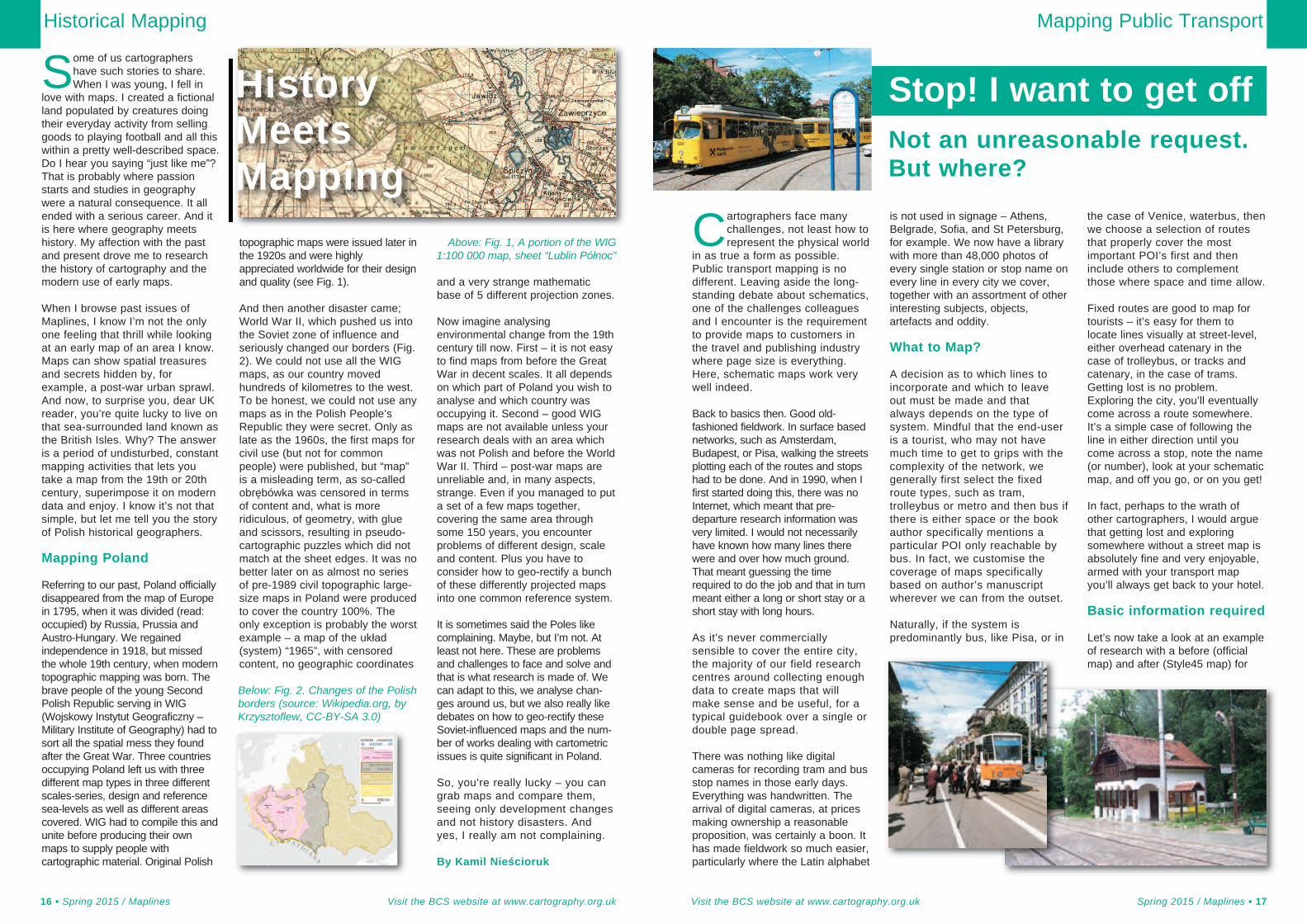
History Meets MappingMaps produced during wartimecan help us understand thepast explains Kamil Nieścioruk.
16
If you would like to sponsor a Maplines Quiz please contact theEditors for more information.
Robin Woods took a trip toSofia to learn about how theymap their tram lines.
17Mapping Public Transport
In September last year, wedelivered a Restless Earthworkshop at the Coborn
Centre for Adolescent MentalHealth in Plaistow. I waswondering how to describe theday, but think it can best be doneby including the letters wereceived afterwards, the firstfrom a member of staff and thelatter two from students whoattended on the day. We lookforward to going back nextacademic year.
Restless Earth
Visit the BCS website at www.cartography.org.uk Spring 2015 / Maplines • 5
Ian Kember
4 • Spring 2015 / Maplines Visit the BCS website at www.cartography.org.uk
Restless Earth Workshop atThe Coborn Centre for
Adolescent Mental Health
Dear Pete
I must apologise for the length of time that this note took to beforwarded to you and your team, nevertheless, our memories ofyour splendid workshop cannot be erased. In fact, your projecthas formed valued resource for a number of cross curricularprojects. One such project was; Facts About Tsunami coveredin English. Students' participation levels were increased as aresult of your videos and pictures that they experienced.
Our students were thoroughly engaged throughout andhave spoken about their enthusiasm of being a part of your
project. Attached are a few of theirresponses.
Finally, your project was skilfullyexecuted by combining rich contentalong with a very creative flair whichmade it utterly enjoyable andengaging throughout.
I anxiously await your next workshop.
Erica
To The British Cartographic Society,
Thank you for coming with your team and forteaching us not to take life for granted. Unlikecountries like Japan who have suffered from aTsunami on March 11th 2011, we are lucky not toexperience this.
Your work helped me to understand the differenttypes of jobs that are needed to save lives fromthe Military through to Search and Rescue teams.Here is some of the information that I rememberedabout each role:
The Military Team were responsible to lead the•investigations for all the teams.The Search and Rescue Team were responsible•for finding places to treat the sick and injured.The Humanitarian Team were responsible to•find a safe place for people to stay. They takeorders from the Military and the Search andRescue Team.
I would like to end by saying thanks for making uswork with other students who have different skills.
ThanksHabeebat
Thank you Pete,
Thank you for helping me tothink like a member from theMilitary Team. You helped us tomake maps by drawing roads,rivers and seas. I also placedstickers and added titles to mymap.
Thank you Pete I liked yoursession.
Tammana
Readers will be saddened tohear of the death of aformer BCS President, Ian
Kember. Ian served as BCSPresident from 1984 to 1986 andwas also a stalwart of the ICA.His funeral took place in Taunton
A T
ribut
e to
form
er B
CS
Pres
iden
t Ian
Kem
ber
Dear Editors,
May I through 'Maplines' pay my small tribute to Ian. I quotefrom my Hon Sec's report to council in the 25th AnniversaryJournal of Dec 1988 (he was leaving council)..... "Ian'inherited' me half way through his term as President. Hisoffer to assist at any time meant just that and he had thehappy knack of treating my major errors as minormisunderstandings and denying that the minor ones everexisted."
However, the facts were in 1985 I had been 'persuaded' byBarbara Bond to fill a sudden vacancy for Hon Sec. Thoughwhat I knew about the workings of council could not havefilled the proverbial postage stamp! Ian was terrific! Quietspoken and with a lovely sense of humour, he fielded all myinane questions (many of them repeats) and managed tocarry out his own work for council without ever making mefeel I was a pest, which I most certainly must have been.
I was fortunate to bump into him in Taunton a few timeslater on and he was always the same lovely man with whomany contact always made you feel better.
Charlie Beattie
President from 1984 - 1986
“Ian was terrific! Quietspoken and with a lovelysense of humour”
on 6th February and BCS wasrepresented by Dr Chris Board.Our thoughts are with Ian’s familyat this time.
The following article was receivedfrom Charlie Beattie.
geochemical readings andphysical readings of thesurrounding rocks and fluids,including any oil or gas. Once thewell has been deemed a success,it will be decided to be produced– the oil is taken out and joined toeither a pipeline or brought to thesurface onshore by vessels orproduced at sea by a FloatingProduction Storage andOffloading vessel (FPSO). Thegas and oil is refined and ends upas gas, fuel, plastics and bitumen.
Where is the oil and gas inthe UKCS?
The UKCS basin has a visibledivide of oil in the northern basinsand gas in the Southern basins.There are also frontier areas inthe West of Shetland andNorthern Rockall Basins.
How does Cartographyfeature in the industry?
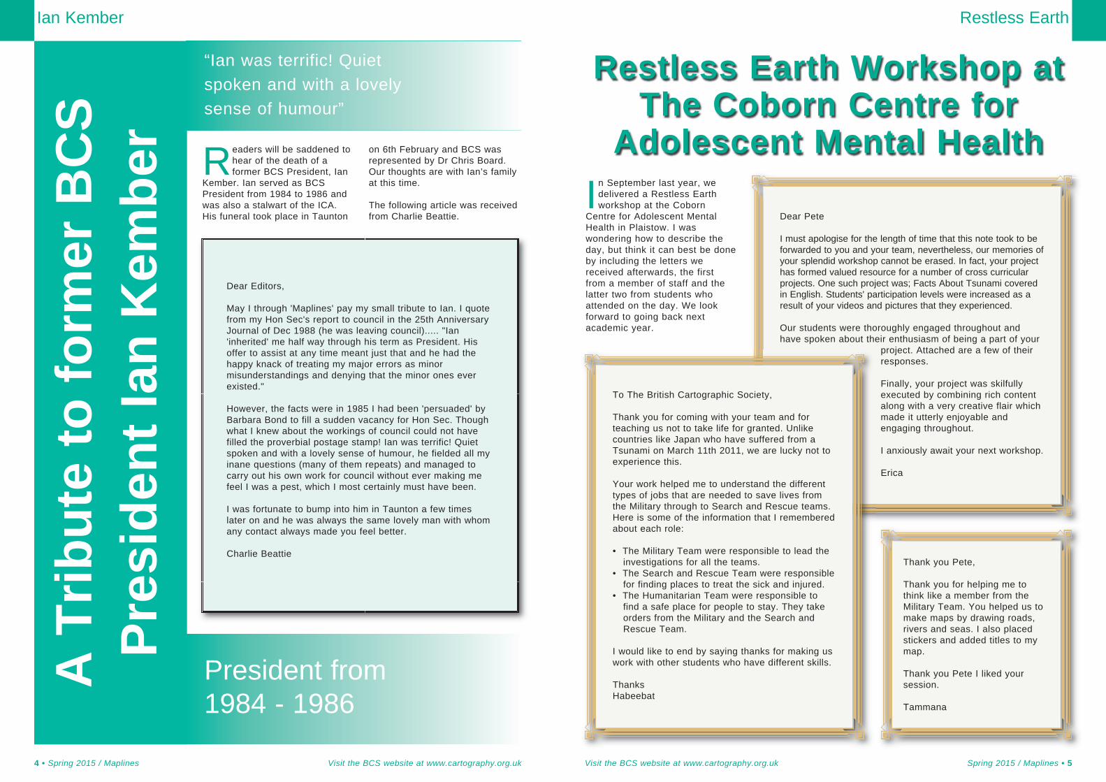
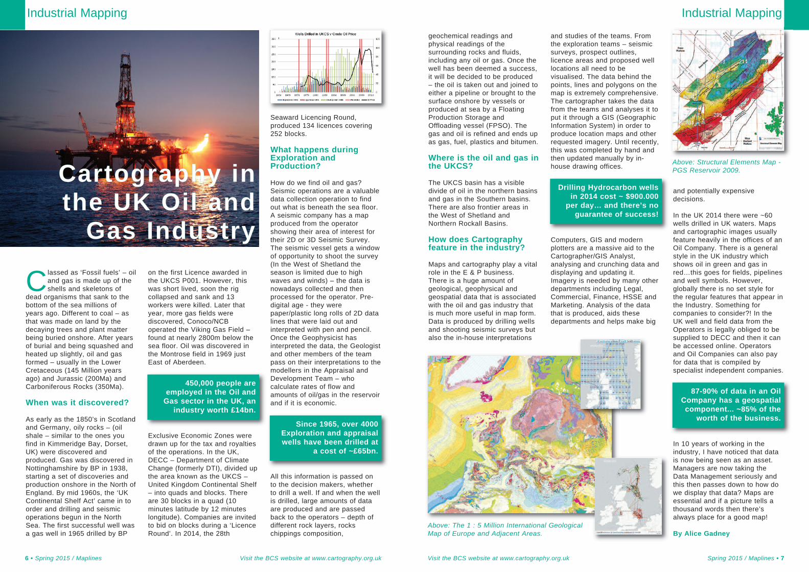
Maps and cartography play a vitalrole in the E & P business.There is a huge amount ofgeological, geophysical andgeospatial data that is associatedwith the oil and gas industry thatis much more useful in map form.Data is produced by drilling wellsand shooting seismic surveys butalso the in-house interpretations
and studies of the teams. Fromthe exploration teams – seismicsurveys, prospect outlines,licence areas and proposed welllocations all need to bevisualised. The data behind thepoints, lines and polygons on themap is extremely comprehensive.The cartographer takes the datafrom the teams and analyses it toput it through a GIS (GeographicInformation System) in order toproduce location maps and otherrequested imagery. Until recently,this was completed by hand andthen updated manually by in-house drawing offices.
Computers, GIS and modernplotters are a massive aid to theCartographer/GIS Analyst,analysing and crunching data anddisplaying and updating it.Imagery is needed by many otherdepartments including Legal,Commercial, Finance, HSSE andMarketing. Analysis of the datathat is produced, aids thesedepartments and helps make big
and potentially expensivedecisions.
In the UK 2014 there were ~60wells drilled in UK waters. Mapsand cartographic images usuallyfeature heavily in the offices of anOil Company. There is a generalstyle in the UK industry whichshows oil in green and gas inred…this goes for fields, pipelinesand well symbols. However,globally there is no set style forthe regular features that appear inthe Industry. Something forcompanies to consider?! In theUK well and field data from theOperators is legally obliged to besupplied to DECC and then it canbe accessed online. Operatorsand Oil Companies can also payfor data that is compiled byspecialist independent companies.
In 10 years of working in theindustry, I have noticed that datais now being seen as an asset.Managers are now taking theData Management seriously andthis then passes down to how dowe display that data? Maps areessential and if a picture tells athousand words then there’salways place for a good map!
By Alice Gadney
Industrial Mapping
Visit the BCS website at www.cartography.org.uk Spring 2015 / Maplines • 7
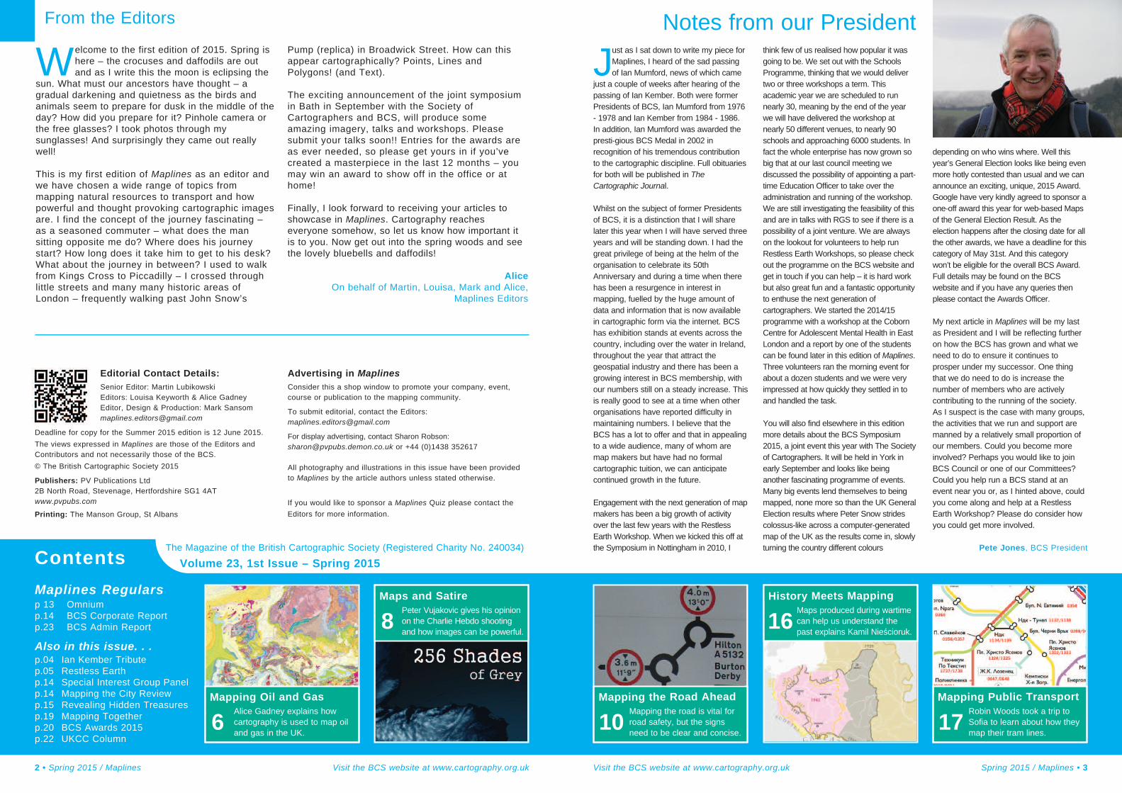
Classed as ‘Fossil fuels’ – oiland gas is made up of theshells and skeletons of
dead organisms that sank to thebottom of the sea millions ofyears ago. Different to coal – asthat was made on land by thedecaying trees and plant matterbeing buried onshore. After yearsof burial and being squashed andheated up slightly, oil and gasformed – usually in the LowerCretaceous (145 Million yearsago) and Jurassic (200Ma) andCarboniferous Rocks (350Ma).
When was it discovered?
As early as the 1850’s in Scotlandand Germany, oily rocks – (oilshale – similar to the ones youfind in Kimmeridge Bay, Dorset,UK) were discovered andproduced. Gas was discovered inNottinghamshire by BP in 1938,starting a set of discoveries andproduction onshore in the North ofEngland. By mid 1960s, the ‘UKContinental Shelf Act’ came in toorder and drilling and seismicoperations begun in the NorthSea. The first successful well wasa gas well in 1965 drilled by BP
on the first Licence awarded inthe UKCS P001. However, thiswas short lived, soon the rigcollapsed and sank and 13workers were killed. Later thatyear, more gas fields werediscovered, Conoco/NCBoperated the Viking Gas Field –found at nearly 2800m below thesea floor. Oil was discovered inthe Montrose field in 1969 justEast of Aberdeen.
Exclusive Economic Zones weredrawn up for the tax and royaltiesof the operations. In the UK,DECC – Department of ClimateChange (formerly DTI), divided upthe area known as the UKCS –United Kingdom Continental Shelf– into quads and blocks. Thereare 30 blocks in a quad (10minutes latitude by 12 minuteslongitude). Companies are invitedto bid on blocks during a ‘LicenceRound’. In 2014, the 28th
How do we find oil and gas?Seismic operations are a valuabledata collection operation to findout what is beneath the sea floor.A seismic company has a mapproduced from the operatorshowing their area of interest fortheir 2D or 3D Seismic Survey.The seismic vessel gets a windowof opportunity to shoot the survey(In the West of Shetland theseason is limited due to highwaves and winds) – the data isnowadays collected and thenprocessed for the operator. Pre-digital age - they werepaper/plastic long rolls of 2D datalines that were laid out andinterpreted with pen and pencil.Once the Geophysicist hasinterpreted the data, the Geologistand other members of the teampass on their interpretations to themodellers in the Appraisal andDevelopment Team – whocalculate rates of flow andamounts of oil/gas in the reservoirand if it is economic.
All this information is passed onto the decision makers, whetherto drill a well. If and when the wellis drilled, large amounts of dataare produced and are passedback to the operators – depth ofdifferent rock layers, rockschippings composition,
6 • Spring 2015 / Maplines Visit the BCS website at www.cartography.org.uk
450,000 people areemployed in the Oil andGas sector in the UK, an
industry worth £14bn.
Since 1965, over 4000Exploration and appraisalwells have been drilled at
a cost of ~£65bn.
Drilling Hydrocarbon wellsin 2014 cost ~ $900.000
per day… and there’s noguarantee of success!
Above: Structural Elements Map -PGS Reservoir 2009.
87-90% of data in an OilCompany has a geospatialcomponent... ~85% of the
worth of the business.
Cartography inthe UK Oil andGas Industry
Above: The 1 : 5 Million International GeologicalMap of Europe and Adjacent Areas.
Industrial Mapping
Different maps, different purposes.Maps are knowledge. Knowledge ispower.
Maps and Satire
This prompts me to return to thediscussion of the relationshipbetween maps and satiricalgraphics. As stated, at their bestthey force us to question ourassumptions. A map of infantmortality rates in Africa is notmerely seeking objectivity, it’s acall to action. Another turningpoint in my decision to write thispiece was hearing Will Self'seloquent BBC Radio 4 broadcast'What's the Point of Satire?'ii. He
provides an insightful critique ofthe value of satire, and discusseshis personal 'yardstick' forwhether something qualifies. Thisis, to quote Self, based on "…aclassic definition of whatconstitutes good journalism - suchan enterprise… should comfortthe afflicted and afflict thecomfortable". Self turns hisspotlight on contemporary satireand Charlie Hebdo in particular:
If we consider the scatter-gunnature of the seeming satirethat Charlie Hebdo dispensedwe can see quite clearly that itfails to pass the test. Whoreally is afflicted by depictions
of the Prophet Mohammed?Well, almost all believingMuslims. And who's comfortedby these depictions? Who findstheir earthly burden lifted bycontemplating such heavenlyinsults?
His yardstick can easily be appliedto the products of cartography.Who was afflicted by maps thatomitted 'Black settlements'? Whowas comforted by the eliminationof Israel from the map? It is worthremembering that Karl Haushoferthe father of German propagandamapping in the 1930s arguedagainst 'lies' in maps, advocatingthe selective use of 'facts' as farmore effective. Yes, maps often'denote' facts accurately, but Idoubt anyone would argue thatHaushofer’s and later Nazipropaganda maps comforted theright people.
The Moral of the Map
The moral of this story is surelythat we must question thepurpose of each graphic weproduce. Does it comfort theafflicted and afflict thecomfortable? The real lesson ofthe Charlie Hebdo affair must bethat images are powerful, but thatwith 'freedom of expression'comes responsibility. Maps andsatire both work by servinginterests… but whose? Maybethis would be a good time toreopen this debate withcartography?
By Peter Vujakovic,Professor of Geography atCanterbury Christ ChurchUniversity and author of an entryon ‘maps in political cartoons’ inthe Univ. of Chicago PressHistory of Cartography series.
Maps and Satire
Visit the BCS website at www.cartography.org.uk Spring 2015 / Maplines • 9
Very few things in this worldare 'black and white'. Infact, in our 'wired-world'
we all know that most areanywhere between 50 and 256shades of grey! I had originallymeant to write a Maplines articlereflecting on the horrificmassacre of the staff at CharlieHebdo in January, when twogunmen attacked the offices ofthe French satirical magazine.These events and theirimplications for freedom ofexpression must surely beimportant to all those whoproduce graphic images,including cartographers? Thisseemed even more appropriatesince the killings in Denmark,
one at a meeting attended by thecontroversial cartoonist LarsVilks. Doubts, however, set in.
Fact vs. OpinionatedGraphics
While I remain entirely certain thatno image, however offensive, canjustify such awful executions, I didnot find myself in total sympathywith many of the provocativeimages published by themagazine. Nor with the kneejerkreaction from those members ofthe public and politicians whoclamoured for 'freedom ofexpression', but appearedunaware of the highly offensivenature of some of Charlie Hebdo'simagery. This all made mequestion how to approach thisissue. The crux came when anacquaintance questioned why Ithought I could make a linkbetween satirical graphics andcartography, surely the formerdeals with opinion and the latterwith facts.
Then it came to me, this was thewrong way to view it. Both
cartography and satiricalgraphics are closely related. Attheir best, they challenge ourworld-views, at their worst theycan contribute to harm. Thewhole episode reminded me ofmy own previous experience. Inthe 1980s, I was a member ofthe national council andpublication committee of theWorld Development Movement(WDM) (renamed Global JusticeNow). I created andcommissioned maps and drewcartoons for WDM publications.This included a regular satiricalstrip cartoon entitled 'Squib' forthe WDM newspaper SPUR. Themaps provided 'objective'information (in so far as they
used 'recognised' data fromcredible agencies) about the direconditions of the world's poor,while the cartoon strips focusedon the structural 'facts' of globalinequality – for example the roleof debt burden or the need forland reform. In my mind, bothworked for a common end andboth dealt with 'facts' about theworld.
It’s all about Context
My colleague appeared toconflate the 'factual' nature ofmaps with the notion of theirsupposed objectivity versus thesubjective nature of satire.Rather, as the late Brian Harleystated, "…maps represent theworld through a veil ofideology, are fraught withinternal tensions, provideclassic examples of power-knowledge, and are alwayscaught up in wider politicalconcerns." Maps taken out ofcontext may appear objective,but are nearly alwaysimplicated in the propagation ofa specific message. To quote
Denis Wood "maps work byserving interests". A goodexample of this is the issue of'silences', where omission ofinformation from a map servesthe interests of those whomake or commission it. Arecent instance is the case ofthe schools’ atlas produced bya well-known UK publisher forthe middle-east market, inwhich Israel was erasedbecause its inclusion was“unacceptable” to its Gulfcustomers. A whole nationpurged from a children'slearning resource onideological grounds - that isoffensive to an educator. Thisissue was picked up by the
Press and led the publisher toissue an apology and to pulpits unsold copies.
Another twist on the issue ofsilences in maps was the responseof one reader of the recentlypublished 14th edition of the TimesComprehensive Atlas of the World.The reader took exception to asection I had written that statedthat official maps produced duringthe Apartheid period in SouthAfrica had omitted 'Blacksettlements'. The reader declared"This is patently wrong: within afew minutes I pulled out a 1982 1:2500 000 scale Surveyor Generalmap of South Africa which clearlyshows Soweto and Tembisa. If Ihad the inclination and the time Icould pull out several SurveyorGeneral maps from the 70s and80s which show townships wherethe scale is appropriate." Howinteresting. Who would haveexpected the Apartheid regime toignore the value of mapping ofthese settlements as a tool ofcontrol? The maps I had in mindwere education, travel and touristmaps with attested omissionsi.
Maps and Satire
8 • Spring 2015 / Maplines Visit the BCS website at www.cartography.org.uk
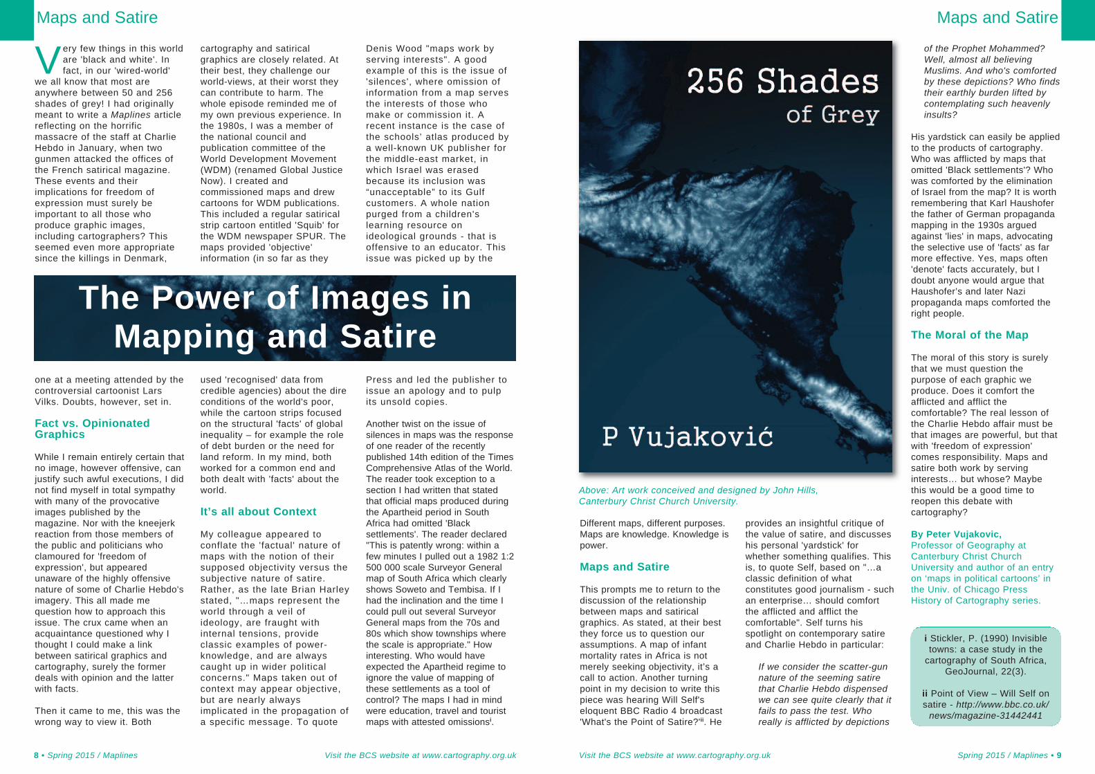
Above: Art work conceived and designed by John Hills,Canterbury Christ Church University.
i Stickler, P. (1990) Invisibletowns: a case study in thecartography of South Africa,
GeoJournal, 22(3).
ii Point of View – Will Self onsatire - http://www.bbc.co.uk/news/magazine-31442441
The Power of Images inMapping and Satire
speed. The more information asign has on it, the longer a driverneeds to take it in, so simplicityand brevity are the over-ridingconsiderations in creating a safeand useable sign.
Traffic signs are governed byregulations issued by governmentministers, and the Department forTransport (DfT) publishes adviceand guidance on using them.Since direction signs have to bevery flexible to accommodate theirsituation, the regulations(commonly known by the initials:TSRGD) simply state that “theroute symbols may be varied”.Chapter 7 of DfT’s Traffic SignsManual (TSM) provides moreinformation and is effectively astyle guide to directional signing.It shows how to include spaceand combine sign elements, andthe required geometry for typicaljunction layouts. However, thereis no guidance upon what degreeof generalisation or simplificationis appropriate. Chapter 2 of TSMwill eventually provide this, buthas been in preparation for a longtime. Most illustrations in TSRGDshow a large degree ofsimplification, with arms perfectlystraight and at right angles toeach other, small irregularitieshaving been ignored, but a fewexamples are more complex.
No roundabout really has itsapproach perfectly central andheading directly towards thecentre of the island, yet this iswhat the signs show. In realitythere will be a curve to the left toslow traffic and an island splittingthe two directions of traffic, butthese details are omitted fromsigns to simplify them and tomake the roundabout a familiar,easily recognisable symbol ratherthat an accurate depiction.
As a result of the lack ofguidance, some sign designersfail to understand the need forsimplified graphics that can beunderstood at a glace, andinstead provide an accurate planview of the junction or a layout socomplicated that it would be hardto follow even for a stationary
observer. In Scotland, forexample, it is common to showthe exit arms froma roundabout inaddition to theentry ones,leading to a morecluttered and lesspleasing sign. Aswell as beingsimple to interpretquickly from amoving vehicle,drivers need to beable to rememberthe essentialdetail of the roadlayout afterpassing the sign – another reasonfor keeping the design simple.
Automation
An interesting aspect of signdesign is the extent to whichsoftware can apply the rules,helping to achieve consistencywhilst also enhancing productivity.
The two computer systems withthe biggest market share for UKtraffic sign design are SignPlotand KeySign, the former from myown company, BuchananComputing. Both allow all types oftraffic sign to be designed,including map-type ones, and helpensure that arm widths, cornerradii, etc., conform to DfTrequirements. But SignPlot goes astep further by automating thepositioning of text and symbols onmap-type signs, using thespecified arm angles. This savestime and also money because itattempts to find the arrangementthat minimises the overall areaand therefore cost of the sign.Because there are manypermutations of layout that areequally valid, experienceddesigners will often need themanual editing option to over-ridethe automatic design and use on-screen guidelines to helpreposition sign elements.Software assistance can then bereapplied to the edited version.Automation also occurs inSignPlot in the form of spellingcorrection, font selection andcolouring, and hint messages that
appear offering to correct possibledesign mistakes.
Safety
Map-type signs play a valuablerole in making our roads easier touse and navigate. They also makea vital contribution towards roadsafety, as they are the onlymeans to advise drivers of anunusual or complicated roadlayout ahead. Whilst directionsigns can show any map layout,arguably the wide variety of ‘minimaps’ that can be placed into ared triangle warrant theconsideration of this type orwarning sign as a form orcartography. As well as thefamiliar T-junctions and cross-roads, triangular warning signscan show many types ofstaggered junction and depictbends in combination with sideroads. The new TSRGD expectedthis March will depict all 23permutations of this type of sign,but with each a fixed symbol thatmay not be varied.
Cartographic Principles
As we have seen, well designedmap-type signs will use a highdegree of generalisation. Junctionlayouts will be simplified, withstandards symbols wherepossible, angles will be roundedto right angles or multiples of 30ºor 45 º, and roads will be shownas straight lines unless for safetyreasons drivers need to be alertedto a bend. As a result, most such
Road Mapping
Visit the BCS website at www.cartography.org.uk Spring 2015 / Maplines • 11
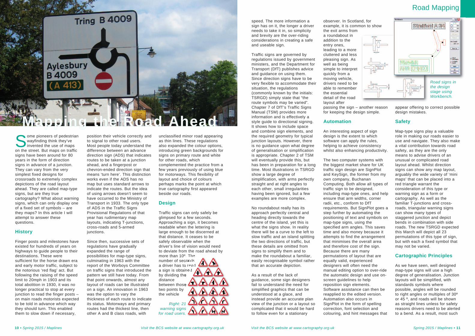
Some pioneers of pedestrianwayfinding think they’veinvented the use of maps
on the street. But maps on trafficsigns have been around for 80years in the form of directionsigns in advance of a junction.They can vary from the verysimplest fixed designs forcrossroads to extremely complexdepictions of the road layoutahead. They are called map-typesigns, but are they truecartography? What about warningsigns, which can only display oneof a fixed set of symbols – arethey maps? In this article I willattempt to answer thesequestions.
History
Finger posts and milestones haveexisted for hundreds of years onhighways to guide people to theirdestinations. These weresufficient for the horse drawn eraand early motor traffic, subject tothe notorious ‘red flag’ act. Butfollowing the raising of the speedlimit to 20mph in 1903 and itstotal abolition in 1930, it was nolonger practical to stop at everyjunction to read the finger posts –on main roads motorists expectedto be told in advance which waythey should turn. This enabledthem to slow down if necessary,
position their vehicle correctly andto signal to other road users.Most people today understand thedifference between an advancedirection sign (ADS) that indicatesroutes to be taken at a junctionahead, and a fingerpost orchevron-ended direction sign thatmeans ‘turn here’. This distinctionworks even if the ADS has nomap but uses standard arrows toindicate the routes. But the ideaof using arrows doesn’t seem tohave occurred to the Ministry ofTransport in 1933. The only typeof ADS in the Traffic SignsProvisional Regulations of thatyear has rudimentary maplayouts, indicating T-junctions,cross-roads and 5-armedjunctions.
Since then, successive sets ofregulations have graduallyexpanded the range ofpossibilities for map-type signs,culminating in 1963 with thereport of the Worboys Committeeon traffic signs that introduced thepattern we still have today. Fromthat point onwards, almost anylayout of roads can be illustratedon a sign. An innovation in 1963was the option to vary thethickness of each route to indicateits status. Motorways and primaryroutes had the thickest line, thenother A and B class roads, with
unclassified minor road appearingas thin lines. These regulationsalso expanded the colour options,introducing green backgrounds forsigns on primary route and whitefor other roads, whichcomplemented the practice from afew years previously of using bluefor motorways. This flexibility oflayout and choice of coloursperhaps marks the point at whichtrue cartography first appearedbeside our roads.
Design
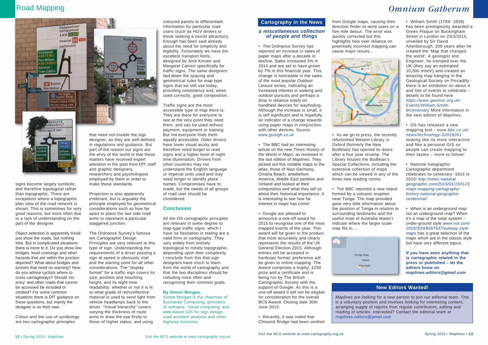
Traffic signs can only safely beglimpsed for a few seconds.Approaching a sign, it becomesreadable when the lettering islarge enough to be discerned atthat distance. It ceases to besafely observable when thedriver’s line of vision would needto deviate from the road ahead bymore than 10º. Thenumber of secondsa driver has to reada sign is obtainedby dividing thedistancebetween thosetwo points bythe vehicle
10 • Spring 2015 / Maplines Visit the BCS website at www.cartography.org.uk
Mapping the Road Ahead
Road signs inthe designstage usingWorkbench.
Right: 21warning signsfor road users.
signs become largely symbolic,and therefore topological ratherthan topographic. There areexceptions where a topographicplan view of the road network isshown. This is sometimes for verygood reasons, but more often dueto a lack of understanding on thepart of the designer.
Object selection is apparently trivial:just show the roads, but nothingelse. But in complicated situationsthere is more to it. Do you show lowbridges, level crossings and otherhazards that are within the junctiondepicted? What about bridges andtunnels that need no warning? Howdo you advise cyclists where tocross carriageways? Should ‘no-entry’ and other roads that cannotbe accessed be included oromitted? For some commonsituations there is DfT guidance onthese questions, but mainly thedesigner is on their own.
Colour and the use of symbologyare two cartographic principles
that need not trouble the signdesigner, as they are well-definedin regulations and guidance. Butpart of the reason our signs arethe envy of the world is that thesematters have received expertattention in the past from DfT staffand graphic designers,researchers and psychologistsemployed by them in order tomake these standards.
Projection is also apparentlyirrelevant, but is arguably theprinciple employed for geometricalconsiderations such as how farapart to place the two side roadarms to represent a particularstaggered junction.
The Ordnance Survey’s famousten Cartographic DesignPrinciples are very relevant to thistype of sign. Understanding therequirements of a driver passing asign at speed is obviously vitaland the starting point for all otherconsiderations. The “displayformat” for a traffic sign covers itssize, position and mountingheight, and its night-timereadability: whether or not it is litor what grade of retroreflectivematerial is used to send light fromvehicle headlamps back to thedriver. “Visual hierarchy” coversvarying the thickness of routearms to draw the eye firstly tothose of higher status, and using
coloured panels to differentiateinformation for particular roadusers (such as HGV drivers orthose seeking a tourist attraction).Enough has been said alreadyabout the need for simplicity andlegibility. Fortunately we have theexcellent transport fonts,designed by Jock Kinneir andMargaret Calvert specifically fortraffic signs. The same designerslaid down the spacing andgeometrical rules for map-typesigns that we still use today,providing consistency and, whenused correctly, good composition.
Traffic signs are the mostaccessible type of map there is.They are there for everyone tosee at the very point they needthem, and can be used withoutpayment, equipment or training.But not everyone finds themequally accessible. Older drivershave lower visual acuity andtherefore need longer to readsigns and a higher level of nighttime illumination. Drivers fromother countries may notunderstand the English languageor imperial units used and mayneed longer to identify placenames. Compromises have tomade, but the needs of all groupsof road user should beconsidered.
Conclusion
All the OS cartographic principlesare relevant in some degree tomap-type traffic signs, which Ihave no hesitation in stating are avalid form or cartography. Theyvary widely from entirelytopological to mostly topographic,depending upon their complexity.I conclude from this that signdesigners have much to learnfrom the world of cartography andthat the two disciplines should becolluding more often andrecognising their common goals.
By Simon Morgan,Simon Morgan is the chairman ofBuchanan Computing, providersof software, ‘cloud computing’ andweb-based GIS for sign design,road accident analysis and otherhighway functions.
Road Mapping
12 • Spring 2015 / Maplines Visit the BCS website at www.cartography.org.uk
The Ordnance Survey has•reported an increase in sales ofpaper maps after a decade indecline. Sales increased 3% in2014 and are set to have grownby 7% in this financial year. Thischange is noticeable in the salesof the most popular OutdoorLeisure series, indicating anincreased interest in walking andoutdoor pursuits and perhaps adrop in reliance solely onhandheld devices for wayfinding.Although the increase is small, itis still significant and is hopefullyan indicator of a change towardsusing paper maps in conjunctionwith other devices. Source:www.grough.co.uk
The BBC had an interesting•article on the new Times History ofthe World in Maps, as reviewed inthe last edition of Maplines. Theypicked out five notable maps in theatlas, those of Nazi Germany,Omaha Beach, antebellumAmerica, Middle East partition andVinland and looked at theircomposition and what they tell usabout their historical importance. Itis interesting to see how farinterest in maps has come!
Google are pleased to•announce a one-off award for2015 to recognise one of the mostmapped events of the year. Thisaward will be given to the productthat most accurately and clearlyrepresents the results of the UKGeneral Election 2015. Althoughentries will be accepted inhardcopy format, preference willbe given to online mapping. TheAward comprises a trophy, £250prize and a certificate and isbeing run by The BritishCartographic Society with thesupport of Google. As this is aone-off award it will not be eligiblefor consideration for the overallBCS Award. Closing date 30thJune 2015.
Recently, it was noted that•Chiswick Bridge had been omitted
from Google maps, causing theirdirection finder to send users on afive mile detour. The error wasquickly corrected but thishighlights how over reliance onpotentially incorrect mapping cancause major issues...
As we go to press, the recently•refurbished Weston Library inOxford (formerly the NewBodleian) has opened its doorsafter a four year revamp. TheLibrary houses the Bodleian’sSpecial Collections, including theextensive collection of mapswhich can be viewed in any of thethree new reading rooms.
The BBC reported a new island•formed by a volcanic eruptionnear Tonga. The map providedgave very little information aboutthe position of Tonga in relation tosurrounding landmarks and theuseful inset of Australia doesn’tindicate where the larger scalemap fits in….
William Smith (1769- 1839)•has been prestigiously awarded aGreen Plaque on BuckinghamStreet in London on 23/3/2015,unveiled by Sir DavidAttenborough, 200 years after hecreated the ‘Map that changedthe world’. A geologist andEngineer, he tramped over theUK (they say an estimated10,000 miles!) and created anamazing map hanging in theGeological Society on Piccadilly -there is an exhibition on about itand lots of events to celebrate –details to be found herehttps://www.geolsoc.org.uk/Events/William-Smith-Bicentenary More information inthe next edition of Maplines.
OS has released a new•mapping tool - www.bbc.co.uk/news/technology-32019261looking like its more interactiveand like a personal GIS sopeople can create mapping totheir tastes – more to follow!
National Geographic•Cartographic departmentcelebrates its centenary -1915 to2015! http://news.nationalgeographic.com/2015/01/150123-maps-mapping-cartography-history-national-geographic-centennial/
When is an underground map•not an underground map? Whenit’s a map of the solar system –under-ground style www.vox.com/2015/3/24/8267637/subway-style-maps has a great selection of themaps which are in the classic stylebut have very different topics.
If you have seen anything thatis cartographic related in thepress or published – let theeditors know [email protected]
Spring 2015 / Maplines • 13Visit the BCS website at www.cartography.org.uk
Omnium GatherumCartography in the News
a miscellaneous collectionof people and things
New Editors Wanted!
Maplines are looking for a new person to join our editorial team. Thisis a voluntary position and involves looking for interesting content,arranging supply of reports from regular contributors, editing andreading of articles. Interested? Contact the editorial team [email protected]
May I take this opportunityto thank all of those whohave supported the BCS
this year by taking sponsorshipfor the symposium. Your supportis greatly appreciated.
The BCS like all membershiporganisations only survive andthrive if they give their membersvalue for money and some returnfor their loyalty. With ourmembership steadily increasingand really bucking the trend of
many similar organisations theBCS is obviously doing somethingright, but are you making full useof all the opportunities andmembership benefits available toyou? Have you promoted yournew products or services inMaplines or sent in your latestnews to the editors? Is yourcompany information up-to-dateon the website? Please take alook. There are also fantasticnetworking opportunities. Pleasedo not miss out on theSymposium in York, this yearcombined with the Society of
Cartographers Summer School.
Our industry is so diverse andinevitably corporate members willtarget different audiences and lookfor different benefits from thesociety. I am interested to hearhow the BCS helps your businessor maybe you think there are areasthat could be improved on. Withoutfeedback it is difficult to know if weare getting it right for you, but weare continually looking to improve.Please help us, help you.
Alan Grimwade
Special Interest Group, Mapping the City & Corporate Report
14 • Spring 2015 / Maplines Visit the BCS website at www.cartography.org.uk
Special Interest Groups areopen to all members, thereare no additional fees.
Map Curators GroupConvener Mrs Ann Sutherland -For librarians, curators, maphistorians and map collectors. Anewsletter, Cartographiti, isissued up to three times a year;an annual workshop combinedwith a specialist visit is arrangedand other workshops andtraining days are organised asrequired.
Map Design GroupCo-Conveners Prof PeterVujakovic and Dr Alex Kent - Forpractical cartographers with aninterest in design. Roadshows areheld throughout the UK. TheGroup has an annual meetingduring the Annual Symposium.
Historical Military Mapping GroupConvener Dr John Peaty -Provides a point of contact anddiscussion for those engaged inresearch into any aspect of thehistory of military survey,photogrammetry/remote sensingand mapping. The grouporganises visits, meetings, one-
day seminars and publishes anoccasional newsletter, Maps &Surveys.
Geographical InformationSciences GroupConvener Mr Rob Sharpe –Provides a forum for BCSmembers to share, discuss andcommunicate ideas relating to theuse of GIS tools for high qualitycartographic production.
To join or for further informationon any one of these groupsplease contact BCSAdministration [email protected]
Walking in to SomersetHouse from a bright crispFebruary morning, I am
welcomed by a nice lady who takestime to give me a leaflet andexplain about the show. Time tounderstand why there is a pyramidof sandcastles made from imperialbuildings in a room…? There are50 pieces separated into the mainhall and 3 smaller rooms. Thereare different mediums... paintings,paper, objects and media... I canhear... but aren’t you meant to seecartography not hear it..? A veryimportant point for the visuallyimpaired! The exhibition could startat 1 and you go round the roomsand reach 50, but no, this is agreat set up! Walk round, look atthe floor for the number and locatethe information on the great A2
Information sheet, which tells youabout the artist and the art you arelooking at... but also shows youlinks to other pieces by the sameartist but at a different location…this is actually a map of the show...a time map and a relationship map.
The pieces are inspiring andobviously totally personal – not forthe traditionalist but maybe theywould benefit to see thatcartography is not just a navigationchart, a battle campaign or an OSmap? I particularly liked (and amvery interested in) how the artistscreate their ideas of ‘time’ in mapform. There’s a video by Tim Headof him driving through the streets ofLondon in the early hours. I stoodand watched and charted theirjourney around Piccadilly thenthrough into the City, but lost theirroute temporarily, but then
recognised Kings Cross Station. Itwas in real time. I had a mentalimage of a line being drawn on amap as if you were charting a busroute or giving directions to a visitor.
The show covered a multitude ofnations (Australia to Argentina,Sweden to Spain & France toFinland) and their ideas and secrets.It was a fantastic experience to seehow far cartography has been and isbeing stretched today. There werealso some very interesting talks anddiscussions throughout the time ofthe exhibition including talks with theartists.
(Great review with imageryhttp://www.huffingtonpost.com/jaime-rojo-steven-harrington/50-ways-to-map-the-city-p_b_6512076.html)
Alice Gadney
Special Interest GroupPanel Information
Mapping the City Review
Corporate Report
Last summer, my sonMohammed bought a newcamera and was asking if there
were any archaeological sites nearbyto photograph with his new purchase.I remembered two sites close toRiyadh that I had visited nearly 25years ago before he was born, and Isuggested that I should re-visit themwith him and his new camera.
I checked over the four-wheeldrive that I usually use for suchtrips. I filled up the water tank andmade sure that the car refrigeratorwas working properly and that wewere adequately supplied withfood and drink, tea and coffee.
We set off at about two o’clock in theafternoon towards the west of Riyadhon the Taif Highway. After we passedTuwaiq cliff and Qunaifdah sanddunes about 100 km from Riyadh, atthe village of Musiqrah, we turnednorth. We drove on a paved road forabout 5km until we reached a cliffthat rises about 40 metres calledKhasm Musiqarh. At the west end ofthe cliff, there is a small mountainabout 35 metres high.
Inscriptions from the Past
In a several locations, this smallmountain boasts a number of rockinscriptions carved by an ancientcivilization. We do not have anaccurate history of theseinscriptions, but experts who havevisited or written about themdescribed them as Thamudic,created in the period between thefirst and seventh centuries AD.
When you stand in front of theseinscriptions you feel there is a voicefrom the distant past calling you todescribe how much this land wasteeming with wildlife, which was themain source of food, about the livesof people who lived in that periodand about how hunting was the wayof life in this region at that time.
The most beautiful inscriptions onthis small mountain are on thenorthwest side where there issmooth large rock like a blackboardat a height of approximately 25metres from the base of themountain. My son was luckybecause the most suitable time tophotograph these inscriptions is atthe end of the day as they face thesun before it sets. The inscriptionscontain amazing graphics ofvarious animals such as ostriches,mountain goats, deer and wolves.
We walked around the mountaintaking pictures of the inscriptionsand enjoying the sunset. Wespent the evening close to the siteenjoying Arabic coffee and tea,before driving back to Riyadhhoping we get the opportunity tovisit this amazing place again.
Second Trip
Two weeks after our visit toMusigrah I told my son aboutanother site close to Riyadh andnot far from the site which wevisited earlier. This site is called AlKhashm Al Asmar. In winter, youcan visit the two sites in one day,but at other times of the year if thetemperatures are high, activityshould be limited in the lateafternoon and cooler temperatures.
About 50 km from Riyadh, we tookthe exit towards Ar Rain City anddrove south for about 70km until we left the mainroad and drove towardsthe south-east on anunpaved road (don’t forgetyour four-wheel drive!)and after about 10 km, wereached the edge of theQunaifdah sand dunes.
Al Kashm Al Asmar siteconsists of a rocky cliffrising about 30 metresnext to the Qunaifdah
sand dunes. It tends to be blackin colour and at the base of thecliff there are a number of largerocks that have rolled into theircurrent position due to erosion.
These rocks have now, in effect,become the pages of a bookchosen by the people of Thamudto leave wonderful inscriptionsthat tell of their lives and theiractivities. Near the top of the cliffthere is a large stone that iscovered in beautiful inscriptions.Usually the inscriptions are onthe front of a vertical roof, buthere you can stand on the rockand see the inscriptions underyour feet. It is worth venturing ashort distance south of the AlKashm Al Asmar site where youwill see a shrub called Al Ghadaat the southern end of the sanddunes. This shrub may becomeextinct from most parts of theSouth Najd but still exists in thisregion.
By Abdullah A. Al SayariAbdullah A. Al Sayari runs DesertMaps in Riyadh’s Industrial City 2.After nearly a decade of mapping,he has an extensive catalogue ofmaps covering Saudi Arabia.
Visit the BCS website at www.cartography.org.uk Spring 2015 / Maplines • 15
Revealing Hidden TreasuresIn the first of a series of articles on Saudi Arabia, mapping expert Abdullah A. Al Sayaritakes Maplines off the beaten track to archaeological sites many tourists might never find.
Some of us cartographershave such stories to share.When I was young, I fell in
love with maps. I created a fictionalland populated by creatures doingtheir everyday activity from sellinggoods to playing football and all thiswithin a pretty well-described space.Do I hear you saying “just like me”?That is probably where passionstarts and studies in geographywere a natural consequence. It allended with a serious career. And itis here where geography meetshistory. My affection with the pastand present drove me to researchthe history of cartography and themodern use of early maps.
When I browse past issues ofMaplines, I know I’m not the onlyone feeling that thrill while lookingat an early map of an area I know.Maps can show spatial treasuresand secrets hidden by, forexample, a post-war urban sprawl.And now, to surprise you, dear UKreader, you’re quite lucky to live onthat sea-surrounded land known asthe British Isles. Why? The answeris a period of undisturbed, constantmapping activities that lets youtake a map from the 19th or 20thcentury, superimpose it on moderndata and enjoy. I know it’s not thatsimple, but let me tell you the storyof Polish historical geographers.
Mapping Poland
Referring to our past, Poland officiallydisappeared from the map of Europein 1795, when it was divided (read:occupied) by Russia, Prussia andAustro-Hungary. We regainedindependence in 1918, but missedthe whole 19th century, when moderntopographic mapping was born. Thebrave people of the young SecondPolish Republic serving in WIG(Wojskowy Instytut Geograficzny –Military Institute of Geography) had tosort all the spatial mess they foundafter the Great War. Three countriesoccupying Poland left us with threedifferent map types in three differentscales-series, design and referencesea-levels as well as different areascovered. WIG had to compile this andunite before producing their ownmaps to supply people withcartographic material. Original Polish
topographic maps were issued later inthe 1920s and were highlyappreciated worldwide for their designand quality (see Fig. 1).
And then another disaster came;World War II, which pushed us intothe Soviet zone of influence andseriously changed our borders (Fig.2). We could not use all the WIGmaps, as our country movedhundreds of kilometres to the west.To be honest, we could not use anymaps as in the Polish People’sRepublic they were secret. Only aslate as the 1960s, the first maps forcivil use (but not for commonpeople) were published, but “map”is a misleading term, as so-calledobrębówka was censored in termsof content and, what is moreridiculous, of geometry, with glueand scissors, resulting in pseudo-cartographic puzzles which did notmatch at the sheet edges. It was nobetter later on as almost no seriesof pre-1989 civil topographic large-size maps in Poland were producedto cover the country 100%. Theonly exception is probably the worstexample – a map of the układ(system) “1965”, with censoredcontent, no geographic coordinates
and a very strange mathematicbase of 5 different projection zones.
Now imagine analysingenvironmental change from the 19thcentury till now. First – it is not easyto find maps from before the GreatWar in decent scales. It all dependson which part of Poland you wish toanalyse and which country wasoccupying it. Second – good WIGmaps are not available unless yourresearch deals with an area whichwas not Polish and before the WorldWar II. Third – post-war maps areunreliable and, in many aspects,strange. Even if you managed to puta set of a few maps together,covering the same area throughsome 150 years, you encounterproblems of different design, scaleand content. Plus you have toconsider how to geo-rectify a bunchof these differently projected mapsinto one common reference system.
It is sometimes said the Poles likecomplaining. Maybe, but I’m not. Atleast not here. These are problemsand challenges to face and solve andthat is what research is made of. Wecan adapt to this, we analyse chan-ges around us, but we also really likedebates on how to geo-rectify theseSoviet-influenced maps and the num-ber of works dealing with cartometricissues is quite significant in Poland.
So, you’re really lucky – you cangrab maps and compare them,seeing only development changesand not history disasters. Andyes, I really am not complaining.
By Kamil Nieścioruk
Historical Mapping
16 • Spring 2015 / Maplines Visit the BCS website at www.cartography.org.uk
Above: Fig. 1, A portion of the WIG1:100 000 map, sheet “Lublin Północ”
Below: Fig. 2. Changes of the Polishborders (source: Wikipedia.org, byKrzysztoflew, CC-BY-SA 3.0)
HistoryMeetsMapping
Cartographers face manychallenges, not least how torepresent the physical world
in as true a form as possible.Public transport mapping is nodifferent. Leaving aside the long-standing debate about schematics,one of the challenges colleaguesand I encounter is the requirementto provide maps to customers inthe travel and publishing industrywhere page size is everything.Here, schematic maps work verywell indeed.
Back to basics then. Good old-fashioned fieldwork. In surface basednetworks, such as Amsterdam,Budapest, or Pisa, walking the streetsplotting each of the routes and stopshad to be done. And in 1990, when Ifirst started doing this, there was noInternet, which meant that pre-departure research information wasvery limited. I would not necessarilyhave known how many lines therewere and over how much ground.That meant guessing the timerequired to do the job and that in turnmeant either a long or short stay or ashort stay with long hours.
As it's never commerciallysensible to cover the entire city,the majority of our field researchcentres around collecting enoughdata to create maps that willmake sense and be useful, for atypical guidebook over a single ordouble page spread.
There was nothing like digitalcameras for recording tram and busstop names in those early days.Everything was handwritten. Thearrival of digital cameras, at pricesmaking ownership a reasonableproposition, was certainly a boon. Ithas made fieldwork so much easier,particularly where the Latin alphabet
is not used in signage – Athens,Belgrade, Sofia, and St Petersburg,for example. We now have a librarywith more than 48,000 photos ofevery single station or stop name onevery line in every city we cover,together with an assortment of otherinteresting subjects, objects,artefacts and oddity.
What to Map?
A decision as to which lines toincorporate and which to leaveout must be made and thatalways depends on the type ofsystem. Mindful that the end-useris a tourist, who may not havemuch time to get to grips with thecomplexity of the network, wegenerally first select the fixedroute types, such as tram,trolleybus or metro and then bus ifthere is either space or the bookauthor specifically mentions aparticular POI only reachable bybus. In fact, we customise thecoverage of maps specificallybased on author’s manuscriptwherever we can from the outset.
Naturally, if the system ispredominantly bus, like Pisa, or in
the case of Venice, waterbus, thenwe choose a selection of routesthat properly cover the mostimportant POI’s first and theninclude others to complementthose where space and time allow.
Fixed routes are good to map fortourists – it’s easy for them tolocate lines visually at street-level,either overhead catenary in thecase of trolleybus, or tracks andcatenary, in the case of trams.Getting lost is no problem.Exploring the city, you’ll eventuallycome across a route somewhere.It’s a simple case of following theline in either direction until youcome across a stop, note the name(or number), look at your schematicmap, and off you go, or on you get!
In fact, perhaps to the wrath ofother cartographers, I would arguethat getting lost and exploringsomewhere without a street map isabsolutely fine and very enjoyable,armed with your transport mapyou’ll always get back to your hotel.
Basic information required
Let’s now take a look at an exampleof research with a before (officialmap) and after (Style45 map) for
Mapping Public Transport
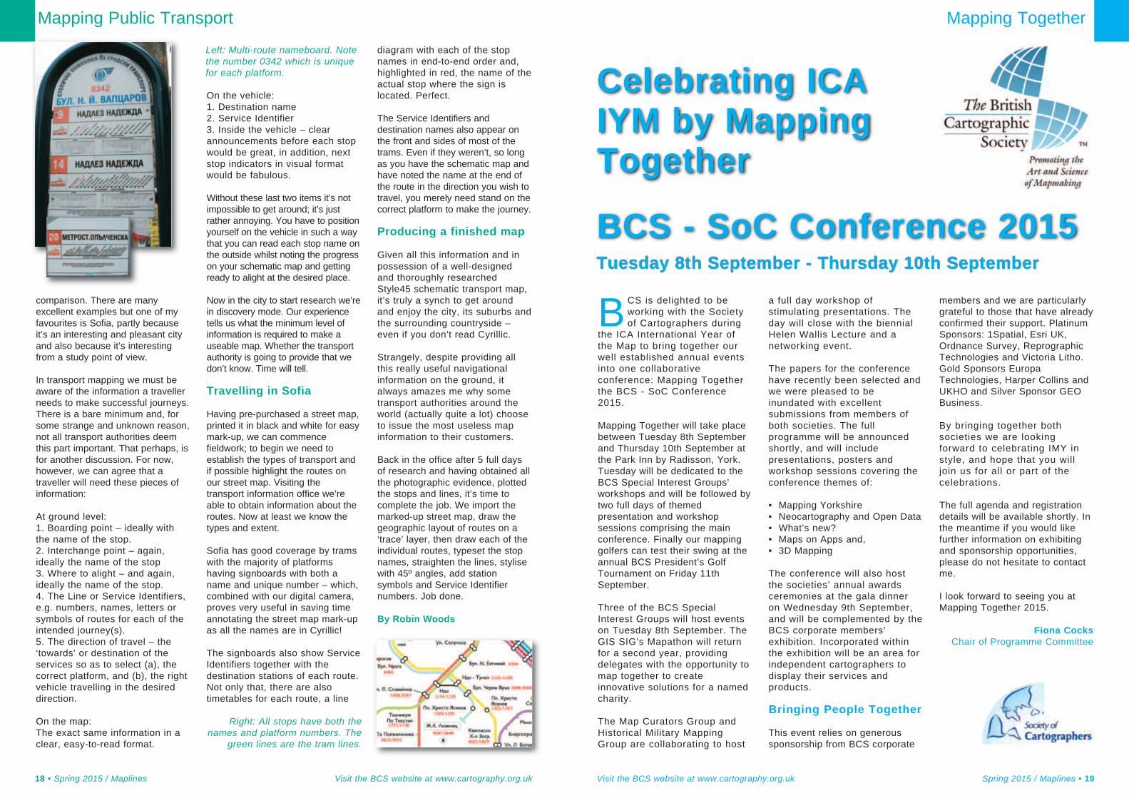
Visit the BCS website at www.cartography.org.uk Spring 2015 / Maplines • 17
Not an unreasonable request.But where?
Stop! I want to get off
comparison. There are manyexcellent examples but one of myfavourites is Sofia, partly becauseit’s an interesting and pleasant cityand also because it’s interestingfrom a study point of view.
In transport mapping we must beaware of the information a travellerneeds to make successful journeys.There is a bare minimum and, forsome strange and unknown reason,not all transport authorities deemthis part important. That perhaps, isfor another discussion. For now,however, we can agree that atraveller will need these pieces ofinformation:
At ground level:1. Boarding point – ideally withthe name of the stop.2. Interchange point – again,ideally the name of the stop3. Where to alight – and again,ideally the name of the stop.4. The Line or Service Identifiers,e.g. numbers, names, letters orsymbols of routes for each of theintended journey(s).5. The direction of travel – the‘towards’ or destination of theservices so as to select (a), thecorrect platform, and (b), the rightvehicle travelling in the desireddirection.
On the map: The exact same information in aclear, easy-to-read format.
On the vehicle:1. Destination name2. Service Identifier3. Inside the vehicle – clearannouncements before each stopwould be great, in addition, nextstop indicators in visual formatwould be fabulous.
Without these last two items it’s notimpossible to get around; it’s justrather annoying. You have to positionyourself on the vehicle in such a waythat you can read each stop name onthe outside whilst noting the progresson your schematic map and gettingready to alight at the desired place.
Now in the city to start research we’rein discovery mode. Our experiencetells us what the minimum level ofinformation is required to make auseable map. Whether the transportauthority is going to provide that wedon’t know. Time will tell.
Travelling in Sofia
Having pre-purchased a street map,printed it in black and white for easymark-up, we can commencefieldwork; to begin we need toestablish the types of transport andif possible highlight the routes onour street map. Visiting thetransport information office we’reable to obtain information about theroutes. Now at least we know thetypes and extent.
Sofia has good coverage by tramswith the majority of platformshaving signboards with both aname and unique number – which,combined with our digital camera,proves very useful in saving timeannotating the street map mark-upas all the names are in Cyrillic!
The signboards also show ServiceIdentifiers together with thedestination stations of each route.Not only that, there are alsotimetables for each route, a line
diagram with each of the stopnames in end-to-end order and,highlighted in red, the name of theactual stop where the sign islocated. Perfect.
The Service Identifiers anddestination names also appear onthe front and sides of most of thetrams. Even if they weren’t, so longas you have the schematic map andhave noted the name at the end ofthe route in the direction you wish totravel, you merely need stand on thecorrect platform to make the journey.
Producing a finished map
Given all this information and inpossession of a well-designedand thoroughly researchedStyle45 schematic transport map,it’s truly a synch to get aroundand enjoy the city, its suburbs andthe surrounding countryside –even if you don’t read Cyrillic.
Strangely, despite providing allthis really useful navigationalinformation on the ground, italways amazes me why sometransport authorities around theworld (actually quite a lot) chooseto issue the most useless mapinformation to their customers.
Back in the office after 5 full daysof research and having obtained allthe photographic evidence, plottedthe stops and lines, it’s time tocomplete the job. We import themarked-up street map, draw thegeographic layout of routes on a‘trace’ layer, then draw each of theindividual routes, typeset the stopnames, straighten the lines, stylisewith 45º angles, add stationsymbols and Service Identifiernumbers. Job done.
By Robin Woods
Mapping Public Transport
18 • Spring 2015 / Maplines Visit the BCS website at www.cartography.org.uk
Left: Multi-route nameboard. Notethe number 0342 which is uniquefor each platform.
Right: All stops have both thenames and platform numbers. The
green lines are the tram lines.
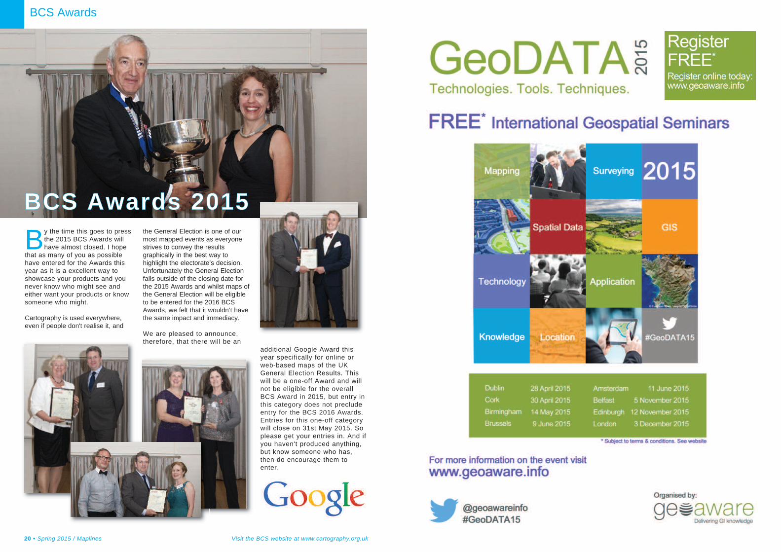
BCS is delighted to beworking with the Societyof Cartographers during
the ICA International Year ofthe Map to bring together ourwell established annual eventsinto one collaborativeconference: Mapping Togetherthe BCS - SoC Conference2015.
Mapping Together will take placebetween Tuesday 8th Septemberand Thursday 10th September atthe Park Inn by Radisson, York.Tuesday will be dedicated to theBCS Special Interest Groups’workshops and will be followed bytwo full days of themedpresentation and workshopsessions comprising the mainconference. Finally our mappinggolfers can test their swing at theannual BCS President’s GolfTournament on Friday 11thSeptember.
Three of the BCS SpecialInterest Groups will host eventson Tuesday 8th September. TheGIS SIG’s Mapathon will returnfor a second year, providingdelegates with the opportunity tomap together to createinnovative solutions for a namedcharity.
The Map Curators Group andHistorical Military MappingGroup are collaborating to host
a full day workshop ofstimulating presentations. Theday will close with the biennialHelen Wallis Lecture and anetworking event.
The papers for the conferencehave recently been selected andwe were pleased to beinundated with excellentsubmissions from members ofboth societies. The fullprogramme will be announcedshortly, and will includepresentations, posters andworkshop sessions covering theconference themes of:
Mapping Yorkshire •Neocartography and Open Data •What’s new?•Maps on Apps and, •3D Mapping•
The conference will also hostthe societies’ annual awardsceremonies at the gala dinneron Wednesday 9th September,and will be complemented by theBCS corporate members’exhibition. Incorporated withinthe exhibition will be an area forindependent cartographers todisplay their services andproducts.
Bringing People Together
This event relies on generoussponsorship from BCS corporate
members and we are particularlygrateful to those that have alreadyconfirmed their support. PlatinumSponsors: 1Spatial, Esri UK,Ordnance Survey, ReprographicTechnologies and Victoria Litho.Gold Sponsors EuropaTechnologies, Harper Collins andUKHO and Silver Sponsor GEOBusiness.
By bringing together bothsocieties we are lookingforward to celebrating IMY instyle, and hope that you willjoin us for all or part of thecelebrations.
The full agenda and registrationdetails will be available shortly. Inthe meantime if you would likefurther information on exhibitingand sponsorship opportunities,please do not hesitate to contactme.
I look forward to seeing you atMapping Together 2015.
Fiona CocksChair of Programme Committee
Mapping Together
Visit the BCS website at www.cartography.org.uk Spring 2015 / Maplines • 19
Celebrating ICAIYM by MappingTogether
BCS - SoC Conference 2015Tuesday 8th September - Thursday 10th September
By the time this goes to pressthe 2015 BCS Awards willhave almost closed. I hope
that as many of you as possiblehave entered for the Awards thisyear as it is a excellent way toshowcase your products and younever know who might see andeither want your products or knowsomeone who might.
Cartography is used everywhere,even if people don't realise it, and
the General Election is one of ourmost mapped events as everyonestrives to convey the resultsgraphically in the best way tohighlight the electorate’s decision.Unfortunately the General Electionfalls outside of the closing date forthe 2015 Awards and whilst maps ofthe General Election will be eligibleto be entered for the 2016 BCSAwards, we felt that it wouldn’t havethe same impact and immediacy.
We are pleased to announce,therefore, that there will be an
BCS Awards
20 • Spring 2015 / Maplines Visit the BCS website at www.cartography.org.uk
BBCCSS AAwwaarrddss 22001155
additional Google Award thisyear specifically for online orweb-based maps of the UKGeneral Election Results. Thiswill be a one-off Award and willnot be eligible for the overallBCS Award in 2015, but entry inthis category does not precludeentry for the BCS 2016 Awards.Entries for this one-off categorywill close on 31st May 2015. Soplease get your entries in. And ifyou haven't produced anything,but know someone who has,then do encourage them toenter.
Preparations are in hand forthe ICA conference in Rio inAugust. The UK has
submitted proposals for threecommissions. Ken Field and DavidFairbairn are both to stand againas chairs of the Commission onMap Design and Commission onEducation & Training respectively.Alex Kent had proposed a newCommission on TopographicMapping. This recognises one ofthe key areas of cartography, butone which has rarely been thefocus of wide research activity.This does represent a slightreduction in the UK leadership ofCommissions, but we have somecontinuing and new faces in vice-chair roles, so our presence isstill significant. Much thanks mustgo to Chris Perkins, SuchithAnand and Steve Chilton whohave chaired commissions for thelast four years.
The UKCC has nominated DavidForrest for the position of Vice-President. The ICA Executiveconsists of the President, theSecretary General and up toseven Vice-Presidents. Menno-Jan Kraak of The Netherlands isthe sole nomination for Presidentwith László Zentai of Hungary setto continue as Secretary-General.This time around there have beennine nominations for V-P withsome very well known andrespected figures in this list, sothe outcome will be veryinteresting. The full list ofnominations for V-P is:
Sara Fabrikant, Switzerland; •Lynn Usery, USA; •Vít Voženílek, Czech Rep; •David Forrest, United Kingdom; •Monika Sester, Germany; •Masatoshi Arikawa, Japan; •Pilar Sanchez-Ortiz, Spain; •Yaolin Liu, China;•Igor Drecki, New Zealand.•
The UK National Report,submitted to the ICA every fouryears, is currently in late stagesof production. This is ashowcase for UK cartography,with contributions from allsectors involved withcartography and handlinggeographic information. We werevery disappointed with the rangeof submissions last time; thisyear there has been a betterresponse to the call forcontributions, but it is still only asmall minority of companies andorganisations that participate,which is a great shame – it isfantastic opportunity to sell UKcartography on a global stage.As for recent reports, it will bepublished as a special issue ofThe Cartographic Journal.
As I write this, entries are aboutto close for contributions to theInternational Map Exhibition heldas part of ICA conference.Interest seems rather low at themoment, but hopefully there willbe a flurry of last minute activityand we will be able to assemblean exhibition to be proud of. TheUK have done very well inrecent times, winning threeawards at each of the last twoexhibitions.
Many of the ICA Commissionsare gearing up for theconference in August, with awide range of pre-conferenceactivities and workshops. Someof these are intended for activeresearchers in various fields, butothers are intended for a wideraudience, and some commissionrun training workshops tointroduce the wider cartographiccommunity to late developmentsor techniques. Obviously, thistime around people from the UKare less likely to be attendingthese workshops unless
attending the conference due tothe location, but I wouldencourage as many as possibleto get involved in theseworkshops, if not this time atfuture events. More informationabout the commissions can befound on the ICA website –www.icaci.org – and about theconference at www.icc2015.org.
If Rio de Janeiro is a step toofar, the next major ICA event isthe 1st ICA EuropeanSymposium on Cartography to beheld in Vienna, 10-12 Novemberthis year. This is obviously muchmore viable for many in Europeand the registration fee is quitemodest at 170 Euros, with areduction to 120 Euros forspeakers. If past conferencesorganised by the team at theTechnical University of Vienna isanything to go by, this will be anexcellent event and well worthattending, and Vienna is a veryattractive city to visit. The ICAExecutive and Commissionchairs will be meeting inconjunction with this conferenceand no doubt severalCommissions will also organisemeetings and workshops tocoincide. The call for papers iscurrently open, with a deadline of1st June for submissions. Seehttp://eurocarto.org/ for moreinformation.
International Map Year will beofficially launched in August inRio and we are currently in theplanning stages of the UKcontribution to the celebrations ofmaps and cartography. Moreinformation will follow insubsequent editions of Maplines,but you can find out more andaccess the new on-line book onThe World of Maps, which is freeto download, athttp://mapyear.org/
David ForrestChair, UK Committee for
Cartography
UKCC Report
22 • Spring 2015 / Maplines Visit the BCS website at www.cartography.org.uk
U K C CSubscriptions for 2015 arenow overdue
All members who did not renewtheir membership by StandingOrder were sent renewal
letters in December 2014 and at thetime of writing there has been a goodresponse, but there are still memberswhose subscriptions are stilloutstanding and I ask them toRENEW NOW! And the easiest wayto do this is through our website atwww.cartography.org.uk on thehomepage select Join or Renew Nowand on the page shown select thesubscription rate applicable (Fellowmembers please select any of therates shown) and you will be directedto the secure Payments Page.
MembershipAt the end of 2014, the society had atotal of 711 current members,unfortunately 48 memberships weresuspended for non-payment ofmembership subscriptions, there were14 resignations and sadly one death;these were offset by a total of 110new members joining through 2014.This year has started off well with 17new members joining since January.
New MembersThe society has the pleasure ofwelcoming the following newmembers who have joined sincethe Winter Maplines 2014.
Corporate MembersGetmapping Ltd, OrdnanceSurvey (Ireland), RTI Digital Ltd.
Educational MembersColyton Grammar School
UK MembersMr G Breen, Miss D Brennan, Mr S Blunt, Mr M Cooper, Mr B R Creed, Mr C Dickey, Dr G Eades, Mr N Edmead, Miss K Ferris, Miss E R G Fryer,Mr H Guolai, Miss a Henderson,Miss L Little, Mr L Mason, Mr S Miles, Mr I Murray, Mr J R Oliver, Mr M Ridout, Mr J Shaw, Mr G Simmons, Mr D Sprague, Miss A V Wood.
Overseas MembersCapt G R Cutler, National Libraryof Estonia
Associate MembersMr M Bate, Mr M Davis, Dr G Parmeggiani
BCS CouncilYou will find enclosed in this issue ofMaplines a form for nominatingmembers to the BCS Council. Councilis the society’s governing body, it isvital for the society that it consists of afair representation of the membersclearly reflecting the diversity of thecouncil. This year it is equallyimportant that the society will need anew President and Honorary Treasureras the incumbents of both posts havecompleted their official terms of office.Council must be a dynamic bodywhere lively debate on how to take thesociety forward can take place. Pleaseconsider carefully what role you couldplay within the society, and if youwould wish to stand for election tocouncil this year. Council meetings areheld 4/5 times a year, usually inLondon, expenses are paid forattendance at such meetings and tocover other costs resulting directly fromsociety business. The next election willtake place at the AGM in November2015. If you wish to stand, please findtwo society members who are willingto propose and second you, andensure that the form is completed andreturned to the address no later than 1Sep 2015. Forms can be mailed, faxedor emailed [email protected] you want more information aboutwhat it might involve, or if you wish tostand but need help in contacting othermembers to nominate/sponsor you,please contact me at BCSAdministration.
The Society MedalThe Society's Medal is forcontributions to cartography, inparticular through active leadership inthe development of cartographictheory or practice by original,substantial and continuingcontributions to research. Personswho have made a distinguishedcontribution to Cartography may beawarded the Society's Medal.Membership of the society shall notbe a condition of the award but theaward shall confer neither rights orprivileges of membership. The awardof the Society's Medal shall be a giftof the council. If you wish to nominatea person for the Society Medal
please contact BCS Administrationsoonest for further details.
Honorary FellowshipPersons who have rendereddistinguished service to the societymay be elected as Honorary Fellows.The election of Honorary Fellowsshall be made by the Society at theAnnual General Meeting. Nominationsshall be submitted to such meeting bythe council as they may from time totime determine. No more than threeHonorary Fellows will be elected inany one year; they will not berequired to pay any subscription andshall be entitled to the same rightsand privileges as an ordinarymember. For further details in regardto nomination procedures pleasecontact BCS Administration soonest.
And finally. . .Now, at the end of Feb as I write myAdministration Report for this Springissue I think to myself that spring reallyis on the way, as I have seen daffodilsblooming by the roadsides theoccasional periods of sunshine, only tohave the thought cruelly dispersed byhowling winds and rain/sleet lashingagainst the window. However, I am notcomplaining as my golf course hasonly been closed on three occasionsduring the winter, albeit one of theoccasions was for two weeks!!Although, I still managed to sneak-offand play a couple rounds per week(she who must be obeyed complainingbitterly about the muddy state of mygolf trousers). You all may havenoticed the Job Advert for my post inthis issue of Maplines; I am afraid thatall good things must come to an end,my good lady decided at the end of2014 that 2015 should be my last yearin post as your Administrator and atthe age of 68 I believe she is right andit is time for me to make way for ayounger person so I shall be handingover (hopefully) to my successorduring the period Sep – Nov 2015. Ifany member is interested in applyingfor the post and would like an insight tothe job I would be more than happy toanswer any questions.
Roger Hore, BCS Administration15 The Crescent, Stanley Common,