31
MapServer and SDE Howard Butler Center for Survey Statistics & Methodology Iowa State University Beginning Middle End
| Date post: | 25-Dec-2015 |
| Category: |
Documents |
| Upload: | jason-rodgers |
| View: | 220 times |
| Download: | 0 times |

MapServer and SDE
Howard Butler
Center for Survey Statistics & Methodology
Iowa State UniversityBeginning
Middle
End
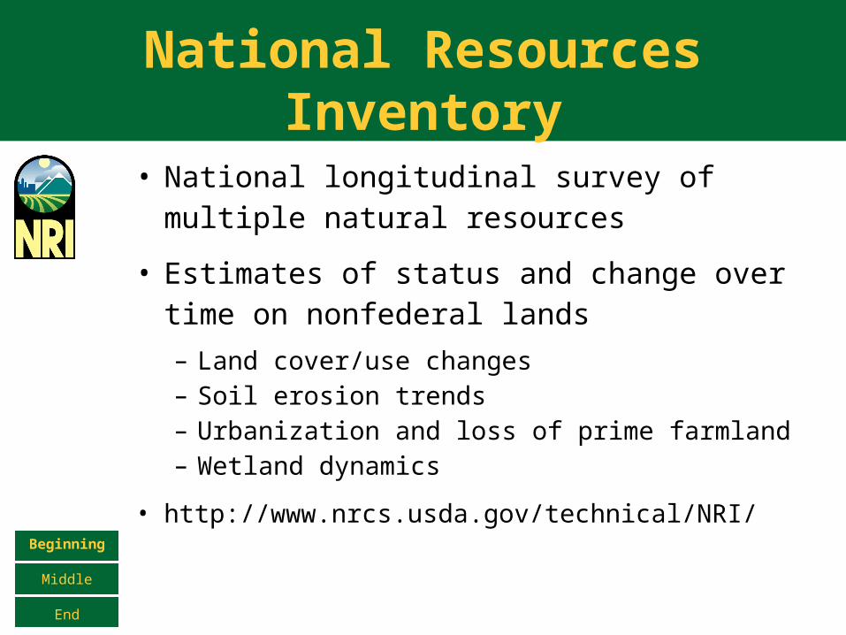
National Resources Inventory
• National longitudinal survey of multiple natural resources
• Estimates of status and change over time on nonfederal lands
– Land cover/use changes– Soil erosion trends– Urbanization and loss of prime farmland– Wetland dynamics
• http://www.nrcs.usda.gov/technical/NRI/Beginning
Middle
End
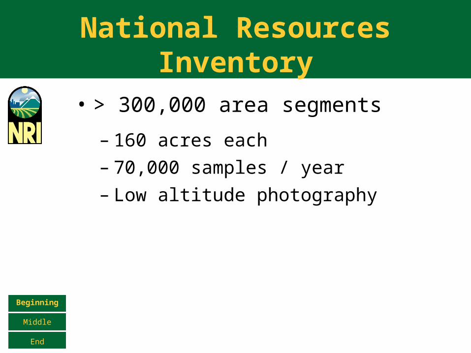
National Resources Inventory
• > 300,000 area segments
– 160 acres each– 70,000 samples / year– Low altitude photography
Beginning
Middle
End
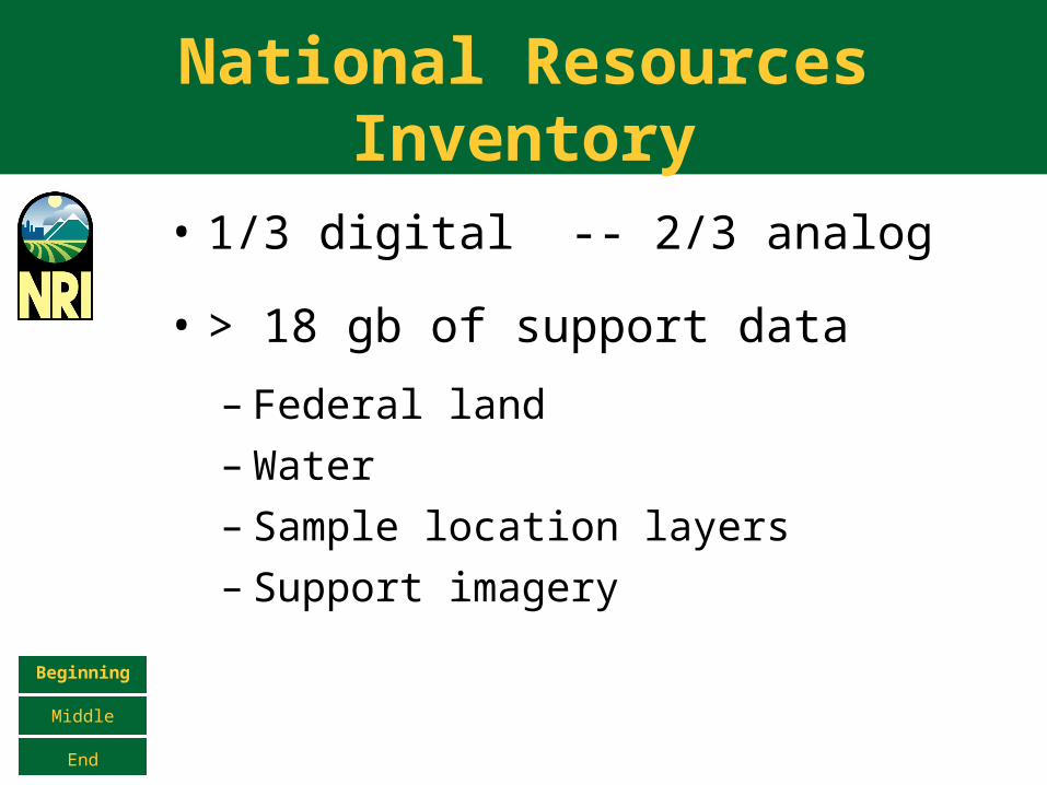
National Resources Inventory
• 1/3 digital -- 2/3 analog
• > 18 gb of support data
– Federal land– Water– Sample location layers– Support imagery
Beginning
Middle
End
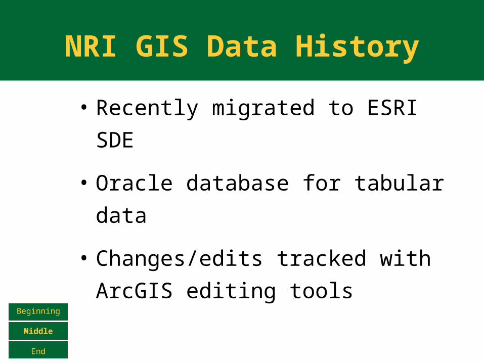
NRI GIS Data History
• Recently migrated to ESRI SDE
• Oracle database for tabular data
• Changes/edits tracked with
ArcGIS editing tools
Beginning
Middle
End
Use of MapServer in NRI
• The need for speed
– ArcIMS doesn’t even compare on
the same hardware– We can get by with cheaper
hardware because of improved
performance– Lower software licensing costs
Beginning
Middle
End
Use of MapServer in NRI
• Still need SDE features, though
– Versioned queries• Edits to data are tracked through a
versioned editing workflow. Web
mapping applications must be able to
see these various versions
– Joins• Spatial and tabular joinsBeginning
Middle
End
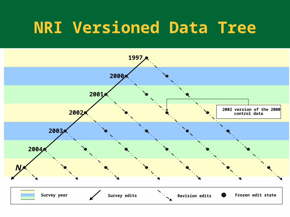
2001
Survey year Survey edits Revision edits Frozen edit state
1997
2000
2002
2003
2004
N
2002 version of the 2000control data
NRI Versioned Data Tree

Use of MapServer in NRI
• MapServer brings features, too
– Fluent WMS allows us to leverage other
data sources that we don’t have to
manage– Bulletproof projection on-the-fly support– MapScript is simpler, more robust, more
flexible (supports many languages), and
faster than many of the ArcIMS connector
technologies such as ActiveX and JSPBeginning
Middle
End
Recent improvements in MapServer SDE Support
• Support for Versioned Queries
– Can specify the version on the
CONNECTION string to query from
• Auto-sensing of SDE table structure
– SDE maintains a unique ID for each
table. The user can change the name of
this column at will, and many
applications within the ESRI family are
not consistent.Beginning
Middle
End
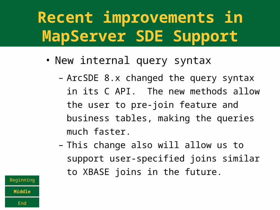
Recent improvements in MapServer SDE Support
• New internal query syntax
– ArcSDE 8.x changed the query syntax in
its C API. The new methods allow the
user to pre-join feature and business
tables, making the queries much faster. – This change also will allow us to support
user-specified joins similar to XBASE joins
in the future.
Beginning
Middle
End
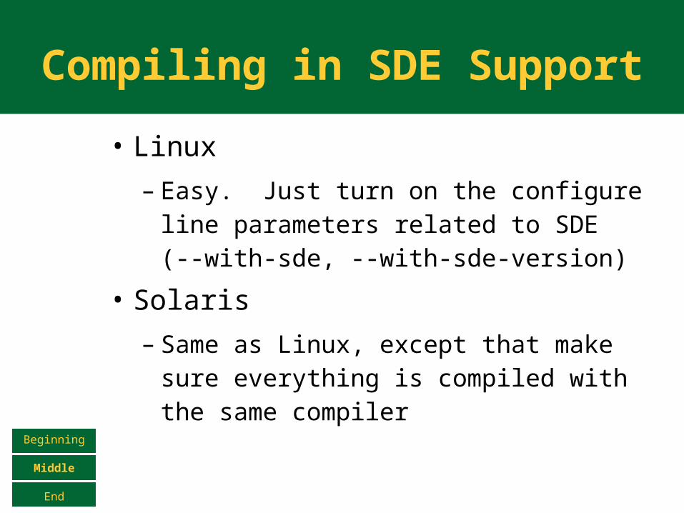
Compiling in SDE Support
• Linux
– Easy. Just turn on the configure line parameters related to SDE (--with-sde, --with-sde-version)
• Solaris
– Same as Linux, except that make sure everything is compiled with the same compilerBeginning
Middle
End
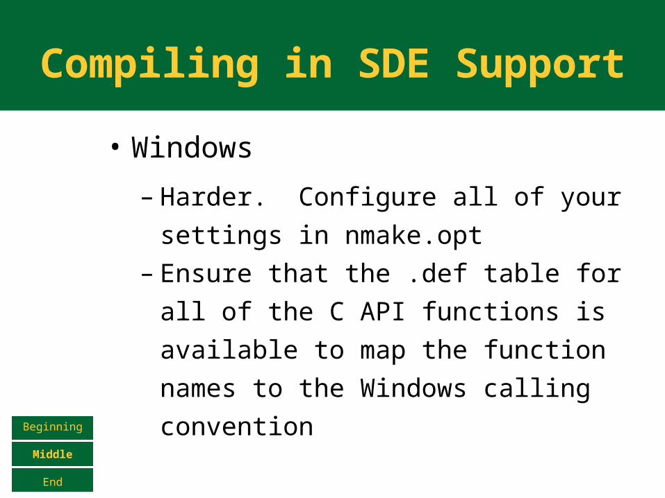
Compiling in SDE Support
• Windows
– Harder. Configure all of your
settings in nmake.opt– Ensure that the .def table for all of
the C API functions is available to
map the function names to the
Windows calling conventionBeginning
Middle
End
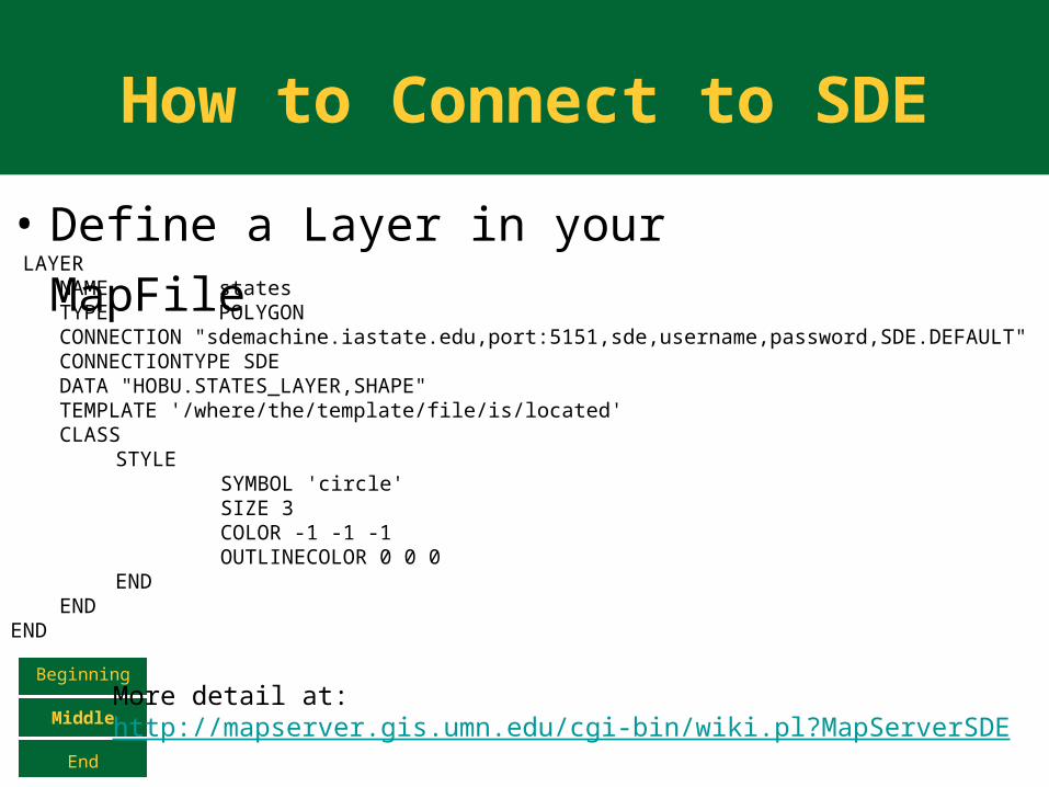
How to Connect to SDE
• Define a Layer in your MapFile
Beginning
Middle
End
LAYER NAME states TYPE POLYGON CONNECTION "sdemachine.iastate.edu,port:5151,sde,username,password,SDE.DEFAULT" CONNECTIONTYPE SDE DATA "HOBU.STATES_LAYER,SHAPE" TEMPLATE '/where/the/template/file/is/located' CLASS
STYLESYMBOL 'circle'SIZE 3COLOR -1 -1 -1OUTLINECOLOR 0 0 0
END ENDEND
More detail at:http://mapserver.gis.umn.edu/cgi-bin/wiki.pl?MapServerSDE
How to Connect to SDE
Beginning
Middle
End
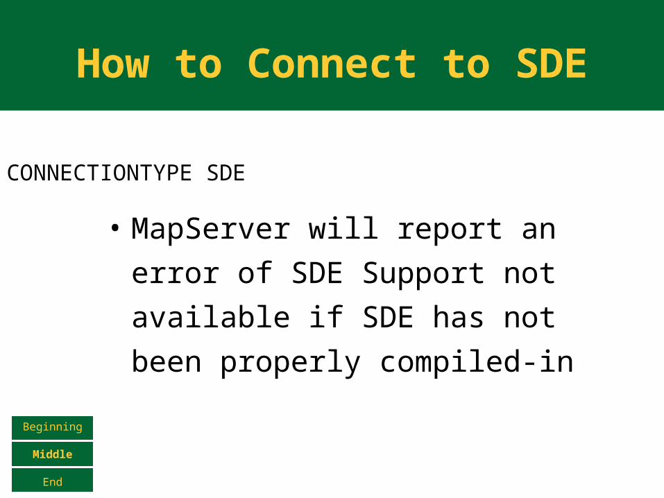
CONNECTIONTYPE SDE
• MapServer will report an error of
SDE Support not available if SDE
has not been properly compiled-
in
How to Connect to SDE
Beginning
Middle
End
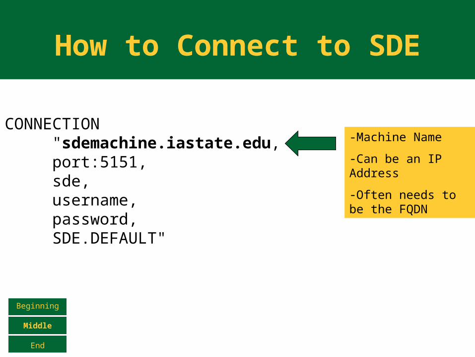
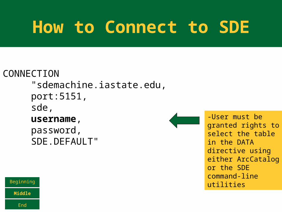
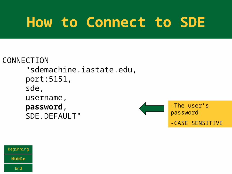
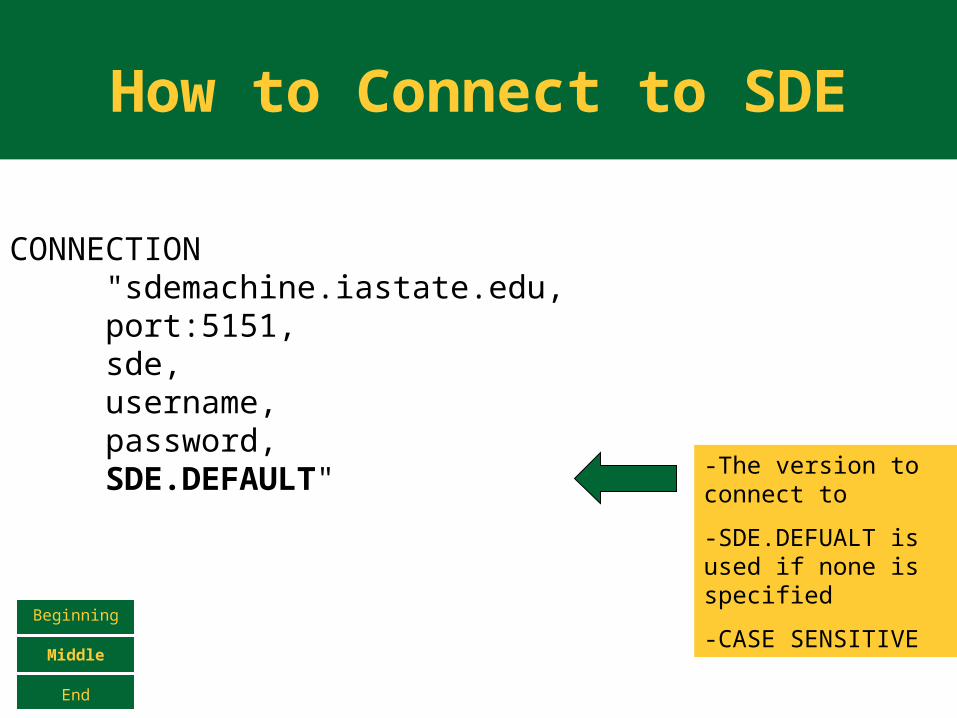
CONNECTION "sdemachine.iastate.edu,port:5151,sde,username,password,SDE.DEFAULT"
-Machine Name
-Can be an IP Address
-Often needs to be the FQDN
How to Connect to SDE
Beginning
Middle
End
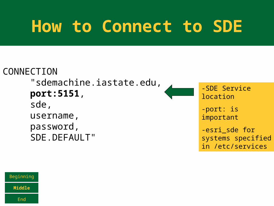
CONNECTION "sdemachine.iastate.edu,port:5151,sde,username,password,SDE.DEFAULT"
-SDE Service location
-port: is important
-esri_sde for systems specified in /etc/services
How to Connect to SDE
Beginning
Middle
End
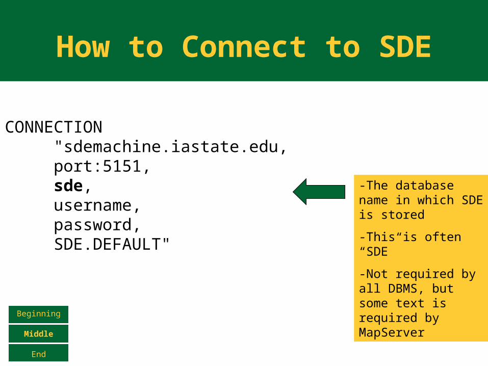
CONNECTION "sdemachine.iastate.edu,port:5151,sde,username,password,SDE.DEFAULT"
-The database name in which SDE is stored
-This is often “SDE”
-Not required by all DBMS, but some text is required by MapServer
How to Connect to SDE
Beginning
Middle
End
CONNECTION "sdemachine.iastate.edu,port:5151,sde,username,password,SDE.DEFAULT"
-User must be granted rights to select the table in the DATA directive using either ArcCatalog or the SDE command-line utilities
How to Connect to SDE
Beginning
Middle
End
CONNECTION "sdemachine.iastate.edu,port:5151,sde,username,password,SDE.DEFAULT"
-The user’s password
-CASE SENSITIVE
How to Connect to SDE
Beginning
Middle
End
CONNECTION "sdemachine.iastate.edu,port:5151,sde,username,password,SDE.DEFAULT" -The version to
connect to
-SDE.DEFUALT is used if none is specified
-CASE SENSITIVE

How to Connect to SDE
Beginning
Middle
End
DATA "HOBU.STATES_LAYER,SHAPE"
Schema Table Name Spatial Column
• No spaces!
• Oracle and MSSQL usually require the
schema name – use the full name
shown in ArcCatalog if not sure
How to Connect to SDE
Beginning
Middle
End
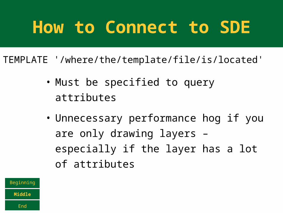
TEMPLATE '/where/the/template/file/is/located'
• Must be specified to query attributes
• Unnecessary performance hog if you
are only drawing layers – especially if
the layer has a lot of attributes
An Example Application
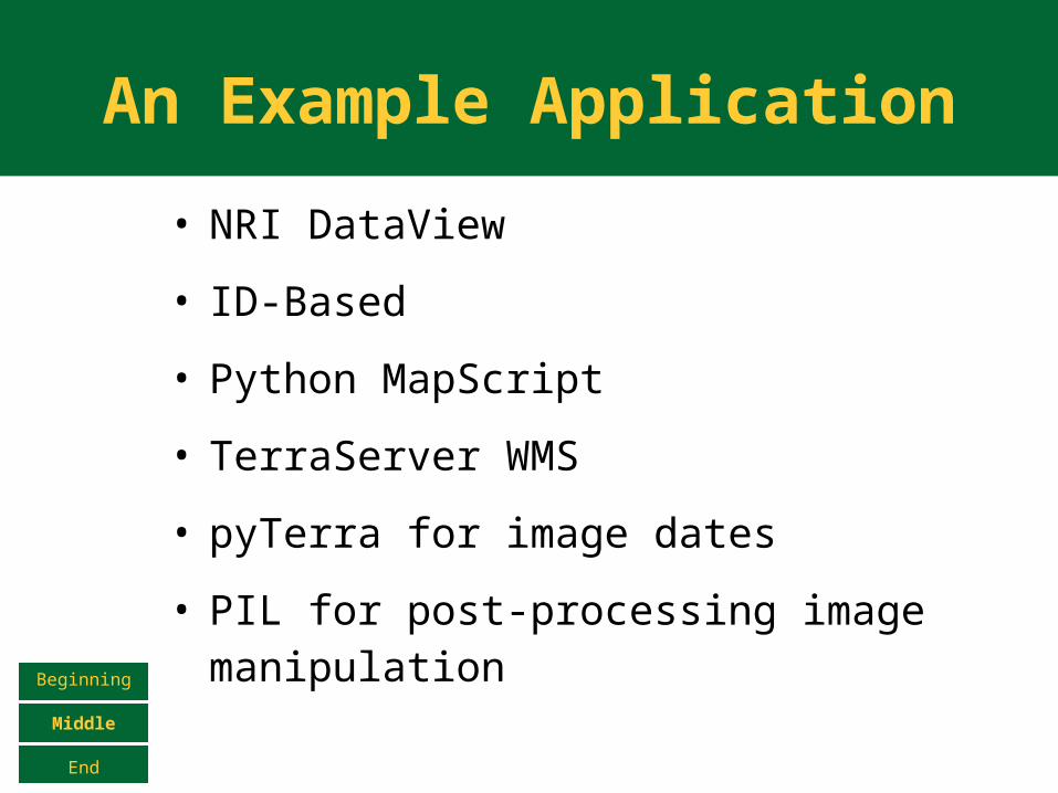
• NRI DataView
• ID-Based
• Python MapScript
• TerraServer WMS
• pyTerra for image dates
• PIL for post-processing image manipulationBeginning
Middle
End
An Example Application
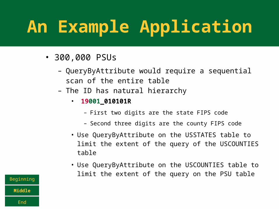
• 300,000 PSUs– QueryByAttribute would require a sequential scan
of the entire table– The ID has natural hierarchy
• 19001_010101R
– First two digits are the state FIPS code
– Second three digits are the county FIPS code
• Use QueryByAttribute on the USSTATES table to limit the extent of the query of the USCOUNTIES table
• Use QueryByAttribute on the USCOUNTIES table to limit the extent of the query on the PSU table
Beginning
Middle
End
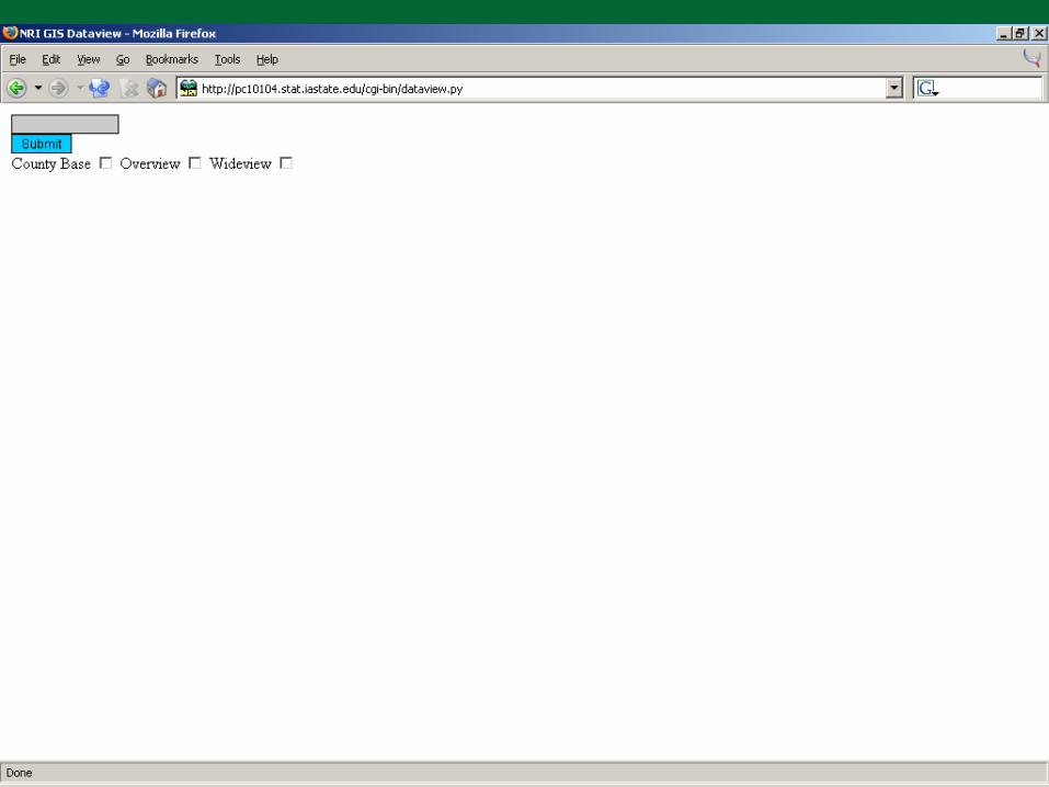
An Example Application
Beginning
Middle
End
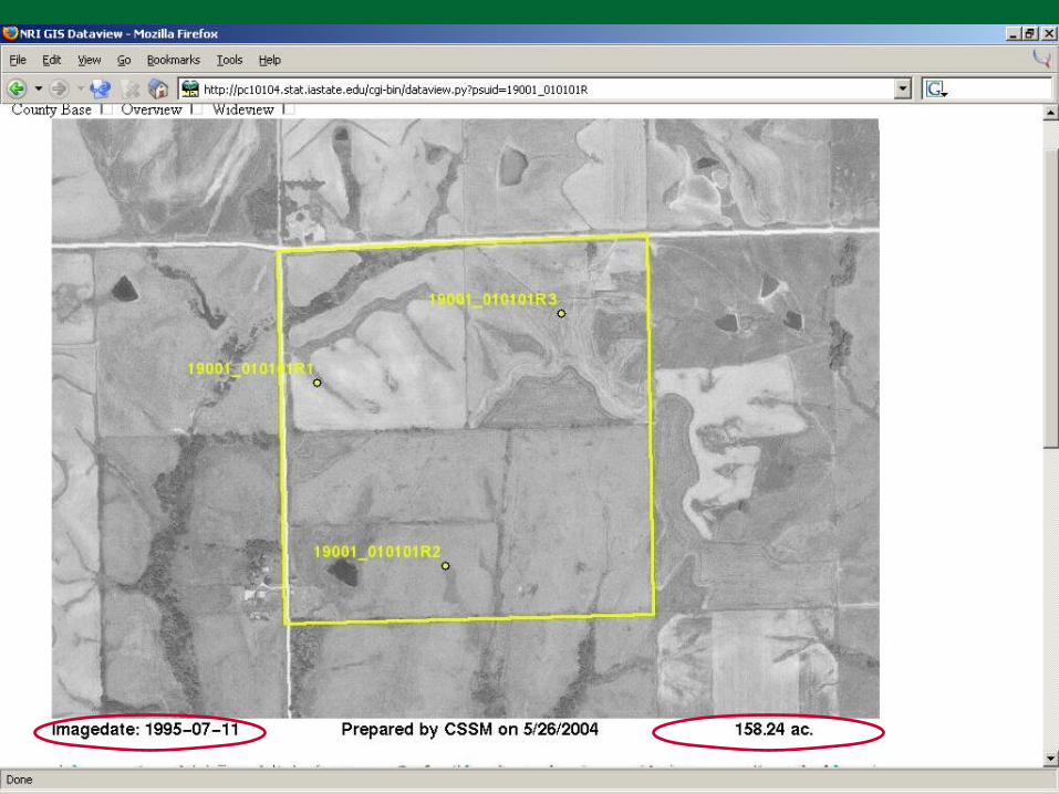
An Example Application
Beginning
Middle
End
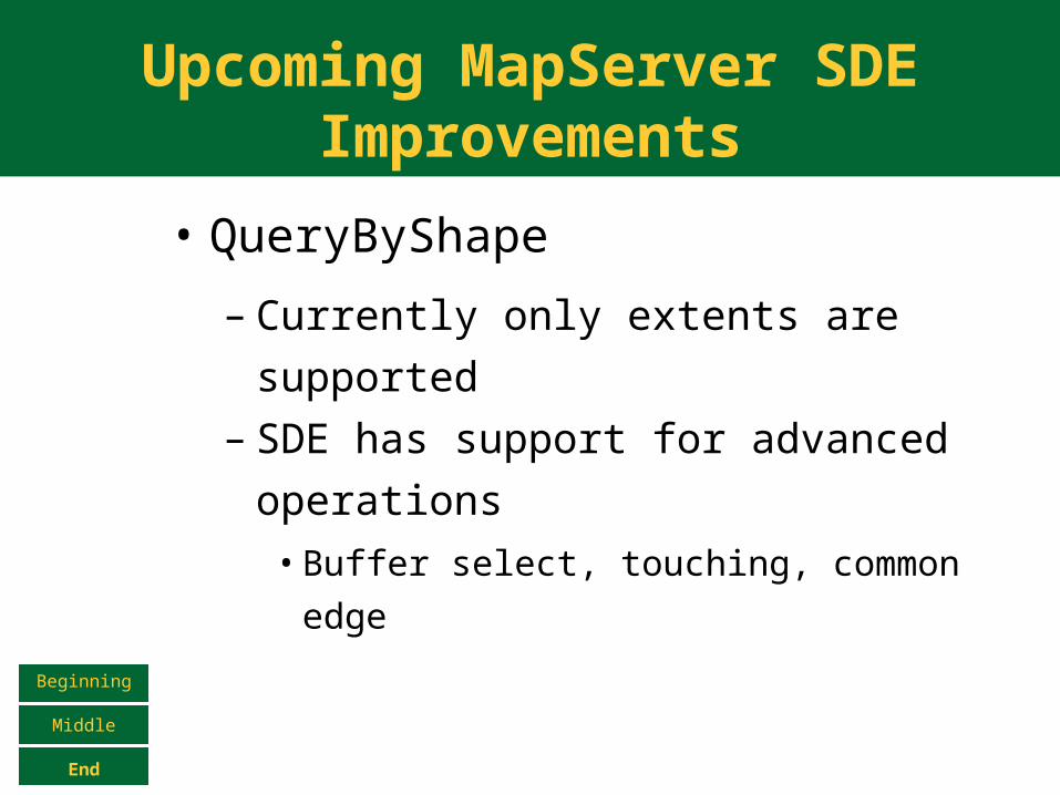
Upcoming MapServer SDE Improvements
• QueryByShape
– Currently only extents are
supported– SDE has support for advanced
operations• Buffer select, touching, common edge
Beginning
Middle
End
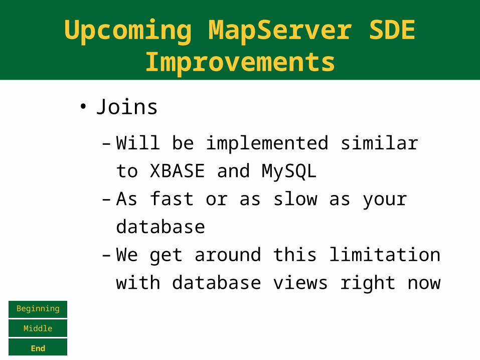
Upcoming MapServer SDE Improvements
• Joins
– Will be implemented similar to
XBASE and MySQL – As fast or as slow as your database– We get around this limitation with
database views right now
Beginning
Middle
End
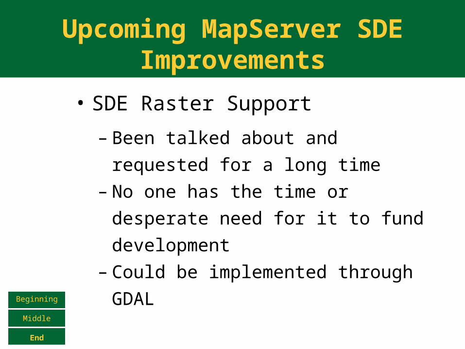
Upcoming MapServer SDE Improvements
• SDE Raster Support
– Been talked about and requested
for a long time– No one has the time or desperate
need for it to fund development– Could be implemented through
GDALBeginning
Middle
End

The End
• Questions?
Beginning
Middle
End


