1 Subaryono, Ir., MA., PhD. Jurusan Teknik Geodesi Universitas Gadjah Mada Yogyakarta subaryono_tgeodesi 2012 1 Land Information Management? Land? Land Information? Information Management? Land Management? subaryono_tgeodesi 2012 2
Transcript
1
Subaryono, Ir., MA., PhD.
Jurusan Teknik Geodesi Universitas Gadjah Mada Yogyakarta
subaryono_tgeodesi 2012 1
Land Information Management?
Land?
Land Information?
Information Management?
Land Management?
subaryono_tgeodesi 2012 2
2
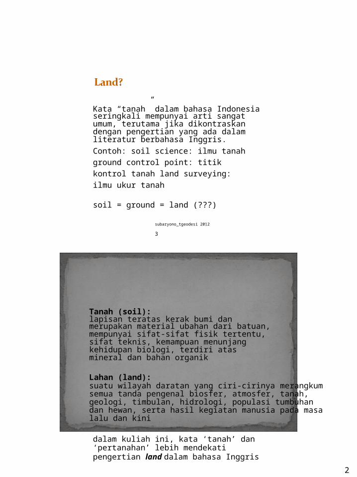
Kata “tanah” dalam bahasa Indonesia seringkali mempunyai arti sangat umum, terutama jika dikontraskan dengan pengertian yang ada dalam literatur berbahasa Inggris.Contoh: soil science: ilmu tanahground control point: titik kontrol tanah land surveying: ilmu ukur tanah
soil = ground = land (???)
subaryono_tgeodesi 2012 3
Tanah (soil):lapisan teratas kerak bumi dan merupakan material ubahan dari batuan, mempunyai sifat-sifat fisik tertentu, sifat teknis, kemampuan menunjang kehidupan biologi, terdiri atas mineral dan bahan organik
Lahan (land):suatu wilayah daratan yang ciri-cirinya merangkumsemua tanda pengenal biosfer, atmosfer, tanah,geologi, timbulan, hidrologi, populasi tumbuhandan hewan, serta hasil kegiatan manusia pada masalalu dan kini
dalam kuliah ini, kata ‘tanah’ dan ‘pertanahan’ lebih mendekati pengertian land dalam bahasa Inggris
subaryono_tgeodesi 2012 4
3
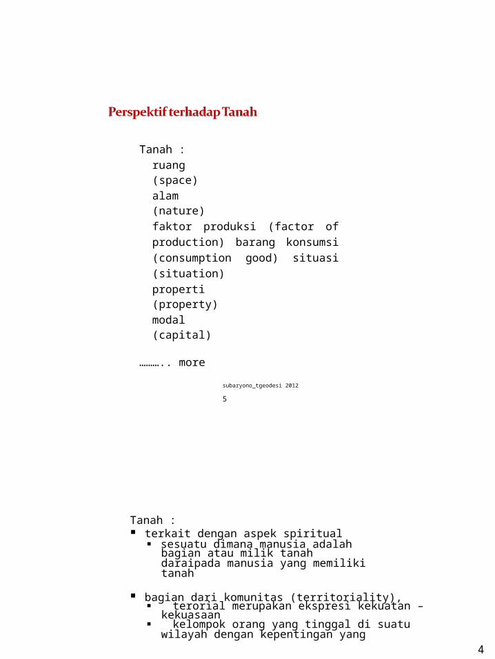
Tanah :ruang (space)alam (nature)faktor produksi (factor of production) barang konsumsi (consumption good) situasi (situation)properti (property)modal (capital)
……….. more
subaryono_tgeodesi 2012 5
Tanah : terkait dengan aspek spiritual
sesuatu dimana manusia adalah bagian atau milik tanah daraipada manusia yang memiliki tanah
bagian dari komunitas (territoriality), terorial merupakan ekspresi kekuatan –
kekuasaan kelompok orang yang tinggal di suatu
wilayah dengan kepentingan yang sama akan membentuk kesatuan a.l kelompok berbasis wilayah - bangsa
4
subaryono_tgeodesi 2012 6
5
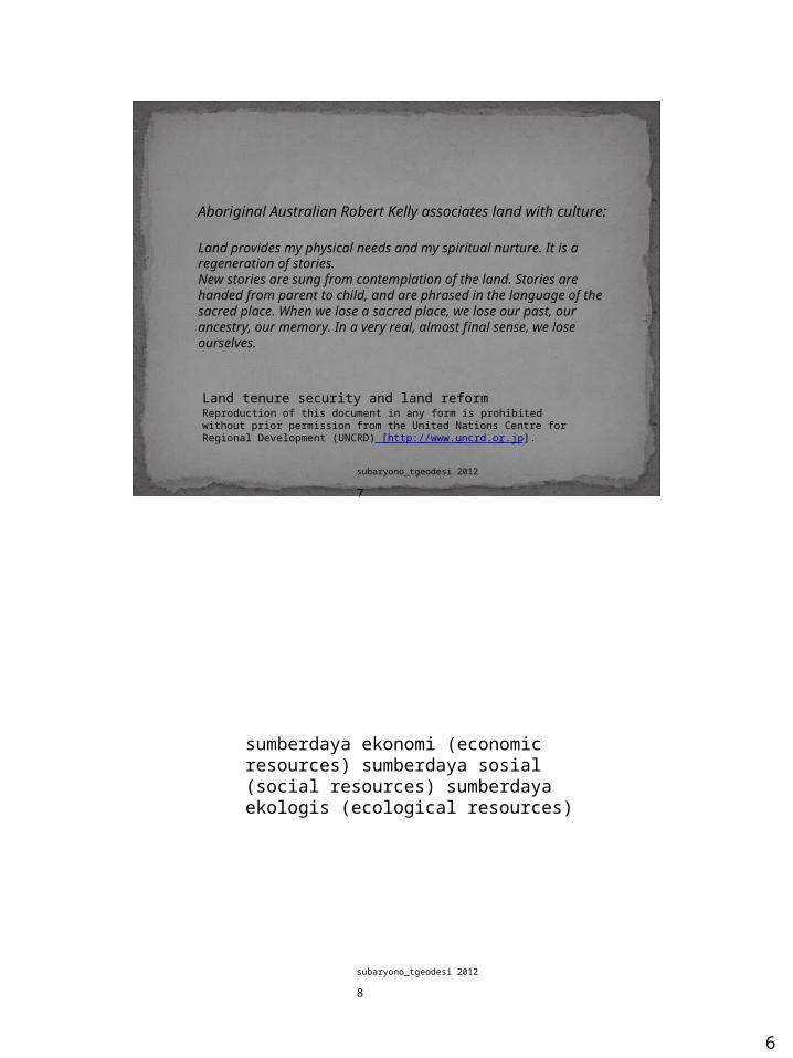
Aboriginal Australian Robert Kelly associates land with culture:
Land provides my physical needs and my spiritual nurture. It is aregeneration of stories.New stories are sung from contemplation of the land. Stories arehanded from parent to child, and are phrased in the language of thesacred place. When we lose a sacred place, we lose our past, ourancestry, our memory. In a very real, almost final sense, we loseourselves.
Land tenure security and land reformReproduction of this document in any form is prohibited without prior permission from the United Nations Centre for Regional Development (UNCRD) [htt p : / / ww w . un crd .o r . j p ].
subaryono_tgeodesi 2012 7
sumberdaya ekonomi (economic resources) sumberdaya sosial (social resources) sumberdaya ekologis (ecological resources)
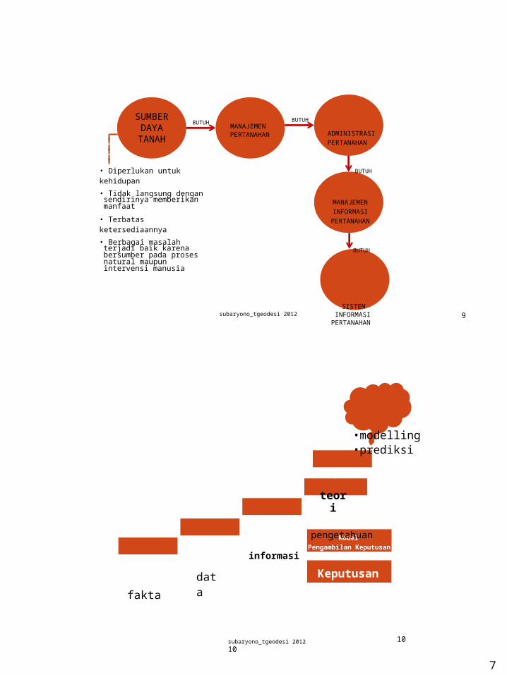
• Tidak langsung dengan sendirinya memberikan manfaat
• Terbatas ketersediaannya
• Berbagai masalah terjadi baik karena bersumber pada proses natural maupun intervensi manusia
BUTUH
MANAJEMEN INFORMASI PERTANAHA
N
BUTUH
subaryono_tgeodesi 2012SISTEM
INFORMASI 9PERTANAHAN
•modelling•prediksi
teori
pengetahuan
fakta
data
informasi
10subaryono_tgeodesi 2012 10
RESTRICTIONS
RIGHTs RESPONSIBILITIES
subaryono_tgeodesi 2012 11
• Proses geologi• Proses hidrologi• Perubahan iklim
subaryono_tgeodesi 2012 12
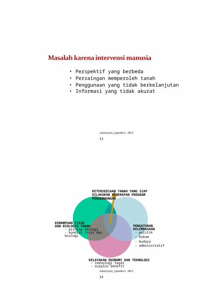
• Perspektif yang berbeda• Persaingan memperoleh tanah• Penggunaan yang tidak berkelanjutan• Informasi yang tidak akurat
subaryono_tgeodesi 2012 13
KETERSEDIAAN TANAH YANG SIAP DILAKUKAN PENERAPAN PROGRAM PENGEMBANGAN
KEMAMPUAN FISIK DAN BIOLOGIS TANAH
- prinsip ekologi- kondisi fisik dan biologi
PENGATURAN KELEMBAGAAN- politik- hukum- budaya- administratif
KELAYAKAN EKONOMI DAN TEKNOLOGI- teknologi tepat- surplus benefit
subaryono_tgeodesi 2012 14
ketidakseimbangan antara kebutuhan dan ketersediaan tanah menimbulkan persaingan
persaingan cenderung menimbulkan konf lik
persaingan penggunaan tanah penggunaan tanah oleh berbagai
sektor kehutanan, pertanian, industri, pariwisata
pengembangan daerah urban vs rural
persaingan pengguna tanah pemodal besar vs kecil penduduk lokal vs pendatang
subaryono_tgeodesi 2012 15
konflik antar pelaku pembangunan pemerintah, pengembang,
masyarakat konflik antar sektor pertanian, kehutanan, pertambangan, pariwisata, industrikonflik antar hirarki pemerintahan pusat, daerahkonflik pengembangan vs pelestarian
sources of conflict?
subaryono_tgeodesi 2012 16
status tanah tidak jelas karena:• transaksi informal (informal transactions)• transaksi ilegal (illegality of transaction)• pemecahan bidang tanah ilegal (illegality of subdivision)• tanah negara vs tanah adat (religious/customary inheritance)• menghindari pajak (avoiding taxes)
• tanah merupakan sumberdaya utama dalam kehidupan
• tanah memiliki keterbatasan• tanah berpotensi menimbulkan konflik• tanpa adanya intervensi, maka tanah
tidak selalu dapat memberikan yang terbaik – bahkan seringkali menimbulkan permasalahan (legal, social, ecological)
perlu land management -manajemen pertanahan …………
subaryono_tgeodesi 2012 18
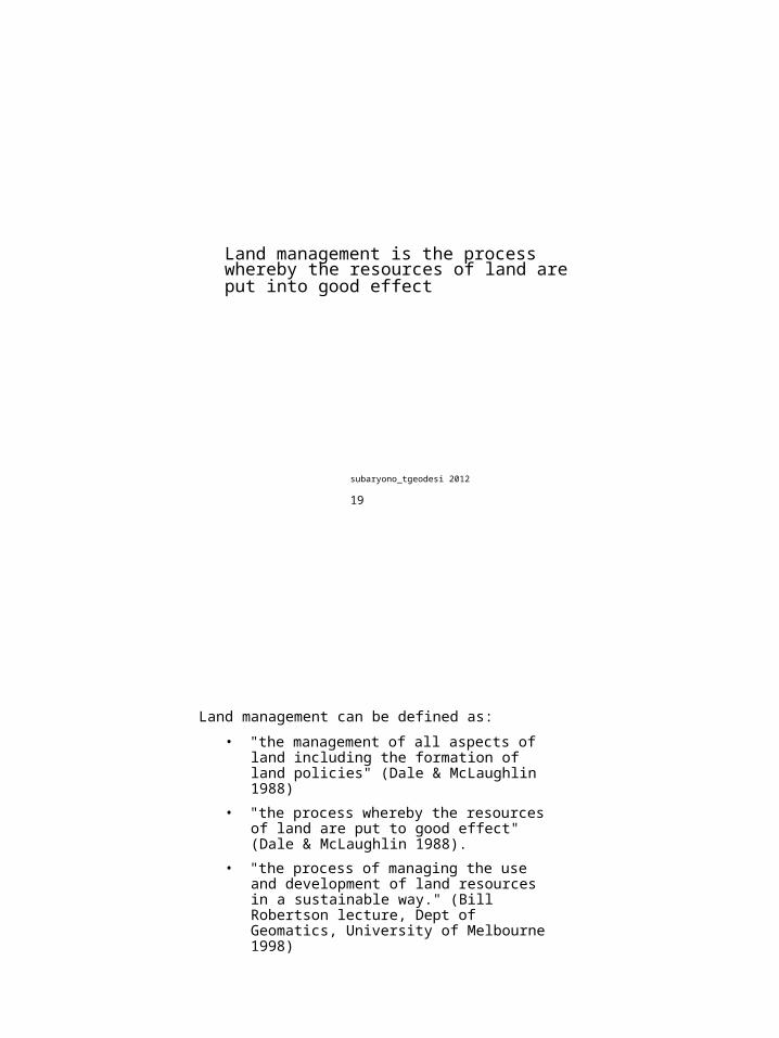
Land management is the process whereby the resources of land are put into good effect
subaryono_tgeodesi 2012 19
Land management can be defined as:
• "the management of all aspects of land including the formation of land policies" (Dale & McLaughlin 1988)
• "the process whereby the resources of land are put to good effect" (Dale & McLaughlin 1988).
• "the process of managing the use and development of land resources in a sustainable way." (Bill Robertson lecture, Dept of Geomatics, University of Melbourne 1998)
subaryono_tgeodesi 2012 20
seni dan sains (art and science) pengambilan keputusan untuk mendukung tujuan tertentu dengan mempertimbangkan inventarisasi, alokasi/settlement, pengembangan dan penggunaan, serta konservasi sumberdaya tanah
Manajemen Pertanahan meliputi:
Pengelolaan data dan informasi
Perencanaan dan permodelan untuk tindakan alternatif planning
policy making (pengambilan keputusan kebijakan) yang fundamental dengan memperhatikan kondisi alamiah, dan masyarakatnya
implementing the policy: keputusan-keputusan rutin operasional oleh administrator pertanahan
Pemantauan dan review efektifitas kebijakan
subaryono_tgeodesi 2012 21
tujuan: meningkatkan efisiensi
penggunaan sumberdaya
menyediakan incentives untuk pengembangan
melindungi lingkungan alamiah dari degradasi
menyediakan akses yang adil dan efisienmenuju keuntungan ekonomis dan pasar tanah
mendukung pelayanan pemerintah melalui perpajakan tanah dan pungutan lain yang terkait dengan peningkatan kualitas tanah dan lingkungan
Land resource management requires a more holistic view of land and a multi-disciplinary approach.
subaryono_tgeodesi 2012 22
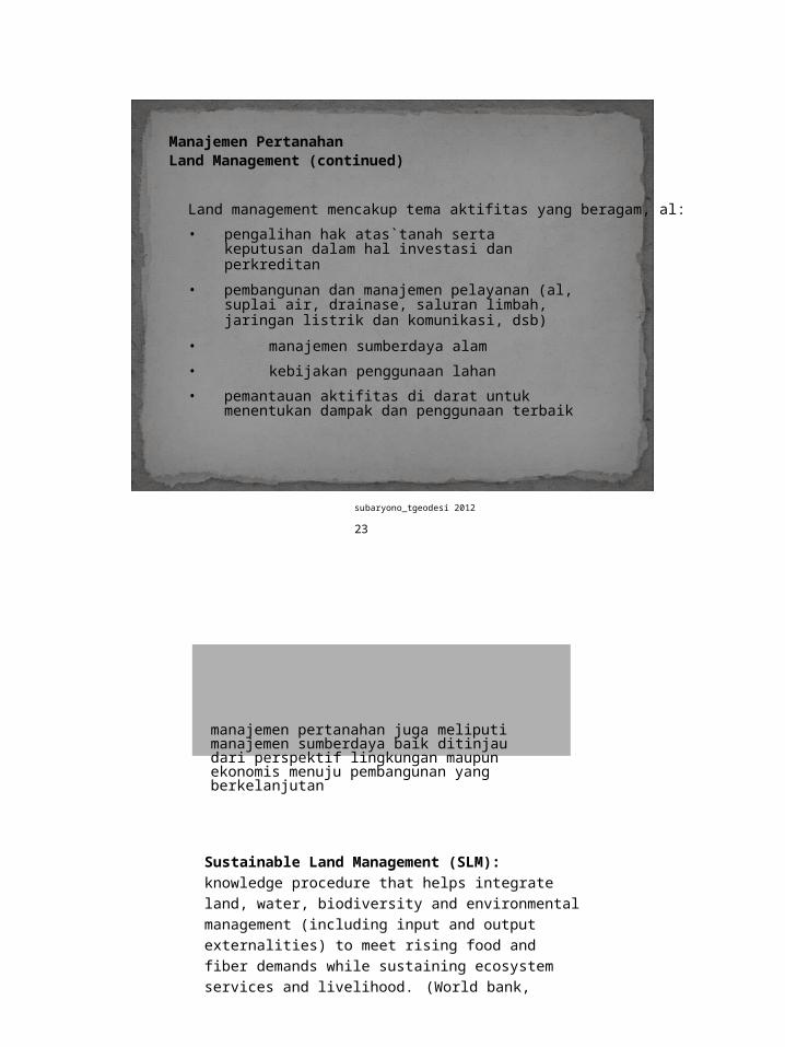
Manajemen PertanahanLand Management (continued)
Land management mencakup tema aktifitas yang beragam, al:
• pengalihan hak atas`tanah serta keputusan dalam hal investasi dan perkreditan
• pembangunan dan manajemen pelayanan (al, suplai air, drainase, saluran limbah, jaringan listrik dan komunikasi, dsb)
• manajemen sumberdaya alam
• kebijakan penggunaan lahan
• pemantauan aktifitas di darat untuk menentukan dampak dan penggunaan terbaik
subaryono_tgeodesi 2012 23
manajemen pertanahan juga meliputi manajemen sumberdaya baik ditinjau dari perspektif lingkungan maupun ekonomis menuju pembangunan yang berkelanjutan
Sustainable Land Management (SLM): knowledge procedure that helps integrate land, water, biodiversity and environmental management (including input and output externalities) to meet rising food and fiber demands while sustaining ecosystem services and livelihood. (World bank,2006)
subaryono_tgeodesi 2012 24
land as wealth
land as commodity
land as scarce resources
land as community scarce resources
feudalism industrialpost war information
revolution reconstruction revolution
1800 1950 1980
FISCAL
land valuation and taxation paradigm
JURIDICAL
land market paradigm
MANAGERIAL
land management paradigm
MULTI- PURPOSE sustainable development paradigm
Evolution of cadastres towards global land management approachsubaryono_tgeodesi 2012 25
Formulasi klasik proses pengambilan keputusan dalam manajemen pertanahan meliputi: identifikasi dan ranking tujuan mengembangkan metode-metode alternatif untuk mencapai investigasi konsekuensi tiap alternatif
Konsep penggunaan tanah tertinggi dan terbaik (highest and best use of land)
Highest and best use : terkait dengan atribut fisik, legal, desain, dan lokasional suatu properti terhadap kebutuhan pasar(market demand) dan feasibilitas finansial
subaryono_tgeodesi 2012 26
Analisis pasar berupaya mengidentifikasi the highest and the best use dari suatu properti berdasarkan pertimbangan dukungan pasar (demand), ketepatan waktu (absorption rates), dan pelaku pasar (probable users and buyers).
subaryono_tgeodesi 2012 27
NILAI PASAR = MARKET VALUE (MV)harga jual yang paling mungkin dari suatu properti dalam pasar terbuka (most probable sale price of a property in an open market)
NILAI PENGGUNAAN = USE VALUE (UV)nilai suatu properti untuk penggunaan tertentu (the value of property for a particular use)
MV dapat sama atau tidak sama
dengan UV MV dari tanah pertanian di
pinggir kota yangsedang berkembang dapat bernilai jauh lebih tinggi dari UVnya
subaryono_tgeodesi 2012 28
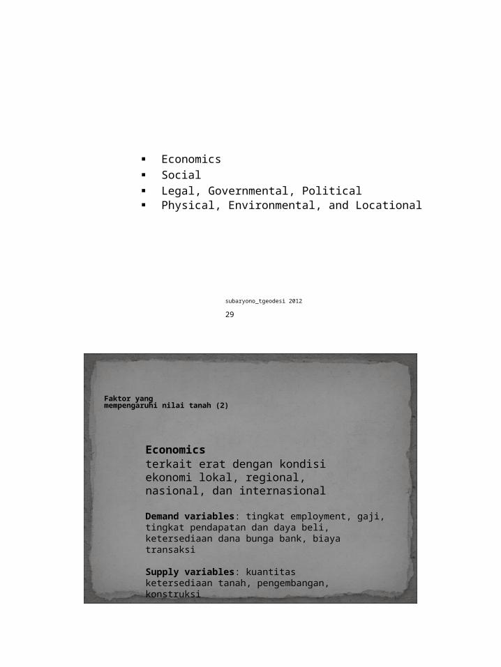
Economics Social Legal, Governmental, Political Physical, Environmental, and Locational
subaryono_tgeodesi 2012 29
Faktor yangmempengaruhi nilai tanah (2)
Economicsterkait erat dengan kondisi ekonomi lokal, regional, nasional, dan internasional
Demand variables: tingkat employment, gaji, tingkat pendapatan dan daya beli, ketersediaan dana bunga bank, biaya transaksi
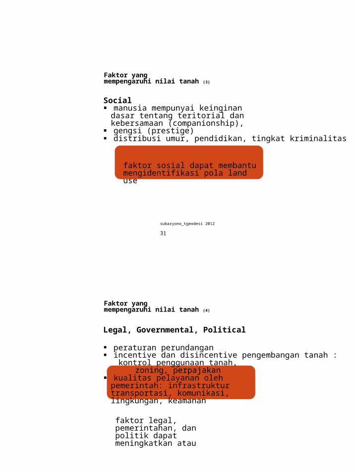
Social manusia mempunyai keinginan dasar tentang teritorial
dan kebersamaan (companionship), gengsi (prestige) distribusi umur, pendidikan, tingkat kriminalitas
faktor sosial dapat membantu mengidentifikasi pola land use
subaryono_tgeodesi 2012 31
Faktor yangmempengaruhi nilai tanah (4)
Legal, Governmental, Political
peraturan perundangan incentive dan disincentive pengembangan tanah :
kontrol penggunaan tanah, zoning, perpajakan kualitas pelayanan oleh pemerintah: infrastruktur
transportasi, komunikasi, lingkungan, keamanan
faktor legal, pemerintahan, dan politik dapat meningkatkan atau menurunkan kebutuhan tanah
subaryono_tgeodesi 2012 32
Faktor yangmempengaruhi nilai tanah (5)
Physical, Environmental, and Locational
• atribut tapak (site): ukuran, topografi, dan keadaan fisiktanah lainnya
• atribut situasi (situation attributes): terkait dengan posisi relatif obyek dengan obyek lainnya, seperti CBD, jalan toll, sekolah, fasilitas kesehatan
faktor-faktor tersebut dapat menjelaskan pola nilai tanah
subaryono_tgeodesi 2012 33
Tanah PerkotaanUrban land
According to the estimation of the UN concerning the number of megacities in 2015, Bombay (22.6 mill. inhabitants), Dhaka (22.8), Sao Paulo (21.2), Delhi (20.9) and MexicoCity (20.4) will be five of the worldwide six biggest megacities each with much more than 20million inhabitants.
100 years ago London (6.5) has been the greatest city(one million more inhabitants than New York), today it is a shrinking town.
subaryono_tgeodesi 2012 34
International Federation of SurveyorsArticle of the Month, August 2004Prof. Dr.-Ing. Theo Kötter, University of Bonn, GermanyRisks and Opportunities of Urbanisation and Megacities
Source:http: //www.me gacitie s. uni- koe ln. de /do c ume nta tion /me ga ci ty/m ap /MC -2015 -PGM. jpg
subaryono_tgeodesi 2012 35
kerumitan (complexity) saling ketergantungan (interdependency) pengetahuan yang tidak lengkap
(incomplete knowledge) kebutuhan jaringan infrastruktur kebutuhan investasi yang besar biaya transfer yang tinggi spekulasi tinggi fluktuasi tinggi
INFORMASI PERTANAHAN SANGAT DIPERLUKAN UNTUK MENDUKUNG MANAJEMEN PERTANAHAN DI PERKOTAAN
Kondisi Faktual Pertanahan keterbatasan tanah kebutuhan yang meningkat perubahan tata guna tanah pasar tanah tuntutan preservasi dan konservasi
Perlu adanya manajemen untuk meningkatkan/memperbaiki kondisi pertanahan
Manajemen banyak melibatkan kegiatan pengambilan keputusan – Pengambilan keputusan yang “accountable”
memerlukan “model pengambilan keputusan” Model Pengambilan keputusan
memerlukan input informasi.subaryono_tgeodesi 2012 37
pengambilan keputusan yang terkait dengan pertanahan menyangkut aspek:
• Land tenureship• Land use• Land valuation• Land development
38
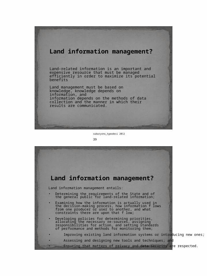
Land information management?
Land-related information is an important and expensive resource that must be managed efficiently in order to maximize its potential benefits
Land management must be based on knowledge, knowledge depends on information, andinformation depends on the methods of data collection and the manner in which their results are communicated.
subaryono_tgeodesi 2012 39
Land information management?Land information management entails:
• Determining the requirements of the State and of the general public for land-related information;
• Examining how the information is actually used in the decision-making process, how information f lows from one producer or user to another, and what constraints there are upon that f low;
• Developing policies for determining priorities, allocating the necessary re-sources, assigning responsibilities for action, and setting standards of performance and methods for monitoring them;
• Improving existing land information systems or introducing new ones;
• Assessing and designing new tools and techniques; and
• Ensuring that matters of privacy and data security are respected.
subaryono_tgeodesi 2012 40
Model
Model merupakan penyederhanaan mengenai fenomena di dunia nyata.
Model seringkali diupayakan untuk disajikan secara kuantitatif dan disajikan dalam bentuk matematik (mathematical model) variable
Pengumpulan Data bertujuan untuk memperoleh nilai untuk parameter maupun variabel yang ditetapkan
subaryono_tgeodesi 2012 41
Pengambilan Keputusan?
pemilihan tindakan dari dua atau lebih alternatif
subaryono_tgeodesi 2012 42
Prosedur Pengambilan Keputusan?
identifikasi masalah klarifikasi tujuan-tujuan khusus
yang diinginkan memeriksa berbagai kemungkinan
untuk mencapai tujuan yang telah ditetapkan
penetapan pilihan
keputusan sebaiknya berdasarkan atas fakta dan nilai (facts and values) INFORMASI
subaryono_tgeodesi 2012 43
•modelling•prediksi
teori
fakta
data
informasi
knowledge
ModelPengambilan Keputusan
KEPUTUSAN
Data: himpunan rekaman fakta (set of facts) yang dapatdiamati dan diukur
Informasi: data yang telah diolah menjadi sebuah bentuk yang berarti bagi penerimanya, dan bermanfaat untuk pengambilan keputusan
Data/informasi pertanahan: data/informasi yang terkait dengan tanah
subaryono_tgeodesi 2012 45
Land is an invaluable resource which requires to be managed
Land information is indispensable for land resource management
land information is a national resource that should be managed
A systems’s approach to land information management facilitates the optimization’s of input and otput of resources required for land resource management
subaryono_tgeodesi 2012 46
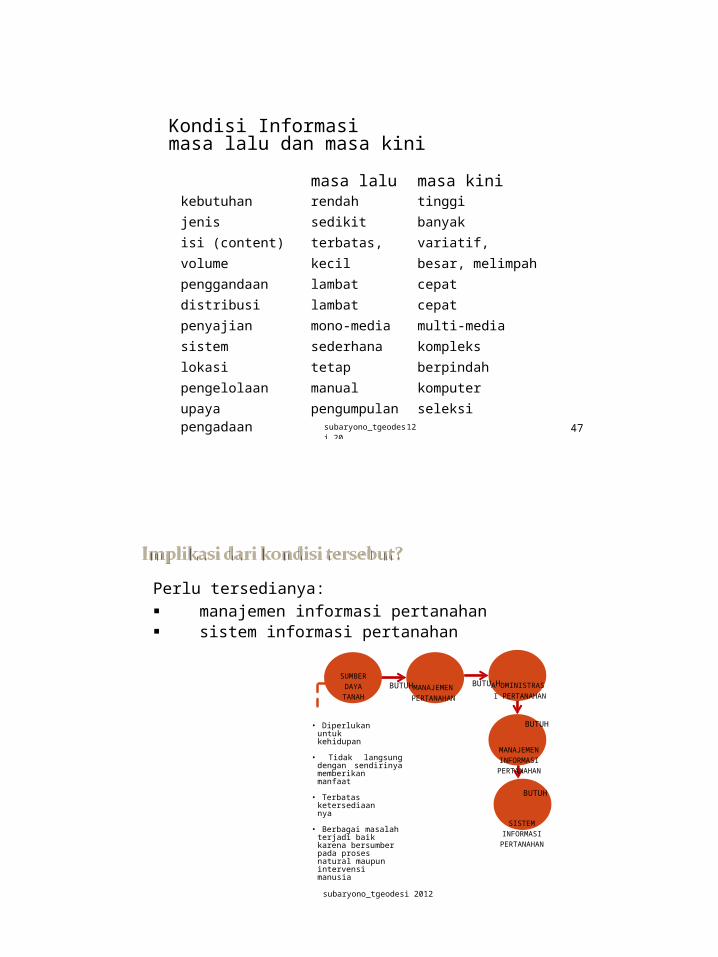
Kondisi Informasimasa lalu dan masa kini
masa lalu masa kinikebutuhan rendah tinggi
jenis sedikit banyak
isi (content) terbatas, statis
variatif, dinamis
volume kecil besar, melimpah
penggandaan lambat cepat
distribusi lambat cepat
penyajian mono-media multi-media
sistem sederhana kompleks
lokasi tetap berpindah
pengelolaan manual komputer
upaya pengadaan
pengumpulansubaryono_tgeodesi 20
seleksi12 47
Perlu tersedianya: manajemen informasi pertanahan sistem informasi pertanahan
SUMBER DAYA TANAH
BUTUHMANAJEMEN PERTANAHAN
BUTUAHDMINISTRASI PERTANAHAN
• Diperlukan untuk kehidupan
• Tidak langsung dengan sendirinya memberikan manfaat
• Terbatas ketersediaannya
• Berbagai masalah terjadi baik karena bersumber pada proses natural maupun intervensi manusia
BUTUH
MANAJEMEN INFORMASI PERTANAHA
N
BUTUH
SISTEM INFORMASI PERTANAHA
N
subaryono_tgeodesi 2012 48
A LIS is a tool for legal, administrative and economic decision making and an aid for planning and development, which consists: on the one hand of a database containing data for a defined area, and on the other hand of procedures and techniques for the systematic collection,updating, processing and distribution of the data.
subaryono_tgeodesi 2012 49
A LIS is a tool for legal, administratif and economic decision making and an aid for planning and development, which consists: on the one hand of a database containing data for a defined area, and on the other hand of procedures and techniques for the systematic collection, updating, processing and distribution of the data.
Key Words:
tool and aid : for legal, administratif and economic
decision making, planning and development
database containing data for a defined area, and on the other hand of
procedures and techniques for the systematic collection, updating, processing and distribution of the data.
subaryono_tgeodesi 2012 50
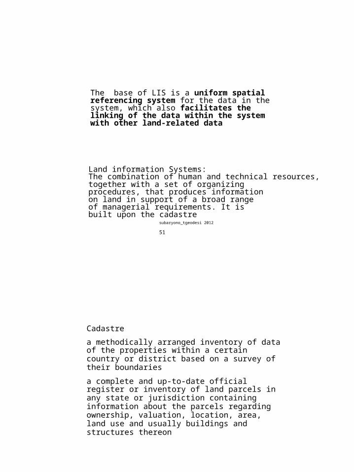
The base of LIS is a uniform spatial referencing system for the data in the system, which also facilitates the linking of the data within the system with other land-related data
Land information Systems:The combination of human and technical resources,together with a set of organizing procedures, that produces information on land in support of a broad range of managerial requirements. It is built upon the cadastre
subaryono_tgeodesi 2012 51
Cadastre
a methodically arranged inventory of data of the properties within a certain country or district based on a survey of their boundaries
a complete and up-to-date official register or inventory of land parcels in any state or jurisdiction containing information about the parcels regarding ownership, valuation, location, area, land use and usually buildings and structures thereon
subaryono_tgeodesi 2012 52
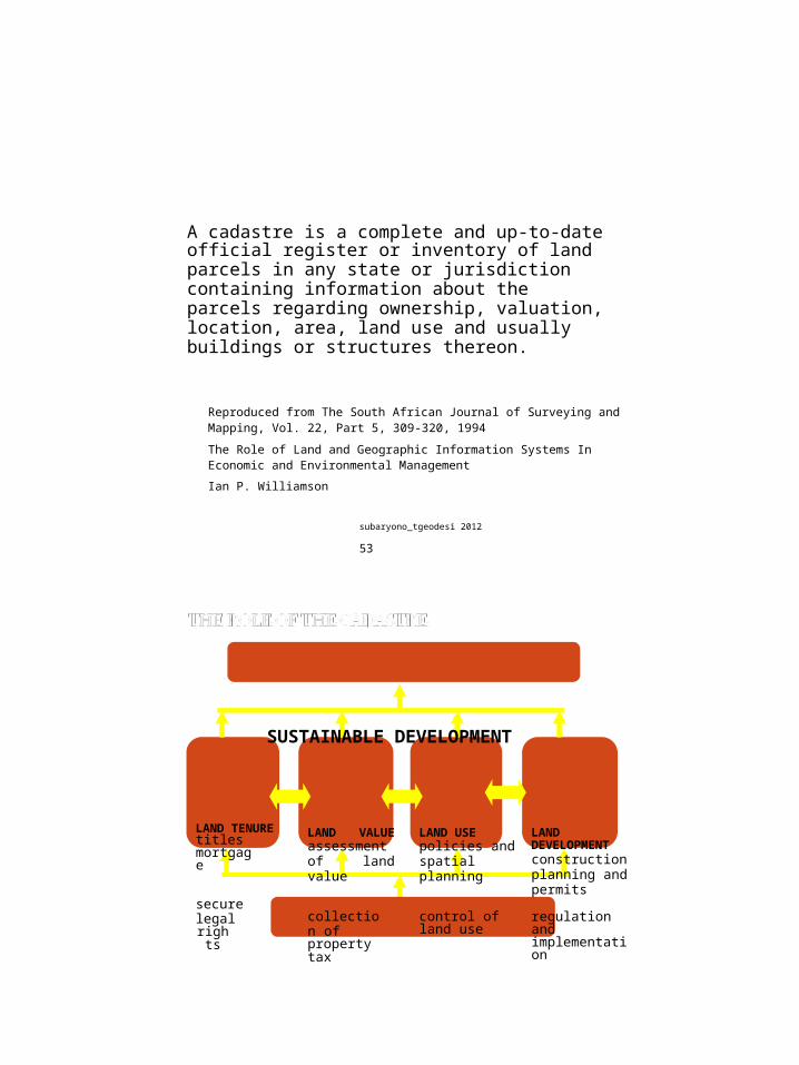
A cadastre is a complete and up-to-date official register or inventory of land parcels in any state or jurisdiction containing information about the parcels regarding ownership, valuation, location, area, land use and usually buildings or structures thereon.
Reproduced from The South African Journal of Surveying andMapping, Vol. 22, Part 5, 309-320, 1994
The Role of Land and Geographic Information Systems InEconomic and Environmental Management
Ian P. Williamson
subaryono_tgeodesi 2012 53
SUSTAINABLE DEVELOPMENT
LAND TENUREtitles mortgage
secure legalright
s
LAND VALUE assessment of land value
collection ofproperty tax
LAND USE policies and spatial planning
control ofland use
LAND DEVELOPMENT construction planning and permits
regulation and implementation
CADASTRE
subaryono_tgeodesi 2012 54
55
Cadastre is a parcel-based and up-to-date landinformation system containing a record of interests in land( e.g., rights, restrictions, and responsibilities).
It usually includes a geometric description of land parcels linked to other records describing the nature of interests, ownership or control of those interests, and often the value of the parcel and its improvements.
It may be established for fiscal purposes (valuation and taxation), legal purposes (conveyancing), to assist in the management of land and land use planning (planning and administration), and enables sustainable development and environmental improvement.
subaryono_tgeodesi 2012
certainty of ownership security of tenure reduction in land disputes improved conveyancing stimulation of land market security for credit monitoring of the land market facilitating land reform management of state lands greater efficiency in land planning improvement in physical planning support land resource management
subaryono_tgeodesi 2012 56
Legal cadastre – parcel-based description of interests or rights in real property; typically supported by titles or deeds, and registry.
Functions:
define property rights describe the extent (spatial, sometimes
temporal) of property rights support land transfer provide evidence of ownership program administration (e.g., enforcement
of laws, targeting of incentives) public land management
subaryono_tgeodesi 2012 57
Fiscal cadastre – property valuation and taxation
Functions: information base for property taxation distribution of funds from public funds monitoring and supporting land markets information for growth management and land
use planning
subaryono_tgeodesi 2012 58
Adjudication - official determination of rights in land
Demarcation - marking of the limits of each land parcel on the ground
Survey - measurements and mapping – including description ofrelevant information
Registration - registering the information in an official registration systems
Information Management - managing the informaton to facilitate decision making
subaryono_tgeodesi 2012 59
Parcel (general):Land parcel or lot, plot, plat:A continuous area of land within which unique andhomogeneous interests are recognized
Cadastral Parcel :A continuous area of land within which unique andhomogeneous legal (property) are recognized
subaryono_tgeodesi 2012 60
Criteria Simplicity (easy to understand and use;
reasonably permanent)
Uniqueness (unambiguous) Accuracy (a relevan criterion if required that
identifier contains spatial information)
Flexibility (to be compatible with various systems, flexible to incorporate future advances in computer for land-data systems)
Economy (cost of initial implementation of land-data systems; cost of operating)
Accessibility (easy assignment and interpretation)
subaryono_tgeodesi 2012 61
Typical LIS: cadastre as a primary component maintained by unit of government
responsible for tracking land ownership, control
parcel oriented relatively large (cartographic) scale bridge between legal and technical land descriptions
subaryono_tgeodesi 2012 62
geographic location individual land parcels legal titles specific description of land parcels economic, social, cultural and administrative data land use physical data data concerning owners, users and occupiers
subaryono_tgeodesi 2012 63
equitable taxation better land transfer better land development process better planning assistance in economic decisions by
private management safety in the use of land greater justice
subaryono_tgeodesi 2012 64
LIS Players/stakeholders:
government- central- local
public- community
land-related business and NGOs- developer- banking- insurance- conservation and environmental protection
subaryono_tgeodesi 2012 65
Information Systems
Non-spatial
Information Systems
Spatial
Information Systems
ResourceInformation
Systems
Other Spatial
Information Systems
Geographic
Information Systems
LandInformation
Systems
subaryono_tgeodesi 2012 66
Sistem Informasi Pertanahan (3) Land Information Systems
IS can be eitherfunction-oriented or provision-oriented
Function-oriented systems serve organizations intheir own activities.The purpose of such systems is to facilitate and to achieve greater efficiency in the work within the organization.
Provision-oriented systems serve organizations which do not use the information themselves - but have the task to provide other organizations with information.
subaryono_tgeodesi 2012 67
adopsi cara berfikir ilmiah dan sistematikjenis dan volume informasi pertanahan yang semakin besarsifat informasi yang dinamisperubahan sikap manajemen yang tertutup menjadi transparanperubahan praktek manajemen hirarkis menjaditerdistribusikebutuhan memperoleh informasi secara cepat dan akuratketersediaan teknologi
subaryono_tgeodesi 2012 68
to seek a return on the government's investment in collecting and maintaining the land-related data
to cover organisational costs in the provision of land information products and servicesto increase efficiency in the allocation of resources within a jurisdiction through market forces
to increase efficiency in the management and use of resources within organisationsto enable market forces to influence demand and supply of land information products and services
subaryono_tgeodesi 2012 69
• to keep government costs in distribution to a minimum by discouraging unnecessary use of the land information services
• to generate income to support the expansion of services and thereby encourage service growth
• to provide an incentive for the use of spare capacity by enabling agencies to generate and utilise additional revenues.
subaryono_tgeodesi 2012 70
A Global Land Management Perspective
subaryono_tgeodesi 2012 71
The land Management Paradigm
subaryono_tgeodesi 2012 72
Integrated Land Use Management for Sustainable Development.
subaryono_tgeodesi 2012 73
• 30 years ago: learned about GIS• 20 years ago: digitized data• 10 years ago: learned about duplication of efforts
from learning to use hardware and software to• data acquisition (how and from where to
get the data)• data quality (why these data do not
fit our purpose?)• data integration (can we get better
information from all these data?)
subaryono_tgeodesi 2012 74
Required Reading:
Dale P.D. and McLaughlin, J.D., Land Information Management, Clarendon Press: Oxford, 1988 (especially chapters 1 and 2).
References
A list of suggested references for understanding the lecture material. eg.
C a d a s t re 2014 : htt p : / / ww w . swiss t o p o . c h / fi g- wg7 1 / D o cs/C a d2 014 in d ex. ht m
FIG Statement on the Cadastre:htt p : / / ww w . sl i . uni me l b .e d u .a u / f i g7/c a d a s t r e /s t at eme n t _o n_ cadastre. htm l
Henssen, J.L.G. and Williamson I.P. Land Registration, Cadastre and its interaction: A world perspective. Proceedings of FIG XIX International Congress, Vol7, Helsinki, Finland: 14-43 (1990).
Larsson, G., Land Registration and Cadastral Systems, Longman Scientific and Technical: London, 1991.
MacNeill, J.W. 1971, Environment Management, PrivyCouncil Office, Government of Canada, Ottawa.
subaryono_tgeodesi 2012 75
References
Phillips, A., Williamson, I.P. and Ezigbalike, I.C. 1998. The Importance of Metadata Engines in Spatial Data Infrastructures. Proceedings of AURISA '98, Perth, Western Australia, 23-27 November, CD-ROM. at htt p : / / ww w . sl i . uni me l b .e d u .a u /r e s e a r c h / p u b l i c a t i o n s/ I P W _ p u b l . ht m l
UN/FIG Bogor Declaration on Cadastral Reform:http: //www. sli. unime lb.e du.a u/ fi g7/Bo go r/ Bo go rDe c larat io n. htm l
UNECE, Land Administration Guidelines, Meeting of Land Administrators [go to Meeting of Officials on Land Administration]
Williamson, I.P. The assessment of a Swiss Cadastre from an Australian perspective, The Australian Surveyor, Vol30, No7, pp423-453.
Williamson, I.P. A Modern Cadastre for NSW, PhD Thesis, UNISERV S-23, School of Surveying, University of New South Wales, 1983 (unpublished).
Williamson, I.P. The role of the cadastre in statewide land information systems. The Australian Surveyor, Vol31, No8, 567-581 (1983).
Papers by Prof Ian WIlliamson and other researchers:h t t p : / / ww w .s l i . u n i m e l b . e d u . a u / r e s ea r c h / p u b l i ca t i o n s / I P W_ p u b l . h tm l
US Dept of Commerce, 1987. The Multi-purpose Cadastre: A ModernApproach to organising Land Data and Information, NOAA, 12pp.
1. Peran GPS/GNSS dalam Manajemen InformasiPertanahan
2. Peran Sistem Informasi Geospasial dalamManajemen Informasi Pertanahan
3. Peran Penginderaan Jauh dalam ManagementInformasi Pertanahan
4. Peran Infrastruktur Data Spasial dalam ManajemenInformasi Pertanahan
Tugas Kelompok (anggota 5-6 orang) Menyusun makalah dengan salah satu judul tsb diatas Dipresentasikan dalam bentuk power point Diserahkan minggu depan (30 Nov 2012)


![[ Sistem Informasi Manajemen ]](https://static.documents.pub/doc/80x56/56814f86550346895dbd3d66/-sistem-informasi-manajemen-.jpg)


