29
Copyright © 2013, Oracle and/or its affiliates. All rights reserved. 1 May 22, 2013 Ronald Reagan Building and International Trade Center Washington, DC USA

Copyright © 2013, Oracle and/or its affiliates. All rights reserved. 1
May 22, 2013 Ronald Reagan Building and International Trade Center
Washington, DC USA
Building Applications with Oracle MapViewer LJ Qian ([email protected]) Director, Software Development
Copyright © 2013, Oracle and/or its affiliates. All rights reserved. 3
The following is intended to outline our general product direction. It is intended for information purposes only, and may not be incorporated into any contract. It is not a commitment to deliver any material, code, or functionality, and should not be relied upon in making purchasing decisions. The development, release, and timing of any features or functionality described for Oracle’s products remains at the sole discretion of Oracle.

Copyright © 2013, Oracle and/or its affiliates. All rights reserved. 4
Program Agenda
What is MapViewer
Getting started
Managing mapping metadata with Map Builder
Introducing the new HTML5 API
The MVDEMO samples application

Copyright © 2013, Oracle and/or its affiliates. All rights reserved. 5
What is MapViewer?

Copyright © 2013, Oracle and/or its affiliates. All rights reserved. 6
A JEE component (.ear) for developing web mapping applications. Usually deployed in WLS.
Renders geospatial content stored in Oracle databases and other sources.
Provides JavaScript (HTML5) and REST/XML APIs
Built-in support of OGC standards Easy mash-up with 3rd party map services Comes with a companion desktop Map Builder
tool
What is MapViewer
Overview
Copyright © 2013, Oracle and/or its affiliates. All rights reserved. 7
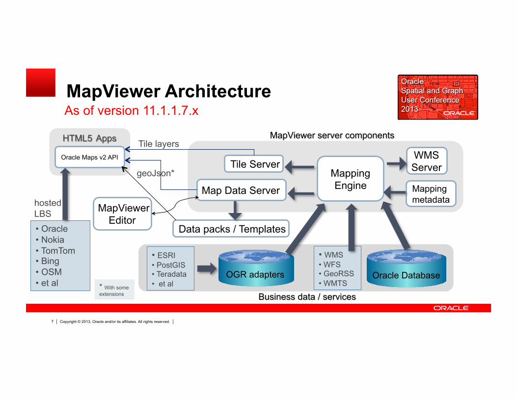
MapViewer Architecture
Oracle Database OGR adapters
Mapping Engine Map Data Server
Tile Server
• ESRI • PostGIS • Teradata • et al
Tile layers
geoJson*
• Oracle • Nokia • TomTom • Bing • OSM • et al
hosted LBS
WMS Server
* With some extensions
Data packs / Templates
Oracle Maps v2 API
MapViewer Editor
• WMS • WFS • GeoRSS • WMTS
Mapping metadata
As of version 11.1.1.7.x
Copyright © 2013, Oracle and/or its affiliates. All rights reserved. 8
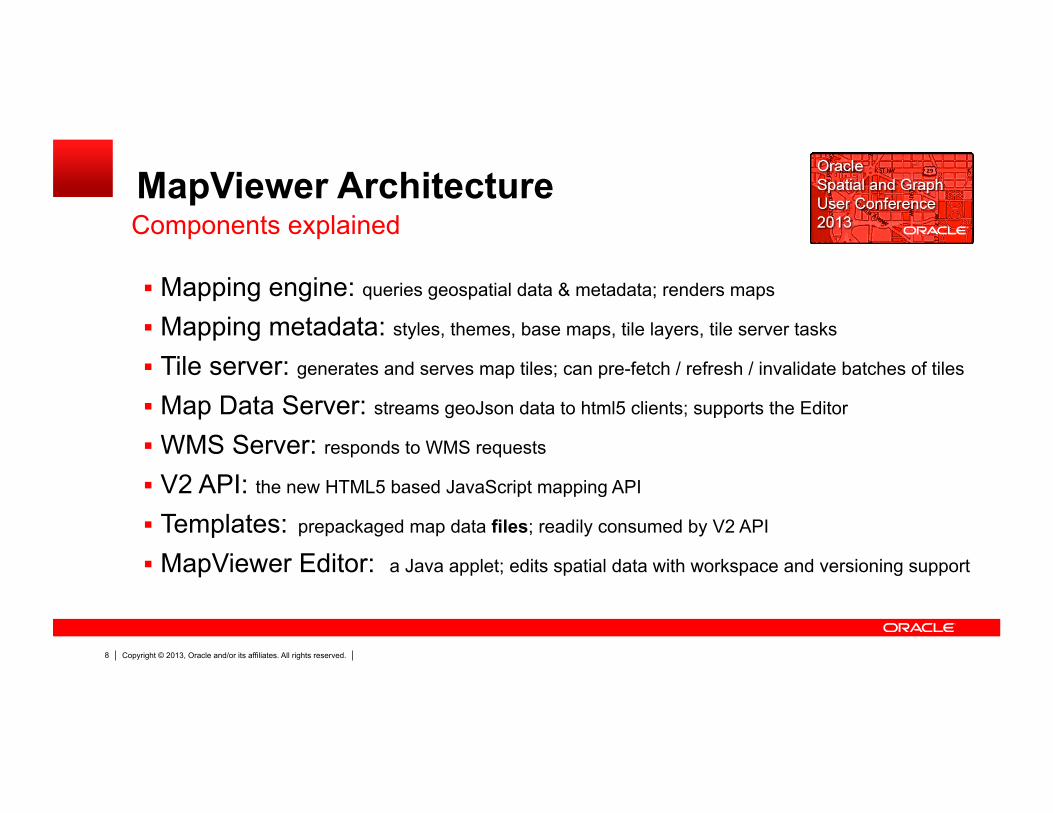
MapViewer Architecture
Mapping engine: queries geospatial data & metadata; renders maps
Mapping metadata: styles, themes, base maps, tile layers, tile server tasks
Tile server: generates and serves map tiles; can pre-fetch / refresh / invalidate batches of tiles
Map Data Server: streams geoJson data to html5 clients; supports the Editor
WMS Server: responds to WMS requests
V2 API: the new HTML5 based JavaScript mapping API
Templates: prepackaged map data files; readily consumed by V2 API
MapViewer Editor: a Java applet; edits spatial data with workspace and versioning support
Components explained
Copyright © 2013, Oracle and/or its affiliates. All rights reserved. 9
Getting started
Copyright © 2013, Oracle and/or its affiliates. All rights reserved. 10
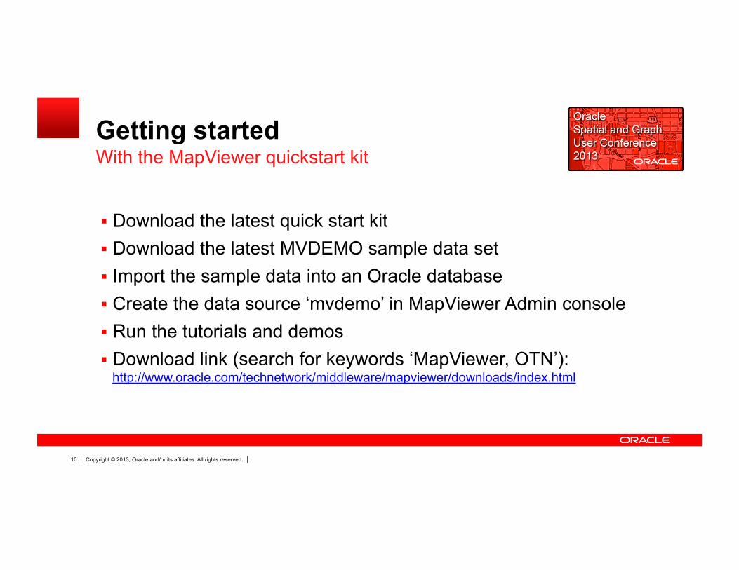
Getting started
Download the latest quick start kit Download the latest MVDEMO sample data set Import the sample data into an Oracle database Create the data source ‘mvdemo’ in MapViewer Admin console Run the tutorials and demos Download link (search for keywords ‘MapViewer, OTN’):
http://www.oracle.com/technetwork/middleware/mapviewer/downloads/index.html
With the MapViewer quickstart kit
Copyright © 2013, Oracle and/or its affiliates. All rights reserved. 11
Managing Mapping Metadata with Map Builder

Copyright © 2013, Oracle and/or its affiliates. All rights reserved. 12
Styles: map symbols, patterns Themes: layers with styling rules Tile layers Base maps
Manages metadata
Map Builder A companion desktop map authoring tool
Copyright © 2013, Oracle and/or its affiliates. All rights reserved. 13
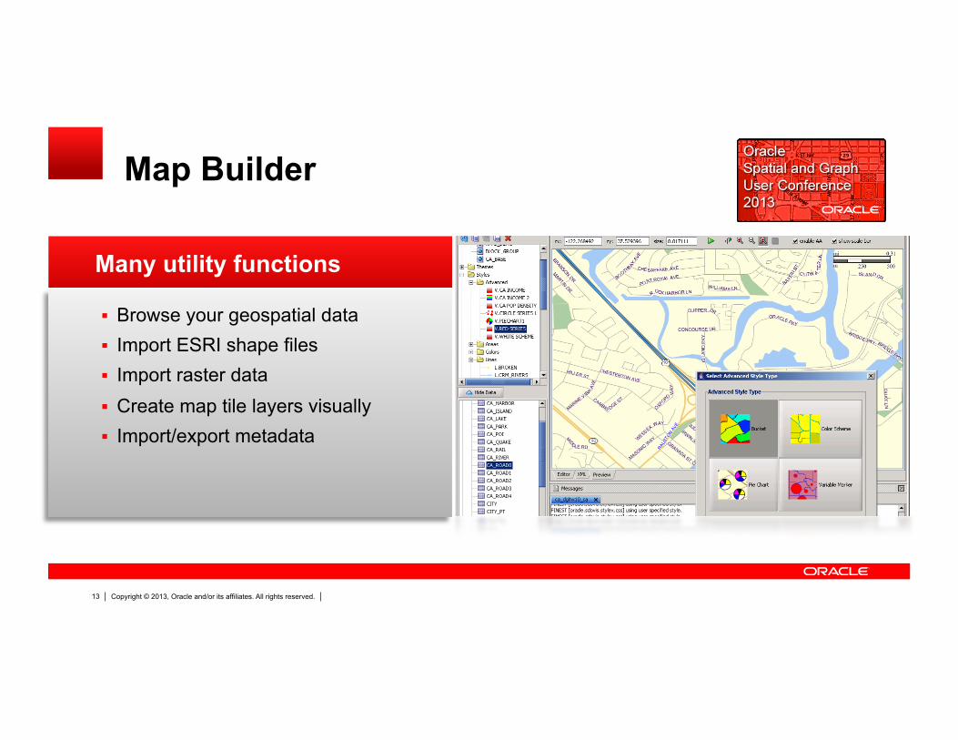
Browse your geospatial data Import ESRI shape files Import raster data Create map tile layers visually Import/export metadata
Many utility functions
Map Builder
Copyright © 2013, Oracle and/or its affiliates. All rights reserved. 14
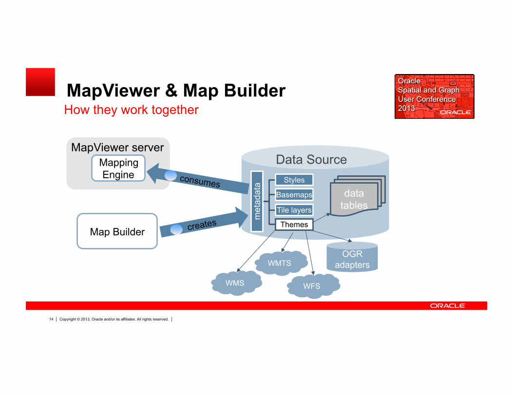
MapViewer & Map Builder How they work together
Mapping Engine
data tables
met
adat
a Styles
Themes
Basemaps
Tile layers
Data Source
WMS
WMTS OGR
adapters
WFS
Map Builder creates
consumes

Copyright © 2013, Oracle and/or its affiliates. All rights reserved. 15
Managing Metadata with Map Builder
Launches from a single JAR file java -jar mapbuilder.jar Connects to databases directly Reads/writes metadata from/to DB

D E M O N S T R A T I O N
Using Map Builder
Copyright © 2013, Oracle and/or its affiliates. All rights reserved. 17
Introducing the new HTML5 API
Copyright © 2013, Oracle and/or its affiliates. All rights reserved. 18
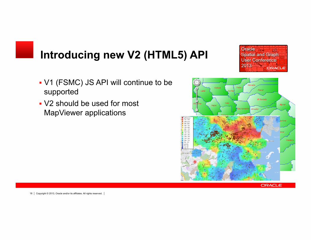
Introducing new V2 (HTML5) API
V1 (FSMC) JS API will continue to be supported
V2 should be used for most MapViewer applications

Copyright © 2013, Oracle and/or its affiliates. All rights reserved. 19
Introducing new V2 (HTML5) API
Written from ground up Uses Canvas/SVG Browser renders JSON data with
many effects and animations Supports all existing MapViewer
metadata Comes with a rich set of tutorials Natively supports Nokia, TomTom,
Bing, OSM and other map services

D E M O N S T R A T I O N
The new HTML5 API
Copyright © 2013, Oracle and/or its affiliates. All rights reserved. 21
The MVDEMO samples app
Copyright © 2013, Oracle and/or its affiliates. All rights reserved. 22
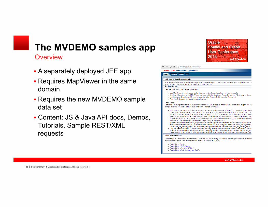
The MVDEMO samples app Overview
A separately deployed JEE app Requires MapViewer in the same
domain Requires the new MVDEMO sample
data set Content: JS & Java API docs, Demos,
Tutorials, Sample REST/XML requests
Copyright © 2013, Oracle and/or its affiliates. All rights reserved. 23
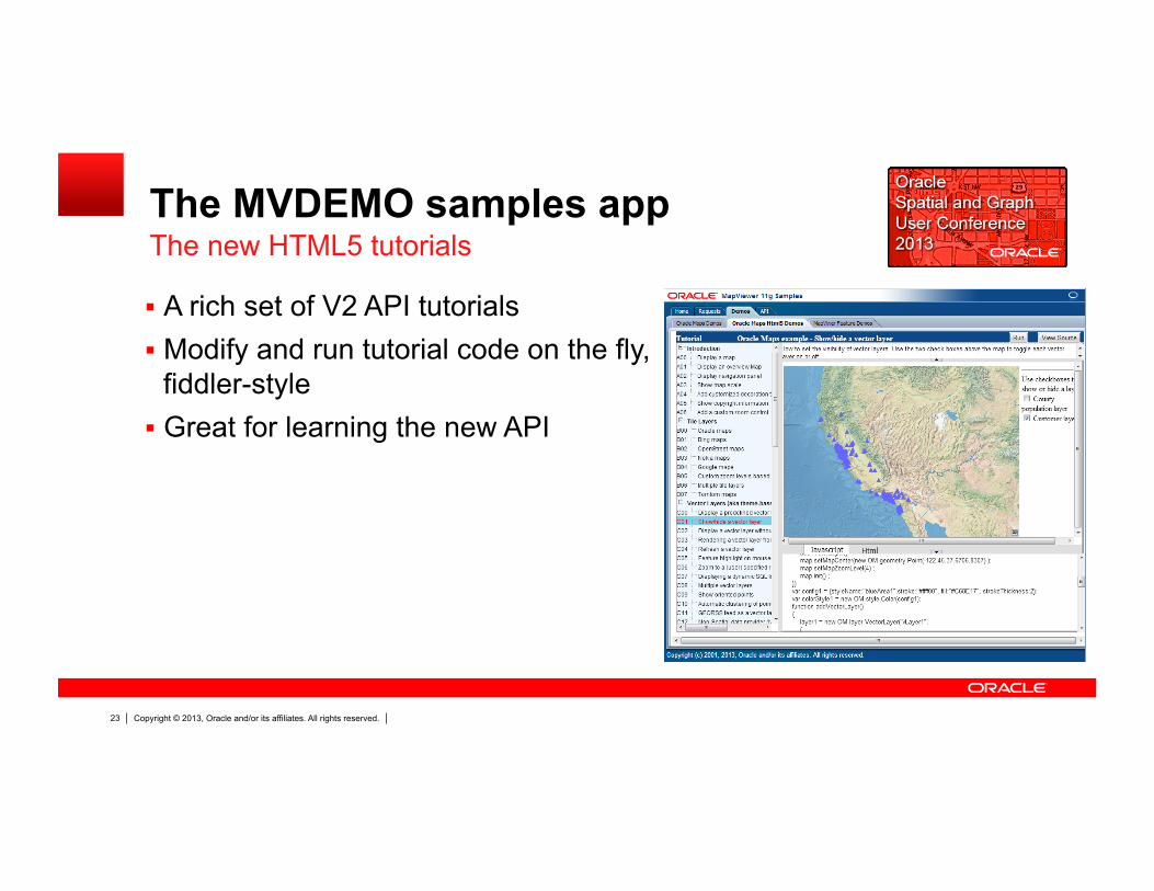
The MVDEMO samples app The new HTML5 tutorials
A rich set of V2 API tutorials Modify and run tutorial code on the fly,
fiddler-style Great for learning the new API

D E M O N S T R A T I O N
The MVDEMO app

Q & A
Resources
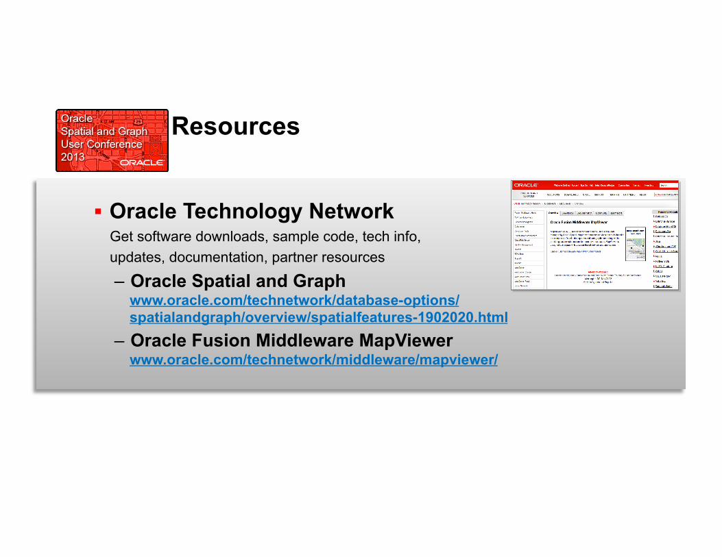
Oracle Technology Network Get software downloads, sample code, tech info, updates, documentation, partner resources
– Oracle Spatial and Graph www.oracle.com/technetwork/database-options/ spatialandgraph/overview/spatialfeatures-1902020.html
– Oracle Fusion Middleware MapViewer www.oracle.com/technetwork/middleware/mapviewer/
Communities & Certification
• Communities: Stay connected and exchange knowledge with the community of users and experts – User Groups Worldwide
• North American IOUG S&G SIG: http://www.ioug.org/p/cm/ld/fid=148&gid=439
– Technology blogs, social networking groups – OTN Spatial or MapViewer > Community Tab
• Partner Specialization & Individual Certification for Spatial Credentials for individuals & official partner specialization
program through Oracle PartnerNetwork Exam information, training, business/competency
requirements for partners, webcast www.oracle.com/technetwork/database-options/
spatialandgraph/learnmore/spatial-partners-423197.html Speak with an specialization committee member at the Oracle
table today

MapViewer in Action
Oracle eLocation Services
http://maps.oracle.com

More Information … http://www.oracle.com/technetwork/middleware/mapviewer


