84
Frederic Max Squires - CTR Unit ed St at es Coast Guard Möbius Strip M.C. Escher
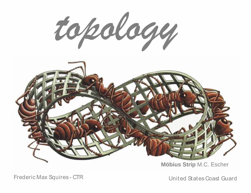
Frederic Max Squires - CTR United States Coast Guard
Möbius Strip M.C. Escher
Topics
• Explain topology and its related components
• Show how to build a topological relationship in ArcGIS
• Discuss the benefits and drawbacks of topological relationships
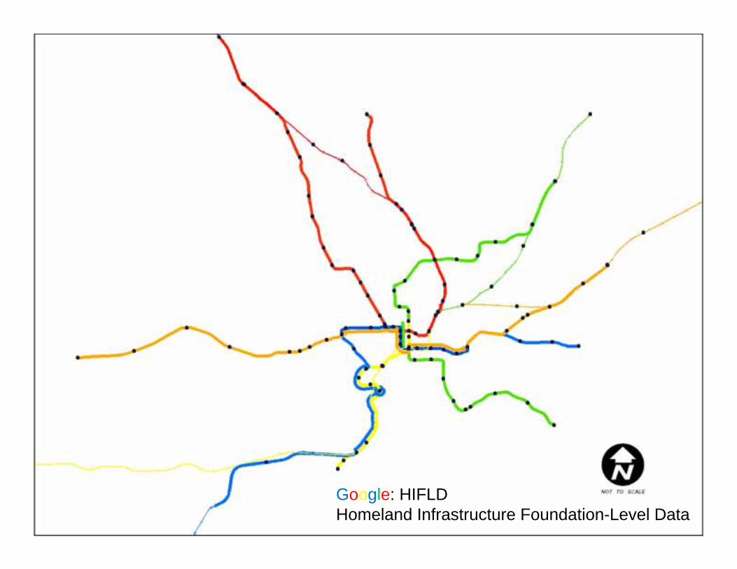
Google: HIFLD Homeland Infrastructure Foundation-Level Data
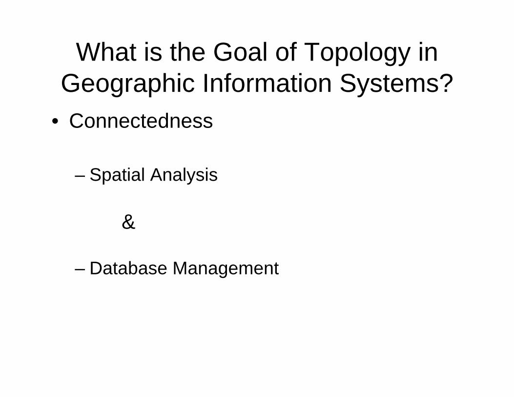
What is the Goal of Topology in Geographic Information Systems?
• Connectedness
– Spatial Analysis
&
– Database Management
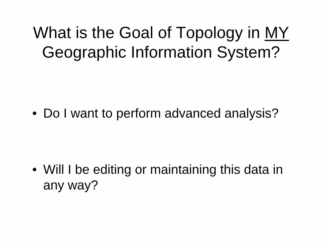
What is the Goal of Topology in MYGeographic Information System?
• Do I want to perform advanced analysis?
• Will I be editing or maintaining this data in any way?
The goal of topology
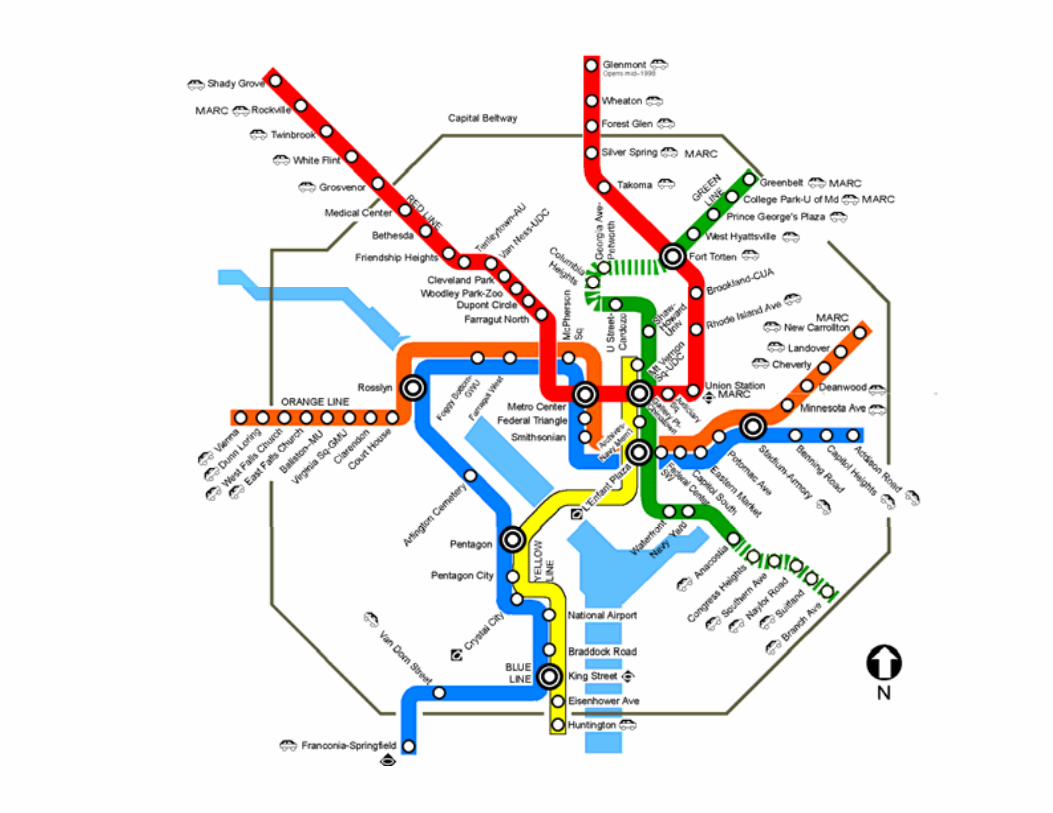
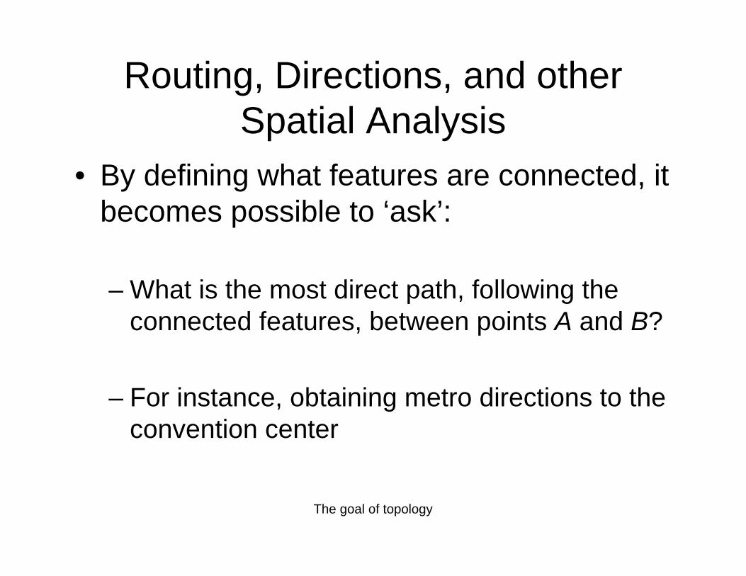
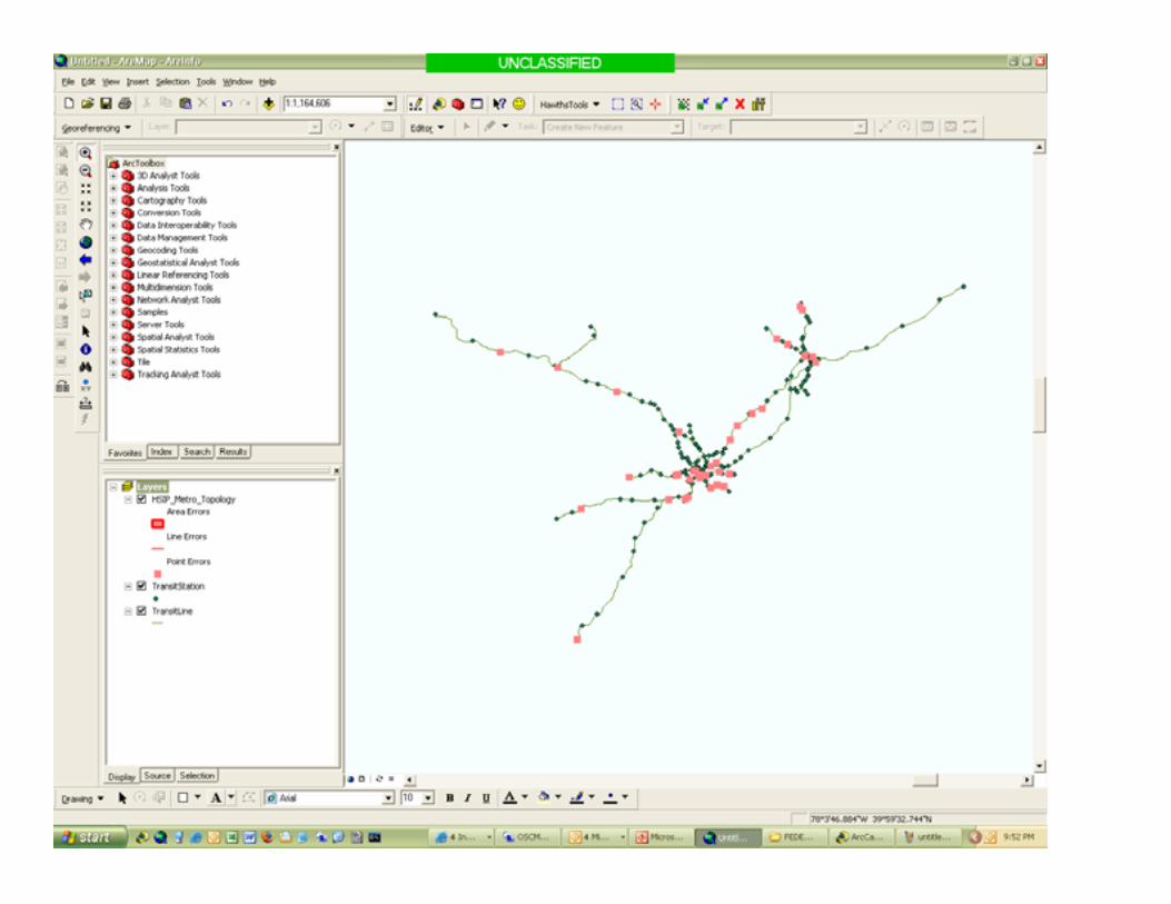
Routing, Directions, and other Spatial Analysis
• By defining what features are connected, it becomes possible to ‘ask’:
– What is the most direct path, following the connected features, between points A and B?
– For instance, obtaining metro directions to the convention center
The goal of topology
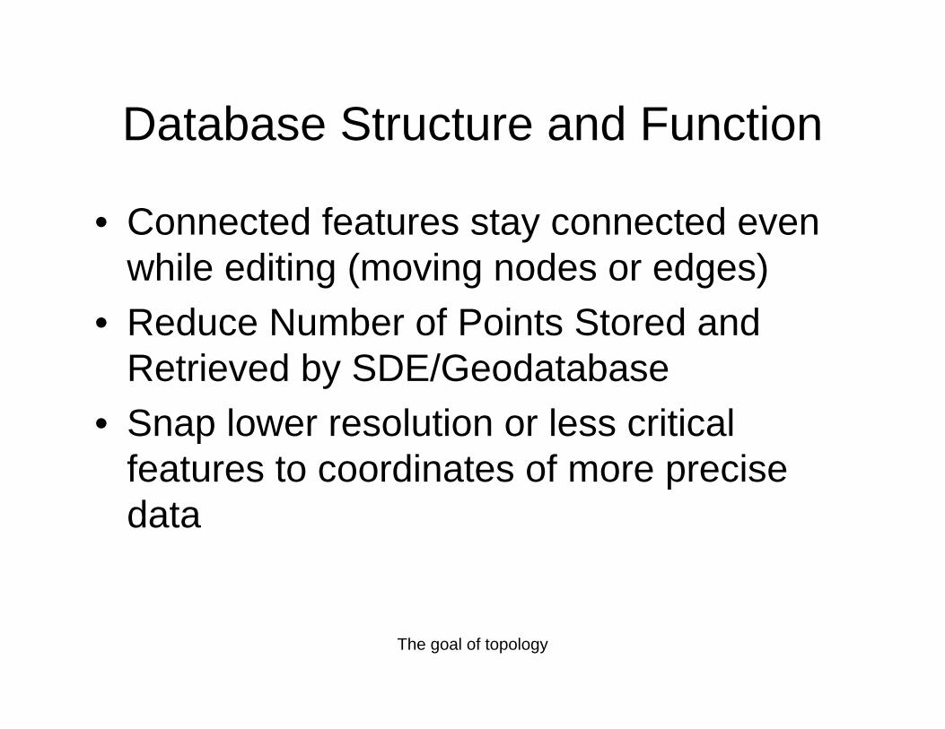
Database Structure and Function
• Connected features stay connected even while editing (moving nodes or edges)
• Reduce Number of Points Stored and Retrieved by SDE/Geodatabase
• Snap lower resolution or less critical features to coordinates of more precise data
Topics
• Explain topology and its related components
• Show how to build a topological relationship in ArcGIS
• Discuss the benefits and drawbacks of topological relationships
Data
• What is the source format of the data?• Are the projections/coordinate systems of
the various data the same?• Does the data already have a topological
relationship that can be exploited?
Metadata
• For what purpose was the data created?• What is the recommended scale of the
data?
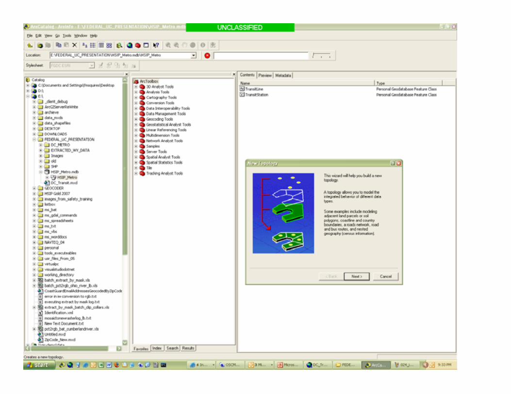
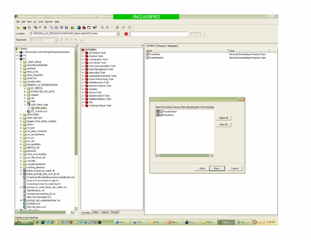
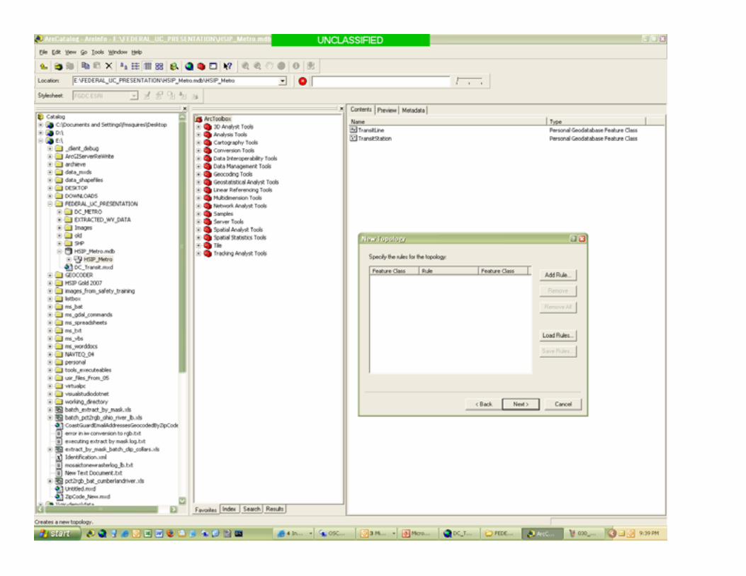
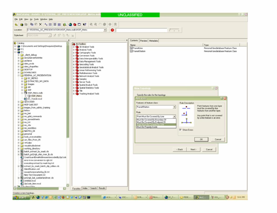
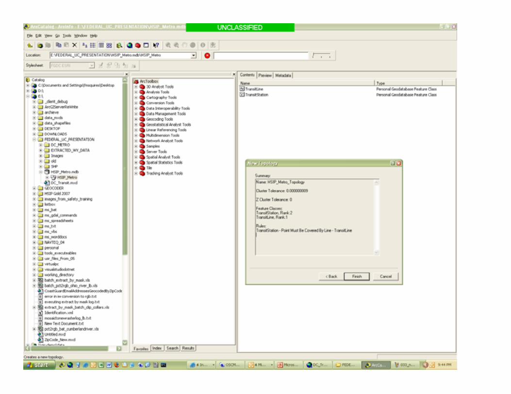
Topological Design
• What features will share geometry?• Should edits to one feature modify others?• How will data be organized? • What topological rules will be followed?• What is the desired accuracy of the data?
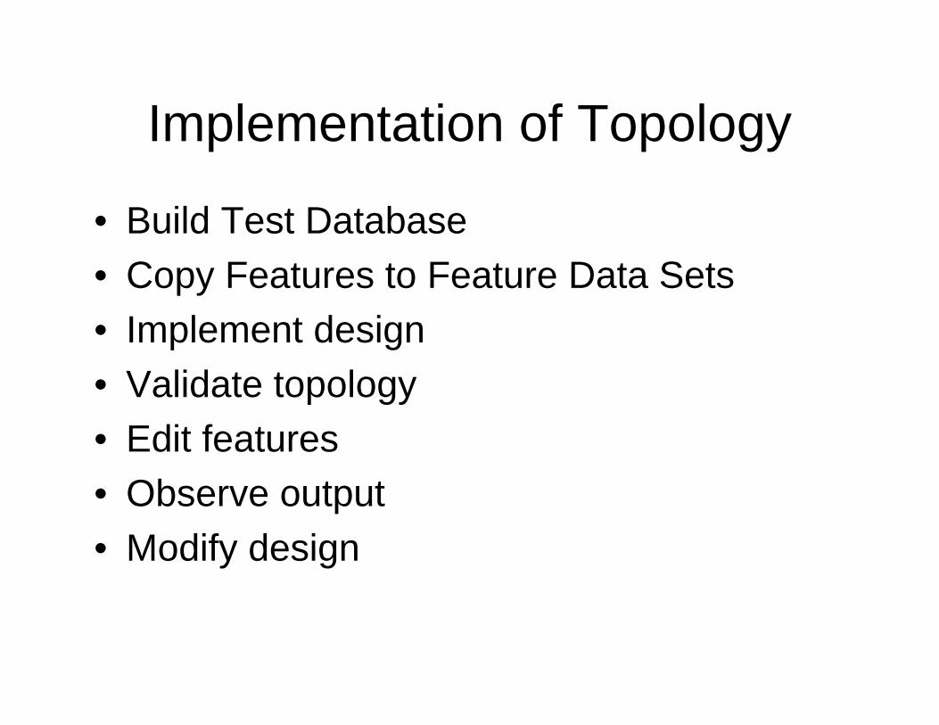
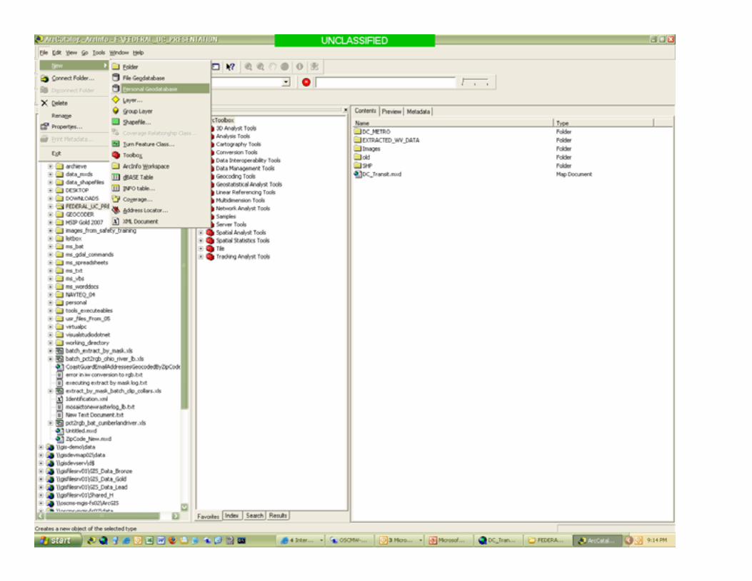
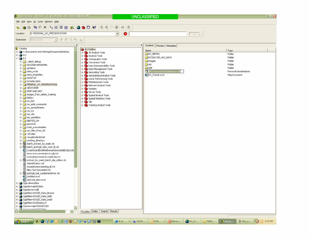
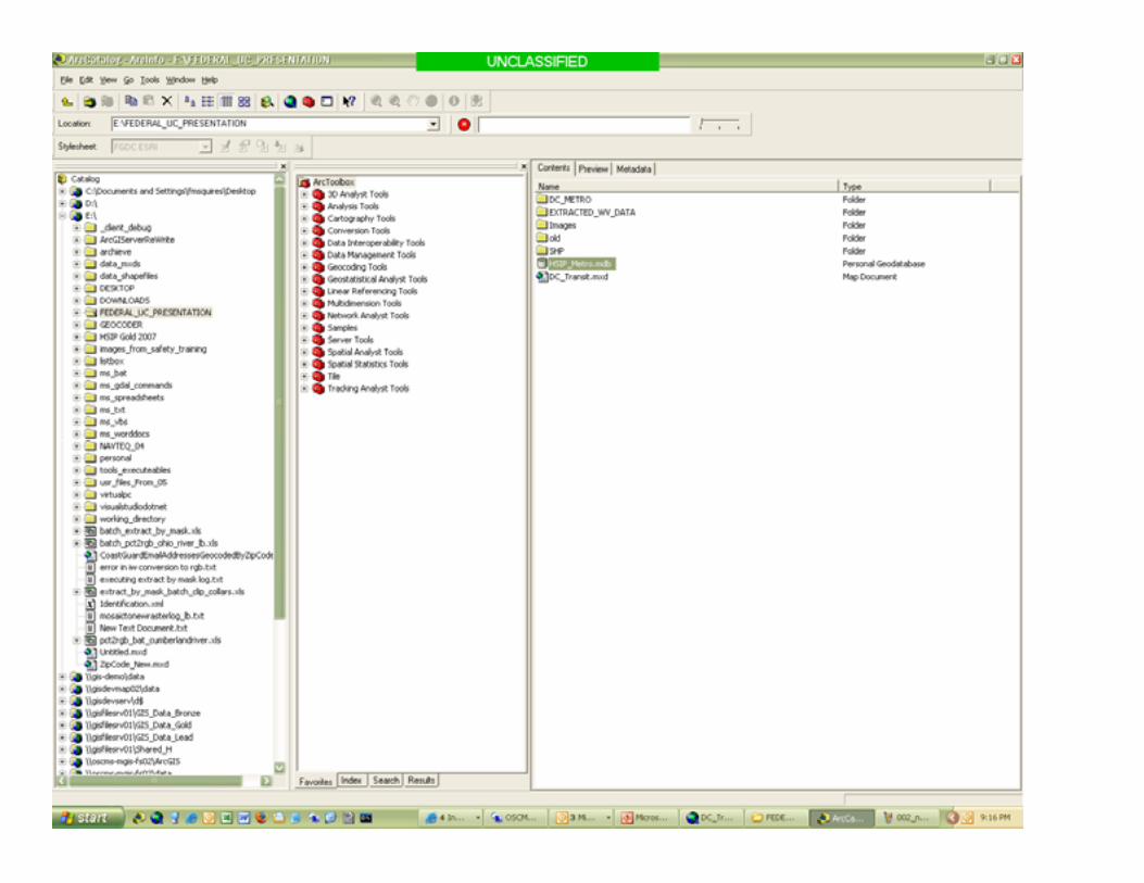
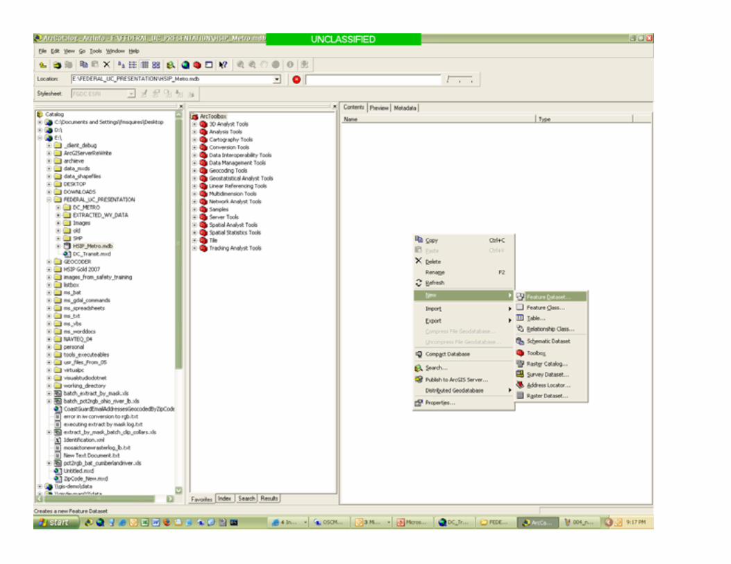
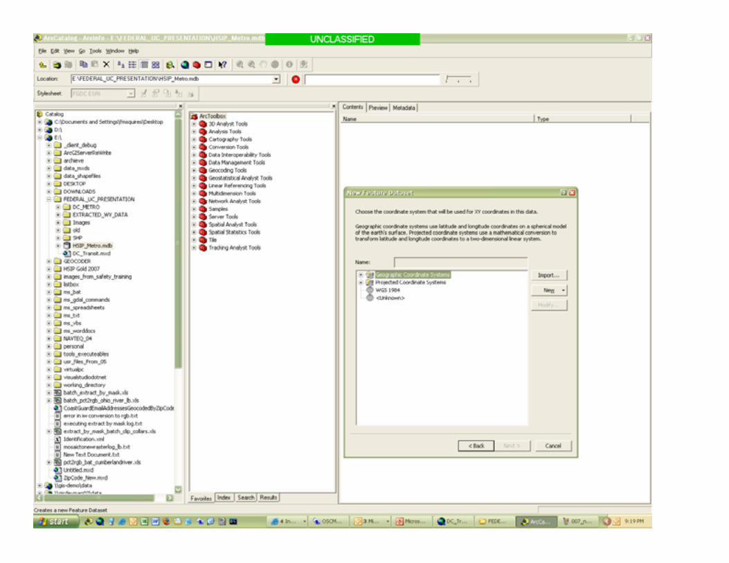
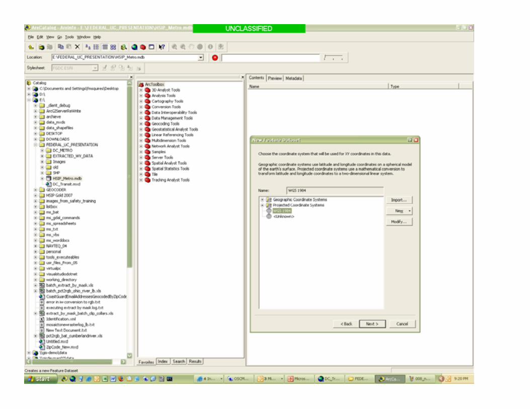
Implementation of Topology
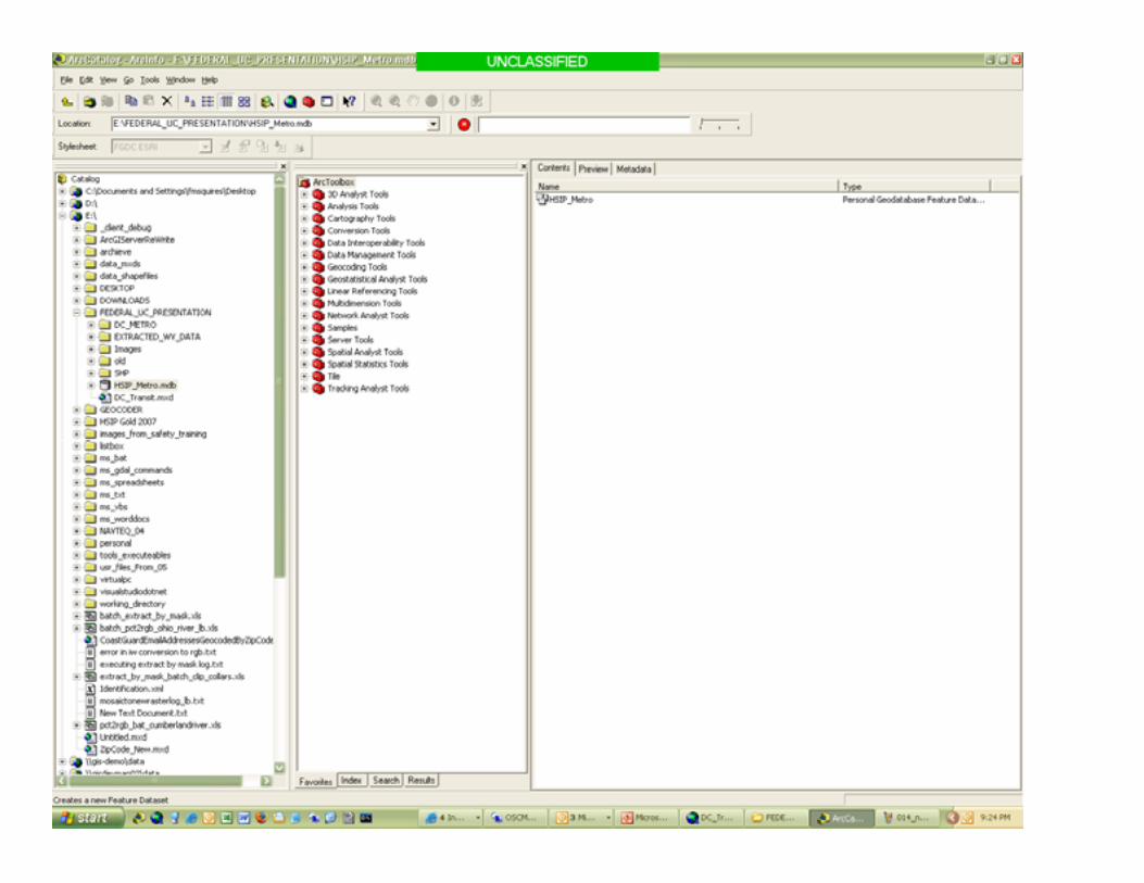
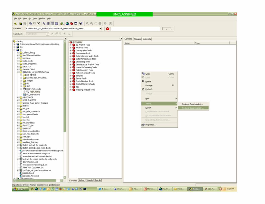
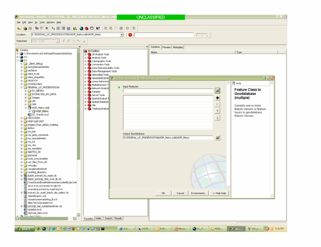
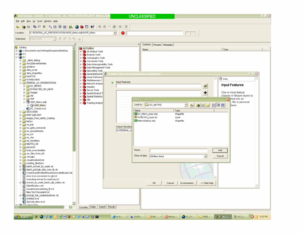
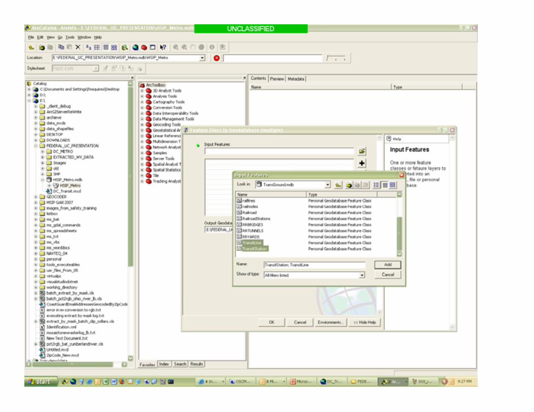
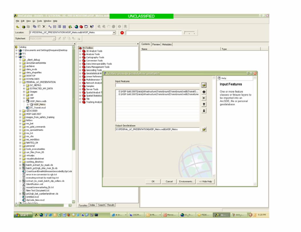
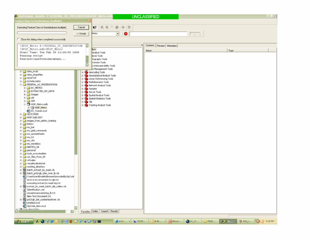
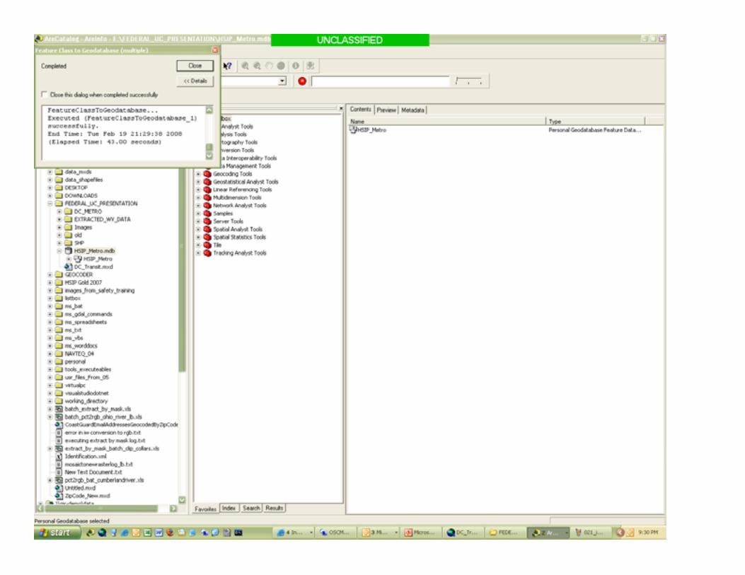
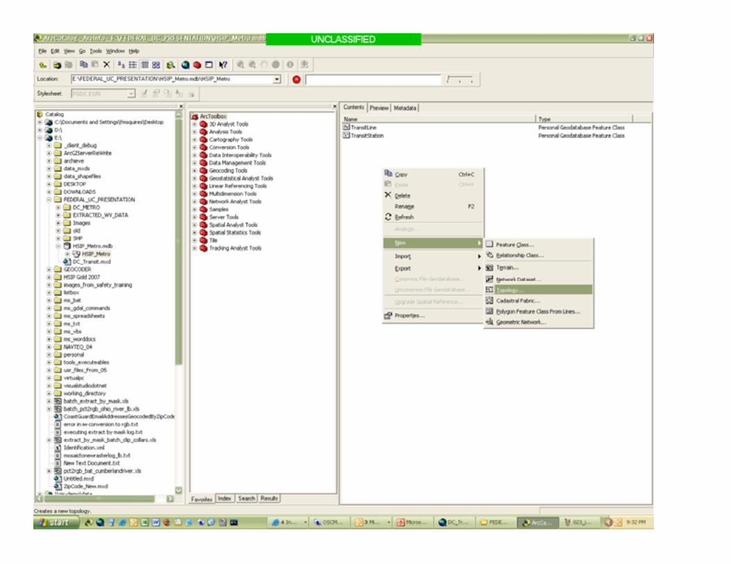
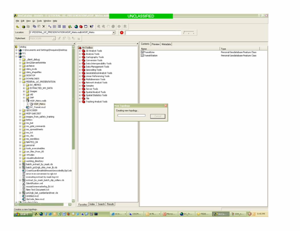
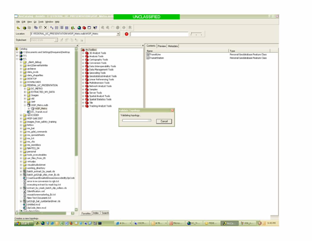
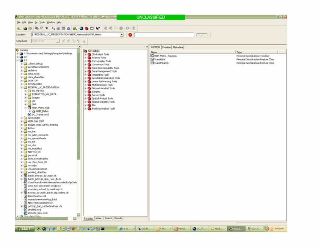
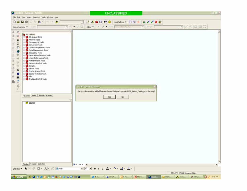
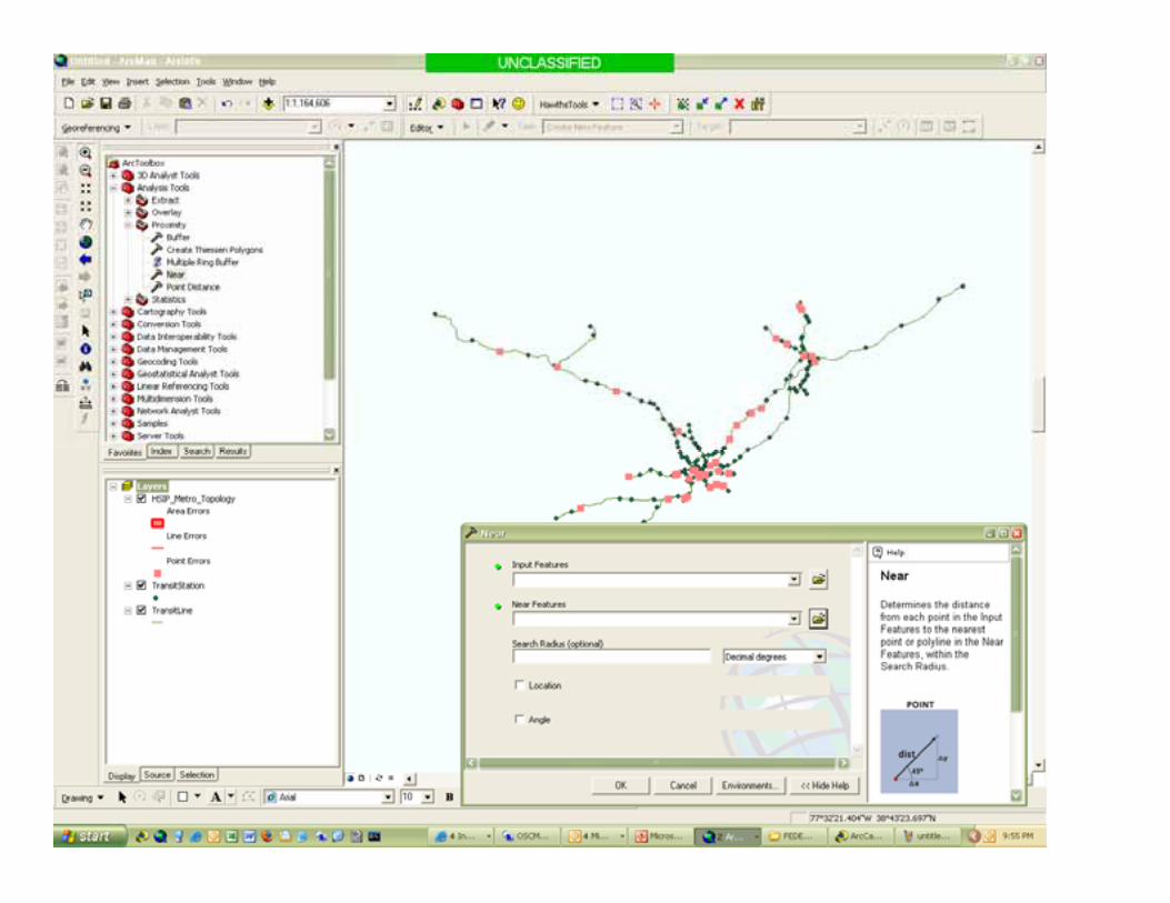
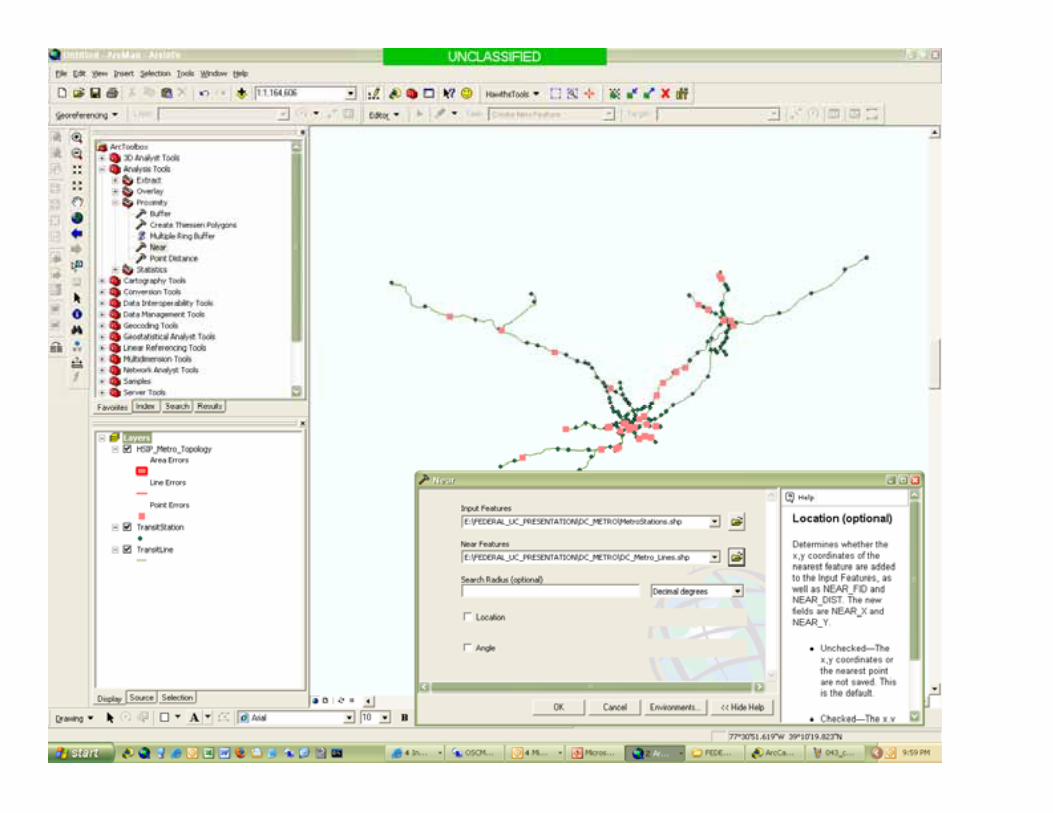
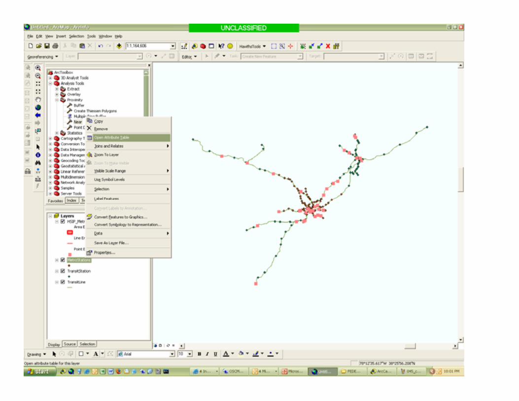
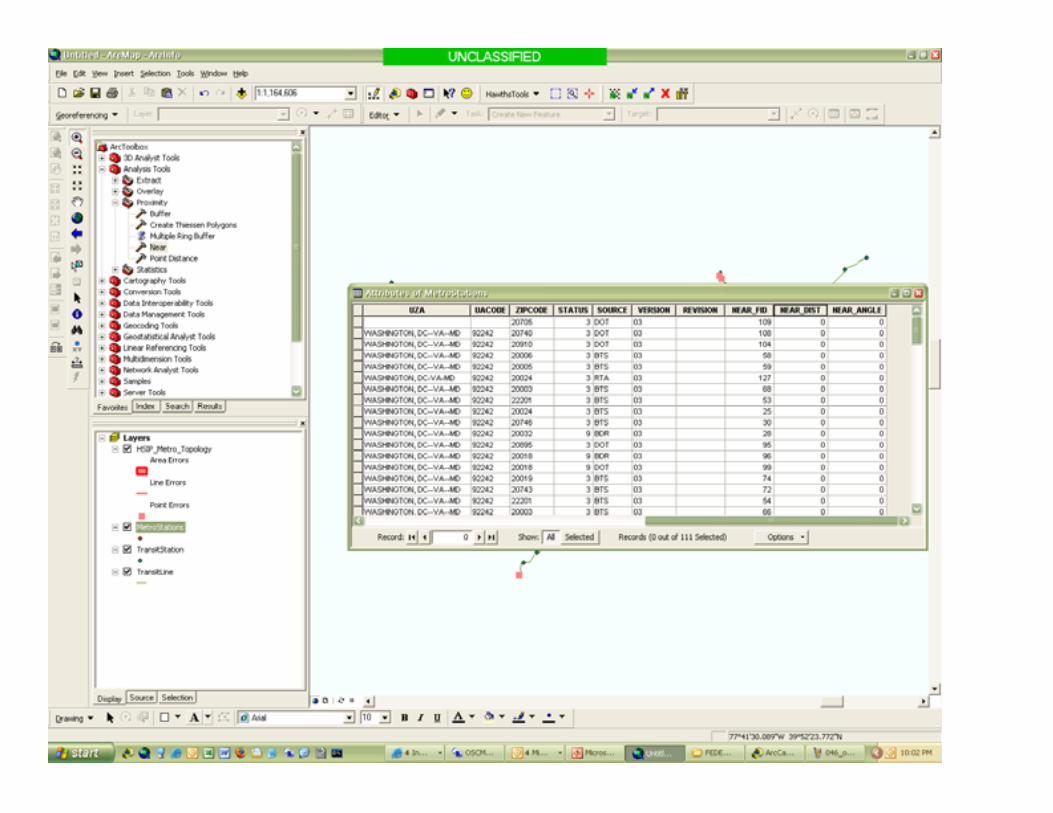
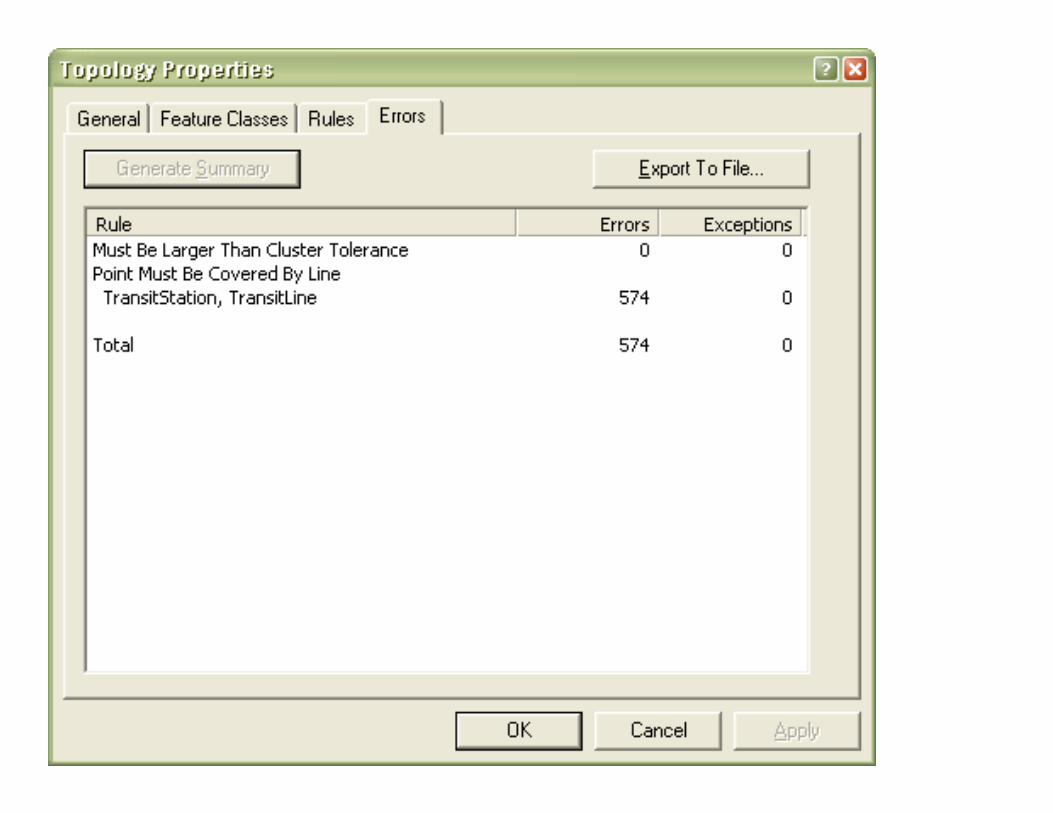
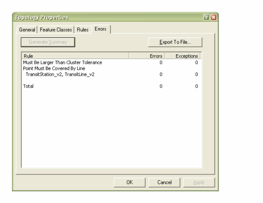
• Build Test Database• Copy Features to Feature Data Sets• Implement design• Validate topology• Edit features• Observe output• Modify design


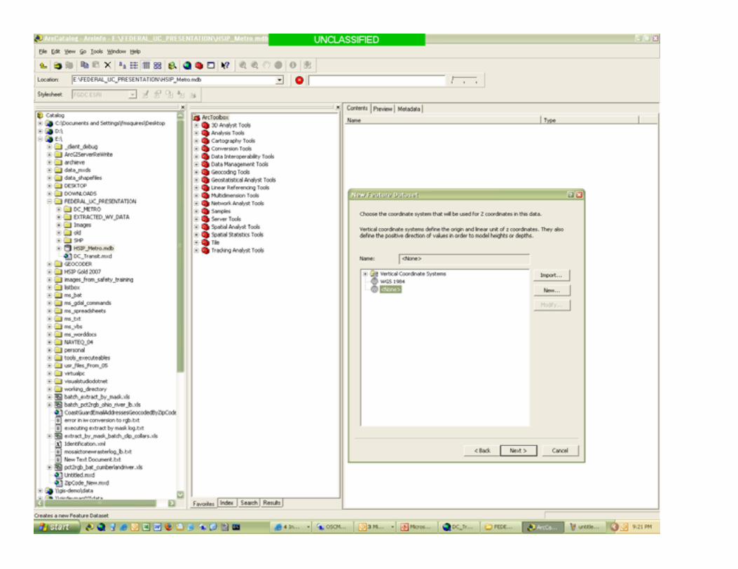

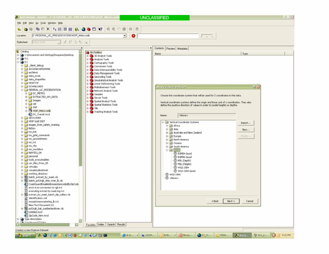

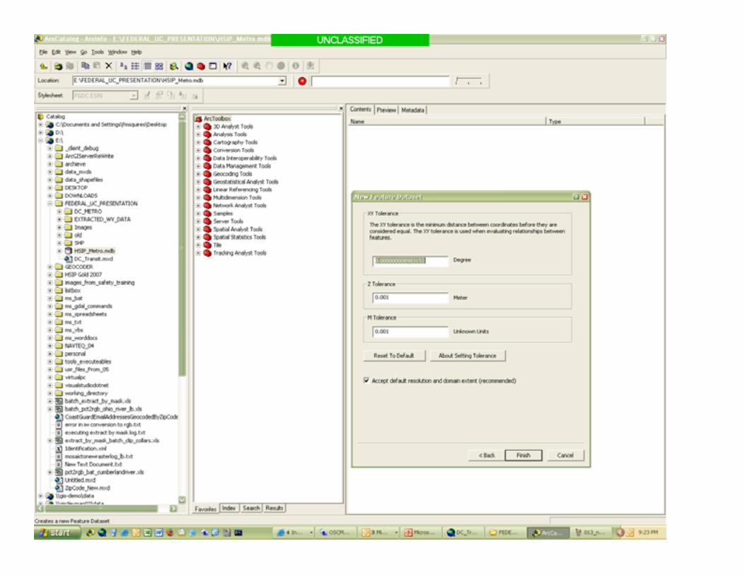

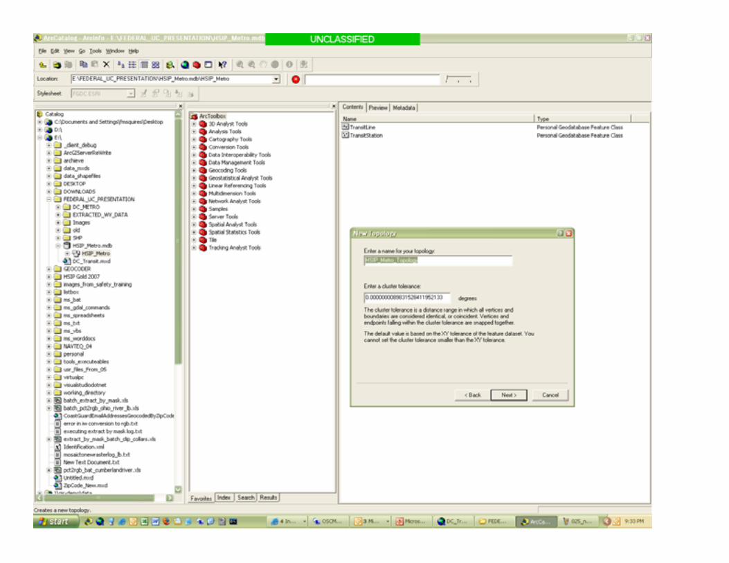

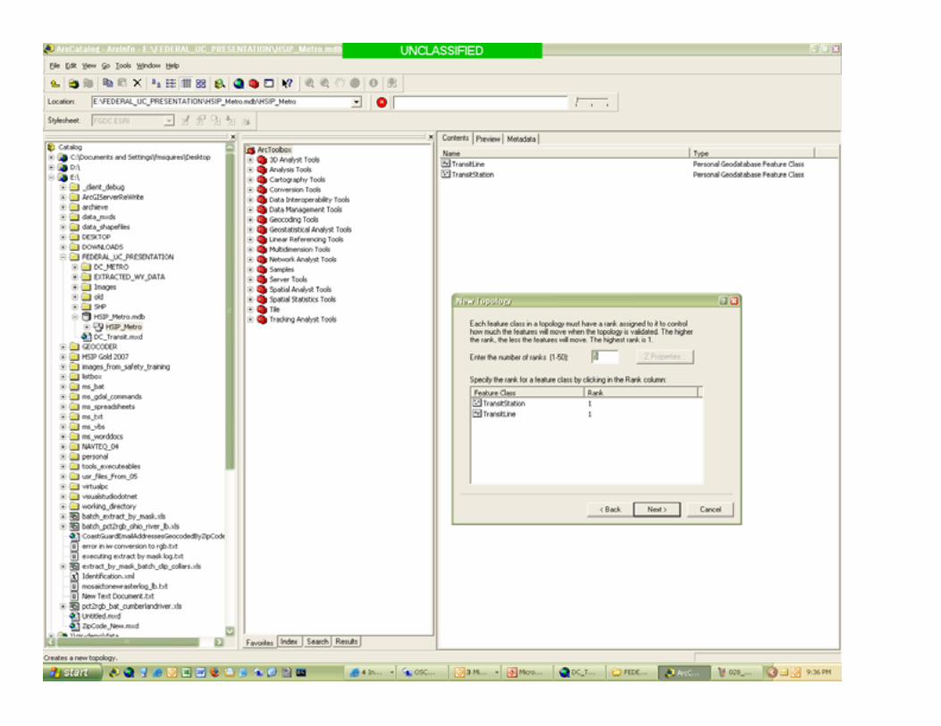


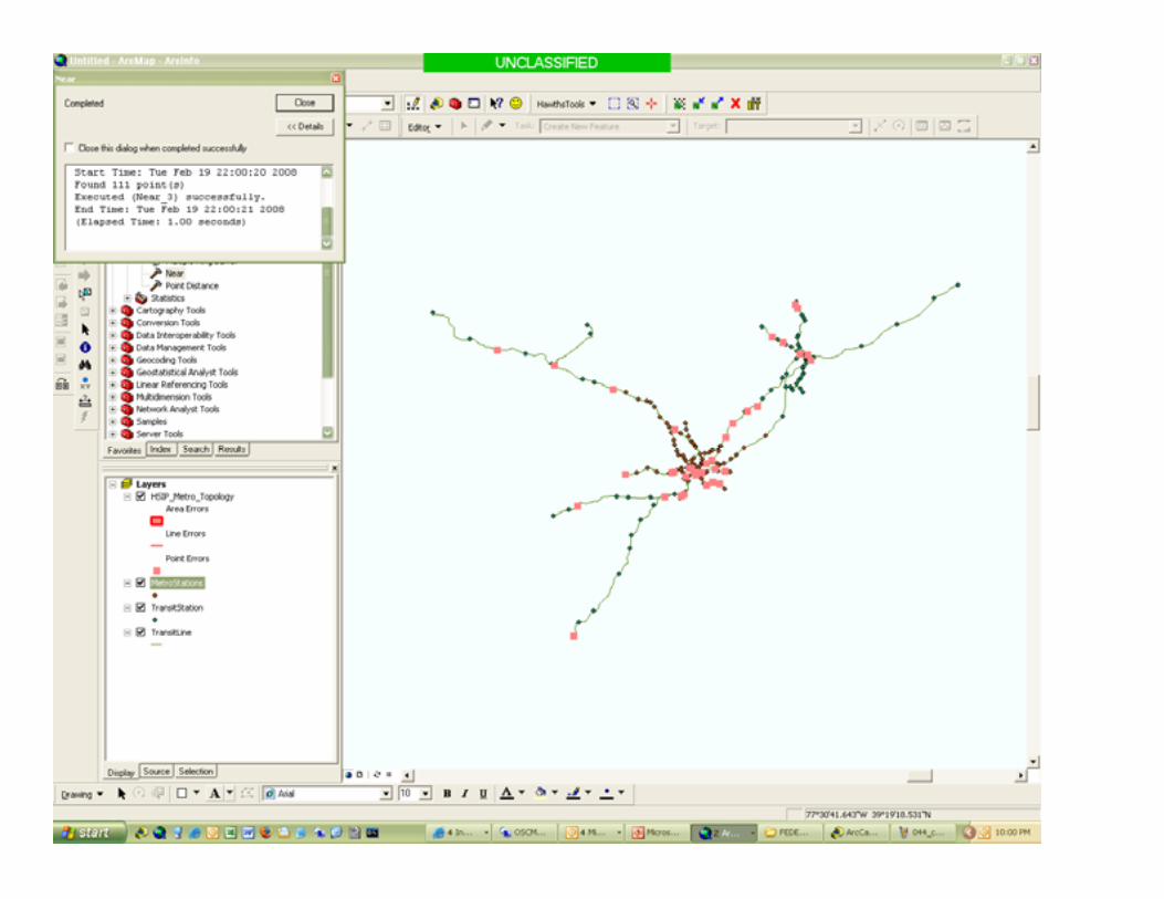
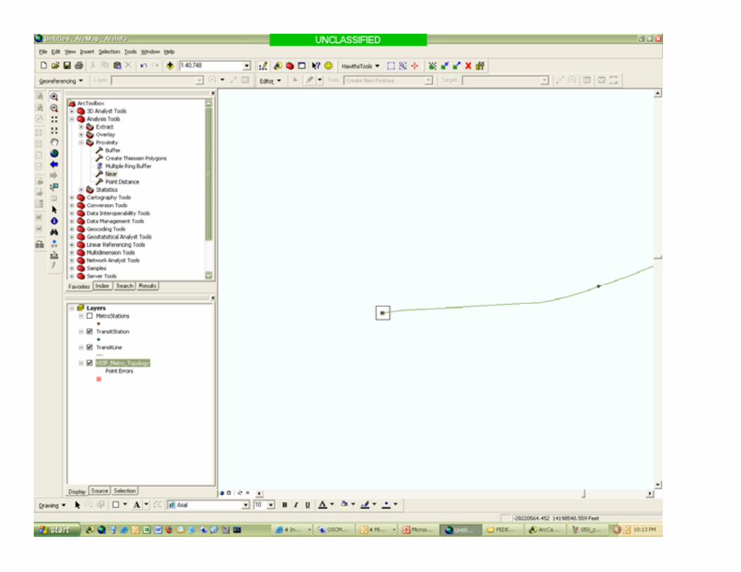
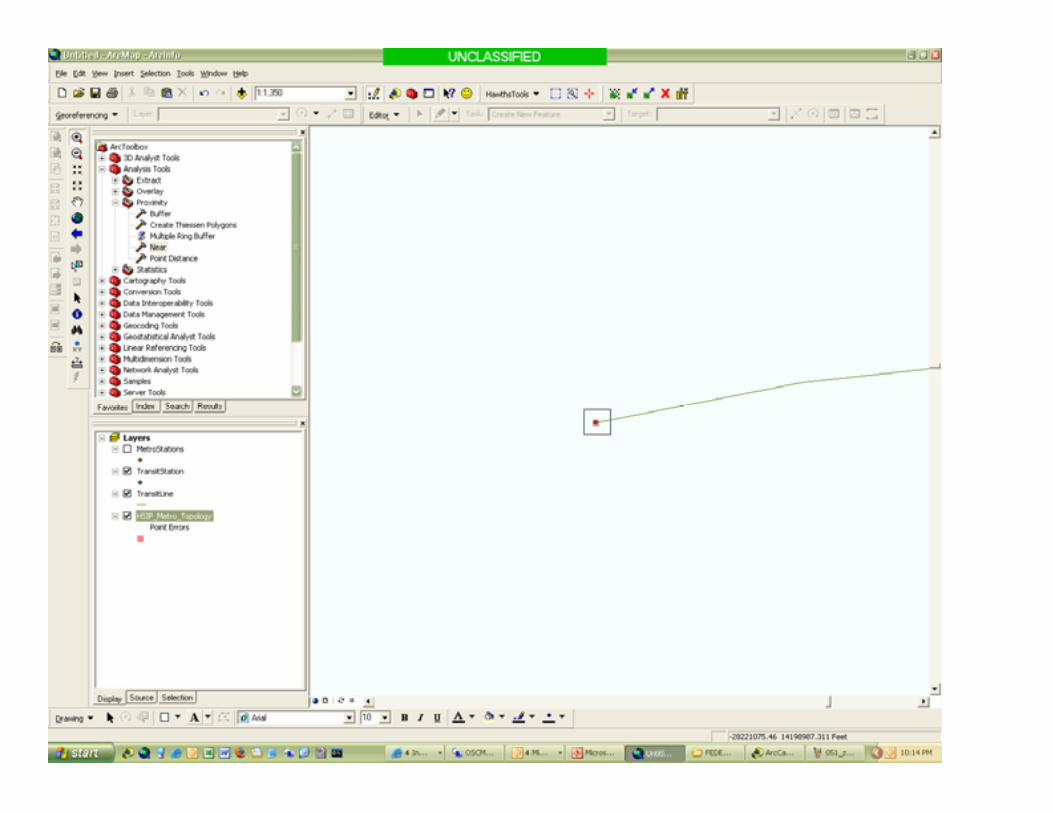

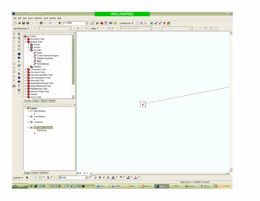
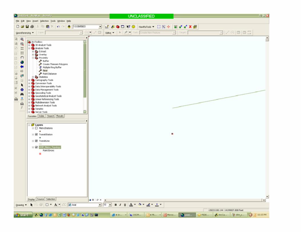
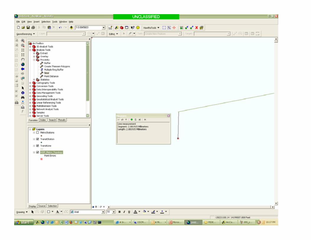
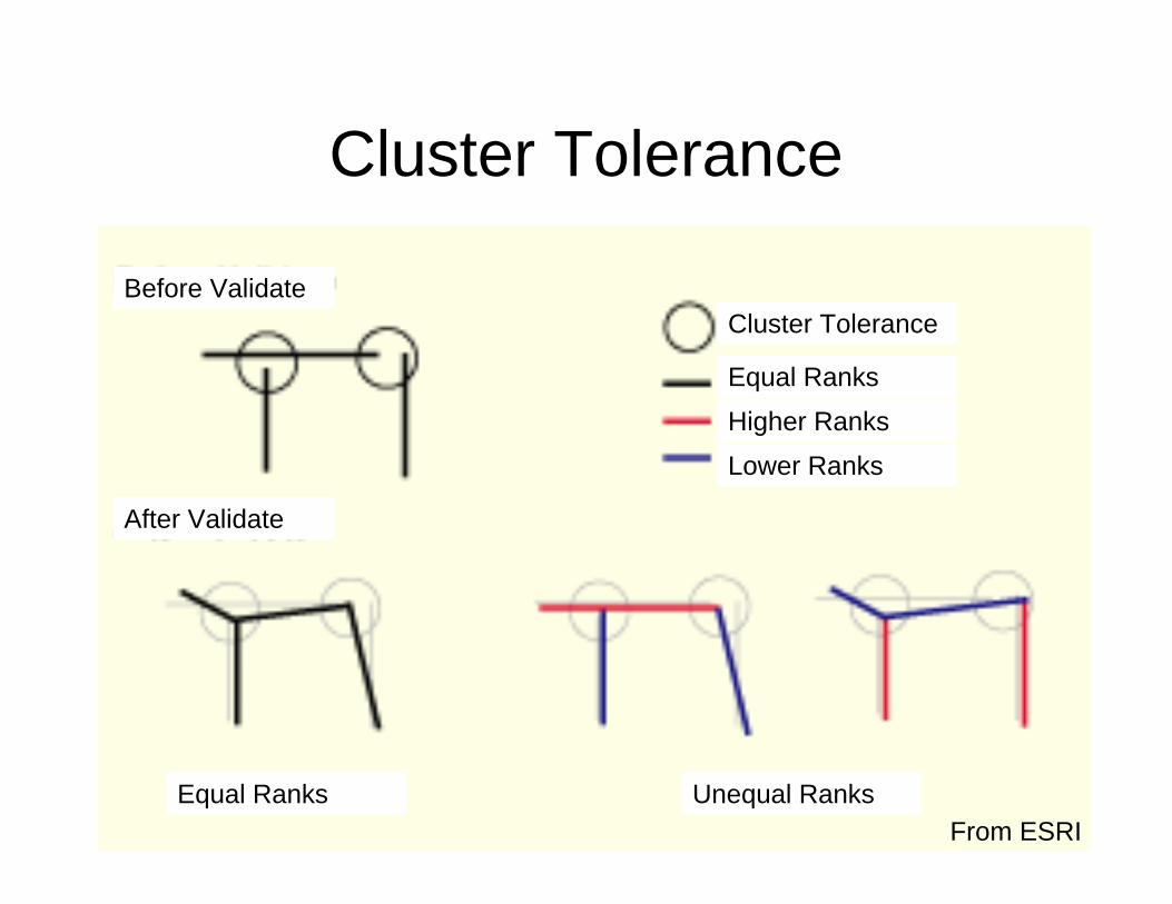
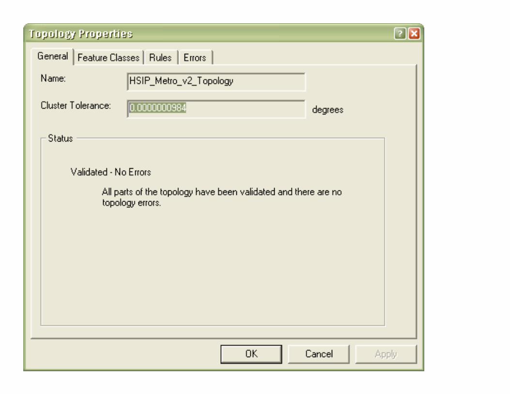
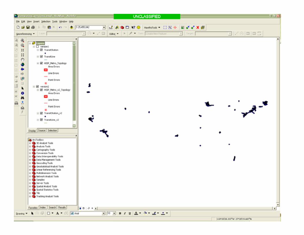
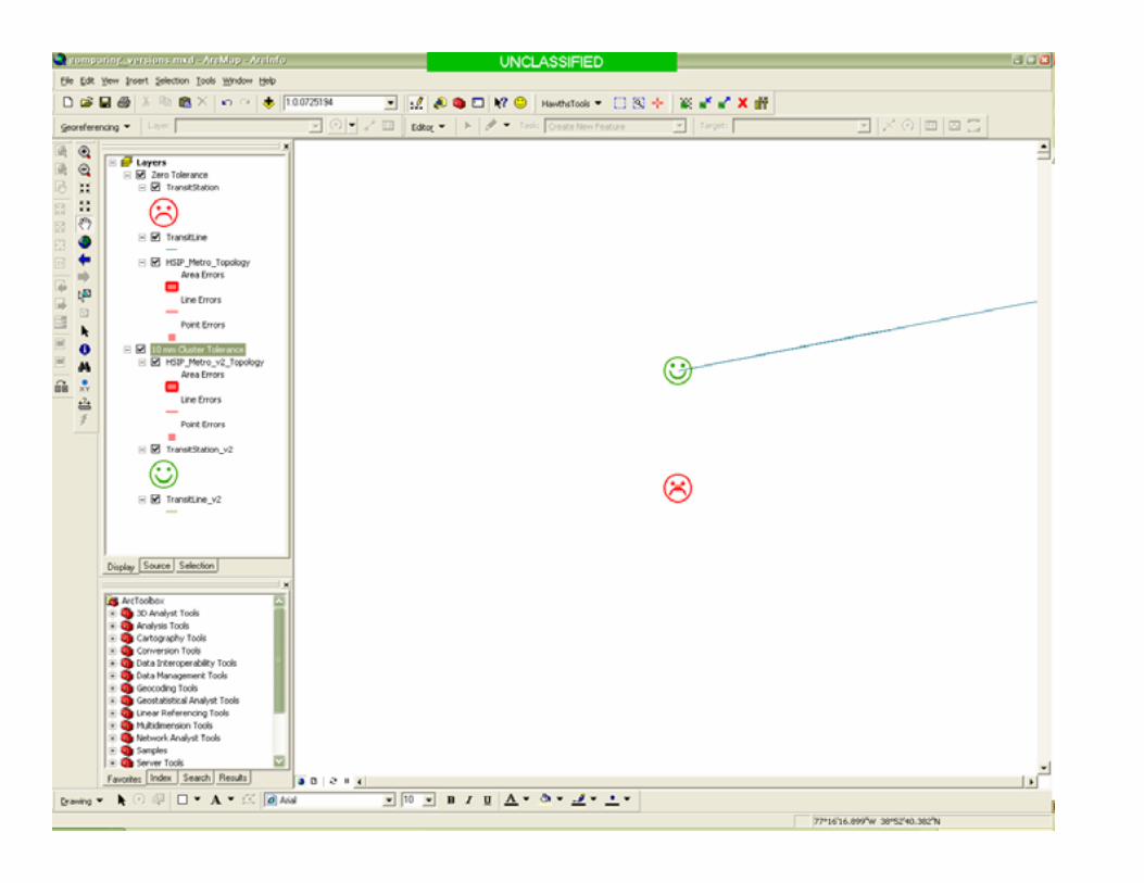
Cluster Tolerance
Before ValidateCluster Tolerance
Equal Ranks
Higher Ranks
Lower Ranks
After Validate
Equal Ranks Unequal RanksFrom ESRI
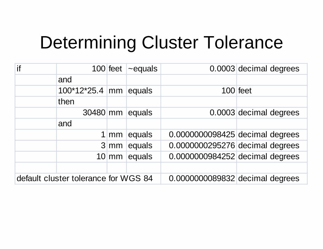
Determining Cluster Toleranceif 100 feet ~equals 0.0003 decimal degrees
and100*12*25.4 mm equals 100 feetthen
30480 mm equals 0.0003 decimal degreesand
1 mm equals 0.0000000098425 decimal degrees3 mm equals 0.0000000295276 decimal degrees
10 mm equals 0.0000000984252 decimal degrees
default cluster tolerance for WGS 84 0.0000000089832 decimal degrees
Topics
• Explain topology and its related components
• Show how to build a topological relationship in ArcGIS
• Discuss the benefits and drawbacks of topological relationships
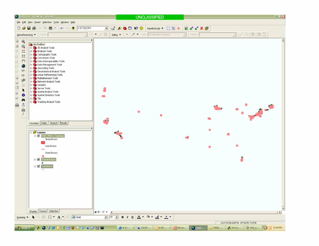
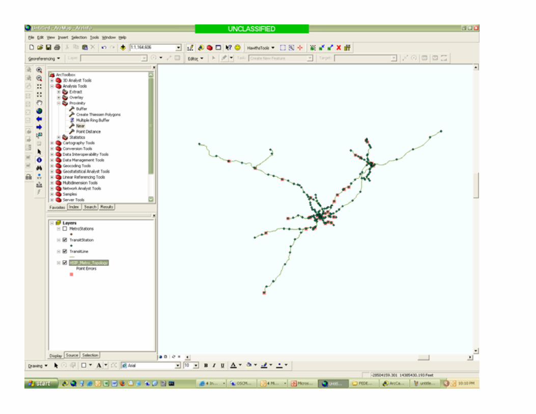
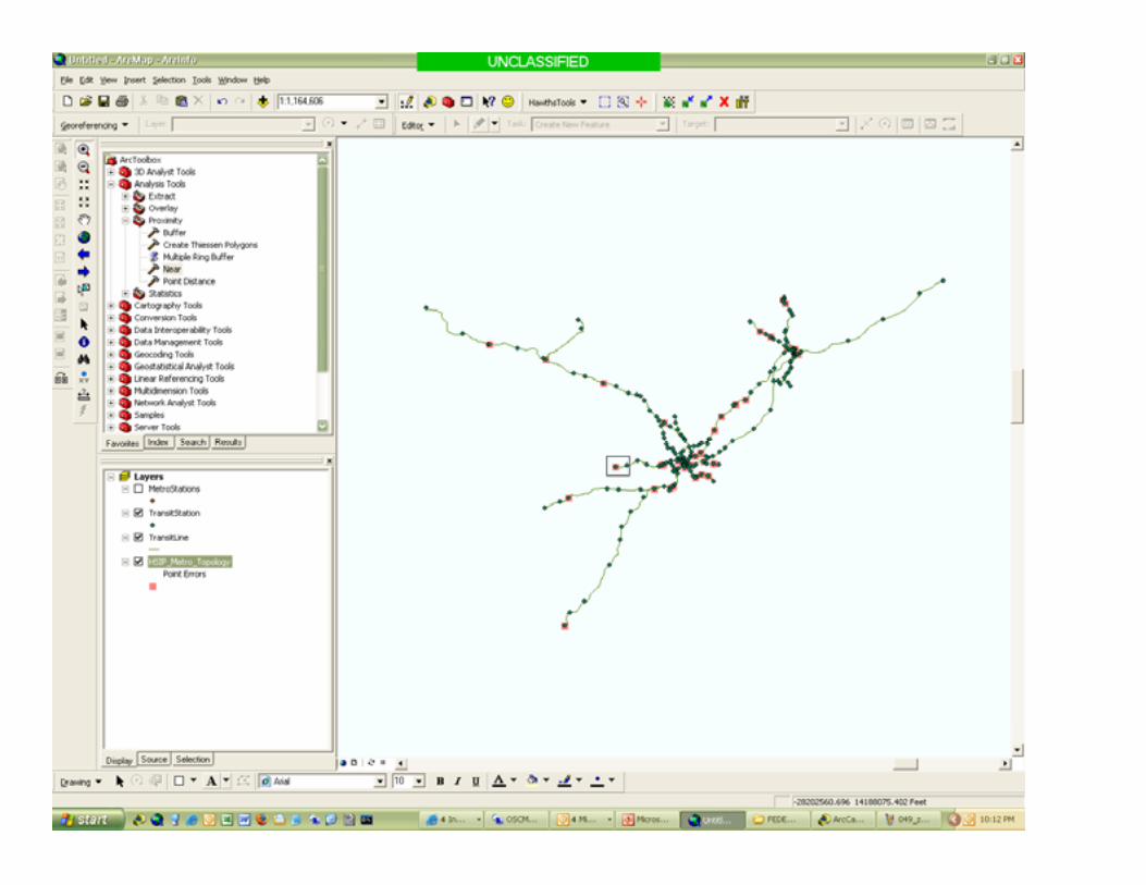
Topology Validated
• Is the data better?
• Cluster tolerance and coordinate shifts
M I S S I O N A C C O M P L I S H E D !M I S S I O N A C C O M P L I S H E D !M I S S I O N A C C O M P L I S H E D !
Topology isn’t
• A good way to “correct” data creationdiscrepancies
• Necessary for simple display/identification of data
Topology and shapefiles
• A final word of caution:
Understanding Topological “Errors”
• Errors are just violations of User Set Rules
• Setting Rules is arbitrary
Valid Reasons For Topological “Errors”
• Most important: Resolution of the data• Definition of features and how they relate
to each other– Not everyone looks at a river the same way.
Summary
• Talked about topology, cluster tolerances, and data source considerations
• Looked at an example of topology creation in ArcGIS
• Considered the ups and downs of topological relationships between datasets.
Thanks for sticking around!
• Questions
• Comments


![Jane Yen Carlo Séquin UC Berkeley I3D 2001 [1] M.C. Escher, His Life and Complete Graphic Work Escher Sphere Construction Kit.](https://static.documents.pub/doc/80x56/56649c785503460f9492d383/jane-yen-carlo-sequin-uc-berkeley-i3d-2001-1-mc-escher-his-life-and-complete.jpg)


![Splitting Tilings. - The Bridges Organization · colour. In the works of M.C. Escher these tiling’s play an important role. In his book Regelmatige Vlakverdeling [1] M.C. Escher](https://static.documents.pub/doc/80x56/5f6fa0c1b9adb57df33cdc50/splitting-tilings-the-bridges-organization-colour-in-the-works-of-mc-escher.jpg)


