27
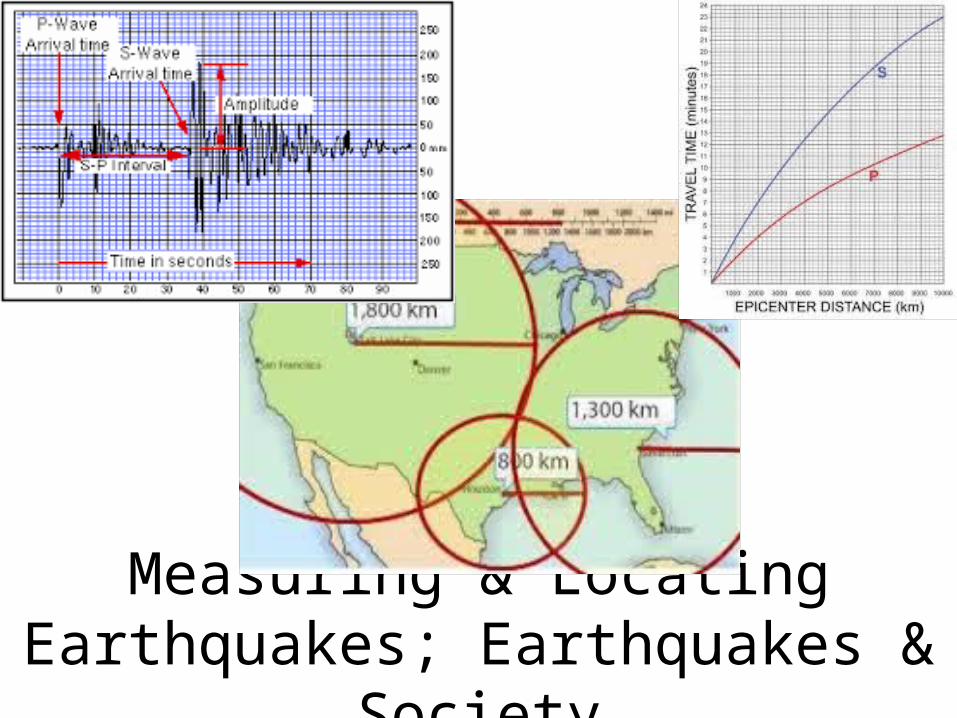
Measuring & Locating Earthquakes; Earthquakes & Society
| Date post: | 18-Dec-2015 |
| Category: |
Documents |
| Upload: | ronald-dawson |
| View: | 227 times |
| Download: | 1 times |
Measuring & Locating Earthquakes; Earthquakes & Society
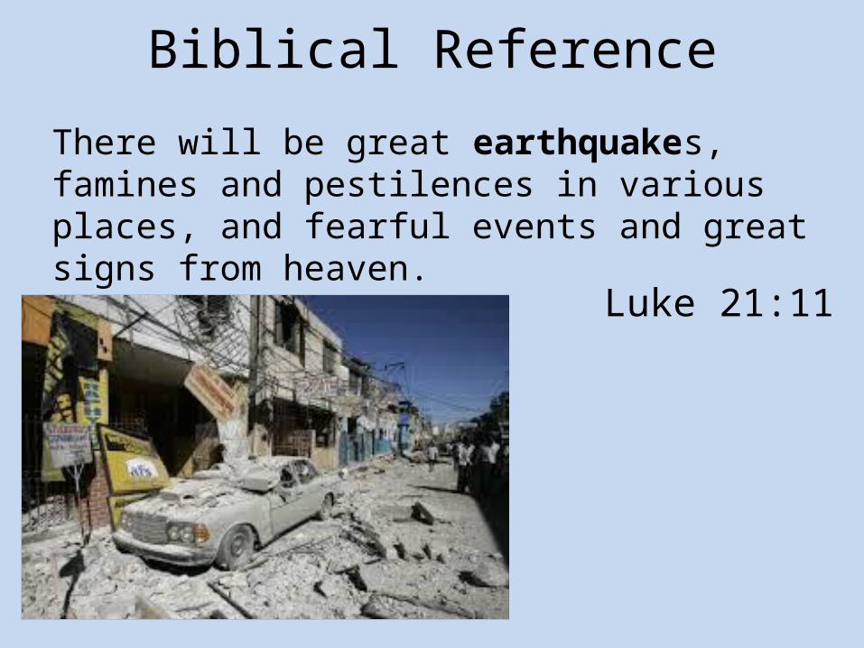
Biblical Reference
There will be great earthquakes, famines and pestilences in various places, and fearful events and great signs from heaven.
Luke 21:11

Richter Scale• The Richter Scale, created by geologist
Charles Richter in 1935, is a numerical rating system that measures magnitudes of earthquakes, based up a logarithm scale.
– Magnitude measures the amount of energy released during an earthquake.
– The Richter magnitude numbers are determine by the amplitude (the height) of the largest seismic wave.

Moment Magnitude Scale• The Moment Magnitude Scale is a rating
scale of the energy released by an earthquake, taking into account:
– The size of the fault rupture– The amount of movement along the fault– The rocks’ stiffness
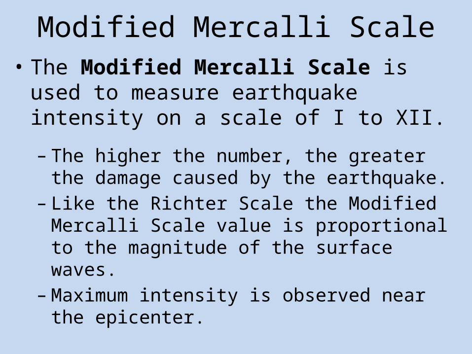
Modified Mercalli Scale• The Modified Mercalli Scale is used to
measure earthquake intensity on a scale of I to XII.
– The higher the number, the greater the damage caused by the earthquake.
– Like the Richter Scale the Modified Mercalli Scale value is proportional to the magnitude of the surface waves.
– Maximum intensity is observed near the epicenter.
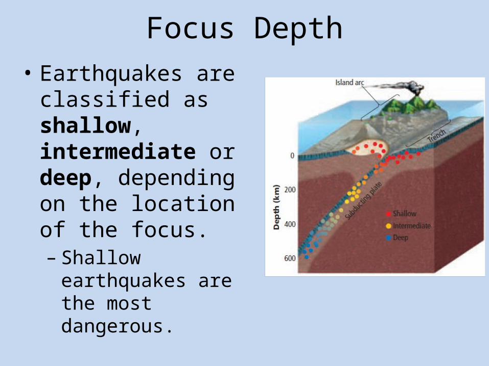
Focus Depth• Earthquakes are
classified as shallow, intermediate or deep, depending on the location of the focus.– Shallow earthquakes
are the most dangerous.

Locating an Earthquake• The epicenter location and time of
occurrence are usually not known at first.
– Seismologists use seismographs and travel-time curves to determine the epicenter location.
– They measure the separation on any seismogram and identify that same separation time on a travel-time curve.

Typical Travel-Time Curves• This station was
located approximately 4,300 km from the earthquake’s epicenter.

Locating an Earthquake• To pinpoint the earthquake’s epicenter
seismologists identify three seismic stations on a map and draw a circle with the radius equal to the distance to the epicenter for each station.
– The epicenter of the earthquake is located where these three circles intersect.

Epicenter Location

Time of an Earthquake• Seismologists use seismograms to
determine the exact time the earthquake occurred at the focus, using a table similar to the travel-time graph.
– For example if a station records a P-Wave at 10:00 a.m., and it was located 4500 km from the epicenter, it took 8 minutes for the P-Wave to travel to the station.
– Thus, the earthquake occurred at 9:52 a.m.

Seismic Belts• The majority of the world’s earthquakes occur on
narrow seismic belts that separate large regions with little or no seismic activity.
– Similar to volcanoes, the locations of most earthquakes correspond with tectonic plate boundaries.

Earthquake Hazards• Earthquake hazards are factors that determine
the severity of damage produced by an earthquake.
– Identifying earthquake hazards in an area can sometimes help prevent some of the damage and loss of life.
– Buildings made of un-reinforced, brittle materials (such as concrete) will sustain the most damage.

Structural Failure• Pancaking is a type of structural failure in
which shaking causes a building’s supporting walls to collapse.
– The upper floors fall onto the lower floors like a stack of pancakes.

Swaying• If the shaking caused by an earthquake
has the same frequency as a building’s natural frequency, the swaying motion is magnified.
– Tall buildings (with long frequencies) and short buildings (with short frequencies) are usually not affected as much as medium-sized buildings.

Land and Soil Failure• In sloping regions, earthquakes can trigger
massive landslides.
– In areas with sand that is nearly saturated, seismic vibrations can cause soil liquefaction, where the soil behaves like quicksand.
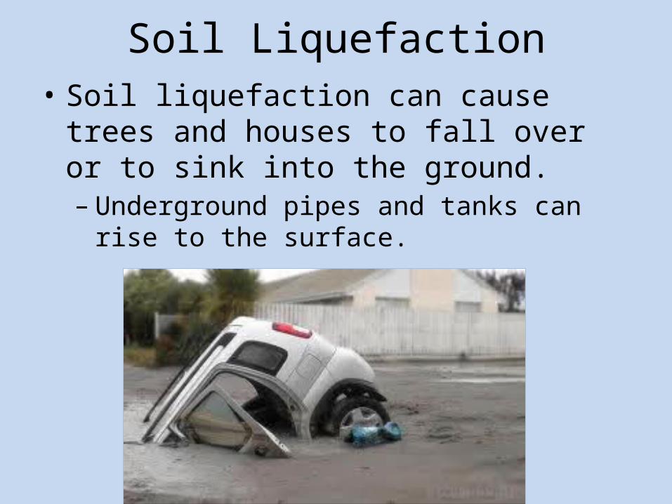
Soil Liquefaction• Soil liquefaction can cause trees and
houses to fall over or to sink into the ground.– Underground pipes and tanks can rise to the
surface.
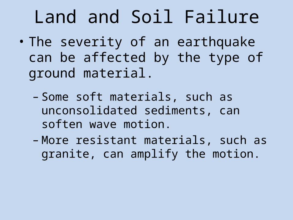
Land and Soil Failure• The severity of an earthquake can be
affected by the type of ground material.
– Some soft materials, such as unconsolidated sediments, can soften wave motion.
– More resistant materials, such as granite, can amplify the motion.

Tsunamis• A tsunami, a large ocean
wave generated by vertical motion, is another earthquake hazard.– Tsunamis become
dangerous as they enter shallow water, with wave heights up to 30 m (100 feet) and wave speeds between 500 km/h to 800 km/hr.

Earthquake Forecasting• The currently is no reliable method to
forecast the exact time and location of the next earthquake.
– “Forecasts” consist of the probability of occurrence based on two factors:
• The history of earthquakes in an area• The rate at which strain builds up in rocks
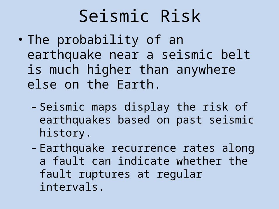
Seismic Risk• The probability of an earthquake near a
seismic belt is much higher than anywhere else on the Earth.
– Seismic maps display the risk of earthquakes based on past seismic history.
– Earthquake recurrence rates along a fault can indicate whether the fault ruptures at regular intervals.
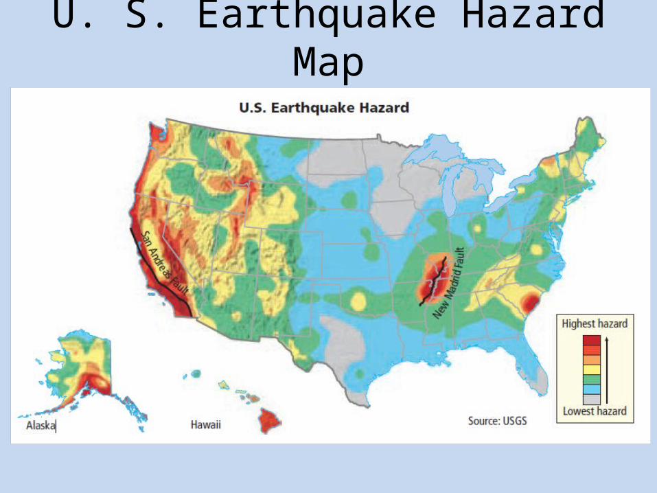
U. S. Earthquake Hazard Map

Seismic Gaps• Seismic gaps are areas along active faults
that have not experienced significant earthquakes for a long time.– Istanbul, Turkey (a city of 18 million inhabitants)
lies within a seismic gap, indicating that it is vulnerable to a future earthquake.

Stress Accumulation• The stress built up and
released during an earthquake cycle in a particular area can be used to develop a stress accumulation map to help determine the probability of future earthquakes.
A. Richter Scale
B. Moment Magnitude Scale
C. Modified Mercalli Scale
D. Seismic Intensity Scale
Which scale is used to describe an earthquake on the basis of the amount of damage it does?
Pop Quiz
Which type of earthquake causes the most damage?
Pop Quiz
A. Core
B. Deep
C. Intermediate
D. Shallow
A. Earthquake Gap
B. Seismic Hole
C. Rupture Gap
D. Seismic Gap
What is it called when a section of a fault stops having earthquakes?
Pop Quiz


