11
Meteorological Data Systems Instrument History, Techniques and Applications By: Daniel Ruth
| Date post: | 19-Dec-2015 |
| Category: |
Documents |
| View: | 216 times |
| Download: | 0 times |
Meteorological Data Systems
Instrument History, Techniques and Applications
By: Daniel Ruth

Observing the Atmosphere
• Dates back to 1600’s• Benjamin Franklin first to track a storms
transient nature• Other early observers included Thomas
Jefferson, George Washington and Louis and Clark

Observation Program
• 1870: President Grant authorizes creation of a national weather service
• Birth of aviation spurs rapid growth in weather observation
• 1920’s: Navy and Weather Bureau utilize aircraft for observing weather
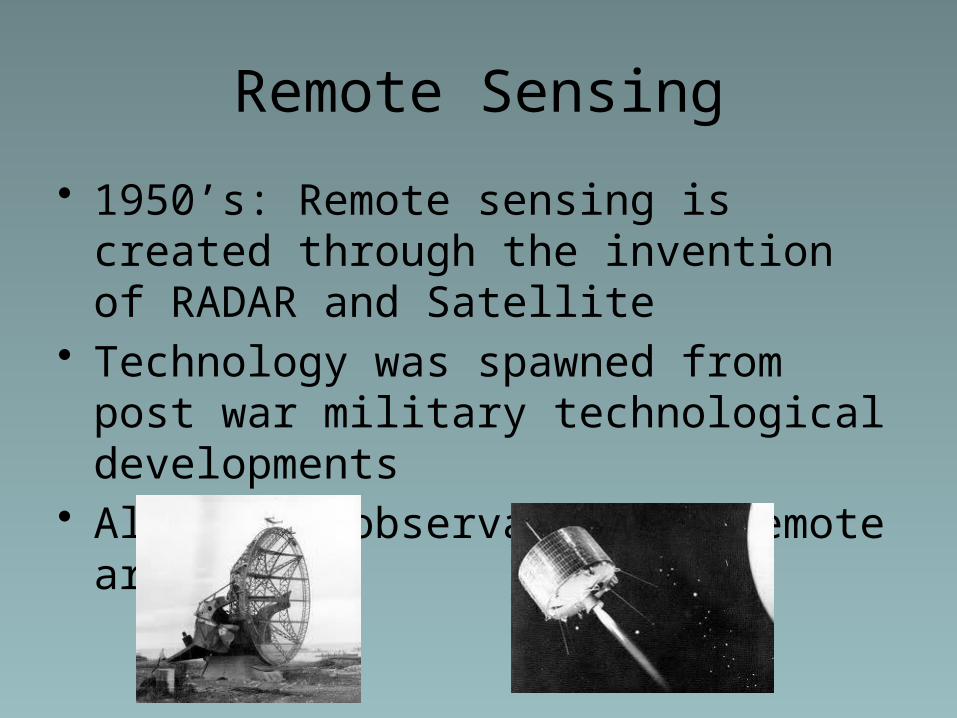
Remote Sensing
• 1950’s: Remote sensing is created through the invention of RADAR and Satellite
• Technology was spawned from post war military technological developments
• Allow for observation of remote areas

Satellites
• Two types of satellite: Geostationary and Polar Orbiting
• Geostationary: Big picture, orbits at 22,000 miles in altitude
• Polar Orbiter: Detailed picture, orbits at 800 miles in altitude
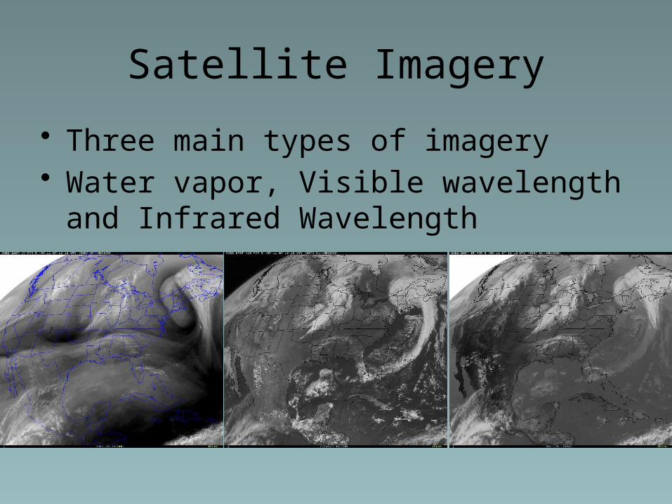
Satellite Imagery
• Three main types of imagery• Water vapor, Visible wavelength and
Infrared Wavelength
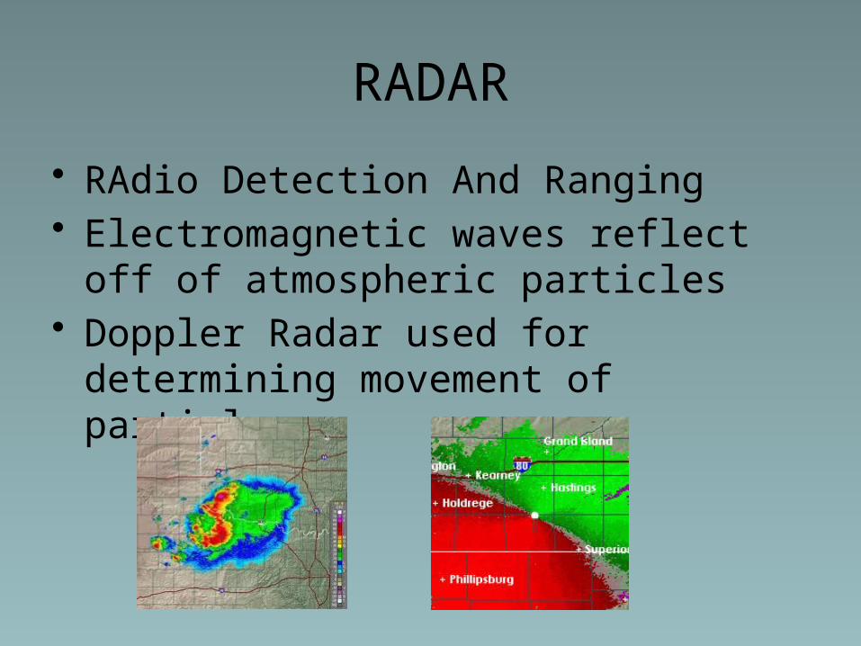
RADAR
• RAdio Detection And Ranging• Electromagnetic waves reflect off of
atmospheric particles• Doppler Radar used for determining
movement of particles

Data Assimilation
• Data is gathered at the National Center for Environmental Prediction (NCEP)
• Quality checked through statistical methods
• Used as initial conditions in numerical weather prediction models

Numerical Modeling
• Three primary models in the U.S.• Global Forecast Simulation (GFS)• North American Mesoscale model (NAM)• Rapid Update Cycle model (RUC)

Predictability
• Current model skill is about 5-7 days• Dr. Edward Lorenz discovers finite
predictability and creates chaos theory• Prediction accuracy hinges on accurate
high resolution observation

Questions?


