64
Methodology of Collaborative Cultural Mapping Série Mapeamento, Manejo e Proteção Nº1
Methodology of Collaborative
Cultural Mapping
SérieMapeamento,Manejo e Proteção
Nº1
Methodology of Collaborative
Cultural Mapping
Brasília,
2008
E d i ç õ e s
© Amazon Conservation Team Editions 2008Reproduction of this publication is permitted because the source is referenced.1st edition. Printing: 500 exemplarsAmazon Conservation Team – ACT BrazilEnding of this edition: December 2007.
Amazon Conservation Team BrasilPresident: Vasco van RoosmalenVice-President: Almir Narayamoga SuruiEnvironmental Coordinator: Marcelo SegalerbaGeoprocessing Laboratory Coordination: Wesley PachecoGeoprocessing Laboratory Staff: Edwilson Campos Pordeus, Jefferson Velloso Nogueira, Marcos Sebastião Ataide, Rafael Cubas.
Editorial group: Ana Carolina Kalume, Ivaneide Bandeira, João Guilherme Nunes Cruz, Júlio César Borges, Marcelo Segalerba, Renata Carvalho Giglio, Thiago Ávila, Vasco van Roosmalen, Wesley Pacheco.
Edition: Social Communications AdvisoryResponsible: Ana Carolina KalumeReview: Renata Carvalho GiglioDrafting and graphic production: Masanori Ohashy – Idade da PedraMake-up: João Gonçalves (trainee) – Idade da PedraIllustrations: Josefa Adlanes Osmídio Cristóvão @ACT Brazil EditionsPhotographs: ACT Brazil Maps: ACT Brazil Geoprocessing LaboratoryTechnical Normalization: Geraldo Campetti SobrinhoPrinting: Athalaya Printer
ACT Brazil www.actbrasil.org.br
S.A.S Quadra 03 – Bloco C – Edifício Business PointSalas 301 a 306 Brasília – DF Cep.: 70070-934Tel: 55 61 3323.7863Fax: 55 61 [email protected]
4
6
10
12
16
22
34
38
44
46
52
56
Presentation
Introduction
The methodology
Composition of the mapping team
Preparatory procedures
The first work shop
First stage of the fieldwork
Second work shop
Second stage of the fieldwork
Third work shop
Final review of the map
Delivery of the map

� Methodology of Collaborative Cultural Mapping
ACT Brazil believes that the best path to safeguarding the en-
vironment and strengthening culture in native lands can be ex-
pressed as three processes: mapping, managing and protecting.
These processes are intrinsically connected because the cultural
and land use mapping process supports collective discussions
that result in plans and strategies for environmental conserva-
tion and territorial protection. This manual has been designed
to encourage comparisons and an exchange of information with
other environmental protection methodologies, especially in light
of the fact that several other institutions currently work with me-
thodologies similar to that applied by ACT Brazil.
Cultural collaborative mapping contributes to a better local
understanding of social and environmental issues: the resident
communities are given the opportunity to systematize their kno-
wledge regarding their territory and to increase and perpetuate
that knowledge through debates that engage the communities’
leadership, elders, youth, and women according to their social
context and community priorities. When a community is able to
systematically articulate and represent its knowledge of its lands,
it gains the necessary tools to establish laws, manage producti-
ve systems, implement protection methodologies and improve
its quality of life. João Evangelista, a representative of the Tiriyo
Mapping, Managing and
Protecting
�Presentation
indigenous people, has stated that the process has taught his
community to have greater concern for the integrity of its lands
and to place a higher value on its traditional culture.
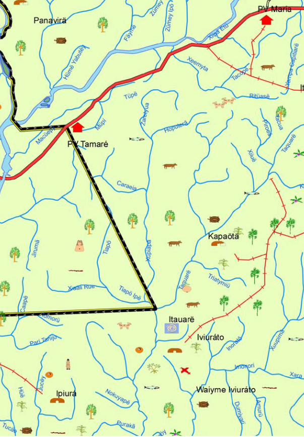
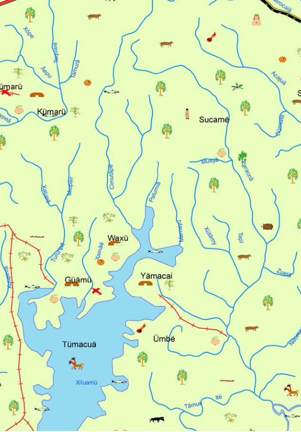
What is aCultural Map?A cultural map is a cartographic
instrument that displays cultural,
historical and practical data from
one or several traditional groups.
Its graphical presentation can
depict a number of shapes and
forms, but the aspects that define
its creation are clear: it must be
defined by the community itself,
combined with cartographic
rules, so that the final result has
precision and order. The map
and the mapping process then
can serve as the basis for the
development by the communities
of important management
tools such as plans for native
education and environmental
and territorial protection. The
map is not conceived of as an
end in itself, but rather as an
instrument to enable effective
land management and cultural
strengthening efforts by the
traditional communities.
� Methodology of Collaborative Cultural Mapping
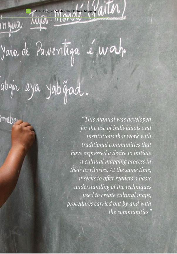
“This manual was developed for the use of individuals and
institutions that work with traditional communities that
have expressed a desire to initiate a cultural mapping process in
their territories. At the same time, it seeks to offer readers a basic
understanding of the techniques used to create cultural maps,
procedures carried out by and with the communities.”
�Introduction
A collaborative methodology requires close teamwork on
the part of multiple stakeholders. In the case of cultural map-
ping, this entails cooperation between the local community, the
community’s leadership, and a cartographical and anthropologi-
cal technical crew (hired by the community, by the government,
or by an entity that works with the community). This partnership
notwithstanding, it is the community and its representatives who
lead the process, including the designation of the area to be ma-
pped, the content to be represented in the map, and the final
visual art and title. The community’s role goes further: it execu-
tes the activity and chooses, among its members, researchers
who will be trained by the technical supporting crew to collect
information with the villages or communities. The choice of re-
searchers is of extreme importance, because they are the ones
who actually generate the maps with the collaboration of the
community and the guidance of the technical crew.
To commence a collaborative cultural mapping process, two basic requirements must be met:
1 The community must have – and recognize – a need to create a cultural map, according to its specific priorities;
2 The minimal conditions must exist to enable the community to access and manage the cartographic instruction and the ethnographic research transmitted by the technical crew.
� Methodology of Collaborative Cultural Mapping
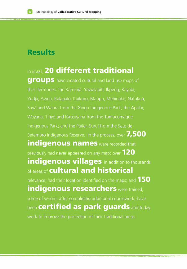
Results
In Brazil, 20 different traditional groups have created cultural and land use maps of
their territories: the Kamiurá, Yawalapiti, Ikpeng, Kayabi,
Yudjá, Aweti, Kalapalo, Kuikuro, Matipu, Mehinako, Nafukuá,
Suyá and Waura from the Xingu Indigenous Park; the Apalai,
Wayana, Tiriyó and Katxuyana from the Tumucumaque
Indigenous Park; and the Paiter–Suruí from the Sete de
Setembro Indigenous Reserve. In the process, over 7,500 indigenous names were recorded that
previously had never appeared on any map; over 120 indigenous villages, in addition to thousands
of areas of cultural and historical
relevance, had their location identified on the maps; and 150 indigenous researchers were trained,
some of whom, after completing additional coursework, have
been certified as park guards and today
work to improve the protection of their traditional areas.
�Introduction
The cultural mapping methodology is relatively simple, and
to date has been used to map traditional territories in three
countries, Brazil, Colombia, and Suriname, in areas ranging in
size from 50,000 acres to over ten million acres and with the
collaboration of very different indigenous groups. Thus, it has
been established that the methodology can be applied within
different cultural and geographical contexts.
This manual seeks to directly contribute to the welfare of tra-
ditional communities by showing them the means to map and
create a record of their ancestral territories as well as the know-
ledge associated with those lands. Recording and transmitting
this knowledge is necessary for the survival of future generations,
which will face ever increasing demands on their ability to pro-
tect their lands. Moreover, the determination of the knowledge
categories that compose each cultural map must obey the cultu-
ral priorities and prerogatives of the assisted population and be
treated carefully, because the knowledge represented can used
for purposes outside of the community’s interests. In these ca-
ses, economic and social benefits arising from the use of this
information must be bestowed upon the communities. For this
reason, this manual contains a section dedicated to the rights of
the communities with respect to the intellectual property repre-
sented by the information depicted on cultural maps.
10 Methodology of Collaborative Cultural Mapping
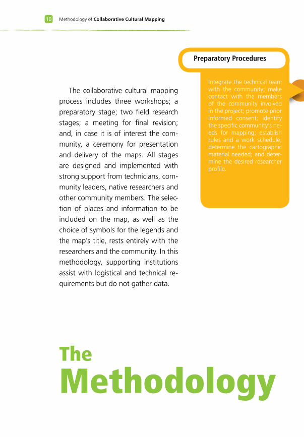
The
Methodology
The collaborative cultural mapping
process includes three workshops; a
preparatory stage; two field research
stages; a meeting for final revision;
and, in case it is of interest the com-
munity, a ceremony for presentation
and delivery of the maps. All stages
are designed and implemented with
strong support from technicians, com-
munity leaders, native researchers and
other community members. The selec-
tion of places and information to be
included on the map, as well as the
choice of symbols for the legends and
the map’s title, rests entirely with the
researchers and the community. In this
methodology, supporting institutions
assist with logistical and technical re-
quirements but do not gather data.
Preparatory Procedures
Integrate the technical team with the community; make contact with the members of the community involved in the project; promote prior informed consent; identify the specific community’s ne-eds for mapping; establish rules and a work schedule; determine the cartographic material needed; and deter-mine the desired researcher profile.
11The Methodology
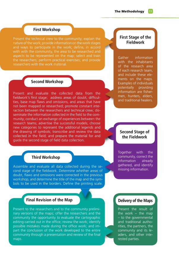
First Workshop
Present the technical crew to the community; explain the nature of the work; provide information on the work stages and ways to participate in the work; define, in accord with with the community, the area to be researched and aspects to be represented on the map; select and train the researchers; perform practical exercises; and provide researchers with the work material.
First Stage of the Fieldwork
Gather information with the inhabitants of the research area of each research team, and include these ele-ments on the maps. Examples of individuals potentially providing information are fisher-men, hunters, elders, and traditional healers.
Second Workshop
Present and evaluate the collected data from the fieldwork’s first stage; address areas of doubt, difficul-ties, base map flaws and omissions, and areas that have not been mapped or researched; promote constant inte-raction between the researchers and technical crew; dis-seminate the information collected in the field to the com-munity; conduct an exchange of experiences between the research teams; advertise the successful models; choose new categories to represent the additional legends and the drawing of symbols; transcribe and review the data collected in the field; and prepare the material for and guide the second stage of field data collection.
Second Stage of the Fieldwork
Together with the community, correct the information already gathered, and identify missing information.
Third Workshop
Assemble and evaluate all data collected during the se-cond stage of the fieldwork. Determine whether areas of doubt, flaws and omissions were corrected in the previous workshop, and determine the title of the map and the sym-bols to be used in the borders. Define the printing scale.
Final Revision of the Map
Present to the researchers and to the community prelimi-nary versions of the maps; offer the researchers and the community the opportunity to evaluate the cartographic editing carried out in the office; review the work; identify possible mistakes made during the office work; and im-part the conclusion of the work developed to the entire community through a presentation and review of the final maps.
Delivery of the Maps
Present the result of the work – the map – to the governmental and traditional autho-rities, the partners, the community and its le-aders, and other inte-rested parties.
12 Methodology of Collaborative Cultural Mapping
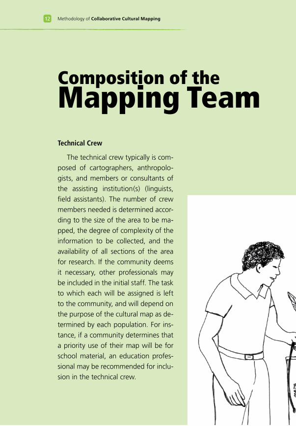
Composition of theMapping TeamTechnical Crew
The technical crew typically is com-
posed of cartographers, anthropolo-
gists, and members or consultants of
the assisting institution(s) (linguists,
field assistants). The number of crew
members needed is determined accor-
ding to the size of the area to be ma-
pped, the degree of complexity of the
information to be collected, and the
availability of all sections of the area
for research. If the community deems
it necessary, other professionals may
be included in the initial staff. The task
to which each will be assigned is left
to the community, and will depend on
the purpose of the cultural map as de-
termined by each population. For ins-
tance, if a community determines that
a priority use of their map will be for
school material, an education profes-
sional may be recommended for inclu-
sion in the technical crew.
13The Methodology
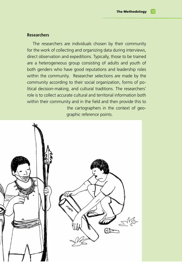
Researchers
The researchers are individuals chosen by their community
for the work of collecting and organizing data during interviews,
direct observation and expeditions. Typically, those to be trained
are a heterogeneous group consisting of adults and youth of
both genders who have good reputations and leadership roles
within the community. Researcher selections are made by the
community according to their social organization, forms of po-
litical decision-making, and cultural traditions. The researchers’
role is to collect accurate cultural and territorial information both
within their community and in the field and then provide this to
the cartographers in the context of geo-
graphic reference points.
1� Methodology of Collaborative Cultural Mapping
Community
The community/communities is (are) the social group(s) that
inhabits the land to be mapped. In Brazil, for example, these may
be indigenous groups, quilombolas, extractive communities, cai-
çaras, faxinalenses, and other resident populations. Because the
knowledge regarding a group’s history rarely resides in just one
individual, every member of the community can play an impor-
tant role in the mapping process. As a rule, a high level of par-
ticipation on the part of the community’s traditional leaders is
necessary to legitimize the results.
Partner Institution
This term describes any institutional partner of the community:
community association, governmental or academic institution, or
any other non-governmental institution. The role of the partner
institution is to assist with project administration and execution,
which may include resource management, hiring of the techni-
cal crew, supervision, and technical and logistical support. The
partner institution(s) must have the trust of the community and
respect the cultural map as a product of community intellectual
property.
1�The Methodology
Methodology of Collaborative Cultural Mapping1�
Preparatory
ProceduresOn the following pages, the mapping preparation stage will
be described. The preparatory stage is very important becau-
se, when well conducted, it becomes far easier to carry out the
subsequent stages. Meetings are held with the community that
lives on the territory to be mapped in order to secure prior in-
formed consent, receive the community’s requests, present the
methodology, and establish the work schedule. At this juncture,
the involvement of a great number of leaders and relevant social
agents of the community is very important.
It is also in this stage that the logistical arrangements and the
dissemination of the work methodology are completed. Logis-
tical and administrative considerations in the process are impor-
tant, but do not follow a strict methodology as they are determi-
ned by the particular situation.
1�Preparatory Procedures
Purpose
Integrate the technical crew with the community; make con-
tact with the community members involved in the project; pro-
mote prior informed consent; identify the specific community’s
needs with respect to mapping; establish rules and a work sche-
dule; define the necessary cartographic material; and define the
desired researcher profile.
Definition of the technical crew
The technicians who will compose the technical crew are se-
lected during the preparatory stage. Generally, the crew consists
primarily of professional cartographers and anthropologists, who
may be assisted by other types of professionals as deemed ne-
cessary by the community and its representatives. The technical
crew collectively defines the necessary technical material for the
work, such as the cartographic basis, satellite images, aerial pho-
tos, cameras, recording devices, software and equipment. Infor-
mation on the ethnographic and historical background of the
community is compiled at this stage to guide the work of the
technical crew.
Community Meetings
Once interest in initiating a cultural mapping project has been
demonstrated, preparatory meetings are arranged to identify the
community’s needs and expectations regarding the project and
its results. These meetings create a space for the community to
have their questions and concerns addressed by the technical
crew. Typical topics of interest include the coordination of the
work, the purpose of a cultural map, and the ways in which such
a map can help meet the community’s socio-cultural interests.
1� Methodology of Collaborative Cultural Mapping
During the preparatory meetings, whose number may vary
according to the situation, the crew presents the collaborative
cultural mapping methodology to the community. After receiving
detailed project information, the community and its traditional
leaders will discuss the process’s acceptability. If there are mul-
tiple communities involved, their leaders must work together to
assure a respect for each traditional group’s characteristics while
building a single framework for the desired map.
This stage, therefore, emphasize the establishment of prior in-
formed consent, in which every community is informed about the
work, its stages, its importance, its purpose, ways of collabora-
ting, and its potential impact and consequences. This part of the
effort must be highly focused in order to address any concerns
that may emerge. For the same reason all partner institutions, re-
presentatives of the technical crew and community leaders must
participate in all meetings.
Work Schedule
The technical crew, community leaders and community mem-
bers define the dates and sites for the workshops as well as the
fieldwork period for the researchers. This schedule must consider
the agricultural and ritual activities of the group, avoiding coin-
cidences between the mapping activities and other important
and vital events for the community, such as harvests and cere-
monies.
The creation of a cultural map, as a very defined process with
different parties being assigned specific tasks, demands a highly
coordinated schedule to minimize disruptions in work.
1�Preparatory Procedures
Selection of the Community Researchers
The selection of researchers is made by the community invol-
ved. Chieftains and community leaders are an essential part of
this decision so that the selection may be considered legitimate.
In order to increase the reliability of data collected, it is desirable
that the research crew be a heterogeneous group in terms of
age, gender, social status, and role in the community.
With respect to the linguistic barriers between the commu-
nity and technical crew, when available, it is extremely useful to
have a linguist or a specialist within the community serve as an
interpreter the two linguistic universes. If such an individual is not
available, it is recommended that the language of the community
researchers be primary in both writing and reading.
20 Methodology of Collaborative Cultural Mapping
Definition of the area to be mapped
The area to be mapped is defined by the community and may
not always coincide with lands legally demarcated. Very often,
the area to be researched is larger than the occupied area, and
may not be continuous. Considerations in the community’s de-
cision may include its traditional land occupation and usage, its
history, and its culture.
Using a printed map of the region, through multiple dialo-
gues, the leaders and the community will delimit the area to
be mapped. Ideally, this delimitation will occur during the pre-
paratory meetings or, if conditions don’t allow, during the first
workshop.
To facilitate
the selection
of the area to
be mapped,
the techni-
cal crew must prepare in advance a
compatible scale map with a broad
view of the area to be researched.
For this purpose, satellite images
may be used. After the area is de-
fined, the cartographers will begin
preparing the cartographic base,
and if necessary, several scale-com-
patible boards must be printed and
appended to one another to com-
pletely cover the work area. The use
of updated satellite images is recom-
mended for correcting and updating
the cartographic base, making the
work of the researchers easier. In
this stage, the digital cartographic
base also will be validated in a for-
mat compatible with the applied
tools.
Suggestion for
cartographers
21Preparatory Procedures
Dica aosCartógrafos
Formal and Legal preparations
Every decision made during the preparatory stage must be
formally recorded and conveyed to the engaged parties. By the
end of the preparatory meetings, once all engaged parties have
agreed on all process rules and decisions, a formal cooperative
agreement must be signed between the executing institution, the
community (through its representative institution or leadership)
and other partner institutions. The agreement must list all project
objectives and activities, each party’s obligation, copyright and
publication rights, documentation of laws regarding the protec-
tion of traditional knowledge, and the duration of the project.
Information about the community and its region (culture, so-
cial organization, language, history, inter-ethnic relationships);
Cartographic preliminary base representation of the local
area and surroundings;
Notepads and formal record-keeping book;
Updated satellite photos of the area to be mapped.
Necessary Material
Methodology of Collaborative Cultural Mapping22
.The FirstWorkshop
The first
workshop
lasts about
a week
Objective
Introduce the technical team to the community;
explain the work; inform the community regarding
the activity schedule and the forms of community
participation; define, with the community, the area
to be researched and what will be represented in
the map; select and train the researchers; perform
practical exercises; and provide the researchers
with the work material.
23The First Workshop
.The FirstWorkshop
Workshop Location
Ideally, the workshop should be conducted in the community’s
main village. Considerations in site selection include available ins-
tallations, working conditions, ease of access, and accommoda-
tions.
This stage is very important, because the commencement
of the first workshop usually marks the first contact between
the community and the technical crew. It is also during the first
workshop that the greatest number of community members is
present, making it the ideal occasion to explain the work, answer
questions and promote full participation.
Components of the first workshop
1. Instructions to the researchers from the technical crew;
2. Distribution of research teams to specific areas;
3. Definition of the data to be collected and how the data will be
presented
4. Practical training;
5. Brief training in ethnographic research, methods and techniques;
6. Official delivery of the material and conclusion of workshop
activities.
Methodology of Collaborative Cultural Mapping2�
Since the primary objective of the workshop it is not to train car-tographers but to train field researchers, cartographic information must be transmitted in the simplest and most concise way possi-ble, preferentially choosing practical examples and avoiding the use of technical terms.
1 Instructions
In this workshop, several mini-courses are conducted
in order to impart western cartographic techniques to the resear-
chers. The cartographers teach specific classes on the following
subject matter:
Maps and their historical basis;
Coordinated systems;
Scale;
Cartographic conventions, symbols and subtitles;
Other relevant themes as chosen by the technical crew.
Some map models, including cultural ones, may be reviewed
at this stage. However, care must be taken so that the shapes and
elements used on these maps don’t influence the creation of the
new maps.
Also during this stage, discussions are conducted on the primary
techniques used in qualitative research: types of interviews; ways
of approaching subjects; development of interview scripts; book
registrations; identification of social categories to be interviewed;
and choice of equipment, such as recording devices, if necessary.
Suggestion for
cartographers
2�The First Workshop
Each research team must travel to the field with a copy of the general map and a few copies of the partial maps containing the work area. These partial maps must be large-scale to facilitate the insertion of data, regardless of the final map scale. The researchers will receive instruction on ways to organize the data on the maps,
including captions, enumeration, and illustrations. It is recommended that the back of the maps be protected with contact paper or plastic in order to enhance their protection, since they will be carried and passed around during several field stages.
2 Distribution of the research teams in specific research areas
In this stage, the community defines the areas to be resear-
ched and the responsibilities of each researcher or team. To make
the job easier, a good strategy to follow is to select teams com-
posed of researchers who inhabit the defined research areas wi-
thin the total area to be mapped. Another option is to enlist the
help of those with historical knowledge and other experienced
people within the community, which will facilitate both interac-
tion and the transmission of information. Each team must have at
least one researcher who can read and interpret all data collected
during the work.
It is also during the first workshop that the researchers receive
the material to be used during their work. The suggested com-
position of the material to be provided is listed at the end of this
chapter.
Suggestion for
cartographers
Methodology of Collaborative Cultural Mapping2�
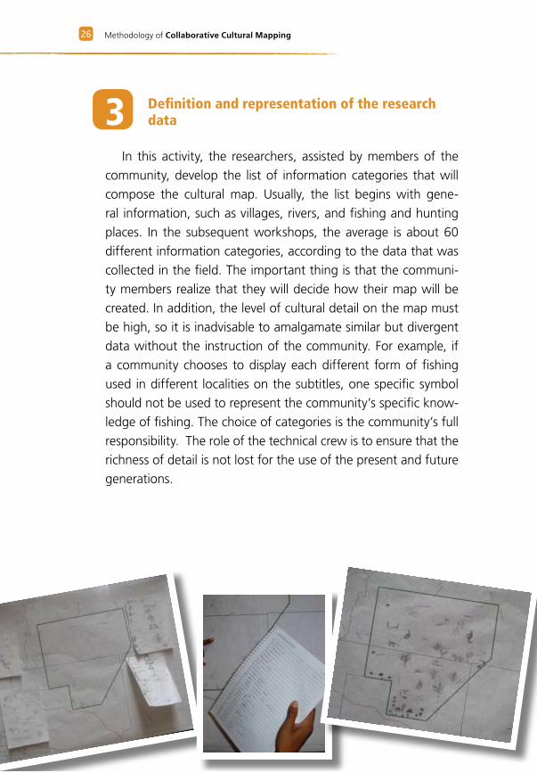
3 Definition and representation of the research data
In this activity, the researchers, assisted by members of the
community, develop the list of information categories that will
compose the cultural map. Usually, the list begins with gene-
ral information, such as villages, rivers, and fishing and hunting
places. In the subsequent workshops, the average is about 60
different information categories, according to the data that was
collected in the field. The important thing is that the communi-
ty members realize that they will decide how their map will be
created. In addition, the level of cultural detail on the map must
be high, so it is inadvisable to amalgamate similar but divergent
data without the instruction of the community. For example, if
a community chooses to display each different form of fishing
used in different localities on the subtitles, one specific symbol
should not be used to represent the community’s specific know-
ledge of fishing. The choice of categories is the community’s full
responsibility. The role of the technical crew is to ensure that the
richness of detail is not lost for the use of the present and future
generations.
Dica aosCartógrafos
2�The First Workshop
Discussion of and agree-
ment on the category list by
the researchers can require
an entire day. The resear-
chers then move on to the
definition of subtitle repre-
sentations for the map, or
symbols created by the com-
munity. Each group will have
its own way of representing
each category of subtitle in-
formation. Each researcher
can be asked, for instance,
to draw a symbol for each
of the categories, and then
the group can decide the
“winning” symbol throu-
gh democratic voting. Each
can also be asked to draw a
specific symbol for one cate-
gory. These are only two of
many possibilities for cho-
osing the symbols that will
compose the subtitles. The
community’s role, through
the researchers, is to work
with the technical crew to
decide how these choices
will be made.
Methodology of Collaborative Cultural Mapping2�
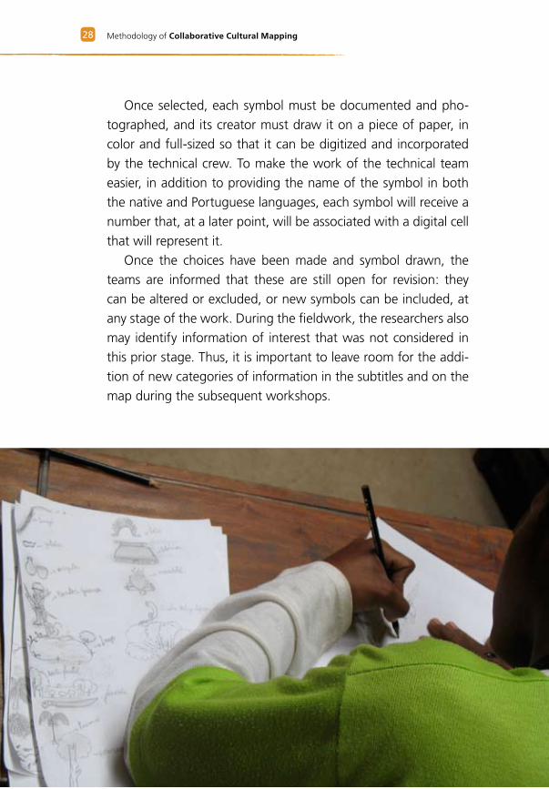
Once selected, each symbol must be documented and pho-
tographed, and its creator must draw it on a piece of paper, in
color and full-sized so that it can be digitized and incorporated
by the technical crew. To make the work of the technical team
easier, in addition to providing the name of the symbol in both
the native and Portuguese languages, each symbol will receive a
number that, at a later point, will be associated with a digital cell
that will represent it.
Once the choices have been made and symbol drawn, the
teams are informed that these are still open for revision: they
can be altered or excluded, or new symbols can be included, at
any stage of the work. During the fieldwork, the researchers also
may identify information of interest that was not considered in
this prior stage. Thus, it is important to leave room for the addi-
tion of new categories of information in the subtitles and on the
map during the subsequent workshops.
2�The First Workshop
4 Practical training in the village
This is an opportunity for each research team to prac-
tice what they have learned in theory. Here, the researchers
receive a regional map of the project coverage containing only
hydrographic details and some other geographic aspects, without
names or symbols. To fill it in, the researchers must contact the
community and collect as much information as they can, based
on their created subtitles. They receive orientation from the tech-
nical team regarding techniques for collecting data and utilizing
their map and their field notebooks, essential to recording the
obtained information. The researchers record the native names
of rivers, mountains and other geographic features and locate
villages, camps, and other site-based elements for the composi-
tion of the map.
During the field practice, the technical crew must be available
to the researchers to provide guidance and clarify any areas of
concern. At the end of the day, after the exercise is finished, the
researchers meet, present their results and exchange experience
and ideas.
In conclusion, it is still necessary to include the names of tra-
ditional places, rivers, villages and every other land related aspect
of the area to be mapped. After all, a map does not consist only
of numbers, but also of every name tag socially built over the
represented land.
Methodology of Collaborative Cultural Mapping30
5 Brief training in ethnographic research: methods and techniques
A cultural map may be considered a portrait of a traditional
territory and a compound of the elements of a culture. Of note
is that the categories of information used may reveal different
visions of the world and divergent existential, moral and aesthetic
values. Therefore, it is fundamental that the researchers initiate
the fieldwork after a free discussion about these differences and
which research strategies will best achieve the objectives. It is also
an opportunity for the researchers to deeply explore their cultural
reality, making it possible for the researchers to relive their an-
cestral stories, visit ancestral sites and learn about their people’s
traditional ways. The results, especially for the community’s you-
th, can be very meaningful. The researchers are able to construct
their own databank, which may be used for other purpose such
as the generation of educational and historical texts.
In this regard, a proper orientation in qualitative and quan-
titative anthropological research techniques can substantially
contribute to data enhancement. Recording techniques, use of
field notebooks, development of interview scripts according to
the characteristics of the interviewed social actors, and develo-
pment of answer sheets are some of the elements that can be
discussed with the researchers. Research techniques should be
considered open to adaptation according to the local reality of
the researchers. Here, the need for anthropologists as members
of the technical crew is emphasized because they are able to deal
with multi-cultural scenarios and inter-ethnic relationships. These
professionals should also systematically advise the researchers on
the processing of field data and guide them in the collection of
new information, strengthening their research practice.
31The First Workshop
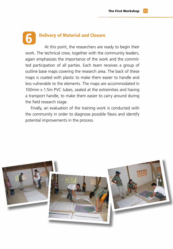
6 Delivery of Material and Closure
At this point, the researchers are ready to begin their
work. The technical crew, together with the community leaders,
again emphasizes the importance of the work and the commit-
ted participation of all parties. Each team receives a group of
outline base maps covering the research area. The back of these
maps is coated with plastic to make them easier to handle and
less vulnerable to the elements. The maps are accommodated in
100mm x 1.5m PVC tubes, sealed at the extremities and having
a transport handle, to make them easier to carry around during
the field research stage.
Finally, an evaluation of the training work is conducted with
the community in order to diagnose possible flaws and identify
potential improvements in the process.
Methodology of Collaborative Cultural Mapping32
Technical Crew
Portable computers, with a digital cartographic base
of the project area, local satellite images, and software
to handle the digital base;
Maps and printed satellite images;
100mm x 1.5m PVC tubes with seals and handles to
keep the maps and papers safe during transportations to
the villages;
Copies of the maps and/or participatory cultural map-
ping products to be used as examples;
Ten white cardstock sheets or flip charts;
Rolls of tape;
White glue tubes;
Rolls of contact paper;
Scissors, pens, pencils, erasers;
Notebooks and record-keeping books;
Boards and rulers;
Rope coils and clothing bails.
Suggested Material
33The First Workshop
Researchers
Each researcher will receive a backpack containing:
100 A-4 paper sheets
An 11.81 inch ruler
A white eraser
A black pencil
A pencil sharpener
A dozen color pencils
A dozen color pens
A roll of tape
Liquid paper
A rain poncho
According to need, other products may be added to the
kits, such as boots, knives, and flashlights.
Research Team
Each team will receive (accommodated by a 100mm x
1.5m PVC tube, sealed on the extremities and with a trans-
port handle) maps and printed images of the research area as
well as field notebooks.
Methodology of Collaborative Cultural Mapping3�
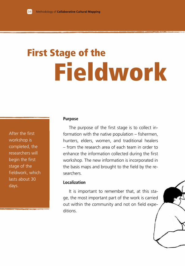
First Stage of the
Fieldwork
After the first
workshop is
completed, the
researchers will
begin the first
stage of the
fieldwork, which
lasts about 30
days.
Purpose
The purpose of the first stage is to collect in-
formation with the native population – fishermen,
hunters, elders, women, and traditional healers
– from the research area of each team in order to
enhance the information collected during the first
workshop. The new information is incorporated in
the basis maps and brought to the field by the re-
searchers.
Localization
It is important to remember that, at this sta-
ge, the most important part of the work is carried
out within the community and not on field expe-
ditions.
3�First Stage of the Fieldork
During the period in which the re-searchers are in the field, the technical
crew moves on to planning the next stages and readies itself for the ma-nagement of data collected during the fieldwork, including designing the structure of the databank and preparing the base maps to incor-porate a transcription of the data collected in the field.
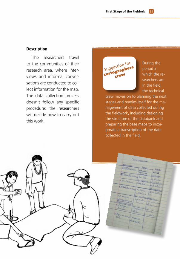
Description
The researchers travel
to the communities of their
research area, where inter-
views and informal conver-
sations are conducted to col-
lect information for the map.
The data collection process
doesn’t follow any specific
procedure: the researchers
will decide how to carry out
this work.
Suggestion for
cartographers
crew
3� Methodology of Collaborative Cultural Mapping
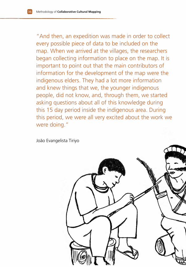
“And then, an expedition was made in order to collect every possible piece of data to be included on the map. When we arrived at the villages, the researchers began collecting information to place on the map. It is important to point out that the main contributors of information for the development of the map were the indigenous elders. They had a lot more information and knew things that we, the younger indigenous people, did not know, and, through them, we started asking questions about all of this knowledge during this 15 day period inside the indigenous area. During this period, we were all very excited about the work we were doing.”
João Evangelista Tiriyo
3�First Stage of the Fieldork
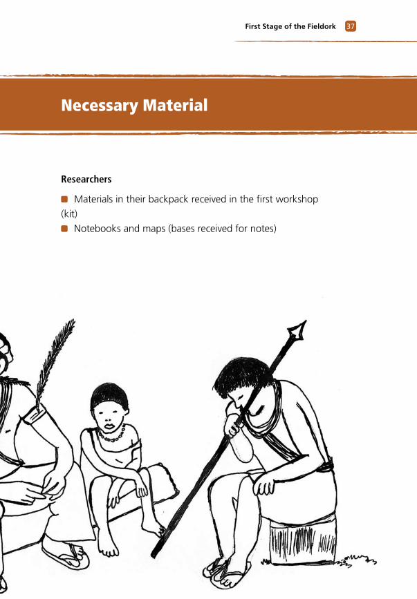
Researchers
Materials in their backpack received in the first workshop
(kit)
Notebooks and maps (bases received for notes)
Necessary Material
Methodology of Collaborative Cultural Mapping3�
SecondWorkshop
The second
workshop
lasts about
two weeks.
Purpose
To present and evaluate the data collected during
the first fieldwork period; resolve possible areas of
uncertainty, difficulties, flaws, omissions and non-ma-
pped or non-researched areas; generate interaction be-
tween the researchers and technical crew; share the
information collected in the field; conduct an exchange
of experiences between the research teams; duplicate
the successful models and select new categories to re-
present the additional subtitles and the drawing of the
symbols; transcribe and review the data collected on
field; prepare the field maps and provide orientation
for the second stage of collecting field data.
The second workshop is the longest and most la-
borious stage for all teams, because the amount of in-
formation collected during the fieldwork requires great
effort and dedication for both proper documentation
and accurate transcription to the new maps.
3�Second Workshop
Location of Workshop
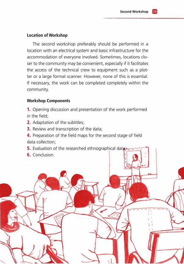
The second workshop preferably should be performed in a
location with an electrical system and basic infrastructure for the
accommodation of everyone involved. Sometimes, locations clo-
ser to the community may be convenient, especially if it facilitates
the access of the technical crew to equipment such as a plot-
ter or a large format scanner. However, none of this is essential.
If necessary, the work can be completed completely within the
community.
Workshop Components
1. Opening discussion and presentation of the work performed
in the field;
2. Adaptation of the subtitles;
3. Review and transcription of the data;
4. Preparation of the field maps for the second stage of field
data collection;
5. Evaluation of the researched ethnographical data;
6. Conclusion.
�0 Methodology of Collaborative Cultural Mapping
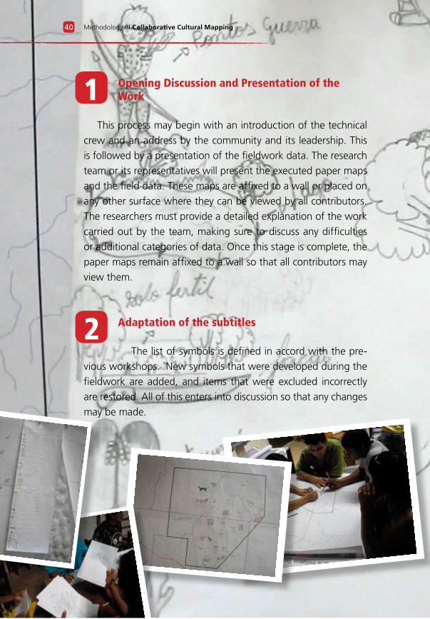
2 Adaptation of the subtitles
The list of symbols is defined in accord with the pre-
vious workshops. New symbols that were developed during the
fieldwork are added, and items that were excluded incorrectly
are restored. All of this enters into discussion so that any changes
may be made.
1 Opening Discussion and Presentation of the Work
This process may begin with an introduction of the technical
crew and an address by the community and its leadership. This
is followed by a presentation of the fieldwork data. The research
team or its representatives will present the executed paper maps
and the field data. These maps are affixed to a wall or placed on
any other surface where they can be viewed by all contributors.
The researchers must provide a detailed explanation of the work
carried out by the team, making sure to discuss any difficulties
or additional categories of data. Once this stage is complete, the
paper maps remain affixed to a wall so that all contributors may
view them.
�1Second Workshop
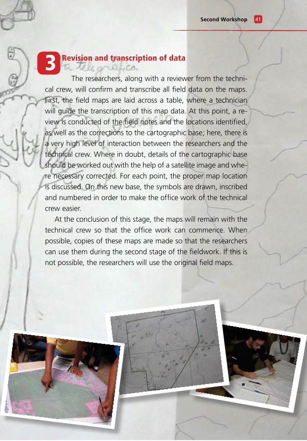
3 Revision and transcription of data
The researchers, along with a reviewer from the techni-
cal crew, will confirm and transcribe all field data on the maps.
First, the field maps are laid across a table, where a technician
will guide the transcription of this map data. At this point, a re-
view is conducted of the field notes and the locations identified,
as well as the corrections to the cartographic base; here, there is
a very high level of interaction between the researchers and the
technical crew. Where in doubt, details of the cartographic base
should be worked out with the help of a satellite image and whe-
re necessary corrected. For each point, the proper map location
is discussed. On this new base, the symbols are drawn, inscribed
and numbered in order to make the office work of the technical
crew easier.
At the conclusion of this stage, the maps will remain with the
technical crew so that the office work can commence. When
possible, copies of these maps are made so that the researchers
can use them during the second stage of the fieldwork. If this is
not possible, the researchers will use the original field maps.
�2 Methodology of Collaborative Cultural Mapping
Experience has shown the importance of generating a single map at a smaller scale
that displays the entire mapped area, because native communities generally do not conceptualize their lands in a fragmented view. Additionally, such a representation enables viewers to
better understand the dynamics in the community of changing social, cultural, political and economic relationships. Therefore, we suggest that both general and partial maps be printed. The general map enables a view of the whole mapping area, while the partial map permits an examination of more detailed information.
4 Integrating Field Maps Into a Map of the Total Area; Second Stage of Field Data Collection
It is advisable to integrate the field maps in individual areas in
order to obtain a complete perspective on the mapped territory.
Integrating the field maps also allows the contributors to identify
any information regarding the area than was omitted and then to
more efficiently schedule the next stage of data collection to re-
solve any omissions, collect new information and confirm data.
At this point, all contributors have gathered together, the
schedule is set, and future expeditions have been planned.
5 Evaluation of the Researched Ethnographic Data
This activity consists of cataloguing the researched
subjects (such as relatives, social organization, means of produc-
tion, and mythical histories); identifying possible omissions; and
if necessary planning a complementary survey on the livelihoods
and cultural aspects of the community involved in the mapping.
Suggestion for
cartographers
crew
�3Second Workshop
Researchers
Materials received during the first workshop (kit);
Notebooks and maps containing the data from the first field
stage collected
Technical Crew
A wide space with three large tables onto which the maps
can be placed for review and transcription of the data;
Two portable computers with CAD and image management
software, a cartographic basis and satellite images of the stu-
died region;
Printed maps of the studied region in sufficient quantity to
receive the transcription of every field map;
Flip chart pads, atomic pencil, pencils, pens, erasers, rolls of
tape, glue, notebooks, notepads, plastic file cases, scissors, ru-
lers, two A-4 sheets of paper, a plastic tube, ropes and bails.
6 Workshop Conclusion
The workshop concludes with an orientation session
for the researchers by the technical team regarding the second
stage of the fieldwork and with an evaluation of the work com-
pleted to this point in order to determine what was done correc-
tly or incorrectly.
Necessary Material
Methodology of Collaborative Cultural Mapping��
Purpose
To correct, with the community, the information ob-
tained to this point and to collect missing information.
Location of Fieldwork
Fieldwork is conducted in the communities and du-
ring expeditions.
Description
Regions that are in need of more information are
identified. This deficit may exist because the people
who possessed this information weren’t present during
the first stage, or because it is necessary to obtain more
details from expeditions with the people familiar with
those regions. It is during the second stage of the fiel-
dwork that the researchers and those in the communi-
ty providing information carry out expeditions to those
areas of the territory where important information is
located that was not included in the map.
Second Stage of the
Fieldwork
The duration
of this stage
can vary from
2 to 4 weeks.
��Second Stage of the Fieldwork
Simultaneously to the second stage of field research, the data generated during the field research and previous workshops are processed in the office; the generation of individual cells and cell libraries is initiated; and the databank is populated with the available information. The generation of margin information, including subtitles, is also initiated during this period.
Necessary Material
Researchers
Material received du-
ring the first workshop
(kit);
Notebooks and the
maps containing data
collected during the first
field stage;
Fuel, food and
transportation for the
expeditions.
“The indigenous re-
searchers have made
several field expedi-
tions to gather infor-
mation. They know
how to best protect
their flora, fauna, cul-
ture, sacred sites, and
other places.”
Juventino Kaxuiana
Suggestion for
cartographers
Methodology of Collaborative Cultural Mapping��
Purpose
Receive and evaluate the data collected during the
second stage of the fieldwork; determine whether all
areas of uncertainty are resolved and whether every
area of difficulty, flaw or omission detected in the pre-
vious workshop was corrected; select the title of the
map and the symbols for the borders; define the prin-
ting scale.
Workshop Location
Here one can apply the same site selection rules
from the second workshop. It is important to have the
necessary supporting infrastructure for completion of
the work.
Components
1. Opening discussion and presentation of the work;
2. Presentation of the data generated in the office;
3. Choice of the title and border symbols for the map;
4. Choice of printing scale and formats;
5. Conclusion.
ThirdWorkshop
The third
workshop
lasts about a
week.
��Third Workshop
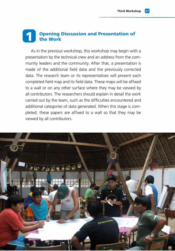
1 Opening Discussion and Presentation of the Work
As in the previous workshop, this workshop may begin with a
presentation by the technical crew and an address from the com-
munity leaders and the community. After that, a presentation is
made of the additional field data and the previously corrected
data. The research team or its representatives will present each
completed field map and its field data. These maps will be affixed
to a wall or on any other surface where they may be viewed by
all contributors. The researchers should explain in detail the work
carried out by the team, such as the difficulties encountered and
additional categories of data generated. When this stage is com-
pleted, these papers are affixed to a wall so that they may be
viewed by all contributors.
Methodology of Collaborative Cultural Mapping��
2 Presentation of Data Generated in the Office
The work generated in the office will be presented to the re-
searchers and matched with the field data that produced it. The
field maps will be affixed to a wall so that all contributors may
view them. The technical crew must explain to those present, in
an objective way, how the data was obtained, and must match
the symbols drawn by the community with the cells made by
the technical crew. If there is interest, the technical details of the
process will be explained.
The maps generated in the office are laid across a table. The
researchers, along with a guide from the technical crew, will re-
view the information. The office maps are compared with the
field maps, and each data point (names, symbols, villages, places,
etc.) is confirmed by the researchers. The data points obtained
during the second stage of the fieldwork then are overlaid with
the office maps so they can be digitized.
At this juncture, the symbols of the subtitles’ digital cells are
evaluated by the researchers and, if necessary, modified with the
objective of better representing the drawings made. If new data
categories are inserted after the second workshop, the resear-
chers draw this new information on sheets of A-4 paper and
then photograph and number the drawings. The sheets contai-
ning this new data may be presented to the group as a whole as
in the previous workshops. By the end of the workshop, every
field map will reside with the technical crew so the office work
may begin.
��Third Workshop
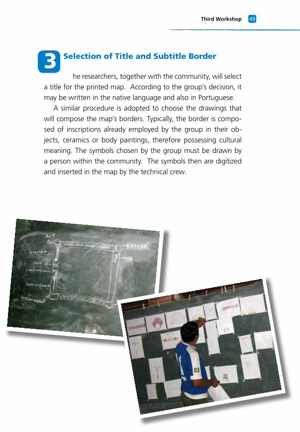
3 Selection of Title and Subtitle Border
he researchers, together with the community, will select
a title for the printed map. According to the group’s decision, it
may be written in the native language and also in Portuguese.
A similar procedure is adopted to choose the drawings that
will compose the map’s borders. Typically, the border is compo-
sed of inscriptions already employed by the group in their ob-
jects, ceramics or body paintings, therefore possessing cultural
meaning. The symbols chosen by the group must be drawn by
a person within the community. The symbols then are digitized
and inserted in the map by the technical crew.
Methodology of Collaborative Cultural Mapping�0
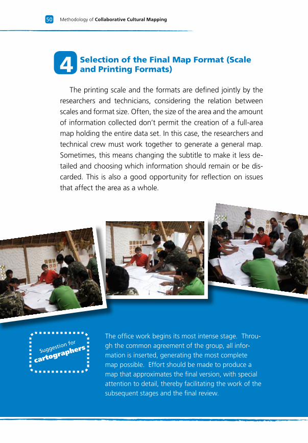
The office work begins its most intense stage. Throu-gh the common agreement of the group, all infor-mation is inserted, generating the most complete map possible. Effort should be made to produce a map that approximates the final version, with special attention to detail, thereby facilitating the work of the subsequent stages and the final review.
4 Selection of the Final Map Format (Scale and Printing Formats)
The printing scale and the formats are defined jointly by the
researchers and technicians, considering the relation between
scales and format size. Often, the size of the area and the amount
of information collected don’t permit the creation of a full-area
map holding the entire data set. In this case, the researchers and
technical crew must work together to generate a general map.
Sometimes, this means changing the subtitle to make it less de-
tailed and choosing which information should remain or be dis-
carded. This is also a good opportunity for reflection on issues
that affect the area as a whole.
Suggestion for
cartographers
�1Third Workshop
Researchers
Material received during the first workshop (kit);
Notebooks and maps containing data collected during the
first two stages of fieldwork.
Technical Crew
The technical crew requires the same material used during
the previous workshop, but in this stage the printed maps also
will be augmented with data collected during the previous
workshop.
5 Workshop Conclusion and Arrangements for the Review Stage
After the third workshop, the activities are concluded and the
necessary materials for office work are provided to the technical
crew. (By the conclusion of the project, all materials must be re-
turned to the researchers and to the community). In accordance
with the schedule, all contributors will be informed about the
dates and locations for the final review of the maps.
Necessary Material
Methodology of Collaborative Cultural Mapping�2
Purpose
Present to the researchers and to the communi-
ty a preliminary version of the maps; evaluate the
cartographic work executed in the office; review
the work; identify possible mistakes made during
the office work; validate the conclusion of the
work through the presentation and review of the
final product, the cultural maps.
Location of Review
To be defined by the partners and the commu-
nities involved.
Components
1. Review the work with the technical crew;
2. Review it with the communities;
Final Review ofthe Map
The final review
last approximately
two days, with
the possibility of
an extension of
several weeks. The
important thing
is that the map is
properly presented
to the communities
involved.
�3Final Review of the Map
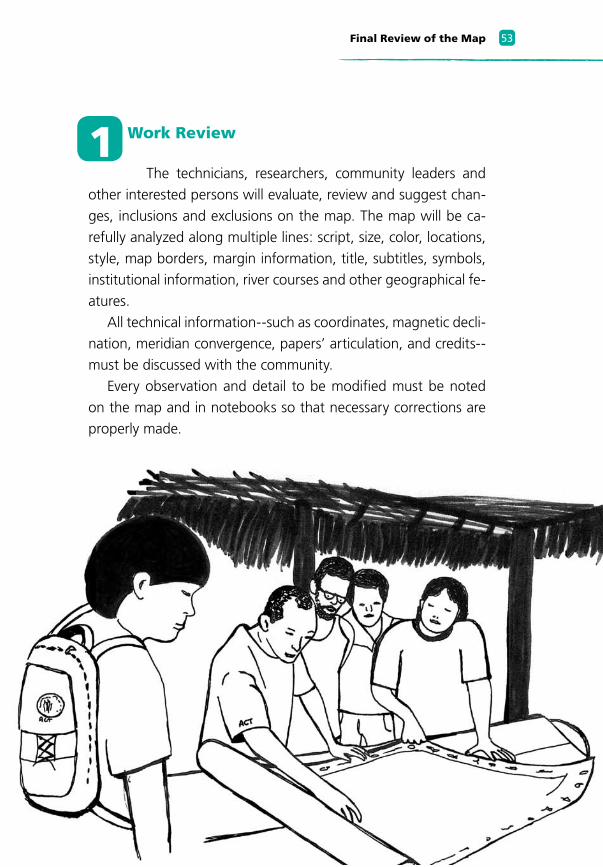
1 Work Review
The technicians, researchers, community leaders and
other interested persons will evaluate, review and suggest chan-
ges, inclusions and exclusions on the map. The map will be ca-
refully analyzed along multiple lines: script, size, color, locations,
style, map borders, margin information, title, subtitles, symbols,
institutional information, river courses and other geographical fe-
atures.
All technical information--such as coordinates, magnetic decli-
nation, meridian convergence, papers’ articulation, and credits--
must be discussed with the community.
Every observation and detail to be modified must be noted
on the map and in notebooks so that necessary corrections are
properly made.
�� Methodology of Collaborative Cultural Mapping
A review must be carried out in detail, symbol by symbol, by each resear-cher, always accompanied by a technician.
2 Review with the communities
After the review with the technical crew has been com-
pleted, the researchers take copies of the maps so that their com-
munities can conduct a final evaluation. They present the map
to interested parties and together discuss the final details. The
commentaries made during the evaluation must be written in
notebooks and on the maps and then are passed to the technical
crew for inclusion in the final edition of the map.
Suggestion for
cartographers
��Final Review of the Map
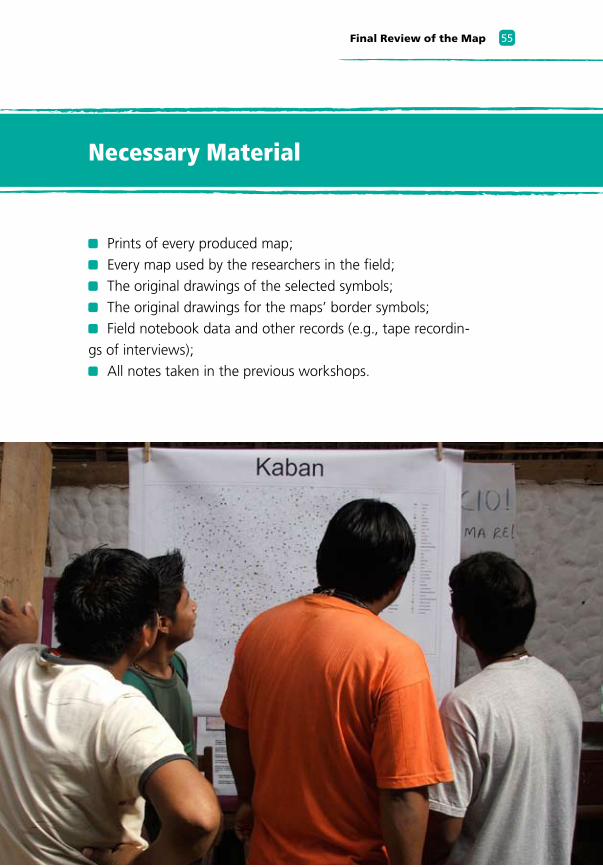
Prints of every produced map;
Every map used by the researchers in the field;
The original drawings of the selected symbols;
The original drawings for the maps’ border symbols;
Field notebook data and other records (e.g., tape recordin-
gs of interviews);
All notes taken in the previous workshops.
Necessary Material
Methodology of Collaborative Cultural Mapping��
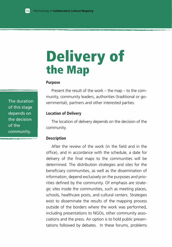
Purpose
Present the result of the work – the map – to the com-
munity, community leaders, authorities (traditional or go-
vernmental), partners and other interested parties.
Location of Delivery
The location of delivery depends on the decision of the
community.
Description
After the review of the work (in the field and in the
office), and in accordance with the schedule, a date for
delivery of the final maps to the communities will be
determined. The distribution strategies and sites for the
beneficiary communities, as well as the dissemination of
information, depend exclusively on the purposes and prio-
rities defined by the community. Of emphasis are strate-
gic sites inside the communities, such as meeting places,
schools, healthcare posts, and cultural centers. Strategies
exist to disseminate the results of the mapping process
outside of the borders where the work was performed,
including presentations to NGOs, other community asso-
ciations and the press. An option is to hold public presen-
tations followed by debates. In these forums, problems
Delivery ofthe Map
The duration of this stage depends on the decision of the community.
��Delivery of the Map
of a territorial, environmental or educational nature may be des-
cribed and their resolutions sought.

This work was composed by the team of the ACT Brazil and was printed in the summer of 2008, in the city of Brasília/DF, by the Athalaia Printer and Publisher. The paper used in the flesh is the recycled 90 g/m2 and the type used in the text is Frutiger, the body 11/16. The cover was printed in paper Supreme Card 250 g/m2.
SérieMapeamento,Manejo e Proteção


