MIAMI: A Study in Urban Geography By MILLICENT TODD BINGHAM This type study of the location and growth of a city as influenced by its location is a spectacular example in urban geography. Writ- ten in French in 1931, it was prepared for a volume of researches by the students of Professor Raoul Blanchard of the University of Grenoble to celebrate the twenty-fifth anniversary of his founding of the Institute of Alpine Geography. It was published in full by that institution.* In abbreviated form the paper was presented, with slides, before the International Congress of Geography in Paris, September, 1931.t To the European audience it was a startling thought that a small settlement could have grown into a metropolis in the brief space of thirty-five years. The study is here made avail- able in English for the first time. Last February when I was in southern Florida, I had just returned one morning from a very early trip out into the Everglades to see the birds- clouds of herons, ducks, and ibises-darkening the sky with their flight, filling the air with the rustle of their myriad wings. We had followed the road fifty miles or more straight across the swamp without a turn, without the sight of a single house or a single human face. Yet here I was once more back in the midst of a city-a great noisy modern city, its silhouette of incongruous sky-scrapers rising through the tropical haze above the bay. Miami, this city beside the Everglades, has grown up like the cities of the fairy tales, almost over night. Twenty years ago it was a sleepy little tropical town, with gentle Southerners in hammocks of rattan dozing at noonday beneath the palms. And now, during the winter season it is a bustling metropolis of over 200,000 inhabitants. It has been groomed until all the old landmarks have been swept away. The ibises and roseate spoon- bills that used to wade in the quiet lagoons know it no more, and the wild- cats that prowled out of the Everglades at night to prey upon the chicken * Millicent Todd Bingham, "La Floride du sud-est et la ville de Miami," Milanges geographiques offerts par ses 6lves a Raoul Blanchard, a l'occasion du vingt-cinquieme anniversaire de 1'Institut de Geographie Alpine de Grenoble, 1932. Pp. 89-133. t M. T. Bingham, "Miami," Comptes rendus du Congris International de Geographie, Vol. III, 1934. Pp. 423-431. 73
Transcript
MIAMI: A Study in Urban GeographyBy MILLICENT TODD BINGHAM
This type study of the location and growth of a city as influencedby its location is a spectacular example in urban geography. Writ-ten in French in 1931, it was prepared for a volume of researchesby the students of Professor Raoul Blanchard of the University ofGrenoble to celebrate the twenty-fifth anniversary of his foundingof the Institute of Alpine Geography. It was published in full bythat institution.* In abbreviated form the paper was presented, withslides, before the International Congress of Geography in Paris,September, 1931.t To the European audience it was a startlingthought that a small settlement could have grown into a metropolisin the brief space of thirty-five years. The study is here made avail-able in English for the first time.
Last February when I was in southern Florida, I had just returned onemorning from a very early trip out into the Everglades to see the birds-clouds of herons, ducks, and ibises-darkening the sky with their flight,filling the air with the rustle of their myriad wings. We had followed theroad fifty miles or more straight across the swamp without a turn, withoutthe sight of a single house or a single human face. Yet here I was oncemore back in the midst of a city-a great noisy modern city, its silhouetteof incongruous sky-scrapers rising through the tropical haze above the bay.
Miami, this city beside the Everglades, has grown up like the cities ofthe fairy tales, almost over night. Twenty years ago it was a sleepy littletropical town, with gentle Southerners in hammocks of rattan dozing atnoonday beneath the palms. And now, during the winter season it is abustling metropolis of over 200,000 inhabitants. It has been groomed untilall the old landmarks have been swept away. The ibises and roseate spoon-bills that used to wade in the quiet lagoons know it no more, and the wild-cats that prowled out of the Everglades at night to prey upon the chicken
* Millicent Todd Bingham, "La Floride du sud-est et la ville de Miami," Milangesgeographiques offerts par ses 6lves a Raoul Blanchard, a l'occasion du vingt-cinquiemeanniversaire de 1'Institut de Geographie Alpine de Grenoble, 1932. Pp. 89-133.
t M. T. Bingham, "Miami," Comptes rendus du Congris International de Geographie,Vol. III, 1934. Pp. 423-431.
73
74 TEQUESTA
yards now follow their trails through the tall sedges to the rookeries of heronswithin the swamp, but not beyond. Only a short time ago this was a pioneerbelt, where brawny men in wide-brimmed hats rode on horseback into thewilderness along narrow trails and alligators lounged in stagnant pools inantediluvian languor.
Miami, the incarnation of the restless American spirit, juxtaposed againsta wilderness, undisturbed, drenched in the quiet of prehistoric calm. Whatcould explain this startling contrast? Why did this city grow here ratherthan elsewhere? What do the people who live here do?
While I was meditating, the postman handed me an invitation to con-tribute to this volume. The present paper exists by virtue of this coincidence.My meditation changed with amazing rapidity to questioning whether, amongthe reasons for the growth of this modern city on the edge of a remote unin-habited area, might not be found problems which could be explained by ageographer? The locality is comparatively unknown, and unique, withunique resources. It is the only tropical, humid part of the United States ofAmerica, the only area of growing coral reefs, and it is all less than twentyfeet above sea-level. A curious region to include in a volume of studies pub-lished by the Institut de Geographie Alpine! However, the very novelty ofits problems, I thought, might be of interest to students of mountaingeography.
And so I began to see what I could discover. I present herewith the re-sult-an outline of a study of Miami and its hinterland, a study complicatedby the fact, I may say, that no surveys of Southern Florida as a whole havebeen made, and no detailed maps of it exist.'
INTRODUCTION
The Florida peninsula is a finger of land stretching more than 400 milesin a southerly direction from the southeast corner, so to speak, of the UnitedStates of America. Its average width is 120 miles. On the east it is boundedby the Atlantic Ocean, on the west by the Gulf of Mexico. Its southern tipis farther south than any other part of the country, and is swept by the tepidwaters of the Gulf Stream as it is forced through the narrow Straits ofFlorida between Key West and Cuba. On the north, the peninsula is con-tinuous with the coastal plain of southern Georgia and the east-west extensionof the state of Florida along the Gulf Coast, but assumes, the farther southone goes, a totally different character.
The southern half of the peninsula is largely covered by the Everglades,a vast swamp about 40 miles wide and 150 miles long, from the head ofLake Okeechobee to the Bay of Florida-a region of more than 3,000,000
MILLICENT TODD BINGHAM 75
acres, level as the surface of the ocean on a quiet day, stretching off to themisty horizon. But Southern Florida includes something more: the south-eastern shore with the long stretch of fringing islands or keys habitable forwhite men.
Except for the keys, the area of our study is roughly co-terminous withDade County, its focal point the city of Miami, located on the east coast nearthe tip of the peninsula, on Biscayne Bay.
After summarizing the structure and relief of southeastern Florida andbriefly discussing the climate, I shall describe the natural regions of themainland, differentiated one from another by soil and vegetation, the keysand shoreline features being treated separately. The denizens of the wilder-ness, birds, animals and wandering Seminole Indians, will be contrasted withthe city of Miami, creature of its environment and a spectacular example forstudents of urban geography. Its history and evolution are so brief that itselements de fixation still characterize the city today, though a brand-newfactor hitherto unknown, which is a function of geographical location, maybe about to start a new era of growth and of prosperity.
PART I
SOUTHEASTERN FLORIDA
A. STRUCTURE AND RELIEF
From the point of view of structure and relief it would be hard toimagine a region more uniform and simple than southeastern Florida. Thestrata are almost horizontal. The elevation above sea-level is so slight andthe surface so flat that no altitude exceeds 20 feet. The uniformity is furtheraccentuated by the fact that the rock is all limestone, though of varyingformations, and though in great part overlaid by surface marl, muck orsand. There is nothing older than Pleistocene, and fossils revealed by ex-cavations are identical with forms now living in the sea. In places the landforms are so fresh, so unmodified by wind and rain, that they look as ifthey had but yesterday been raised from the sea-bottom. An uplift of twentyfeet would add hundreds of square miles to our area, while a depression ofa like amount would obliterate all traces of it. Why such delicate ad-justments?
I. STRUCTURE
Peninsular Florida cannot be considered apart from its under-sea ex-tension. The name "Floridian Plateau" is applied to the great projection ofthe continent of North America which separates the deep water of the Gulfof Mexico from the deep water of the Atlantic Ocean. The plateau includes
76 TEQUESTA
not only the visible peninsula, but a larger area that lies submerged beneathwater less than 50 fathoms deep, mostly very much less. (See U. S. Coastand Geodetic Survey relief-model of the Bay of North America reproducedin bibliographical reference No. 6.)
Though the Floridian Plateau has been in existence since very ancienttimes, it has undergone repeated changes of elevation and consequent changesof form and area. Not to go further back than Pleistocene times, there wasan elevation of a few feet early in that epoch, followed by subsidence of asimilar amount in middle Pleistocene, when the coral-reefs along the Floridianborder of the Gulf Stream (Upper Keys) were built up, and most of thelimestone laid down in shallow water. Then came a period of slight eleva-tion in late Pleistocene when the southern tip of Florida assumed itspresent form.
There are many proofs of this last elevation: an old coastal-reef in theEverglades (Everglades Keys); elevated sand dunes north of Miami, half amile inland from the present shore-line; sub-aqueous caverns (near CapeSable) with immense stalactites which must have been formed above thewater-table.
That the coast is at present subsiding, however, is abundantly shown, notonly by stumps of live oaks and other trees in the localities where they un-doubtedly grew and now below high-tide level, but by drowned shorelinetopography. That both emergence and subsequent submergence have takenplace in Recent times will not be questioned. The only point in doubt is themagnitude of these movements.
During these fluctuations, deposits have accumulated both on land andunder the sea: marine formations such as shell marl, sandy limestone, oiliticlimestone, coral-reef rock and sand; terrestrial, wind-blown sand, muck, peat,cavity-fillings in limestone, and residual sand and clay.
The contorted mica-schists, quartzites and other rocks that make up thefoundation of the plateau have been reached by only one deep well consid-erably north of our area (290 North), but as has been said, the sedimentarydeposits that overlie the basement rocks have suffered very little deforma-tion. They appear to retain very nearly the attitude in which they wereoriginally laid down.
Throughout the Miami area the surface rock is an o6litic limestone(Miami oilite) of Pleistocene origin. It extends from a point forty-three orforty-four miles north of Miami southward and southwestward along thecoast almost to Cape Sable. Where it is not exposed at the surface in bareridges or outcrops, it is covered by loose sand or by peat, muck or fresh-
MILLICENT TODD BINGHAM 77
water marl. Typical Miami o6lite is pure soft white limestone which in-cludes occasional layers of calcite and usually more or less sand, particu-larly toward its northern boundary. It shows cross-bedding, hardens on ex-posure and makes good road material and building stone. Oblite is distin-guishable from other calcareous deposits by its content of small spherules ofcarbonate of lime which resemble the roe of a fish. Its surface is a nearlylevel plain that ranges in altitude from less than 15 feet above sea-level onthe mainland to less than 15 feet below in the lagoons.
The Lower Keys are composed of o6litic limestone like that of the main-land, the chief difference being that it shows fewer signs of surface rough-ening. But the Upper Keys are different. The rock of which they are com-posed (Key Largo limestone, the name taken from the largest key), has acoral-reef facies. This elevated coral-reef appears to have been built up inlarge part by corals, calcareous algae and other organisms on the edge ofthe deep water of the Straits of Florida at the same time that Miami o6litewas accumulating in shallow water on the submerged part of the FloridianPlateau. It is found nowhere else.
The mention of these two formations is sufficient for our purpose, whichis to emphasize the simplicity of structure of the Floridian Plateau.
II. RELIEF
The topography of southeastern Florida reflects the simplicity of struc-ture: a former shallow sea-bottom, recently lifted to its present level. Aspreviously stated, most of the area is a flat plain that slopes imperceptiblysouthward from an altitude of 18 feet near Lake Okeechobee. (See sectionon Everglades.) On a floor of shell-marl or limestone, this plain is generallycovered by 6 or 8 feet of peaty muck, thicker toward the north. There isbut little difference in elevation between the Everglades and the Miamioblite area.
The topography has all the aspects of infancy: defective drainage-de-fective to such an extent that most of the Everglades is under water fromJune to October; consequently, no well-defined river systems or streamvalleys, the streams being mere drainage lines. In the Miami o6lite area,where the limestone reaches the surface, there is subterranean drainage andthe soil is dry. Minor topographic forms and surface-features are an integralpart of the rock of which they are formed. This oblite is so soft and porousthat it is easily eroded. The effects are everywhere visible: potholes, largeand small, caverns, sinks and natural wells which communicate with under-ground solution channels and subterranean springs, sometimes gushing with
78 TEQUESTA
clear, sweet water below tide-level, as in Coconut Grove. Nearly everywherewater is near enough to the surface to be brought up by suction pumps,larger supplies obtainable from wells, the water of which contains lime,sulphur or salt, though not sufficient in quantity to make the water undrink-able, except on the keys. But erosion has resulted in a surface so rough andragged, with such angular shapes and knife-edges, that it is dangerous towalk upon it. In places the honeycombed rock becomes so undermined thatit breaks under the foot and a fall may result in an ugly wound.
In an area where topographic contrasts are lacking, vegetation, whichreflects the composition of the soil, serves to differentiate natural regions,the more so since it is still largely native, in spite of the fact that "develop-ers" are destroying it as fast as they can, to make way for problematicalfarms and towns.
Before considering vegetation, however, we must briefly sum up theclimatic characteristics of the region.
B. CLIMATE
After all, it is not so much the topography and soil which constitute thedifference between southern Florida and the rest of the country, as the climate.At the extreme end of the Atlantic coast temperature-ladder, lying betweenthe warm waters of the Atlantic Ocean and those of the Gulf, in sub-tropicallatitudes, the region enjoys an almost tropical climate. The winters are ex-traordinarly mild and equable, interrupted now and then by moderate coldspells which, on relatively infrequent occasions, are sufficiently severe tobring frost.
The climate of the city of Miami, where there is a station of the U. S.Weather Bureau, may be considered typical of the region as a whole. Recordscover the last 34 years with scattering records for the past 50 years. Thatcity has a modified tropical climate. During the summer months it is onlyslightly, if at all, affected by continental influences; but in winter the areasof high and low pressure which control the weather of the rest of the country,move far enough south to reach our area.*
I. TEMPERATURE
Average seasonal temperatures are as follows: winter, 680, 2 spring, 740,summer, 820, and autumn, 770, with a mean annual of 75.10. The wintermean is about twenty degrees warmer than that of Nice. Freezing tempera-
* At this point in the original text charts were introduced depicting extremes of tem-perature (1895-1930), and average annual and monthly rainfall, as given in the AnnualMeteorological Summary, Miami, Florida, 1930.
MILLICENT TODD BINGHAM 79
tures have been recorded on only seven days in a period of thirty-four years,and then only for a few hours, the absolute minimum for the same periodbeing 270. There is on the average only one day in the year when Miamidoes not have a temperature of 600 or more. The sea-water at Miami Beachis always 700 or warmer.
Though continuously warm in summer, excessively high temperatures donot occur. The average number of days in the year with temperature of 900or above at Miami Beach is four, while Boston has nine such. The absolutemaximum at Miami in a period of thirty-four years was 960.
The temperature of the Gulf Stream is 800 in mid-summer and the airabove is about the same during both day and night. Diurnal sea-breezesreinforce the prevailing onshore wind during the warmer hours of the day.When the air reaches Miami Beach it is about as warm as when above theGulf Stream, with a maximum of 860 or 870 at midday. It grows pro-gressively warmer as it proceeds, reaching perhaps 890 above Miami, whilea mile or two inland it may reach 960 or 970, a difference of seven degrees.Mean annual ranges of temperature are less than anywhere else in the coun-try except in Key West. Miami's average daily range is 11.80 and its averageyearly range of mean monthly temperatures is 14.4°.
II. INSOLATIONMiami averages only six days a year without sunshine. The cloudy days
usually occur in the summer and fall. Because of the low latitude the varia-tion of sun-angle is less than for any other city in the United States. Theseseveral conditions combine to provide a large amount of sunshine of quiteconstant quantity, particularly valuable at the time of year when the restof the country has very little. An observatory for investigating the qualitiesof the sun's rays has been established, but as the records began only in No-vember, 1929, it is too early as yet to predict their value, though importantdiscoveries as to therapeutic effects of the sun's rays are confidently expected.
III. WINDS AND RAINFALL
Most of the United States lies in the belt of the storm-bearing prevailingwesterly winds, but the southern tip of Florida reaches into the belt of thenortheast trades. By reason of latitude, therefore, Miami should enjoy thetrade-winds. But though the summer winds have the constancy of the trades,they are persistently from the southeast and east, not northeast. This is be-cause a branch of the trades is under the control of the Atlantic high-pressurearea, as a result of which they shift to southeasterlies. These prevailingwinds blow in summer across the warm Gulf Stream and consequently be-
80 TEQUESTA
come a source of plentiful water-vapor-supply near at hand, which explainsthe high relative humidity, 75 to 80 per cent throughout the year. Few fogsoccur, and those that do, always lift with the rising of the sun. Day-time fogis almost unknown.
The rainfall is of a distinctly tropical type, with a total for the year ofabout 60 inches. From June to September or October there is a true rainyseason, the maximum tending to occur in September-October. Maximum pre-cipitation may be as much as 8 inches in 24 hours, the result of local con-vectional thunderstorms or tropical hurricanes with their flooding downpours.This is the only district in the United States with over 35 per cent of its an-nual rainfall in autumn. The average winter rainfall is as follows: Decem-ber, 1.89 inches; January, 2.9; February, 2.05; March, 2.52. No severestorm has ever been recorded during the winter months. The average windvelocity for the year is 9 miles per hour, the highest recorded wind-velocity,December to April inclusive, being 38 miles per hour. Much higher veloci-ties during the summer and fall are due to West Indian hurricanes, the oneadverse element in the climate of southeastern Florida.
Hurricanes are tropical cyclones which occur during the months of Juneto October inclusive, with 35 per cent in September and 32 per cent in Oc-tober. During fifty years there has been a total of 316, or an average of 6.3per annum. (The number varies greatly from year to year, the least number,one, the greatest, sixteen in a single year.) But of all the storms so classified,only a few were of hurricane intensity, by which is meant a central pressureof 29.00 inches or lower, and winds near the center of more than 60 milesan hour. (The highest recorded velocity at Miami was 138 miles on Sep.tember 16, 1926, after which the anemometer blew away.) Eighty-four ofthe 316 have been of hurricane intensity along the east coast of the UnitedStates, sixteen of which could be classed as "great," both as to intensity anddiameter of storm-area.
Great hurricanes deface the landscape to such an extent that even if treesare not uprooted, it takes several weeks or months for them to grow a newset of leaves. These storms cause tides which make it dangerous for personsto remain in houses located on the beach. But they do not seriously damageany properly constructed building, and there is no reason for anyone to beinjured in a hurricane if he will remain in a substantial house until thestorm is over. Fortunately, no one need be taken unawares as their appear-ance can be predicted several days in advance.
Though southern Florida is included in the Gulf Province among theclimates of the United States, its climate is very different from that of north-
MILLICENT TODD BINGHAM 81
ern Florida, which, in turn, differs from that of the rest of the eastern sea-board. Southern Florida has in general higher temperatures, milder winters,weaker cyclonic control-summer cyclonic control being hardly perceptible-
the wind, temperature and weather changes are fewer, less sudden and lessemphatic, and rainfall is heavier, with a marked late-summer or early-autumnmaximum. In other words, conditions are more settled, except for an oc-casional hurricane.
Since the climate of Miami is typical of southeastern Florida as a whole,and since its topography is uniform, the natural regions must be differen-tiated by soil and vegetation, of which the latter is the more convenientmeasure.
C. VEGETATION AND NATURAL REGIONS OF THE MAINLAND
In the broadest sense there are but two natural regions in southeasternFlorida, that in which Miami oilite reaches the surface, and the far largerarea of swamp land surrounding it. But it is not so simple as this. For bothof these regions have an important characteristic in common, one with moreor less uniform traits, yet utterly unlike either matrix in which it is found,namely, islands of vegetation, large and small, different from either pine-land or swamp, but superficially resembling one another. These islands arecalled "hammocks," the latter a word of presumably Indian origin meaningdense tropical vegetation. Their importance from a human point of view isout of all proportion to their area. In addition to the hammocks, salt marshesalong the coast, irrespective of soil or hinterland, become mangrove-swamps.If a natural region were defined as an area geographically distinct fromthose surrounding it, each mangrove-swamp, each hammock, should be en-titled to separate consideration, which is manifestly impossible.
So, our method is indicated: after describing the pineland and askingthe reader to bear in mind its boundaries and extent as well as those of theswamp area, both of which, though topographically equally flat, are distinctfrom the point of view of soil-limestone in the pinelands, and peat, muckor marl in the swamps-we shall proceed to describe hammocks and man-grove-swamps irrespective of location, belonging as they do to pineland,Everglades and coast prairie alike. In describing the Biscayne pineland itshould not be forgotten, however, that the first thing to strike the eye is thetwo types of vegetation-plant-associations, to use the ecological term-pinewoods and hammock, of which the pine woods occupy by far the larger area.
I. BISCAYNE OR MJAMI PINELAND
This region coinciding with the outcrop of Miami oilite, begins on thecoast about forty-five miles north of Miami, where it averages 20 miles in
82 TEQUESTA
width. Its eastern edge follows the shore until, in the vicinity of Miami, it
turns, and in crescentic form the outcrop extends south and southwest forabout fifty-five miles, gradually dwindling to less than two miles in width.
West of Homestead it tapers off in a series of rocky "islands" known as"Everglades Keys," surrounded by swamp. The trend indicates that for-merly these inland islands were part of the Antilles. Though their average
elevation is but a few feet, it is sufficient to enable them to support a flora
different from that of the surrounding country.
This essentially flat area has a surface of exposed, honeycombed lime-
stone, the innumerable cavities of which are mostly filled with sand north ofCoconut Grove, and with residual clay in the Redlands district near Home-stead. It is intersected by numerous transverse glades averaging a few hun-dred feet in width, to be described in connection with the Everglades, of
which, although not identical in all respects, they may nevertheless be con-sidered a part.
The pine woods are composed of Pinus caribaea, a long-leaf pine peculiar
to the locality. It is handsome when young, with luxuriant masses of long
rich-green needles, stately in its prime and picturesque in old age, the gnarled
branches spreading flat at the top of the tall trunk. The undergrowth is saw-
palmetto, scrub-oak and coontie, with a few annual and perennial herbs.
The surface of the soil is almost always dry, as the rain that falls quickly
disappears in the porous rock. The woods are so often fire-swept that the
soil, sand or rock, is nearly if not quite, devoid of humus. As a result there
is no tall growth aside from the pines, which do not require humus as do
broad-leafed trees. In fact, it is said that they die when cultivated. If the
pines survive fire in their youth, they become immune to it, unless the bark
is broken so that the flames can get through to the resinous heart of the tree.
Fire is constantly modifying Florida ecology. As one passes through on
the train it seems as if the entire state were burning. The crackle of the
flames close at hand blends with the smouldering blue distance. It is in-
credible to the observer how any vegetation can remain. Yet these fires are
not casual. They are part of the policy of the Florida "cracker," as the native
is called, who is greedy to make his state attractive to winter visitors, yet
thinks the way to do so is to denude it of all plant growth! Nor can he be
made to see that to the northern tourist native vegetation is one of the chief
attractions. The pine woods in particular are the object of the cracker's at-
tack, and fire is his weapon. But the study of fire in Florida belongs perhaps
in the field not so much of geography as in that of psychology.
MILLICENT TODD BINGHAM 83
Two other fire-resistant plants are abundant in the pine woods. Thecoontie (Zamia) of four endemic species, a cycad, has a subterranean stemand is thus protected. It has been so much modified from its original formthat the healthier and more robust plants are now found in areas that areperiodically fire-swept. Its root is a storage-organ for starch. The other lowplant particularly prominent in the landscape is the saw-palmetto (Serenoarepens), which, like the coontie, thrives on fire. Tannic acid is stored in thestem. The trunks are typically prostrate. After being exposed to fire, theplants show only blackened trunks resembling large reptilian monsters, withthe charred stubs of petioles where the crown once stood. After a short pe-riod of rest, however, the bud breaks forth with renewed vigor, develops afresh crown of leaves and is soon in readiness for the next fire.
What are the uses to which these resources can be put? For lumber,Pinus caribaea is inferior to the larger and straighter pines farther north,but for most purposes it is more economical to use it than to pay freight onbetter material. Though the pines are used extensively for lumber, the tur-pentine industry has not yet reached as far south as Miami, fortunately. Thecoontie has been drawn on recklessly for many decades for the manufactureof starch in commercial quantities. Wire-grass (Aristida) would furnish goodgrazing for cattle were it not for the honeycombed surface of the limestone.Less than 5 per cent of the Biscayne pineland has so far been cultivated. Pos-sibly ten per cent of it is occupied by settlements, with their groves of citrusand other tropical fruit-trees. (See Part II, C, II, Role of Present City.)
The Biscayne Pineland is surrounded by swamplands of different typeswhich include Everglades on the west and south, salt meadows and mangrove-swamps along the coast. Scattered over both pineland and swamp are ham-mocks of various sizes, from a few square miles to a few square yards in area.
II. THE HAMMOCK
As previously stated, hammocks are covered with dense tropical jungle ofbroad-leafed trees, palms and shrubs characteristic of the Antillean flora, allwreathed in an epiphytal covering of orchids, bromeliads, resurrection ferns,Spanish moss and climbing lianas of giant proportions. The ground is coveredwith rich, loose black mold. The hammock cannot be correlated with altitudeor with subsoil, for beneath the humus resulting from the decaying vegetablematter, may be found sand, clay, marl or rock. Problems as to whether ham-mocks are increasing or diminshing in number, their relation to fire and howthey originated, are of absorbing interest to the botanist. 3
Tropical hammocks are most common southwest of Miami. They areusually encircled by live oaks (Quercus virginiana). In a typical hammock
84 TEQUESTA
most of the trees have crooked trunks, hard heavy wood, and stiff evergreenleaves. They make so dense a shade that few herbs grow on the ground, buta profusion of air-plants cling to limbs and leaning trunks of live oak, andother rough barked trees: massive gumbo limbo (Bursera), mastic (Side-roxylon), buttonwood (Conocarpus), red bay (Persea), ironwood (Eugenia),satin-leaf (Chrysophyllum), pigeon plum (Coccolobis), various figs includingFicus aurea which strangles its host, papaw, (Carica papaya), Spanish bayonet,(Yucca aloifolia), palmettoes and an occasional majestic royal palm (Roy-stonea) sometimes as much as one hundred feet tall. Small trees, vines,climbers and creepers, briers, shrubs and air-plants, ferns and tillandsias fillevery inch of space. This profusion of vegetable life contrasts with the drymonotony of the pineland. The hammock is a striking and welcome featureof the landscape. Different hammocks, though alike in general appearance,have rare plants peculiar to themselves. Even the beautifully colored tree-snails (Liguus) are different in neighboring hammocks, a fact which fires theimagination of the zoologist. Thirteen species of palm are said to grow wildin Dade County, including the non-indigenous coconut palm which is foundeverywhere, from the saltiest marsh to pineland and hammock. There are inaddition over one hundred and fifty other exotic species, now so common asto appear native.
Very little use has as yet been made of hammock trees, for the wood ishard to work. Roads have now been cut through some of the finest hammocksand a few others have been "improved"-shocking misnomer-for valuablebuilding sites.
III. MANGROVE-SWAMPS
Wherever hammocks reach to the water's edge they blend with thosestrangest of all plant-associations, mangrove-swamps. Dr. David Fairchild,distinguished botanist, having visited the mangrove-swamps of the easternhemisphere says, "Nowhere have I seen such magnificent mangrove vegetationas that which characterizes the southern Everglades of Florida." It flourisheswherever there is shallow or brackish water not too much exposed to wave-action. The nature of the soil seems to make but little difference. The widthof the strip occupied along the shore is extremely narrow since mangrovescannot live on dry land, nor can they thrive if the water is too deep.
In addition to the red mangrove (Rhizophora) which forms the bulk ofsuch swamps, are black mangrove (Avicennia), white mangrove (Lagun-cularia), buttonwood (Conocarpus), sea-grape (Coccolobis) and a few otherplants. Little use has been made of the wood of these trees, though the red
MILLICENT TODD BINGHAM 85
mangrove has served for tan-bark and the buttonwood is the favorite sourceof charcoal for the kitchens of Key West. Though mangrove soil is nevercultivated, in recent years a good deal of the swamp has been converted intobuilding sites by pumping sand into it, a dismal process which slowly killsthe trees.
IV. EVERGLADES
As previously said, most of southern Florida is occupied by the Ever-glades, a great swamp owing its existence to low altitude, flatness and abun-dant rainfall. It is hard for one who has not seen it to imagine the endlessexpanse of sedges, stretches of shallow water, scattered clumps of bushesand small islands (hammocks) which constitute the region. Photographscannot convey an idea of the distance and remoteness, the aloofness of thisvirgin wilderness.
This area, south of Lake Okeechobee, five to six thousand square milesin extent, is one in which a difference of two feet in water-table, the normalrange between high and low water in the Everglades, makes the differencebetween shallow lake and dry land. These relationships, moreover, are con-stantly changing, drastically so with the seasons. Okeechobee, though shownon the map as a lake thirty-five miles across, a body of water apparentlysecond in area to any in the United States, is in reality merely a part of theEverglades in which the water is a little too deep for sedges to grow. Itsaverage depth is under ten feet. Moreover, the borders are impossible to de-fine, particularly on the south where, in seasons of high water, the overflowtakes place. The movement of the water, though almost imperceptible, is ingeneral toward the south-southwest, the average elevation of the lake-surfacebeing 18 feet.
At the extreme south, the Everglades merge with mangrove-swamp, wherethe shoreline is disguised by impenetrable jungle, or with sandy beachesstrewn with coconut palms. On the west, the Everglades blend with the BigCypress Swamp, a vast lonely region of undetermined area. The cypressstands in water, a deciduous tree with an abruptly enlarged base, the but-tresses reaching to high-water mark. Its wood, being very durable, is muchin demand for poles and shingles. On the east the swamp land reaches tothe pineland.
The Seminoles' name for the Everglades is "grassy-water," for the vege-tation is mostly saw-grass (Mariscus jamaicensis, a variety of Cladium).It is, in fact, the largest saw-grass marsh in the world. This plant is a sedgewith grasslike, folded leaves seven feet long. They "spring in a great tuftfrom the root and the slender leaves are armed on their edges with sharp
86 TEQUESTA
teeth like those of a rip-saw." There are other reed-like plants, phragmites,foxtails and bulrushes as much as fifteen feet tall, Sagittaria, boneset, gamagrass, floating-leafed aquatics in the open spaces where water is deepest,water-hemp, pickerel weed (Pontederia), water-hyacinth, water-lettuce (Pis-tia), water-lilies and many other species derived from Middle America. Allthese plants by their partial decay under water have formed the peat or muckdeposits which are gradually building up the soil. If it were not for this ac-cumulation, most of the area would be a shallow lake.
But the character of the Everglades is by no means uniform. In additionto small areas of cypress there are myriads of hammocks, standing out onthe plains of saw-grass like oases on a green Sahara, with their wealth oflow trees covered with air-plants. Dr. Fairchild says, "In no other tropicalregion of the world have I seen anything like these hammocks. The nearestapproach to them I encountered on the so-called Winneba Plains of theAfrican Gold Coast."
The greater part of the Everglades is covered with peat or muck beforementioned, in layers ranging in thickness from a feather-edge to several feet,which has to be drained before it can be cultivated. This they have beentrying to do for twenty-five years, but though many canals have been cut,not more than two per cent of the area was under cultivation in 1927 andsince then it has doubtless diminished. The most marked effect of the pre-liminary work is that along the banks of the canals and on all slightly ele-vated spots trees and shrubs are springing up, so that where formerly theeye swept over an unbroken, monotonous expanse of saw-grass, there arenow patches of incipient forest. When drained the soil is rich in nitrogenand in nearly every other necessary constituent except potash, which mustbe artificially added at great expense. The supply of peat is practically un-limited, and it could be used for fuel or fertilizer-filler were it not for thecost of labor. But in southern Florida little fuel is needed and there is aneasily obtainable supply of wood. Moreover, in wet seasons it is hard to getrid of the water, and in dry seasons the drained peat sometimes catches fire.If that happens the soil merely goes up in smoke. This is on the whole adiscouraging country for the farmer, imperilled as he is by both fireand water.
The soil of the southern end of the Everglades, with the numerous narrowglades intersecting the pineland before mentioned, and the coast prairie isdifferent. It is not muck or peat but a soft gray marl lying beneath the mucktoward the northwest, but exposed over more than one hundred square milesat the south. The glades are elongated depressions at most a few feet deep
MILLICENT TODD BINGHAM 87
and from fifty yards to a half mile in width. Inundated in the wet season,they are grass-covered and edged by water-worn pillars of limestone a footor two in height. Some of them extend through from the Everglades on thewest to the salt coast prairie and mangrove-swamps on the east, while othersopen only into the latter. For our purposes they may be considered partof the Everglades although both soil and vegetation are slightly different.
The salt coast prairie, southeast and east of the Biscayne pineland, reach-ing from the shores of Biscayne Bay to the Bay of Florida, is another per-fectly flat area, nearly all of which is subject to inundation either by hightides or by fresh water during the rainy season. Although continuous withthe Everglades it is quite distinct, for they are never touched by salt water.There is very little farming in the coast prairie (about one per cent of thetotal) except at its inner edge, where vegetables, especially early spring to-motoes, are raised. To the eye, the expanse of sedges in both narrow gladesand prairie is indistinguishable from the Everglades with which they blend.All are equally negligible from a utilitarian point of view.
D. KEYS
The structure and climate of the keys have already been touched uponduring the course of our study of the mainland. This long fringe of islandscurving southwestward along the edge of the Straits of Florida from BayBiscayne to Key West, includes outlying islands as far west as the Dry Tor-tugas. They are of all sizes, from Key Largo, 30 miles long by 3 miles wide,to a single struggling mangrove on a submerged bank. All stages of islandgrowth are visible. Shorelines are ephemeral, often being impossible to de-fine, on account both of shallow water and dense vegetation. The keys arefamous as a fisherman's paradise.
A glance at the map shows two different types of key, the Upper and theLower. East of Bahia Honda Channel, the Upper Keys lie along a sweeping arecurving toward the east and gradually more and more toward the north. Westof the channel the Lower Keys form a triangular archipelago, its axis per-pendicular to the arc, reflecting a difference in rock structure and in theforces which have shaped the islands. As I have said, the Upper Keys areremnants of an old coral reef while the Lower Keys are composed of thesame rock as the mainland, of which they are the partly submerged extension.
I. UPPER KEYS
From Soldier Key, eleven miles south of Miami, to Bahia Honda Channel,a distance of about one hundred miles, the Upper Keys are of differentlengths, but average less than a mile in width with a maximum of three
88 TEQUESTA
miles, the long axis distributed along the curve determined by the directionof the Gulf Stream. The rock surface looks new and fresh, its major inequali-ties not the result of sub-aerial decay. The highest elevation is 18 feet abovesea-level on Key Largo. All are of Key Largo limestone, an uplifted, un-changed fossil coral much in demand for building material because of itsbeauty. After exposure this rock is harder than oblite.
The vegetation is sparse tropical hammock: buttonwood, ironwood andmadeira, with mangroves below the level of high tide. The forests whichwere luxuriant before the building of the Florida East Coast Railroad (1908-1909) have been nearly exterminated and the soil along with them. As it isimpossible to use either plough or hoe, citrus-groves, principally limes, aregrown in holes blasted out of the rock. On account of scarcity of soil andwater the population is sparse, but the Upper Keys shared nevertheless in theboom of 1925-1926 when much land was sold at fancy prices.
II. LOWER KEYS
The Lower Keys extending from Bahia Honda Channel for about 40miles to Key West are not part of the coral-reef, but are composed of obliticlimestone. Although irregular in shape, the long axis of each key is nearlynorth and south, as previously stated, while that of the adjacent Upper Keysis east and west. The rock, Key West o6lite, though of the same age as Miamio6lite, is more solid, less sandy, and with a smoother surface. The highestelevation in the Lower Keys is 13 feet. Wells yield water too salt to drink,so the city of Key West depends on rain, or on water hauled by rail fromHomestead more than one hundred and twenty miles away. Though the vege-tation is more diversified than that of the Upper Keys, with some forests ofpine, they were probably never as tall and dense as those on the mainland,as this is not only the driest part of Florida, it is also subject to severe hurri-canes every few years. Many varieties of fish and sponges marketed at KeyWest are the chief resources of the region. It used to be the center of thesponge industry, now shifted to the west coast.
The water-areas enclosed behind the keys are, from the north to south,Biscayne Bay, Card Sound, Barnes Sound and south of about 250, the greathorn-shaped Florida Bay, the water in which is so shallow, seldom as muchas 10 feet deep, that the bottom can everywhere be seen. What are some ofthe characteristics of this coast, this ill-defined meeting place of land and sea?
E. SHORELINE FEATURES
On the ocean side of southern Florida there is shoal water for a mile orso, but as the distance increases, the water deepens up to the point where abarrier reef is forming, 4 to 7 miles off shore. The seaward face of this reef
MILLICENT TODD BINGHAM 89
lies along an arc roughly concentric with the outer edge of the old coral-reef,or present Upper Keys. Seaward from the barrier reef, the bottom fallsaway and the hundred-fathom line is within 4 to 10 miles of the line of outercoral patches. This, however, should not be mistaken for an abrupt descentto abyssal depths. A glance at the relief model of the Bay of North Americaalready referred to, shows that the sudden deepening indicates the channelof the Gulf Stream across the continental shelf, a furrow gouged out as thatgreat river flows north from the Straits of Florida. The eastern boundary ofthe Floridian Plateau is, in fact, more than one hundred miles to the east.The Gulf Stream is nearer the coast here than ever again throughout its course,being but three miles distant opposite Bay Biscayne. The proximity of thismass of warm water helps to make the climate of Miami unique.
Sandy beaches follow the outer shore. On the keys they are composednot of grains of quartz, but of limestone, shell fragments and powderedcoral. Such calcareous sand, once packed, does not blow. From Key Bis-cayne north, on the other hand, where beaches are composed of silicious sand,the great seas accompanying hurricanes pile it up into dunes. Contrary towhat might be expected, however, there are no active dunes higher than5 or 6 feet. But beginning a few miles north of Miami, dunes run parallelto the shoreline about half a mile inland. Though aeolian in origin, theyare not growing at present, but are quiescent. Instead of burying forests intheir advance, they are themselves covered with large pine trees, where notdenuded by man.
Shoreline topography shows such adolescent forms as cuspate forelands,bay bars and long beaches with gentle curves. As dominant currents movetoward the south between the Gulf Stream and the coast, sand bars lengthentoward the south. The water thus surrounded becomes a lagoon, which inturn gradually fills with silt until transformed into marsh or mangrove-swamp, a network of channels and islands, nearly impenetrable.
On beaches and low dunes there is a rather sparse vegetation, resemblingthat of northern sea-beaches except for having more woody plants, and ex-cept for the coconut palm, now common everywhere though not native.Most species are tropical, having overflowed from adjacent hammocks ormangrove-swamps. The more noticeable shore plants are sea-grape (Cocco-lobis) and Spanish bayonet (Yucca). Beautiful vines with shining leaves,Ipomoea in particular, grow to immense lengths, trailing across the sand.
F. ANIMALS
There are still about forty species of land mammals in swamp and pine-land. Unlike plants, however, their relationships are with the north instead
90 TEQUESTA
of with the tropics: opossum, wild cat, panther, now nearly extinct, otter,raccoon, and the small Florida white-tailed deer. The manatee or sea-cow,one of the strangest beasts alive, can still be found in remote swampy dis-tricts. The trapping of fur-bearing animals, principally raccoon and otter,is still an important industry in such districts.
The Everglades teem with bird-life, water-birds in particular. The greedof man has led to the shooting of these beautiful creatures in their rookeriesuntil several species including the most beautiful of all-great white heronand roseate spoonbill*-are nearly, if not quite exterminated. But myriadsbelonging to other species still remain.
Mammals and birds, however, are not the only creatures of interest, forreptiles and amphibia include crocodiles, alligators, lizards, snakes, turtles,frogs, toads and salamanders of rare species. Skins and tortoise-shell consti-tute the basis of a small industry.
The variety of salt-water fish is almost endless. There are 83 species ofcommercial importance, in addition to those noted for their grotesque orbeautiful appearance which are shipped to aquaria in the north. One of thechief attractions to the winter visitor is fishing in the Gulf Stream, especiallyfor tarpon and sail-fish.
There are literally thousands of species of insects. Mosquitoes are mostabundant on the keys, Cape Sable and Ten Thousand Islands, and least soin the Everglades and on the pineland. Though Anopheles has been reportedfrom a few places malaria has never been prevalent.
Crustaceans include the salt-water crawfish (Palinurus), an article ofcommerce, and the fresh-water crawfish (Cambarus) of the Everglades. An-other delicacy is the stone-crab (Menippe mercenaria) which sometimesweighs as much as a pound. The land-crab (Gecarcinus), on the other hand,is not only inedible, it is a pest which ravages plants and gardens.
Mollusks are more abundant in southern Florida than in any equal areain the United States. Shells are everywhere, on the ground and beneath itssurface, on the beach, in the water, even on the trees. Clam digging is an im-portant industry. Nor was it different in previous ages, so archaeologists tellus. The Stone Age of America was almost the Shell Age in this region, forprehistoric Indians had hoes and axes of shell, shell cups and ornaments, aswell as war-clubs made of shell.
* These birds, thanks to the efforts of the National Audubon Society, are now (1948)increasing in numbers.
MILLICENT TODD BINGHAM 91
G. INDIANS
I. PREHISTORIC INDIANS
When Ponce de Leon and his companions reached Florida in 1512-1513they found the peninsula peopled by sedentary Indians. These were dividedinto tribes of which the most powerful were the Caloosas. The Tequestasoccupied the southeastern shore. These Indians had grouped villages alongboth coasts, around the inland lakes and beside the streams. A man namedFontaneda, who lived as a captive among them a little later, reports that theywere cruel, naked savages, living on mollusks, fish, game, roots, wild fruit,acorns of the live oak and vegetables raised in small patches. The men werefighters, equipped with bows, arrows, knives and spears. They traded in fish,skins and ambergris and went about in canoes. Living predominantly on low,insect-plagued coasts and keys liable to inundation, they built extensive shell-heaps that would serve as dry platforms on which to live.
French Huguenots attempted to settle on the east coast (1562-65), buttheir villages were destroyed by the Spanish and their Indian allies. Duringthe eighteenth century invasions by the English from the Carolinas and theirsavage Indian allies, Creek, Catawba, Seminole and others, were attendedby great destruction and bloodshed. The native Indians, who were loyal tothe Spaniards, rapidly dwindled with the decline of Spanish power until, onthe transfer of the territory to the United States in 1821, only a handful re-mained. After seeking refuge on the keys they finally disappeared, not aliving trace of them having been seen since 1821. The only material proofthat they ever existed is in their mounds and shell-heaps. These are notsimple kitchen-middens, but structures built with a purpose from all. avail-able shell.
Matthew W. Stirling, of the Bureau of American Ethnology, has recently(May, 1931) returned from several months of archaeological exploration inFlorida. On the edge of the Everglades, near Lake Okeechobee, he foundgreat earthworks, elaborately laid out, covering an area a mile square. Themost prominent feature is a flat-topped rectangle of earth, 30 feet high and250 feet long. He says, "The whole plan is laid out with remarkable pre-cision. The parallel lines are straight as a string, and the semi-circles areso perfect that we can imagine some Indian walking around a fixed pointwith a string held taut, to mark the outline." Excavations on this importantsite will be made next season.
The peopling of Florida was a relatively late event in the peopling ofthe continent, which may have been due to several causes: its meagre fitness
92 TEQUESTA
for agriculture, plagues of mosquitoes and other insects, and chiefly to thefact of under- rather than over-population on the adjacent mainland. Theprehistoric population never reached numerical, cultural or political im-portance. The same can be said of their successors, the Seminoles.
II. SEMINOLESThese Indians of the Everglades seem to be a part of the environment,
a product of it, inseparable from it. Of Muskhogee stock, related to Choc-taws, Chickasaws and Creeks of the Mississippi Valley, they migrated east-ward before the discovery of America by Columbus, settling north and westof the Florida peninsula. Gradually reduced by war and disease, in 1740their warriors numbered only about 1500. Hrdlicka says they united withNegroes in the English and Spanish colonies, a blend which formed thenucleus of the nation called ishti semoli (wild men), corrupted to Seminole.They subsequently possessed the whole peninsula. Driven by persecutionfrom one place to another, however, they have finally reached the most un-desirable part, the Everglades, where their adaptation to life in the greatswamp, with the name of which they are indissolubly associated, is a spec-tacular instance of geographical adjustment.
Ever since their first settlement in Florida late in the eighteenth century,the Seminoles have been engaged in strife with the whites. The so-calledSeminole Wars (1817 and 1836-1843), their last stand against superior armsand numbers, resulted in complete defeat for the Indians. The remnant ofthe once fierce tribe, now mild and docile, roams about in the wildest regionsof the swamp. In 1930 there were, according to Lucien Spencer, SeminoleAgent, but 578 left.
The Seminoles live in a primitive state, a few families together in widelyscattered camps on hammocks in the swamp. The dwellings are the merestshelters, a platform of small logs seven or eight feet square built on postsa foot or two above the ground. A low roof of palmetto-thatch shelters theplatform which is open to wind and weather on all sides. They live mostlyby hunting and trapping. It is estimated that for their furs they receive atotal annual income of perhaps $25,000, most of which is spent on bad
whisky. The illegal sale of venison further augments the income. In the fallof 1930, for the first time, they shipped their furs direct to Sears, Roebuckand Company. But their life as hunters is doomed, for the Seminole is nowbeing beaten at his own game. In a dugout canoe, with a torch and by greatprowess, he can kill eleven alligators in one night, while the white man ina gasoline launch, with a powerful reflector, can kill over a hundred in thesame length of time.
MILLICENT TODD BINGHAM 93
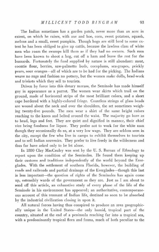
The Indian sometimes has a garden patch, never more than an acre in
extent, on which he raises, with axe and hoe, corn, sweet potatoes, squash,
melons and a small, sweet pumpkin. Though hogs are still bred to some ex-
tent he has been obliged to give up cattle, because the lawless class of white
men who roam the swamps kill them as if they had no owners. Such men
have been known to shoot a hog, cut off a ham and leave the rest for the
buzzards. Fortunately the food supplied by nature is still abundant: meat,coontie flour, berries, saw-palmetto buds, cocoplums, sea-grapes, prickly
pears, sour oranges-all of which are to be had for the picking. The Indians
weave no rugs and fashion no pottery, but the women make dolls, bead-work
and trinkets which they sell to tourists.Driven by force into this dreary morass, the Seminole has made himself
gay in appearance as a parrot. The women wear skirts which trail on the
ground, made of horizontal strips of the most brilliant colors, and a short
cape bordered with a highly-colored fringe. Countless strings of glass beads
are wound about the neck and over the shoulders, the set sometimes weigh-
ing twenty-five pounds. The men wear a shirt of the same bright colorsreaching to the knees and belted around the waist. The majority go bare as
to head, legs and feet. They are quiet and dignified in manner, their chief
vice being fondness for liquor. They prefer not to work for the white man
though they occasionally do so, at a very low wage. They are seldom seen inthe city, except the few who live in camps to exhibit themselves to tourists
and to sell Indian souvenirs. They prefer to live freely in the wilderness and
thus far have asked only to be let alone.In 1880 Clay MacCauley was sent by the U. S. Bureau of Ethnology to
report upon the condition of the Seminoles. He found them keeping uptheir customs and traditions independently of the world beyond the Ever-
glades. With the settlement of southern Florida, however, the building of
roads and railroads and partial drainage of the Everglades-though this last
is less important-the question of rights of the Seminoles has again come
up, ostensibly wards of the government as they are. Just as I am about tosend off this article, an exhaustive study of every phase of the life of the
Seminole in his environment has appeared; an authoritative, contemporane-
ous account of this remnant of Indian life, destined so soon to be absorbedby the industrial civilization closing in upon it.
All natural forces having thus conspired to produce an area geographic-ally unique in the United States-the only humid, tropical part of thecountry, situated at the end of a peninsula reaching far into a tropical sea,with a predominantly tropical flora and fauna, much of both peculiar to the
94 TEQUESTA
locality-its protection hitherto has been that it has been undiscovered. Butnow, with its myriads of birds, its strange animals and its isolated littlegroups of Seminoles, if it is to survive all the plans for its improvement,an enlightened public opinion must intervene. And it is trying to do so. TheFederal Government has at present under consideration a project for thereservation of a part of the southern tip of Florida as a National Park be-fore it is too late. If it should become law, this strange beautiful region withits wealth of natural wonders will remain to intrigue the minds and rejoicethe hearts of Americans of the future, when the age of the machine shallhave passed away.
PART II
THE CITY OF MIAMI
Our study culminates in an extraordinary town-Miami, "The MagicCity," focal point for southeastern Florida. The geographical factors of itslocation will be briefly summarized before examining the evolution ofthe city itself.
A. GEOGRAPHICAL FACTORS
These factors are of two kinds, general and local: the general, called thesituation; the local, called the site.
I. SITUATION
The Miami region is flat and less than twenty feet above sea-level. Theunderlying limestone either crops out at the surface, or is covered, as northof the city, by a thin layer of sand, or in places south of it, by marl. Thetotal area of the Miami or Biscayne pineland region, in which the soil isdominated by rock too near the surface and too compact to plough, is perhaps500 square miles.
The chief asset is the climate, of modified tropical-marine type: averagewinter minimum of 620; average summer maximum of 860; mean annualtemperature of 75.10. Days without sunshine are so rare as to cause com-ment. The mean annual rainfall is about 60 inches, most of which falls inlate summer and early autumn. The prevailing wind is off the ocean andis agreeable except when, in early autumn, it sometimes reaches hurricaneintensity.
The native vegetation is slash pine with undergrowth of saw-palmetto,sprinkled with tropical hammocks. About five per cent of the limestone areais under cultivation.
In so low an area water-courses are hardly more than drainage ditchesfrom the Everglades on the west to the bay on the east. Travel by water is
MILLICENT TODD BINGHAM 95
in small boats, except in artificially deepened channels. Transportation ispreferably by land, or by air-a topic taken up in a later connection.
The raw materials are mostly those peculiar to a tropical and sub-tropicalcountry. The waters teem with edible fish and crustaceans. Fibre-yieldingplants are a source of paper-pulp and other substances; the bark of the man-grove of dyeing and tanning material; the root of the coontie of starch; pines,of timber for lumber-mills and mill-works. Tropical fruits abound. (SeePresent City, Agriculture.) Mineral resources are largely limestone deriva-tives, cement and lime. Though oil-production is being curtailed throughoutthe country as a whole, they are at present drilling near Miami. I visited awell about forty miles west of the city on the Tamiami Trail which hadreached a depth of 4565 feet in February, 1931. No oil has as yet beenreached but expectation runs high.
The region has industrial possibilities, for, in addition to many raw ma-terials, it has excellent transportation facilities and a labor-supply whichcould be indefinitely augmented as necessity arises, since it requires little in-ducement for a working-man from the north to go to Miami to live. Its ad-vantages include elimination of fuel bills and reduced expenses for clothing,as only the lightest materials are worn. At present labor is not plentiful,though more than twenty per cent of the population are Negroes, mostly un-skilled laborers. Water-power is lacking, but public utility developmentduring the past few years is one of the marvels of the region. The power-system is supplied by new and modern generating stations. Another sourceof power as yet but little utilized is the heat of the sun. Now, it is muchused for water-heating in private houses; after initial installation of equip-ment the cost of upkeep is negligible.
Within this area, what were the reasons underlying a choice of thecity site?
II. SITEThe sand-bars which parallel the east coast of Florida are separated from
the mainland as we have seen by salt-water bays or lagoons, usually tooshallow for navigation. Biscayne Bay is one of these, separated from theAtlantic Ocean by Virginia Key, Biscayne Key and the Miami Beach penin-sula, joined to the mainland at its northern end. The bay is about 38 mileslong and from three to nine miles wide. The city of Miami is located on thewest shore of the bay at 250 48' N. and 800 12' W., midway between itshead and its principal entrance at Cape Florida.
Advantages of the site of Miami exist only by virtue of its relation tobodies of water. But for this relation it might have been located anywhere
96 TEQUESTA
else on the oblite shore. The city originated on the north bank of the Miami
River where it empties into Biscayne Bay. The name, Miami River, gives a
false impression, however, for this so-called "river" is only 4.5 miles long.
It rises in the Everglades and flows southeast and east, emptying into the
bay opposite the tip of the Miami Beach peninsula. Canals join it at its
upper end, thereby prolonging its drainage area. The river proper is entirely
within the city-limits. It is about 200 feet wide at the mouth and tidal at
its lower end. The normal fresh-water discharge is about 200 cubic feet per
second, which, during floods, can approach 1500 cubic feet. The limiting
depth in the lower river is seven feet at mean low water in the bay, and
about five feet at the junction with the drainage canal 3.7 miles above the
mouth. The lower reaches have been improved by dredging and the construc-
tion of small docks and yacht piers, now forming part of Miami harbor.
The city has been connected with deep water by a 25-foot channel, 200
feet wide at mean low water, the work of government engineers. The harbor
includes the artificial turning-basins as well as channels dredged along the
water-front and through shoal water to the ocean. The greatest natural depth
averages 6 to 10 feet, with a mean tidal variation of 1.5 feet to 2.2 feet at the
entrance, varying a foot or more according to the wind. The terminal facili-
ties, not including the municipal piers, consist of eight wharves with a total
frontage of 3500 feet. Two of these have railway connections. The municipal
piers, with 25 feet of water, provide berthing space of about 5775 feet, with
warehouses and storage yards.
Lines of coastwise vessels are now making Miami their southern terminal,the most important of which are the Clyde Line, Merchants and Miners Trans-
portation Company, Munson Steamship Line and the Baltimore and Carolina
Steamship Company.4
The land on which Miami is built is geologically so recent that in places
it looks as if it had risen from the sea but yesterday. The evolution of the
land has taken place during the last chapter of geological history. So, like-
wise, the development of the city is confined to the very last chapter of
human history, contained in its entirety within the memory of a not yet very
old man. Though there has been a sprinkling of white settlements in south-
eastern Florida for one hundred years, as late as 1885 there were but two
families living in what is now a metropolis. The founding of Miami has
possibilities to attract a writer of romance.
B. CITY GROWTH
Henry M. Flagler was a builder of railroads who began in the 1880's to
extend a line south along the Florida coast from St. Augustine, thereby
MILLICENT TODD BINGHAM 97
making a wilderness accessible. The immediate cause of the founding ofMiami is a geographical one-devastating frosts in the winter of 1894-95.The citrus crop was the principal source of revenue for Florida. On the29th of December, 1894, the temperature dropped so low that the fruit,still ungathered, was frozen on the trees. Most of the young groves werekilled. And then, just as the survivors had begun to put out new growth,on February 7th, 1895, a still more severe freeze occurred, and most of thetrees which had escaped the first, were killed by the second frost. Thestate was financially ruined. Mr. Flagler was at Palm Beach at the time, therailroad finished to that point. When he heard that in Miami and in theregions to the south of it the orchards had not suffered he is said to haveremarked, "If there is a place in Florida where the freeze did not reach,there we will build a city." And so the railroad was straightway extended50 miles farther south, as far as Miami, and the city founded in 1895. 5 Itwas incorporated July 28, 1896, with barely the three hundred registered votersrequired for incorporation. In thirty-five years it has changed from a sleepylittle settlement of 480 inhabitants to a city with a permanent populationof 110,637.
For the first fifteen years or so the growth of the city was slow. In 1910 itcovered but two square miles. In 1931 it covers 46 square miles, includingmade land, dredged from the bottom of the lagoon.
The Federal Census gives the growth of permanent population as follows :
The tremendous jump in 1926 was due to the following cause. As pop-ulation grew, real-estate values increased correspondingly, culminating duringthe winter of 1925-26 in one of those wild orgies of speculation impossible,perhaps, elsewhere than in the United States where mob-psychology sweepsthe country with the rapidity of a spark along a train of gunpowder. A countof the entire population that winter would have shown close to a quarter
98 TEQUESTA
of a million people in Greater Miami. Not only was the entire section over-run by real-estate operators from the North, but every small shop-keeper,every local truck-man was caught in the frenzy. They gave up their businessto speculate in real-estate. New cities were laid out at an expense of millionsof dollars, paved streets built for miles and miles out into the pine barrens-
tangible highways for ghost inhabitants. Now, as you explore them, theasphalt street with its sidewalks and elaborate lamp-posts suddenly stops,leaving you in a desert of gaunt pines and palmetto-scrub-a dream of ex-pansion abruptly ended. For the bubble burst.
In that extravaganza of speculation land values soared to fantastic heights.Such a boom reflected in the statistics not only of population, but of commerceand of business as a whole, can with difficulty be imagined by one who hasnot himself experienced the hysterical excitement. Although it may not bewithin the province of geography to do so, a thorough study of that phe-nomenon should certainly be made.
C. THE PRESENT CITY
The period of city evolution has been so short that the reasons for thefounding of Miami, its elements de fixation, so-called, are those which stillcause it to prosper. One of the factors explanatory of its growth has beenso incorporated that it serves to characterize the present city. Climate wasthe decisive reason for its founding thirty-six years ago, and it remains todaythe chief asset. The word "Miami" is synonymous with soft breezes of atepid ocean, dazzling sunshine and tropical verdure.
I. DESCRIPTION
The physical aspect of the city has undergone a miraculous change. Dur-
ing the past ten years frame-shacks have given way to towering structuresof brick and cement-modern stores and office buildings, great hotels andapartment-houses-a towering sky-line beside the tropical bay;white roadsto concrete thoroughfares; mangrove-swamps to parks, of which there are
37, totaling 173.31 acres in area. Bay Front Park, half a mile in length,
skirts the bay,its water-front gay with yachts. It is planted with palms ofmany species, poinciana, almond, rubber, mango, hibiscus, oleander and
poinsettia.7 (There are said to be over one hundred and fifty species of exoticplants in the vicinity of Miami, some now so common as to seem indigenous.)
The city area extends two miles west, south and east of its original
boundary lines, with outlying towns reaching many miles beyond. To the
west is Hialeah, with the Jockey Club, the racetrack, municipal water-supplypumping station, and air-ports. To the south are Coconut Grove, South Miami
MILLICENT TODD BINGHAM 99
and Coral Gables, to reach which the Miami River is crossed on four modernbridges. The over-expansion due to the boom of 1925-26 is chiefly visiblein Coral Gables, a residential city planned on a grandiose scale. With a hun-dred miles or more of paved streets and twice that amount of sidewalks, forinstance, it has a present population of 5,697. (U. S. Census, 1930.) To thenorth are Buena Vista, Lemon City, Little River, Arch Creek, Fulford andHollywood. The intervening areas are filled with subdivisions in process ofdevelopment.
East of the city the bay is crossed to the Miami Beach peninsula by threecauseways. The first is a solid-fill causeway, paralleling the channel to theocean already described, and complementary to it. North of it and connectedwith it by bridges, are several artificial islands with palatial homes. Lessthan a mile north of this solid causeway is a concrete viaduct spanning sev-eral artificial islands between Miami Beach and the mainland. The thirdcauseway is at northeast 79th street, while another still farther north is nowbuilding.
With regard to the area of artificial land in Biscayne Bay, a letter datedApril 6, 1931, from Ernest Cotton, Director of Public Service in the City ofMiami, says that "approximately 6,000 acres have been filled, which area isabout equally divided between island fill, i. e., where wholly new land hasbeen made, and low-lying areas that have been raised and made tenantable."
II. ROLE
Cities are usually classified as industrial, commercial, agricultural, ad-ministrative, military or intellectual. Does Miami belong in any of thesegroups?
a. INDUSTRY AND COMMERCE
The number of manufacturing plants in Greater Miami today is 210 (U.S.Census 1930), from the smallest, employing but a few workers, to those withseveral hundred employees. In order of capital invested these industries arerated as follows: newspapers, $4,250,000; ice manufacture, $2,090,000;cement products, $1,515,000; ice cream manufacture, $1,275,000. Thoseinvolving a capital of less than $1,000,000 include mill-works, bakeries, bot-tling-works, sheet metal works, boat building slips, printing establishments,nurseries, canning factories, and chemical manufacture. The list is notimpressive and Miami cannot be called an industrial city. How is it withcommerce and other business?
Of the total volume of wholesale business, 53.3 per cent, or 89 of the 175wholesalers, are engaged in the food- and tobacco-products business. Next in
100 TEQUESTA
order are petroleum-products, iron and steel, chemicals, lumber and buildingmaterials. In retail trade the two leading groups are the automotive, with 469establishments, doing an annual business of $16,097,198, or 22 per cent ofthe total, and food-stores with sales amounting to $14,957,888, or 21 per centof the total retail business.
The elements of import by sea are mostly materials for building con-struction and food for local consumption. For 1929 the list included asphalt,automobiles, beverages, building supplies, canned foods, cement, crushedstone, feed, flour, fruits, grain, lumber, paper, petroleum products, sand,sugar, vegetables and general merchandise. The tonnage for the year was961,570 short tons, of which 408,845 was local traffic, 403,847 was coast-wise commerce, and the remainder, cargoes in transit. Though this was atotal increase of over 16 per cent as compared with the preceding year, thetonnage during the boom year, 1925, amounted to 2,401,472 short tons. Forexport, ships carry out little for either foreign or coastwise trade other thanfruits and vegetables. Up to the present time commerce has not bulked largein the city's activity.
If Miami is neither an industrial nor a commercial city, then, can it beclassified as agricultural?
b. AGRICULTURE
The estimated area of Dade County, of which Miami is the county seat,is 1,292,160 acres, of which 50,620 are at present in farms mostly on thepineland. There were, in 1930, 1167 farms, mostly of less than 100 acreseach. In the county there is every variety of soil, from sandy loam to Ever-glades muck. These soils combined with the climate will, with properfertilization, produce almost all useful tropical and sub-tropical plants, aswell as every garden vegetable grown in the United States. The climate, more-over, permits from two to four crops annually, making it possible to marketthem at a time of year when they cannot be produced elsewhere. The tomatoindustry of the Redlands district, south of Miami, already referred to, is anillustration. Tropical fruits include avocadoes, pineapples, papayas, mangoes,sapodillas, coconuts, guavas, grape fruit, oranges, limes, and other citrusfruits. Small-scale intensive farming is also being carried on, with approxi-mately 30,000 acres in truck gardens. This sometimes results in the value ofproperty per farm and of crops per acre being inversely proportional tofertility, some of the highest yields being on white sand near the easterncoast. While the number of chickens has doubled during the past ten years,the number of milk cows has almost tripled, 1557 in 1920, 4004 in 1930.
MILLICENT TODD BINGHAM 101
Over sixty dairies are now producing an average of 300,000 gallons of milkper month.
The annual value of agricultural products in Dade County is estimatedat $15,000,000. But the industry is still in its infancy. One of the projectswhich is geographically sound is to make Miami a center of perfume man-ufacture comparable to that of the C6te d'Azur. Nothing to realize thisproject, however, has as yet been done.
Agriculture in Dade County must face many adverse conditions. As itis impossible to use plows in the limestone, when a fruit-tree or any othernot native to the pineland is to be planted it is first necessary to blast a holeseveral feet across, which, when filled with suitable soil, receives the youngtree. Clearing the land is a difficult and expensive task-dynamiting, burn-ing and removing the trees, carrying off the blasted rock and destroying thethree or four species of palmetto as well as other scrub. When it is donethere is an uninviting waste of dry, sandy soil. During the last five years,moreover, three severe windstorms in succession have destroyed a large partof the citrus crop, while disastrous speculation in land has upset the normaldevelopment of agriculture as of other undertakings.
No reliable statistics are available, but number of car-load shipments, anindex of production, are as follows:
Estimates indicate that car-load shipments for the present season, 1930-31,however, have been between six and eight thousand. But agriculture is ob-viously not a major source of revenue to the city.
If Miami is not an industrial, commercial or agricultural city, neither isit administrative (though it is the county-seat of Dade County, three-quartersof whose population live within the city-limits). And it is certainly neithermilitary nor intellectual in type. How, then, can it be classified?
c. TOURIST TRADE
A function of its greatest asset, climate, the chief raison d'etre of Miamiis the tourist. The number of those who wish to escape the rigors of anorthern winter is growing by leaps and bounds. The estimated number ofwinter visitors to Miami, Miami Beach and Coral Gables, compiled for
102 TEQUESTA
1929-30 from a survey of automobile, railroad and steamship travel, givesan idea of what happens during the height of the season.
Supposedly the population is at least doubled during the winter. To provideaccommodations for this constantly increasing throng it has become neces-sary to build hotels, apartments and houses. Miami is now the fourth cityin the United States in hotel accommodations. According to a statement pub-lished by the city in October, 1930, there are 140 hotels with number ofrooms in excess of 20,000; 1606 apartment structures, number of units,16,589; number of housing units of all types other than hotels, over 51,000.A capacity tourist crowd means, in one season, a gross revenue to the city ofabout $100,000,000.
Thus, the tourist trade is by far the greatest source of revenue, and onewhich is growing because of Miami's accessibility from the population-centers of the country. The largest conventions have chosen it as their placeof meeting. The throng of visitors comes from every state in the union aswell as from foreign countries. Each year some of them remain at the endof the season, thus adding to the permanent population. This is truly cos-mopolitan, giving Miami the characteristics of a wide-awake northern city,to which its latitude would hardly entitle it.
An orgy of expenditure is taking place at Miami Beach. Twenty yearsago it was a mangrove-swamp. Now it is one of the most luxurious beachresorts in America with a developed ocean frontage of seven miles or more.With a permanent population of 6,494, it has a winter population of morethan 35,000 and an assessed valuation of $50,000,000. Palatial residences,196 apartment houses of from four to fifty units each, 65 hotels ranging fromone of 25 rooms to a $2,000,000 hostelry, 500 store and office buildings withbranches of the most expensive New York establishments, casinos and bathingpools, polo fields, golf courses, tennis courts, ocean-front parks-these supplythe demands of a pleasure-seeking horde. The outstanding feature of MiamiBeach during this past year of business depression is the construction of anelaborate Surf Club on the strand, and a Golf Club on Indian Creek, the125 acres of land for the golf course of which have been dredged from thebottom of the lagoon. The cost of these shockingly extravagant structuresmounts into eight figures.
MILLICENT TODD BINGHAM 103
Abundant sunshine; a dry soil; relatively few stormy days; a soft, balmy
air; the beauties of tropical vegetation; every inducement to an outdoor life
which natural conditions and the ingenuity of man can devise; luxurioushotels and sea-bathing even in mid-winter-these are sufficient to insure the
popularity of Miami as a winter resort (ville hivernale). And Miami is today
a tourist city most of whose permanent population remains but to supplythe needs of the winter visitor. But we have not yet reached the end of the
story.
III. TRANSPORTATION FACILITIES
Flagler's Florida East Coast Railroad enabled travelers to reach Miami
in the beginning, but once there, cause and effect were reversed. More and
more was demanded of transportation facilities, construction of which has
been feverishly trying to keep pace with demand. Miami is now served by
two main trunk-lines, the East Coast and the Seaboard Air Line. Traction
companies operate both tramways and busses to outlying districts. There are
now approximately 700 miles of oiled macadam and paved streets which
connect with hard-surfaced roads, enabling the automobilist to go from one
end of the state to the other. This makes it possible for many to visit Miami
who could not otherwise afford to do so, and the city furnishes free camping-
space for such tourists. The Dixie Highway runs from Jacksonville to Miami
and on to Key West, with the help of two ferries. Within the last two years
the first road has been built across the Everglades, connecting Miami with
Tampa, on the Gulf Coast. It is called the Tamiami Trail. It has an excellent
surface and is skirted by a canal, the remnant of excavation for road-material.
Both of these are Federal highways and connect with centers of population
farther north.
Yet another factor, and one of central importance, has come to the front
during the past three years: I refer to aviation. This new method of trans-
portation insures the prosperity of Miami not only as a city of the future,
but, in a peculiar sense, as a geographical city of the future, and for this
reason.
As we have seen, the growth of the city hitherto has been due largely to
a geographical cause, climate. Future growth will tighten dependence on
geography. For not only will the climate continue to draw winter visitors,
geographical location will become a greater and greater asset as the system
of airways connecting the United States with the countries to the south of itdevelops. For, except for northern Mexico, Miami is the nearest city in theUnited States to Latin America.
104 TEQUESTA
One of the crucial problems of today is our Latin-American relations.Due to air transportation connections are becoming closer. Trade and travelfollow these lines.
Fully to appreciate the significance of aerial transportation for SouthAmerica, one must realize that it serves a region still largely in the pioneerstage of development. Until the advent of the air-plane the greater part ofLatin America depended on the pack-train, the river boat, the coastwisesteamer and a few short railway lines. Air-transportation thus enables it tohurdle the most costly stages of transportation development, particularly ex-pensive in mountainous countries where the modern demand for rapid trans-
portation can be satisfied only by aircraft. The air-plane has found in LatinAmerica a realm prepared by nature for its enthusiastic reception. Air-mailservice is revolutionizing past methods of conducting Latin-American trade,due to the great saving in time.
The entire area of Central and South America is served by a single, pri-vately-owned company, Pan American Airways, Inc., with headquarters inMiami. The growth of this company during the past three years is spectacu-lar. On October 19, 1927, it obtained the first United States Government for-eign air-mail contract. Since then its planes have flown more than 19,000,000passenger-miles, carried 77,797 passengers and transported more than 4,600,-000 pounds of mail, express and baggage. It now has (May, 1931) 18,500miles under contract and in operation, serving thirty-two countries and colo-nies, 87 airports, and a fleet consisting of 101 air-liners and 14 sea-goingflying boats which carry from twenty to thirty-two passengers. Passenger-traffic, measured in passenger-miles flown, has increased from 5,400,000 in1929 to 9,100,000 in 1930. Air-mail ton-miles during the year were morethan quadrupled over 1929.
The northern terminal of this company is called the Pan American Air-ways International Airport and is situated in Hialeah. On February 22,1931, the company began work on construction of a large sea-plane base atDinner Key, which, during the World War, was the United States Naval AirCorps sea-plane base. It will eventually become the point of entry for Centraland South America.
Connecting with the Pan American passenger and mail service from Miamithrough the West Indies, Canal Zone and Central America to the north, eastand west coasts of South America, the Eastern Air Transport, Inc., operatesfrom New York to Miami serving in all 19 cities. It has flown the air-mailfor the U. S. Government for the past three years and began its air-passenger
MILLICENT TODD BINGHAM 105
system in August, 1930, with an increase in passengers carried since that dateof 500 per cent.
Not only is Miami the indicated point of departure for the south, fromthe point of view of meteorological conditions it is also well-placed as a portof entry from Europe. Columbus followed the trade-winds and landed in theAntilles. The Graf Zeppelin on its flight from Germany last year took thesame favorable course. Future lighter-than-air craft, if following favorablewinds from Europe, would conveniently land in Miami, whence they couldcontinue up the coast, thereby avoiding encounters with the prevailing west-erlies of the North Atlantic.
The climate still further favors Miami as an air-terminal, for it is the onlypart of the Atlantic seaboard practically free from fog. It has an average ofeight hours' fog for a twelve-month period, less than two fogs a year. This,together with the fact that there is so little manufacture that the atmosphere isfree from dust and smoke, makes for good visibility. With a low average windvelocity it seems an ideal aviation center. Hurricanes are not a serious men-ace since their paths can be predicted several days in advance, and conse-quently avoided. Thus, though its strategic geographical location is the chiefreason for its development as an international airport, climate, the presid-ing genius of its prosperity from the start, helps to make it so.
The city has a Greater Miami Airport Association which has organizedthe Aviation Department, an integral part of the city government. It sponsorsexpansion of all companies operating in the region. Miami Municipal Air-port is a field of 120 acres, also located at Hialeah. There are four sea-planebases on the artificial islands in the bay, one of which is operated by the city.
CONCLUSION
And so, the questions raised at the beginning of this paper, why Miamiwith its phenomenal growth is located where it is, and what its inhabitantsdo, have in part been answered. The city is where it is primarily because ofits climate which is in turn explained by the location. Few profited by theclimate, however, before the era of modern transportation. Miami is thecreature of both elements and would not exist without either. Child of cli-mate and child of transportation by land and sea, such it is and such itwill remain.
But still another advantage of its location has recently developed, becauseof which Miami is emerging in a new role: to preside over the destinies ofthose who travel by air. The city of the future will have a double part to
106 TEQUESTA
play-as winter resort and as gateway of air-transportation to the continent
of South America. And both of these roles, being sponsored by geography,have presumably come to stay.
NOTES
I The following maps have been used:U. S. Geological Survey
State of Florida. 1:500,000. Partially revised 1925.U. S. Coast and Geodetic Survey
Miami Harbor and Approaches, No. 583. 1:40,000. 1931. Florida Inside Route,Jupiter Inlet to Key West, Nos. 3260-3261. 1:80,000. 1929.
Florida State Geological SurveyGeneralized Soil Map of Florida. 1:1,000,000. 1925. Geological Map of Florida.1:1,000,000. 1929.
Squires, Karl. Miami, Florida.Street Map of Greater Miami. 1929.
2 Temperature measurements in this article are in degrees Fahrenheit.3 This problem, together with most others relating to the flora of southern Florida,
have been studied for the past thirty years by Dr. John K. Small, Director of the NewYork Botanical Garden. The titles of his publications on this subject are more thanfifty, largely contained in the Journal of the N. Y. Botanical Garden.
4 The intracoastal waterway, known as the East Coast Canal, extends from Miami toJacksonville, a distance of 335 miles, between the fringing islands and the coast. Itenters Biscayne Bay at its northern end and traverses the bay to the city, its southernterminus. In the artificial sections the width is 50 feet, the depth, now from 3 to 5feet, will be 8 feet at local mean low water throughout, when the existing Federalproject is completed. At present this waterway is used by small commercial boatscarrying freight and passengers to and from the towns along its route, and by yachtsand other pleasure craft. It enables such boats to ply up and down the coast withoutrisking the dangers of the open ocean.
s Flagler did not stop at Miami. After building the Royal Palm Hotel at the mouth ofthe Miami River-until 1930 when it was torn down the most famous hostelry on thesoutheastern coast-he pushed on toward the south. From one wind-swept and oftenwave-swept key to another, across intervening shoals, the road was built, until onJanuary 22, 1912, the first through train arrived at Key West. The once isolatedisland city was united to the continent. Meanwhile, all along the east coast townshad sprung up, harbors and ports had been improved and the whole territory wasstarted on a career of such sensational development as to be almost incredible to onewho has not watched it from the start.
6 The population of Greater Miami, including Coral Gables, Miami Beach, Hialeah,Miami Shores and other smaller communities, is now about 162,000. It has had anincrease of 274.1 per cent since 1920. Of the total population (1930) native whitesform 69.8 per cent or 77,243 persons; foreign-born whites, 7.4 per cent or 8,218 per-sons; and Negro, 22.7 per cent or 25,116, while other races contribute .1 per cent,or 60 inhabitants.
7 This property was acquired in 1922 and, with a forty-acre fill, now includes 62.5 acresof park as well as wharves and harbor-construction. The 1,014,510 cubic yards ofmaterial dredged to make it provided a yacht anchorage half a mile long, 800 feetwide and twelve to twenty feet deep.
BIBLIOGRAPHY
I Aviation Corporation of the Americas, Holding Corporation for Pan American AirwaysSystem. Annual Report, 1930.
2 Bangs, Outram. Land Mammals of Peninsular Florida. Proc. Boston Soc. Nat. Hist.,Vol. 28, 1898.
MILLICENT TODD BINGHAM 107
3 Brevard, Caroline M. A History of Florida. Florida State Historical Society, De-land: 1925.
4 City Manager's Annual Reports for 1926, 1927 and 1928. City of Miami, Florida.a Cooke, C. Wythe. Fossil man and Pleistocene vertebrates in Florida. Am. Jour. Sci-
ence, 5th ser., Vol. 12, 1926. Also Nat. Acad. Sci. Proc., April 24, 1928.s Cooke, C. Wythe, and Mossom, Stuart. Geology of Florida. Florida State Geological
Survey, Twentieth Annual Report. Tallahassee: 1929. (In cooperation with the U. S.Geol. Survey.)
7 Gray, Richard W. Climate of Miami Beach. 1930.s Harper, Roland M. History of Soil Investigation in Florida and Description of the
New Soil Map. Florida State Geological Survey, Seventeenth Annual Report. Talla-hassee: 1926.
9 Harper, Roland M. Natural Resources of Southern Florida. Florida State GeologicalSurvey, Eighteenth Annual Report. Tallahassee: 1927.
o1 Hrdlicka, Ales. The Anthropology of Florida. Florida State Historical Society, De-land: 1922.
11 Mitchell, A. J. Climate of Florida. University of Florida, Agricultural ExperimentStation, Bulletin 200. Gainesville: 1928.
12 Mitchell, Charles L. Hurricanes of the South Atlantic and Gulf States, 1879-1928.United States Department of Agriculture, Weather Bureau. Washington: 1928.
13 Nash, Roy. The Seminole Indians of Florida, Survey made in 1930. United StatesSenate, 71st Congress, 3rd Session, Document No. 314. Washington: 1931.
14 Safford, W. E. Natural History of Paradise Key. Smithsonian Institution, AnnualReport for 1917. Washington: 1919.
s1 Sanford, Samuel. Topography and Geology of Southern Florida. Florida State Geo-logical Survey, Second Annual Report, 1908-1909, page 177. Tallahassee: 1909.
16 Simpson, Charles T. In Lower Florida Wilds. New York: Putnam, 1920.17 Small, John K. Articles on the Plant Life of Southern Florida. The New York Botanical
Garden, Journal, beginning with Vol. III, 1902.18 U. S. Army, Chief of Engineers. Annual Report, 1930.o1 U. S. Bureau of the Census, 15th Census, 1930.
Census of Distribution of Population.Farm Census, Dade County.Population Bulletin, First and Second Series. Number and Distribution of Inhabitants.Retail Trade in Miami, Florida.Wholesale Trade in Miami, Florida.