THE OHIO JOURNAL OF SCIENCE Vol. 72 NOVEMBER, 1972 No. 6 THE ORIGIN OF LATE PLEISTOCENE DEPOSITS AT GARPIELD HEIGHTS, CUYAHOGA COUNTY, OHIO 1 - 2 BARRY B. MILLER AND ARTHUR H. WITTINE Department of Geology, Kent State University, Kent, Ohio 44%4O ABSTRACT Illinoian sand and gravel, Sangamonian paleosol, Altonian and Farmdalian loesses, and Woodfordian sediments (laminated sand, silt, clay, and till) occur in superposition at the George Rackle and Sons Gravel Pit, situated in the valley of Mill Creek, Garfield Heights, Ohio. A molluscan fauna consisting of 17 species of terrestrial snails was identified from three studied sections of the Farmdalian loess. Ten species, Deroceras laeve, Discus cronkhitei, Gastrocopta armifera, Helicodiscus parallelus, Nesovitrea electrina, Punctum minutissimum, Strobilops sp., Triodopsis algonquinensis, Vertigo elatior, and V. gouldi hannai, are new to the Farmdalian loess of this area. Ten of the loess species do not occur at all of the sampled sections. These variations in the composition of the molluscan fauna, together with a considera- tion of the color and thestructure of the Farmdalian loess examined at four sections within this pit, suggest that the deposition may have been interrupted by erosion, or a period of non-deposition, or both, and that it is probably steeply time-transgressive. Colluviation toward the end of the Farmdalian Substage is suggested by a contorted two- to six-inch zone containing broken, angular clasts of clay, pebbles, sand, and terrestrial snails, all contained in a silt (loess) matrix, that occurs locally near the top of the Farmdalian loess. The lower 6 feet of the overlying Woodfordian laminated sequence consists of inter- calated layers of sand, silt, and clay, with scattered rock, shell, and plant fragments. This unit contained 12 species of terrestrial snails, all of which also occur in the Farmdalian loess. The terrestrial nature of the fauna, the similarity of the Woodfordian and Farm- dalian snail assemblages, the total absence of pollen or of any aquatic organisms, and the presence of scattered clay-blebs, sand-sized quartz grains, and pebbles all suggest that the lower part of the Woodfordian sediments may have been derived locally from older units (Farmdalian loess, Sangamonian paleosol, and Illinoian sand and gravel). These materials were probably transported by some mass-wasting process and redeposited subaerially in topographic lows as slopewash, or as colluvium, or both. Layered modern sediments now accumulating in small, shallow depressions on the floors of abandoned borrow-pits in the area appear to simulate on a small scale the features observed in the basal Woodfordian sediments. INTRODUCTION Quaternary deposits locally exposed along the valley of Mill Creek, Garfield Heights, Ohio (fig. 1) are unique for this area of the state. At the George Rackle and Sons Gravel Pit, a sequence of Illinoian, Sangamonian, Altonian, Farmdalian, and Woodfordian sediments occur in superposition (White 1953; 1965; 1968), with some of the units in the sequence being relatively fossiliferous. Fossil molluscs have been reported from the Sangamonian paleosol-colluvium complex and from the overlying Wisconsinan "loesses" (Leonard, 1953). Coope (1968) has de- scribed an insect assemblage recovered from a thin organic zone occurring near the base of a sequence of "varved" silt and clay layers which locally overlie the Farm- contribution number 77, Department of Geology, Kent State University. 2 Manuscript received November 4, 1971. THE OHIO JOURNAL OF SCIENCE 72(6): 305, November, 1972.
Transcript
THE OHIO JOURNAL OF SCIENCE
Vol. 72 NOVEMBER, 1972 No. 6
THE ORIGIN OF LATE PLEISTOCENE DEPOSITS ATGARPIELD HEIGHTS, CUYAHOGA COUNTY, OHIO1- 2
BARRY B. MILLER AND ARTHUR H. WITTINE
Department of Geology, Kent State University, Kent, Ohio 44%4O
ABSTRACTIllinoian sand and gravel, Sangamonian paleosol, Altonian and Farmdalian loesses, and
Woodfordian sediments (laminated sand, silt, clay, and till) occur in superposition at theGeorge Rackle and Sons Gravel Pit, situated in the valley of Mill Creek, Garfield Heights,Ohio. A molluscan fauna consisting of 17 species of terrestrial snails was identified fromthree studied sections of the Farmdalian loess. Ten species, Deroceras laeve, Discuscronkhitei, Gastrocopta armifera, Helicodiscus parallelus, Nesovitrea electrina, Punctumminutissimum, Strobilops sp., Triodopsis algonquinensis, Vertigo elatior, and V. gouldi hannai,are new to the Farmdalian loess of this area. Ten of the loess species do not occur at allof the sampled sections.
These variations in the composition of the molluscan fauna, together with a considera-tion of the color and the structure of the Farmdalian loess examined at four sections withinthis pit, suggest that the deposition may have been interrupted by erosion, or a period ofnon-deposition, or both, and that it is probably steeply time-transgressive. Colluviationtoward the end of the Farmdalian Substage is suggested by a contorted two- to six-inchzone containing broken, angular clasts of clay, pebbles, sand, and terrestrial snails, allcontained in a silt (loess) matrix, that occurs locally near the top of the Farmdalian loess.
The lower 6 feet of the overlying Woodfordian laminated sequence consists of inter-calated layers of sand, silt, and clay, with scattered rock, shell, and plant fragments.This unit contained 12 species of terrestrial snails, all of which also occur in the Farmdalianloess. The terrestrial nature of the fauna, the similarity of the Woodfordian and Farm-dalian snail assemblages, the total absence of pollen or of any aquatic organisms, and thepresence of scattered clay-blebs, sand-sized quartz grains, and pebbles all suggest thatthe lower part of the Woodfordian sediments may have been derived locally from olderunits (Farmdalian loess, Sangamonian paleosol, and Illinoian sand and gravel). Thesematerials were probably transported by some mass-wasting process and redepositedsubaerially in topographic lows as slopewash, or as colluvium, or both. Layered modernsediments now accumulating in small, shallow depressions on the floors of abandonedborrow-pits in the area appear to simulate on a small scale the features observed in thebasal Woodfordian sediments.
INTRODUCTION
Quaternary deposits locally exposed along the valley of Mill Creek, GarfieldHeights, Ohio (fig. 1) are unique for this area of the state. At the George Rackleand Sons Gravel Pit, a sequence of Illinoian, Sangamonian, Altonian, Farmdalian,and Woodfordian sediments occur in superposition (White 1953; 1965; 1968), withsome of the units in the sequence being relatively fossiliferous. Fossil molluscshave been reported from the Sangamonian paleosol-colluvium complex and fromthe overlying Wisconsinan "loesses" (Leonard, 1953). Coope (1968) has de-scribed an insect assemblage recovered from a thin organic zone occurring near thebase of a sequence of "varved" silt and clay layers which locally overlie the Farm-
contribution number 77, Department of Geology, Kent State University.2Manuscript received November 4, 1971.
THE OHIO JOURNAL OF SCIENCE 72(6): 305, November, 1972.
306 BARRY B. MILLER AND ARTHUR H. WITTINE Vol. 72
dalian loess in an adjacent gravel pit (fig. 2, unit 5). Wood collected from thesame level as the insects has been dated at about 24,000 B.P. (White, 1968).
It was the reported occurrence of fossil molluscs that first brought the seniorauthor to the area in 1964. Numerous collecting trips in subsequent years haveprovided ample opportunity to examine carefully large areas within this gravelpit where the deposits are best exposed. These studies, which were confinedprimarily to the Farmalian loess (unit 4) and the Woodfordian sequence of sand,silt, and clay layers (unit 5), provide new data on these molluscan faunas and ondetails of the stratigraphy. This paper presents these new data and theirinterpretation.
FIGURE 1. Locality Maps. (A) Location of Garfield Heights, Cuyahoga County, Ohio. (B)Location of George Rackle and Sons Gravel Pit in Garfield Heights. Lines A'-Aand W'-W show the relative positions of Figure 1C (lower left) and of Figure 2.(C) Southwest wall of pit showing positions of five sections illustrated in Figure 3.
DESCRIPTION OF DEPOSITS
As a part of this investigation, 10 stratigraphic sections along the southwestwall of the George Rackle and Sons Gravel Pit were studied (fig. 1). Of these,five representative sections are illustrated in Figure 3. The elevations at thetops of these sections were established by alidade and the wall of the pit was con-toured in 10-foot intervals to provide an accurate base map.
The following is a composite description of the stratigraphic sequence revealedin these sections (thickness listed for each unit is the maximum thickness recordedfor that unit in any of the sections).
No. 6 LATE PLEISTOCENE DEPOSITS IN NE OHIO 307
CT Gray sandy gravel, Illinoian
<2j Oxidized gravel, upper half leachedand much weathered
3" Humic gley, in part in situ soil andin part accretion silty clay,Sangamon
4 Dark yellow brown loess, lower partfossiliferous, upper part weatheredand clayey
-500 yards-
Light yellow loess, fossiliferous
Laminated (varved] silt and clay
Kent Till, yellow brown silty sandy,sand 39%, clay 20%
FIGURE 2. Diagramatic sketch of deposits exposed along line W'-W in Figure IB (from White,1968, p. 751).
WOODFORDIAN | FARMDALIAN A L T O N I A N SANGAMONIAN| I L L I N O I A N I
3 'Hl^i '••""SlSe'El H.I '"KID
FIGURE 3. Diagramatic presentation of five sections exposed along line A'-A in Figure 1C,the southwest wall of the George Rackle and Sons Gravel Pit. The unit numbersin the legend are explained in the text.
308 BARRY B. MILLER AND ARTHUR H. WITTINE Vol. 72
COMPOSITE SECTION OF PLEISTOCENE UNITS IN GEORGE RACKLE ANDSONS GRAVEL PIT, GARFIELD HEIGHTS, OHIO
WISCONSINANWOODFORDIAN THICKNESS
Hiram. Till feet inches7b. Soil 77a. Till, composed of sand 31 percent, silt 32 percent, and clay 35
percent; orange-brown; depth of oxidation and leaching 21 inches;lower 54 inches calcareous and oxidized; black shale fragmentscommon towards base (till description from section 1) 6 3
" Varves"6c. Silt, composed of silt 83 percent and clay 16 percent; yellow-
brown (at section 2); with carbon flecks; layered, thickness oflayers ranging from 6 inches to several feet; total thickness ofunit ranging from 6 inches (section 2) to 7 feet (section 5) 7
6b. Silt, composed of silt 80 percent and clay 20 percent; alternatinggray to grayish-brown (at section 2); calcareous; laminationsapparent on weathered faces, appearing massive when fresh,laminae of alternating clay and silty clay up to 1 inch thick;thickness of unit ranges from 10 inches (section 2) to 14 feet(section 3) 14
6a. Silt, composed of silt 83 percent and clay 16 percent; yellow-brown; calcareous; only present at section 2 1 3
Colluvium5. Colluvium, composed of sand, silt, and clay; alternating gray
and brown towards the top (at section 2); calcareous; lamina-tions in the basal several feet tending to be thinner (3^-inchthick) than those above, laminations discontinuous laterally,and containing interbeds of fine to medium sand; basal 6 feetcontaining terrestrial snails, insects (Coope, 1968), and com-minuted wood and plant fragments; contact with underlyingunit sharp 8 2
percent, and gravel 10 percent; reddish-brown, oxidized, cal-careous; with broken and bent clay clasts, pebbles (to 2 inchesin diameter), wood fragments, and terrestrial snails; contactwith underlying unit gradational 6
" Upper Loess"4a. Loess composed of silt 83 percent and clay 16 percent; light-
yellow-brown to gray-brown; calcareous; with carbon streaks;terrestrial snails extremely abundant ( = levels 3 and 4 of Fig. 1 inLeonard, 1953) 1 10
ALTONIAN
"Lower Loess1'3b. Loess composed of silt 57 percent, clay 21 percent, and sand 21
percent; dark-yellow-brown; non-calcareous; with carbon streaks;irregular and wavy banding caused by iron oxide 1 3
3a. Loess composed of silt 75 percent and clay 23 percent; light tomedium yellow-brown; non-calcareous; with shell fragmentsand etched specimens of terrestrial snails ( = level 2 of Fig. 1 inLeonard, 1953) 1 4
SANGAMONIANPaleosol2b. Composed of silt 45 percent, clay 42 percent, and sand 12 per-
cent, (at section 4); dark-gray, non-calcareous; carbonaceous( = level 1 of Fig. 1 in Leonard, 1953) 10
2a. Composed of silt 22 percent, clay 15 percent, sand 47 percent,gravel 16 percent (at section 2); yellow-brown; pebbles weath-ered; only top 6 inches exposed 6
ILLINOIAN1. Sand and gravel; partly covered 15-)-
No. 6 LATE PLEISTOCENE DEPOSITS IN NE OHIO 309
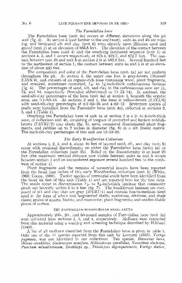
The Farmdalian loessThe Farmdalian loess (unit 4a) occurs at different elevations along the pit
wall (fig. 3). At section 5 (and farther to the southeast), units 4a and 4b are miss-ing, and laminated silt and clay (unit 6) rests directly upon Illinoian sand andgravel (unit 1) at an elevation of 885.5 feet. The elevation of the contact betweenthe Farmdalian loess (unit 4) and the overlying laminated sequence (unit 5) atsections 4, 3, and 1 occurs respectively at 878.4, 878.7, and 872.7 feet. The con-tact between unit 4b and unit 5 at section 2 is at 882.9 feet. Several hundred feetto the northewest of section 1, the contact between units 4a and 5 is at an eleva-tion of about 860 feet.
The composition and color of the Farmdalian loess (unit 4a) are not uniformthroughout the pit. At section 4, the upper one foot is gray-brown (Munsell2.5Y6/4), and consists of an organic-rich zone containing wood, plant fragments,and streaked, sometimes contorted, }/%- to 3^-inch-thick carbonaceous laminae(fig. 4). The percentages of sand, silt, and clay in the carbonaceous zone are 11,73, and 14, respectively (hereafter abbreviated to 11-73-14). In contrast, thesand-silt-clay percentages of the loess (unit 4a) at section 4, beneath the organiczone, are 0.1-83-16. At sections 2 and 1, the loess is yellow-brown (2.5Y5/6)with sand-silt-clay percentages of 0.2-83-16 and 4-82-12. Seventeen species ofsnails were identified from the Farmdalin loess (unit 4a), collected at sections 2,3, and 4 (Table 1).
Overlying the Farmdalian loess of unit 4a at section 2 is a 2- to 6-inch-thickzone, of colluvium unit 4b, consisting of tongues of contorted and broken reddish-brown (7.5YR7/2) clay clasts (fig. 5), sand, occasional disseminated plant frag-ments, and pebbles up to 2 inches in diameter (fig. 6) in a silt (loess) matrix.The sand-silt-clay percentages of this unit are 12-53-25.
The Early Woodfordian ColluviumAt sections 1, 2, 3, and 4, about 10 feet of layered sand, silt, and clay (unit 5)
occur with erosional disconformity on either the Farmdalian loess (units 4a) orthe Farmdalian colluvium (unit 4b). Relief on the disconformity is at least 20feet (the maximum vertical distance now visible between units 4a and 5 occursbetween section 1 and an unnumbered exposure several hundred feet to the north-west of section 1).
Plant fragments and the remains of terrestrial insects have been reportedfrom the basal four inches of this early Woodfordian colluvium (unit 5) (White,1968; Coope, 1968). Twelve species of terrestrial snails have been identified fromthe basal six feet of this unit (Table 1) and are reported here for the first time.The snails occur in discontinuous 3/2- to %-inch-thick laminae that commonlypinch out laterally within 6 to 8 feet (fig. 7). The fossiliferous laminae are com-posed of silt and clay that are gray (10YR7/1) and contain fine-to-medium sizedsand in the form of whole and fragmented shells; sandstone, siltstone, and shaleclasts; grains of quartz, biotite, and muscovite; plant fragments; and unidentifiablepieces of carbon.
THE FARMDALIAN-WOODFORDIAN SNAIL FAUNA
Approximately 200-, 20-, and 50-pound samples of Farmdalian loess (unit 4a)were collected from sections 2, 3, and 4, respectively. Molluscs were extractedfrom this material using a washing and screening technique described by Hibbard(1949).
A list of all molluscs identified from the Farmdalian loess is given in table 1.Only one of the 11 species reported from this unit by Leonard (1953), Vertigopygmaea, was not identified in our collections. Ten species, Deroceras laeve,Discus cronkhitei, Gastrocopta armifera, Helicodiscus parallelus, Nesovitrea electrina,Punctum minutissimum, Strobilops sp., Triodopsis algonquinensis, Vertigo elatior,
310 BARRY B. MILLER AND ARTHUR H. WITTINE Vol. 72
T. K \ •• • v."%R . i / ^ . 10
FIGURE 4. Contorted carbonaceous laminae (arrow in unit 4a at section 4).FIGURES 5 and 6. Contorted and broken clay clasts (arrow) (Figure 5), and pebbles (Figure 6)
from unit 4B at section 2.FIGURE 7. Unit 5 at section 2, showing the discontinuous nature of the laminae.
FIGURE 8. Stenotrema leai, a terrestrial snail, from unit 5, section 2.FIGURE 9. Clay bleb (arrow), unit 5, section 2.
FIGURE 10. Pebble (arrow), unit 5, section 2.
No. 6 LATE PLEISTOCENE DEPOSITS IN NE OHIO 311
and V. gouldi hannai, were not listed by Leonard (1953) and are reported hereinfor the first time from the Farmdalian loess (unit 4a). The occurrence of T.alonquinensis at all three of our collecting localities, together with its absencefrom Leonard's faunal list, is perhaps of greatest significance, because it is highlyunlikely that this large snail would have been overlooked by so experienced aworker if it had been present at or near the site from which he collected.
Ten of the 17 species of snails identified in the present study did not occur atall of the sampled sections (Table 1). The disjunct distribution of these speciesdoes not appear to be entirely related to sampling error or to differences in the localhabitat conditions present at the collection sites. Pupilla muscorum, for example,was a common species (22 specimens) at section 3, but was absent at section 2,only several hundred feet to the northwest. The large sample size (200 poundsof matrix was collected from section 2), together with the close proximity of thesections (fig. 1), diminishes the probability that the species was not present atsection 2 because of inadequate sampling or because the samples were taken fromslightly different contemporaneous local habitats.
Species present in the early Woodfordian sediments are identified in Table 1by single stars. No species were found in this unit which had not also been foundin the underlying Farmdalian loess.
TABLE 1Molluscs from the Farmdalian and Early Woodfordian Substages. A Kent State University
catalogue number indicates the occurrence of the species at the locality. An X indicates thatthe species was recorded from the Farmdalian loess by Leonard, (1953).
*Species also occurs in the overlying Early Woodfordian sand, silt, and clay (unit 5).**First reported occurrence of this species from the Farmdalian loess (unit 4a) at Garfield
Heights.
DISCUSSION AND INTERPRETATIONThe faunal differences between the collections obtained from sections 2, 3, and
4, and between these collections and that reported by Leonard (1953) can beexplained most parsimoniously by assuming that loess deposition in this area wasdiscontinuous and probably took place over a time interval that included most ofthe Farmdalian Substage. In this interpretation, the faunal differences are con-sidered to be at least in part the result of faunal successions, with new speciesmigrating into this area during a long interval of time. The fauna in each sample
312 BARRY B. MILLER AND ARTHUR H. WITTINE Vol. 72
is thus believed to be slightly different because they represent collections madefrom loess of slightly different ages.
Variations in color, organic content, and particle size within unit 4a at sections2, 3, and 4 also suggest that these sediments might not have been deposited con-temporaneously throughout the pit. At section 2, a contorted 2- to 6-inch-thickzone (unit 4b) containing broken angular clay clasts (fig. 5), pebbles, and sand,mixed in a silt (loess) matrix, is gradational with the underlying loess (unit 4a).The convoluted bedding does not appear to be the result of post-depositional dif-ferential compaction because the snail shells intermixed in this zone are not crushed.The appearance of the material in unit 4b suggests emplacement by some mass-wasting process which the writers believe was colluviation.
The origin of the laminated silt, clay and sand (unit 5) poses a problem. White(1968, p. 751) interpreted these sediments as varves " . . . deposited in a lakeformed by damming of the drainage by the advance of the Kent ice." G. W.White states (written communication of December 24, 1971) that "Coope's beetlescame from a 'litter layer' at the base of the 'varved' silt and clay which I interpretas a deposit in the swash zone (upper part?) along the encroaching lake. Theabraided wood and small logs in the layer are exactly like the materials along partsof the present Lake Erie shore." This interpretation is difficult to reconcilewith the total absence of aquatic species from the insect fauna reported fromnear the base of this unit by Coope (1968). The present study revealed thatunit 5 also contains a terrestrial snail fauna consisting of twelve species (Table 1),all of which also occur in the underlying Farmdalian loess (unit 4a). Samples ofunit 5 submitted for pollen analyses produced no identifiable materials.
The discontinuous nature of the 3̂>- to ^-inch thick layers in unit 5, togetherwith the composition of the scattered, fine to medium sand-sized rock, shell, andplant fragments, suggest that this unit may have been derived from local olderunits. Unit 5 appears to have been deposted on a surface with at least 20 feetof relief. The depth to which previous erosion had progressed determined whichof the older units would be exposed locally on the dissected surface and would thusprovide a source for the materials making up unit 5. Contributions from both theIllinoian sand and gravel (unit 1) and the Farmdalian loess (unit 4a) are suggestedby the presence of terrestrial snails (fig. 8), clay belbs (fig. 9), pebbles (fig. 10),and quartz grains in zones scattered through the basal 6-feet of unit 5.
These sediments were either deposited subaerially or in a subaqueous environ-ment of ephemeral pools that were dry during most of the year (Coope, 1968).The total absence of pollen and of aquatic insects or snails strongly supports asubaerial origin for these sediments. The layering within unit 5 may be geneticallyrelated to the rhythmically stratified slope deposits described by Dylik (1955).Stratified slopewash and colluvium now accumulating in small depressions on thefloors of local borrow pits in the area (fig. 11) may represent a modern analog that
FIGURE 11. Modern stratified slopewash accumulating on the floor of a borrow-pit in theCuyahoga River Valley, near Akron, Ohio.
No. 6 LATE PLEISOCENE DEPOSITS IN NE OHIO 313
simulates on a small scale the environmental conditions that prevailed at the timeunit 5 was deposited.
AKCNOWLEDGMENTS
The writers wish to express their thanks and appreciation to Mr. GeorgeRackle for granting permission to work on his property, to Mr. Milton Cooperfor doing the granulometric analysis, to Mr. George Gardner who provided thefigure of modern stratified slopewash depsoits, to the Kent State University Re-search Council for funding the study, and to our colleagues in the Departmentof Geology for their helpful suggestions and stimulating discussions on the GarfieldHeights deposits.
LITERATURE CITEDCoope, G. R. 1968. Insect remains from the silts below till at Garfield Heights, Ohio. Geol.