42
Mission Planning and Mission Planning and SP1 SP1
| Date post: | 27-Dec-2015 |
| Category: |
Documents |
| Upload: | candace-mccormick |
| View: | 214 times |
| Download: | 0 times |

Mission Planning and SP1Mission Planning and SP1

Outline of SessionOutline of Session
StandardsStandards ErrorsErrors PlanningPlanning Network DesignNetwork Design AdjustmentAdjustment

ICSMICSMStandards and Practices for Standards and Practices for
Control SurveysControl Surveys‘SP1’‘SP1’

Positional UncertaintyPositional Uncertainty
95% circle of uncertainty (metres)95% circle of uncertainty (metres) Independent of the nearby networkIndependent of the nearby network SP1 ‘the uncertainty, in metres, at the SP1 ‘the uncertainty, in metres, at the
95% confidence level, with respect to 95% confidence level, with respect to the defined reference frame (in our case the defined reference frame (in our case GDA94)’GDA94)’
Order is relative – PU is absoluteOrder is relative – PU is absolute From 2005, PU replaces OrderFrom 2005, PU replaces Order

Assigning Positional UncertaintyAssigning Positional Uncertainty
Formula in SP1 by Leenhouts, 1985Formula in SP1 by Leenhouts, 1985 C = b/aC = b/a K = q0 + q1C + q2C2 + q3C3K = q0 + q1C + q2C2 + q3C3 Radius = aKRadius = aK Where:Where:
a = semi-major axis of the standard error ellipsea = semi-major axis of the standard error ellipseb = semi-minor axis of the standard error b = semi-minor axis of the standard error ellipse.ellipse.q0 = 1.960790q0 = 1.960790q1 = 0.004071q1 = 0.004071q2 = 0.114276q2 = 0.114276q3 = 0.371625q3 = 0.371625
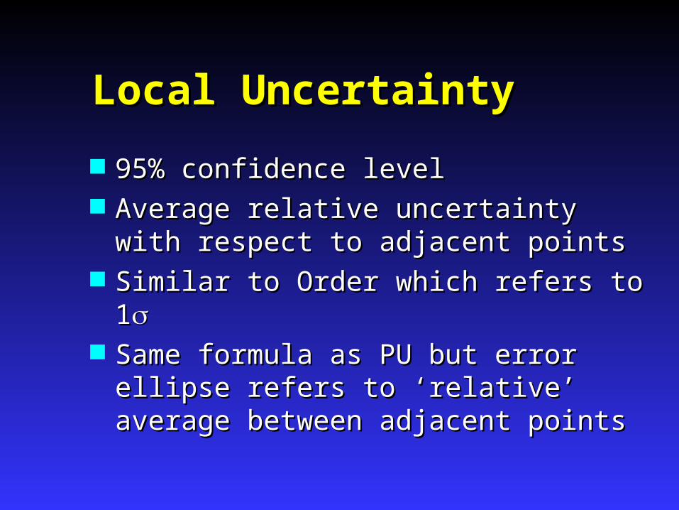
Local UncertaintyLocal Uncertainty
95% confidence level95% confidence level Average relative uncertainty with Average relative uncertainty with
respect to adjacent pointsrespect to adjacent points Similar to Order which refers to 1Similar to Order which refers to 1 Same formula as PU but error ellipse Same formula as PU but error ellipse
refers to ‘relative’ average between refers to ‘relative’ average between adjacent pointsadjacent points

Class and OrderClass and Order
Quality Indicators Quality Indicators Determined byDetermined by
The field and reduction procedures of the The field and reduction procedures of the survey.survey.
The quality of the origin dataThe quality of the origin data Adjustments are an important element Adjustments are an important element
of verifying Class and Orderof verifying Class and Order

ClassClass““CLASSCLASS is a function of the precision of a is a function of the precision of a survey network, reflecting the precision of survey network, reflecting the precision of observations as well as suitability of observations as well as suitability of network design, survey methods, network design, survey methods, instruments and reduction techniques used instruments and reduction techniques used in that survey. Preferably the CLASS is in that survey. Preferably the CLASS is verified by an analysis of the minimally verified by an analysis of the minimally constrained least squares adjustment of constrained least squares adjustment of the network.”the network.”

Class is determined byClass is determined by
The network design.The network design. Observing procedures and Observing procedures and
practices.practices. Reduction of observations.Reduction of observations. The results of a minimally The results of a minimally
constrained adjustment.constrained adjustment.

Testing ClassTesting Class
The semi major axis of each relative The semi major axis of each relative error ellipse is tested against:-error ellipse is tested against:-
r = c(d + 0.2)r = c(d + 0.2)
r = Maximum allowable semi-major axis in mmr = Maximum allowable semi-major axis in mm
c = Factor to relate Distance to Error c = Factor to relate Distance to Error
d = Distance between stations in kmd = Distance between stations in km

C Values for Each ClassC Values for Each ClassClass C Value
(for 1sigma)
Typical Applications
3A 1 Special highprecision projects
2A 3 High precisionNational GeodeticSurveys
A 7.5 National and Stategeodetic surveys
B 15 Densification ofgeodetic surveys
C 30 Survey coordinationprojects
D 50 Lower class surveys
E 100 Lower class surveys
r = c (d + 0.2) e.g. Class A 1km GPS Line ~ r = 9mm

Relative Error EllipseRelative Error Ellipse
< r

OrderOrder
““ORDERORDER is a function of the class of a is a function of the class of a survey, the conformity of the new data set survey, the conformity of the new data set AND the precision of any transformation AND the precision of any transformation process process requiredrequired to convert the results to convert the results from one datum to anotherfrom one datum to another””

OrderOrder
Order is determined in the same way as Order is determined in the same way as class but class but AFTERAFTER a fully constrained a fully constrained adjustmentadjustment
The same formula for ‘r’ is usedThe same formula for ‘r’ is used

Some Order and C valuesSome Order and C values
ORDER
C (For one )
00 0 1 2 3 4 5
1 3
7.5 15 30 50 100

Class A
Class A
Significance of Class and OrderSignificance of Class and Order
Class A
4th Order4th Order
4th Order
1st Order
1st Order
1st Order1st Order
1st Order
4th Order1st Order
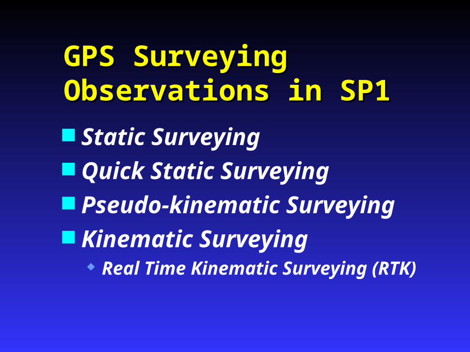
GPS Surveying GPS Surveying Observations in SP1Observations in SP1 Static Surveying Quick Static Surveying Pseudo-kinematic Surveying Kinematic Surveying
Real Time Kinematic Surveying (RTK)
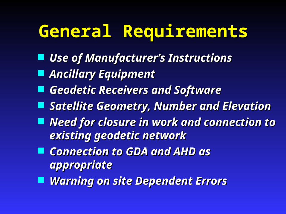
General RequirementsGeneral Requirements Use of Manufacturer’s InstructionsUse of Manufacturer’s Instructions Ancillary EquipmentAncillary Equipment Geodetic Receivers and SoftwareGeodetic Receivers and Software Satellite Geometry, Number and ElevationSatellite Geometry, Number and Elevation Need for closure in work and connection Need for closure in work and connection
to existing geodetic networkto existing geodetic network Connection to GDA and AHD as Connection to GDA and AHD as
appropriateappropriate Warning on site Dependent ErrorsWarning on site Dependent Errors
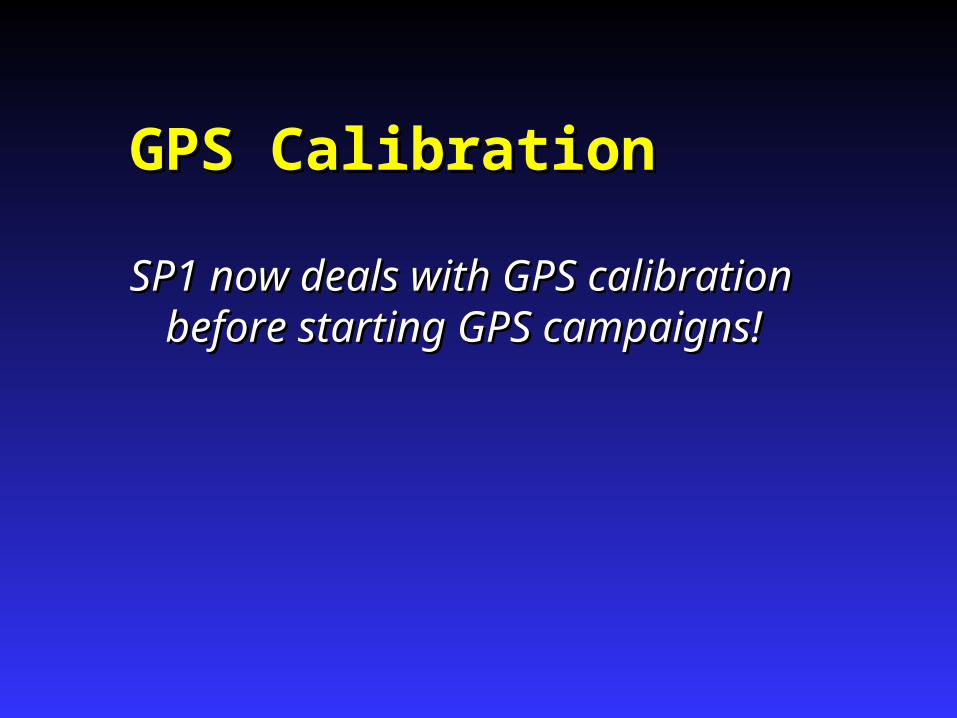
GPS CalibrationGPS Calibration
SP1 now deals with GPS calibration SP1 now deals with GPS calibration before starting GPS campaigns!before starting GPS campaigns!

GPS Field Techniques Vs ClassGPS Field Techniques Vs Class
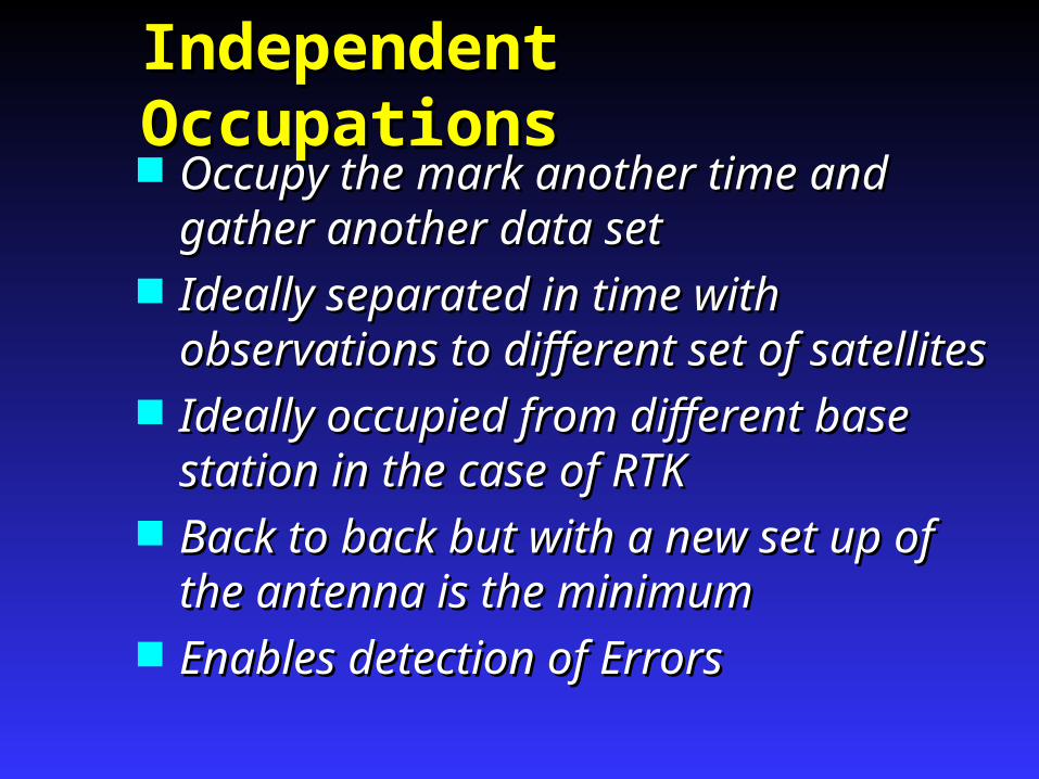
Independent OccupationsIndependent Occupations Occupy the mark another time and Occupy the mark another time and
gather another data setgather another data set Ideally separated in time with Ideally separated in time with
observations to different set of satellitesobservations to different set of satellites Ideally occupied from different base Ideally occupied from different base
station in the case of RTKstation in the case of RTK Back to back but with a new set up of Back to back but with a new set up of
the antenna is the minimumthe antenna is the minimum Enables detection of ErrorsEnables detection of Errors

Errors in GPS Errors in GPS SurveyingSurveying

Avoiding ErrorsAvoiding Errors
Specifications and Recommended Practices have been designed to minimize errors
GPS Errors can be put in 2 groups... Factors which affect Phase data and Factors which affect Phase data and
thus the GPS Processingthus the GPS Processing Factors external to Processing which Factors external to Processing which
can affect the final resultcan affect the final result
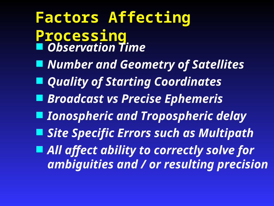
Factors Affecting ProcessingFactors Affecting Processing Observation Time Number and Geometry of Satellites Quality of Starting Coordinates Broadcast vs Precise Ephemeris Ionospheric and Tropospheric delay Site Specific Errors such as Multipath All affect ability to correctly solve for
ambiguities and / or resulting precision
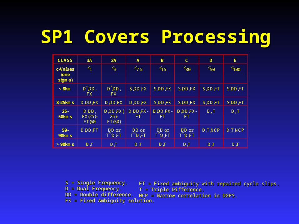
SP1 Covers ProcessingSP1 Covers ProcessingCLASS 3A 2A A B C D E
c-Values (one
sigma)
1 3 7.5 15 30 50 100
< 8km D*,DD, FX
D*,DD, FX
S,DD,FX S,DD,FX S,DD,FX S,DD,FT S,DD,FT
8-25kms D,DD,FX D,DD,FX D,DD,FX S,DD,FX S,DD,FX S,DD,FT S,DD,FT
25-50kms
D,DD, FX(25)-FT(50
D,DD,FX(25)-
FT(50)
D,DD,FX-FT
D,DD,FX-FT
D,DD,FX-FT
D, T D, T
50-90kms
D,DD,FT DD or T**,D,FT
DD or T**,D,FT
DD or T**,D,FT
DD or T**,D,FT
D,T,NCP D,T,NCP
> 90kms D,T D,T D,T D,T D,T D,T D,T
S = Single Frequency.S = Single Frequency.D = Dual Frequency.D = Dual Frequency.DD = Double difference.DD = Double difference.FX = Fixed Ambiguity solution.FX = Fixed Ambiguity solution.
FT = Fixed ambiguity with repaired cycle slips.FT = Fixed ambiguity with repaired cycle slips.T = Triple Difference.T = Triple Difference.NCP = Narrow correlation ie DGPSNCP = Narrow correlation ie DGPS.

Factors External to ProcessingFactors External to Processing
Centring Error Antenna Height Error Number of repeat occupations of sites Quality of existing control to which
GPS survey is being fitted Datum Transformation For Heights - quality of Geoid
Ellipsoid Separation

GPS Survey PlanningGPS Survey Planning

Survey PlanningSurvey Planning Station MarkingStation Marking Station NamingStation Naming ManpowerManpower FundingFunding GPS Equipment AvailableGPS Equipment Available Other ResourcesOther Resources
key maps, access information, program key maps, access information, program sheets, booking forms, ancillary equipmentsheets, booking forms, ancillary equipment
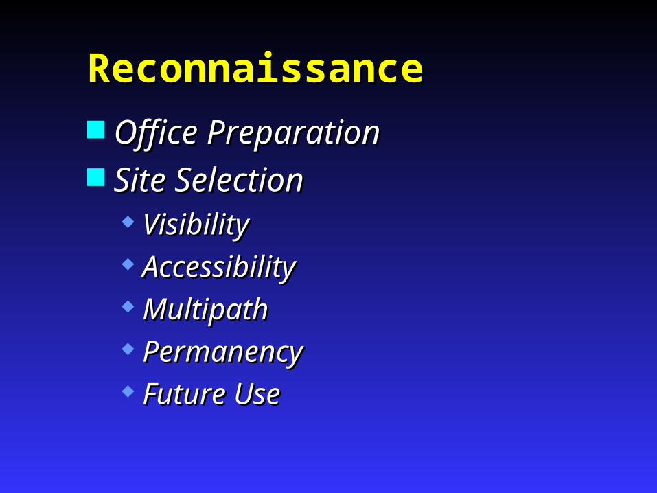
ReconnaissanceReconnaissance Office PreparationOffice Preparation Site SelectionSite Selection
VisibilityVisibility AccessibilityAccessibility MultipathMultipath PermanencyPermanency Future UseFuture Use

ReconnaissanceReconnaissance Station DocumentationStation Documentation
Speedo TraverseSpeedo Traverse Travel TimesTravel Times Special RequirementsSpecial Requirements Field RecordsField Records
LogisticsLogistics Travel timeTravel time SetupSetup Observation timeObservation time Optimum TimesOptimum Times

ObservationObservationand Networkand Network
DesignDesign
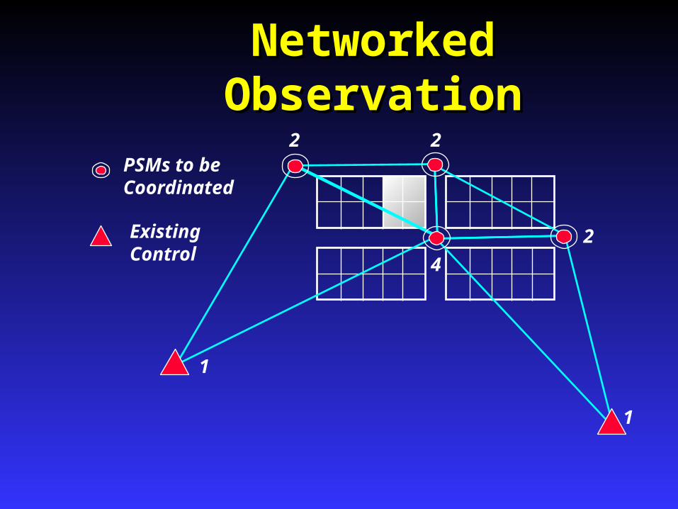
Networked ObservationNetworked Observation
PSMs to be Coordinated
ExistingControl
1
1
4
2 2
2
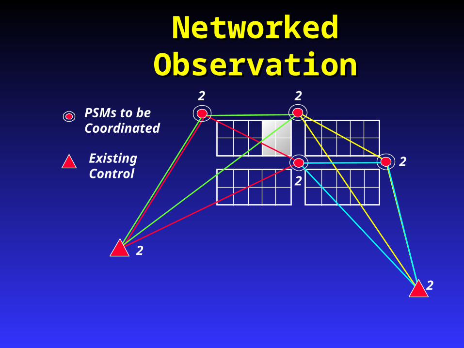
Networked ObservationNetworked Observation
PSMs to be Coordinated
ExistingControl
2
2
2
2 2
2

Direct Measurement - extra check - little extra timewith GPS - or - Traversed during Cadastral Survey
Second Set - Checks Control and New Marks
Radiations are not closed - no check
Observation DesignObservation Design
PSMs to be Coordinated
ExistingControl

Connections to ControlConnections to ControlNetwork ModeNetwork Mode

Connections to ControlConnections to ControlBase Station ModeBase Station Mode
Base 1
Base 3
2
Used for RTK and covered in SP1

AdjustmentAdjustment
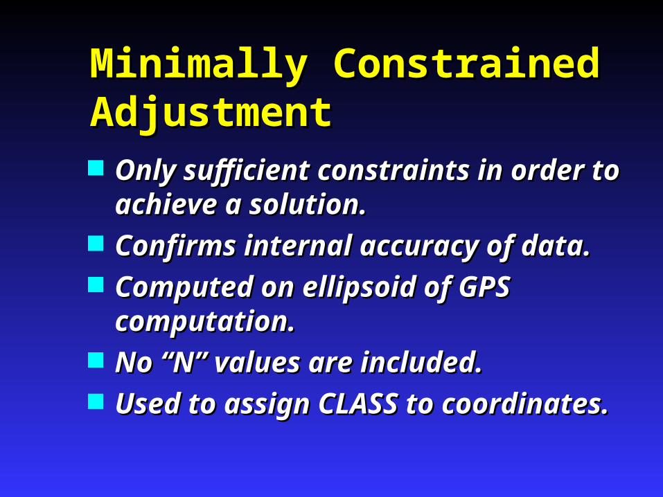
Minimally Constrained Minimally Constrained AdjustmentAdjustment Only sufficient constraints in order to Only sufficient constraints in order to
achieve a solution.achieve a solution. Confirms internal accuracy of data.Confirms internal accuracy of data. Computed on ellipsoid of GPS Computed on ellipsoid of GPS
computation.computation. No “N” values are included.No “N” values are included. Used to assign CLASS to coordinates.Used to assign CLASS to coordinates.
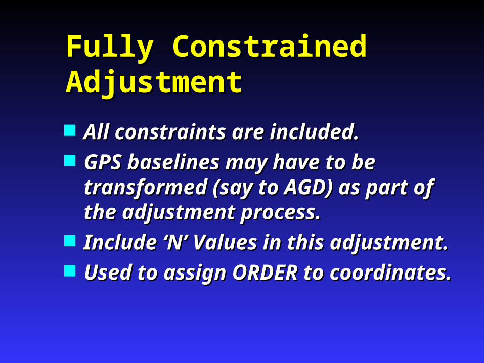
Fully Constrained Fully Constrained AdjustmentAdjustment
All constraints are included.All constraints are included. GPS baselines may have to be GPS baselines may have to be
transformed (say to AGD) as part of transformed (say to AGD) as part of the adjustment process.the adjustment process.
Include ‘N’ Values in this adjustment.Include ‘N’ Values in this adjustment. Used to assign ORDER to Used to assign ORDER to
coordinates.coordinates.
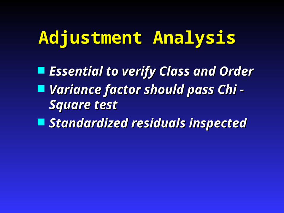
Adjustment AnalysisAdjustment Analysis
Essential to verify Class and OrderEssential to verify Class and Order Variance factor should pass Chi - Variance factor should pass Chi -
Square testSquare test Standardized residuals inspectedStandardized residuals inspected

RTKRTK

Questions?Questions?Questions?Questions?


