1 Modern Surveying Techniques Prof. S. K. Ghosh Department of Civil Engineering Indian Institute of Technology, Roorkee Lecture - 2 Introduction to Global Positioning System Introduction to global positioning system: Global positioning system that is GPS is a technology which provides unequalled accuracy and flexibility of positioning for navigation, surveying and GPS data capture. (Refer Slide Time: 00:32) The GPS NAVSTAR that is Navigation Satellite Timing and Ranging is a satellite based navigation timing and positioning system. GPS provides 3D continuous positioning 24 hours a day throughout the world.
Transcript
1
Modern Surveying Techniques
Prof. S. K. Ghosh
Department of Civil Engineering
Indian Institute of Technology, Roorkee
Lecture - 2
Introduction to Global Positioning System
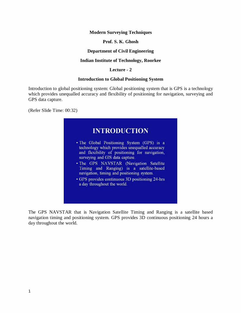
Introduction to global positioning system: Global positioning system that is GPS is a technology which provides unequalled accuracy and flexibility of positioning for navigation, surveying and GPS data capture. (Refer Slide Time: 00:32)
The GPS NAVSTAR that is Navigation Satellite Timing and Ranging is a satellite based navigation timing and positioning system. GPS provides 3D continuous positioning 24 hours a day throughout the world.
2
(Refer Slide Time: 1:03)
The technology is beneficiary to GPS users in terms of obtaining accurate data up to about 100 meters for navigation; meter level for mapping and down to millimeter level for geodetic positioning. The GPS technology has tremendous amount of application in GPS data collection, surveying and mapping. The basis of GPS is on the geopositioning of the instrument where the GPS is placed. So, let us discuss the basic concepts related to geopositioning. (Refer Slide Time: 1:44)
First of all, positioning relates to the determination of positioning of stationary or moving objects. Well, this can be determined by either defining the point in relation to a well defined
3
coordinate system; usually by 3 coordinate values or in relation to a another point, taking one point as the origin of a local coordinate system. (Refer Slide Time: 2:13)
In the first mode of positioning known as the point positioning, while the second mode is known as the relative positioning. If the object is positioned is stationary, it is known as static positioning. When the object is moving then it is known as kinematic positioning. Usually, the static positioning is used in surveying, while kinematic positioning is used for navigation purposes. With this, let us look at some of the GPS components and the basic facts which are involved in GPS technology. (Refer Slide Time: 2:57)
4
The GPS uses satellites and computers to compute position anywhere on the earth and is based on satellite ranging. This means that the position on the earth is determined by measuring the distance from a group of satellites in space. (Refer Slide Time: 3:14)
The basic principle behind GPS is really simple, even though the system employs some of the most high technology based equipment’s ever developed. In order to understand GPS basics, the system can be categorized into 5 logical steps. (Refer Slide Time: 3:34)
5
This slide shows the 5 logically steps which are there. First of all, we find the distance from the satellites which are used. In order to find out the distance, we need to find what is the time required by the signal to travel from the satellite to the point on the earth. Thus, the second step is we require accurate clocks. Having determined what is the time; then we also need to know what is the precise position of the satellites. So, the third step is to need to know the satellite location. Since, the signal is traveling from the satellite to the earth and in between the earth’s atmosphere is encountered by the signals. Thus, we need to undertake certain procedures to correct for atmosphere and ionospheric effects which may deteriorate the signal characteristic. Finally, the fifth step which is selective availability; however, at present this particular step is eliminated and hence may not be considered in the actual process. So, let us look at the first step. (Refer Slide Time: 4:56)
The first step is emphasis is to compute a position in 3 dimensions for which a minimum of 4 satellites have to be observed. This particular slide shows 4 satellites which have been tracked by the GPS receiver and on the basis of this, it is now going to compute its own location on the earth surface.
6
(Refer Slide Time: 5:22)
The second step is to triangulate the GPS measurement, measure the distance between the travel time of the radio message which has been received from the satellite and second is to measure this travel time. It requires a very accurate clock. In order to do so, it basically tries to look at the codes which have been received from the satellite and what has been the time difference between the same parts of the code. The same has been illustrated at the bottom part of the slide, wherein, one can see the signal pattern as it has been received from the satellite and the signal pattern as it has been received at the ground level. Based on this, the distance between the 2 between the 4 satellites will be determined to triangulate the GPS position.
7
(Refer Slide Time: 6:20)
The third step is that once the distance of the satellite is known, then the location of the satellite in space is required. This information is provided by the master control station which provides accurate information regarding the position of the satellite at the time of observation. Here we can see that from the master control station, the satellite is receiving its exact position and based on this, it is transmitting the same to the user so that the exact position of the satellites are known and can be used for subsequent computations. (Refer Slide Time: 7:03)
The 4th step is basically to provide a correction to the signal transmission which has taken place. This is primarily because of the atmosphere layer which occurs through which the signals have
8
to travel. So, we have to workout what is the delay which has been imposed by the atmosphere on to the signal which has been transmitted by the satellite and has been received by the GPS receiver. Having had a look at the logical steps which are involved, now, let us look at what are the main components of a GPS. (Refer Slide Time: 7:44)
The GPS is divided into 3 major components. That is the space segment, the control segment and the user segment. So, let us look at each of these segments, the layout in totality. (Refer Slide Time: 8:01)
9
This particular slide shows us all the 3 components which are involved in the GPS activity. The space segment consists of these GPS satellites. The control segment is the one which controls the movement of the satellite and provides all the information to the navigation purposes of the satellite and its orbital characteristic. And, the third segment is the user segment, wherein the GPS an10na has been placed on the earth surface and this is the point for which the coordinates have to be computed. So, let us look at them one by one. (Refer Slide Time: 8:45)
The first segment is the control segment. The control segment consists of 5 monitoring stations. That is Colorado Springs, Ascension Islands, Diego Garcia, Hawaii and Kwajalein Island. This particular slide shows the location of all the control stations which are there. It may be interesting to note that apart from Colorado Springs, all other control stations are located around the equatorial region because this these satellites are revolving continuously around the earth surface in such a manner that they need to be controlled as they are passing through the equatorial plane.
10
(Refer Slide Time: 9:36)
By and large, it has been found that the Ascension, Diego Garcia and Kwajalein control stations serve as uplink installations, capable of transmitting data to the satellites including new ephemerides. That is satellite position as a function of time, clock, corrections and other broadcast message data. Colorado Springs serves as the master control station. (Refer Slide Time: 10:00)
The control segment is a total responsibility of the department of defense, US government who undertakes the construction, launching, main10ance and virtually constant performance
11
monitoring of all GPS satellites. The department of defense monitoring stations, tracks all GPS signals for using in controlling the satellites and predicting their orbits. So, it plays a major role in the GPS system by and large. And hence, this is a very critical element in the whole process of GPS. (Refer Slide Time: 10:44)
Along with the other informations, metrological data are also collected by the monitoring stations, thus allowing for a accurate evaluation of the tropospheric delays of GPS signals. The satellite tracking data from the monitoring stations are transmitted to the master control station for processing. This processing involves the computation of satellite ephemerides and satellite clock corrections.
12
(Refer Slide Time: 11:12)
The next element is the space segment. The space segment consists of the constellation of NAVSTAR earth orbiting satellites. The currently, the department of defense plan calls for full constellation of 24 block II satellites, out of which 21 are operational and 3 are in standby mode. Out of this 21 satellites which are there, these satellite are placed in 6 orbital planes which are inclined 55 degrees to the equator. (Refer Slide Time: 11:51)
The slide beside shows us the approximate location of each of the orbital planes and the satellites as they are revolving around the earth surface. These orbits are at an altitude of about 12,000 miles each with orbital periods of 24 sidereal hours. That is the time which is based on star
13
computations and is required for precise matching with the earth’s orbit cycle system. However, it may be noted that this is approximately half the earth’s period that is 24 hours (Refer Slide Time: 12:34)
The next block of satellites known as block II R. These satellite are expected to provide improved reliability and better capability to the range between the satellites in order to increase the orbital accuracy. Each satellite consists of 4 precise atomic clocks that is rubidium and cesium standards and has a microprocessor on board for limited self monitoring and data processing. The satellites are also equipped with thrusters which can be used to maintain or modify their orbits. Then we come to the next segment which is the user segment, wherein the observations are to be taken by the user themselves. Well, this will consist of both the civilian and military users. At this point it maybe noted that military users require much more confidential targeting of points and thus they are categorized separately from the civilian users and GPS as matter of fact, provides a well defined segmented information data collecting procedures for both the type of user community.
14
(Refer Slide Time: 13:55)
Well, it consists of all the earth based GPS receivers that have been designed which can vary greatly in size and complexity even though the basic design is rather very simple. (Refer Slide Time: 14:08)
The next slide shows a view of the GPS receiver which is there. We can see that a typical GPS receiver is composed of an an10na and a preamplifier, radio signal based microprocessor control and display device, data recording unit and power supply. The GPS receiver decodes the timing signals from the visible satellites; generally, 4 or more and after having calculated the distance from each satellite, computes its own latitude longitude
15
elevation and time. This is a continuous procedure and generally the position is updated on a second to second basis. (Refer Slide Time: 14:57)
This is then sent to the receiver display device and if the receiver has provision for data capture capabilities, then it is stored by the receiver’s data logging unit. Having had a look at the basic components of the GPS; now, let us look at the procedure as to how do we really make the measurements and this is what we call it as satellite ranging. (Refer Slide Time: 15:26)
16
GPS positions are based on the measurement of the distance from the satellite to the GPS receiver on the earth. The GPS receiver can determine the distance to each of the satellites. The basic idea of determination of position is that of resection or trilateration which many of the surveyors use in their daily work. (Refer Slide Time: 15:49)
If the distance of the 3 points relative to the unknown point is known, then the positions of the unknown point relative to these 3 points can be determined. This is the basic principle of resection or trilateration which is very commonly used in surveying. Similarly, if the distance of one satellite is known, then the position of the receiver must be at some point on the surface of an imaginary sphere of radius equal to that distance with origin at the satellite. By intersecting 3 imaginary spheres, the receiver position can be determined accurately.
17
(Refer Slide Time: 16:33)
The GPS receiver also calculates the distance from the receiver to the satellite using the basic equation that is distance is equal to velocity multiplied by time where velocity is the velocity of the radio signal that is 290,000 kilometers per second which is the speed of the light and time is nothing the time taken by the radio signal to travel from the satellite to the receiver. (Refer Slide Time: 17:05)
All GPS satellites communicate all the information to the receivers by using codes. It broadcasts 2 carrier waves which are modulated by the coded information signal. The 2 GPS carrier waves are radio waves called L1 and L2 in the L band. That is 390 mega hertz to 1550 mega hertz.
18
These are derived from the fundamental frequency of 10.23 mega hertz generated by a very precise atomic clock. These radio waves travel at the speed of light. (Refer Slide Time: 17:48)
These high frequency transmissions from the satellite travel in straight lines and have very low power. It has been observed that the power of transmission from the satellite is about 50 watts. Hence, it is essential that the an10na of the GPS receiver have a direct view of the satellite itself. (Refer Slide Time: 18:23)
19
When we look at the signals which are being broadcasted by the satellite; first, carrier wave L1, it broadcasts at a frequency of 1575.42 mega hertz which is 154 times the fundamental frequency of 10.23 mega hertz which has been generated by a very precise atomic clock. The second carrier wave that is L2, it broadcasts at 1227.67 mega hertz which is 120 times the fundamental frequency of 10.23 mega hertz. Further, to make these 2 carrier waves more effective and non intersecting, these waves are also modulated by 2 codes. The L1 carrier has 2 codes modulated upon it. The first one is the course slash acquisition code or what we call it as C/A code modulated at 1.023 mega hertz and the second code is the precision code or known as the P code at 10.23 mega hertz. This L2 carrier has only one code modulated upon it. That is the P code that is at 10.23 mega hertz. (Refer Slide Time: 19:52)
Along with this the satellite also broadcasts a navigation message. That is the information that the satellite transmits to a receiver. What it will consist of? First, the satellites orbital and clock information, the second is the general system status messages and the third is the ionospheric delay model. Well, these 3 informations are required after the observations have been made, in order to find out the exact location of the point on the earth surface and these 3 things are being already discussed when we were discussing the 5 logical steps. So, the navigation message is going to provide us all these information for the computation. The navigation code has a low frequency of 50 mega hertz and it is modulated upon both L1 and L2 carrier waves. This is required so that if a user is only using one of the carrier waves, he will not be deprived of the navigation message. It communicates the data in a message what we call it as GPS message or navigation message as we have discussed just now. In order to distinguish the 2 waves that we have that is L1 and L2 carrier waves, GPS receiver use different codes to distinguish between the satellites. It is very necessary because if the signals
20
are being transmitted by the satellites are of the same information or content, then they would be a confusion at the observation level and also at the computation level. So, what we do is we resort to pseudo range measurements. For pseudo range measurements, we need to have GPS codes which are there. GPS codes are primarily binary in nature and when we look at these GPS codes, there are 3 basic codes in GPS which are sent by the satellites. (Refer Slide Time: 22:11)
The precise code or the P code, the course slash acquisition code or C/A code and the navigation code.
21
(Refer Slide Time: 22:26)
The modulated C/A code and the P code are referred to as pseudo random noise or what we call it as PRN code. This PRN code is actually a sequence of very precise time which transmits the ground receivers to compare and compute the time of transmission between the satellite and the ground station. From this transmission time, the range to the satellite can be derived and is the basis behind the GPS range measurements. The C/A code pulse intervals are approximately 300 meter in range and the more accurate P code intervals have a range of 30 meters. (Refer Slide Time: 23:14)
Well, let us look at the importance of PRN code. The PRN code is a complex pattern, thus ensuring that this receiver does not accidentally synchronize with some other signals so that there
22
is no corruption in the data computations subsequently. The patterns are so complex that it is highly unlikely that a stray signal will have exactly the same shape. This is a very unique feature which has been adapted in GPS so that there is a distinct characteristic between the signals which is being received by, from each of the satellites which are communicating with the GPS receiver on the earth surface. In order do so, each satellite has been provided with a unique PRN code which ensures that the receiver will not accidentally pick up a signal from any other satellite. Hence, all the satellites can use the same frequency without signal jamming. (Refer Slide Time: 24:26)
Well, this also provides another advantage and that is that the system cannot be tampered by any hostile force which may try to jam the system. In fact, the PRN code gives the department of defense a complete control to the access of the GPS system. Also, these codes make it possible to use the information theory to amplify the GPS signals. Further, the complexity of the PRN code makes the whole process of GPS economical and that is why GPS receivers do not require big satellite dishes to receive the GPS signals.
23
(Refer Slide Time: 25:14)
Now, coming to the pseudo range; it is a measure of the apparent signal propagation time from the GPS satellite to the GPS receiver antenna, scaled into distance by time by scaled into distance by speed of light. The apparent propagation time is the difference between the time of the signal reception and the time of emission. Hence, pseudo range is the time delay between the satellite clock and the receiver clock as determined from C/A code or P code pulses. (Refer Slide Time: 26:05)
If a satellite is directly over the head of an observer, the travel time for a signal would be about 0.06 seconds which is a very small time; well, this time difference gives range measurements but
24
it is called a pseudo range, since at the time of the measurement the receiver clock is not synchronized to the satellite clock. (Refer Slide Time: 26:28)
In most cases, an absolute 3 dimensional real time navigation position can be obtained by observing atleast 4 simultaneous pseudo ranges. These pseudo ranges differ from the actual range due to the influence of satellite orbital errors, user clock errors and ionospheric delays. With this knowledge regarding the GPS system, the user is now ready to take the observations. So, in the next session I shall discuss the various GPS positioning methods. Thank you.