MODERNIZATION OF THE NATIONAL SPATIAL REFERENCE SYSTEM Keeping Pace with Changes in Positioning Technology and User Expectations in a Dynamic World American Society for Photogrammetry and Remote Sensing March 14, 2014 Dave Doyle NGS, Chief Geodetic Surveyor (Retired) Base 9 Geodetic Consulting Services [email protected]301-704-9578
Transcript
MODERNIZATION OF THE NATIONAL SPATIAL REFERENCE SYSTEM
Keeping Pace with Changes in Positioning Technology and User Expectations in a Dynamic World
American Society for Photogrammetry and Remote SensingMarch 14, 2014
• Official NGS policy as of Jan 31, 2013– Updates 2008 plan– Modernized and Improve NSRS– Attention to accuracy– Attention to time-changes– Improved products and services– Fully vetted by NSPS/AAGS
• 2022 Targets:– Replace NAD 83 and NAVD 88 – Cm-accuracy access to all coordinates
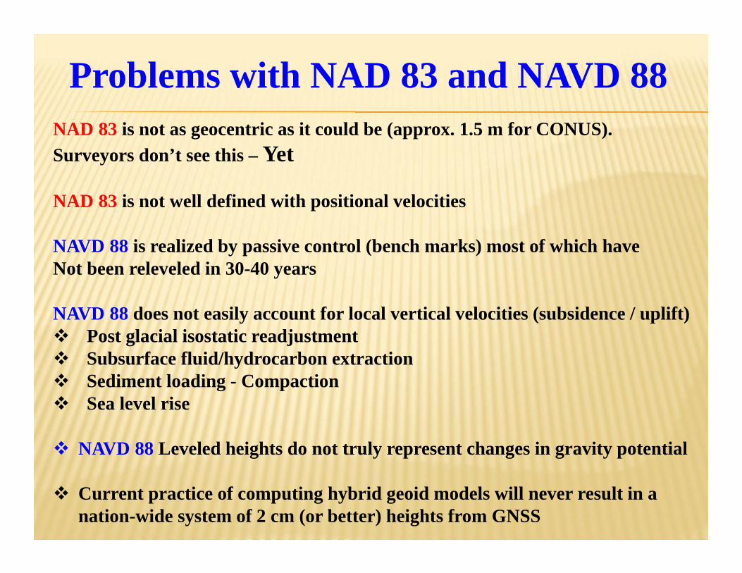
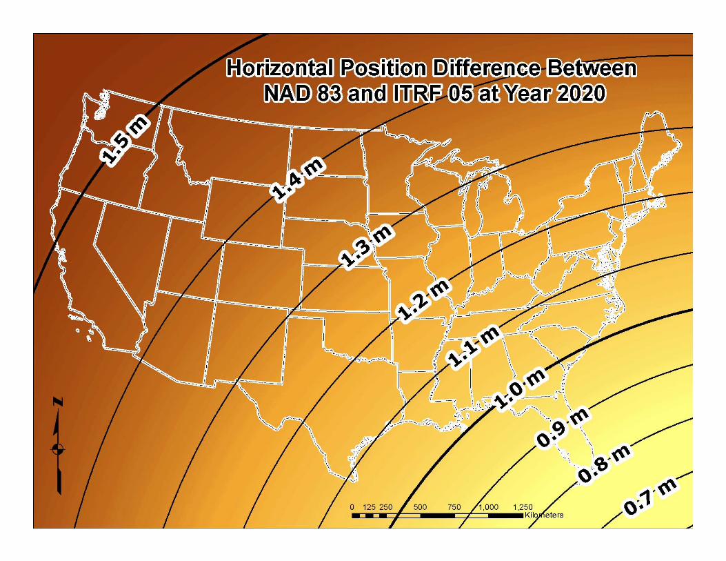
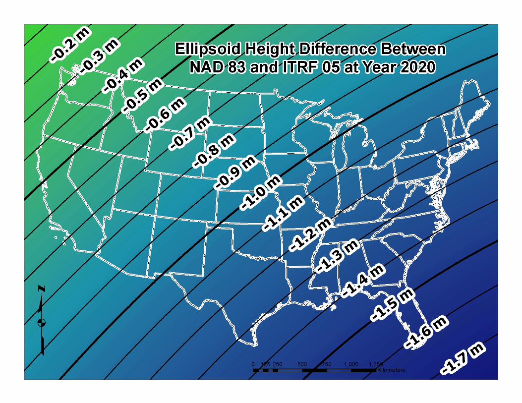
Problems with NAD 83 and NAVD 88NAD 83 is not as geocentric as it could be (approx. 1.5 m for CONUS). Surveyors don’t see this – Yet
NAD 83 is not well defined with positional velocities
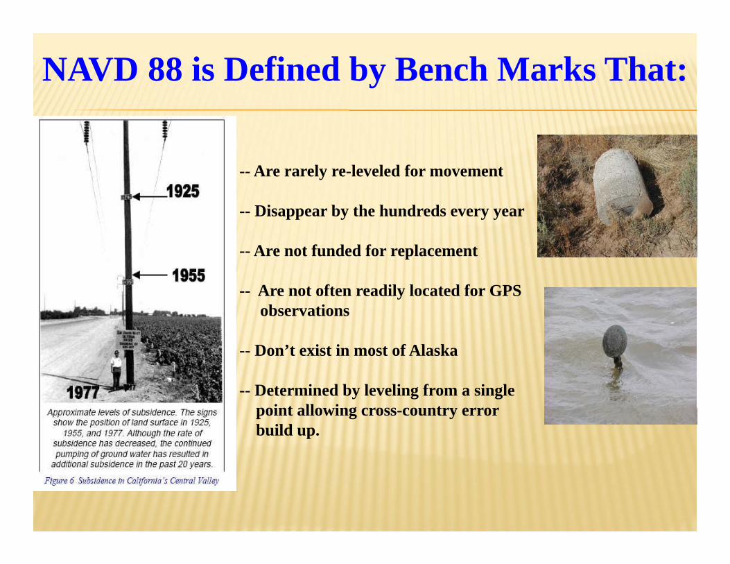
NAVD 88 is realized by passive control (bench marks) most of which haveNot been releveled in 30-40 years
NAVD 88 does not easily account for local vertical velocities (subsidence / uplift) Post glacial isostatic readjustment Subsurface fluid/hydrocarbon extraction Sediment loading - Compaction Sea level rise
NAVD 88 Leveled heights do not truly represent changes in gravity potential
Current practice of computing hybrid geoid models will never result in a nation-wide system of 2 cm (or better) heights from GNSS
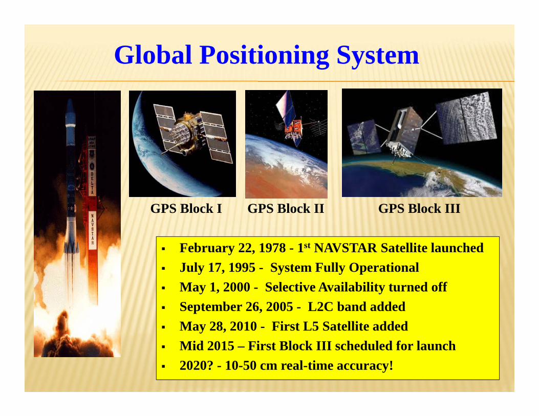
February 22, 1978 - 1st NAVSTAR Satellite launched July 17, 1995 - System Fully Operational May 1, 2000 - Selective Availability turned off September 26, 2005 - L2C band added May 28, 2010 - First L5 Satellite added Mid 2015 – First Block III scheduled for launch 2020? - 10-50 cm real-time accuracy!
Global Positioning System
GPS Block I GPS Block II GPS Block III
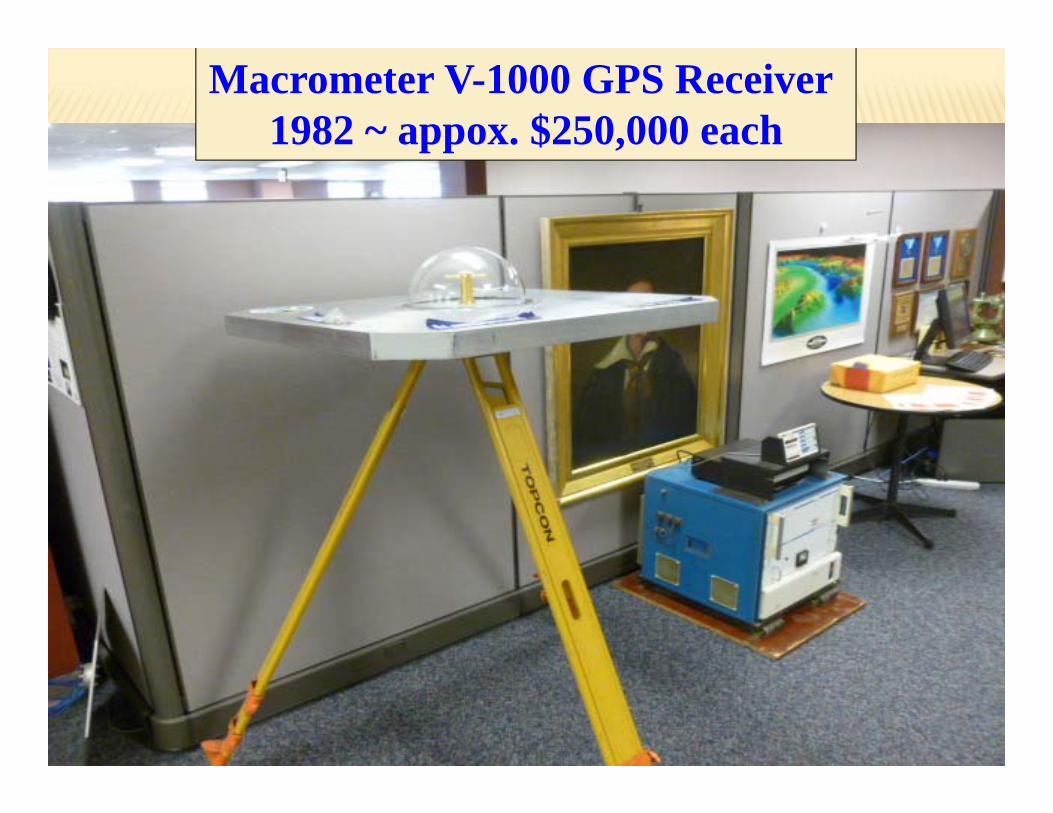
Macrometer V-1000 GPS Receiver 1982 ~ appox. $250,000 each
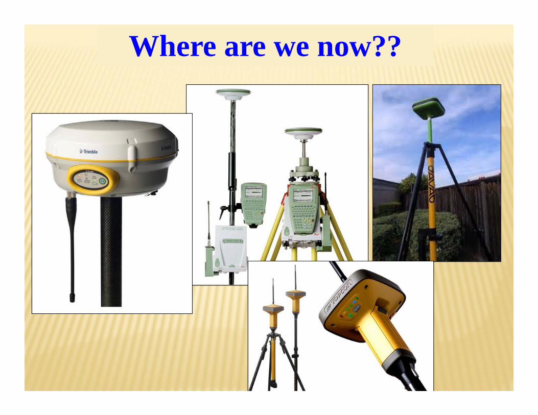
Where are we now??
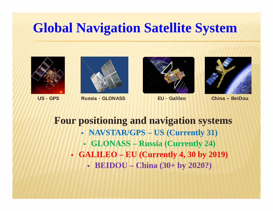
Four positioning and navigation systems NAVSTAR/GPS – US (Currently 31) GLONASS – Russia (Currently 24)
GALILEO – EU (Currently 4, 30 by 2019) BEIDOU – China (30+ by 2020?)
Russia - GLONASSUS - GPS EU - Galileo China – BeiDou
Global Navigation Satellite System
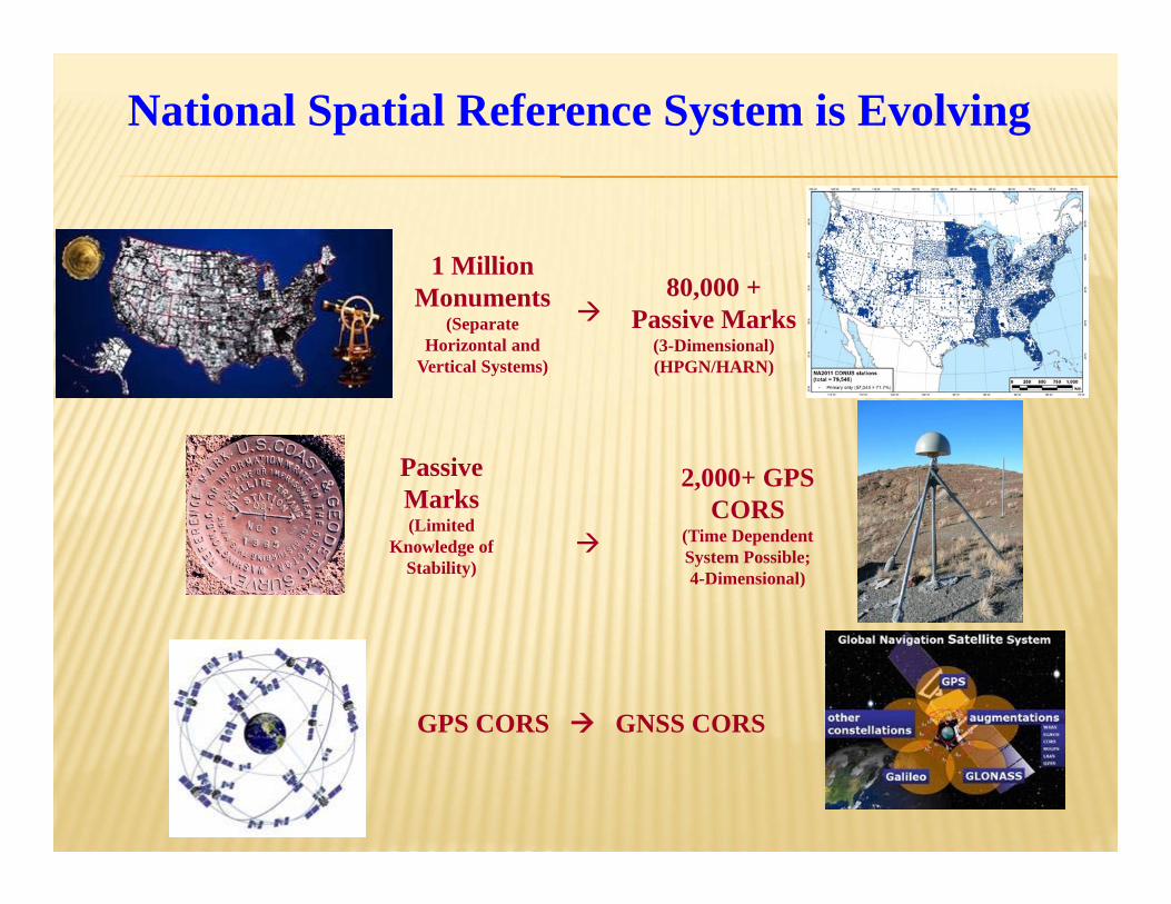
1 Million Monuments
(Separate Horizontal and
Vertical Systems)
Passive Marks(Limited
Knowledge of Stability)
GPS CORS GNSS CORS
80,000 +Passive Marks
(3-Dimensional)(HPGN/HARN)
2,000+ GPS CORS
(Time Dependent System Possible; 4-Dimensional)
National Spatial Reference System is Evolving
International Gold Standard
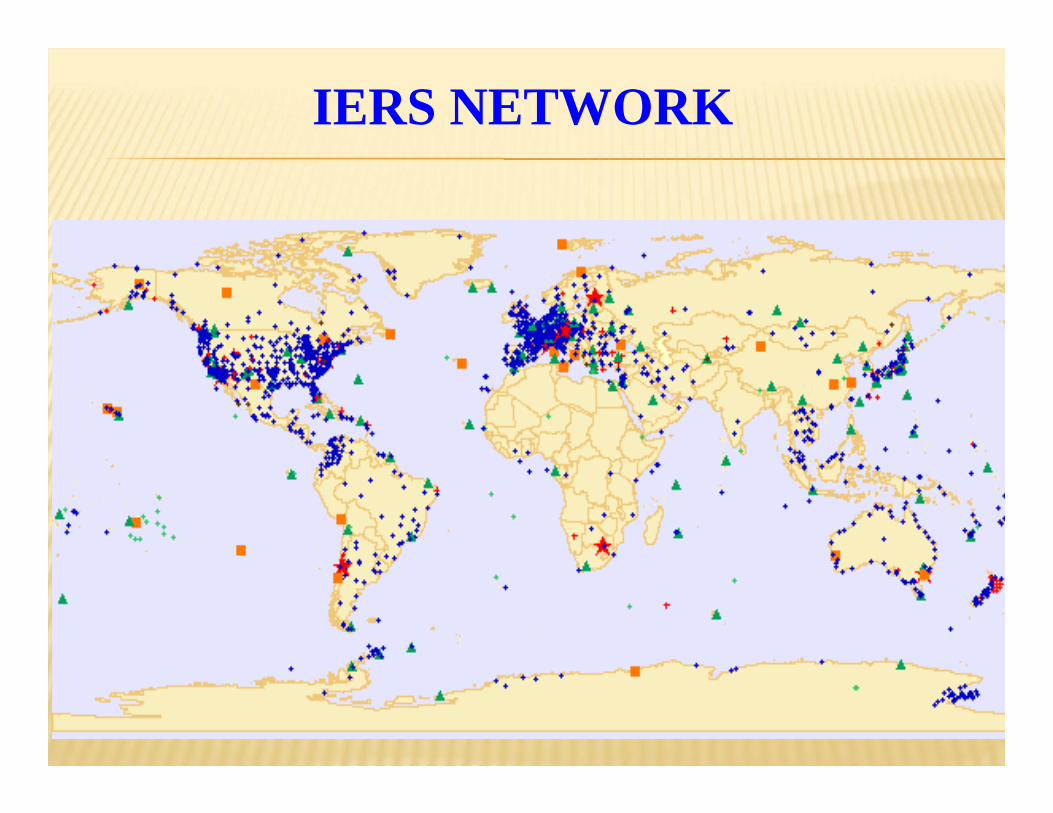
International Earth Rotation and Reference System Service (IERS)
Established 1987Office in Paris, France
Produces the International Terrestrial Reference SystemAnd
International Terrestrial Reference FrameFirst ITRF – 1988Latest ITRF - 2008
IERS Four Geodetic Services
International GNSS Service International VLBI Service
International Laser Ranging Service International DORIS Service
IERS NETWORK
U.S. NAVAL OBSERV (USNO), DISTRICT OF COLUMBIA_____________________________________________________________________________
| || Antenna Reference Point(ARP): U.S. NAVAL OBSERV CORS ARP || -------------------------------------------------------- || PID = AI7403 || || || IGS08 POSITION (EPOCH 2005.0) || Published by the IGS in Nov 2010. || X = 1112189.773 m latitude = 38 55 08.26603 N || Y = -4842955.026 m longitude = 077 03 58.41015 W || Z = 3985352.266 m ellipsoid height = 48.869 m || || IGS08 VELOCITY || Published by the IGS in Nov 2010. || VX = -0.0150 m/yr northward = 0.0040 m/yr || VY = 0.0000 m/yr eastward = -0.0146 m/yr || VZ = 0.0024 m/yr upward = -0.0011 m/yr || || || NAD_83 (2011) POSITION (EPOCH 2010.0) || Transformed from IGS08 (epoch 2005.0) position in Aug 2011. || X = 1112190.454 m latitude = 38 55 08.23647 N || Y = -4842956.480 m longitude = 077 03 58.39613 W || Z = 3985352.362 m ellipsoid height = 50.151 m || || NAD_83 (2011) VELOCITY || Transformed from IGS08 velocity in Aug 2011. || VX = 0.0015 m/yr northward = -0.0008 m/yr || VY = 0.0015 m/yr eastward = 0.0018 m/yr || VZ = -0.0019 m/yr upward = -0.0021 m/yr ||_____________________________________________________________________________|
IGS08 – NAD 83(2011)Horiz = 0.972 mEHt = 1.282 m
IGS08 is the GNSS component of the ITRF08They can be considered to be equivalent
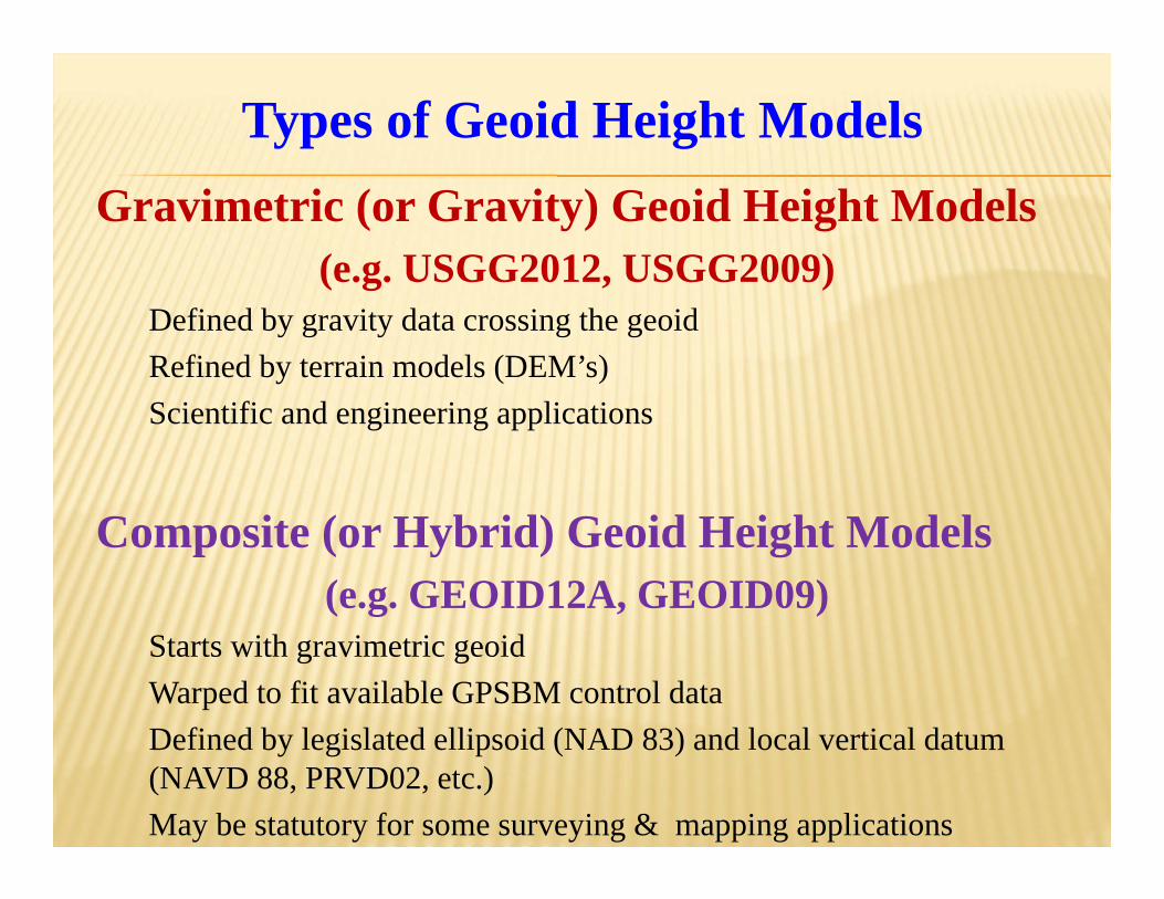
Starts with gravimetric geoidWarped to fit available GPSBM control dataDefined by legislated ellipsoid (NAD 83) and local vertical datum (NAVD 88, PRVD02, etc.)May be statutory for some surveying & mapping applications
Types of Geoid Height Models
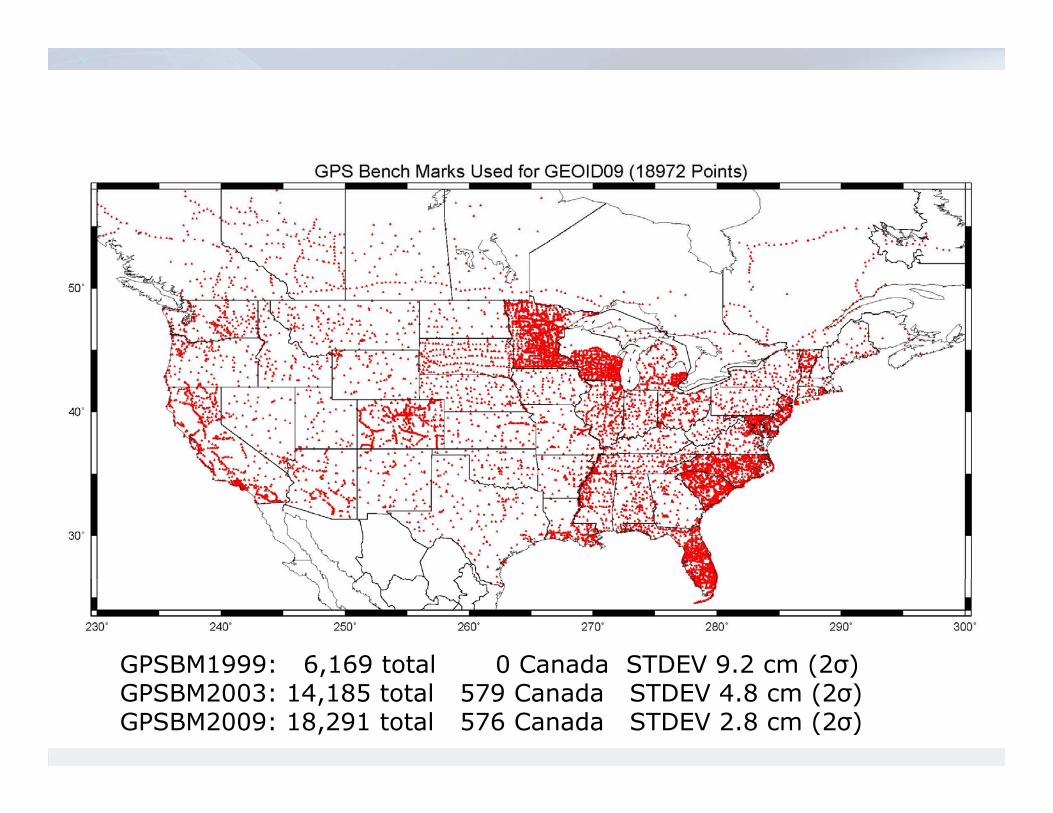
GPSBM1999: 6,169 total 0 Canada STDEV 9.2 cm (2σ) GPSBM2003: 14,185 total 579 Canada STDEV 4.8 cm (2σ) GPSBM2009: 18,291 total 576 Canada STDEV 2.8 cm (2σ)
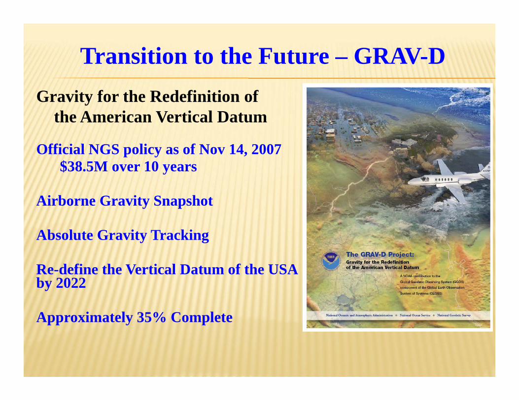
Official NGS policy as of Nov 14, 2007$38.5M over 10 years
Airborne Gravity Snapshot
Absolute Gravity Tracking
Re-define the Vertical Datum of the USA by 2022
Approximately 35% Complete
Transition to the Future – GRAV-DGravity for the Redefinition of
the American Vertical Datum
Space-Base Gravity Observations
Gravity Recovery And Climate Experiment(GRACE)
Launched - 2002
Gravity field and steady state Ocean Circulation Explorer (GOCE)Launched – 2009Reentered November 2013
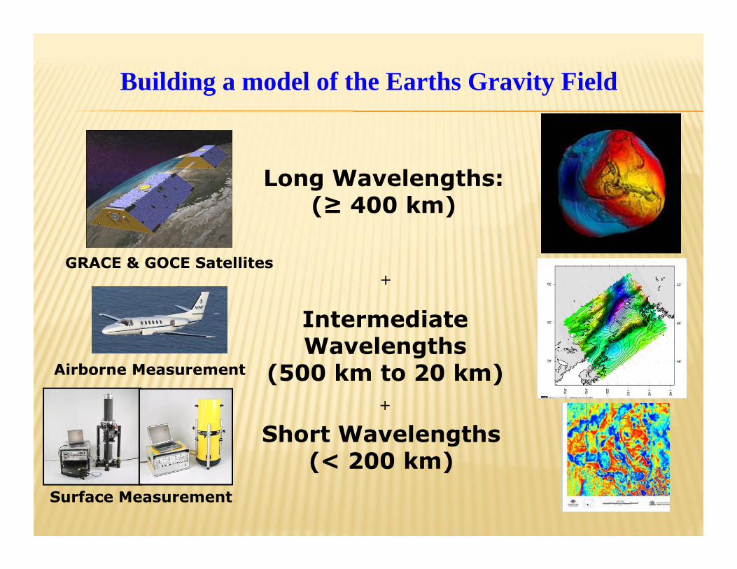
Long Wavelengths:(≥ 400 km)
GRACE & GOCE Satellites
Intermediate Wavelengths
(500 km to 20 km)Airborne Measurement
Surface Measurement
Short Wavelengths(< 200 km)
+
+
Building a model of the Earths Gravity Field
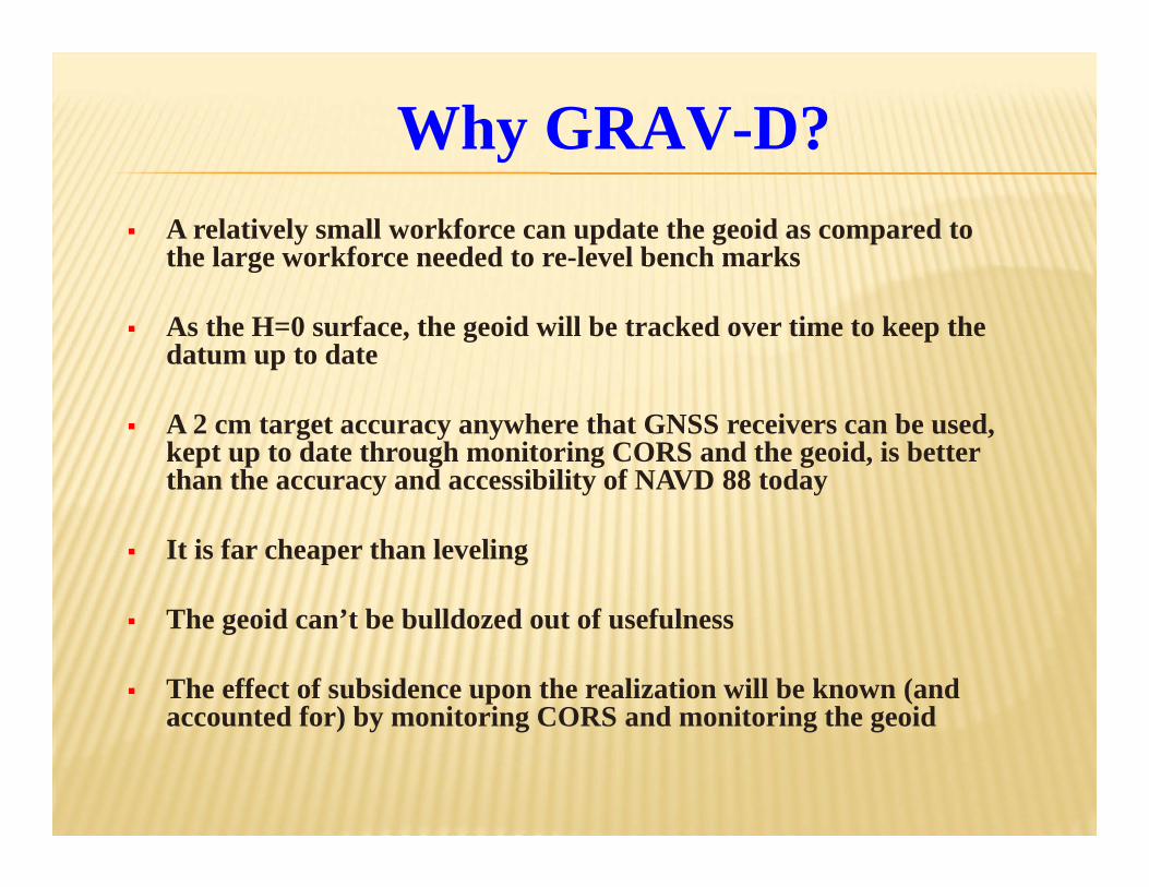
A relatively small workforce can update the geoid as compared to the large workforce needed to re-level bench marks
As the H=0 surface, the geoid will be tracked over time to keep the datum up to date
A 2 cm target accuracy anywhere that GNSS receivers can be used, kept up to date through monitoring CORS and the geoid, is better than the accuracy and accessibility of NAVD 88 today
It is far cheaper than leveling
The geoid can’t be bulldozed out of usefulness
The effect of subsidence upon the realization will be known (and accounted for) by monitoring CORS and monitoring the geoid
Why GRAV-D?
Primary access (NGS mission)
Users with geodetic quality GNSS receivers will continue to use RTNs, RTK and OPUS suite of tools
Ellipsoid heights computed, and then a gravimetric geoid height applied to provide orthometric heights in the new datum
No passive marks needed
But, could be used to position a passive mark
How will you access the new vertical datum?
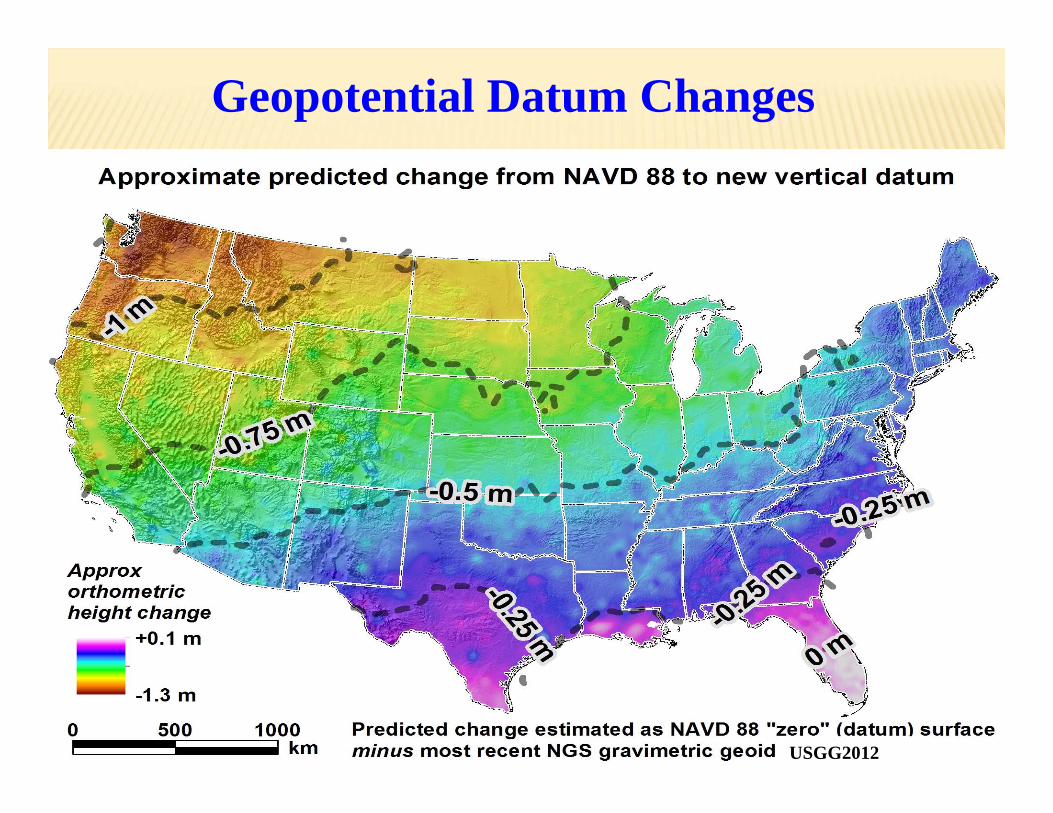
Geopotential Datum Changes
USGG2012
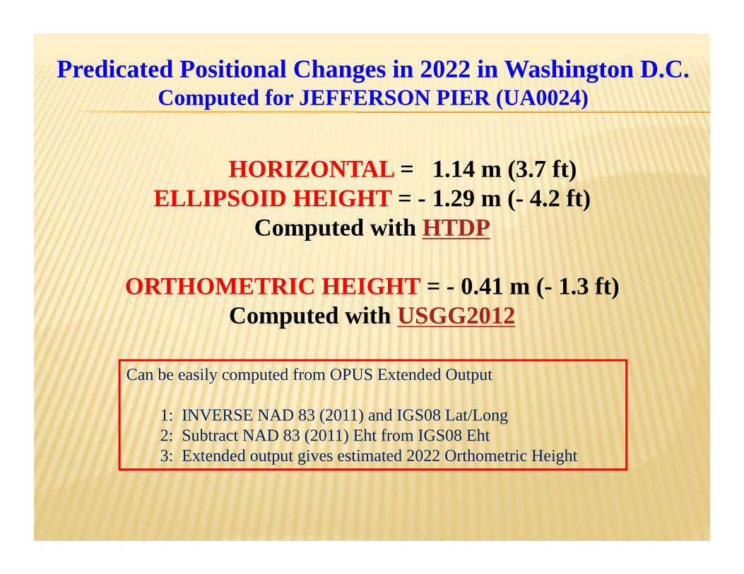
HORIZONTAL = 1.14 m (3.7 ft)ELLIPSOID HEIGHT = - 1.29 m (- 4.2 ft)
Computed with HTDP
ORTHOMETRIC HEIGHT = - 0.41 m (- 1.3 ft)Computed with USGG2012
Predicated Positional Changes in 2022 in Washington D.C.Computed for JEFFERSON PIER (UA0024)
Can be easily computed from OPUS Extended Output
1: INVERSE NAD 83 (2011) and IGS08 Lat/Long2: Subtract NAD 83 (2011) Eht from IGS08 Eht3: Extended output gives estimated 2022 Orthometric Height
HORIZONTAL = 1.49 m (4.9 ft)ELLIPSOID HEIGHT = - 0.34 m (- 1.1 ft)
Predicted with HTDP
ORTHOMETRIC HEIGHT = - 1.23 m (- 4.0 ft)Predicted with USGG2012
Predicated Positional Changes in 2022 near Seattle, WAComputed for HAFF (SY5646)
Can be easily computed from OPUS Extended Output
1: INVERSE NAD 83 (2011) and IGS08 Lat/Long2: Subtract NAD 83 (2011) Eht from IGS08 Eht3: Extended output gives estimated 2022 Orthometric Height
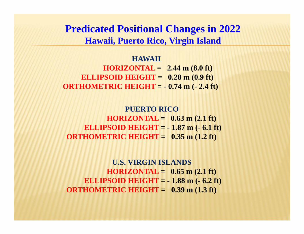
HAWAII HORIZONTAL = 2.44 m (8.0 ft)
ELLIPSOID HEIGHT = 0.28 m (0.9 ft)ORTHOMETRIC HEIGHT = - 0.74 m (- 2.4 ft)
Predicated Positional Changes in 2022 Hawaii, Puerto Rico, Virgin Island
PUERTO RICO HORIZONTAL = 0.63 m (2.1 ft)
ELLIPSOID HEIGHT = - 1.87 m (- 6.1 ft)ORTHOMETRIC HEIGHT = 0.35 m (1.2 ft)
U.S. VIRGIN ISLANDS HORIZONTAL = 0.65 m (2.1 ft)
ELLIPSOID HEIGHT = - 1.88 m (- 6.2 ft)ORTHOMETRIC HEIGHT = 0.39 m (1.3 ft)
What can you do to get ready for 2022??
Understand the impact of changing positions and heights for your community, company or agency
Consider legislative changes to federal regulations, state legislation and codes
Should NGS continue to publish State Plane Coordinates?If yes:
Retain or change NAD 83 geometric parameters?
Communicate your issues directly to NGSJoe Evjen – [email protected]