64
A Discovery Guide The Mohawk Towpath Scenic Byway www.mohawktowpath.org
| Date post: | 24-Mar-2016 |
| Category: |
Documents |
| Upload: | larry-mossey |
| View: | 238 times |
| Download: | 0 times |
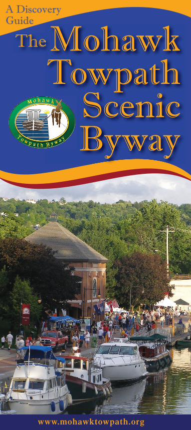
A DiscoveryGuide
TheThe MohawkTowpath
Scenic Byway
www.mohawktowpath.org
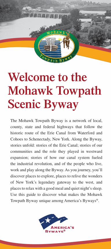
The Mohawk Towpath Byway is a network of local,
county, state and federal highways that follow the
historic route of the Erie Canal from Waterford and
Cohoes to Schenectady, New York. Along the Byway,
stories unfold: stories of the Erie Canal; stories of our
communities and the role they played in westward
expansion; stories of how our canal system fueled
the industrial revolution, and of the people who live,
work and play along the Byway. As you journey, you’ll
discover places to explore, places to relive the wonders
of New York’s legendary gateway to the west, and
places to relax with a good meal and quiet night’s sleep.
Use this guide to discover what makes the Mohawk
Towpath Byway unique among America’s Byways®.
Welcome to the Mohawk Towpath Scenic Byway
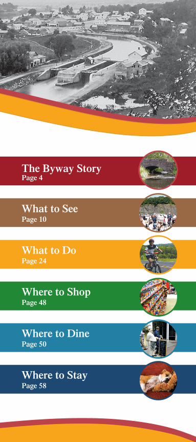
The Byway StoryPage 4
What to SeePage 10
What to DoPage 24
Where to ShopPage 48
Where to DinePage 50
Where to StayPage 58
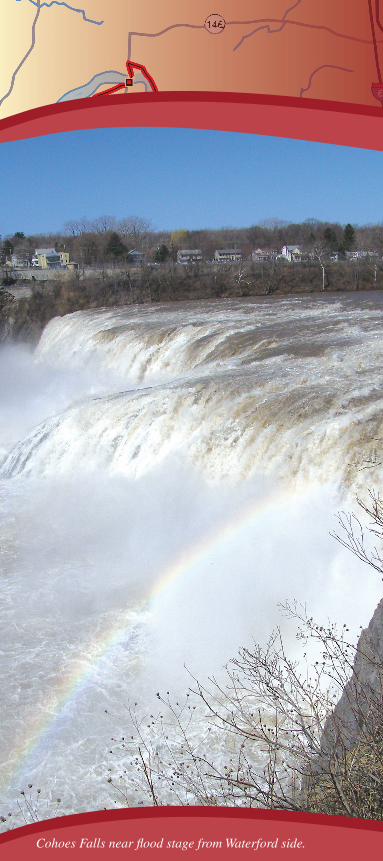
Cohoes Falls near fl ood stage from Waterford side.
Beginnings
Stretching westward from the Hudson River to central New York State, the Mohawk River Valley was carved by glaciers during the great Ice Age, two million years ago. Through this valley, the Mohawk River fl ows eastward from just north of Rome to merge with the Hudson River at Waterford. Because this valley was the only water-level passage through the Appalachian Mountains, it became a major North American trade route between the Atlantic Ocean and the Great Lakes. Both native American and early European settlements, like Schenectady’s Stockade, hugged the Mohawk Riv-er, affording access to water, food and travel.
Though the river was a welcome trade and transportation thoroughfare, a series of rapids and waterfalls (Cohoes Falls, Little Falls) could make travel perilous. At several spots, boats, cargo and passengers had to leave the water to portage—or travel over land—around falls or rapids to reach the next navigable section of the river.
Canal Days
As early as 1783, plans were being developed to build an artifi cial waterway for faster and safer travel between the eastern seaboard and the Great Lakes. From 1810 to 1816, efforts were made by New York legislators and businessmen to secure federal funding to construct a canal from Albany to Buffalo. When this endeavor failed, supporters suggested that New York State alone might bear the cost. When DeWitt Clinton, who had campaigned on a pro-canal platform, became Governor in 1817, he started work on the massive project at Rome. Despite public skepticism, “Clinton’s Big Ditch” was carved across the state between 1817 and 1825.
5
The B
yway Story
Mohaw
k Towpath B
yway
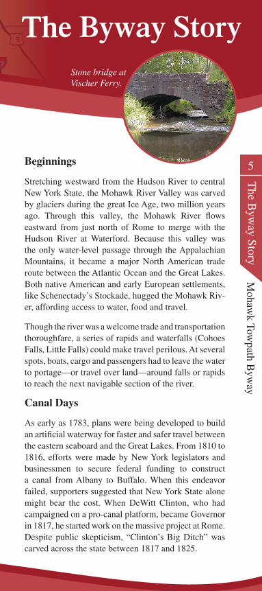
The Byway StoryThe Byway StoryThe Byway StoryStone bridge at Vischer Ferry.
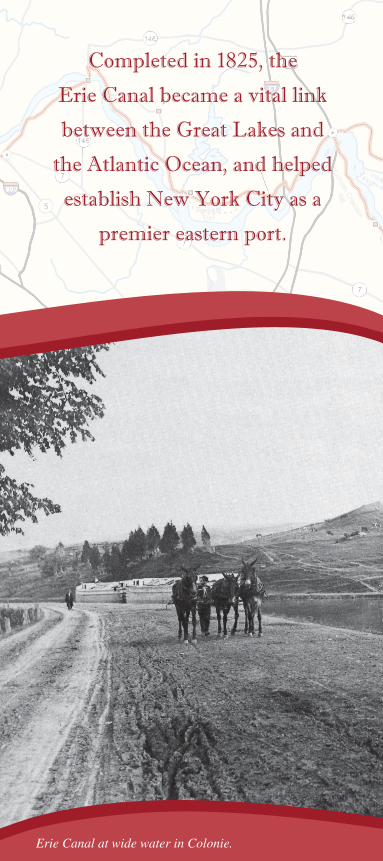
Completed in 1825, the
Erie Canal became a vital link
between the Great Lakes and
the Atlantic Ocean, and helped
establish New York City as a
premier eastern port.
Erie Canal at wide water in Colonie.
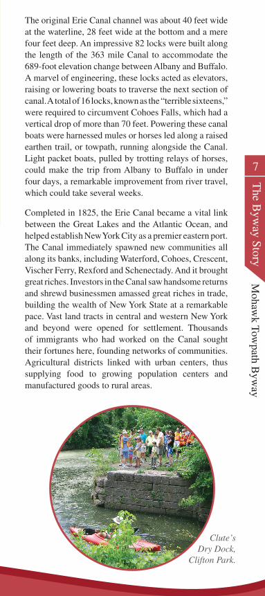
The original Erie Canal channel was about 40 feet wide at the waterline, 28 feet wide at the bottom and a mere four feet deep. An impressive 82 locks were built along the length of the 363 mile Canal to accommodate the 689-foot elevation change between Albany and Buffalo. A marvel of engineering, these locks acted as elevators, raising or lowering boats to traverse the next section of canal. A total of 16 locks, known as the “terrible sixteens,” were required to circumvent Cohoes Falls, which had a vertical drop of more than 70 feet. Powering these canal boats were harnessed mules or horses led along a raised earthen trail, or towpath, running alongside the Canal. Light packet boats, pulled by trotting relays of horses, could make the trip from Albany to Buffalo in under four days, a remarkable improvement from river travel, which could take several weeks.
Completed in 1825, the Erie Canal became a vital link between the Great Lakes and the Atlantic Ocean, and helped establish New York City as a premier eastern port. The Canal immediately spawned new communities all along its banks, including Waterford, Cohoes, Crescent, Vischer Ferry, Rexford and Schenectady. And it brought great riches. Investors in the Canal saw handsome returns and shrewd businessmen amassed great riches in trade, building the wealth of New York State at a remarkable pace. Vast land tracts in central and western New York and beyond were opened for settlement. Thousands of immigrants who had worked on the Canal sought their fortunes here, founding networks of communities. Agricultural districts linked with urban centers, thus supplying food to growing population centers and manufactured goods to rural areas.
7
The B
yway Story
Mohaw
k Towpath B
yway
Clute’s Dry Dock,
Clifton Park.
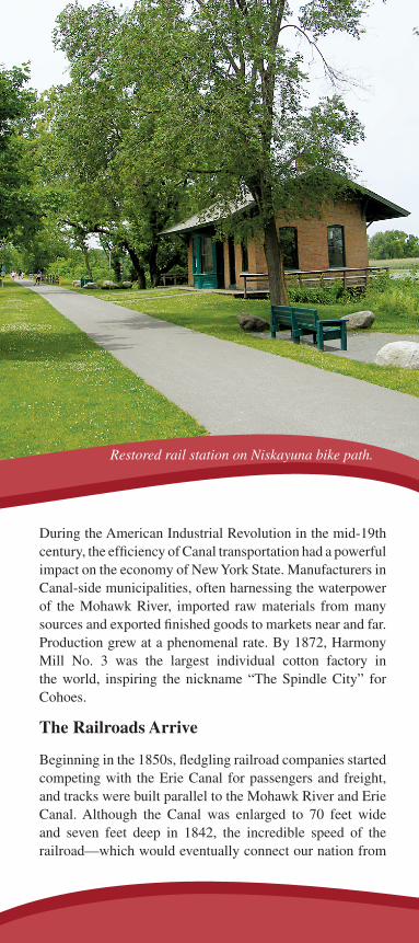
During the American Industrial Revolution in the mid-19th century, the efficiency of Canal transportation had a powerful impact on the economy of New York State. Manufacturers in Canal-side municipalities, often harnessing the waterpower of the Mohawk River, imported raw materials from many sources and exported finished goods to markets near and far. Production grew at a phenomenal rate. By 1872, Harmony Mill No. 3 was the largest individual cotton factory in the world, inspiring the nickname “The Spindle City” for Cohoes.
The Railroads Arrive
Beginning in the 1850s, fledgling railroad companies started competing with the Erie Canal for passengers and freight, and tracks were built parallel to the Mohawk River and Erie Canal. Although the Canal was enlarged to 70 feet wide and seven feet deep in 1842, the incredible speed of the railroad—which would eventually connect our nation from
Restored rail station on Niskayuna bike path.
ocean to ocean—numbered the days for New York’s great canal. In 1903, the New York State Barge Canal System was established, and the improved canal system opened in 1917. This allowed the Canal to remain a major grain route from the midwest to New York City for several decades. But by the 1980s, the waterway’s commercial viability had faded.
Preserving Our Heritage
After decades of serious pollution problems, aggressive environmental efforts have restored the Mohawk River and Barge Canal system as a recreational resource. Development of the waterway and adjacent areas for leisure activities, such as recreational boating and bike-hike trails, has increased tourism and brought new revenues to canalside communities.
Growing public interest has led to the creation of two heritage corridors with the Mohawk River/Erie Canal story at their core. They are the Erie Canalway National Heritage Corridor and the Mohawk Valley Heritage Corridor. Both of these corridors encompass The Mohawk Towpath Byway and, with continued local, state and national support, will help preserve the stories of New York’s great Westward Corridor for many future generations.
9
The B
yway Story
Mohaw
k Towpath B
yway
Restored rail station on Niskayuna bike path.
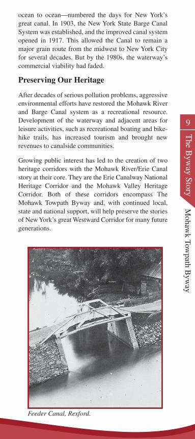
Feeder Canal, Rexford.
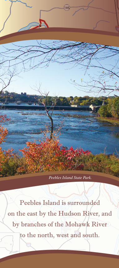
Peebles Island is surrounded
on the east by the Hudson River, and
by branches of the Mohawk River
to the north, west and south.
Peebles Island State Park.
Peebles Island State ParkCohoes and Waterford
In 1668, Philip Pietersen Schuyler and Goosen Ger-ritsen von Schaick acquired Peebles and van Schaick Islands, using the rich fl ood plain for farming and other parts for grazing cattle. Peebles Island is surrounded on the east by the Hudson River, on the north by the fourth branch of the Mohawk River, and on the west and south by the third branch of the Mohawk.
On August 17, 1777, Colonial forces retreated south to these islands to prepare for a fi nal stand against the Brit-ish before their assault on Albany. These included three batteries of cannon behind still extant earthworks with troop entrenchments, a design attributed to Polish engi-neer Thaddeus Koscuiszko. But the American victory at Saratoga made these defenses unnecessary.
The old military road from Fort Ann to Albany runs through the middle of Peebles Island, and the road at its north end became the ford across the water to Battery Park in Waterford. There are several markers to note the island’s history.
Van Schaick HomeVan Schaick Ave., Cohoes
Built in 1735 by Anthony Van Schaick, son of Goosen Gerritsen von Schaick, the original patentee, this brick gambrel roof home is a fi ne example of Dutch Colonial architecture. Patriots John G. and Anna Van Schaick owned the home in 1777 when it served as summer headquarters for the Northern Department of the Conti-nental Army. General Philip Schuyler and General Hor-atio Gates planned the Saratoga Campaign here, and on August 19, 1777, General Gates assumed command.
11
What to See
Mohaw
k Towpath B
yway
What to See
Peebles Island is surrounded
on the east by the Hudson River, and
by branches of the Mohawk River
to the north, west and south.
What to SeeWhat to See
Peebles Island State Park.
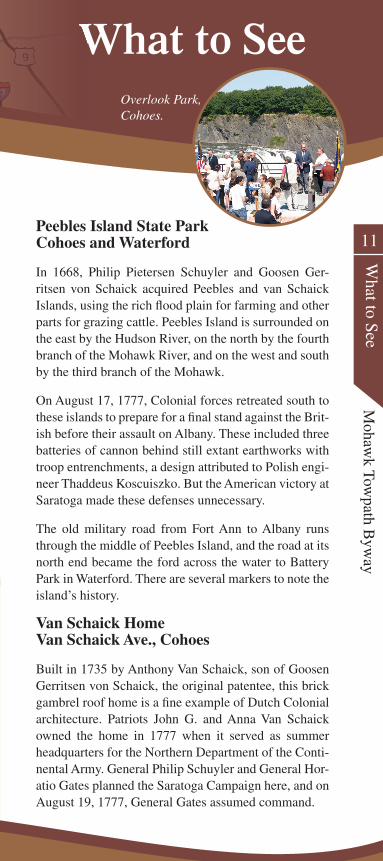
Overlook Park, Cohoes.
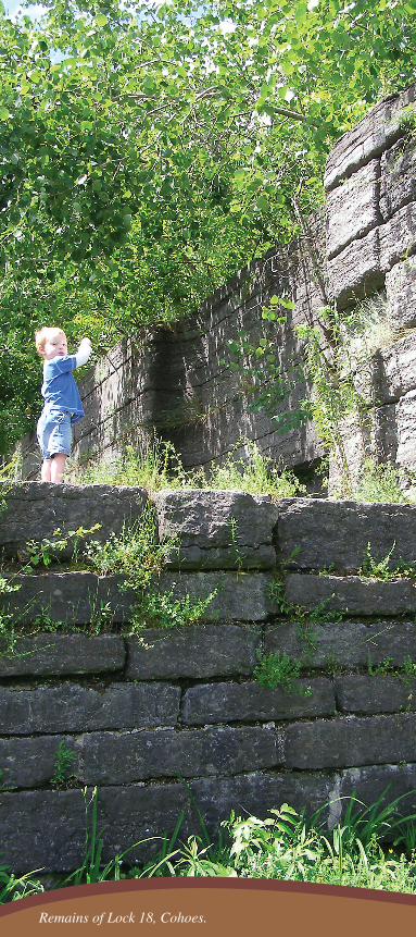
Remains of Lock 18, Cohoes.
13
What to See
Mohaw
k Towpath B
yway
On August 15, 1777, General Benedict Arnold and his troops marched from the Van Schaick home to relieve Fort Stanwix. Guests at the Van Schaick home included Governor George Clinton, General Benjamin Lincoln, General Ebenezer Learned, Colonel Peter Gansevoort, General Enoch Poor, General John Stark, Colonel Dan-iel Morgan, and Colonel Thaddeus Koscuiszko, engi-neer of the fortifications on Peebles Island and at Bemis Heights. John Burgoyne and his staff were also enter-tained at this home after the surrender at Saratoga.
Historic Locks, Cohoes
The original 1825 Erie Canal came north through Co-hoes and proceeded north along Mohawk Street. The sixteen locks that brought the canal up around the Co-hoes Falls were referred to as the “terrible sixteens” because it would take a whole day to bring your boat through them. One of our country’s first railroads, es-tablished in 1831 between Albany and Schenectady, was built to avoid this time delay.
After the canal was expanded and rerouted in the 1840s, the remnant of the original Erie Canal was used as a power canal for the Harmony Mills. A linear park through Cohoes follows the route of the canal. Double chamber Lock 18, north of Church Street, is on the Na-tional Register and can be seen from the Byway.
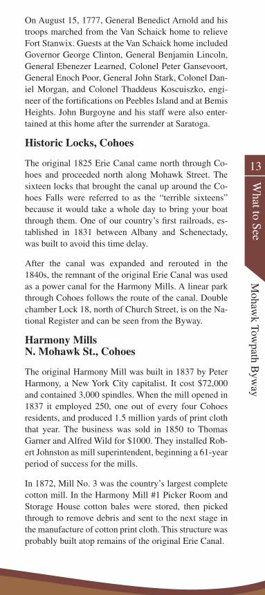
Harmony Mills N. Mohawk St., Cohoes
The original Harmony Mill was built in 1837 by Peter Harmony, a New York City capitalist. It cost $72,000 and contained 3,000 spindles. When the mill opened in 1837 it employed 250, one out of every four Cohoes residents, and produced 1.5 million yards of print cloth that year. The business was sold in 1850 to Thomas Garner and Alfred Wild for $1000. They installed Rob-ert Johnston as mill superintendent, beginning a 61-year period of success for the mills.
In 1872, Mill No. 3 was the country’s largest complete cotton mill. In the Harmony Mill #1 Picker Room and Storage House cotton bales were stored, then picked through to remove debris and sent to the next stage in the manufacture of cotton print cloth. This structure was probably built atop remains of the original Erie Canal.
In 1872, Harmony Mill No. 3 was
the country’s largest complete
cotton mill.
15
What to See
Mohaw
k Towpath B
yway
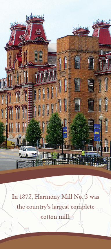
Harmony Mill #3, constructed in 1866, became the mod-el cotton mill in the United States, and was frequently visited by cotton goods manufacturers from across the country and overseas. An addition was built on Mill #3 in 1872, making it the country’s largest complete cotton mill, at 1,856 feet long, 75 feet wide, and fi ve stories high. This building and other structures comprising the Harmony Mills complex are a National Historic Land-mark. While excavating to build the mill in 1866, the contractors dug into an ancient sinkhole and found the 11,000-year-old bones of a mastodon, which now stand at the entrance to the New York State Museum. The southern section contains two of the original fi ve Boy-den turbines that powered this massive mill.
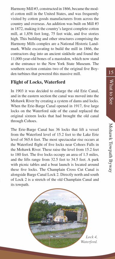
Flight of Locks, Waterford
In 1903 it was decided to enlarge the old Erie Canal, and in the eastern section the canal was moved into the Mohawk River by creating a system of dams and locks. When the Erie-Barge Canal opened in 1917, fi ve large locks on the Waterford side of the canal replaced the original sixteen locks that had brought the old canal through Cohoes.
The Erie-Barge Canal has 36 locks that lift a vessel from the Waterford level of 15.2 feet to the Lake Erie level of 565.6 feet. The most spectacular rise occurs at the Waterford fl ight of fi ve locks near Cohoes Falls in the Mohawk River. These raise the level from 15.2 feet to 180 feet. The fi ve locks occupy an area of 1.5 miles, and the lifts range from 32.5 feet to 34.5 feet. A park with picnic tables and a boat launch is located around these fi ve locks. The Champlain Cross Cut Canal is alongside Barge Canal Lock 2. Directly north and south of Lock 2 is a stretch of the old Champlain Canal and its towpath.
Lock 4, Waterford.
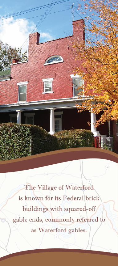
The Village of Waterford
is known for its Federal brick
buildings with squared-off
gable ends, commonly referred to
as Waterford gables.
17
What to See
Mohaw
k Towpath B
yway
Waterford Village
The Village of Waterford is known for its Federal brick buildings with squared-off gable ends, commonly re-ferred to as Waterford gables. The Greek Revival and Victorian styles are also prevalent. While here, visit the Waterford Harbor Visitors Center as well as several an-tique shops and canal-era homes.
Working Landscape, Colonie
There is little doubt that what has shaped the eastern Mohawk Valley most is the need to harness water pow-er. The Crescent Dam and the New York State Power Authority generating station on the Cohoes-Crescent Road are located at the historic military crossing be-tween Fonda Road in the Town of Colonie and Fonda Road in the Town of Waterford. The dam maintains the water level in the Mohawk River and Erie Canal west to Vischer Ferry. The adjacent facility can generate 9.9 megawatts. Another source of power comes from gas collected at the adjacent landfi ll.
Freddie’s Park, Colonie
Historic travel routes in the Byway corridor exemplify how the area has always been an important historic crossroad. Not only were there migrations (human and animal) east and west along the Mohawk, but north and south parallel to the Hudson River. An excellent kiosk in Freddie’s Park provides information on the historic signifi cance of river crossings in this area.
River Crossings, Colonie and Halfmoon
One of the most dramatic crossings was the lower aque-duct that carried the Erie Canal across the Mohawk near where US Route 9 now crosses. Early engineers found it easier to construct the Canal on the north side of the River because of the post-glacial sand deposited there. In addition, the early spring sunshine thawed winter’s accumulation of ice quicker on the north side of the valley than on the south side. A series of great stone masonry arches carried the towpath across the river. A trough of large wooden planking carried the canal. This was the longest aqueduct on the Erie Canal system. Remnants of the aqueduct can be seen at both ends of the Route 9 Bridge.
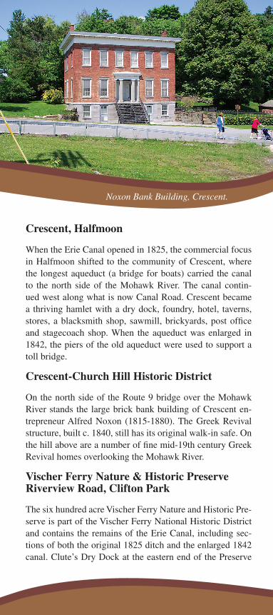
Crescent, Halfmoon
When the Erie Canal opened in 1825, the commercial focus in Halfmoon shifted to the community of Crescent, where the longest aqueduct (a bridge for boats) carried the canal to the north side of the Mohawk River. The canal contin-ued west along what is now Canal Road. Crescent became a thriving hamlet with a dry dock, foundry, hotel, taverns, stores, a blacksmith shop, sawmill, brickyards, post office and stagecoach shop. When the aqueduct was enlarged in 1842, the piers of the old aqueduct were used to support a toll bridge.
Crescent-Church Hill Historic District
On the north side of the Route 9 bridge over the Mohawk River stands the large brick bank building of Crescent en-trepreneur Alfred Noxon (1815-1880). The Greek Revival structure, built c. 1840, still has its original walk-in safe. On the hill above are a number of fine mid-19th century Greek Revival homes overlooking the Mohawk River.
Vischer Ferry Nature & Historic Preserve Riverview Road, Clifton Park
The six hundred acre Vischer Ferry Nature and Historic Pre-serve is part of the Vischer Ferry National Historic District and contains the remains of the Erie Canal, including sec-tions of both the original 1825 ditch and the enlarged 1842 canal. Clute’s Dry Dock at the eastern end of the Preserve
Noxon Bank Building, Crescent.
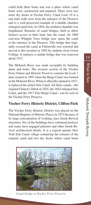
could hold three boats and was a place where canal boats were constructed and repaired. There were two more dry docks in Vischer Ferry. Canal Lock 19 is a one-mile walk west from the entrance of the Preserve and is a well-preserved example of a double chamber enlarged canal lock. In 1894, the northern chamber was lengthened. Remains of canal bridges, built to allow farmers access to their land, line the canal. An 1869 cast-iron Whipple Truss bridge now spans the canal at the entrance to the Preserve. This bridge that origi-nally crossed the canal at Fultonville was restored and moved to this location in 1992 by students from Union College. It replaces a similar bridge that was removed about 1917.
The Mohawk River was made navigable by building dams and locks. The western section of the Vischer Ferry Nature and Historic Preserve contains the Lock 7 dam created in 1907 when the Barge Canal was formed in the Mohawk River. When it officially opened in 1917, it replaced the earlier Erie Canal. All three canals—the original Clinton’s Ditch of 1825, the 1842 enlarged Erie Canal, and the 1917 Erie-Barge Canal—can be seen in the Vischer Ferry Preserve.
Vischer Ferry Historic District, Clifton Park
The Vischer Ferry Historic District was placed on the National Register of Historic Places in 1975 because of its large concentration of working class Greek Revival structures. Six of the buildings have columned porticos and many have engaged pilasters and other Greek Re-vival architectural details. It is a typical upstate New York Erie Canal village containing the remains of the original canal and two dry docks where canal boats
19
What to See
Mohaw
k Towpath B
yway
Noxon Bank Building, Crescent.
Canal bridge at Vischer Ferry Preserve.
were built and repaired. Canal boat carpenters constructed the homes between 1833 and 1862. The Vischer Homestead at the end of Ferry Drive was built about 1740, with the large front section added in the Federal style about 1806. Exam-ples of later Victorian and Queen Anne architecture are also evident in the District. Walking tours and information about the Historic District are available at the Clifton Park Town Hall and Historic Grooms Tavern.
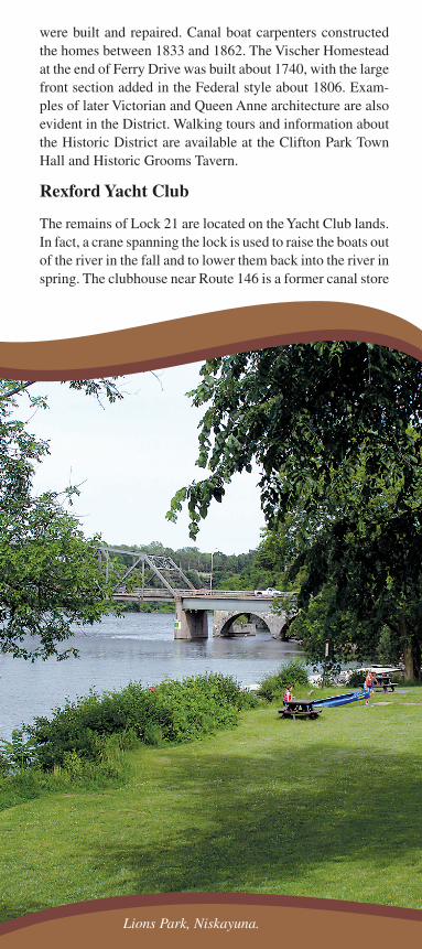
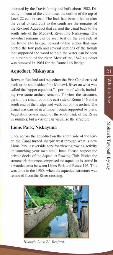
Rexford Yacht Club
The remains of Lock 21 are located on the Yacht Club lands. In fact, a crane spanning the lock is used to raise the boats out of the river in the fall and to lower them back into the river in spring. The clubhouse near Route 146 is a former canal store
Lions Park, Niskayuna.
21
What to See
Mohaw
k Towpath B
yway
operated by the Travis family and built about 1902. Di-rectly in front of the clubhouse, the outline of the top of Lock 22 can be seen. The lock had been filled in after the canal closed. Just to the south are the remains of the Rexford Aqueduct that carried the canal back to the south side of the Mohawk River into Niskayuna. The aqueduct remains can be seen best on the east side of the Route 146 bridge. Several of the arches that sup-ported the tow path and several sections of the trough that supported the wood to hold the water can be seen on either side of the river. Most of the 1842 aqueduct was removed in 1964 for the Route 146 Bridge.
Aqueduct, Niskayuna
Between Rexford and Aqueduct the Erie Canal crossed back to the south side of the Mohawk River on what was called the “upper aqueduct,” a portion of which, includ-ing two stone arches, remains. To view the structure, park in the small lot on the east side of Route 146 at the south end of the bridge and walk out on the arches. The Canal was carried in a timber trough supported by piers. Vegetation covers much of the south bank of the River in summer, but a visitor can visualize the structure.
Lions Park, Niskayuna
Once across the aqueduct on the south side of the Riv-er, the Canal turned sharply west through what is now Lions Park, a riverside park for viewing rowing activity or launching your own small boat. Please respect the private docks of the Aqueduct Rowing Club. Notice the stonework that once comprised the aqueduct is stored in a wooded area between Lions Park and Route 146. This was done in the 1960s when the aqueduct structure was removed from the River crossing.
Lions Park, Niskayuna.
Historic Lock 21, Rexford.
Rural Landscapes, Niskayuna
Here the Byway passes through a more rural area that re-calls our agricultural heritage. A century ago this area was agricultural and the Canal provided transportation for raw materials and agricultural products to manufacturing centers and manufactured goods back to the agricultural areas.
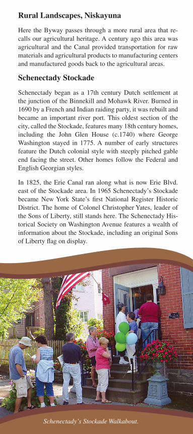
Schenectady Stockade
Schenectady began as a 17th century Dutch settlement at the junction of the Binnekill and Mohawk River. Burned in 1690 by a French and Indian raiding party, it was rebuilt and became an important river port. This oldest section of the city, called the Stockade, features many 18th century homes, including the John Glen House (c.1740) where George Washington stayed in 1775. A number of early structures feature the Dutch colonial style with steeply pitched gable end facing the street. Other homes follow the Federal and English Georgian styles.
In 1825, the Erie Canal ran along what is now Erie Blvd. east of the Stockade area. In 1965 Schenectady’s Stockade became New York State’s first National Register Historic District. The home of Colonel Christopher Yates, leader of the Sons of Liberty, still stands here. The Schenectady His-torical Society on Washington Avenue features a wealth of information about the Stockade, including an original Sons of Liberty flag on display.
Schenectady’s Stockade Walkabout.
23
What to See
Mohaw
k Towpath B
yway
GE Realty Plot, Schenectady
First developed at the turn of the century by GE execu-tives, the GE Schenectady Realty Plot evolved into an imposing collection of homes along broad tree-lined streets. Mainly intact today, the Plot has many exam-ples of elegant early-20th century homes, including the first fully “electric house” in the country, designed as a showcase for General Electric products. These large homes include Colonial Revivals and Arts and Crafts styles. The GE Realty Plot is now a National Historic District.
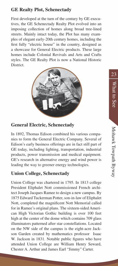
General Electric, Schenectady
In 1892, Thomas Edison combined his various compa-nies to form the General Electric Company. Several of Edison’s early business offerings are in fact still part of GE today, including lighting, transportation, industrial products, power transmission and medical equipment. GE’s research in alternative energy and wind power is leading the way to greener energy technologies.
Union College, Schenectady
Union College was chartered in 1795. In 1813 college President Eliphalet Nott commissioned French archi-tect Joseph Jacques Ramee to design a new campus. By 1875 Edward Tuckerman Potter, son-in-law of Eliphalet Nott, completed the magnificent Nott Memorial called for in Ramee’s original plans. The sixteen-sided Ameri-can High Victorian Gothic building is over 100 feet high at the center of the dome which contains 709 glass illuminators patterned after star constellations. Located on the NW side of the campus is the eight-acre Jack-son Garden created by mathematics professor Isaac W. Jackson in 1831. Notable public figures who have attended Union College are William Henry Seward, Chester A. Arthur and James Earl “Jimmy” Carter.

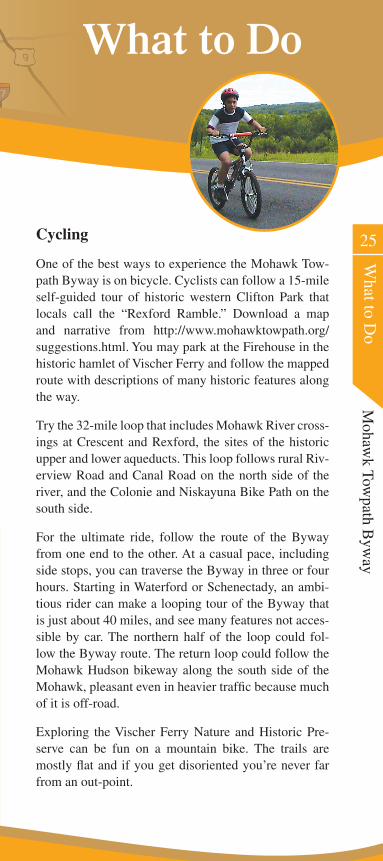
Cyclists can follow a 15-mile
self-guided tour of historic
western Clifton Park that locals call
the “Rexford Ramble.”
Cycling
One of the best ways to experience the Mohawk Tow-path Byway is on bicycle. Cyclists can follow a 15-mile self-guided tour of historic western Clifton Park that locals call the “Rexford Ramble.” Download a map and narrative from http://www.mohawktowpath.org/suggestions.html. You may park at the Firehouse in the historic hamlet of Vischer Ferry and follow the mapped route with descriptions of many historic features along the way.
Try the 32-mile loop that includes Mohawk River cross-ings at Crescent and Rexford, the sites of the historic upper and lower aqueducts. This loop follows rural Riv-erview Road and Canal Road on the north side of the river, and the Colonie and Niskayuna Bike Path on the south side.
For the ultimate ride, follow the route of the Byway from one end to the other. At a casual pace, including side stops, you can traverse the Byway in three or four hours. Starting in Waterford or Schenectady, an ambi-tious rider can make a looping tour of the Byway that is just about 40 miles, and see many features not acces-sible by car. The northern half of the loop could fol-low the Byway route. The return loop could follow the Mohawk Hudson bikeway along the south side of the Mohawk, pleasant even in heavier traffi c because much of it is off-road.
Exploring the Vischer Ferry Nature and Historic Pre-serve can be fun on a mountain bike. The trails are mostly fl at and if you get disoriented you’re never far from an out-point.
25
What to D
oM
ohawk Tow
path Byw
ay
What to DoWhat to DoWhat to Do
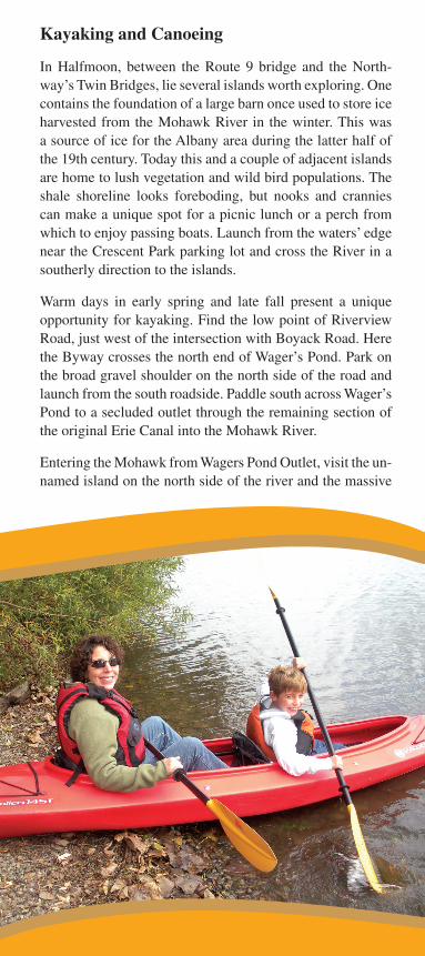
Kayaking and Canoeing
In Halfmoon, between the Route 9 bridge and the North-way’s Twin Bridges, lie several islands worth exploring. One contains the foundation of a large barn once used to store ice harvested from the Mohawk River in the winter. This was a source of ice for the Albany area during the latter half of the 19th century. Today this and a couple of adjacent islands are home to lush vegetation and wild bird populations. The shale shoreline looks foreboding, but nooks and crannies can make a unique spot for a picnic lunch or a perch from which to enjoy passing boats. Launch from the waters’ edge near the Crescent Park parking lot and cross the River in a southerly direction to the islands.
Warm days in early spring and late fall present a unique opportunity for kayaking. Find the low point of Riverview Road, just west of the intersection with Boyack Road. Here the Byway crosses the north end of Wager’s Pond. Park on the broad gravel shoulder on the north side of the road and launch from the south roadside. Paddle south across Wager’s Pond to a secluded outlet through the remaining section of the original Erie Canal into the Mohawk River.
Entering the Mohawk from Wagers Pond Outlet, visit the un-named island on the north side of the river and the massive
27
What to D
oM
ohawk Tow
path Byw
ayshale cliff across the river. These features mark the lo-cation of what was historically referred to by the Dutch as “Wat Hoix Gap,” and by Native Americans as the “White Horse” or “Evil Spirit.”
Since 1907, when power dam construction at Crescent formed a five-mile lake between Crescent and Vischer Ferry, this area has been flooded and is navigable. The geologic formation is less formidable and the water is flat, but is every bit as interesting to explore.
Before the 1900s, Wager’s Pond was productive farm-land. The field was flooded by the construction of Cres-cent Dam for hydropower and improved navigation in 1907. It is now a lagoon filled with aquatic vegetation during the summer that obstructs forward motion of even the smallest kayak. In late fall, as the vegetation dies off, it is a great place to observe waterfowl during migratory seasons.
In Niskayuna, Lions Park in Aqueduct is a good access point to the Mohawk River. From here paddle upriver beyond the old trolley line abutments, cross the navi-gation channel and enter Alplaus Creek. As you pass through the hamlet of Alplaus, both banks of the creek offer a parklike setting as property owners groom their lawns and gardens right to the creek. Further upstream the creek becomes more natural until it reaches the shal-lows downstream of the Glenridge Road bridge. When launching, please respect the Rexford Rowing Club’s property and the privacy of property owners along Al-plaus Creek.
In Clifton Park, Clute’s Dry Dock at the eastern end of the Vischer Ferry Nature and Historic Preserve, a Town-maintained floating dock, is ideal for launching car-top watercraft. The historic dry dock opens to the Erie Canal where you may explore a half-mile in ei-ther direction. Going east about a half-mile, the Canal opens to the Mohawk River to the south (right) and to Wagers Pond (left). At the Vischer Ferry Nature and Historic Preserve, you can launch a car-top craft at the Whipple Bridge entrance to the Preserve. The Towpath Trail passes under this bridge’s south abutment and dips along its north side right to the water’s edge. From this launch site you can explore the 1842 Erie Canal, from the causeway a half-mile east of the launch a mile west to a point just east of the Lock 19 remnants.
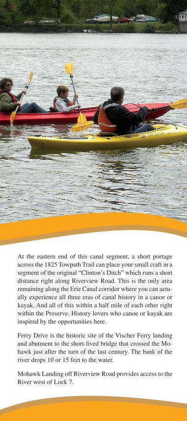
At the eastern end of this canal segment, a short portage across the 1825 Towpath Trail can place your small craft in a segment of the original “Clinton’s Ditch” which runs a short distance right along Riverview Road. This is the only area remaining along the Erie Canal corridor where you can actu-ally experience all three eras of canal history in a canoe or kayak. And all of this within a half mile of each other right within the Preserve. History lovers who canoe or kayak are inspired by the opportunities here.
Ferry Drive is the historic site of the Vischer Ferry landing and abutment to the short-lived bridge that crossed the Mo-hawk just after the turn of the last century. The bank of the river drops 10 or 15 feet to the water.
Mohawk Landing off Riverview Road provides access to the River west of Lock 7.
29
What to D
oM
ohawk Tow
path Byw
ayExplore Waterford Harbor, around Peebles Island, and the fight of locks. After cascading over Cohoes Falls and the dam below the Route 32 (Saratoga Ave) bridge the Mohawk branches into several forks before joining the Hudson River. Two of these forks flow either north or south of Peebles Island. Currents and flows around the island vary with the seasons and the weather in the Mohawk River Basin. At certain times and under cer-tain conditions the river flow around Peebles Island can create some interesting white water challenges.
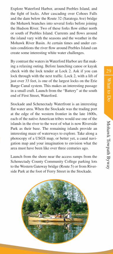
By contrast the waters in Waterford Harbor are flat mak-ing a relaxing outing. Before launching canoe or kayak check with the lock tender at Lock 2. Ask if you can lock through with the next traffic. Lock 2, with a lift of just over 33 feet, is one of the largest locks on the Erie Barge Canal system. This makes an interesting passage in a small craft. Launch from the “Battery” at the south end of First Street, Waterford.
Stockade and Schenectady Waterfront is an interesting flat water area. When the Stockade was the trading port at the edge of the western frontier in the late 1600s, each of the native American tribes would use one of the islands in the river to the west of what is now Riverside Park as their base. The remaining islands provide an interesting maze of waterways to explore. Take along a photocopy of a USGS map, or better yet, a canal navi-gation map and your imagination to envision what the area must have been like over three centuries ago.
Launch from the shore near the access ramps from the Schenectady County Community College parking lots to the Western Gateway bridge (Route 5) or from River-side Park at the foot of Ferry Street in the Stockade.
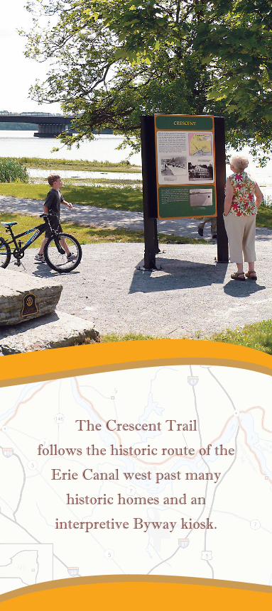
The Crescent Trail
follows the historic route of the
Erie Canal west past many
historic homes and an
interpretive Byway kiosk.
31
What to D
oM
ohawk Tow
path Byw
ayHiking
The Town of Halfmoon has a stone-dust surface trail from Route 9 west to the intersection of Canal and Beach Roads. The Crescent Trail follows the historic route of the Erie Canal west past many historic homes and an interpretive Byway kiosk.
In the Waterford area, few spots appeal more than the old Champlain Canal Towpath, a pleasant respite any time of day. This trail stretches from the Waterford Mu-seum north to Lock 2 on the present day Erie Canal. The towpath lies a block east of Route 32 and runs north from the Cohoes Bridge into the Village of Waterford.
The south end of the trail is accessible from a stairway just east of Museum Row at the Waterford Museum. An-other access is the small park at the foot of Fulton Street. Find the trail from the north end by walking along the south wall of Lock 2 from Waterford Harbor and follow it as it enters the woods along the watercourse. Distance is one mile. Allow extra time to inspect the remains of old Champlain Canal Lock 3 and watch a vessel navigate through Lock 2 on the current Erie Canal.
From Lock 2 Park in Waterford you can hike upstream along the north side of the fl ight of locks, along Flight Lock Road to Lock 6 Park. Follow a vessel as it locks through the sequence of locks either eastbound or west-bound. During the late fall, winter or early spring, this trek provides a unique insight into the construction and operation of the canal system, as the navigation locks are drained for the winter months. Access these trails from either end: Lock 2 Park on 4th Street and South Street or at Lock 6 Park at the end of Flight Lock Road in Waterford.
The best location to view the spectacular Cohoes Falls is at the fl ood plain below the falls. To get there, park at the visitor’s lot on the west side of North Mohawk Street. Cross the power canal bridge within Falls View Park to reach the stairway to the base of the falls. Lower parts of the trail may be closed depending on weather and fl ow over the falls.
The Spindle City Historical Society offers a self-guid-ed tour pamphlet and map of historic Cohoes Mills District, including canal remnants, mill architecture, the discovery of the Mastodon, and other signifi cant
historical features. Ask for the pamphlet at the visitor center on the first floor of the Cohoes Music Hall, or download the map from http://www.mohawktowpath.org/suggestions.html.
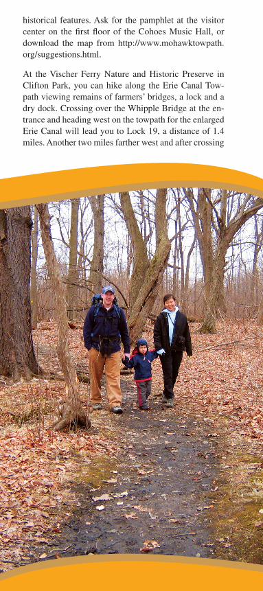
At the Vischer Ferry Nature and Historic Preserve in Clifton Park, you can hike along the Erie Canal Tow-path viewing remains of farmers’ bridges, a lock and a dry dock. Crossing over the Whipple Bridge at the en-trance and heading west on the towpath for the enlarged Erie Canal will lead you to Lock 19, a distance of 1.4 miles. Another two miles farther west and after crossing
33
What to D
oM
ohawk Tow
path Byw
ayFerry Drive, you will arrive at the Lock 7 Dam of the Barge Canal. The section of the towpath west of Ferry Drive can also be accessed from a parking area at the end of Ferry Drive or from the Lock 7 overlook at the end of Sugar Hill Road. The section of the trail between Ferry Drive and the overlook is about one mile.
The Trail east of the Preserve entrance on the north side of the Whipple Bridge leads along the 1825 Erie Canal towpath to Clute’s Dry Dock where canal boats were built and repaired. The Dry Dock is about 0.7 miles from the entrance.
Crossing over the Whipple Bridge and heading south along what remains of the old Public Bridge Road, one of the oldest roads in Clifton Park, brings you to the Mohawk River and the site of Fort’s Ferry, the Town’s first settlement, begun in 1672. The river is about one half mile from the Whipple Bridge.
The marsh areas of the Preserve provide many oppor-tunities to observe waterfowl, land-based bird popula-tions, amphibians, reptiles and other wildlife. This was an important agricultural area for Native Americans who referred to the area as “Canastigione.” Later Eu-ropean settlers farmed the area until much of the low-lying areas were flooded with the construction of the Crescent Dam in 1907.
The Vischer Ferry Preserve is accessible from the main entrance at the intersection of Riverview and Van Vran-ken Roads or at smaller parking areas at Clute’s Dry Dock and Ferry Drive. Be sure to obtain the free guide to the Preserve at the Clifton Park Town Hall.
A short hike from Island View Road (off of Dunsback Ferry Road) in Colonie will bring you to the top of a large face of shale cliff on the south side of the Mohawk River. This provides a unique view of the Northway’s Twin Bridges and the southernmost tip of land where the common border between Clifton Park and Half-moon meets the river. From this point you can see quite an expanse of the river.
Park to the side of Island View Road and walk up the Mohawk Hudson Bikeway slope, then west to where the power lines cross overhead. Leave the bikeway here and climb north along the power line right of way to the overlook.
35
What to D
oM
ohawk Tow
path Byw
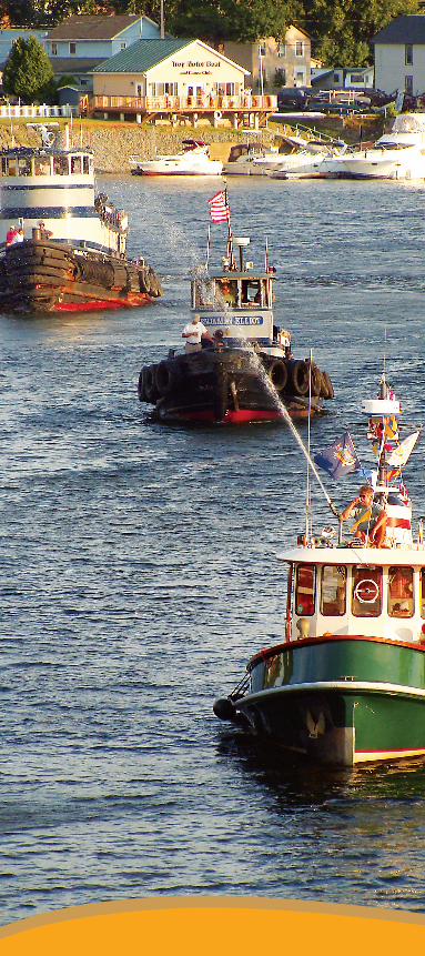
ayBoating
The present day Erie Canal is an interesting 20 mile chain of lakes formed by operating hydroelectric gener-ating facilities with connecting locks open to navigation from May 1 through November 15.
Besides canoeing, kayaking, and fishing mentioned above, activities include cruising and motorboating. Information on renting fully equipped canal cruis-ers or historic live-on canal boats is available from the New York State Canal Corporation. Just log onto www.nyscanals.gov/exvac/boatsforhire/. They are also a source for navigational maps, locking information, and other services along the Canal.
There are two locations on the Byway where you can tie up your vessel and explore. The most eastern is the Visitor Center on Waterford Harbor, where rest room, shower facilities and picnic tables are available. It’s a short walk to services right on Broad Street, reminiscent of a New England village Main Street. The second is the State Dock at Terminal Road in Halfmoon, located on the east side of Crescent Bridge alongside Route 9. A convenience store with rest rooms is located right across the road. There are several commercial mari-nas along this stretch of the Erie Canal. Some of these marinas are built around significant historic features, including the Schenectady Yacht Club in Rexford, the Crescent Boat Club, and Albany Marine on Route 9.
Recognizing that advanced planning is key to mak-ing the most of your travels along the canal, The Erie Canalway National Heritage Corridor offers these cruising tips:
Expect a leisurely pace as you travel. Distance in •miles can be misleading, since you must account
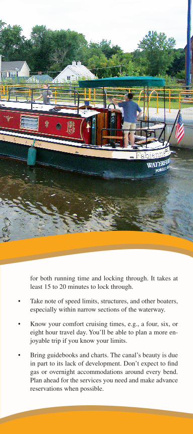
for both running time and locking through. It takes at least 15 to 20 minutes to lock through.
Take note of speed limits, structures, and other boaters, •especially within narrow sections of the waterway.
Know your comfort cruising times, e.g., a four, six, or •eight hour travel day. You’ll be able to plan a more en-joyable trip if you know your limits.
Bring guidebooks and charts. The canal’s beauty is due •in part to its lack of development. Don’t expect to fi nd gas or overnight accommodations around every bend. Plan ahead for the services you need and make advance reservations when possible.
37
What to D
oM
ohawk Tow
path Byw
ayFollow proper etiquette and rules for safe boating. •Stay within the canal speed limits and rules. Re-member: you are responsible for your wake along the entire canal.
Stop along the way. Small towns and friendly folks •characterize the Erie Canalway. Take time to dis-cover the region’s rich heritage, natural beauty, agricultural bounty, arts and culture, and unique shops and dining.
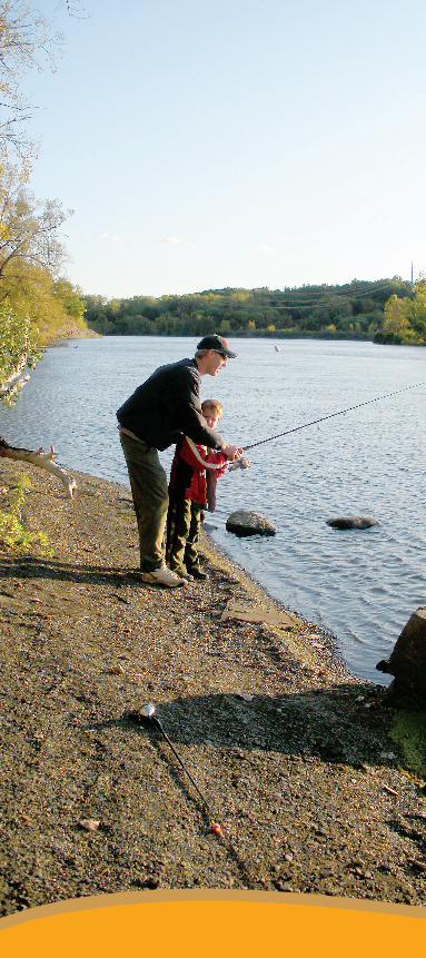
Fishing
No one who seriously fi shes will give up their secret spots or techniques, but any locals can tell you where they see successful fi shing. Many fi shermen seek out areas near dams and the Erie Canal system’s locks, where fi sh often congregate. Common catches include walleye, northern pike, small and large mouth bass, panfi sh, and blueback herring. There are quite a number of popular places along the Byway for fi shing.
In Schenectady there’s access at:
the bike trail that goes west from the parking lot be-•hind the Schenectady County Community College campus at State Street and Washington Avenue;
the historic bridge abutment at the foot of Ferry •Street in the Stockade; and
along the waterfront park just north of Ferry •Street.
In Niskayuna check out the Lions Park waterfront on the Aqueduct (south) end of the Rexford Bridge where Route 146 crosses the Mohawk.
In Clifton Park there is a new access to the river at Mo-hawk Landing off Riverview Road. There’s also a se-cluded area below the Lock 7 Dam just west of Vischer Ferry at the foot of Sugar Hill Road.
Halfmoon has a newly installed handicap fi shing ac-cess on Terminal Road. An access ramp is provided to a platform located under the Route 9 Crescent Bridge. There’s also access on Canal Road at the intersection with Clamsteam Road.
In Colonie there’s Freddie’s Park on the east side of Route 9 just south of the Crescent Bridge, but a more
39
What to D
oM
ohawk Tow
path Byw
aypopular access is just below the NYS Power Authority Power Plant on the Cohoes Crescent Road.
Some have good luck below the Cohoes Falls. There’s access to the water at an unpaved parking lot oppo-site the intersection of Mohawk Street and New Cort-land Street in Cohoes. Another fishing spot is recently opened at Falls View Park on North Mohawk Street.
Waterford has a secluded spot at the western end of Fight Lock Road where fishing is popular with plenty of parking. Fishing is great at the “Battery” just east of the Waterford Visitor Center and at a number of spots around Peebles Island State Park, but both of these ar-eas are “catch and release only.”
New York State requires everyone above the age of 16 to have a license to fish in New York’s fresh waters. For more detailed fishing regulations and information on fishing in New York, visit the Department of Envi-ronmental Conservation’s website at http://www.dec.ny.gov/outdoor/fishing.html. Fishing licenses can also be obtained at town halls along the Byway during regu-lar business hours.
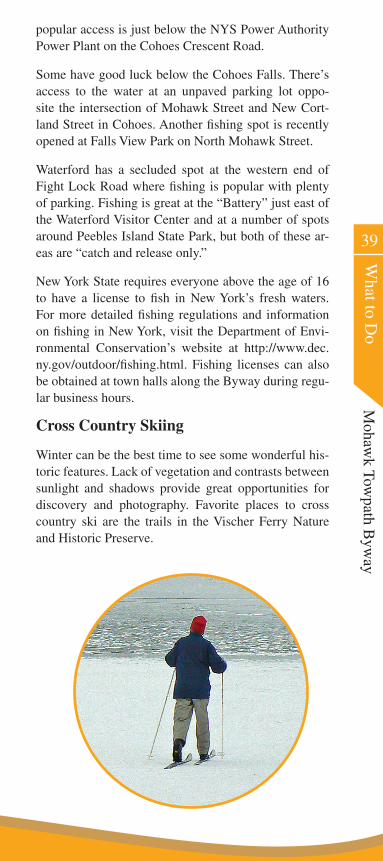
Cross Country Skiing
Winter can be the best time to see some wonderful his-toric features. Lack of vegetation and contrasts between sunlight and shadows provide great opportunities for discovery and photography. Favorite places to cross country ski are the trails in the Vischer Ferry Nature and Historic Preserve.
Ice Skating
Several nights of below zero temperatures with no snow cover provide an opportunity to skate on ponds and old Canal segments in the Vischer Ferry Preserve. There’s also skating further east on Wager’s Pond. Skate with a friend—not side by side—and recognize areas where ice may be thinner; areas near shore, where animal traf-fic and drainage ways enter, and where the winter sun shines all day. Remember, even in shallow canal waters a careless mishap without some assistance can turn into a life threatening situation.
Snow Shoeing
An ever-growing winter pastime is snow shoeing. Snow shoe construction has evolved from big and bulky to light and narrow, and all the hiking trails become acces-sible even after the deepest snow accumulations.
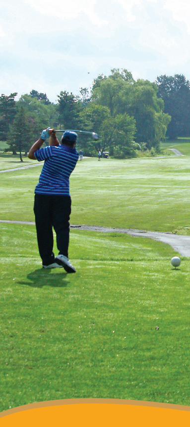
Golfing
Golf on the Byway is a great way to challenge yourself, get some exercise, experience the great outdoors, and enjoy the company of friends. Our Byway golf courses are well designed, incorporating natural features and the beauty of our surroundings.
The Mohawk River Country Club in Rexford has 18 holes, is somewhat flat, challenging and has elegant dining.
Visitors can play by invitation of a member at two pri-vate clubs. Van Schaick Island Country Club is a nine hole private club located on Continental Avenue in Co-hoes near a fork of the Mohawk River. The Edison Club at the intersection of Riverview Road and Route 146 is a private club. The 27 hole course is challenging and has many natural attributes as well as fine dining, ten-nis, and an Olympic size pool.
Schenectady Municipal is located a short drive from the Byway on Golf Road a block east of Route 7. It’s a challenging 18 hole course, open to the public, and has a historical background. Stadium Golf course is also a short drive from the western end of the Byway. The 18 hole course is challenging and has plenty of that natural feeling. Be active, go hiking, or play a round of golf, but enjoy the beauty of the outdoors.
41
What to D
oM
ohawk Tow
path Byw
ay
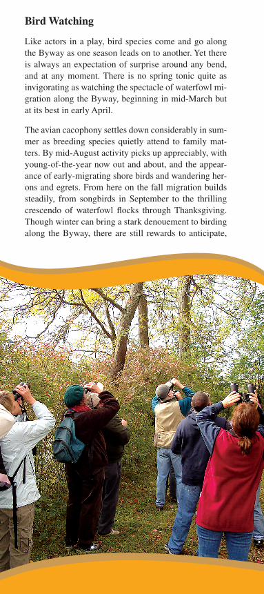
Bird Watching
Like actors in a play, bird species come and go along the Byway as one season leads on to another. Yet there is always an expectation of surprise around any bend, and at any moment. There is no spring tonic quite as invigorating as watching the spectacle of waterfowl mi-gration along the Byway, beginning in mid-March but at its best in early April.
The avian cacophony settles down considerably in sum-mer as breeding species quietly attend to family mat-ters. By mid-August activity picks up appreciably, with young-of-the-year now out and about, and the appear-ance of early-migrating shore birds and wandering her-ons and egrets. From here on the fall migration builds steadily, from songbirds in September to the thrilling crescendo of waterfowl flocks through Thanksgiving. Though winter can bring a stark denouement to birding along the Byway, there are still rewards to anticipate,
43
What to D
oM
ohawk Tow
path Byw
aysuch as gulls, mergansers and eagles. No matter what the season, the Byway always holds irresistible prom-ise, sure to enrich even the most casual visitor.
Vischer Ferry Nature and Historic Preserve has special designation by the National Audubon Society as an im-portant location to sight rare bird species.
Local Agriculture
Don’t forget to visit the farms along the Byway. Farms include apple orchards, dairy, produce, horse and sheep farms. Clifton Park supports local agriculture with ac-tivities for children and adults with a mid-September “Farm Fest.” Visit farms by appointment or shop at their stores and pick your own apples, strawberries and other fruits and berries. Many communities have farmers’ markets where you can buy fresh from the producer.
Cohoes Music Hall
James Masten, owner of the Cohoes Cataract, and mill owner William Acheson built the Cohoes Music Hall in 1874. One of three theatres in Cohoes, it seated 1000 people and housed the post office, library and, in 1880, the First National Bank of Cohoes. Nichols and Halcott of Albany designed the French Renaissance style build-ing, and Samuel Brooker of the Albany Opera House designed the ceiling. The stage curtain featured a scene on Lake Lugano, Italy, painted by Fred Stanfield.
Among the famous personalities who graced the Co-hoes Music Hall stage were Eva Tanguay, Buffalo Bill, George Jessel, Jimmy Durante, Al Jolson, Sophie Tucker and Harry Houdini. The theatre closed in 1901 and reopened after a complete restoration in 1974, one hundred years after its first opening.
Proctors Theatre, Schenectady
Designed by Thomas W. Lamb, “Master of the Golden Age of Movie Palaces,” Proctors Theatre opened in De-cember, 1926, as a vaudeville and movie theatre. It was owned by showman Frederick Proctor, who operated a number of theatres throughout the northeast. Design-er Lamb was best known for creating a dream world in a movie theatre, designing more than 300 of them throughout the world, and his classical designs became a symbol of the era, well represented by Proctors.

45
What to D
oM
ohawk Tow
path Byw
ayThe theatre’s arcade, connecting State and Smith Streets, housed 14 boutiques and 35 offices. In 1978 the 2700-seat theatre came within a hair’s breadth of the wreck-ing ball, facing the fate of other stately Schenectady palaces including the Plaza and State Theatres, but was rescued in the nick of time by concerned citizens who raised money to begin extensive preservation and res-toration efforts. Today Proctors Theatre is a surviving jewel of a grand era, hosting major Broadway produc-tions, concerts, films and diverse programming.
Waterford Historical Museum & Cultural Center
Located in the 1830 Hugh White Homestead, in 1964 this Greek Revival mansion was scheduled for demoli-tion. However, a group of citizens rallied to move the house from Saratoga Avenue to its present location overlooking the Mohawk River and the old Champlain Canal. The Museum features a permanent exhibit about Waterford history, temporary exhibitions related to lo-cal history, two Victorian period rooms, and the George and Annabel O’Connor Library for Local History.
Waterford Harbor Visitor Center
Moor your boat along the shores of historic Waterford, gateway to New York’s canals, boasting 1,000 feet of linear floating docks and 600 feet of available concrete wall. Visitor Center services include water, showers, electric, and pump-out. Merchandise, phone/computer service and information are also available.
Peebles Island State Park Visitors Center
The main powerhouse building at Peebles Island was built in 1910 and was originally part of the larger bleach-ery complex run by Troy-based shirt manufacturer Clu-ett, Peabody & Co. Unused for over 30 years, the pow-erhouse has been rehabilitated as a public visitor center and office space for State Parks and the Erie Canalway National Heritage Corridor. Exhibits highlight Peebles Island maritime and industrial history, New York’s fed-eral and state preservation programs, state historic sites and the heritage area systems. The history of the park spans Native American and colonial settlements, the Revolutionary War, barge and shipbuilding, and early 20th century textile manufacturing.
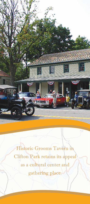
Historic Grooms Tavern in
Clifton Park retains its appeal
as a cultural center and
gathering place.
47
What to D
oM
ohawk Tow
path Byw
ayRiverspark Visitor Center, Cohoes
This visitor center is located inside the historic Cohoes Music Hall and features exhibits on the industrial his-tory of Cohoes, the Erie Canal and the history of the Music Hall. Tours of the Cohoes Music Hall feature a 15-minute audio program narrated by Paddy, the resi-dent ghost of the Music Hall. There is also a 20-minute audio-visual presentation, “A Day in the Life of Co-hoes: 1882.”
Historic Grooms Tavern, Clifton Park
Constructed in 1825, the same year the Erie Canal opened, this historic tavern was the site of Clifton Park’s fi rst town board meeting in April 1828. Clifton Park, the last town formed in Saratoga County, was sep-arated from the Town of Halfmoon that year. The tavern was later converted to a general store about 1880 and still retains its 19th century appearance, complete with original store counters and shelving.
The building now serves as a Historical and Cultural Center for the Town of Clifton Park, and features ex-hibits on the Erie Canal, agriculture and Clifton Park history. Contact the Town of Clifton Park about open hours.
Schenectady County Historical Society, Schenectady
Located in a Colonial Revival house in the historic Stockade district of Schenectady, the Schenectady County Historical Society is home to a vast collec-tion of paintings, furniture, and artifacts refl ecting Schenectady’s rich past.
Schenectady Museum & Suits-Bueche Planetarium
Celebrate science, invention, and imagination at this learning museum and planetarium. Explore interactive exhibits and experience the planetarium’s real-life view of the night sky. The Museum’s archives include 1.6 million images from the General Electric Photograph Collection. Tours are available, and the Gift Shop offers unusual gifts and educational toys.

Coho
es a
nd T
roy
Exit
7
Cre
scen
tEx
it 8
Hal
fmoo
nEx
it 8a
Erie Blvd
Aque
duct
Road
Riverview Road
Mohawk River
Mohawk River
Moh
awk
Rive
r
Canal Road
Hudson River
Chu
rch
Hill
Roa
d
Fonda RoadEr
ie C
anal
Scen
ic B
yway
Maxon Road
Ext.
Rive
rvie
w R
oad
Cohoes-Crescent Road N. Mohawk St.
Cla
m-
stea
m R
d. 9ROU
TE
4ROU
TE
32
ROU
TE
7ROU
TE
5ROU
TE
87
9ROU
TE
7ROU
TE
787
146
ROU
TE
4ROU
TE
32
ROU
TE
890
Vis
her
Fer
ry
Sto
ckad
e
Rex
ford
Aqueduct
Cre
scen
t
Wat
erfo
rd
1
2
4
3
5
6
8
7
View interactive map at http://mohawktowpath.org
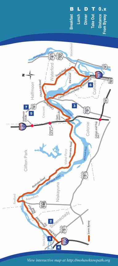
Where to Shop for conveniences
49
Where to Shop
Mohaw
k Towpath B
yway
Mobil Mart71 Broad St., Waterford.
1
Stewart’s Shops30 Saratoga Ave., Waterford, 235-8679.
2
Stewart’s Shops1403 Rt.9, Halfmoon, 371-9884.
4
Stewart’s Shops1033 Erie Blvd., Schenectady, 377-6951.
8
Stewart’s Shops923 Riverview Rd., Rexford, 399-2651.
7
Stewart’s ShopsMiddletown & Fonda Rds, Waterford, 235-2397.
3
Stewart’s Shops183 Guideboard Rd., Halfmoon, 348-0302.
5
Mobil MartGuideboard Rd. & Rte 236, Halfmoon.
6
ATM
ATM
ATM
ATM
ATM
ATM
ATM
ATM
Brea
kfas
tLu
nch
Dinn
erTa
ke O
utDi
stan
ceFr
om B
yway
B L D T 0.x
Coho
es a
nd T
roy
Exit
7
Cre
scen
tEx
it 8
Hal
fmoo
nEx
it 8a
Erie Blvd
Aque
duct
Road
Riverview Road
Mohawk River
Mohawk River
Moh
awk
Rive
r
Canal Road
Hudson River
Chu
rch
Hill
Roa
d
Fonda RoadEr
ie C
anal
Scen
ic B
yway
Maxon Road
Ext.
Rive
rvie
w R
oad
Cohoes-Crescent Road N. Mohawk St.
Cla
m-
stea
m R
d. 9ROU
TE
4ROU
TE
32
ROU
TE
7ROU
TE
5ROU
TE
87
9ROU
TE
7ROU
TE
787
146
ROU
TE
4ROU
TE
32
ROU
TE
890
Vis
her
Fer
ry
Sto
ckad
e
Rex
ford
Aqueduct
Cre
scen
t
Wat
erfo
rd
1
3
6
7
2
45
View interactive map at http://mohawktowpath.org
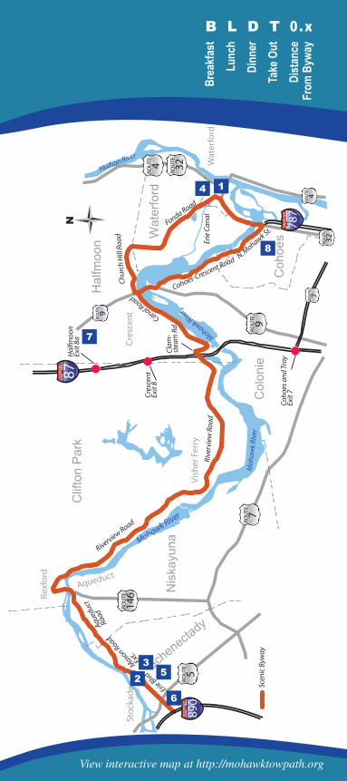
51
Where to D
ineM
ohawk Tow
path Byw
ay
Where to Dine or grab a bite
Ambition Cafe 154 Jay Street, Schenectady, 382-9277.Light fare, full bar, steps from Proctors.
L D T 0 . 2 m i
1
Bangkok Bistro 268 State Street, Schenectady.Thai cuisine, martini bar, 247-3048.
B L D T 0 . 1 m i
3
Burger King 323 Erie Blvd., Schenectady, 382-8254.Home of the Whopper.
B L D T 0 . 0 m i
6
Chez Daisie 183 Jay St, Schenectady, 344-7082.A taste of the French countryside. Fresh crepes, sandwiches and wraps. A local favorite.
L D T 0 . 2 m i
7
The Angry Penguin 41 Broad St, Waterford, 237-2829.
L D T 0 . 1 m i
2
Black Cat Ale House 25 White Street, Cohoes, 235-3199.Lunch and dinner.
L D 0 . 2 m i
4
Bread and Jam 130 Remsen Street, Cohoes, 326-2275.Coffee and light fare.
L D T 0 . 2 m i
5
Brea
kfas
tLu
nch
Dinn
erTa
ke O
utDi
stan
ceFr
om B
yway
B L D T 0.x
Coho
es a
nd T
roy
Exit
7
Cre
scen
tEx
it 8
Hal
fmoo
nEx
it 8a
Erie Blvd
Aque
duct
Road
Riverview Road
Mohawk River
Mohawk River
Moh
awk
Rive
r
Canal Road
Hudson River
Chu
rch
Hill
Roa
d
Fonda RoadEr
ie C
anal
Scen
ic B
yway
Maxon Road
Ext.
Rive
rvie
w R
oad
Cohoes-Crescent Road N. Mohawk St.
Cla
m-
stea
m R
d. 9ROU
TE
4ROU
TE
32
ROU
TE
7ROU
TE
5ROU
TE
87
9ROU
TE
7ROU
TE
787
146
ROU
TE
4ROU
TE
32
ROU
TE
890
Vis
her
Fer
ry
Sto
ckad
e
Rex
ford
Aqueduct
Cre
scen
t
Wat
erfo
rd
1
2
3
4
5
6
7
View interactive map at http://mohawktowpath.org

Inferno Pizzeria 222 Guideboard Rd., Halfmoon, 383-8080.Specialty pizzas, wings, Italian fare.
L D T 1 . 1 m i
7
Clinton’s Ditch Erie Blvd, Schenectady 346-8376.Lively crowds, pub food and drink specials, a popular gathering spot.
L D T 0 . 0 m i
1
53
Where to D
ineM
ohawk Tow
path Byw
ay
Where to Dine or grab a bite
Halfmoon Diner 231 Grooms Road (Rt.9), Halfmoon, 371-1177. Classic dinner menu.
B L D T 1 . 0 m i
5
Hometowne Pizzeria 150 Remsen Street, Cohoes, 235-2600.Lunch and dinner, Italian fare.
L D T 1 . 1 m i
6
Glen Sanders Mansion 1 Glen Ave. Scotia, NY 12302, 374-7262.One of the nation’s oldest structures is home to this fine dining restaurant.
D 1 . 0 m i
4
Dom’s Pizza, Subs & Wings 1099 Loudon Rd (Rt.9), Cohoes, 783-0722.Premium pizza, subs and wings, calzones.
L D T 2 . 9 m i
3
Cornell’s Restaurant 39-45 N. Jay St, Schenectady 370-3825.A Schenectady landmark since 1943, offering distinctive Italian cuisine.
L D T 0 . 2 m i
2
Brea
kfas
tLu
nch
Dinn
erTa
ke O
utDi
stan
ceFr
om B
yway
B L D T 0.x
Coho
es a
nd T
roy
Exit
7
Cre
scen
tEx
it 8
Hal
fmoo
nEx
it 8a
Erie Blvd
Aque
duct
Road
Riverview Road
Mohawk River
Mohawk River
Moh
awk
Rive
r
Canal Road
Hudson River
Chu
rch
Hill
Roa
d
Fonda RoadEr
ie C
anal
Scen
ic B
yway
Maxon Road
Ext.
Rive
rvie
w R
oad
Cohoes-Crescent Road N. Mohawk St.
Cla
m-
stea
m R
d. 9ROU
TE
4ROU
TE
32
ROU
TE
7ROU
TE
5ROU
TE
87
9ROU
TE
7ROU
TE
787
146
ROU
TE
4ROU
TE
32
ROU
TE
890
Vis
her
Fer
ry
Sto
ckad
e
Rex
ford
Aqueduct
Cre
scen
t
Wat
erfo
rd
1
2
5
6
3
4
7
8
View interactive map at http://mohawktowpath.org
Jumpin’ Jack’s Drive-In Schonowee Ave (at Rt.5), Scotia, 393-6101.Landmark fast food drive-in, on the river.
L D T 1 . 0 m i
155
Where to D
ineM
ohawk Tow
path Byw
ay
Where to Dine or grab a bite
Klamsteam Tavern 32 Clamsteam Rd., Halfmoon, 373-9409.An old road house on the Mohawk River.
L D T 0 . 0 m i
3
McDonald’s 42-44 Saratoga Ave, Waterford, 235-7321.
B L D T 0 . 0 m i
7
Lisa D’s Luncheonette 133 Remsen Street, Cohoes, 687-0606.
B L D T 0 . 0 m i
4
Mickey D’s 50 Oneida Street, Cohoes, 590-0168.
B L D T 0 . 0 m i
8
Katie O’Byrnes Erie Blvd, Schenectady, 395-5949.Irish-style pub dining in the heart of downtown.
L D T 0 . 1 m i
2
Lyle’s Hoagies 140 Erie Blvd, Schenectady, 372-3171.If you like hoagies, this is the real deal.
L D T 0 . 1 m i
5
Mari’s Japanese Cuisine 2049 VanVranken Ave., Schenectady, 381-4881.
L D T 1 . 0 m i
6
Brea
kfas
tLu
nch
Dinn
erTa
ke O
utDi
stan
ceFr
om B
yway
B L D T 0.x
Coho
es a
nd T
roy
Exit
7
Cre
scen
tEx
it 8
Hal
fmoo
nEx
it 8a
Erie Blvd
Aque
duct
Road
Riverview Road
Mohawk River
Mohawk River
Moh
awk
Rive
r
Canal Road
Hudson River
Chu
rch
Hill
Roa
d
Fonda RoadEr
ie C
anal
Scen
ic B
yway
Maxon Road
Ext.
Rive
rvie
w R
oad
Cohoes-Crescent Road N. Mohawk St.
Cla
m-
stea
m R
d. 9ROU
TE
4ROU
TE
32
ROU
TE
7ROU
TE
5ROU
TE
87
9ROU
TE
7ROU
TE
787
146
ROU
TE
4ROU
TE
32
ROU
TE
890
Vis
her
Fer
ry
Sto
ckad
e
Rex
ford
Aqueduct
Cre
scen
t
Wat
erfo
rd
1
23
4
5
6
7
8
View interactive map at http://mohawktowpath.org
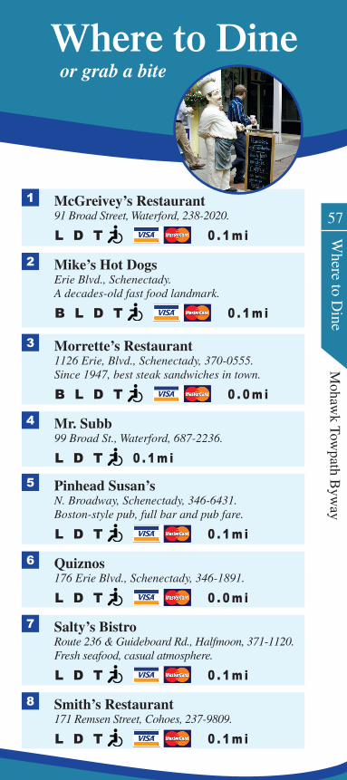
McGreivey’s Restaurant 91 Broad Street, Waterford, 238-2020.
L D T 0 . 1 m i
1
57
Where to D
ineM
ohawk Tow
path Byw
ay
Where to Dine or grab a bite
Mr. Subb 99 Broad St., Waterford, 687-2236.
L D T 0 . 1 m i
4
Salty’s Bistro Route 236 & Guideboard Rd., Halfmoon, 371-1120.Fresh seafood, casual atmosphere.
L D T 0 . 1 m i
7
Smith’s Restaurant 171 Remsen Street, Cohoes, 237-9809.
L D T 0 . 1 m i
8
Mike’s Hot Dogs Erie Blvd., Schenectady.A decades-old fast food landmark.
B L D T 0 . 1 m i
2
Morrette’s Restaurant 1126 Erie, Blvd., Schenectady, 370-0555.Since 1947, best steak sandwiches in town.
B L D T 0 . 0 m i
3
Pinhead Susan’s N. Broadway, Schenectady, 346-6431.Boston-style pub, full bar and pub fare.
L D T 0 . 1 m i
5
Quiznos 176 Erie Blvd., Schenectady, 346-1891.
L D T 0 . 0 m i
6
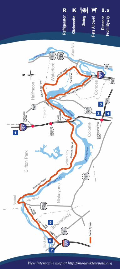
Key
Refri
gera
tor
Kitc
hene
tte
Dini
ng
Pets
Allo
wed
Dist
ance
From
Byw
ay
R K 0 .x
Coho
es a
nd T
roy
Exit
7
Cre
scen
tEx
it 8
Hal
fmoo
nEx
it 8a
Erie Blvd
Aque
duct
Road
Riverview Road
Mohawk River
Mohawk River
Moh
awk
Rive
r
Canal Road
Hudson River
Chu
rch
Hill
Roa
d
Fonda RoadEr
ie C
anal
Scen
ic B
yway
Maxon Road
Ext.
Rive
rvie
w R
oad
Cohoes-Crescent Road N. Mohawk St.
Cla
m-
stea
m R
d. 9ROU
TE
4ROU
TE
32
ROU
TE
7ROU
TE
5ROU
TE
87
9ROU
TE
7ROU
TE
787
146
ROU
TE
4ROU
TE
32
ROU
TE
890
Vis
her
Fer
ry
Sto
ckad
e
Rex
ford
Aqueduct
Cre
scen
t
Wat
erfo
rd
1
2
3
4
5
6
7
View interactive map at http://mohawktowpath.org
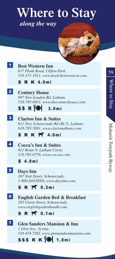
Best Western Inn 617 Plank Road, Clifton Park.518-371-1811, www.book.bestwestern.com.
$ R K 4 . 0 m i
1
59
Where to Stay
Mohaw
k Towpath B
yway
Century House 997 New Loudon Rd, Latham.518-785-0931, www.thecenturyhouse.com.
$ $ R 3 . 0 m i
2
Clarion Inn & Suites 611 Troy Schenectady Rd (Rt.7), Latham.618-785-5891, www.clarionalbany.com.
$ R K 4 . 0 m i
3
Cocca’s Inn & Suites 831 Route 9, Latham Circle.518-785-0776, www.coccas.com.
$ 4 . 0 m i
4
Days Inn 167 Nott Street, Schenectady.1-800-DAYSINN, www.daysinn.com.
$ R 0 . 3 m i
5
English Garden Bed & Breakfast 205 Union Street, Schenectady.www.englishgardenbandb.com.
$ R 0 . 1 m i
6
Glen Sanders Mansion & Inn 1 Glen Ave., Scotia.518-474-7262, www.glensandersmansion.com.
$ $ $ R K 1 . 0 m i
7
Where to Stay along the way
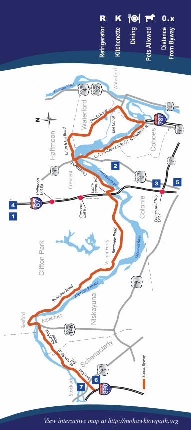
Key
Coho
es a
nd T
roy
Exit
7
Cre
scen
tEx
it 8
Hal
fmoo
nEx
it 8a
Erie Blvd
Aque
duct
Road
Riverview Road
Mohawk River
Mohawk River
Moh
awk
Rive
r
Canal Road
Hudson River
Chu
rch
Hill
Roa
d
Fonda RoadEr
ie C
anal
Scen
ic B
yway
Maxon Road
Ext.
Rive
rvie
w R
oad
Cohoes-Crescent Road N. Mohawk St.
Cla
m-
stea
m R
d. 9ROU
TE
4ROU
TE
32
ROU
TE
7ROU
TE
5ROU
TE
87
9ROU
TE
7ROU
TE
787
146
ROU
TE
4ROU
TE
32
ROU
TE
890
Vis
her
Fer
ry
Sto
ckad
e
Rex
ford
Aqueduct
Cre
scen
t
Wat
erfo
rd
1
2
3
4
5
67
Refri
gera
tor
Kitc
hene
tte
Dini
ng
Pets
Allo
wed
Dist
ance
From
Byw
ay
R K 0 .x
View interactive map at http://mohawktowpath.org
61
Where to Stay
Mohaw
k Towpath B
yway
Hampton Inn 620 Plank Road, Clifton Park.518-373-2345, www.hamptoninn.com.
$ $ R K 3 . 8 m i
1
Hampton Inn 400 Old Loudon Rd, Cohoes.518-785-0000, www.hamptoninn.com.
$ $ R K 3 . 3 m i
2
Holiday Inn Express 946 New Loudon Rd., Latham.518-783-6161, www.hiexpress.com.
$ $ R K 3 . 5 m i
3
Parker Inn 434 State Street, Schenectady.518-630-4020, www.parkerinn.com.
$ $ $ R 0 . 1 m i
6
Stockade Inn 1 N. Church St. Schenectady.518-346-4300, www.stockadeinn.com.
$ $ $ 0 . 2 m i
7
Where to Stay along the way
Holiday Inn Express 18 Clifton Park Village Rd., Clifton Park.800-315-2621, www.hiexpress.com.
$ $ R K 3 . 8 m i
4
La Quinta 833 New Loudon Road, Latham.518-640-2200, www.lq.com.
$ $ R 4 . 0 m i
5
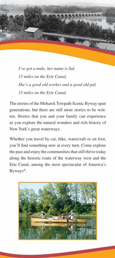
I’ve got a mule, her name is Sal,
15 miles on the Erie Canal,
She’s a good old worker and a good old pal,
15 miles on the Erie Canal.
The stories of the Mohawk Towpath Scenic Byway span
generations, but there are still more stories to be writ-
ten. Stories that you and your family can experience
as you explore the natural wonders and rich history of
New York’s great waterways.
Whether you travel by car, bike, watercraft or on foot,
you’ll find something new at every turn. Come explore
the past and enjoy the communities that still thrive today
along the historic route of the waterway west and the
Erie Canal, among the most spectacular of America’s
Byways®.
Discover the Scenic Byway for Yourself
Acknowledgements
This Guidebook is published by the Mohawk Towpath Scenic Byway Coalition, Inc., a not for profit 501(c)(3) corporation formed by representatives of each of the municipalities through which the Mohawk Towpath Byway passes. The Coalition’s purpose is to implement the Corridor Management Plan that was developed as the Byway gained status of one of a number of New York State Scenic Byways in July 2003, and one of America’s Byways® in September 2005. The Coalition would like to thank those involved in the preparation of this guide by providing text and/or photos, including Maureen Gebert, Eric Hamilton, John Scherer, Henriet-ta O’Grady, Larry Syzdek, Raj Malhotra, Ed Tremblay, Brad Utter, Rodney Priddle Sr., Edward Brown, Judy Brown Cox, Sheila DeMola, Nelson Ronsvalle, Amy Facca and other Byway volunteers.
Funding
This project was funded by a grant to the New York State Scenic Byways Program, at the New York State Depart-ment of Transportation, through the Federal Highway Administration and the Transportation Equity Act for the 21st Century of 1998. Additional funding was pro-vided by the Bender Foundation; and by the eight local municipalities along the Byway, including the Cities of Cohoes and Schenectady, the Towns of Clifton Park, Colonie, Halfmoon, Niskayuna, and Waterford, and the Village of Waterford.
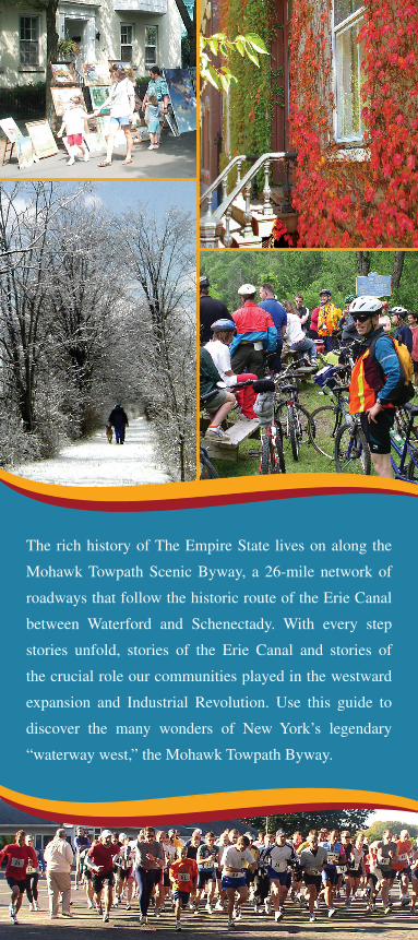
The rich history of The Empire State lives on along the
Mohawk Towpath Scenic Byway, a 26-mile network of
roadways that follow the historic route of the Erie Canal
between Waterford and Schenectady. With every step
stories unfold, stories of the Erie Canal and stories of
the crucial role our communities played in the westward
expansion and Industrial Revolution. Use this guide to
discover the many wonders of New York’s legendary
“waterway west,” the Mohawk Towpath Byway.


