Processing a combined network of single- and dual-frequency GPS data with GAMIT/GLOBK at Soufrière Hills Volcano, Montserrat (West Indies) Karen Pascal (1,2) , Kirill Palamartchouk (3 ) (1) Montserrat Volcano Observatory, Montserrat, West Indies (2) Seismic Research Centre, University of West Indies, Trinidad & Tobago (3) School of Civil Engineering and Geosciences, Newcastle University, United Kingdom
Transcript
Processing a combined network of single- and dual-frequency GPS data with GAMIT/GLOBK at Soufrière Hills Volcano, Montserrat (West Indies)
Karen Pascal (1,2), Kirill Palamartchouk (3)
(1) Montserrat Volcano Observatory, Montserrat, West Indies
(2) Seismic Research Centre, University of West Indies, Trinidad & Tobago
(3) School of Civil Engineering and Geosciences, Newcastle University, United Kingdom
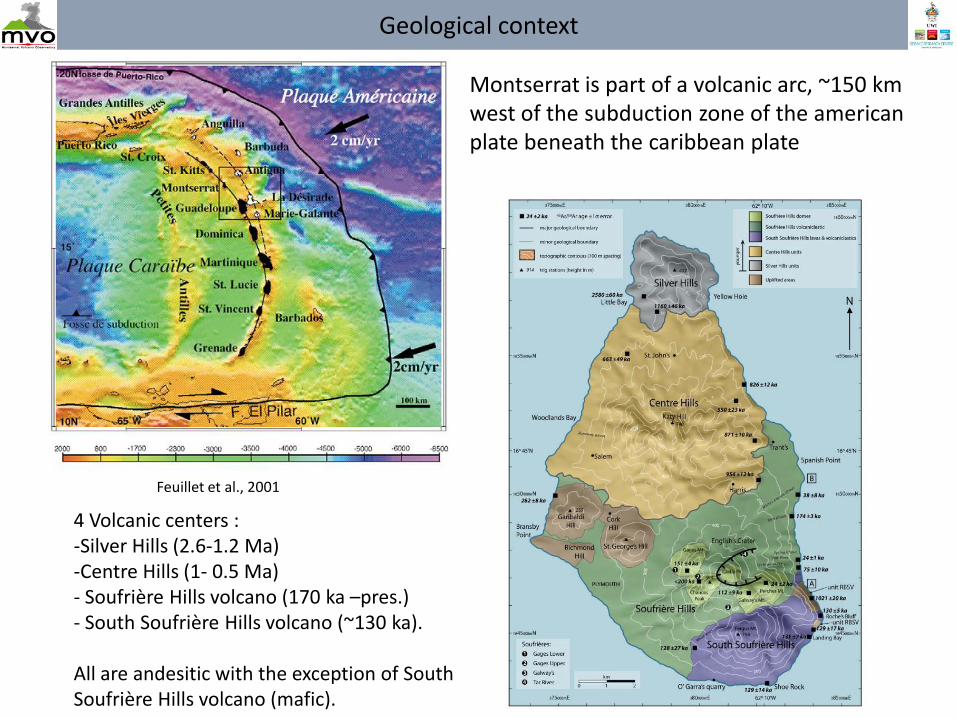
All are andesitic with the exception of South Soufrière Hills volcano (mafic).
Montserrat is part of a volcanic arc, ~150 km west of the subduction zone of the american plate beneath the caribbean plate
Geological context
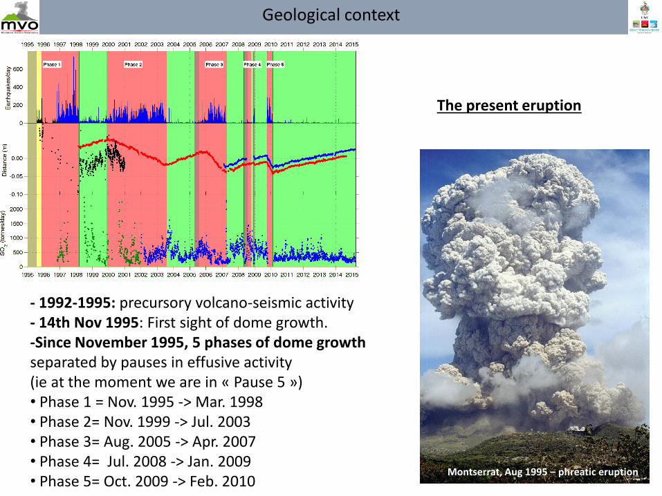
- 1992-1995: precursory volcano-seismic activity - 14th Nov 1995: First sight of dome growth. -Since November 1995, 5 phases of dome growth separated by pauses in effusive activity (ie at the moment we are in « Pause 5 ») • Phase 1 = Nov. 1995 -> Mar. 1998 • Phase 2= Nov. 1999 -> Jul. 2003 • Phase 3= Aug. 2005 -> Apr. 2007 • Phase 4= Jul. 2008 -> Jan. 2009 • Phase 5= Oct. 2009 -> Feb. 2010
Montserrat, Aug 1995 – phreatic eruption
The present eruption
Geological context
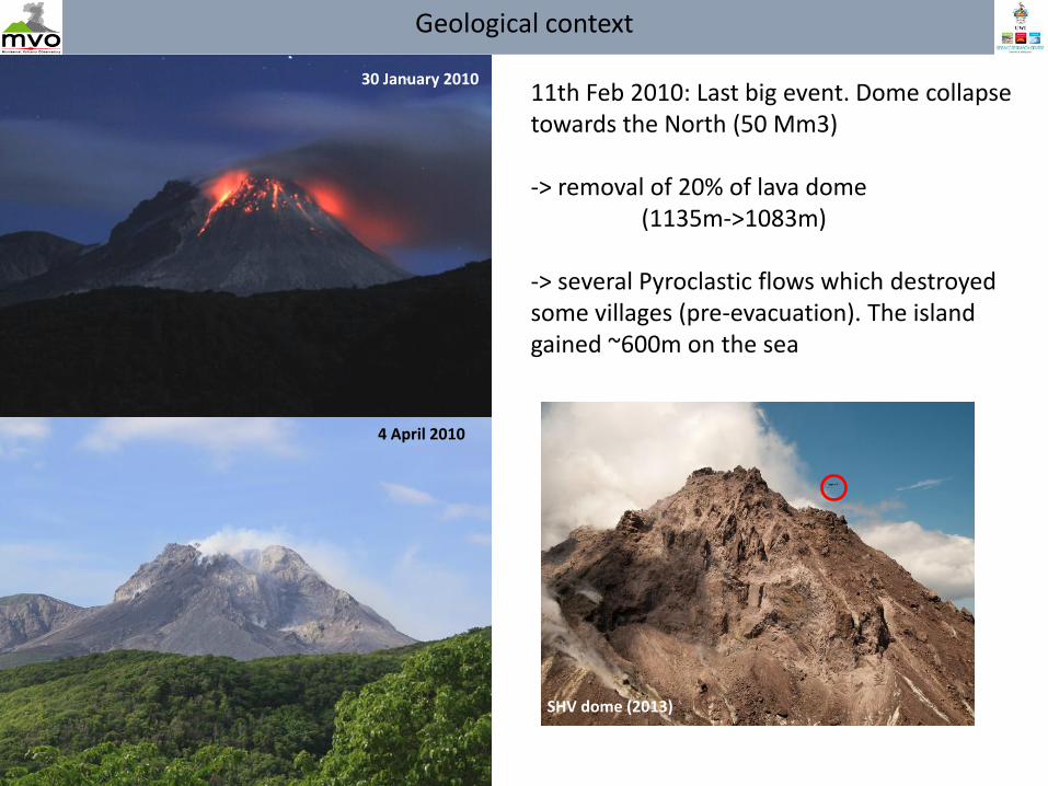
11th Feb 2010: Last big event. Dome collapse towards the North (50 Mm3) -> removal of 20% of lava dome (1135m->1083m) -> several Pyroclastic flows which destroyed some villages (pre-evacuation). The island gained ~600m on the sea
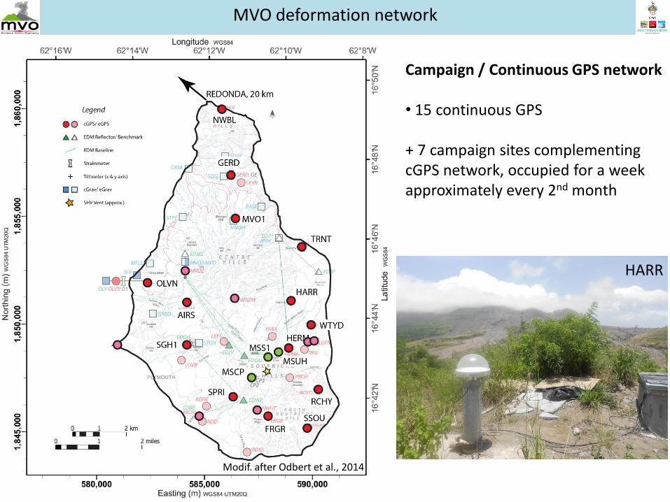
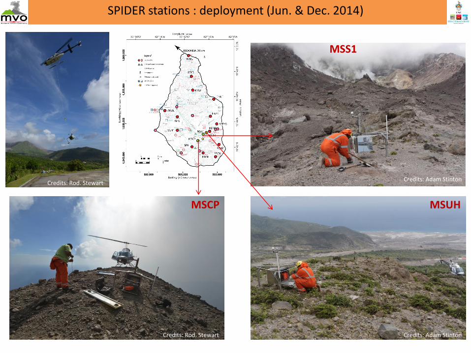
+ 7 campaign sites complementing cGPS network, occupied for a week approximately every 2nd month
Modif. after Odbert et al., 2014
Spider, 2014
HARR
MVO deformation network
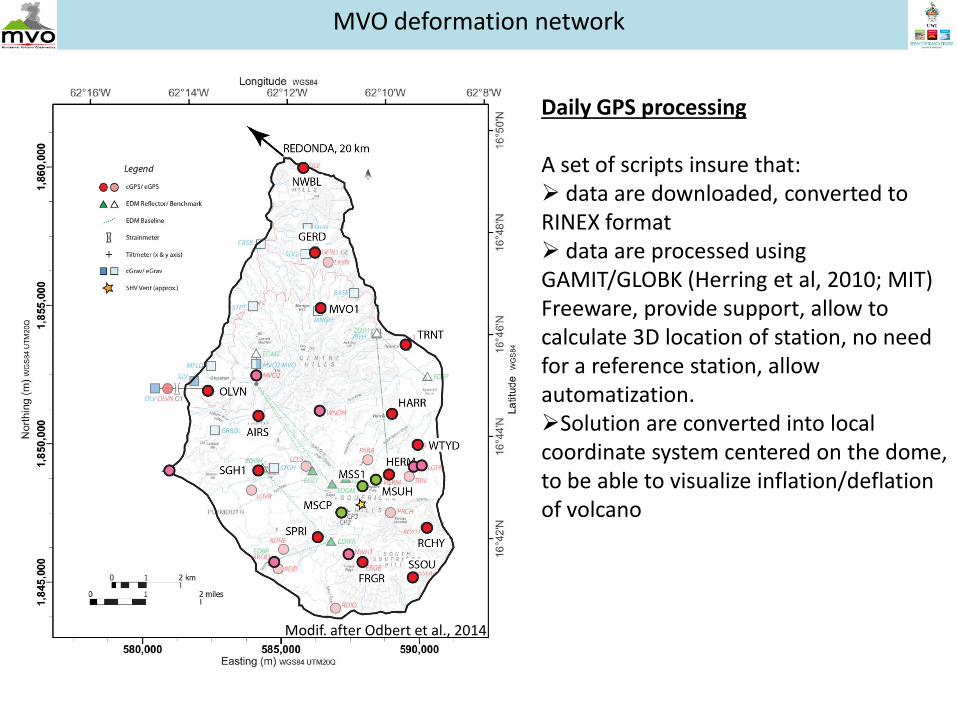
Daily GPS processing A set of scripts insure that: data are downloaded, converted to RINEX format data are processed using GAMIT/GLOBK (Herring et al, 2010; MIT) Freeware, provide support, allow to calculate 3D location of station, no need for a reference station, allow automatization. Solution are converted into local coordinate system centered on the dome, to be able to visualize inflation/deflation of volcano
Modif. after Odbert et al., 2014
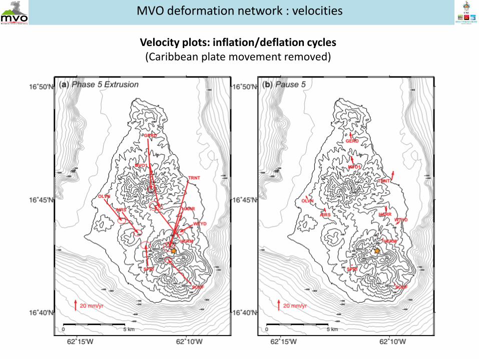
MVO deformation network : velocities
Velocity plots: inflation/deflation cycles (Caribbean plate movement removed)
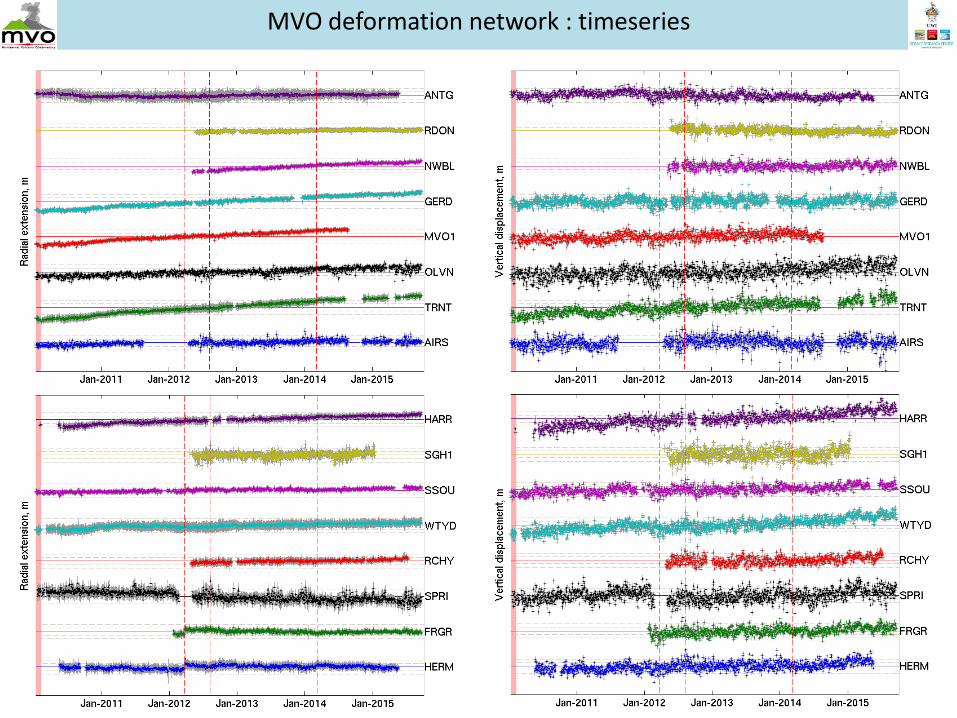
MVO deformation network : timeseries
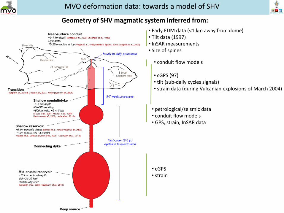
MVO deformation data: towards a model of SHV
• Early EDM data (<1 km away from dome) • Tilt data (1997) • InSAR measurements • Size of spines
Geometry of SHV magmatic system inferred from:
• conduit flow models • cGPS (97) • tilt (sub-daily cycles signals) • strain data (during Vulcanian explosions of March 2004)
• petrological/seismic data • conduit flow models • GPS, strain, InSAR data
• cGPS • strain
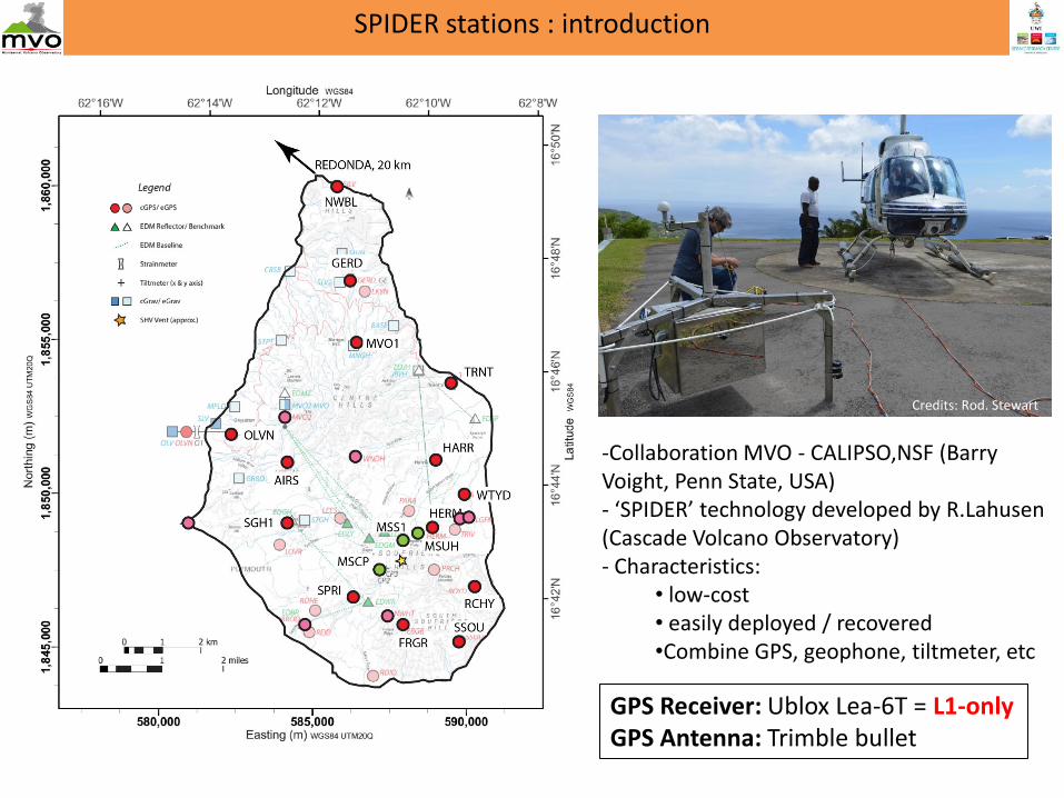
SPIDER stations : introduction
Credits: Rod. Stewart
-Collaboration MVO - CALIPSO,NSF (Barry Voight, Penn State, USA) - ‘SPIDER’ technology developed by R.Lahusen (Cascade Volcano Observatory) - Characteristics:
-Collaboration MVO - CALIPSO,NSF (Barry Voight, Penn State, USA) - ‘SPIDER’ technology developed by R.Lahusen (Cascade Volcano Observatory) - Characteristics:
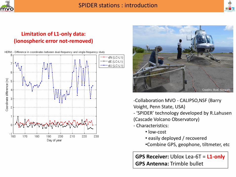
Limitation of L1-only data: (ionospheric error not-removed)
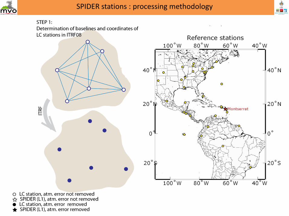
SPIDER stations : processing methodology
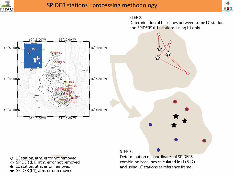
SPIDER stations : processing methodology
SPIDER stations : processing methodology
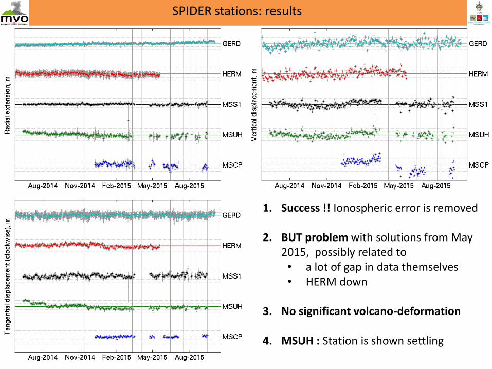
SPIDER stations: results
1. Success !! Ionospheric error is removed
2. BUT problem with solutions from May 2015, possibly related to • a lot of gap in data themselves • HERM down
3. No significant volcano-deformation
4. MSUH : Station is shown settling
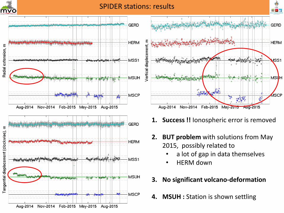
SPIDER stations: results
1. Success !! Ionospheric error is removed
2. BUT problem with solutions from May 2015, possibly related to • a lot of gap in data themselves • HERM down
3. No significant volcano-deformation
4. MSUH : Station is shown settling
• Various geophysical methods (eg: deformation, seismics, gas, gravimetry) gave valuable insights in the magmatic system geometry of Soufrière Hills Volcano
• Because they can be installed close to the dome, SPIDER stations could help with:
– Understanding geometry of uppert part of magmatic system
– Study of the hydrothermal system
– Monitoring / eruption forecasting
• This work presents a method to integrate CHEAP (L1-only) receivers within a dual-frequency network, and gives encouraging results: the ionospheric error is removed
• However the processing still need to be refined, particularly improving the reference network, eg. to avoid relying heavily on one station.