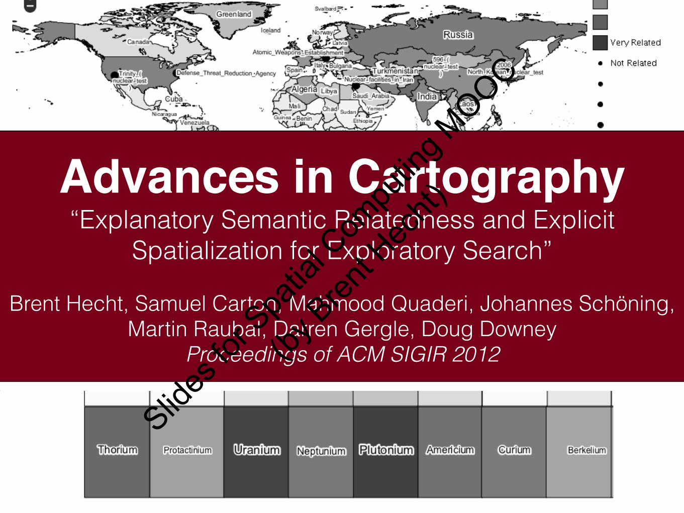
Advances in Cartography “Explanatory Semantic Relatedness and Explicit Spatialization for Exploratory Search” Brent Hecht, Samuel Carton, Mahmood Quaderi, Johannes Schöning, Martin Raubal, Darren Gergle, Doug Downey Proceedings of ACM SIGIR 2012 Slides for Spatial Computing MOOC (by Brent Hecht)
Transcript
Advances in Cartography“Explanatory Semantic Relatedness and Explicit
Spatialization for Exploratory Search”
Brent Hecht, Samuel Carton, Mahmood Quaderi, Johannes Schöning, Martin Raubal, Darren Gergle, Doug Downey
Proceedings of ACM SIGIR 2012
Slides
for S
patia
l Com
putin
g MOOC
(by B
rent H
echt)
SpatialComputing
Slides
for S
patia
l Com
putin
g MOOC
(by B
rent H
echt)
Douglas Downey
Darren Gergle Brent Hecht
Johannes Schöning
Mahmood Quaderi
Martin RaubalSamuel Carton
Computer Science Geographic InformationScience
Slides
for S
patia
l Com
putin
g MOOC
(by B
rent H
echt)
Slides
for S
patia
l Com
putin
g MOOC
(by B
rent H
echt)
Slides
for S
patia
l Com
putin
g MOOC
(by B
rent H
echt)
Slides
for S
patia
l Com
putin
g MOOC
(by B
rent H
echt)
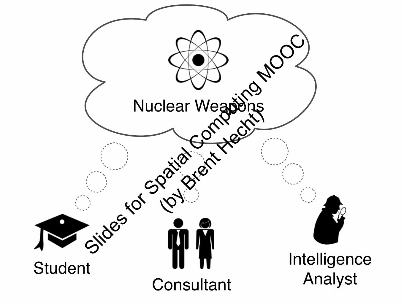
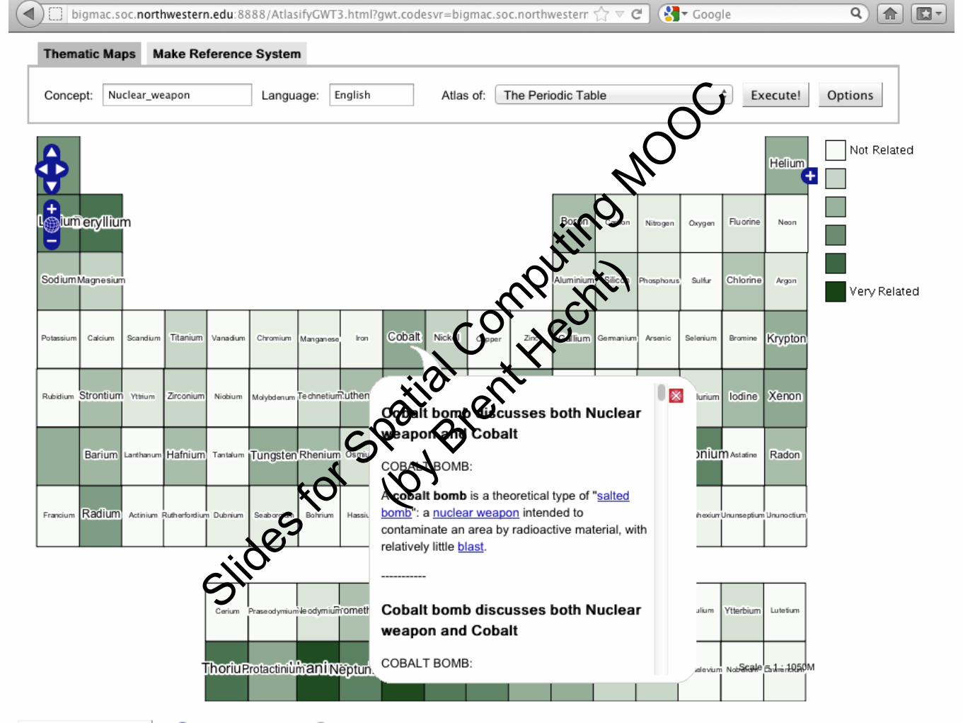
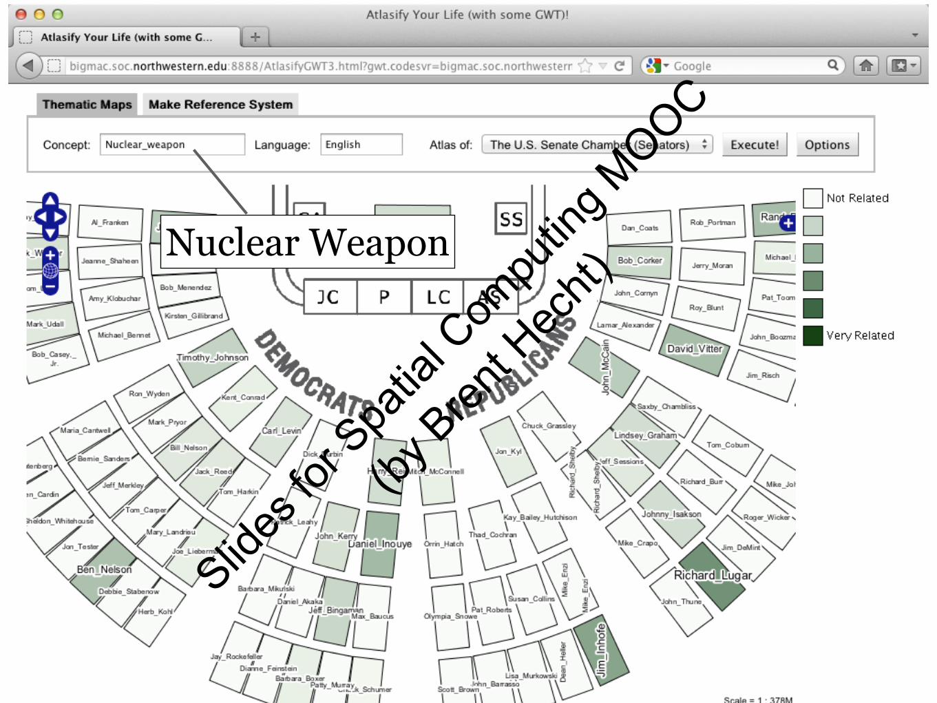
Student
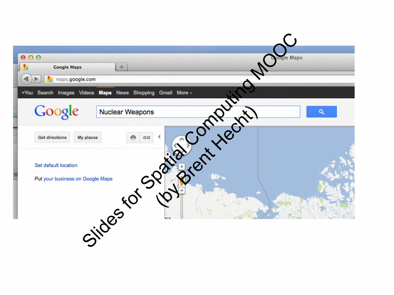
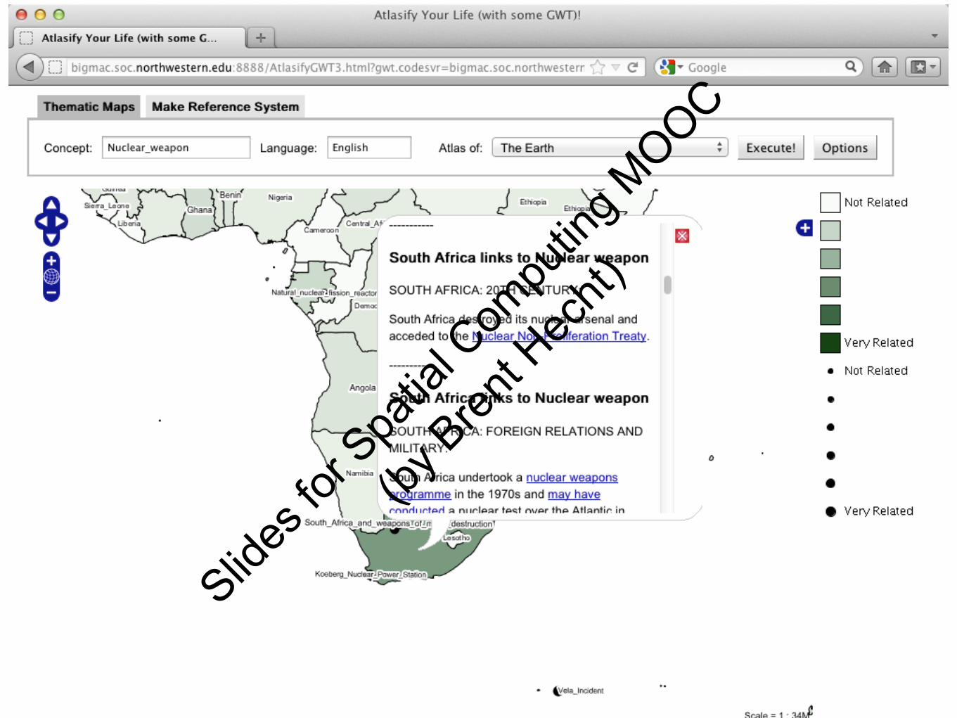
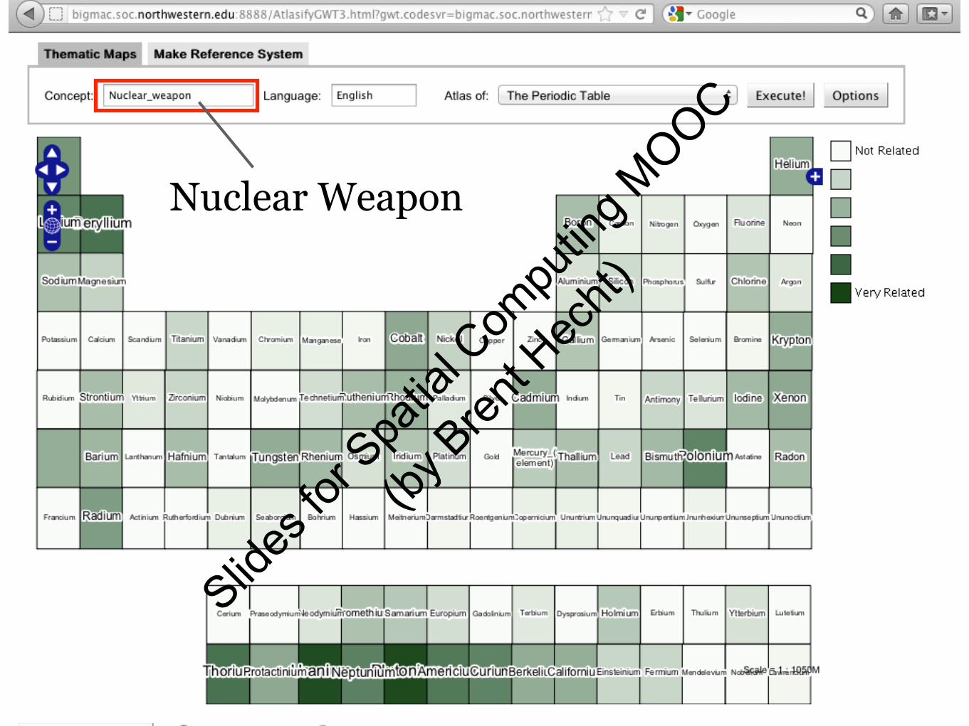
Nuclear Weapons
ConsultantIntelligence
AnalystSlid
es fo
r Spa
tial C
ompu
ting M
OOC
(by B
rent H
echt)
Slides
for S
patia
l Com
putin
g MOOC
(by B
rent H
echt)
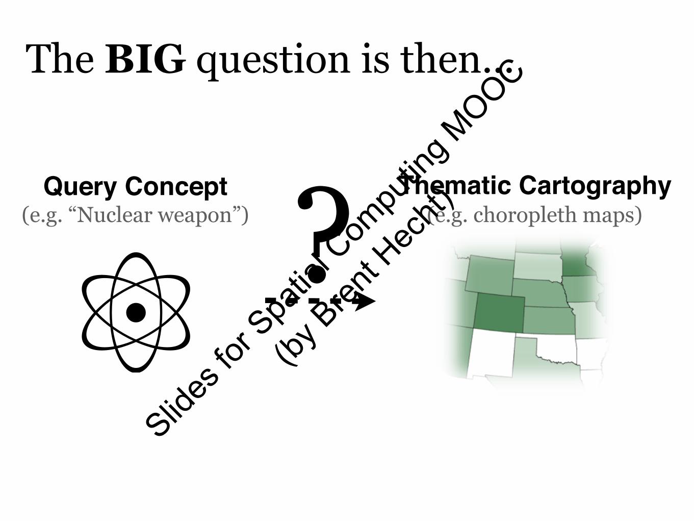
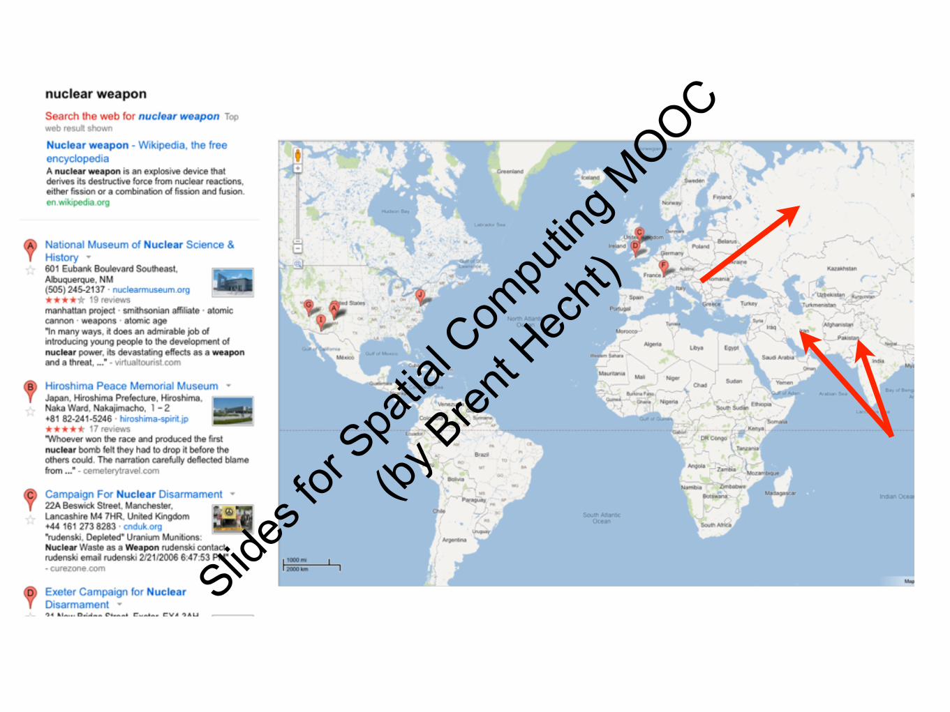
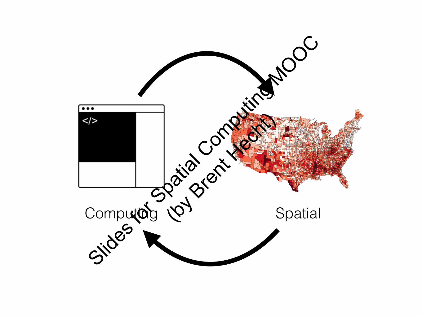
Exploratory Search
e.g. “Nuclear weapons”
Closed Information Requests
e.g. “Mayor of Minneapolis, MN”
???
[White and Roth 2009]
Navigational Queries
e.g. “spatial computing mooc”
Slides
for S
patia
l Com
putin
g MOOC
(by B
rent H
echt)
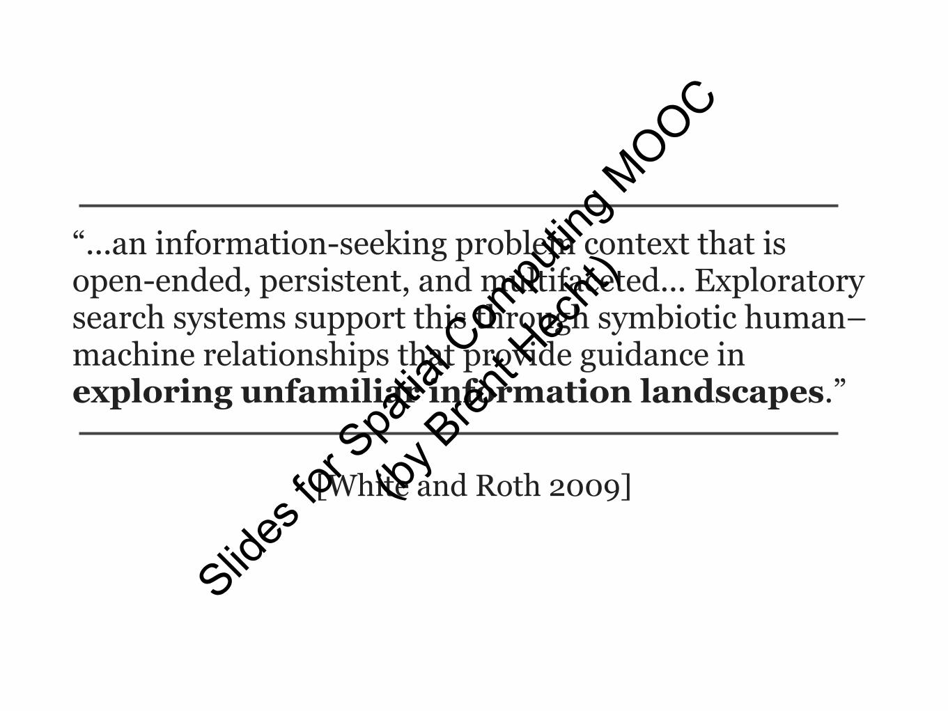
“...an information-seeking problem context that is open-ended, persistent, and multifaceted... Exploratory search systems support this through symbiotic human–machine relationships that provide guidance in exploring unfamiliar information landscapes.”
Advances in Cartography“Explanatory Semantic Relatedness and Explicit
Spatialization for Exploratory Search”
AttributionsBy Base map: BART Bart-logo.svg:ChrisRuvolo at en.wikipedia 20_airtransportation.svg: AIGA symbol sign collection derivative work: Train2104 [CC-BY-SA-3.0 (http://creativecommons.org/licenses/by-sa/3.0)], from
Wikimedia Commons
"Cell tower in jovel chiapas" by Leogeograph - Own work. Licensed under Creative Commons Attribution-Share Alike 3.0 via Wikimedia Commons - https://commons.wikimedia.org/wiki/
Location-based advertising using subway positioning:
Exit at the next stop for a free slice
of pizza!
Slides
for S
patia
l Com
putin
g MOOC
(by B
rent H
echt)
Subways
GNSS Wifi CellSubwayPS
Slides
for S
patia
l Com
putin
g MOOC
(by B
rent H
echt)
Sensors Internet Smartphone
$€¥£
Wifi Cell
Slides
for S
patia
l Com
putin
g MOOC
(by B
rent H
echt)
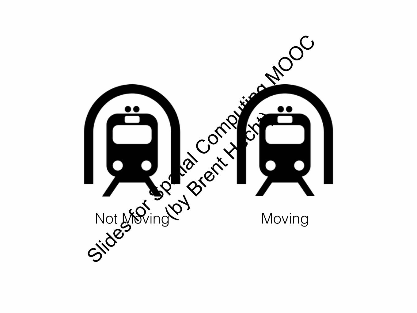
Not Moving Moving
Slides
for S
patia
l Com
putin
g MOOC
(by B
rent H
echt)
Slides
for S
patia
l Com
putin
g MOOC
(by B
rent H
echt)
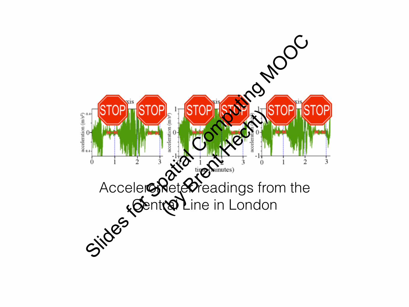
Accelerometer readings from the Central Line in London
Slides
for S
patia
l Com
putin
g MOOC
(by B
rent H
echt)
Accelerometer readings from the Central Line in London
Slides
for S
patia
l Com
putin
g MOOC
(by B
rent H
echt)
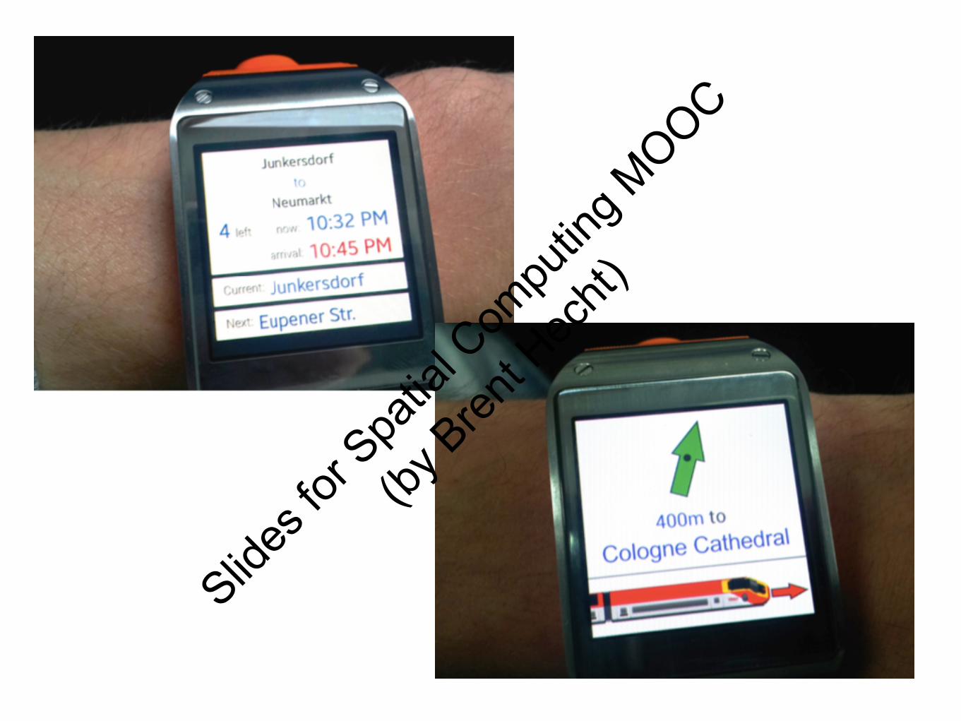
Stop Detection Official Timetable
Smartphone Positionalong a subway line
Slides
for S
patia
l Com
putin
g MOOC
(by B
rent H
echt)
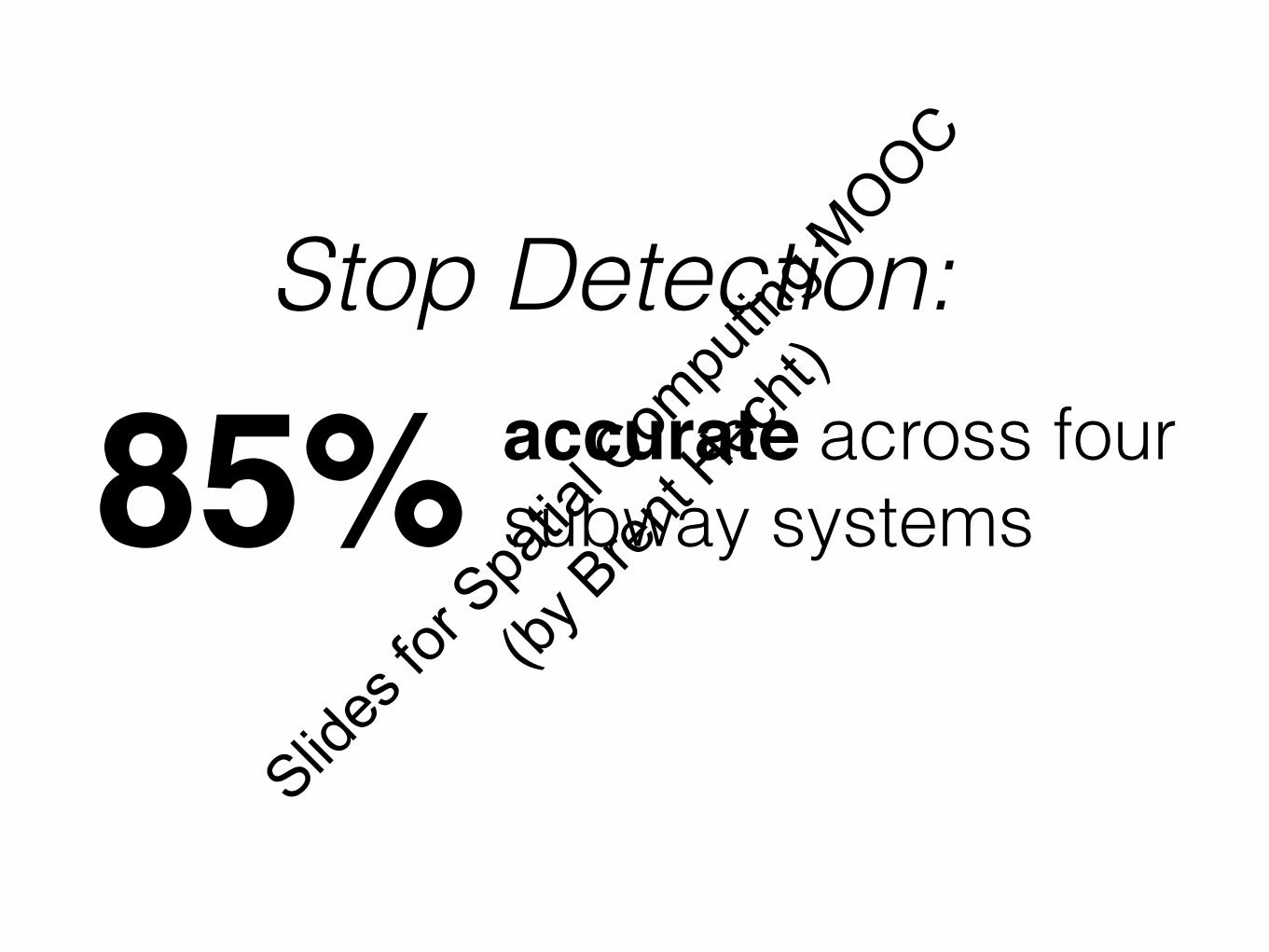
accurate across four subway systems85%
Stop Detection:
Slides
for S
patia
l Com
putin
g MOOC
(by B
rent H
echt)
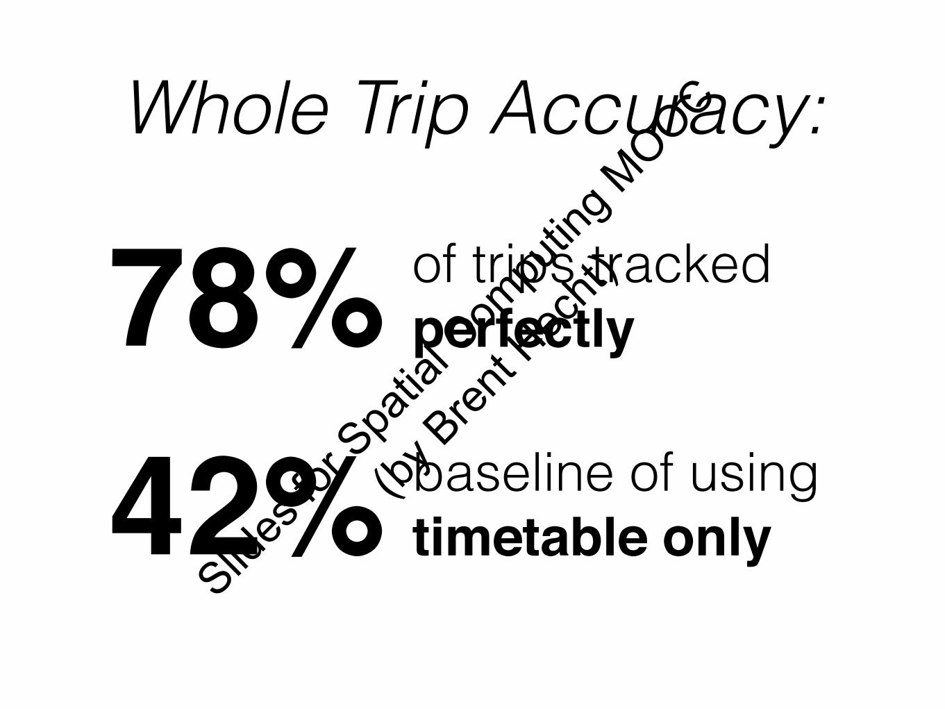
of trips tracked perfectly78%
Whole Trip Accuracy:
baseline of using timetable only42%
Slides
for S
patia
l Com
putin
g MOOC
(by B
rent H
echt)
MetroNavigatorSlid
es fo
r Spa
tial C
ompu
ting M
OOC
(by B
rent H
echt)
Slides
for S
patia
l Com
putin
g MOOC
(by B
rent H
echt)
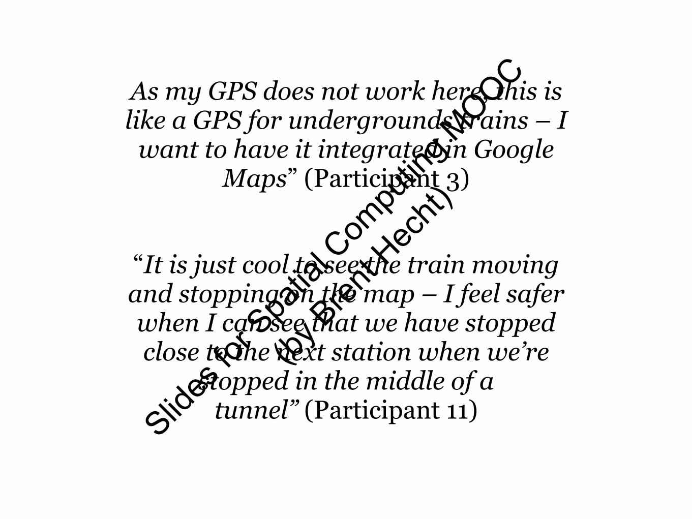
As my GPS does not work here, this is like a GPS for undergrounds trains – I
want to have it integrated in Google Maps” (Participant 3)
“It is just cool to see the train moving and stopping on the map – I feel safer when I can see that we have stopped close to the next station when we’re
stopped in the middle of a tunnel” (Participant 11) Slid
es fo
r Spa
tial C
ompu
ting M
OOC
(by B
rent H
echt)
Oops, it seems that the system missed a stop – that is not good. I would also be happy to
help the system to detect the stops, if the system could help me to get out at the right
station. That would be totally fine with me.” (Participant 3)
Slides
for S
patia
l Com
putin
g MOOC
(by B
rent H
echt)
Future Work
+Correcting for drift errorsSlid
es fo
r Spa
tial C
ompu
ting M
OOC
(by B
rent H
echt)
Advances in Positioning“SubwayPS: Towards Enabling Smartphone Positioning in
Underground Public Transportation Systems”
AttributionsBy Base map: BART Bart-logo.svg:ChrisRuvolo at en.wikipedia 20_airtransportation.svg: AIGA symbol sign collection derivative work: Train2104 [CC-BY-SA-3.0 (http://creativecommons.org/licenses/by-sa/3.0)], from
Wikimedia Commons
"Cell tower in jovel chiapas" by Leogeograph - Own work. Licensed under Creative Commons Attribution-Share Alike 3.0 via Wikimedia Commons - https://commons.wikimedia.org/wiki/