3
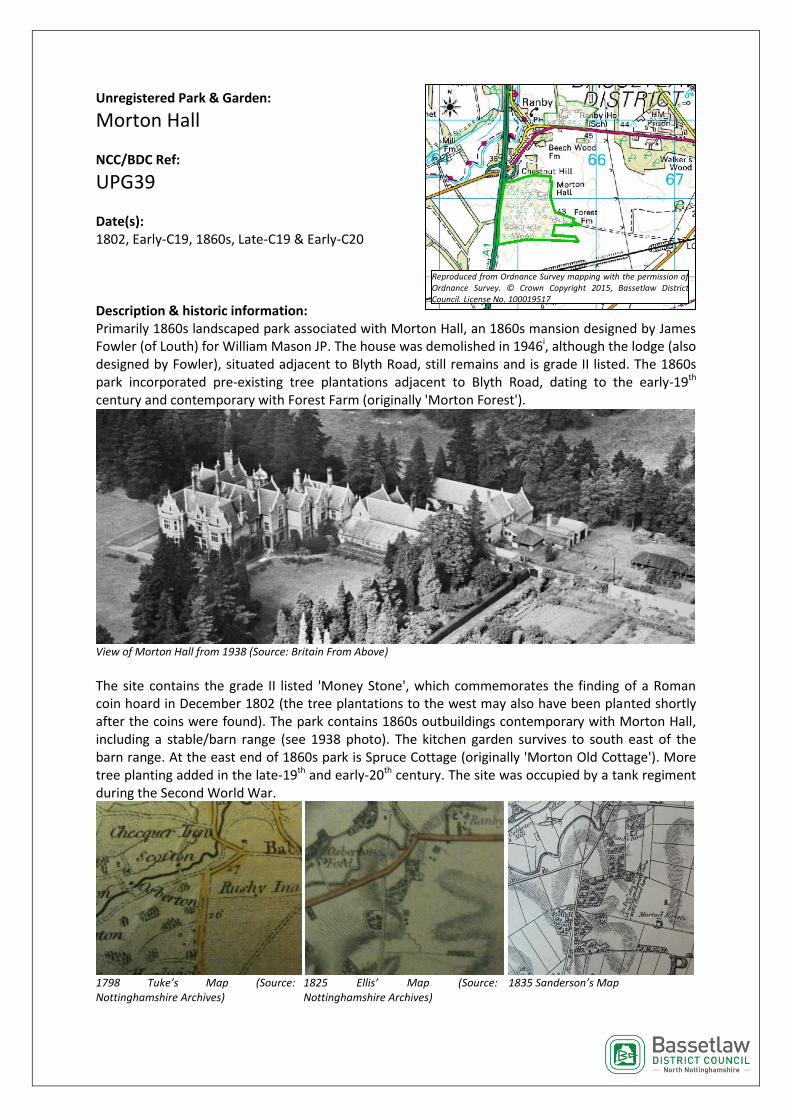
Unregistered Park & Garden: Morton Hall NCC/BDC Ref: UPG39 Date(s): 1802, Early-C19, 1860s, Late-C19 & Early-C20 Description & historic information: Primarily 1860s landscaped park associated with Morton Hall, an 1860s mansion designed by James Fowler (of Louth) for William Mason JP. The house was demolished in 1946 i , although the lodge (also designed by Fowler), situated adjacent to Blyth Road, still remains and is grade II listed. The 1860s park incorporated pre-existing tree plantations adjacent to Blyth Road, dating to the early-19 th century and contemporary with Forest Farm (originally 'Morton Forest'). View of Morton Hall from 1938 (Source: Britain From Above) The site contains the grade II listed 'Money Stone', which commemorates the finding of a Roman coin hoard in December 1802 (the tree plantations to the west may also have been planted shortly after the coins were found). The park contains 1860s outbuildings contemporary with Morton Hall, including a stable/barn range (see 1938 photo). The kitchen garden survives to south east of the barn range. At the east end of 1860s park is Spruce Cottage (originally 'Morton Old Cottage'). More tree planting added in the late-19 th and early-20 th century. The site was occupied by a tank regiment during the Second World War. 1798 Tuke’s Map (Source: Nottinghamshire Archives) 1825 Ellis’ Map (Source: Nottinghamshire Archives) 1835 Sanderson’s Map Reproduced from Ordnance Survey mapping with the permission of Ordnance Survey. © Crown Copyright 2015, Bassetlaw District Council. License No. 100019517