14
GOVERNMENT OF WESTERN AUSTRALIA Murujuga National Park Visitor guide Download this now and take with you
1
GOVERNMENT OFWESTERN AUSTRALIA
MurujugaNational Park
Visitor guide
Download this now and take with you
“Ngayintharri Gumawarni Ngurrangga” (We all come together for country)
Welcome
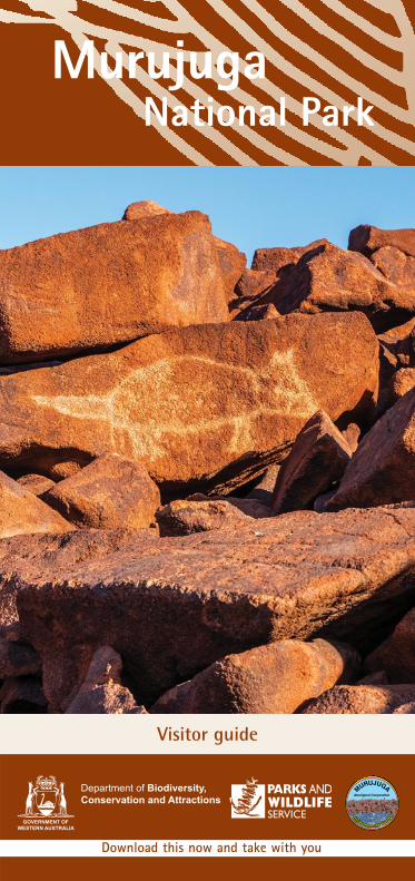
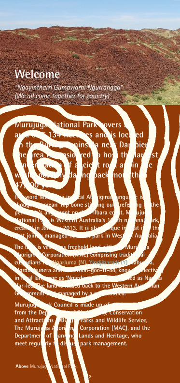
Murujuga National Park covers an area of 5,134 hectares and is located on the Burrup Peninsula near Dampier. The area is considered to host the largest concentration of ancient rock art in the world, possibly dating back more than 47,000 years. The word Murujuga in local Aboriginal language is thought to mean ‘hip bone sticking out’, referring to the peninsula’s alignment on the Pilbara coast. Murujuga National Park is Western Australia’s 100th national park, created in January 2013. It is also unique in that it is the first jointly managed national park in Western Australia.
The land is vested as freehold land with the Murujuga Aboriginal Corporation (MAC) comprising traditional custodians the Ngarluma (N), Yindjibarndi (Y), Yaburara, Mardudhunera and the Woon-goo-tt-oo, known collectively in local language as ‘Ngarda-ngarli’, pronounced as Nar-da Nar-lee. The land is leased back to the Western Australian Government and managed by a park council.
Murujuga Park Council is made up of representatives from the Department of Biodiversity, Conservation and Attractions (DBCA) – Parks and Wildlife Service, The Murujuga Aboriginal Corporation (MAC), and the Department of Planning, Lands and Heritage, who meet regularly to discuss park management.
Above Murujuga National Park.
2
3
Pronunciation of Aboriginal words used in this publication• Ngarluma - Nar-lu-ma
• Yindjibarndi - Yind-ji-barn-di
• Yaburara - Yab-oo-ra-ra
• Mardudhunera – Mar-doo-thun-u-ra
• Woon-goo-tt-oo,
• Cold time - Muthu (ma – thu)
• Hot time - Garrbarn (N) (gar-barn),Garrwarn (Y) (gar-warn)
In this publication and on signs in the park, the Ngarluma (N) name is shown in brown and the Yindjibarndi (Y) name is shown in teal.
The parks approved management plan guides decision making and these arrangements aim to conserve, protect, and promote Aboriginal cultural and archaeological values, natural and recreational values and provide for managed access and recreation on Murujuga.
Over the long term, Ngarda-Ngarli seek to manage the park with a greater degree of independence. This will be achieved through ongoing joint management and the sharing of knowledge and ongoing training opportunities between DBCA and MAC.
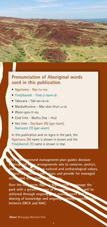
Above Murujuga National Park.
3
4
Murujuga Land and Sea Unit Ranger ProgramRangers from the Murujuga Land and Sea Unit (MLSU) conduct patrols and undertake works throughout the national park. MLSU consists mostly of local language group Aboriginal people employed by MAC, working alongside the DBCA Parks and Wildlife Service to provide land management services throughout the national park. MLSU also offer cultural tours and important cultural awareness sessions, which include a brief history of Murujuga, information on rock art, the importance of cultural safety and an introduction to the MLSU.
Murujuga inscription on the World Heritage ListIn 2007 the Dampier Archipelago, including the Burrup Peninsula and Murujuga National Park, was placed on the Australia’s National Heritage List in recognition of containing one of the worlds greatest concentrations of engraved rock art.
In 2020 Murujuga was added to Australia’s World Heritage Tentative List, the first step to have the unique cultural, spiritual and archaeological values of the area internationally recognised at the highest level.
With more than one million images, Murujuga is home to one of the largest, densest, and most diverse collections of rock art in the world. It is estimated to contain more than one million petroglyphs, which provide an archaeological record of traditional use of the area over thousands of years. The area also features middens, fish traps, rock shelters, quarry sites, stone tools, ceremonial places, and stone arrangements.
A successful World Heritage nomination requires a collaborative and cooperative approach. MAC is working with the Western Australian Government to prepare the nomination in collaboration with the Australian Government and stakeholders.
For further information visit dbca.wa.gov.au/parks-and-wildlife-service/world-heritage-areas/murujuga-world-heritage-nomination
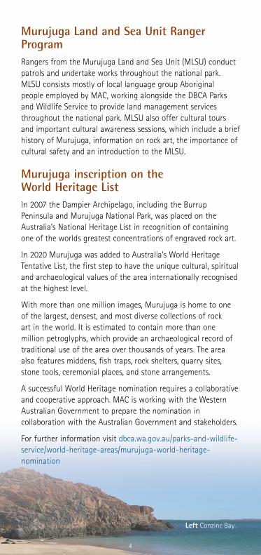
Left Conzinc Bay.
4
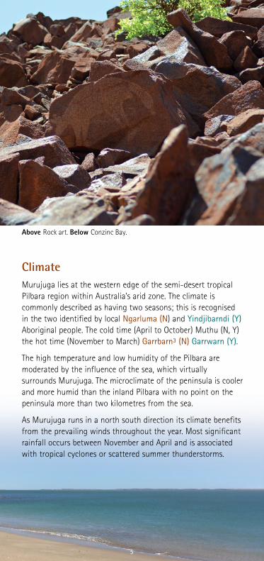
ClimateMurujuga lies at the western edge of the semi-desert tropical Pilbara region within Australia’s arid zone. The climate is commonly described as having two seasons; this is recognised in the two identified by local Ngarluma (N) and Yindjibarndi (Y) Aboriginal people. The cold time (April to October) Muthu (N, Y) the hot time (November to March) Garrbarn³ (N) Garrwarn (Y).
The high temperature and low humidity of the Pilbara are moderated by the influence of the sea, which virtually surrounds Murujuga. The microclimate of the peninsula is cooler and more humid than the inland Pilbara with no point on the peninsula more than two kilometres from the sea.
As Murujuga runs in a north south direction its climate benefits from the prevailing winds throughout the year. Most significant rainfall occurs between November and April and is associated with tropical cyclones or scattered summer thunderstorms.
Above Rock art. Below Conzinc Bay.
5

6
Geology and landforms The rocks of Murujuga are comprised mostly of granophyre (a fine-grained granite) and gabbro that intruded as a sill of magma between layers of surrounding volcanic and sedimentary rocks. The sill is at least two kilometres thick and was formed around 2717 million years ago or 2.7 billion.
The archipelago was formed between 5000 and 6000 years ago when the sea level was rising following the last ice age. This once hilly area, was flooded, leaving hilltops as islands. Coastal dunes of shelly lime-sand then accumulated around and partly over the newly formed islands whose grains later formed limestone.
Murujuga and the islands of the Dampier Archipelago tend to be aligned in a north-east orientation, because the dominant grain and structures of the rocks run in this direction. Most of the channels, straits and embayments like Flying Foam Passage, Searipple Passage and King Bay owe their origin to fractures and joints that crosscut the rocks in various directions. This encouraged erosion and weathering which formed the current valley systems and hills including the Pistol Ranges.
Rock pilesThe rocks piles of Murujuga National Park are one of its most unique features. The first question that springs to mind when viewed is ‘Did someone dump those there?’ The answer is no they did not. They are unique to this part of the Pilbara coastline and are a result of the physical breakdown of the parent material, the fine-grained Gidley granophyre, and the coarse-grained gabbro. Both are resistant to erosion. Oxidation of the rock surface over thousands of years has created the rich red colour we see today. A recently split rock is blue grey inside.
Above Petroglyphs.
6

7
While they look intriguing, the rockpiles also protect fire sensitive plants and special ecological communities. The increased humidity around them means moisture collects amongst the rocks and plants growing here have a close affiliation with the Northern Botanical Province or ‘Kimberley’ species, including the native rock fig (Ficus brachypoda).
Other species have a more restricted distribution like the rock kurrajong (Brachychiton acuminatum) with its large, hand shaped foliage and Terminalia supranitifolia, a small, spreading tree to about four metres tall, which are unique to the Pilbara region.
A low-density population of the Rothschilds rock-wallaby (Petrogale rothschildi) lives in areas away from vehicles and people.
Rock poolsThe rock pools of the park are also special ecological communities. They fill after heavy rain and others, that are near permanent are fed by seepages and often contain small fish and invertebrates.
Most contain tufa deposits. Tufa is a highly porous sedimentary rock (limestone) composed of calcium carbonate. This is formed by biological and chemical precipitation of calcite from cold super saturated surface or ground waters. The rocks in the surrounding gullies are often blue/grey where the water washes the oxidation layer away.
The Pilbara olive python (Liasis olivaceus barroni) is one of Australia’s largest snakes growing to around five metres long. It can be found on Murujuga where it shelters during the day in caves and crevices and beneath large boulders. Its diet consists of rock wallabies, small kangaroos, flying foxes and birds. It is never too far from fresh water.
Above Petroglyphs.
7
8
Plan your visit
Safe walking tipsTake care when walking in the park. Do not climb on rock piles as rocks can be unstable and present a physical and cultural safety hazard. Use tracks that appear to have been used before. Avoid heat stress and sunburn - wear a hat, long-sleeved, loose clothing and apply sunscreen regularly. Wear sturdy walking shoes. In summer, restrict walking to early morning or late afternoon.
WaterFresh water is not available in the park. Please bring your own drinking water. Avoid dehydration by drinking small amounts regularly.
Recreational fishingFishing is popular in the waters surrounding Murujuga.
For the most up-to-date information on fishing regulations, download Recfishwest. This app has the most up to date WA fishing rules and fish ID at the touch of a button. You can also use it when there is no phone or internet reception.
Boat launchingVisitors can access the national park beaches by boat. There is an informal boat ramp at Withnell Bay (outside the national park).
Access roads north of Withnell Bay are extremely rough and normally require high clearance or four-wheel drive vehicles.
Check the local tide tables for tidal movements before driving on beach tracks near the water.
There are two boat ramps in Dampier: the public ramp near the Windy Ridge Oval and the private ramp at the Hampton Harbour Boat and Sailing Club (See map below for locations).
No camping Camping is not permitted in Murujuga National Park.
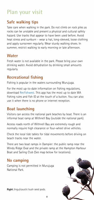
Right Jingu/caustic bush seed pods.
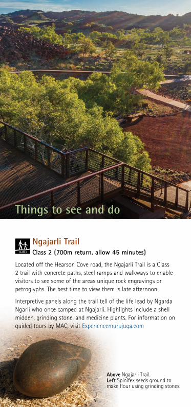
Ngajarli TrailClass 2 (700m return, allow 45 minutes)
Located off the Hearson Cove road, the Ngajarli Trail is a Class 2 trail with concrete paths, steel ramps and walkways to enable visitors to see some of the areas unique rock engravings or petroglyphs. The best time to view them is late afternoon.
Interpretive panels along the trail tell of the life lead by Ngarda Ngarli who once camped at Ngajarli. Highlights include a shell midden, grinding stone, and medicine plants. For information on guided tours by MAC, visit Experiencemurujuga.com
Things to see and do
Above Ngajarli Trail. Left Spinifex seeds ground to make flour using grinding stones.
9

10
Bird watchingEvery year, thousands of migratory shorebirds visit the beaches of Western Australia’s north-west on their mega journeys across the globe. Sand bars, rocky shores, beaches, salt marshes, intertidal flats and mangroves are all important feeding and resting habitat during spring and summer when the birds escape the harsh winter of their breeding grounds in the northern hemisphere.
While many are travellers, there are some that are resident all year round and both can be spotted in a quiet moment in the coastal parts of the park. Grab your binoculars and favourite bird book and see what you can find.
SwimmingMany of the beaches surrounding Murujuga are ideal for swimming. If you are lucky, you may even get a beach to yourself. Refer to Things You Need to Know for information on jellyfish and crocodiles.
Above White mangrove (Avicennia marina) at high tide.

Emergency appInstall the free Emergency+ app on your mobile phone (emergencyapp.triplezero.gov.au) to help provide location details when you call 000 (Triple Zero). Ensure your phone is fully charged and location services is turned on. Please note if there is no mobile coverage on any network where you are, you will not be able to reach Emergency Services via a mobile phone.
BushfiresBushfires are dangerous and are common in Western Australia. They can start without warning throughout the year and can spread rapidly on hot, windy days. Avoid the risk of bushfire by planning your visit during mild weather conditions.
During bushfire season, for your safety, have a bushfire survival plan. Bushfires can pose extreme risk to visitors and must be avoided. Watch for signs of bushfire such as smoke and the smell of burning bush. If you see or smell signs of a bushfire put your safety first and act immediately, monitor wind conditions and move to a safer place as quickly as possible if it is safe to do so, do not wait to see as the consequences can be catastrophic.
In case of bushfire call 000 and the Parks and Wildlife Service Karratha office on (08) 9182 2000.
Listen for Bushfire Alerts (warnings) on the local ABC radio station or by visiting emergency.wa.gov.au
Reporting damage or disturbance to Aboriginal sitesIf you notice damage or disturbance to any registered Aboriginal heritage sites or rock art, please report it to the Department of Planning, Lands and Heritage (08) 6551 8100 or the Murujuga Land and Sea Unit on (08) 9183 1248.
Things you need to know
Below Yigara/white mangrove.
11
Above Turtle egg rock art. Left Yigara/white mangrove.
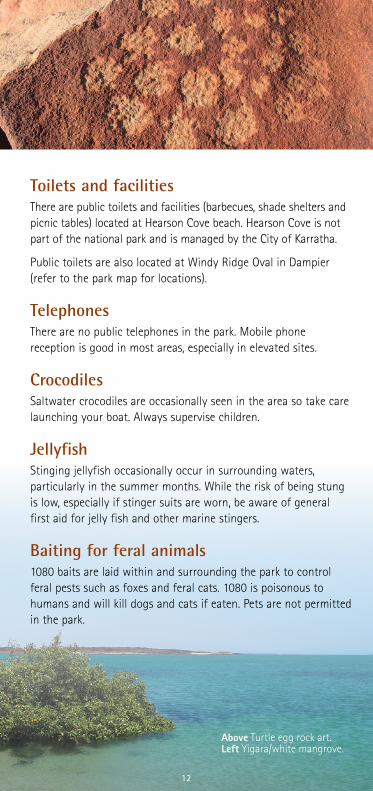
Toilets and facilitiesThere are public toilets and facilities (barbecues, shade shelters and picnic tables) located at Hearson Cove beach. Hearson Cove is not part of the national park and is managed by the City of Karratha.
Public toilets are also located at Windy Ridge Oval in Dampier (refer to the park map for locations).
TelephonesThere are no public telephones in the park. Mobile phone reception is good in most areas, especially in elevated sites.
CrocodilesSaltwater crocodiles are occasionally seen in the area so take care launching your boat. Always supervise children.
Jellyfish Stinging jellyfish occasionally occur in surrounding waters, particularly in the summer months. While the risk of being stung is low, especially if stinger suits are worn, be aware of general first aid for jelly fish and other marine stingers.
Baiting for feral animals1080 baits are laid within and surrounding the park to control feral pests such as foxes and feral cats. 1080 is poisonous to humans and will kill dogs and cats if eaten. Pets are not permitted in the park.
12

Cover Ngajarli.
Information current at April 2021. This document is available in alternative formats on request.Please consider the environment before printing.
Online resources:parks.dbca.wa.gov.au/park/murujugaParks.dbca.wa.gov.au/park/dampier-archipelagoRegister for updates on the World Heritage nomination visit https://www.dbca.wa.gov.au/parks-and-wildlife-service/world-heritage-areas/murujuga-world-heritage-nomination
2020
_615
-042
1-DL
Parks and Wildlife Service State Operational Headquarters17 Dick Perry Avenue Kensington WA 6151 Phone: (08) 9219 9000 Fax: (08) 9334 0498dbca.wa.gov.au
Karratha Visitor Centre Lot 4548 Karratha Road Karratha WA 6714Phone: (08) 9144 4600 Fax: (08) 9144 4620 karrathaiscalling.com.au
More informationParks and Wildlife Service Pilbara RegionCnr Anderson and Mardie roads Karratha Industrial EstatePO Box 835, Karratha WA 6714 Phone: (08) 9182 2000Fax: (08) 9144 1118Email: [email protected]
Murujuga Land and Sea Unit (Headquarters)313 Cnr King Bay and Griffin roads Burrup WA 6714PO Box 1544 Karratha WA 6714Phone: (08) 9144 4112
Department ofPlanning, Lands and Heritage 140 William StreetPerth WA 6001Locked Bag 2506Perth WA 6001Phone: (08) 6551 8002dplh.wa.gov.au
Emergencies – call Triple Zero ‘000’
13

14
Geology and landforms The rocks of Murujuga are comprised mostly of granophyre (a fine-grained granite) and gabbro that intruded as a sill of magma between layers of surrounding volcanic and sedimentary rocks. The sill is at least two kilometres thick and was formed around 2717 million years ago or 2.7 billion.
The archipelago was formed between 5000 and 6000 years ago when the sea level was rising following the last ice age. This once hilly area, was flooded, leaving hilltops as islands. Coastal dunes of shelly lime-sand then accumulated around and partly over the newly formed islands whose grains later formed limestone.
Murujuga and the islands of the Dampier Archipelago tend to be aligned in a north-east orientation, because the dominant grain and structures of the rocks run in this direction. Most of the channels, straits and embayments like Flying Foam Passage, Searipple Passage and King Bay owe their origin to fractures and joints that crosscut the rocks in various directions. This encouraged erosion and weathering which formed the current valley systems and hills including the Pistol Ranges.
Rock pilesThe rocks piles of Murujuga National Park are one of its most unique features. The first question that springs to mind when viewed is ‘Did someone dump those there?’ The answer is no they did not. They are unique to this part of the Pilbara coastline and are a result of the physical breakdown of the parent material, the fine-grained Gidley granophyre, and the coarse-grained gabbro. Both are resistant to erosion. Oxidation of the rock surface over thousands of years has created the rich red colour we see today. A recently split rock is blue grey inside.
While they look intriguing, the rockpiles also protect fire sensitive plants and special ecological communities. The increased humidity around them means moisture collects amongst the rocks and plants growing here have a close affiliation with the Northern Botanical Province or ‘Kimberley’ species, including the native rock fig (Ficus brachypoda).
Other species have a more restricted distribution like the rock kurrajong (Brachychiton acuminatum) with its large, hand shaped foliage and Terminalia supranitifolia, a small, spreading tree to about four metres tall, which are unique to the Pilbara region.
A low-density population of the Rothschilds rock-wallaby (Petrogale rothschildi) lives in areas away from vehicles and people.
Rock poolsThe rock pools of the park are also special ecological communities. They fill after heavy rain and others, that are near permanent are fed by seepages and often contain small fish and invertebrates.
Most contain tufa deposits. Tufa is a highly porous sedimentary rock (limestone) composed of calcium carbonate. This is formed by biological and chemical precipitation of calcite from cold super saturated surface or ground waters. The rocks in the surrounding gullies are often blue/grey where the water washes the oxidation layer away.
The Pilbara olive python (Liasis olivaceus barroni) is one of Australia’s largest snakes growing to around five metres long. It can be found on Murujuga where it shelters during the day in caves and crevices and beneath large boulders. Its diet consists of rock wallabies, small kangaroos, flying foxes and birds. It is never too far from fresh water.
Plan your visitSafe walking tipsTake care when walking in the park. Do not climb on rock piles as rocks can be unstable and present a physical and cultural safety hazard. Use tracks that appear to have been used before. Avoid heat stress and sunburn - wear a hat, long-sleeved, loose clothing and apply sunscreen regularly. Wear sturdy walking shoes. In summer, restrict walking to early morning or late afternoon.
WaterFresh water is not available in the park. Please bring your own drinking water. Avoid dehydration by drinking small amounts regularly.
Recreational fishingFishing is popular in the waters surrounding Murujuga.
For the most up-to-date information on fishing regulations, download Recfishwest. This app has the most up to date WA fishing rules and fish ID at the touch of a button. You can also use it when there is no phone or internet reception.
Boat launchingVisitors can access the national park beaches by boat. There is an informal boat ramp at Withnell Bay (outside the national park).
Access roads north of Withnell Bay are extremely rough and normally require high clearance or four-wheel drive vehicles.
Check the local tide tables for tidal movements before driving on beach tracks near the water.
There are two boat ramps in Dampier: the public ramp near the Windy Ridge Oval and the private ramp at the Hampton Harbour Boat and Sailing Club (See map below for locations).
No camping Camping is not permitted in Murujuga National Park.
Bird watchingEvery year, thousands of migratory shorebirds visit the beaches of Western Australia’s north-west on their mega journeys across the globe. Sand bars, rocky shores, beaches, salt marshes, intertidal flats and mangroves are all important feeding and resting habitat during spring and summer when the birds escape the harsh winter of their breeding grounds in the northern hemisphere.
While many are travellers, there are some that are resident all year round and both can be spotted in a quiet moment in the coastal parts of the park. Grab your binoculars and favourite bird book and see what you can find.
SwimmingMany of the beaches surrounding Murujuga are ideal for swimming. If you are lucky, you may even get a beach to yourself. Refer to Things You Need to Know for information on jellyfish and crocodiles.
Ngajarli TrailClass 2 (700m return, allow 45 minutes)
Located off the Hearson Cove road, the Ngajarli Trail is a Class 2 trail with concrete paths, steel ramps and walkways to enable visitors to see some of the areas unique rock engravings or petroglyphs. The best time to view them is late afternoon.
Interpretive panels along the trail tell of the life lead by Ngarda Ngarli who once camped at Ngajarli. Highlights include a shell midden, grinding stone, and medicine plants. For information on guided tours by MAC, visit Experiencemurujuga.com
Things to see and do
Above Petroglyphs.
Above Ngajarli Trail. Left Spinifex seeds ground to make flour using grinding stones.
Above left The end of the Ngajarli self-guided trail.Left White mangrove (Avicennia marina) at high tide.Right Jingu/caustic bush seed pods.
Withnell Bay
King Bay
Watering Cove
Cowrie Cove
Hearsons Cove
Ngajarli Trail
Conzinc Island
Dampier
Woodside LNG Plant
Woodside Visitor Centre
Murujuga Land and Sea Unit Office
Searipple Passage
Mermaid Sound
0 2km
Cafe
Shopping
Picnic tables
Sheltered picnic tables
Gas barbecues
Swimming
Fishing
Boat launch
Sealed road
Unsealed road
National Heritage Listed
Murujuga National Park
Information
Toilets
Medical
Fuel
Murujuga National Park


