AN O VERVIEW ON R OADS INFRASTRUCTURE DEVELOPMENT IN CAMBODIA Presented by: Mr. CHHOUK Chhay Horng Head of Civil Engineering Department Institute of Technology of Cambodia THE INTERNATIONAL SYMPOSIUM ON RURAL ROADS 2013: Toward Sustainable Road Development 4 th December, 2013 Rama Garden Hotel, Bangkok
Transcript
AN OVERVIEW ON ROADS INFRASTRUCTURE
DEVELOPMENT IN CAMBODIA
Presented by: Mr. CHHOUK Chhay Horng
Head of Civil Engineering Department
Institute of Technology of Cambodia
THE INTERNATIONAL SYMPOSIUM ON RURAL ROADS 2013:
Toward Sustainable Road Development
4th December, 2013
Rama Garden Hotel, Bangkok
Outline
General Background of Cambodia
History of Road Construction
Road Classification & Statistics
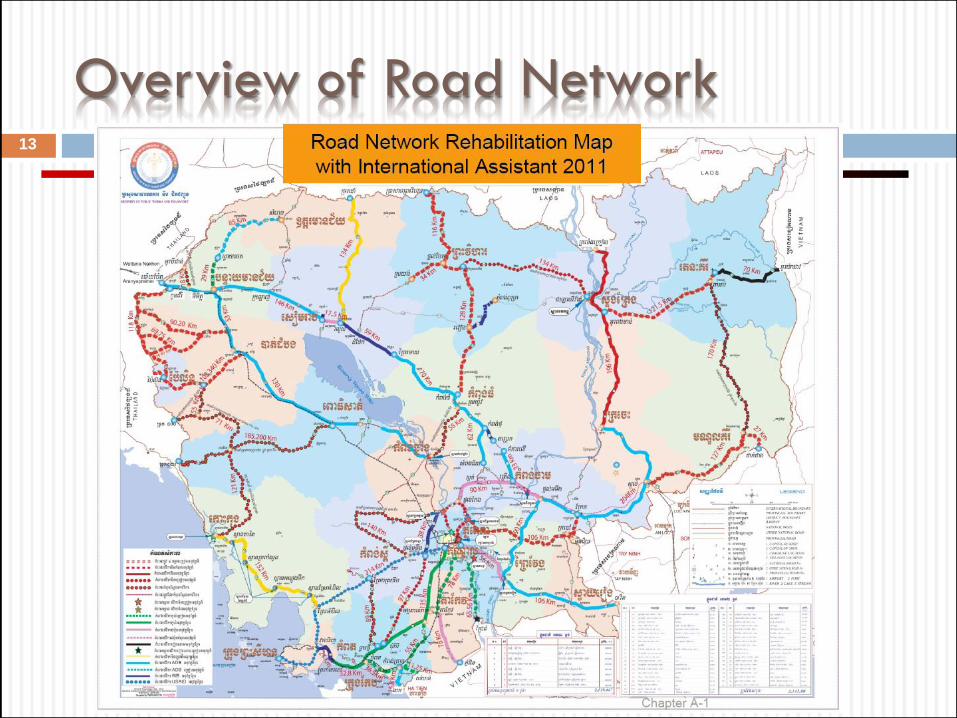
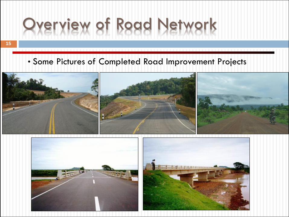
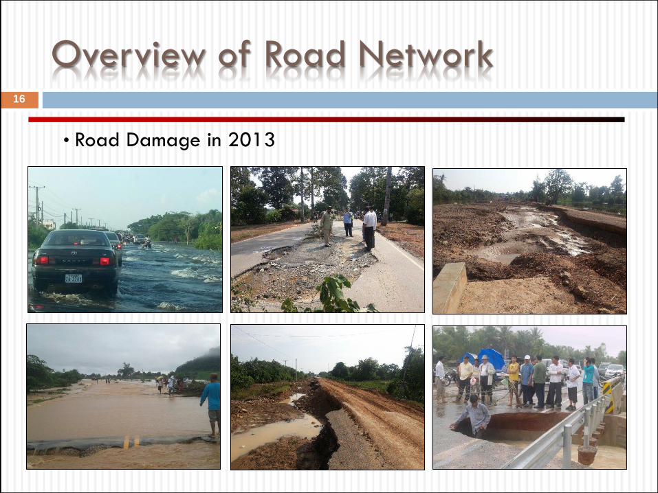
Overview of Road Network
Road Development Plan
2
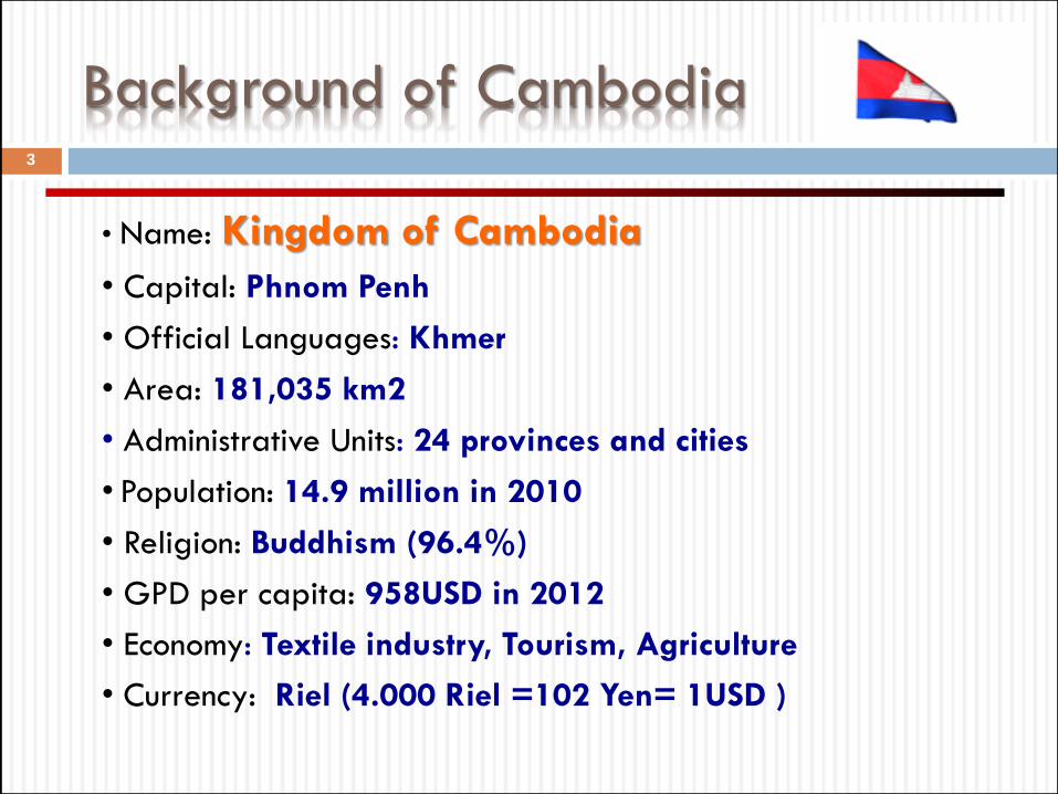
Background of Cambodia
• Name: Kingdom of Cambodia
• Capital: Phnom Penh
• Official Languages: Khmer
• Area: 181,035 km2
• Administrative Units: 24 provinces and cities
• Population: 14.9 million in 2010
• Religion: Buddhism (96.4%)
• GPD per capita: 958USD in 2012
• Economy: Textile industry, Tourism, Agriculture
• Currency: Riel (4.000 Riel =102 Yen= 1USD )
3
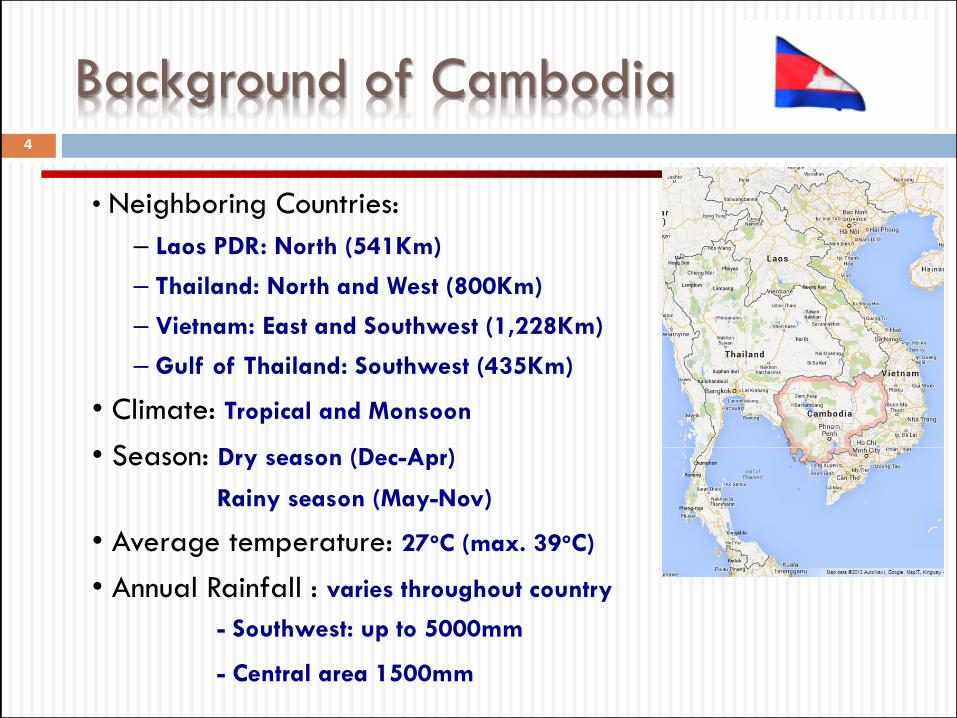
Background of Cambodia
• Neighboring Countries:
– Laos PDR: North (541Km)
– Thailand: North and West (800Km)
– Vietnam: East and Southwest (1,228Km)
– Gulf of Thailand: Southwest (435Km)
• Climate: Tropical and Monsoon
• Season: Dry season (Dec-Apr)
Rainy season (May-Nov)
• Average temperature: 27oC (max. 39oC)
• Annual Rainfall : varies throughout country
- Southwest: up to 5000mm
- Central area 1500mm
4
• Background:
– Developed between 1890 and 1950
– Designed for light traffic
– Pavement width: 4m - 6m
– Low Embankment
– Pavement type: Macadam base and Asphalts concrete
• Reason that caused damaged to road infrastructure
– Destroyed by Civil war in the decade of 1970
– Lack of Maintenance
– Disastrous floods in 1991, 1996, 2000, 2012 and 2013
– Grow of traffic volumes and overloaded truck
History of Road Construction
5
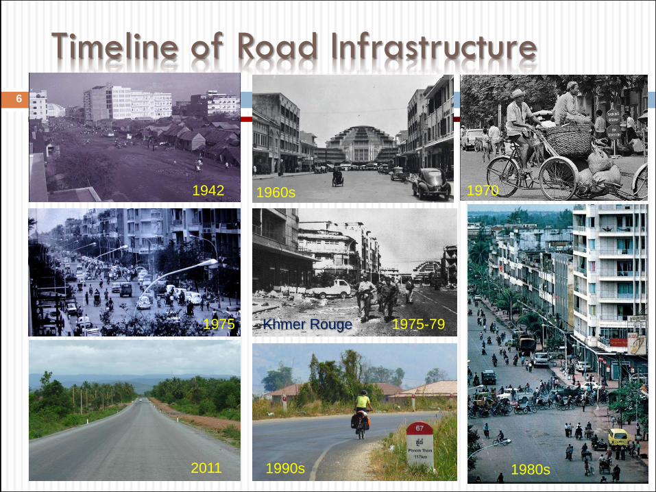
Timeline of Road Infrastructure
6
1942 1960s 1970
1975
2011 1990s
Khmer Rouge 1975-79
1980s
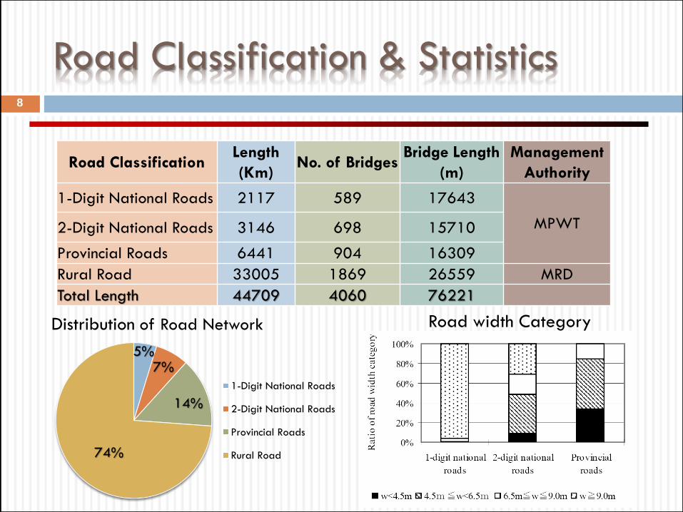
Road Classification & Statistics 7
• Road Classification and Division of Responsibilities