Date post: | 16-Dec-2018 |
Category: |
Documents |
Upload: | truongquynh |
View: | 212 times |
Download: | 0 times |
Primary Contact:William Dunn, [email protected]
Location & Design4975 Alliance Drive Fairfax, VA 22030
703-259-2950
Anissa [email protected]
Environmental4975 Alliance Drive Fairfax, VA 22030
703-259-3358
Brian [email protected]
Right of Way & Utilities4975 Alliance Drive Fairfax, VA 22030
703-259-2986
Jennifer [email protected]
Communications4975 Alliance Drive Fairfax, VA 22030
703-259-1779
The Virginia Department of Transportation welcomes you to the third public information meeting for the Richmond Highway (Route 1) Corridor Improvements project from Jeff Todd Way to Napper Road in Fairfax County. We look forward to your active participation.
This meeting is being held to provide an opportunity for citizens and organizations to comment or give suggestions on the proposed project. VDOT strives to ensure that all members of the community have the opportunity
to participate in public discussions on transportation projects and programs affecting them. VDOT and Fairfax County continue to coordinate on preliminary design of road improvements, the county’s Embark initiative and the future Bus Rapid Transit system.
A comment sheet is included in this brochure and your input is encouraged. All comments received will be reviewed by VDOT and the design team. You can email comments to [email protected].
VDOT representatives will review and evaluate information received as a result of this meeting. Please fill out the comment sheet provided in this brochure if you have any comments or questions. You may leave the sheet or any other written comments in the comment box, or mail/email your comments.
Comments must be postmarked, emailed or delivered to VDOT by May 4, 2018.
Mail comments to Mr. William Dunn, P.E. at the address below or email [email protected].
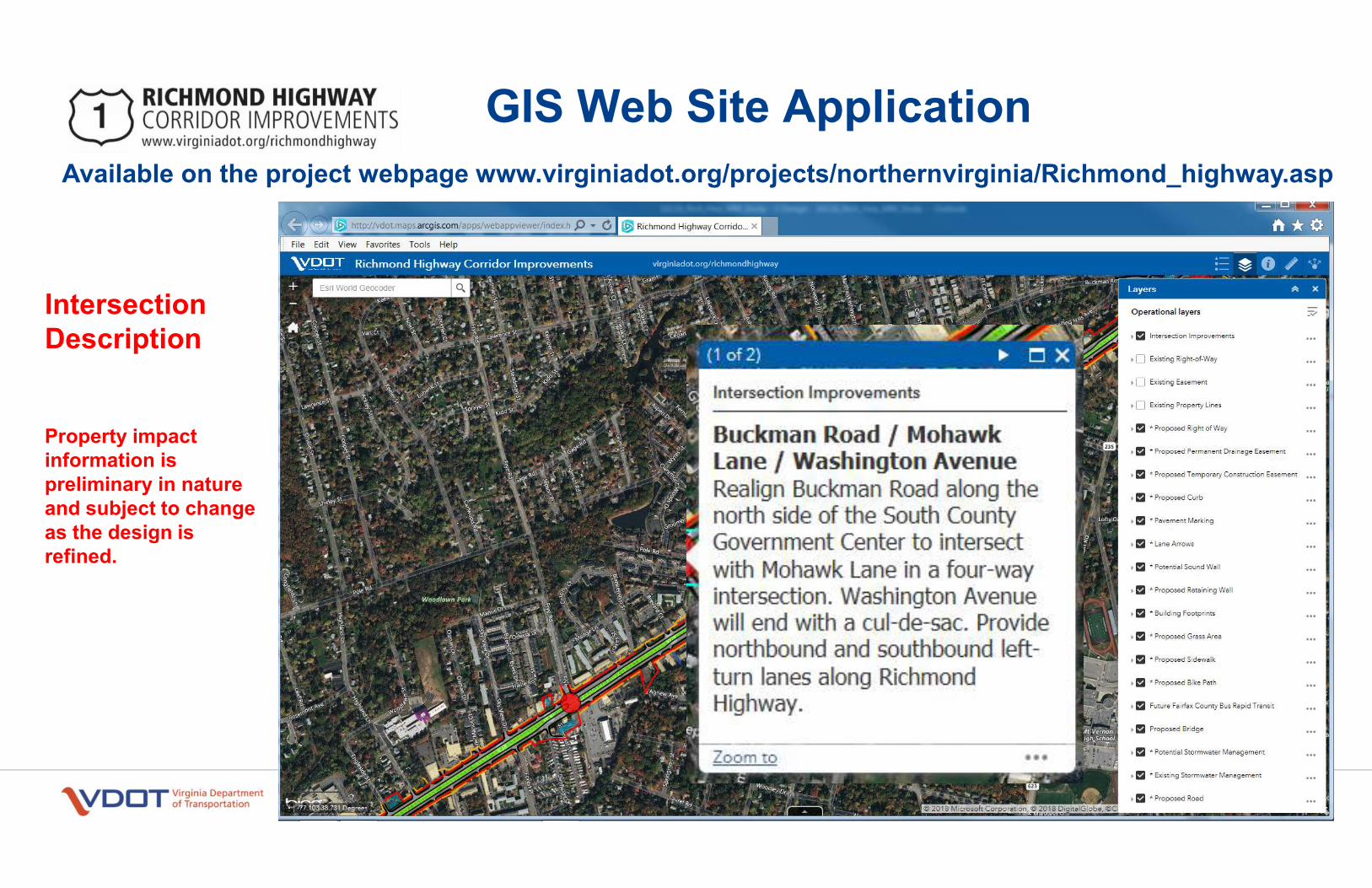
Project information shared at this meeting will be available at www.virginiadot.org/richmondhighway and at VDOT’s Northern Virginia District Office.
The project team continues to meet with homeowners associations and community groups throughout the corridor. If you’re interested in having the project team give a briefing to your group, let someone from the project team know tonight or email [email protected].
Get Involved
Contact Information
Public Information Meeting
Project Overview
State Project: 0001-029-205, P101, R201, C501 UPC: 107187
Richmond Highway Corridor Improvements project area
TTY/TDD Dial 711
Purpose: To increase capacity, safety and mobility for all users
Project Limits: Richmond Highway from Jeff Todd Way to Napper Road
Improvements: Widen about three miles of the road from four to six lanes, including bicycle and pedestrian accommodations
Richmond Hw y
Mount Vernon Memorial Hwy Ge
orge Washington
Memorial Hwy
1
623
Old Mill Rd
235
N
Frye Rd
Lawr e nce St Russell Rd
Buckman Rd
Sherwood Hall Ln
Je� To dd Way
Old
Mou
nt Ve
rnon
Rd M
ount Vernon Hwy
235
Sacrame n to Dr
Pole Rd
Na pper Rd
Dogue Creek
Little Hunting Creek
Richmond Hwy
RICHMOND HIGHWAY CORRIDOR IMPROVEMENTSwww.virginiadot.org/richmondhighway
151
Public Information Meeting
Richmond Highway Corridor ImprovementsFrom Jeff Todd Way to Napper Road Wednesday, April 4, 20186:30 p.m. to 8:30 p.m., Presentation 7 p.m. Mount Vernon High School8515 Old Mount Vernon Road Alexandria, VA 22309
© 2017 Commonwealth of Virginia
Public Information Meeting - April 4, 2018
Public Hearing - Fall 2018
Approve Design - Winter 2018/19
Begin Right of Way Acquisition - Spring 2019
Begin Utility Relocation - Summer 2020
Begin Construction - Spring 2023
Preliminary Engineering: $12.5 million
Right of Way: $142.3 million
Construction: $60 million
Total Cost: $215 million
* This project is currently funded through preliminary engineering and includes Regional Surface Transportation Program, Revenue Sharing and Northern Virginia Transportation Authority funds.
VDOT ensures nondiscrimination and equal employment in all programs and activities in accordance with Title VI and Title VII of the Civil Rights Act of 1964. If you need more information or special assistance for persons with disabilities or limited English proficiency, contact VDOT’s Civil Rights at 703-259-1775 or TTY/TDD 711.
As design of this project is finalized, additional easements may be required beyond the proposed right of way and will be shown on the public hearing plans. The property owners will be informed of the exact location of the easements during the right of way acquisition process and prior to construction.
Information about right of way purchase is discussed in VDOT’s brochure, “Right of Way and Utilities: Guide for Property Owners and Tenants.” Copies of this brochure are available here from VDOT personnel.
After this meeting, information regarding right of way may be obtained from the right of way contact listed on the back of this brochure.
The meeting will also provide information
about the Environmental Assessment (EA)
initiated to comply with the National
Environmental Policy Act (NEPA) and 23 CFR
771. VDOT will provide updates regarding
the environmental analyses and coordination
with federal/state regulatory agencies
about environmental resources within
project’s vicinity.
Once approved by the Federal Highway
Administration (FHWA) for public review, the
NEPA document and any other applicable
environmental studies will be made available
at the project’s design public hearing and
online at
www.virginiadot.org/richmondhighway.
Representatives from VDOT’s Environmental
Section will be available to discuss the
environmental review process and to answer
any questions.
Right of Way
Environmental Review
Anticipated ScheduleProject Description Estimated Project Cost
Civil Rights
Typical Section
This project will improve almost three miles of Richmond Highway between Jeff Todd Way and Napper Road.
Proposed project improvements include:• Widening the road from four lanes to
six lanes• Making intersection improvements • Providing separate bicycle and pedestrian
accommodations on both sides of the road• Reserving the median width necessary to
accommodate future planned Bus Rapid Transit for dedicated bus-only lanes.
These improvements focus to improve safety, decrease congestion, increase capacity, and expand mobility for all users, all in conformance with Fairfax County’s Comprehensive Plan.
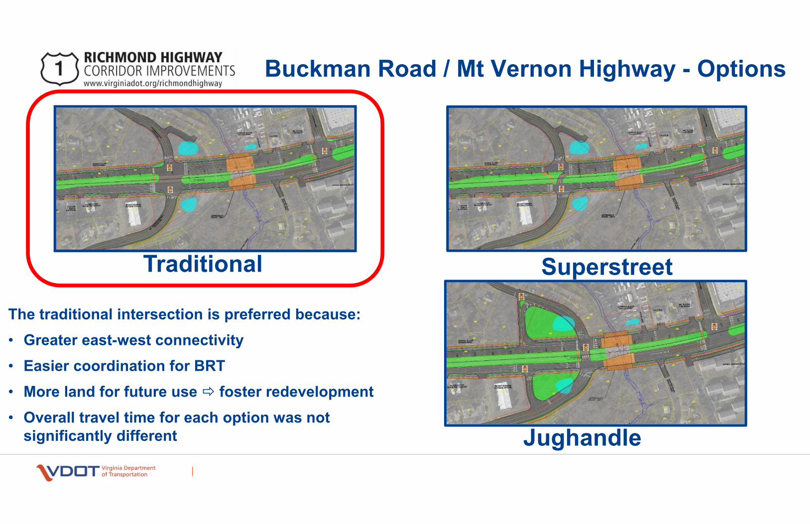
The project design and road widening includes several major intersection improvements as part of the preferred traditional intersection design, including the following: • All turns (left, thru and right) can be made at
each signalized intersection• The intersection must accomodate up to four
signal phases to improve traffic flow
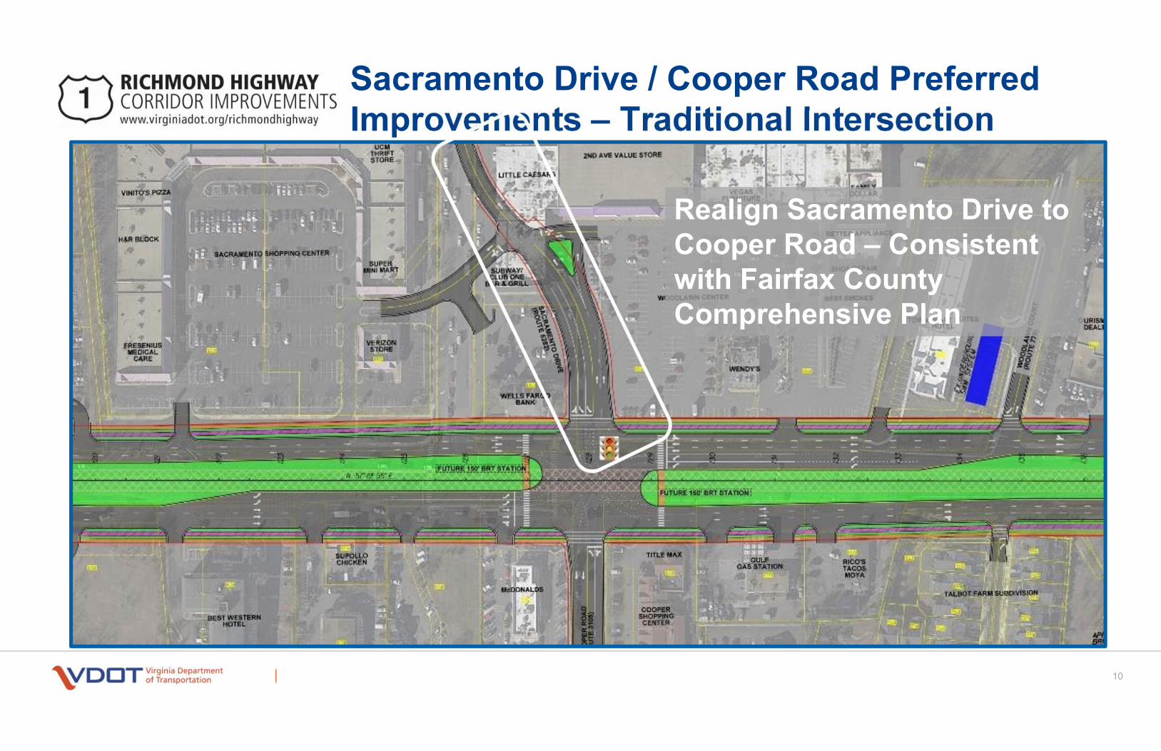
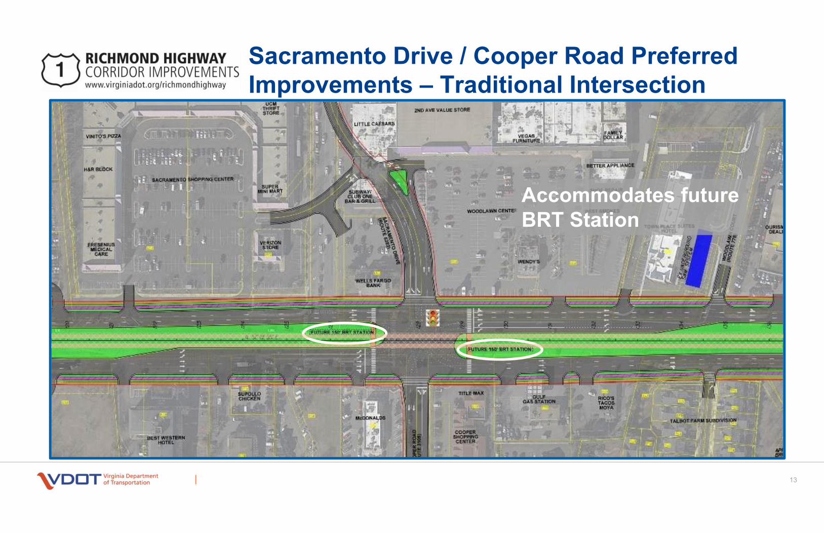
Sacramento Drive and Cooper Road • Realign Sacramento Drive to meet the
existing Cooper Road intersection• Add a new left-turn lane along
Sacramento Drive• Add pedestrian crosswalks and
pedestrian signals
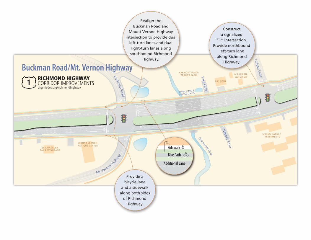
Buckman Road and Mount Vernon Highway • Realign the Buckman Road and Mount
Vernon Highway intersection to provide dual left-turn lanes and dual right-turn lanes along southbound Richmond Highway
• Add pedestrian crosswalks and pedestrian signals
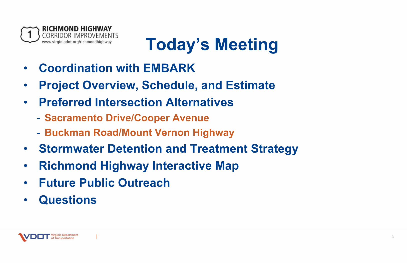
The meeting tonight will provide additional information on the preferred design alternatives and stormwater management strategies (see stormwater insert for more detailed information). Representatives from Fairfax County are present to discuss other planned improvements and projects along the corridor.
Future BRT Station
Future BRT Station
WELLS FARGOBANK
SUPER MINI
MART
VERIZONSTORE TOWNPLACESUITESHOTEL
TALBOTTFARM
SUBDIVISION
McD
ON
ALD
S
BESTWESTERN
HOTEL
SUBWAY/CLUB ONE
BAR & GRILL
LITTLECAESARS
FRESENIUSMEDICAL
CARE
SUPOLLOCHICKEN
GULFGAS
STATION
WOODLAWNCENTER
WENDY’S
2ND AVE VALUE STORE VEGASFURNITURE
FAMILYDOLLAR
BETTERAPPLIANCE
SHOE REPAIR
BESTSMOKES
COOPERSHOPPING
CENTER
Coop
er R
oad
Sacramento D
rive
Sacramento Drive/Cooper Road
Woo
dlaw
nCo
urt
Sidewalk
Additional Lane
Bike Path
Convert intersection to right-in/right-out.
Provide a bicycle lane
and a sidewalk along both sides
of Richmond Highway.
Realign Sacramento Drive
to intersect with Cooper Road, creating a four-way “traditional” intersection. Provide dual left-turn lanes
along northbound and southbound Richmond
Highway.
MOUNT VERNONANTIQUE CENTER
EL AMANECERBAR RESTAURANT
HARMONY PLACETRAILER PARK
7-ELEVEN
SPRING GARDEN APARTMENTS
MR. KLEANCAR WASH
Little Hunting Creek
APPROXIMATE
BRIDGE LIMITS
Buckman Road
Mt. Vernon H
ighw
ay
Napper Road
Pace Lane
Ladson Lane
Buckman Road/Mt. Vernon Highway
Sidewalk
Additional Lane
Bike Path
Provide a bicycle lane
and a sidewalk along both sides
of Richmond Highway.
Construct a signalized
“T” intersection. Provide northbound
left-turn lane along Richmond
Highway.
Realign the Buckman Road and
Mount Vernon Highway intersection to provide dual
left-turn lanes and dual right-turn lanes along southbound Richmond
Highway.
VDOT is required by law to control and treat stormwater runoff from roadways. New, more stringent regulations took effect in July 2014 making it more difficult to design stormwater treatment facilities, especially in a constrained urban corridors such as Richmond Highway. The following stormwater management options are being considered:
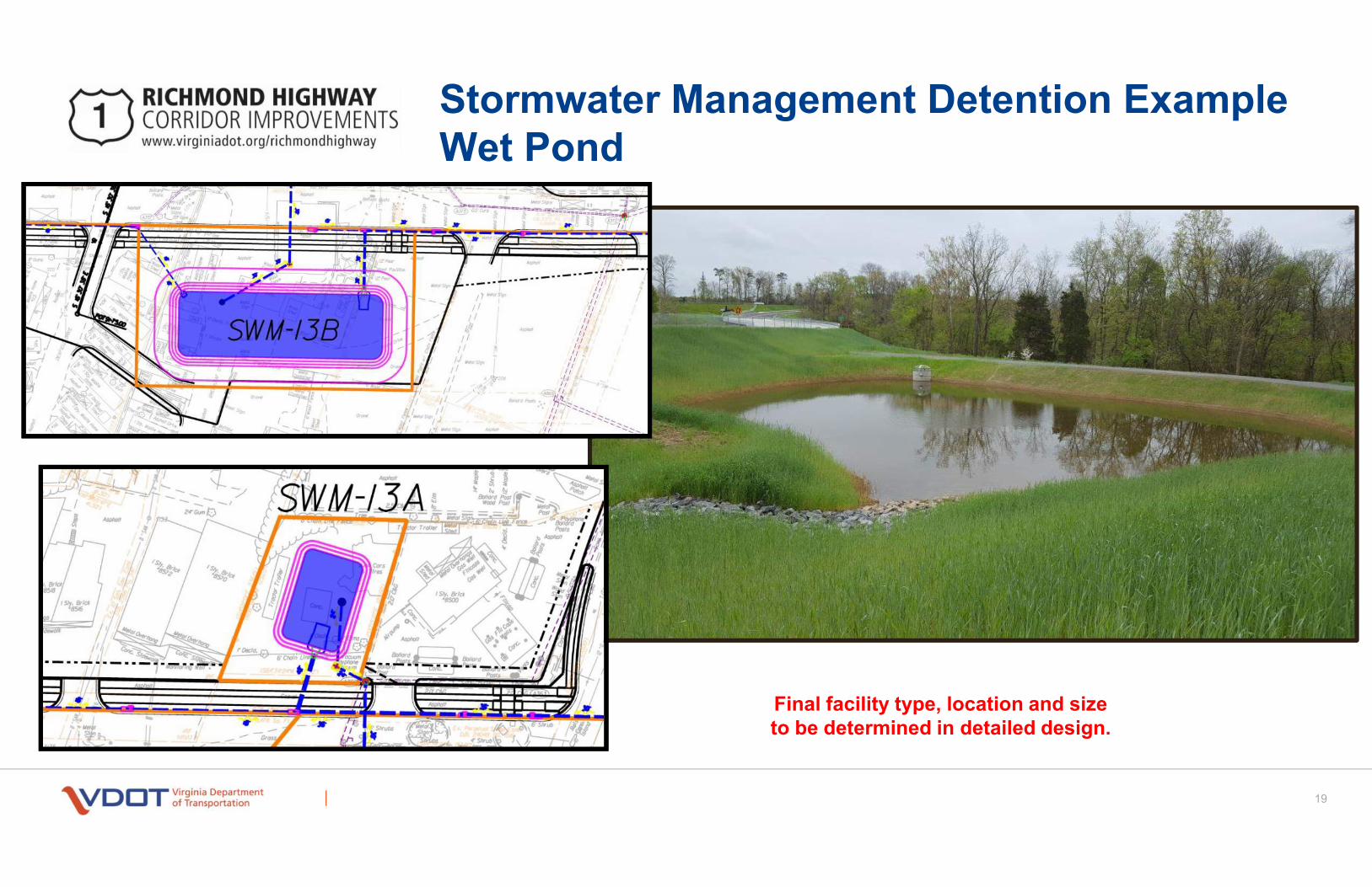
• Bioretention• Wet Pond• Underground Detention
The type, location, and size of each stormwater management facility are determined by a detailed
engineering design. Each facility is designed to meet federal and state regulations while taking into account the following:
• The size of the area draining into the facility• The amount of pavement area the facility
will treat• Existing landscape and obstructions• Soil conditions (infiltration capabilities and
ground water elevations)• Underground utility impacts• Wetlands, streams, parkland, and historic
property impacts• Construction and future maintenance cost
To support the preferred alternatives for the Richmond Highway Corridor Improvements, the project team has identified a 15 potential stormwater management facilities.
Stormwater Management
Richmond Hw y
Mount Vernon Memorial Hwy Ge
orge Washington
Memorial Hwy
1
623
Old Mill Rd
235
N
Frye Rd
Lawr e nce St Russell Rd
Buckman Rd
Sherwood Hall Ln
Je� To dd Way
Old
Mou
nt Ve
rnon
Rd M
ount Vernon Hwy
235
Sacrame n to Dr
Pole Rd
Na pper Rd
Dogue Creek
Little Hunting Creek
Richmond Hwy
RICHMOND HIGHWAY CORRIDOR IMPROVEMENTSwww.virginiadot.org/richmondhighway
151
Example of stormwater management with bioretention
The table below identifies the locations and proposed facilities along Richmond Highway.
Approximate Location Type under consideration
Facility Along Northbound Richmond Highway
800' South of Cooper Road Bioretention
100' North of North Fork Dogue Creek Bioretention
100' North of Denfield Drive Wet Pond
200' South of Mohawk Lane Bioretention
100' North of Proposed Buckman Road / Mount Vernon Highway Bioretention
200' North of Proposed Buckman Road / Mount Vernon Highway Bioretention
Facility Along Southbound Richmond Highway
900' North of Jeff Todd Way Bioretention
Between Woodlawn Court and North Fork Dogue Creek Bioretention
25' North of Engleside Street Bioretention
200' South of Frye Road Bioretention
200' South of Mohawk Lane Underground
300' North of Gregory Drive Underground
300' North of Janna Lee Avenue Bioretention
50' North of Proposed Buckman Road / Mount Vernon Highway Bioretention
100' North of Proposed Buckman Road / Mount Vernon Highway Bioretention
50' North of Pace Lane Wet Pond
COMPONENTS OF A BIORETENTION SYSTEM
Ponding
Mulch
Filter soil
Crushed stone
Outlet pipeDRAWING NOT TO SCALE
For more information on VDOT’s approach to stormwater management design, visit virginiadot.org/programs/stormwater_management.asp
What is a bioretention stormwater facility?
A bioretention facility removes pollutants from stormwater runoff by allowing the water to seep through mulch and specialized soil (primarily sand). Plantings in bioretention facilities also assist in removing pollutants through natural nutrient uptake into the roots.
What is an underground retention facility?
An underground retention facility is a structure designed to hold a volume of water and slowly release it over time. This design helps to reduce the peak flow rate to offsite drainage structures.
What is a wet pond?
A wet pond removes stormwater pollutants by allowing them to settle in a permanent pool of water. Plantings in these facilities also assist in removing pollutants through nutrient uptake into the roots. In addition, wet ponds hold and slowly release stormwater to prevent flooding.
Will wet ponds encourage mosquito breeding?
No, wet ponds are designed to limit stagnant water. They also include natural vegetation that attract natural predators of mosquitos such as frogs, fish and dragonflies.
Understanding Stormwater Management
COMMENT SHEET State Project: 0001-029-205, R201, C501 UPC 107187
Please leave this comment sheet at the designated location, mail your comments to the addressee on the reverse side, or email them to [email protected] by May 4, 2018.
Name (optional):
Address (optional):
Email (optional):
1. Do you have any comments about the proposed design improvements along the corridor?
2. Do you have any comments related to bicycle and pedestrian safety issues along the corridor?
3. Do you have any comments about the proposed stormwater management plans?
4. How did you hear about this meeting?
All comments are subject to public disclosure.
Public Information Meeting
Richmond Highway Corridor ImprovementsFrom Jeff Todd Way to Napper Road
Wednesday, April 4, 2018 6:30 to 8:30 p.m., Presentation 7 p.m. Mount Vernon High School8515 Old Mount Vernon RoadAlexandria, VA 22309
Newspaper Postcard Other____________________VDOT Road Signs
Richmond Hw y
Mount Vernon Memorial Hwy Ge
orge Washington
Memorial Hwy
1
623
Old Mill Rd
235
N
Frye Rd
Lawr e nce St Russell Rd
Buckman Rd
Sherwood Hall Ln
Je� To dd Way
Old
Mou
nt Ve
rnon
Rd M
ount Vernon Hwy
235
Sacrame n to Dr
Pole Rd
Na pper Rd
Dogue Creek
Little Hunting Creek
Richmond Hwy
RICHMOND HIGHWAY CORRIDOR IMPROVEMENTSwww.virginiadot.org/richmondhighway
151
Postal Servicewill notdeliver withouta stamp
Fold Line
Fold Line
Mr. William Dunn, P.E.
Virginia Department Of Transportation
Northern Virginia District
4975 Alliance Drive
Fairfax, VA 22030
UPC 107187 Richmond Highway Corridor Improvements
PUBLIC INFORMATION MEETING
Nicholas Roper, PE, VDOT, Assistant District Administrator for Project Development
William Dunn, PE, VDOT, Design Project Manager
John McDowell, PE, RK&K, Director - Transportation
WEDNESDAY, APRIL 4, 2018
MOUNT VERNON HIGH SCHOOL
8515 OLD MT. VERNON ROAD, ALEXANDRIA, VA 22309
• Coordination with EMBARK
• Project Overview, Schedule, and Estimate
• Preferred Intersection Alternatives
- Sacramento Drive/Cooper Avenue
- Buckman Road/Mount Vernon Highway
• Stormwater Detention and Treatment Strategy
• Richmond Highway Interactive Map
• Future Public Outreach
• Questions
Today’s Meeting
3
� Fairfax County-led components of EMBARK are providing the vision for the design of the widening of Richmond
Highway from Jeff Todd Way to Napper Road.
� Fairfax County Board of Supervisors approved the Embark Comprehensive Plan Amendment on March 20, 2018
� Coordination between state and local agencies occurs at project progress meetings and during informal
discussions and mini-workshops.
� VDOT maintains Richmond Highway and makes final decisions considering the positions of its partners and the
public
� Fairfax County Board of Supervisors will be asked to provide endorsement of this project.
Project Coordination
COMPREHENSIVE
PLAN AMENDMENT
ROAD WIDENING
BUS RAPID
TRANSIT
(BRT)
Embark Richmond Highway is an initiative focused on creating a multimodal future for Richmond Highway
Corridor where residents, workers, and visitors can walk, bike, or drive to the places they want to go. The
components of the Embark Richmond Highway project include:
4
� Widening of Richmond Highway (US Route 1) from four lanes to six lanes
� Jeff Todd Way to Napper Road
� Approximately 3 miles
� Safety Improvements
� Congestion relief
� Intersection Improvements
� Median reservation for future
Bus Rapid Transit (BRT)
� Sidewalks and separate bicycle
path on both sides of road
� Three Bridge Replacements
� Potential noise walls
� Utility relocations
Project Overview
5
Sacramento Drive /
Cooper Road
Buckman Road /
Mount Vernon Highway
6
Typical Cross Section
The intent of this exhibit is to depict the configuration of elements within the
proposed right-of-way width of 178 ft. For clarity, potential landscaping is not depicted.
Schedule
2016 2017 2018 2019 2020 2021 2022 2023 2024 2025
Environmental
(NEPA)
Road & Bridge Design
Right of Way & Utilities
Construction
Prelim Design
FinalDesign Detailed Design
PreAd
ROW Acquisition
Utility Relocation
Ad
Draft EA FONSI
PublicHearing
DesignApproval
PublicInformation
Meetings
• Title• Appraisals• Negotiations• Relocations
• Closing/Filing• Certificates• Demolitions
Construction
NTP
NEPAScoping
NEPAStudies
= Milestones
We are here -
April 4, 2018
7
Activities Dates
Public Information
Meeting #1
April 2017
Public Information
Meeting #2
November
2017
Public Information
Meeting #3
April 2018
Release Environmental
Assessment
Fall 2018
Public Hearing Fall 2018
FHWA Finding of No
Significant Impact
Winter
2018/19
Design Approval Winter
2018/19
Final Design Winter
2018/19
Begin Right of Way
Acquisition
Spring
2019
Begin Utility Relocation Summer
2020
Begin Construction Spring
2023
Project Open to Traffic 2026
Calendar Schedule
List of Milestone Events
@ 3 ½ yrs
• Dominion Virginia Power - Electric
• Cox Communications – Cable TV
• Verizon – Telephone & Fiber
• Washington Gas - Gas
• FCPW – Sanitary Sewer
• FCWA – Water Lines
Project Estimate and Funding
Possible ways to address $170.8M funding gap:• NVTA regional, additional federal RSTP funds or state programs,
local revenues, and developer contributions
Route 1
Widening
($ in Millions) Need
Available
Funding Request
Project
Estimate 214.8
Current project estimate -
see note
RSTP 27.1 Allocated by NVTA
Revenue
Sharing 15.9
Sourced from State
Revenue Sharing funds
Regional NVTA 1.0
Sourced from Regional
NVTA funds
Funding Gap 170.8
Total 214.8 44.0 170.8
8
• Changes are being made to the
initial design concept and
future project estimates could
possibly increase. Means for
offsetting cost increases will be
investigated.
• The project estimate will be
updated by Fall 2018.
Sacramento Drive / Cooper Road - Options
Traditional
The traditional intersection is preferred because:
• Conforms to the County’s Comprehensive Plan
• Simple movements and fewer signals �better for BRT
• Public involvement indicated a preference for the traditional option
• Overall travel time for each option was not significantly different
Superstreet
Sacramento Drive / Cooper Road Preferred
Improvements – Traditional Intersection
10
Realign Sacramento Drive to
Cooper Road – Consistent
with Fairfax County
Comprehensive Plan
Sacramento Drive / Cooper Road Preferred
Improvements – Traditional Intersection
11
Four-way intersection with
full turning movements
Sacramento Drive / Cooper Road Preferred
Improvements – Traditional Intersection
12
Signalized pedestrian
crosswalks provided
across all intersection
legs
Sacramento Drive / Cooper Road Preferred
Improvements – Traditional Intersection
13
Accommodates future
BRT Station
Buckman Road / Mt Vernon Highway - Options
Traditional
Jughandle
Superstreet
The traditional intersection is preferred because:
• Greater east-west connectivity
• Easier coordination for BRT
• More land for future use � foster redevelopment
• Overall travel time for each option was not
significantly different
Buckman Rd/Mt Vernon Highway Preferred
Improvement – Traditional Intersection
15
Intersection relocated
south to provide more
room for southbound
turn lanes
250 feet
Buckman Rd/Mt Vernon Highway Preferred
Improvement – Traditional Intersection
16
Four-way intersection with
full turning movements
Buckman Rd/Mt Vernon Highway Preferred
Improvement – Traditional Intersection
17
Signalized pedestrian
crosswalks provided
across east, south and
west legs of intersection
18
Stormwater Detention & Treatment
Strategy
VDOT is required by law to control and
treat stormwater runoff from roadways.
New, more stringent regulations took
effect in July 2014, requiring more
sophisticated stormwater treatment
facilities, especially in a constrained urban
corridor such as Richmond Highway.
These regulations require ponds to
be bigger and to detain more water
for longer periods of time.
Therefore, more and larger facilities
are required for roadway projects
19
Stormwater Management Detention Example
Wet Pond
• Bioretention
• Wet Pond
• Underground Detention
Final facility type, location and size
to be determined in detailed design.
20
Stormwater Management Detention Example
Bioretention
Final facility type, location and size
to be determined in detailed design.
21
Stormwater Management Detention Example
Underground Storage
Final facility type, location and size
to be determined in detailed design.
22
Stormwater Strategy
Facility
locations and
types are
preliminary
and are subject
to change as
the design
progresses
Approximate Location Facility type being considered
23
GIS Web Site Application
Available on the project webpage www.virginiadot.org/projects/northernvirginia/Richmond_highway.asp
Opening page
Property impact
information is
preliminary in nature
and subject to change
as the design is
refined.
24
GIS Web Site Application
Available on the project webpage www.virginiadot.org/projects/northernvirginia/Richmond_highway.asp
High level
overview
Property impact
information is
preliminary in nature
and subject to change
as the design is
refined.
25
GIS Web Site Application
Available on the project webpage www.virginiadot.org/projects/northernvirginia/Richmond_highway.asp
Intersection
Description
Property impact
information is
preliminary in nature
and subject to change
as the design is
refined.
26
GIS Web Site Application
Available on the project webpage www.virginiadot.org/projects/northernvirginia/Richmond_highway.asp
Intersection
level view
Property impact
information is
preliminary in nature
and subject to change
as the design is
refined.
27
GIS Web Site Application
Available on the project webpage www.virginiadot.org/projects/northernvirginia/Richmond_highway.asp
Property view
Property impact
information is
preliminary in nature
and subject to change
as the design is
refined.
VDOT will be hold a series of meetings with potentially impacted property
owners for review of the preliminary design plans
• At South County Government Center, Room 221AB:
� Tuesday, May 1, 2018 – 6:30 PM to 8:30 PM
� Wednesday, May 9, 2018 – 6:30 PM to 8:30 PM
� Tuesday, May 15, 2018 – 6:30 PM to 8:30 PM
• At Mount Vernon Government Center, Community Room:
• Saturday, May 19, 2018 – 9:30 AM to 11:30 AM
• Property owners will be receiving a postcard inviting them to one of
these meeting dates
28
Future Public Outreach
� At Tonight’s Public Information Meeting:
• Submit written comments on the comment sheet
• Provide oral comments during the question and answer session following the formal presentation
� Mail:
• Mail written comments to VDOT, attention William Dunn, VDOT Northern Virginia District, 4975
Alliance Drive, Fairfax, VA 22030
� Email:
• Email your comments or questions to [email protected]
� Online:
• Submit your comments via the online comment form, available at
www.virginiadot.org/richmondhighway
Please reference “Richmond Highway Corridor Improvements” in subject line
of all correspondence – Response Deadline May 4, 2018
How to Provide Comments
29