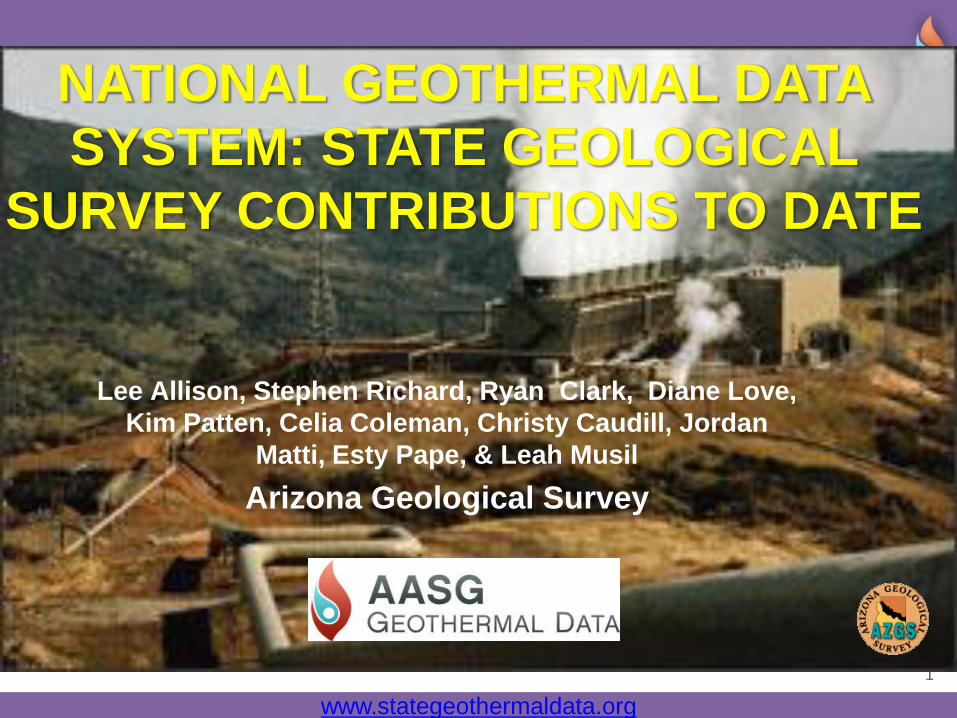
Page 1
www.stategeothermaldata.org
1
Lee Allison, Stephen Richard, Ryan Clark, Diane Love,
Kim Patten, Celia Coleman, Christy Caudill, Jordan
Matti, Esty Pape, & Leah Musil
Arizona Geological Survey
NATIONAL GEOTHERMAL DATA
SYSTEM: STATE GEOLOGICAL
SURVEY CONTRIBUTIONS TO DATE
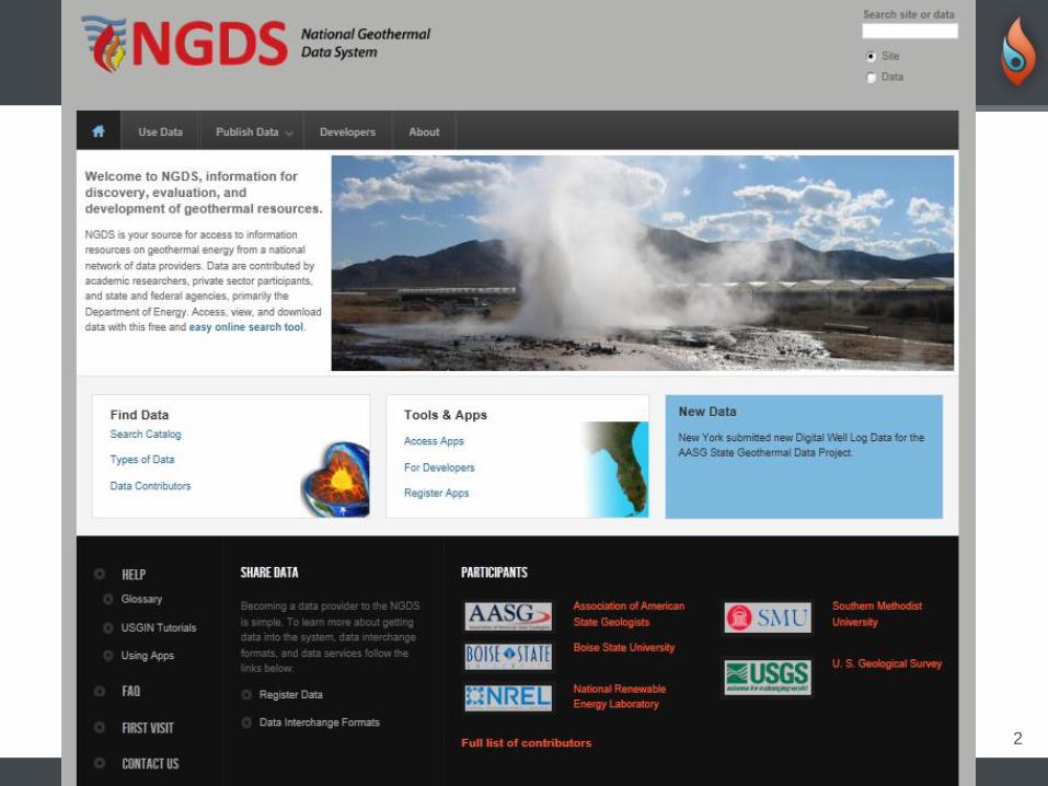
Page 2
www.geothermaldata.org and www.stategeothermaldata.org
2
Page 3
www.stategeothermaldata.org
3
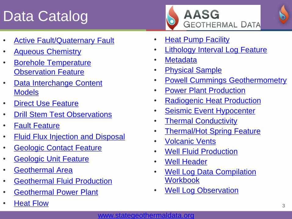
Data Catalog
• Active Fault/Quaternary Fault
• Aqueous Chemistry
• Borehole Temperature
Observation Feature
• Data Interchange Content
Models
• Direct Use Feature
• Drill Stem Test Observations
• Fault Feature
• Fluid Flux Injection and Disposal
• Geologic Contact Feature
• Geologic Unit Feature
• Geothermal Area
• Geothermal Fluid Production
• Geothermal Power Plant
• Heat Flow
• Heat Pump Facility
• Lithology Interval Log Feature
• Metadata
• Physical Sample
• Powell Cummings Geothermometry
• Power Plant Production
• Radiogenic Heat Production
• Seismic Event Hypocenter
• Thermal Conductivity
• Thermal/Hot Spring Feature
• Volcanic Vents
• Well Fluid Production
• Well Header
• Well Log Data Compilation Workbook
• Well Log Observation
Page 4
www.stategeothermaldata.org
4
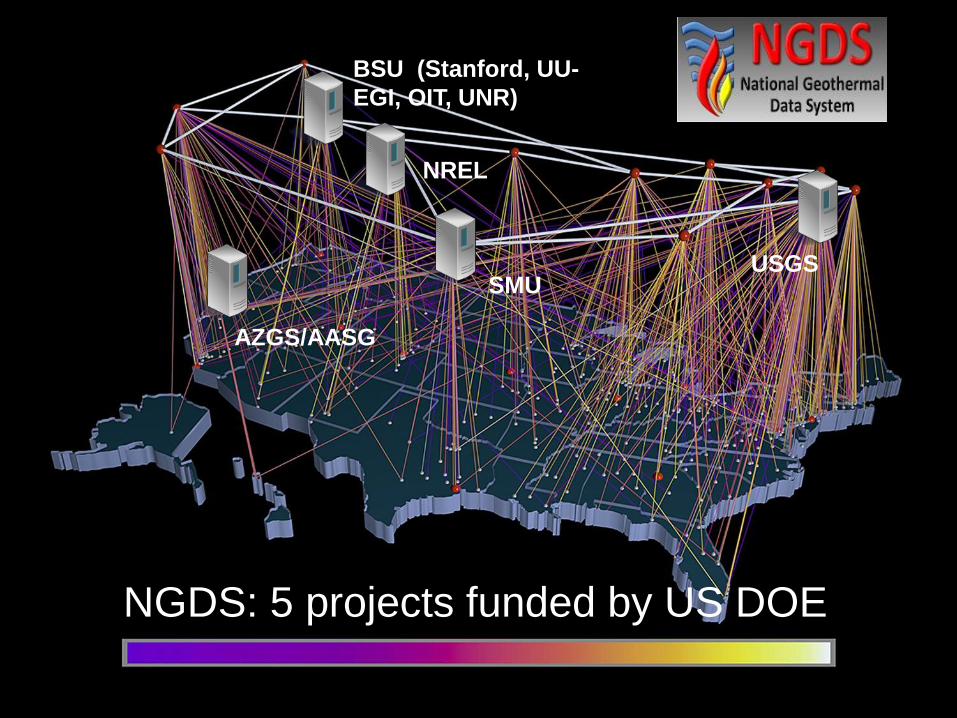
SMU USGS
BSU (Stanford, UU-
EGI, OIT, UNR)
AZGS/AASG
NREL
NGDS: 5 projects funded by US DOE
Page 5
www.stategeothermaldata.org
5
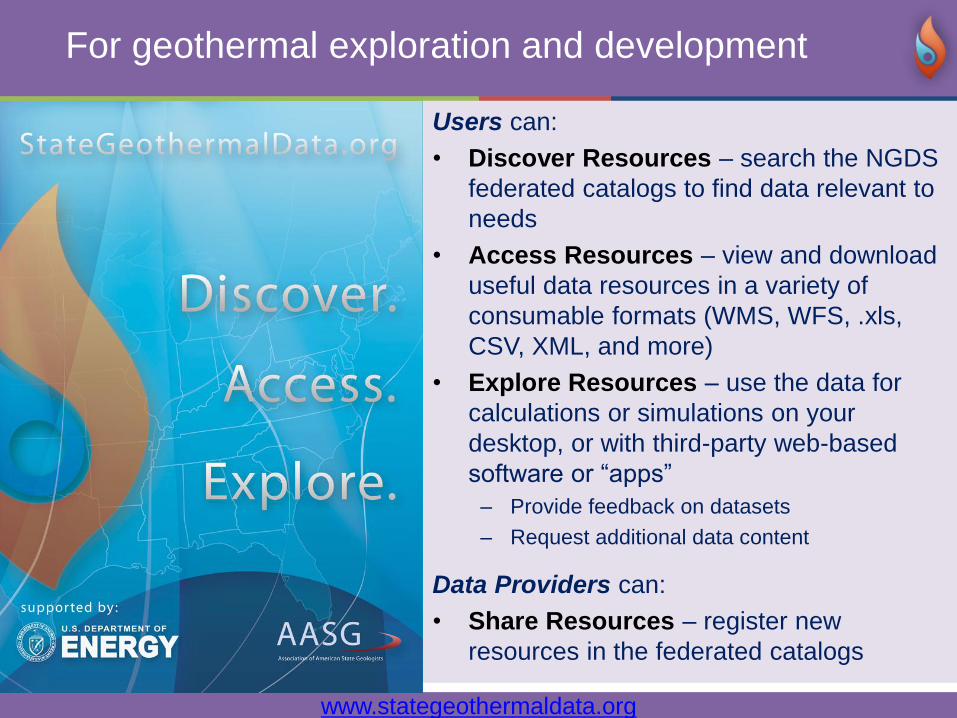
Users can:
• Discover Resources – search the NGDS
federated catalogs to find data relevant to
needs
• Access Resources – view and download
useful data resources in a variety of
consumable formats (WMS, WFS, .xls,
CSV, XML, and more)
• Explore Resources – use the data for
calculations or simulations on your
desktop, or with third-party web-based
software or “apps”
– Provide feedback on datasets
– Request additional data content
Data Providers can:
• Share Resources – register new
resources in the federated catalogs
For geothermal exploration and development
Page 6
www.stategeothermaldata.org
6
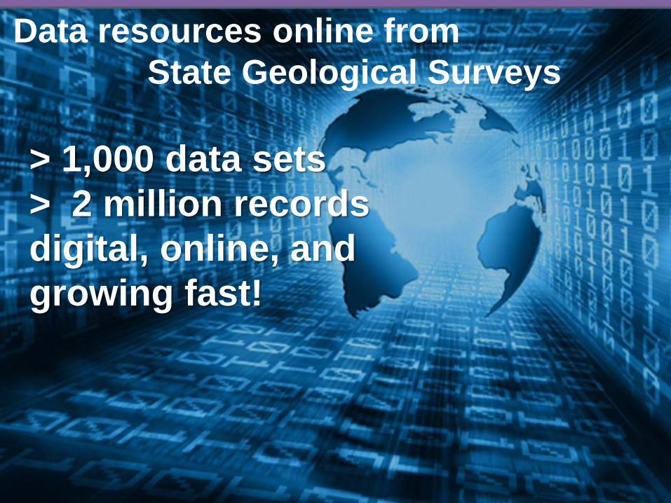
Data resources online from
State Geological Surveys
> 1,000 data sets
> 2 million records
digital, online, and
growing fast!
Page 7
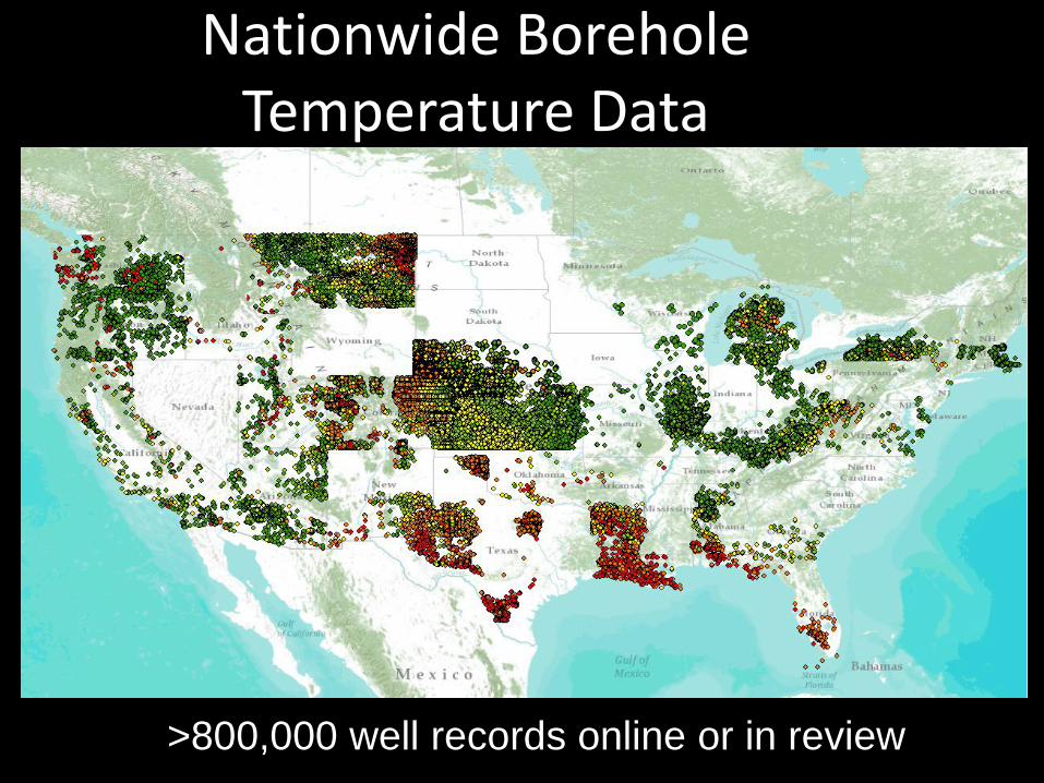
Nationwide Borehole Temperature Data
>800,000 well records online or in review
Page 8
www.stategeothermaldata.org
8
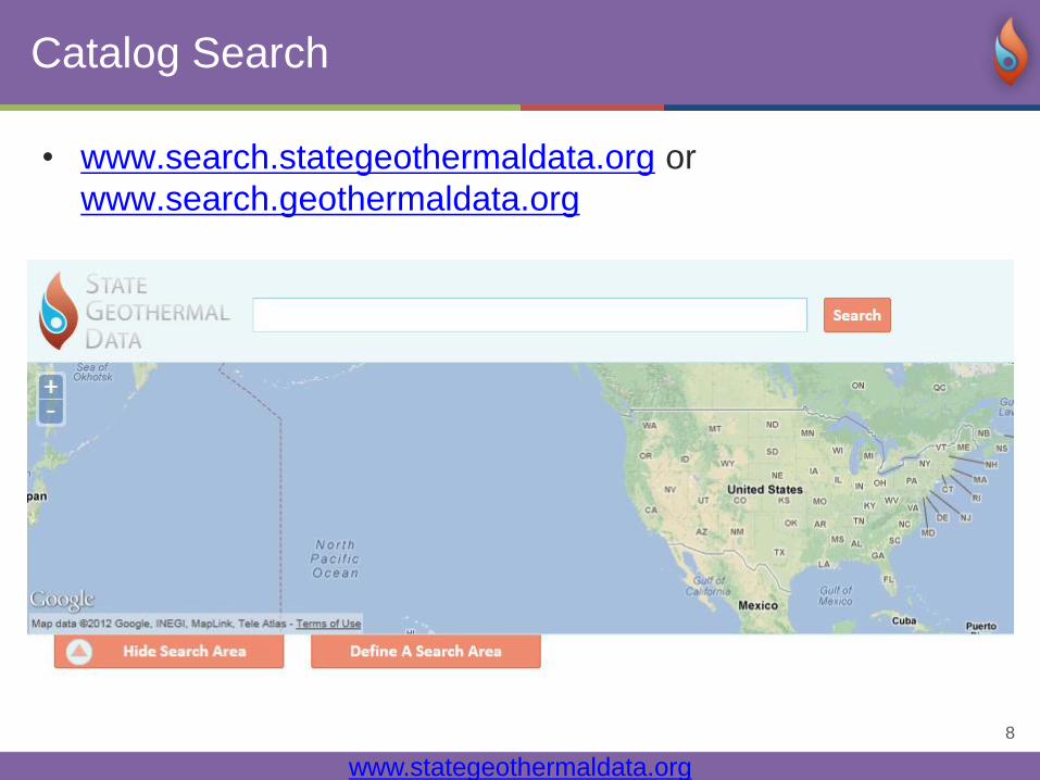
Catalog Search
• www.search.stategeothermaldata.org or
www.search.geothermaldata.org
Page 9
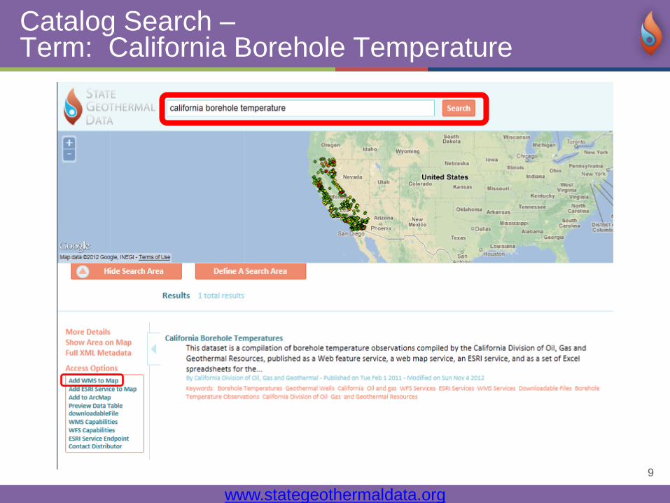
www.stategeothermaldata.org
9
Catalog Search – Term: California Borehole Temperature
Page 10
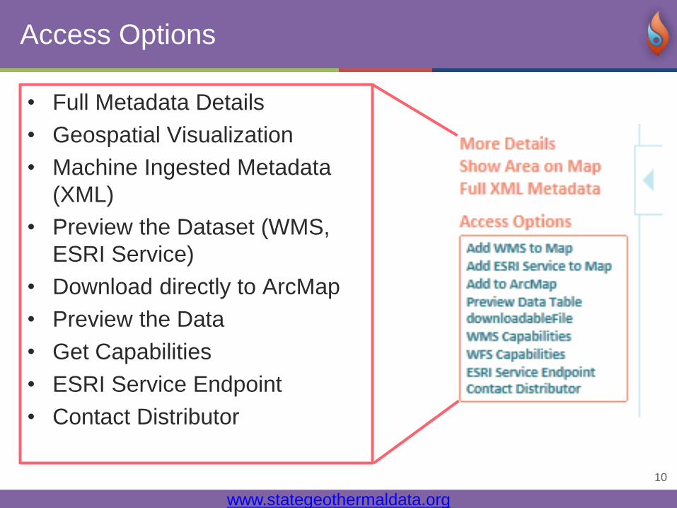
www.stategeothermaldata.org
10
Access Options
• Full Metadata Details
• Geospatial Visualization
• Machine Ingested Metadata
(XML)
• Preview the Dataset (WMS,
ESRI Service)
• Download directly to ArcMap
• Preview the Data
• Get Capabilities
• ESRI Service Endpoint
• Contact Distributor
Page 11
www.stategeothermaldata.org
11
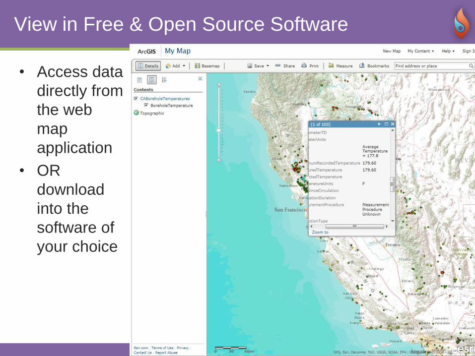
View in Free & Open Source Software
• Access data
directly from
the web
map
application
• OR
download
into the
software of
your choice
Page 12
www.stategeothermaldata.org
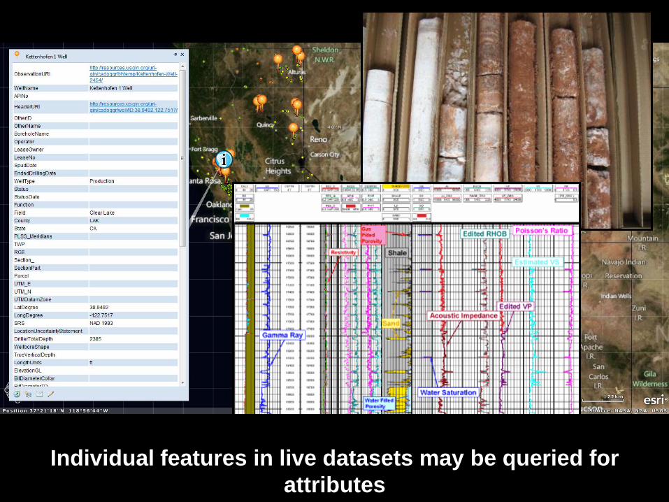
12 Individual features in live datasets may be queried for
attributes
Page 13
www.stategeothermaldata.org
13
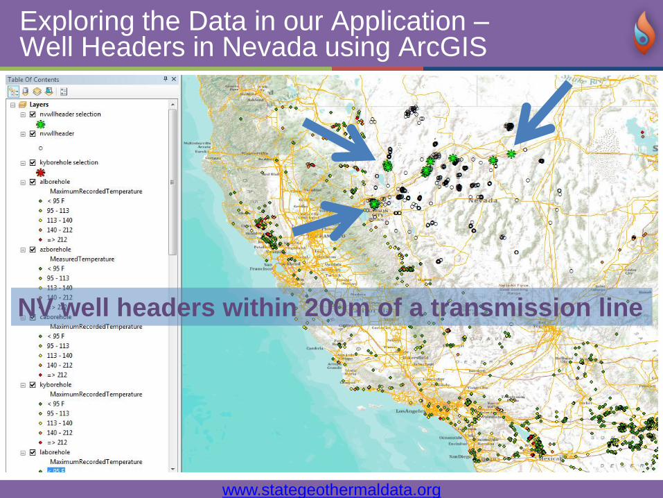
Exploring the Data in our Application –Well Headers in Nevada using ArcGIS
NV well headers within 200m of a transmission line
Page 14
www.stategeothermaldata.org
14
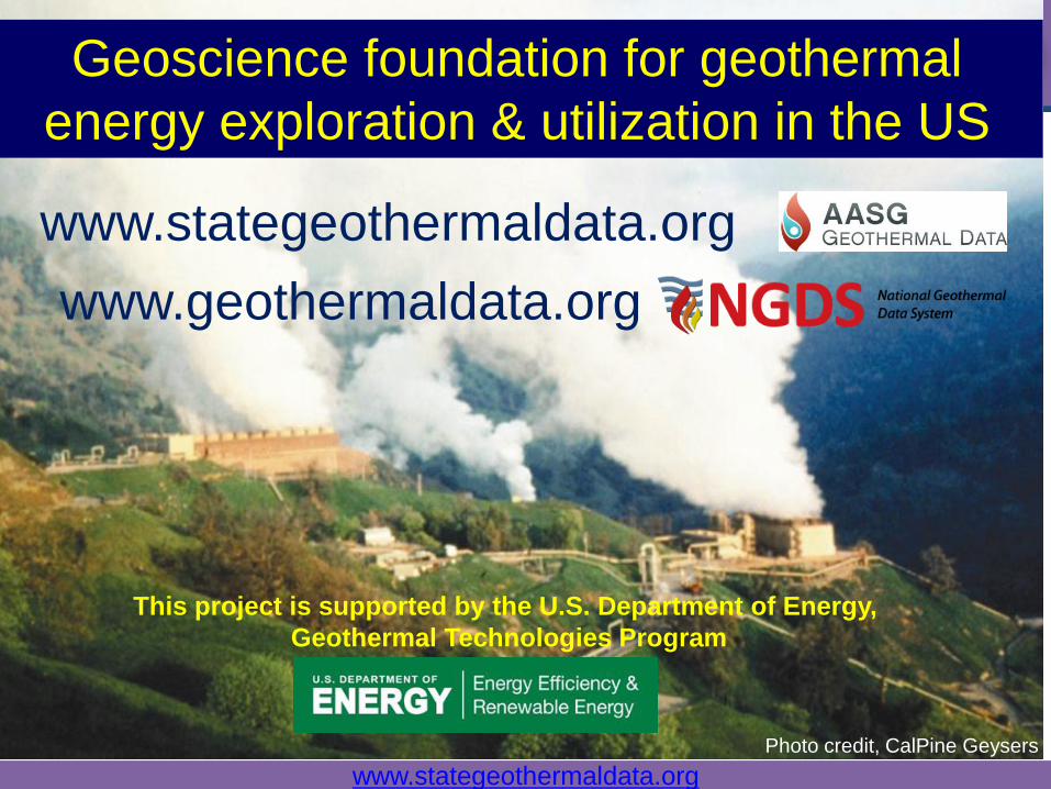
Geoscience foundation for geothermal
energy exploration & utilization in the US
www.stategeothermaldata.org
www.geothermaldata.org
Photo credit, CalPine Geysers
This project is supported by the U.S. Department of Energy,
Geothermal Technologies Program