NATIONAL HISTORIC LANDMARK NOMINATION NPS Form 10-900 USDI/NPS NRHP Registration Form (Rev. 8-86) OMB No. 1024-0018 DEER MEDICINE ROCKS Page 1 United States Department of the Interior, National Park Service National Register of Historic Places Registration Form 1. NAME OF PROPERTY Historic Name: Deer Medicine Rocks Other Names/Site Number: Medicine Deer Rocks; Medicine Rocks; Deer Rocks; Light in the Rock; Moving Picture Rocks; Indian Rocks; Indian Picture Rocks; Painted Rocks; Painted Cliffs; Rock Writing Bluff; Sitting Bull’s Medicine Tower/24RB401 2. LOCATION Street & Number: 1/2 mile west of MT Highway 39 Not for publication: X City/Town: Lame Deer Vicinity: X State: Montana County: Rosebud Code: 087 Zip Code: 59327 3. CLASSIFICATION Ownership of Property Category of Property Private: X Building(s): ___ Public-Local: District: ___ Public-State: ___ Site: _X _ Public-Federal: ___ Structure: ___ Object: ___ Number of Resources within Property Contributing Noncontributing buildings 1 sites structures objects 1 Total Number of Contributing Resources Previously Listed in the National Register: None Name of Related Multiple Property Listing:
Transcript
NATIONAL HISTORIC LANDMARK NOMINATION NPS Form 10-900 USDI/NPS NRHP Registration Form (Rev. 8-86) OMB No. 1024-0018 DEER MEDICINE ROCKS Page 1 United States Department of the Interior, National Park Service National Register of Historic Places Registration Form
1. NAME OF PROPERTY Historic Name: Deer Medicine Rocks Other Names/Site Number: Medicine Deer Rocks; Medicine Rocks; Deer Rocks; Light in the Rock; Moving Picture Rocks; Indian Rocks; Indian Picture Rocks; Painted Rocks; Painted Cliffs; Rock Writing Bluff; Sitting Bull’s Medicine Tower/24RB401 2. LOCATION Street & Number: 1/2 mile west of MT Highway 39 Not for publication: X City/Town: Lame Deer Vicinity: X State: Montana County: Rosebud Code: 087 Zip Code: 59327 3. CLASSIFICATION
Ownership of Property Category of Property Private: X Building(s): ___ Public-Local: District: ___ Public-State: ___ Site: _X_ Public-Federal: ___ Structure: ___
Object: ___ Number of Resources within Property Contributing Noncontributing buildings 1 sites structures objects 1 Total Number of Contributing Resources Previously Listed in the National Register: None Name of Related Multiple Property Listing:
NPS Form 10-900 USDI/NPS NRHP Registration Form (Rev. 8-86) OMB No. 1024-0018 DEER MEDICINE ROCKS Page 2 United States Department of the Interior, National Park Service National Register of Historic Places Registration Form
4. STATE/FEDERAL AGENCY CERTIFICATION As the designated authority under the National Historic Preservation Act of 1966, as amended, I hereby certify that this ___ nomination ____ request for determination of eligibility meets the documentation standards for registering properties in the National Register of Historic Places and meets the procedural and professional requirements set forth in 36 CFR Part 60. In my opinion, the property ____ meets ____ does not meet the National Register Criteria. Signature of Certifying Official Date State or Federal Agency and Bureau In my opinion, the property ____ meets ____ does not meet the National Register criteria. Signature of Commenting or Other Official Date State or Federal Agency and Bureau 5. NATIONAL PARK SERVICE CERTIFICATION I hereby certify that this property is: ___ Entered in the National Register ___ Determined eligible for the National Register ___ Determined not eligible for the National Register ___ Removed from the National Register ___ Other (explain): Signature of Keeper Date of Action
NPS Form 10-900 USDI/NPS NRHP Registration Form (Rev. 8-86) OMB No. 1024-0018 DEER MEDICINE ROCKS Page 3 United States Department of the Interior, National Park Service National Register of Historic Places Registration Form
6. FUNCTION OR USE Historic: RELIGION Sub: Ceremonial site Current: AGRICULTURE Sub: Cattle grazing LANDSCAPE Natural feature RELIGION Ceremonial site 7. DESCRIPTION ARCHITECTURAL CLASSIFICATION: Other MATERIALS: N/A
Foundation: Walls: Roof: Other:
NPS Form 10-900 USDI/NPS NRHP Registration Form (Rev. 8-86) OMB No. 1024-0018 DEER MEDICINE ROCKS Page 4 United States Department of the Interior, National Park Service National Register of Historic Places Registration Form
Describe Present and Historic Physical Appearance. Deer Medicine Rocks, a sandstone rock formation in the Rosebud Valley of Montana, is nationally significant under National Historic Landmark Criterion 1 for its associations with the Great Sioux War of 1876-77. Numerous petroglyphs cover the walls of Deer Medicine Rocks, including a rock art inscription of the prophecy of a tribal victory at the Battle of the Little Bighorn.1 The prophecy was revealed to Hunkpapa Lakota medicine man Sitting Bull during a Sun Dance held in the Rosebud Valley in June 1876, approximately two weeks prior to the Indians’ victory over of Lieutenant Colonel George A. Custer’s Seventh Cavalry command at the Battle of the Little Bighorn on June 25-26. Deer Medicine Rocks borders the west bank of Rosebud Creek, Montana, about two miles north of the mouth of Lame Deer Creek. The site is approximately five miles north of the community of Lame Deer which is the seat of the Northern Cheyenne Indian Reservation, fifty-seven miles south of the city of Forsyth and one-half mile west of Montana Highway 39. Geologically, the monolithic landforms of buff or pale yellow sandstone ridges and nearly vertical bluffs are classified as part of the Fort Union formation of the late Cretaceous/early Tertiary periods. They are mostly comprised of vast near-surface coal beds known as the Forsyth field on the northwestern edge of the Powder River Basin. The thick sandstone bed composes the upper zone known as the Tongue River member of the Fort Union formation, and is thus designated Tongue River Sandstone.2 The surrounding land encompasses broad, rolling terrain of grassy hillocks and ridges intermittently surmounted by naturally sculpted sandstone outcroppings overlooking Rosebud Valley. These edifices have been buffeted through time by wind and precipitation that have caused erosion to their surfaces. Although the site has been privately owned for approximately five generations by the same family, it remains in a relatively pristine setting amid the Rosebud hills, and the present owner maintains and protects the site in its natural configuration permitting limited access to visitors. The massive buff-colored promontories of Deer Medicine Rocks rise to fifty feet above the surrounding terrain and occupy approximately two acres measuring about 150 feet north-to-south and 100 feet west-to-east.3 On the adjoining west, north, and south sides, the monolithic outcrop rests atop gently sloping ground, while on the east side the terrain declines more abruptly toward Rosebud Creek less than one quarter mile away. Because of bends in the stream the south side of Deer Medicine Rocks is only about 200 yards from the creek. Smaller stone outcroppings exist throughout the area. Native grasses carpet the ground immediately surrounding Deer Medicine Rocks, while yucca, skunk brush, sage, wild turnips, and wild potatoes grow throughout the area and chokecherry bushes sporadically mass at their base. Animals living in and around the rocks include deer, pronghorns, rabbits, badgers, snakes, and lizards; horses range the country nearby. Hawks and eagles fly overhead with other native birds, while swallows nest in holes and crevices in the rocks. From their position astride the ridge above the environs of Rosebud Creek the rocks fairly dominate the view shed in all directions.
1 Rock art is defined as engravings or petroglyphs, “made by cutting into the rock surface,” and paintings, or pictographs, “made by coating the rock surface with pigment.” James D. Keyser and Michael A. Klassen, Plains Indian Rock Art (Seattle: University of Washington Press, 2001), 5.
2 C. E. Dobbin, The Forsyth Coal Field: Rosebud, Treasure, and Big Horn Counties, Montana. U.S. Geological Survey Bulletin 812-A (Washington, DC: Government Printing Office, 1929), 54, 55; David Alt and Donald W. Hyndman, Roadside Geology of Montana (Missoula, MT: Mountain Press, 1986), 301, 363-64, 366; Clifford A. Balster, ed., Catalog of Stratigraphic Names for Montana, State of Montana Bureau of Mines and Geology Special Publication 54 (Butte, MT: Montana College of Mineral Science and Technology; and Billings, MT: Montana Geological Society, 1971), 19. See also, Montana Bureau of Mines and Geology, Open File Report: Petroleum Potential of the Greybull Sandstone on the Northern Cheyenne Reservation, South-Central Montana, MBMG 416 (Helena: Montana Bureau of Mines and Geology, 2000), 9.
3 Although Deer Medicine Rocks is not on a direct north-south axis, for the purposes of simplifying the descriptions in this nomination the sides of the feature will be described as north, south, east, and west.
NPS Form 10-900 USDI/NPS NRHP Registration Form (Rev. 8-86) OMB No. 1024-0018 DEER MEDICINE ROCKS Page 5 United States Department of the Interior, National Park Service National Register of Historic Places Registration Form
Deer Medicine Rocks consists of a rock outcropping containing numerous petroglyphs. The outcropping is set within a larger geographic landscape that includes sandstone formations containing many additional examples of rock art. This nomination focuses specifically on the Deer Medicine Rocks assemblage of rock art separate from the other rock art and nearby cultural features because of Deer Medicine Rocks important association with the Great Sioux War. The numerous petroglyphs that cover the walls of Deer Medicine Rocks indicate prolonged precontact and historical use of the site. Carved and/or etched into the sandstone, presumably with sharpened stone, bone, antler, and perhaps fire-hardened wood implements, the incised drawings depicting various representations of man and nature (mainly people, animals, designs, and inanimate objects) cover all sides of the monolith for a considerable distance above ground level, although most of the artwork is confined to the northeast, east, southeast, and south sides. At least one stone implement has been found near the base of Deer Medicine Rocks. In 1959, a knife of brown jasper measuring 6 ½ inches in length, 2 ⅛ inches wide, and ⅜ inch thick in the center, was recorded there. It was manufactured using percussion flaking and pressure flaking methods.4 The incised art work represented at Deer Medicine Rocks and elsewhere throughout the Northern Plains, has largely been a subject of conjecture by archeologists and is only beginning to be systematically studied to determine its broad value. The relative age of rock art is generally difficult to determine in this area. Only rarely have opportunities permitted establishment of tentative dates through sediment deposition (although several methods of estimating petroglyph age are now being used). Additionally, archeologists often have difficulty interpreting petroglyphs and pictographs. As one investigator concluded, “their pictographic significance must remain obscure, . . . for such symbolism is a highly individualized thing….” Although some authorities believe that most petroglyphs and pictographs in this area are less than 1,000 years old, others believe that they might date as far back as 2,000 years BCE. Furthermore, there is evidence that some rock art here represents a more recent historic period as conveyed through the introduction of horses, guns, and other items (small shields versus earlier large shields, etc.). Students of rock art discern a possible increased sophistication in petroglyphs indicating animated art over presumed earlier panels of apparent inanimate one-dimensional figures. Some archeologists who study rock art believe it can help determine regional chronologies and that type/context classifications through documentation and comparison of replicated drawing patterns might be significant. Further, theoretical studies considering rock art in hunting and gathering economies can potentially add new dimensions of knowledge about those societies.5 Examinations of Deer Medicine Rocks have occurred in conjunction with studies of Native American rock art, either in particular studies related regionally to the Northern Plains area or in broader reviews of trans-Mississippi indigenous art forms. In most of these cases, the inscription-bearing sides of the rocks have been
4 Jim Foster to Stuart W. Conner, June 2, 1965. Deer Medicine Rocks correspondence in the possession of Margot Liberty,
Sheridan, Wyoming. 5 Julie E. Francis, “An Overview of Wyoming Rock Art,” in George C. Frison, Prehistoric Hunters of the High Plains (San
Diego: Academic, 1991), 398-99. Quote, William T. Mulloy, “A Preliminary Historical Outline for the Northwestern Plains,” University of Wyoming Publications, 22, no. 1, (1958): 119. See also, George C. Frison, “Hunting and Gathering Tradition: Northwestern and Central Plains,” in William C. Sturtevant (gen. ed.), Handbook of North American Indians (Washington, DC: Smithsonian Institution, 2001); William C. Sturtevant, gen. ed., Handbook of North American Indians. Vol. 13, Pt. 1, Plains, ed. Raymond J. DeMallie (Washington, DC: Smithsonian Institution, 2001), 142-43; and James D. Keyser, Art of the Warriors: Rock Art of the American Plains (Salt Lake City: University of Utah Press, 2004), 16-23. For more discussion of elements of rock art, including dating techniques, together with comprehensive photographic documentation of regional examples, see Julie E. Francis and Lawrence L. Loendorf, Ancient Visions: Petroglyphs and Pictographs of the Wind River and Bighorn Country, Wyoming and Montana (Salt Lake City: University of Utah Press, 2002), 52-67 passim; and Mary Helen Hendry, Indian Rock Art in Wyoming (Lysite, WY: Privately published, 1983), passim. Discussion of early comparison of rock art images at sites in the Cave Hills, South Dakota, with those at Deer Medicine Rocks and elsewhere appears in a note by Stuart W. Conner dated August 27, 1980. Deer Medicine Rocks correspondence in the possession of Margot Liberty, Sheridan, Wyoming.
NPS Form 10-900 USDI/NPS NRHP Registration Form (Rev. 8-86) OMB No. 1024-0018 DEER MEDICINE ROCKS Page 6 United States Department of the Interior, National Park Service National Register of Historic Places Registration Form
photographed or otherwise copied for recordation purposes. The art panels at Deer Medicine Rocks include numerous examples of long-established categories of petroglyph forms. Among these are the v-necked human figure motif, the tepee, elk and deer, mountain sheep (with ground-out body), bear, bear paws, salamanders or lizards, animal tracks, the horse (with rider), horse tracks, and various inanimate objects and designs. Many rock art forms are believed to be Shoshonean in origin because of comparisons of such designs in Montana with those in the Great Basin region and because of a protracted Shoshoni/Bannock presence in Montana roughly between 800 CE and 1700 CE. Another theory is that the drawings may have been carved by long-present Crow Indians, but because the data is insufficient, modern Montana tribes cannot be conclusively affiliated with the extant rock art forms of the Northern Plains in general, or to those on Deer Medicine Rocks in particular. Archeologists suggest that the drawings closest to the top of the rock formation reveal substantial erosion of the soil at their base, and might therefore be among the oldest at this site. Archeologists who have surveyed and recorded Great Plains rock art further recognize similarities with objects drawn on winter count (Lakota calendars) and hide paintings, suggesting that certain localized motifs date from the latter nineteenth century.6 Among graphic representations on the walls of Deer Medicine Rocks are: elk with tracks; buffalo bull sitting down (possibly Sitting Bull’s signature); buffalo tracks; bear tracks and a grizzly bear; mountain sheep; deer; birds; salamanders; a thunderbird; a coyote; the sacred Sun Dance of the Lakota people, with pole and piercing of the flesh; tepees; a man on horseback; war regalia in the form of bear claws, a mirror, and eagle bone whistles; a view of soldiers with grasshopper-like legs falling into camp; an apparent medicine wheel with quadrants including a moon and a man smoking a pipe; and a human with a shield. At a particular place along the northeast side, a lightning bolt struck the rock creating a blue stripe that seared through the image of a deer and knocked away a piece of the stone thereby providing the site’s most common name, “Deer Medicine Rocks.” The large individual rock that bears the lightning strike is itself known as “Deer Medicine Rock.” There are also several examples of historic graffiti: “J. B. Clark F Co. 22,” acknowledges the presence of James B. Clark, a soldier of Company F, Twenty-Second Infantry, who passed along the rocks and possibly bivouacked there in May 1877, with Colonel Nelson A. Miles’s command during closing operations of the Great Sioux War. “T. Cosgrove 76” may refer to Thomas Cosgrove, who supervised the Shoshoni scouts with Brigadier General George Crook’s command in 1876. While the figures on Deer Medicine Rocks depict various anthropomorphic, zoomorphic, and abstract drawings, several petroglyph design types in particular are considered religious by the Cheyenne as well as the Lakota. These include the turtle, the lizard, v-necked humans, a circle containing a dot, and a bisected circle with affiliated lines. Some panels girdling the rocks reportedly suggest elements of the Sun Dance, or reflect parts of nature, ceremonialism, and facets of Cheyenne theology/cosmology. Although learned elders and holy men alone can interpret the rock inscriptions, not everyone agrees altogether with one another’s interpretation of the sacred marks.7 On the south side of the monolith, for example, is a representation of bear claws, a mirror, and
6 Stuart W. Conner and Betty Lu Conner, Rock Art of the Montana High Plains (Santa Barbara: University of California, 1971),
12, 14-28, 31-41; Francis, “Overview of Wyoming Rock Art,” 420; “Montana Archaeological Society Pictograph Survey,” reported by Jim Foster, January 28, 1961, copy in Deer Medicine Rocks correspondence in the possession of Margot Liberty, Sheridan, Wyoming. Hendry wrote that nineteenth century examples were probably created by the Arapaho on the Wind River Reservation after 1872. Hendry, Indian Rock Art in Wyoming, 7-8, 56. For context see also, Stuart W. Conner, “A Preliminary Survey of Prehistoric Picture Writing on Rock Surfaces in Central and South Central Montana,” Anthropological Paper No. 2, Billings Archaeological Society, Billings, Montana, 1962, passim; and Jeffrey R. Hanson, “The Late High Plains Hunters,” in Archeology on the Great Plains, ed. W. Raymond Wood (Lawrence: University Press of Kansas, 1998), 465. Deer Medicine Rocks was recorded, photographed (negatives destroyed), and added to the Montana Archaeological Society’s “Pictograph Survey” (Site Number 24RB401) on January 28, 1961.
7 The Northern Cheyenne Tribe and Its Reservation, 2002. A Report to the U.S. Bureau of Land Management and the State of Montana Department of Natural Resources and Conservation, April 2002, 7-7, 7-8. This is a technical support document accompanying Final Statewide Oil and Gas Environmental Impact Statement and Proposed Amendment of the Powder River and Billings Resource Management Plans; Francis, “Overview of Wyoming Rock Art,” 405-15; Andrew Gulliford, Sacred Objects and
NPS Form 10-900 USDI/NPS NRHP Registration Form (Rev. 8-86) OMB No. 1024-0018 DEER MEDICINE ROCKS Page 7 United States Department of the Interior, National Park Service National Register of Historic Places Registration Form
eagle bone whistles that represent a warning, “what you’re doing to us, you’re doing to yourself.” A nearby mirror concept is interpreted as an admonition to always look at oneself, while a tree of life and constellations denote protection on life’s journey.8 Another petroglyph represents a Northern Cheyenne warrior who holds a large shield as protection in battle. Hunting is a prevalent theme as well. A drawing of a grizzly bear that has eaten a man shows a hunter’s arrow striking the animal but purposefully not penetrating deeply to prevent from striking the man inside, who was later reborn as a boy. Other themes center on birth and the continuum of Northern Cheyenne life, such as in a petroglyph interpreted as a woman delivering a child with medicine men praying nearby. Another one addresses the sanctity of the Sacred Buffalo Hat in Cheyenne culture with the portrayal of the Medicine Hat tepee. An image of a priest standing over a Northern Cheyenne man killed by enemy arrows is said to portend a troubling period for the tribe.9 For the Northern Cheyenne new drawings are always being revealed by the Deer Medicine Rocks, and are often seen in three-dimensional form. Although individual interpretations might differ, in accordance with Cheyenne theology the rocks with their ever-changing visions of life and the future, continuously affect people throughout the world.10 Deer Medicine Rocks is nationally significant for its association with the Great Sioux War of 1876-77, and several images on the rock formation directly relate to the Indians’ participation in the war. A famous petroglyph is an image of soldiers with long grasshopper legs falling from the sky into camp; it is believed to depict a vision of Sitting Bull’s that occurred in 1876 and foretold a Native American victory at Battle of the Little Bighorn. Other elements are interpreted as telling the people (Cheyenne) to leave that battlefield without taking anything, a dictum that was not obeyed. According to one interpretive perspective, the blue lightning strike at the northeast corner of the Deer Medicine Rocks cluster signaled to the Hunkpapa Lakota medicine man Sitting Bull that his people should hold a Sun Dance at this site. The feather-head dressed individual at the lower right of the deer whose image was marred by the lightning bolt is believed by some to represent the Hunkpapa leader. Another image depicts a Cheyenne Sun Dance priest in an apron with a whistle passing a pipe to another man. This event is interpreted as having occurred in 1876 at a Sun Dance following the Battle of the Little Bighorn when the Cheyenne offered spiritual succor to Sitting Bull’s people before journeying into Canada.11 Deer Medicine Rocks has a high level of integrity in terms of the rock formation, its petroglyphs, and setting. While centuries of erosion have obliterated and/or obscured some of the art, much of it remains intact. There is evidence of exfoliation and sloughing of the sandstone, which has effaced some parts of the artwork, and in some instances later carvings have been inscribed over earlier ones. There are a few instances of modern graffiti and a small number of crucifixes have been incised into the rock by destructive visitors in recent years. The only object within the proposed National Historic Landmark boundary is a small survey marker reference point located near the southwest corner of the rocks. Because of its small size it is not countable as resource. A slightly rutted dirt road or trail leading approximately one mile north from the Bailey Ranch to Deer Medicine Rocks, is outside of the proposed boundary. Visitors to Deer Medicine Rocks can experience a near panoramic Sacred Places: Preserving Tribal Traditions (Boulder: University of Colorado Press, 2000), 88.
8 Philip Whiteman, Jr., interpretations in Jerome A. Greene, Field Notes, August 30, 2006. 9 Interpretations by Donlin Many Bad Horses in 2001 calendar, Stories in Stone. Deer Medicine Rocks, Rosebud Creek,
Southeastern Montana (Bozeman, MT: Stories in Stone Partners, 2000). 10 Philip Whiteman, Jr., interpretations in Greene, Field Notes. It should be noted that traditional Indian views of sacred
landscapes as represented by Deer Medicine Rocks are hardly limited to the immediate resource itself but normally embrace expansive natural elements as found in the immediate adjoining area, such as hills, buttes, and streams, that embody and connote powerful spiritual aspects of tribal culture and religion including those of several of the associative sites addressed below; together with those manifested in Deer Medicine Rocks they compose a cultural/spiritual landscape reflecting the essence of the people. Fred Chapman, “The Bighorn Medicine Wheel: Landscape Wars and Negotiating Native American Spirituality in the New West,” in Preserving Western History, ed. Andrew Gulliford (Albuquerque: University of New Mexico Press, 2005), 159-62, 164.
11 Philip Whiteman, Jr., interpretations in Greene, Field Notes; Interpretations by Donlin Many Bad Horses in 2001 calendar, Stories in Stone.
NPS Form 10-900 USDI/NPS NRHP Registration Form (Rev. 8-86) OMB No. 1024-0018 DEER MEDICINE ROCKS Page 8 United States Department of the Interior, National Park Service National Register of Historic Places Registration Form
view of the Rosebud Valley, which was the location of numerous activities associated with the Great Sioux War including Sitting Bull’s Sun Dance, encampment sites, and the travel routes used by army troops and Native Americans. The most significant incursion to the viewshed is Montana Highway 39, which is one-half mile west of the site. Although much of the valley is now used for cattle grazing and agriculture, there are only three ranches (including the Bailey Ranch) within a mile radius. Overall, the open landscape, viewshed, quietness, and limited modern intrusions create a physical setting that has changed relatively little from the time of the Great Sioux War. The larger geographic landscape beyond Deer Medicine Rocks includes other places that are significant to the Northern Cheyenne, including the high level bench land immediately to the west of the rocks where the people often camped. A cliff located along the rocky ridge one-quarter mile south from Deer Medicine Rocks is where, during the Great Sioux War, a young Northern Cheyenne woman lamenting a sorrowful event in her life purposefully danced backward off the edge and fell to her death.12 On the north face of a large sandstone rock outcropping approximately 200 yards southwest of Deer Medicine Rocks, is an incised drawing that is presently interpreted by Lakota as the Oglala leader Crazy Horse’s premonition of his own death. The drawing, said to have been incised into the rock during the 1850s by a young Crazy Horse, was explained by Lakota visitors to landowner Jack Bailey in 2003 as showing a man believed be the Sioux warrior chief wounded near the kidneys by a spear-like weapon. Crazy Horse’s tribesman Little Big Man, along with government physician Dr. Valentine T. McGillycuddy, are also interpreted in this rendering. (Crazy Horse was mortally wounded in the kidneys by a soldier’s bayonet on September 5, 1877, at Fort Robinson, Nebraska.)13 Another site bearing petroglyphs is Tepee Rocks, located about one mile southwest from Deer Medicine Rocks. Among the inscriptions interpreted there are views of Indians hunting, a Dog Soldier with a crow-feather roach, a grizzly bear with a blunderbuss-type firearm (flintlock with feathers attached), a tepee, flying birds, and lightning bolts.14 About three miles north of Deer Medicine Rocks are grounds once camped upon by the ancestors of modern Northern Cheyenne and Lakota; there are tepee rings and evidence of a buffalo jump nearby.15 There are doubtless other rock formations, some presenting examples of inscriptions in the eroded sandstone ledges and projections scattered throughout the landscape adjoining Deer Medicine Rocks. Contributing Resources Site: Deer Medicine Rocks (rock formation) (1)
12 Philip Whiteman, Jr., interpretations in Greene, Field Notes. 13 Greene, Field Notes; Billings Gazette, June 25, 2003. 14 Greene, Field Notes. 15 Billings Gazette, November 14, 1962; Jim Foster to Stuart W. Conner, June 2, 1965. Deer Medicine Rocks correspondence in
the possession of Margot Liberty, Sheridan, Wyoming; See also Kenneth Feyhl, “Rosebud County, Montana Site Leads,” July 14, 1965, in Ibid., which indicates existence of Indian occupation sites, including those with inscriptions in areas to the north of Deer Medicine Rocks.
NPS Form 10-900 USDI/NPS NRHP Registration Form (Rev. 8-86) OMB No. 1024-0018 DEER MEDICINE ROCKS Page 9 United States Department of the Interior, National Park Service National Register of Historic Places Registration Form
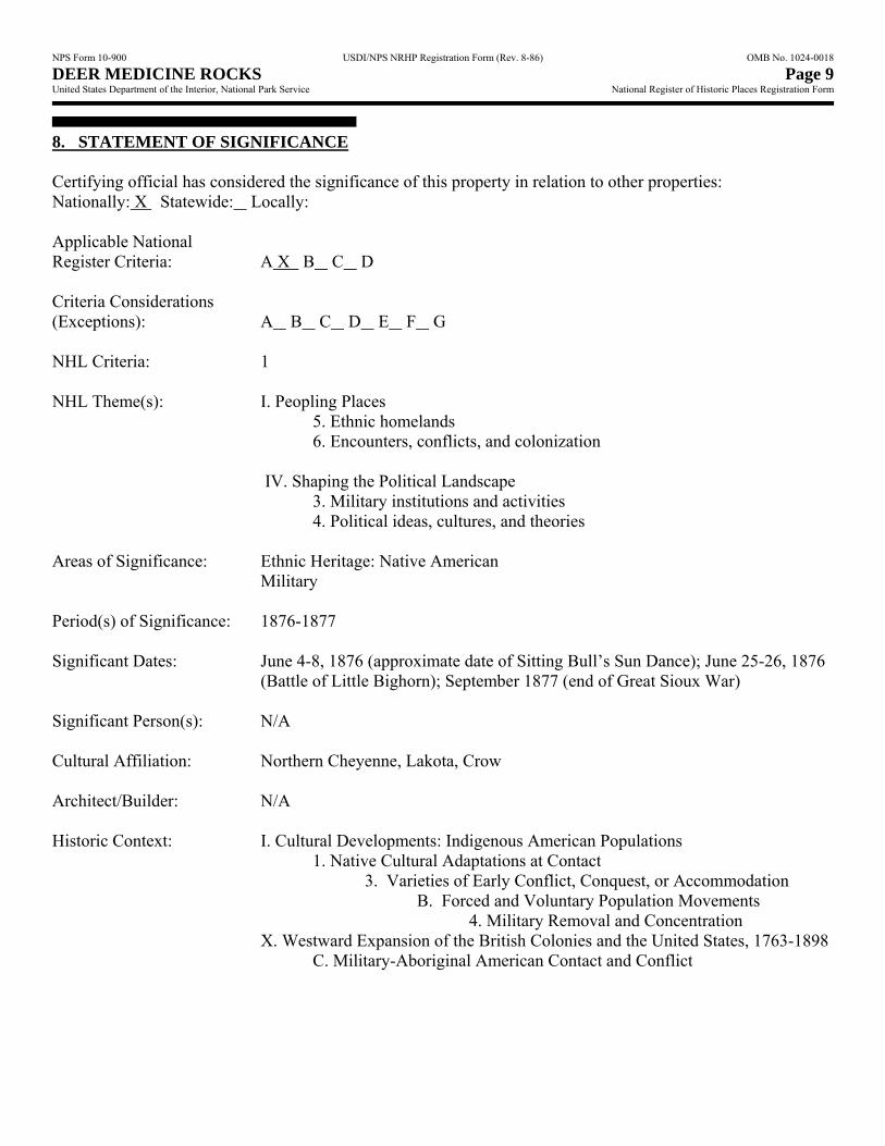
8. STATEMENT OF SIGNIFICANCE Certifying official has considered the significance of this property in relation to other properties: Nationally: X Statewide: Locally: Applicable National Register Criteria: A X B C D Criteria Considerations (Exceptions): A B C D E F G NHL Criteria: 1 NHL Theme(s): I. Peopling Places 5. Ethnic homelands 6. Encounters, conflicts, and colonization IV. Shaping the Political Landscape 3. Military institutions and activities 4. Political ideas, cultures, and theories Areas of Significance: Ethnic Heritage: Native American Military Period(s) of Significance: 1876-1877 Significant Dates: June 4-8, 1876 (approximate date of Sitting Bull’s Sun Dance); June 25-26, 1876
(Battle of Little Bighorn); September 1877 (end of Great Sioux War) Significant Person(s): N/A Cultural Affiliation: Northern Cheyenne, Lakota, Crow Architect/Builder: N/A Historic Context: I. Cultural Developments: Indigenous American Populations 1. Native Cultural Adaptations at Contact 3. Varieties of Early Conflict, Conquest, or Accommodation B. Forced and Voluntary Population Movements 4. Military Removal and Concentration X. Westward Expansion of the British Colonies and the United States, 1763-1898 C. Military-Aboriginal American Contact and Conflict
NPS Form 10-900 USDI/NPS NRHP Registration Form (Rev. 8-86) OMB No. 1024-0018 DEER MEDICINE ROCKS Page 10 United States Department of the Interior, National Park Service National Register of Historic Places Registration Form
State Significance of Property, and Justify Criteria, Criteria Considerations, and Areas and Periods of Significance Noted Above. Evaluation of Significance under NHL Criterion 1 Deer Medicine Rocks is nationally significant under National Historic Landmark Criterion 1 for its associations with the Great Sioux War, and specifically for its connection with Sitting Bull’s Sun Dance of early June 1876 during which he had a prophecy of tribal victory at the Battle of the Little Bighorn. His vision is inscribed on Deer Medicine Rocks. Among the Lakota and Northern Cheyenne, Deer Medicine Rocks was a major cultural site that was well known to then-resident tribes and before the 1870s. Deer Medicine Rocks assumed major significance to these tribes when a graphic depiction appearing on the rocks after Sitting Bull’s Sun Dance foretold the Indians’ defeat of Lieutenant Colonel George A. Custer’s Seventh Cavalry command at the Battle of the Little Bighorn on June 25 and 26, 1876. The prophecy of the Hunkpapa Lakota medicine man was translated into an etched drawing on the face of the rocks and interpreted as “many soldiers falling into camp.” This prophesy later inspired the tribesmen and helped brace them for future conflict with the soldiers. Spiritually and psychologically, the prediction manifested in Sitting Bull’s vision and further presaged in the stone of Deer Medicine Rocks, was a major cause in extending the duration of the Great Sioux War. The period of significance for Deer Medicine Rocks is directly tied to the Great Sioux War of 1876-77. Within the National Park Service thematic framework, Deer Medicine Rocks falls under Theme I, “Peopling Places,” under the subthemes of ethnic homelands and encounters, conflicts, and colonization, and under Theme IV, “Shaping the Political Landscape,” under the subthemes of military institutions and activities and political ideas, cultures, and theories. The National Park System includes a number of sites associated with the Great Sioux War but Deer Medicine Rocks is the only non-battle site to be nominated to date as a National Historic Landmark, and the only one that tells the story of the Battle of the Little Bighorn wholly from a Native American perspective and sources. Little Bighorn Battlefield National Monument, approximately 35 miles directly west of Deer Medicine Rocks, is the site of the June 25-26, 1876, victory of the Lakota and Northern Cheyenne over Custer’s troops.16 Two National Historic Landmarks within the vicinity of Deer Medicine Rocks are also associated with military engagements of the Great Sioux War. Rosebud Battlefield National Historic Landmark (2008), approximately 33 miles directly southwest of Deer Medicine Rocks, is the site of the Battle of the Rosebud, also known as Where the Girl Saved Her Brother; this battle took place one week before the Battle of the Little Bighorn. Here, on June 17, 1876, Northern Cheyenne and Lakota turned back Brigadier General George Crook’s troops arresting the army’s strategy of launching a three-pronged attack on the tribes’ village on the Little Bighorn River.17 Wolf Mountains Battlefield National Historic Landmark (2008), approximately 30 miles directly southeast of Deer Medicine Rocks is the site of the last major battle of the Great Sioux War. On January 8, 1877, Lakota and Northern Cheyenne led by Crazy Horse, Two Moon, and others attacked a U.S. army encampment at Wolf Mountains but were forced to withdraw. The battle was a major turning point in the war and led to the eventual surrender just a few months later of the Lakota and Northern Cheyenne.18
16 A number of people from other tribes were visiting and camping with the Lakota and Cheyenne. Richard A. Fox, Jr., “West
River History: The Indian Village on the Little Bighorn River, June 25-26, 1876,” in Legacy: New Perspectives on the Battle of Little Bighorn, ed. Charles E. Rankin (Helena: Montana Historical Society Press, 1996), 144.
17 Indeed, some tribesmen believed that the Battle of the Rosebud was the engagement that was prophesized in Sitting Bull’s vision, but the Lakota leader maintained that the victory forecasted in his vision was still to come.
18 During the course of nominating Wolf Mountains Battlefield and Rosebud Battlefield as National Historic Landmarks, possibility of designating Deer Medicine Rocks as a National Historic Landmark was first raised. Several American Indian tribes supported the designation of Rosebud Battlefield and Wolf Mountains as National Historic Landmarks. However, during tribal consultations on those efforts, members of the Northern Cheyenne Tribe asked why the National Park Service only seemed interested in U.S. military engagement sites, and not American Indian sites associated with the war. Specifically, they asked, why the National
NPS Form 10-900 USDI/NPS NRHP Registration Form (Rev. 8-86) OMB No. 1024-0018 DEER MEDICINE ROCKS Page 11 United States Department of the Interior, National Park Service National Register of Historic Places Registration Form
Deer Medicine Rocks which Northern Cheyenne regard as a living being, has been a major spiritual and cultural site to American Indian tribes for perhaps as long as two thousand years.19 The numerous petroglyphs on the face of the rock formation reflect an uninterrupted and continual use of the site by humans. Pilgrimages to the site by Northern Cheyenne and Lakota, as well as members of other tribes, occur regularly because of the site’s enduring personal relevance to their lives which extends beyond its associations with the Great Sioux War. Although Deer Medicine Rocks has traditional use values and the larger landscape in which it is located is integral to those uses, the site is not being nominated as a traditional cultural property. The National Historic Landmark nomination is focused on Deer Medicine Rock’s associations with the Great Sioux War of 1876-1877, and in particular the Battle of the Little Big Horn, as a historic site and it is therefore being nominated under Criterion 1. The Lakota and Northern Cheyenne on the Northern Plains20 The Great Sioux War involved the Federal government’s ultimate prosecution of two Indian tribes, the Teton Sioux, or Lakota, and the Northern Cheyenne. Although linguistically unrelated, the two peoples possessed cultural similarities that influenced their parallel courses through much of the nineteenth century. The Cheyenne were Algonkian speakers and had at one time been hunters, fishermen, and agriculturalists who occupied earth lodges on the prairies east of the Great Plains. They called themselves Tsistsistsas, meaning “The Human Beings” or “The People,” but in time were known as “Cheyenne,” a term probably given to them by a Siouan-speaking neighboring tribe meaning “crazy talkers,” a reference to their language. This semi-sedentary people lived in the western Great Lakes and upper Mississippi River but migrated west to occupy the buffalo prairies east of the Missouri River by the mid-to-late seventeenth century. Their acquisition of horses early in the eighteenth century along with pressures from neighboring tribes further pushed their migration westward. They joined and incorporated with another Algonkian group, the Suhtais, bison hunters who introduced the Cheyenne to new religious elements while further solidifying others already part of Cheyenne culture. The groups gradually abandoned most of their horticultural lifeways and assumed the cultural characteristics of the classic buffalo hunting-tipi-dwelling complex that typified the Great Plains Indians by the early nineteenth century. In time, the ten bands of Cheyenne occupied lands beyond the Black Hills as far north as the Yellowstone River and south to below the Platte River. Socially, the Cheyenne’s basic structure was the band, which pervaded all aspects of tribal life. Spiritually, they revered four sacred medicine arrows of supernatural origin. The Sacred Arrows, or Mahuts, embodied the Cheyenne’s future welfare in terms of sustenance. The Cheyenne also exalted the Sacred Buffalo Hat, Is'siwun or Esevone, which had been introduced by the Suhtais and possessed powers relating to tribal health and well-being. These articles, perpetually entrusted to hereditarily designated keepers, coupled with the Sun Dance, were the focus of Cheyenne existence. Politically, the Cheyenne were guided by the Council of Chiefs (Council of Forty-four), consisting of older and widely respected leaders who deliberated over day-to-day matters affecting the tribe, such as moving the village and determining the start of the annual buffalo hunt. The chiefs also oversaw the assorted soldier societies and promoted tribal discipline along with monitoring hunts, overseeing ceremonies, and providing military leadership against enemies. Each of the ten bands normally designated four chiefs among the chiefs’ council; four elder chiefs who had previously served with distinction on the council were also included on the council. As band dispersement increased during the mid-nineteenth Park Service was not pursuing designation of Deer Medicine Rocks, a site directly associated with the Great Sioux War and one of enormous significance to the tribes. In consultation with the Northern Cheyenne and other tribes, the National Park Service then began an evaluation of Deer Medicine Rocks as a National Historic Landmark within the context of the Great Sioux War.
19 The statement regarding Deer Medicine Rocks as a living being was made by Conrad Fisher, Northern Cheyenne Tribal Historic Preservation Officer, to the Montana Historic Preservation State Review Board, January 19, 2011.
20 This section was taken from the draft context study, The Great Sioux War of 1876-1877 in Montana, Wyoming, South Dakota, and Nebraska, written by Jerome A. Greene, 2003.
NPS Form 10-900 USDI/NPS NRHP Registration Form (Rev. 8-86) OMB No. 1024-0018 DEER MEDICINE ROCKS Page 12 United States Department of the Interior, National Park Service National Register of Historic Places Registration Form
century, leaders made decisions for the band that had previously been made by the full chiefs’ council on behalf of the entire tribe. During the early years of the nineteenth century, growing trade prospects connected with the Santa Fe Trail attracted some of the Cheyenne to the area of the Arkansas River Valley. One band, the Hevatanuis, moved south from the Black Hills while the others, including the Suhtai-related Cheyenne, stayed in the north, effectually creating two tribes, the Southern Cheyenne and the Northern Cheyenne. They nonetheless maintained familial, inter-band, and religious associations while evolving separate and distinct identities. The northern bands took up residence in the area of north-central present Wyoming in the Powder River drainage. In their seasonal movements, the Northern Cheyenne, despite a relatively small population (ca. 2,500 people), vied with other peoples for supremacy over the land and its game resources, and became respected fighters as a result of their battles with the Crow, Kiowa, Comanche, and the bitterly-hated Pawnees, and other neighboring groups. Conversely, they formed durable alliances with other groups, notably the linguistically related Northern Arapaho and the culturally similar Lakota, and particularly the Oglala Lakota. These enduring relationships were a significant factor in conflicts with other tribes and with Euro-Americans from the middle of the nineteenth century onward. Formerly prairie tribesmen, the Teton Sioux (Lakota) also reached the plains country by traversing much of the same ground as the Cheyenne during the same approximate period. Early in the nineteenth century, the seven tribes of the Siouan-speaking Lakota – Oglala (Those Who Scatter Their Own Grain), Hunkpapa (Campers at the Entrance of the Camp Circle), Sichangu (Burned Thighs People, commonly known as Brule), Minneconjou (Planters By the Water), Sihasapa (Blackfeet, or Wearers of Black Moccasins), Oohenunpa (Two Kettles, or Two Boilings People), and Itazipcho (Those Without Bows, commonly called Sans Arcs) – occupied the Yellowstone country laying a strong claim by their superior numbers. These loosely confederated Lakota bands had leaders for religious and civil purposes, as well as headmen of military societies. Headmen were recognized for their bravery and leadership attaining status from within the band. The tribes honored The Great Mystery, Wakan Tanka, who imparted spiritual guidance and power through personal vision quests. Like other Plains tribes, the Lakota practiced a Sun Dance through which individual warriors gained strength and personal fortitude. Numerous tribes embraced the buffalo – both as a cultural symbol and a staple for sustenance. Within decades of their arrival on the Plains, the Lakota and Cheyenne had developed a culture based on the buffalo. By the 1860s, the seven Lakota bands generally ranged over the region of the upper Missouri River including the Powder, Bighorn, and Yellowstone Rivers, hunting buffalo and operating relatively independently of each other, a course influenced by population levels and resource availability. Occasionally, two or more bands temporarily merged for ceremonial or familial reasons while other times the inter-band cohesion was motivated by security reasons. Although the Sioux and Cheyenne occasionally fought one another, their conflicts were minimal in comparison to those between the Sioux and the Crow, who had been decimated by disease and who vigorously contested Sioux encroachment. Because of cultural similarities and intermarriage, the Sioux continued their longstanding alliances with the Cheyenne and Northern Arapaho. However, such intertribal cohesiveness in no way compromised either tribe’s autonomy. As the people followed the herds for sustenance, the Lakota and Cheyenne, as well as the Crow, Blackfeet, Shoshone, Arapaho, and other groups entered a period of increasing intertribal competition for game, guns, horses, and territory. Because of their relatively large population (ca. 20,000-25,000 people in 1850), the Teton Sioux attracted the attention of Euro-Americans during the periods of national expansion that followed the War with Mexico and the Civil War. On the Northern Plains, especially in the area presently comprising the states of Montana, Wyoming, North and South Dakota, and Nebraska, the years of warfare with United States forces that began in the 1850s mainly
NPS Form 10-900 USDI/NPS NRHP Registration Form (Rev. 8-86) OMB No. 1024-0018 DEER MEDICINE ROCKS Page 13 United States Department of the Interior, National Park Service National Register of Historic Places Registration Form
involved native people whose expansion was being superseded by white Americans. Before and after the Civil War, increasing white hegemony intensified intertribal conflict and pushed people south or farther west. The Northern Cheyenne, along with tribes of Lakota and most notably the Hunkpapa and Oglala, were pushed into remote and isolated parts of eastern Montana Territory. The cultural and social connections among these peoples proved to be the impetus for loose military alliances as these people contended with neighboring tribes, and later with United States army troops. As intertribal warfare escalated on the plains, smaller tribes found themselves squeezed territorially by larger tribes and as a result gravitated to the Federal government as an ally and as a potential means of survival. By the 1870s, groups like the Crow and Shoshone –former enemies – and Arikara readily served as scouts against such traditional adversaries as the Lakota, Northern Cheyenne, and Northern Arapaho. Ultimately, all of the tribes acceded to Federal authority and relocated to reservations. Throughout the course of the Great Sioux War of 1876-77, these various events significantly and permanently altered the lives and societies of the native groups of the Northern Plains.21 Background on the Great Sioux War22 The Great Sioux War of 1876-1877 was the largest and widest-ranging army-American Indian war in the country’s history. As with any war, theories regarding the background, the causes, and the consequences vary depending on one’s point of view; there are differences of opinion even about the dates of the conflict. From a Euro-American perspective the clash resulted from nineteenth-century ideals of “Manifest Destiny” that promoted post-Civil War policies of expansionism and commercialism in the West. Seeking to clear native peoples from lands that Euro-Americans coveted for their own advantage, the army served as an instrument of national policy against indigenous populations throughout the nineteenth century. The war itself constituted the largest Federal military operation since the close of the Civil War in 1865. Set against a backdrop of railroad promotion, white settlement, and mining enterprise, as well as Reconstruction politics, the conflict reflected the country’s proclivity for fiscal initiative coupled with simultaneous hard-handed military resolution. The Great Sioux War saw casualties on both sides; however, it brought death, destruction, and profound change to the Lakota and Northern Cheyenne peoples, producing a trauma that resonated long after their removal to the reservations. Because of the concurrent seizure of the Black Hills and other Sioux and Northern Cheyenne treaty lands, the war also fostered an atmosphere of pervasive distrust among these groups, creating land ownership issues that continue to complicate Federal government-Indian relations to this day. As with other army-American Indian conflicts in the trans-Mississippi West, the Great Sioux War of 1876-1877 owed its origins to the expansionist policies of the United States government during the period following the Treaty of Guadalupe-Hidalgo that in 1848 ended the war with Mexico. During this time, the nation first
21 Historical background information about the Lakota, Northern Cheyenne, and other tribes has been compiled from the
following sources: Raymond J. DeMallie, “The Sioux in Dakota and Montana Territories: Cultural and Historical Background of the Ogden B. Read Collection,” in Vestiges of a Proud Nation: The Ogden B. Read Northern Plains Indian Collection (Burlington, VT: Robert Hull Fleming Museum, 1986); Royal B. Hassrick, The Sioux: Life and Customs of a Warrior Society (Norman: University of Oklahoma Press, 1964); George E. Hyde, Red Cloud’s Folk: A History of the Oglala Sioux Indians (Norman: University of Oklahoma Press, 1936); George E. Hyde, Spotted Tail’s Folk: A History of the Brule Sioux (Norman: University of Oklahoma Press, 1961); Kingsley Bray, “Teton Sioux Population History, 1655-1881,” Nebraska History 75 (Summer 1994); Peter J. Powell, Sweet Medicine: The Continuing Role of the Sacred Arrows, the Sun Dance, and the Sacred Buffalo Hat in Northern Cheyenne History, 2 vols. (Norman: University of Oklahoma Press); John H. Moore, The Cheyenne Nation: A Social and Demographic History (Lincoln: University of Nebraska Press, 1987); Peter J. Powell, People of the Sacred Mountain: A History of the Northern Cheyenne Chiefs and Warrior Societies, 1830-1879, with an Epilogue, 1969-1974, 2 vols. (San Francisco: Harper and Row, 1981); John Stands In Timber and Margot Liberty, Cheyenne Memories (New Haven: Yale University Press, 1967); George Bird Grinnell, The Fighting Cheyenne (Norman: University of Oklahoma Press, 1956); and Frederick E. Hoxie, ed., Encyclopedia of North American Indians: Native American History, Culture, and Life from Paleo-Indians to the Present (Boston: Houghton Mifflin, 1996).
22 This section was taken primarily from the draft context study, The Great Sioux War of 1876-1877 in Montana, Wyoming, South Dakota, and Nebraska, written by Jerome A. Greene, 2003.
NPS Form 10-900 USDI/NPS NRHP Registration Form (Rev. 8-86) OMB No. 1024-0018 DEER MEDICINE ROCKS Page 14 United States Department of the Interior, National Park Service National Register of Historic Places Registration Form
confronted many of the native peoples who inhabited the region which stretched north-to-south between the modern Canadian and Mexican borders, and east-to-west from the Mississippi to the Pacific Ocean. As the war with Mexico yielded new territorial gains to the United States, it inspired an almost immediate influx of thousands of Euro-Americans migrating west via emigrant trails seeking California’s gold and Oregon’s abundant land. Facing ever constricting hunting territory in their normal seasonal peregrinations, Indians now saw their lands exploited by whites, a factor that aggravated existing intertribal schisms and generated new ones. In 1868, in the wake of mounting conflict between the army and the Lakota and Cheyenne on the Northern Plains, the government convened a meeting at Fort Laramie, Wyoming. The resulting treaty created the Great Sioux Reservation which encompasses what is now the western half of the state of South Dakota, and designated adjoining areas in present Wyoming and Montana as “unceded hunting grounds,” on which the tribes could presumably live and hunt in perpetuity. However, capitalistic enterprises fostered repeated confrontations with Lakota outside of reservation agencies on the Northern Plains. Among those who refused to accept the terms of the treaty was Sitting Bull (ca. 1831-1890), a Hunkpapa Lakota who was a distinguished hunter, warrior, medicine man, and leader. Politically and militarily prominent among the Lakota, Sitting Bull was also well known to the American public, in particular for his 1866 attacks on soldiers and civilians at Fort Buford near the confluence of the Yellowstone and Missouri Rivers. In the wake of the Fort Laramie Treaty of 1868, many Lakota left reservation agencies to join Sitting Bull, who was determined to protect his people’s homeland.23 Also refusing to abide by the treaty was Crazy Horse (ca. 1840-1877), an Oglala Lakota whose “unyielding opposition toward the demands of the U.S. government and toward the reservation regime made him a central figure among the nontreaty Oglala and Miniconjou Lakota and the Northern Cheyenne, who increasingly looked to him for leadership after 1868.”24 Both Sitting Bull and Crazy Horse were present at the Battle of the Little Bighorn. In 1873, a surveying party for the Northern Pacific Railroad escorted by the military penetrated the Yellowstone River lands occupied by several bands of Lakota, mostly Hunkpapa and Oglala under the nominal leadership of Sitting Bull and Crazy Horse. Warriors from the assorted bands aggressively resisted the intrusion in two encounters with Custer’s Seventh cavalrymen along the Yellowstone in August. Neither side sustained more than a few casualties in these encounters. The volatile situation was further exacerbated by Indians leaving the Great Sioux Reservation agencies. These “Northern Sioux,” as authorities termed them, were perceived as disruptive influences among reservation bands. In 1874, Custer moved into the Black Hills, a part of the Great Sioux Reservation, purportedly to locate a site for a post but in reality to verify reports of gold deposits. Although the army rationalized its presence on the reservation in terms of national interest, the Lakota apprehensively termed Custer’s route “the Thieves Road,” and Custer’s actions exacerbated existing tensions. Along with army incursions into the Yellowstone country, the intrusion into the Black Hills and the reports of expedition geologists confirming the existence of gold provided the major causes for the largest Indian war in American history. Within a year, as miners flooded into the Hills, the Ulysses S. Grant administration tried to buy the region from the Lakota. Failing that, officials formulated plans to not only facilitate civilian occupation of the Black Hills but to compel the “Northern Sioux” onto the Great Sioux Reservation militarily. At a White House meeting on November 3, 1875, President Grant directed that the army no longer try to keep miners off the reservation, although he hoped that citizens would respect the integrity of its boundaries. Grant’s dictum promoted invasion by whites. Furthermore, because it was mainly the non-reservation Sioux – those who remained in the “unceded” lands along the Yellowstone – who influenced their agency kinsmen to oppose the
23 David J. Wishart, ed., Encyclopedia of the Great Plains (Lincoln: University of Nebraska Press, 2004), 602-603. 24 Ibid., 825.
NPS Form 10-900 USDI/NPS NRHP Registration Form (Rev. 8-86) OMB No. 1024-0018 DEER MEDICINE ROCKS Page 15 United States Department of the Interior, National Park Service National Register of Historic Places Registration Form
sale of the Black Hills, Grant and Lieutenant General Philip H. Sheridan, commander of the Military Division of the Missouri, with the concurrence of Commanding General William T. Sherman, agreed to drive the dissidents onto the reserve where they might be forcibly controlled. Early in 1876, following the tribesmen’s noncompliance with a War Department ultimatum to remove them onto the reservation, the army mobilized to force Indian submission. For the U.S. military, the war officially began in January 1876 when the Army mounted the first of its nine campaigns to force the Lakota and Northern Cheyenne onto the Great Sioux Reservation. From a Euro-American perspective it was the establishment of the reservation and the Indian’s resistance to settlement upon it that initiated a long period of conflict with the army in 1876-77. Northern Cheyenne Chronology of the Great Sioux War For the Northern Cheyenne, the war began in 1874 when the Sacred Buffalo Hat (Is'siwun, Esevone) was desecrated. “No enemies were involved this time. Instead it was a Suhtai woman, the Keeper’s own wife, who, in anger and spite, ripped a horn from the Sacred Hat.”25 This violation of the entity that possessed powers respecting tribal health and well-being cast a “shadow on all subsequent tribal history.”26 Following this dreadful sacrilege, the last free bands of the Southern Cheyenne were defeated by soldiers in 1874-75.27 In August 1874, Custer and his troops also entered the Black Hills and camped about six miles from Bear Butte, the Sacred Mountain in the Black Hills where the Cheyenne lawgiver, Sweet Medicine, had received the four Sacred Arrows. The following spring, white gold seekers pushed into the Hills. That summer – for the first time anyone could remember – Cheyenne and Lakota gathered for “one great Sun Dance together” at the mouth of Lame Deer Creek. “Hundreds of lodges were pitched there,” Powell writes, as the Cheyenne and Lakota drew closer together in their desire to protect the Black Hills.28 While Euro-Americans date the end of the Great Sioux War as September 1877, the Northern Cheyenne see the war ending during “The Winter of Dying” that followed the last battle, and the subsequent 1878-1879 Northern Cheyenne Exodus or “Outbreak.” Following their surrender to the military, Northern Cheyenne were marched nearly 1,200 miles to the Darlington Agency in Indian Territory in present-day Oklahoma. Nine hundred thirty-seven Northern Cheyenne enrolled at the agency in August 1877. One year later, only three hundred fifty-three had survived the harsh living conditions on the agency. On September 8, 1878, most of them deserted the reservation in a desperate attempt to return to their beloved North Country. Many of the escapees were captured and held in a stockade at Fort Robinson, Nebraska. On January 9, 1879, they escaped again in what turned into a bloody massacre by army forces.29 Deer Medicine Rocks and the Great Sioux War Deer Medicine Rocks is nationally significant for its connection with Sitting Bull’s Sun Dance of early June 1876 and his resulting visionary prophecy of tribal victory at the Battle of the Little Bighorn, which is inscribed
25 Peter J. Powell, People of the Sacred Mountain: A History of the Northern Cheyenne Chiefs and Warrior Societies, 1830-1879
(New York: Harper & Row, 1981), xviii. 26 Peter J. Powell, Sweet Medicine: The Continuing Role of the Sacred Arrows, the Sun Dance, and the Sacred Buffalo Hat in
Northern Cheyenne History (Norman: University of Oklahoma Press, 1998), 1:4. The Sacred Buffalo Hat is the “animate symbol of female renewing power” and guarantor of an abundant quantity of buffalo. “In this power to renew the herds the Hat is linked to the Sun Dance and to the Buffalo ceremony.” A woman played a crucial role in both ceremonies as the “symbolic reproducer of the tribe, the family, the buffalo, and creation as a whole. . . . If the Buffalo Hat is desecrated there is danger that woman’s power will be broken or destroyed. When this happens there can be no new Cheyenne nor any new animals or plants upon which the people can subsist or increase.” The Hat, with the Sacred Arrows and the Sun Dance, were together the inspiration of Cheyenne existence. Powell, Sweet Medicine, 4-5.
27 Powell, People of the Sacred Mountain, xviii. 28 Ibid., 928. 29 Thomas R. Buecker, Fort Robinson and the American West, 1874-1899 (Norman: University of Oklahoma Press, 1999), 141-
42.
NPS Form 10-900 USDI/NPS NRHP Registration Form (Rev. 8-86) OMB No. 1024-0018 DEER MEDICINE ROCKS Page 16 United States Department of the Interior, National Park Service National Register of Historic Places Registration Form
on the rocks. The prophecy of the Hunkpapa Lakota medicine man, foreshadowed in the stone of Deer Medicine Rocks, inspired the tribesmen and helped them brace for future conflict with the soldiers. The imagery connects the rock art site with the Sun Dance and the tribal victory at Little Big Horn. Spiritually and psychologically, the prediction manifested in Sitting Bull’s vision was a major factor in extending the duration of the Great Sioux War. Certainly, the appearance of the imagery of Sitting Bull’s vision here was not only a powerful verification of the traditional importance of the site but also of the efficacy and power of the Sun Dance and the tribal rituals associated with it. The highly important role of Deer Medicine Rocks in recording Sitting Bull’s vision prophesying the outcome of the event became a testament to the power of Indian spiritual thought, communication, and ritual, as well as an illustration of tribal attachment to the native landscape. For future generations the graphic depiction of Sitting Bull’s vision of “many soldiers falling into camp” at Deer Medicine Rocks, more than the actual location of the Sun Dance, became the focal point of the commemoration and interpretation of these events. It is likely that most Euro-American transients to Rosebud Creek Valley knew nothing of the petroglyphs adorning Deer Medicine Rocks or of the site’s significance to area tribes. Yet it is clear that the rocks’ locale and sacredness among the Northern Cheyenne and Lakota influenced certain events important not only in tribal histories but in Euro-American history as well. One of the earliest recorded references to what is apparently the property appears on a winter count of the Red Cloud band of Oglala Lakota.30 While the identity of the keeper of the winter count remains unknown, at an unknown date he provided its history to Whiteman Stands in Sight (born ca. 1880) of the Pine Ridge Reservation in South Dakota, who transcribed its content in both Lakota and English and who also elaborated on its content based on his knowledge of his people. He provided the winter count information to scholar William K. Powers in 1949. According to Whiteman Stands in Sight (also known as John Colhoff), the notation for 1870 alluded to a significant tribal event of that year, specifically the killing of High Back Bone during a war party raid on the Shoshonis. The entry is as follows:
“Canku Wankatuya ahi kte pi” (back bone high they arrived they killed him)—High Back Bone was killed. This happened in Wyoming. 16 Oglala formed a war party to go to the Shoshoni territory. In this party were several noted warriors: Crazy Horse, High Back Bone, Good Weasel, Charging Raven and Bald Face Horse. On their way they visited the Painted Cliffs and gave offering to the Divine Being who causes the pictographs daily. Next morning they visited the cliff again. They saw the marking on the cliff that the Sioux were going to get the worst of it.
Although Crazy Horse urged the party to turn back the warriors kept on; a few days later they struck the Shoshoni village. But the Shoshoni who were well prepared, maneuvered the Sioux into a running engagement and presently outflanked them killing High Back Bone and wounding two others from the war party, one of whom subsequently died. Crazy Horse and the other survivors later buried their comrades and returned to their village.31 The winter count record of this incident indicates the spiritual power that the tribesmen vested in Deer Medicine Rocks and its overriding historical importance in guiding the lives of the people. Similarly, in 1876 during what is known to whites today as the Great Sioux War of 1876-1877, the nearby presence of Deer Medicine Rocks influenced an event that is today of profound importance in Lakota history and is also recorded in Northern Cheyenne history. According to Cheyenne and Lakota sources, in the late spring of 1876 nearly three months after troops under Colonel Joseph J. Reynolds had attacked a Northern Cheyenne village along the Powder River, and as soldiers under Colonel John Gibbon increasingly appeared in the Yellowstone country to seek out the Indians who had not complied with the government edict to remove
30 Winter counts were pictures of notable events that the Lakota used as calendars to mark the passage of time. 31 William K. Powers, A Winter Count of the Oglala (Kendall Park, NJ: Lakota Books, 1994), 32. See also, Kingsley M. Bray,
Crazy Horse: A Lakota Life (Norman: University of Oklahoma Press, 2006), 154.
NPS Form 10-900 USDI/NPS NRHP Registration Form (Rev. 8-86) OMB No. 1024-0018 DEER MEDICINE ROCKS Page 17 United States Department of the Interior, National Park Service National Register of Historic Places Registration Form
themselves to the agencies of the Great Sioux Reservation (in present western South Dakota and Nebraska), the scattered tribes began to draw together for security purposes. It was also the time of year when many of the groups customarily assembled to follow religious ceremonial practices. Between mid-March and early June Reynolds attacked the Cheyenne who sought relief from a village of Oglala Lakota. Over the ensuing weeks and into the month of April, they joined with Sitting Bull’s Hunkpapa in the Powder River country. Camp groups of Minneconjou, Blackfeet Sioux, Sans Arcs, and other Cheyenne also joined the Hunkpapa. They moved north to the lower Powder River and crossed to the Tongue, hunting buffalo as they continued west. The six groups eventually reached lower Rosebud Creek in mid-May. Loosely segregated into several camp circles, they gradually ascended to the stream as their accompanying pony herd required considerable space to graze. The tribesmen were aware of the soldiers scouting the country to the north but were eager to avoid any contact with the soldiers.32 The largest of the camp circles belonged to Sitting Bull’s Hunkpapa followers. The entire encampment continued to swell with new arrivals from the agencies. Black Elk, a well-known Oglala Lakota holy man, who was a youth at the time, recalled through John G. Neihardt that:
many, many people were there – Oglala, Hunkpapas, Minneconjous, Sans Arcs, Black Feet [Sioux], Brules, Santees, and Yanktonais; also many Shyelas [Cheyenne] and Blue Clouds had come to fight with us. The village was long, and you could not see all the camps with one look. . . . Great men were there: Crazy Horse and Big Road of the Oglala; Sitting Bull and Gall and Black Moon and Crow King of the Hunkpapas; Spotted Eagle of the Sans Arcs; the younger Hump and Fast Bull of the Minneconjous; Dull Knife and Ice Bear of the Shyelas; Inkpaduta with the Santees and Yanktonais. Great men were there with all those people and horses.33
Sometime during the first two weeks of June (some accounts specify around June 4), after ascending Rosebud Creek to a point about four miles above Miller Creek, the conclave of Indians camped in their accustomed order: the Cheyenne farthest upstream (south) and west of the Rosebud followed by the Lakota tribes, and the Hunkpapas’ camp circle northernmost and east of the stream. The ever-growing assemblage of some 460 lodges, or perhaps 3,000 people including 800 warriors, probably stood as far as six miles north-northeast from Deer Medicine Rocks. Various camp elements likely extended a good distance south along the stream in the direction of the rocks. The Northern Cheyenne Wooden Leg, who was with his people in 1876 but who had gone hunting on the Tongue River, remembered the location thus:
A few miles up the valley from this camp site are the deer medicine rocks. . . . They may be seen about a mile west of the present road [ca. 1920s] and off from the base of the hills. They are about half a mile or farther southwest from the big ranch house of a white man named [Henry] Bailey [i.e., the Bailey home as located in the 1920s]. In the old times, both Cheyenne and Sioux had reverence for these separated cliff towers. . . . It is probable that the Indians at that camping time paid the usual respect to this old-time place of worship. 34
32 Thomas B. Marquis (Interpreter), A Warrior Who Fought Custer (Minneapolis, MN: Midwest, 1931), 177-86; Thomas B.
Marquis, Map, “Indian Travels, Summer of 1876,” Thomas B. Marquis Collection, Little Bighorn Battlefield National Monument, Crow Agency, Montana.
33 John G. Neihardt, Black Elk Speaks: Being the Life Story of a Holy Man of the Oglala Sioux (Lincoln: University of Nebraska Press, 1961), 95.
34 The locations of the grand Indian encampment are described in Marquis, A Warrior Who Fought Custer, 190-91, and in Marquis, Map, “Indian Travels, Summer of 1876.” In their book, Marquis and Wooden Leg related that “By the present roadside, just below the [then] Toohey ranch house, is a signboard that tells people, ‘Custer camped here June 23, 1876.’ The place where Sitting Bull’s people had their Great Medicine dance is only half a mile southwest from this roadside signboard.” Marquis, A Warrior Who Fought Custer, 192. Years later, in 1964, the Daughters of the American Revolution raised a small marker commemorating Custer’s
NPS Form 10-900 USDI/NPS NRHP Registration Form (Rev. 8-86) OMB No. 1024-0018 DEER MEDICINE ROCKS Page 18 United States Department of the Interior, National Park Service National Register of Historic Places Registration Form
Sitting Bull’s Sun Dance and the Battle of the Little Big Horn Near this camping place presently located about one-quarter mile west of the modern highway, the Hunkpapa sponsored a large Sun Dance. According to Lakota sources, the Sun Dance organized by Sitting Bull followed two other recent religious experiences by the Hunkpapa medicine man. These included a vivid dream of a storm that came to him as he communed with Wakan Tanka, the Great Mystery and Lakota life force, on the lower Rosebud between May 21 and 24, which he interpreted as soldiers coming to destroy the Indians, and a prayer he had made to Wakan Tanka near the mouth of Greenleaf Creek in which he beseeched the Creator for enough game for his people. During the latter experience, Sitting Bull promised in return to Sun Dance for two days and two nights and to deliver to the Creator a whole buffalo. Sitting Bull also offered his flesh, and between June 4 and 8 as the people camped nearby, the Sun Dance proceeded a short distance below the camp circle. The Sun Dance was the most important religious ceremony among the Lakota. The public events took place in June and July when the moon was full and celebrated a coming together of the people during which prayers were offered for good buffalo hunting and for promoting an increase in population. On the Rosebud in 1876, the Hunkpapa and other Lakota embraced their Northern Cheyenne friends who took part in peripheral festivities and thus benefited from the moment. A Sun Dance lodge with an opening toward the East stood at the center of the grand assembly of Indians. The ritual proceeded with the participants (Hunkpapa Lakota men) dancing inside the lodge and offering painful physical sacrifices to Wakan Tanka. Traditionally, dancers painfully pulled against skewers thrust beneath pectoral and back muscles; in some instances they offered pieces of their cut flesh as Sitting Bull did during his Sun Dance. Participants stared continuously into the sun until they collapsed in pained exhaustion; during this part of the ceremony they welcomed prophetic visions affecting themselves, their families, and communities. During Sitting Bull’s Sun Dance, the chief moved to the center pole where he endured the taking of 100 pieces of his flesh. He then danced around a Sun Dance pole fasting and peering intently into the sun until he passed out on his feet and was gently lowered by friends to the ground. On awakening, Sitting Bull described having seen a vision of many soldiers on horseback moving toward an Indian village. The troops and animals appeared upside down, while a voice told him that “these soldiers do not possess ears. They are to die, but you are not supposed to take their spoils.”35 When the prophecy was announced, the tribesmen interpreted it as a portent of great victory over the soldiers who were coming to destroy them. Later, following “Sitting Bull’s Sun Dance,” as it came to be known, and after the gathering of Sioux-Cheyenne had migrated farther up the Rosebud and had passed west to camp on
camp of June 23, evidently at the site of the previous signboard. Quote is in Ibid., 192. Mari Sandoz, in her biography of Crazy Horse based partly on reminiscences of those who knew him, wrote that the Hunkpapa held their Sun Dance “near the sacred Deer Medicine rocks where hunters sometimes went for help.” Crazy Horse: The Strange Man of the Oglala (New York: Hastings House, 1942), 312-13. The Lakota One Bull told Vestal that the Sun Dance took place “near a place where a rock was located bearing Indian hieroglyphics.” Account of One Bull, Box 110, Walter S. Campbell Collection, Western History Collections, University of Oklahoma (copy provided by Robert M. Utley). See also, Paul L. Hedren, Traveler’s Guide to the Great Sioux War: The Battlefields, Forts, and Related Sites of America’s Greatest Indian War (Helena: Montana Historical Society Press, 1996), 56-58.
35 Quote, Robert M. Utley, The Lance and the Shield: The Life and Times of Sitting Bull (New York: Henry Holt, 1993), 138, citing accounts of White Bull and One Bull, Boxes 105 and 110, Walter S. Campbell Collection, Western History Collections, University of Oklahoma (copies provided by Robert M. Utley). Brief accounts of the Lakota Sun Dance appear in Neihardt, Black Elk Speaks, 96-99, and Edgar I. Stewart, Custer’s Luck (Norman: University of Oklahoma Press, 1955), 192-95, but an accessible fuller treatment is in Joseph Epes Brown, ed., The Sacred Pipe: Black Elk’s Account of the Seven Rites of the Oglala Sioux (1953; repr., Norman: University of Oklahoma Press, 1989), 67-100. For an overview of various Plains tribes’ Sun Dances, including that of the Teton Sioux, see JoAllyn Archambault, “Sun Dance,” in William C. Sturtevant, gen. ed., Handbook of North American Indians (Washington, DC: Smithsonian Institution, 2001), vol. 13, pt. 2, Plains, ed. Raymond J. DeMallie, 983-95. For a modern telling of the Sitting Bull Sun Dance, see Billings Gazette, June 30, 2001.
NPS Form 10-900 USDI/NPS NRHP Registration Form (Rev. 8-86) OMB No. 1024-0018 DEER MEDICINE ROCKS Page 19 United States Department of the Interior, National Park Service National Register of Historic Places Registration Form
Sun Dance Creek (named Reno Creek today), warriors went to fight General Crook’s soldiers on upper Rosebud Creek on June 17. Although some tribesmen believed that Sitting Bull’s vision referred to that engagement, the Hunkpapa leader maintained that the overwhelming victory forecasted in his vision was still to come, with soldiers directly assaulting the village. In fact, that action materialized eight days later, June 25, 1876, when Custer and the Seventh Cavalry attacked a now even larger multi-tribal encampment (1,000 lodges, containing as many as 5,000 people including some 1,500 warriors) stretched along the Little Bighorn River, destroying Custer’s entire battalion and inflicting heavy losses among the other units. Following their victory, many of the Indians ignored Sitting Bull’s warning against taking guns and horses. “Do not touch the spoils,” he had warned at the time of the Sun Dance. “If you set your hearts upon the goods of the white man, it will prove a curse to this nation.”36 The events surrounding the Lakota Sun Dance, including the resulting prophetic description of the defeat of Custer’s command in June 1876, held profound meaning for the Lakota and Northern Cheyenne who believed that the prophesy manifested itself on Deer Medicine Rocks. When Custer’s Seventh Cavalry command passed up Rosebud Creek from the Yellowstone River seeking the Indian trail on June 23, the troops bivouacked in the proximity of the Lakota-Cheyenne encampment of early June. There, Custer’s Crow and Arikara scouts saw repeated signs of the Indians’ prophecy of victory, some registered in drawings portraying many dead men scratched in the sand inside a deserted sweat lodge. The scouts found recent and related inscriptions on the sandstone hills in the vicinity of Deer Medicine Rocks, according to their description, on the right (east) rather than left (west) bank of Rosebud Creek (based on the direction of the stream’s flow) and near Custer’s campground. It is possible that the scouts’ description was meant to indicate Deer Medicine Rocks.37 On June 24, while the troops made ready to resume their march, Custer assembled his officers for consultation. The commander’s personal guide here fell to the rear on two successive occasions; after the Little Bighorn disaster, at least one of Custer’s officers recalled this incident as a “bad omen.”38 The command then proceeded up Rosebud Creek passing directly east of Deer Medicine Rocks.
36 Marquis, A Warrior Who Fought Custer, 191-92; Utley, Lance and Shield, 136-38, 142; Peter J. Powell, People of the Sacred
Mountain: A History of the Northern Cheyenne Chiefs and Warrior Societies, 1830-1879, with an Epilogue, 1969-1974, 2 vols. (San Francisco: Harper and Row, 1981), 2:950-52; Stanley Vestal (Walter S. Campbell), Sitting Bull, Champion of the Sioux (Norman: University of Oklahoma Press, 1957), 148-51. Although Vestal/Campbell stated that the Sun Dance ended on June 14, 1876 (Ibid., 151), the authority John S. Gray stated that it took place on June 5-7. Centennial Campaign: The Sioux War of 1876 (Fort Collins, CO: Old Army, 1976), 156.
37 As indicated in “The Arikara Narrative of the Campaign against the Hostile Dakotas,” one of the drawings showed two buffalo fighting, evoking “various interpretations” from the Arikara as to their meaning: “The Arikara scouts who were present during the giving of the narrative [in 1912] finally agreed upon the interpretation. The smaller buffalo charging at the larger one was Custer and his army. They would pursue the Dakotas [sic—Lakota] into the broken bad-land country, represented by the shaft of stone between the two buffaloes. The Dakotas are pictured as a larger buffalo drawing back into the broken country which the Dakotas claimed as their own and would fight for to the last. The message of the picture to Custer’s command was: Do not follow the Dakotas into the Big Horn country to which they have gone for they will turn and destroy you.” Orin G. Libby, ed., “The Arikara Narrative of the Campaign against the Hostile Dakotas, June, 1876,” North Dakota Historical Collections 6 (1920) reprinted as The Arikara Narrative of Custer’s Campaign and the Battle of the Little Bighorn (Norman: University of Oklahoma Press, 1998), 78-79, quote on p. 79. A sketch of the buffalo drawing, probably from memory, is included in the book. See also, Edgar I. Stewart, Custer’s Luck (Norman: University of Oklahoma Press, 1955), 262. Gray assumed that the buffalo drawings along the stream were in fact ancient drawings viewed at the “Medicine Rocks.” “The Rees [Airfares] did not know that these ‘Medicine Rocks’ had been inscribed in antiquity by long-forgotten red men.” Centennial Campaign, 158. See also, David C. Evans, Custer’s Last Fight: The Story of the Battle of the Little Big Horn (El Segundo, CA: Upton and Sons, 1999), 166, who interpreted the evidence similarly to Gray. It is not known if the drawing of two buffalo described by the Arikara scouts exists (or existed) on Deer Medicine Rocks.
38 Edward S. Godfrey, The Field Diary of Lt. Edward Settle Godfrey, Commanding Co. K, 7th Cavalry Regiment under Lt. Colonel George Armstrong Custer in the Sioux Encounter at the Battle of the Little Big Horn, ed. Edgar I. Stewart and Jane R. Stewart (Portland, OR: Champoeg, 1957), 8-9. See also, Edward S. Godfrey, “Custer’s Last Battle. By One of His Troop Commanders,” The Century 43 (January 1892), 365-66. Custer’s passing through the site of the recent Sun Dance camp is most comprehensively documented citing primary materials in James Willert, Little Big Horn Diary: A Chronicle of the 1876 Indian War (El Segundo, CA: Upton and Sons, 1997), 236-40.
NPS Form 10-900 USDI/NPS NRHP Registration Form (Rev. 8-86) OMB No. 1024-0018 DEER MEDICINE ROCKS Page 20 United States Department of the Interior, National Park Service National Register of Historic Places Registration Form
Aftermath of the Little Big Horn In the weeks following the army’s defeat at the Little Bighorn some of the Lakota, anticipating pursuit by Crook’s soldiers, passed down Rosebud Creek and visited Deer Medicine Rocks. As Black Elk recalled to Neihardt, “We moved on down stream to a sacred place where there is a big rock bluff right beside the water, and high up on this bluff pictures used to appear, foretelling something important that was going to happen soon. There was a picture on it then, of many soldiers hanging head downward; and the people said it was there before the rubbing out of Long Hair [Custer]. I do not know; but it was there then, and it did not seem that anybody could get up that high to make a picture.”39 Neihardt’s published 1931 interviews with Black Elk elaborated on this visit of the Oglala to Deer Medicine Rocks and provide a direct statement from the holy man that the image had indeed appeared on the sandstone face at least a year before the battle:
We stopped at a sacred place where a big rock bluff was. The Indians claim that before the Custer fight the whole thing was pictured on it. No man could possibly get up to where the picture is. Things are foretold here always. When there was a man hanging down headfirst, why something will probably happen that year. And a year before [the] Custer fight there was a bunch of soldiers with their heads hanging down pictured on this bluff. Anything important that will happen that year will be pictured on this bluff. This rock is called Rock Writing Bluff. This rock stands right next to the water on the Rosebud. Here we camped and the drawing of the Custer fight was still there and the other people also saw it.40
In early August 1876, advancing from their base camp on Goose Creek, Wyoming Territory, General Crook’s soldiers also passed north along Rosebud Creek; as the proceeded they examined the trails of the scattering Indian bands. During the march, members of the command visited Deer Medicine Rocks because the Crow scouts accompanying this column knew the site. “On this march,” wrote Crook’s aide, First Lieutenant John G. Bourke, Third Cavalry, “we saw a large ‘medicine rock,’ in whose crevices the Sioux had deposited various propitiatory offerings, and upon whose face had been graven figures and symbols of fanciful and grotesque outline.”41
Reuben B. Davenport, a correspondent for the New York Herald with Crook’s command, described the same landmark offering a more detailed (yet opinionated and perhaps exaggerated) accounting of its appearance and purpose:
A gigantic column of silicious limestone [sic] stands detached from the huge hill of the same substance. Its vertical faces are smooth except that they are perforated by holes or pores like those made by the gas escaping from baking bread. According to the traditions of the Sioux and Crows, this rock is an oracle, and the latter call it “Sitting Bull’s Medicine Tower.” They ascribe to it a sacred and supernatural quality of presenting writing on its surface which has prophetic meaning and which changes after each rain. Of course, the “medicine men” are the necromancers and draw the pictures while the believers are asleep. When we approached it, we found the ground near its base strewn with the rude offerings of the savages. The pores of the rock were filled with bundles of tobacco, richly beaded strips of buckskin and bits of red flannel, while scented bags of medicine were tied to pendant stalactites. Pony and moccasin tracks were
39 Neihardt, Black Elk Speaks, 136. 40 Raymond J. DeMallie, ed., The Sixth Grandfather: Black Elk’s Teachings Given to John G. Neihardt (Lincoln: University of
Nebraska Press, 1984), 198. See also, Bray, Crazy Horse, 187. 41 John G. Bourke, On the Border with Crook (New York: Charles Scribner’s, 1891; Glorieta, NM: Rio Grande, 1969), 353-54.
NPS Form 10-900 USDI/NPS NRHP Registration Form (Rev. 8-86) OMB No. 1024-0018 DEER MEDICINE ROCKS Page 21 United States Department of the Interior, National Park Service National Register of Historic Places Registration Form
thick around and medicine wands were leaning against the tower. The Sioux had very recently been there, trying to conjure their propitious destiny. There were indistinct profiles of men on horseback, armed with guns, on the face of the rock, but we could not construe them into any significance. . . .42
Probably during this march by Crook’s army Thomas Cosgrove, leader of the Shoshoni scouts accompanying the command, carved his first initial and last name together with the year “76” on Deer Medicine Rocks.43 On August 10, 1876, approximately six miles north-northeast from Deer Medicine Rocks at the “great bend” of the Rosebud just below and very near the site of Sitting Bull’s Sun Dance, the commands of General Crook moving north and General Terry moving south from the Yellowstone River, met. From this point near the fork of present Montana Highway 39 and county route 447, most of the large united command moved east over to the Tongue River Valley and then on to the mouth of the Powder River on the Yellowstone, closing operations in Rosebud country, for the time being.44 When campaigning resumed in that area in the late fall and winter of 1876 and the spring of 1877, the Rosebud Valley again served as a corridor, this time for troops of Colonel Nelson A. Miles’s command of the Fifth and Twenty-Second Infantry regiments and companies of the Second Cavalry as they scoured the country searching for tribesmen who had not previously surrendered at the Dakota and Nebraska agencies. In early May 1877, Miles and his soldiers passed Rosebud Creek en route to attacking the village of Minneconjou Lakota chief Lame Deer on Muddy Creek (today known as Lame Deer Creek), a tributary of the Rosebud Creek. The troops probably camped close to Deer Medicine Rocks at least part of the night of May 6 before departing to initiate the attack at dawn the following morning. On May 8, the day following his assault and destruction of the camp, Miles led his men eight miles back down Rosebud Valley bivouacking that night in close proximity to Deer Medicine Rocks. Later that month, a detachment of soldiers from Miles’s command under Captain Edward Ball, Second Cavalry, ranged the valleys of Tongue River and Rosebud Creek searching for refugees from Lame Deer’s village. It was probably while camping near Deer Medicine Rocks on the night of May 8 with Miles’s command that Private James B. Clark of Company F, Twenty-Second Infantry, inscribed his name and unit on the sandstone.45 The Lame Deer Fight and the army operations that followed in 1877 marked the end of a large-scale Sioux presence in the country below the Yellowstone River. Although not directly related to Sitting Bull’s Sun Dance and its connection to the site preceding and following the Battle of the Little Big Horn, these various army and Indian movements in the vicinity of Deer Medicine Rocks in 1876 and 1877, including visitations to the site by Indians and soldiers, nonetheless further enhance the site’s associative significance to the Great Sioux War of 1876-1877. American Indian Sites Associated with the Great Sioux War In addition to Deer Medicine Rocks, other American Indian sites are associated with the Great Sioux War, including village encampment sites, vision quest and Sun Dance sites, ceremonial sites, burial sites, and other rock art sites. A general discussion of these sites follows.
42 Quoted in James Willert, March of the Columns: A Chronicle of the 1876 Indian War, June 27-September 16 (El Segundo, CA:
Upton and Sons, 1994), 328. 43 Beverley Badhorse, “Petroglyphs—Possible Religious Significance of Some,” The Wyoming Archeologist 23 (September
1979): 25; James Willert, comp., After Little Bighorn 1876 Campaign Rosters (La Mirada, CA: James Willert, 1985), 54. 44 See Gray, Centennial Campaign, 214-16; and Greene, Yellowstone Command, 41-43. The most comprehensive description of
the meeting of the two columns, as quoted from various sources, appears in Willert, March of the Columns, 331-38. 45 Charles B. Erlanson, General Miles, the Red Man’s Conqueror and Champion: General Miles’ Campaign Against Lame Deer
(Sheridan, WY: Privately printed, 1969), 11; Greene, Yellowstone Command, 202-203, 214; Brochure, The Deer Medicine Rocks (n.p., n.d.). A brief biography of Clark appears in Ibid.
NPS Form 10-900 USDI/NPS NRHP Registration Form (Rev. 8-86) OMB No. 1024-0018 DEER MEDICINE ROCKS Page 22 United States Department of the Interior, National Park Service National Register of Historic Places Registration Form
Bear Butte The invasion of the Black Hills by the U.S. military and civilians alarmed the Cheyenne and Lakota, and was a major cause of the Great Sioux War. As the traditional homeland of the Cheyenne and Lakota, the Black Hills is also the location of Bear Butte, the Sacred Mountain. Lakota speak of it as “Mato Paha” and Cheyenne as “Nowah’wus” or “Noavose.”46 Designated a National Historic Landmark (1981), Bear Butte is within Bear Butte State Park near Sturgis, South Dakota. It was at Bear Butte that Cheyenne Lawmaker Sweet Medicine received the Sacred Arrows and the knowledge of how the tribe should live and act. As Powell states, “Here life truly had begun for the Cheyenne, for here, inside the holy mountain, Maheo, the All Father Himself, first gave Sweet Medicine the four Sacred Arrows. After that, the Cheyenne had become the People, the chosen-called-out-ones from all other people, the ones who were Maheo’s own people. To be far distant from the Sacred Mountain was to be cut off from the source of sacred life itself. . . ”47 Historically and through to the present, American Indians have come to Bear Butte to fast and pray. In 1978, Edward Red Hat, arrow keeper of the Cheyenne, spoke of Bear Butte as “a religious center,” a shrine to traditional Cheyenne culture and a symbol of the tribe’s historical continuity and endurance.48 Sacred Mountain is also an important vision quest site through which practitioners seek “a guardian spirit helper by fasting and praying in an isolated location. . . .”49 The birthplace of Crazy Horse is also near Bear Butte. It was at Bear Butte that fifteen-year-old Crazy Horse, then named Curly, underwent a purification ceremony in the fall of 1857. The boy helped his father build a sweat lodge at Bear Butte and there the father gave the boy his name, Crazy Horse. In June 1871, three years before Custer’s troops entered the Black Hills, the young man returned to the top of Bear Butte for another vision quest in which “he foresaw much warfare between Indians and whites.”50 Encampment and Village Sites51 Several village sites are associated with the Great Sioux War. These associations are tied to their attacks by Federal forces and can therefore also be categorized as engagement sites. The first engagement of the Great Sioux War was an attack on a Northern Cheyenne village in what is now Powder River County, Montana. On March 17, 1876, the army attacked a village of Northern Cheyenne under Chief Old Bear along the Powder River in southeastern Montana. The troops, led by Colonel Joseph J. Reynolds, mistakenly believed that they had attacked a camp of Oglala Sioux under Crazy Horse. The Northern Cheyenne, believing they were being targeted by the army, soon joined with the Sioux in subsequent fighting. Moreover, news of the Reynolds attack reached the agencies of the Great Sioux Reservation creating dissension among the Sioux and causing many Indians to break away to join their kinsmen in the spring of 1876. Reynolds’s error in attacking the Powder River camp thus effectively brought the Cheyenne into the Great Sioux War. Similarly, another army attack on a Northern Cheyenne village was a major cause leading to the surrender of the tribe near the end of the war. On November 25, 1876, cavalry led by Colonel Ranald S. MacKenzie attacked and destroyed the Northern Cheyenne village of Morning Star (Dull Knife) and Little Wolf, located in what is today Johnson County, Wyoming. The village contained more than one thousand people, practically the
46 Powell, Sweet Medicine, xxxiv; James W. Sheire, Heritage Conservation and Recreation Service, “Bear Butte,” National
Register of Historic Places Nomination Form (Washington, DC: United States Department of the Interior, 1981), 2. 47 Father Peter J. Powell and Michael Malone, “They Drew from Power: An Introduction to Northern Cheyenne Ledger Book
Art,” in Montana Past and Present, Papers Read at a Clark Library Seminar, April 5, 1975 (Los Angeles: William Clark Memorial Library, University of California, 1976), 18.
48 Edward Red Hat to President Jimmy Carter, October 16, 1978, quoted in “Bear Butte,” National Register Form, 7. 49 James D. Keyser and Michael A. Klassen, Plains Indian Rock Art (Seattle: University of Washington Press, 2001), 61. 50 Gulliford, Sacred Objects and Sacred Places, 144-45. 51 This section was taken primarily from the draft context study, The Great Sioux War of 1876-1877 in Montana, Wyoming, South
Dakota, and Nebraska, written by Jerome A. Greene, 2003.
NPS Form 10-900 USDI/NPS NRHP Registration Form (Rev. 8-86) OMB No. 1024-0018 DEER MEDICINE ROCKS Page 23 United States Department of the Interior, National Park Service National Register of Historic Places Registration Form
entire Northern Cheyenne tribe. Mackenzie’s destruction of the village was absolute and the impoverished surviving tribesmen fought through drifting snow and freezing cold to find relief among Crazy Horse’s people in Montana. The attack on the village, which was on the Red Fork of the Powder River, delivered the Northern Cheyenne a debilitating blow and the tribe played no further significant role in the Great Sioux War. Some Cheyenne warriors from the Morning Star and Little Wolf village, however, later participated in the Battle of Wolf Mountains on January 8, 1877, the last major battle of the war. One of the most important Indian encampments associated with the war is the village attacked by Lieutenant Colonel George Custer during the Battle of the Little Bighorn on June 25-26, 1876. The encampment, one of the largest assemblages of American Indians in the history of the West, stood on the Little Bighorn River. Located at a popular summer rendezvous where tribesmen hunted and practiced religious ceremonies, the encampment comprised as many as 8,000 people, including as many as 2,500 warriors. On June 25, three days after leaving the mouth of Rosebud Creek, Custer’s Crow and Arikara scouts sighted the Indian village.52 Custer was determined to attack the village even though such army assaults on Indian encampments normally took place at dawn while the village occupants were asleep. The largest engagement of the Great Sioux War, the Battle of the Little Bighorn, brought resounding defeat for Custer and the nearly 700 men of the Seventh Cavalry and a momentous victory for the Sioux and Cheyenne. It was the worst army defeat by American Indians in the history of the trans-Mississippi West. The village site is adjacent to Little Bighorn Battlefield National Monument near the Crow Agency in Montana.
Ceremonial and Sweat Lodge Sites When Arikara scouts who joined the U.S. military campaign against the Sioux and Cheyenne, they recounted their role in the battles and skirmishes of 1876-1877, and mentioned, almost in passing, coming across Sioux and/or Cheyenne ceremonial sites now long erased and unrecorded. The Arikara scout Red Star, for instance, told how he and fellow scouts Bob-tailed Bull and Strikes Two came to an abandoned Dakota camp, shortly before the Battle of the Little Bighorn. There “the sand had been arranged and smoothed, and pictures had been drawn,” evidence of the Dakotas “having made medicine.”53 Sweat lodges still stood and in one there was “a long heap or ridge of sand” where figures had been drawn of hoof prints representing, according to the Arikara, Custer’s men on one side, and the Dakota on the other. Between the hoof prints lay drawings of dead men with their heads facing toward the Dakotas. The Arikara scouts interpreted this to mean that Dakota medicine “was too strong for them and that they would be defeated by” them.54 Because many of the scouts were young and inexperienced in battle, the Arikara named Stabbed “rode around on horseback, back and forth, exhorting the young men to behave well and be brave.” Stabbed rubbed clay between his hands and prayed. Then, “he called up the young men and had them hold up their shirt in front so that he could rub the good medicine on their bodies.” As they came up one by one, “he spat on the clay and then rubbed it on their chests.”55
52 The Arikara were a Missouri River tribe who were constantly at war with the Sioux. By the early 1860s, they were forced to
move to the Fort Berthold region in North Dakota. When Custer requested scouts for the Lakota campaign he found willing volunteers among the Arikara.
53 Orin G. Libby, ed., The Arikara Narrative of Custer’s Campaign and the Battle of the Little Bighorn (Norman: University of Oklahoma Press, 1998), 9-10, 78. In August 1912, nine surviving Arikara scouts related their stories to Judge A. McG. Beede and the secretary of the North Dakota State Historical Society at the home of Bear Belly on the Fort Berthold Reservation. The narratives were recorded as interpreted by Peter Beauchamp, a graduate of Hampton Institute, Virginia, “and then submitted to the Indians to be read and corrected through their interpreters.” Although the term “Dakota” usually refers to Sioux tribes living farther east, the Libby document consistently used “Dakota” to describe the Lakota in Montana, and is therefore used when citing information from that publication.
54 Ibid., 78. 55 Ibid., 84. One of Custer’s troop commanders, Edward S. Godfrey, kept a diary during the campaign. He noted that the Arikara
scouts “seemed to have become satisfied that we were going to find more Sioux than we could well take care of.” Godfrey described how the “medicine man anointed them and invoked the Great Spirit to protect them from the Sioux.” Capt. E. S. Godfrey, Custer’s
NPS Form 10-900 USDI/NPS NRHP Registration Form (Rev. 8-86) OMB No. 1024-0018 DEER MEDICINE ROCKS Page 24 United States Department of the Interior, National Park Service National Register of Historic Places Registration Form
At another Dakota camp, the scout Young Hawk saw three stones, all painted red in the middle of a sweat lodge. “This meant in Dakota sign language that the Great Spirit had given them victory, and that if the whites did not come they would seek them.”56 In addition, the scout Soldier “saw offerings, four sticks standing upright with a buffalo calfskin tied on with cloth and other articles of value.” This was considered evidence “of a great religious service.” This was also seen by Strikes Two, Little Sioux, and Boy Chief, who concluded “that the Dakotas were sure of winning.”57
Sun Dance Sites “The sun dance,” Sitting Bull biographer Robert Utley writes, “was to the tribe what the vision quest was to the individual – a great outpouring of religious devotion and supplication aimed at securing tribal power and well-being.” It “occupied a place of incalculable importance in the life of the Lakota.” The sacrifice of one’s body to the Sacred Powers was also intensely sacred to the Cheyenne.58 As explained by J. R. Walker, a wide distinction existed between the ceremony of the sun dance and the sun dance itself with the dance “but a culminating rite of the ceremony.”59 It was Sitting Bull’s Sun Dance on Rosebud Creek in June 1876 that resulted in the prophecy inscribed on Deer Medicine Rocks. Sun Dance sites are not permanent. “What endures,” historian Andrew Gulliford writes, “is the process, the community ritual, and the repetition of the dance, with each group of committed dancers sacrificing themselves at the same sacred place.”60 Sitting Bull biographer Stanley Vestal, whose account was based on interviews with “old Indians of high reputation,” including Sitting Bull’s nephews White Bull and One Bull, wrote that, for many years after the big Sun Dance near Deer Medicine Rocks, the Sacred Pole where Sitting Bull shed his blood and had his vision of soldiers falling into camp stood on a flat not far from the Northern Cheyenne Reservation. “Even after the pole fell, the stump remained,” Vestal wrote, “for no Indian would go near the site of a Medicine Lodge – that was holy ground. But at last some white men removed it.”61 As part of the ceremonial rituals for that Sun Dance Sitting Bull, according to Steve Brady, chairman of the Northern Cheyenne Cultural Commission, fasted at a spot some ten miles north of Deer Medicine Rocks on what today is private ranchland.62 That Sitting Bull often fasted is substantiated by his contemporary, the Northern Cheyenne Wooden Leg, who told how all Indians admired Sitting Bull “as a man whose medicine was good – that is, as a man having a kind heart and good judgment as to the best course of conduct…He was strong in religion – the Indian religion. He made medicine many times. He prayed and fasted and whipped his flesh into submission to the will of the Great Medicine.”63 On the eve of the Battle of the Little Bighorn still weak from his Sun Dance, Sitting Bull once again made offerings to Wakan Tanka. Heavily painted and accompanied by his nephew One Bull, he climbed a high ridge across the Little Bighorn River and made offerings of a buffalo robe, a ceremonial pipe, “and bits of tobacco Last Battle (Olympic Valley, CA: Outbooks, 1976), 368.
56 Ibid., 79. 57 Ibid. 58 See Utley, Lance and Shield, 116; Powell, Sweet Medicine, 300-301. 59 James R. Walker, Lakota Belief and Ritual, ed. Raymond J. Demallie and Elaine A. Jayner, rev. ed. (1980; repr., Lincoln:
University of Nebraska Press, 1991), 58. 60 Gulliford, Sacred Objects and Sacred Places, 86-87. 61 Stanley Vestal, Sitting Bull: Champion of the Sioux (Boston: Houghton Mifflin, 1932), ix, 150-54. Vestal’s account places the
Sun Dance south of the Northern Cheyenne Reservation which is south of Deer Medicine Rocks. See 25-26 and fn. 70 of this nomination for accounts that place the Sun Dance approximately six and one-half miles north of Deer Medicine Rocks.
62 The ranch is owned by Wally McRae. 63 Wooden Leg quoted in Utley, Lance and Shield, 134.
NPS Form 10-900 USDI/NPS NRHP Registration Form (Rev. 8-86) OMB No. 1024-0018 DEER MEDICINE ROCKS Page 25 United States Department of the Interior, National Park Service National Register of Historic Places Registration Form
wrapped in buckskin and tied to carved cherry sticks.”64 After each offering, as recounted by One Bull, Sitting Bull prayed for Wakan Tanka to guard his people. One Bull, as recounted to Robert Higheagle, said the ceremony took place on the hill where Custer fell the next day. Robert Utley suggests, however, that the site more likely was three miles south of Custer Hill opposite the Hunkpapa camp circle on what later was known as Weir Point. Utley draws on the words of Lieutenant Charles A. Varnum, who testified at the Reno Court of Inquiry. During his testimony, Varnum mentioned that on climbing Weir Point on June 28, 1876, he observed “lots of little piles of stone, and Indian medicine-bags on top of it.” It is possible, Utley writes, that Varnum “had unknowingly stumbled on to Sitting Bull’s offerings.”65 It would not be until some days after their victory on the Little Bighorn that the Northern Cheyenne stopped to celebrate. Camped on the Rosebud just above the mouth of Muddy Creek north of what today is Busby, Montana, they painted their faces black, erected the red-and-black victory pole with a severed hand and a scalp attached, and danced “a great victory dance.”66 Council Sites On October 20-21, 1876, four months after the Battle of the Little Bighorn, Sitting Bull agreed to meet with Colonel Nelson A. Miles along the upper reaches of Montana’s Cedar Creek. The council constituted the first meeting of a Federal agent with a leader of the Indian coalition since inception of the warfare.67 Statements by Long Feather, a Hunkpapa, Bear’s Face, a Blackfeet, and Spotted Elk, a Minneconjou, told how Sitting Bull took his most prominent men and met with Miles on succeeding days. “Sitting Bull took a fine robe,” the narrative reads, “and spread it out and asked the chief white men to sit on it….saying this robe should be the emblem, or bond, of his willingness to make a treaty of peace.” At the meeting, the chief demanded that the soldiers leave the region but Miles resolved to remain, precipitating the battle of Cedar Creek.68 Another important council was held in the spring of 1877. With the destruction the previous fall of Morning Star’s village on the Powder River, the Northern Cheyenne erected “a great double lodge” in the valley of the Little Bighorn where they were camped, and over the course of two days discussed an offer to surrender. “Again the Chiefs gathered, and the pipe made its sacred round,” Powell writes. After these councils, on April 22, 1877, more than 300 Northern Cheyenne surrendered to Miles at the Cantonment on Tongue River.69 Individual and Mass Burial Sites Just days before the Battle of the Little Bighorn at the mouth of the Tongue River, Custer’s troops came across an abandoned Lakota camp where a burial scaffold still stood, its uprights “colored alternately black and red,” indicating that a brave man was buried there. On the scaffold were “little rawhide bags with horn spoons in them,” and partly made moccasins. Custer ordered the scaffold taken down and the body thrown into the river.70 A few days later while camped at the mouth of the Rosebud and with a battle imminent, Red Star told
64 Utley, Lance and Shield, 144. 65 Ibid., 360, fn. 25. 66 Powell, People of the Sacred Mountain, 980-81. 67 See Jerome A. Greene, Lakota and Cheyenne: Indian Views of the Great Sioux War, 1876-77 (Norman: University of
Oklahoma Press, 1994), 97-107; and Greene, Yellowstone Command: Colonel Nelson A. Miles and the Great Sioux War, 1876-1877 (Lincoln: University of Nebraska Press, 1991), 92-100.
68 National Park Service, U.S Department of the Interior, Intermountain Support Office, The Clash of Cultures Trails Project: Assessing the National Significance of Trails associated with U.S. Army/American Indian Campaigns in the Trans-Mississippi West (Denver: National Park Service, Intermountain Support Office, Cultural Resources and National Register Program Services, 2002), 80, 82.
69 Powell, People of the Sacred Mountain, 1089, 1125-26. Buecker notes the surrender date as April 21. Fort Robinson and the American West, 93.
70 Libby, Arikara Narrative, 75.
NPS Form 10-900 USDI/NPS NRHP Registration Form (Rev. 8-86) OMB No. 1024-0018 DEER MEDICINE ROCKS Page 26 United States Department of the Interior, National Park Service National Register of Historic Places Registration Form
how the Arikara sang their death songs. “We got on our horses and rode around,” he said, “singing our songs.”71 The Fort Robinson and Red Cloud Agency (NHL, 1960) in Nebraska is also historically associated with the Great Sioux War. The fort was the site of the death of Crazy Horse in 1877 as well as the Cheyenne Outbreak of 1879; the latter event resulted in the deaths of many Northern Cheyenne. In 1873, the U.S. government relocated approximately 13,000 Sioux, Cheyenne, and Arapahos to the Great Sioux reservation. The following year, Fort Robinson, then known as Camp Robinson, was established adjacent to the reservation to guard over the nearby Red Cloud and Spotted Tail Agencies. In September 1877, Crazy Horse, who had surrendered and was being held at the fort, was killed there by a sentry. The death of Crazy Horse symbolically sealed the military conquest of the Sioux and Northern Cheyenne definitively eliminating the possibility that they might bolt the agency and reassert their dominion over the Yellowstone-Powder River country.
Following the war, Northern Cheyenne were marched to the Darlington Agency in Indian Territory in present-day Oklahoma. In a desperate attempt to return home to Montana, most of them deserted the reservation on September 8, 1878. On October 23, troops from Fort Robinson encountered Morning Star’s band leading to their surrender and imprisonment at Fort Robinson. In January 1879, during an attempted escape from the fort, at least fifty-seven Northern Cheyenne were killed and buried near the fort. For almost two weeks patrols of cavalrymen intermittently scoured the Nebraska countryside skirmishing with the escapees. The final engagement occurred northwest of the post on January 22 when soldiers surrounded thirty-three tribesmen along Antelope Creek, killing most of them and burying them in a mass grave. Northern Cheyenne commemorate the event in their annual Fort Robinson Outbreak Spiritual Run; the run includes prayers at Bear Butte and a stop at Cheyenne Creek to pay tribute to ancestors killed there.72 Following the Cheyenne Outbreak, the partial bones of twenty-five of the slain were collected for scientific study by the U.S. Army Medical Examiner and later transferred to the Smithsonian’s National Museum of Natural History. After more than a century, on October 8, 1993, in a ceremony in Washington, D.C., the remains were returned to the Northern Cheyenne who carried them back to Montana. After a stop for ceremonies at Fort Robinson, the remains were buried on October 16, 1993, in a traditional ceremony on a hill near Two Moons Monument in Busby, Montana.73 The remains of Dull Knife (Morning Star) and Little Wolf lie in the cemetery at Lame Deer, Montana, where they were interred in 1917.74 Rock Art James D. Keyser and Michael A. Klassen define rock art as engravings, or petroglyphs, “made by cutting into the rock surface,” and paintings, or pictographs, “made by coating the rock surface with pigment.”75 In addition to Deer Medicine Rocks, other sites appear in the historical literature. In interviews after the military campaign, for instance, Arikara scouts told how they had noticed “Dakota inscriptions on the sandstone of the hills at their
71 Ibid., 57, 77. The scouts, Red Star said, had sung their war songs at every camp on their way to Fort Abraham Lincoln to join
the U.S. military campaign. On May 17, 1876, Elizabeth Bacon Custer, who rode with her husband on the first day of the march out of the fort, wrote that the Indian scouts beat their drums and kept up their songs “for miles along the road.” Elizabeth Bacon Custer quoted in Libby, Arikara Narrative, 136.
72 See “Fort Robinson Outbreak Spiritual Run and Schedule of Events,” accessed January 2009, http://www.yellowbirdinc.org/cms/index.php?page=fort-robinson-outbreak-spiritual-run; and Media Release, accessed February 12, 2010, http://www.treatycouncil.org/section_211122111112111111111. htm.
73 See Russell Thornton, Studying Native America: Problems and Prospects (Madison: University of Wisconsin Press, 1998), 385-87; and “Bones of Indians Slain in Escape to Go Home,” The New York Times, October 10, 1993.
74 John H. Monnett, Tell Them We Are Going Home: the Odyssey of the Northern Cheyenne (Norman: University of Oklahoma Press, 2001), 199.
75 James D. Keyser and Michael A. Klassen, Plains Indian Rock Art (Seattle: University of Washington Press, 2001), 5.
NPS Form 10-900 USDI/NPS NRHP Registration Form (Rev. 8-86) OMB No. 1024-0018 DEER MEDICINE ROCKS Page 27 United States Department of the Interior, National Park Service National Register of Historic Places Registration Form
left” as they marched along the right bank of Rosebud Creek.76 One inscription depicted two buffalo fighting, one smaller than the other. The Arikara interpreted the smaller buffalo as representative of Custer and his army pursuing the Lakota into the broken badland country represented by a shaft of stone between the two buffalos. “The message of the picture to Custer’s command was: Do not follow the Dakotas into the Big Horn country to which they have gone for they will turn and destroy you.”77 Lakota, Blackfeet, and Santee scouts, as well as Arikara scouts, accompanied Custer’s expedition into the Black Hills in June 1875. When they camped near a place called “the cave” or “big den,” the Arikara scouts Lucky Man, Enemy Heart, and Red Nose entered the cave and found the walls “covered with painted designs and toward the interior were carved figures on the walls. On the ceiling a flash of lightning was figured.”78 At the opening of the interior to the cave they found “offerings of beads in a heap and bracelets.” Beyond the cave were “two piles of stones put up by the Dakotas.” The Northern Plains, as well as many other regions of the American West, are rich with rock art examples in the form of petroglyphs and pictographs, with many regional variations representing cultural and geographic differences. However, those found at Deer Medicine Rocks are especially significant to the Northern Cheyenne whose reservation seat at Lame Deer is located a few miles to the south. The Crow Indians, whose reservation lies twenty miles west, also recognize the major significance of Deer Medicine Rocks as do bands of the Sioux tribe who occupy reserves scattered throughout North Dakota and South Dakota approximately 200 miles to the east. For American Indians, rock art, as seen traced over the surfaces of Deer Medicine Rocks, represents their heritage, both before and after the arrival of Euro-Americans. Only the artist who created a specific work knows its full meaning. Interpretations represent intensely personal experiences for individuals that help explain for them elements of their history regarding hunting, fighting, and relationships in nature; some portray associations with spiritual patrons while others depict ventures of success and/or victory in life’s pursuits. Although this document is not nominating Deer Medicine Rocks as a traditional cultural property it must be noted that tribal visitations to Deer Medicine Rocks are private, prayerful, and represent a pilgrimage in which visitors enter a spiritual sphere of influence respecting the site. Pilgrims often offer prayer offerings of tobacco, food tied in cloth bundles, and cloth strips or flags. An explanation of the Northern Cheyenne temporal viewpoint regarding Deer Medicine Rocks and other American Indian sites is described as follows:
The tribal-historical perspective, in contrast to the scientific-academic view of history, emphasizes the interrelationships between the past and the present, the living and the dead, people and the environment, and the spiritual and physical aspects of life. Time from this perspective is not only a chronological ordering of events but also has a quality and texture that continues into the present and future as it establishes the rationale and basis for living in the proper fashion. From this perspective, there is often an intimate relationship between a person
76 Libby, Arikara Narrative, 79. It is possible that the scouts were describing carvings on Deer Medicine Rocks. If so, the
inscriptions they saw would be on their right (to the west), not their left. Based on the official report of Lt. George D. Wallace, who kept the itinerary of the Seventh Cavalry’s march, the columns of troops did follow the right bank of the Rosebud on the morning and early afternoon of June 24 until crossing “the first two running tributaries” of the Rosebud, where the columns rested before crossing to the left bank at about 5 p.m. They marched for another two hours and forty-five minutes finally camping on the right bank of the Rosebud after a day’s march of about twenty-eight miles. As they marched that evening, Wallace reported, they “passed through what had been several large (Indian) camps; the trail was then fresh, and the whole valley scratched up by trailing lodge poles.” Wallace’s report quoted in Captain Michael J. Koury, Diaries of the Little Big Horn (Bellevue, Nebraska: Old Army, 1968), 15-17.
77 Ibid. 78 Ibid., 163-64.
NPS Form 10-900 USDI/NPS NRHP Registration Form (Rev. 8-86) OMB No. 1024-0018 DEER MEDICINE ROCKS Page 28 United States Department of the Interior, National Park Service National Register of Historic Places Registration Form
and his past. Time or the past provides a template for the proper way of life. It legitimizes the present by showing it is related to things that have gone before. From the tribal-historical perspective, cultural resources are evidence that the landscape has always been physically and spiritually compatible with tribal peoples. The location of sites is interpreted as being evidence that sometime in the past tribal peoples recognized the physical and spiritual characteristics of the landscape that made it an appropriate place to camp, hunt, fast, and so on. Because traditional tribal peoples today can still recognize these same physical and spiritual characteristics of the landscape, there is a continuing tie between the people and the landscape, and between the people who created the site and those who view it today. It is this sense of connectedness that is important. Because this relationship is highly valued, sites must be shown respect and the tie to the sites may be periodically renewed by visiting them, praying and making offerings. These are significant qualities of site locations that transcend time. Therefore, from the tribal-historical perspective, it is often irrelevant whether a site/feature is 10,000 or 200 years old. The presence of the sites/features indicates an earlier relationship with the landscape and validates the continuing relationship with the area into the present.79
Among the Northern Cheyenne traditionalists as well as other contemporary tribal peoples, knowledge of the ancestry of creators of ancient or precontact sites is not considered critical to recognition/acceptance of these sites.
Traditionalists do not generally identify cultural material scatters, petroglyphs, bison kill sites, and stone feature sites as being Crow, Northern Cheyenne, or Sioux. Rather, they describe why the Indians who made the site might have camped or hunted in that particular location or why they might have chosen to build [or record] particular features. What is important from this perspective is that Indians (people who share certain beliefs with the site interpreters) or spirit beings known to Indians made the sites, and that their actions are explicable and understandable by contemporary Indians who follow traditional ways.80
Trans-generational oral histories often help to establish identifiable tribal connections to historic or precontact sites with historical components. Such historic sites stem from the period of the late eighteenth and early and middle nineteenth centuries when known groups of Lakota, Cheyenne, Crow, Arapaho, and others ranged the country of present-day southeast Montana. During these peregrinations, native artists scored the faces of Deer Medicine Rocks with representative petroglyphs.81 Conclusion Following the conclusion of military operations in the area and the removal of the Lakota to the Great Sioux Reservation agencies in present-day South Dakota, many Northern Cheyenne managed to remain in the area of Rosebud Creek and Deer Medicine Rocks serving as army scouts in the waning months of war. Early in 1879, others who fled forced incarceration in Indian Territory made their way to Montana and were allowed to remain there. In 1884, the Northern Cheyenne’s permanent relationship to Deer Medicine Rocks was underscored
79 The Northern Cheyenne Tribe and Its Reservation, 2002. A Report to the U.S. Bureau of Land Management and the State of Montana Department of Natural Resources and Conservation (April 2002), 7-2 to 7-3. See also, Crow Indian Reservation: Natural, Socio-Economic, and Cultural Resources Assessment and Conditions Report (2002), 57. This document is a support component for Montana Statewide Revised Draft/Final Oil and Gas Environmental Impact Statement and Amendments of the Powder River and Billings Resource Management Plan (January 2002).
80 Ibid., 7-4. 81 Ibid., 7-5.
NPS Form 10-900 USDI/NPS NRHP Registration Form (Rev. 8-86) OMB No. 1024-0018 DEER MEDICINE ROCKS Page 29 United States Department of the Interior, National Park Service National Register of Historic Places Registration Form
when the Federal government established the Northern Cheyenne reservation tract near present-day Lame Deer just four miles south of the rocks. In their continued proximity to Deer Medicine Rocks, the Northern Cheyenne have faithfully overseen the sanctity and welfare of the place, a stewardship that has sustained their historical and spiritual ties with it. Deer Medicine Rocks is nationally significant for its association with the Great Sioux War and the Battle of the Little Big Horn. During a Sun Dance ceremony in June 1876, Sitting Bull had a vision of a tribal victory over Lieutenant Colonel George A. Custer’s Seventh Cavalry command at the Battle of the Little Bighorn on June 25 and 26, 1876. This vision later appeared as an image on the walls of Deer Medicine Rocks. Sitting Bull’s prophecy inspired the tribes and braced them for future confrontations with the soldiers. The imagery connects the rock art site with the Sun Dance and ultimately, tribal victory at the Little Big Horn. Deer Medicine Rocks represents an alternate historical perspective on the Battle of the Little Big Horn told from a Native American perspective. Nomination of this site also offers an opportunity to designate as an NHL a property that is a non-battle related site. To date, this is the only site nominated to offer a wholly Native American historical interpretation of the Battle of the Little Big Horn.
NPS Form 10-900 USDI/NPS NRHP Registration Form (Rev. 8-86) OMB No. 1024-0018 DEER MEDICINE ROCKS Page 30 United States Department of the Interior, National Park Service National Register of Historic Places Registration Form
9. MAJOR BIBLIOGRAPHICAL REFERENCES Manuscript Material Jerome A. Greene. Field Notes, including drawing interpretations by Philip Whiteman, Jr., August 30, 2006. Thomas B. Marquis. Map, “Indian Travels, Summer of 1876.” Thomas B. Marquis Collection, Little Bighorn Battlefield National Monument, Crow Agency, Montana. White Bull and One Bull Statements. Walter S. Campbell Collection, Western History Collections, University of Oklahoma, Norman, Oklahoma. Sheridan, Wyoming. Deer Medicine Rocks correspondence in possession of Margot Liberty. Books and Reports Alt, David, and Donald W. Hyndman. Roadside Geology of Montana. Missoula, MT: Mountain Press, 1986. Balster, Clifford A., ed. Catalog of Stratigraphic Names for Montana. State of Montana Bureau of Mines and
Geology Special Publication 54. Butte, MT: Montana College of Mineral Science and Technology; Billings, MT: Montana Geological Society, 1971.
Bray, Kingsley M. Crazy Horse: A Lakota Life. Norman: University of Oklahoma Press, 2006. Brown, Joseph Epes, ed. The Sacred Pipe: Black Elk’s Account of the Seven Rites of the Oglala Sioux. 1953. Reprint, Norman: University of Oklahoma Press, 1989. Bourke, John G. On the Border with Crook. New York: Charles Scribner’s Sons, 1891; Reprint, Glorieta, NM: The Rio Grande Press, 1969. _____. The Diaries of John Gregory Bourke. Volume 2, July 29, 1876-April 7, 1878. Edited and annotated by Charles M. Robinson III. Denton, TX: University of North Texas Press, 2005. Bray, Kingsley M. Crazy Horse: A Lakota Life. Norman: University of Oklahoma Press, 2006. Buecker, Thomas R. Fort Robinson and the American West, 1874-1899. Norman: University of Oklahoma
Press, 1999. Chittenden, Hiram Martin, and Alfred Talbon Richardson. Life, Letters and Travels of Father Pierre-Jean De Smet, S.J., 1801-1873. 4 vols. New York: Francis P. Harper, 1905. Conner, Stuart W. and Betty Lu Conner. Rock Art of the Montana High Plains. Santa Barbara: University of California, 1971. Crow Indian Reservation: Natural, Socio-Economic, and Cultural Resources Assessment and Conditions Report, 2002. Deloria, Jr., Vine. God is Red: A Native View of Religion. Golden, CO: Fulcrum Publishing, 1994.
NPS Form 10-900 USDI/NPS NRHP Registration Form (Rev. 8-86) OMB No. 1024-0018 DEER MEDICINE ROCKS Page 31 United States Department of the Interior, National Park Service National Register of Historic Places Registration Form
DeMallie, Raymond J, ed. The Sixth Grandfather: Black Elk’s Teachings Given to John G. Neihardt. Lincoln: University of Nebraska Press, 1984. Dobbin, C. E. The Forsyth Coal Field: Rosebud, Treasure, and Big Horn Counties, Montana. U.S. Geological Survey Bulletin 812-A. Washington, DC: Government Printing Office, 1929. Erlanson, Charles B. General Miles, the Red Man’s Conqueror and Champion: General Miles’ Campaign Against Lame Deer. Sheridan, WY: Privately printed, 1969. Evans, David C. Custer’s Last Fight: The Story of the Battle of the Little Big Horn. El Segundo, CA: Upton and Sons, 1999. Godfrey, Edward S. The Field Diary of Lt. Edward Settle Godfrey, Commanding Co. K, 7th Cavalry Regiment under Lt. Colonel George Armstrong Custer in the Sioux Encounter at the Battle of the Little Big Horn. Edited by Edgar I. Stewart and Jane R. Stewart. Portland, OR: Champoeg Press, 1957. Gray, John S. Centennial Campaign: The Sioux War of 1876. Fort Collins, CO: Old Army Press, 1976. Greene, Jerome A. Lakota and Cheyenne: Indian Views of the Great Sioux War, 1876-77. Norman: University of Oklahoma Press, 1994. _____. Morning Star Dawn: The Powder River Expedition and the Northern Cheyenne, 1876. Norman: University of Oklahoma Press, 2003. _____. Yellowstone Command: Colonel Nelson A. Miles and the Great Sioux War, 1876-1877. Lincoln:
University of Nebraska Press, 1991. Gulliford, Andrew. Sacred Objects and Sacred Places. Boulder: University Press of Colorado, 2000. Hedren, Paul L. Traveler’s Guide to the Great Sioux War: The Battlefields, Forts, and Related Sites of America’s Greatest Indian War. Helena: Montana Historical Society Press, 1996. Hendry, Mary Helen. Indian Rock Art in Wyoming. Lysite, WY: Privately published, 1983. Francis, Julie E. and Lawrence L. Loendorf. Ancient Visions: Petroglyphs and Pictographs of the Wind River and Bighorn Country, Wyoming and Montana. Salt Lake City: University of Utah Press, 2002. Keyser, James D. Art of the Warriors: Rock Art of the American Plains. Salt Lake City: University of Utah Press, 2004. _____ and Michael A. Klassen. Plains Indian Rock Art. Seattle: University of Washington Press, 2001. Koury, Captain Michael J. Diaries of the Little Big Horn. Bellevue, NE: Old Army Press, 1968. Libby, Orin G., ed. The Arikara Narrative of Custer’s Campaign and the Battle of the Little Bighorn. Norman: University of Oklahoma Press, 1998.
NPS Form 10-900 USDI/NPS NRHP Registration Form (Rev. 8-86) OMB No. 1024-0018 DEER MEDICINE ROCKS Page 32 United States Department of the Interior, National Park Service National Register of Historic Places Registration Form
Marquis, Thomas B. A Warrior Who Fought Custer. Minneapolis, MN: Midwest, 1931. Michno, Gregory F. Lakota Noon: The Indian Narrative of Custer’s Defeat. Missoula, MT: Mountain Press, 1997. Monnett, John H. Tell Them We Are Going Home: The Odyssey of the Northern Cheyenne. Norman: University of Oklahoma Press, 2001. Montana Bureau of Mines and Geology. Open File Report: Petroleum Potential of the Greybull Sandstone on
the Northern Cheyenne Reservation, South-Central Montana. MBMG 416. Helena: Montana Bureau of Mines and Geology, 2000.
National Park Service, U.S Department of the Interior, Intermountain Support Office. The Clash of Cultures Trails Project: Assessing the National Significance of Trails associated with U.S. Army/American Indian Campaigns in the Trans-Mississippi West. Denver: National Park Service, Intermountain Support Office, Cultural Resources and National Register Program Services, 2002.
Neihardt, John G. Black Elk Speaks: Being the Life Story of a Holy Man of the Oglala Sioux. Lincoln:
University of Nebraska Press, 1961. The Northern Cheyenne Tribe and Its Reservation, 2002. A Report to the U.S. Bureau of Land Management
and the State of Montana Department of Natural Resources and Conservation, April 2002. A technical support document accompanying Final Statewide Oil and Gas Environmental Impact Statement and Proposed Amendment of the Powder River and Billings Resource Management Plans.
Powell, Peter J. People of the Sacred Mountain: A History of the Northern Cheyenne Chiefs and Warrior Societies, 1830-1879, with an Epilogue, 1969-1974. 2 vols. San Francisco: Harper and Row, 1981. _____. Sweet Medicine: The Continuing Role of the Sacred Arrows, the Sun Dance, and the Sacred Buffalo Hat in Northern Cheyenne History. 2 vols. 1969. Reprint, Norman: University of Oklahoma Press, 1998. Sandoz, Mari. Crazy Horse, The Strange Man of the Oglala. New York: Hastings House, 1942. Stewart, Edgar I. Custer’s Luck. Norman: University of Oklahoma Press, 1955. Stuart, Granville. Forty Years on the Frontier, as Seen in the Journals and Reminiscences of Granville Stuart Gold-Miner, Trader, Merchant, Rancher and Politician. Edited by Paul C. Phillips. 1925. Reprint, Lincoln: University of Nebraska Press, 1977. Thornton, Russell. Studying Native America: Problems and Prospects. Madison: University of Wisconsin
Press, 1998. Utley, Robert M. The Lance and the Shield: The Life and Times of Sitting Bull. New York: Henry Holt, 1993. Vestal, Stanley, and Walter S. Campbell. Sitting Bull, Champion of the Sioux. Norman: University of Oklahoma Press, 1957.
NPS Form 10-900 USDI/NPS NRHP Registration Form (Rev. 8-86) OMB No. 1024-0018 DEER MEDICINE ROCKS Page 33 United States Department of the Interior, National Park Service National Register of Historic Places Registration Form
Walker, James R. Lakota Belief and Ritual. Edited by Raymond J. Demallie and Elaine A. Jayner. 1980. Reprint, Lincoln: University of Nebraska Press, 1991. Weibert, Don L. The 1874 Invasion of Montana: A Prelude to the Custer Disaster. Billings, MT: Privately Published, 1993. Willert, James, comp. After Little Bighorn 1876 Campaign Rosters. La Mirada, CA: James Willert, 1985. _____. Little Big Horn Diary: A Chronicle of the 1876 Indian War. El Segundo, CA: Upton and Sons, 1997. _____. March of the Columns: A Chronicle of the 1876 Indian War, June 27-September 16. El Segundo, CA: Upton and Sons, 1994. Articles, Newspapers, and Brochures Archambault, JoAllyn. “Sun Dance.” In Handbook of North American Indian, edited by William C.
Sturtevant, Vol. 13, pt. 2 of Plains, edited by Raymond J. DeMallie, 983-95. Washington, DC: Smithsonian Institution, 2001.
Badhorse, Beverley. “Petroglyphs—Possible Religious Significance of Some.” The Wyoming Archaeologist 23
(September 1979): 18-30. Billings Gazette, 1962, 2001, and 2003. Brochure, The Deer Medicine Rocks (n.p., n.d.). Chapman, Fred. “The Bighorn Medicine Wheel: Landscape Wars and Negotiating Native American
Spirituality in the New West.” In Preserving Western History, edited by Andrew Gulliford, 159-74. Albuquerque: University of New Mexico Press, 2005.
Conner, Stuart W. “A Preliminary Survey of Prehistoric Picture Writing on Rock Surfaces in Central and South Central Montana.” Anthropological Paper No. 2, Billings Archaeological Society, Billings,
Montana, 1962. Francis, Julie E. “An Overview of Wyoming Rock Art.” In Prehistoric Hunters of the High Plains, edited by
George C. Frison, 397-430. San Diego: Academic Press, 1991. Godfrey, Edward S. “Custer’s Last Battle. By One of His Troop Commanders.” The Century 43 (January 1892), 358-84. Hanson, Jeffrey R. “The Late High Plains Hunters.” In Archeology on the Great Plains, edited by W. Raymond
Wood, 456-80. Lawrence: University Press of Kansas, 1998. Frison, George C. “Hunting and Gathering Tradition: Northwestern and Central Plains.” In Handbook of North
American Indian, edited by William C. Sturtevant, Volume 13, pt. 2 of Plains, edited by Raymond J. DeMallie, 131-45. Washington, DC: Smithsonian Institution, 2001.
NPS Form 10-900 USDI/NPS NRHP Registration Form (Rev. 8-86) OMB No. 1024-0018 DEER MEDICINE ROCKS Page 34 United States Department of the Interior, National Park Service National Register of Historic Places Registration Form
Many Bad Horses, Donlin. Interpretations by Donlin Many Bad Horses, in 2001 calendar, Stories in Stone. Deer Medicine Rocks, Rosebud Creek, Southeastern Montana, with photographs by Kim Donau. Bozeman, MT: Stories in Stone Partners, 2000.
Mulloy, William T. “A Preliminary Historical Outline for the Northwestern Plains.” University of
Wyoming Publications 22, no. 1 (1958): 1-235. Powers, William K. A Winter Count of the Oglala. Kendall Park, NJ: Lakota Books, 1994. The New York Times. “Bones of Indians Slain in Escape to Go Home,” October 10, 1993. Previous documentation on file (NPS): Preliminary Determination of Individual Listing (36 CFR 67) has been requested. Previously Listed in the National Register. Previously Determined Eligible by the National Register. Designated a National Historic Landmark. Recorded by Historic American Buildings Survey: # Recorded by Historic American Engineering Record: # Primary Location of Additional Data: X State Historic Preservation Office X Other State Agency: Montana Historical Society, Helena Federal Agency Local Government University Other (Specify Repository): 10. GEOGRAPHICAL DATA Acreage of Property: Approximately 2 UTM References: Zone Easting Northing 13 368327 5061332 Verbal Boundary Description: The nominated property is a roughly triangular-shaped parcel measuring approximately 200 feet long (running in a northeast-southwest direction) and approximately 150 feet at its widest point. It lies in the northeast quarter of Section 5, T2S, R41E, Montana Principal Meridian. The boundary line conforms to a line approximately 25 feet out from the contour line at the base of the Deer Medicine Rocks formation as indicated on USGS map, Jimtown, Mont. (1958). The nominated property is approximately one-half mile west of Montana Highway 39.
NPS Form 10-900 USDI/NPS NRHP Registration Form (Rev. 8-86) OMB No. 1024-0018 DEER MEDICINE ROCKS Page 35 United States Department of the Interior, National Park Service National Register of Historic Places Registration Form
Boundary Justification: The boundary is drawn to include Deer Medicine Rocks and an approximate 25-foot perimeter around the base of the rock formation; the perimeter includes unmarked footpaths, viewing points, and offering areas used by visitors to the site.
NPS Form 10-900 USDI/NPS NRHP Registration Form (Rev. 8-86) OMB No. 1024-0018 DEER MEDICINE ROCKS Page 36 United States Department of the Interior, National Park Service National Register of Historic Places Registration Form
11. FORM PREPARED BY Name/Title: Jerome A. Greene, Historian Shirl Kasper, Historian National Park Service (Section on “American Indian Sites Associated with the Intermountain Region Great Sioux War”) National Park Service Intermountain Region Address: 12795 West Alameda Avenue Lakewood, CO 80225-0287 Telephone: 303-969-2882 (Christine Whitacre) Date: July 20, 2010 Edited by: Caridad de la Vega, Historian Christine Whitacre, Historian Dr. Erika Martin Seibert, Archeologist Lysa Wegman-French, Historian National Park Service National Park Service, IMRO-Denver National Historic Landmarks Program 12795 West Alameda Parkway 1849 C St., NW (2280) Lakewood, CO 80228 Washington, DC 20240 Telephone: (202) 354-2253 and (202) 354-2217
NATIONAL HISTORIC LANDMARKS PROGRAM March 23, 2011
NPS Form 10-900 USDI/NPS NRHP Registration Form (Rev. 8-86) OMB No. 1024-0018 DEER MEDICINE ROCKS Figures and Images United States Department of the Interior, National Park Service National Register of Historic Places Registration Form
NPS Form 10-900 USDI/NPS NRHP Registration Form (Rev. 8-86) OMB No. 1024-0018 DEER MEDICINE ROCKS Figures and Images United States Department of the Interior, National Park Service National Register of Historic Places Registration Form
National Historic Landmarks Property Name: DEER MEDICINE ROCKS
PAGE REMOVED
FIGURE 2
REASON: FIGURE 2 CONTAINS SENSITIVE INFORMATION AS DEFINED UNDER SECTION 304
The location of this property is restricted information under law: National Historic Preservation Act of 1966, as amended, section 304, 16 U.S.C. 470w-3(a) - Confidentiality of the location of sensitive historic resources Section 304 [16 U.S.C. 470w-3(a) – Confidentiality of the location of sensitive historic resources] (a) The head of a Federal agency or other public official receiving grant assistance pursuant to this Act, after consultation with the Secretary, shall withhold from disclosure to the public, information about the location, character, or ownership of a historic resource if the Secretary and the agency determine that disclosure may – (1) cause a significant invasion of privacy; (2) risk harm to the historic resources; or (3) impede the use of a traditional religious site by practitioners. [16 U.S.C. 470w-3(b) – Access Determination] (b) When the head of a Federal agency or other public official has determined that information should be withheld from the public pursuant to subsection (a) of this section, the Secretary, in consultation with such Federal agency head or official, shall determine who may have access to the information for the purpose of carrying out this Act. [16 U.S.C. 470w-3(c) – Consultation with the Advisory Council] (c) When the information in question has been developed in the course of an agency’s compliance with section 106 or 110(f) of this Act, the Secretary shall consult with the Council in reaching determinations under subsections (a) and (b) of this section. A redacted version was included with the series, from the state and year for this property that was sent to the Federal Records Center and from there to the National Archives. A full version was sent in the address restricted series to the Federal Records Center and from there to the National Archives.
NPS Form 10-900 USDI/NPS NRHP Registration Form (Rev. 8-86) OMB No. 1024-0018 DEER MEDICINE ROCKS Figures and Images United States Department of the Interior, National Park Service National Register of Historic Places Registration Form
General view of Deer Medicine Rocks, view looking to the east. Roger Whitacre, May 15, 2007.
View in the vicinity of Deer Medicine rocks, view looking to southwest toward a sandstone outcropping
approximately 200 yards southwest of Deer Medicine Rocks. Roger Whitacre, May 15, 2007.
NPS Form 10-900 USDI/NPS NRHP Registration Form (Rev. 8-86) OMB No. 1024-0018 DEER MEDICINE ROCKS Figures and Images United States Department of the Interior, National Park Service National Register of Historic Places Registration Form
View of Rosebud Valley taken from the site of Deer Medicine Rocks, view towards the northeast.
Roger Whitacre, May 15, 2007.
Inscriptions on Deer Medicine Rocks. Roger Whitacre, May 15, 2007.
NPS Form 10-900 USDI/NPS NRHP Registration Form (Rev. 8-86) OMB No. 1024-0018 DEER MEDICINE ROCKS Figures and Images United States Department of the Interior, National Park Service National Register of Historic Places Registration Form
View of northeast side of Deer Medicine Rocks, view looking towards the west. A lightning bolt struck the rock creating a blue stripe that seared through the image of a deer and knocked away a piece of the stone. The event gave the complex its most common name, “Deer Medicine Rocks.” The rock itself is known as Deer Medicine Rock. Note the image of a deer at the bottom of the stripe. Roger Whitacre, May 15, 2007.
NPS Form 10-900 USDI/NPS NRHP Registration Form (Rev. 8-86) OMB No. 1024-0018 DEER MEDICINE ROCKS Figures and Images United States Department of the Interior, National Park Service National Register of Historic Places Registration Form
Inscriptions on Deer Medicine Rocks. Roger Whitacre, May 15, 2007.
NPS Form 10-900 USDI/NPS NRHP Registration Form (Rev. 8-86) OMB No. 1024-0018 DEER MEDICINE ROCKS Figures and Images United States Department of the Interior, National Park Service National Register of Historic Places Registration Form
Inscriptions on Deer Medicine Rocks, southeast edge of rock, view towards the west. Graphic depiction of “many soldiers falling into camp,” that appeared on the rocks after Sitting Bull’s Sun Dance which foretold the Indians’ victory at the Battle of the Little Bighorn River. The drawing is on the smooth rock face on the right side of photograph on lower right. Roger Whitacre, May 15, 2007.
NPS Form 10-900 USDI/NPS NRHP Registration Form (Rev. 8-86) OMB No. 1024-0018 DEER MEDICINE ROCKS Figures and Images United States Department of the Interior, National Park Service National Register of Historic Places Registration Form
National Historic Landmarks
Property Name: DEER MEDICINE ROCKS
PAGE REMOVED USGS MAP
REASON: USGS MAP CONTAINS SENSITIVE INFORMATION AS DEFINED UNDER SECTION 304
The location of this property is restricted information under law: National Historic Preservation Act of 1966, as amended, section 304, 16 U.S.C. 470w-3(a) - Confidentiality of the location of sensitive historic resources Section 304 [16 U.S.C. 470w-3(a) – Confidentiality of the location of sensitive historic resources] (a) The head of a Federal agency or other public official receiving grant assistance pursuant to this Act, after consultation with the Secretary, shall withhold from disclosure to the public, information about the location, character, or ownership of a historic resource if the Secretary and the agency determine that disclosure may – (1) cause a significant invasion of privacy; (2) risk harm to the historic resources; or (3) impede the use of a traditional religious site by practitioners. [16 U.S.C. 470w-3(b) – Access Determination] (b) When the head of a Federal agency or other public official has determined that information should be withheld from the public pursuant to subsection (a) of this section, the Secretary, in consultation with such Federal agency head or official, shall determine who may have access to the information for the purpose of carrying out this Act. [16 U.S.C. 470w-3(c) – Consultation with the Advisory Council] (c) When the information in question has been developed in the course of an agency’s compliance with section 106 or 110(f) of this Act, the Secretary shall consult with the Council in reaching determinations under subsections (a) and (b) of this section. A redacted version was included with the series, from the state and year for this property that was sent to the Federal Records Center and from there to the National Archives. A full version was sent in the address restricted series to the Federal Records Center and from there to the National Archives.