42
Conservation Objectives National Parks and Wildlife Service Dundalk Bay SAC 000455 Dundalk Bay SPA 004026 19 July 2011 Page 1 of 36 Version 1.0

Conservation Objectives
National Parks and Wildlife Service
Dundalk Bay SAC 000455
Dundalk Bay SPA 004026
19 July 2011 Page 1 of 36Version 1.0

European and national legislation places a collective obligation on Ireland and its citizens to maintain habitats and species in the Natura 2000 network at favourable conservation condition. The Government and its agencies are responsible for the implementation and enforcement of regulations that will ensure the ecological integrity of these sites.
A site‐specific conservation objective aims to define favourable conservation condition for a particular habitat or species at that site.
Favourable conservation status of a habitat is achieved when: • its natural range, and area it covers within that range, are stable or increasing, and • the specific structure and functions which are necessary for its long‐term maintenance exist and are likely to continue to exist for the foreseeable future, and • the conservation status of its typical species is favourable.
The favourable conservation status of a species is achieved when: • population dynamics data on the species concerned indicate that it is maintaining itself on a long‐term basis as a viable component of its natural habitats, and • the natural range of the species is neither being reduced nor is likely to be reduced for the foreseeable future, and • there is, and will probably continue to be, a sufficiently large habitat to maintain its populations on a long‐term basis.
The overall aim of the Habitats Directive is to maintain or restore the favourable conservation status of habitats and species of community interest. These habitats and species are listed in the Habitats and Birds Directives and Special Areas of Conservation and Special Protection Areas are designated to afford protection to the most vulnerable of them. These two designations are collectively known as the Natura 2000 network.
The maintenance of habitats and species within Natura 2000 sites at favourable conservation condition will contribute to the overall maintenance of favourable conservation status of those habitats and species at a national level.
1. The targets given in these conservation objectives are based on best available information at the time of writing. As more information becomes available, targets for attributes may change. These will be updated periodically, as necessary.2. An appropriate assessment based on these conservation objectives will remain valid even if the targets are subsequently updated, providing they were the most recent objectives available when the assessment was carried out. It is essential that the date and version are included when objectives are cited.3. Assessments cannot consider an attribute in isolation from the others listed for that habitat or species, or for other habitats and species listed for that site. A plan or project with an apparently small impact on one attribute may have a significant impact on another.4. Please note that the maps included in this document do not necessarily show the entire extent of the habitats and species for which the site is listed. This should be borne in mind when appropriate assessments are being carried out.5. When using these objectives, it is essential that the relevant backing/supporting documents are consulted, particularly where instructed in the targets or notes for a particular attribute.
Notes/Guidelines:
Introduction
19 July 2011 Page 2 of 36Version 1.0

Qualifying Interests* indicates a priority habitat under the Habitats Directive
QI Description
Dundalk Bay SAC000455
1130 Estuaries
1140 Mudflats and sandflats not covered by seawater at low tide
1220 Perennial vegetation of stony banks
1310 Salicornia and other annuals colonizing mud and sand
1330 Atlantic salt meadows (Glauco‐Puccinellietalia maritimae)
1410 Mediterranean salt meadows (Juncetalia maritimi)
QI Description
Dundalk Bay SPA004026
A005 Great Crested Grebe Podiceps cristatus wintering
A043 Greylag Goose Anser anser wintering
A046 Light‐bellied Brent Goose Branta bernicla hrota wintering
A048 Shelduck Tadorna tadorna wintering
A052 Teal Anas crecca wintering
A053 Mallard Anas platyrhynchos wintering
A054 Pintail Anas acuta wintering
A065 Common Scoter Melanitta nigra wintering
A069 Red‐breasted Merganser Mergus serrator wintering
A130 Oystercatcher Haematopus ostralegus wintering
A137 Ringed Plover Charadrius hiaticula wintering
A140 Golden Plover Pluvialis apricaria wintering
A141 Grey Plover Pluvialis squatarola wintering
A142 Lapwing Vanellus vanellus wintering
A143 Knot Calidris canutus wintering
A149 Dunlin Calidris alpina wintering
A156 Black‐tailed Godwit Limosa limosa wintering
A157 Bar‐tailed Godwit Limosa lapponica wintering
A160 Curlew Numenius arquata wintering
A162 Redshank Tringa totanus wintering
A179 Black‐headed Gull Chroicocephalus ridibundus wintering
A182 Common Gull Larus canus wintering
A184 Herring Gull Larus argentatus wintering
A999 Wetlands & Waterbirds
19 July 2011 Page 3 of 36Version 1.0

Supporting documents, relevant reports & publications (listed by date)Supporting documents, NPWS reports and publications are available for download from: www.npws.ie/Publications
Author: NPWS
Title: Dundalk Bay SPA (004026): Conservation objectives supporting document [Version 1]
Year: 2011
Series: Unpublished Report to NPWS
Author: NPWS
Title: Dundalk Bay SAC (000455): Conservation objectives supporting document ‐marine habitats [Version1]
Year: 2011
Series: Unpublished Report to NPWS
Author: NPWS
Title: Dundalk Bay SAC (000455): Conservation objectives supporting document ‐ coastal habitats [Version 1]
Year: 2011
Series: Unpublished Report to NPWS
Author: Aquatic Services Unit
Title: A subtidal soft sediment survey of Dundalk Bay
Year: 2009
Series: Unpublished Report to NPWS
Author: McCorry, M.; Ryle, T.
Title: Saltmarsh Monitoring Report 2007‐2008
Year: 2009
Series: Unpublished Report to NPWS
Author: Aquatic Services Unit
Title: A survey of mudflats and sandflats in Ireland. An intertidal soft sediment survey of Dundalk Bay
Year: 2008
Series: Unpublished Report to NPWS
Author: Aquatic Services Unit
Title: A survey of mudflats and sandflats [Dundalk Bay]
Year: 2007
Series: Unpublished Report to NPWS
Author: McCorry, M.
Title: Saltmarsh Monitoring Report 2006
Year: 2007
Series: Unpublished Report to NPWS
Author: Moore, D.; Wilson, F.
Title: National Shingle Beach Survey of Ireland 1999
Year: 1999
Series: Unpublished Report to NPWS
19 July 2011 Page 4 of 36Version 1.0

Spatial data sources
Title: EPA transitional waterbody data
Year: 2010
GIS operations: Clipped to SAC boundary
Used for: 1130
Title: Mudflat and sandflat surveys 2007, 2008; subtidal soft sediment survey 2009
Year: Interpolated 2011
GIS operations: Polygon feature classes from marine community types base data sub‐divided based on interpolation of marine survey data
Used for: Marine community types, 1140
Title: OSi Discovery series vector data
Year: 2005
GIS operations: High water mark (HWM) and low water mark (LWM) polyline feature classes converted into polygon feature classes and combined; Saltmarsh and Sand Dune CO datasets erased out
Used for: Marine community types base data
Title: Saltmarsh Monitoring Project 2007‐2008. Version 1
Year: Revision 2010
GIS operations: QIs selected; clipped to SAC boundary
Used for: 1310, 1330, 1410
Title: OSi Discovery series vector data
Year: 2005
GIS operations: High water mark (HWM) and low water mark (LWM) polyline feature classes converted into polygon feature classes and combined; saltmarsh data for site combined to HWM and LWM polygon feature class; resulting polygon feature class unioned with SPA boundary; resulting polygon feature class clipped to SPA boundary; bird use zone attributes assigned to each polygon
Used for: Bird use zones (map 6)
19 July 2011 Page 5 of 36Version 1.0

Conservation objectives for: Dundalk Bay SAC [000455]
1130 Estuaries
Attribute Measure Target
To maintain the favourable conservation condition of Estuaries in Dundalk Bay SAC, which is defined by the following list of attributes and targets:
Notes
Habitat area Hectares The permanent habitat area is stable or increasing, subject to natural processes. See map 2
Habitat area was estimated at 2799ha using OSI data and the defined Transitional Water Body area under the Water Framework Directive. See marine habitats supporting document for further information
Community distribution
Hectares The Subtidal fine sand community complex should be conserved in a natural condition. See map 4
Habitat structure was elucidated from intertidal core and dig sampling undertaken in 2007 and 2008 combined with data obtained from subtidal grab samples obtained in 2009. See marine habitats supporting document for further information
19 July 2011 Page 6 of 36Version 1.0

Conservation objectives for: Dundalk Bay SAC [000455]
1140 Mudflats and sandflats not covered by seawater at low tide
Attribute Measure Target
To maintain the favourable conservation condition of Mudflats and sandflats not covered by seawater at low tide at Dundalk Bay SAC, which is defined by the following list of attributes and targets:
Notes
Habitat area Hectares The permanent habitat area is stable or increasing, subject to natural processes. See map 3
Habitat area was estimated at 4375ha using OSI data. See marine habitats supporting document for further information
Community distribution
Hectares The Muddy fine sand community and Intertidal fine sand community complex should be conserved in a natural condition. See map 4
Habitat structure was elucidated from intertidal core and dig sampling undertaken in 2007 and 2008 combined with data obtained from subtidal grab samples obtained in 2009. See marine habitats supporting document for further information
19 July 2011 Page 7 of 36Version 1.0

Conservation objectives for: Dundalk Bay SAC [000455]
1220 Perennial vegetation of stony banks
Attribute Measure Target
To maintain the favourable conservation condition of Perennial vegetation of stony banks in Dundalk Bay SAC, which is defined by the following list of attributes and targets:
Notes
Habitat area Hectares Area stable, subject to natural processes, including erosion and succession
Exact current area unknown, but shingle is known to occur almost continuously from Salterstown to Lurgan White House in the south bay and from Jenkinstown to east of Giles Quay in the north bay. Shingle is estimated to cover 12ha. Probably less than 25% of this would be vegetated. See coastal habitats supporting document for further details
Habitat distribution Occurrence No decline, subject to natural processes
See coastal habitats supporting document for further details
Physical structure: Functionality and sediment supply
Presence/absence of physical barriers
Maintain the natural circulation of sediment and organic matter, without any physical obstructions
Based on data from the national shingle beach survey conducted in 1999 (Moore and Wilson, 1999). See coastal habitats supporting document for further details
Vegetation structure: zonation
Occurrence Maintain range of habitat zonations including transitional zones, subject to natural processes including erosion and succession. See map 5
Based on data from Moore and Wilson (1999). See coastal habitats supporting document for further details
Vegetation composition: typical species and sub‐communities
Percentage cover at a representative sample of monitoring stops
Maintain the presence of species‐poor communities with characteristic species: Honckenya peploides, Beta vulgaris ssp. maritima, Crithmum maritimum, Tripleurospermum maritimum, Glaucium flavum and Silene uniflora
Based on data from Moore and Wilson (1999). See coastal habitats supporting document for further details
Vegetation composition: negative indicator species
Percentage cover Negative indicator species (including non‐natives) to represent less than 5% cover
Based on data from Moore and Wilson (1999). See coastal habitats supporting document for further details
19 July 2011 Page 8 of 36Version 1.0

Conservation objectives for: Dundalk Bay SAC [000455]
1310 Salicornia and other annuals colonizing mud and sand
Attribute Measure Target
To restore the favourable conservation condition of Salicornia and other annuals colonizing mud and sand in Dundalk Bay SAC, which is defined by the following list of attributes and targets:
Notes
Habitat area Hectares Area stable or increasing, subject to natural processes, including erosion and succession. For sub‐site surveyed: 35.00ha. See map 5
Based on data from the Saltmarsh Monitoring Project (McCorry and Ryle, 2009). One sub‐site (Dundalk Bay) was mapped, giving a total estimated area of 35ha for Salicornia mudflat, which is one of the largest areas of this habitat in the country. NB further unsurveyed areas maybe present within the site. See coastal habitats supporting document for further details.
Habitat distribution Occurrence No decline, subject to natural processes. See map 5 for known distribution
See coastal habitats supporting document for further details
Physical structure: sediment supply
Presence/absence of physical barriers
Maintain/restore natural circulation of sediments and organic matter, without any physical obstructions
See coastal habitats supporting document for further details
Physical structure: creeks and pans
Occurrence Maintain/restore creek and pan structure, subject to natural processes, including erosion and succession
Based on data from McCorry and Ryle (2009). See coastal habitats supporting document for further details
Physical structure: flooding regime
Hectares flooded; frequency
Maintain natural tidal regime See coastal habitats supporting document for further details
Vegetation structure: zonation
Occurrence Maintain range of saltmarsh habitat zonations including transitional zones, subject to natural processes including erosion and succession. See map 5
Based on data from McCorry and Ryle (2009). See coastal habitats supporting document for further details
Vegetation structure: vegetation height
Centimetres Maintain structural variation within sward
Based on data from McCorry and Ryle (2009)
Vegetation structure: vegetation cover
Percentage cover at a representative sample of monitoring stops
Maintain more than 90% of area outside creeks vegetated
Based on data from McCorry and Ryle (2009)
Vegetation composition: typical species and sub‐communities
Percentage cover at a representative sample of monitoring stops
Maintain range of sub‐communities with characteristic species listed in Saltmarsh Monitoring Project (McCorry & Ryle, 2009)
See coastal habitats supporting document for further details
Vegetation structure: negative indicator species ‐Spartina anglica
Hectares No significant expansion of Spartina. No new sites for this species and an annual spread of less than 1% where it is already known to occur
Based on data from McCorry and Ryle (2009). See coastal habitats supporting document for further details
19 July 2011 Page 9 of 36Version 1.0

Conservation objectives for: Dundalk Bay SAC [000455]
1330 Atlantic salt meadows (Glauco‐Puccinellietalia maritimae)
Attribute Measure Target
To maintain the favourable conservation condition of Atlantic salt meadows in Dundalk Bay SAC, which is defined by the following list of attributes and targets:
Notes
Habitat area Hectares Area stable or increasing, subject to natural processes, including erosion and succession. For the sub‐site (357.57ha) and potential areas (22.42ha) mapped: 379.98ha. See map 5
Based on data from the Saltmarsh Monitoring Project (McCorry and Ryle, 2009). One sub‐site (Dundalk Bay) was mapped and additional areas of potential saltmarsh were identified from an examination of aerial photographs, giving a total estimated area for Atlantic salt meadow of 379.98ha. NB further unsurveyed areas maybe present within the site. See coastal habitats supporting document for further information
Habitat distribution Occurrence No decline, subject to natural processes. See map 5 for known distribution
See coastal habitats supporting document for further details
Physical structure: sediment supply
Presence/absence of physical barriers
Maintain/restore natural circulation of sediments and organic matter, without any physical obstructions
See coastal habitats supporting document for further details
Physical structure: creeks and pans
Occurrence Maintain/restore creek and pan structure, subject to natural processes, including erosion and succession
Based on data from McCorry and Ryle (2009). See coastal habitats supporting document for further details
Physical structure: flooding regime
Hectares flooded; frequency
Maintain natural tidal regime See coastal habitats supporting document for further details
Vegetation structure: zonation
Occurrence Maintain range of saltmarsh habitat zonations including transitional zones, subject to natural processes including erosion and succession. See map 5
Based on data from McCorry and Ryle (2009). See coastal habitats supporting document for further details
Vegetation structure: vegetation height
Centimetres Maintain structural variation within sward
Based on data from McCorry and Ryle (2009)
Vegetation structure: vegetation cover
Percentage cover at a representative sample of monitoring stops
Maintain more than 90% of area outside creeks vegetated
Based on data from McCorry and Ryle (2009)
Vegetation composition: typical species and sub‐communities
Percentage cover at a representative sample of monitoring stops
Maintain range of sub‐communities with characteristic species listed in Saltmarsh Monitoring Project (McCorry & Ryle, 2009)
See coastal habitats supporting document for further details
Vegetation structure: negative indicator species‐Spartina anglica
Hectares No significant expansion of Spartina. No new sites for this species and an annual spread of less than 1% where it is already known to occur
Based on data from McCorry and Ryle (2009). See coastal habitats supporting document for further details
19 July 2011 Page 10 of 36Version 1.0

Conservation objectives for: Dundalk Bay SAC [000455]
1410 Mediterranean salt meadows (Juncetalia maritimi)
Attribute Measure Target
To maintain the favourable conservation condition of Mediterranean salt meadows in Dundalk Bay SAC, which is defined by the following list of attributes and targets:
Notes
Habitat area Hectares Area stable or increasing, subject to natural processes, including erosion and succession. For sub‐site mapped: 0.045ha. See map 5
Based on data from the Saltmarsh Monitoring Project (McCorry and Ryle, 2009). One sub‐site (Dundalk Bay) was mapped, giving a total estimated area of 0.045ha for Mediterranean salt meadow. NB further unsurveyed areas maybe present within the site. See coastal habitats supporting document for further details
Habitat distribution Occurrence No decline, subject to natural processes. See map 5 for known distribution
See coastal habitats supporting document for further details
Physical structure: sediment supply
Presence/absence of physical barriers
Maintain/restore natural circulation of sediments and organic matter, without any physical obstructions
See coastal habitats supporting document for further details
Physical structure: creeks and pans
Occurrence Maintain/restore creek and pan structure, subject to natural processes, including erosion and succession
Based on data from McCorry and Ryle (2009). See coastal habitats supporting document for further details
Physical structure: flooding regime
Hectares flooded; frequency
Maintain natural tidal regime See coastal habitats supporting document for further details
Vegetation structure: zonation
Occurrence Maintain range of saltmarsh habitat zonations including transitional zones, subject to natural processes including erosion and succession. See map 5
Based on data from McCorry and Ryle (2009). See coastal habitats supporting document for further details
Vegetation structure: vegetation height
Centimetres Maintain structural variation within sward
Based on data from McCorry and Ryle (2009)
Vegetation structure: vegetation cover
Percentage cover at a representative sample of monitoring stops
Maintain more than 90% of area outside creeks vegetated
Based on data from McCorry and Ryle (2009)
Vegetation composition: typical species and sub‐communities
Percentage cover at a representative sample of monitoring stops
Maintain range of sub‐communities with characteristic species listed in Saltmarsh Monitoring Project (McCorry & Ryle, 2009)
See coastal habitats supporting document for further details
Vegetation structure: negative indicator species‐Spartina anglica
Hectares No significant expansion of Spartina. No new sites for this species and an annual spread of less than 1% where it is already known to occur
Based on data from McCorry and Ryle (2009). See coastal habitats supporting document for further details
19 July 2011 Page 11 of 36Version 1.0

Conservation objectives for: Dundalk Bay SPA [004026]
A005 Great Crested Grebe Podiceps cristatus
Attribute Measure Target
To maintain the favourable conservation condition of Great Crested Grebe in Dundalk Bay SPA, which is defined by the following list of attributes and targets:
Notes
Population trend Percentage change Long term population trend stable or increasing
Population trend assessment (Generalised Additive Modelling (GAM)) was undertaken using waterbird count data collected through the Irish Wetland Bird Survey and other surveys. See the the SPA conservation objectives supporting document for further details
Distribution Number and range of areas used by waterbirds
No significant decrease in the numbers or range of areas used by waterbird species, other than that occurring from natural patterns of variation
As determined by regular low tide and other waterbird surveys. Waterbird distribution from the 2009/2010 waterbird survey programme is discussed in Section 5 of the SPA conservation objectives supporting document
19 July 2011 Page 12 of 36Version 1.0

Conservation objectives for: Dundalk Bay SPA [004026]
A043 Greylag Goose Anser anser
Attribute Measure Target
To maintain the favourable conservation condition of Greylag Goose in Dundalk Bay SPA, which is defined by the following list of attributes and targets:
Notes
Population trend Percentage change Long term population trend stable or increasing
Population trend assessment (Generalised Additive Modelling (GAM)) was undertaken using waterbird count data collected through the Irish Wetland Bird Survey and other surveys.See the the SPA conservation objectives supporting document for further details
Distribution Number and range of areas used by waterbirds
No significant decrease in the numbers or range of areas used by waterbird species, other than that occurring from natural patterns of variation
As determined by regular low tide and other waterbird surveys. Waterbird distribution from the 2009/2010 waterbird survey programme is discussed in section 5 of the SPA conservation objectives supporting document
19 July 2011 Page 13 of 36Version 1.0

Conservation objectives for: Dundalk Bay SPA [004026]
A046 Light‐bellied Brent Goose Branta bernicla hrota
Attribute Measure Target
To maintain the favourable conservation condition of Light‐bellied Brent Geese in Dundalk Bay SPA, which is defined by the following list of attributes and targets:
Notes
Population trend Percentage change Long term population trend stable or increasing
Population trend assessment (Generalised Additive Modelling (GAM)) was undertaken using waterbird count data collected through the Irish Wetland Bird Survey and other surveys. See the the SPA conservation objectives supporting document for further details
Distribution Number and range of areas used by waterbirds
No significant decrease in the numbers or range of areas used by waterbird species, other than that occurring from natural patterns of variation
As determined by regular low tide and other waterbird surveys. Waterbird distribution from the 2009/2010 waterbird survey programme is discussed in Section 5 of the SPA conservation objectives supporting document
19 July 2011 Page 14 of 36Version 1.0

Conservation objectives for: Dundalk Bay SPA [004026]
A048 Shelduck Tadorna tadorna
Attribute Measure Target
To maintain the favourable conservation condition of Shelduck in Dundalk Bay SPA, which is defined by the following list of attributes and targets:
Notes
Population trend Percentage change Long term population trend stable or increasing
Population trend assessment (Generalised Additive Modelling (GAM)) was undertaken using waterbird count data collected through the Irish Wetland Bird Survey and other surveys. See the the SPA conservation objectives supporting document for further details
Distribution Number and range of areas used by waterbirds
No significant decrease in the numbers or range of areas used by waterbird species, other than that occurring from natural patterns of variation
As determined by regular low tide and other waterbird surveys. Waterbird distribution from the 2009/2010 waterbird survey programme is discussed in Section 5 of the SPA conservation objectives supporting document
19 July 2011 Page 15 of 36Version 1.0

Conservation objectives for: Dundalk Bay SPA [004026]
A052 Teal Anas crecca
Attribute Measure Target
To maintain the favourable conservation condition of Teal in Dundalk Bay SPA, which is defined by the following list of attributes and targets:
Notes
Population trend Percentage change Long term population trend stable or increasing
Population trend assessment (Generalised Additive Modelling (GAM)) was undertaken using waterbird count data collected through the Irish Wetland Bird Survey and other surveys. See the the SPA conservation objectives supporting document for further details
Distribution Number and range of areas used by waterbirds
No significant decrease in the numbers or range of areas used by waterbird species, other than that occurring from natural patterns of variation
As determined by regular low tide and other waterbird surveys. Waterbird distribution from the 2009/2010 waterbird survey programme is discussed in Section 5 of the SPA conservation objectives supporting document
19 July 2011 Page 16 of 36Version 1.0

Conservation objectives for: Dundalk Bay SPA [004026]
A053 Mallard Anas platyrhynchos
Attribute Measure Target
To maintain the favourable conservation condition of Mallard in Dundalk Bay SPA, which is defined by the following list of attributes and targets:
Notes
Population trend Percentage change Long term population trend stable or increasing
Population trend assessment (Generalised Additive Modelling (GAM)) was undertaken using waterbird count data collected through the Irish Wetland Bird Survey and other surveys. See the the SPA conservation objectives supporting document for further details
Distribution Number and range of areas used by waterbirds
No significant decrease in the numbers or range of areas used by waterbird species, other than that occurring from natural patterns of variation
As determined by regular low tide and other waterbird surveys. Waterbird distribution from the 2009/2010 waterbird survey programme is discussed in Section 5 of the SPA conservation objectives supporting document
19 July 2011 Page 17 of 36Version 1.0

Conservation objectives for: Dundalk Bay SPA [004026]
A054 Pintail Anas acuta
Attribute Measure Target
To maintain the favourable conservation condition of Pintail in Dundalk Bay SPA, which is defined by the following list of attributes and targets:
Notes
Population trend Percentage change Long term population trend stable or increasing
Population trend assessment (Generalised Additive Modelling (GAM)) was undertaken using waterbird count data collected through the Irish Wetland Bird Survey and other surveys. See the the SPA conservation objectives supporting document for further details
Distribution Number and range of areas used by waterbirds
No significant decrease in the numbers or range of areas used by waterbird species, other than that occurring from natural patterns of variation
As determined by regular low tide and other waterbird surveys. Waterbird distribution from the 2009/2010 waterbird survey programme is discussed in Section 5 of the SPA conservation objectives supporting document
19 July 2011 Page 18 of 36Version 1.0

Conservation objectives for: Dundalk Bay SPA [004026]
A065 Common Scoter Melanitta nigra
Attribute Measure Target
To maintain the favourable conservation condition of Common Scoter in Dundalk Bay SPA, which is defined by the following list of attributes and targets:
Notes
Population trend Percentage change Long term population trend stable or increasing
Population trend assessment using (Generalised Additive Modelling (GAM)) could not be undertaken for this species due to an incomplete dataset. A measure of population change was calculated using the 'generic threshold' method. See Section 4 of the SPA conservation objectives supporting document for more details
Distribution Number and range of areas used by waterbirds
No significant decrease in the numbers or range of areas used by waterbird species, other than that occurring from natural patterns of variation
As determined by regular low tide and other waterbird surveys. Waterbird distribution from the 2009/2010 waterbird survey programme is discussed in Section 5 of the SPA conservation objectives supporting document
19 July 2011 Page 19 of 36Version 1.0
Conservation objectives for: Dundalk Bay SPA [004026]
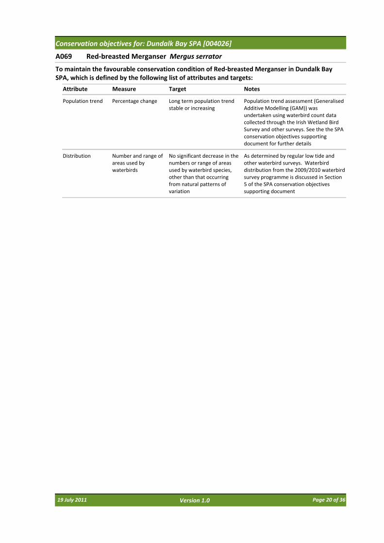
A069 Red‐breasted Merganser Mergus serrator
Attribute Measure Target
To maintain the favourable conservation condition of Red‐breasted Merganser in Dundalk Bay SPA, which is defined by the following list of attributes and targets:
Notes
Population trend Percentage change Long term population trend stable or increasing
Population trend assessment (Generalised Additive Modelling (GAM)) was undertaken using waterbird count data collected through the Irish Wetland Bird Survey and other surveys. See the the SPA conservation objectives supporting document for further details
Distribution Number and range of areas used by waterbirds
No significant decrease in the numbers or range of areas used by waterbird species, other than that occurring from natural patterns of variation
As determined by regular low tide and other waterbird surveys. Waterbird distribution from the 2009/2010 waterbird survey programme is discussed in Section 5 of the SPA conservation objectives supporting document
19 July 2011 Page 20 of 36Version 1.0

Conservation objectives for: Dundalk Bay SPA [004026]
A130 Oystercatcher Haematopus ostralegus
Attribute Measure Target
To maintain the favourable conservation condition of Oystercatcher in Dundalk Bay SPA, which is defined by the following list of attributes and targets:
Notes
Population trend Percentage change Long term population trend stable or increasing
Population trend assessment (Generalised Additive Modelling (GAM)) was undertaken using waterbird count data collected through the Irish Wetland Bird Survey and other surveys. See the the SPA conservation objectives supporting document for further details
Distribution Number and range of areas used by waterbirds
No significant decrease in the numbers or range of areas used by waterbird species, other than that occurring from natural patterns of variation
As determined by regular low tide and other waterbird surveys. Waterbird distribution from the 2009/2010 waterbird survey programme is discussed in Section 5 of the SPA conservation objectives supporting document
19 July 2011 Page 21 of 36Version 1.0

Conservation objectives for: Dundalk Bay SPA [004026]
A137 Ringed Plover Charadrius hiaticula
Attribute Measure Target
To maintain the favourable conservation condition of Ringed Plover in Dundalk Bay SPA, which is defined by the following list of attributes and targets:
Notes
Population trend Percentage change Long term population trend stable or increasing
Population trend assessment (Generalised Additive Modelling (GAM)) was undertaken using waterbird count data collected through the Irish Wetland Bird Survey and other surveys. See the the SPA conservation objectives supporting document for further details
Distribution Number and range of areas used by waterbirds
No significant decrease in the numbers or range of areas used by waterbird species, other than that occurring from natural patterns of variation
As determined by regular low tide and other waterbird surveys. Waterbird distribution from the 2009/2010 waterbird survey programme is discussed in Section 5 of the SPA conservation objectives supporting document
19 July 2011 Page 22 of 36Version 1.0

Conservation objectives for: Dundalk Bay SPA [004026]
A140 Golden Plover Pluvialis apricaria
Attribute Measure Target
To maintain the favourable conservation condition of Golden Plover in Dundalk Bay SPA, which is defined by the following list of attributes and targets:
Notes
Population trend Percentage change Long term population trend stable or increasing
Population trend assessment (Generalised Additive Modelling (GAM)) was undertaken using waterbird count data collected through the Irish Wetland Bird Survey and other surveys. See the the SPA conservation objectives supporting document for further details
Distribution Number and range of areas used by waterbirds
No significant decrease in the numbers or range of areas used by waterbird species, other than that occurring from natural patterns of variation
As determined by regular low tide and other waterbird surveys. Waterbird distribution from the 2009/2010 waterbird survey programme is discussed in Section 5 of the SPA conservation objectives supporting document
19 July 2011 Page 23 of 36Version 1.0

Conservation objectives for: Dundalk Bay SPA [004026]
A141 Grey Plover Pluvialis squatarola
Attribute Measure Target
To maintain the favourable conservation condition of Grey Plover in Dundalk Bay SPA, which is defined by the following list of attributes and targets:
Notes
Population trend Percentage change Long term population trend stable or increasing
Population trend assessment (Generalised Additive Modelling (GAM)) was undertaken using waterbird count data collected through the Irish Wetland Bird Survey and other surveys. See the the SPA conservation objectives supporting document for further details
Distribution Number and range of areas used by waterbirds
No significant decrease in the numbers or range of areas used by waterbird species, other than that occurring from natural patterns of variation
As determined by regular low tide and other waterbird surveys. Waterbird distribution from the 2009/2010 waterbird survey programme is discussed in Section 5 of the SPA conservation objectives supporting document
19 July 2011 Page 24 of 36Version 1.0

Conservation objectives for: Dundalk Bay SPA [004026]
A142 Lapwing Vanellus vanellus
Attribute Measure Target
To maintain the favourable conservation condition of Lapwing in Dundalk Bay SPA, which is defined by the following list of attributes and targets:
Notes
Population trend Percentage change Long term population trend stable or increasing
Population trend assessment (Generalised Additive Modelling (GAM)) was undertaken using waterbird count data collected through the Irish Wetland Bird Survey and other surveys. See the the SPA conservation objectives supporting document for further details
Distribution Number and range of areas used by waterbirds
No significant decrease in the numbers or range of areas used by waterbird species, other than that occurring from natural patterns of variation
As determined by regular low tide and other waterbird surveys. Waterbird distribution from the 2009/2010 waterbird survey programme is discussed in Section 5 of the SPA conservation objectives supporting document
19 July 2011 Page 25 of 36Version 1.0

Conservation objectives for: Dundalk Bay SPA [004026]
A143 Knot Calidris canutus
Attribute Measure Target
To maintain the favourable conservation condition of Knot in Dundalk Bay SPA, which is defined by the following list of attributes and targets:
Notes
Population trend Percentage change Long term population trend stable or increasing
Population trend assessment (Generalised Additive Modelling (GAM)) was undertaken using waterbird count data collected through the Irish Wetland Bird Survey and other surveys. See the the SPA conservation objectives supporting document for further details
Distribution Number and range of areas used by waterbirds
No significant decrease in the numbers or range of areas used by waterbird species, other than that occurring from natural patterns of variation
As determined by regular low tide and other waterbird surveys. Waterbird distribution from the 2009/2010 waterbird survey programme is discussed in Section 5 of the SPA conservation objectives supporting document
19 July 2011 Page 26 of 36Version 1.0

Conservation objectives for: Dundalk Bay SPA [004026]
A149 Dunlin Calidris alpina
Attribute Measure Target
To maintain the favourable conservation condition of Dunlin in Dundalk Bay SPA, which is defined by the following list of attributes and targets:
Notes
Population trend Percentage change Long term population trend stable or increasing
Population trend assessment (Generalised Additive Modelling (GAM)) was undertaken using waterbird count data collected through the Irish Wetland Bird Survey and other surveys. See the the SPA conservation objectives supporting document for further details
Distribution Number and range of areas used by waterbirds
No significant decrease in the numbers or range of areas used by waterbird species, other than that occurring from natural patterns of variation
As determined by regular low tide and other waterbird surveys. Waterbird distribution from the 2009/2010 waterbird survey programme is discussed in Section 5 of the SPA conservation objectives supporting document
19 July 2011 Page 27 of 36Version 1.0

Conservation objectives for: Dundalk Bay SPA [004026]
A156 Black‐tailed Godwit Limosa limosa
Attribute Measure Target
To maintain the favourable conservation condition of Black‐tailed Godwit in Dundalk Bay SPA, which is defined by the following list of attributes and targets:
Notes
Population trend Percentage change Long term population trend stable or increasing
Population trend assessment (Generalised Additive Modelling (GAM)) was undertaken using waterbird count data collected through the Irish Wetland Bird Survey and other surveys. See the the SPA conservation objectives supporting document for further details
Distribution Number and range of areas used by waterbirds
No significant decrease in the numbers or range of areas used by waterbird species, other than that occurring from natural patterns of variation
As determined by regular low tide and other waterbird surveys. Waterbird distribution from the 2009/2010 waterbird survey programme is discussed in Section 5 of the SPA conservation objectives supporting document
19 July 2011 Page 28 of 36Version 1.0

Conservation objectives for: Dundalk Bay SPA [004026]
A157 Bar‐tailed Godwit Limosa lapponica
Attribute Measure Target
To maintain the favourable conservation condition of Bar‐tailed Godwit in Dundalk Bay SPA, which is defined by the following list of attributes and targets:
Notes
Population trend Percentage change Long term population trend stable or increasing
Population trend assessment (Generalised Additive Modelling (GAM)) was undertaken using waterbird count data collected through the Irish Wetland Bird Survey and other surveys. See the the SPA conservation objectives supporting document for further details
Distribution Number and range of areas used by waterbirds
No significant decrease in the numbers or range of areas used by waterbird species, other than that occurring from natural patterns of variation
As determined by regular low tide and other waterbird surveys. Waterbird distribution from the 2009/2010 waterbird survey programme is discussed in Section 5 of the SPA conservation objectives supporting document
19 July 2011 Page 29 of 36Version 1.0

Conservation objectives for: Dundalk Bay SPA [004026]
A160 Curlew Numenius arquata
Attribute Measure Target
To maintain the favourable conservation condition of Curlew in Dundalk Bay SPA, which is defined by the following list of attributes and targets:
Notes
Population trend Percentage change Long term population trend stable or increasing
Population trend assessment (Generalised Additive Modelling (GAM)) was undertaken using waterbird count data collected through the Irish Wetland Bird Survey and other surveys. See the the SPA conservation objectives supporting document for further details
Distribution Number and range of areas used by waterbirds
No significant decrease in the numbers or range of areas used by waterbird species, other than that occurring from natural patterns of variation
As determined by regular low tide and other waterbird surveys. Waterbird distribution from the 2009/2010 waterbird survey programme is discussed in Section 5 of the SPA conservation objectives supporting document
19 July 2011 Page 30 of 36Version 1.0

Conservation objectives for: Dundalk Bay SPA [004026]
A162 Redshank Tringa totanus
Attribute Measure Target
To maintain the favourable conservation condition of Redshank in Dundalk Bay SPA, which is defined by the following list of attributes and targets:
Notes
Population trend Percentage change Long term population trend stable or increasing
Population trend assessment (Generalised Additive Modelling (GAM)) was undertaken using waterbird count data collected through the Irish Wetland Bird Survey and other surveys. See the the SPA conservation objectives supporting document for further details
Distribution Number and range of areas used by waterbirds
No significant decrease in the numbers or range of areas used by waterbird species, other than that occurring from natural patterns of variation
As determined by regular low tide and other waterbird surveys. Waterbird distribution from the 2009/2010 waterbird survey programme is discussed in Section 5 of the SPA conservation objectives supporting document
19 July 2011 Page 31 of 36Version 1.0
Conservation objectives for: Dundalk Bay SPA [004026]
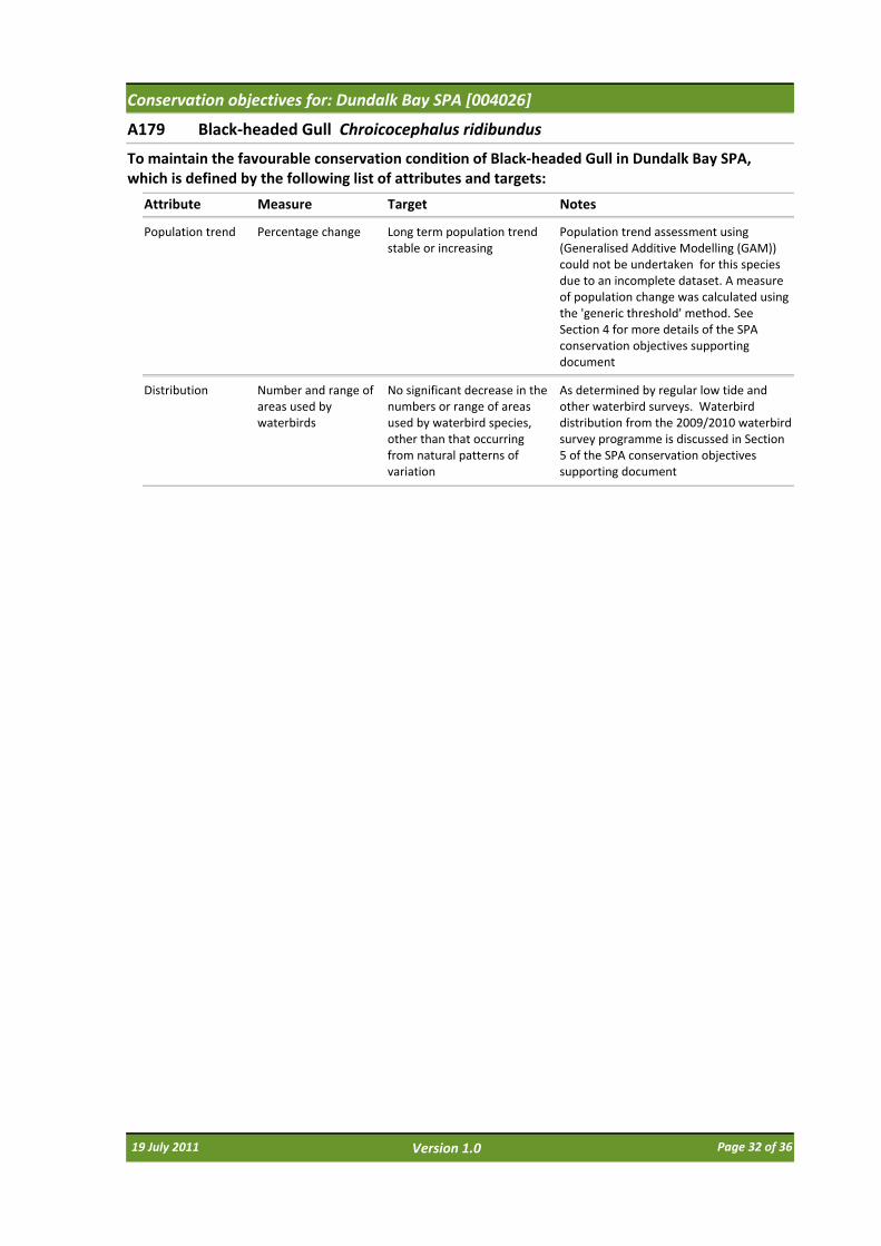
A179 Black‐headed Gull Chroicocephalus ridibundus
Attribute Measure Target
To maintain the favourable conservation condition of Black‐headed Gull in Dundalk Bay SPA, which is defined by the following list of attributes and targets:
Notes
Population trend Percentage change Long term population trend stable or increasing
Population trend assessment using (Generalised Additive Modelling (GAM)) could not be undertaken for this species due to an incomplete dataset. A measure of population change was calculated using the 'generic threshold' method. See Section 4 for more details of the SPA conservation objectives supporting document
Distribution Number and range of areas used by waterbirds
No significant decrease in the numbers or range of areas used by waterbird species, other than that occurring from natural patterns of variation
As determined by regular low tide and other waterbird surveys. Waterbird distribution from the 2009/2010 waterbird survey programme is discussed in Section 5 of the SPA conservation objectives supporting document
19 July 2011 Page 32 of 36Version 1.0
Conservation objectives for: Dundalk Bay SPA [004026]
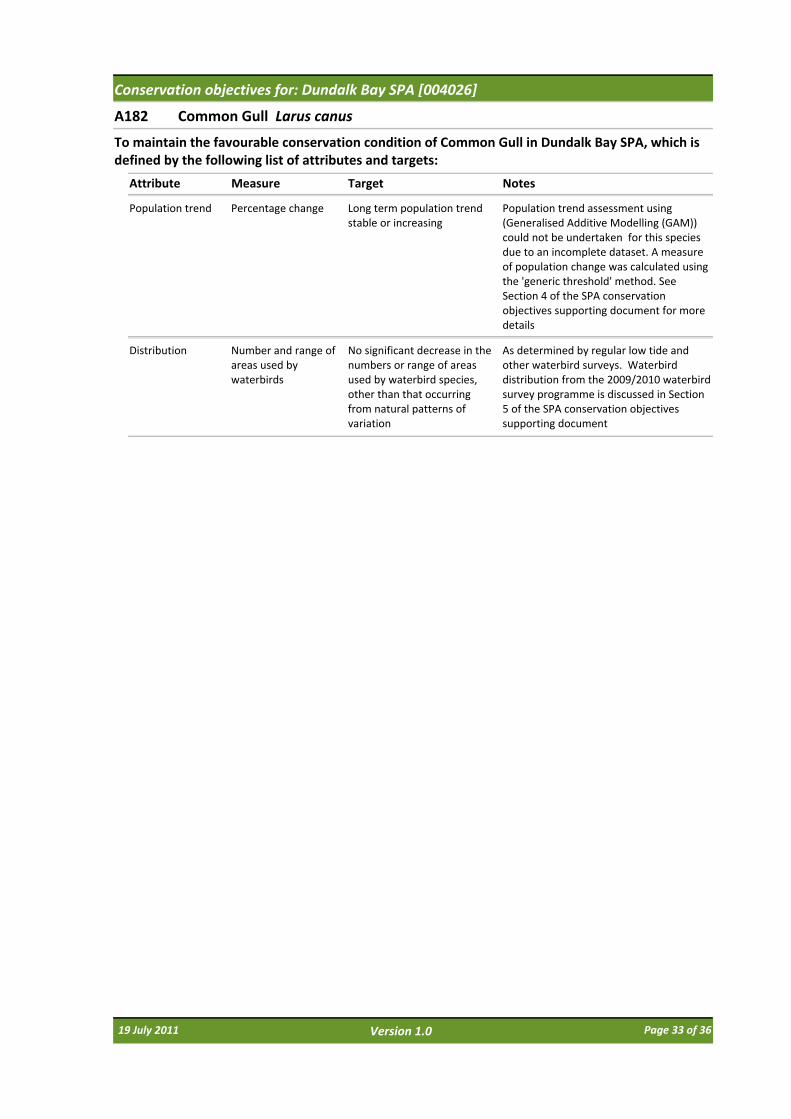
A182 Common Gull Larus canus
Attribute Measure Target
To maintain the favourable conservation condition of Common Gull in Dundalk Bay SPA, which is defined by the following list of attributes and targets:
Notes
Population trend Percentage change Long term population trend stable or increasing
Population trend assessment using (Generalised Additive Modelling (GAM)) could not be undertaken for this species due to an incomplete dataset. A measure of population change was calculated using the 'generic threshold' method. See Section 4 of the SPA conservation objectives supporting document for more details
Distribution Number and range of areas used by waterbirds
No significant decrease in the numbers or range of areas used by waterbird species, other than that occurring from natural patterns of variation
As determined by regular low tide and other waterbird surveys. Waterbird distribution from the 2009/2010 waterbird survey programme is discussed in Section 5 of the SPA conservation objectives supporting document
19 July 2011 Page 33 of 36Version 1.0

Conservation objectives for: Dundalk Bay SPA [004026]
A184 Herring Gull Larus argentatus
Attribute Measure Target
To maintain the favourable conservation condition of Herring Gull in Dundalk Bay SPA, which is defined by the following list of attributes and targets:
Notes
Population trend Percentage change Long term population trend stable or increasing
Population trend assessment using (Generalised Additive Modelling (GAM)) could not be undertaken for this species due to an incomplete dataset. A measure of population change was calculated using the 'generic threshold' method. See Section 4 for more details of the SPA conservation objectives supporting document
Distribution Number and range of areas used by waterbirds
No significant decrease in the numbers or range of areas used by waterbird species, other than that occurring from natural patterns of variation
As determined by regular low tide and other waterbird surveys. Waterbird distribution from the 2009/2010 waterbird survey programme is discussed in Section 5 of the SPA conservation objectives supporting document
19 July 2011 Page 34 of 36Version 1.0

Conservation objectives for: Dundalk Bay SPA [004026]
A999 Wetlands & Waterbirds
Attribute Measure Target
To maintain the favourable conservation condition of the wetland habitat in Dundalk Bay SPA as a resource for the regularly‐occurring migratory waterbirds that utilise it. This is defined by the following attribute and target:
Notes
Habitat area Hectares The permanent area occupied by the wetland habitat is stable and not significantly less than the areas of 8136, 4374 and 649 hectares respectively for subtidal, intertidal, and supratidal habitats, other than that occurring from natural patterns of variation. See map 6
As defined by SPA boundary to MLWM; MLWM to MHWM; and MHWM to SPA boundary (the latter value is minus the area of Lurgangreen Fields)
19 July 2011 Page 35 of 36Version 1.0
SITE CODESAC 000455Version 1.02SPA 004026Version 1.02
Map Version 1Date: March 2011
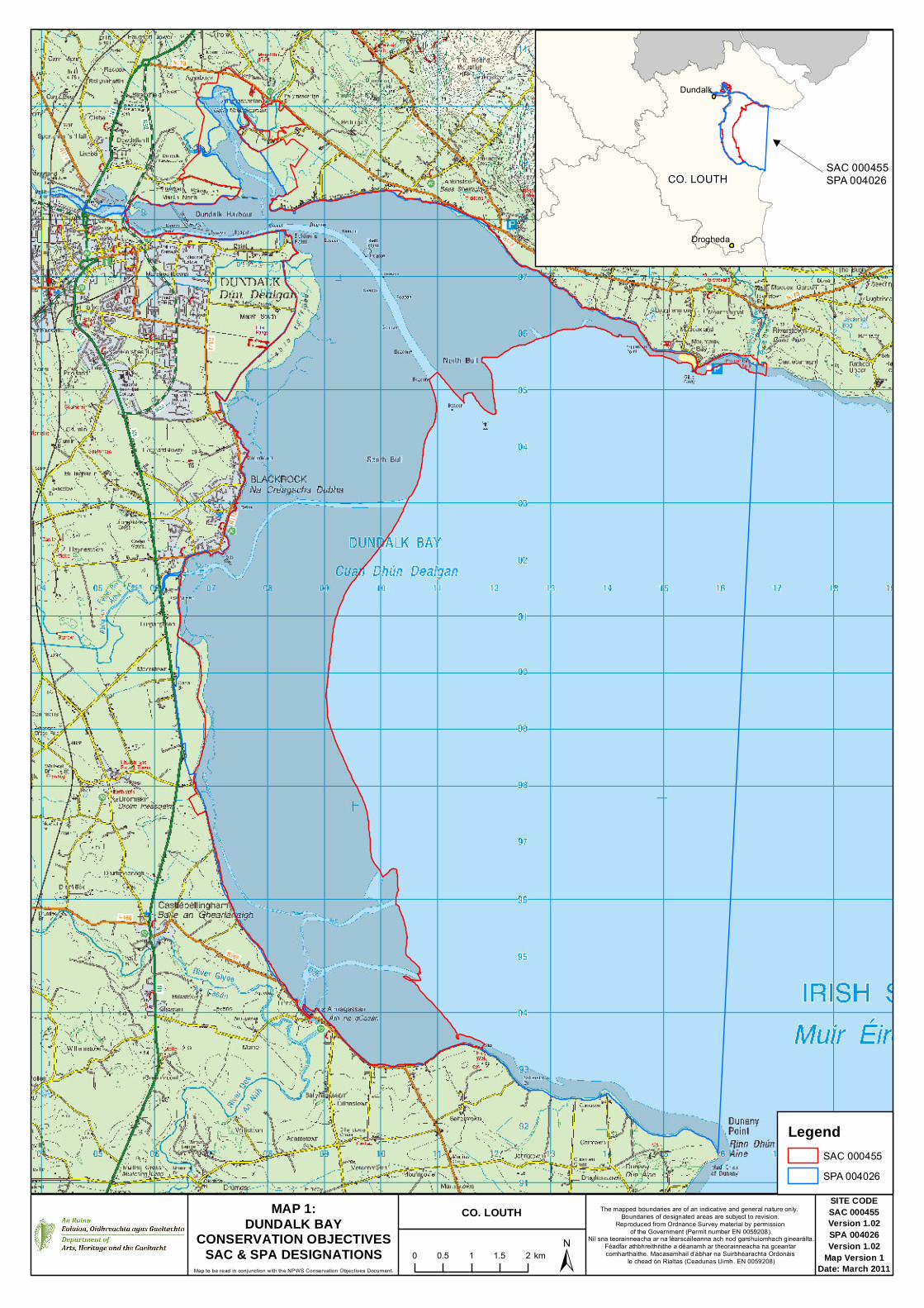
MAP 1:DUNDALK BAY
CONSERVATION OBJECTIVESSAC & SPA DESIGNATIONS
Map to be read in conjunction with the NPWS Conservation Objectives Document.
CO. LOUTH The mapped boundaries are of an indicative and general nature only. Boundaries of designated areas are subject to revision.
Reproduced from Ordnance Survey material by permission of the Government (Permit number EN 0059208).
Níl sna teorainneacha ar na léarscáileanna ach nod garshuiomhach ginearálta.Féadfar athbhreithnithe a déanamh ar theorainneacha na gceantar comharthaithe. Macasamhail d’ábhar na Suirbhéarachta Ordonáis
le chead ón Rialtas (Ceadunas Uimh. EN 0059208)
LegendSAC 000455SPA 004026
±0 0.5 1 1.5 2 km
Dundalk
Drogheda
SAC 000455SPA 004026CO. LOUTH

SITE CODE
SAC 000455Version 1.02
Map Version 1Date: March 2011
MAP 2:DUNDALK BAY
CONSERVATION OBJECTIVESESTUARIES
Map to be read in conjunction with the NPWS Conservation Objectives Document.
CO. LOUTH The mapped boundaries are of an indicative and general nature only. Boundaries of designated areas are subject to revision.
Reproduced from Ordnance Survey material by permission of the Government (Permit number EN 0059208).
Níl sna teorainneacha ar na léarscáileanna ach nod garshuiomhach ginearálta.Féadfar athbhreithnithe a déanamh ar theorainneacha na gceantar comharthaithe. Macasamhail d’ábhar na Suirbhéarachta Ordonáis
le chead ón Rialtas (Ceadunas Uimh. EN 0059208)
LegendSAC 0004551130 EstuariesOSi Discovery Series County Boundary
±0 0.5 1 1.5 2 km

SITE CODE
SAC 000455Version 1.02
Map Version 1Date: March 2011
MAP 3:DUNDALK BAY
CONSERVATION OBJECTIVESMUDFLATS AND SANDFLATS
Map to be read in conjunction with the NPWS Conservation Objectives Document.
CO. LOUTH The mapped boundaries are of an indicative and general nature only. Boundaries of designated areas are subject to revision.
Reproduced from Ordnance Survey material by permission of the Government (Permit number EN 0059208).
Níl sna teorainneacha ar na léarscáileanna ach nod garshuiomhach ginearálta.Féadfar athbhreithnithe a déanamh ar theorainneacha na gceantar comharthaithe. Macasamhail d’ábhar na Suirbhéarachta Ordonáis
le chead ón Rialtas (Ceadunas Uimh. EN 0059208)
LegendSAC 0004551140 Mudflats and sandflats not covered by seawater at low tideOSi Discovery Series County Boundary
±0 0.5 1 1.5 2 km

SITE CODESAC 000455Version 1.02SPA 004026Version 1.02
Map Version 1Date: March 2011
MAP 4:DUNDALK BAY
CONSERVATION OBJECTIVESMARINE COMMUNITY TYPES
Map to be read in conjunction with the NPWS Conservation Objectives Document.
CO. LOUTH The mapped boundaries are of an indicative and general nature only. Boundaries of designated areas are subject to revision.
Reproduced from Ordnance Survey material by permission of the Government (Permit number EN 0059208).
Níl sna teorainneacha ar na léarscáileanna ach nod garshuiomhach ginearálta.Féadfar athbhreithnithe a déanamh ar theorainneacha na gceantar comharthaithe. Macasamhail d’ábhar na Suirbhéarachta Ordonáis
le chead ón Rialtas (Ceadunas Uimh. EN 0059208)
LegendSAC 000455SPA 004026OSi Discovery Series County Boundary
Marine Community TypesFine sand community complexMuddy fine sand communityGravel dominated by Polychaetes
±0 0.5 1 1.5 2 km

SITE CODE
SAC 000455Version 1.02
Map Version 1Date: March 2011
MAP 5:DUNDALK BAY
CONSERVATION OBJECTIVESSALTMARSH HABITATS
Map to be read in conjunction with the NPWS Conservation Objectives Document.
CO. LOUTH The mapped boundaries are of an indicative and general nature only. Boundaries of designated areas are subject to revision.
Reproduced from Ordnance Survey material by permission of the Government (Permit number EN 0059208).
Níl sna teorainneacha ar na léarscáileanna ach nod garshuiomhach ginearálta.Féadfar athbhreithnithe a déanamh ar theorainneacha na gceantar comharthaithe. Macasamhail d’ábhar na Suirbhéarachta Ordonáis
le chead ón Rialtas (Ceadunas Uimh. EN 0059208)
LegendSAC 000455OSi Discovery Series County Boundary
Saltmarsh Habitats1310 Salicornia and other annuals colonising mud and sand1330 Atlantic salt meadows (Glauco-Puccinellietalia maritimae)1410 Mediterranean salt meadows (Juncetalia maritimi)Potential Annex Habitat
±0 0.5 1 1.5 2 km

SITE CODE
SPA 004026Version 1.02
Map Version 1Date: March 2011
MAP 6:DUNDALK BAY
CONSERVATION OBJECTIVESWETLANDS AND WATERBIRDS
BIRD USE ZONESMap to be read in conjunction with the NPWS Conservation Objectives Document.
CO. LOUTH The mapped boundaries are of an indicative and general nature only. Boundaries of designated areas are subject to revision.
Reproduced from Ordnance Survey material by permission of the Government (Permit number EN 0059208).
Níl sna teorainneacha ar na léarscáileanna ach nod garshuiomhach ginearálta.Féadfar athbhreithnithe a déanamh ar theorainneacha na gceantar comharthaithe. Macasamhail d’ábhar na Suirbhéarachta Ordonáis
le chead ón Rialtas (Ceadunas Uimh. EN 0059208)
LegendSPA 004026OSi Discovery Series County Boundary
Bird Use ZonesSubtidalIntertidalSupratidalTerrestrial
±0 0.5 1 1.5 2 km
Produced by: National Parks and Wildlife Service,Department of Arts, Heritage and the Gaeltacht, 7 Ely Place, Dublin 2, Ireland.Web: www.npws.ieE‐mail: [email protected]
NPWS (2011) Conservation Objectives: Dundalk Bay SAC 000455 and Dundalk Bay SPA 004026. Version 1.0. National Parks and Wildlife Service, Department of Arts, Heritage and the Gaeltacht.
Citation:
ISSN 2009‐4086
Series Editors: Rebecca Jeffrey & Naomi Kingston
19 July 2011 Page 36 of 36Version 1.0


