(Rev. 10-90) NPS Fol-m 10-900 1 I/ y~@ 4/i~i*) OMB No. 1024-0018 United States Department of the Interior National Park Service NATIONAL REGISTER OF HISTORIC PLACES REGISTRATION FORM :.I#, r.rm ..: r uic n inomln~ttng ~r xcl.rst!ng Jcc~rm.n~t~~ns:b~ ~nJ,\tduai pmpentc, ,indalsrrlcLi Ser tllrnuctun, in lio\r roi~mplelcmcNlr~onat Rcqirier >I !Ilrl.,t#: Place; Red~,nal~on form Nal~ond. Rcqsler Bjdetin .6,\ .~'ornp.cl< c2.u .tL.m 0% nlar*t!lg \: ~n ~hcippr>prtae nor or bvtntrnne thetnformatlon reauerted. 1f inv item does not aoolv to the orooerrv being documented, enter 'NIA for 'not aoolicable." For functions. nrch~tectural . . , . . - . . ..lrjlt:c3rlall. lldrerlaj rnd arcu or itgntricance :nl:r ,nl$ :3tegor.'. and iun:alcgorle, :rum the lnsrmcrlon I' aLe lodltlonal enutcs sna narrall%e Icms ,n .~nund~t~on ,n:sr, NP5 Form I1 -h,a C,r. I npesrlter nor3 processor ~r ;ornpJtsr. to ;omplcte 311 item, 1. Name of Property historic name Markham Historic District other nameslsite number VDHR #030-5157 2. Location street & number Parts of E. John Marshall Hiehwav. Farm House Road, Leeds Manor Road, Old Markham Road, Povertv Hollow Lane. Rail S t o ~ Road. and Stone Church Road. not for publication N/A city or town Markham vicinity a code VA - i er cnde 061 7,io 22643 3. StatelFederal Agency Certification As the designated authority under the National Histortc Prese~ation Act of 1986, as amended, I hereby certify that this nomination -request for determination of eligibility meets the documentation standards for reglstenng properties in the National Register o f Historlc Places and meets the procedural and praiesrional requirements set forth in 36 CFR Part 60. In my opinian, the property meeU -does not meet the Natlonnl Register Criteria. I recommend that this property be considered significant - nationally - statewide L locally. (See continuatron sheet for - ~i&atu& of certi&ine official Date , - Virginia Department of Historic Resources State or Federal azency and bureau In my opinion, the property -meets - does not meet the National Register criteria. ( See continuation sheet for additional comments.) Signature of commenting or other official Date State or Federal agency and bureau 4. National Park Sewice Certification 1, hereby cert~fy that this property is: - entered in.the ~ a t i o h a l Register - See continuation sheet. Signature of Keeper -determined eligible for the National Register - See continuation sheet. - determined not eligible for the National Register -removed fiom the National Reglster Date of Action - other (explain):
Transcript
(Rev. 10-90) NPS Fol-m 10-900
1 I / y ~ @ 4 / i ~ i * )
OMB No. 1024-0018
United States Department of the Interior National Park Service
NATIONAL REGISTER OF HISTORIC PLACES REGISTRATION FORM
:.I#, r . rm ..: r uic n inomln~ttng ~r xcl.rst!ng J c c ~ r m . n ~ t ~ ~ n s : b ~ ~nJ,\tduai pmpentc, ,indalsrrlcLi Ser tllrnuctun, in lio\r roi~mplelcmcNlr~onat Rcqirier >I !Ilrl.,t#: Place; Red~,nal~on form Nal~ond. Rcqsler Bjdetin .6,\ .~'ornp.cl< c2.u .tL.m 0% nlar*t!lg \: ~n ~hcippr>prtae nor or bvtntrnne thetnformatlon reauerted. 1f inv item does not aoolv to the orooerrv being documented, enter ' N I A for 'not aoolicable." For functions. nrch~tectural . . , . . - . . ..lrjlt:c3rlall. l l d r e r l a j rnd a r c u or itgntricance :nl:r ,nl$ :3tegor.'. and iun:alcgorle, :rum the lnsrmcrlon I' aLe lodltlonal enutcs sna narrall%e Icms ,n . ~ n u n d ~ t ~ o n ,n:sr, NP5 Form I1 - h , a C,r. I npesrlter nor3 processor ~r ;ornpJtsr. to ;omplcte 311 item,
1. Name of Property
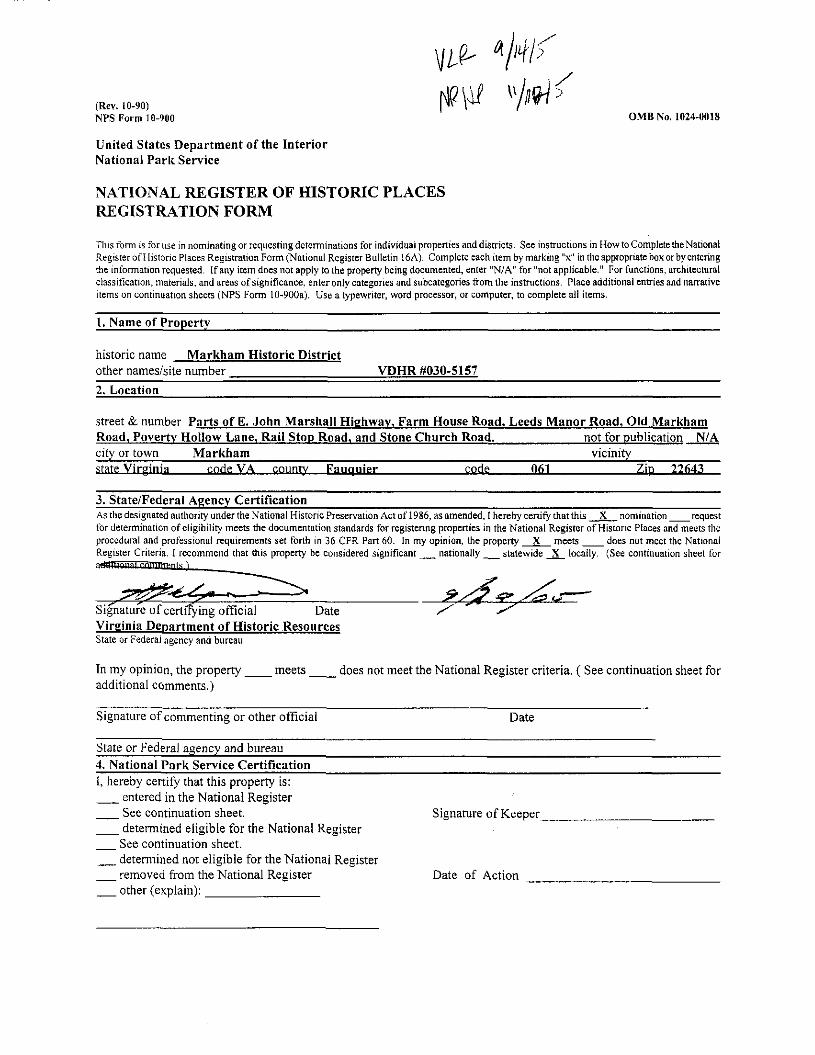
historic name Markham Historic District other nameslsite number VDHR #030-5157 2. Location
street & number Parts of E. John Marshall Hiehwav. Farm House Road, Leeds Manor Road, Old Markham Road, Povertv Hollow Lane. Rail S t o ~ Road. and Stone Church Road. not for publication N/A city or town Markham vicinity
a code VA -ier cnde 061 7,io 22643
3. StatelFederal Agency Certification As the designated authority under the National Histortc Prese~ation Act of 1986, as amended, I hereby certify that this nomination -request for determination of eligibility meets the documentation standards for reglstenng properties in the National Register o f Historlc Places and meets the procedural and praiesrional requirements set forth in 36 CFR Part 60. In my opinian, the property meeU -does not meet the Natlonnl Register Criteria. I recommend that this property be considered significant - nationally - statewide L locally. (See continuatron sheet for
- ~i&atu& of certi&ine official Date , - Virginia Department of Historic Resources State or Federal azency and bureau
In my opinion, the property -meets - does not meet the National Register criteria. ( See continuation sheet for additional comments.)
Signature of commenting or other official Date
State or Federal agency and bureau 4. National Park Sewice Certification 1, hereby cert~fy that this property is: - entered in.the ~a t i oha l Register - See continuation sheet. Signature of Keeper -determined eligible for the National Register - See continuation sheet. - determined not eligible for the National Register -removed fiom the National Reglster Date of Action - other (explain):
NPS Form 10-900 OMB No. 1024-4018 (Rev. 10-90) U. S. Department of the Interior Markham Historic District National Park Service Fauquier County, Virginia
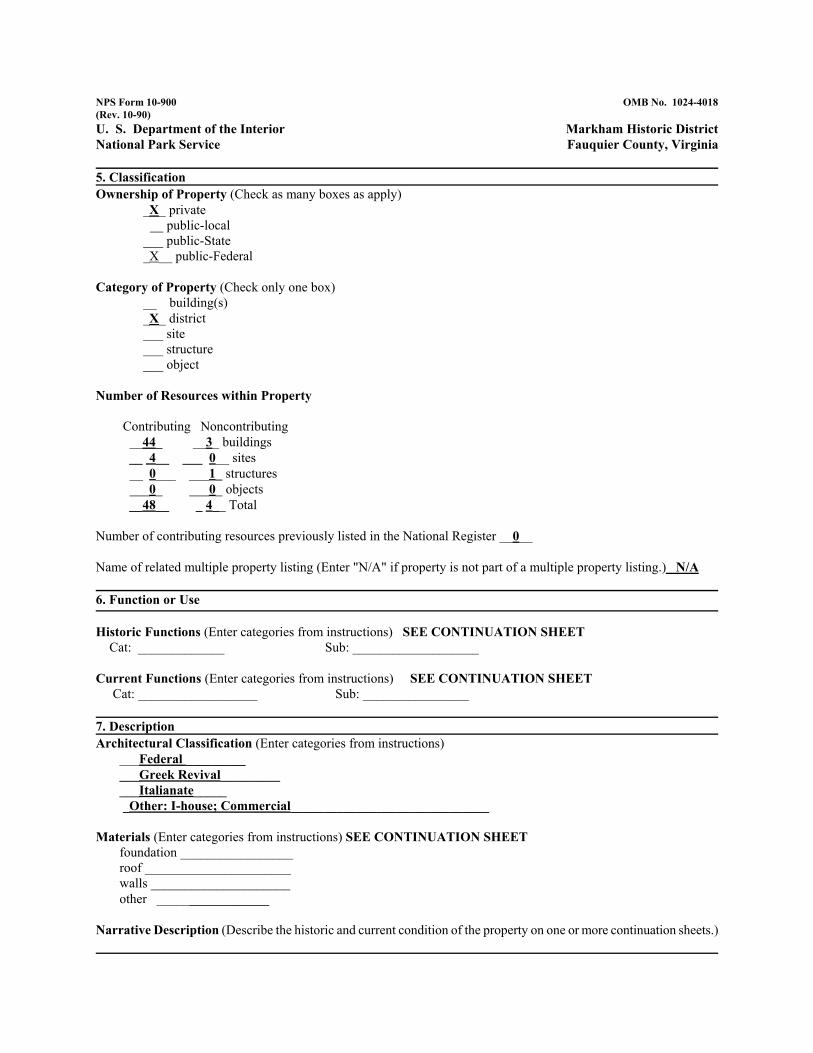
5. Classification Ownership of Property (Check as many boxes as apply)
_X_ private __ public-local
___ public-State _X__ public-Federal
Category of Property (Check only one box) __ building(s) _X_ district ___ site ___ structure ___ object
Materials (Enter categories from instructions) SEE CONTINUATION SHEET foundation _________________ roof ______________________ walls _____________________ other _________________
Narrative Description (Describe the historic and current condition of the property on one or more continuation sheets.)
NPS Form 10-900 OMB No. 1024-4018 (Rev. 10-90) U. S. Department of the Interior Markham Historic District National Park Service Fauquier County, Virginia
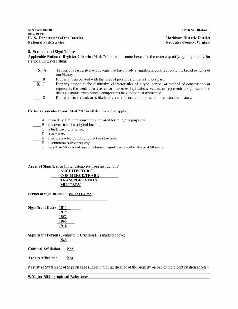
8. Statement of Significance Applicable National Register Criteria (Mark "x" in one or more boxes for the criteria qualifying the property for National Register listing)
__X_ A Property is associated with events that have made a significant contribution to the broad patterns of our history.
____ B Property is associated with the lives of persons significant in our past. __X_ C Property embodies the distinctive characteristics of a type, period, or method of construction or
represents the work of a master, or possesses high artistic values, or represents a significant and distinguishable entity whose components lack individual distinction.
____ D Property has yielded, or is likely to yield information important in prehistory or history.
Criteria Considerations (Mark "X" in all the boxes that apply.)
____ A owned by a religious institution or used for religious purposes. ____ B removed from its original location. ____ C a birthplace or a grave. ____ D a cemetery. ____ E a reconstructed building, object or structure. ____ F a commemorative property. ____ G less than 50 years of age or achieved significance within the past 50 years.
Areas of Significance (Enter categories from instructions) _____ARCHITECTURE_________________________ _____COMMERCE/TRADE__________ _____TRANSPORTATION__________ _____MILITARY__________
Period of Significance __ca. 1811-1955_ __________________________
Significant Person (Complete if Criterion B is marked above) _______N/A________________________
Cultural Affiliation ___N/A_____________________________
Architect/Builder ____N/A_____________________
Narrative Statement of Significance (Explain the significance of the property on one or more continuation sheets.)
9. Major Bibliographical References
NPS Form 10-900 OMB No. 1024-4018 (Rev. 10-90) U. S. Department of the Interior Markham Historic District National Park Service Fauquier County, Virginia
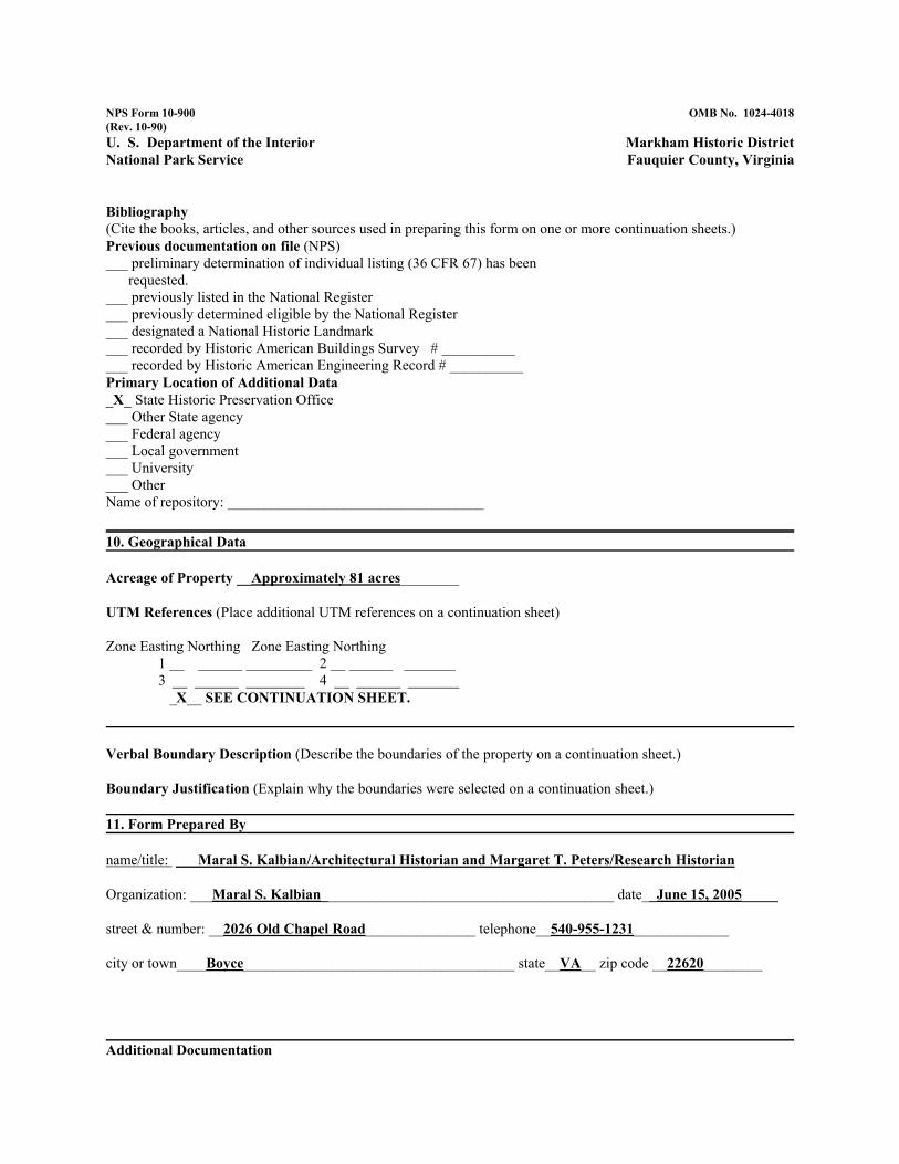
Bibliography (Cite the books, articles, and other sources used in preparing this form on one or more continuation sheets.) Previous documentation on file (NPS) ___ preliminary determination of individual listing (36 CFR 67) has been
requested. ___ previously listed in the National Register ___ previously determined eligible by the National Register ___ designated a National Historic Landmark ___ recorded by Historic American Buildings Survey # __________ ___ recorded by Historic American Engineering Record # __________ Primary Location of Additional Data _X_ State Historic Preservation Office ___ Other State agency ___ Federal agency ___ Local government ___ University ___ Other Name of repository: ___________________________________
10. Geographical Data
Acreage of Property __Approximately 81 acres________
UTM References (Place additional UTM references on a continuation sheet)
Verbal Boundary Description (Describe the boundaries of the property on a continuation sheet.)
Boundary Justification (Explain why the boundaries were selected on a continuation sheet.)
11. Form Prepared By
name/title: Maral S. Kalbian/Architectural Historian and Margaret T. Peters/Research Historian
Organization: ___Maral S. Kalbian________________________________________ date__June 15, 2005_____
street & number: __2026 Old Chapel Road_______________ telephone__540-955-1231_____________
city or town____Boyce_____________________________________ state__VA__ zip code __22620________
Additional Documentation
NPS Form 10-900 OMB No. 1024-4018 (Rev. 10-90) U. S. Department of the Interior Markham Historic District National Park Service Fauquier County, Virginia
Submit the following items with the completed form:
Continuation Sheets
Maps A USGS map (7.5 or 15 minute series) indicating the property's location. A sketch map for historic districts and properties having large acreage or numerous resources.
Photographs Representative black and white photographs of the property.
Additional items (Check with the SHPO or FPO for any additional items)
Property Owner (Complete this item at the request of the SHPO or FPO.) name __SEE ATTACHED PROPERTY OWNER’S LIST_________________________________
street & number___________________________________ telephone__________
city or town____________________________ state____ zip code __________
================================================================================== Paperwork Reduction Act Statement: This information is being collected for applications to the National Register of Historic Places to nominate properties for listing or determine eligibility for listing, to list properties, and to amend existing listings. Response to this request is required to obtain a benefit in accordance with the National Historic Preservation Act, as amended (16 U.S.C. 470 et seq.). Estimated Burden Statement: Public reporting burden for this form is estimated to average 18.1 hours per response including the time for reviewing instructions, gathering and maintaining data, and completing and reviewing the form. Direct comments regarding this burden estimate or any aspect of this form to the Chief, Administrative Services Division, National Park Service, P.0. Box 37127, Washington, DC 20013-7127; and the Office of Management and Budget, Paperwork Reductions Project (1024-0018), Washington, DC 20503.
KPS Form 10-900-2 (8-86)
United States Department of the Interior National Park Service
National Register of Historic Places Continuation Sheet
OMB Fio. 1024-0018
Markham Historic District Fauquier County, Virginia
Section 6 - - Page -1-
6. HISTORIC FUNCTIONS:
DOMESTIC Single dwelling Secondary structure Hotel
United States Department of the Interior National Park Service
National Register of Historic Places Continuation Sheet
OMB No. 1024-0018
Markham Historic District Fauquier County, Virginia
Section -7- Page 2 -
7. DESCRIPTION
Materials:
FOUNDATION STONE
WALLS STONE WOOD: weatherboard SYNTHETICS STUCCO
ROOF METAL: tin
OTHER WOOD BRICK STONE
SUMMARY DESCRIPTION
Located in northwest Fauquier County, just south of lnterstate 66, Markhan is nestled in a hollow between Red Oak, Hardscrabble, and Naked mountains. The historic district boundaries are drawn to include resources along Route 688 west to the village of Farrowsville and north to incorporate resources along Goose Creek and along the north side of US Route 55. Farrowsville and Marlcham have been combined as one district because the boundaries between the two communities are almost indistinguishable. Farrowsville is the older community, as it is located directly at the intersection of Route 688 (Leeds Manor Road) and Goose Creek. When the Manassas Gap Railroad was completed through the area in 1852 the station was located at Marlcham as the grade at Farrowsville was too steep to stop and start rail traffic. The name Marlcham was chosen by Edward C. Marshall, the president of the new railroad, in honor of his great-grandmother's family.
NPS Form 10-900-a (8-86)
United States Department of the Interior National Park Service
National Register of Historic Places Continuation Sheet
OMB No. 1024-0018
Markham Historic District Fauquier County, Virginia
Section 7 - - Page -3 -
Even though the community has no official limits, the linear district encompasses roughly 8 1 acres that are historically and visually associated with the community's growth and development from a crossroads in the early 19th century and as a railroad community during the mid-19th century. The district contains 24 properties with 48 contributing resources. The four non- contributing resources include two garages, a shed, and a swimming pool. Although Markham is located in a rural setting, more remote rural areas directly adjacent to the district are not included within the boundaries.
The district has three nodes: the eastern edge along US Route 55 (John Marshall Highway); the buildings flanking the railroad at the center of town; and the westem edge near where Route 688 (Old Marlcham Road) crosses the railroad tracks at Farrowsville and becomes Leeds Manor Road. Located at the edges of these nodes are dwellings with fairly large acreage. These include: Mountain View [030-5157-0024; 030-0132], constructed ca. 181 1; Wolfs Crag [030-5157-0001; 030-0097], constructed ca. 1820; and Rosebank [030-5157-0015; 030-0101], constructed ca. 1870.
The oldest resources in the district are generally found in the area near the western boundary at the village of Farrowsville, which was located along a significant 18th- and 19th-century stagecoach road. These include two early-19th-century dwellings, an 1819 stone church, and a collection of early- to mid-19th-century outbuildings. Early-1 9th-century dwellings as well as an inn stand in the center of the district, and were constructed before the arrival of the railroad in 1852. The majority of resources in the district were constructed in the mid- and late 19th century and include multiple dwellings, a hotel, as well as commercial buildings, and a train station. The district also contains early-20th-century dwellings. The most modem resource is the 1918 Markham School, located adjacent to the 1819 church.
ARCHITECTURAL ANALYSIS
Markham is a well-preserved, small, rural village that lies in northwestern Fauquier County, Virginia. In many ways Markham has been protected because it was bypassed by Interstate 66 in the 1970s and has physical site limitations: it is situated in a hollow between three mountains, is flanked by US Route 55(John Marshall Highway) and 1-66 to the north, and has Goose Creek and the old Manassas Gap Railroad running through it. Marlham is undoubtedly one of the best- preserved 19th-century communities in all of Fauquier County and contains a wide range of
NPS Form 10-900-a (8-86)
United States Department of the Interior National Park Service
National Register of Historic Places Continuation Sheet
OMB No. 1024-0018
Markham Historic District Fauquier County, Virginia
Section -7- Page -4-
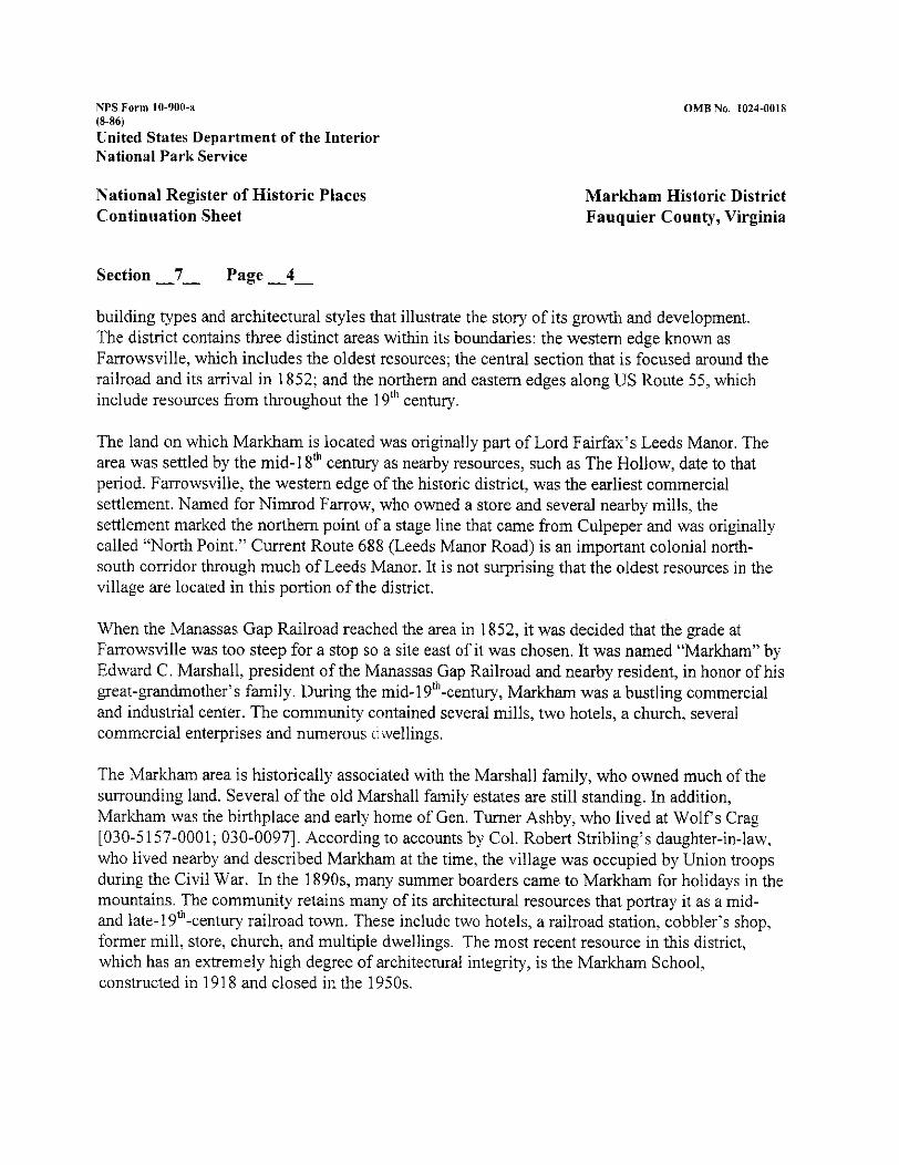
building types and architectural styles that illustrate the story of its growth and development. The district contains three distinct areas within its boundaries: the westem edge known as Farrowsville, which includes the oldest resources; the central section that is focused around the railroad and its arrival in 1852; and the northern and eastern edges along US Route 55, which include resources from throughout the 19"' century.
The land on which Markham is located was originally part of Lord Fairfax's Leeds Manor. The area was settled by the mid-1 gth century as nearby resources, such as The Hollow, date to that period. Farrowsville, the western edge of the historic district, was the earliest commercial settlement. Named for Nimrod Farrow, who owned a store and several nearby mills, the settlement marked the northern point of a stage line that came from Culpeper and was originally called "North Point." Current Route 688 (Leeds Manor Road) is an important colonial north- south corridor through much of Leeds Manor. It is not surprising that the oldest resources in the village are located in this portion of the district.
When the Manassas Gap Railroad reached the area in 1852, it was decided that the grade at Farrowsville was too steep for a stop so a site east of it was chosen. It was named "Markham" by Edward C. Marshall, president of the Manassas Gap Railroad and nearby resident, in honor of his great-grandmother's family. During the mid-19th-century, Markham was a bustling commercial and industrial center. The community contained several mills, two hotels, a church, several commercial enterprises and numerous c wellings.
The Markham area is historically associated with the Marshall family, who owned much of the surrounding land. Several of the old Marshall family estates are still standing. In addition, Markham was the birthplace and early home of Gen. Turner Ashby, who lived at Wolfs Crag [030-5157-0001; 030-0097]. According to accounts by Col. Robert Stribling's daughter-in-law, who lived nearby and described Markham at the time, the village was occupied by Union troops during the Civil War. In the 1890s, many summer boarders came to Markham for holidays in the mountains. The community retains many of its architectural resources that portray it as a mid- and late-19"'-century railroad town. These include two hotels, a railroad station, cobbler's shop, former mill, store, church, and multiple dwellings. The most recent resource in this district, which has an extremely high degree of architectural integrity, is the Markham School, constructed in 1918 and closed in the 1950s.
NPS Form 10-900-n (8-86) United States Department of the Interior National Park Service
National Register of Historic Places Continuation Sheet
OMU No. 1024-0018
Markham Historic District Fauquier County, Virginia
Section -7- Page -5-
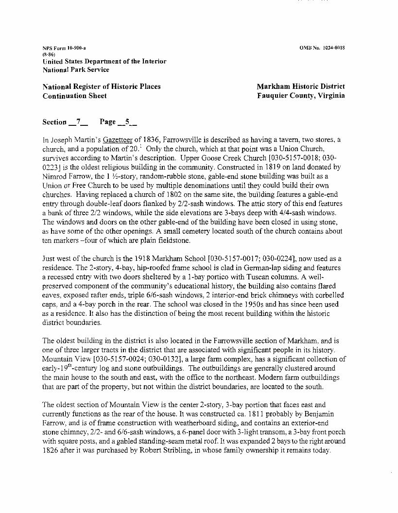
In Joseph Martin's Gazetteer of 1836, Farrowsville is described as having a tavern, two stores, a church, and a population of 20.' Only the church, which at that point was a Union Church, survives according to Martin's description. Upper Goose Creek Church [030-5157-0018; 030- 02131 is the oldest religious building in the community. Constructed in 1819 on land donated by Nimrod Farrow, the 1 I%-story, random-rubble stone, gable-end stone building was built as a Union or Free Church to be used by multiple denominations until they could build their own churches. Having replaced a church of 1802 on the same site, the building features a gable-end entry through double-leaf doors flanked by 212-sash windows. The attic story of this end features a bank of three 212 windows, while the side elevations are 3-bays deep with 414-sash windows. The windows and doors on the other gable-end of the building have been closed in using stone, as have some of the other openings. A small cemetery located south of the church contains about ten markers -four of which are plain fieldstone.
Just west of the church is the 1918 Markham School 1030-5157-0017; 030-0224], now used as a residence. The 2-story, 4-bay, hip-roofed frame school is clad in German-lap siding and features a recessed entry with two doors sheltered by a l -bay portico with Tuscan columns. A well- preserved component of the community's educational history, the building also contains flared eaves, exposed rafter ends, triple 616-sash windows, 2 interior-end briclc chimneys with corbelled caps, and a 4-bay porch in the rear. The school was closed in the 1950s and has since been used as a residence. It also has the distinction of being the most recent building within the historic district boundaries.
The oldest building in the district is also located in the Farrowsville section of Markham. and is one of three larger tracts in the district that are associated with significant people in its history. Mountain View [030-5157-0024; 030-0132], a large farm complex, has a significant collection of early-] 9"'-century log and stone outbuildings. The outbuildings are generally clustered around the main house to the south and east, with the office to the northeast. Modern farm outbuildings that are part of the property, but not within the district boundaries, are located to the south.
The oldest section of Mountain View is the center 2-story, 3-bay portion that faces east and currently functions as the rear of the house. It was constructed ca. 181 1 probably by Benjamin Farrow, and is of frame construction with weatherboard siding, and contains an exterior-end stone chimney, 212- and 616-sash windows, a 6-panel door with ;-light transom, a 3-bay front porch with square posts, and a gabled standing-seam metal roof. It was expanded 2 bays to the right around 1826 after it was purchased by Robert Stribling, in whose family ownership it remains today.
NPS Form 10-900-;1 (8-86)
United States Department of the Interior National Park Sewice
National Register of Historic Places Continuation Sheet
OMB No. 1024-0018
Markham Historic District Fauquier County, Virginia
Section 7 - - Page -6-
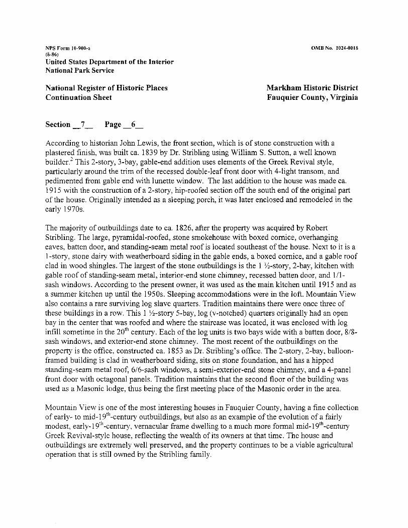
According to historian John Lewis, the front section, which is of stone construction with a plastered finish, was built ca. 1839 by Dr. Stribling using William S. Sutton, a well known builder.' This 2-story, ;-bay, gable-end addition uses elements of the Greek Revival style, particularly around the trim of the recessed double-leaf front door with 4-light transom, and pedimented front gable end with lunette window. The last addition to the house was made ca. 191 5 with the construction of a 2-story, hip-roofed section off the south end of the original part of the house. Originally intended as a sleeping porch, it was later enclosed and remodeled in the early 1970s.
The majority of outbuildings date to ca. 1826, after the property was acquired by Robert Stribling. The large, pyramidal-roofed, stone smokehouse with boxed cornice, overhanging eaves, batten door, and standing-seam metal roof is located southeast of the house. Next to it is a 1-story, stone dairy with weatherboard siding in the gable ends, a boxed cornice, and a gable roof clad in wood shingles. The largest of the stone outbuildings is the 1 %-story, 2-bay, kitchen with gable roof of standing-seam metal, interior-end stone chimney, recessed batten door, and l l l - sash windows. According to the present owner, it was used as the main kitchen until 191 5 and as a summer kitchen up until the 1950s. Sleeping accommodations were in the loft. Mountain View also contains a rare surviving log slave quarters. Tradition maintains there were once three of these buildings in a row. This 1 %-story 5-bay, log (v-notched) quarters originally had an open bay in the center that was roofed and where the staircase was located, it was enclosed with log infill sometime in the 20"' century. Each of the log units is two bays wide with a batten door, 818- sash windows. and exterior-end stone chimney. The most recent of the outbuildings on the property is the office. constructed ca. 1853 as Dr. Stribling's office. The 2-story, 2-bay, balloon- framed building is clad in weatherboard siding, sits on stone foundation, and has a hipped standing-seam metal roof, 616-sash windows, a semi-exterior-end stone chimney, and a 4-panel front door with octagonal panels. Tradition maintains that the second floor of the building was used as a Masonic lodge, thus being the first meeting place of the Masonic order in the area.
Mountain View is one of the most interesting houses in Fauquier County, having a fine collectioi~ of early- to mid-1 9"'-centuiy outbuildings, but also as an example of the evolution of a fairly modest, early-19"'-century, vernacular frame dwelling to a much more formal 1nid-l9'~-century Greek Revival-style house, reflecting the wealth of its owners at that time. The house and outbuildings are extremely well preserved, and the property continues to be a viable agricultural operation that is still owned by the Stribling family.
NPS Form 10-900-a (8-86)
United States Department of the Interior National Park Service
OMB No. 1024-0018
National Register of Historic Places Continuation Sheet
Markham Historic District Fauquier County, Virginia
Section -7- Page -7-
Once part of the Mountain View property, the house at 12016 Poverty Hollow Lane [030-5157- 0023; 030-0163] appears to have been constructed ca. 1900. The 2-story, 2-bay, frame dwelling rests on a split-level stone basement and has a hipped roof clad in asphalt shingle. Located across Leeds Manor Road from Mountain View is the house at 3324 Leeds Manor Road [030- 5 157-0022]. This fine property contains an unusually large vernacular frame dwelling. According to an old plat this was the location of C.T. Page's farm during the mid-19'~ century. The property also contains an interesting collection of outbuildings, one of which may date to the Page era. The 2-story, 2-bay, side-passage-plan vernacular house appears to have been constructed ca. 1880 but may in fact contain an earlier house at its core. It is clad in German-lap siding, rests on a raised stone foundation, and has a gabled roof clad in standing-seam metal. The house, while very large because of rear wings that appear contemporary with the front, is relatively constrained in its exterior architectural detailing which is limited to a double-leaf entrance door with a transom above it, 3-light French doors on the first-floor front, a 3-bay front porch supported by Tuscan columns, a plain friezeboard, gable-end returns, an interior brick chimney, and Gothic- arched attic vents in the gable end.
The collection of buildings south of the railroad crossing in Fanowsville includes two late-19"'- century buildings, and an early-19"'-century dwelling that was later enlarged. According to old plats, other buildings once stood in the same general area, but have since been demolished. The earliest of the three is the house at 3298 Leeds Manor Road [030-5157-00211. Located at the junction of Old Marlham and Leeds Manor roads, the old road used to continue past the house over Goose Creek and onto US Route 55 and went past Farrow's Mill, which has since been demolished.
The southernmost two bays of this 3-bay dwelling are of log construction, probablj- date to ca. 1820, and are associated with Nimrod Farrow. During the mid-19'h-century a side addition converted the house into its present form as an I-house. The house, clad in stucco, features a standing-seam metal gabled roof, an exterior-end stone chimney on the south end, 616-sash windows, a 6-light transom and 3-light sidelights around the front door, a rear 2-story ell with a central stone chimney, and a 3-bay front porch with Tuscan columns.
The house at 3295 Leeds Manor Road [030-5157-00191 is a 2-story, gable-end, stuccoed vemacular building that appears on a late-] 890s plat labeled as "Gaskins House formerly Stribling Old ~ f f i c e . " ~ While not architecturally sophisticated, this vernacular dwelling may have originally housed Dr. Stribling's (of Mountain View) office and features a stone foundation, standing-seam
NPS Form 10-900-3 (8-86)
United States Department of the Interior National Park Service
OMB No. 1024-0018
National Register of Historic Places Continuation Sheet
Markham Historic District Fauquier County, Virginia
Section -7- Page -8-
metal roof, 616-sash windows, and multiple additions. Located just south of it, directly adjacent to the railroad tracks is the House at 3303 Leeds Manor Road [030-5157-00201, Constructed, ca. 1890, this 2-story, 3-bay, side-passage-plan building features a gabled roof with 3-bay, 2-story, 2- level integral front porches. Although now used as a dwelling, the building may have once been used as a hotel, as it has that commercial appearance, although no documentation was found to support this.
As stated earlier, at one time Leeds Manor Road continued north and crossed Goose Creek at Farrow's Mill and proceeded up to Upper Goose Creek Church and Markham School, and eventually to US Route 55. It now turns and continues to the west to the central part of Marlcham along Old Markham Road. The railroad track, which was laid in the early 1850s as the Manassas Gap Railroad, acts as a spine through the district with buildings located on either side of it wherever geographically possible. A 2-story, franle dwelling at 3234 Rail Stop Road [030-5157- 0016; 030-0106] is located on the south side of the tracks along the portion of Route 688 that runs between Farrowsville and the center of Markham. This vernacular hall-parlor-plan dwelling is clad in weatherboard siding and may have been constructed as early as the mid-19'~ century, as is suggested by the large exterior stone chimney on its east end. It is one of several mid-to late- 19'"-century vernacular dwellings in the village of Markham. Further east along the railroad track is Homeland [030-5157-0009; 030-0014], a fine example of a vernacular Greek Revival-style I- house that appears to have been constructed just before the arrival of the railroad, as it is sited very close to the tracks. Perhaps once used as a tavern, the house, set on a raised limestone foundation, is stuccoed and has a standing-seam metal roof, exterior-end stone chimney, 616-sash windows, batten shutters, a '-bay flat-roofed porch with square columns, and Greek Revival- style door surround with 4-light transom and 3-light sidelights. The small cobbler's shop in the side yard dates to the mid-19"' century and is one of the few surviving industrial-related buildings in the district, despite its modern remodeling as a cottage.
The center of Markham is defined by the location where Old Markham Road gets very close to the railroad track, and a road (known as Rail Stop Road) crosses the track. This area is very narrow as the topography is steep to the south and Goose Creek is just to the north. Within this area is a concentration of buildings that includes the freight station, two inns, a store, former mill. a store, and several dwellings. The oldest building in this general area is located at 11 527 Old Markham Road [030-5157-0004; 030-0125]. The 2-story, 6-bay, gable-roofed, stuccoed building appears to have been constructed as an inn sometime in the first quarter of the 19"' century, well before the arrival of the railroad in 1852. The building, which has a central brick chimney and an
NPS Form 10-900-1 (8-86)
United States Department of the Interior National Park Service
OMB No. 1024-0018
National Register of Historic Places Continuation Sheet
Markham Historic District Fauquier County, Virginia
Section -7- Page -9-
exterior-end stone chimney on the west end, may have in fact been constructed in two sections. Clad in stucco siding, the building appears to be of frame construction, and features a two-level porch, doors on both stories, an 8-light transom and 3-light sidelights around the main front door? a rear 2-story shed-roofed wing, and gable-end returns. This is one of the earliest surviving buildings in Marlcham and attests to the strategic location of the community at the intersection of two colonial roads in the 19"' century. One of the few laown hotels or taverns to survive in this part of Fauquier County, the building, has a high degree of architectural integrity and is similar in detailing with [030-5157-0003; 030-0124] next door but appears to pre-date it by about 30 years. The later building, which is located just to the east at 11 521 Old Markham Road, is also a 2- story, &bay, gable-roofed frame structure clad in German-lap siding, with an integral, full-height, 4-bay porch that was originally two levels but is now one. Built as a rooming house or hotel at the time of the arrival of the railroad in 1852, it and the earlier inn next to it are unique surviving examples of early- and mid-19'"-century rooming houses built as a consequence of first road transportation, and later, the railroad, which came through the area in 1852. Both now appear to be used as apartments.
Just west of these two buildings, but also south of the railroad tracks, is 3229 Rail Stop Road [030-5157-0005; 030-01 151, another building from the mid-19"' century. This interesting 2-story, 4-bay, gable-roofed, random rubble stone building features a 2-story, 2-level, 3-bay integral front porch with square posts and 3-rail balustrade. The house, which is stuccoed on the front fagade, contains 2 front doors on the first level: one is 6-paneled; the other is a double-leaf 2-panel door. This suggests that the house originally had a mixed use, possibly commercial in nature. The second floor contains one door and other details include modern 111 windows, wooden lintels, overhanging eaves, an interior-end stone chimney, and a stone foundation. Just east of the main building is a large stone springhouse. Constructed ca. 1850, the 8-foot stone foundation is banked on the south side and includes a modern door along the entry on the east side. The %-story. gable- roofed, frame superstructure is clad in random width oak boards with wire nails, and includes exposed rafter ends (some of which are log), overhanging eaves, and a door, and was probably used for storage. Although the exact original use of this property is uncertain, it appears to maybe have been used either as a boarding house or as a residence and store.
The former Markham Freight Station [030-5157-0006; 030-0123] is located along the north side of the railroad tracks. Constructed ca. 1900, this well-preserved example of aperiod freight station is probably not the original one on the site. The 1-story, frame building is clad in asbestos shingle siding and features a roof that is hipped on one end and gabled on the other and clad in terra-cotta
NPS Form 10-900-a (8-86)
United States Department of the Interior National Park Service
National Register of Historic Places Continuation Sheet
OMB No. 1024-0018
Markham Historic District Fauquier County, Virginia
Section -7- Page -10-
tile. The deeply overhanging eaves are supported by triangular knee brackets, and also contain decorative exposed rafter ends.
Directly north of the station, off the south side of Old Markham Road is the Hartland Orchard Warehouse [030-5 157-0007; 030-0123]. This interesting banked warehouse is one-story on the 6-bay faqade facing the railroad tracks, while it is a full 2 stories on the other side and rests on a raised stone basement. The original section includes the three bays on the east end that contain 616-sash windows, and freight doors. The bay to the west is a later addition. The building has a gable roof clad in standing-seam metal, gable-end returns, a 7-bay porch with square posts, an interior flue, and painted letters on the north side "Hartland Orchards Apples Peaches Cherries." It appears as though the original portion was constructed in the third quarter of the 19"' century and the addition in the early 2oth century. According to historian Eugene Scheel, this mill was constructed ca. 1854 as a water mill, became a horse-powered mill after the Civil War, and in the early 2oth century was converted into a gas-powered mill for James R. re en.^ Most recently it has been used as a warehouse for Hartland orchards and is currently vacant. Although such an early construction date could not be substantiated, nonetheless it is a surviving historic commercial building in Markham and contributes to the overall character of the village.
The community of Marlcham still maintains its own post office, which since 1952 has been housed in the former Markham Cash Store building at 11524 Old Markham Road [030-5 157- 0008; 030-0107]. Located just off the north side of Old Markham Road directly adjacent to the banks of Goose Creelc, this vernacular, frame commercial building constructed ca. 1885 is made up of the main 3-bay, gable-end portion with a small 2-bay, 1-story gable-roofed wing to the west; and a 2-bay 1-story gable-roofed warehouse addition to the east. Extremely well-preserved the building is clad in German-lap siding and stucco, and maintains 616-sash windows on the T"' floor and rear of the building, an interior brick flue; an intact 3-part storefront on the first floor comprised of large 4-light windows flanking a central double-leaf entry door with ;-light transom. and a 3-bay front porch with square posts. Extending to the west side is a I-story, 2-bay, gabled wing, and a 1 -story warehouse wing with a deeply overhanging front gable that protects a formed concrete loading doclc extending to the east.
Two other buildings are located in this area of the district: both of which are dwellings. The house at 11 5 11 Old Markham Road [30-5 157-0002] is a 1 %-story, vernacular frame dwelling constructed ca.1900. The house at 1 1505 Old Markham Road [030-5157-0010; 030-0110] is precariously sited between Goose Creelc and the railroad tracks, and is a mid-191h- century,
NPS Form 10-900-a (8-86)
United States Department of the Interior National Park Sewice
OMB No. 1024-0018
National Register of Historic Places Continuation Sheet
Markham Historic District Fauquier County, Virginia
Section -7- Page -11-
vernacular, 1 %-story frame dwelling with exterior-end stone chimney and raised stone basement.
Sited on a hill in this part of Marlcham is Wolfs Crag [030-5157-0001; 030-0097]. Although often thought to be constructed in the late 18"' century, the architectural evidence at Wolfs Crag as well as the deed research indicate a construction date of the first quarter of the 191h century, probably around 1820 by Nimrod Farrow. Turner Ashby, who was born at nearby Rosebank [030-0101; 030-5 157-001 51 in 1828, moved to Wolfs Crag around 1853. Local historians point out that it was on this property that Ashby trained his white stallion that was his mount during his Civil War service. Architecturally the house is an interesting example of a vernacular Federal- style dwelling with some fine woodwork. Its setting is fairly pristine and there have been few modem alterations. The oldest portion of the vernacular Federal-style dwelling is the 2 X-story, 3-bay, stuccoed, main block that is of stone construction and features a standing-seam metal gabled roof with two gable-roofed dormers on each side, interior-end stone chimneys, 616-sash windows, and 4-light attic windows in the gable ends. Originally the building faced south, but the first floor of that f a ~ a d e has been covered by an enclosed porch and now acts as the back of the house. The interior of this portion of the house features Federal-style detailing in the mantels and woodwork and woodwork on the second floor, thereby supporting a ca. 1820 date. The house is unusual in that it is built into a banked site and the basement level is the ground level; the main floor is on the second level and contains the parlor. The primary entrance to the house is through a 1 -story, 2-bay, gable-roofed hyphen off the south end of the house that connected it to a 2-story stuccoed wing that is on a split-level stone foundation and was probably built in the mid-19"' century as a detached outbuilding. Off the north end of the house is a ca. 1920, 1 %-story wing that contains the kitchen. The house also includes an early-20"'-century frame bank barn.
Rosebank [030-5157-0015; 030-0101] is located on a hill above Markham between Route 55 and 1-66, The original Rosebank house was constructed by Col. Turner Ashby ca. 18 12 and was the birthplace of Civil War-hero Gen. Turner Ashby. In 1853 it was sold to Edward C. Marshall, first president of the Manassas Gap Railroad. Local histories indicate the house burned in 1863 and was rebuilt ca. 1870, although the ruins of the stone meat house that went with the original Ashby home still survive. Rosebank was sold out of the Marshall family in 1871. The house exhibits design elements of the Italianate style, a popular architectural style of the period, and is a 2-story, 2-bay, gable-roofed frame dwelling clad in aluminum siding with a standing-seam metal roof with two interior brick chimneys. The bracketed cornice features paired brackets on all sides except the west end, and the house has a stone foundation, gable-end returns, a 2-story gable- roofed
NPS Form 10-900-a (n-86)
United States Department of the Interior National Park Service
OMB No. 1024-0018
National Register of Historic Places Continuation Sheet
Markham Historic District Fauquier County, Virginia
Section -7- Page -12-
projecting rectangular bay and a I-story projecting polygonal bay on the east end, 616-sash and paired 414-sash windows, full-height multiple-light French doors on the first floor, and a 14-bay wrap around porch with Tuscan columns and turned balusters.
The easternmost edge of the district is defined by a group of resources along the northern side of US Route 55 (John Marshall highway). These include: a late-19~~-century, 2-story commercial building [030-5157-0013; 030-0017] known as Triplett's Store for many years; a late-19"'- century I-house with a central front gable [030-5157-0012; 030-0109] and Folk Victorian detailing; and a mid- to late-19"'-century dwelling with a large exterior-end stone chimney [030- 5157-001 1; 30-1 1 I], that may have been constructed in two sections. On the hill just northwest of these resources, between US Route 55 and 1-66, is a fine 1ate-l9'~-century Folk Victorian-style dwelling [030-5157-0014; 030-0105] known as the Triplett House. Constructed in the early 1880s by Theodore Triplett and his wife Mary Agnes Lake, the 2-story frame I-house, clad in German-lap siding and with a standing-seam-metal roof with central front gable, features two exterior-end stone chimneys with brick stacks. A 2-story, 2-level, 5-bay, full-width front porch with turned spindles and elaborately scrolled brackets and sawn balustrade dominates the front of the house. Projecting I-story polygonal bays flank the entry which is surrounded by a 6-light transom and 4-light sidelights. The rear 2-story ell has side porches, a central brick chimney, and a bracketed projecting bay window on the west side. The house is in extremely well preserved condition and is the most elaborately decorated late-19'h-century dwelling in Markham. Directly behind the house is a 1-story frame summer kitchen on top of a raised stone basement that appears to have been a root cellar or icehouse. The frame superstructure has a gable roof clad in standing-seam metal, an interior briclc flue, a side 2-bay porch, and weatherboard siding. Located southwest of the house is a fine frame bank barn with a gable roof of standing-seam metal. The stone foundation is a full story on the south side and is protected by a shed-roofed overhang with frame screen enclosure and doors.
The district contains four non-contributing resources: a swimming pool, two garages, and a shed. Marlcham's location along fairly major local arteries makes it still a somewhat vibrant community. Freight trains still pass through the village although they do not stop, and while the store has closed, the post office is still operational. The village retains visual cohesiveness and represents the community from the mid-19'~ century to the mid-2oth century. Markham maintains a remarkable degree of architectural integrity and contains a variety of building types and architectural styles that help illustrate its significant historic past.
NPS Farm 10-900-n (8-86)
United States Department of the Interior National Park Service
National Register of Historic Places Continuation Sheet
OMB ha. 1024-0018
Markham Historic District Fauquier County, Virginia
Section -7- Page -13-
ENDNOTES
- Joseph Martin. A New and Comurehensive Gazetteer of Vireinia and the District of Columbia, [Charlottesville:Mosely and Tompkins, printers, 18361 172. ' John Lewis. "Markham or Farrowsville," An Architectural Survey, [Virginia Historic Landmarks Commission, 19761 4. Fauquier County Deed Book 901391 (1899). Scheel. Eugene M., The Guide to Fauauier: A Survev of the Architecture and Histow of a Vireinia Counh..
United States Department of the Interior National Park Service
National Register of Historic Places Continuation Sheet
OMB No. 3024-0038
Markham Historic District Fauquier County, Virginia
Section -Inventory - Page -1 4-
MARKHAM HISTORJC DISTRICT INVENTORY The properties are listed numerically by street address and are lceyed to the map in regular order.
Farm House Road
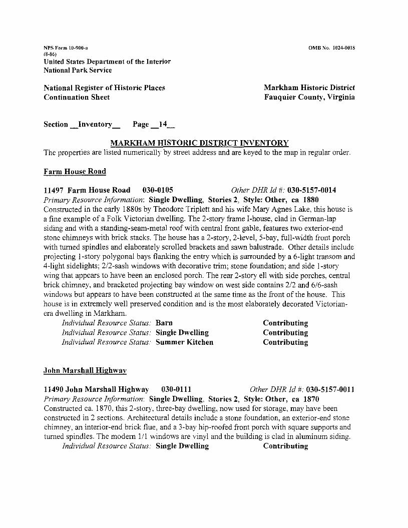
11497 Farm House Road 030-0105 Other DHR Id #: 030-5157-0014 Primary Resource Information: Single Dwelling, Stories 2, Style: Other, ca 1880 Constructed in the early 1880s by Theodore Triplett and his wife Mary Agnes Lake, this house is a fine example of a Folk Victorian dwelling. The 2-story frame I-house, clad in German-lap siding and with a standing-seam-metal roof with central fiont gable, features two exterior-end stone chimneys with brick stacks. The house has a 2-story, 2-level, 5-bay, full-width front porch with tumed spindles and elaborately scrolled brackets and sawn balustrade. Other details include projecting 1 -story polygonal bays flanking the entry which is surrounded by a 6-light transom and 4-light sidelights; 212-sash windows with decorative trim; stone foundation; and side I-story wing that appears to have been an enclosed porch. The rear 2-story ell with side porches, central brick chimney, and bracketed projecting bay window on west side contains 212 and 616-sash windows but appears to have been constructed at the same time as the front of the house. This house is in extremely well preserved condition and is the most elaborately decorated Victorian- era dwelling in Marlham.
Individual Resource Status: Barn Contributing Individual Resource Status: Single Dwelling Contributing Individual Resource Status: Summer Kitchen Contributing
John Marshall Highwav
11490 John Marshall Highway 030-0111 Other DHR Id #: 030-5157-0011 Primary Resource Information: Single Dwelling, Stories 2, Style: Other, ca 1870 Constructed ca. 1870, this '-story, three-bay dwelling, now used for storage, map have been constructed in 2 sections. Architectural details include a stone foundation, an exterior-end stone chimney, an interior-end brick flue, and a 3-bay hip-roofed front porch with square supports and turned spindles. The modem 111 windows are vinyl and the building is clad in aluminum siding.
Individual Resource Status: Single Dwelling Contributing
NPS Form 10-900-a (8-Xb)
United States Department of the Interior National Park Sewice
OhlB Nu. 1024-0018
National Register of Historic Places Continuation Sheet
Markham Historic District Fauquier County, Virginia
Section -Inventory- Page -15-
11494 John Marshall Highway 030-0109 Other DHR Id #: 030-5157-0012 Primavy Resource InJormation: Single Dwelling, Stories 2, Style: Other, ca 1890 The Follc Victorian frame house, ca. 1890. has aluminum siding and sits on a brick infill, stone pier foundation. The gable roof, now asphalt shingle, features a central front gable on both the front and rear that contains a Gothic-arched attic vent window. Other details include new 616- sash windows, gable-end returns, interior-end briclc chimneys, a side, 2-bay, gable-roofed, 1-story wing on stone foundation, a 3-bay rear porch with turned spindles, and 4-light transom and 2- light sidelights around original front door. the current front of the house is the original rear.
Individual Resource Status: Single Dwelling Contributing
11500 John Marshall Highway 030-0117 Other DHR Id #: 030-5157-0013 Primary Resource Information: Commercial Building, Stories 2, Style: Other, ca 1890 This building is in two sections; the oldest is the 1-story gable-roofed wing to the west surrounded by a wrap-around diner-type addition. The 2-story gable-end general store was constructed ca. 1890, and its current front is the original rear. Although converted into a dwelling, the commercial building still maintains its form, gable-end returns, standing-seam- metal roof, interior brick flue, and historic neon "Philco" sign. Alterations include vinyl windows, stucco on the 1" floor, vinyl siding on 2nd floor, and modern stairsldeck on east side.
Individual Resource Status: Commercial Building Contributing
11560 John Marshall Highway 030-0101 Other DHR Id #: 030-5157-0015 Primary Resource Information: Single Dwelling, Stories 2, Style: Italianate, ca 1870 The original dwelling was constructed in 1812, burned in 1863, and was replaced with the current building ca. 1870. Vernacular with Italianate-style detailing, the 2-story, 2-bay, gable- roofed frame dwelling has aluminum siding and standing-seam metal roof with two interior brick chimneys. The cornice features paired brackets on all sides except the west end. Other details include: a stone foundation; gable-end returns; 2-story gable-roofed projecting bay on the east end; 1-story projecting polygonal bay on the east end; 616 and paired 414 windows; full-height multiple-light French doors on the first floor; 616 attic windows in the gable ends; louvered shutters; 14-bay wrap around porch with Tuscan columns and turned balusters; and north end. 2- story gable-roofed wing with exterior-end stone chimney. stucco siding, and 616 windows.
United States Department of the Interior National Park Sewice
National Register of Historic Places Continuation Sheet
OMB No. 1024-0018
Markham Historic District Fauquier County, Virginia
Section -Inventory - Page -16-
Leeds Manor Road
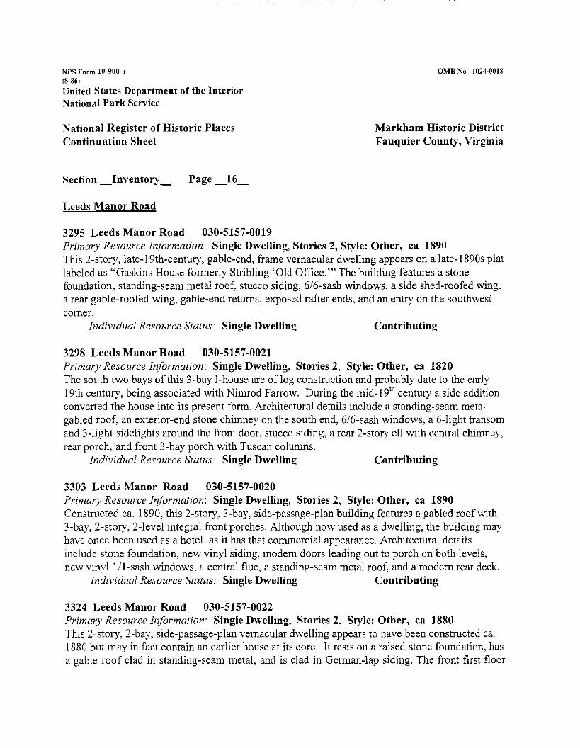
3295 Leeds Manor Road 030-5157-0019 Primary Resource Information: Single Dwelling, Stories 2, Style: Other, ca 1890 This 2-story, late-1 9th-century, gable-end, frame vernacular dwelling appears on a late-1 890s plat labeled as "Gaskins House formerly Stribling 'Old Office."' The building features a stone foundation, standing-seam metal roof. stucco siding, 616-sash windows, a side shed-roofed wing: a rear gable-roofed wing, gable-end returns, exposed rafter ends, and an entry on the southwest corner.
Individual Resource Status: Single Dwelling Contributing
3298 Leeds Manor Road 030-5157-0021 Primary Resource Inforrnation: Single Dwelling, Stories 2, Style: Other, ca 1820 The south two bays of this 3-bay I-house are of log construction and probably date to the early 19th century, being associated with Nimrod Farrow. During the mid-19"' century a side addition converted the house into its present form. Architectural details include a standing-seam metal gabled roof, an exterior-end stone chimney on the south end, 616-sash windows, a 6-light transom and 3-light sidelights around the front door, stucco siding, a rear 2-story ell with central chimney, rear porch, and front 3-bay porch with Tuscan columns.
Individual Resource Slatus: Single Dwelling Contributing
3303 Leeds Manor Road 030-5157-0020 Primary Resource Inforrnation: Single Dwelling, Stories 2, Style: Other, ca 1890 Constructed ca. 1890, this 2-story. 3-bay, side-passage-plan building features a gabled roof with 3-bay: ".story. 2-level integral front porches. Although now used as a dwelling, the building may have once been used as a hotel. as it has that commercial appearance. Architectural details include stone foundation. new vinyl siding, modem doors leading out to porch on both levels, new vinyl 111-sash windows, a central flue, a standing-seam metal roof, and a modem rear deck.
Individual Resource Status: Single Dwelling Contributing
3324 Leeds Manor Road 030-5157-0022 Primary Resource Inforrnation: SingleDwelling, Stories 2, Style: Other, ca 1880 This 2-story, 2-bay, side-passage-plan vernacular dwelling appears to have been constructed ca. I880 but may in fact contain an earlier house at its core. It rests on a raised stone foundation, has a gable roof clad in standing-seam metal, and is clad in German-lap siding. The front first floor
NPS Fol-m 10-900-n (8-86)
United States Department of the Interior National Park Service
Xational Register of Historic Places Continuation Sheet
Markham Historic District Fauquier County, Virginia
Section -Inventory - Page -17-
has a double-leaf entrance door with a transom above it, 3-light French doors, and a 3-bay front porch supported by Tuscan columns. The second floor has paired 1i1 windows, while the rear wing has 2/2 sash windows. Other details include plain friezeboard, gable-end returns, interior brick chimney, Gothic-arched attic vent in gable end, and rear ell with side porches connecting to a very large reru- 2-story wing with similar detailing as the front portion.
Old Markham Road 030-0123 Other DHR Id #: 030-5157-0006 Primary Resource Information: Depot, Stories 1, Style: Other, ca 1900 This 1-story, ?-bay, frame freight station appears to have been constructed ca. 1900. It is clad in asbestos shingle siding and features a roof clad in terra-cotta tile that is hipped on one end and gabled on the other. Other details include: deeply overhanging eaves with triangular knee brackets: decorative exposed rafter ends; wood pier foundation interior-end brick chimney; 6i6- sash windows, and modern sliding glass door in front of the freight door.
Individual Resource Status: Depot Contributing
Old Markham Road 030-0122 Other DHR Id #: 030-5157-0007 Primary Resource Information: Warehouse, Stories 2, Style: Other, ca 1900 This interesting banked warehouse is one-story on the 6-bay faqade facing the railroad tracks, while it is a full 2 stories on the other side and rests on a raised stone basement. The original section includes the three bays on the east end that contain 616-sash windows, and freight doors. The bay to the west is a later addition. The building has a gable roof clad in standing-seam metal. gable-end returns, a 7-bay porch with square posts, an interior flue, and painted letters on the north side "Hartland Orchards Apples Peaches Cherries." It appears as though the original portion was constructed in the third quarter of the 19th century and the addition in the early 20th century.
United States Department of the Interior National Park Service
National Register of Historic Places Continuation Sheet
OMB No. 1024-0018
Markham Historic District Fauquier County, Virginia
Section -Inventory- Page -18-
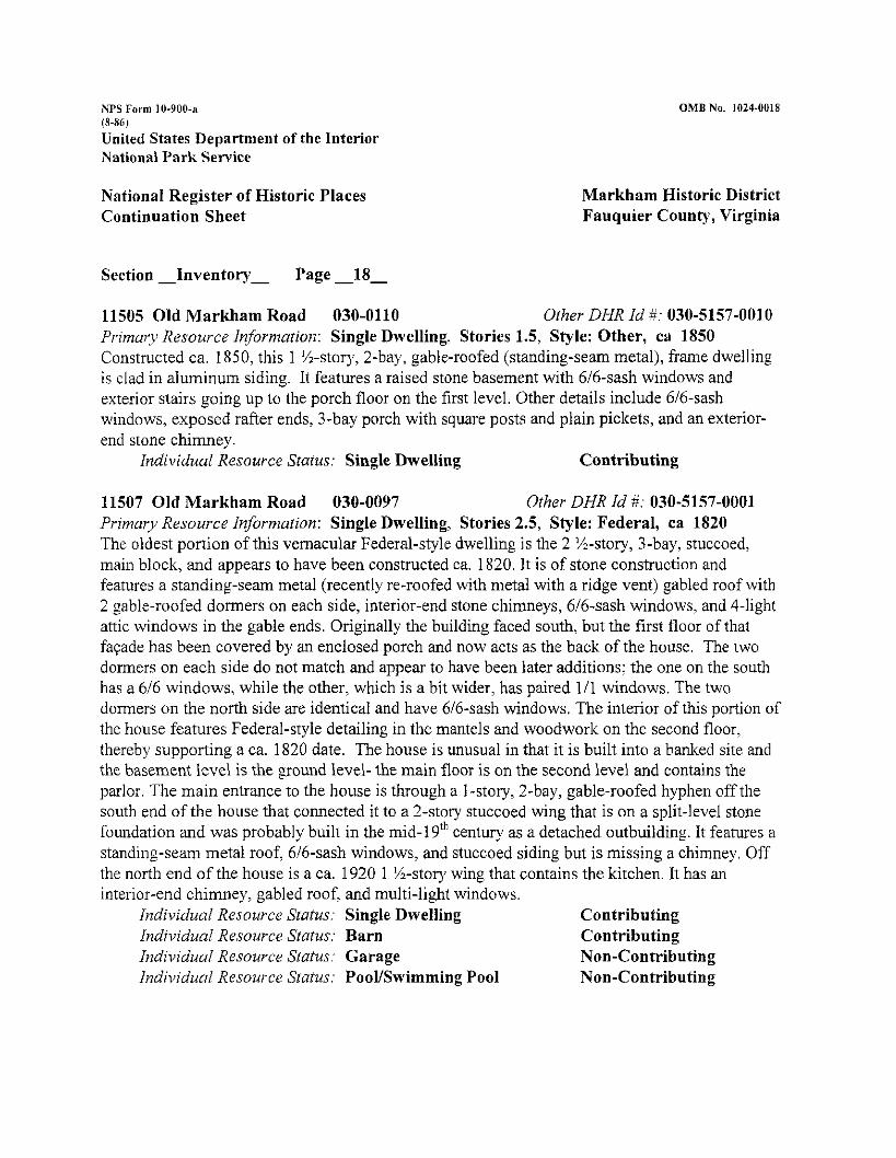
11505 Old Markham Road 030-0110 Other DHR Id ii: 030-5157-0010 Primary Resource Information: Single Dwelling. Stories 1.5, Style: Other, ca 1850 Constructed ca. 1850, this 1 %-story, 2-bay, gable-roofed (standing-seam metal), frame dwelling is clad in aluminum siding. It features a raised stone basement with 616-sash windows and exterior stairs going up to the porch floor on the first level. Other details include 616-sash windows, exposed rafter ends, 3-bay porch with square posts and plain pickets, and an exterior- end stone chimney.
Individual Resource Status: Single Dwelling Contributing
11507 Old Markham Road 030-0097 Other DHR Id #: 030-5157-0001 Primary Resource Information: Single Dwelling, Stories 2.5, Style: Federal, ca 1820 The oldest portion of this vernacular Federal-style dwelling is the 2 %-story, .?-bay, stuccoed, main block, and appears to have been constructed ca. 1820. It is of stone construction and features a standing-seam metal (recently re-roofed with metal with a ridge vent) gabled roof with 2 gable-roofed dormers on each side, interior-end stone chimneys, 616-sash windows, and 4-light attic windows in the gable ends. Originally the building faced south, but the first floor of that faqade has been covered by an enclosed porch and now acts as the back of the house. The two dormers on each side do not match and appear to have been later additions; the one on the south has a 616 windows, while the other, which is a bit wider, has paired 111 windows. The two dormers on the north side are identical and have 616-sash windows. The interior of this portion of the house features Federal-style detailing in the mantels and woodwork on the second floor, thereby supporting a ca. 1820 date. The house is unusual in that it is built into a banked site and the basement level is the ground level- the main floor is on the second level and contains the parlor. The main entrance to the house is through a I-story, 2-bay, gable-roofed hyphen off the south end of the house that connected it to a 2-story stuccoed wing that is on a split-level stone foundation and was probably built in the mid-1 9"' century as a detached outbuilding. It features a standing-seam metal roof, 616-sash windows, and stuccoed siding but is missing a chimney. Off the north end of the house is a ca. 1920 1 %-stoty wing that contains the kitchen. It has an interior-end chimney, gabled roof, and multi-light windows.
Individual Resource Status: Single Dwelling Contributing Individual Resource Status: Barn Contributing Individual Resource Status: Garage Non-Contributing Individual Resource Status: PooVSwimming Pool Non-Contributing
NPS Form 10-900-n (8-86)
Linited States Department of the Interior National Park Service
National Register of Historic Places Continuation Sheet
OMB No. 1024-0018
Markham Historic District Fauquier County, Virginia
Section -Inventory- Page.-19-
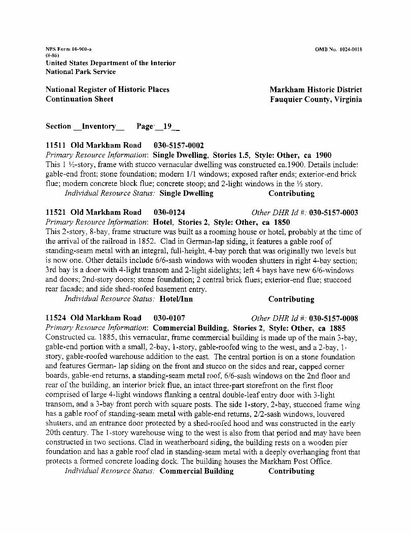
11511 Old Markham Road 030-5157-0002 Primary Resource Information: Single Dwelling, Stories 1.5, Style: Other, ca 1900 This 1 %-story, frame with stucco vernacular dwelling was constructed ca.1900. Details include: gable-end front; stone foundation; modem 111 windows; exposed rafter ends; exterior-end brick flue; modem concrete block flue; concrete stoop; and 2-light windows in the '/z story.
Individual Resource Status: Single Dwelling Contributing
11521 Old Markham Road 030-0124 Other DHR Id #: 030-5157-0003 Primary Resource Information: Hotel, Stories 2, Style: Other, ca 1850 This '-story, 8-bay, frame structure was built as a rooming house or hotel, probably at the time of the arrival of the railroad in 1852. Clad in German-lap siding, it features a gable roof of standing-seam metal with an integral, full-height, 4-bay porch that was originally two levels but is now one. Other details include 616-sash windows with wooden shutters in right 4-bay section; 3rd bay is a door with 4-light transom and 2-light sidelights; left 4 bays have new 616-windows and doors; 2nd-stor)) doors; stone foundation; 2 central brick flues; exterior-end flue; stuccoed rear facade; and side shed-roofed basement entry.
Individual Resource Status: HotelAnn Contributing
11524 Old Markham Road 030-0107 Other DHR Id #: 030-5157-0008 Prin2ai.y Resource Information: Commercial Building, Stories 2, Style: Other, ca 1885 Constructed ca. 1885, this vernacular, frame commercial building is made up of the main 3-bay, gable-end portion with a small, 2-bay, 1-story, gable-roofed wing to the west, and a 2-bay, 1- story, gable-roofed warehouse addition to the east. The central portion is on a stone foundation and features German- lap siding on the front and stucco on the sides and rear, capped corner boards, gable-end returns. a standing-seam metal roof, 616-sash windows on the 2nd floor and rear of the building, an interior brick flue. an intact three-part storefront on the first floor comprised of large 4-light windows flanking a central double-leaf entry door with 3-light transom, and a 3-bay front porch with square posts. The side 1-story, 2-bay, stuccoed frame wing has a gable roof of standing-seam metal with gable-end returns, 212-sash windows, louvered shutters, and an entrance door protected by a shed-roofed hood and was constructed in the early 20th century. The 1-story warehouse wing to the west is also from that period and may have been constructed in two sections. Clad in weatherboard siding, the building rests on a wooden pier foundation and has a gable roof clad in standing-seam metal with a deeply overhanging front that protects a formed concrete loading dock. The building houses the Markham Post Office.
Individual Resource Status: Commercial Building Contributing
NPS Form 10-900-n (8-86) United States Department of the Interior National Park Service
OMB No. 1024-0018
National Register of Historic Places Continuation Sheet
Markham Historic District Fauquier County, Virginia
Section -Inventory- Page -20-
11527 Old Markham Road 030-0125 Other DHR Id #: 030-5157-0004 Primary Resource Infornzation: Hotelllnn, Stories 2, Style: Federal, ca 1820 This 2-story, 6-bay, gable-roofed stuccoed building appears to have been constructed as an inn sometime in the first quarter of the 19th century, well before the arrival of the railroad in 1852. Although it resembles the building (030-0124) next to it, it has architectural details that indicate a much earlier date. The building, which has a central brick chimney and an exterior-end stone chimney on the west end, may have in fact been constructed in two sections. Architectural details include: stucco over frame (although earlier survey says stone, this does not seem to be the case); stone foundation; 2-story, 5-bay, 2-level porch with square posts on concrete block piers on the first floor and sawn balustrade; 2 doors on the first floor; 8-light transom and 3-light sidelights around main front door; rear 2-story shed-roofed wing; gable-end returns; and 616-sash windows.
12012 Poverty Hollow Lane 030-0132 Other DHR Id #: 030-5157-0024 Primary Resource Information: Single Dwelling, Stories 2, Style: Greek Revival, ca 1811 The oldest section of the house is the center ?-story, 3-bay portion that faces east and is currently the rear of the house and was constructed ca. 181 1 probably by Benjamin Farrow. It is of frame construction with weatherboard siding and contains an exterior-end stone chimney, 212 and 616 windows, a 6-panel door with 3-light transom, a 3-bay front porch with square posts, and a gable standing-seam metal roof. It was expanded 2 bays to the right around 1826 after it was purchased by Robert Stribling. The first floor of that section was altered with the addition of a bay window in the 1980s. According to historian John Lewis, the front section, which is of stone construction with a plastered finish, was built ca. 1839 by Dr. Stribling using William S. Sutton, a well known builder. This 2-story, 3-bay, gable-end addition uses elements of the Greek Revival, particularly around the trim of the recessed double-leaf front door with 4-light transom, and pedimented front eable end. The last addition to the house was made ca. 191 5 with the addition of the 2-stoy, hip- - roofed section off the south end of the original part of the house. It was constructed as a sleeping porch but was later enclosed and remodeled ca. 1970.
NPS Form 10-900.8 (8-86)
United States Department of the Interior National Park Service
National Register of Historic Places Continuation Sheet
OMB No. 1024-0018
Markham Historic District Fauquier County, Virginia
12016 Poverty Hollow Lane 030-0163 Other DHR Id #: 030-5157-0023 Primary Resource Information: Single Dwelling, Stories 2, Style: other; ca 1900 This 2-story, 2-bay, frame (vinyl siding) dwelling rests on a split-level stone basement and has a hipped roof clad in asphalt shingle. The vernacular building appears to have been constructed ca. 1900 and contains the following details: overhanging eaves; full basement story at north and west elevations; interior brick chimney; 2-light transom over front door; 616-sash windows; modem 1- story wing that wraps around the rear of the house; and screened in front porch with square posts, sawn bracltets, and lattice-covered bays at the basement level.
Individual Resource Status: Single Dwelling Contributing
Rail Stop Road
3228 Rail Stop Road 030-0114 Other DHR Id #: 030-5157-0009 Primary Resource Information: Single Dwelling, Stories 2, Style: Greek Revival, ca 1850 This 2-story I house appears to have been constructed ca. 1850 and exhibits vernacular Greek Revival-style detailing. Set on a raised limestone foundation, the stuccoed frame dwelling has a standing-seam metal roof. exterior-end stone chimney, 616-sash windows, batten shutters, basement entry on east side near chimney, 6-light basement windows, rear 1 -story wing, 2-bay flat-roofed porch with square columns, and Greek-Revival-style door surround with 4-light transom and 3-light sidelights.
United States Department of the Interior National Park Service
National Register of Historic Places Continuation Sheet
Markham Historic District Fauquier County, Virginia
Section - Inventory- Page -22-
3229 Rail Stop Road 030-0115 Other DHR Id #: 030-5157-0005 Primarv Resource Information: Single Dwelling, Stories 2, Style: Other, ca 1850 This interesting 2-stor), 4-bay, gable-roofed, random rubble stone dwelling appears to have been constructed ca. 1850. Vernacular in nature. it features a 2-story, 2-level, 3-bay integral front porch with square posts and 3-rail balustrade. The house, which is stuccoed on the front faqade, contains two front doors on the first level: one is 6-paneled; the other is a double-leaf 2-panel door. This suggests that the house originally had a mixed use: possibly commercial in nature. The second floor contains one door. Other details include modem 111 windows, wooden lintels, overhanging eaves, interior-end stone chimney, stone foundation, and rear 2-story shed-roofed wing.
Individual Resource Status: SpringISpring House Contributing Individual Resource Status: Single Dwelling Contributing
3234 Rail Stop Road 030-0106 Other DHR Id #: 030-5157-0016 Primary Resource Information: Single Dwelling, Stories 2, Style: Other, ca 1850 This vernacular 2-story, gable-roofed frame dwelling clad in weatherboard siding may have been constructed as early as the mid-19th century. It is a hall-parlor-plan dwelling with an exterior stone chimney on the east end and a 1 %-story, gabled wing with 616-sash windows on the west end. The house has been remodeled and the 111-sash windows are new and the porch is missing.
3210 Stone Church Road 030-0224 Other DHR Id #: 030-5157-0017 Primarj~ Resource Information: School, Stories 2 , Style: Other, ca 1918 This 2-stor), 4-bay. hip-roofed school was constructed in 191 8, and features a recessed entry with 2 doors sheltered by a l -bay portico with Tuscan columns. The roofing is metal and the siding is German-lap. Other details include flared eaves, exposed rafter ends, triple 616 windows, 2 interior-end brick chimneys with corbelled caps and a 4-bay porch in the rear. The school is currently used as a residence. The west end has been clad in aluminum siding.
Individual Resource Status: School Contributing Individual Resource Status: Shed Non-Contributing
NPS Fa1.m 10-900-a (8-84)
United States Department of the Interior National Park Sewice
National Register of Historic Places Continuation Sheet
OMB Na. 1024-0018
Markham Historic District Fauquier County, Virginia
Section -Inventory - & 8- Page -23-
3212 Stone Church Road 030-0223 Other DHR Id #: 030-5157-0018 Prinzur)~ Resource Informulion: Church, Stories 1.5, Style: Other, ca 1819 This one-and-one-half-story, random-rubble-stone, gable-roofed vernacular church was constructed in 18 19 and has since been remodeled. The gable end entry is through a double door flanked by 212 windows. The half-story of this end is a bank of three 2!2 windows. The side elevations are 3 bays deep with 414-sash windows. The windows and doors on the other gable- end of the building have been closed in using stone. Openings have been made smaller; some openings have been closed in; chimney is missing; the beaded ceiling on the interior appears to be fairly new.
Individuul Resource Status: Church Contributing Individuul Resource Status: Cemetery Contributing
8. STATEMENT OF SIGNIFICANCE
Marltham, a small village located in the northwestern part of Fauquier County, Virginia, is arguably the best preserved and least altered 19'h-century town in the county. Markham began its life as "North Point," as it marked the northernmost point of the stage road coming from the south from Barbee's Cross Roads and Culpeper Court House. It later became known as "Farrowsville," named for Nimrod Farrow a large landholder and mill operator in the area. In 1850, it expanded eastward to include the eastern part of present-day Markham and was named "Marlcham" by Edward C. Marshall, son of Chief Justice John Marshall and first president of the Manassas Gap Railroad, in honor of his great-grandmother's family name.' Its significance lies in its surviving and remarlcably unaltered architectural fabric that dates primarily from the early to late 1 9th century. It also is significant for its close identification with Civil War hero, Turner Ashby, as well as with railroad pioneer Marshall. Marlcham thrived from its early years as a 19"'- century stage road stop and later as a strategic stop on the Manassas Gap Railroad at the foot of the Blue Ridge Mountains. Because Markham was hemmed in by large landholdings dating from the 1 8'h century and by physical barriers, such as a large over-hanging cliff and the steep grade of the mountainside to the west, its physical growth has been limited, perhaps leading to the survival of its fine collection of 19'"-century buildings. Its location on the upper reaches of Goose Creek, which was a primary source of power for milling operations in the 19"' century, as well as its siting at the intersection of Barbee's Cross Roads (County Road 688) and what became laown as the Markham Road (Route 55) made Markham a strategic town during the Civil War. Both Confederate and Federal forces fought throughout the war to control the
NPS Form 10-900-a (8-86)
United States Department of the Interior National Park Service
National Register of Historic Places Continuation Sheet
Markham Historic District Fauquier County, Virginia
Section -8- Page -24-
Manassas Gap Railroad and its various junctions. Markham is also significant for a remarlcable surviving journal that describes the village and underscores its importance when it was occupied by Federal troops in the early years of the Civil War. Few communities in the United States have experienced military occupation and the resulting ambivalence of those who lived through this difficult time. Moreover, the area was important for its strategic location on a rail line that linked the eastern portion of the state with the Shenandoah Valley, providing an important shipping point for the produce from the surrounding farmland. The village retains its early-20"'~century railroad station along with a post office, several stores, an early mill, and hotel/rooming houses that often appeared in railroad towns to accommodate travelers. Markham is significant under Criterion C for its intact and varied architectural fabric and under Criterion A for it association with military. transportation, and commercial life during the 19" century.
HISTORICAL BACKGROUND
The area around the Markham Historic District, which was part of Lord Fairfax's "Manor of Leeds" created in 1736, with its rich farmland, was settled in the 18'" century by some of Fauquier County's founding citizens, most notably Thomas Marshall, father of John Marshall. Just north of Markham was the Hollow, home of Thomas Marshall and birthplace of his famous son. What is called Markham today, made its appearance first as "North Point," denoting the northernmost point of the road coming from the south and Culpeper Court House; by the early 19"' century the cluster of stores and buildings at the intersection of Route 55 and County Road 608 was called "Farrowsville," for Nimrod Farrow, a large landholder in the area as well as a mill operator. The name "Farrowsville" continues to appear in county records until early in the 20'" century, although it seems to have been used nearly interchangeably with "Markham" beginning after the Civil War.
Farrowsville's location on the headwaters of Goose Creek made it an ideal location for water- powered mills. Land tax records from the early part of the 19"' century note at least eight mills in the immediate area of Farrowsville including both sawmills and flou~mills. Among the mill operators' names that appear in the 18 15 personal property tax records were Nimrod Farrow with rwo sawmills and two gristmills. The ruins of what likely was one of Nimrod Farrow's mills stood on the property at 3298 Leeds Manor Road [030-5157-00211 located south of and behind the Primitive Baptist Church [DHR 030-5157-001 8; 030-0223] at 3210 Stone Church Road. That may have been his first mill, possibly dating from the late 18''' century, which has been demolished.' Others charged with owning mills included William Gibson with a sawmill, John
NPS Form 10-900-r (8-86)
United States Department of the Interior National Park Service
National Register of Historic Places Continuation Sheet
OMB No. IU24-UU18
Markham Historic District Fauquier County, Virginia
Section -8- Page - 25 -
Triplett with a sawmill, William Thompson with a sawmill, and Robert Catlett with a sawmill. A number of property owners in this area, which in the Land Tax Books is described as 24 miles northwest of the courthouse at Warrenton, were large landholders including John Ashby and both Benjamin and Nimrod Farrow. The 1820 land tax records indicate that the buildings they held were valued at a very high level. Nimrod Farrow was charged with buildings assessed at a total of $20,000, an exorbitant amount in the 19' century.3 Most records point to Farrow owning the house that became lmown as "Wolfs Crag," at 11507 Old Markham Road [DHR030-5157-0001; 030-0097]. It is likely that a house owned by John Ashby in 1820 with property improvements valued at $2000 ultimately passed to his son Colonel Turner Ashby ca. 1820 and stood on the property now laown as Rosebank at 11560 John Marshall Highway [030-5157-0015; 030-0101]. This same property appears in the tax records charged to Turner Ashby (senior) as being valued at $1200 in 1835 and was at that time known as "Grove Crest." Turner Ashby Sr.'s heirs were also charged in 1835 with a 15-acre parcel with $12,000 in improvements which points to a large mill in addition to a dwelling house. Writing in his survey of water-powered mills, Lee Moffett indicates that there is a mill site "under the hill" (of Rosebank) with only a few remaining stones to mark the location. It is lilcely that this was the mill operated by Turner Ashby, Jr. in the 1850s.~ Because there were a number of mills in the area, and likely many subsequent mills were built on the sites of earlier ones, it is difficult to determine to whom the present Hartland Orchard Warehouse on Old Markham Road [030-5157-0007;030-01221 belonged. Historians have said the mill was built ca. 1854. According to the most comprehensive survey of water-powered mills in Fauquier County, a very revealing entry appeared in a deed of 1823 when Nimrod Farrow rented a mill to Baldwin Bradford. Quoting from the text of the deed, the property was described as "his Springfield Mills together with the distillery Stone House, dwelling House and garden.. .Bradford paying Farrow a yearly rent of 120 barrels of Superfine flour to be delivered in the mills.. .Nimrod Farrow to repair the dam of said mills and clean out the races so that said mills can go to work.. ."' A later reference to Springfield mill appears in 1852 and then again in 191 1 when it is called "Triplett's Old Mill." It is likely that this mill was built on the site of the earlier mill and closed in the 1930s and possibly could have been the mill built and operated by Turner ~ s h b y . ~ Unfortunately none of the court documents of the 20'" century mentions the mill. and it ultimately came into the ownership of the James R. Green family that owns many of the properties in the core of the village including the warehouse.' What is clear from this data is that this portion of Upper Goose Creelc was very conducive to the operation of mills, all of which would enhance the prosperity of the town.
NPS Form 10-900-n (8-81)
Unitcd States Department of the Interior National Park Service
OMB No. 1024-0018
National Register of Historic Places Continuation Sheet
Markham Historic District Fauquier County, Virginia
Section -8- Page -26-
Among the earliest buildings in the village of Farrowsville is the Upper Goose Creek Church, also known as the Upper Goose Creek Primitive Baptist Church at 3212 Stone Creek Road 1030- 5 157-0018; 030-0223]. In 1819, Nimrod Farrow and his wife Dolly deeded 3% acres to the trustees of the church. The parcel was described as being located on the "Alexandria Road near Farrowsville," present State Route 757; the purpose of the gift from Farrow was to "erect a house of public worship." Farrow apparently specified that the church was to be a "Union Church" and. although preference was to be given to Baptists, it could he used by all denominations until they built their own sanctuaries. Upper Goose Creek Baptist Church was organized in 1799 and in 1802 received a lot from a Mr. Catlett whereon they built a log structure. Presumably this is John Catlett who in 181 6 is listed as a landholder in the area. The present stone structure dates from 1819. There is a small cemetery associated with the c h ~ r c h . ~ One of the more active members of the Upper Goose Creek Primitive Baptist Church was Robert M. Stribling who lived at Mountain View [030-5157-0024; 030-0132] and owned considerable acreage in the Farrowsville area. Stribling was one of the trustees to whom the church property was deeded in 1819. During the early years of the Civil War. the church was served by a Mr. Duncan whose wife was a Yankee and northern sympathizer. He is described in Mary Ambler Stribling's diary written in 1862 in which she discusses the awkwardness of having the minister-s wife be a northern sympathizer.9 The only other church in the district was the Markham Methodist Church dating from the 1880s which burned in recent years. The lot on which it stood was given to the church by James R. Green, whose family continues to own property and live in Markham. The church parcel continues to be identified in the Fauquier County records as owned by the Marlcham Methodist Church trustees.''
Probably the best description of what Farrowsville loolted like before the railroad came appears in Martin's Gazetteer of 1836. Farrowsville is described as sited on the headwaters of Goose Creek about four miles below Manassas Gap. It was considered a post "village" not a post "town," which probably indicates it did not have a post office at that time. The village had a tavern, two mercantile stores, and a "house of public worship free for all denominations," according to Martin, which undoubtedly would have been the Upper Goose Creek Primitive Baptist church.' None of the co~nrnercial buildings from this time period appear to survive.
Because of the interchangeable use of the name "Farrowsville" and "Markham, it is difficult to ascertain the location of properties in the period from 1820 to 1880. Tax records from 1836 indicate that a Benjamin Bradford owned an improved lot "at Farrowsville," with $300 improvements, enough for a modest dwelling but probably not a store or commercial building.
NPS Form 10-900-1 (8-86)
United States Department of the Interior National Park Sewice
National Register of Historic Places Continuation Sheet
OM8 No. 1024-0018
Markham Historic District Fauquier County, Virginia
Section -8- Page -27-
However, in Mrs. Stribling's journal, she mentions that her father had recently come from Markham and had gotten some war news from men traveling from Charlottesville at "Mr. Bradford's." This might indicate that Bradford was maintaining a tavern or a store of some sort." Other landholders with improved properties in the immediate area in the mid-1830s include Colonel Turner Ashby, who owned what was then called "Grove Crest," with $1200 in~provements that later would become lcnown as Rosebank.[030-5157-0015: 030-0101, 0129, 01301; and Robert M. Stribling who owned a fairly large parcel with $2000 worth of improvements, which is today "Mountain View." [030-5157-0024; 030-0132]. The Stribling property was called Mountain View at least by 1862 when Stribling's daughter-in-law was writing about it in her diary.I3
Another substantial landowner in Fmowsville was Cam T. Page. In an agreement involving condemnation of some of his property at Farrowsville for the Manassas Gap Railroad in 1851, a hand-drawn sketch map showing "C T. Page's F m " also notes "Farrowsville" and a small cluster of buildings standing just south of Goose Creek and north of the road to Salem (now Marshall) to the east, now Old Marlham Road. At least eight structures are rendered on the sketch including a linear group along the so-called Salem Road. Page's dwelling shows up to the west of the road to Barbee's Cross Roads (present-day 688). Although the present house gives a late-19"'-century appearance, it could be the core of the house at 3324 Leeds Manor Road [030- 5 157-0022]. Page appears in the county records as deeding property to Turner Ashby in this area as well.14 Land of Robert M. Stribling, owner of Mountain View is depicted as bordering Page's land to the south.
Turner Ashby sold land in the Farrowsville vicinity as well, including a 2-acre parcel to Alf~ed R. Bolen in 1856 and a small lot to Robert Stribling in 1852. The parcel that he sold to Bolen is described as having a "store house" and a dwelling in a later deed in 1865, pointing to its collstruction having taken place sometime in the 1850s.'~ The location of this parcel is uncertain. Physical evidence and local histories suggest that it is possible that the property at 3303 Leeds Manor Road [030-5157-00201 was at one time a hotel. This property was known in the early 20'" century as "Broolcby" and is described as "near Markham." Its exact construction date is nnknown but it may be the same property described in Fauquier County Deed Book 90. page 391 which portrays structures on this parcel as the "Gaskins House," part of the old Joe Davis House, and most particularly a house erected by Llewellyil Walter. The Walter family name appears in several earlier 19"'-century records including the 1873 Land Tax Books where Mr. Walter's improvements on a lot at Farrowsville are listed as $750. '~
NPS Farm 10-900-a ((1-86)
United States Department of the 111terior National Park Service
OMB No. 1U24-0018
National Register of Historic Places Continuation Sheet
Markham Historic District Fauquier County, Virginia
Section -8- Page -28-
The coming of the railroad brought about the biggest change to the Markham-Farrowsville area. With the creation of the Board of Public Worlts in 1816, Virginia began its drive to develop a statewide transportation system, beginning with canals and ultimately leading to railroads. By the 1830s, railroads, with underwriting and support from the state, had surpassed canals as the primary transportation system. Nearly half of the $37 million that the state invested in internal improvements was spent in the 1850s." The Manassas Gap Railroad, whch was to link the Orange and Alexandria Railroad at Manassas with Strasburg in the Shenandoah Valley, was built in the 1850s. The spur that came to Markham crossed the mountain just west of Markham at Ashby's Gap. The grade was so steep, that it was decided to move the actual stopping point for the trains eastward to more level terrain so that the trains could get a running start to climb the mountain. The railroad and its all-important right-of-way were eventually acquired by the Southern Railway system in the 1880s.
On March 9, 1850, the Virginia General Assembly chartered the "Manassa [sic] Gap Railroad Company to build a railroad from Prince William County through Thoroughfare Gap and Manassas Gap to Strasburg in the Shenandoah alley.'^ The name "Manassa" or "Manassas," liltely derived from a Jewish innkeeper at Manassas Gap whose name was "Manasseh," a name first found in Genesis 48 verses 1-22. Manasseh was the elder son of Joseph and grandson of .lacob."
Edward C. Marshall was the first president of the Manassas Gap Railroad. The Marshall family owned large parcels of land in northwestern Fauquier and the ancestral home of the Marshalls was just outside the village of Farrowsville. During the 1850s, Edward Marshall and his family acquired the Turner Ashby, Sr. homestead from the heirs, now known as Rosebank, [030-5 157- 0015; 030-0101] which overloolced what would be the Markham railroad station. As late as 1848, the buildings at Rosebank were valued at more than $8000. Although the tax records do not reflect the sale of the property to Marshall until 1859 when a notation says that the parcel with $4000 worth of improvements had been sold from the Ashby estate to Edward C. Marshall, it seems liltely that this transaction probably took place earlier in the 1850s. No deeds were discovered that reflected this t ran~fer . '~ Marshall retained this property until 1871 when it was sold to William A. Loney for $15,000. Local histories indicate that the original Rosebank burned in 1863 and was rebuilt in 1870, possibly reflected in the elevated selling price for the property in 1871. In the deed from Marshall, the property is referred to as the "Home Place" and contained some 240 acres. In 1877, William A. Loney sold the "Home Place" to James R. Green for $1 1.900. It is described as being located on the road from Fmowsville to Markham Station. In
NPS Form 10-900-a 18-80)
United States Department of the Interior National Park Sewice
OMB No. 1024-0018
National Register of Historic Places Continuation Sheet
Markham Historic District Fauquier County, Virginia
Section - 8 - Page-29-
1917, Green sold the property to his son-in-law, Tullis Jones, reserving "to himself out of the said tract land on which storehouse, ware house, and corn house are situated in the village of ~ a r l h a m . " ~ ' This likely is the store that stands today at 11530 John Marshall ~ i ~ h w a ~ - [ 0 3 0 - 5 157-0013; 030-01 171 and along with deeds to A. G. Green from 1874, 1875, and 1880 for parcels in the area substantiates the claim that the Green family owned much of the commercial core at Markham beginning in the mid-1 8 7 0 s . ~ ~
With the removal of the center of the village to the east; Edward Marshall renamed the community for his great-grandmother's family, Markham. It is likely that a small station or freight depot was built concurrent with the completion of the railroad in the 1850s but was replaced or supplemented in 1870 when tax records begin to refer to the village as "Marlham Station." The present freight depot 1030-5157-0006; 030-0123] probably stands on the same site and dates from ca. 1900. One of the interesting stories about the building of the railroad to Marlcham relates to Turner Ashby, the younger, who went on to become a notable Civil War hero. Like most sections of the railroads built for the Orange and Alexandria and the Manassas Gap railroads, labor was often provided by immigrant Irishmen. In 1852, Ashby, who had moved from Rosebank where he had been born in 1828 to Wolfs Crag in Markham L030-5157- 0001; 030-0097] raised a force of young horsemen from the Markham vicinity to keep the worlcers on the railroad, mostly Irish, "under control."23 Architectural evidence suggests that Wolfs Crag was probably built in the early 19Ih century, possibly by Nimrod Farrow who was charged with $20,000 worth of buildings in this area in 1820.'~ This elevated sum reflects Nimrod Farrow's extensive holdings including property acquired from a Mr. Anderson. Others have suggested that this property was owned by Ben.jamin Bradford in 1835 who had acquired it from Alexander Keith. It is confirmed by deeds and land tax records that Ashby acquired the property in 1852 from Cam T. Page, another large landowner in the area.'5 Land tax records from 1853 confirm this as well, noting that he had acquired a small parcel of 3-314 acres from Cam T. Page with $850 worth of buildings on the property. Tax records for 1825 indicate that Farrow had sold part of his holdings to Turner Ashby by 1825 with $1 500 worth of improvements, probably Rosebank. Local historians point out that it was on Ashby's Wolfs Crag premises that he trained his white stallion that was his mount during his Civil War service.26
Two distinctive buildings that survive from the antebellum period are a pair of rooming houses at 1 1521 and 11527 Old Markham Road [030-5157-0003; 030-0124 and 030-5157-0004; 30-01251, One of these rooming houses may date as early as 1820 [030-5157-0004; 030-0125], suggesting that it would have functioned as a stopping place on the way from Farrowsville to Salem (now
NPS Form 10-900-a (8-86) United States Department of the Interior National Park Sewice
OMB No. 1024-0018
National Register of Historic Places Continuation Sheet
Markham Historic District Fauquier County, Virginia
Section -8- Page -30-
the town of Marshall). The other rooming house [030-5157-0003; 030-0124] probably dates from the early 1850s when the railroad was being built. Not only would housing have been required for the workmen who helped build the railroad, but with the beginning of train service, passengers would have needed lodging as well. Deeds from 1910, 191 7, and 1943 note "two lots with two dwellings on the county road from Farrowsville to ark ham.^'
Another complex of buildings dating from the mid-19" century is the property lcnown as Homeland [030-5157-0009; 030-0014] at 3228 Rail Stop Road. This property includes both a dwelling house and a cobbler shop. These two properties stand at 3228 Rail Stop Road and during the 20"' century were owned by James R. Green. Green's will in 1948 and a plat of the property from 1982 show the two parcels, which always seem to be joined. One had only 1/10 of an acre which contains the cobbler shop; the other just less than an acre which contains the dwelling. The descriptions of the lots mention "iron pins" as markers and indicate that they stand just outside the railroad right-of-way. The Green family acquired much of this land at the heart of Markham in the 1870s and 1880s and their heirs continue to hold it today.28
Another significant and highly visible residence dating from before the Civil War in Marlcham is Mountain View [030-5157-0024; 030-0132] at 12012 Poverty Hollow Road. Architectural evidence suggests that this dwelling may date from as early as 1810. The family most closely associated with the property was the Stribling family, which continues to own the property along with other parcels in Markham today. The Stribling family has been among the longest residents of FarrowsvilielMarkham. Robert Stribling was among the trustees of the Upper Goose Creek Primitive Baptist Church when it received its land from Nimrod Farrow in 18 19. He was a doctor and a small office building stands on his property. Another office building called "Stribling's Old Office" stood on the south side of the road from Farrowsville to Markham and may in fact be the current house at 3295 Leeds Manor Road [030-5157-00191.'~ When doctrinal issues divided the area Baptists in the mid-1 840s and a group of congregants decided to leave the old stone church at Marlham (Upper Goose Creek Church), Stribling was appointed to a committee to contract for the construction of a new Baptist church at Pleasant It was in 18 19 that Robert Stribling purchased the property that became lcnown as Mountain View at Farrowsville from John Tutt who owned considerable property in the immediate vicinity including a gristmill. The buildings at Mountain View, which includes several outbuildings and the stone foundation of another structure, were valued at $2000 by the mid-1830s. According to John Lewis, Dr. Stribling had a well known local builder, William G. Sutton, construct the stone addition to the dwelling in 1839.~' Dr. Stribling appears to have been a successful farmer and tax records
NPS Form 10-900-1 (8-86)
United States Department of the Interior National Park Service
OMB Na. 1024-0018
National Register of Historic Places Continuation Sheet
Markham Historic District Fauquier County, Virginia
Section -8- Page -31-
indicate he held an additional 95 acres in the Markham vicinity. In 1850 he was charged with 31 slaves, a substantial number in that area of Fauquier Robert M. Stribling, son to Dr. Stribling, was a colonel in the Civil War and wrote a remarkable description of the Marlcham Guards entitled "From Markham to Appomattox with the Fauquier Artillery." In his treatise he describes the guards as assembled, outfitted, and trained in "the Old Stone Church" with local ladies from Markham using cloth provided by the county to make uniforms. The Fauquier Artillery, led by then Captain Robert Stribling, went on to see service in many of the major battles, including the Peninsula, Seven Pines, Malvem Hill, Winchester, Fredericksburg, Gettysburg, and ~ e t e r s b u r g . ~ ~ Mountain View Farm remains in ownership of the Stribling family today, along with the adjacent property known as the Barton House, ca. 1900 [030-5157-0023; 030-0163] at 12016 Poverty Hollow Road which was undoubtedly part of the original Mountain View tract and may have been the residence of a Stribling in-law. In examining the will of Robert M. Stribling, a descendant of Dr. Robert Stribling, dated 1993; it appears that he also owned two lots in Farrowsville; a 1-acre parcel and a small .14-acre lot called the "railroad lot."34
It was Colonel Stribling's wife, Mary Ambler, who so vividly described Markham during the Civil War. Markham was occupied by Federal troops for part of 1862 and her diary references the difficulties faced by the civilian populace in dealing with being occupied by an enemy force. Mrs. Stribling began her journal while living at Morven with her parents after her husband left for military service. Her comments on daily life and her lively interest in both the political and military news of the day are enlightening. In one instance, she says: "Papa says that Mr. Iden was at Marlham this morning and someone asked him if he was not afraid to come there for fear the Yankees might catch him." To which Mr. Iden replied. "If they catch me they can only kill me and I have got nine lives like a cat." She vividly describes the Yankee troops coming and malting off with their food stores and particularly their meat. She mentions Mr. Duncan, the pastor of the Upper Goose Creelc Church, choosing to preach in private homes but still being allowed to preach in the church in Markham as well. She often cites the "ladies at Markham," and displays a remarlcable curiosity about them and the war. It would seem that news was often brought to Marlcham by rail and it clearly was a center of both attention and activity from nearby residents. Near the end of her diary, her husband returns home for a short period to find that his father. Dr. Robert Stribling, master of Mountain View has died. Mary Ambler Stribling died at Mountain View in February of 1868. Two of her children were born at Mountain View and one, an infant, died there in 1866. 35 Local historian and mapmalter Benjamin Curtis Chappelear reported that Mountain View was visited by Woodrow Wilson, later president of the United States, who spent a summer there while a professor at ~r inceton. '~
NPS Form 10-900-2 (8-86)
United States Department of the Interior National Park Sewice
National Register of Historic Places Continuation Sheet
OMB No. 1024-0018
Markham Historic District Fauquier County, Virginia
Section -8- Page -32-
Probably one of Markham's most dashing and well known Civil War heroes was Turner Ashby. Turner Ashby, whose home was always in Marlham, was born at Rosebank [030-5157-0015; 030-0101] in 1828 and later lived at Wolfs Crag [030-5157-0001; 030-0097]. It was the community of MarkhamIFarrowsville with which he is most closely associated. He operated a general merchandise business and mill at Marlcham until 1858 and lived at Wolf Crag with his brother Richard Ashby. Upon hearing in 1859 of John Brown's raid at Harper's Ferry, he quiclcly assembled a group of neighbors who later became known as the "Mountain Rangers." Ashby was a "singularly gifted horseman and natural leader," according to the official entry in the history of the Seventh Virginia Cavalry. He ran unsuccessfully for the House of Delegates on the Whig ticket and was opposed to secession "as long and it could honorably be avoided." A sketch of Ashby on horseback, after he became a general in the Southern Illustrated News, portrays the dashing nature of this Markham native, astride his well-laown white stallion. With his rangers at Harper's Ferry he first met a professor from the Virginia Military Institute, Thomas J. Jackson, and a young army lieutenant, James Ewe11 Brown Stuart. Both would make a "lasting impression on him." After Brown's trial, Ashby and his men returned home to Markham and disbanded. Soon after Virginia seceded in April of 1861, Ashby reassembled his men from Marlcham as the "Mountain Rangers" and returned to Harper's Feny where his men became Company A of the 7th Virginia Cavalry under Colonel Angus MacDonald and where Ashby was made a lieutenant colonel. By the spring of 1862, the 7th Virginia Calvary was often called "Ashby's Cavalry" and was later renamed the "Laurel Brigade" now with 26 companies.37 In recognition of his unusual daring and militaql excellence, Ashby was commissioned a brigadier general in February of 1862 by Confederate Secretary of War Judah P. Benjamin to organize cavalry, artillery, and infantry units to protect the Shenandoah Valley and help to shield Jaclcson's retreating forces as they moved up the Valley. Ashby is remembered for his last words on the battlefield near Harrisonburg "Forward my brave men." He was killed in action on June 6, 1862. Of Ashby, Jaclcson said, "As a partisan officer, I never h e w his superior."38
Because of its strategic location and the increased commercial activity during the Civil War, Markham continued to thrive in the post war years. Some have said that when Rosebank burned in 1863, Edward Marshall was intent upon rebuilding it as a symbol of Markham's important position in the region. Another residence associated with a long-time resident of Markharn, the Triplett House [030-5 157-0014; 030-01 051 at 11497 Farm House Road was built ca. 1889. In 1889 Robert M. Stribling of Mountain View sold his part interest in this parcel described as a "stone-fenced timbered field" to his business partner Theodore M. Triplett who had owned it jointly with him. The present High Victorian-style dwelling was constructed shortly thereafter
NPS Fornl 10-9011-8 (8-86)
United States Department of the Interior National Park Sewice
National Register of Historic Places Continuation Sheet
Markham Historic District Fauquier County, Virginia
Section -8- Page -33-
and remained in the ownership of the Triplett heirs until 1965.'~ A mixed used building constructed ca. 1885 stands on other property owned by the James R. Green family and their heirs [030-5157-0008; 030-0107]. Deeds refer to it as the "Hotel Property and Post Office Parcel," the post office parcel being referred to as the "Page" lot. This structure functioned as both a store and a post office, and its proximity to the railroad made it an important focal point for the community in the late 19'" century.40
The most recent building in the Markham Historic District is the Markham School, now a private residence [030-5 157-001 7,030-02241 at 3210 Stone Church Road. In 191 8, James Green along with W. C. Stribling and other trustees of the Old Goose Creek Church deeded to the Fauquier School Board authorities a parcel of 1.31 acres for $300. The building housed the public school until 1945. Interestingly, before 191 8 there had been no school within the limits of Markham, possibly because of the proximity of a school at the Marshall property known as the Hollow. In 1948, the School Board sold at public auction the property "known as the Marlcham School" which contained 1.3 1 acres with all improvements to Paul Pierce for $2200. A subsequent owner, Sophie Chinn. sold the property to the trustees of the United Methodist Church in 1986.~'
Marlham's significance derives from its remarkable collection of both antebellum and late-19'"- century architecture and the important place in Virginia's history and the Civil War played by several of its leading residents. Moreover, the district recalls the anguished diary of a young mother during the early years of the Civil War when her town was occupied by Yankee troops. The earlier village of Fmowsville, which was later absorbed into Markham, well represents an early-19"'-century settlement located on a primary road and waterway that linked this part of the county with communities to the south and ultimately by rail to the east and west. As the primary residence of Edward C. Marshall, who from his Rosebank residence was able to view the railroad and its traffic, Marlcham remains a tribute to his energy and foresight in planning and constructing rail service to this remote community.
NPS Form 10-900-it (8-86) United Sta tes D e p a r t m e n t of t h e In te r io r National P a r k S e w i c e
N a t i o n a l Register of Historic P l a c e s
Continuation Sheet
Section -8- Page -34-
ENDNOTES
OMB Nu. 1024-0018
Markham Historic District Pauqnier County, Virginia
1 Clara S. McCarty, editor, The Foothills of the Blue Ridge in Fauauier Counn,. Virginia, [Warrenton: The Fauquier Democrat, 19741 76-77.
Lee Moffen. Water Powered Mill .... 45. Fauauier Countv Personal Pro~er tv Tax Records (1815): Fauauier Countv Land Tax Records (1820 . . Lee Moffen. Water Powered Mills of Fauauier Countv. [Warrenton. Va., 19721, 44. Fauquier County Deed Book 25,248 (I 825).
T e e Moffen. Water Powered Mills ... 43-44. 1 Fauquier County Will Book 63 (1946), 233. 8 Clara S. McCarty. The Foothills ...., 88, 132-134; Fauquier County Deed Book 30, 157 (1819). ' Mary Ambler Stribling, "When Beloved Ties are Broken," Journal, 1862, in Emily G. Ramey and John K. Gon. Compilers, The Years of Anguish. Fauouier Countv. Virginia. 1861-1865 [Warrenton: The Fauquier County Civil War Centennial Committee, 19651, 119. l o Clara S. McCarty. The Foothills ..., 89. I ' Joseph Martin. A New and Coln~rehensive Gazetteer of Virginia and the District of Columbia, [Charlottesville:Mosely and Tompkins, printers, 18361 172. I' Mary Ambler Stribling, "When Beloved ...," in The Years ofAneuish ..., 116. I' Fauquier County Land Tax Books, 1836; Stribling, "When Beloved. ..," in Ramey and Goti, The Years of Anguish ..., 110. l4 Fauauier Countv Deed Book 521122 (18521: Deed Book 52/98 (1852)
~auqu ie r count; Deed Book 591553 i1865j: l 6 Fauquier County Deed Book 901391 (1899); Fauquier County Land Tax Boobs, 1873. 17 Emily J. Salmon and Edward D. C. Campbell, Jr. The Hornbook of Virginia Histow, [Richmond: The Librag. of Virginia, 19841. 39-40. 18 Norman L. Baker, Vallev of the Crooked Run -The History of a Frontier Road, Delaplane, Virginia: (2001), 1 18. l 9 salmon, A Guidebook ... 20. 20 Fauquier County Land Tax Books, 1848-1860. " Fauquier Deed Books 631266 (1871); 6914 (1877); 1211434 (1917). 2' Fauquier County Deed Book 66!55 (1874); Deed Book 671172 (1875); DB 711100 (1880). '? Richard L. Armstrong. 7Ih Virginia Cavalry, [Lynchburg, Va.: H. E. Howard, Inc., 19921, 106. '' Fauquier County Land Tax Books, 1820, 1825. ' 5 Fauquier County Deed Book 53198 (1852). 26 john Lewis. "Markham or Farrowsville," An Architectural S u ~ e y , [Virginia Historic Landmarks Commission, 19761 3. "Fauquier County Deed Book 901 391 (1899); Deed Book I031238 (1910); Deed Book 1161265 (1917): Deed Book 154166 (1943). " Fauquier County Deed Book432149 (1982) Will Book 631233 (1948). '9 Fauquier County Deed Book 90!39l (1 899). I0 McCarty. The Foothills.. . , 97-98. 3 I Fauquier County Personal Property Tax Books, 1815; Fauquier County Land Tax Books, 1820, 1836; John Lewis, "Markham or Far~owsville," 4.
NPS Form 10-YOU-a (8-86)
Unitcd States Department of the Interior National Park Service
National Register of Historic Places Continuation Sheet
OMB No. 1024-0018
Markham Historic District Fauquier County, Virginia
Section - 8 & 9- Page -35-
Patricia B. Duncan. 1850 Fauauier Countv. Vireinia Slave Schedule, [Westminster, Maryland: Heritage Books, 20031. 54. 33 colonel Robert M. Stribling. "From Markham to Appomattox with the Fauquier Artillery," reprinted in The Years ofAneuish ..., 184-197. " Fauquier County Will Book 19111471 (1993). 31 Mary Ambler Stribling, "When Beloved Ties are Broken," 109-138. 3benjamin Curtis Chappelear. Maps and Notes Pertainine to the Upner Section of Fauauier Countv, [Warrenton, Virginia: Warrenton Antiquarian Society, 19541. 37 htt~://wwu,.civil-war-historv.com "A Short History of the 7"' Virginia Cavalry. .." 38 Richard Armstrong, 71h Virginia Cavalrv, 106; Years of Aneuish.. . , 16 1-1 63. 3"irginia Historic Landmarks Commission, File # 30-105 (1981). 40 Fauquier Count). Deed Book 107140 (1912); 1131203 (1914); 7691522 (1996). 4 1 Fauquier County Deed Book 12.11245 (1918); 1651520 (1948); 2711362 (1971); 5351483 (1986).
9. MAJOR BIBLIOGRAPHIC SOURCES
.4rmstrong, Richard L. Seventh Virginia Cavalry, Lynchburg, Virginia: H. E. Howard, Inc., 1992.
Beveridge, Albert J. Life of John Marshall, Volume 1: Cambridge, Massachusetts: Harvard University Press. 191 6.
Bradley, Carson and Jim Bradfield. Historical Analvsis of Fauouier C o ~ n t y Public Schools. (undated).
Chappelear, Benjamin Curtis. Maps and Notes Pertaining to the Upper Section of Fauquier Countv. Virginia. Warrenton, Virginia: Warrenton Antiquarian Society, 1954.
Chataigne & Gillis, Virginia Business Directow and Gazetteer [Richmond: J. H. Chataigne, 1884185-1893194; J. L. Hill Printing Company, 18971981.
Davis, Burke. The Southern Railway: Road of the Innovators, Chapel Hill and London: University of North Carolina Press, 1985.
. They Called Him Stonewall - A Life of Lt. General T. J. Jackson. CSA, New York: Rinehart and Company, Inc., 1954.
NPS Form 10-900-a (8-86)
United States Department of the Interior National Park Service
National Register of Historic Places Continuation Sheet
OMB No. 1024-0018
Markham Historic District Fauquier County, Virginia
Section -9- Page -36-
Duncan, Patricia B. 1850 Fauquier County Virginia Slave Schedule, Westminster, Maryland: Willow Bend Books: Heritage Books, 2003.
Fauquier County (Va.) Board of Trade. Fauquier Countv, Virginia. Historical Notes. Published as a supplement to the Map of Fauquier County. Warrenton, Virginia, 1914.
Fauquier County Bicentennial Committee. Fauquier Countv. Virginia, 1759-1959. Wanenton: 1959.
Fauquier County Deed Books; Fauquier County Land Tax Books; Fauquier County Personal Property Tax Books.
Foote, Shelby. The Civil War. a Narrative. Fort Sumter to P e w i l l e , New York: Vintage Books, 1958.
Lewis, John G. "Markham or Fmowsville, Fauquier County, Virginia: An Architectural Survey of the Village and the Important Structures Around it," hchmond: Virginia Historic Landmarks Commission. 1976.
Martin, Joseph, editor. A New and Comprehensive Gazetteer of Virginia and the District of Columbia. Charlottesville, J. Martin; Moseley and Tompkins, printers, 1836.
McCarty, Clara S., editor, The Foothills of the Blue Ridge in Fauquier Countv Virginia, Warrenton, Virginia: Fauquier Democrat, 1974.
Moffett, Lee. Water Powered Mills of Fauquier County. Warrenton, 1972.
Ramey, Emily J . and Gott, John K., The Years of Anguish, Fauquier County. Virginia. 1861- 1865. Fauquier County Civil War Centennial Committee and the Board of Supervisors, County of Fauquier, Virginia, 1965.
Scheel, Eugene M., The Civil War in Fauquier County. Virginia. Warrenton: Fauquier National Bank. 1985.
: The Guide to Fauquier: A Survev of the Architecture and Historv of a
NPS Form 10-900-n (8-86) United States Department of the Interior Rational Park Service
National Register of Historic Places Continuation Sheet
OMR No. 1024-0018
Markham Historic District Fauquier County, Virginia
Section -9 & 10- Page -37-
Virginia Countv. Warrenton: Fauquier County Bi-Centennial Commission, 1976.
Salmon. Emily J. and Campbell, Edward D. C., Jr., The Hornbook of Virginia History, Richmond: The Library of Virginia, 1984.
10. GEOGRAPHICAL DATA
UTM REFERENCES
VERBAL BOUNDARY DESCRIPTION: The boundaries of the nominated Markham Historic District are shown on the accompanying map entitled "Marlchanl Historic District." (Scale 1" = 200 feet)
BOUNDARY JUSTIFICATION: The Markham Historic District boundaries were drawn to include the largest concentration of historic buildings in the village of Markham. Noncontributing buildings and more rural properties were excluded. The district boundaries coincide with property lines and natural landscape features whenever possible.
U3HS 30 n31N33 I V NOllVNll330 HlnON 3113N0VW E861 ONV 0180 R l l l
a e L 5 LI -0 .MO.S 5-0 lenlasal aleis .o euo leN a,] ,o sa .ewnoq 9-1 .IG]~M sa~qp 0 4 ~ 1 aien .o aq ieu. %a,-
pay3aqsun s! uogeuno4u1 s !q l 'sqde18oloqd (e!lae uo alq!sln Lllelauaa a l a q ~ sau~l pla!( pue aaual pawa!as ale3!pu! sauu paqsep pal au!A
sy311 lauloa paqsep Lq U M O ~ S Se l s a ~ Slalaw PZ pue qlnos slalaw 8 sau!l uo!lsa!old
aqi anow ~ 8 6 1 wnlea ues!lauv q v o ~ pal3!pald aq+ uo arre!d 01 hiea ues!lawv q v o ~ LZ61 .anlq u! urnoqs '81 auoz
'sys!~ p!kl loleslayy as~ansue~ l leslan~un 1a+aw-0001 a o z u ~ o u 'walSAS a+eu!plooa e!u!81!~ uo paseq sy314 p!B loo4-000'01 'uo!pa!old 31U03AIOd
~ 9 6 1 palep dew a3!NaS dew Awv sapavadns O L ~ I pawaqa pla!d ,6961 pue 5961
NO uayq sqdeldoloqd le!lae wo14 spoq$aw 3!11alllwe18oloqd Aq Aqdu8odol $9 NW ' e'
r 3 3 s n P U ~ c~~~~~~~ ' s~)sn Lq I ~ J V ~ +5;>
h a m s le3!Bo(oa3 aq$ /(q paqs!lqnd pue 'paypa 'paddew c4'
MILE
QUADRANGLE LOCATION
lKlERlOR4EOL001CALSWM. RESTON. YlRGiNlA-1991
ROAD CLASSIFICATION -a "$+ Primary highway, Light-duty road, hard or cv *$ hard surface ................. improved surface . .
Secondary highway, hard surface .................... - Unimproved road . =========