REPORTS OF THE DEPARTMENT OF CONSERVATION AND DEVELOPMENT STATE OF NEW JERSEY C. P. WILBER, Director BUI-I-WFIN 53 Geologic Series NEW JERSEY GEODETIC CONTROL SURVEY BENCH MARKS IN BURLINGTON, MONMOUTH AND OCEAN COUNTIES Elevationsand descriptions of,t52 beach marks established itJ Burlington, Monmouth andOceanCounties. The bench mexks included form the Ocean Couaty LevelNq_.. Published 1941 Division OfGeology end Topography NEW JERSEY GEOLOGICAL SURVEY
Transcript
REPORTS OF THE
DEPARTMENT OF
CONSERVATION AND DEVELOPMENT
STATE OF NEW JERSEY
C. P. WILBER, Director
BUI-I-WFIN 53
Geologic Series
NEW JERSEYGEODETIC CONTROL SURVEY
BENCH MARKS
IN BURLINGTON, MONMOUTH AND OCEAN
COUNTIES
Elevations and descriptions of ,t52 beach marks establisheditJBurlington, Monmouth and Ocean Counties. The bench
mexks included form the Ocean Couaty Level Nq_..
Published 1941
Division OfGeology end Topography
NEW JERSEY GEOLOGICAL SURVEY
REPORTS OF THE
DEPARTMENT OF
CONSERVATION AND DEVELOPMENT
STATE OF NEW JERSEY
C. P. WILBER, Director
BULLETIN 53
Geologic Series
NEW JERSEY
GEODETIC CONTROL SURVEY
BENCH MARKS
IN BURLINGTON, MONMOUTH AND OCEAN
COUNTIES
Elevations and descriptions of 452 bench marks establishedin Burlington, Monmouth and Ocean Counties. The bench
marks included form the Ocean County Level Net.
Published 1941
Division of Geology and Topography
NEW JERSEY GEOLOGICAL SURVEY
BOARD OF OON3_VATION AND _LOPM_RT
State Hou6a Annex, Trenton_ N. _.
Kenry L. Moelle_, President ..................... _111burn
A_thu_ _. Oolli_s, Jr ........................... _oorestoW£
William O. Cope ................................. _len RidCe
Hairy A. Derby .................................. _ontalaLT
_mtln J. Hoseneemp ............................. Paterson
W. Stewart Hollln_shead ......................... Riverton
Charles A. _yer ................................ Andover
Prod S° Childs, _tate Direotor, Div. of Operations
A_th_r Noaok_ State Supe_vlso_, N, J, Geodetic Control Sul_ey
NEW JERSEY GEOLOGICAL SURVEY
_'_ OF _.._T._,
_. Charles P. Wilber, DlreotorDepar_ent of Conservation and Bevelol_ent
sir;
I take pleasure in transmitting with this note thesixth report in the series designed to put in convenient formthe results of the accurate leveling done by the New Jersey@eodetie Control Survey, an organization which _ have spon-sored from its inception end the work of whioh has been ofgreat value to engineers end all others who n_st know theaoeurate elevation of the ground surface, and whioh is nowin great demand by AT_ engineers engaged in re-mapping mushof the _outhern half of the State as a vi_l defense project.This report describes all the bench marks established inOceam County end gives their elevation above mean sea-level.
For the oonvenienee of readers unfamiliar withthe previous reports in this series end who may desire toadd them to their personal libraries for ready reference,I am listing these below:
Bul. 44 - Bench _'*srke in I_'z'oer & _iddlesex Counties
45 - Bench _arks In Rseex & Passaic Counties
48 - Bench N_rke in Bergen & Hudson Counties
49 - Bench _Ee in Cemde_ & Burlington Counties
51 - Bench Marks in Camden. Gloucester a_
Bel_ Couuties
A uniform price of 50 cents has been plased on enoh of
these reports.
Re epe et fu_lly yours.
Meredith _. _ohnson.
Chief, Division of @eology and Topography
NEW JERSEY GEOLOGICAL SURVEY
II
I
May S, 1941
Mr. Neredlth E. Johnsont ChiefDivision of Geology and TopographyDepartment of Conservation and DevelopmentTrenton, New Jersey
Sir:
There are herewith submitted for yo_ approval and
publication additional level data obtained by the New
Jersey Geodetic Control Survey.
The organisation of this Survey, its purpose and the
methode used in obtaining these data are described in
detail in Bulletin No, 46 published by your department in
1938.
_ae data now submitted cover parts of Burlington,
_.onmouth and Ocean Counzieso
The datum used for all elevations given in the Bulletin
is Mean Sea Level.
Old bench marks have been tied in with the work of the
Ne_ Jersey Geodetic Control Survey and elevations for them
are given in accordance with the least square adjustment
made by this Survey. All U.S. Coast and Geodetic Survey
first and second order bench marks in the vicinity of the
level net herein described have been held fixed and are listed
in the Appendix.
Bench Esrks established years ago by the New Jersey Geo-
logical Survey have been checked. It was fecund that thro_gh-
out the area of this level net there has been settlement as
compared with the latest least square adjustment made by the
NEW JERSEY GEOLOGICAL SURVEY
_.S. Coast & Geodetic S_rvey's flret order level net.
Corrections should be applie_ in oonfoz_ty wlth _he values
shown in _hs attache_ ta_nalatlon for various points th_ou_-
out _he net.
In this Bulletln_ as in _he preoeeding ones, all bench
marks are _oaped in ru_s which are named as shown on the
acoc_spanTir_ e_ap. _ach run has a distingulshin_ deel_tion,
the first tl_ee letters of the Count_ in which the _Jor
portiou of _e run lles and another dieti_ishln 8 letter.
In order to find bench marks oxlet$_ in a certain
looalit 7 it is necessary to refer to the index of contents
given hereafter. This index _ivee all nn_nlolpalltles
included in the net and indic&tee the run along which the
bench marks in each _11clpalit7 can be found.
ARTHUR g_AC_, S_ate SupervisorNew _ersey _eodetic Control Sul_e_"
STARTIMa llt FRE_Do _O_W_._T_ OOt_TT, Oi_ EAST Matg 'fl'J3_EKT A'_' COURTSTREET AND OPPOSITE _TH STREET. AND RUNNING TH_CE 8_JTHERLY ALONG8OUTH 8TR_ TO STATE HIG_AY ROUTE NO. _, _CE 8OUTHEY_ ALONG 8.H. ROUTE NO._,TO THE GEORGIA _HCOL HOUSE ROAD, FREEHOLD TO.SHIP,SAME COUNTE, THEMGE 8OUTHWEST_RLY ALONG GEORGIA mCHOOL HOUSE ROADTHR_GH OEORO_A, _ DOUNT"£., AND JACKSON TOF_SHIp, OCEAN COUNTT, ANDCO_TIR'OZNG ALORO OOI/_TE '_OUTE RO,. _*_ TO COMTE R_TE 140,6, JAC[_O_*SMILLS, OCEAN C_MTY.
STANDARD _EVATIONS IN FEET ABOVE MEAN SEA LEVEL, BASED ON THE 1929 "GEEERAL ADJUSTXEHT OF THE FIIa_T ORDER 5EV_ NET OF THE U.8. COAST_D 011ODETIC SURVEY.
MOH, _21_6; BORO, OF FREEHOLD, MORMO_TH CO., g. J. On the northwestside of E* _2n St.in fPon_ of _he _oraeouEh County Cou_HOUSe, about on _he p1"olon_ed oen_e_llne ol_ 8outs S_.,0.08 ft;, at)owe _;he cFo_n of _he pavemer_t; 1S.S ft. south-west o1" a fire plug; 51.l f_. northeast of a fl_ pole;16. 5 f_, noi-_hwe8_ of the curb; _r_d 7_*_ f_- sou_.h of theeas_ corner of _he Mormouth County Court House bull_lng.A _ta_da_ U.S,C.& O._,& S.8. d_sk. se_ _n oo_l_l-el;e.
Elevation: 172.6_ 1_ ft.
MOH. _260; BORO. OF FREEHOLD, _0_UTM CO., g. J. On _he southeastside O_ South S_. JUst 8ouCh O_ MaLean and Marcy Ste..and level _l_h _he crown o_ the e_reet; 20.0 ft. so_heeslo_ the oente_'l_ne of South 81;.; _5.5 ft. no_rt_lwesl; of thenorth corner Of a stucco buildi_; and _9._ ft. eas_ of •pole across the street. A standaPfl U.S.C.& G.S.& S.5.dlsk_ set In concrete+
Eleva_lon_ 175.51; ft.
MOM, _i: BORO. OF FR_E_OLD, 140NJI_TR CO., N. J. On the southeastcorner of 8ta_e Hlgh_e_ Rou_e #_ at Its ln_eraeo_lon• _tb Soul_h S_. on the proper_y of Co Cusmlnge; O.OS fl;._bo_e the OZ'OW_Iof 1;he road; _6.8 rE. 8ou_hea_ O_ theIn_erse_tlon of _he c_enterllnes of SOU_h S_. and Route#_); 6_.i f_. northeas$ of a fl_'e hydrant; 21.8 :_. nor_of a pole #F--_; ar_ _O. 5 ft. no_%h_ee_ of the northwestcorner of the house of C, Cu_inE_. & _ta_ard U.S.C.&O.S.& S.5, dls_, set In _oncre_e.
Elevation: 15S. 395 f_.
NEW JERSEY GEOLOGICAL SURVEY
N_W J_X Momsouth County
OEODETIC CO_TaOL _JR_ 19 _
DESCRXPTIOH OF 5,CH MA_S I'X" P_|q_e ' I
NON. 9265: 8OMO. OF F_KHOLD. MONMOUTHCO.. H. _. On the leer wideof Route _. about 0._ mile south of Route )3; flush withground; _.OO ft. north of polo _7; 9.32 ft. north ofeenterllne of a driveway; 2_.0_ ft. south of 8outheas¢eeRieR of porch of a house; _7._ ft. west Of pole J.C.F.& F.T._I; and _.lO ft. west of eenterline of Route _. Aetand_rd H.J.O.C.H. disk. set _n eonor_te.
Elevation: I_.8_ fro
MOH. 9269_ BORO. OF FREEHOLD, MONMOUTH CO°, N. J. On the east eldeOf Rou_ _, about O°_ silo south of Hours _3, _ueh withHrOUnd; _._2 ft. northeast of pole _; 18.O2 ft° south-east of eenterline o_ road; _5._0 ft. sou_heas_ of pole51; 62.1_ _¢. south of pole _. A s_andard H.J,O.C°S.disk, se1_ in concrete.
Elevation: 158.091 ft.
RV° )258: FREEHOLD TIP., MONMOUTH CO., H. J. O_ the west elde of3_ate HIEhway Route _, On 1;lle p_operty of Pa_te_, 0.6•iles south of the lnterse_tion O_ State Highmay Route_ end SOU_h St.(Sorou_h of _eehold); 2_._ ft. 8ouCh_east of the _ou_heast corner of the Patten dwelling;IO_.8 ft. southwest of pole _T55 & 63.1 ft. west of thecenterllne of Sl_ate _Ehway Route #_. A stsnd_d m_nelmetal rlve_, set in a la_e mass of brown field stone.
Elevation: 15_._9_ ft.
RV. 3_59: FREERO_D T_P._ MONMOUTH CO., N J. On the wee_slde ofSta_e Highway Route _, about i,_ miles south of _heinterseotlon of State Highway Route _ and South St°{BorOugh of F_eehold); 6_._ ft. west of the tenterl_neof Route _; I_1.6 it. northwest of pole F_-76 & 99.0 ft.southwest Of pole FT-75 ; In _he pavement in fRo_of AI,__arket. A standard monel _etal flyer, set in concrete.
Elevatlon: 130.301 ft.
RV. 3260_ FREEHOLD T_,, MON_q_UTH CO., 5. J. On the east side ofState Highway Route _, about _*_5 _lle_ eouf;h of theIntersection of State Highway Route _ end South St.(BOROUgh of Freehold); an_ at a pleoe kno_as _nc_sStand; 17.9 ft, east ot the eenterllne of State _IfhweyRou_e _; 76,0 f_. northwest of the northwee¢ corner ofMac's Stand; 9,1 ft. south of pole FT-9k _ l_5.E ft.southwest of the southwest corner of the house of R,J.Tiee, A atanda_ monel metal rivet, set in the top ofa 8_II CO_cg'_¢e C_IveRt head-wall.
Elevation: 120.)55 ft.
NEW JERSEY GEOLOGICAL SURVEY
R_ J_SEY _on_outh County
@ZODETI¢ CONTROL SUaVEX 19_o
DESGRIPTION OF B_OH MARKS I MOH.X, page ] I
_N. }26]; FREEHOLD T_P., _O_/OUTH 00., N. J. on the east elde ofState Highway Route _, at the GeorE_a School House Reef,on the property of the Freehold NuPeery, ibout 2.12miles south of State Hlghway Route 33; 0.75 ft. below thecrowR of the road; 16.O ft. east of the eenterllne ofRoute _; 38.8 ft. northwest of the southwest corner of agreen-house; an_ 7_.0 ft. east of the northeast corner of_he Clayton house, k standard U.8.C.& _.B.& S.S. dlskpsa$ In eoncreta.
Elevation: i13.17_ ft. DESTROYED
M_N. 3264; FREEHOLD T_P., MONMOUTH OO., R. J. On the west slde ofGaorgi_ Schoolhouse Rosa, about 0.25 mlle southwest ofRoute _; flush wlth _he ground; 15.20 ft. northwes_ of_enterllne of road; ?5.2Oft. northeast of pole F,T.-_O101; i_9.oo ft. northeast of north llne of frame houJe;68,90 ft. southwest of pole _.T.-9OO_; and 89.60 ft.wear of southwest earner of houee of L. Oonover. Astandard U.S.G.& G.S.& 8.S. fleE, set In ten,Pete.
E1evatlon; 106.796 ft.
lioN. 9_0: FReeHOLD T_P., _OMMOUTH CO., R. _. On the east alde ofGeorgla Schoolhouse Road, about 0.6 mlle southwest of
Route _; 36._5 ft. northeast of end post of a fence;3_.63 ft. northeast of aoross out In curb inlet; 125.6_ft. northeast of pole 40026; 31.65 ft. east of a crosscut In curb inlet on opposlte aide of the road; I_._3 ft.southeast of eenterllne of roa_; and _)._ ft. southeastof pole _0_5, A etan_ar_ N.J,O.C.S, _Isk, set in_onorete.
Elevat_on: 102.3_i ft.
MON. 9271; FREEHOLD T_P,, MONMOUTH CO,, N. J. On the west side ofGeorgia School house Road, about 1.05 miles south ofRoute _; flush wlth _round; 9._2 ft. northeast frompole F.T.-]_; 156.68 ft. southwest from southeast corner
bridge wall; 33.03 ft. west of 15th post of _a_ rail,_outh of bri_e; 17o60 ft. west of cante_llne of Georgia_hool house Roa_. A standard H,J.G.C.S. disk, set In
Elevation: _6.2_6 ft.
NEW JERSEY GEOLOGICAL SURVEY
|_ J_L_I Mormouth County
D.QP_P,IO, OF B.C, _, I MO_X, pqe_ i
ION. 9272; rRL_HOLD TWP., _0NI_T_ CO.. K. J. On the west side ofGeo_la School-house Road, about 1._ miles 8o_th of Route4; flush with ground; 59,72 ft. north Frol _aek In 1_lnoh _ tree; 25,16 f_. northeast from pole F.Y.-_2; _1.5_ft. northeast fFom northeast corner of house of XoFsrlane;I;.2_ ft. west of _lddle of 12 lnah Cedar tree; 29,_0 ft.northwest from oen_e_llne of Georgia _hool-houae Road.A standard N,J.6,C,S. disk, ee_ In ¢onere=e.
_evstion: 10;.820 ft.
iON. 927): F_W.£ROLD TVP., k_OXMOUTHCO.. N. J. On the west 81_e oi"Georgia School-house Road, about l._ mllee south of Route_, and 292._O 1"_. south of oenterllne of Unlonvllle-eykoff Mills Road; 1"lush with g_ound; 73.0_ ft. north ofpole F.Y.-_7; 12_._o fg. northeast fro_ northeast ¢o_nerof tra_e house o_ A. Hendrlokson; ZE_.O_ f_. mouth of poleF.T°-_; end 19._9 ft. west of oenterllne o_ PodS. A8Sandar_ N.J.G.C.5. disk, eat in _oncrete.
Elevation; 108.10_ 1"_.
W, _26_: _OLD T_P., _OH_OU_H CO., N. J. On the west side o_Gso_la _l_hool-_ouse Road, a_ a branch o_ _he _masquan
River'; 119.O ft. northeast of pole F.?,-_2; _,0 f_.•ou3hwest o_ pole F.?. _l; tn the concrete abutment(north-west] of a small wooden brl_e {desi_nate_ as #_0). Astandard monel _e_al rivet, set In con_re_e.
_Levatlon ; _. _O_ ft,
_. 927_: _._LD 70., MOMMOU?H CO., _, J. On the east aide ofOeo_-_la School-house Road. abo_t l,_ miles _outh ofRoute _, an_ _8._ ft. south o_ south aide of CountyBPI_e F-_O; flush wl_h the ground; 61.9_ ft. hot.east
Of pole F.T:-_; 22._O f_. sou_h of _ack _n 20 inchLocust tree, I_._3 ft. east of centerllne of road; 137.70ft. southeast of pole F.Y.-_. A s_andard N,J.G.C.S. dlskset in concrete.
Clara:ton: 108.417 ft.
NEW JERSEY GEOLOGICAL SURVEY
I_ JERSCTMonmouth County
GEODETIC COUTROL SURVEY lo_
o,.o. i..x,_, 1I_. 9275: FREEHOLD _., _NU{_ CO., W. J. On the east alde of
Oeor_la %ohool,houee Road 0 opposlte house of C, Rotoh-ford. 2._O wiles south of Route _, and _._ n11es northof Colanty Line Road; flush with ground; 7._2 fro north-east of, _27 ft, southwest and 8o_5 ft. southeast ofthree small oonors_e nailers with a nail In top; _._ft. eoutheas_ and _9oI_ f_. northeast of t_o R.R. spikesin road; 55.O7 ft. south of pole F.T,-61 and 98.56 ft.southeast of a tack loa 1_ lnoh Pine tree. A standar_N.J._.C.8. disk, set In ooncrete.
W/evaSion: 1tO.6_ f_.
MON. _26_: FREEHOLD TI_.. M_b_UTH CO., N. O. On the west slde OfOeo_la School-booms RCed, about 2.20 allem south of theintersection of Georgia School-house Road and _he _ltomAdelphia Road. on _he properCy of A. Konoenlg; flushwl_ _he ground; _1.2 f_. west of the centerllne Of road69.6 ft, southwest of pole F.T,-_; 152.O f_. northeastof pole 66; 200 ft. southwest of _e south llne of _hehouse of A. Konoenl_. k standard U.8.G.& G.S.& S.8.disk. Set In _o_ete.
Elevetlon: I_1,261 ft,
MOM. 3266; FREEHOLD T'WP., MOMMC_THCO., _ J. On _he eas_ slde of_he _eorgla Bohool-houee Road, about 2,_ miles southof the Elton-Adelph_a Road, _ ft. north of _he senior-line of the _nlthbur_-For_ Plains Road; 17.2 ft. eastof the oenterllne of the road; _1.1 ft. ¢o_h of n poleP.T,-7_. k standard U.3.C.& G._,_ S.8. dlSk, set InOo_cl'e_e,
Ele_atton; 125._6_ ft,
MO_. 9276: F_;EROLD TWP., _OHMO_TH CO , H. O. On the we_t side ofGeorgia _ohool-houee Road. *about _.O 5 miles south ofRoute _. and _.60 miles north of County Line Ro_d; flushwith ground; 1_._2 ft. northwest of OSnterline of Pond;5_.97 ft. northwest and _7._ 5 ft. southwest of two R.R.spikes I_ road; 110.50 ft. muthwest of pole F.T.~7_;113.60 ft. northeast of end post of Guard tell; andl_,OR ft. northeast of pole F.T.-_. A standard H.J._.C.3, di_k_ set lrt concrete.
_levatlon: i16._7 ft.
NEW JERSEY GEOLOGICAL SURVEY
m _2 Jfonm, uc._ ,_uat¥
GICO_O GGll'_aOL WMI_ lo_
lION. 9277; _ T,V/P., J1dol_co_rl_ co., R. J. On the eai_ side oft_e _eorgla _k_hool-house Road, about _,25 ltlec southof Route _. and _._3 miles north ot County Line Road;flush alt_ the 6round; 12,73 ft, southeast of center-line of road; 16,_ ft. n_rtheast of end poet of aKusrd rail; 91,68 ft. northeast of pole F.T.-8_; andlll._O ft, northeast of north llne of s_all plank brtd_a• standard R.J._._,$. disk, set In oone_ete.
Elevation: 106o390 ft.
RV, )26_; FP.Ig_OLD TVP.. IOJM_JT_ CO., N. O. On the Test side ofthe OeorK_a _hool-hOuse Road, _8.2 ft, south of thesouthwest corner of brldKe #_8 and 22g.0 ft. south of_he south lin_ (produced) of • yellow house owned byMo Ashaan; 1_.8 ft. west of the cen_srllne of theGeo_a 5_hool-houee Road; 176.5 ft, nonthwest of poleF.T,-85 and 7_.O ft. southwest of pole F,To-8_, Astandard Io_el ietal rivet, set in a oo_crete mo_u_e_to
_',!ev&tlon: 106._6 fl;,
_0_. 9278: rRE_LD TIP.. VON%OUT_ CO., H J, On the west elde orGeorgia 8ohool-house Road, about _,_O miles south ofRoute _,, and _.i 5 _11es north of County Line Road; _luehwith the _round; i_.95 ft. northvest of ce_terllne ofroad; 25,_ ft. _outhveet and 26._0 ft. nor.thwest of *-,.'_'oR.R. eplkes In road; 66._ ft. north,-nst of e_d poet ofa _uard _a_l; 106.67 ft. southwest of pole F.T.-88; and280,00 ft. 8curb o_ the south l_ne of the house of R,[to11;S, & sl;andard _o_.O.C.5, d1_k, set in concrete.
•levation _ 127. _a8 ft.
_ON. 9279: FREERCLD TAP., _ON_OUTH CO., N. J. On _he east a_de ofthe Georgia School-house Road_ about :_.75 miles south o?Rou_e _. a_d _.90 _iles _o_th of County Line ROa_; flushwlth _he _rou_d; 16.65 ft. east of centerllne of _eorgla_ehool-houae Road.- _7.5_ ft. eoutheest of a property•or_ment on the ea_l'_ Side Of the rOa_; I_._ f_. 8CurbOf the e_d poet of _uard rail on the es_ side of road,A standard _,J,G.C.S. _.sk_ s_t In conereT.e,
Elevation: 127,010 ft,
NEW JERSEY GEOLOGICAL SURVEY
NEW JERSEY _Onmouth CountyOcean Gounty
_EODETIC CONTROL _R_EY lq_S
DEdCRIPTIO_ OF B_CH MARKS _MON.X, page ?
H
I !
I/OH. 9280; FREEHOLD TWp., MONMOUT_ CO., N. J. On the west elde of_eorgia School-ho_se RoaQ, abou_ _.O_ miles south ofRoute _, and 2.60 miles nort_ of County Line Ro_; 13._ft. west of _enterllne Of road, 29.65 ft. nartheas_ o_ aPine _ree marked B.io-15; _7.20 ft. northwes_ of _henorthwest corner of a coneret_ head-wall on the eastside of the road; _9o65 ft. northeast o_ the end post ofguard rail on-the west _lde of _he road; 50.00 ft. nor_h-west of _he end post of guard rail on the east aide Ofthe road. A standard N.J.Q.C.S. d_sk, ae_ _n concrete.
Elevation: 152.057 ft.
NON. 3267; JACK_ON T_., OCEAN CO., N. J. On the southeast ¢lde ofOeorgta School-_ouse Road, a_out t_OO ft. southwest ofthe Ocean-Monmouth County Line, 671 ft. southwest of R.Clayton,s house, _.3 miles northeast of the Couat¥ LineRoad at Jackson,s Millz; 1.37 ft. above the crown of theroad; 17.81 f_. southeast of, 26.75 south of, and 26.1_ft. northeas_ of three spikes In the centerllne o_ _heroad. A s_andard U._.C.& _._.& 8.S. disk, set In concre_
Elevation: 153,539 ft.
MONo 3268: JAONBOM T_P., OCEAN 00.. N. J. At the eoutheagt _ornerof the intersection of Oeorgla School-house Roa_, CountyRoute 34 & County Route 12, Hid intersection tmlnglocated southerly from s road leadin_ in an ealterlydlreotton from Oeorgla School-house Road to Farmlngdale;iO1.O ft. southwest of the oenterllne Intersection of•eor_a 3chool-house and Faratngdale Road¢; 33,7_ ft.southeast of a aplke in ce_tarllne of _eorgla _chool-house Road; _._ ft. southeae_ of a spike In center-l_ne Intersection of Harmon_ a_ Jaokson,a MIlIe Roads;an_ _i.05 ft. northeast of a eplke In eenterlIn- ofRarmony Road. A standard _.5.C.& _.S.& 8.8. dlsk_ setin c(mcreta.
_1 evatlon; 1_2. _02 ft,
NON. 9281; JAOK_M_N2_P., OCEMI CO., _. J. On the _e_t aide of•eorgla School-house _oad, about _._5 miles south ofRoute _, and 1%90 mIle_ _or_h of _ounty Line Road; flushwith the _round; 15._8 ft. northeast of a tack in a I_Inch Oa_ tree; 1_._7 ft. northeast of a tack in a I0Inch Pine tree; 19._0 f3. northwest of centarllne of roadand _7._8 ft. northwest of a 30 lnch Bla_k Oa_ tree, Astandard R.J,6.C.S. dlsk, set In concrete.
Elevat_on: 155.7M9 ft.
NEW JERSEY GEOLOGICAL SURVEY
II_ J_ Ocean County
ff q
DE_P_PTIO_ orI !
NDN. 9282: JkCKSOB TI_P., OCEAN CO., N. J. On _he eas_ Bide of(_eo_la _ehool-house /_oad, abou_ _.OO miles 6outh ofRoute 4, and I°65 miles north o_ County L_ne l_oaO; flushwlth the ground; 14.2_ ft. aou_hweBt of a tack In a 10Inob Oak tree; I_._ f_. north of a _aok in an 8 InohPine _ree; 16°55 ft. aoutheast of oente_1_ne of road;and 9_oi0 _. nor%heas_ of a proper_y monument° A_tan_ard _,J._.C.B. dlsk_ se_ _n ooncrete.
E1e_a_on: I_.26_ ft.
liON. 92_ _AC_ON _°, OC_A_ _0., _, J. On the west Bld_ o__eorgla Sohoo_-house Road, about 5.30 mlle_ _outh of_oute _, an_ 1.3_ m_les north oi" County Line /_oa_; _1_sh•$th ground; 19.0_ _t° northwest of cen_erllne _ road;
76._O _. eou_es_ o_ a _aok In • pole (_o namber);i71.7_ _t. north_,_ o_ a tack In another pole (no nu_ber_and 266.00 ft, eou_est oi' sou_heas_ corner of a roa_-•_an_o A s_andar_ N.J._._°_. d_k_ set In oo_cre_e°
Eleva_!on: I_.129 _t°
MO_. 928_; _AC_ON q_., OCEAN CO., N, J° On the ea|t slde ofOeorg_a _ehool-heuse Road, abou_ _°_O m_le_ south of_oute _, anO io0_ m11es nort_ o_ County Line l_oad; _lushwlth the _round; 16.60 f_. eai_ o_ Cen_rllne of roa_;_1.90 _t. eoutheast o_ a guard ra_l post; I_6,_O ft. southWest o_ a taok in pole-_; and ZO6°20 f_. northeast o_a tack In a pole (no uuabev). A stan_a_ N.J,O.C._.
dlek, set _n concrete. D_TROY_D_lev_on: 1_2.159 ft. "
_ON. 928_: JAC_O_ 1_P., OCFAN CO,, _. J. On the _eat s1_e o_6eo_la Sehool-houae Road, Just no_h of" Harmon_ Roa_,about 5.90 tulles eouth of _oute _, and 0°_ mile northO_ County Line Roa_; _luah wl_h ground; I_.90 _t. _estof een_e_llne of ro_; _._ ft. north of eente_llne oi"Harmony Road; IO_°_O ft. northwest o_ a tae_ In a I_inoh _hlte Oak _ree; and I_8.OO _t, southwest oi" a _aokin a 12 Inoh Loouat _ee. A _tandar_ _.J.O.C._, d_sk_se_ in oon_re_e.
EleTat_on: 129°0_0 tto
NEW JERSEY GEOLOGICAL SURVEY
Oe*m Omm_
_ _]ITMI. nRvlrf 1Q_
MOl_. 9286: JAal001( TVP,, OOY.aJ O0., 18. J. On the oae_ slAe 'of_orKle Seboal-booae Road, 8bout 6°05 uiles anut of'P_mte It, and 0.6 nile ner_ of looney Line Road; flushwtt_ gs_una; 16.o8 ft. moQthoast of een_eF_ine of roan;_.70 ft. nor_heita_ of eenteFltne of a farm lane; _.60ft. southealt of s _O Inch Oak tree; and 7_._ ft. i_th-eae_ of the southeast corner of • house o_ the opheliaside of the road. & standard W.J.O.C.80 d_k. set Ineo_oreteo
glev_tlon: 1_2.833 ft.
nON. 9287: JACISON TWF.. OC_J_ 00., N. Jo On the test sl_'ofGeorEl& _obool-house Roitd. about _o_ miles wench ofRout_ _. a_d 0._ _lle north of Co_nt¥ Line Road; fl_ehwl'Ch Eround; 16.20 f_. west of osaterline of roa_; _.70ft. _o_h_est Of a task In s _ l_oh Pine tree; 119._0 ft.northeast of e_d post of it _'_e_d _11 o_awest side o_road; and 12_.?E ft. northwest of end poet of a _ardtall o_ east side of ro_d. A st,_ndsrd _.J.G.G._. disk.set 1_ Cow,Fete.
Kle_ittlon; 112.9_ ft.
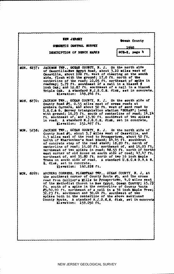
E_. 82_.: JAC[_O_ I_lJ, d_ OC_L_ 00,,._. _. O_ the e_theast else ofQo_nty Route )l;, about _O ft. nor_heas_ of t_e lnte_8eotion wl_h County Line Road. o. ;he s_.te Of an old oll•ell venture; ),7; ft. _or_h O_ nell in Lo_aet _ree;10.O_ ft.. east Of ep_ i, ro_de_; 9.20 ft. s_atheaetOf aaother sp2ke; 11.00 ft, solid, eat of Red 0edar. Astandard _.J.G.C.5. disk, set 1_ O0_ete.
_Lev_tlon; 110.0_ ft.
IO_. _3_: _AC_SO_S _ILLS, 4ac_o_ _P., OCFJ_ CO., _. J.On thesou_;heast elde st tA_, lnte_seotlon of _he ya_ltlse_,tlle_oad (Co.Rte,)_) and _he 9ennett_ %ills Road (Co._te.6),oppoal_;e _e hotel; _¢._2 ft. eootheast of the eenterllneof th_ roitd; and_T._7 ft. southeast of It task In • poleJK-9_. £ etartdard U.8.C.& G._.& S.8. disk, set In_ono_ete.
• leva_ion: lOS._ ft.
NEW JERSEY GEOLOGICAL SURVEY
NP J_RSEY OC_ _
GEODETIC coNTROL SURVEY lqhO
DESCRIPTION OF B_CH Y_KS I ,GK_F, page i l
STARTING IN BEACHWOOD, OCEAN COI_, AT THE CROSSING OF Th_ PENN-_YLVANIA RAILROAD AND C_TPJJ- RAILROAD _ N_W JERSEY, AND RUNNI_DTHENC_ _AST_P_L¥ TO STATE HIGHWAY ROUTE NO. 4, Th_CE IN A GENERAL8OUT_#EST_RLY DIRECTION ALONG STATE HIG_AY ROUT_ _, TMROUGH MOTT' 8CORNER, BERKELEY TWP., LANOKA HAP_OR, FO_tKED RIVER, WARETO_,DAP_GAT, KAN_J_AWKI_, 8TAFFORDYILLE AND WEST CREEK TO A POIHT A_OUT!1.2 RILES NORTHEAST OF GR_ STREET IN TUOKERTON, _AID PgINT B_INOIN LITTLE _GG HApBOR TONN_HIP, _?ILL IN OCEAN COUNTY.
_TANDA_D _VATION5 IN FEET ABOVE XEA_ SEA LeV_, _A_ED ON T_ 1929_RAL A_JU_TRENT OF T_ FIRST @RDE_ LEVEL N_T OF THE U. 8. C_TAND GEODETIC _RVEY.
i_-6: 8_ACHWOOD, OCEAN COUNTY, N. J. At the crossing of thepennsylvaula _a_Iroad and Central Railroad of New Jersey,70 ft. east of th_ railroad _tatlon, i_ _t. northeast ofthe Intereectlon of the tracks, and 58 ft. southwest ofthe end of the curb on the street les_Ing to the _tatlon.A standard _e_, stamped _h_-1930 _, and set In the topof & concrete poet.
Elevation: 7._11 meters or 25.6_7 _t.
MON. 2235: _P_. OF BEACH_¢OD, OCEAN COUNTY, N. J. On the northeastslde of 5tote _$ghway Route #_, In the eeet an£1e ofSpr1_ st., and a short dletaneP easterly along _tateH_ghway Rout_ #_ from the trmfflc circle at Beachwood Slv_and about ioo mil_ southeast of Toms River ,_me County;_.88 f_. Aouth of pole BE-50; _._5 ft. weet of _ streetmonument; _6.2_ ft. north of pole #51-A a_ oppoelt_ thebungxlow occupied b_ H. _out_lette. A standar_ U._.c.aO.S.& 8.8. disk, _et In concrete.
Elevatlon: 21.930 ft.
.-6: B_AC_WOOD, @GEAN COUNTY, N. J. _ the Penneylvanl a _Jtl-read, 7_ ft, ,_,s1: of _he oenter of thm cromslng of theAtlantlo C_ty Highway; 25.7 ft. south Of _e sou_h tall,and 17 ft. north of a dirt roa_ which pa_l]_le the _rzckeA standard dlak, stamped *L-6-19_O', an_ se_ tn the topof a ooncreto post.
Elevatlon_ 7,_81 met_re or 2_,_IF f_.
tV. ;_O: BEACHheaD, BE_L_I' _t_,. _ CI)_L_, N. J. On thenortheast corner at concrete bm,e of _aa pu_e Ot Langera• as 8tatlon, _met slde Of Atl_mtlo City H_ghwa_ (R@uto _),0.65 Iltlee south Of 8pFing St., 9eaohwood; 2_.5 ft. e,etof mast ed_8 of concrete in tel'_oe on r2ght hand e2do ofconorete stepo opposite pole #_91 and north of pole P.B.7_. A 8tandaz_ _nel metal rivet, se_ln oonorel;e.
_.ov_t_on: 37.787 ft.
NEW JERSEY GEOLOGICAL SURVEY
NEW JERSET Ooean County
OEOD_TIC CONTROL _JRVEI' lq_o
D.aRi.io, Io0 r, 2 1w i
RY. 2241; BERKELEY TWO., OCWAM COUNTY, N. J° At Lindstroms RoadStand on west sl_e of highway, 1.2 miles south of SpringSt., Beaa_wood; 100 ft. south of Pleasant Ave., Pine8eaoh; 20,0 ft. west of w_st edge of conorete; 3_.5 ft°south of pole #206S. & standard monel metal rivet, setin ooflcFete.
EleTation: 35.205 ft.
RV, 52_5: BERKELEy TIp,, OCEAH COUNTY K.J. West of Route #_, at_all Run (Mill Creek) bri_e, north end of west abutmentguard rail; 1.33 miles south of 8pring St.. 8eaohwoo_;1.35 ft. south of north end of guard rail; 20 ft. west ofoenterline of highway. A stai%dard mortal metal rivet, setin concrete.
Elevat_on: 22.534 ft.
BY. 2242: BKI_KELEY TWP., OCEA_ COUNTY_ N. J. On the west side ofRoute #4, at Sher_ers Gas 5_ation, Bayvllle on concretebase of gas pump_, south end, 1.8 miles south of SpringSt., Beaohwood; 25-73 ft. west of west edge of concretehighway; 48o25 ft. north of pole #2043 . A standard monelmetal rivet, set In concrete.
Elevation: 37.086 ft.
MON.2236: BERKELEY TWO.. OCEA_ COUNTY, N. J. On the southeast si_eof State Highway Route #4, near the _ayvllle School build-Ing, _bout _.35 miles southeast of th_ Post Office inToms River; 12._ 5 ft. southwest of the edge of _he o0_-crete pavement; 54.5_ ft, sou_hass_ @f a nail at the _estcorner of highway slab #)12; and 50.0 ft. southeast ofpole #2026. A standar_ U.3.C.& @.S.& S.S, disk, set inconcrete.
Elevation: 30._0 ft.
_0N.2257: gOTT8 CORNER, B_ELEY 7WP., @CEk_ COUNTY, N. 3. On thenortheast aide of State Highway Ro_ts /_. and between _hatwo aide roads to Pine Beach _d _ea_ _te, abOUt _,6_miles southeast of the POSt OffiCe in Toms River; 4_.66 ft.sout_hsast of a tack in pole #_-i_; 12.16 ft. south of atac_ in pole #BT-489; and 117.57 ft. northeast of theeast corner of a telephone man-hole, A standard U.S,C.& O,8.a S,_, disk, set in concurs.
_l,watlon: Z6.728 _t.
NEW JERSEY GEOLOGICAL SURVEY
NEt J_SEY eoe_ County
_EODETIC CONTR_£ _RVL_ _9 _
DE_P_FTION OF B_ .BXB IOCI_', Pag"' 1
RV. 2243: S_ELEy T_P., OCEAN COUNTY, N. J. On the east side of
ROute #_. at Raker8 White Flamh Gas Bt&tion_ _aTville.3.0 miles south of Spring St., Beachwood, _.2 ft. eastof east edge of concrete; _2._ ft. north ofpole B-167;in north end of concrete base of gas pu_po. A etan_._mo_el metal rivet, _e_ l_ ooncrete.
Elevation: 38.607 ft.
RV. 2_L_-; BERKELEY TWP., OCF.AR OOt_;TY, N J, On Q_e west side ofState _l_hway Route #_, st Brld_e over b_an_h of PottersCreek In center of parapet base; 3.5 miles m_th ofSpring St., Beaohwood; IO,75 _t. west of west edge ofconcrete; Just aouth of pole #1971. A s_sndard _onel_etal rivet, set In co_Yet_.
Elevation: i_.67_ ft.
P-6: LANOKA I_OR OCEAN COUNTY, N J. About g 9 miles southof _eachwoo_, Ocean Count_, on the Central R_llroad ofHew Jersey, about 60 ft. northeast of a hlghw_y CFO_SI_E;55.O ft. ea_ of the east rail; 16 ft. east o[i dl_troad which paFellel, the _T&OEe; 7_ ft. north of m _o&dleadln_ to the h_gh_a¥; and SO ft. _e_ Of a IO_ bs_.A standard _lsk_ stamped .P-6-19_O% and set in the topof a co_cFete posE.
Elevatlon: 15.5_7meters or 50,97__t.
RV. 22_5: _ERKELE_ T_P., OCEAN _OUNTY, N.J. On the east si_e ofRo_te #_, In _he south en_ top of _all or concrete _tepoat reeldence of _. Ho Cleckner_ _._ miles south of Sprln KSt.. Beaohwood; 12.55 ft, eas_ o_ eae_ edge of _onc_ete;_?.5 ft. south of pole #B-21_. A atan_ar_ monel motel_Ivet_ _e_ i_ oo F/_ete,
Elevation: 37.57_ _t.
MO_. 22_8: B_KEEY T_P.. OCEAN COUNT_, N. 3. On the west elde o__tate Highway Route _, In the sidewalk, and In front ofthe house of A. Bri_r, about 5.70 nllee southeaa$ ofthe Poet Offloe in Toms River; 19._0 ft. west of _hecenterllne of Route #_; 21.75 ft. south of a pole #8T-192_; an_ 2.72 ft. south of the southeast corner of theconcrete steps. A e'tandmrcl U._.C.& O,8,& 8.$. di_k.set In coccreteo
Elevation: _.176 ft.
NEW JERSEY GEOLOGICAL SURVEY
Ocean County
oe_nqc c_5-_ 8va_ l_o
lion, 22}9: |_l_ YW., _/_1 _Ot_, J. J. On S_ oas_ 81de of_e 8tats Highly _ou_ _ and Just Iout_ of s or_asr_ad, abut _,95 lille IO_thlllt Of the pals O_flOt InToss River; _2.72 ft. east of the eenterllne of Ro_te d_t;80.0 ft. south of the eenterllneof _he plneeal4 Road; and_oO_ ft. north of a pole #B-2_. £ i_ndar_ U.S,C.& Go8. & 8.5. dls_) let l_ oonereta.
R¥. 22_: JSl_XIO,k_ Y/_,, OClrAN _YY. R. J. On the wesT. 114e of6*.ate Hll_hws_ Route _. t Ille sou_ of Jut_n entranoe_o p$1'lll'l_lt {Mort. 22}{]) if, 80tlth end Of oulyert head-mill, 0._ atlal s_th of ion. 2219; 10 ft. east of poled_lT.l_l.l_. £ s_ndBrd moflel meta_ rivat. 8e_ InOONO/_Itee
Elewation: 2).0_ ft. _rrae¥_
RV. _7: l_IOlA_ OCFJJI _li_, M. J. At southeast earner of hlKb-way ao_e_ate brl_e _ar °e_ CFeeX_ Lane,s Ho_rbor,balaw and _ the rlKht of n_ta_l _w on e_ast past.A standard nonel ae_e_ rivet, set in sons,re.
_levatlon: 10._) ft.
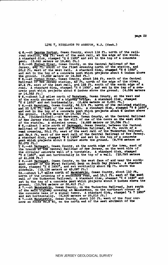
@...6: IJ/O_k i_.kR_OR, O_W OOLM.Y_ N. J. About 116 ft. northof _h_ rsllroad stilton, _ ft. salt of the east rail,a_ the _d_e of the Ioodl. & |tan_-rd disk, stauaped _-_-19_0_: s_d set in _he top of I concrete poet.
s_awttlon; _.9_1 meters Or 1_._1 f;.
RV. 22_: LAbOr&. OClA_ OOUM_, i. J. O_ th_ _eet slde Of Route_, _or_h and top of concrete stops at Aoke_a_ rolideno!Lanoka l_lrbor, about _ tulle oou_h of Cedar Crea_; 12,_ft. meat of l_st edge Of eo_ereta hl_h_ay lad northwesto_ pole #L-28_. A standar_ nonel meta_ rivet, set. InO0_te,
Elevation: _0,_8 ft.
NEW JERSEY GEOLOGICAL SURVEY
m_ JER_ Ooeun County
@_ODgTXC CONTROL 8URVEy_9_n
_ESCRIPTION OF RE_CH MARKS I O_E-F, page 5 l
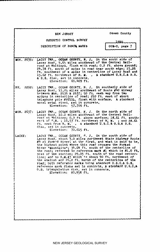
KOW. 2_0: LAC_Y Tlrp,, OCEAN GOLIRTY_ R J. On the moutheast sideof State Highway Route #_) opposite the apple orchardof _saac Jones_ about 8.0 miles south of the Poet OfficeIn Toms River; 20,60 ft, southeast of the oenterllne ofRoute #_; 21. 3 f_. north of a guy pole #B_I_-183_ and13,99 ft. west of a 20 inch Apple Tree. A e_audard U.S.C.& G,S.& S.S. dIBk, set in concrete.
_evation: 3_._19 f:.
dON. 22_I: LACEY TWP., OCEAN COUNTY, N J, On the weBt _Id_ ofSta_e Highway Rou_e #4, near the Piedmont Inn, 8.$5 m11oesouth of _he Post Office in Tome Rlver00.67 ft belowthe ground; 3_,57 ft. west of the centerllne of the road l15.1_ ft, southwest oe a pole #18_6; and 83.02 ft. nor_b-west of pole #BT-1825. A standard U.S,C.& 8, S.& S.8. dlsl8e_ 1_ concPete.
E_,at_on: 36.739 ft.
_Y. 2249: LAGEE TI_.° OCEAN COUNTY. N. J. On the meat side ofState Rlgnway Route #_, north end of culvert heed-wall;0.66 miles north of _acey Road, Forke_ River; 13.og TO.west of west edge of concre_ between polee #1798 a_di 97. A standard monel meta_ rivet, eeC In concrete.
_levation: 17.73_ ft.
av. 2850: FORKED RIVER, LAC_Y T_P.° OCEAN COb_T_, S. J. Onthewest slde of State R_ghway Route _4. opposite entranceto State Game Far, In south edge of concrete drtveway_O._ m11es north of Lacey Road; 6,7_ ft, weet of _estedge Of concrete between poles #1_1 and B_-I_0. Astandar_ monel _etal rivet, _e_ In eo_orete.
_evatlon: 16.3_ 3 ft.
_ON. 22_2: FORK£D RI_, LAG_Y TIP,, OCE._I CO_STY. _. J. On th*wes_ corner, in _he _deealk In front of the gasoline8tatlo_ of _. Rebeler° at the intereeo_lo_ Of 8tareHlghwey RouCe #_ a_d La_ey Road (Co° Rou%e @3_). O._ _t.below _round; 16.53 ft. north, eat of th_ c_nterllne OfRoute #_; _.5_ ft. soutbwe_ of a pole #_-1_71; and_6.35 f_. northeast of a po_e #BT-1770, A etandard U,S.C.& G.S.& S.S. dis_, set l_ concrete.
Eleva_ion: 1_.292 ft.
NEW JERSEY GEOLOGICAL SURVEY
]IIEW JKRSET Ooe_n Gounty
GEODKTIC CONTROL SURVEY lq_o
DESCRIPTION OF B_CH NARK S [OCt-F_ page 6 J
8-6 FORXED RIVe, OCEAN CODNTY, K. J. On the Central Rail-road of New Jersey, _J_ ft. south of the first crossingnorth Of _he s_atlon, and 20.2 ft. west of the west railA standard dick, stmped "S-6-1930", and set in the topof a concrete post which projects about 4 inches abovethe ground.
Elevation: 5.942 enters or I_.495 ft.
R-6: FORKED R_VER, OCEAX COUNTY, R. J. About 164 ft. southof _he Central Railroad of New Jersey Station, 6_ ft.north of the edge of the river, 4_.4 ft. east of theeas_ rail, and l_ ft. south of the south edge of a roadA |tandard disk° eta•pod "R-6-1930"_ and set in the topof a concrete post which projects about _ inches abovethe groundo
EleVation: _.384 _ters oF 14o383 ft.
%ON. 22_; FORKED RIVER, X_CKY T_., OC_N COUNTY, N. J. On thesoutheast side of 8tare Hlghwa_ Route #4, In the e_dewalat Bay Ave., about O.2_ miles southwest of Lacy ?_ad,O._ft. below Rround i 20.55 ft. southeast of _he eenterlineof Route #_; 4.96 ft. 8outhwee_ of a 9 lneh box post;and 4.71 ft. north of the east end of • culvert. A stan-dard U.5.C.& O.8.& 5.S. disk° get In concrete.
EleVatlon_ 13.317 ft.
R¥. 2251: LACEY TWP., OCEAN COD_T_, N. Jo In 8ou_hweet corner ofBridge over Middle Branoh of Forked RSve_, Route #_, 1nile south of Laoey Road, Forked _ver; _7._ ft° northOf pole _728, unde_ _he nuaeral "_, of 192_. A e_n-dmrd monel metal rivet, set in oonorete°
•q evasion: 9.179 f_.
R¥. 22_2; L_C_¥ _., OCEAN COUNTY, N. J. On eouthveet corner ofBridge over 5curb B_a_oh of Forked Rlver, I._ allen southof Laeey Road[u_de_ numeral '5' In 192_; 50 ft. north ofguy pole #L-_76X. A standard _onel 8oral rivet, net Inoon_Fete.
Elevation: 10. _28 ft.
NEW JERSEY GEOLOGICAL SURVEY
Ooean CountyNEW JERSEY
GEODETIC CONTROL _/RVE_ lq40m I
l r
MON. 2245: OCEAN T_., OCEAN COUNTY, N.J. On th. east side ofState Highway Route #_. Just south of Oyster Creek, and2,25 giles south of Its lnter_eot_on with Lacey Road inForked River; 8._O ft. east of the edge of the concretepavement; 14._ ft. southeast of the southeast corner ofthe bridge, neap the guard rail fence. A standard U.S.C.& G.S.& 8.5. disk, set _ concrete.
Elevation: 7.867 ft.
T-6: WARETOWN, OCEAN COUNTY. N. J° About 1.2 miles north ofWaretown, 0oean County, on the west end of the southabuSment of a highway brldee. £ 8_dard dlsk, sipped"T-6-1930", and set horizontally.
Elevation: 2.454 meters or 8.O51 ft.
MeN. 22_6: OCEAN TWP., OCEAN C_., N J. On the east slde of StateHighway Route #_ and 16OO.O ft. south of Oyster Creek,about 2.60 miles south of Ire intersection with LaoeyRoad in Forked Rlver; 9°56 ft. east of the edge of theconcrete pavement; 18._6 ft. south of pole #ON-415; and14.33 ft. southeast cf a drill hole in the pavement° Astandard U.H.C.& °.3.& 5.H. disk, set in ooncrete.
Elevat_on: 19.331 ft.
RV. 2253: WARETO_, OCEAN COUNTY, H. J. On the west side of StateHighway Route #h, 3,0 m11ee sOUth of Lacey Road, ForkedRiver, In south end of culvert head-wall; 0.35 a11eenorth of Saretown Creek; 14._ ft. west of west edKe ofconcrete and northwest of pole #OM-_31° A standard monelmetal rivet, set in concrete.
Elewtlon: 15._2 ft.
RV. 2254; RARETO_, OCEAN COUNTY, N J. In southwest end of High-way Bridge over Saretown Creek Route #_,under numerale2s in 1925, southwest of pole _ON-_l. A etan_ aonelmetal rivet, set in concrete.
Elevation: 12.638 ft.
NEW JERSEY GEOLOGICAL SURVEY
Nil 41m813
Iloean 0<mtyOIC0_fX0 0011_ mllr 19_
_WP.IFTIO_ OY SIlCI_I M&ii8 1001_-IP, pqre $ I
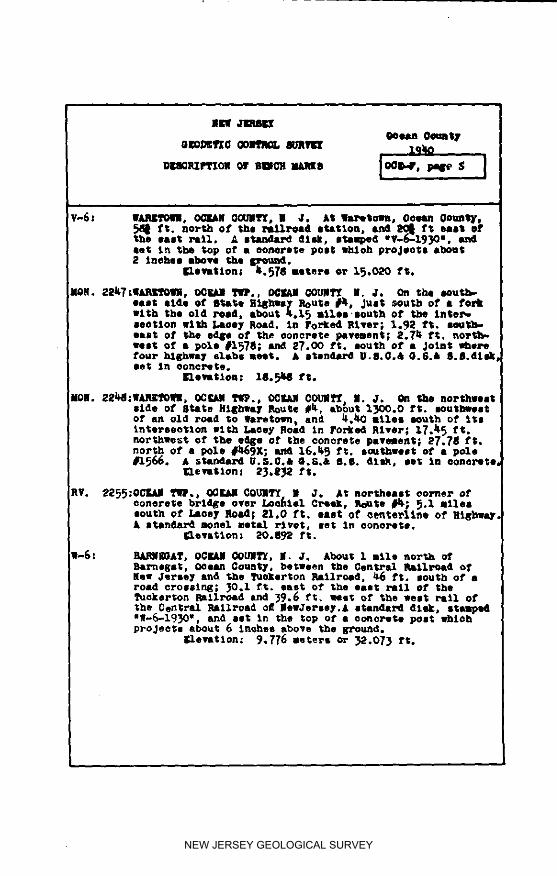
V-6x IIARIrtPOU. _ 0(XqlYT. • J. At lhuPetolm. Soma 0ocmtyj_l ft. north of the _11Poa4 station, and _ ft east o_the lilt l_,J.l, £ I+ dllll+ Itlllped "V-_-19_lO • .let _r. the top o_" • ooltorlte post lhloh pPoJlOtl about2 thebes above PJae ll_'om_t.
enevutlorll Ii._PII miters el" 1_.020 tl;.
MON. 22it7;II_, OClht]l '_IP., O(_Ir£11c_rllT'f II. J, On the south-east etde of ISl;sP.e R:LE_Ip Route flit+ Just south st I forkwt_b 1;be old road, about ;.l_ miles,sour I_ st t_e lnte_-
seotlon with Laooy Road, in Forked R_Lver; 1._)2 ft. mmEl_east; st P_lxe stile of the ooncPoll;e pavement, 2.71_ ft. nor_l_lel_; of I pole #1578; ar_ 27.00 ft. south ot • Joint _ePefour bll;bway slabs m_lt. & eton441PO U.8.0.& O.8.& 8. d.dllJllet In oonerete.
IleVstlon: 18._141 1"I.
M011. 221111:lIAR]re, till+ OCt31 I_I_., OCI_UI COU)IPJ_, II. J. On She noPthgelltside of' State Sll_hway l_o,.tte #it, about 1_00.0 ft. soutl_est
of an old road to llaretmm+ and b+._lO a_les+south of 1Istntet-seotlon wl;h Llleey Plead In Fop]led River, 17.it_ ft.northwest of the e41_e st the conore1;e payment,- ET,?II ft.norl;h o1" a pole _III_OX; _ 1_.1_ ft. southwest of a pole4r15(:_. £ sl_nda_d U.5.C.& Ci,G.& 6.8. Alsk, ee'_ In eerier'eta
Itlemt IOrl I 2_. _1_ ft.
oonerese brtd_e over Loohtel CPIi]r.+ Route _; _.l I1lelsouth at Laoey Road; 21,0 t't. east st' oenterlino of Righw_J, s_Aar_ monel _etal rivet, set In oonorete.
I:lewa_ton; ;+0.8_2 ft.
I1._: _JJI_II_O£T, OCIrJUI _OU]IT_+ II. J, AbO_tt 1 II_le noz'_b OfRamada1;, 0Jean County, between the CentPttl RIIllPoad ofHa_ Jersey lu_d the Tuo_erton _llllrold, _ ft. south of aroad crossln4_; _O.1 ft. east of _he 11ol; PIIII of theTuekeP_on Railroad and _._ f1;. _es_ of the _est rail ofthe Cent;re1 railroad o/_ IlewJePssy.£ l_andaN dick+ siltedsW-_-l_OV, and set In the 1top of a eo_ePete post whlohpro Jests about _ _n_hea abo_e the _o_lld.
i_levatlon: 9°776 asters or _2.o73 ft.
NEW JERSEY GEOLOGICAL SURVEY
_W J_l' Ocean County
G_0DETIC CONTROL _URVEY lq_
DESCRIPTI_ OF B_C_[ IbtP_s _CE-F, page9 J
_V. 2256: BARN_)AT, t_lON TWP., OCEAN COUWTY, N. J. On the eastside O1, _tate Highway Route #1_,2,25 miles south of Were-town, in so_th end 01" culvert head-wall; 1_.65 1,t, eastof east edge Of concrete; )O 1,t. north of pole #U-506.A standard monel metal rivet, set In ooflcrete.
Elevation: 26.506 ft.
iON. 222: BARN_AT, URION _., OCEAN COUNTX, n. J. On the westslde o1, State Highway Route #_, in the sidewalk and about0.2_ miles north Of Bay Ave.; 1.10 ft. west o1, the ourb;2_.26 ft, south of the top nut o1, a 1,1re hydrant; andi_.66 ft. north of a po_e #U-_. A standard U.8.C.& O.S,& 8.S. dlsk, se_ In concrete.
E1evatlon: 3t_.429 ft.
_ON. 2_50: BARN_AT, UNION TfP., OCEAt_ COUNTY, R. O. On th_ north-west corner of State Hlghw_y Route #_, at its %nterseotto!with Bay ave.(¢o. Route #2); 30,67 ft. northwest of a_all at the Intersection of the een_erlineso1, the two_oads; 2°28 ft. west of the curb; and 20._ 1,t. north ofa water gate. A standard U.S.C.& G.S,& 5.6. disk, set Inconcrete.
E1evatlon: _8.l_ 1,t.
_-_: BA_tR_)AT, OCEAN COUNTY N.O. On the west face of a_dnear the southwest cor_#r o1, the _trst National Bank onSouth Bay Street. A standard dl_/, stamped 'X-6-19_',and set vertleally about 2_ ft, above the sidewalk.
Elevatlon: I_.136 meters or t_.O_ 7 ft.
_'-6: BAR_E_AT, OCEAN COUNTY, N. J, At the north edge of thetown, east of the trsoks of _he Central Rallroa_ of NOWJersey, on the west _/de of _he eI_c_tlar co,crete wallof a turntable. A #$andard _l_k, |tamped 'Y-_-I9_O _,and _et hor_zontally In the top O1, a wall.
NEW JERSEY GEOLOGICAL SURVEY
J_51_ _ean County
DE_C_IP?ION OF B_ICH MA_B IOC_F. page 10 J
HV. 2258: 8A_AT, U_XON _P., OCF_ COUMTY H.J. In bile ofcement itep on w_et side Of Route _, _ mile 8o_th of BayAve., Barnegat; Wheeler rasideneej (Fire We.r_.en); t£11.1ft. west of west e_ge of Highway. & standard _nel uetalrivet, set In concrete.
glsTatlon: _A2,6L_ ft.
Hr. 2259: _IOH T_., OGIr_N CO_, N. J. On west lids of Route#_, at R. H. crossing, 8.10 miles eotlth Of Bay Ave.pBarnegat, in culvert head-_all; 2_.1 ft. wast fromedge of Highway end _2.62 ft. northeae_ Of pole _-5_.A standard _onel metal rivet, set In concrete.
Elevation: _.2_7 ft,
RV. 22_0: _ION T_., OG_ GO_ I.J. On east SlAt Of Route#_, about 1_ mile_eouth _f Bay Ave., Bar_egaS; innorth end o1" culvert h_-wall; 16.7_ ft. east of ed_Of Highway and 11.O_ ft. north Of pO_e _r_L_08. Astandard _onel metal rivet, _et in concrete.
RY. 222_: STA_FO_D TI_,, OCF_t_ _O_TX, _. J. About 1.9 _dles southo_" Ba_egat on west _lde of ROU_ #1t, at eo_t_ end 41_west oulvert hea_-wall. _._ ft. _est of eeuterlineof concrete paving and 19.7 ft. norl;_. Of _le #BI_I_-1385. A standard aonel metal rivet, let In e_ta_te,
_levatlon: _I._08 ft.
gON. 22_1: STAFFORD T_P., OC_AN GOU_, _. O. On _he eou_hee_tside of Sta_e EtEh_ay Rou_e #_, og_oelte _he Joint betwe__l_way _labe #2)S and #2_9_ about 2.6 _ilee eout,_-west of lie lntersectl_ vlth Cotm_ Ho_tte #2 inBarnegat; 12.09 ft. southeast of the e0ge of the eo_o_etepavement; _0.0 f_. south of a pole #1157 ; and _._O ft.northese_ of a d_lll hole in _igh_ay slab #2_O. £standard U.S.C.& G.8.& d.8. di -_, set In oon_el;e.
_levatio.: _A._ ft.
NEW JERSEY GEOLOGICAL SURVEY
_ean CountyN_f J_51_
GEGDETI C COHTROL SURVEY lq_D
DESCRIPTION OF B_CH I"LRK3 IOCF_-r, pa_e 11 I
R.H.#_
wMCKIHLAI_: STAFFORD TWF., OCEAN COL_TY, N. J. Cn _be northw_Itside of State Highway Route #_, near a 16 lnoh oulvert,about 2.9 miles 8outhwest of County Route #_ in EMarne-_at; 65°0 ft. southwe_of _e southwlet Bide of theoulvert; _5.O ftl northwest of the oenterl_ne of theroad; and abou_ 125o0 ft. southwest of a oand Toad. Astandard U.S.C.& G,S.-R.M. disk, set in concrete.
Elevation; 50.943 ft.
Z-6: MA_AHA_KIN, OCEAN COUNTY H. J. AbOu_ 1.7 miles north ofManahswkln, O_ean County: about iiO ft. north of thecroBslng of a secondary road, and 15.1 ft, east of theeast tall of the Tucker_on Railroad. A slandsrd disk,stamped "Z-6-1930", and set In the top of a concretepoet which pro_ecte about _ Inohee above the ground.
Elevation: IO.79_ meters oF 35._13 ft.
RV. 2261_ _TA_YORD TWp,, OCE&H COUNTY, H. J, C_ the west side ofRoute #4, about 2_ miles south of Barnegat, in SOUth endof oulvert head-wall; 13o68 ft. eeoc _om edge o_ _Igh-way an_ 60.18 ft, north of pole #BT-Ib_-I_5, a etande_cdmonel _etal rivet, eat In Concrete.
RV. 2262: |LkNARa_K_N, STAFFORD T_P., OCEAN COUNt, H. J. At_anatmwkln Jun_tlon of Routee #_ and _, in sou_h endo_ Gae Stand,S_nahawkin Auto 8e_loe Station.; _O._5 ft.weet from edge of Route #_. A standard monel _etal fleet,set in Oono_e;;e.
__ evasion : _i. 699 fT..
MOH. 2g52: _L%_AHAI_IN, STAFFORD TIP., OCEAN COUNTY. H. J* O_ thesoutheast slde of State Highway Route #_, on _ hedge llneopposite highway elnb #_5; eleo opposite the BaptistChurch, just northeaet Of State H-_.ghway Route #8-_0;11.20 ft. southeast of _he edge of the concrete pavement_5.55 ft. north of a pole #AC-_IO; and 17,6_ft. southof the south corner o_ highway sl_h #_. A s_aod_'_U,S,C,& G._.& S.S. disk, eet in concrete.
Elevatlon: _2.2_9 ft.
NEW JERSEY GEOLOGICAL SURVEY
gL_ J_[Y Ocean Cowry
GiODETI0 CONTROL StSqVEX 19_O
DggCRIP_0N OF B_CH MARLS _ OC_F, pa6e _2
l B
I I
B-7: _AFJ_IK]K, _l&l_ 0_, N. J. About 100 ft. west of thefour corners on Route #B-40, In the north end of the eastabu_ent of the flrlt highway bridge west of the town. Astandard disk itamped, "B-7-1930m, and set horizontally.
£1evatlon: 7.6_6 meters or 25.118 ft.
k-7; _AHAWKI_, OCEAN COU_Tf, _. J. On the Tuckerton Railroad,Just south of the main highway crossing at Manahawkln) onthe northeast corner of the concrete base of a signal tower.A standard disk, stamped 'A-7-I_30", and met horizontally.
Elevation; _.6OO meters or 28.21_ ft.
_ON. 225_:MANAHAWKIN, STAFFORD TWP., OCKAN COUNTY, N. J. On thesoutheast side of the 8tats Hlghwa_ _oute #_ &t the Qtt_Ve,_ust southwest of SZste Highway Route #8-40, 12 Inchesbelow gravel surfacing; 17.41 it. southeast of the edgeof the concrete pavement; ll._O ft. northeast of a pole#A0-6701; and 19.36 ft. south of the end of a Jointbetween highway slabs. A standard U.S.C.a O.5.& S.S.disk, set In concrete.
Elevation; 2_.8)2 ft.
RV. 2263:WmASAWI[IN,STAF_RD TWP., OCEAN coUNTY N.J. On thewest side of RoUte #4, at Cedar Run; In'north ena ofconcrete platforza o_ Cgder Run Tourist Ca_p; 13._5 it,west of edge of Highway _nd Ii._6 ft. easy of pole #BT-I_-12_5. A standard monel metal rivet, set In concrete.
Elevatlon: _5.91_ ft.
RV. 2_6_:STAFFOKD T_., OCEAN OOtr_TY, N. J. On the _ast side ofRoute #_, In west side of concrete platform, "C.dar RunAuto _upply", in center of platform; 23.92 ft. east ofedge of Highway. A standard monel metal rivet, set in
Elevatlon: 20._30 ft.
RV. 52_;STAFFORD TWO.° OCEAN COUNTY, N. J. At Cedar Run on eastside of Route #_, _n north end of cement guard rail onconcrete bridge over Cedar Creek directly un4er numeral•_"; _.O _t. east of centerllne of cement pevlng. Astandard monel metal rivet, set in concrete.
Elevatlon: _l.O_O it.
NEW JERSEY GEOLOGICAL SURVEY
NEll JERSEY Ocean County
GEODETIC CONTROL SURVEY I_
DESCRIPTION 0F BENCH MARKB IOCE-_, page 13 [
m
I I
RV. 2265: ST_rFORDYILLE, STAFFORD TWP., OCEAN COUNTY, N. Oo On thewest slde of Route #_, at Mayetta in oulTer¢ hea._-wall;l_.d2 ft. west from edge of _onerete; _8.O6 ft. south ofpole #661_ and about 250 ft. south of Hayetta Chew_oletAgency. A gCandaFd monel metal Plve_. set In concrete.
Elevation: 29.181 f¢,
lION. 2254: MAYETTA, STAFFORD TWP., OCEAN COUNTY, _. J° On the north-west side of State Hlgh,ay Route #_. epic)Bite highway ila|#169 and near a si_ board; about 2.00 Riles southwestof Its intersection with State Highaay Route #S-I_O in_anahawkln; 10.92 ft. northwest of the edge of th_ eoncretpavement; 8.52 ft. northeast of a guy pole #BT_I_-IIg_and 17.5_ ft. north of the north colder of highway Slab#168. A standard U.5.C.& G.S.& S.S. dlek, set in eoneretl
Elevation: 37,731 ft.
MeN. 2255: 8TAFFORDVILLE, STAFFORD TWp., OCEAN COURTT, |. J. On _hewest e_de of Sta_e Highway Route #_ and near the houseOf _toveIP & Sons, about 2.25 Riles southwest of itsIntersection uith State Highway Route' #8-_O In Manahawkln9.0_ ft. southeast of a Cedar tree; 2.78 ft. northeastof a Ceda_ tree; and _._O Tt. gest of the edge of theconcrete pavement. A standard U.8.C.& G.S.& S.8. disk,set in coherete.
Elevation: }9.833 ft.
V-7: 8TAFFORDVILLE, OCEAN COUNTy, N.J. On the T_ckerton Railroad, 60_ ft. south of the hl_hgay ere|Lira, and 1_.O ft,west of the west rail. A standard dIl_, stm_ped _V'7-19_and set In the top of a concrete poat_
E_evatlon: 8._86 meters or 28,169 ft.
RY. 2266; BTAFF_RDVILL_, OCEAN COUNTY, N. J. O_ _he west sideof Route #_ at 5tafferdvllle in eou_h emd o_ _&8olinePlat_.'o_m In front of eLaura Tourist I_tae; _.0_ ft.gest o_ west edge o_ glRhway and 15.95 ft. southwest ofpole #6_ (Large Atlsntlo Ihlte Flash 81_ visible fromHighway). A standard m_nel me_al rivet, set in eoncrete,
Elevation: _0. 018 ft.
NEW JERSEY GEOLOGICAL SURVEY
NEW J_Sk_/ Ocean County
GEODETIC CONTROL ffURV_Y/ l_ko(
| I
RV, 2_67; EAGLEBWOOD TWp., OCEA_ COUNTY N. J. 2n _tle O_ ltepat northeast corner in front of 8park Plug Znn, Wee_Creek on Route #k. A etanda_ monel metal rlve_, set. inOon_ete,
Elevation: _7.195 _t.
RV. 2P68: _AGLESWOOD TWP., OCEAN COUNTY H. J, On the weJt sideof Route #4, at g_st Creek;In gaaollne s_a_d on eastside of center pump, .Llndy, e Filling Station; 30.5_ ft,west from edge of Hi hwly.
_levatlon: 2_.762 ft.
MON. 22_6: EAQLESWOOB TWP., OCEAN COt_TY N.J. On _be aou_bea_side of State _lghway Rout_ #_. near _e _oad tO starford Forge, about _.6_ mllee southwest of Its inter-8ee_ion wlth State Highway Route #S-_O in M_nahawk_n;0. 5 f_. below ground; 12.65 ft. south_st of the edgeof the concrete _avement; 50.O ft. southwest of a pole#AC~6_96; an_ 17._O ft. south of _he sou_ corner ofhighway slab #_16. A _t_ndard U.S.C.& O._._ _.B. dieM,• et in conePete.
Klevatlon: 1_.981 ft.
MON. 2257: WEST OREE_, EA_LE_WOOD T_P., OCEAN GOUNTY N. J. On thenorthwest aide of State Highway Route #_, about 190.0ft. southwestof the ce_tP_ Of _eet C_eek Bridge and alsoabout }_.90 miles southwest of its Intersection withState Highway Route #S-b_O in Msnahawkln; 9,1_ ft. _Ort_west of zhe edge of the concrete pavement; 20.25 ft._or_h of the _orthwest corner of h_hway slab #_7;and29._O ft. southwest of the southwest corner of highway.A standard U.S.C & G.S.& S.5. dlek, set in concrete.
Elevation: 7.508 ft.
W_7: WEST CREEK, OCEAM COUNTY. N. J. On the _ucker_on Rail-road, about 30 ft. _outhwes_of the station, and alsoshout 31_ ft. south o_ the center of the highway; I_.Oft west of the west rail. A standar_ dls_, stamped_g-7-1930"0 and Bet in th_ top of _ concrete post whichprojects about 3 inches shove the _round.
Elevation: 7.166 meters or 23,510 ft.
NEW JERSEY GEOLOGICAL SURVEY
Ooean CountyOEODETIC CONT}_DL SURVET
19_O
DESCRIPTION OF B_CH MARKS IIOCE"' page 1, ]'
RV0 22)3: r._LESWOOD TIT., OCEAg 0OU_Tt, W, J, O_ the eaa¢ sideOt Rou¢e #_, north end of eul_er_ hei_-wIll, abou¢lille aouih of Wes_eoon_ C_eek; 25 fro P,aet of _en_er-llne of ooncrete paving. A standard monel metal r2ve¢,ae_ in concrete.
Elevatlon: 16.693 re.
RV. 8269: LITTLE _ HARBOR TI_., OCEAN COUNTY, No J. On _he eastIlde of Rou_e #_ at PaPkertolrn, in south end of gasolines_enO ._hell Co.', in front of ParkerCown (}a_q_e; 26.1__Pt. east of edge of Highway. A el;arJdL_t-d mortal me_alP1vef; se_ _n concrete.
glsvstlon : IL_,I_I f%.
RV, 2_70; LXTTL£ _00 HARBOR TWP.. OCEA_ COUNTY, M. J. On the westaide o1" Rou_e #_, 1._ miles e_u_h of I_erto_n G_aae;16.6 ft. west from edgeof Hl_hway; 31.18 ft. north frompole #992..A standard _onel me_al r_vet, see in concrete
elevation : 12.57_ f_;.
RV, 2271: Z,,Z¢'I'_ EGG HARBOR TWp , OCEAN 0OUSTS, N. J. On ¢_e e.stside ot RouZe #4, in _asoltne plat_'ol_a a¢ .0h_llena go_-_ow Stand", a_ou¢ I_ _ilea notch of 6_en St., TucMerton22.1_ ft, e_ag of edge of Hlgh_a7 and _._i ft. notch o£.]rico. sign. A standa_ mortal metal _ve_, set Inoonol-e rie.
Elevation: 2_.'/29 ff;.
_CULL¢]I: LITTLE I_G II_RBOR T_P., OCE_ OOU_J_, _. ,1". On t_e no_tlwea$ aide of Stage Highway Route #_, _poe_te highway'slab #781, about 1.2 miles llorCbealt of O]Peln St. InYuckerton, 0._ tl;, above ground; 2h.65 f1_. norC, h_eef;of _he edge of _he pavement; _3,1] f_, norCheal_ of a
pole #979; and 69._2 ft. no_theeat o_ a pole #_nCP6870.A a,:.and_rd U.S.C.& O.._.& 8.8. dieM, let Irl ooneIPele.
¢lev_tLon: 20._7 ft.
TIE TO M.,/.(}.S.BF, JI(_II I_RK:_.j.O.S.3_tETO_r_, OGICJ_ C_U_T_, If. J. On oenier of _uthle8_
side of large E_n_te _F_ikin_bu_) monument, on Copo_ _ail. flat p_-oJe_t_.on OT th_ top _ae_-lCone di-racily un_e_ the pollshe0 _ns_rlp_1on-faoe, upon abebottom of whloh _a cut,"D_nf _ay 10, _855". The_on_efl_ 2a l_ _;he _a_'etowfl _emete_'y, aa_l; Of lalnahoPe roa_.
Elevat_on: 20.7_0 ft,
NEW JERSEY GEOLOGICAL SURVEY
N_W JERSEY O_ean County
O_D_TIC CONTROL SURVEY 1740
DESCRIPTION OF BENCH MABKS I OcE-F' page 16 I
KLI_INATIONS OF SPUR _EVATION5_BY. 5241: BF2_KLEY TWP,. OCEAN COUNTY, N. J, At eoutheast corner
of Route #4 and road leading eaat along north el_e ofCedar Creek, _ f_. Ice,de of _oncrete curb, eet In amonument. A sta_d_r_ mo_el metal flyer, se_ In concrete
_levatlon: i_.359 ft.
M[. 52_: LANOKA HARBOR, OCKA_ COUNTY, N. J. on Route _4, clrnlecu_ in aouthweet bridge eeat of concrete Highway Bridgeover Cedar-Cre_k, 18 ft. w_st of eenterllne o_ _IKhway.(Au_. 1935). _ olrcul_r cut. (U.S.O._.)o
Elevatlon: 6°754 ft.
MK. 5_k3: LANOKA HARBOR, OC_ COUHTY N.J. On _oute #4, bronze_°S.G.B. dlsk, gauging _tatton, aouth aide of Cedar Creeon re_a_n!n_ wall _ sou_h end of e_ _au_In_ welt;31._ ft..eet of cen_erllne o_ H_h_a_. A atand_r_U._.G.S. _lak.
_levatton: 3.9SO ft.
BY. _2_7: BARN_)AT, OCEAN COUNTY, H. J. On eas_ elde of Route #4In north end of concrete baee o_ _a_ pu_p8 a_ Koz-m_nef111_n_ a_a_ion at corner o_ Cedar 8_reet, Barne_a_;16.3_ ft. east of eae_ e_ge of concrete highway, &8_andard monel metal rlve_, act i_ concrete.
_leva_ion: 3%.607 ft.
%_K_NLAY_ STA_DRD TWP,, OCEAN COUNTY. H. J. About l._ m11e8north of Manahawk_n and abou_ 0.% 5 m_le vee_ of StateHlghwey Route #4_ on the Beach Vlev Farm owned byWalter McKinley; l_B.l f_. wesa of the 8and road; I_.Ift. 6curb of the woven wire fence and _69o0 ft. north-west of twln a_loe; re_erred to reference mark #i whlchle 97.B7 ft. cut of the _tatlon st the southeaet col _-net of the w_e fence; 62.0 ft° eeet O_ the _fore-mentlo.ed eacd _Ad acd 19B._ ft. northwest of tw%nmlloe; and to R.M.#_ which le l_O.l ft° .or_hwelt ofthe etatlon, _bou_ _2 f_. north of _he aouth fence ofthe field and %.9_ ft. ea=t of the fence _o the Appleorchard both refereno_ markm beln_ mtan_t U°_.C.& G.8.reference mark dZf_e, act In concrete. £ e_an_ard U._oC. & 0._. trlan_atlon 8_atlon dt_. let in concrete.
_evatlon; 98.692 ft.
_D OF SPUR _L_M/NATION8
NEW JERSEY GEOLOGICAL SURVEY
NEW JERSEY0¢ean County
GEODETIC CONTROL SURVEY 1941
DESCRIPTION 0P Bh_CS MARKS IOCE'P' page IV J
TIE TO N.J.G.S. B_CH MARK IN BARNEGAT:
N.J.G°S°_5.76: BARWEGAT, OCEAN COUNTY, N.J. A _OSs out in east end of
lo_es_ flagstone step on _ouhh Bide of the blaement f_on_door of P_esbyteriln Church on east slde of _In StTge_about 0.I m_le east of Ba7 AvenUeo
Elevation: _5,806 ft.
NEW JERSEY GEOLOGICAL SURVEY
NEW JERSEY OCEAN COUNTY1939
GEODETIC CONTR OL SURVEY I IDOE-G, page IDESCNIFTI(T_ OF BENCH MARKS
STARTING IN SURF CITY, OCEAN COL_TY, AT T_ CITY WATER TANK ANDRUNNING T_ENCE TO LONG BEACH BOULEVARD AND NORTH NINTH ST., SAITLOCALITY, TEENCE SOUTh'_EST ALONG LONG BEACH BOULEVARD THROUGH BOROOF SHIP BOTTOM-BEACH ARLINGTON. BRANT BEACH, BEACH HAVEN CREST,BEACH MAVEN pARK. BEACH HAVEN TERRACE END SPRAY BEACH TO T_ BONDSCOAST GUARD STATIOW, ABOUT 1.7 MILES SOUT_ OF BEAC_ HAVEN. STILL INOCEAN COU_TYp N.J.
STANDARD EIZVATIONS TN FEET ABOVE BEAN SEA I_VEL, BASED ON THE IBS9GEh_ERAL ADJUSTMENT OF T_ FIRST ORDF_ LEVEL NET OF THE U.B. COASTAND GEODETIC SDR%_Y.
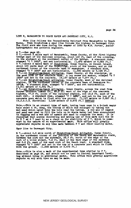
p 7: SURF CTTY, OCEAN COUNTY. On the nox_hwest corner of the
noz_hweat Concrete footing, at the Surf City wateP tank.A 8t_dIl'd disk, mteJ_ped B 7 19S0",
Elevation: 2.047 mste_80_ 6.716 ft.
NON. 5_91 -SURF CITY OCEAN COUNTY. On the southeaBt cor_em of
intePse_t_on Of Long Be_eh Blvd. and noah 9th St., aboutO.g miles north of Long Beach CausewaT; IS.O ft. east ofoenteP llne of Lon 6 EkDath Blvd; 41.9S ft. noZ_Ch of ]_le#B-B599; IS.91 ft. west of flre plug; and 19.84 ft, north-West of northwest aoP1%e_Pof 6amage. A standard N.J.G.C.S* disk. set in tone,re, f_ush with the gPound.
Elevation: S.ESS ft.
Hr. 5257 -SURF CITY, OCEAN COD_TY, On east side of Lon_ BeachBlvd| 0.6 miles mouth of Long Be&eh CauBeway (fTCRManahawkln). A standard monel metll rilTst set in Curbat anglep midway be_ee_ 8curt 4th St. and So. 5md St.
Elevation: 5,150 f%,
M_. EE_ -BORG OF SHIP BOTTOH-BE&CH ARLINGTON, OCEAN COt_TY. Onthe aou_hwest ooPneP of _nte_se_tlon of Long Beach Blvd._d S, 9th St** about O.B mile noPth of Long BeachCausev_; 5.20 ft. south of pole #12; 3.80 ft. west ofwear ourb of LO_ Beach Blvd.; 6,40 ft. east of east oul'bOf sidewalk. A st_nd_-d N.J.G.C.E. disk, met in conc_eflush With the slde_Ik between _t and e_o.
Elev&tlom _ 4.'757 _¢,.
E TI SHIB HOTTOH _EAC_, OCHER COD"_I_Z, On the nox_heeat eo_nePof the _u_t_On of the Bea_h end _h_wk_n _eed8# about0.5 _i_ no_h, beseem the curb and the 81dew.k; 23.7ft. _o_th of the od_ of the _ of • blind mt_et] 7.Bft. welt of the _st edge of the slde_alk emd 5.:_ ft.e_lZ Of the e_It 4o_b of the Beach _oad. A 8tand_ dlskIt_mped "E ? 1930", a_d cot in the top of • comomete poetwhi@h la fluah wl¢h the gmound.
Elevation: 1.668 mete_e 0_" 5.4?B _.
NEW JERSEY GEOLOGICAL SURVEY
JERSEY OCEAN 00_
GE_ET_O 0 _RTROI. _D'R_I' I 0¢1.G, __2 IDESCRIPTIO_ OF BWR_ J_RE8
M_o S_ -BOB0 OF SHIP BOTTOM, _ JRLIJ_TO_, OGE_ CO0]_/.the east side of Lon6 Beth mv_°, Just no_ of bll_street opposite Lon_ _eaoh Cau_'l_ to J_nah_n; I,_ft. north o1-north eurb of blind et_etl I._8 ft. outof east ed,ge of sidewalk| 47.50 ft, southeast of eastcor_e_ of Joint 1_8 in highway° £ etaudard N.J°O.C.S.disk, sot in ooncr_te_ flulh with eidOWLlk.
Elevation: _,293 ft.
BVo 6S58 -BONO OF S_ZP B_OM, _EAC_ _I_GTON, OCEAN C_.east side of Blvd.; 0.25 miles south oP the CauemT.A itandard mortal _t_ _i_t set in no_th oul_ at neath-east eo_el. 13th St. & Blvd. _st of s_devalk.
Hleyatlonz 5.444 ft.
RV. _9 -BORO OF _IP BOTTOM, _£C_ aRLX_oYOI_ OCEA_ O0_H'_t. O_salt side 0£ _Ivd. 0._ _lell eO_th o_ Canse,_1¥. Ast_a_ monel metal Pivot aet in e_unt 0urb of BlwL,mi_a_ between o_c_ete H_ Joints 210 and 211 and _nll_no_th of whel_ ourh 3"etu_s east to 1-ol_a the p_asaabo_t i00 ft. north of IBth St.
Ele_tlon: 5°_43 ft.
0-7 -SHIP BOTTOH_ BEACH ARLINGTON, OCEAN CO_R_/. Xn the _o_h.east co_i"_e_ of the consists base of _$_pher_ No. 10_10,west of the railroad stltlon, • standard disk, lapped
"O 7 19_0", and set ho:'le_Cell_.Elevation. i._II mote_'s o_ 4._01 ft.
F-7 -SHIP BOTTOB, BEACH ARLINGTON, OC_J_ COUNTY. £0_0111 the1"_ad fP_ _¢_,2r.ld _9_Potho_ Lu_be_ C+O.+, 49+_ ft. _,_est Ofthe edge Of the c_ncrets highest; ?_.g ft. 8_th o1- the_ai_poad etatlon_ and 19.2 ft. east o1" the east Pail. Astandard di_k_ stamped np 7 1930_, a_ set in the to_ ofa cono_te post _hloh Is f_ush with the g_ov31d.
Elevatlc_ 1.120 n_te_s o_ 3.675 ft.
NON. 5294 -BORO OF SHIP BOTTOM, BEACH ARLINGTON, OCEAN COUNTY. Onthe s_th_st oodles, of Inte1"eeoti_ 01" S4th _t.Lor_ Boaoh Blvd., ah_t BO it. southeast o1- RR Stationand about _00 ft° south o1- eenta_ line of Con_ad+s _d-v_ _tore; 14._ ft. west of vest edge o£ highway p_v--In_. a st_nda_ B.J.O.O.S, disk, met in ¢ono_ete, levelwith pavln_.
Elevation: 3,_II ft.
NEW JERSEY GEOLOGICAL SURVEY
ig_9
GEODETIC CONTROL SURVEY I IDEECRIPTIO_ OF BENCH MARKS 0Gm-(}, pegs
MON. 5295 ,BBA_T BEACh, OCEAN COUNTY, On the west etde of LongBeach Blvd. oppomite Junction of Z4%h St! 5.5 ft. east ofstone pillar _rking noPth bo_nda_7 llne of B_ant Bea_h__5.9 ft. mOuthwest of weBt end of Joint #48! 15o97 ft.no_th of west end of _olnt #4_J 11.44 fro west of westedge of concrete _vlr_ of h_hwa_. A standar_ N.J.O.C.S° disk, set In conomete, level wlth pavement°
Elevatlon_ 4.165 ft.
_v. E260 -BRANT BEACH, OCEAN CO_.ITY° On east curb of Long BeachBlvd. 1.45 mil_s south of Cau_ew&y at northeast corrm__8th Street opposite concrete h_ _oin% #ETA° A standardmon_l _tal r_votj set i_ co_Pets°
Elevatlon: 4°6_4 ft.
_V. 5281 -_RANT BEACh, OCEAN COUNTY. On the _ast slde of LongBeach Bird°, at the southeast _o_ner of the Blvd., and45th St_ io_0 mll_s south of CausewaT° A standard monelme_al rive_ _et In conc_e, in cu_ a_ 45th _t_ 4_.78ft. southeast of a flre _lug.
Elevatlon: 4._80 ft.
MO_° 5_96 -BRANT BEACh, OCEAN COUNTY° On the southeast corner of£nteP_ectlon of Long Beach Blvd. _nd 5_nd St.| about _.0miles south of Causewa_ to Manahawkln_ _7.1_ ft. _emt ofoen_e_ 1_ne of h£EhWay; 5_.47 ft. northeast of _ast end o_Jolnt _40-B_ E0.95 _t, southeast of ®_at en_ of Joint_9-B. A e_andar4 N.J.G°C.S° disk, set 2n concrete,_vel with _he sidewalk.
Elevation: _._5_ ft°
MON. 5_7 -BRANT BEACH, OCEAN COUNTY_ On the east sSds of Lon 6Beach Blvd. a_ the nor_hesat _ol-ner of the Offset inhi_hwa_ between 59th St. and 60th St_ about _.S5 milemsou_h of C_usew&_ _o Manahawkin; sot between _Pb andsldswalk_ 96.0 ft. soubh of the south _urb of 5_th St._15°2_ ft. e_st of pol_ _-3_7; _6.50 ft° eas_ of east endof Jo£nt _90-B; 47°40 ft. oouth_as_ of _st end of _olnt2_9-B. A s_andar_ N.J.G.C.S° disk, set Sn uon_te wlevel with sidewalk.
Elev_tlon: 5.590 f_.
T._.E. 76 -ERA_T _EACE, OCEAN COUNTY, At the B_ant Beach watert_er In the _ast fac_ of the southesst _oncr_t_ fooling.A la_ _cPew _e_ented in a horizontal d_ill hole In then_arly v_tlcal fa_e of the concr_t_ footlr_.
Elevatlon: 1.9_0 meter_ or 6,_3E ft°
NEW JERSEY GEOLOGICAL SURVEY
_EW JERSEY OCEAN COU_Y/1959
GEOD_IC CONTROL SURVEY I°GE'O' _6_4 IDESCRIPTION OF BENCH MARKS
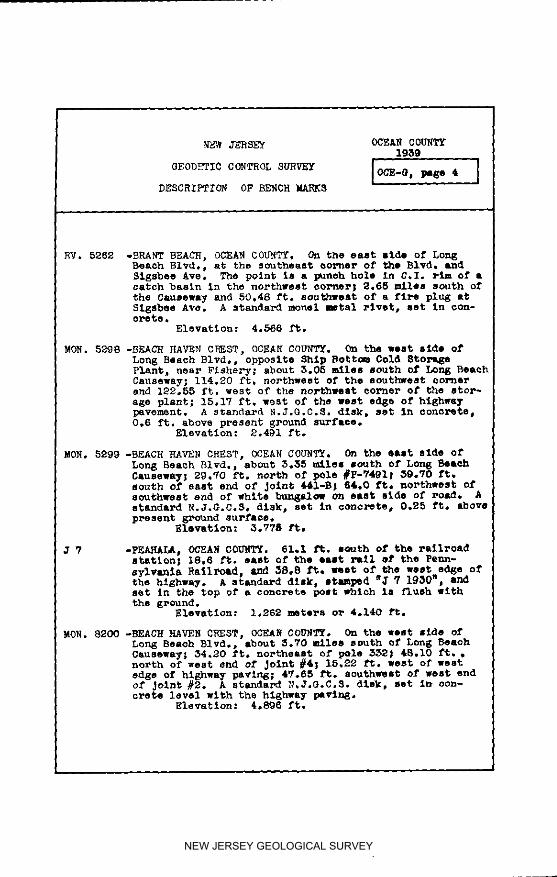
RV° 5262 .SRA_T BEACh, OCEAN COUNTYo On the east mlde of Lon_Beach 81vd° r at the southeBat oorner of the Blvd, LndSigsbee Ave. The pQlnt is a _noh hole in 6,I, _Im ofcatch basin in the northwest oorne_; 2°65 milem south o_the Causeway and 60.48 ft° southwest of a fire plug atSigsbee Ave. A standard monel mtal _Ivet, aet in con-o_65oo
MO_° 5299 -BEACH _AVEN C_EST, OCEA_ COUNT_. On the e&st side o_Lon_ _each _ivd°, about 5°_5 miles _th of Long _e_oh
south of east end of Joint _I-B; 64.0 ft. northwest ofsouthwest en_ of white bun_l_w on e_st _de of ro&d. Astandard N.J°G°C°S, disk, set in c_._o_ete, 0°25 ft. above
Elev_tlon: 3°77S _°
? -PEAHALA, O_EAN COUNTY. 61.I ft. i_u_h of the r_ilroadstation; 18.5 ft° oas_ of the e_t _i ef the Penn-
sylvanla Railroad, and _8o8 f_° w_at of the _ested_e o_the highway° A standard disk, mtmped _ _ i_30 _ andset In the top o_ a concrete post _hlch Is flush withthe _r_und.
Elev_tlon: I°_62 meters o_ 4o140 _t°
_ON. 8200 -BEACH HAVEN CREST, OCEAN COD_TY° On the west mide ofLong Beaoh _Ivd°_ about 3°VO males south of Lon_ BeachC_useway; 84°80 fro northeast of pole 532; 48°i0 ft° •north of west _nd of Joint #4; 15°_2 ft. west of westedge of highway pavlug; 4_°85 ft. aouthw_It of west endof Joint #2° A st_ndmrd _,J.G°C°S° _lak, set i_ oon-o_ete level with th_ hi_h_L_ pavln_°
Elevation: 4°8_6 _t°
NEW JERSEY GEOLOGICAL SURVEY
JERSEY OOSJ_f CO_WYI19_
_E ODA'TZC C01TROL SURVEY I 0CB..O. _ B IDEBCBIPTIOW C_ BRNCH M£RK_
RV. 528H -BEACH HAVEN PARK OCEAN COU_T_, On t_e east side of LongBeach Blvd., 4._ miles south of the Causewa_j in south-west ce_nsr of a catch b&ain at the northeast oorner o£BlVd. and A_abeau AVSj 158.08 ft. southwest of a fireplug at _riel Ave. and Bl_o i atandal-d mo_el metalrivet, let in oonorete.
Elevation: 4.524 ft.
RV. 5264 -BEACH _VEN pARE s OCR_ COUNTY. On the east side of LougBeaoh Blvd,| 4.45 miles Booth of Causeway in southwestOOrner of a e&toh basin opposite Joint #336 of theconcrete hIEhway; 66.49 ft, southwest of Pole #7564 ACEsystem. A standard z_onel metal rivet, set in oonor_ts.
Elsvatien: 4°465 ft.
E0_. 8201 -BEACE PAV_ TERRACE w OCEXN COU_FF£. On the west side oi'Long Beach Blvdo _ about 4.8 miles south of Long BeachCauseway, Just north of Beach Haven Crest Fiahery_ 52.91ft. east of east rall of Be; 14.55 ft. _st of west s_eo£ hlghway _aviu_; 47.0 ft° southwest of west end ofJolnt 125; and 110,14 ft. northeast of northwest eol_ne_of Flehe_y. A standand N.JoOoC.S° disk, set in concretelevel with hlghw_y°
Elevation: 4.567 ft.
HOE. 820_ -BEACH HAVEN TERRACE, 0CEA_ COU_TY. On the wear side ofLong _each BI_,, about B,l miles south Of L_ BeaobCauseway over Barnegat Ba_| 31.75 ft. northwest of westend of Joint 161; 13°0_ ft. west of west edge o_" oon-cre_e paving o_ hlghway; 20.92 _to southeast of west endof' Joint 150; 54.40 _. east of east tall of RR. Astandard N,J.G.C°S. dlsk_ set iD oo_ex_te_ level mathroad,
Elevation: 4.540 Tt.
K 7 -B_ACH HAVEN TEBRAGE, OCEAN COU_I_, On the east side ofthe oonol, ete base_ at the Lo_ Beaoh st_dptpe. Astandard disk, stamped "K 7 1_0" _ set ho_o_tally,
Elevation: 1,996 me_ers 01" _5.548 ft.
RV. 526,5 -BEACH HAVEN TERRACE, OCEAN COUNTY, On the east side ofLong _aoh Elvd., at the northeast colT=st of 54th St.,, andthe Blvd, j 5.4_ miles south of the Causeway| in no1"thcu_o of _turn of 54th 5t. ourb and 1004 south Of a Pu_Oil Gas station. A standard monel met_ rivet set inC071_ste.
Elevation: 4.108 ft.
NEW JERSEY GEOLOGICAL SURVEY
NEW JERSEY O_FJ_ C(_I_ig_9
GEODETIC CONTROL SURVEY IOCE.O. pa_e 6 ,,ID_SCRIPTION OF BENCH MARKS
HO_, 82_ -SFRAY B_C_, OCEAN COU_T_. On the east elde of LongBeach Blvd°. about 6.8 m11es sou_h o_ Lone Be_ch Cause-_ay_ _nd Just north of 26th S_._ 81,58 et° north ofnorth cumb o£ 26th St°_ 42°58 ft° northeast of east endof _oln_ 488_ 29°28 _t. southeast ot east end o_ Joint487_ A standard N.J.G°CQS° dlak e _e_ in concx_te, levelwi_h _he sldewalk°
_leva_ion: 4°i_6 ft°
MO_° 8204 -SFRAy BEACR, OCEAN COUA_T° On Che _o_%heaet cor_e_ o_iutePse_tlon of 20th _. and Lon8 Beach Blvd°, _ou_ 6.1mile south of 5on8 Be_h Oausew_ 17.08 ft. east of_ents_ llne o_ road_ _°40 _t° north o_ north ¢u_ ot20_h St,, 44.45 ft. northeast of pole 79E0° A stsnda_d_,3.G,C°_° dls_, set in concrete, level wi_h sidewalk..
Elevation: 4,554 _.
RV. 5266 -BEACH HAVE_, OCEAN COUP. On the _a_% slde of 5on__each _ivd°, _t no_h_u_ _on_e_ of the _Ivd° (_aT Ave.)and 13th St,, 6°_0 miles south of the C_usew_7° Astand_Pd monel _etal _i_et set in oon_e in notch curbof 15_h St° in line with wost edge of _i_ewalk.
Elevation= _o55_ tO°
RV. 5_6_ -BEACH HAVE_, CCEAN COUP. On the we_ aide of Bay AvQ°(Lon_ B_h Blvd°) at _th St., and 6.80 _ile_ sc_th ofOJusew_T° A s_snd_rd monel _etsl rlv®_ _et in con_otein wes_ _u_b o_ BaT Av_°_ _bout 5.5 f%° noz_h o_ n_th
E1ovation= 3°48_ _%°
L • wgEAC_ _AVENj OCE_d_ C_NT_° On _he _ou_hwe_ coPner of •_rlck s_hooi building in the no_h p_ o_ _he town.standard dleM stamped "L _ I_50 B _nd N_ ve_ticall7 in_be wsllo
GEODETIC CONTROL SURVEY IOC_.@_ _@_ 7 1DESCRIPTION OF BE_CH MAPleS
R.M. #2 -BEACH HAVEN, OCEAN COUNTY. At the east end of the street"Beach leading from the station, about 0.25 mile east o£ theHaven" station; 3 meters east of _u_bl_ at Interseetlon of
Atla_tlc and Englsslde Ave. A standard disk reFsl_D_amark, set in oor_rete.
Elevation: 10.560 ft*
BEACH BAVRN._ACH HAVEN, OCEAN CGUhw_y, N.J. On to_ property westof the water tank in line with the Jaln track of therailroad nc_th of said tank about 50 yards northwestof the water tank and also abOUt 50 yards north of thepump house; the station is r_ferred to R.M. #I _ohis 244.15 ft. north of the station _ud set in drillhole in the concrete loading platfome in s fleh _k-In_ plant; to R._. #2 which is at the east and o1" thestreet leadln 6 from the station about 0.$5 mile s_tof the station; 9,8 ft. east of the ourb_ at _aintersectlon of Atlantic and Engleslde Avsnue_ andto RoM. #5 Which is 146,@ ft, southeast 0_" the StatiO_in a concrete base, said raTe,nee _s belr_ st_U.S.C,&O.S. reference ma_ disks. A standard U.S.C.A_.8.trlan_ulatlon 8tatio_ dlsk_ set In oonoret@.
Blevatt o_ : 4.851 ft.
M V -BEACH HAVEH, OCEAN COD_TY. On the n_thwest _ol*ner ofthe northwest footir_ for the Beach Haven water tank,near the center o_ the /;e_t. A standard dlsk_ sta_]_ed"M _, i_30" and set horizontally.
Elevation: _.009 meters o_ 6,591 ft.
M 7 -BEACH MAVEN, OCEAI_COUNTY. On the norths_t corner ofthe Beach Haven _ational Bank and Trust CO. buildi_. •standard disk st_ped "_ 9 1930" and set ve_tloall_ inthe brick wsl_.
Elevation: 1.842 m_ters _ _.043 _t.
RV. 5268 -BEACH HAVEN OCEAN COUNTY. On the north ride of _e_kleySt. at Bay _ve; 0.35 miles south of En_lesids Avs; 16._ft. southwest of Pole AB-20-16, A standard rachel _talrivet set In concrete apron of a catch baeln in _bssoutheast cca_ner.
Elevation: 3,859 _t.
EV. 5269 -BEACH HAVEN. OCEAN COUNTY, On the east side of Ba_ Ave.at the southeast cc_ner of B_y Ave. and Dolphin St.;60.18 ft. southwest of a faro plu@ at Dolphin St, and HA7Ave. A standard rachel metal rivet set in ¢or_rets apronof a catch basin ar_ is 0.55 miles south of En_IssldeAVe,
Elevation: 5.985 ft.
NEW JERSEY GEOLOGICAL SURVEY
,_ ,,,
/ERSEY Ocean County
OEODETIC COHTROL S_VEY _B40| |
IOH, 8S_9",': BEAC]_ EJ_t,_EN_OC_L.R COUNTY, N. J. On 'the welt slde'o_" BaAve,,, near pelham St.. 144o fro north Of the cente_llnePO_ Ste| 24e30 ft. wegt of the een%erllne of _7 Ave.?,74 Ft. south of pole eliTe;iS.tO ft. southeast of theec.ltheast O0_"_rJSI.of a bungalow on the west side of _y AVlA standard H,J,O.C.S. dlsk. eat in eoncrete_level with thl
sidewalk.Elevation: 4.660 f't*
R.N.#2"ST.JAXES*; OCEAN COUNTY, H. 3. 0,15 miiO north ef the load tothe sta_iont east ef Bay A_es,ln the llz_ Of' tele_aphpoles to the north and north of the _.le at _he turn ofthe ifne of the poles, A standard _sk, refel-enee _eset i_ co.crates
Elevation: 7.114 ft*
BOH. 8208| BEACH RAVEN, OCEAN COUNTY, _. J, On _e _et side ofLong _eneh Bled., abo_t 1.6 miles 8e_th ef _gleelde Ave.i_4.e rt. west of the centerli_e of _he B1v_.; 44.15 ft.north of pole _ACE-III96; 3_,80 ft. west of Dole #CO_HH8.A standard N.J._.C.S. disk, act In eCmereteelevel _ltb _d,
Elevs _I_ 4,_I ft.
TIDAL.2: BEAC_ RAVEN, OC_ COENTT, N. J. ab_t I._ miles sou_h,a_ the Bonds Coast _ua_d S_at_on, on top o_ _he south-west eo_..r:o:, o_ a squat@ oo_o1_te _t_._ _eln at thea_tesi_n well, about _S ft. eo_h 01" the _st _u_',d Sta-tler. No ma_k _a s_de c_ the_onereta _t the level _oawas held on the ce_ner about _ Inches f_om both edge_.
Elevatiou: 2.2_5 meters or 7._3,S tt_.
ELI_INATIOW OP SPUR ELEVAtIOn:_._. _o_: BEAd_ FAV_I, OCEAlq COUWT_ H. _. On _he eeutkesat oo_e_
el _ _hs Interseet_e_ or Atlantie Ave. and _erMele7 Ave..6 thebes below the sidewalk| ?.OH ft. south Of the so_t_.eu_b o_ _e_ele¥ Ave.; 8._0 f_. east of the east curb of
• ' Atlantis Ave.; e?._oft. eou_a_et or t_. southeast oor-ne_ o_ concrete block wall on the northwest eo_ne_ of.the Inter-settles. • g_an_a_d i,J.G.c.3, d_sk. let _ncc_crete.
Elevation| _80_ fLEND OF SPUR ELI_IHATIO_
NEW JERSEY GEOLOGICAL SURVEY
I_ 8H eeea, ¢_m_7
a_rr_0 aUTAW, immv_ I?_
_gso_xpTx_ er D_ _s I ecl_-J.paseI ]
8TARTIIIQ.IR U-UA'.I_ZII, eC/Udl 06_lT_, AT _Z I](TI_I_XOB _ BTA'L'EHIO_AY RIcTg8 g AND _ AID C_WT_ _T_ 16, _ _miIG THEgcgHOP_JWlU_Bq_ A].,ono STATI_HXOHWA_[llUTt 8-.1_ "A'FJ_OUOH8TAW¢_D 'Z'qiW-Blip TO 00_ MUTE I0. 2, UJ(IOJ _elrRSHXp, '['gl_Ot T.AgTEI_¥ ALONGCOUHS'YROUTEgo, _ {BA_ ATI.) TO _ C_AZ. RaIL_AD Ole N_ Jl_tSk_CROSf_XNQ,BARREOAT, BAn TOWNSHIp, 8T_, IN e_l_ CO_T_.
8TAHgARD_EVATYoNs IS F_T A_O_E _ SEA LE_E_, BASED ON Tl_ 1929O_ERAL AD_ST_mT OF _ FXRS? ORDER LEV_h _'r Or T_ U. S. COASTAMD OEODETIC _R_ET.
_-7: MA_WIIN, _KA_ _OD_TT. N. J, About I00 ft. west ofThe four oo_-_e_s 01'1Route no. I_O, on the _orl;h end ofthe eW_t abu_t of th_ flr_t highwgy bridge west ofthe t_wn. A 8_an_ar_ dlSM. s_eaped "B-7-1930". an_ anthorl_onta11_.
Elevatlon: 7.656 meters Or 25.118 ft.
MON. 5609; 8TA_RD TWP., OCEEMO(It_TY N.J. On _e 8OUthlelt Illdee_ RoU_:e #8-_, abO_t 0.3 mile norThwest of Route #1_, at_wkln; 1.0 ft. _elow gPevel shoulder; }6._ ft. noP_wee¢ of a d_lll hole at e_e of concrete paving Joint15-A; 12.09 ft. IlOUthWelt Og"• drill hole al; edge of_oint 16-A; and 36,75 f_. south of w drill hole at _o_nt17-A. A stan_a_ _.J.O.C.8. disk. let In oonorete.
Eleven;Ion: )1.7_,7 ft.
MON. 5610: STAFFORD T_P., OC_A_ COU_TT L J, _ _he anu_hwee_ eldeof Route #S-_, about 0._5 Alle norT_wes_ of Route #_ atManaha_kin; 0,5 ¢¢. below g_avel _ho_er; 37.21 1"1;.
northwest of a dross ou_ at edge of paving _otnt 6_-A;13,_)7 ft. eouthwee_; of dross cut e_ e_e of Joint _6-A.and 36.6_ ft. anuTh o1" cross ou_: a_ e_l_e of Joint (,7,67A.A atandsr_ N.J.G.C,_. dt_k, eet In oonore_e.
gle_tJ_on: g7.785 ft.
MOIL. 5611: _?Al_Ol_ _P,, OCr_ COLR(TT,#° J. On the southwest aideof Route #_.1_, about O.92 mile norThwest of Route #b, atManaha_kln; 0. 5 ft. below gravel shoulder; _9.0_ ft._orthweet of a _roee out i_ edge of pav_ng Joint llg-A;18._ f_;. Iouthweet of e or+oil _ut in edge of join_; l:_O-Aand 36.57 ft. e_uOb of s oroee out _n edge o_" Joint l_l-AA atan_a_ N.J.G.C.8. dish, set In conerete.
Elevation: 39.S65 ft.
NEW JERSEY GEOLOGICAL SURVEY
i
NEW JERSEY Ocean County
GEODETIC CONTROL SURVEY 1Q_
DEdCP/PTION OF B_CH MARK_ [ OGE'J. page 2 1
MON. 5612; _TA_ORD T_,, OCEAN C_UNTY N.J. On the southwestside of Route #8-40, about _.25 uAlee northwest ofRou_e #4 st SanahswMln; 0.5 ft. below gravel shoulder;37,5 M f_. northwee_ of a cross eu_ in edge of pavln_Joint 167-A; 16.75 ft. so_thwel¢ of a crees cut in edgeof Jolnt 168-A; and 37.90 ft. south of a crees out inedge of Joint 169-A, A standard MoJ.G.G.S. disk. actIn _on_rete.
E1evatAon: 35.23_ ft.
WON. 5613: STAFFORD TIP.. OCEAN OOUNT_. g. J. On the aouthwea_ sldeot Route #_-b_O, about 1.5_ miles northwest of Rou_e #_at Manahawkln, near the sou_h end of a guard tall; 0,5 ft,below gravel _boul0er; 19.80 ft. northwest of a creel cutin edge of paving Joln_ 209-A; I_.OM ft. eouChleet of across ou_ on southwest side of the concrete; and 2_.60 ft,sou_h of a cross cut in edge of paving Joint 210-A. Astandsnd N.J.G.O.S. disk, set in concrete.
MON. 5615: STAFFORD T_., MCEAN _TX, g. J. On the north_lt ;ddeof Route #S-_O, ebout 2.2 miles nut.west of Route #k atJ/anl]_Awk_n, opposite a IO Inch Pine Tree;, O. 5 ft. belolgravel shoulder; _6.85 ft. norl_h of a cross out in edgeof pavl_ Jolnt _00; 15._I ft. northess_ o_ n cross outin e_ge of Joint _01; and 38.50 ft. southeast of a orell_u¢ in edge Of _oin¢ _O_. • st_daT_ N.J.G.C.B. dl_k_set t_ O0_orlCe.
_le_ntlon: _5,679 ft.
NEW JERSEY GEOLOGICAL SURVEY
_ Oo_n C_unl:y
_P_Xm OF |g_ W,H| l e01_f, page _ I
m
side of Route #8-_1¢. about _.65 Illoo northwesl; ofRou_o _ a_ lllaaba#lln; 0. 5 f_. bel:: sravel _oulder;_8.2_ /'1;. nurtbwes_ of a oroee uu_ in o_e o/' puvlagJoint 36_-A_;15o77 ft. oou_west of cron out In e_uo/' Jolnt _6_-A; an(_ _9,7_ f$. so_th of Ot_oso _t Insage Of Joint _67-&. A standard R.J.G,C.B. dl _r, 111;in ooflcrQ1;_o
Zlevattou: 57.7_) at.
,,OH. 5617: 8TA_ORD 71rP., ecl_3 _'_ I.J. In _e hc_eal1;Sldll 0/' l:to'.._l;e _IBL"I_O+Opl;_)ll_O 8 l_llaPd Pli"l+, Ibout _._miles northwest of _oute #_ so; Eana_awkln; O.5 f_, 'belowgravel shoulder; _7._ ft. noP_h of • CPOIS out in U_to_ pa_lng Joint _05; 1)._2 f1;. no_tbsos_ of • or_so outIn e_e o/' Joint _; •nd _6.10 f1;. _OU_ll|t ef U D2eOlS_ut In edge of .lolflt _10. • standard _.J.G.C.a, dl_k_SOt in co_o_'te.
Elevation: I_,_. _ _ f$.
MeN. 561S: 8?AF_RD ?_P., ecrAN C4_T_, II. O. On 1;be eout]_,wee1;side of Route #5-_O, •bout ]b_ _llss northwes1; o/' _oute
at _anahawMln; 0.5 /'t. below g_avel shouldeP; _5._2 /'northwest of • cro_ out in eCgs of pavlnE Juln1; _8-A;12.;_ /'t. southwest Of CrOI| out In et_g o_ Joint _A_d _.88 /'t. lOU=b UP troll _1; In odl;o of Join_ _-k
A s1;andar4 N.J,_C.8. dl_, set In cono_ete._evatlou, 8_. 5_;/_ ft.
MeN. 5619: STAPPORD TIP.. _J_ _"_. M. J. e, _he eoutb_e_1;O_,_e of P_u1;e #S-IMD. opposi1;e a &_ul_ _sll, •botl_ 3.90mites northwem_ o/' _oute _ at Ne_ahawkln; 0._ f1;. belowgravel shouldor; _°_ ft, northwest o/' a oros_ out atpaving Joint _9-£; 12._8 ft. southwest of • oros_r ou1;at Jolnt _0-£; and _9._5 /'1;- seu_h of a o_ooo ou1; as;Joint _I-A. £ 11;anOar£'l H.J.G.¢,B, dlsk. set in oonereto
_levatlon: _3._3 ft.
NEW JERSEY GEOLOGICAL SURVEY
wgw JERSrf Oeoan County
O_ODETIC _OgTROL SUR_'Y _Q_I i
NON. 5620; _TAFFORD TWP.. OCEAN COUNTT_. J. On the 'northeasts_e or Rou_e #S._O0 abou_ _5 atles nor_hweg_ orRou_e #_ a_ gan_h_wkXn; 0. 5 f_. bol()_ g_vel _ouXder,:36,85 r_. nor_n of a o_o** ou_ Sn _he edge or paT2n_Jo.t.n_ _; 12._ f_. nol"thels= of o_oII nun _.n edge ofJoln_ 605; and 36.37 f_. southeast of • o_,oso ou_ Inedge or Joln_ 606, • standard g.J.(}.C.S, dl-_,, _e_ in
Elevation: 90._1 f_o
MO_. _21: U_IOM T_P., OGEAN CO_TY. E. 3. On _he _outh_est s_doof Rou_e #S-I_O, sbou_ _._ silos noP_h_e_t of Rou_e #_a_ _anahawkln; 2 lnohes above 6Toun_; _1._ ft. non,h-west o_ a cross out: 11_ _he edge of plvln_ Joln_ _l-A;17.70 f_. southwem¢ of a cross ou_ on edge of oonoretepaving midway between ,_o$.ntm 671-& and 672-A; and 28.86ft. _ou_h of a oro_l _ut In edge of Jolnt 672-Ao £sl;an_a_:_ N.J.O,.C._, d_skp BSt in oonoP%te..
Elevation: I_.18_ f_.
gO_, _63_; UNION T_P._ OCEAN OO_TY, R. J. On the lon1_hlel_ sideof Rou_e #5-I_O, st_ut 5.1 mAlem northwest Of Ro_ge #_s_ |ganaha_k_.n; 2 Inches above gPot_n6; 25.25 ft. no_r'th,-weet o_' a cross out in e_e of paving 3o_n_ "[I_-A; lll.O_ft. southweo_ of a or_os out in _e of nona_,ete mid_ybetween Jointe _I3-A and _IIM-A; and 2:_.67 f_. eou_h o_a crone cut In edge of _o_nt _I_--A. • s'randav4 I_.0.6,G.8,disk, set _.u oonore_e.
Elevation: 127.972 £t.
_o)Z. 562_: _ION T_P., OC_ O0_T'_ m, J. On _he no_eaet side ofRoute #_-_), about _,_ el_lell norgh_elll; of _ute #[_ atMana_awkln; _ fnohes above _-ound; _.20 1"1;. norl;b of across Ou_ a_ Jolf;1; _6_; 19,%0 f_;. northeast o1" • o_'osscu_ at Joint 76_'; and _9._r ft. IOttl;honll; Of a O]qlll OU_at Joint T65, A s_lndard _,J.O.O.S. dl_k, Set 111 O0_-n_ete.
Eleva_lon: 122.579 ft.
NEW JERSEY GEOLOGICAL SURVEY
NIIf JERSEY Ocean County
O_ODETIO CO, TIrOL Ig_Rvg'_ lqhoT
_ORIPTIOR OF B_CHI I
MON. 5_23: UNION T_P., OCEAN COUNTY R. J, On the northeaet sld*of Route #8-_. abut 5._ miles northwest of Route #_a_ Manahawkin; Just northwest of • sand road to thenortheast; 3 inQhes above ground; 2_.60 ft. north of across cut a_ paving Joint 809; lg.97 ft. north,ask ofc_oes cut on edge of concrete m£dway between Joints 809and _iO; and gg.g7 f_. east of a crees OUt at _olnt 810.A standard R.J.G.C._. dt_, set In concrete.
glevatlan: 15_.6_ ft,
_OH. 5_4: UHION TAP., OCEA_ GOUNT_ N. _. On the southwest sl_eof Bouts #_-40, about 6._ miles northwest Of Route #_st ManahAwkln; 0. 5 ft. below ground; _6.35 ft. norkh_west of a cross ou_ at sag, of paving Joint 865-£ ; 12.35£_. oouthwes_ of a cross _u_ et Joint _6-A; an_ 3_._ft. south of a cross eu_ at _d_e of Joint 867-A. As_anda_d N.J.G.C._. disk, set in concrete.
Elevation: 137._ £t°
MeN, 5_25: L_IOR T_P., OCEAN COUNTY+ R. J, _ the northeast s16_of Routs #_-L_O, about G.6 mlle8 northwest of Route #l_a_ Manahawkin; 2 Inches above ground; _2._ ft. nortJ_*east of a cross ou_ at edge of paving Jo£nt 9_9; 2_.6_ft. northeast of a ¢rbs8 cut at edge of Joint 930; a_d_.25 ft. southeast of a cross cut at jolnt 931. Astandard N.J.O.C.8. disk, se_ In concrete.
Elevation: 15_.599 f_.
_ON. 5_26: UNIO_ T_P., 00_£_ _O_T_ _. J. On the northeast sloeof RoUte #_0, _b_t 7,_ miles northwest of Routeat Manaha_kin; 0. 5 ft. _elow _round; 36._5 f_, northof a epees cut in edge O? pavi_ Joint 98_; 1_.8_ ft.northeast of a e_ols cut In edge of Joint 985; and 38.O1_ft. southeast o_ 8 eros cut In edge of Joint _,s_andard M,J.O.C.S. disk, se_ in concrete.
Elevation: I_,_.735 fro
NEW JERSEY GEOLOGICAL SURVEY
Ooean CountyS_ JE_EY
OEODETIC CONTROL _JRVEY _oho
B_C_ MARKS IOCt#J, page 6 i
I
DESCRIPTTON OF| J
R.M.3PJI_EWA_: _I0g _M_., 0C_ _T_. 3. J. On the iouthwos_ slde
o1" _ute #8-110, abou_ 7,_ nllan norl;hwem_ of Route #_st Manahawkln, an_ at the _unotlon of COunty Road _ fr_Barnegat; one toot above ground; _7o_O rt, west of w
spike at paving Joint 101_-£; 39,5_ fl;. southwest of edgeof paving, and _5_60 ft. south of • spl_e in pavln_ JointiO16-A. A etanSard U.S.C.& O.fl.R,H. dlak, set in oono_t
_ewatlon; i_._O_ ft.
SON. 228_: _XOS _., OCEAN O0_TY, N. J. On the northeast ••deof _y Avenue (County Route #_), n_ar the entrsnow $o •gravel+p_t, about _.8_ miles nor_vest of State HighwayRoute #q In Barn•get: 18.0 ft. northeast of the osnter-line of the road; end 38.0 ft. northe•st of a 10 InchTelephone Pole. A standard U,5.C.& O.8.& 8.8. dlak_ setIn concrete. D_TROYED
Elevation: 1_.315 ft.
R.M.2RIDGEWAY; UNIO_ TWP., OCEAN GO_TY+ S. J. _ t_e morth sl4e of
State Hl_hway Route #5-_O, 35.1 ft. north o1" the centeA_-llne and I_,_7 ft. _outh of tr_a_gulatlon s_aClon,RID_E_IAY,. A sP_ndard U.8.C.& G.8. R.M. dlgk. set in_onc%_e to.
_levatlon; 161.609 ft*
MON, _: UNION T_., O_EAN GO_NTY S.J. On tl_s southwest slde_f Bay Ave.(Co. _oute #_I, neap ao_e bla_ed trees, a_out_.18 miles northwest of State Highway Route #_ inBarn•get; i_.2 ft. southwest of _he centerllne of theroad; 10.O ft. |outheaet o_ and 10+O ft. iouth_emt ofI;WO spikes both near the south sl_e o_ the pavement oTSaM Ave. (CO. Rou_e #E). A standard U.S.C.& _.8.& S,S.disk, _et _n concrete.
Elevation; 126.1_ ft.
MO_. 2;_$6: UNIO_ T_P.. OCEAN COD!qTY+ N. J. On the north side of_ay Ave. (Co, Route #2), about 3.83 miles northwest of5_ate Highway Route #_ in Barn•get; 1_.9 ft. northeasto_ a eplke in the omnterlIne; i_,O ft. northeast of _ed1_.0 ft. northwest of two spi_es hot_ near She northedge of the pavement Of Bay £Ve,(Co. Route #2)° Astan_ar_ U.S._.& _.S.& 5. B. di_k, set in ¢onorete.
Elevation; 11_. g88 ft.
NEW JERSEY GEOLOGICAL SURVEY
EEl J_NI_ 0o_ Ocunty
OEODIY_C COmOL _
13_._t_IVT_.OH OF BIDI(aR 1_,._8
_Otl. 27_7: tmIOll _17., OCIM_ GO(TB_, I. J, 0_ the northeast aideor lay Ave. (Ca. ?,o_te #_), about t.O5 melee no_thweoto_ 8tale KI_hway Ro_tte /J_ In ]_rllegat; at the top ofa gz_d0; 17.9 t't, earths•at of the eenterllns of kyAve. (GO. Route #2); 16.0 ft. northeast of; 16.0 ft,northwe8¢ of two _Ikee both near the taorth sAlVe o/" the9&ve_nt of Bay Ave.(Co. _:_z'¢e /I_). A i,',',_'ndar.B U.S.O. 40.8.& II.6. dl_¢, set In oonorets,
Elevationz 106._T ft.
MI_N. 2286: _I_ YtlIP,, _ OOUEYY, E. _. On _a eouthteat sideof Bay &vs.(Co. Route #2), a_ut 1.65 mlleo northsestof Bta_e Highway P_ute #_ in 9a_a_e_at; at _be top oi" •hill, about 1_) _'_, nor1_we=_ of • 711_s Warden Blt_;15._ ft. eouth_eotot" the oenterllnn oi* Bey &ve.(Oo.Ro_Ate#_) ; lO.O re. southeast; I0.0 t't. ao_th_est o_ t_o _plkeaboth near the southwest edge o_ the pave=e_t of Bay Ave.(Co. ROute #_). A standard U.E.C.& O._.& S.8. dlsk. getIn _oncrete.
Elevation: 12_.BB5 ft,
MOB. 228_ ; 5ARNEOAT, UI(ION T_P.. OCFJUI _O_NT'_ E. J. O_ the Southaide o_ Bay Ave.(Co.Ro, te #_), about O._5 m_.le ,est O:
l_s intersection of State Highway Route #_; 1_.9 _t._uth O_ the ce_%erli_e of _&_ kve.(CO,Rout_ #_}; 79._ift. southwest of the _ou_h_ee_ corner o1" • f_e d_ellln_i58.0_ ft. eoutheeo_ o1" the cow,beast corner of a corruga-ted iron parsee; lg._ ft. weal of a tao_ 1_ pole #_0018U;17.95 f_. 6outhea_ O_ at_ 17,_j f_. eottthweet of two8p_kell _o_h nea_ _he south e_e of the pavemen_ of B_y
X-6: 8A_.T_.AT, OCCA}_ COU_T_, W. J. On the weet; f'aee o,r on_near the _outhweat corner of _he 7fret Rational Bank on8curb Bay Street. A e_andard dick, it_i_ped _X-6-19_O',a_d set vertically about 2_ f_. abo_e the sldewal_,
y-6: BARNE_AT, OCEAN COUNTY M. J, At the north edge of _hetown, east of the traeRs ot" tbs Csntral Railroad of NewJersey, on the we_t 61de of the o_P_inl" co_ol-ete _allO_ • turntable. A standard disk, ,rasped "Y-6-19_0',and set horizontally In the top of n _all.
•levatlon: 12.798 meters or _I.gM ft.
NEW JERSEY GEOLOGICAL SURVEY
L ,,
MEW .._,RSE_ O_ean OountT
Gg_DETI_ ¢,ONTI_L _RVL'X 1Q_.o
DESORIpTION OF B:CI( _N[8 [O(:I&-.t, pqe 8 I
4 E
_UU_AX) "_iuN r_., UU_ UUU_ m. J. Cm the north aJ_e oft._.#l State Ht_xfaf" Rout;,,#S,-_._,i05._) ft. sou_heae¢ of
trlangulatlon sl;atton ,BZDGEW#.I[". A standa_ U.S.C.&O.S.R.M. dlsk, eet In conorelle,
urlevatlon: 161.2_ ft.
RZI_I_AY: _IO_ T_IP., OC_ COUINIT][,N. J, On She north alde orStaGe HIr_hway _oute #B-ha, about 2# mile northeast ofthe lntereeotlon oI" _oute #5-%0 and the _aea_s= ro_tleading eest to Barne_a_; referred to R,_.#l whl_ laon Che notch 81de of Sta_e Hl_h_ay Route #_-ha, lO_,_t9ft. southeast of the station; aad ¢o R,_,#_ whl(:h _l_on the no_zh slde of Sta_e H1.¢hn&_Route #3-110; )5,%ft, north of _he cen%*rlln_ an_ i_._7 ¢_. south ofthe s_atlon; both ref_renoe marks belng l_andard U,|.C.
& G.5° re_erence mark d_sk_ set _n conore_. _ stae_ardU.S.C.& O.s. triangulation station dls_,set in oon_reCe.
£1e_atton: 161,I_ ft.
NEW JERSEY GEOLOGICAL SURVEY
NL'lf _RSEX Ocean Counter
GEODETI C CONTRGL SURVEY lq40
D£SCRIPTION 0F BENCH BARKS I OCE-K, pass I I
sTARTING IN CASSVIL_E, JACKSON TOffNS_P, OC_ C_J}_TY, AT THE %NT]_%-8ECTXON Or 00UNTX ROUTES 5 AND 27, AND RU_RIRO THENOE W_STI_LY AL_COUNTY ROUTE 5_ T_ROUO_ ARCHERS CORNERSw _ T0WNSHIP, TO THE ROADLEADING NORTHEASTERLY TO HORNER_TO_, NEW EOYPT, PLUMSTEAD TOIrNsRIP_THENCE SOUT_fl_EsTERLY TO _IAIN _TREET AND RAILROAD AV_E, _AIELOCALITy.
_TANDARD ELEVATIONS IN F_ET _OV£ MEAN S_A L£VI_, BA_ED O_ THE I_29CEREbrAL ADJUSTMENT OF THE FIRST ORD_q LEY_ NET OF THE U. S. COAST
I_ND _ODETIC _U_YEY.
IMON. 5228: OAS$_LLE, JACKSON T;f_.. OCEAN COUNTY, R. _. On th__outheast corner of _he La_ewood_New E_ypt Reed (Co. •Route #_), at _e Intersection etch _he road to TommRiver (Co. Route #27); El.7 _. east o_ th_ oen_e_-11ne or the road to Toms River (CO. Rou_e #27); 19,2_t. oou_ o_ the oenterlln_ o_ _he LaE_wood-New E6_,p_Road; and I._ _t. no.threat o_ a new pole, 3 Inchesbelow surface; £ s_anda_ U.S.C.& G._.a _._. dls_, z_tin oonoFO_e.
Elevation: i_9.155 ft.
ION. _233: JACK_ON T_P., OCEAN COUNTY, N. J. On the north sideof the Cassvllle-gew _ypt Road, and about 17 ft. north-west of the ¢nnterllne o_ the roa___0.5 mile meat ofCassvllle. flush with the _round; 68.%7 ft. north of a12 Inch Red Cedar on _he 8curb side of road; 56.03 ft.north, eat o_ a nail in a blazed 1_ Inch Pine O_ _heeou_h a_da of road; an_ 9._? ft. east of a nail In ablazed 10 Inch Pine. A standard H.J._.C._o AIsk, 8e_In concrete.
EleWatlon; 13_.155 ft.
RV. 5223: JACKSON T_P., OCE£N COUNTY, H. J. On north 8ida ofCOunty _l_hway Route #5, (Cassvllle to Raw E_yp_), 0,65_Ilaa _eat of cross roaA8 at Casgvllle and about 375 ft.east of Men. 82_, in eaat end of concrete bane of.A_ll_ltto. |l_n; 1_._O ft. north of oanterllne of K_6h-_ay and b,l.8_ ft. 8outhwest of southwest coiner of _8Stall;ion. A _.nfard _nel _t_Ll P_vat, se'_ tn oonorete
¢lewatlon: 1_5.7_ ft.
NEW JERSEY GEOLOGICAL SURVEY
IIi;w ,.'1_81_ Oeean 0ount¥
_,oDg1'IC CONICS, 8URVZX ]ol;tn
MC_R.IP'fIO, O, RW0H MARKS Ioor._. pB4re ;_ ]
KOK. 82_; JACKSON TWP., OCEkH COUNTY, N. J. On the south side of_he Cassville-llew _4_ypt Road, about 0.7_ nile west ofCassv111e, and opposite the mall box of J. Aetor, _ lashesbelow the ground; 18.0ft. south of the eenterllne of theroad; 28.0 ft. northeast of a nail in a blazed 6 lnohSassafras Tree; 14.05 ft. west of a blared 6 inch PineTree; and 39.03 ft. east of a 1 Inch eurve_ pipe on _henorth slde of the road. A standard H.J.G.C.B. disk. setin sons,ere,
Elevation : 1_. 716 ft.
tON. _5: JACKSON Y_P., OCEAN CO_TT, H. J. On the north s$de ofthe Hew Y_ypt,Oaenvll_e Road, about 1.O_ mile west ofCazsvllle, 3 inches below the surface; 18.O f_. north ofthe cen_erllne of road; 10.75 ft, northeast of west spikeIn road; 2_o_4 ft. south of • nail _n an 8 Inoh white oakand _.)_ ft. southwest of a nail in a blazed 10 InchTriple Oak tree. A standard N.J.o.C.8. dieM, net In_onc_et_.
Elevation: 1_1.263 ft.
10H. _2_6: JACXSOH _P., OCEAN COU'R_Y, N J. O_ the south side ofthe Lakewood-New F_ypt Road its.Routs #5), near the_uap Tavern, sbou_ 1.g miles west of the road to Lg_da-burst (Co. RoUte #27) ; lg.2_ ft. south of the oente_llneof the road; _.8_ ft. north of a _aak In a 36 _nehblazed Oak tree; and about 200.0 ft. west of the _ro-longed _e_terllne of a Gasoline Statler. A standard U.8.C.& _.S.& 5.5. disk, met In eoncrote.
Elevation: I_9.765 ft.
//ON. 52_7; JACKSON TNP., OCEAN COU_T_ B.J. On the north zlde Ofthe Lakewoo_-New F_t ROa_ (Co. Route #5), about 0.)alle nest of _he St_u_p Tavern and about 2.1 miles vestof the road to Lakehurzt (Co. Route #27) in Oaesv_lle;1_._ ft. north of _he cen_erllne of the l-sad; 9.05 f_.sou_h o_ a tack in a blazed 1P tnoh Pine tree. Astandard U.S.C.& O.S.& _.S. disk, set In concrete,
ylevatlon: i_7.898 ft,
NEW JERSEY GEOLOGICAL SURVEY
NEI JERSEY Ocean County
6EODETIC CONTROL SURVET lq_O
DESCRIPTIOS OF ,=C, MARKS IO_-K, page _ IB
I I
MON, 8272: JACKSON TWP., OCEAN COUNTY, N. J. on the south side of_O_l,lCy ROUte _5, 1.5 m21ee e_sc of the troll roads atArcherB 0orners, and 2.3 miles west of Camarilla; 17.02ft. sou_h of the spik_ in thP _ente_tne of County Route#5; 14,75 ft. 8outheaat ot sn_ 13,95 ft, sout_wegt oftwo _p_kes, both near the aou_h edge of the pavemen_ ofthe Bbove mentioned County Route; a_ alJo a 8hor_ dis-tance eas_ of a houae olned by Kant¢. A _can_ard N.J._.C.S. disk, 8e_ in concrete.
Elevation: 145.120 ft.
M0_° _271: JACK,OR TfP., OCEAN COURTY, S. J. On the north _ide o_County Route #5, 1.3 _lles east o_ _he erosa rosd_ atArcher8 _orners, and _-5 mile8 west o_ Ca_svllle; oppos*ice a d_m road _nd 16.$2 ft. north o_ _he spl_e 2n the_en_erline of County Route #5; l_.kO ft. northeast ofand l_.8_'nor_hwest of two 8p_kee bo_h near the nort_edse of _he pavemen_ of _he shove mentioned County Route,A standard N.J,_.C.B. dinE. set in eonor_te.
_leva_1on: 137.491 ft.
RV. 522_: JACK_ON T_P.. OCEAN C_DDW_. M. J. On the north aide ofaounty Highway #5. (Cassville to Se_ Egypt), 12 ft. wes_Of Sugar R_3, _.46 f_. eaec of westerly iron-post; 2.75miles wes_ of irom8 road at Castville; 675 ft. west otMort. 82_i; in concrete culvert head-_l; 15.7 ft. northof centerl_ne of Highway. A stan_rd _onel me_al rivet,set In concrete.
Elevation: 13_.9_ _ ft.
MO_. _2_: JAC_O_ _., OC_J_ OO_MTY, _. J. On the south tide ofthe Cassville-Nea _gypt Road, _bout _.85 a21e_ _eet ofCa_svillec near cut in cop of b_l_; _ Inohea below thesurface; 6,76 ft. north of a hall in a 6 Inch blazedPine Suit; 9.72 ft. _outbeaet of a spIXe in saeada_ road;snd 9.08 ft. southwest of the moot enltwPly spike, 18 ft.louih of the oenterllne of _he road. & standa_ N._.G.C.S. disX, _ec in con0rete.
_levat_on: 160.055 f_.
NEW JERSEY GEOLOGICAL SURVEY
WI_ JUUBX kee_ County
a_nTIC 0U_OL 8t_ lq_o
I !
MOH. 8_]7: JACISOH TWP., OCTJ_ COUW_, W. J. On She norSh sideof Caseville-lew F_ypS Road, ibout _.10 miles wes_ of_ssellle, about lOS it. edit of e%esrtng on the sou_h_lde, fluBh wish the ground; %_.0 ft. north of _heoenSerllne of the road; 10oO_ ft. northosst of aup_Lkotnroadway; 5.79 ft. southeast of a nail in a blazed 8lush 0_X; and 1_.8_ ft. southwest of a nail in a blazedTriple Oak, A ithndar_ _.J.O.C.a. _lsk, set in sons.ere.
Elevation; 1_.21_ ft.
MOH. _70: _ACK_OH _#P., OCEAN COU_, _(. J. On the south side ofCo_nty Road #_, O._ miles eas_ of cross r_ads atA_here Co.nero, and about _O ft, _est Of sand roa_ toU.5. C,& G. _rvey triangulation s_tlon "_JGARm; levelmith grOtL_d; 16.2_ f_. sOUth of csnterline of _oad; 1_.1_ft, southeast of, and l_._O ft. southwest of _wo spikesin road. _ sta_da_ N.J.G,C.d, dl_k, set _u concretes
_levatlon: 1D1.1_9_ ft.
WON. _3_: _ACKSO_ Tl_., OCZA_ Cotm_, R. J. on the north side ofCounty _oad #5, about 3.7 miles wes_ of Ca#sy111e, and0. 5 miles east of the road to Prosl_rto_n_ a_out 50 _t,north of Whartonhee*s Road Stand; _._ ft. southwestof concrete step of the road sta._; 1_._O f_. north ofcenterllue of road; i_.O_ f_. northeast of, and l_.O_ fronorthwest of t,o spikes in road; 1_8._3 ft. north of northeast corner of old house on south _lde of road; _q._'7z"t,northeasS of, and _,60 ft. north of two 16 lush MapleTress on south side of road. A star_z'_ U.5.C.& O._,& _,8. dl_k, set in concrete,
_levatlon: I_O._E_ ft.
%0N. _69: /_Cl_i_8 COR_.S, PLUMS_K&D TWF., OCEAH COUNTY N. Jo A_the southwest eorne_ of County Route #5, and _he drossroad from Collier's _IiI| _o proepertown, _.O mllee eastof 1;he Methodist Church in Re: _Eypl;, Ooe_II COUntry; l_._ft. sou_h of a eplke In the een_er%ine of County _oute#_a_O.90 f_. northwest of • nail in n_6 lnoh Maple Tree;_._ ft. southeast and _Oo6_ f_. southwest Of twosplke_ both to the oenterlln_ of _he above mentionedCounty Route, A standard N.J.O._.B. dtek, set in eone_e%a
NEW JERSEY GEOLOGICAL SURVEY
Ocean County
6_OD_r_ C_CL 8URV_
DESGRIPTIOH OF BENCH MARK8 IOCE_K' _e 5 I
MO_. 8_68: PLUMSTEAD T_P., OCEAN COUNTY, H. J. On the north slneCounty Route #5, 3.8 miles east of the Uetho_Ist ChurchIn New EIEYpt_, O_saR Couat¥_ and about 150 ft. west ofthe driveway leadi_ northerly from the above lentlonedCounty Route to the Lakewood Dairy Farm; 15.90 ft. nor_Of a spike in the centeriIne of the road; 13,74 ft. north-east of and 13o37 ft. northwest of two spikes both nearthe north edge of the pavement of the above mentionedCounty Routs. A standard H.J.O.C._. dlsk, set In concrete
Elevation: 161._7 ft.
MON. 8267:PLUMSTYAD TWF., OCEAH COURTY. N. J. On _he north side ofCounty Route #5. _._ miles east of the Methodist Church_n Hew E_ynt. Ocean County. opposlte the _hlte _aSh _aS8tatlon;16.98 It. north o_ a spike in the centerllne ofCounty Route #_; I_.50 ft. northeast of an_ I_.26 ft.northwest of two epikes bo_h near the north edge of thepavement of the above mentioned County Route, A stan-dard N.J._.C._. diem set in concrete.
Vlevatlon: i_5.891 _t,
MON. 8266: PL_MSTEAD T_P., OOEA_ COUNTY, N. J. On the south side ofCounty Rou_e #5, }.I miles east of the Methodist ChurchIn _ew E_ypt, Ocean CounCy_ In side _opeof cut, 7 ft.above Rrade, and about 160 ft. west of a Standard Oil si_ron the same size of the road; _5.85 ft. south of a spikeIn _he centerllne of County Route #5; 22.80 ft. _OU_-east of and _,_2 ft. southwes$ of two spikes bo_ near_he south edge of t_e paveman_ of the a_ove men_lone_County Rou_s. A t_andard H.J.O.C.S. di_k, set In con-e_ets.
Elevation: 211._ 5 ft.
MOH. _65: PLUMSTEAD T_P., _CEA_ CO_YY. M. J. At the northeastcorner of _he intersection of County Routes #5 & #Ii,2.75 miles east of the Methodist Church _n New ERyptoOcean 0ounty; _7.93 ft. northeast of spike at the lnte_Asection of oenterllnee of County ROUtes #5 & #ll; _2._ft. east of a spike near _he east edge of the pavement ofCounty Route FI1 and 16.9_ ft, nort_ of a upt_e In the_enterllne _f Coum_y Route #_ and _._0 fl;. |out}} of thesouth slde of • Twin Oak Y_ee. A atandar_ N,J._.C.8.dis k , set l_ oonoPete,
_.evatioa: 186.3_9 ft.
NEW JERSEY GEOLOGICAL SURVEY
NP JERSEY Ocean County
OF_DETIC CONTROL SURVEY lq_
DESCRIPTION OF B_CH YaRK_ [OCF_,, paEe 6 I
i 1
! i
lION. _: PLb_STEAD TNP,, OCEAH COUNT_, N. J. On the south sideof County Route #_, 2._ m$1em east of the MethodistChurch In New E_,pt, O_ean County_ _ Inches above theEround; 1_.27 ft. south of a spike in the eenterllne ofCounty Route _5; i_._ ft, ooutheaet of, and I_.90 i't.8outhwest of two spikes both ne,r the south edgeof _hepavement of the above mentioned County Route. £ et_-dar_ N.J.G.C._. _Isk, set In oonnrete,
_:levatlon: 173.5S2 ft.
MON. _63: PLUISTEAD TWP,, OCEAN COUNTY, N.J. _ the north sideof County Route #5, 2,_ miles east of the _ntbodls_Chu1_eh in New _pyt, O_ean County, told opposite ZionCemetery and Zion Farm; 2 Inches halo1 the _nund; 1_.61ft. north of a spike in the centerllne of Co_ntF Route#5_ ii,_ ft. northeast of and I_.56 ft. northwest oftwo spikes bo_h near the north edge of the pavement ofthe above mentioned County Rou_, A 8tandal_ N.J.O.C.S.dlsk i see In concrete.
Eleva$1on: 15£.I_1 f_.
MON. 5240: PLUBSTEAD TIP., OCEAH _OUN?y, N. $. On the north_eJts_de of the L&ke_ood-Nem E_ypt Road, (to.Route #_), nea_a fel_ road_ about 6.1 miles west of _aeevllle; 17.97 ft.northwest of the centerllne of the road; 5.0_ f_. southof _ tack in a bla£e_ 8 Inch O_k Tree; an_ 25.71 ft.southeast of e tack in s blazed 8 inch Oak T_ee. Astandard _.S.C.& O,$,& S.S. disk, set In concrete.
E1evatlon: 1_2.592 ft.
MON. 52_i: PLUMSTEAD TWP.. OCEAN COUNTY, N. J. On the southeastside Of _be La][ewood-New F4[ypt Road,(to.Route #5), neara farm house wl_h red barns, about b._ 5 miles west ofCaeev_lle; 15._ ft. southeast of the een_erline o_ theroad; and l_.O_ ft. west of a _6 _ch Buttonwood Tm_e,A standard U.S.C.& O.s.& S.8. disk. eat in annette.
Elevation: I_8.278 ft.
NEW JERSEY GEOLOGICAL SURVEY
J _[I_Y Ooean County
OT.eDITIC OOHTRQL N._VEI' . 1_O
D,sCRIPTIO, or ,1_, _KS ;.CF,-K, pa_, _ II I
MON, _2_; PLUNSTEAD TI_.. _EAl( OOUHTT, N. J, On the north sideof County Route #_, 1.1_ miles east of the Methoels_Churoh In Raw _RYpt, ocean County; In the s_e slope ofthe load, 1 ft, above the _round, 18.(_,ft. north of asp_.ke In the eenterllne Of County Rou_e #_; 12.1_ ft.soft, least of mld 11_.71_ ft. northwest of two •pikes bothnear the north _AKe of the pavement of the above mention-ed County Bouts. A si;endard N.J.G.C.R. disk, set in_3onol*et e.
Elevation: 128.217 ft.
NOH. 8261; PLUXS_tD _P., OCEAM COUNTY, II. J. On the south sideof County Rou_e #5, 0,8 alle east of the JetbodiasChurch in New _¥ps, Ooeon County; In the shoulder ofShe road; 16.68 ft, mouth of a spike in the nsntnrllneof Count X Routs #5; 16.9_ ft. southeast of and Z2._5 ft.southwe_ of two spikes both near _he sout, h edge of thepaveaent of the a_ove mentioned County Route; and _._8 _tnorthwest of a oopper nail In a 2_ lnob Black Oed; Tl_e.A standard N.J.G.C.B. disk, set In annotate.
Elevation: l_._Sl ft.
NO_. _2_O: P_-J_D _., O01_W COmiTY, _. J. on the south sideof County Route #5, 0.6 mile east Of the NethodistOhur_h in New EEY_t, Ocean O_unty. and about l_O ft. wes_of a 60 inoh sonorous pipe ou/ve_t; 15 ft. south of sspike In _J_e oenterline of County Route #5; 16.96 ft.southeast O_ end 20.6_ ft. eoutbmest of two spikes bo_hnear the south ed(e of _e psvelent of the above mention-ed COUnty Route; anA 2.0_ ft. northwest of _hs first postof the _uard rail on the south side o_ ?.he road, saidpost bsir_ the _ost meste_ly poet of t_e _uard rail. Astandard N.J.G.C._° dick, set in oonnrstso
Elevation: 91.8_ ft.
MO_. 8259: PLUI(STEAD TNP., OCEAN CO_qT_ R, J. On the south sl_eof County Route _, O_ _ile east of the Methodist_hu1_h in Nee Z_t, O_e_n County; 2 inohes below the_round; 16._ ft. _uth of "the spike In the County ROUTS
5; 15°_9 _;t. southeast of and 22._ ft. sou3bwest oftwo •pike• both near _he south edKe of the above mention-ed County Route ond 6,7_ ft. west of • nail In a _ Inob)kapls T_ee, said nail beln_ _e foot above _he _round.A standard N.J.G.C.8. dlok, set in ooncrete.
F_e_at Ion: 90. _,_9 ft.
NEW JERSEY GEOLOGICAL SURVEY
II&ll ,,TIRIIET Ooe_ County
GI_D_ZC 0NrFWL mml_YIL_ lqIK)
DESCRIPTIO..r slRclf MeR.K. , _r,,q(, _ 8 ]
l
I !
MDN. 8258: II1_ ID_T, Iq_JlSTEAD _q_., OOEAII 001_1171', II. J. _ theseer oor_er or r_e tnT.ereeetlon OF County Route #_, theroad leading northeeeterly to Allon_osum and the _dleadl_ nor_eterly" to Hor_erl Toln; In the sidewalk1.5 ft. fPon the faee of the ourh; 5_o90 ft. _uth otthe south earner of the leth_lst Churnh; 69._ ft,north, elf of _he northerly Corner of _be a_deP pinnt_of • house; and _5.O7 ft. north of a ores• out In theeast O0)_n_'P of the rt.ll of • oatch-_ein. & ecandar_ l.J.G.C.d. dis k, set in coerCe.
Elevltlo_ _ 77.1_3 ft.
hiGH. 3297; a_Jl I_'T, _.UllSTEaD Tel%, eClCA_ COtRI'TY, N. J. W= thesouth alas of Maln Be., oppolite p_allrQ•d &re,, in frontOF the sto_ of E. dtephene, and about O._2 ft. •hewn Checrown of the road; 20.99 ft. north_e_ of the elope Of E.5tephene; _.82 f_;. southerner n_ o_tter _f l;u;*n v_l:e onfix.•.hydrant; and 27._7 ft. northeast o_ _he note, be•stcorner o_ fore,darien of _un-parlnr _ house of RaY_on '_,Wot'th, A _a_daPd U.5.C.&. G.S.& S.5. 4leE, set to con-Crete,
l_e_ra_;lon: 7].793 ft.
TIE5 TO _.J.O.S_ BE_CR _qKSI
_.J.G.5. NE_ EOZPT_ O_EAR COUNTY, N._. £ ores• on the oea•nt w•Ik6_.5_: about 1.7 _t, above the east end of the spillway and
immediately below the west end of the vertical concretewa_l eupPort£n_ _t_hets for Oper.atle_ the elulo• gsteeof dam •cross C_sswioke Creek J_et aou_h Of _ttn 8t_etbridge,
Elevatlon _ _ ._86 f_;.
_.J.GoS. _E_ E_T_ 00EA_ COUNT_ N.J. &oroee on fhe northeast_9.11: corner of the eou_hwes_ _onore_e p_eP o_ city vate_ •
towe_ on the south side of the Cooketo_ road at _hn-ea_ edge of the Town.
gle_'a_;lon _ 89.1_0 ft.
N.J.G.S. NE_ EOY_T_ OCEAN COUNTT, N.J. • _roee nex_ Co doo_ _amh89.00; ' on the west end of _ement dooF sill of the most •set•Ply
enCP_Qe On the 8ouCh face of New _ypt Creamery O_ thenorth side o_ the tracks about O.A =flee ,set of thesta_lon. This Is al•o the elevation of the floor,
•levatlo, t _9.O50 fee
NEW JERSEY GEOLOGICAL SURVEY
NE_ JERSEY Non_outh County
GEODETIC CONTROL SURVEY lq_|
| A
3TARTING IN UPPER FREEHOLD TOWN@_IP, _N_OU_ CoUnTY, ON COUNTYROUTE NO. 1 ABOUT 0,i MILE _EST O_ ROAD L_ADING SOUTE_£$TERL¥ TOI_LAYTO_N, SAME TO_SHIP, A_D RUN_INQ THE_GE I_ EASTERLY AND SOUTH-EA@T_RLY DIRECTION@ ALONO COUNTY ROUTE NO. i T_ROU@_ BTO_E T_VEBNAND CLARK_UR3, MILLSTONE TO_IP, A_ CD_TINUING _UT_EA@TERL¥ALO_ A ROAD WHICH JOIHS GOUNTY ROUTE NO. 26 AT C_R@ TAVERN. SA_TO_NSEIP_ TE-_C_ I_ _ _E_EP£L SOUT_EAS_¥ DIRECTION ALON@ COUNTYROUT_ _O. 26 T_ROU_ HOL_SO_ _A_E TO'_N_HI_ _0NMOUTH COUNTY A_DCO_TI_ING _OUTHEA_T_L¥ ALO_O OC_A_ COUNTY R_UT_ _0. 27 TO IT@INTERqECTI_ @ITH OCEAN COUNTY ROUT_ _0. 5, CA_SVILLE, JACK_O_TOWN_HIP, OCEAN GOUNTY°
@TA_DA_D £LEVATIO_@ _N FEET ABOVE _EA_ SEA _E¥_. BASED ON TH£ 1929GENiaL _D/0_T_T O_ T_ FI_T O_DEB _V_L NET OF T_E U. _. COAST
_N. 2172: UPPE_ FRE[HOLD T_P., _ON_O_]TR COUNTY, N. 6. On t_e_ou_ side o_ County Route #i, _e_ween Allentown andFreehold; about _,0 _le_ west of Clar_6_ur_ an_ a_out0.i =11e we_ o_ a d_r_ road le_d_n_ to _h_ Res_t_le-_eu_ Admln_s_rat1on Pro_e_t; O._ ft, above _round; 15.0_t. eout_east of th_ centerllne of the roe0; 67.0 _t._outl_east o_ _ole #72; 82.7 ft. southwest o_ Pol_ #7_,A stan_rd _.J.O.C.@. dlsk, set _n _on_ete.
E1eva_1on: 2_2._50 _t.
RV. 5299: _TON_ TAV_N, _ILLSTONE T_., _ON_O_T_ COi_NTY, N. J.On the south slde o_ _e C_arksbu_g-Allentown Roa_0.8 m11e easterly _ro@ _$ _n_erse_on w_th the roadleadln_ from Robln_v111e, sa_ To_nDh_p to Iml_¥sto_n,Upper Freehold To_nehlp; O._ _t. above the _und;_.97 f_, _or_hea_t _ro_ a nell in a large _ed Cedar Tree;26._0 _t. _o_t_east o_ and 25.@9 _t. _out_west of _woaplkes both In the ce_terl_ne of the a_ore _ent_onedClar_bur_-Allento_n Ro_d° A s_andard _onel metal rlvet_
E1evatlon: 195.772 ft.
RV. 5_98: CLARKSBUP_, _LLSTO_E T_., _O_O_TH _OU_T/, N. J.on the m uth side of the Clar_ebur_-_lento_n Road,about _ mile =cut of Clar=e_urE; 12.6_ ft, southea6tof a aptEe _n the ¢enterllne of the afore mentioned
out near the we_t end oF a concrete head-_all; • •east end o_ a oonerete culvert head-_811. A =_andmrdmonel metal rivet, met _n monc_rete.
elevation: 207._92 ft.
NEW JERSEY GEOLOGICAL SURVEY
N_W JERS_Monmouth Oounty
G_ODETI C COH TROL SURVEY I_40
DESCRIPTION OF 8_CN MARK5 lOCaL, page 2 1
RV. 5297: CLARKSSURG, _LLSTOHE TWP., NONMOUTN COUNTY, N, J.On the east side of the oiled road through Clarksburgat the Junction of a road leadlnE westerly to Allen-town and a ro*d leadlng easterly to Freehold; _1.60 ft.BE of center of road thlch leads from Allentown ¢0Freehold, said cent-r polnt being marked by a spikeabout on the produced centPrllne of the o_led roadthrough Clarksburg and 19.47 ft. east of a spike inthe oenterline of the afore mentioned oiled road; nearthe west end of a concrete hesS-wall, A standsr_ monelmetal rtvetj set in concrete.
Elevation: 209.915 ft.
RV. 5296: CLkRKaBUR_, MILLSTONE T_P., MONMOUTH COUNTY_ g. J.On the west aide of the road leading from Clarksburgto Nolmeson, In the north angle of s road leadingwesterly to Red Valley an_ opposite a road leadingeasterly to Freehold; at a Sun Oil Gas Station; 26.10ft. southwest o_ and 2_.02 ft. northwest of two spikesboth _n the centerllne of the aforementioned _lark_b_Ir_-Nolmeaon Road; in a concrete island. A standard _onelmetal rivet, set in concrete.
Elevation: 189._4_ ft.
RV, 5295: _ILLSTONE TNP., KONMOUT_ COUNTY, N. J. On the south-east side of S gravel road leading from CllrKabur_ toNolmeson; st the southeast corner of a small woodenbrl_ge Just north of a far_ house which le on theopposite side o? the road; 3._3 f_. 6outhwegt of across CUt and 17.60 ft. southeast of anoth*r cross cut;in a stone ret_Inlng sail. A atandar_ monel coral rivetset in concrete.
Elevation: 170.09T ft.
RV. 529_: CARGOS TAVERn, _LLNTON_ TFP,, _ONROUTH C0blIT_. _, J.O_ the So_th side of the road which leads westerlyto Trenton opposite the road leading northerly to Clarkeburg, _bout 1 mile north of Nolmeeon; 2_.91 ft. south-ea_t of and 24.93 f_. ue_thwest of two aplkes both inthe centerllne of th_ afore mentioned road lea_lng west-erly to Trenton; and about i0 ft, northwest of Pole #33-A standsr_ monel metal rivet, set In concrete.
Elevation: 181.266 _t.
NEW JERSEY GEOLOGICAL SURVEY
NE_ JERSEY Monmouth CountyOoean County
O_.ODET_C CO_Ta_ _RVEY l_o_nu I
D_PT_O_ OP B_CH MARK_ I 0_. p_e 3 I
I I
RV. 5293; GARRI_ TAVERN, _ILLSTONE TWOs, _ON_OUTH COUNTY, N. JoOn the east slde of the roa_ leading northwesterly toTrenton, and southerly to Cassvllls In the north angleo_ a dirt road leading eaeterlp a_d opposlte theoffice of _he Paterson Lumber Co_panp; 1}._9 ft. eastof Pole _-_5 a_d 3_._ ft. northwest of a cross near_he last e.d of a concrete culver_ head-wall; nea_ _hewest end of a concrete headwall. A standard _on_l metalrivet, set In _onore_e,
Elevation; I_._2 f_°
RV. 5292: HOr-uE_ON, MILLSTONE T_., MONMOOTH COUNT£, N. J. On thewest side of' the road from Carr,s Tavern to Cassvllle,about 4.9 miles north of Caalville; _.03 ft. southwestof a spike In the oenterl_ne of the afor_ent_oned roadleadlngfr_Carr' s Tavern to Caeev£11e; 3_.O3 _t. west o_a crass cu_ _n concrete and 6._B ft. north o_ s cross cutal_o in concrete; at the southwest corner of a concretebridge over a small stream Ju_ north of "DmAO_• (whichcunslsts only of two old houses and a church). Astandard mortal _etal _vet, set tn concrete.
NV. 5_gl: JACKSON TAP., OCEA_ COUNTY, N. J. On the east e_de of_he Caesv_lle-?rsnton Ro_d, about _.65 _£1es north o_Cassvllle and shout 300 f_. northeast of an old trolleycar whloh has been con_erte_ _nto llvlng quarters; 22.08_'t. north.ast of and 23.31 ft. southeast of two spireaboth _n the centerllne O_ the aforementioned Cnsaville-Trenton Road. near _he south end o_ a concrete culverthead-_all. A atandard _onel metal rivet, set in _onorete
ln.evn:lon: 157.960 ft.
RV. _290: JA_KSO_ T_P., OCEAN COO_, _, _. On the east si_e ofthe Cnssvllle-Trenton Road_ about _,I_ _lles north OfCassvtlle and ahou_ 0.2 ella north of the Ja_son MillsRoad; _.00 ft. east of a oron out In _onerete and 1_1ft. south o_ IL_other cross _1_ also In concrete; and2._.7_ _t. southeast o_ a spike In the _enterline ST theaforementioned Cassv_lle-T_enton Rond; near the eouth endof a eonorete head-wall. A etandard _onel metal flyer.se_ in concrete.
Elevate.on: I_5.988 ft.
NEW JERSEY GEOLOGICAL SURVEY
lisle Jill.2 O.lmn Count 7
_'_0 O011'J_ 1103_
DClcwrp'J_oN O, Nml_'_ HA.q[, J O_l_. p4_, II. II !
R¥. _: J£CCBOI TIFF.. O_f-,_ OOGIlT_, N. J. _ 'the welt elde _fthe Call, lie-Trenton RoQd, about _}.8 Jllee north ofCaievllle i_Id ibo_t _O ft. eC_th of the road lea0_r4¢ooutheaete_l_ to Jaakaon 112lie; at the top o_" a emallhill; 37..20 tt. northweBt ot and _.25 it. eouthweet ottwo gpl_ee both In the ceflterltne of the aforementionedOaesvllle-Trenton ROad. A eCe_dard monol le_. rivat_Set In oonorete.
ElewatloD: I_2.155 f¢,
RV. _88: JACKeOM TI_., OCFJ_ C(X_TT, N, J. On the east _l_e ofthe Caeev$lle-Yrento_ Road, mbQut _.25 miles north ofCamarilla and opposite _he tin entranoe _o the Th_op9Karate; _I.15 ft. northeast o_ and Ee._ it. eo_theaetof two aplke| bo¢h in the centerllne o_ _he afore_ent_o_ed Case_lle-Trenton Road. A etanderd _o_e¢ _nt_l r_vetee_ in Generate.
_levation: 160.95_ f't.
RV. _28_; _AC_EON TWO., OCYAN C_I_Z_ N. J, On _he went aide otthe Caeevtlle-Trenton Road, _bou_ R._ _llee no_th o_Cassville and oppoeite the ro_d leadi_ easterly toyanhieeville; _I.95 _¢. northwest Of md _9._O ft. eoutJ_--we_t: oi" two ape]eel both in the o_nl:erlIne of the a_o_e-• en¢$oned Caasvllle Road. A etan_ard _onel metal rivet,apt %n oon_e¢eo
_e_atlon_ 1_6.O_7 ft.
RV. 5_8_: JACK_OI_ T_P.. OC_J_4 COUNTY i.J. On ¢_e north aide ofthe ro_d fro_ Cansvil_e _o'Rolmelon about 2._ miles nort_of Canvllle nor_heas_ _BE£_ DA_ st old road; _i._2ft. no_th of and _,1._7 ft. east o_ two _Poe_ nuts bothIn _he steel curb; nea_ the northoas¢ morner of thehighway bridge. A etanSard monel metal flyer, _et in_oncre_e.
Elevstlon: 126.537 f_.
NEW JERSEY GEOLOGICAL SURVEY
J_S_ Ocean County
GI_TtC CONS_OL BtJ'R_+Y _.ol_t ]
o,- Ioc._,.,p,,.+,,.+.++]
RV. 5285: JACKSOR '_IP,, OCEAN OOl_T_ r, N. J, On _he east slde ofthe Caasvlll_-TPen_on Road. about 1.55 miles north ofCaaavllle; at the top of a _rade; 26.18 ft.northeast of&26.70ft. southeast of two |pikes botah in the center-line of the aforementioned Casaville-Trenton Road. •standerd monel metal rivet, set In concrete.
Elevation: 161.#23 ft.
RV, 5284: JACKSON TI_., OCEAN COt_TY N.J. On the east slde ofthe Cassville-Trenton Road_ 1.0 =ale north of CassvilleCorners and east of Pole #1OJK; opposite a sand roadisadlng westerly; 28._O ft. southeast of and 27.65ft.northeast of t_o spikes both in the centerllne of theaforementioned Cassville-Trenton Road. A standar_monel metal rivet, set In concrete.
Elevation: IL_8.O59 ft.
RV. 5283: CASSVILLE, JACKSON T_P., OCEAI_ COUNTY, N. J+ On theeast side of the road from Cassville to Holmeson. about0,_ mile north of Cassvllle corners a_d oppoBite pro-perty olned by the Rova Farms Trio. ; 30,47 ft. east ofand _1.69 ft. south of two crosses both In steel curb;near the s_theas_ corner of a concrete br_e. Aetandsrd monel metal rivet, set in concrete.
Elevation: 117.106 ft.
MON. 5228: CAS_VTLLE, JACKSON TWp., OCEAN cGMqTY, N. J. On thesoutheast corner of the Lakewood-Nel E_ypt Road (Co.RoUte #5), at its intersection with the road to TomeRiver (co. Route #27); 21.7 ft. eae_ of the eente_llne of the road to Toms River (Co, Route #_7); 19.2ft. south of the csnterlins of the Lakewood-New EgyptRoad; and 1.45 ft. northwest of a nee pole, 3 inchesbelow Eurfaoe. • standard U.8.C.& _,8.& S.8. disk, setSn concrete.
Ele_tlon : IM_.I_ f1:.
NEW JERSEY GEOLOGICAL SURVEY
NEW JERSEY C_an County
@EODETIC CONTROL SURVEY i@40
D_SCRIPTION OF B_CH _A_K8 IO_-Mo page l ]
STARTING IN JACKSON'S gILLS, JACKSON TOWNSHIP. OC_L/_ C_UNTY, AT_TE_SECTION OF COUNT_ ROUTES 3_ AND 6, AND R_NINO T_CE BOU_-WEST_PL_ AND SOUTHeRLy _LON_ COUN%q P_UTE 34 _OUOH PLEAS_T @ROVE,18A_E TO',TN3HIP,TO COUNTY ROUTE 5, VA_HISEVILLE, SAME TOWN_HIPD THENCEWEST_PLy _L_NG GOUNTY ROCTE 5 TO ITS INTERSECTION WITH COUNI"L ROUTE!27, CASSVILLE, SA_ _3'_NSHIP, STIL_ IN OCF_ COUNTY.
_STANDARD EL_V_TION_ IN F_T A_O_ _g_ SEA LEVEL, BASED ON THE 1929_@ENE/_ALADJUST_HT OF TH_ FIRST ORD_ LEV_ NET O_ THE U. S. COAST
MON. 5_35: JACKSONS MILLS, JACKSON T_., OCEAN COUNT_, N J, On_he _o_%he_s_ _e of _he road, opposite _he ho_el a_ _heIntersection of _he _anhlsev111e R_ad (Co. Rou_e #34) an__e Benne_s _ill_ Road (Co. Rou_e #6); 18.OO f_. sou_h-e_s_ of the cen_erl_n_ o_ _h_ roa_; and 37.27 f_. sou_h-we_c of a _ack In a pole #JK-95° A standard U.S.C.& @°S_
Elev_tlon: IOE._O4 f_°
_ON. 5_34: JACKSONS MILLS. JACKSON T_P., OCg_ COUNTY, M J, _ _henorthwest slde of Ch_ road _o yanh18evXlle (Co.ROu_e #_),Iop_o_ _h_ _rlveway _o a s_uc_o bungalow; abou_ 0.32m_lee souChwe_ of _he road co S_nne_c_ K_Is (Co._ou_e#6); i_._4 f_. norChwes_ of Ch_ cen_erl_ne of _h_ road;42.6_ ft. noPChwe_ of a b_d 8 _nch Oak T_ee; and55.2_ _. w_e_ of a _l_zed 8 Inch F1n_ Tree. A _Csn_rd
Eleva_1on: 115°4_9 _C.
_V. 52_2: JACKSON T_., QC_ _OU_TY, N J. Abou_ 2._ m_les northof _h_ Vanhlsevllle Poet Of_Ice _n eaI_ end o_ a _u_ve_%hea6-wall on _he north _de of Cas_ville-Jackgon MXIIs
Road and _bou_ 15 _. from cen%_l_n_ of _oa_. A s_an_ardmonel _e_l _Ive_, se_ _n ooncre_e.
Eleva_1on: IO4._O5 _c.
_V. 52_i: JACKSON TI_., OCEAN COUNTY, N. J° Abou_ 2.2 miles northof _he _r_h_sevXlla po_C O_f_ce _n a _iver_ head-w_tll onsou_h 81de o_ Cas_ville-Jac_son _illJ Ro_d; 14.73 f_o_o_ cen_e_l_ne of road and approx. _O f_. nor_ ofcurve _n road.
_leva_on: 116._56 f_.
NEW JERSEY GEOLOGICAL SURVEY
]IW J_R_ enOCh aounty
GEOD[TIa O0_TROL _t_t_ lq_o
DESCRIPTION OF R_CR MARKs I OCF_U, page_ J
MeN. 82_9: JACKSON T_P., OCEAN COUNTY. N. J. At the junotion anglefonaed by the north.set aids of County Road #3_ and thenortheast slde of CUt off road Joining Oaekaone ullle-Allentowl Road w about 1.0 mile southwent of JackeonlMille Oorne_e; and l_ miles north of Vanhlse_ille; 4Inches helen ground; 25.10 ft. northwest of, and 25.20ft. west of 2 spikes In road; 75.4_ ft. north*eat of spl_In north end post of guard Fail on nest side of CountyRoad #34; 46.OO ft. northwest of spike In llth guardrall poet from south and iO2.84 ft. west of spike inangle poet of guard rail on east side of road; and 5_.32ft. south of spike in 8 Inch blazed Pine Tree. A etan-dar_ #.J._.C,S. dieM, see in concrete.
Elevation: 117.766 ft.
MON. 5233: JACK,ON TAP.. OCEAN COUNTY R.J. On the east alde ofVanhlaeville-Jackson Mil_e Road Co,Route #34)° about1. 7 mlle_ north of the Lekeno_-R_w Egypt Road _Co,Route #5); I_.25 ft. east of spike In centerllne of theroad; 12,OO ft. northeast of and 12.O2 ft. zoutheaet of
spikes In road; 10,_O ft. southwest of a tack in abla_ed 4 %rich Pine Tree; an_ 5.76 ft. northw_et of atack in s blazed 6 _nch P_ns Tree. A standard U.S_C.&O.S._ S.S. disk, eat In conorete.
Elevatlon: 123.063 ft.
MOM. _232: JAC_SO_ T_p., OCEAN COUNTY, _. J. On the _est slde ofVanhiseville-Jaoksone Milll Road (Co.Route #34), about1.45 miles north of the La_l_ood-_ea Egypt Road (Co.Route #5); 15.73ft. west Of spike in centerll e ofthe roa_; 10.O2 ft. northwest of, end 10.O2 ft. south-west of _ spikes In roa_; i_._ ft. north of, and 15.21ft. northeast of tacks in two 6 inch blazed _hlte OskTree¢. A standar_ U.B.C.& G.S.& S.8. disk, s_t in con-cPete.
Elevation: 122.1_ ft.
RV. 527_: JACK,ON TWp., OCEAN COUNTY, N. J. On the west side ofCounty Road #34, JnokeoreMills to Vanhlsevllle, 1.8miles south of Jack_on_ _Illa and _/_t mile north ofcross roads at ple_sant Stove. A standard _onel met.1rivet, _t In south ,n_ Of con_ret_ hendwall of crossroad drain.
Eleva_on: ll_.2_R ft.
NEW JERSEY GEOLOGICAL SURVEY
Ocean CountyNEW J_,RS£Y
GEODETIC CONTROL SURVEY 19_i i
DEBC_PTI(_N O_ B_CH _AF_KS Iocrq_ pa_e _ II I
MON=. 8225: JACKSON TIP., OCEAN COUNTY N.J. On the east side ofCounty Route #34, opposite road to Lsesvllle, atPleasant Grove, 3 inches below surface; 4.62 ft. north-eest of pole #JK-3I ; 50.64 ft. north of spike In 15 inchBlack Oat; 109.16 ft. northeast of the northeast cornerof Nattle Bills house; 66._6 ft. southeast of the north-east corner of Robert Bllls house. A standard N.J.O.C.8.disE, set in concrete.
Elevation: 119.051 ft.
MON. 8226: JACKSON TIP., OCEAN COUNTY, N. J. On the west side ofthe road to Vanhlsev_lle (Co. Route #}4), about 2.35miles S of Jackaons Mills, 8 inches below the surface;_2.31 ft. north of a tack In pole #JK-22-_;54.27 ft.northwest of tack in pole #JK-22; and _7.b2 ft. south-west of a hall In a i_ inch Locust T_ee. A standardN.J.G.C.5. disK, set In concrete.
Elevatlon: 11_.771 ft.
RV. 5220: JACKSON TWP., OCEAN COUNTY, N. J. About 0.50 milesnorth of the Vanhlsevllle Poet Office in the concreteapron of the concrete steps leading to _he rBsldenceof Mr. polsky in front of the north plllar Just soothof the driveway on west side Of highway. A standardmonel metal rivet, set In concrete.
Elevation: 110.916 ft.
RV. 5274: JACKSON TMP., OCEAN COUNTY, I. J. On west side ofCounty Road #3_, _i0 Bile north of Van_ssvllle _ostOffice, In north end of concrete Itep, entrmlce Soproperty of Samuel Loulgman'a house wlth green _rlm.A standard monel metal rivet, set An concrete.
Elevation: 109.988 ft.
KON. 52]1: VANHISEVlU,g, JACKSO_ TIP., OOE_ COUNTY, m. J. In :hegrass traffic laland on the Lakewood-New E4EYP_ Road atthe tor_e in the roa_ to Bennetts Mills; 1.98 ft. northof a picket fence; 8,26 f%. northeast of a tack in •fence post; and 7.7 _ f_. northwest of a tack In • fencepost, i standard U.8.C.& O.8.& 8.8. dist, set In con-oFste.
elevation: 100._1;9 ft.
NEW JERSEY GEOLOGICAL SURVEY
gl_ J_EY Ocean County
O_I_ODETZCCONTROL SURY_J_ lqL_o! f
DESCRIPTION OF B_CH _J_K3 I OCE-M, page _ I
MEN. 5230: VA_HZSEVILL£, JACK_ T%P., OCEAN COL_ITY, K, O. On =hesouth slde of the Lakewood-_ew Egypt Boad,(Co.Route 05),about 2.25 mlles east of County Route #27 in CassvilZe;20.0 ft. south of the centerllne of the road; 9._I ft.north of a tack In pole #JK-?21X; and 17.O ft. east ofthe centerllne of the woods road. k stendard U.B.C.&G.S.& 8.8. disk, set in concrete.
Elevatlon: 119.233 ft.
gO_. 8228: JACKSON TWP., OCEAN COUNTY, N, J. On the south slde Ofthe Vanhlaeville-Caesvlll. Road, opposite the Inter-eectlon of Allentown Ro_d; about 0°55 miles ,eat of Van-hlaeville Post Office. _ Inches halo, ground; 68.98 ft.southeast of pole A_OI45-JX; 83.O9 ft. southwest of pole_OI4_-JK; and iO3.33 ft. west of a sp_Xe in a 24 InchTwin Oak Tree. A standard U.J.O.C,S. disk, set in con-crete.
•levatlon: 131.487 ft.
NON, $229: JACKSON TWP., OCEAN COUNTY, N. J. On _he north slde ofCounts Route #5,(Vanhlseville-Cassville Road); abou_1.05 miles west of Vanhleeville Poet O_flce, on theeO_e of a _ravel pit; 87.12 ft. _th of the northeastcorner of _he hou_e of J. Landl;_8.97 f_. northeast ofa nell in s 6 inch _Ine Tree; 31.65 ft. we_t of a nellin pole #JK-253. A standar_ _.J.G.C._. disK, set inconcrete.
Elevation: I_I_O3_ fg.
_ON. REDO: JACK_O_ T_P., 0_A_ CO_, M. J. On the north sideof County Route #5, about 1.25 _les _eet of _he Van-hlaeville Post Offlne; 3 _nnhes above ground; E_.50ft. east of pole #_O176-/£; _1.50 ft. north of a nellin an CaM _tump; an_ 60._2 ft. west of anall _n an8 Inch White Oa_ Tree. A standard _.J,G.C.N. disk,S_t _n COhC_ete.
Elevation: i_.5_2 ft.
NEW JERSEY GEOLOGICAL SURVEY
_cean CountyNEW JFARSEY
OEODETIC CONTROL SURVEY I$_Q ,,
DESCRIPTIO. OF BENC_ MARK-q 10cE-M' psg. 5 J
WON. _2}I: J_CKSON TWp,, OCEAN COUNTY, N. J. On _he northwestBide o_ _he Vanhlseville-CasBv_lle Ro_d, abou_ 1.45m£1es we6_ of _he Vsnhlsev111e Pos_ Offloe, an_ abou_2oo0 f_. eas_ of Allens Bridge; _ Inch_s below surfaceof 6round; 55.03 fc nor_h of pole _JK-_70; _i._ f_.noT_hwes_ o_ sou_hwes_ splk_, _nd 21.57 f_. we_ ofnor_h_ _%_e In roadway. A 6_and_r_ N.J._.C._._i6kj set _ con_Pe_eo
Eleva_ton: i_3.550 f_.
MON. _232: JACK_ON TWp.j OCEAN COUNTY, N. J. On _he _outh _I_oof _he v_nhlBev_lle-Oa_v_lle Ro_d, _bou_ 2.10 mil_swes_ _f V_nh_sevllle _nd abou_ 0._5 m11e e_t ofCa_vllle Corners, 6 Inch_s abow _h_ _ro_n_; 66.9__. _ou_h o_ the c_n_rlln_ of road; _I._O ft. eas_of a hall _n a 36 _nch Oak TPee; an_ 8°5b f_. northof _ hall In a 10 inch Pine Tree; an_ _5-5_ f_. w_6_of a n_ll _n _ 2_ £nch Oak T_ee. A _and_rd N.J_.C.
MON. 5229: CASSVILLE, JACKSON TWP., OCEAN _OUNTY, N. J. On _henorth slde of _h_ New _ypt~L_kewood Ro_d (Co.Rout_
#5), near _h_ h_u_ o_ M. _. Ka_P, abou_ O.2_ _llee_ of _e roa_ _o TOmB _ver (CO. Route #_7). 18.60
oor_h_a_ o_ pole #JK-_03; and 6_,_7 _. so_thes6_ of_a_k I_ _he _ou_heas_ cor_er of _he ho_e Of Mo E.
_se_; 3 Inches below _ur_ace. A s_and_rd U.S.C.& _._.& 5.S. d_sk, 6e_ in concrete.
M_N. 5_P_; CA3_V_LL_, JACX30_ T_P., OCEAN COUNTY, _. J. Dn _he_o_h_ corn °r of _h_ Lsk_wood-Ne_ Egy_ Road (Co.aou_ #5) near _he _eal _a_e O_Ice o_ Fedora, atl_s l_erse_ion w1_h _e ro_d _o Toms R_veP (Co.
rosa _o Toms Rlver (Co,_o_e #_7); 19._ f_. sou_n o_th_ cen_erllne of _he L_wood-New ERypt Ro_d; &n_I_.0 _. no_hwe_ of a pole. A _and_pd U.8.C.& _._.
_lev_t_n: 1_9.155 f_.
NEW JERSEY GEOLOGICAL SURVEY
Ooean Oounly
@I_ODICYICCOIIY_L IKIIqVI_ 1Q_
DESCRIPTIOM oF BUCR lAP*, [ OOll_l Pa4[" I I
BTARTINO IN LAK_OOD, LAKEWOODTO_IP, OCEA_ OO_TY, AT T_IUNCTIOH OF STATE HIGHWAY ROUTES #_ ARD #33, AND _SIJG TRICE_ORTHERLX ALOHO STATE HI@HWAXROUTE #_ TO XTS INTERSECTXOI WITR:OUNTY ROUTES #6 AID _28, Sa_ TOWNSMIN, TH_CE HORTHWESTERL__LOS@ CO_TY ROUTES #b AND #28, '00_TY LIJE ROAD', ASD COUNTfROUTE #6 THROUGH LAKEWOODTO.SHIP TO THE INTERSECTION OF CO_TTROUTES #6 AND #3_ JACKSON'S IILLS, JACKSO_ TO_SHIPo STXLL IS_CEAN COUNTY,
_TADDARD D.EVATIONB IH FEET ABOVE U SEA LEVEL, BASED ON THE 1929_ENERAL ADJUSTMENT OF THE FIRST ORDER LEYEL NET OF TH_ U,S. COAST_ND @EODETIC SURYE_.
SOS. 221_: LAKEWOODT_., OCEAN COUMTY, N. J. On the wee_ oide ofs_a_e Highway RoUte #_ in _he grass 1 foo_ inside of_he curb a_ the intersection of s_a_e Highway Rou_e #_and S_a_e Highway Rou_e #35, _lagonally opposite aCatholic Church, In fron_ of Hc_el Armen, 0._ f_. belowthe surface of _he ground; 1.66 f_. wes_ of _he eas_face of the curb; 2_.13 ft. southwes_ of _he edge of amanhole; and 9.1S f_. sOUth of a pole #LD-20. A atandar_
Klewtlon: 5_._36 f_.
_¥. 5270: LAKEWOOD, OCEAN COUNTY N.J. In village of Lakewood,a_ northeast corner of'_ad_son A_e.(Rou_ #_) and 3r_St. in _adison Ave. Curb. stander_
66.21_ ft. monel metal rivet.Elevation:
ION, 8211" LAKEIOOD, OCEAN COUNTY N.J. On th_ northwest cornerof _he Intersec_lon of 6th st. and Made,on Ave.(B.M.
Route #_)" _O°_0 ft. southwest of drlll hole In a_anhole; _9°_ ft. north of pole #LD-_-JB; _°_ f_°northeaet of •nall In a 15 inch Mapl_ Tree; and 15.23f_. south of a nail in a 1_ inch Maple Tree. •s_andard [email protected],_. disk, set in concrete.
Elev_tion: 90.976 -t.
t'0_, S21_: LAKE_OOD, 0CEA_ C0_3_TY, 2. J. 0n _he sou_heas_ cornerof the ln_ersection o_ Madison Ave.(S,H°Route #_),andCarey St. between _he sidewalk and _he curb; 36°_5 _.southeas_ of drill hole In a manhole; 2°1_ f%. northof pole #50_; 50,85 ft. northwest of _he northwest cor-ner of a bric_ houe_ foundatlo_. • standard N.J.O.C.S._is_, se_ in concrete.
Elevation : 67. _5_ f_.
NEW JERSEY GEOLOGICAL SURVEY
ocean CountyR_I JERSEY
GEO_TIC _ONTROL SURVEY lq_
DE8CRIPTION OF BENCH _5 I OOY_N, page 2 II !
MON. 52_: LAK_WOOD TTP., OCEAN COUNTY, R. J. On the northwestcorner of State HIKhway Route #_ Bt the n*.netts u111eOreenvllle Rop.d,(Ce. Routes #6 and #28), in front of aOa_ollne _tatlon, about 1.15 miles north of Lakewood;28.35 ft. we_t of the _enterllne of 5tats Hl_hway Route#4; 19.27 ft. north of the cent_rllne of County Route#6; and 6.55 ft. south of a pole #LD_78-A. A standardU.S.C.& O.S.& 8.B. dlsk, set in concrete.
Elevatlon: 68.646 ft.
%0N. 5243; LAKE_OOD TWP., OCEAN COUNTY, N. J. On the north sldeof the Bennett• M111a-Greenville Road,(Co.Routes #6and #28), about 0.25 miles west of 8tats Hlghway Route#% 17.58 ft. north of the osnterllne of the road; ii.I0ft. southeaB_ of a blazed 12 inch Pine Tree; and /=0o08ft. southvest of a bls_ed 12 Inoh Oak Tree. A standardU.8.O.& G.S.& S.8. disk_ set In concrete.
E1evat_on: 69.894 ft.
MOR. 821_: LAKEWOOD T_P., OCEAN COUNTY N.J. On the south sldeof the County Line Road. about 0.65 mile west ofMadison Ave..(Route #_), 8 Inches below the _rade ofshoulder, and set in a curve; 5.16 ft. northeast of •nell in a I_ inch pine Tree; 10,6 3 ft. northwest of •nail in a 10 inch Pine Tree; and 9._7 ft. southwestof a spike in the road, and 11.5_ ft. southeast ofanother spike in road. A standard N.J.G.C.8. disk,setIn ¢on_Fe%e.
Election : 68.689 f_.
MO_. _i_; LAXEWOOD T_P., OGEA_ 0OU_TY, N. Jo On the north sideof the Oo_ntF Llne Road, about I_O ft. west of D_.eyAnderson Rouse, and about 500 ft. e_et oT Kent Road,level with the road; 3.09 ft. west of • nell lh • 12Inch Ftne Tree; 61.98 ft. north.set of pole #LD-21_;• .l_ ft. east of a spike in the Foadway; /u1_ I_._0 ft.southeast of a nell In • IO Inch Oak Tree. A standardM.J.G.C.8. disk. set in concrete.
Elevation: 7_._5 ft.
NEW JERSEY GEOLOGICAL SURVEY
HEW JERSEY Ooean Gounty
OEODE_IG CONTROL SURVEY 1Q_
DESCRIPTION OF HEHCH V_/_K_ IOGE'Hj pa_e _ {
MON. 8215: LAKEWOOD TWP., OCEAN COUNTY, N. J. On the mouth sideof the County Line Road, Just east of Hope Road s andopposite the entranoe to Pine pal-k, level _lth theroad; 46.19 ft. east of pole #LD-202; 45.55 ft. northof a nail in a 12 Inch Twin Oak; 53.80 ft. southwestof pol_ _LD-203; _4.60 ft. southeast of a rlve_ in the2rid to east stone post of the entranoe of Pine Fark.A standard N.J.G.C.S. dlsk set In concrete.
Elev_tlon_ 51.10_ ft.
MON. 52_: LAN_WOOD TWP., oCEAN COUNTY, N. J. On the southwestaide of the B_nnetts 1_lla_reenville RoaA, [Co,Routes#6 and #PS), in front of a wire fanes, about 1.7 milesnorthwest of State Highway Route #4; 20.57 ft. south_vest of the c_nterllne of th_ road; and-)_.60 ft. southof a pole #_-180. A standard U.N.C.& G.B.& N,S. disk,Se_ In concretP.
Elevetlon; 90.56_ ft.
MON. 5245: L4&KEWOOD TWP., OCEAN COUNTY, N. J. At the slde road toHarmony. and on the southwest _ide of the Bennetts-Mills-Greenville Road,(Co.Routes #6 and #2B), about 2.O 5miles northwest of its intersection wlth 8.H.Route #_;18.O2 ft. southwest of the centerli_e of roa_; 16.89 ft.north of a blazed 12 inch Pine Tree; and about 20.0 f_.northwest of _he c_nterllne of a w0ods road. £ standardU.S.C.& G.S.& S.N. disk, _et in ooncrete.
Elevation: I_0.54B ft.
MON. _216: LAK_GOD T_P., OC_ _OU_TY H.J. On the north side ofGounty Line Road, _.35 mile_ west of State Hlghlay Route#_, near the west end of an old grmvel pit, level withth_ read; _6.39 ft. southeast of a hall in an 8 inchOak; 8.70 ft. northwest efa spike In the z,oad; _O.62 ft.northeast of Twin Oak But_. A _tandard N.J.G.C.N. disk,set i_ ooncPete°
Elevatlon: 130._O7 ft.
NEW JERSEY GEOLOGICAL SURVEY
Ooean CountyNEW JERSEY
_EODETIC CONTROL _J,VET 19_0i i
| J
RV. 5228: JACKSON TNP., OCEAN COUNTY, N. J. .3.O miles west oflntersentlon of County Line Road and Routes #_ & #9 inLakewood, N. J. located in a culvert header on northside of road, 18 ft. from centerllne of road; 25 ft.from 14 Inch Blazed oak. A standard aonel metal rivet.set in concrete.
Elevation: 10y.23_ ft.
dON. _21_; JACK_ON TWP.. OCEAN COUNTY. On the north aide of CountyLine Road, about 2.9 miles wes_ of Stat_ Highway Route#_, on the property l_np of the Feeney-Hendrloks@n Farms,8 Incb_ below present surface; 9._O ft. southwest ofI_ inch Twln Cedar Tree; 8.58 ft. northwest of spike inruad; _7._2 f_. north,sat of a nall in an 8 inch CherryTree. A standard N.J.G.C.S. disk, set in concrete.
El_v_tlon; I12._57 ft.
_ON, 8218: JACKSON TWP., OCEAN COUNTY N.J. On the south side ofCounty Line Road, about _._ miles west of State HighwayRoute #4, and abou_ 140 ft, '_est of DQhanskl Mail box,bevel wlth grade of road; 58.31 ft. east of a nall inpole; 17.60 ft. nort_ of 8 inch Twin Oaks at top of out;g.37 ft, southwest of a spike in roadway. A 0_andar_N.J.G.C,S. disk, _et in concrete,
Elevatlon_ 95.044 ft.
MON, 52_6: JACKSON TWP., OCEAN COUNTY, N. J_ On the southwest aldeof the Bennetts Mills-Jackscns Mills Road,(Co.Route #6),near the house of H.A.Hanklns, about 3.9 mllee nor_h-west of It_ intersection with State Highway Route #_;6 inches b_low surface; 16.O ft. southwest of the center-llne of the road; 8.32 f_. northwest of a blazed g inchLocust Tree; and _o95 ft. east of a blazed 8 inch LocustTree. A sta_dsrO U.S.C.& G.S,& S.S. disk, set In concrete
Elevation: I09._72 f_.
NEW JERSEY GEOLOGICAL SURVEY
IN Jl_lt_f Ooe_ Oounty
GIgOlO OON_OL aURV_ 19ttO
DEBORZPTIO, OF _ M&A_H [ OOE--R, page 5 [
E
_ON. _7; JACKSON TIIPo, OCFAN _URT_, R. J, On the Northeastaide of the Bennotta 1111e,Jaoksone Mllls Road, (Co.Route #6), abo_t 4.15 miles northwest of los inter.-soetlon with State Highway Route #4, at a durra,inches below Kutter; 16.22 ft. northeast of tJ_ denier-line of _he _ad; 2.SO ft. southeast of a pole #JK-g6X; and _O._ ft. northeast ot a pole #Jg-86. A|tanda_ U.N.C.& G.S.& B.S. disk, set in oonoreteo
Elevation: 97. _52 ft.
MOHo 8219: JACKSON T_P., OOT_N COUNTY, H. J. On the nort_ sl4eof County Line Roa_,(Oe.Route #6), about _.g atle$west Of _tate Highway Route #4, near the west end ofplcke_ £euce of the Le_lne Turkey Farm; level wt_hthe _rade; 41._ ft. northeast of a blased 6 lnehLocust Tree; 42,O_ ft. southwest of the southwestoorner of the Levlne House; and 42,_2 ft. northwestof pol@ #JK-62. A etaD_ard N.J.G.C.S.dlsk, set inooneeete,
Sl_vatlon: i02.542 ft.
MeN. 5699: JACKSON TWP., OCEAN CO_TY, N. J. 0_ the south side
of County Route #6,(_ounty Line R_ad), about _.10_Ii - me6t of _ate Highway Route #_, opposite _heJunction of the FreehoZd Road, level with grade of
rQad; 2,8_ ft. e_t of pole #JK-56; _,.f_ ft.. sout_-e_,_ of sign poet; _.g7 ft. southwest of the south-west c_er of foundation of Frank HulsartJe House;70._7 ft, _ou_hwes_ of _he southwest corner of StoneRoad_t_nd. A s_andard N.J.O.C.8. disk, _es in concrete.
Elev8 tion: 111.419 ft.
MOR, 82_i: JACKSON Y_p., OCEAN COUNTY, N. J. On the north _Idwof County Line Road, (Co.Route #6), abou_ 5.45 Illeswe_t of State Highway Route #4, O.5 ft. below thesurface; 10_.)_ ft. southeast of _he southeas_ cornerof _.O.Clayton*s House; 6.46 ft. southwest of 1_inch Locust Tree; 4},1_ ft. north of" pole #JK-_6;and 128._1 f"t. northeast of pole #JK-_5. £ standardM.J.G.C.S. d_k, set _ concrete.
Elewtlon: 119.158 f_.
NEW JERSEY GEOLOGICAL SURVEY
JI_RSEY Ocean County
GEODETIC CONTROL SURVEI" I_0
RV. 5231: JACKSON T_P., OCEAN COUNTY, M J. In culvert header,on south side of Lakewood,--Jaeksons Mills Road atwest end of culvert. A brown shingled house Is 250feet east of rivet; _.15 ft, west of Route #4=(StateNigh,ay).
Elevatlan: 109.479 ft.
NON. 82E2: JACK_N TIP., OCEAN COUNTY M.J. On %he south sideof County Line Road, (CO.Ro'_te #6), abou_ 6._ mileswest of 8tats Hl_hway Route #_ and about 0.2 mileseast of the Intersection at Jacksons Mille; 6_.07 It.west of pole #JK-IO_S._2 ft. eoutheeat of spine insurfaoe of road; _.L_0 It, southeast of another spike;49.85 ft. east of a nell in a 15 inch Whlte Oak T_ee,A stendard N.J.O.C.5. disk, set in conc_rete.
ElevsClon: 107.366 ft.
RV, 5272: JACKSON MILLs, JACKSON TWp., OC_ COUNTY, N. J4 AtIntersectlon DT County Roads #6 and #34; 2._ ft. southof north end of wall, in too oT upstream hea_wall ofoutlet flume of lake. A standard monel metal rivet.
Elevation: 9_.i_ ft.
NON. _,235: JACKSONS MIlLe, JACKBON TWP., OCEAN COUNTY, N. J, Onthe southees_ side of the road, opposite _he hotel,at the Intersection OF _he YanhlsevlZle Road(Co.Route#3_) and the BenneCts I/ills Road (Co. Route #6); 18.OOft. southeast of the centerllne of _he road; and 37._7ft. southwest of a tack in a pole #JK_95. A s_anda_U.S.C.& G,S._.5. disk, ee_ i_ concrete.
Elevation: iO8.30_ ft.
LOOp R_N; MO_, 2214 TO RV. 5a7o:
NON. 8209: LAKEWOOD, OCEAN COUNTY, N. J. On the south aide of_aln _., opposite LexlnKton Ave., in _ront of aChewrole_ Agency Oara_e; _ Inches belo_ the sidewal_;69.8_ ft. southeast of a fire hyerant; _8.10 ft.southwest Of a nail in _O inch Maple Tree; _O._O ftnortheast of the _ortheest cor_er of the ChevroletA_ency. A #tan_a_ N.J.O.C.S. dla_, set in concrete.
Elevation: _._45 _t,
NEW JERSEY GEOLOGICAL SURVEY
WEt J_ Ocean CounCy
6_DETIC CON_OL SURVEY 19_
DESCRIPTIONOFBENCH_RK8 [OC¢-N,_ge7J
MON, 8210: LAKEWOOD, OCEAN CouNTY, H. J. On ¢he northwes¢ cornerof _he in_ersec_1on of Lexlng_on Ave. and _rd S_.,12inches below _he sidewalk; 52.17 ft. north of the nor_h-eas_ corner of _he Telephoae Building; t;A._7 t_. nor_-wes_ of _h_ cen_er of a manhole; 40°93 f_. souChwee¢of pole #D-I_-JB; and 5_.33 t_. east of a hall In •I_ inch Maple Tree. _ eCandard N.J.G.C.8. d_B_, Be_ _noonore_e.
_leva_on: 63.300 _.
_V. _270: LAKE_OOD, OCEA_ COUNTY N.J. In Madison _ve. curb, a_nortneas_ corner Made,on Ave°(Rou_e #_) an_ 3r_ _ree_.& A_andard mo_el meCal flyer, se_ in oon_rete.
Ele_a_on: 66.216 f_.
EHD O_ LOOP R_
NEW JERSEY GEOLOGICAL SURVEY
Ocean CountyNEW JERSty
GEODETIC CONTROL 8URY_ lq_
DESCRIPTION OF 8ENCH _ARKS IOCE_O, panel I
ITARTING IN NORO. OF LAKEF_JRNT, MANCHESTER TOWNsHIp, OCEAR COUNTy,AT JUNCTION OF STATE HIOh'WAY ROUTE _0 AND COUNTY ROUTE _'5 {LEADI_NORTHERLy PAST NAVAL AIR STATIO_, AND RYNNINO TH_CE NONTN_qLYALONG COUNTY ROUTE 45 TO ITS INTERSECTION WITH COUNTY ROUTE 37,IAME TO_NSHIP, THENCE NORT_TWEST_Y ALONG COUNTY ROUTE 27 THROUGHMANCHESTER TOWNSHIP TO _TS INT_SECTIO_ WITH COUNTY ROUTE 5, OABB-YILLE, JACKSON TOWNSHIP. STILL IN OCEAN COUNTY.
_TAND_RD ELEVATIONS IN FEET ABOVE _ SEA LEV_, BASED ON THE 1929O_ERAL ADJUSTM_T OF THE FIRST ORDER LEVEL NET OF THE U. S. COASTAND GEODETIC SURVEY.
NON. 2676: BORG. OF LAEEHSRST, OCEAN COUNTY, N.J. In a smalltraffic clrele at the junction of State Highway Route#_O, and road leading from La_ehurst _o Naval AirS_at_on, 0,_ 5 miles west of bridge over Central R.R.;£1uah with _round; I_.58 f$.easC of a spl_e In a Jointin northwest pert Of curb to circle; 2.33 f_. southeastof a croas cu_ in eame curb; 2.ttO ft. southwest ofanother croes cut in east portion of _urb; 13.55 ft.northwest of a Opine In southwest part of curb. Astandard N,_.O.C.S. d_sz° set In concrete.
Elevation: 66.210 ft.
NON. _2_i: NAVAL AIH STATION, LAKEHURST, MANCHESTER TWp., OCEANCOUNTy, N. J. On the eae_ Bide of _be Ls_ehurst-Late.cod Road,(Co.Route #45) , and in _ront of a JCP&LCo. Sub-atation, about i.O mile north of Lakehursc;19.5 ft. eaat of the cenC.rll_e of the road; _6.50 ft.west of a corner fence poa_; and 5.10 ft. southwest Ofa corner fence post. A _andard U.N.C.& O,S.& S.S. diskset In concrete.
Elevation: 72. _(_ ft.
NON. 5252: NAVAL AIR STATION, LAKEHURST, MANCHESTER Tflp.. OCEANCOUNTY, N. J. In a c_t on _he eaet s_de of the Lake-nuret-Lakewood Road,(Co.Route #_5), about I._ mllesnorth of Lakehurst ,nd also _bout 600.0 ft. south Ofthe main entrance _0 the Nsval St_t_on; 16,98 ft. eastOf _he cen_erllne o_ the road; Ii._O fc. we_ of a pole#_O-MC; and $6.40 ft. southeast of the swltch polntof _he railroad sldin_. A standard U.S.C.& O.S.& S.S.dis_, set in concrete.
Elev. tlon : 85.2_3 ft.
NEW JERSEY GEOLOGICAL SURVEY
_EW JERSEY O_ean County
O_ODETIC CONTROL SURV£y lq_
DESCRIPTIOM OF B_CH _LqK8 IOGE_0, page 2 1
MO_. 5220: MANCHESTER T_P., OCEAN COUNTY, g. J. On the south cornerof the Lakehurst-I_kewood Road,(Co.Route #_5), at It.Interseotlon .Ith the Cassville-Toms River Road, aboutO.75 miles northeast of the maln entranoe to the MavalAir 8_atlon; 1.38 ft. north.eat of a pole #k_-8; 17.O6ft. southvelt of the centerllne of the Cassville-TomeRiver Road; and 24.O ft. eoutheaBt of the centerllne ofthe Lakewood-Lakehurst Road. A standard U.S.C.& _.S.&9. '_, disk, set in concrete.
Elevation: 73.SO9 ft.
MOM. _221; MANC[{EeTER-JACKSOM T_P.LINE, OCEAN C_NTY, N. J. On thenortheast slde of the Tome Rlver-Calsville Road,(Oo.Route _27) in front o_" t_e Hoffman house, about O._miles northwest O_ _he Lakeh_rst-Lakevood Road,(_o.Route#_5); 15.75 ft. northeast of the centerllne of the road;2_.52 ft. northwest of the centerllne of a drlvevay; and_i.25 ft. north of a pole #MC-I 5, A standard U.S.C.&O.S.& S.S. disK, se_ I_ concrete,
Elevation; 77._98 ft.
_ON, 52_2: JAC[8OH TIIP., OCEAN COUNTY, N. J. On the southwest sldeOf the Tome Rlver-Gassvllle Road, (Co.Rou_e #27),opposltee road stand, about 1.4 miles northwest of the LaEehurst-La_evood Road, (Co.Route #_5) ; 15,73 ft. southwest ofthe Üenterllne of _he road; end 38.76 ft, SOUtJ1 Of apole #JK-_. A s_andard U.S.C.& O.S.& S,_. dla_, set inoott_rete.
glevat10n : 86,16_ ft.
MON, 5_3; JACKSON T_P., OCEAN COUNTY, _. J, On the _ortheast sldeOf the Casavllle-Toms River Road,(Oo. Rout. #_7), about1.75 miles no_Chvest of the Lake_ood-Lakeburst Road,(Co.Route #_5);17.O ft. northeast of the eenterline of theroad; and 26.20 ft, southeast of a blazed 18 Inch OakTre_. A standard U.S.C,& O.B.& $,3. disk, set in core-CFeteo
Elevation: _O.O_ ft.
NEW JERSEY GEOLOGICAL SURVEY
_¢_ JERSEY Ooesn Courtly
OEODET_C CONTROL _URVEY lq_Om
| |
RV._ 5276: JACKSON T_P., OCE_ COUNTY, N, J. on the northeast sidest County Road #27, In B concrete County Road Kon., 5.0miles south of lntereec¢lon of CounSy Roads #27 and#5 atCaasville, O._ •lles north st Xon. _2_5 and 17 ft. Pass o¢cenSerllne; 2.2 miles notch of InSet•action of CountyRoads #27 and #45 at _rattlo light near "Happy L_ndlng'road stand. A standard mortal _e$al rlwer, see In _onorets
Eleva_lon: 93.265 ft.
BY. 52OO: JACKSON TWP., OCEA_ COUMTY N.J. On the norZh slde ofLakehur_t-Oassville Ro,d. _.7 •lles west of Interseo¢$ona_ Ridge.•y; _1.55 ft. northeea_ o_a spike _n center-lSne of road; _.42 ft. southeast of a nail in • _ Inchblazed OaK and 17.81 ft. west of • na_l in _ inch blazedOaK and IOO f_. _ast of a drlve-way go an old abandonedhouse. A 8_andar_ monel moral flyer, se_ in • oo_ere_ecounty road monument, level with ghe _urfais.
¢le,stlon: 92.526 ft.
MON. 5_2_: JA_K_O_ TWO.• OCEAN COUNTY, M. J. _ _he southwest sideof the TOSS Rlver_Cassville Road,(Co.Route #2[),oppoe2teihe b_D_a_o_ of 81d Sgl_ime _ongl, _bo_ 5._ mile8northwest Of the L_kewood-Lakeh_rs_ Road,(Co.Hou_e #_5);16.o it, southwest o_ the centerllne of _he road; 7.95f$. north of a blazed 8 inch OaK Tree; and abou¢ iO0.Ofg. northwest of the prolonged cengerllne o_ • d_Iv•way,A aSandard U.S.C.& G.S.& S.8, disK, set in conore_e.
¢le*_ion: 109.681 it.
_O_. 92_5: JACK_ON _P., OC_J_N COUNTY, H. J. On _he northeast sideof the Caaswille-Toms River Road, (Co._o_te #27),_ar •plpe culvert, and opposite a _oods road; abou_ 5.5 •tle•northwest o_ she La_e_rsCPLake_ood R_ad_(Co.RouSs #_);I_.0 f_, _orthsast of _he oenterllne of the road; 20.10r_. southeas_ of e blazed _ lnc_ OaK Tree; •n_ 11.5_ ft.eou%hwee_ of a bla_ 10 Inch Oek Tl'e_. A sta_a_ "d _,_.C.& G.S.& S.B. disk, set in oon_rete.
Kleva_lon: 111.452 ft.
NEW JERSEY GEOLOGICAL SURVEY
om_o oomm_ _ 17_o
=_'_,,XO. O, .0..,_, I0_",,0o ,',," I
mY, 5_7e: J_mon TWP., O_EJU# OOUIIT_, N. J. On the northeast sideof GouJlty huts _7, •Oout _.l miles south Of crees r_e• t Oasmvllle, k.1 •tles north of trnfflo light at inter-section of _ounty Routem #27 •nd #_ and also about 0.5mile north of Monument _2_5; •t 8outhern vleu PoulteyvFarm; 56._7 ft. nora•eat of the northwest cor_er of •homes; _.70 ft. northeast of n 8 inch Black CoX Tree;32._8 Ft. south of the westerly of • pair of twin O_tand _ ft. east of the osnterllne of County Route #2_In the base of • gas pump near the northwest corner ofsame. A mtendard mORel metal _lvet, se_ in concrete.
Elevation: 131.828 ft.
iroN. 522_.. J£CK_ lqlP., OCEAH COUNTY, N. J. On tile west slde ofthe Cassvllle-Toms Blver Road, (Co,Route #27), about4. 9 miles northwee_ of the Lakewood-Lakehurst Road,(Co.Rou_s #_5); 16.O f_. west of the cen_erllne of the road;13._ ft. southeast of • blazed 16 inch Oak Tree; and7.10 ft. northeast of _he most northerly of twin CedarTrees. A etand•rd V.S.C.& _.S.& S.8. disk, se_ In son-crete.
Elevation: i12.9_I f_.
MON. _27: JACKSON TWP., OCEAN COUNTY, N. J. On _he east side of_he Cassvllle-Toms River Road, (Co. Rou_e #27), in •6 _t. cut and opposll;e an old woods road, about 5,25miles northwest of the Lakewood-Lmkehurs_ Road,(Co.Route #_5); 1_.5 ft. eas_ of the centerllne of the road;l_._ f_. cou_hwee_ of an 8 inch bla_ed Oa_ Tree. Astanda_ U.B.C.& G.5.& 8.8. di_k, set In concrete,
Elevation: 1_5.O_ ft.
BY. 5279: JACKSON TIp., OCEAN COUNTY, N. J. On the e•st etde of 1;heLakehurst-Cassvllle Road (County Route #_7), about 250 ft.south of an old •bandenee far_ house havln_ an old rambler•ell In _ front yard; about i._ miles mouth of thecross roa_sat" Cassvllle; in • County Road Mon_ent. As_andsrd monel meCfL_ Fiver, set in cono_'ete.
Klevatlon : 11t7.)£87 ft.
NEW JERSEY GEOLOGICAL SURVEY
NEW JERSEYOcean County
@EODETXC CONTROL SURVEY1_o
DESC_P,_ONOr B_CH_U_S t ocg.o,p,_s 5 ]
_oN. 8277: JACKSON T_P., OCEAN COUNTY, N. J. On the eqS¢ slde oTCounty Route #27, 0.95 mils south of the cross roads stCassvills; level with the grade of the highway; 16._ ft.east of the oenterllne of the above lentloned CountyRoute; 19.98 ft. south of a concrete monument and 15.89ft. north of a spike near the east edge of the paveBentof the sforementloned County Route; also opposlte a i_1nob C,dar Tree sald Cedar Tree being shout 50 ft. noPthof the north side of a White House also on the west sldeof County Route #27. A standard N.J.G.C._. disk, set inConcrete,
Elevatlon: 1_7,316 ft,
MeN, 8276: JACKSON T_., OCEAN coUNTY N.J. On tb_ west side ofCounty Route #27,about O._ 5 mile south of the crossroads at Cassvllle; 16,93 ft. w_st of the centerllne;16.k2 ft. south of end 18.32 ft. north of two spikes,both sp_kes being n_ar the _est edge Of the paveolent OTthe above mentioned county Rou_e; also opposlbe pole JK-76, A standard N.J.G.C.8. disK, set in concrete,
Elevation: 151.522 ft.
MON_ 8275: JACKSON TWP., OCEAN C_TY, N. J. On the east side ofCounty Route #27, about 0.4 mile south of the crossroads at Cassville; 0.3 ft. above the cro_ of theglghwey; 15.5_ ft. east of the cen_erllne; 17.9_ ft.southeast of a spike near tb_ east edge of the pavementof the above mentioned County Route; 72.31 ft. southwestof the southwest corner of a building loca_ed on thenorth side of the driveway; also a short dlstanoe south-west of telephone pole #JK-85. A standard N.J.G.C.S.di_K, set In co_crete.
Elevation: 158.649 ft.
MeN. 8274: JACKSON _FP., OCEAN COUNTY N. J° On the west side ofCounty Route #27, about 0._ mile south of the inter-section of County Routes #27 and #5 at Cassville; 0.3 ft,below the grade of the road; 17.71 ft, west of the cente]llne; 15.49 ft. southwest of and 18.95 ft. northwest oftwo spikes both near the west edge of the pavement ofthe above mentioned County Route. A standard N.J.G.C.S.dlek, set In concrete.
Elevation: 147°451 ft.
NEW JERSEY GEOLOGICAL SURVEY
lip _ Oaesn Count],
_EO=I_YIC COIIYROL I_RVIL_
I !
llOH, 5228; O&58_rlLIJt, JACJ[BON 11?., OCgMI _?/)_TZ N.J. On 1;hemoutbeatt eor_er o1".the ;akewood-Wt! _ypt Ros_, (Co.Route #_), at 11;8 lnteraeetXon with the roa_ to ?olsRlver (Co. Route #27); 21.7 ft. east of the oenter-l_.ne of the road to Tome River (C_. Route _1_7) ; 19,2ft. mul;h of the eenterl_ne o2 the Lakeeood-'Nee _ypl;Road; and 1._5 i't. northwest o;" a n_w pole, _ _nehesbelow eurf'ace. J_ etandar_ U.5. C.& G.6.& 8.S. dlek.set in _on_rote.
Ln.evatlon: 11_),1_ Tt,-
NEW JERSEY GEOLOGICAL SURVEY
SE_ J_aS_x ocean County
GEODETIC CONTROL SURVE_
STARTI_O IN LAKEWOOD TOWNSHIP, OCEAN COUNTY, ON STATE HI_AY ROBTE#4, ABOUT 2,S _LIL_B SOUTH OF STATE HIO_WAY ROUTE @35 AND ALSO ABOUT1850 FT. 8OUTH OF CROSS STRF_T, AND RUNNING THENCE SOUTHERLY TOSTATE HIGH',VAYROUTR _O, DOV_ TOWNSHIP, THENCE _OUTHWESTERLY ALON_STATE HIGHWAY ROUTE _O, TRPOUGH MANCMEST_ TO.SHIP TO Th_ ROADLEADING SOPTH_LY TO T_ NAVAL AIR STATION, BAID ROAD BEING ABOUT0.29 _/LEB WEST OF CENTRAL RAILBOA_ O_ NE_ JERSEY, LAEE_URBT BOROUGH,STISL IN OCEAN COUNTY.
STANDARD ELEVATIONS IN FEET KBOV_ M_-AN SF._LEVEL, BASED ON THE 1929GENEFJkL _JUSTM_NT OF THE FIRST ORDER LEVE_ NET OF THE U. 9. COASTAND OEODETIQ SURVEY.
MOB. 2_20: LAKEWOOD TWP. ,OCEAN COUNTY, _. J. On the west side ofS_a_. Highway Route #_, on the property of "Roslna Villa"road-6_and, auou_ 2.8 tulles sou_h of B_ate High.By Route@55 near the sou_heas_ _ownshlp l_ne; ii.77 f_, west of_he w_s_ edge of _he pavemen_ 30.67 f_. souDhes8_ of a15 inch Black Oa_ Tree; lh.?_ ft. south of the center ofa flre-hydran_; 97._7 f_. southwest of %he wes_ en_ ofthe Joln_ between pave_enZ slabs #151 and #152; and 5_.6_f_. nor_hwes_ of _h_ wesz end of _he joi_ be_wee_ pave-mast slabs #15_ and #i_. A s_anda_d B.S._.& G.S,& B.S.dlaK, set In concrete.
Elevat fen: IRS. _OO ft.
WON. 266_: DOVER T_P., OCEAN COUNTY, N. J. On _he sou_h alde ofSta_e _Ighwa_ Roses #_, abo_ O._ miles west of under-pads s_ Sta_c Highway Route #_; 0.3 ft. below g_velshoulder; _.91 f_. ea_ of a spike in _ou%h edge ofhighway join% #1850 ; _.SO f¢. cou_h of S eroa_-eu_ insouth edge of concrete pavia; l?.OS.f_, southwest ofa spike In .ouCh e_e of Joln_ #18_9. A s_anda_ N.J._.C.S, disk, set in concrete.
F.leva_ion: 91.1_3 ft,
_ON. 2_631 DO_ T_P,, OCEAN COUNTY N._. On th, southeast c_aRerOf _e Highway Route #_0 and Mas_ohu_etts Ave. _ about0.6 miles west of under'pass .t 8_ace Blgbway Route #_;{).iS f_. below 6ravel shoulder; iS.55 f_. northsas¢ @f aspike in sou_heas_ eor_er of the concrete apron on thesouth side Of Route @b,_ a¢ _t_tmchusett8 Ave.; _.15 ft.e_gC of a spike at asid _pron and south edge of _onore_epavl_ of Route #49; 2,_9 f¢, southwest of a spike Insouth _dge Of Jo%n% #i_8_. A stander4 N.J.G.C.B. _isk,Bet in concrete.
_lev, tion: 98.776 r_.
NEW JERSEY GEOLOGICAL SURVEY
NEW J_RSET O_ean _ounty
_EOD_TIC CON_OL BURVEY I_
DESC_IPTYGN O. BF_NCH kU_RKS I OCE-¥. page. I
l l
! !
MON. 2664: DOVER TWp., OCEAN COUNTY, N. J. On $h8 som%h side ofB_ate Highway Rou_e #_0, abou_ 0.9 m_leB ,ee_ of un_r-pas_ at B_a_e H£ghwsy Route #_; 0.4 f_, below gravels_o_ider; 2_._0 ft, east of B ep_e _n eouth e_g_ of_Ighway joint 1907; 10,O3 ft. scu theas_ of a croas-c_¢in south edge o_ concrete pavlng; 3_.22 ft. southwestof o sp£k_ on south e_e of Jolnt 190_. A _a_dar_N.J._.C._. dlsk_ set I_ concrete.
Elew_n: iO6,86_ f_.
_ON. _665: DOVER TWF., OCEAN COUNTY, N. J. O_ the sou_hea_corner o_ S_t_ _ghway Route #_O end IFn_t_av_ll_Rosd. _bou_ 1. 3 mile w_t of underpazs _t _ta_e High-way Rou_e #4; 0._ f_. b_low gravel ehoul_er; _.3_ _t.
sou_h edg_ of concre_ pav_ng o_ Rou_e #_O; I_._6 _t._o_thwe_t of a s_1_e _n _outh edg_ of joint #19_5;31.O_ f_. north of a cros_ cut _n U.H. rim a_ eouth-e_et _orner of Rou'_e #_O and Wh_teavi11_ Roa_ A
_ON, _666_ DOV_ TWp., OCEAN COUNTy, N. J. On _he _ou_h 8_de o_$_a_e H_ay Route #40, abou_ 1.6 m11ee we_ ofanderpa_ B_ _t_te Highway Route #_; O._ _. below_rawl _ho_lder; _7-76 f_. eas_ of a spike at _hesout_ end o_ sn unnumbered h_gh,a_ _oln_; i_,_6 ft,sou_ of _ _pl_e in th_ so_h e_ of Joi_ #1874;57._i f_. southwest of _ _e in 8ouCh edg_ of
_ON, _667: DO_ER T_.. OCEA_ COUNTY N_ J_ On _he south ¢Ideof St_e Highway Route #_0, _t th_ s_u_heaet cornerof _he Orldge over the To_s River, about 1.9 m_le__e_t of _h_ un_erpae_ _ _t_e Ni_hway _o_e #_; O._ft. bel_w surface o_ gr_wl _houlder; _.67 ft. eaatof 8 cro_ cut i_ so_hesst cor_r of • steel _urbat _e so_the_ cor_er o_ _h_ _r_dge; 7,_2 f_, eastof _ _ke in e_t edge of bridge floor a_d eouth1_ne of concrete p_vlng; 25.2_ _t. southwest of a_pi_ in eou_h e_ge of hlghway Joint #2000. A 8tan_d_rd N.J._.C._. d2_ set _n concrete,
NEW JERSEY GEOLOGICAL SURVEY
NE_ JERSEY Ocean County
GEODETIC CONTROL _URVEY __
DESCR%pTION OF _CII MARK_ I OCE-_, page 3 1
_ON, 266S: MANCHE_TE_R TWp.+ OCEAN COUNTY N.J. On _he sou_side of 8tare Highway Route #_O, abau_ 2.7 mileswest of _he _nd_rpas_ et _ate Highway Rou_s #4;0.3 ft. below gravel _oul_er; 42.16 f_, eas_ of aepl_e at _he south edge of _lghway joint #2076; _.2_ft. _outh end opposite a cro_s cu_ in sou_h edge o_concrete p_vln_; 17,7_ ft. sou_hweet of a spl_e _n
_levation_ _3.716 ft.
_DN. _669: _ANCH_YER TWO.. O_EA_ COUNTY N, J. On the Jou_h-ea_ corner of State Highway Rou_e _O. _bou_ _.Omiles west of _he underpes_ a_ 8_ate Highway _oute,#_, an_ _h_ Toms Rlve_C_vllle Ro_;_23,_3 ft.ea_ of a s_l_e _n sou_h edge of h_ghway Jotn_#2107 et cros_ road_; 3_.1_ ft, southwes_ o_ a ep_kein _ou_h e_e of Jo_n_ _2106; 20.67 _t. northea_o_ a cro_ c_t in _q_ _lm a_ _ou_hea_ corner o_road ln_e_ctlon; and 4.03 ft. aouth of eo_h edg_of concr_t_ _avl_g. A s_nd_rd N.J.@_C._. dl_k, set
_O_, 2670: t_NCHE_T_R T_., OCEAN COUNTYjN. J, On the sou_hslde of _tete Highway R_ute #_O, abou_ 3-3 mlleawest o_ under_ a_ _a_e N_g_way Rou_e #4, an_at the sou_heas_ corner _f bridge over _he R_ge-way Br_nch of _he TO_ River; O._ ft. below eurfaceof gr_v_l shoulder; 5._3 _t. ees_ of oroee cut in
b_ge; 7.26 f_. eaa_ o_ east end of brid_e an_sout_ l_ne of _oncrete p_vlng; 2_.1_ ft, south-weet of a _p_e 1_ _ou_h _ of highway jo_n_ #_123.A _tand_rd N.J,G.C._. o18_, _e_ _n concrete.
Elewt_on: _7._18 f_o
aON. 26_1: _J_C_T_R TWP., OCEA_ _OU_TY_N. J. on _he _outh_l_e of _ta_e Hlghuy Route #_O, a_out 3.7 milesw_s_ of underp_e_ at _ate Highway Rou_e #_; 0.3 ft,belo_ grsvel eho_der; _6._9 f_. east of a sp_e_n sou_h e_ge o_ highway Join_ _2167; _.39 ft. sou_ho_ a _p_e _n _outh edg_ of _o_nt #2166; 57.68 _.southwest of a _p_e a_ _ou_ e_g_ of Joint #2165.A s_ndar_ N.J.O,C._. d_k, se_ In ¢o_cre_°
_lewtlon: 70,85_ _t.
NEW JERSEY GEOLOGICAL SURVEY
IJEg _ O_eLn C_am_7
G_ODETIC 00_OL M.a_ 19_)0
_eCRI PY_I _r BIalON ]I£.'_, I 00_,, pap _ J
MeN. 2672: _ANCHESY_ TWP,, ocr,_ court-f. W. J. oa the eoath sideof 8tats Highway Route #40, about _.2 llleJ met ofunderpass at State BIKhumy Route _; flush with g_und;_t9,26 ft. east of a spike In the south edge Of hith-way Joint d1_218; _0.12 ft. |ou_east and opposite thecross out In south edge of honorers parity; _b,.98 Ft.southeast OF a spike In south edge of hiKhla7 Joint#221"/, • etanda_ N,J O 0.50 disk, set in oonerete.
MeN. 2_: MANCHES_P. OCF_ COUld, U.J, On the south sideof Btat_ _lghway Route #_O. about ,_ alles _eet ofunderpass at 8ta_e HIKheay Route _; flush with g_nd;_.9;_ _.sou_neae_ of a spike In the south edge of hl_-gay Joint #22_9; 30.1_ ft. south and opposite a spikein south edge of hl_hwey Joi_t _; _._ _t, south-lest of a spike In south edge of highway Joint #22_7.k standar_ _.J.G._.8, dlsk, set In concrete.
E_eyat_on : _8.1_ ft.
}/OH. 2_7_: _ORO. OF I_J(KHURST_ OCFJ_ COUNTY, N. J. On the southsl_e of State Highway Route _O, at the east end O_a traffic olrcle, about O._ mllee east of bridge overCentral R. R, of New Jersey, Just Inslde of the curb,set flush with the surface; 13.78 ft. eas_ of a arosecut In the northeast corner of a catch basin flu on thesouth side of Route #l_O; _._6 ft, 8outhwest o_ s crosscut in the southwes_ corner of e 8el;oh basin rim on the
north side of Ro_te #_0; _.76 f_, ges_ O_ a spike Inthe south end of highway _otat #_OO. • standard N.J.• .C.S, disk, set In concrete.
Elevation: _6. _0 ft.
V0N. 2_7_: 8ORe. OF _A[F_JRST, OCEAN C_U_T_, R. J. On the northside Df S_ate Highway Route #_O, at the northeast cor-ner of the brld_e over the Central F_ailroad; 1.R7 ft.east of a cross cut in the Iron guard rail at the northend of the _rldge; _2.72 ft. west of a spike In thenorth edge of hlgh,_ay Jotn_ #9_i; _0._ ft. north of across cut and drill _ole In the center of the east sideof the hrld_e. & standard N.J._.C.S. dlsk, sec In con-01"ere.
•levatlon: 91._96 ft.
NEW JERSEY GEOLOGICAL SURVEY
N]_ JERSEY Ooean County
QEODETZC CONTROL SUR_%'Y I_O1
I I
gCN. 2676: BORO, OF LAKEHURST, OCEAN COUNT_, H. J. In a ,malltraffic circle at the Junction of S_a_e Hl_hway Route#L_O, and road leading from Lak_L_urs_ to Maval klr8_a_ion, O.2_ miles wes_ of bridge over Central Rall-road_ flush wl_h ground; 18.58 f_. east of a spike inJoint in northwes_ par_ of curb to clrcle_2.3_ f_,sou_heas_ of _ cross ou_ in same curb; 2._O f_. 8outhwest of another cross cu_ in east port,on of curb;I_,_ f_. nor_hwes_ of a s_Ike In southwest par_ of curb.A standard N.J.G.C.S. disk, se_ in concrete.
_levatlon; 66.210 _.
NEW JERSEY GEOLOGICAL SURVEY
NEW JERSEY Ocean County
G_ODETIC CONTROL SURVEY lO_
DESCRIPTION OF B_CR _S I OCE-_, p.se 1 1
STARTI_ IN MANCHESTER TOWNSHIP, OCEAN COUNTY, AT THE JUNCTION OrLACEY ROAD WITH STATE HIOHWAY ROUTE #_O. AND RUNNINO T_CE WESTERLYALONG STATE hqO_AY ROUTE #_0 THROUGH THE ABOVE NENTIONED TOWNB}_IPIAND ACROSS THE OCEAN OOUNTY LINE TO THE UPTON BTATZON CROSSING ST
STANDARD ELEYATIONB IN FEET ABOVE M_AN SEA LEVEL, RASED ON THE 1929OEN_RAL ADJUSTMENT OF THE FIRST ORDER LEV_ NET OF THE U. S, COASTAND GEODETIC SURVEY.
NON. 5_-I_ MANCHEETER T_P., OCEAN COUNTY N.J. At southeast cor-ner of Interseetlon Ntate Rou_e #_O and Lacsy Road; S.}9f_. east of a tack in northeast corner of teas _s _¢a-fish, and O._ ft, belo_ surface; _-9_ _E. ease of adrill hole near paving jolnE BlOt; _2.66 f_, south of adrill hole near pavlng jolnt 8106; and 70.26 f_. southof a drill hole near _avin g JolnE BIO_; all drill holesbeing on sou_h siSe of highway. A s_nda_ U°B,C.& _.8.& B.N. disK, set in concrete.
Elevation: i_6. _O ft.
_ON. 5215: MANCHESTER TWp., OCEAN OOUNTX, N J. On south aide of(opposl_e hlgh, ay mlab #849), _tate Nigh,ay RouEs #_O,abou_ 3.92 miles _o_Ehwest Of _e St. _n L_KehuI"SE;20.95 ft. so_th of, }2.30 ft. _outhe_st of, and _3,2_ft. southwest of three _rill-holes in south edge ofpavement; about 70 fL _eet of the center of a gravelroad; _nd _2.7S f_. southe&st Of the _o_thweeE oOX_eFof highway slab #N_9. A s_andar_ _.S.C.& @.B.& S.8.disk, _e_ i_ c0_rete.
Elevation: I_B.793 ft.
_ON. 26EI: _A_HENT_R T_P., OCEA_ COUNTY, N, J. On the south eta_of Btat_ Nigh.a¥ Route #_. about O.6 mt_es _e_t ofLaces Road at _hltir_e; flush .I_h g_ound; _,.87 ft.east of & splke In highway JolnE DS; _6.50 ft. south ofa Sp_ke I. Joint DT; and _._ f_. southwest of • _p_E@In Joint D_, A stan_az'_ N._.G,C,N. disk, set in ao_re?,i
Elevatlon; 150.876 ft.
MOB. 2682: _OHEBTER T_J_*, O_EAR _O_TE, ]l. d. _r_ the gouth sideof 8ta_e Nlgh.a_ ROUTS #_. m_ 0.95 mile_ _elt of
L_oey NORA at Whl_ngs; 0.;_ fg. _eloll ground; _;N._O f_;.east of a iplk* In highway ScEnt I$_, 25.45 ft. south @fs spine in _oint _,_; end _,_.0_ ft. so_thtnt of •=plUs _n _olnt _I. A e_n_ar_ N.J,G,C.8. 6iNk, set inooncPete.
Elevat_on: 16].517 ft.
NEW JERSEY GEOLOGICAL SURVEY
Ooean CounterI[L_r JERSEY
_DgTYC C0_TROL SURVE_ _gan
DESCRIPTION OF BENCH MARKS IO_E-_. peg. 2 1
MON. 26_3: MANCHESTER TWP., OCEAN C0UNT_, N. J. On the south sideof Stste High.ay ROUte #40, about 1.45 miles west ofLaeey Rosd, at Whitings; flush with ground; 46.t_ ft..eas_
of a spike in hlghway joint 120; 31.26 ft. south of aspike in Joint 119, and 44._ ft. southwest of a spikein Joint 118. A standard N,J.G.C.S. disk. _ in concrete
Elevation: I_. _Ol ft.
MON. 26_: MANCHESTER TWP.. OCEAN COUNTY, N. J. On _h_ south sideof State Highway Route #_40, about 1.9 miles west of LaeeRoaO) at Whitings; 0.2 fZ. below ground; 3_.20 ft. eastof a splke in highway Joln% lg4; 16.91 ft. south of aspike in joint 183; and 38.35 ft southwest of s spikein Joint i_2. A standard N.J.G,C.8. disk, se_ in con-Crete.
Elevation: 138.319 ft.
MON. 2685: _MCg_ST_R TWP., OCEAN COUNTY, N J. On the sou_h sideof S_a_e Highway Rou%e #_O, about 2.1 mile_ wesZ ofLacey Road at Whltlngs; In shoulder flush wlt_ ground;32.20 f_. east of a spi_e in higneay Joint 220; 18.33f_. sou_n of a spike in Joint 219; and _,_8 f_. _outh-wPs_ of s s_ike in Joint 21_. A standard N.J.O.C.B.disk, set in concrete.
Eleva¢lon: 13_.311 ft.
NON. 2686: _ANCHEST_R TWP., OCEAN CouNTY, N. J. On _he _outh sideof Sta_e Highway Rou_e #40, about 2,6_ miles west ofLacey Rosd st Whltlnge; flush with ground; _1.63 ft.east of a spik_ in highway Joint 302; 22.8_ ft. south~east of a s!_Ike in Joint 301 and 26.99 ft. southwestof a s_lae In Joint 300. A standard N.J.G.C,S. disk,set in concrete.
Eleva_ion: 15_.626 ft.
NEW JERSEY GEOLOGICAL SURVEY
Oeean 0euntyNP J_StT
• EODETIO GO.TROT,, _H_ 19_O
DMC_RTION OF B_CH MAR_S I OC_'q' page 3 I
ION+ 2657: MAMCHEBTER T_P., OCEAN COUNYY, N. J. On the north sideof State Highway Rou_e #_O, about at point of inter-seetion of a curve in road to the south and about _.2miles West of Lacey Road at _hltl_s; 0.2 f$+ above_OrOUnd; _6._+9 ft. n@rth_ast of a spike In highway Joint
43; 70.37 ft+ north of a spike In Joint loll; and5_.20 ft northwest of a spike In Joint 10_D. A standardH.J.O.C+B. dls_, set In concrete.
Elevation: 12_o2_ ft.
_ON. 2688: MA_CHEST_ TWP._ OCFAR COUNTY N.J. On the southeastside of State Highway Route #_O, about 3,65 miles westof Lacey Road at _hltlnge; flush with ground; _3.2_ ft,east of a splke In highway Joins _2_; 26.2_ ft. south-east of a ,pike In Joln_ _4_; and _3._5 ft. southwestof a splke In joint 447. A standaP_ M.J.G,C,S. dlsk,set in concrete.
ElevBtlon: i19._12 ft.
iON. 521S: MANCHESTER TIP.. OCEAN COUNTY, N. J. on _he south sideof State Highway Route #MO, Just west of the road to _heBeaver Dam Cranberry Co., about 9,75miles southwest ofLake St. In Lakah_rst; 13.20 ft. south of drill hole Inso_th side of pavement; i_.O7 f_. southwest of the south~wes_ corner of hlgh,ay _lab #522; and 35._5 ft. south-east of the southeast corner of highway slab #_. Astandard U.S,C.& G.S.& S.S. disk, set in oonoret%.
El_vatlon: 117.O81 ft.
MON, 5219: MANCHESTER T_P+, OCEAN COUNTY N+ J. On the south sl_eOf State H1Khway Route #hO, opposite highway slab #573,a_d about O.E mlle_ eas$ of _he loDE of the road,alsoabout iO.I miles southwest of hake St. _n Lakehurst;14,19 ft. south of drill hole in pavement edge; _1.92ft. s_uthwest of the southwest cor_er of highway slab#572; and 21.55 ft. southeast of the southeast cornerof hlgh_ay slab #57_. A sSanda_ U.S.C+& G.$.& S.S._Isk, set in concrete.
Elevation i15.60_ fs.
NEW JERSEY GEOLOGICAL SURVEY
O_eRn GountyNEW JERSEY Burlington Counl
GEOD£TIC CONTROL SURVEY _q_o
MON. 26_9: _ANCHKSTER TWP., OCEAN CCI_TY__N. J. On th_ eoutheaat_Ide of State Hlgh._y _ou_e #_¢, about 4._5 milee we_tof Lacey Ro_d _t _hltln86; _nd _bout 0.2 mile east o_Ocean County-Burllng_on County Line; flush with ehoul_er_7-97 _t. northees_ of a _Ike in Hlgh._y Joint 627;2_.9S f_. _ouZhe_t of a spl_ in Highway jolnt 6_6;an_ 36.13 f_ sou_hweBt or a _plke in Highway _nt 6_5;all _pl_e_ in Bou_heast en_ of _oint_. A 6tan_ar_ N.J.G,C.S. di_k, _t in eoner_.
glevatlon: 112.452 ft.
MON. 2690: PEWBERTON T_.° BURLIngTON CO., N, J. On south aide _fb_an_h _oa_ le_In_ to Browns hills, abou_ 0.2 _il_ _s_of O_ean-Burlln_ton County lin% _nd about iOO ft. mestof Junctlon of Stat_ R_ghw_y Rou_e #_O, and road _o_o.n_ WIll6; flush wi_h _TOUnd; I_.24 ft. east of aU. S, Army BM _t for_ of roa_; 71.14 ft. weet of eplk__n Nl_h_y Joint nex_ _o an_ norZhea_ o_ _Igh_ay Jolntiio8; 60.08 _. northwe_ of a _plke In Hi_h_a_ _olnt1106; and 6_.O9 ft. no_h of a 8pike In H_h_ay _olntnext to _n_ south of Hlgh_ay Joln_ 110_; ell iplkee innorth_e_z end_ of _olnt_. A _tandard N.J._.C.S. dls_.se_ in _onerete.
Elevatlon: 10_._34 f_.
_ON. 2691: pK_BERTON T_P., BU_LI_G_N 00., N. J. On the _outh _i_eof Route #40, ebou_ 0.6 _lle_ _ of Oce_n-Bu_lln_onCounty lln8 at s_uthe_st _orner of b_%_Ee ove_ poleBrld_e Branch; O._ ft_ b_low road _houl_er; 2._6 ft.en_t of a _ross cut in _ou_h iron _urb; 13.44 ft. eout_-east of a _pl_ in south edge of _oncre_e pavln_ ateast end of brld_e; and 2_°_ ft. _ou_nw_a_ of • spikein hi_b*_y _olnt 1164. A etandar_ N.J._.C.R. _lak,B_ _n cone_et_°
Elevstlon: 101.254 f_.
WON, _692: PF_BERYON TWO,, BmU,I_TON CO., N. J, On the eouth sideof Route #_O_ about I.i milea west of Oeean-_urlln_tonCounty llne; O._ ft. belo_ Kround; }7.18 _. southeastof • ,_Ike _n hl_bwsy _oln_ 986; i_._2 ft. _ou_h o_ ••p_e in _olnt 987; and 36._ ft. southwe$_ of • sp_ke_n Joint 988. A _a_a_ _.J.O.C.S. disk, set in _o_-_ete.
Elevation: 10_.703 ft.
NEW JERSEY GEOLOGICAL SURVEY
N]:_ JERSEY Burlington County
GEODETIC CONTROL SURVEy 18_0
DESCRIPTION OF BENCH YJ_RKS I OCE-Q. p.,. 5
i
! !
dON. 2693: PE_ERTON TWp., BURLINGTON C01_TY, H. J° On the southside of Route #_O, about 1.45 milea west of O_ean-
Burlln_ton County lln_; flush with ground; 49.47 ft.east o_ a spike in highway Joint 929; 24._4 ft. south-_as_ of a sglke in Joln_ 930; an_ 33.02 ft. _outhwe_tof _ spi_e in Joint 931; _ll 6plke8 in _outh endB ofJoints. A _tand_r_ N.J.G.C._. _isR, _e_ in concrete.
_levatlon: I01._? _t.
MON. 2694: PEMBERTON TWp.. B_RLINGTON COU_TY N. J. On the aouth_Ide of Rou_e #_O. about 1.8 miles w_t of Oceen-Burllngton County Line. an_ Just ess_ of a aand crossros_; 0.3 ft. below ground; 51.29 ft. ea6_ of a _p_,in hiEh_y joint _; 22.9_ ft. southeast of a spire inJoint 883; and _7.9 _ f_. so_th_e_t of a_splke in _olnt8&_. A _t_nd_rd N.J.G.C.S. disk. set in concrete.
_levatlon: 96.555 ft.
KON. 2695: PEMBERTOI_ TWP., BURLINGTON C_NT_, N. J. On the nort_hside of Route #I_O, about _.25 mlle_ 8outhwest of _heOcean-_urlington County llne, on e fill to the _pproa_of _ orldge over P._.R. and on a _urv_ to the _outh in_h_ulder; O. 3 ft,below shoulder;38.C_ ft, northeast ofa spire i_ highway Joln_ 811X; 13.1_ ft. _orth_est of sspike in Joint Sl2X; and 35.SO ft.west _ _ spike _njoint 813X. A st_ndar_ _.J.G.C.S. dis_, _t in con-crete.
Elevation: 96.806 ft.
MON. _696: PEMBERTON _P,, BURLINGTON COUNTY, N. J. On the north~_eSt s_de Of _OUte #_O, about _.9_ mil_6 8oothwe_t OfO_8an-Burlin_on C_un_y li_e, _ear northeast side ofOrld_e over P.R.R.; 5._ ft. northeast of a cro_ curin northwest iron curb; 27.55 ft. southwest of m spikein north*e8_ end of h_hwa_ Joint next and northe&stof brld_e; 4._0 ft. north of _ sp_ke in nortnwe_d_eof concrete highway where it Joinm _he b_i_. Astandard N.J.O.C.8. d%sk, _et in c_crets.
Elevatlon: I19,095 f_.
NEW JERSEY GEOLOGICAL SURVEY
,, T _
g_lf JERSEY iBurlln_ton County i
@EODETIC COnTrOL SU_VET 19_J I
DESCRIPTION! !
W-20: UPTON, BUP_bIN_ON COUNTY, N. Jo About 8.1 miles west ofthe Penn_. Rallro_ S_at_on a_ Wh_tln_, at Up,on B_a_ioncroseln_ of S_e Highway #40; 9 r_l_ wes_ of overhead_a_l_o_d crossing; North Of _'ack _n_ in _Ign_l m_e_foo_In_; 500 f_. _t of _n s_ an old abandone_ mill¸
NEW JERSEY GEOLOGICAL SURVEY
JI;M_ Ooekn County
G_X_L'IfJ_OOOmBR_L8_'rl_ loire
DE,ORIPTZOII OF .1110, ILERKR I O01k'R.." 1 I
STARTING II BOR0. OF LAK_F_RBT, _CHI_T_ TOH_tlP, OCEAN_NTT,_D T:_EJ_IOTION OF BTAT'e:WIo_AZ R_JTES #_7 _ #_o, MID _7_THENCE SOUThWESTeRLY ALO_ STATE HIG_AZ ROUTE #_O TO LACEY ROAD,MA_CHEST[R TO.SHIP, TRENCE SOUTHE&STERLy ALONG. LACEY ROAD TO TRE
PENHSYLVAMIA RAILROAD CROSSINO, WHITI_@S, BTILL IN OCEAN COURTT.
STANDARD ELEVATIONS IN _EET ABOVE MEA_ SEA LEVEL, BASED ON THE 1929GENERAL ADJUSTMENT OF THE FIRST ORDER LEVEL NET OF THE U.S.COAST
AND GEODETIC SURVEY.
MON. 2639: BOP_. OF LaKU_URST, OCEAN COUMTT, N. J. 0.9 tullewest of R. R. at LaEehurst. In traffle olrcle atJunction of State Routes #37 & _o, 0._ Tt. aboTeground; 96._2 ft. west of north drill hole; 7_._
ft. WeSt of middle drlll hole and 95,57 ft. northof south drill hole; all drill holes 'located Insoutheast curb of trafflo clrcle, a Itanda_ R._'.G.C S. dl_k_ act in coneeet*.
F_leva_lon 7_-98_ ft_
RV. 52_1: BORO. OF LAKEHURST, OCEAN CouNTY, 5. J. On thenorth elde of old S_te Rt_hway Route #1_O, et thew@et end of th_ berouKh and about O.b_ talle_ w_etof Lake Street; 69*_8 ft, southwest Of end _O,7_ ft.southeest of the frbnt corners of a _hlte Stucco
House; and 0.9_ ft, east of the west enc_ of thesouth curbing of the _alk lea_In_ to the terraceon the east s_de of the above mentioned White
stucco House. A .tand_r_ monel metal rivet, setIn concrete.
E_eva¢lon: 71.0)5ft.
RV. 52_: UANCHESTEN TWp., OCE_ COUNTY, _. J. A_ the north-e_t OOX_e_ of • new H_ghway Brld_e on Route #AO,
about 0._ m_le we_t of new traffic circle, west ofba_ehurs_ and i._. miles east of railroad at La_e-
buret; 5.d_ ft. froa a cro_s out under the figure
i of 1958, and _.16 25. from a cro@s out in _teelcurb edging. A stander_ mo_l met_l rivet, Se_in concrete,
Elevation: 69.723 ft.
NEW JERSEY GEOLOGICAL SURVEY
_EW JERSEY Ocean County
i
DESCP IPTZON! w
RV. 5210: MANCHESTER TWp., OC_kN COUNTY, M, J. In the easte_d of a culvert h_ader on the east side of Route
#_0, one mile southwest of circle at Lakshurst;
34.15 ft. _o_th of road At joint #056 _ of S_ate
Highway Route #40. A standard monel metal flyer,set in concrete.
Elev_lon; _l.llO ft.
NON. 5210: _WCHEST_H TWp., OCEAN COUNTY. N. J. On the north-west 81de of Stste Highwsy Route #40,opposlte hlgh-
Way slab #O721.about 1.8 miles southweGt of Lake
Stree_ in Lakehurst; 21.Sa ft. northweGt of the
edge of the _avement; 16._S ft. northeast of a
tack In pole #N0-_l; and 36.O 5 ft. northwe,t ofthe e_nterllne of the Posd at the northeast Joint
of hl_hw_y sl_b #O721. A standa_ U.B.C.& S.S.
& S,S, disk, set In co_erete,
Elevat_on: 79.571 ft.
NON. 5211: MANCHESTER TWP., OCEAN COUNTY, M. J. On the north-west side of State Highwsy Route #_0, op_sitehighway slab #0_4_, about 2.1 miles southwest ofLaKe St. in Lak_huPs$; 13.O ft, northwest of the
edge of the pavemeht; 4.1_ ft, southeast of atack in pole #MC-38 ; and 23.$9 ft, northwest ofthe centerl_ne of the road at the southwest joln_
of hlgnway sl,b #0443. A standa_ _.S.C.& G.S.& S.S, disK, set in concrete,
Klevatlon: 78.733 ft.
_ON. 2621: _ANOHESTER TWP.__OCEAN COUNTY, N. J. On the south_Ide of Rou_e #_O, _.35 miles soothweet of R. B.
at Lakehurst, on top of a 4 ft. bank, O._ ft. above
surface; _3.18 ft. east of s drill hole near pave-
ment Joint A_57; 35-33ft southeast of drlll hole
near pavln_ _olnt A45_ ; and 5_,_ ft. south of adrill nolo near paving Joint A459 ; all 8rlll holes
beln_ on eact slde of co,crete pavln_. A _t,nda_
N.J.G.C.8. disk, ae_ in concrete.Klevatlon: 94.98? ft.
NEW JERSEY GEOLOGICAL SURVEY
NEW JER8_ Ocean County
_EODETIC CONTROL SURVEY
DESCR_PTIO_ OF B_CH MARKS I OC_-R, page _ Ii f
RV.. 5211: MANCHESTER T_P., OCEAN COD"_TY, N. J. At forks of a roadI._ 5 miles southeast of circle at Lake_rs_; 16.7_ ft.southeast edge of concrete highway Route #_O at aJunction of Joint nulbers A437 & A438, oppostte poledqfC56. A standard usual metal rivet, ee_ in concrete.
Eleval;_on: 9A_.527 f_;.
MO_. 26_2: MANCHESTER TWP., OCEAN COL_TY, N, J. On _e northwestslde of 5tn_e Route #_0_ _._ miles southwe8_ of R.R.a_ Lakehurst. Just northeast of a sand _oad leadingnorthwest, see to grade of road O. 5 ft, aboYe s_rfaoe;_O.71 ft. north of a _rlll hole near paving Joint O88_;31.12 ft. northwes_ of drill hole near paving Joint O_g _.and _5.8_ f_. southwest o_ drill hole near paving JointOE86; all _rill holes being on wes_ side of concretepaving. A standard N.J,G,C.S. disk_ set In concrete.
Elevation: 98.1_2 ft.
MON.._212: MAMCHESTER TI_.. OCEAN _OU_TY, N. J. On southeast el_eof State Highway Route #qO, ahou_ _.8 _ile_ eo_th_entof L_e St. in L_keh_at, _lth_n the V fO_d by the_u_ot_on of State Highway Rou_e #b_ arid _oad to Ilhitl_;
-77 ft. southwest of the southwest osier of a _atoh-basin o_ east aide of road to Whitlng_; 1_.O ft. south-west of spike in oan_arllne of same road; l_._ ft.southeast of the southeast corset of a _a_eh-baJln end13.65 ft. east of a road JtEn ho;h oa aou_heae_ aide OfRou_e #_o. A standard U.S.C.& G.S.& S.go dlsk_ se_ inaon_re_a.
_avaEion; lla.Tg_ _.
M{_. 5287: _C_ST_ T_P., OCF_ CO_TY_ N. _. On the northeastalde of State Highway R_u_e #qO, about _.1 _lle8 south-west of Lake St. in Lakehu_st; and O._ ft. aouthgestOf J_no_lon of road _o Wh_ttnKa and S_a_eRlgheay Route#_O, _ Inehes balsa aurfaee of paving; 17.6_f_. no_E_
west Of drill _ole on north_eaE acd_e of aonerata pavl_[;25.0_ f_. north of _lab _elnt #27_, and 2_.65 ft. veerof slab lolnt #_76; and _.31 /_, aou_hveat of pole#1_-',_0, i a_L_dal"d U.S._.& _.S.& 8.0. d_, get Insons, re.
NEW JERSEY GEOLOGICAL SURVEY
MEW JIIR_L"f Ooe_n County
O_ODETIC CONTROL _JRW.'_ 1,_
OF 5_CH MARKS _ OC_R, page _DF.SCRXM_ ONI J
_. 2623: MANC_STER TIP., OCEAN COUNTY, M. Oo On _he south sideof State Route #_O, _.2_ miles southwest of R,R. atLakehurst, about i00 ft. northeast of a OaR Station androad stand on the south side of the highway, 0.2 ft.above _he surface; _7.29 ft. east of a drill hole nearpaving Joint 073; _3._3 ft. southeast of a drill holenear pavlng Joint #O7_; and 38._ ft. south of a drillhole near pavlng Joint #075; all drill holes on aouth_east side of h_ghway. A standard _,J.O.C.5, disk, setin _onorete.
Elevatfon: 131.7_ ft.
MON. 2_2_: MANCHESTER TWP., OCEAN C_RTY_,M. J. On the northwestslde of State Hours #_, _._5 miles southwest of Rail-road at Lak_huret, opposite a new road leading south-ward, O._ ft, beloe surfaee; 12.91 ft, northeast o_ pole#MC'99; 2_._2 Tt. north of a drill hole near paving_o_n: #O_; i_.99 f_. northwest of a drill hole; and31.61 _t. west of a dr_ll hole at paving Joln_ #O_O_,all drill holes beln E on northwest side of hlgh_ay. A_tandard N.J._.C.8. disk, _et in concrete.
_levation: l_2.111 f_.
MON. 5_I_: MANCHESTER T_P., OCEAM COUNTY N. Jr £t _outhaast oor-net of intersection S_ate High,By Rou_e #_O a_d LaoeyRoad, 8,_9 ft. east of e _aok tfl northeast earner ofEaeo Oas Statlon, and O._ ft. below sur_aoe; 68,9_ ft.east of a drill hole near pavlng Jolnt #B-IOn; _._5 ft.south of a drill hole near pavln_ Joint #B-IO6; and 70.26ft. south of a drill hole near paving Joint #B-IO7; alldrill holes being on south slde of Hlgh-ay. A standard_.8.C.& O.S.& S.S. dlek. eet in concrete.
_levstion: 156,5_O ft.
M_ 26E5: MA_OHESTE_ TWP., OCEAN COUNTY, N. J. On the _e_t sldeOf Laoey Road, O.25 mile_ south of state Route #_0,0. 3 f_. above surface; 27.15 ft, |ou_heast of pole#MC-6; 2_._% ft. so_h of a sp_,.ke In _esterly e_e ofoiled gravel pavement; 17.82 _t. southwest of andoppoeite a spike In approximate oenterllns of Lacey Rodd;and 2_.70 ft, northwest of a spike in westerly edge ofoiled gravel pavement. A standard M.J.G.C.S. dlsk, setIn concrete,
Elevat_on: 163.8_9 f_.
NEW JERSEY GEOLOGICAL SURVEY
IIH J_ Oamm Coml_y
Old.TIC a_l_. BOR¥ET lo_
Dr,80_M'IOI Or BIli¢'18 _S I0_, _s _ I
n
ll_g. 2_6; Lt_CREN_ TIP,, OCEAR OOUg'_, B. J. On _l_e sou_hees1'.eide of Laoey Road, 0, 5 liln soutbe•s_ of S_a_e Routed_ Oo_ ft. •bore aurf&oe; ll-_.e_ ft. norTheegt Of Pole_/G-I_; 20.00 ft. south of • spike In southerly edgeof oiled Kravel parley; 2_.00 ft, southwee(; of and oppo--site a spike In _he approxllate oanterline of Laoey Road_d 19o_7 ft. east of a spike In southerly edge of oiledgrawel paving. £ etandard N.J.G.C.5. disk,set in cenoretl
el ewmtlon: 167. _g2 fro
NON. 2_'7: L_NC_ST_ YI_., OCKA_ COUNYf, I, J. On south side of
Laooy Road, 0,85 miles east Of 8tare P_ute #I_ near C_P., R*n set I;0 Krads Of road. 0.2 ft. above surTaoew _.lgft. eoutheas_ of pole #MC-2b,; _2._ _tF ft. _or_hwes¢ of _estrail of C, R. R.; 7,70 _t. north 0£ a _ in lg inohE_ex; and I_._,_ ft. eae_ of approximate oenterllne ofgravel road 1sadie R south. • standard MoJ.O.C.8. disk,set in concrete.
Elevation; 17_.);9; ft.
_-_0 ff_TING. OC_J_ OOUN_ N.J. At _hlting. 270 _t, southof station on Penns. _allroad, _0 fl_. northeast of traokin pole line; 12 ft. eO_th of • pole. A standard U,8.C.G,8. dl_k, at•sped _¥-_O-19_ s, let In s oonerete post.
_I eval;Ion : 170.12_ t ft.
TIE TO N.J.G.B. BENGH JlLIkd_;
N.J,G._. WHITINGS, OCEAN COUNT'f, N.J. Tills mon_en_ (No. 16) _e1_3._: located at _e cross-roads In _tl_e, where the road_
New _Ypt t;o Toms P_ver, cros_es _he road running alonKthe ws$_ side of the New Jersey _outher_ railroad fromWoodmansle _o ue_oheste_, i_ is set In the oen_er li_eof the for_er road, and in line wl_h the _rees plantedalor_ _he west side of the latter road, between _he aide.wal_ and _a_on _raok. I_ Ie _i._ f_* southwest of thesou_hvest coiner of _, WrlEht_s store; ii ft. from thewes_ line of the street _unnln_ nearly north a_d south;g_. ft. to oenter Of the _ain track of the _ew JerseySouthein railroad; 21, ft, to osn_er Of nearest maple_ree of _he row on the north; _o_ ft. to oenter of next21._ ft, _0 center of nearest maple troe of the row o_the sourJ_, and _.9 f_° to the next. The top of _hlsmon_t_ent Is below the 8_rfaoe.
Elevmtlon_ 17_ .29_ ft.
NEW JERSEY GEOLOGICAL SURVEY
1SEWJERSE_ Ooean C_unty
O_D_IC _E_ B_Y 19_0
DI_p_p_ON OF BE_CH _S I OCE"'. P_" 1 J
RTARTINO IN TOMS RIVER, DOVER TO_P_SHIP. OCEAN O00NTY, AT THE INTER-SECTION OF STATE HIQHWAy ROUTE_ #_ _D #37* AND RU_IRO THENCE RORT_-WESTerLY ALONG STATE HI_P_AY ROUTE #37. THROUOS DOVER AND RERK_L_'TTO.SHIPS TO THE JUNCTIO_ OF STATE RIC_WAY ROUTES #77 AND #_O, BoRe.OF LAKEWdRST, _A_OHESTER TO_HIP, AND A_ INTERMEDIATH R_ STARTINOIN BoRe. OF LAKEHURST, _CHESTER TO.SHIP, AT THE JUNCTIO_ OF BTATERIOHWAY ROUTEs #_7 AND #_O, AND RUNNIRG THENCE EARTHY ALONG STATEHIGHWAY ROUTE #_O TO COUNTY ROUTE #_5. _ LOCALITY, STILL 18OCEAN GOUNTX °
IT_IDARD I_¢VATIO_S IN FEET ABOVE MFAN SEA LEVI=,, BASED ON THE 1929GENERAL ADJ_JSTER_T OF THE FIRST ORDER LEVEL NET OF THE U. 8. COASTAND GEODETIC SURVEY.
_0N.2227: TOMS RIVER, DOVER T_., OCEA_ COUNTY, R, J. On thesouthwest eerier of the propoled O_r_le and _.1_ tt,south Of the present edge of the pave_en_ of State HighwayROU_e#37, about 0.7lzles north of the To_# R%ver PostOtTloe on State H_shway Rou_e #_7 8¢ _he _n_erseetlonu_th Sta_e H_ghwaY Route #_; S._ 5 f¢, east o_ a stonemonument; _._ ft. southeast of the _ol_t betleen pave--Bent slab8 _0 and _9; _.18 ft° South Of _he edge of thepavement; _._ ft. SOUthWeSt Of the JoXn_ between pawe--went elSbl _9 a_d _S; a_d 79.59 ft. northeast of thenortheast corner of oalklll_i Road-stamd. £ standa_U.S.O.& O.S.& S._. disk, set In concrete.
Elewatlon: _.575 tt.
M0_,52_65 DOVER TIP., OCEAN COUNTY, N. J. On _he south a_de ofState Ri_hle_y Route #_, abO_t 0.65 l_les west of Route#_ a_d at the east end of the concrete hrtd_e over thenorth hranoh of To_s Rive]*. flush _Ith the ground; 12.6{)ft. southwest of the southerly edge of the oonerete pave-len_; _,lkO ft. east of the northeast cor_er of the parapetwell (_ the 8¢_th _de of the bridge; _._ ft. south of,.he southeast corner Of the parapet w_11 on the north81de of the bride° b standard _,_,C*& G,S.& 8,8. d$_k,_et _n concrete.
Elevation: 12, ]_ ft.
NEW JERSEY GEOLOGICAL SURVEY
NEW JERSEY Ooean Covnty
OEODETIC COHTROL HURgEY 1Q_
DE_RIPTION OF B_CH _ARKS I OCE-Sm page H J
RV. 5200; TOMS RIVER. DOYER TIP., OCEAN COHHT_, g. Jo Zn aoncreteabutment of bridge over north branch of the TOIB Giverat the northeast eorne_, 0,6 miles west of Route #4 onRoute #97. A etandar_ monel metal rivet.
Elevation: 12.97_ ft.
mOM. 5257: DOVER TWP., Oaten CO_TY, H. J. On the touth slde of8tst, HHgh.ay Route #_7, about i.O mile ,eat of Route
• #_ and about 0.35 miles west of the bridge over thenorth branch of Tome Rlver_ flush wl_h the ground; _o_Oft. southwest of the southeast corner Of _lab #59_; 12.__t. south of _he southerly edge of the concrete pavemen_at the joint between slab #_95 and #59_; 9_._ ft. 8outh-eas_ of the southwest corner of ulab #59_. A gtmndardU.8.C.& _,S,& _,5. dle_, set In concrete.
_levatlon: 91.069 ft.
RV. 5201: TO_S RIVER, DOV_q TWP., OCEAN COUNTY M. J. On the northalde Of Route #97, I.i miles west of Route #_ at TomsRiver, In e culvert header at north end ; 3g.55 ft. northof centerllne. A standar_ monel metal rivet, alt I_oo_cFete.
• levetlon: _O.688 ft.
_OH. 5202: HERKELE_ T_P., OCEA_ COUNTY, N. Jo on the southwest sideof 8tats Highway Route #_, at its Junotlon wl_h the oldroad to Tome Rlver,(Co. Route #1_), about 1. 5 miles w_stof 8tats Highway Route #4; _._ft. 8o_thwest Of theoenterli_e of the old road, 6_.90 f_, southeast of a tackin a pole; and about _O,f_. _orthuest of a pole #DV-110.A etandar_ _.3.C._ _,S.& 8.8. dlsk, _et In concrete.
_levatton: _6,2_ ft.
MO_. 5_O3: _ERK[LEy T_.. OCEAN COUNTY R, J. On the northe_mt mldeof State Highway Route #_7,'about 1.75 mlXem northwestOf 8_ateRl_hway Rout@ #_ In Toms River, opposite highwayslab #658; iI._I ft. 8outhvemt of a pole #D¥-198; 93-55ft. north of the eenterline of the road at the Joint;and _8._ 9 ft. east of the ce_erl_ne of the z'oad at theJoint. A standard U.S.C.& O,S.& 8.8. dl_k, set In con-crete.
Elevation: 59._/c_) ft,
NEW JERSEY GEOLOGICAL SURVEY
NEW J_BEY Ocean C_unty
@EODETIC OONTROL SUR_ 1_40|
dC,TIOHo, Iscab 31,. , ,,
RV. 5202: TO_d RIVER, DOVER TWP., OCEAN COUNTY, H. J. On nor_side of Route #37, 3/_ miles west of Intersection withW.Wa_er St. to Toms River; 30.5_ ft. north of eent_rl_ueof concrete and 37.77 ft. northwest of J.C.P.a L.pole_o. D.V.151;In a culTert header. A 6_ndard mon_l metalr_vet, set In oo_oreSeo
Elevation: 4_.362 ft.
MON, 5259; DOVER TIp., OCEAN COUNTY, N. J. On the north side ofStats Highway Route #37, about 2._5 mlles .eat of Route#_, flush ,Ith the _round; 11.80 ft. west Of pole #DV-15939-65 ft. northwest of the northeast corn,r of slab #565;18.35 ft. north of the northerly edge of the eon_retepavement at the Joint bet,sen slabs #565 and #56_; 38. 60ft, northeast of the northwest corner of slab #56_. Astandsr_ U,H.C,a S.S.& S,S. disk. set in concrete.
Elevatlon4 44,9A_A ft.
BY. 5203: DOVER TWP., OCEAN COUNTY, N. J. In a eonerete culvertheader on north slde of Route #_, I_ m11es west of Into?section with _.Water St.; _O._ 3 ft. north Of edge ofconcrete In bloe_ #533. A s_da_d monel metal rive_,set in _onerete.
Elevation: _8.122 ft.
]iON. _60: DOVER T_P., OCEAN COUNTY, N. J. on the north sl_e ofState Hlghway Route #3_, about _.8 m_les west Of Route#_ and about opposite No,berry Lumber Co. sign; 36.60ft. northwest of the northeast corner of slab #513;i_._ 5 ft. north of the northerly edge of concrete pave-ment at the Joint between _labs #513 and #51_; 3_.?O ft.northeast of _he northeast corner of slab #51_, Astandard U.S.C.& d.d.& d.S. disk, set in concrete.
Elevation: _6.663 f_.
MON. 5261: DOVER T_P., OCEAN COUNTY, N. J° On the south-slOe ofState Highway Route #3_, 3.15 miles wes$ of Hout_ #_,flush _l_h the ground; 39.30 ft, southeas_ of _he south-west corner of slab #_62; 16._5 ft. south of thesoutherly edge of the concrete pavement a_ the Jointbet,een slabs #_62 and #_63; 3_.O ft. southwest of thesoutheast corner of slab #_63. A standard U,S.C.& Q.S.&S.S. disk, set in concrete,
I/OR. _62: DOV_ TIIP., OCF._ COU_YY, R. J. On the south lids ofState H_,ay Route #_7, about _._ miles welt oI" Route
and opposite a concrete oulvert head; flush wlththe ground; _o90 ft. southeest of _he eouthwee_ _orne_o1' 81ab #_07; 1_.25 ft. south o_ %he southerly edg_ of
the oono rete pavemen_ at the Jolnt between slabs _TO 7and #t_Og_ _.0,0 ft. _outhweat of the southeast corner ofslab #1_O_. A standal_ U.5,C.& 0.8.& S,_. dlsk, set inOOnoi"ete o
Elevation: _. _;_ ft.
_ON, _20_: B_£LEY T_P., OCFJ_N COUNTY, N, J. On the northeast sideof Brats Highway Route #_7, about 3,_ e_lee northwest o_$_ate H14;hla7 ROUte #I_ In To_e River, also abO_t l_OO.f_.southeast of _he entrance to Pine Lake Park- 12, ft.northeast of the edge of the pavement; _.2_ ft. so_th-wee_ of • pine tree; and 30,0_ ft, nor_huea_ O_ the eae_corner of highway slab #_2, g s_a_dard U.S.C.& G,8,&_,S. disk, set In concrete.
F.1efat_ on : _.lSl ft.
•0_, _O_; _A_CHESTER TWP°, OCEAN COU_w_, _, J. On the northeastaide of $da_e H_gh_ay Route #_7, at _be entrance _o PlneLake _ark, about _.1 a_lee northwest of _tate HighwayRou_e #_ In To_8 River; _ inches below ground; i_. _t.northeast of the edge of the pavement; _8._ ft. northof the oenterllne oi" _he road at _he southeast JointOf highway slab #_0_; and _.26 ft. eas_ o_ th_ center-line of the road a_ the northwest Joint of the same slabA standard U.5. C,& (}.S,& S.8, disk, set In concrete.
K1evatlon : _g, ;_7_ ft.
NEW JERSEY GEOLOGICAL SURVEY
•.. ,,,, ,,= ,,..
NE_ JKRSEX Ocean Count_
OEODETIC CONTROL _JRVEY , i_0 ..,
0.0.,PT o.o.oR 8IRV. 52051 _ANCg_BTER T_., OCEAN _OUNTY, R. J, In east end of a
concrete culvert beadeP on north _lAe of Route #_;mlle west of entrance to pine Lake park; 26.61 f_. northfrom edge of concrete, block #8_9, A standard monel•etal rivet, set In _oncrete.
Elevation: 62._4) ft.
_08. 52_: JULNCHE_TER TWP., OCEAN COUNTY, N. J, on $he south sideof State Highway Route @37, about _._ m_lea wemt ofRoUte #_ and abou_ _0OO ft. eaBt Of the Chlneae farm__ouae; flush with the g_ound; 39,55 ft. southeast ofthe sou_h_es_ corner of slab #20_; _9.60 ft. SouthweltOf the Imu_herly _dge of _he aoncre$e paveRent at theJolnt between slabs #80_ and #20_; 39.60 f_, qouth, estof the southeast corner of slab #RO7. A standard U,8.C.& G.S. & 8.S. dlsk, set _n concrete.
Elevatlon: 77.661 ft.
RV. 5206: MANCHESTER TWP., OCEAN C0_TY, N. J. In ea6t end of ao_Iver_ heeler on north el_e of Ro_e #_, 1 mlle _stof entrance to Pine Lake Park; _O._8 ft. north of e_eof Rl_bway block #I_i. A i_ar_ _onel m_tsl rlvet,ee_ In concrete.
Elevatlon: _5.055 ft.
_OR. 5_6_: _L%NOREeT_R T_., OCEAN COUNTY _. Jo On _he _outh elseof 8tare Ki_h.ay Route #_, a_out 5._ miles .eat ofRoute #_ and about IOOO wes_ of the Ohl_ese fa1"_-bouse;flush with Sh_ ground; }9.80 ft _outheaBt of the |curb--eat _or_r of elsb #I_S; 17.1_ ft. south of "_e _ou_h-erly e4ge of oonerete pavement at the _o_t be_ee_ slab|#138 anA #i_9; 39._O ft. southwest of the aoutheastcorner of _l_b #1_9, A a_an_nPd.U.8,C.& @.8.& 8.8. 81sk.a8_ In concrete.
Elevation: 82°090 ft,
MOIl. _26_: J_,MCHEBTI_ TIP., OQE_R COUNTT N. _. _ _@ north sideof _tste Highway Route #3_, about 5.6 _lles w_et ofRoute #4 ariaabout I_00 ft. east of a cemetery; flushw1:h t_e ground; 37.90 ft. northeast of the nor_eetcorner of slab #_5; I_.O ft. north o_ the northerly e_eof ooncre_e pavement st the _ol_t _etween slabs #95 s_d#96; 37.80 ft. north.eat of the northeast cor_er Of slab#96. A stan_r_ IF.S.C.& _.8,& 8.8. disk, set in conore$e
Elev*t_on: 85.8_1 ft.
NEW JERSEY GEOLOGICAL SURVEY
i,,
NEW JERSEY Ocean Oounty
OEODETIC CONTROL SURVE_ I_0| |
RV. _207: M_CHESTER TWP._ OCEAH COUNTY, M.J. In east end of a_ulvert header on north side of Route #)7, I_ mile we_tof entrance to Pine Lake Park; 26.71f_ north of edgeof concrete block #_0. A staDdard morel met_l rivet,eet In oona_e_e.
Elevatlon: _O.791 ft.
MON_ 5206; _CHESTER TWP., OCEAH COUNTY, N. Oo On the south sldeof Routs #_7, about 6.1 m_les northwes_ free Intereeotlorof Route #_ and #_7 at Toms River, nbo.t 0.8 miles southe_a% oT _. R. cr_s_ng a% Lskehurs%; EluBh _i%h ground;_.12 _. sou_h o_ s splke in south edge of oonorstepavin2 e_ _olnt Ii-i_; 2_.80 ft. southwest Of and oppos1_a spike In south _dge of paving _oln_ IS-l); _5.66 ft.west O_ a spike in south edse or pav_ng at Joln_ 1_-1_;and 7,4_ ft. northwest of a hlRhway monument at P.C. ofcurve. A standa_ U.S.C.& ,.S.& 5.8. disk. set In c_n-orate.
_lewat lon: 69._50 ft.
MeN. _07: MANCHESTER TWP.. CCEAH COUNTY. 2. J. On the north sideor Route #)7, about 0, 5 slles _outheast of R. R. _rose-ing st Lakehurot, and _bout _90 ft. east of a ounorete_rldge ovem the Drier B_snoh of the Tom_ Rl_er; _ _n_heibelow _Tound; _.99 ft. northeast of a spike in _en_er_line of concrete at _sst era of concrete _lab #_L; 16._ft. north end opposite a _rtll hole In north _dge of_oncrete pa_ng; _m_ t_t._ 9 _$ northwest o.e a spik_ inoenterline o_ concrete at east and of concrete slab _.A standard U.B°O.A O.5.& 8,8. d_sk. set in concrete.
RV. _: &_NCHESTER Tire,, OCEJ_l C05_TT. M.J. in northeast cor-ner of oo_ersts brid_e, 0.55 _lle_ easter C. R. R. of NeeJersey _I(_S in Lakehu_st. Bri_e erosses the _mion_Fanoh of Tome River sn_ th_ r_ve_ I_e set dlreotl_ uP_e_-the number _ lfl the date of _rl_e oonat_ot_on. Astandard morel met_l _Ive_. set In oonerete,
_lova_lon: _.061.ft.
MOH, 82_8; MaRtmESTi_ TII_,, OCEI_I OOUNT_, _, J. On _hs north stae_f Ro_e #_7, at ln_reeotien _ aonneot_ to Ro_eabo_t 0.)9 allae east Of R. R ero4_lm_ aS LIEOhUFSt;ln4hss below g_o_nd; 57,75 f_. noPtaeast of a sp_e Inn_ _de_ _t oon_r_a _a_ln_ at Joins _j_l_; 5_.27 _'t,eamt of a Spike in hess ot pole #LT87; _ I8 north
o_" and opposite a _plke in oentsrllne of paving berthaJoints #7_ and #782; _ld _0.08 ft. northwest of • spikein nor_ ed_ of oonare_e tmvln_ ak _oln_ #_. • 8_nds_dN.J.O.C.8. dl -k, set in _oPlte.
I_I l'llti On ; 9_.097 ft.
NEW JERSEY GEOLOGICAL SURVEY
N_W JERSE_ Ocean County
GEODETIC CONTROL SURVEX _o_J
t !
MON, _250: RORO. OF LAKF_URST, OCEAN COUNTY, N. J, On north sideof Route #37, about 100 ft, east of R. R, crossin_, oppo-site a vseant feed _tore; 4 inches below ground; _9.O9 fteast of the e_em of a hydrant; _/_.95 ft. southeast of thesouthwest corner of, and 23.47 ft. south of the souCheaBtcorner of the _eed store; and 21.38 ft, north of a spike_n centerl_ne of oiled grnvel road (Route #37). A e_an-_ard U.S,C,& G.S,& S.S. dlsk, ee_ in eon_rete°
Elevation: 65.819 f_.
MOR. 52OS: BORO. OF LAKEHURST. OCEAN COUNTY. R. J. At the southwestcorner of Union Ave. and Center St.; flush wlth groutS;5.17 ft. south of a Chlsel mer_ in curb; _,33 f¢- south-west of a chlsel mark In curb return; 3_._5 ft. west Qftack in pole #LT-_-JB; I._i ft meet of a chl¢_l mark Inwest curb of Center St.; and IAo22 ft. northeast of aniron fence corner. A standard U.S.C.& G.S.& S.S. disk._et in concrete.
_le..t_on: 68.1OO ft.
MON. 5209; BO_, OF LAKEHUR_T. MANCHESTE_ T_P., OCEAN COUNTY. N. J.On the southeast corner opposite the Pine Tree Inn. atthe intersection of Lake and Union BEs,; 9,_5 ft, north-ee_t of th_ so_theast corner of a o_Ivert; and _._O ft.southeast of a _ack in pole #LT-_. A standard U.8.C.&G.S.& S.S. disk, se_ in concrete.
Elev_tton; 66.922 ft.
iMON. 26_: BORO. OF LA_EHURST. OCEAN EO_gTY M.J. In t_afflo circat Junction of _tate HiEh,ay RoU_ee #_ & #_O_ 0. 9 _lle
west of R. R. at Lakehu_at; O._ ft, above _round; 9_._2ft. west of north drill hole; 7_,62 ft. west of middledrlll holm and 9_._ ft. north of _outh drill hole; alldr111 hole_located in southeast curb of traffic _Ircle. Astandard M.J,O.C.8. dls_, set in concrete.
_leva_on: 73.987 r_.
_PUR RUN: =ON. _o TO 1._A_ER_RST:_.;_.#2-LAKEHURST: LAKERURST, OCEAN COUNTY, N. J. AbO_t O._ mile
west of a road leading northerly from State Highway Route#_ in the center of the tomn of LaMehurst. Ocean County._rough the U.8. Maval Air Reservation to County Route#6 In Lakewood Township sam- County _nd also about 0.__ile north of the center of Lakehurst; at the north edgeof the concrete apron of the _est end of a ha_ga_, fl_sh_th apron; 95.O1 ft, northwest of the northwest cornerof the hanger; 19.O7 ft. west of the northeast corner ofthe concrete apron; 6.O6 ft. south of tb sou_h e_e of thect,nerate walk parallel%ng th_ north side of the hangar;and about 0.2 mile south of trlanEulat_on statlon Lake-huret. A standard U._.C. & G.S. reference _ark disk,ae_ in con ret
_eva_on; 9_,lPO ft,
NEW JERSEY GEOLOGICAL SURVEY
BEW JERSEY OQean County
O_DETIC COntROL, _JRY_ 19l;0
LA_EHURBT; LAKEHURST, OGEA_ GOL_TY, N. J. On the grounds of the U,SNaval Air 8tat_on, about I mile north of the center of_he torn of Lakehurst; about i/2mlle woBt of a roQd lea_,Ing northerly from state Highway Route 037 in th_ centero_ Lakehurst throuEh the U. S. Nav_l Air Reeervatlon toCounty Route 06, Lakewood Township same County; onelevated ground between No water tanks north of the han-gar snd southwest of the power houee; 82.07 ft, mouth-east of toll .ater tank (center-plpe); g9.O9 ft. weat-_ _southwest of squat water t_n_ (aluminum painted) center- ::pipe; 62.O ft, northeast of the centerlIne of road; abou_O.S_ mile north of hangar and about 984 ft. southwest ofpower house; referred to reference mark 01 whl_h i8 12g,8ft. southeast of station and Sg.O ft. southwest of the
centerllne of the road a_d to R.M.#3 which la 92,]3 ft.northwest of t_e statlon and drilled In the east cornerof the southwest concrete fou_datlon of the tall watertank; 2_.06 ft. southeast of the center-plpe of the tallwater tank; both references _arks be!rig standard U.S.C.&G,S. reference marks disks, set in concre_eo A standardU.S,C,& G.B. triangulation dlsk, s_t in concrete.
Elewtlon: lOO._O 3 ft°
_D OF SPUR RUN
TIE Ig/N FROM R.M.#2 LAKERURST TO U.S.G.S.8_.666;_$S,@.S. 83.b6b: LAK_{URST, OCEAN COUNTY, N. J. From junction of
Caeeville Read and Roberts Roed, about I,_ 3 miles south-
west;.N.j.B.M.inroBt..ofconcrete poet; e oronze table_ stamped
NJGCSElevatlon: S3,364 ft.
_ND OF TIE RUM
NEW JERSEY GEOLOGICAL SURVEY
Ocean OountyNEff JERSEY
GEODETIC CONTROL SURVEY ig_O
OF BENCH _RK_ I OCE-S, page 9 1DESCRIPTION
!INTERMEDIATE RUN: _O8. 26_ TO,MON. _676 _ ......._ON. 2580: BORO. OF LAKE_RST, OCEA_ COUNTY, N. J* At _he north-
,eat oorner of 8Cats Highway Route #_0 and Lilac S_.,about 0.9 miles we.t of brld_e over Central Railroad;flush with _round; 87.67 ft. nor_,es_ o_ a sp_ke inwest edEe of hi_hwaM Joln_ #606; 9%39 ft. southeast ofs_em of a hydrant on south sid_ Of Lilac St. wes_ ofRoute #40; 77,93 ft, southwest of a spike in west edgeof highway Joint #_9. A standard 8.J.O.C.S. disk, setin concrete.
_evatlon_ _1.50_ ft.
MON. B6_9: BORO. OF LAKEHURST_ OCEAN COUNTY N. J. On north sideO_ State High.s¥ ROUte #b_O, abou_ 0° 7 mile west of brld_eover Genital Rail_oad; flush with Eroun_g 91._ ft.east of a spike in north edge of highway Joint #203;91.O7 ft. north,eat of 8 spike In north edge of highwayjoint #205; end 71.15 ft, opposite end north o_ a spikein north ,dge Of hl_hway jolnt #20_, A standard 8.J.G.C.S. disk. _t $n concrete,
Elevation: 7_._57 ft.
8ON. B678: BORO. OF LAKEHURBT. OCEAN COUNTY, N. J. _t the no_th-•est corner of State HA_hWay Route #hO end OrChard St,_about 0.5 miles west of brides over Central R.llroad;flush with _round; B_.$7 ft. northeast of n spike inth_ centerllne of R_ute #_O et hlgh_ay _olnt #_i];92._8 ft. northwest of a spike in centerli_e of Hout_#_0 at Joint #_1_. s standard N.J._.C.B. disk, set in_onorete.
Elevation: 69.358 ft.
¢0_. 2676: BORO. OF LAKEHURBT, OCEA_ COL_TT, _. J. In a mall_reffi_ elrole At the Junntlon of _tateHigh_ay Roues#I_0, and road leadi_ from Lakehurs_ to Haval Air Eta-tlon, 0.25 miles W_S_ of bridge over Central RailroAd;flush lith ground; 18._ ft. east of a spike In ajoint in northwest part of o_rb to elrele;2._} ft.southeast of a cross out in same curb; 2,t_o ft.'south-west of asotbeP _roe_ o_t in east poPtlon of curb;i_._ ft,, northwest of a spike in souchwest pert of curb.A _tandard _.J.O,C. 8. disk, set in eoncP_t_.
Elevation: 66.210 ft.
•_DOF INTER_gEDIATE RUN
NEW JERSEY GEOLOGICAL SURVEY
Ocean CountyU_ JERSEY
OEODETIC CORTROL S_RVEY I_O
8TARTIN_ IN BERKELEY TO_SEqP, OCEAN CONTY_ OR STATE H_G_AY ROUTENO. 37 ABOUT 1,75 gILES NORTHWEST OF ITS INTER_ECTION WITH STATEHIGHWAY ROUTE NO. _ IN TOuR P_VER AND RUNNINO ThrOE EASTERLy ALOROSTATE HIGHWAY ROUTE #_7 TO WEST WAT_ STREET, DOVER TO_SUlP, TU_CESOUTHEASTERLy ALONO WEST _ATER STREET TO MAIN STRUT, TOMS RIVER,STILL IN OCEAN COUNTY.
STANDARD ELEVATIONS IN FEET ABOVE uEAN SEA LEVw_, BASED OR THE 1929G_ERAL ADJUSTM_L_T OF THE FIRST ORD_ LEVEL MET OF THE U. S, COASTAND O_ODETIO SURVEy.
MON. 520_I BERKELEY TWP,, OC_ CO_T_. N* J. On _he nor_hea,_side of Rt_e Highway Rouf;e #_7, opposite highway slab#_8, aboul; 1.7_ miles nor_hweet oi" S_a_e Rl_hmay Route#_ In Toml River; ii.61 f_. southwest of a pole #DV-I_8;_o55 ft. north o£ the centerllne of _he road st _he_oln_; and _ b,_ f_. east o_ the _en_erllne o_ _he roada_.the _oln_. A e_andard U.S.C.& O.S.& S.S, dl._k, set_n concrete,
Elevation: 5_._9 f_.
zION. 26_'." DOVER TIIP., OCEAN COUWTY, N.J°g_notlo_ Route _7 & _aterSt., 1._ mile wes_ of Roe_e #_; ._2.4q-f_. wee_ of drillhole In eo_erete; _I,_ ft. _est oTa spike In oe_%er-line of Ul_hway a_ a Joint a_ south end of blo_k _O5;i_*_9 f_. eou_hwest of a drill hole i_ block 60_; 6_.90f_. sou_heas_ of' a ta_k In an eleo_rIo l_gh_ pole, and_.l_hes below eurfaoe. A standard R.J._.C.S. d_k,llet iO 8onol-e_e.
MON. 2640: TOM8 RIVER, DOVER TWI,._,C_E$_ COUNTY N.J. On th__or_hea_t sXde 0£ West Water St., 0._ mile east ofintersee_lon wX_h sta_e Route #_7, level mt_h grade;_1.7_ f_. eas_ of a sp_ke in men_.erllne of road atJoin_ #_; 31._ f_. north of" a spike In een_erllnes_ Jo_n$ #_7; end I_,_ f_. northeast of m d_lll holeIn nor_heas_ edge of oonere_e. A e_rd H.J.G.C.S.d_sk, set In Concrete.
Eleva_lon : _O. 819 ft.
NEW JERSEY GEOLOGICAL SURVEY
g£I JERSEY Ooean County
Q_0DETICCO, TROLSUR= 1_0
DE,CRIPTIO_OpBE_CH_ARKS [OC¢-T, pa_. 2 ]
WoN.2641: _Ms Rlv_n,DOVERTWO.,OCEA_COt_TY,N.'J, On thesou_WSBt 81de of _eBt WAter St,_ 0._ mile east of its lnteP-se_tlon with Sta_e _ute #77. level with _raSe; _8.76 ft.sou_h Of a sp_e in the centerl1_e o£ road at _olnt #1_O_;21.17 ft. southwest of a drill hole In southwest edge Ofconcrete; and 71._7 f_. so_th,eet of a sp_e In oen_er-llne o[ road at Joint #_3_. A 8_andard _.J.G.C.S. dlsk elee IN eoncPete.
_ew_o.; _.775 tt.
MON. 26_2: TO_L_ _IVER. DOVER TWP._ OCE_ COUNTY S.J. On thenortheast slde of West _a_er S¢.. opposite Syor RO_d_0.8_ mlle east o£ State Route #77, level with Erede;2}._2 ft. east o_ a spike in een_erline of road at _olnt#II_; i).89 ft. nor_heas_ of a drlll hole in northeastedge of concrete; 7_.2_ f_. north 0£ a spike in een_er-l_ne of road st Jolnt #120; an_ 9.6_ ft; _orthwss_ ofpole #_5_5_. A Standard H.JoO.C.S. dl_k_ set In concrete
Elevation; 7_.266 ft.
WON. 26_: TOMS _ZVE_, DOVER T_P._ OCEA_ CO_TY N, J. On thesouthwest aloe o_ _est _ater St.. I._ miles vast ofState Route #_7. I.0 ft. above grade; 30.16 ft. sou_h.22.II ft. southeeet, and 72.ii ft. west o_ three aptkesin een_erline of oiled _ravel toed. A standard N.6._.C.S. disk, se_ in eo_ore_e.
Elewtlon: 23._I _t.
MQN. 26_: TO_5 _IVER. DO_ T_,_ OCEAN COUN?Y N.J. On thenortheaBt 81de Of West Water S¢., I._ mile east ofState Route #37, level w%th grade; 19,97 ft. east,12,_ ft. _o_theast. a_d 2_.27 ft. northwest of tb2"eespl_es In eente_11ne Of o11ed gravel _oad; and 2_.7_f_. _oP%hweet o_ pole #_)}2. A standard N.J.O.C.S.d_sk, se_ i_ co_creEe,
Elevatio,; S.6_ 5 ft,
NEW JERSEY GEOLOGICAL SURVEY
BI_ JJWI_ Oo_a 6B;;nW
,o,. 2_: _-e .xvsk',.ov_ vo.. oa-- co_ I. _. o. u_soul;_west side of Weal; Water Be., 1._5 nile ea81; f_'.oJJfll;a_e R_ute #_7. ].evel wtl;h K'rade; 2_._ t"l. noul;h _F aalP_e 2n _enZerllno of oonorete pavln_ st Join1; dP2_;12,_,7 tl;. southwest OF a d_ll hole Jn Jottl;hv_8_ edlreOf ¢onorete; _0.10 ft. weBe OF a spike In eeflterllneo1" cono_ete at; Joln_ _2_; 8_d between pore _ a_d_y Pole _eX. £ o_andard N,J.G,C,fl. d28k, 8e_ Inooncl_te,
r_ovatio.: 7,,'_. ft.aV, 223_: DO_ TWO., 00E_ OOUN_ J, J. At rarer Matlonal
Bared at _ou_heaet oo_e_ _ M_l_ Od_6_&te_ 9_z_eet8_TO_ Rlyer, _n _8_e 0_"_JoFthweet ool_m In bar& fror_4;.A s_a_dard _o_el netal _tve_, Set it1 o_ol'_ltll.
NEW JERSEY GEOLOGICAL SURVEY
,.., , ,,.,
N_.f JERSEY Ooean County
_KODETIC CONTROL SURVKY I_0
DESCRIPTION OF B_CH MARKS I O,CE'U' page 1 I
_TARTING IN WHITING. OCEAN COUNTY, AT THE Wh_TINQ. BTATION ON THE_E_NSYLVABIA RAILROAD, AND RUNNING TH_CE EASTERLY ALONG THEPENNBYLVANIA RAILROAD TO LACEY ROAD° MANCRESTER TO.gN_HIP, T_E_CEIN A GENERAL SOUTHEASTERLY DIRECTION ALONG LAOEY ROAD THROUGHMANCHESTER TOWNdRXP TO STATE HIGHWAY ROUTE 0_, FORKED RIVER, LACEYTOWNSHIP, STILL IN OCEAN COUNTY.
STANDARD _EVETIONS I_ FE_T ABOVE MEAN SEA LEVEL, BASED ON THE 1929GENERAL ADJUSTM_T OF THE FIRST ORDER LEV_ NET OF THE U. S, COASTAND GEODETIC _JRVET.
V-20: W_ITING. OCEAN COUNTYj N. J, About 270 ft. south of stat1_on Pennsylvanda RallPoad; 30 ft. northeast of _rsek In polellne; 12 ft. south of _ pole. A otande_ U._,C,& G.S,dlsk, se_ In concrete and s_amped "v-20-1935 _.
Elevation: 170.1_ ft.
MON.5_OI:M*_CHE_TER TWP.. OCEAN COUNTY, N, J. 00 Le_e¥ Road, _bout1,65 mll_, southeast O_ Its InterseQ¢lOn e_Ch Sta_e HIKhwayRoute #_O and O._5 m_le_ _outhse_ of Whlt_nE_; 6 Inohe¢belo_ surfeoe; _,5_ f_- east of _he cen_erllne of theroad; 9,)) f_, so_h of a nell in an 8 lneh Oak Tl'ee; a_dabo_ _, ft. no_thwe8_ of' _he roa_ I;o Ke_IcKColorty, A_¢_ndard U.S.C.& O.S. & S.S. dls_, _et In concrete.
Elevation: i_2.650 f_.
MON.92C_:_ANC_EST_ T_/_., OCEAN COUNTY. N. J. On the east s_de ofLaGS y Road, Opposite a dim dlr_ road, about _.Omiles _ou_h-eas_ of IZs Interseo¢ion wlth 3¢a_e Hl_hwax RoUts #_O;_bo_t i m%le southeast of Whltln_s; i_.i_ f_. east of the_enterl_ne o_ Lao_ y Road. A s_anda_d _,S.C.& O.S.& 8.S.d_, set In ooncrete.
Elevatlon: i_.783 f_.
MON.26aS:_h%_OHEOTER TI_., OCEA_ COUNTY N.d. On the west side OfLaoey Road, 1.60 m_les southebst of Centr_l Rallroad at• hltln_B; 0._ ft. above the i_ound; 18.52 fl;. west of asp1_e in eenterllne of road; 19.86 ft, iouthw_¢_ Of and21.65 ft. northwest of 2 sp_kel _n west edge of ro&d (@e%_splke_ _e _e.Z) f_, _par_}. a standag-d _,8.C,& G.S.& S,S.disk, se_ in concrete.
E1evatlon: I_5.7_5 ft.
NEW JERSEY GEOLOGICAL SURVEY
• NEW JERSEY Ocean County
OEODETIC CONTROL SURVEY 19_O
DESCRIPTION OF BENCH MARKS I OCE-U, pa_e 2 1
MOM. 262_: MANCHESTER TWP., OCEA_ COUNTY, M. J. At an ankle on thewest side of Lacey Road, 2.00 miles southeast of CentralRailroad erosslng at WhltesvIlle, 0. 3 ft. above thesurfaoe; _2,90 ft. south of a 8tone marker at Intersee-tlon of no_th side of a dim road and Lacey Road; 2_olI flsouthwest of a _plke in _enterllne of Lacey Road; _}.O9ft. south and 29._6 ft. west of 2 spikes in west edge ofroad (sald spikes are _.17 f_. apart). A standard U.S_C. & O.S.& S,S. d_sk, set In concrete.
Elevation: I18.7)6 ft.
RV. 2296: MANCHESTER TWP., OCEAN COUNTY. H. J. On the nor_heaa_81de of Laoey Road, _,05 Nile_ sou_heas_ Of ROUte #_O_500 ft. 8outheast of Men. 262_; 16.5 ft. northeast of a8pike in Qmnt_rllne of road. number painted in black ontop Of monument, flush with surface. A standard morel•etal rivet, set In concreted
Elevatlon: I17.976 ft.
MeN. 2299: J_NCHESTEB TWP., OCEAN COUNTY, M. J. On the northeastside of _he Forked Rive_-Whltin_s Road (Co. Route #_),on the farm of Rufus Hausba_k, and near _he d_lveway,about 2,6 miles southeast of ira IntereeotIon wi_h StatsHighway Rou_e #_0, 8 Inche_ belo_ surface; 20,15 ft.northeast of the centerllne of the Forked Rlvsr-Whi$1nHeRoad; 5._ f_. so_th of a ta_k In a larks Hook O_an_eTree; and about _5. ft, south of the cen_erline of thed_ivewayo A s_an_ard U.S.C.& _.S,& S.S. dlsE, _et in_oncPete°
Eleva_loR: I0_,I_ ft.
MeN, _98: MANCHESTER T_P., OCEAN COUNTY. N.J. On the southeastpoint of a side road to [_Ok Orova and opposite aswamp on the Forked River-Whitings ROad,(Co. Rou_s #]_),abOUt 2.9 miles southea_ of Its _nterzeot_on _lth _tateHighway Rou_e #_O, 6 inches below _ur_a_.; 19,5 ft. eastof the ee_terline of _heWhltln_s-Fo_ked River Road; a_d19.17 ft. northeast of an en_ _ua_d rail poet, A s_an-dard U.S,C.& _.S,& 5.8. dlak, act in oone_te.
Elewation: 101.5_6 ft.
NEW JERSEY GEOLOGICAL SURVEY
NEW JERSEY Ocean County
GEODETIC CONTROL SURVEY ..... I_O,,,
IoN. 2630: LACEY TWP., OCEAN COUNTX, N. J, On the **s_ sld_ ofLacey Road, 3.SO miles southeeot of Central Railroadat Whltlr_a, just south of a guard rail, 0.3 ft. aboveground; 7i,9_ ft. southwest of a aplke in the ¢en_er_llne of Lacey Reed; 30.98 ft. _outh of _._. and 26.75ft, _est of R. M. (sai_ R,Ms ar_ 27.g7 _t, apar$). Astandard N.J.O.C.S° dls_, set i_ concrete.
Eleva_lon: i05._56 _t,
SV, 229_: LACEY TWP., OC_ CO_TY, N. J. On the southwee$ sldsof La_ey Ros_, 5.05 sile_ southeast of Route #_O, 6_ft. _ou_hea_z of son, _23_; 22.86 ft. south.eBt of aSpl_e In centerllue of road; 16.4 ft. north of an Sinch bl&ze _ pine Tree; 0.2 £$. above surface. A stan-dard monei metal flyer, se_ in concrete.
Elevat_on; IO_._52 ft.
MeN. 26_i: LACEY TWP., OCE_CO[_q_, N. J. On _he _orth 81_e OfLacey Rosd, %.O miles southe@st of Centr_l Railroad atWhitings; O. 3 _t. above Kround; 22.55 ft..ortheastfr,_s a _pike in _he Centerl_se of Laeey S_ad i _._ froeast and _3,S 3 ft. north of 2 sp_ke_ in the northerlye_e_ o? ro_ _nd 5.0 ft, southwest Of an S inch P_neTr_e (said spikes ar_ 53._i ft. apart). A stander4N.J.G.C.S, disk, set in concrete.
Elevation: 106.660 ft.
MeN. 2297: LACEY TWp., OCEAN COUNTY, N. J. On the northeast sideof the _orke_ Rlver-Whltlngs Rood (Co. Ro_te #33},near some old bullOlng foundatlons, about _._ milessouthesst Of its Inter_ectlon with State Highway Route#40; 1£.90 ft. northeast of; 23.65 _t. east of anO26.00 ft. north of three splkss all in the centerllneof the _bove mentloned County Route #3_. A standardU.S.C.& O.S,& S. s,di_k,_et in concrete.
Elevstlon: i05.0_ _Z,
NEW JERSEY GEOLOGICAL SURVEY
NEW JEBSEY Ocean County
6_O_ETXO CON_OL _RVEy 1@_O.
DESCRIPTION OF B_CH MARKS J OCE-U, page_ J
MON, 2296: LAGEY TWP., OCEAN COUNTX N. Jo On the southwest 81deof the Fol'ked Rlver-Whlt[ngs Road (Co. Route #_), about9.15 miles northwest of Its Intersectlon with Btate High-way Route #_ in Forked River also about 0,25 miles north-west of the Lacey School Bldg.; 24.O6 ft. southm_st ofthe centerllne of the road; _O.23 ft. northeast of thecenter of the Tu_ker_n Railroad tracks; and 180. ft.southeast of the end of a guard rail. A ltandard U.S.C. & G.S. & S.S. dlsk, set in concrete.
Elevation: 91.685 ft.
MON. _6_; LACKY TWP., O_EA'_ COUNTY, N. J. On the east side ofLacey Road nearly opposite the road to Barber 5._O miles@outheast of Central Railroad at _hltln_s, 0._ ft. belo_ground; 17.2_ ft. east of a spike In the oenterllne ofLaoey Road; 20._ ft. east of solve in the northerly edgeof rosd; 19._I ft. north of R.M. in the east edge ofroad (said eplke & R. Mo are )_.62 ft, apart) and 12._ft. meet of a blazed dead IO Inch Pine Tree. A standardM.J.6._.S, dlak, set In concrete.
Elevatlon: 98.913 ft.
RV. 229_: X_CEY _P., OCEA_ COUNT_, _. J. On south side of LaeeyRoad, 6._ miles southeast of Route #1_0, Bamber, 2_O ft.northwest of a small bridge over Bamber Creek betweenMona. 26_2 and 26_, 6 ft. north of an 8 Inch Pine Treeand _0 ft. west of .eat end of a gua_ rail, flush withsurface; 18.6_ ft. south of a spike in centerline ofroad. A standard mortal _etal r_vst_ get in concrete.
Elevation; 77.016 ft.
MON. _6_: LACEY T_P., OCEAN COUNTY_ N. J. On the west alde of_a_ey Road, _.90 mlleesoutbesst of th_ Central R_llroadat _hltlngs, flush with rosa; 12._ f_. south of R.M,;I_.0_ f_. southwest of spike in centerllne of L_ce_ Roadand 21.0_ ft, northwest of s_Ike in the _est edge of roadand about 13, _ f_. south of the end post of _uerd rat1;the center spike Is 18.91 ft. southeast of the R._. andthe south spike 33.0 ft. southeest of R.W.. A standardN,J.G.C._. d_sk, set In concrete.
Elevation: 77.5E1 ft.
NEW JERSEY GEOLOGICAL SURVEY
NEW JERS_.Y Ooea_l (_ount:r
GEODETIC CONTROL SURVEY I$_0 ..
DESCRIPTICN OF B_CH _AF_KS IOCE_]' page 5 I
RV. 2291: LACEY TWP., OOEAN COUNTY N.J. On southses% side ofLacey Road, about 7_ _l16s northwest of Forked River stBamber, in Eravel shoulder, flush with surface; 12 ft.northwea_ ot Mona. _2_3 about 15_O ft. southeast of Rv._294, 13OO ft. _outhesst of BambeP stream at a bend In_be road and about _oO ft. northwest of a 6mall whitetwo-room shack. A standard monel metal flyer, a_t _n_cn_ete.
¢lev_lon: 77.337 ft.
MON. 2295: LACEY T_., OCEAN COUNTY. N. J. On the northeaet sldeof the For_ed RiveP-Whitlngs Roed,(Co. Route #_), onthe llne of a _usr_ rail., about _._ miles northwes_ ofState Highway Route #_ In Forked River, and 0. 5 mile8sou _heast of a fork in the road; I%.73 ft. northe.st ofthe centerl_ne of _he rope; 8nd 31_° ft. sout_eas_ ofthe southeast en0 guard tall post. & standard U.S.C.&_.5.& $.B. disk, Set I_ concrete.
Eleva_lon: 75.117 ft.
MON. 229_; LACE"/ TWP., OCEAN COUNTY, N. J. On the southwes_ sldeof _he Forkea River-_hltings Roa_,(Co. Route #_), about7.1 miles northwest of 5tare H_hway Route #_ _n ForMedRiver, al_o about O._ _11ea eo_the_st of s fork _n _heroa_, 6 inches belo_ surfnee; I_.92 ft. aouthwest of _heeenSerllne of the ro_; and _6.Q9 ft. northwest of a tackin a 7 Inoh Pine Tree. A atandard U,S.G,& _.S.& B._.disk, Set _n concrete.
Elevation: 6_.2_9 ft.
MON. 26_k: L_CEY T_P., OCEAN COUNTY, _. J. On the south side ofLaoey Road, 7._5 miles southeast of Central Rallroa_at _hltlngs, 0.2 ft. above ground; 16.88 ft. southwestO_ 6plke in the ce_terllne o£ Laoey Road; 17.O9 ft.Sou_h and 1_._ ft. _est O_ _ spikes In s_uth side ofPoad (said 2 spl_es sre 2_.97 ft. apart) and _1,_ _°northlest of pole #BT-I_. A atandar_ N.J.G.C.9. dieM,aet in concrete.
Elevation: 88.901 ft.
NEW JERSEY GEOLOGICAL SURVEY
NEW JERSEY Oaean County
_EODET_C CONTROL SURVEY lq_OI ff
MOB. 2635; LACBY TIP., OCEN_ COUNTY N. J. On the north side ofLa_ey RoaO, 7.70 miles southeast of Central Ra11_oada_ Wh_tlngs, flush wlth road; 11.89 ft. south of aR.L ; 16.50 ft. north f_m a spike Sear the northedge of road; 17.24 f_. northeast of a spies In theoenterline of Laeey Road and 2_._5 ft. southeast of siO _nch P_ne Tree; _he center sp_ke in road is B6.39ft. south of the R.M. _ utandard N.J.Q.O.S, disk mset In concreSe.
Elevation; 91.938 ft.
RV. 2293; LACZY TWP., OCB_ COUNTY, B. J. on south s_de of LaoeyRoad, 9.05 miles sou_he_s_ o£ Route #_O, 12 f_. northof an _ Inch _lazed Pine Tree, 50 ft. southeast of Mort.26_5; 21.90 f_. _outh from a splke In Genterllne of Ioad0.} ft. above surface. K standard monel metsl rivet,_et In _oflcrete.
Elevation: 9R.286 _t.
MON. 229_: LACBY TWP., OCEAN COUNTY. N. J. On the northeast sldeof the Forked Rlver-_hltlngs Road_(Co. Route #3_),at theend of the cut, ebout 5-5 miles northwest of State High-wsy Rou_e #_ In Forked River, end O._ 5 m_les southea_of Fsctory Branch Rrid_e; 19._I ft. northeast o_ thecenterltne of the _oad; 72.2S ft. southeast of a tack _na 1_ inch Pine Tree and 0°_ ml_es southeast of guardrail. A standard U.S.C.& _.S.& S.8. _Isk, set In oo_-_reta.
_levatlon: 67.793 f_.
MOH. 2292; LACEY T_P., OCEAN COUNTY, H. J. On the southwest side ofthe For_ed Rlver-_hltlr_s Road_ (Co. Route #_), shout5._5 miles northwest o_ 8tats Highway Route #_ in ForkedRIver, also about 0.50 miles southeast of the brld_eover Factory Branch Stream; 19._8 ft. southwee_ of thecenter-line o_ the road; _6._ ft. east of a tack in a_lld Cherry Tr_e; and about 120. ft. southeast Of Stuvey-sand Road. A standard U.S.C.& G._.& _,8. disk, s_t Inoonere_e.
F._evatlon: 86.2_6 ft.
NEW JERSEY GEOLOGICAL SURVEY
HEW J_SEY Ooesn County
GEODETIC _N'_OL SURV_ l_n
DESCRIPTION OF RENC_ MARKS _ OC_U, page 7
m
! I
MON. 2636: LACEY TWP.. OCEAN COtTNTY, N. J. on the south side ofLacey Road, 9.65 mile8 southeast of the Central Rail-road at Whitings, flush wlth road; 0.2 ft. above ground;_.7_ ft. south of spike in road near south edge; 2_.26ft. southwest of a spike in centerline of Laeey Road and15,62 ft. northwest of R. M, A standard U.S.C.& G.B,& S.S. disk, set in concrete.
Elewtion: 69.409 f_.
RV, 2292: LACEY TWP., OCZAN COUNTy, N. J. On southerlyslde ofLacey Ro_d, ii.2_ miles southeast of Route #%0 mldwayb_tween _on. 2636 & _657; 50 f:. eaeh way from twos_ikes in centerllne of road; _IO ft. east of shorttelephone pole #STlIL, flush with surface. A standard•onel metal rive_, set in concrete.
Elevation: 5_.?O6 f_.
_ON. 2637: LACEY TWP., OCEAN COUNTY, N. J. On the north side ofL_cey Road, I0.O m11es southeast of the Central Rail-rosd at Whltin_s- 0.3 ft. above surface; 18.61 ft. south-_t of u._. ; i_.53 f:. northwest of R.M. ; and 2S.61ft. _est from R. M. . A standard U.$.C.& G.5.& S.8.dis_, se_ in concrete.
Elevstlon: 70.615 ft.
LACEY: LACEY TWP., OCEAN COUNTY 3. J° On the south s_de ofLacey Road, _bout _.O mi_es northwest State Highway Route#_ _t Forked River; at the first, and _hat is said _o be,the hi_hest point where this road crosses th_ ForkedRiver .Mountains"; 3_.0_ ft. south of the centerline ofthe road; referred to referencm mar_ #l _hich is _I.O ft._as$ of th_ station; 29.05 ft. aouth of the road center-line; and to R.M.#3 which _ about 90 ft. northwest ofthe ssat_on and 26.2 ft. north of the cehterllne of theroad; both reference marks being standard U.S.C.& O,5.reference mark disks se_ _n concrete. A standard U.B.C.&G._, _rlangulation disk, set in concrete.
Elevation: 50.958 ft.
NEW JERSEY GEOLOGICAL SURVEY
NI_JERSE_ Ooesn 0ounty
G_ODETXC CONTROL SURVEY19_O
DESCRI_TION OF BI@ICX IIA.RK3 [ OCF_U, page _ 1
_ON, 2291: LACEX 7WP., OCEAN 00UNTY, N. J. On the northeast sideof the Forked Rlver-_hitings Road,{Co. Route #_}), Inscrub groeth, about 2.75 miles northwest of State High-way Route #4 in Forked River; 17.60 ft. northeast of thecenterllne of the road; 1_,78 ft. southwest of a tack ina _lne Tree; and 19.70 ft. south of a tack In a Pine Tree& standard U.S.C.& G.B.& B.S. disk, set In concrete.
glevstion: 75.757 ft.
R.N.#2_ACEY;LAOEY T_,, OC_ COUNTY N.J. On _he northeast sideof Lacey Road about 2.7 _lles northwest of Stste RlghwsyRoute #4 at Forked River and about O. 3 mile east o_triangulation etatlon Lacey; 32,$ ft. northeast of thecenterllne of Lacey Road and about 900 ft. southeast ofMonument _291. A s_a_dard U.B,C.& GjS, reference markdISk_ 8_t i_ _O_Cr_te,
_levatlon:65._06f_.
MOS. 2290: LACEY TWP., OC_A_ COUNTY, M. J. On the southwest side o_the Forked River-_hltings gosd,(Co. Route #33), In agrowth of scrub Oak, about 2.45 miles northwest o_ BratsRighway Route #4 in For_ed Rlver_ 22._0 ft. southwest ofthe c_nterllue of the road; and _.O ft. east of a _ Inchblazed Pine Tree. A standard U.S.C.& G.B.& S.S. disk,se_ In concrete.
Elevation: 62.804 ft.
RV. 52_O: LACEY TWP., OCEAN COUNTY, N. J. On the north side ofLacey Road, O.42 miles _est of Rivet#_2_at F.I, ofLacey Road, i_ ft. n0r_h of cen_erllne of road, at westend of gravel road cut. A standard monel metal rivet,set i_ concrete.
FAevatlon: 60._3_ ft.
NEW JERSEY GEOLOGICAL SURVEY
NEW JERZEYOcean Count_
GEODETI C CONTROL SURVEY lq40
DE3CRIPTION OF BENCH _IAREE IOCE_U, page 9 J
RV. _23_; LACEY TWP., OCEAN COUNTY, N. J, On the north Bide ofLBcey Road at P.I. of curve, 1.5 miles we_t of Route #_at Forked River, 35 ft. north of centerllne of LaceyRoad. A Btandard monel me_al r_vet, set in concrete.
Elevation: 5_.53_ ft.
RV. 523_: LACEY TIP,, OCEAN COUNTY, M. J. On the south _Ide ofLacey Ro_d, 0.9_ miles w_s_ of Rou_e #_, west _Ide ofdim wood road(abandoned to gravel pit and crossing LaceyRoad on crest of hill, 16 ft. south of centerlln_ ofLaoey Road, A stqndard monel _etal rivet, set in con-CF_t@.
Elevation: 46.6_O ft,
MON. 2245: FORKED RIVER, LACEY TWP., OCEAN GOUNTY,, N. J. On thenortheast slde of Lacey Road, (Co. Route #33), about 0.25miles northwest of State Highway Route #4, about 460 ft.northwest of the railroad tracks, a_d In fro_t of a wirefence: 17. ft. northeBst of the centerllne of _he roa_;14.O6 ft, mouthes st of a pole #L--_5; and &3.24 ft. _outh"east of the corner fence post. A s_andard U.S,C.& G.3.& 8._. disk, s_t in concrete.
Elevation: 18.941 ft.
MON. 2242: FORKED RIVER, LACEY TWp., oCEAN CODNTY N.J. On thewest co_n_r in the sidewalk in front of _he GamollneStation of Wm. Hebeler, at the intersection of StateHighway Rou_e #4. and L_cey Road,(Co. Route _33), 0.33
ft. below Kround; 16.53 f_. n_rthwes_ of _he c_nterllneof RoUte #4; 47.57 ft. soutbw st of a pole #BT-1771; and46.35 ft. northeast of s pole #BT-I?_O. A standard U.S.C. & G.S.& S.S. disK, set in concrete.
Elevation: 14.292 f_.
NEW JERSEY GEOLOGICAL SURVEY
FIRST ORD_ LEVELINO
OF
_ITED STATES COAST & GEODETIC _u_v*_x
DESGRIPTIO_S AUD ELEVATION8
OP
BE_CH Et_KS
THE VICIIITY OP THE OCEA_ COD_TT LEVEL BET
NEW JERSEY GEOLOGICAL SURVEY
page 21
LI}_.7• HIGELANDS TO ABSECON, _.J. (C_nt.)
EX 6c---AtLavalletta• Ocean County, g3_ ft. south of the south face ofthe railroad station. 49_ ft. east of the east tall of the maln-llnetr4ok_ and 87 ft. no_h of the _enter of an east-and-weSt street. A stan-dard disk, stamped "El 6 1950" and set in the top of a concrete post whichproJeot_ •bout 2 inetms above the _ound. (1.845 meters or 6,05;_ f_.)
B,_At b•sldo Heights, Ocean County# on _he west face of the re,treadstation on the sout_ slde of the south entrance. A standard disk. stamI_d"F 6 19_ _. and set ve_tios/ly in the f•ce of the doorsill. (_.186 metersor _.17_ _.)0 8,--at Se_lde Park_ Ooe_ Countyp at the southeast c_-ne_ of the 3easidePark Soho_ll about 2 f_. above the 6_ound# 1 ft. west of the east face ofthe building, and 1 ft. below the corner stone. A standard disk. stamped"O 6 1930 ", and eet vePtically. (2.073 meters and 6.801 ft.)_.--At Seaside Pe_ Ocean County, about 12_ ft. south of the railroad
_tation, 25.0 ft. east of the e•st mall. 10.3 fro south of • bed e. and8_ ft. _e_t of pole No. 56X. A standard dlsk, stamped "H 6 1930 _ andset in the top o_ • concrete post which projects about 6 inches above the8pound. _1.895 meters o_ 6.21+ _c.)_,--£t _eaeide P•_k, Ocean County• about 700 ft. no_th of the _ail_oadat•tics, at the e_e of the town, in the southeast concrete footln_ of theSeaside P•_k wste_ tank. • standard disk stamped "J 6• 1950" and setho_izontall F. (i.8_ metals o_ 6.014 ft._
8.--at Oceans•re, Ocean County_ 45.1 ft. south of the southwest corne_of _he _iX_d statlo_ _d 27.96 ft. South of the south tall o_ the_in_e tL_ok. A _/t_d dick. mt_n]_d "K 6 19_0", _nd set in the topof • oone_ete poet whi_ p_oJeots about 6 Inches above the _n_.
L 6.--At _•ol_ood• Ocean CousiN, on t_e pen_sylvanla Rail_oad• 76_ ft.west of the oen_ o_ the ero_In_ of the Atlantic City highway 25.7 ft.
_o_th o_ _ so_th _•1_ and 1_ ft. north of a dl_t _cad which parallelsthe t_eke. • standard disk_ stamped L 6 1930 , and set in the top of acome,eta poe_. (V.481 m_tePs o_ 24.544 ft. )N 6.--At Beaehwood_ Ocean Coun_y_ at the c_oss_ of the PennsylvaniaRailroad and the _entr_tl Railroad of New Jersey, 70 ft. east of the _all-Poad etatlo_ 18 ft. northeast of the _nte_sectlon of the t_scks_ and _8f_. s_thw_st of the end of the curb on the street lead_n_ to the station.£ _tanda_ disk_ stamped aM 6 1930" and set in the top of a concrete post.(%811 _e_s or 25.6_? ft.)M 6.--About S miles south of Beaohwood, Ocean County, on the Central Rail-l_.oad of New Jersey• •bout 100 f_. no_h of the road forks b_tween the
t_aoka and th_ gravel road# 21.a _C. west or the west ral_: 21 ft. ea___of the center of the 8_a_el road_ and 4_ ft. south o:[• _le, A sua_.diak_ stamped "N 6 I930" and set in _e top of • concrete post. _10.o1__te_s or 33.848 ft.)p _.--AbO_t 2.9 miles eo_th of Be•ehwood O_an County_ on the OentralNeil_oad of New Jersey• about 60 ft. no_heast of a highway crossing, 55.0ft. east of the east r•ll_ Id ft, east of a dirt road which paral_ela thetr&oks_ 7S ft. _o_th of a road leadl to the hi hw_ • and 20 ft. west of• long ha_. • standard disk, st-a_a_ "P 6 Ig_O_ _ set in the top of a_o_oz_te post. (15.53V raters o_ 50.974 ft.)
NEW JERSEY GEOLOGICAL SURVEY
LI_ q, H_O_A_D8 TO ABSECON, N.J. (cents)
I_.24 (N.J.G.So).--At Belm•r, Monmouth County, _t the railroad station
on the west face of the bulldlng, at the outer edge of the south end ofthe doorsill. A chiseled _ross. (5.192 meters or 17.034 ft.).
20.95 (N.J.G.S.).--At Ia_ke Come, Monmouth County, on the vest faoe of the
railroad station, at %he most southerly entrance, on the outer oc_nor atthe north end of the door sill. k chisel_ orosn. (6.342 meters Or 20.827ft.).
X 5.--At SpTin_ Like. Mg_mo_th County, on the _st sldo of the railroadstation, I_ the faoe Of the stone window sill of the tloket office, A
st_d_1_ disk, stamped "X S 19_0", a_d set vertically. (7,598 _ters or24._25 _t.)
Y 5,--At Sea61rt _ Monmouth County, about 78 yards south of the r_ll_oadstation, about 75 ft. north of the center of the crossing of a highwa
and 14.2 ft. east of the east rail. f standemd disk, ntamped "y 5 19_0" t_%d set in the top of a cono_te post. (5.854 meters or I_.2_ ft.)Z 5.--At _anas_um/1, _onmouth County, at the soubheast corner of the B_n-
as_/8_ HiRh School, about 8 inches above the o_uld, in the fa0e of •stone wlndow sill. A st_d_d disk, stamped _Z 5 1930", and set vertical-ly. (5.1SS mters or 16.804 ft.)
• 5c--At Manasqumn, Monmouth County, in the norbh face of bhe _st office,3 ft* above the alde_&ik, _d 1 ft. f_om the east face of the building°• standard dlsk, stamped "A S 1930". and set in the stone wall. (6,40_maters oP 21.0_ ft.)
19.37 (N.J.G.S.).--At Manaaqu_n, Monmouth County, at the M_nasquanRational Bank _n Main street, J_at east of South St_et, on the outer e_Of the easterly end of the _ite d@o_sill _d step at the sntl"_/_eO tethe buildln_. A chiseled cross. (5._07 meters o_ 19.380 ft.)
T.B.M. _.--About 1 mile south of Manasqu_. Monmouth County, on thepennsylvania R_llro_d at the secon_ hrl_e south of Manasquan, on _enortheast pier or the lon_ railroad bridge over a str_e_a. A ohlseledcross. (2.508 meters or 5.2_8 ft°)
B 6.--At Point Pleasant, Ocean County, in the face of the ticket-wlndowpro_eotion' o'r the railroad station, and about 2 ft. above the sidewalk.A standard dlsk, stamped eB _ 1930", and set vertloally. (4.501 moto_sor 14.111 ft.)
C 6.--About 0°1 mile north of Ba_head, _ean CotterS! at _ POtmSy_,VlL_A.Railroad brld_e NO. 69/18, abou_ 5.6 ft. east of the east _ilo on thesoutheast abutmenb. A st_Ide1_d disk, 8t_d "C _ 19_0"_ _d set in _h@c_n_te abutment° (1.595 meters or 5.2_5 ft.)
D 5.--At _ntolekin_, O_ean County, at the southeast corner of the firestation, on the concrete stops. • s_anda_d disk, stamped "D 6 1950 n,_nd seb horlzont_lly. (i._6_ _ters Or 4.140 ft,)E 6.--At L_valette, Ocean Cotunty. about 130 ft. no_th of the railr_d
_tation, _etween • siding and a dirt road which is parallel to and e_stof the t_cks. 48 ft. no_th of the center llne of a street which crossesthe tracks, _nd R5.3 ft. east of the east _il of the _i_-li_e t_aok.A steered disk, st_pOd "E 5 19_0 m, _d set in the top of • concretepout. (1,979 meters or 6.493 ft.} Note_ This _rk is in d_x_er ofhelnS dlstuphed by tra_flo.
NEW JERSEY GEOLOGICAL SURVEY
page 29
LINE 7_ HI@HLANDR TO A_3ECON, N.J. (Cont.)
Q 6.--At L_uoka _arbcr, 0seas County_ about 116 ft. uerth of the rail-road station, 4_ ft. east of the salt railp at the edge of the woods,A standard disk, stamped "Q d I_0" and set in the top of • oono_tepost. (5.941 meters or 19.491 ft.)
B 6.--A% Forked River, Ocean County w on the Central RailrOad of _w
Js_seyp 44_ ft. so_t_ of the fi_t orosB!Lng north of the Utation, and80.2 ft, west of the west rail. A standard disk, sta_d uS 6 i9_0 _,
and set in the top o_ a cone_tQ _oat which _oJocts about @ inches ebqvothe ground. (5.942 _ters or 19,495 fro)R 8.--At Forked 21verj Ocean County, about 164 ft. south of the Conrail2elIr_d of New Jersey station, 63 ft. north of _ od_ of the rlverj45.4 It. east of the east rail, and 1_ ft. south of the south edge of aroad. A standa_ disk, 8taml_d "R 6 1930", _nd set _n _he top of • Oo_crete post which projects about _ inches above the g_ound. (4.384 m_ttrsor 14.38_ ft,)T 6.--About 1.2 miles north of WaT etmn},., 0scan Count,, on the 'eegt oddof the south abutment of a hiRhway bF_. • standard dick, tl_sJap4__T 6 1930" ar_ set ho_iae_tally. (R.4_4 m_te_ or 8.051 ft.) .
V 6.-_tt Waretown_ Ocean County, 88 3/4 It. north of th_ _atlr_ s_tion_and 20 5/4 ft. east of the east z_ll. • stand_Pd dlsk_ s%all_d 3F O 1950",and set in the top of a oonel, ete post which pro_ecta shoat • _L_ohes a_ethe _round, (4.5_8 meters or 15.C_0 ft.)B.M. (Unidentified).--At Warmth, 0ose_ Cot_ty, at the Central 2allr_dOA" New Jersey station, on the sill of _ of the doors on the east sld_of the static. • ohlselsd _Z_SS* (4,(_ mte_s or 12,384 f_.)
6.--About 1 m_.ls north of P_L_ne_at, O_oan Cm_nt_r. hetween-the Centz.alRailroad of Row _orsey and the Tusko_m_ Railroad, 46 f_. south of a
r_d cPosslr_, 30.I ft. east of the east _all of the T_oks_on Reil_oad,and 39.5 f_. vest of the _est rail of the Central Rallread of Hew Je_y.
• standard disk, sta_q_d _ 6 19_0 w and set in the toF of a oo_ol_tepost _hloh pl-oJeets abOUt 6 Inches above th_ ground. (9._6 ms_e_ 01"32.073 ft.)
y 6.--At Baleen•t, OCO_ Count_, at the north edge of the to_n, east ofthe tracks Of t_o CentreS Railroad of New _ersey, on the west ald_ ofthe c_reula_ concrete wall of a turn,able. • standard di_k, st_ped
"Y 6 1930", and set horizontally in _he t_p of a wall. (_._98 mts_sor 41.988 It.)
X 8._At Rarne_at, O_ean Ccunty, on the wast faoe of and near %he south-First National Bank on South Bay_treet, • standardw_st Gorner o1" theI930", an_ set ve_tSeally about S_ ft. above thedisk, stamped "X 5
s_dewalk, (13,136 meters or 43.09_ ft.)
Z6.--Abont 1._ _ile8 north Of _a_ha_kin_ 0_oan County, about 110 f_.ne_th o_ the crossing of • seo_da_j" road, _Id l_l _. @&St O_ t_ east_a_l of the Tuokerton Railroad. A standard disk, stud "Z 6 in_ _ and
set l_ the top of a concrete _ost which p1"o,_eot8 about 3 _neBaS above theground. (10._94 minters or _5.41_ ft.)A ?.--At _anahawkin, ocean Ceunt_, on the Tuoksrt_n Ra_lroad, Jnst s_th
the concrete base of a Signal to.or. A standard GIBK_ s_8_eand set horison_aIly. (8,600 meters or 28.216 It.)B _.--At Manabawkln, 00san Coun_y_ about i00 ft, west of the four cor-ns_ on ROUZe NO._ 40, on th_ north e_td of the east a3_lt_l_nt of the
NEW JERSEY GEOLOGICAL SURVEY
LXHE 7, _OHLA_D3 TO ABSECONp N.J* 4Cont.)
first highway bridge west of the town. A standard disk, st_amped"B V 1950" and set ho_IsOntally. (7.8_6 starers Or 25.118 I_.)
V _.--&t 8taffordvllle, 0seen County, on the Tuckerton Railroad,ft. south ST the hlKhway oPosoin_,w and lV.O 1_, west oF the west full.£ standard disEp stamped "V 7 1930" and set in the top of a concreteWpoTst, {8,589 meters or 28,169 it,)
•--_t lest Creek, O0e_ County, on the T_okerton Rallr_ad, ,bout 30_. southwest sT the station, about 31_ f_. sOUth of the tenter of thehlihway and 14.O _t. west of the west Tail. A standard disk, stamped"W _ IP_O s and set in the top of a CO_ICFObe _8t whloh _To_sct, about3 ln_hee ahovo the gpOUnd. (?.166 meters or 25.510 ft.JX 7.--2t Tueke_tqDp _esn County, 91} ft. southeast of the railroadstation, 69 ft, e'ast of a _ad which _allels the t_aeks on the west,_O f_. south of a dlPt 1_ead r_t_n_ng east and west, and 16.8 ft. east ofthe _st easter'17 z,ail. £ standard dlsk_ stamped "X 7 1930 s and e_tin the top of a eQne_ehe pcst_ which projects about 6 In0hes above theground. (4.800 meters or 15.748 ft.)
_.--At TueEe_ton, O_ean County_ on the southwest corner of the Tu0kel_
to_ H_h _hOOl, _d _ _. above the _ound. A standand disk. a_a_d"Y ? 1930" and set verti_l_ in the b_Ick wall. 46.941 meters o_22.779 ft.)Z _.--At Tucke_ton. 0_0e41 County, in the north fees o_ the Tu_ke_onBank. 2 f_. %a_t of the northwest ooPnsT_ and about 8 Inches above _he
8_ound. A stander_ disk, stained nZ _ 1930" and set ve_tlcally in theIrene wall. (6.458 meters o_ 21.188 f_.|
A 8.--Abo_f_ _2 miles west of Tuckerto_, Ooelm Count_, P5 ft. n_th-
west of pole No. _52, 80 ft. north _ east fTe_ pole _Oo $37, and_. n_th of the center or* the hl_wa 7. A ltandand disk, staffipod
a£ 8 1950", and set in the top of a oonope_e _st which p_o_ects aboutInehes above the _pou_d. 417.963 _tsi*s o_ 58.P_4 ft.}
2 8._Ab_ut I.T mllea east of WOWGmOtna, Burlington County, on the
absent at the nOTtheaSt C01"¢1_P OT t_ hl2h_ay hrldie or01" _'ob8 C_ek.• standard disk, stamped "B 8 1930". (2,509 meter's or 8.252 1_b.)
8.--At New O_etna, Burlington County, at the north edse of the tow___39 its northwest or the center of hldhways Non, 4 8Jld 2, 52 ft. so_th
west of a culve_. 69 _;, north of A.C,E. 3yshem pole _0. 5901. and _00ft. west of a ¢u_e in the highway. A e_andard disk, st_ped SC 8 1930 s_d sot in the top of a oono_te post which _oJeots about 6 Ir_he_above the _ound. (_.d_8 meters o1" 5.505 fb*)
D 8.--At _ew G_etna_ _rlln_ton Co_ntT| neap the cente_ of the town,about 137 r_. southwesb of the St. Paul s Methndlst Episcopal Chu_sh,about I00 _t* west o_ the PesldeDoe of E. Cp_ms_. 92 ft. northwest ofpole NO. _9. and 28_ ft. west of the cents1- oi* highways Non. 4 and 9.• standard disk, st_ed "D 8 1950", and set in the top O_ a concrete
post Which pPoJeots about 4 inches above the 6l"ound* 45*I_8 meters o_16,988 ft. )E 8*--At New G1"etna_ _u_llnEton _ounty, at the south ed4_e of the town.
in the soU'thweSt col'ne_ of a cultivated flsld at the edge of a WOOd,_94 ft. south of a Pond intersection and pole No. 841, and 26 ft* east
of the _t_p llne of h_hways NOn. 4 and 9. A st_dand dlsk_ sta_pef8 1930" and set In the top st a concrete post which Is flush with
the ground. 44.472 mete1,e or 14.672 _t.)F 8.--I_ Atlantic County, about 5.6 miles south of New Gretna, _Pl_-ton County, 17,3 ft. west of the D.A.R. Monument, and 34 ft. north ofpole No. 494. • sb_dal'_, disk, stamped eF 8 1930 s and set in a con-
NEW JERSEY GEOLOGICAL SURVEY
Pap* 26k 24
_NE 7, HIGhLAnDS TO ABSECON, N.J. (Cont.)
crete post which p_ects ab_t _ inches above the ground. (2.540meters or 8.3_ ft.)G 8°°-About 2.3 miles nc_th of the _ost office at O_eanvllle, Atl_tioCounty, 34.5 ft. east of the _onter line of hlg_a_ Nose 4 _ 9,243 ft. north of a road interseotion_ 460 ft° south o_ another F_interls_ion, 28 ft. west of the cento_ of a diPt ro_ Which 1_trllle18the highway, 9,0 ft. south _f a spike in a pine t_se, _nd V.0 _. eamtof a spike in an oak tree. A standard disk, stamped mG3 1930 m and setin the top of a concrete peat _hl_h F_oJe_tJ _out 2 inches LbOVe _he_ro_nd. (4°_34 _e_s or 13o95_ ft.)
8.-oAt _oeanvilleo Atlantic County _t the northeast eo_e_ of SchoolNo, 1. a s_snd_*',_ disk, s_us_ed "H _ 1_0 n and set vertically in theh_i_k wall. (13.348 mte_s or 43._3 _,)
8.-°At Abmeoon. Atlantic Cou_, at the southeast oo_ne_ of the Fiz_tMatlonal _a_ of _bme_o_. A atandar_ _iak, st_ed w_ 8 1930 _ and setvo_tl_ally in the brick w_ll. (6.05_ _te_m o_ 1_._88 ft.)L B°-oAt Absents, Atlantic Count,, o, _he southeut eo_sr of theA_seeon School° A m_nd_d dieM, st_ed "_ 8 1930", ar_ let vert_callyin the b_ick we_l. {8o1_? _ters or 25._ ft.)K 8.-_ Abseoon, Atlantic County, o_ the southeast _e of _h_ _ityhal_, about 1_ ft. 8oathw_st _f the _o_he&_t co_ne_ of the buil_,and _ ft. above the ground° A stAn_a_ disk, ste=_ed "K B _9_O" mcemented vertically in _he b_lc_ wall. (_.76_ mte_s or _5._89 f_.)
BM 54 (?).--At Ab_econ, Atl_t_o Count,, on _he n_t ib_nt ofPenn_ylvanl_ R_lIr_ad _ridge No. 3_/_ _hich Is _he fl_et b_idge io_th-east of the station. A holt emnte_ in _ock _l_h the i_ezi1_i_ _B.M°S_" chlsele_ in _he _c_. (2,362 _ete_s o_ _._ ft.)M _,--At Pleasantville, Atlantic County, on _ee_s Aven_o at Pleaser°rills School No. 3, on the ao_th _ace of the buil_ir_, 4 ft. e_st ofthe m_ entrance, and _ _t. a_o_e _he g_o_. A stand_ disk, Bt_-ed "_ 8¸ 1_30" a_ cez_nted vertically in the h_l_k wall. (_.814 mte_
8.°_A_ Pleas_tville_ Atlantic County_ _.O _° nat of t_e no_e_too_ns_ of _he FxQa_an_ville S_hool o_ Washin_bo_ Aven_e. A _tan_l_disk, sta_ed _ 8 19_0 n, and set ve_tiollly in the b_lek w&11.(10°V_ met_s o_ 35.381 ft.)
_,--_e _age 16.P 8°-_At Pleas_tville, Atlantic _nty, _ _li_ Avers, at t_e _l_snt_an_s to the _enlo_ High S_hool, an_ at the _ol_weJt oor_e_ _f thes_e_s. A stan_a_ dimk, stamped "P 8 1930 and _e_nted re_tioally i_the b_ick wall. (3.564 meters o_ 12.021 ft.)
NEW JERSEY GEOLOGICAL SURVEY
l_ge 24
LTI,F_ 8 e 3_A_AHA_ZN _0 B_A_ HA_I4 AND BARNEOATCI_I_Lj N.J.
_q_ls line follows t_,le Pennsylv_n_._. Ra_.lro_ _o_n _ahawk_.n '_o Beach_ve_° _'l_nn _,h_.pbo'ct_mz _. spt_r line follows the h_.ghway to Barn_gat Clt_'°'/'he fleld worm was c_or_e _r_ t_ s_ of 19_0 b_ WoR. Po_er, Junlo_h_roS_aphic _nd _eod_lc engineer°
(_ _7.--.qbou'_ _ n_.lem e_,st of M_r_a]._s_w_.n_,Oce_.-_ (_ounty I at _he _'l_"s_ b._hwa_
on the abu_;_nt at the southwest oo_e_' of Che b_id_e_ A t_t_c_a_, dSB]Ce
a'oOut 100 _'aP'4_ west c_f _e _aw_r_.dge_, sou(;h of _he traolcs,, and. _r_ _h_no_"t_eaB_: ¢o_tr _f _he cc,'nc_t_ "_lse of se_o_,_° A _tt_.nds_,d disk eO_ml_d "D 7 19_0" and set ho_lzont_.l_'° (1.580 _s _r 5°_._ _'t°)I_ _°--At S_._t_o_-Beleh .q_lln_on_ Ocean Oount_y, at; the st_clpl_p onthe ea_ slcle or _he oo_¢_'_te _,s_° .q _.ag a_:_'q_w_nd _ashe_"j sta/al_ "_ 719_0" and _et In the cono_'_e° (2°].57 m_te_s or _°077 _t°|• '_°_At _,h_._o_-c_-_aoh _l_]._n_t_on_ Ooean Cour_t'_'_,west of the _'_.ill_oa_
hl_hw_.y w 77.2 ft_° sou_h of _se r_l_'oe._ _a_._._%, 9._.c_19°_ _t. east of t]_eea_'c ra_._.° A st;annabel dtsk_, itm_d "F 7 1_" and set in the top of' ¢concrete _a_ _,h_._ _.! _'].c_h wi_ch the _roun_° _1.1_7 meters o_ _.697 ft:°)
ho_.e about 4 _'t° deep_, the bottom o1" which w_s enlarged b_ t_.s'_S c_u_.we_ earth. _t_t'_ ca bed In'co t.v_e hole nem_" the bot;tc_° A dry _ of een_n¢st/sol m_d w_._ ulecl to fll_. the hole u_ _o w'_ _l_._'l • _._ _4_ en¢o_el_d_.:n _gg_n_ and a wet _ o1" oement and sand to compl_t;e the m_° I_ 1_
to H _ er G _ nea_ by as s. cheok on th_ stebil_¥ of F 7,, w_c.h _.s sm_
I_ _7°--_bout 0,,5 mile notch of 3hl_tto_.-Beach Arllu_tors_, Oce_m County.
between th_ curb and t_he 81_lew_].k,, _°_ _'t. north of the ed_ o_ _he¢_u_b ,o_"e. b_._ _t_,_, _7°2 ft;° wes_ o_ the west _e of _he stdew_.k
• °2 £_. east o_ t_e east: curb o_' the Bee.oh _._e.d° A mC_._ c_s_,,a_c4C_l_t "E ? _.9_0" and set in t_he tc,p of a ¢on_e_e po_t which is flushwl_ t_he _.oun_. (1._68 use_.,e_'B o_ ,_._2 ft.)
_c, ce.--'_.s _._ a_.ao a ma_._c o_" the e_cpe_'imental t_0e s_._.l_" _o F _,
_.n_ w_Chout_ t_'ln_ _'_ addi'_lonal nm_s° T'nls offloe will _'eat_l_" apprec_.atez_poz._s on ar_ euc_ tSe_ _.s m_ _e md_°
NEW JERSEY GEOLOGICAL SURVEY
pal_o 86
LINE _, _t_A_AWKi_ TO BEACH _AVE_ AND _O, kT CITY, N._. (Gont,}
R 7.--about i._ mtlo8 iou_t__ __ o_ean _ountT_ 51_ ft.
_elophons pole _o, _4_ and 33_ ft° _est o_ the _onte_ o_ the _ad.A s_andaw5 d£sk, _ta=ped RR 7 1930" and se_ L_ thB top Of a cono_ete
_oto°--Th_8 _ _a o_ tho iam_ tTpe o_ oon_t_tlon as F ? and shouldno¢ b_ u_ed _o control Important levellY8 v_thou_ _hook_n8 up_ uea_-bybench _ark_ o_ th_ standard _ oi"_onltr_ot£on°
_o--At BarneEat Ci_r, O_ean County_ at the Co&8_ G_a_d _a_£on_ ontho southeast Qo_o_ of _he con_r_te ba_o o£ tha flaEpole° a 8t_n_rdd_akj et_nped "$ ? 1930" |2o157 mte_8 o_ ?.011 it,)T _°--At Bar_o_at C£ty_ Oeoan County wost o_ the n_t _nd o_ tho st_o_about 100 ya_d_ w_s_ o_ _e po6_ _£T_oe_ About I00 ya_1_ sou_h of the_un_ot _o_el. 49 _to nst o_ thl oon_er o_ the It_e_, _5} ft. a_a_hof _le _° _22, _3°5 _t° south oi"a tone.ere _onu_ _u_oo_d "B_w_and 35 £t. 8_u_h of the mouth odse o_ _he hotel p_ope_° • utgulda_dd£sk_ 8tamped "T _ 1930" and ee_ _n & _n_e_e post _h£¢h oztend_about 8 tuctmm a_e the E_oun4° (i,49_ metere or 4.898 f%°}
Noto._Th_a _a_k 1.8o_ th_ im tTpe oi"_ou_e_i_n aJ _ ? and ehouldnot bo used to _o_t_l 1_p_ant 1ov_11n_ w£thout _ho_ki_8 upon nea_-b7•_n_h _ka o_ th_ standard _3_ of _onmt_uot_o_
pes_ o_oe anE_33_--f_n_th of _emQh _ T 7_ _esori_d above, A_osJ _ut £n the _op o_ • 4ono_ete p_Jt _hlah _a_JQet_ abo_t i_ Ineho8abe_ the _nn£o |i°99_ mte_ e_ A.5_8 it.)
?.--_t Baz_e_at O£t-y,O_em_ Oount_a_ _he 11_ht_o_eo_ on the aouth-_e_ co_ne_ or _ne o_oro_e baee of _ho battery bOX° • standard 41_k,_ta_ped _ 7 19_0_. (_.8_ m_o_8 o_ 11,667 Pro)
Note._Thls la an exlperlmental t_pe of mark slmilar to ]_ 7, doeeri_odon pass 24j and anyone UB_UK thls mark to aontrol l_portant levellnKshc_id tls to some Other nsa:r-_ 7 mark. off,Leo _i_l greatl75_saypx*eolato • repore_ on any such t£aa that _ay bo made.
X T°--At _*aoh _aven Tex_*aoe_ Ocean County, at _he Long _aoh atandpl]pe,on the east 5£de of the aonorete base. • standard d_*k, ataml_d "E ?ig3Ow, and let ho_zontallyo (I.995 n_tevs or 6o545 fb.)L _°o-At B_*¢h _ave_, Ocean CountT, _n tY_ north paz_ of* the town, onthe lo_th_e'B'_ cor_e_ of a b_$ck school 1_u_idln_° A 8tandar_ dlnkitmeped mL _ 19_0 _ and Bet vsrtlcally £n the wall. (2°_ mt4r_ o_8,_0 ft.|M T°--£t _aoh HaTenp Oaean County_ nea_ the center of _he t_r_ n on the_orthw_st '¢'_x_ner oI the northwest _oot_J_ fox* th_ _aoh _v*_ vate_ ta_k°• _anda_d disk stamped _M 7, lg30" and set hox_ontally° (2.CO9 amtm_m* 6.5_1 _'t.)
'7.--A_ _toh R_V'eD_ O0_tr; Couxrty_ on tb_ nox*t,heamt ool, r_, ol" th_ _g_Eave_ ]lattOnaZ Banjo and _¢ _o. bu_ld_rq_. A s_andard d_k_ *_aml_d"W '7 1950 _ end _et _rt2oall]v £n th_ bx_k _all, (1.842 mete_ o_ 6,04_ft.]y_dal _._1._ adl_ south o_* _a_h ]3_ven, _u_ 9m_ty, at th* B_d_
_1, abeut '7 ft. _ th_ _outh mide o_' the Coa*_ O_d 8ta_,t_n, a_lft. ahoy* t_ _ro_nd. O_8_ually T_da_ _ was an u_ma_k.d 9olLnt
in_*s _a_ both *dKes o_ the concocts, but £n 19_50 _ _and_XKl d£sk.
dal _._•bc_b 1of. ndles sou_h of _aoh _aven, 0¢e_n C_au_y_ a% _h*
_re_a _te_ ba_tn xt the a_*a_am well about 23 1%, eou_h of _e Co•at_hxaz_ Sta_.ion. _o zuark was x_d_ on the _noz_t_ but _hs l_vel rod wa8held on the _ox_e_ about 2 inches _ both edK*_. (2._ amte_a o_9°_%_ ft.)
NEW JERSEY GEOLOGICAL SURVEY
115
_ITED STATES COAST AND GEODETIC SURVEYSeoond-O_er Le_elln_
By H.J. OLIVERT_S River _o K1nko_ I New Jerso_
Standard elevatlona_ in fe_ above me_ sea levelnbaaed _n the 1929 Qenerml A_ultment of the First-Order Lo_l Not°
M - 6 - At _achwood, at t_ crosain_ of _he Penn_ylvanla Railroa_an_ the Cen_rul Ra£1road of New Jor_ey, VO f_° _a_% of the_lil_oad s_tlon_ 18 f_° northe_s_ o£ _he _nte_e_tlon o_the t_ao_ and 58 _° s_u_hw_st of the end of _he cu_ _nthe s_re_t lea_In6 _o th_ _tatlOno A s_and_ _$_k. _tam_e_"_ 6 i_0"_ and se_ In the top of a _on_rote _a_.
Ele_atlon: 2_°6_V f_
D - 6 - At Boach_od_ o_ the Penns_ivsn_ Ra$_a_. ?6 t_° west _fthe _en_er of _he _as_n6 _ th_ A_lan_i_ _i%y h_hnT, _°Vft. lou_h of _he south _ail, and _ f_. north of a _Ir_ r_which _rallel_ the traa_e. A s_andard _. stmm_d "L SI_0"_ and _e_ i_ _h_ top of _ conc_e pos_.
Eleva_nt 24°5_4 _
R - 20 - Abou_ Oj8 miles we_ of Pennsylvania Rallro_d at Beachwoodt5 _I_i north of s_ation at To_,s River i_ footln_ fo_•i_nal mUt_ a_ Sin_lalr 011 Company b_M station. A _t_n-
S - 20 - About So_ _le_ ns_ of Penn_l_n_ Rail_ 8ta_ion a_B_aehw_d_ ea_ of _he Crosel_ S_t$on, _ Penns_l_an_ Rail-_ 5 pel_ eas_ of M.P° _ 50 f_o e_ of _le and _V f_°
T - _0 - A_ _°8 _ile_ eas_ of _he Penns_Iv_n_ Railroad _t_io_ a__hi_ins_ roa_ oreIi$_ _ast of Crudely _onj 74 _. eas_of c_uln_ and _V ft. north o_ _k i. pole llne, 15 frow_st of a _oleo A _tanQa_ _SC&Q_ dieM, s_am_ed "T _0 1@58"aet _n • c_te _s_
Eleva_: 58°91_ f_°
T_M - 5 - |Ohlse_e_ SQ.a_)- About 2.8 mil_a eaIt o_ PennB_iva_la Ra_-_a_ Station _ _h_1_. Cut _n _h_ southwes_ Qo_er of the_t ho_a11 of _he Penni_1_nla R_Irea_ Bri_Ee 44/6g enthe Ponn_ylv_la _a_l_
E1eva_$on_
- 20 - About 1.7 miles eas_ of _h_ Penns_iv_nla R_11road Station a_Wh_tln_° At atatlon _e_t_k Orov_ on Penns_Iv_nSa _a_iroa_V5 f_° e_st of an_ 2_ ft. so_th of trac_ A st_ UB_
COPFfl_ BOLT -Lo_ated 7.4; _t_os e_t e_ the clty _sto_ tow_ at _b_-31.48 ten; in the sou_h_o_t _oM_e_ _ bridge No. _i,4_ _ _enns_l-
vacua 2ai1_. A copper belt _et in a cono_ste b_Id_e, b_the _rm:_lv_ _ai1_a_ 0
Elevatlon_ _.
T_ - 16 - (_lsel_d g_)-5_eted 8.? mtle_ e_t of the _lt_ _at_rt_w_ _t Pembe_ton_ _bo_t 0._ _lee @_th of _tation _tB_I I_llaJ _ f_. Iest of oenta_ ll_I of _Iva_aRail_a_ t_. _t in tho _nc_ete _ase of s_ abanAonedsisal t_Sr.
Elevation:
OOP_R _0_ -L_cs_ed 6,0 mAlea east ef _t_ wate_ _er a_ Pe"_e_en_BRANS MILL_ 4 peles wsst of station at 2ro_ns _L_II _metion, 4,,01 north_us_ hea_all of P_ns_v_ia R_llrO_ ou_rt, •
post. aut by the Pennsylwn_ _mal_cad Ccmps_y._levatlon_ _8,3_3 ft.
NEW JERSEY GEOLOGICAL SURVEY
RV.-_6--Pasadena. O_esn County+ N.J° •bout 45 ft. north of CentralRailroad traak, at milepost ?6. • r4£eed luS on base of taLleSt sot by_e Central asll_a c_T.
Elevation: 146.869 ft.
IW.-77--Ooe_ 0o_. N.J, •bout 1.0 atle 8outhveat at Pasadeaa! 46ft. north of Central RaAlroad ta_aok, at milepost 77. • ralmed lus on baseof milepost, set b_ the Central Railroad ¢
Elevation z 147._5 t_.
RV.-_S--_oodl,ud Tvp._ Burlington, B.l. About 2.0 m_el iouthwolt ofPasadena; on Central Railroad, at _lepoIt 78, 45 _. north of _aek, •_ilaed lug on _aae of _lepoat set by th_ Central Rall_oad OfT.
EIevatlon: 14_.894 f_o
RV.-79--W_ole, B_rllr_on (_o_t_, _°_. •_out 3.0 miles soft,weltof PalIda_l on Central Rall_oad_ at wqlepolt _91 4_ _. r_o_ ff tPa4_, •_al_ad l_g o_ bill of adle_st le_ _ the Cen_al _ll_o_d CIDa_.
Elovatl_t 151,102 ft,
vest of Pasadena: en _entral Railroad, at u_lspent 00! 4_ f_. north oft_aok. • raised _u_ on bass of :lle_st _et _y the Centr.l Railroad C_w_ny.
Elevation: 171.043 t_o
R_.-Bl--Weedt_ T_.. DurllnKt_ O_r, R.J. Ab_t _*0 _L1ee satire-vest of Pasadena) ou Central Railroad, at _lo_t 81) 48 _. no_ oftl_k. • _laed 1_ on base o_" _l_epost act by th_ Cont_ _all_ C_I_ T.
R-Sl--_o_la_ _.___111_ County, P,_. •_out 6._ mA_e8 awa_stof Paiada_a; on _e_ta.alRailroad st l_lI_l_ 70_Oa:_ If 2_he _o t. Ielectric als_s oont_ele set in shelf fonud t_ eo_4_ _ footing of _lle-poet 81. • standard U_ dlsk_ 8tawped _ 21 1956, eat in o_e_ete footAn_.
Elevstl_¢ llS2,S68 fl:,
_-_--H,edland T_p.o _u_llagtcn ¢oun_7: _._° About 6_0 silos south-vast of _asadena!_ Central Railroad, at _l_Lepm, t _i 4_ ft, n_'th ofif,ask. A _ised lu_ on bai4 of _lltpost _et ty _e Central Rallr_d _.
Rlavstl_s 181._46 /_.
RV.-_3-_eo41and Tvp.. _rl_nston County. N._. About ?.0 ndAea _e_h-west of Paa_da_al On Cen_l Railroad_ at _lepest 0_ 48 A_. nerth e_t_a_k. • raised 1_ on base of nilepest set by th_ Cent_ _silroed _I!r_
Elevstl_ 113.0_1 t_
R_.-84--_nats_e_r_, _u-llagtea _m_, H._. Abe_t 8._ iil_.aa aeutMwe_t~of Pssadana_ on Con_ P.alIl_-d_at _e3_et 84! _ Ft. _e_ of t_aek,• z_sed I_ on ba_e of _Lle_I_ Iet I_ the Centa_ Ra_e_ CeI_l*7.
Elev_t_ 99_44 _.
RV.-65--C_ataworth_ _urlln_tea _eunt_ N._. Abeut 9.0 ailas leaa4_vestof Pasade_t; on Contre_ F_llroan_ at _le_st 88! 4_ fro noah of *_aak.• _alaed lug on haas of ]_lopost set b_ the Centz_l 2allr_ad O_u_.
Rlovatlon_ gl,4_ f_
NEW JERSEY GEOLOGICAL SURVEY
119
_ITED STATES COAST AND QEOD_TIC _FGEYboond-o_er IA_el In6
Whltlnx to Brldget_. N.J, - Relev811_[
RVo-_2--Wh_t$n_. Oooam C_mtyp _.Jo About 920 ft. 8outhwest oftho o_ss£n_ of pennsTlvani_ Ra$1_c_d and Central Rail_oad of NoJof 8 ft._o_'thwQst of _e nB_thwe_t r_dl of track, A lu8 on the oae_ co_nQr of_on _Do of :11epo_t #_2, se_ _ Cent,s1 Ra11_oad C_m_ny of _ow Jo_O_o
• oh_sal_ squa_ _n top of _'_n£to _onum_nt.EIQvat_on_ I_o924 _t.
pRR _HITl_--_rnlt_n_, Oooan _mm_, _.J° A_t _00 ft. uo_th_a_tof Contral Ra£L_ead Stat_ton_?8 I%. oalt of Con_ral Rsl1_oad t_a_ks_ _?f_o _ou_h o_ road c_esi£_ t_aoks. • Qh£s_led _qus_e In top o_ 8tonomownt by the Ponns_ivan£a R_11_oad Com_m_o
Eleva_£on_ I_4o009 f_o
¥-_O--_hltln_, O_an County, _oJo _ut 2?0 f_o south of mtatlonon ponnsylvsn£a R_11_oed_ 50 I_. n_rtheut of _rs_k In I_Io llnol I_ ft.south o_ • polQ. A _tsnda_ _ d_ set _n cqn_Qte po_t, and s_p-•d V 20 1935.
E1e_Ion_ I_0o124 ft.
RVo-_3--Roe_evQIt Ci_ O_an Count_. _°J_ About I._ m11e_ aouthwos_ ofPonnsTlv_a Railr_d 8_a_on at wn£tln_! 4B I%. n_'t_ of C_nt_a_ Rs11_osdt_tok8 at _£1Q_olt #7_o • ;_IsQd lu8 on basQ of m11epo_ l_t b_ theC_nt_a_ Ra_1_oad Co_pa,_o
Elevat_n_ _56o5_ _t.
RVo-_4--Han_hoste_ T_p., O_sn Geun_ _oJo _out 2.0:11es no_%hoam_of Pasadena! 45 _. north o_ Qent_al Ra£1_Q_d tz_oks_ a_ mllQpost #_4._IBed lu_ on bame of m11epos_ s_ _¥ tho Con_al Ra/l_osd Com_enTo
E1evat£ens 185,908 ft.
of pasadona_ 9_ _s£1m eas_ _llep0st _, in _ho east _e of _aso ofCentral Rail_sd sl_nal to_e_ _4oI & mtsnd_u_ U_C_98 dlsk_ _amped _ 20_9_, and set v_t1_all_ _n _i_al to_e_ base.
E14vat£onz 164o66_ ft.
RVo-78--_ancholte_ T_po. Oooan Coun_ _.J. _bou_ Io0 m11o no_%h6a|tof p_sadona} 4_ ft. north of C_n_sl Ra_1_sd t_s_k_ _ mll_pos_ 76° £_Ltsed I_ m_ base o_ :11epost _Q_ b_ _ _nt_a_ Pa_iroad C_=_nyo