52
NEW MEXICO GEOTHERMAL Resource Base, Exploration, and Current Uses GEOTHERMAL EXPLORATION, MCGREGOR RANGE, NEW MEXICO Witcher JAMES C WITCHER WITCHER AND ASSOCIATES
| Date post: | 14-Sep-2018 |
| Category: |
Documents |
| Upload: | vuongthuan |
| View: | 218 times |
| Download: | 0 times |
NEW MEXICOGEOTHERMALResource Base, Exploration, and
Current Uses
GEOTHERMAL EXPLORATION, MCGREGOR RANGE, NEW MEXICO
Witcher
JAMES C WITCHERWITCHER AND ASSOCIATES
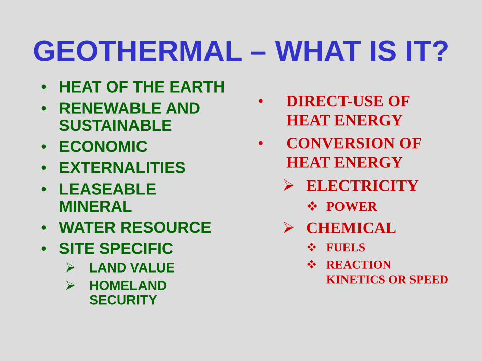
GEOTHERMAL – WHAT IS IT?• HEAT OF THE EARTH• RENEWABLE AND
SUSTAINABLE• ECONOMIC• EXTERNALITIES • LEASEABLE
MINERAL• WATER RESOURCE• SITE SPECIFIC
LAND VALUE HOMELAND
SECURITY
• DIRECT-USE OF HEAT ENERGY
• CONVERSION OF HEAT ENERGY ELECTRICITY
POWER
CHEMICAL FUELS REACTION
KINETICS OR SPEED
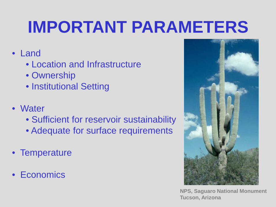
IMPORTANT PARAMETERS• Land
• Location and Infrastructure• Ownership• Institutional Setting
• Water• Sufficient for reservoir sustainability• Adequate for surface requirements
• Temperature
• EconomicsNPS, Saguaro National MonumentTucson, Arizona
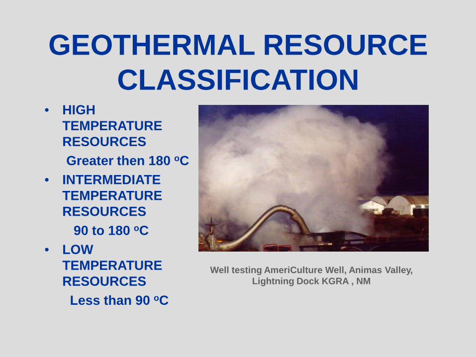
GEOTHERMAL RESOURCE CLASSIFICATION
• HIGH TEMPERATURE RESOURCESGreater then 180 oC
• INTERMEDIATE TEMPERATURE RESOURCES
90 to 180 oC• LOW
TEMPERATURE RESOURCES
Less than 90 oC
Well testing AmeriCulture Well, Animas Valley, Lightning Dock KGRA , NM
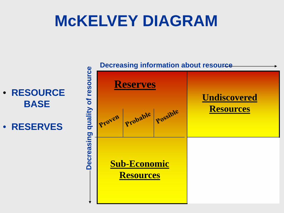
Undiscovered Resources
McKELVEY DIAGRAM
Decreasing information about resource
Dec
reas
ing
qual
ity o
f res
ourc
eReserves
Undiscovered Resources
Sub-Economic Resources
• RESOURCEBASE
• RESERVES

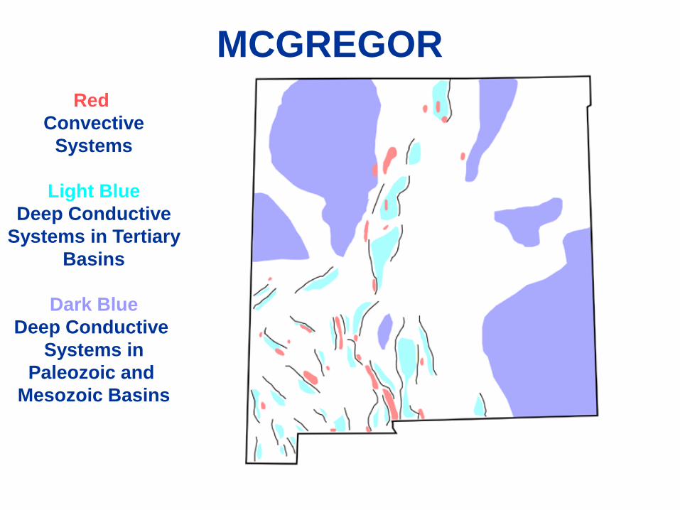
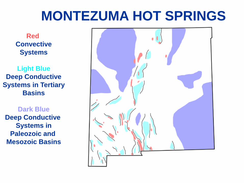
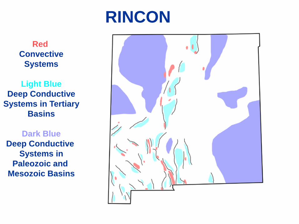
Red Convective
Systems
Light BlueDeep Conductive
Systems in TertiaryBasins
Dark BlueDeep Conductive
Systems inPaleozoic and
Mesozoic Basins
GEOTHERMAL DOMAINS

TYPICAL CONVECTIVEGEOTHERMAL SYSTEM
CONTROLS• Heat Source• Structure
fracture permeability (reservoir permeability and storage) hydrogeologic windows (primary discharge site)
• Flow Dynamics Free convection (density driven flow) Forced convection (ground water head driven flow)
deep seated regional ground water flow systems thermal sweep of background regional heat flow

HEAT SOURCES• Favorable Shallow Magmatic
Large volume Pleistocene silicic volcanic center(Smith and Shaw, 1975 and 1979) Valles Caldera, Jemez Mountians, NM
Hulen and Nielson (1986)(Goff and Gardner, 1994 and 2004)
• High Regional Heat Flow Requires favorable Structure and
Hydrogeology May be enhanced by lower and
middle crust intrusions (basaltic)
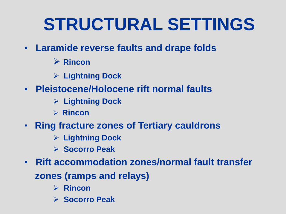
STRUCTURAL SETTINGS• Laramide reverse faults and drape folds
Rincon Lightning Dock
• Pleistocene/Holocene rift normal faults Lightning Dock Rincon
• Ring fracture zones of Tertiary cauldrons Lightning Dock Socorro Peak
• Rift accommodation zones/normal fault transfer zones (ramps and relays)
Rincon Socorro Peak

HYDROGEOLOGYRift basin ground water flow constrictions (or outlets)
Hydrogeologic windows

OUTFLOW PLUME DYNAMICS• Mixing with near surface ground water.• Flow direction follows shallow hydraulic gradient.
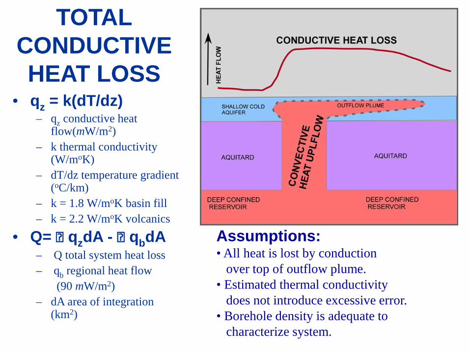
• qz = k(dT/dz)– qz conductive heat
flow(mW/m2)– k thermal conductivity
(W/moK) – dT/dz temperature gradient
(oC/km)– k = 1.8 W/moK basin fill– k = 2.2 W/moK volcanics
• Q= qzdA - qbdA– Q total system heat loss– qb regional heat flow
(90 mW/m2)– dA area of integration
(km2)
TOTALCONDUCTIVEHEAT LOSS
Assumptions:• All heat is lost by conduction
over top of outflow plume.• Estimated thermal conductivity
does not introduce excessive error.• Borehole density is adequate to
characterize system.
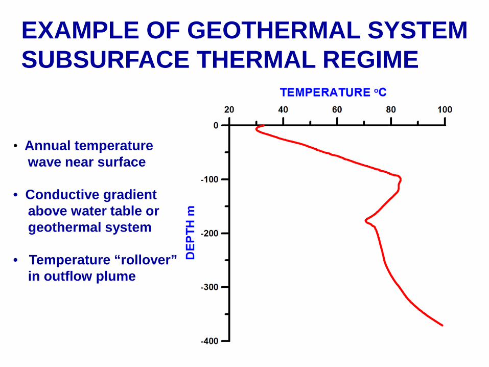
EXAMPLE OF GEOTHERMAL SYSTEMSUBSURFACE THERMAL REGIME
• Annual temperaturewave near surface
• Conductive gradientabove water table orgeothermal system
• Temperature “rollover”in outflow plume
Red Convective
Systems
Light BlueDeep Conductive
Systems in TertiaryBasins
Dark BlueDeep Conductive
Systems inPaleozoic and
Mesozoic Basins
MCGREGOR

McGREGOR HEAT FLOW
•Maximum Heat Flow
454 mW/m2
• Area of Heat Flow
over 90 mW/m2
100 km2
• Reservoir Volume
>50 km3
• Heat Loss
>16 MWt
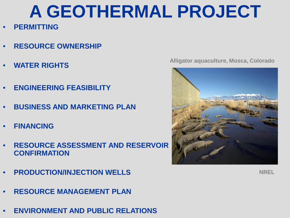
A GEOTHERMAL PROJECT• PERMITTING
• RESOURCE OWNERSHIP
• WATER RIGHTS
• ENGINEERING FEASIBILITY
• BUSINESS AND MARKETING PLAN
• FINANCING
• RESOURCE ASSESSMENT AND RESERVOIR CONFIRMATION
• PRODUCTION/INJECTION WELLS
• RESOURCE MANAGEMENT PLAN
• ENVIRONMENT AND PUBLIC RELATIONS
Alligator aquaculture, Mosca, Colorado
NREL
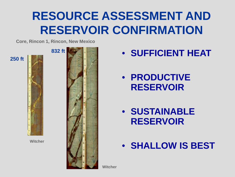
RESOURCE ASSESSMENT AND RESERVOIR CONFIRMATION
• SUFFICIENT HEAT
• PRODUCTIVE RESERVOIR
• SUSTAINABLE RESERVOIR
• SHALLOW IS BEST
Core, Rincon 1, Rincon, New Mexico
Witcher
250 ft832 ft
Witcher
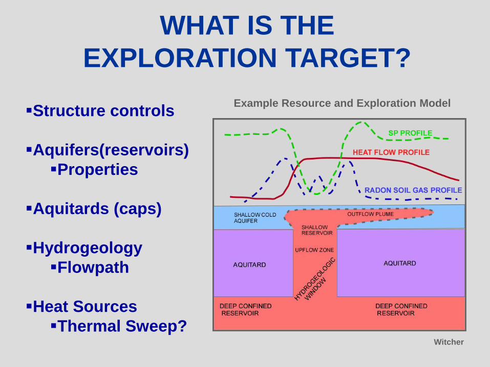
WHAT IS THEEXPLORATION TARGET?
Structure controls
Aquifers(reservoirs)Properties
Aquitards (caps)
HydrogeologyFlowpath
Heat SourcesThermal Sweep?
Example Resource and Exploration Model
Witcher
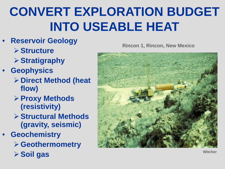
CONVERT EXPLORATION BUDGET INTO USEABLE HEAT
• Reservoir GeologyStructureStratigraphy
• GeophysicsDirect Method (heat
flow)Proxy Methods
(resistivity)Structural Methods
(gravity, seismic)• GeochemistryGeothermometrySoil gas
Rincon 1, Rincon, New Mexico
Witcher
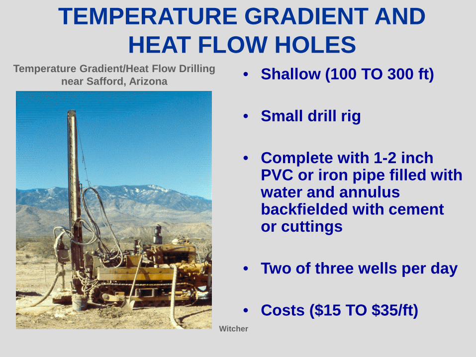
TEMPERATURE GRADIENT ANDHEAT FLOW HOLES
• Shallow (100 TO 300 ft)
• Small drill rig
• Complete with 1-2 inch PVC or iron pipe filled with water and annulus backfielded with cement or cuttings
• Two of three wells per day
• Costs ($15 TO $35/ft)
Temperature Gradient/Heat Flow Drillingnear Safford, Arizona
Witcher
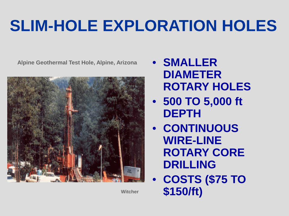
SLIM-HOLE EXPLORATION HOLES
• SMALLER DIAMETER ROTARY HOLES
• 500 TO 5,000 ft DEPTH
• CONTINUOUS WIRE-LINE ROTARY CORE DRILLING
• COSTS ($75 TO $150/ft)
Alpine Geothermal Test Hole, Alpine, Arizona
Witcher
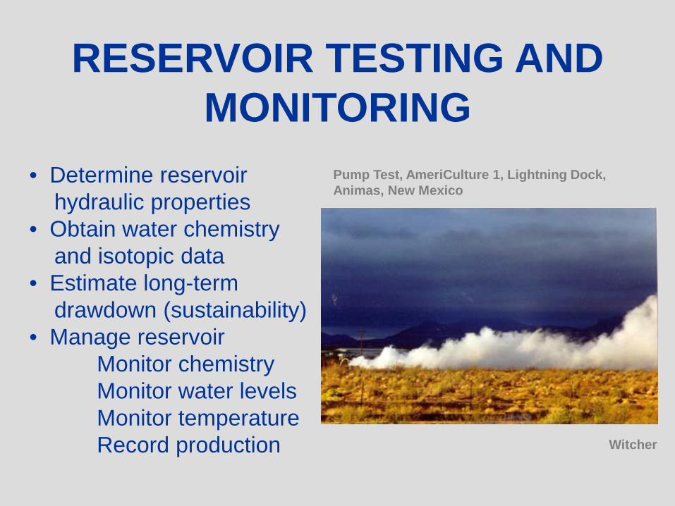
• Determine reservoirhydraulic properties
• Obtain water chemistryand isotopic data
• Estimate long-termdrawdown (sustainability)
• Manage reservoirMonitor chemistryMonitor water levelsMonitor temperatureRecord production
Pump Test, AmeriCulture 1, Lightning Dock, Animas, New Mexico
Witcher
RESERVOIR TESTING AND MONITORING
Red Convective
Systems
Light BlueDeep Conductive
Systems in TertiaryBasins
Dark BlueDeep Conductive
Systems inPaleozoic and
Mesozoic Basins
MONTEZUMA HOT SPRINGS

MONTEZUMA HOT SPRINGS
• TDS – 864 mg/L• 55o C surface discharge• Sodium chloride water• 171 gpm maximum total flow
into the Gallinas River
• Qtz – 119o C• Chalcedony – 89o C• Regional heat flow
60 to 80 mW/m2
From Baltz (1972)

NOMENCLATURE AND FRACTURE PERMEABILITY MODEL
• ForelimbDomain
• Nature ofBasement Fabric
• ReservoirHost?
• Barrier toLateral Flow?
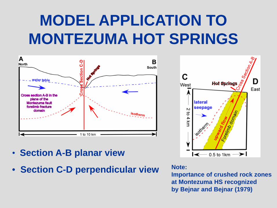
MODEL APPLICATION TOMONTEZUMA HOT SPRINGS
• Section A-B planar view
• Section C-D perpendicular view Note:Importance of crushed rock zonesat Montezuma HS recognized by Bejnar and Bejnar (1979)
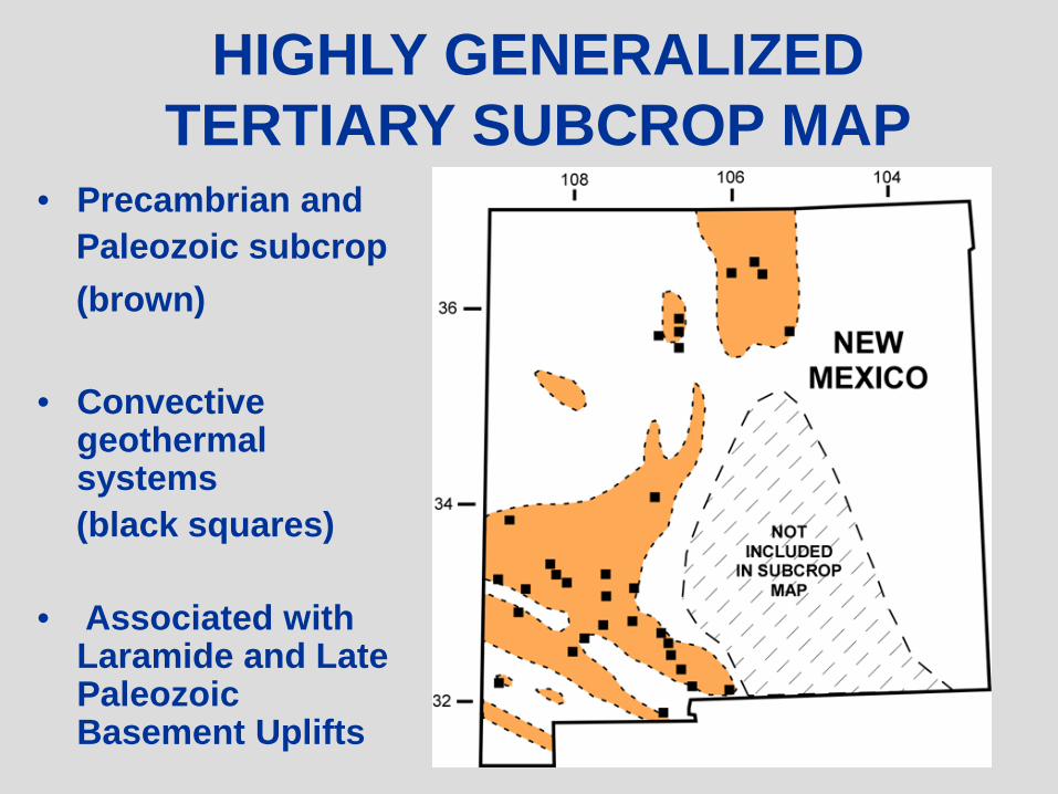
HIGHLY GENERALIZED TERTIARY SUBCROP MAP
• Precambrian andPaleozoic subcrop(brown)
• Convective geothermal systems(black squares)
• Associated with Laramide and Late Paleozoic Basement Uplifts
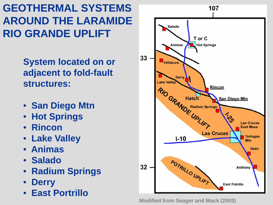
GEOTHERMAL SYSTEMSAROUND THE LARAMIDERIO GRANDE UPLIFT
System located on or adjacent to fold-faultstructures:
• San Diego Mtn• Hot Springs• Rincon• Lake Valley• Animas• Salado• Radium Springs• Derry• East Portrillo
Modified from Seager and Mack (2003)
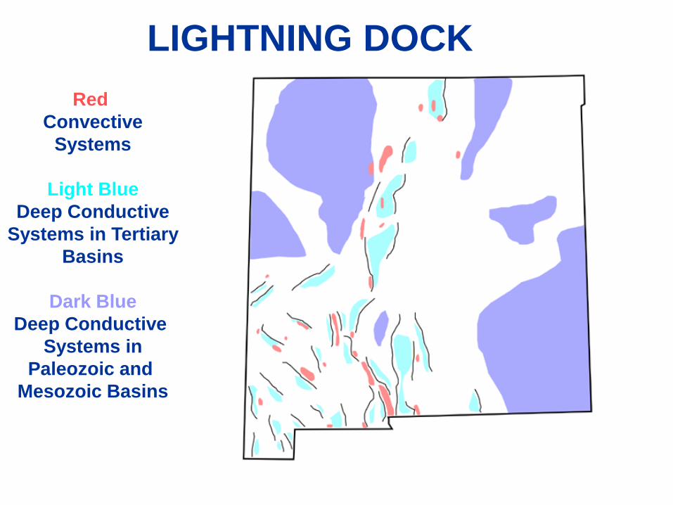
Red Convective
Systems
Light BlueDeep Conductive
Systems in TertiaryBasins
Dark BlueDeep Conductive
Systems inPaleozoic and
Mesozoic Basins
RINCON
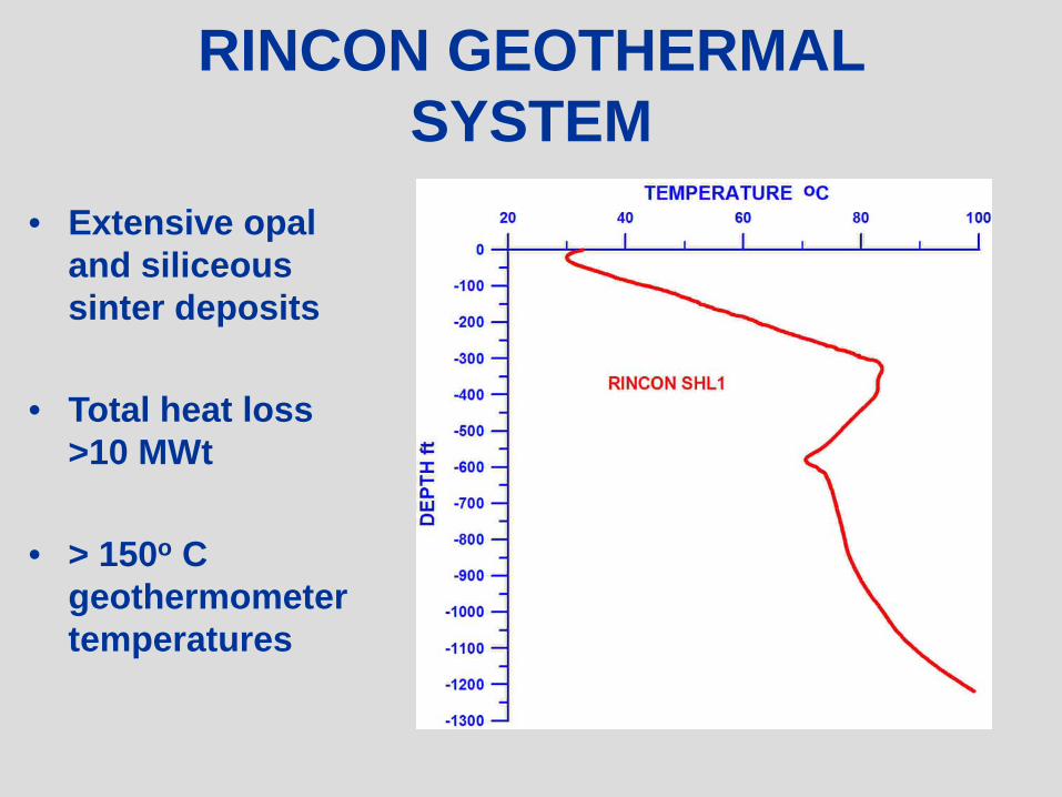
RINCON GEOTHERMAL SYSTEM
• Extensive opal and siliceous sinter deposits
• Total heat loss >10 MWt
• > 150o C geothermometer temperatures
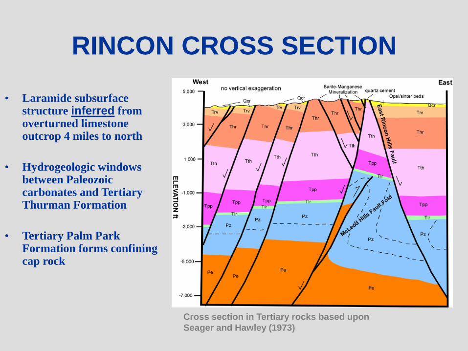
RINCON CROSS SECTION
• Laramide subsurface structure inferred from overturned limestone outcrop 4 miles to north
• Hydrogeologic windows between Paleozoic carbonates and Tertiary Thurman Formation
• Tertiary Palm Park Formation forms confining cap rock
Cross section in Tertiary rocks based uponSeager and Hawley (1973)
Red Convective
Systems
Light BlueDeep Conductive
Systems in TertiaryBasins
Dark BlueDeep Conductive
Systems inPaleozoic and
Mesozoic Basins
LIGHTNING DOCK

LIGHTNING DOCK
REGION
• Potential for deep seated fracture permeability
• Structures have long and repeated deformation history
From Kucks and others (2001)
From various sources (Titley (1976), Swan (1976), Seager (2004), Lawton (2000) and others

SUMMARY GEOLOGIC LOG OF THEAMERICULTURE 2 WELL
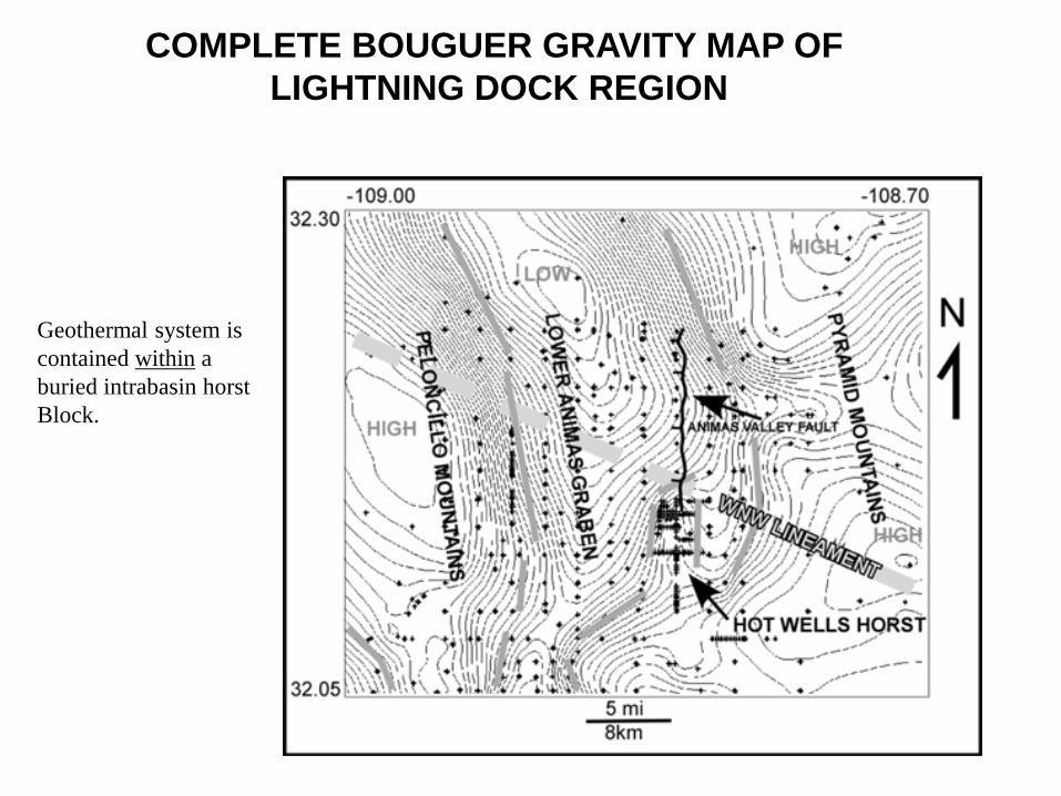
COMPLETE BOUGUER GRAVITY MAP OF LIGHTNING DOCK REGION
Geothermal system iscontained within a buried intrabasin horstBlock.
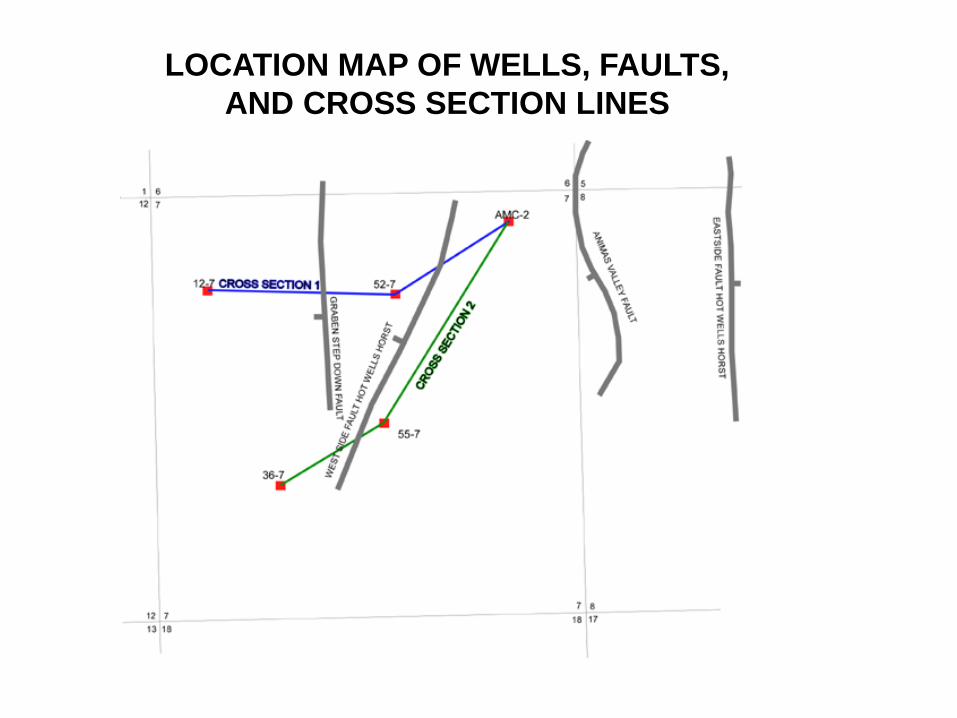
LOCATION MAP OF WELLS, FAULTS,AND CROSS SECTION LINES
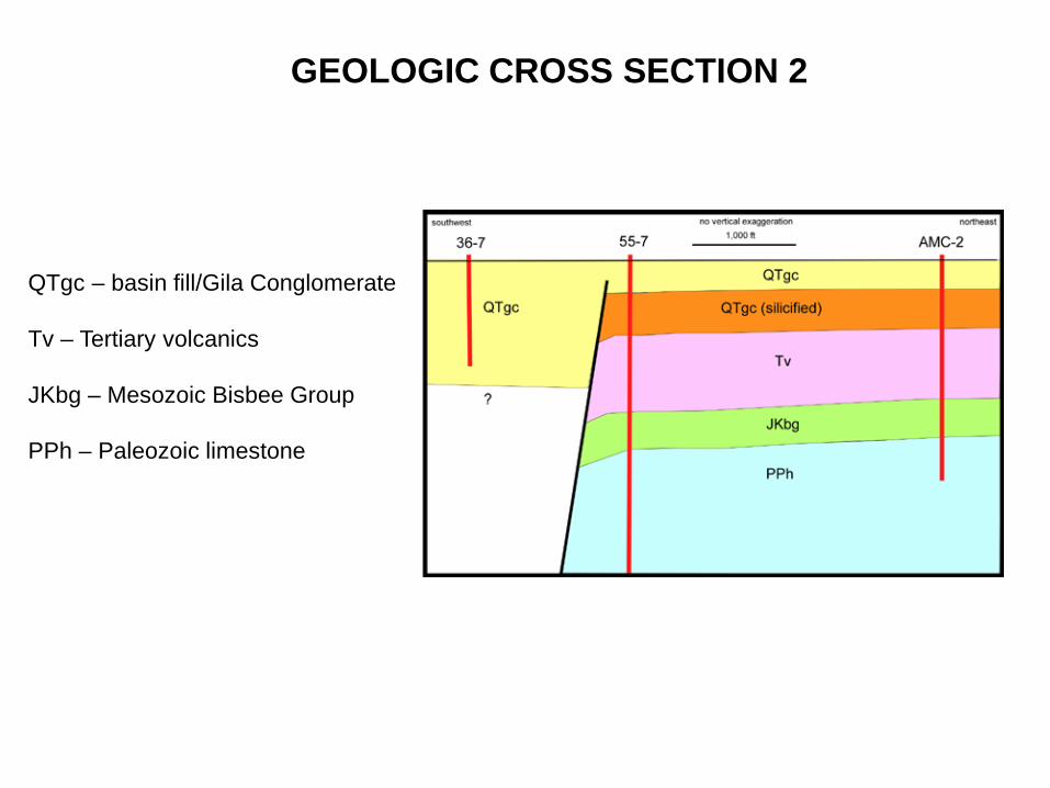
GEOLOGIC CROSS SECTION 2
QTgc – basin fill/Gila Conglomerate
Tv – Tertiary volcanics
JKbg – Mesozoic Bisbee Group
PPh – Paleozoic limestone
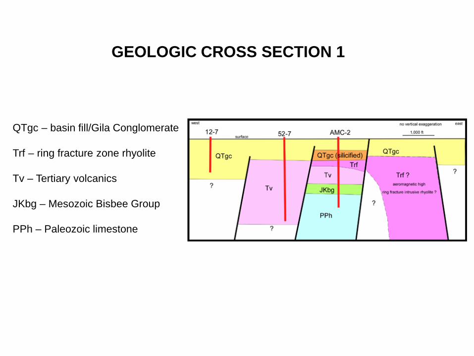
QTgc – basin fill/Gila Conglomerate
Trf – ring fracture zone rhyolite
Tv – Tertiary volcanics
JKbg – Mesozoic Bisbee Group
PPh – Paleozoic limestone
GEOLOGIC CROSS SECTION 1

SUMMARY OFLIGHTNING DOCKSTRUCTURAL ELEMENTS
1) Cockrell 1 Pyramid2) AmeriCulture 23) Steam Reserve 55-7
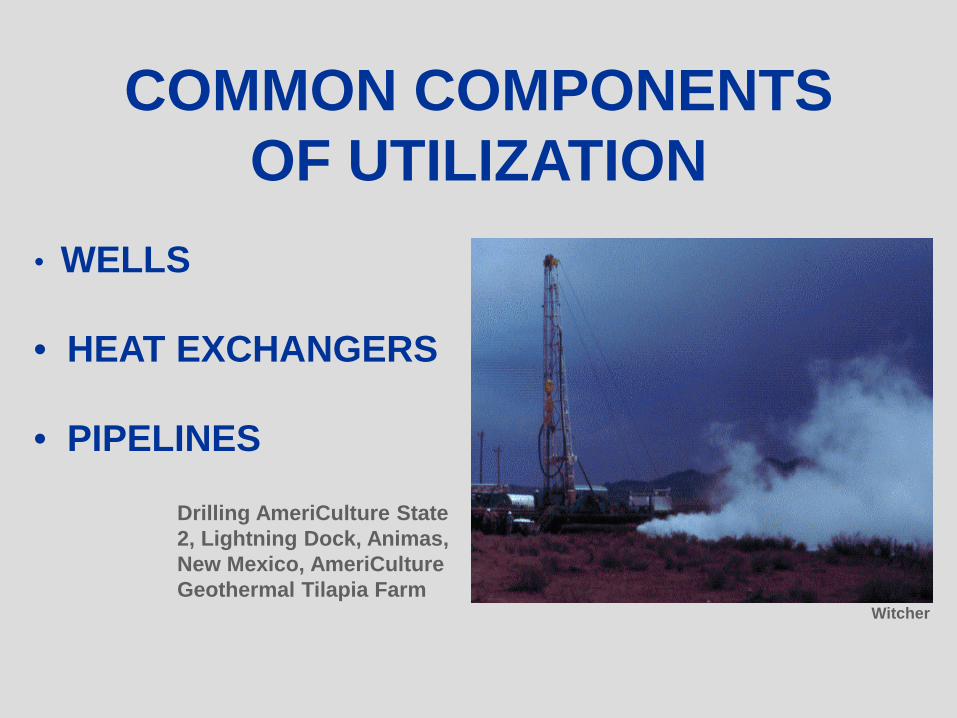
COMMON COMPONENTS OF UTILIZATION
• WELLS
• HEAT EXCHANGERS
• PIPELINES
Drilling AmeriCulture State 2, Lightning Dock, Animas, New Mexico, AmeriCulture Geothermal Tilapia Farm
Witcher

HEAT EXCHANGERS
Haslego and Polley (2002)
• Prevent scaling and corrosion
• Isolate geothermal fluids from heating equipment andenvironment
• Plate and frame heat exchangersare very efficient
NMSU
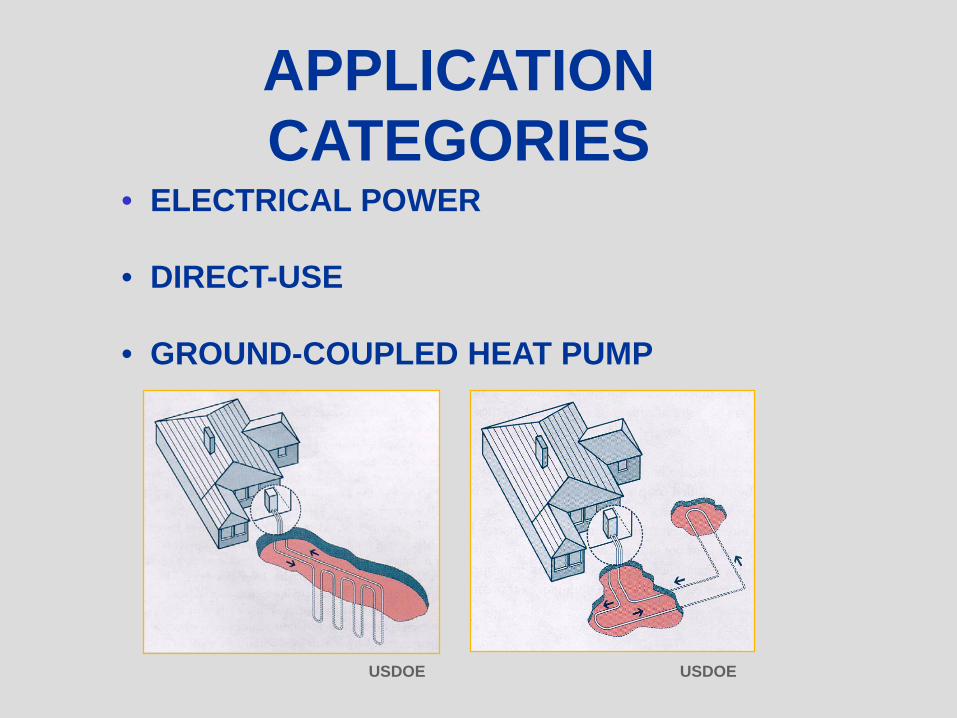
APPLICATION CATEGORIES
• ELECTRICAL POWER
• DIRECT-USE
• GROUND-COUPLED HEAT PUMP
USDOE USDOE
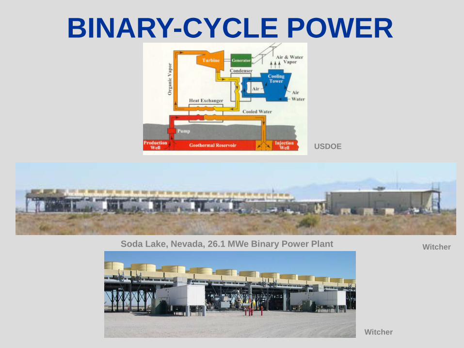
BINARY-CYCLE POWER
USDOE
WitcherSoda Lake, Nevada, 26.1 MWe Binary Power Plant
Witcher
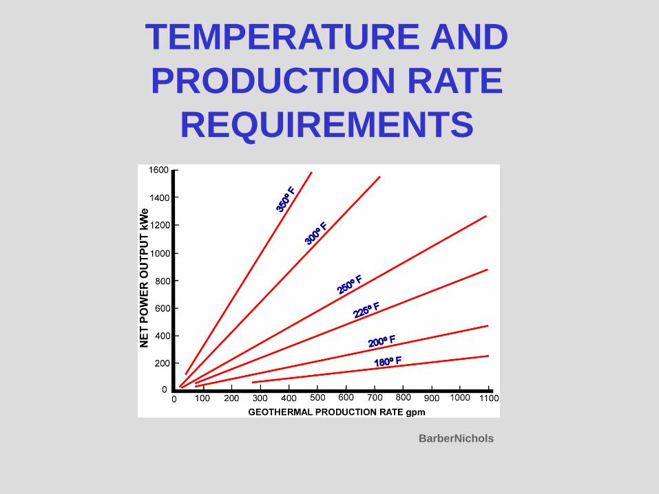
TEMPERATURE AND PRODUCTION RATE
REQUIREMENTS
BarberNichols
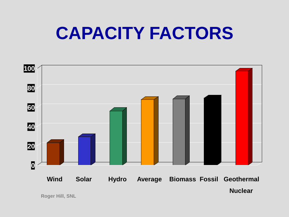
0
20
40
60
80
100
Wind Solar Hydro Average Biomass Fossil Geothermal
Nuclear
CAPACITY FACTORS
Roger Hill, SNL
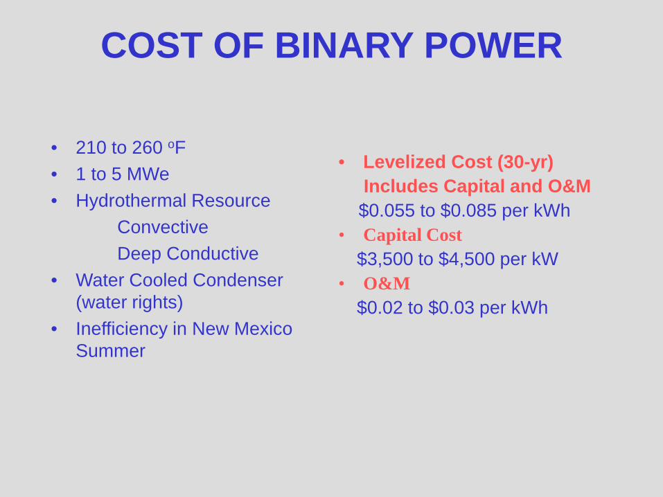
COST OF BINARY POWER
• 210 to 260 oF• 1 to 5 MWe• Hydrothermal Resource
ConvectiveDeep Conductive
• Water Cooled Condenser (water rights)
• Inefficiency in New Mexico Summer
• Levelized Cost (30-yr)Includes Capital and O&M$0.055 to $0.085 per kWh
• Capital Cost$3,500 to $4,500 per kW
• O&M$0.02 to $0.03 per kWh

DIRECT-USEANY PROCESS THAT REQUIRES LARGE AMOUNTS OF LOW-GRADE HEAT
• DISTRICT HEATING• AGRICULTURE APPLICATIONS• INDUSTRIAL APPLICATIONS
USDOEMasson Geothermal Greenhouse, Radium Springs, New Mexico
Williamson, NREL
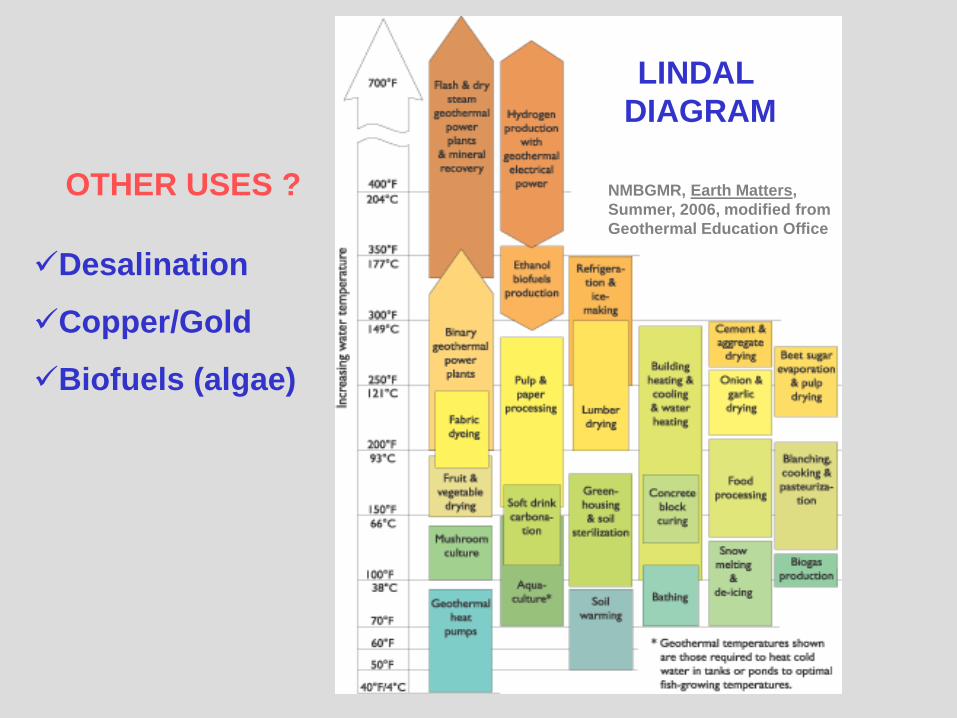
LINDAL DIAGRAM
NMBGMR, Earth Matters, Summer, 2006, modified from Geothermal Education Office
OTHER USES ?
Desalination
Copper/Gold
Biofuels (algae)
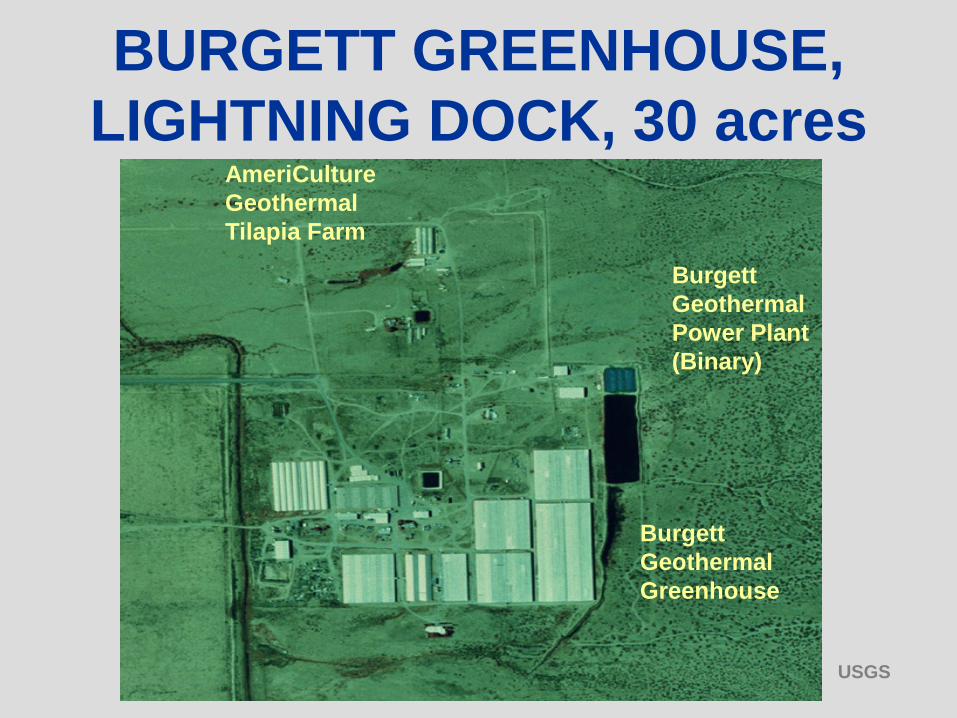
Burgett Geothermal Greenhouse
AmeriCulture Geothermal Tilapia Farm
Burgett Geothermal Power Plant (Binary)
BURGETT GREENHOUSE, LIGHTNING DOCK, 30 acres
USGS

AMERICULTURE TILAPIA FARM, LIGHTNING DOCK
• CONTROL CONSTANT TEMPERATURE FOR OPTIMAL GROWTH
• SUPPLIER OF TILAPIA FRYACROSS US
• FULL SIZE GROWOUT OF TILAPIA AND LIVE TILAPIA SUPPLIER FOR RESTAURANTS IN PHOENIX AND TUCSON
Tilapia
AmeriCultureAmeriCulture
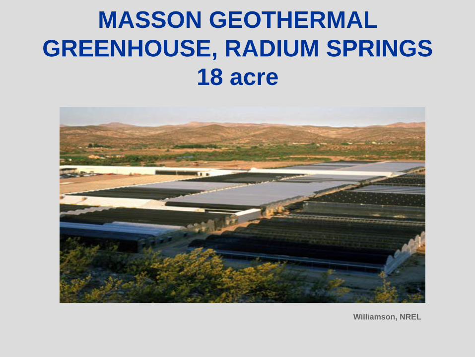
MASSON GEOTHERMAL GREENHOUSE, RADIUM SPRINGS
18 acre
Williamson, NREL
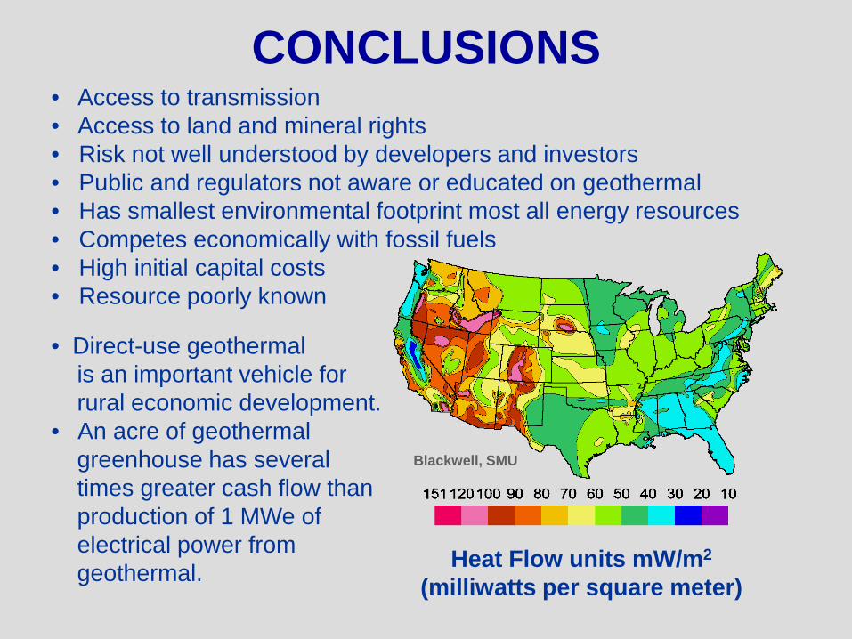
CONCLUSIONS
Heat Flow units mW/m2
(milliwatts per square meter)
Blackwell, SMU
• Access to transmission • Access to land and mineral rights• Risk not well understood by developers and investors• Public and regulators not aware or educated on geothermal • Has smallest environmental footprint most all energy resources• Competes economically with fossil fuels• High initial capital costs• Resource poorly known
• Direct-use geothermalis an important vehicle forrural economic development.
• An acre of geothermal greenhouse has severaltimes greater cash flow than production of 1 MWe of electrical power fromgeothermal.


