12
New York’s Glacial Landscape Shaped by Erosion and Deposition
| Date post: | 22-Dec-2015 |
| Category: |
Documents |
| View: | 232 times |
| Download: | 2 times |

New York’s Glacial Landscape
Shaped by Erosionand Deposition
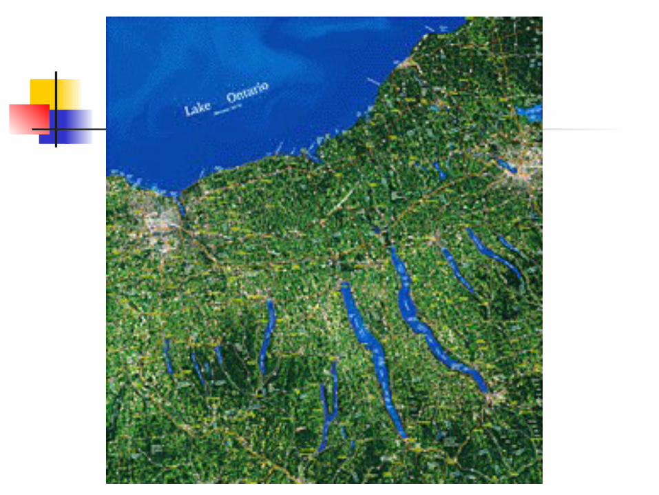
Glaciers and New York’s Landscape
Great Lakes – Erie and Ontario Glacially widened and deepened E-W stream
valleys Finger Lakes
Glacially deepened N-S stream valleys Mohawk Valley – “misfit” stream
Glacially widened and deepened E-W stream valley
Glacial Lake Albany – drained when ice left Hudson Valley

Glaciers and New York’s Landscape
Susquehanna Valley modified to U shape
Dammed by till at Wells Bridge (near Otego)
Dam broke and lake drained

Glaciers and New York’s Landscape
Hudson Valley – a fjord Glacially deepened N-S stream valley Flooded when sea level rose Salt water as far north as Poughkeepsie Tides affect river level as far north as
Troy Ocean freighters can sail up to Albany –
an inland seaport

Glaciers and New York’s Landscape
Long Island Two terminal
moraines Outwash plain Long Island Sound
- Glacially widened stream valley flooded by rising sea level

Hudson Fjord, Long Island Sound,Moraines and Outwash of Long Island

Art and the Earth Sciences
Painters of the Hudson River School Mid to late 1800’s Albert Bierstadt Frederick Church Thomas Cole Asher B. Durand Martin Johnson Heade George Inness John F. Kensett Thomas Moran

Kensett’s Hudson - Fjord
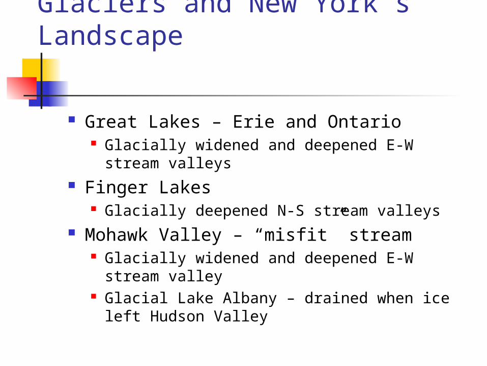
Palisades (igneous rock) along the Hudson Fjord

Church’s Niagara Falls – Outwash Channel

Glaciers and New York’s Economy
Thick, fertile soils developed on till and outwash – foundation of agriculture in state
Microclimate associated with Lakes Water moderates climate Warmer in winter, cooler in summer Ideal for growing grapes/producing wine
Aquifers – especially in outwash Sand and gravel for construction


