NIPPUR EXPEDITION McGuire Gibson The architecture exposed in our last excavations at Nippur, carried out in early 1990 on the Gula Temple in Area WA (fig. 1), has held up amazingly well, according to a recent photograph taken at the site (fig. 2). The deep pit at WF (figs. 3-4), nearby, is beginning to cave in, but I am surprised to see that it is open at all. In previous years, the sea of sand that used to cover the site would have filled in both areas. As can be seen in the recent photographs, there is virtually no sand in evidence, and in fact, there are features in the WA area that have not been visible for decades. For instance, above and to the right of the Gula Temple, there are several round pillars of baked brick, which are the remnants of a colon- nade that bordered the central court of a Parthian villa excavated by the University of Pennsylvania in the 1890s. Figure 1. View over Gula Temple, as left in 1990, from the southeast The shifting of sand from the site, a process that we have been recording for some years now, can be documented and studied even when we are not in Iraq. Landsat satellite images, purchased recently, allow us to view the Nippur area as part of the complex area that is southern Iraq. Computer programs applied to these remote sensing images, when used in the light of our previous knowledge of the landscape, will allow us to carry out a variety of studies of not just Nippur's sustaining area but all of Babylonia. It is possible to combine these most modern methods with more standard approaches. For instance, by a close study of the THE ORIENTAL INSTITUTE oi.uchicago.edu
Transcript
NIPPUR EXPEDITION McGuire Gibson
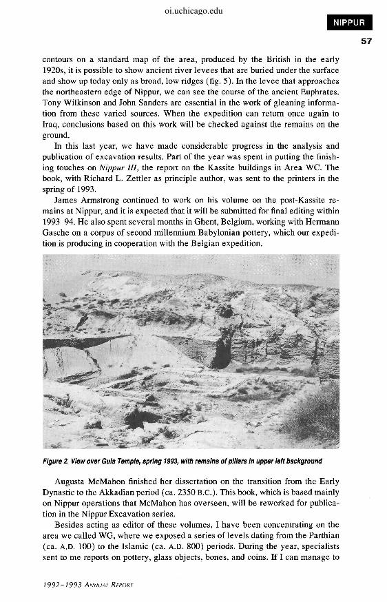
The architecture exposed in our last excavations at Nippur, carried out in early 1990 on the Gula Temple in Area WA (fig. 1), has held up amazingly well, according to a recent photograph taken at the site (fig. 2). The deep pit at WF (figs. 3-4), nearby, is beginning to cave in, but I am surprised to see that it is open at all. In previous years, the sea of sand that used to cover the site would have filled in both areas. As can be seen in the recent photographs, there is virtually no sand in evidence, and in fact, there are features in the WA area that have not been visible for decades. For instance, above and to the right of the Gula Temple, there are several round pillars of baked brick, which are the remnants of a colonnade that bordered the central court of a Parthian villa excavated by the University of Pennsylvania in the 1890s.
Figure 1. View over Gula Temple, as left in 1990, from the southeast
The shifting of sand from the site, a process that we have been recording for some years now, can be documented and studied even when we are not in Iraq. Landsat satellite images, purchased recently, allow us to view the Nippur area as part of the complex area that is southern Iraq. Computer programs applied to these remote sensing images, when used in the light of our previous knowledge of the landscape, will allow us to carry out a variety of studies of not just Nippur's sustaining area but all of Babylonia. It is possible to combine these most modern methods with more standard approaches. For instance, by a close study of the
THE ORIENTAL INSTITUTE
oi.uchicago.edu
contours on a standard map of the area, produced by the British in the early 1920s, it is possible to show ancient river levees that are buried under the surface and show up today only as broad, low ridges (fig. 5). In the levee that approaches the northeastern edge of Nippur, we can see the course of the ancient Euphrates. Tony Wilkinson and John Sanders are essential in the work of gleaning information from these varied sources. When the expedition can return once again to Iraq, conclusions based on this work will be checked against the remains on the ground.
In this last year, we have made considerable progress in the analysis and publication of excavation results. Part of the year was spent in putting the finishing touches on Nippur III, the report on the Kassite buildings in Area WC. The book, with Richard L. Zettler as principle author, was sent to the printers in the spring of 1993.
James Armstrong continued to work on his volume on the post-Kassite remains at Nippur, and it is expected that it will be submitted for final editing within 1993-94. He also spent several months in Ghent, Belgium, working with Hermann Gasche on a corpus of second millennium Babylonian pottery, which our expedition is producing in cooperation with the Belgian expedition.
Figure 2. View over Gula Temple, spring 1993, with remains of pillars in upper left background
Augusta McMahon finished her dissertation on the transition from the Early Dynastic to the Akkadian period (ca. 2350 B.C.). This book, which is based mainly on Nippur operations that McMahon has overseen, will be reworked for publication in the Nippur Excavation series.
Besides acting as editor of these volumes, I have been concentrating on the area we called WG, where we exposed a series of levels dating from the Parthian (ca. A.D. 100) to the Islamic (ca. A.D. 800) periods. During the year, specialists sent to me reports on pottery, glass objects, bones, and coins. If I can manage to
1992-1993 ANNUAL REPORT
oi.uchicago.edu
ARCHAEOLOGY
58
Figure 3. Area WF, as left in 1990
devote just a few weeks to this book, it will be completed.
The information we have derived from excavation of Nippur during the past twenty years now makes it possible to restudy material not only from previous Nippur seasons but also from other sites. In the past year, students and I have begun to work on the artifacts that were exca-
ri;;i>.
vated in the Diyala region in the 1930s. Of chief importance is the mass of small objects, such as beads, tools, weapons, clay items, etc., that have not yet been published. The presentation of these objects, the last large body of unanalyzed material from the Diyala excavations, has been awaited with impatience by the entire field of Near Eastern archaeology. In the next few years, through a continuing graduate seminar, I intend to complete the organization and analysis of this material for eventual publication. I expect that some of the material will be the basis of M. A. papers and Ph.D. dissertations for the students, and that the final publication will be, in good part, authored by them.
As can be seen from the above, the Nippur Expedition is actively engaged in research, even though it cannot resume excavation on the site. The Iraqi Department of Antiquities has been in contact and makes it clear that we are welcome to return at any time. Although most of the excavations by the Department of Antiquities were suspended for some time after the Gulf War, there is renewed activity at a number of sites, some related to development projects. Work has been resumed at Nineveh, Nimrud, and Assur in Assyria, and a new project has been initiated at Khorsabad (fig. 6), where the Oriental Institute worked in the late 1920s. Excavations are also being carried out at Hatra and in the Nuzi area, as well as at Babylon. New work is being done at Ur, to repair the ziggurat and to investigate areas that were damaged by bombing in the Gulf War. There
; is also a plan to excavate in an area that will - ' be affected by the creation of a new reser-
Figure 4. Area WF, spring 1993 voir/marsh in the area between Ur and Eridu.
THE ORIENTAL INSTITUTE
oi.uchicago.edu
Figure 5. Contour map of area around Nippur, showing buried levees of ancient Euphrates and other channels to the north of Nippur, which is the solid white area in lower center
Here, dozens of potentially extraordinary sites will be lost. As a response to the economic boycott, the Iraqis are bringing under cultivation a huge area of alluvial desert between the Tigris and Euphrates to the south of Baghdad. These areas, once the heartland of Babylonia and the location of thousands of sites, will be irrigated for the first time since the thirteenth century. Some salvage work is being carried out here, but the pace of development is so accelerated that the Department of Antiquities will be unable to excavate even a small percentage of sites. Meanwhile, a new dam, planned for the Euphrates to the north of Hit, has made it necessary to begin salvage work on sites that will be lost in that reservoir. I am told that there are extremely interesting results already at one site, where there are numerous Isin-Larsa/Old Babylonian (ca. 2100-1800 B.C.) baked clay plaques with an unusual and innovative style. The Iraqis would welcome all foreign expeditions to help in these and other salvage projects, but we cannot respond to the call under present conditions.
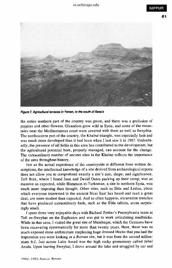
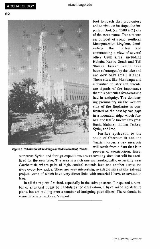
The economic embargo, which prevents our return, will be lifted soon, we hope. In the meantime, we must contemplate field work in other countries and have been making some exploratory plans. During the spring 1993, for instance, I spent more than a month in Yemen, visiting many parts of the country and making arrangements for a survey that Tony Wilkinson and I will carry out in the coming year in one of the mountain areas (fig. 7). I was able to visit much of Hadramaut, an alluvial valley in southern Yemen, where the architecture is of unbaked mudbrick in a blend of styles from Yemen, India, Indonesia, and Britain (fig. 8). The field crops and the date palms present a picture very similar to southern Iraq, if you ignore the rock cliffs on either side of the valley. Although in a sense isolated by desert and mountains, Hadramaut has always had far-flung historical, intellectual, and economic interests. For hundreds of years, traders from Hadramaut have maintained colonies all over the Near East, and in India, Indo-
1992-1993 ANNUAL REPORT
oi.uchicago.edu
60
Figure 6. Map of Iraq
nesia, Vietnam, Malaysia, Africa, and other regions. The valley is relatively untouched archaeologically, but when the digging begins on a large scale, the results should be spectacular, reflecting the international contacts.
I spent the latter part of May in Syria. I rented a car and traveled through much of the country, examining numerous sites, including famous ones such as Ebla, Mari, Tell Brak, Leilan, Dura Europus, and Ugarit. My previous experience of Syria, limited to a few weeks in the 1960s and 1970s, had been limited to the Damascus-Aleppo corridor, with side trips to Palmyra, Krak des Chevaliers, and a few places on the Euphrates and in the Khabur valley. Although books can give you factual knowledge of a region, it is only by carrying out an extensive and systematic trip that you begin to appreciate the complexities, potentialities, and limitations of a landscape and can understand why ancient and modern settlements are located where they are.
It is very obvious that, today, the Syrians are very serious about reforestation. Hillsides and roadways are covered with trees that were not in evidence fifteen years ago, and there are preparations for further planting in a number of areas. Lake Assad, formed by the Euphrates dam at Tabqa, eventually will be surrounded by forests. I was pleasantly surprised to find that, even without forests,
THE ORIENTAL INSTITUTE
oi.uchicago.edu
Figure 7. Agricultural terraces in Yemen, to the south ofSana'a
the entire northern part of the country was green, and there was a profusion of poppies and other flowers. Oleanders grow wild in Syria, and some of the mountains near the Mediterranean coast were covered with them as well as forsythia. The northeastern part of the country, the Khabur triangle, was especially lush and was much more developed than it had been when I last saw it in 1967. Undoubtedly, the presence of oil fields in this area has contributed to the development, but the agricultural potential here, properly managed, can account for the change. The extraordinary number of ancient sites in the Khabur reflects the importance of the area throughout history.
Just as the actual experience of the countryside is different from written descriptions, the intellectual knowledge of a site derived from archaeological reports does not allow you to comprehend exactly a site's size, shape, and significance. Tell Brak, where I found Joan and David Oates packing up their camp, was as massive as expected, while Hammam et-Turkoman, a site in northern Syria, was much more imposing than thought. Other sites, such as Ebla and Leilan, about which everyone interested in the ancient Near East has heard and read a great deal, are more modest than expected. And as often happens, excavation trenches that have produced extraordinary finds, such as the Ebla tablets, seem surprisingly small.
I spent three very enjoyable days with Richard Zettler's Pennsylvania team at Tell es-Sweyhat on the Euphrates and was put to work articulating mudbricks. While in that area, I visited the great site of Mumbaqat, which the Germans have been excavating systematically for more than twenty years. Here, there was so much exposed stone architecture employing huge dressed blocks that you had the impression you were looking at a Roman site, but it was from the second millennium B.C. Just across Lake Assad was the high rocky promontory called Jebel Aruda. Upon leaving Sweyhat, I drove around the lake and struggled by car and
7992-) 993 ANNUAL REPORT
oi.uchicago.edu
ARCHAEOLOGY
62
foot to reach that promontory and to visit, on its slope, the important Uruk (ca. 3500 B.C.) site of the same name. This site was an outpost of some southern Mesopotamian kingdom, dominating the valley and commanding a view of several other Uruk sites, including Habuba Kabira South and Tell Sheikh Hassan, which have been submerged by the lake and are now only small islands. These sites, like Mumbaqat and a number of later settlements, are signals of the importance that this particular river-crossing had in antiquity. The dominating promontory on the western side of the Euphrates is confronted on the east by two gaps in a mountain ridge which funnel land traffic toward this great liquid highway linking Turkey, Syria, and Iraq.
Farther upstream, to the south of Carchemish and the Turkish border, a new reservoir will result from a dam that is in process of construction. Here,
numerous Syrian and foreign expeditions are excavating sites that will be sacrificed for the new lake. The area is a rich one archaeologically, especially near Carchemish, where pairs of high, conical mounds face one another across the river every few miles. There are very interesting, available sites in this salvage project, some of which have very direct links with material I have excavated in Iraq.
In all the regions I visited, especially in the salvage areas, I inspected a number of sites that might be candidates for excavation. I have made no definite plans, but am mulling over a number of intriguing possibilities. There should be some details in next year's report.
Figure 8. Unbaked brick buildings in Wadi Hadramaut, Yemen


![Nippur de Lagash 021 - E027 - La Bruja [Woodiana]](https://static.documents.pub/doc/80x56/577cc78e1a28aba711a14d70/nippur-de-lagash-021-e027-la-bruja-woodiana.jpg)


![Nippur de Lagash 006 - E006 - La Fugitiva de Los Hititas [Woodiana]](https://static.documents.pub/doc/80x56/577cc7931a28aba711a15e51/nippur-de-lagash-006-e006-la-fugitiva-de-los-hititas-woodiana.jpg)


![Nippur de Lagash 093 - ESN - Rimas El General (Reedicion ByN) [Woodiana]](https://static.documents.pub/doc/80x56/577cc6d11a28aba7119f34f6/nippur-de-lagash-093-esn-rimas-el-general-reedicion-byn-woodiana.jpg)


