NMFS-SEFSC-650 North Carolina Sentinel Site Cooperative: Report on the Sea-Level Rise Research and Monitoring Coordination Workshop NOAA Auditorium, Beaufort, NC March 12-13, 2013 Rebecca Ellin, Sarah Spiegler, Carolyn Currin, Chris Ellis, John Fear, Aleta Hohn, Whitney Jenkins, Dave Meyer, Tancred Miller, Carol Price, Karsten Shein U. S. DEPARTMENT OF COMMERCE National Oceanic and Atmospheric Administration 101 Pivers Island Road, Beaufort, NC 28516 August 2013
Transcript
NMFS-SEFSC-650
North Carolina Sentinel Site Cooperative:
Report on the Sea-Level Rise Research and Monitoring Coordination Workshop
NOAA Auditorium, Beaufort, NC
March 12-13, 2013
Rebecca Ellin, Sarah Spiegler, Carolyn Currin, Chris Ellis, John Fear, Aleta Hohn, Whitney Jenkins, Dave Meyer, Tancred Miller, Carol Price, Karsten Shein
U. S. DEPARTMENT OF COMMERCE
National Oceanic and Atmospheric Administration 101 Pivers Island Road, Beaufort, NC 28516
August 2013
This page left blank intentionally
NMFS-SEFSC-650
North Carolina Sentinel Site Cooperative:
Report on the Sea-Level Rise Research and Monitoring Coordination Workshop
NOAA Auditorium, Beaufort, NC
March 12-13, 2013
By
Rebecca Ellin, Sarah Spiegler, Carolyn Currin, Chris Ellis, John Fear, Aleta Hohn, Whitney Jenkins, Dave Meyer, Tancred Miller, Carol Price, Karsten Shein
NOAA Auditorium
101 Pivers Island Road Beaufort, NC 28516
U. S. DEPARTMENT OF COMMERCE Penny Pritzker, Secretary
NATIONAL OCEANIC AND ATMOSPHERIC ADMINISTRATION
Kathryn Sullivan, Acting Administrator
NATIONAL MARINE FISHERIES SERVICE Samuel Rauch, Acting Assistant Administrator
August 2013
This Technical Memorandum series is used for documentation and timely communication of preliminary results, interim reports, or similar special-purpose information. Although the memoranda are not subject
to complete formal review, editorial control, or detailed editing, they are expected to reflect sound professional work.
NOTICE
The National Marine Fisheries Service (NMFS) does not approve, recommend, or endorse any proprietary product or material mentioned in this publication. No reference shall be made to NMFS, or to this publication furnished by NMFS, in any advertising or sales promotion which would indicate or imply that NMFS approves, recommends, or endorses any proprietary product or proprietary material herein or which has as its purpose any intent to cause directly or indirectly the advertised product to be used or purchased because of NMFS publication. The scientific results and conclusions, as well as any views or opinions expressed herein, are those of the author(s) and do not necessarily reflect the views of NOAA or the Department of Commerce. This report should be cited as follows: Ellin, R., Spiegler, S, Currin, C., Ellis, C., Fear, J., Hohn, A., Jenkins, W., Meyer, D., Miller, T.,
Price, C., Shein, K. 2013. North Carolina Sentinel Site Cooperative: Report on the Sea-Level Rise Research and Monitoring Coordination Workshop. NOAA Technical Memorandum NMFS-SEFSC650. 56 pp.
North Carolina Sentinel Site Cooperative: Report on the Sea-Level Rise Research and Monitoring
Coordination Workshop EXECUTIVE SUMMARY The North Carolina Sentinel Site Cooperative (NCSSC) was established in 2012 as part of a National Oceanic and Atmospheric Administration (NOAA) effort to provide coastal communities and resource managers with information on the potential impacts of sea-level rise on coastal habitats. The NCSSC utilizes a collaborative business model to bring together stakeholders, including data producers and users, through a Core Management Team and advisory committee. The goal of the Cooperative is to leverage resources across organizations and integrate the multiple efforts within the NCSSC geography to provide better information to help stakeholders address the challenges associated with sea-level rise and coastal inundation. This includes facilitating collaborative workshops, understanding and addressing information needs, conducting and analyzing research and monitoring across organizations, improving access to high quality data, effectively communicating information to stakeholders through coordinated educational programs and community involvement, and leading by example through implementation of management strategies by Cooperative participants. The Cooperative was formed to capitalize on and enhance the individual strengths of stakeholders to collectively address sea-level rise impacts within the coastal zone in a more holistic and efficient manner. The Sea-Level Rise Research and Monitoring Coordination Workshop was hosted by the North Carolina Sentinel Site Cooperative 12-13 March 2013, at the NOAA Auditorium on Pivers Island in Beaufort, North Carolina. Participants included scientists from universities, government agencies, and non-profits and coastal managers involved in generating or applying research and monitoring data related to sea-level rise and inundation in the central coast of North Carolina. Through presentations by Rebecca Ellin (Manager of the North Carolina Coastal Reserve and National Estuarine Research Reserve), scientists and coastal managers became familiar with the NOAA Sentinel Site Program and the NCSSC. The workshop agenda also included presentations from the North Carolina Coastal Reserve and National Estuarine Research Reserve, NOAA National Ocean Service (Center for Coastal Fisheries and Habitat Research and Coastal Services Center), East Carolina University, University of North Carolina Coastal Studies Institute, and University of North Carolina Chapel Hill’s Institute of Marine Sciences about sea-level rise research and monitoring in the Cooperative geography. Breakout group discussions focused on providing feedback on the NCSSC Implementation Plan, identifying and prioritizing monitoring and research gaps within the NCSSC’s geography, and the next steps for the Cooperative. There was a high level of energy and participation at the workshop, with most participants acknowledging the importance of leveraging resources and partnerships in sea-level rise research and monitoring. Scientists and coastal managers were provided an opportunity to learn from other workshop participants in a collaborative setting, which most participants expressed as a valuable part of the workshop. The Cooperative was described by many participants as being important to enhance partnerships in the area, to facilitate cooperation and decrease redundancies
iii
in research and monitoring, for citing in future funding proposals, and to raise the overall awareness of the effects of sea-level rise in the area. A significant meeting outcome was the education of scientists and coastal mangers about the goals and objectives of the NCSSC. Participants provided valuable feedback on the Cooperative’s Implementation Plan, and most were enthusiastic about the need for this type of collaborative group. Participants agreed to spread the word to others in the area who are not yet involved in the Cooperative. Participants discussed the viability of creating a citizen science program and identified the top seven gaps in sea-level research and monitoring in the Cooperative’s geography:
1. The need for more water level data. 2. The development of a central clearinghouse for Cooperative data. 3. Increased awareness of sea-level rise issues and impacts. 4. Understanding sediment supply and dynamics and effects of land use changes on
sediment dynamics. 5. Improved coastal LIDAR data and bathymetry. 6. Economic assessment of sea-level rise impacts on the built environment and ecosystem
services. 7. More water quality and data collection stations.
To move the Cooperative forward, the following action items were discussed in breakout groups:
1. Identify others who would be interested in being involved in the NCSSC moving forward.
2. Produce a technical memorandum report detailing the Research and Monitoring Coordination Workshop and distribute to Cooperative members and potential members.
3. Better define the immediate priorities of the NCSSC and distinguish these from long-term goals. Refine the top gaps in research and monitoring and list specific needs for each gap.
4. Share the top gaps in research and monitoring with the appropriate agencies (NOAA, U.S. Fish and Wildlife Service) as soon as possible.
5. Provide an avenue for regular communication among Cooperative members through a quarterly email update.
6. Utilize infrastructure that is already in place, and/or create a website, database, or clearinghouse of research and monitoring projects.
7. Create Topical Sub-committees to address water level monitoring and other Cooperative priorities as deemed necessary.
8. Recruit people for the Core Management Team. 9. Produce a peer-reviewed journal article detailing the efforts of the NCSSC and current
research and monitoring projects in the Cooperative’s geography. 10. Consider the viability of using economic data in addition to natural science in
determining the effects of sea-level rise in the Cooperative’s geography. 11. Receive feedback on the NCSSC Implementation Plan, and determine how the NCSSC
will structure outreach components and public involvement in the Cooperative.
iv
The Core Management Team, workshop participants, and relevant stakeholders will need to continue to work together to address the actions identified in the NCSSC five-year Implementation Plan and the gaps and priorities identified at this workshop to move the Cooperative forward.
v
Affiliation of Authors Rebecca Ellin, Sarah Spiegler, John Fear, Whitney Jenkins
NC Division of Coastal Management, NC Coastal Reserve and National Estuarine Research Reserve, Beaufort, NC
Carolyn Currin, Carol Price NOAA, National Ocean Service, National Centers for Coastal Ocean Science Center for Coastal Fisheries and Habitat Research, Beaufort, NC Chris Ellis NOAA, National Ocean Service, Coastal Services Center, Human Dimensions Program Charleston, SC Aleta Hohn, Dave Meyer NOAA, National Marine Fisheries Service, Southeast Fisheries Science Center Beaufort, NC Tancred Miller
NC Division of Coastal Management, Dept. of Environment & Natural Resources Morehead City, NC
Karsten Shein NOAA, National Environmental Satellite Data and Information Service National Climatic Data Center, Asheville, NC
vi
TABLE OF CONTENTS
Executive Summary ................................................................................................................. iii List of Abbreviations ............................................................................................................. viii Background ................................................................................................................................1 Workshop Statement of Purpose ................................................................................................3 Summary of Outcomes ..............................................................................................................4
Feedback on Implementation Plan Identification of Gaps in Research & Monitoring Growing the NCSSC and Next Steps
LIST OF ABBREVIATIONS APNEP: Albemarle Pamlico National Estuary Partnership CAMA: North Carolina Coastal Area Management Act CCFHR: Center for Coastal Fisheries and Habitat Research CSC: Coastal Services Center DoD: U.S. Department of Defense DoI: U.S. Department of the Interior ECU: East Carolina University EPA: U.S. Environmental Protection Agency GPS: Global Positioning System LIDAR: Light Detection and Ranging N.C.: North Carolina NCCF: North Carolina Coastal Federation NCCOS: National Centers for Coastal and Ocean Science NCCR: North Carolina Coastal Reserve NCDC: National Climatic Data Center NCDCM: North Carolina Division of Coastal Management NCDMF: North Carolina Division of Marine Fisheries NCGS: North Carolina Geodetic Survey NCNERR: North Carolina National Estuarine Research Reserve NCSG: North Carolina Sea Grant NCSU: North Carolina State University NCSU-CMAST: North Carolina State University Center for Marine Sciences and Technology NCWRC: North Carolina Wildlife Resources Commission NERRS: National Estuarine Research Reserve System NMFS: National Marine Fisheries Service NOAA: National Oceanic and Atmospheric Administration NOS: National Ocean Service NPS: U.S. National Park Service SAV: Submerged Aquatic Vegetation SECART: Southeast and Caribbean Regional Team SECOORA: Southeast Coastal Ocean Observing Regional Association SET: Surface elevation table SSP: Sentinel Site Program UNC-CH: University of North Carolina, Chapel Hill UNC-CH, IMS: University of North Carolina Chapel Hill’s Institute of Marine Science UNCW: University of North Carolina, Wilmington USACE: U.S. Army Corps of Engineers USFS: U.S. Forest Service USFWS: U.S. Fish and Wildlife Service USGS: U.S. Geological Survey
viii
BACKGROUND The North Carolina (N.C.) Sentinel Site Cooperative (NCSSC) was established in 2012 as part of a National Oceanic and Atmospheric Administration (NOAA) effort to provide coastal communities and resource managers with information on the potential impacts of sea-level rise on coastal habitats. The goal of the NCSSC is to bring together stakeholders to leverage resources across organizations, integrate the multiple efforts within the N.C. Sentinel Site geography, and provide better information to help stakeholders adapt to sea-level rise and coastal inundation. This is one of the five pilot Sentinel Site Cooperatives implemented by NOAA. The other four sites include the Hawaiian Islands, the San Francisco Bay, the Chesapeake Bay, and the Northern Gulf of Mexico. More information is available at http://oceanservice.noaa.gov/sentinelsites/. NOAA established the Sentinel Site Program (SSP) to utilize existing assets, programs, and resources to address coastal management issues of local, regional, and national significance through a place-based, issue-driven, and collaborative approach. The SSP capitalizes on existing investments in NOAA trust resources, such as National Marine Sanctuaries, National Estuarine Research Reserves, observing systems, and partner capabilities in research, monitoring, management and decision-making to address sea-level change and coastal inundation. The SSP outlines an innovative business model to better leverage resources across NOAA and its partners to increase efficiencies, integrate multiple parallel efforts, and provide information and tools to help communities and resource managers adapt to sea-level change and inundation. North Carolina represents a unique suite of characteristics that make it well suited to pilot a Sentinel Site Cooperative. The coast of North Carolina has one of the highest vulnerabilities to sea-level rise on the Atlantic coast (Thieler and Hammar-Klose, 1999; CCSP, 2009), due to its high wave exposure, low-relief coastal slope, and abundance of barrier islands. Many of North Carolina’s coastal habitats are protected within existing management boundaries, including U.S. National Park Service (NPS) National Seashores (Cape Lookout and Cape Hatteras), National Forests, States Forests, State Parks, U.S. Department of Defense (DoD) installations, North Carolina Coastal Reserves (NCCR) and National Estuarine Research Reserve (NCNERR), U.S. Fish and Wildlife Service (USFWS) National Wildlife Refuges, and The Nature Conservancy Nature Preserves. These locations provide comparatively undisturbed (by human) references to measure and observe both the vulnerability and resiliency of natural communities to sea-level rise. The NCSSC geography is the central North Carolina coast, as depicted in Figure 1. The selected geography represents median conditions for the North Carolina coast, and is particularly well instrumented and studied due to its physical setting, biological diversity, and high concentration of marine science facilities in the area. This includes the multi-partner NOAA laboratory, which houses NOAA National Ocean Service (NOS) and National Marine Fisheries Service (NMFS) programs, and the NCCR/NCNERR offices. The NOAA National Weather Service Weather Forecast Office based in Morehead City provides information on surge and climate in the area. The headquarters for the North Carolina Divisions of Coastal Management (NCDCM) and Marine Fisheries (NCDMF), three graduate marine science research institutions (Duke University, University of North Carolina at Chapel Hill (UNC-CH), North Carolina State
University (NCSU)), Cape Lookout National Seashore, Cedar Island National Wildlife Refuge, Croatan National Forest, Fort Macon and Hammock’s Beach State Parks, North Carolina Aquarium at Pine Knoll Shores, North Carolina Maritime Museum, North Carolina Coastal Federation (NCCF) headquarters, and the Port of Morehead City are all located within the geography. The Cooperative geography also includes United States Marine Corps Base Camp Lejeune and Marine Corps Air Station Cherry Point. The geographical region encompassed by the Cooperative relies heavily on tourism, ecotourism, shipping, and commercial and recreational fishing to sustain its economy which is explicitly linked to the ecosystem services provided by the area’s natural resources. The area’s military installations also utilize the physical setting of the central coast for various training scenarios which are critical to their operations. This combination of characteristics presents a unique opportunity for the Cooperative to accomplish the end-to-end implementation of science to decision-making, ensuring the resiliency of these ecosystems and communities to sea-level rise impacts. The Cooperative therefore offers the potential of future expansion to the entire North Carolina coast based on its success. Cooperative results may also be transferable to the mid-Atlantic and southeast regions of the United States with similar environments and economies.
Figure 1. Geography of the North Carolina Sentinel Site Cooperative.
2
The three goals of the NCSSC, as outlined in the Implementation Plan, are listed below. Goal 1: Increase the understanding of sea-level rise impacts on coastal ecosystems through NCSSC research and monitoring and effectively translate findings to support informed decision-making.
• Determine gaps in research and monitoring related to factors controlling the response of coastal habitats to sea-level rise.
• Conduct ongoing monitoring and fill priority gaps. • Initiate collaborative research projects on how sea-level rise will impact coastal habitats
and their ecosystem services. • Identify key information needs of relevant stakeholders to increase understanding of how
sea-level rise will impact coastal habitats and their ecosystem services. • Produce outreach materials for coastal decision-makers and coastal residents.
Goal 2: Provide resource managers with NCSSC scientific data, and encourage incorporation of information to enhance sustainable and resilient conservation strategies for coastal ecosystems.
• Identify resource managers and their needs and barriers in implementing sea-level rise adaptation strategies.
• Develop and test management strategies and share project information with resource managers, other Sentinel Site Cooperatives, and the broader coastal community.
• Work with the NOAA SSP to secure external resources for projects to increase resilience of coastal habitats from impacts of sea-level rise.
Goal 3: Motivate coastal residents to become better informed about how to address sea-level rise impacts.
• Incorporate stakeholder input into the implementation process to engage stakeholders and create buy-in for the NCSSC.
• Develop the framework for a citizen science program that engages coastal communities and residents to enhance ecosystem stewardship.
• Engage 4th-8th grade science teachers and their students in activities related to NCSSC science and management to improve understanding and stewardship of coastal ecosystems.
WORKSHOP STATEMENT OF PURPOSE The Sea-Level Rise Research and Monitoring Coordination Workshop was hosted by the North Carolina Sentinel Site Cooperative on 12-13 March 2013, at the NOAA laboratory on Pivers Island in Beaufort, North Carolina. Scientists and coastal managers involved in generating or applying research and monitoring data related to sea-level rise and inundation in the central coast of North Carolina were invited to participate in this workshop. The purpose was to share related work and identify and prioritize monitoring and research gaps related to sea-level rise. This workshop fulfilled Goal 1, Objective 1, Action i of the NCSSC Implementation Plan (http://bit.ly/14x8xea); conduct a sentinel site research and monitoring workshop by March 2013.
3
The stated objectives of the workshop included:
• Participants would learn about past and current research and monitoring efforts that focus on the effects of sea-level rise in North Carolina;
• Participants would determine and prioritize gaps in research and monitoring that are needed to help stakeholders understand the ongoing and future potential impacts of sea-level rise;
• Participants would provide feedback on the NCSSC Implementation Plan; and • Participants would be provided a forum to forge and enhance partnerships.
These objectives were accomplished at the workshop through presentations and facilitated discussions. Presentations on current projects related to sea-level rise research and monitoring in the NCSSC geography were delivered by scientists and coastal managers from NCDCM, NOAA NOS, NCSU, University of North Carolina Chapel Hill’s Institute of Marine Sciences (UNC-CH, IMS), and East Carolina University (ECU). Breakout groups at the workshop discussed the NCSSC Implementation Plan, gaps in sea-level rise research and monitoring efforts, and how to grow the NCSSC (see Appendix B for workshop agenda, Appendix C for workshop presentation summaries, and Appendix E for a summary of breakout group discussions). This summary report of the workshop outcomes is expected to support research, monitoring, and partnership efforts. This workshop was hosted by the North Carolina Sentinel Site Cooperative, which includes staff from the NCDCM, NCCR/NCNERR, NOAA’s National Climatic Data Center (NCDC), NOAA’s National Centers for Coastal and Ocean Science (NCCOS), and NOAA/NMFS Southeast Fisheries Science Center (SEFSC). Support for this event was provided by NOAA’s Southeast and Caribbean Regional Team (SECART) and NOAA’s Coastal Services Center (CSC). SUMMARY OF OUTCOMES Feedback on Implementation Plan The NCSSC Core Management Team distributed the Cooperative’s Implementation Plan prior to the workshop for feedback during workshop discussions. Three breakout groups discussed the scope and specific goals and actions of the NCSSC Implementation Plan. Many participants concluded that the overall goals are very broad, and that it is important for the Cooperative to distinguish between present and future goals and actions. Participants questioned what systems are included in the scope of the plan (e.g., natural ecosystems, human infrastructure, culture resources, etc.). While it was accepted that focusing on just natural ecosystems would be much more feasible, there was a concern that leaving out social and economic systems would limit the success of the Cooperative in achieving its goals. Participants also wanted the plan to more specifically state its targeted stakeholders, and what information about sea-level rise these stakeholders will need. A suggestion was made to partner
4
with the North Carolina Center for the Advancement of Teaching or national environmental educators to meet this need. Participants noted that understanding where decision-makers receive their information, how networks influence communication among stakeholders, and how to best disseminate information about sea-level rise are important next steps. Most participants responded positively to the idea of implementing a citizen science program within the Cooperative. Most of the discussion about citizen science programs focused on the time and resources needed to start this type of program, and whether it would result in accurate data collection or if the greater value would be for education and stewardship purposes. Participants suggested researching already existing citizen science programs or volunteer networks that fit within the goals of the Cooperative. Breakout groups also discussed the extent of the geography boundary of the Cooperative, and concluded that there is no boundary that will be fully inclusive of all research and monitoring efforts in central coastal North Carolina. A boundary is a NOAA requirement for the NCSSC, but participants noted that the boundary should be flexible and should not limit the Cooperative. The goal of the Cooperative is to start successfully with a focal point in a small area, which was how the initial boundary was chosen. Participants also noted that as the Cooperative grows, it can consider including other areas. It was noted that the Cooperative is limited by not including all of Pamlico Sound and should consider extending the boundary as far as Bluff Shoal. Pamlico Sound itself is a monitoring gap (continuous water level and water quality measurements are needed), with the exception of some biological monitoring by the NCDMF and collaborative work by the Albemarle Pamlico National Estuary Partnership (APNEP) and UNC-CH, IMS. Identification of Gaps in Research and Monitoring At the workshop, participants were split into two breakout groups to discuss the current gaps in research and monitoring related to sea-level rise within the Cooperative’s geography. The full list of gaps, as determined by workshop participants, are summarized in Appendix E. Participants recognized that NOAA’s Sentinel Site Program goals are to realign resources to meet the priority needs of the five Cooperatives, and thus a specific list of priorities in the NCSSC geography is needed. Each breakout group decided on their top six priorities, which were then presented to all workshop participants. These top six priorities from the two breakout groups were combined into one list, and each workshop participant individually voted for their top three priorities from this combined list. The three gaps in research and monitoring with the most votes at the workshop, and therefore the highest priority for the NCSSC, were more water level measurements, the development of a central clearinghouse for data within the Cooperative, and creating/increasing awareness of sea-level rise issues and impacts. While these are the top three priorities for the NCSSC, there are other gaps that are also considered high priority for the Cooperative. The following list details the voting breakdown of all participants at the workshop for the top seven priority gaps in the NCSSC geography.
1. Obtain more water level measures (20 votes) This includes obtaining more local tidal datum, documenting short term flooding events, and examining links to sea-level rise.
5
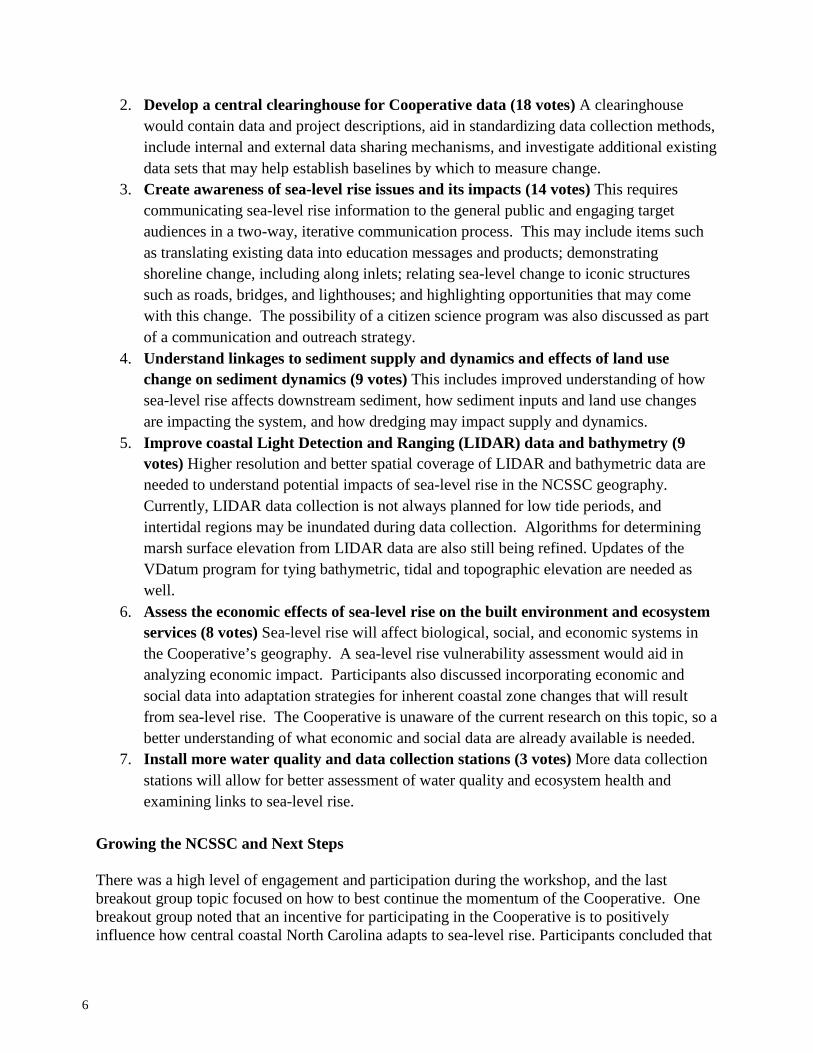
2. Develop a central clearinghouse for Cooperative data (18 votes) A clearinghouse would contain data and project descriptions, aid in standardizing data collection methods, include internal and external data sharing mechanisms, and investigate additional existing data sets that may help establish baselines by which to measure change.
3. Create awareness of sea-level rise issues and its impacts (14 votes) This requires communicating sea-level rise information to the general public and engaging target audiences in a two-way, iterative communication process. This may include items such as translating existing data into education messages and products; demonstrating shoreline change, including along inlets; relating sea-level change to iconic structures such as roads, bridges, and lighthouses; and highlighting opportunities that may come with this change. The possibility of a citizen science program was also discussed as part of a communication and outreach strategy.
4. Understand linkages to sediment supply and dynamics and effects of land use change on sediment dynamics (9 votes) This includes improved understanding of how sea-level rise affects downstream sediment, how sediment inputs and land use changes are impacting the system, and how dredging may impact supply and dynamics.
5. Improve coastal Light Detection and Ranging (LIDAR) data and bathymetry (9 votes) Higher resolution and better spatial coverage of LIDAR and bathymetric data are needed to understand potential impacts of sea-level rise in the NCSSC geography. Currently, LIDAR data collection is not always planned for low tide periods, and intertidal regions may be inundated during data collection. Algorithms for determining marsh surface elevation from LIDAR data are also still being refined. Updates of the VDatum program for tying bathymetric, tidal and topographic elevation are needed as well.
6. Assess the economic effects of sea-level rise on the built environment and ecosystem services (8 votes) Sea-level rise will affect biological, social, and economic systems in the Cooperative’s geography. A sea-level rise vulnerability assessment would aid in analyzing economic impact. Participants also discussed incorporating economic and social data into adaptation strategies for inherent coastal zone changes that will result from sea-level rise. The Cooperative is unaware of the current research on this topic, so a better understanding of what economic and social data are already available is needed.
7. Install more water quality and data collection stations (3 votes) More data collection stations will allow for better assessment of water quality and ecosystem health and examining links to sea-level rise.
Growing the NCSSC and Next Steps There was a high level of engagement and participation during the workshop, and the last breakout group topic focused on how to best continue the momentum of the Cooperative. One breakout group noted that an incentive for participating in the Cooperative is to positively influence how central coastal North Carolina adapts to sea-level rise. Participants concluded that
6
involvement in the Cooperative could result in more institutional and interagency collaboration; a leveraging of expertise in the area; access to new information, research, and people; more data sharing; stronger funding proposals; improved communication and networking opportunities; and education/outreach opportunities. Participants noted that the Cooperative could act as a center for collaboration and cooperation across agencies, encourage regular communication among Cooperative members, and provide education and outreach support. Participants discussed the gaps that need to be filled to move the Cooperative forward. A lack of funding was identified as a main concern for the Cooperative. Suggestions included focusing on the Cooperative’s top priorities and applying for large, interagency type grants, as well as external grants. This could include private organizations, universities, and government/municipal grants to diversify funding sources. The possibility of sharing scientific equipment amongst partner organizations in the Cooperative was suggested. The inclusion of federal agency groups such as the U.S. Environmental Protection Agency (EPA), USFWS, the U.S. Forest Service (USFS), and the U.S. Army Corps of Engineers (USACE) was recognized as an important next step in increasing support for the Cooperative. Breakout groups also discussed conducting an assessment of available research and monitoring data and creating a clearinghouse of this information, including geospatial data. The possibility of formalizing partnerships between organizations was discussed. One group also suggested arranging a field event to engage and educate government officials and agencies, and other stakeholders such as researchers, businesses, and citizens about where North Carolina is starting to see the impacts of sea-level rise. The following action items were developed at the workshop as important next steps for the Cooperative.
• Identify others who would be interested in being involved in the NCSSC moving forward. The NCSSC and workshop participants will reach out to partners who were not able to attend the workshop, beginning by asking respondents in the workshop evaluation to provide contact information of people who would be valuable to the NCSSC and are not already included. The NCSSC will also reach out to local governments and other local organizations to educate them about the Cooperative, how they can participate, and how to provide input on the Implementation Plan.
• Produce a technical memorandum report detailing the Research and Monitoring
Coordination Workshop and distribute to Cooperative members and potential members. NCSSC Core Management Team and workshop participants will provide input on this technical memorandum.
• Share the list of research and monitoring gaps/priorities as soon as possible. The
NCSSC will share the list of priorities that workshop participants identified within NOAA, the U.S. Department of the Interior (DoI), other state and federal agencies, and universities that can help fill these gaps.
• Provide an avenue for regular communication among Cooperative members. Workshop
participants decided that they wanted to regularly communicate with other Cooperative
7
members. It was suggested that the most viable method was a quarterly email update with Cooperative member contributions about current research projects and any other relevant information. There was also discussion about creating a blog or website that would allow for two-way communication through which Cooperative members could discuss topics that arise and respond to news of regional importance.
• Utilize infrastructure that is already in place, and/or create a website, database, or
clearinghouse of projects. Participants at the workshop desired a clearinghouse with research and monitoring project information. There was also a suggestion that a website could also be used for NCSSC updates, sharing information, and formally keeping communication channels open. It was suggested to explore partnerships with Coastal Atlas at ECU, NOAA CSC, and others that may be able to provide these services.
• Better define and detail the priorities of the NCSSC. Workshop participants cited the
need to better articulate research and monitoring gaps by completing an inventory/needs/synthesis assessment. For example, one need of the Cooperative is to implement a water level monitoring plan to begin work on this priority.
• Consider the importance of linking economic assessment to natural science needs.
Assessing how to include social and economic systems without making the goals of the Cooperative too broad will be important to get more people involved within the NCSSC geography and to fully understand the impacts of sea-level rise in the Cooperative’s geography.
• Form volunteer advisory topical subcommittees. Participants desired the formation of
subcommittees soon after the workshop to advance the work of the cooperative and increase collaboration among members. Subcommittees will focus on goals/objectives, priorities/gaps, and refining the definition of a sentinel site for the NCSSC.
• Recruit volunteers for the NCSSC Core Management Team. New Core Management
Team members will serve to grow the Cooperative by diversifying the expertise of the management team.
• Produce a peer-reviewed journal article. Workshop participants developed the idea of
producing a peer-reviewed journal article detailing the goals and objectives of the Cooperative and current research and monitoring efforts. This journal article could be cited in future funding proposals by individual Cooperative members as evidence of participation and collaboration in the wider North Carolina community.
Following the workshop, the Cooperative successfully completed a number of action items.
• In the post-workshop evaluation, more people were identified as potential Cooperative members.
• The first and second quarterly email update was sent to all workshop attendees detailing the workshop, news from the NCSSC Core Management Team, research updates, and future events.
8
• The first volunteer topical subcommittee, focusing on water level, was formed and met to discuss coordination of existing and potential increases in water level monitoring.
• Three new members for the NCSSC Core Management Team were recruited. REFERENCES CCSP (Climate Change Science Program) 2009. Coastal Sensitivity to Sea-Level Rise: A Focus on the Mid-Atlantic Region. A report by the U.S. Climate Change Science Program and the Subcommittee on Global Change Research. U.S. Environmental Protection Agency, Washington, D.C., 320pp. Thieler, E.R. and Hammer-Klose, E.S. 1999. National Assessment of Coastal Vulnerability to Sea- Level Rise: Preliminary Results for the U.S. Atlantic Coast. U.S. Geological Survey Open File Report 99-593.
9
APPENDICES
10
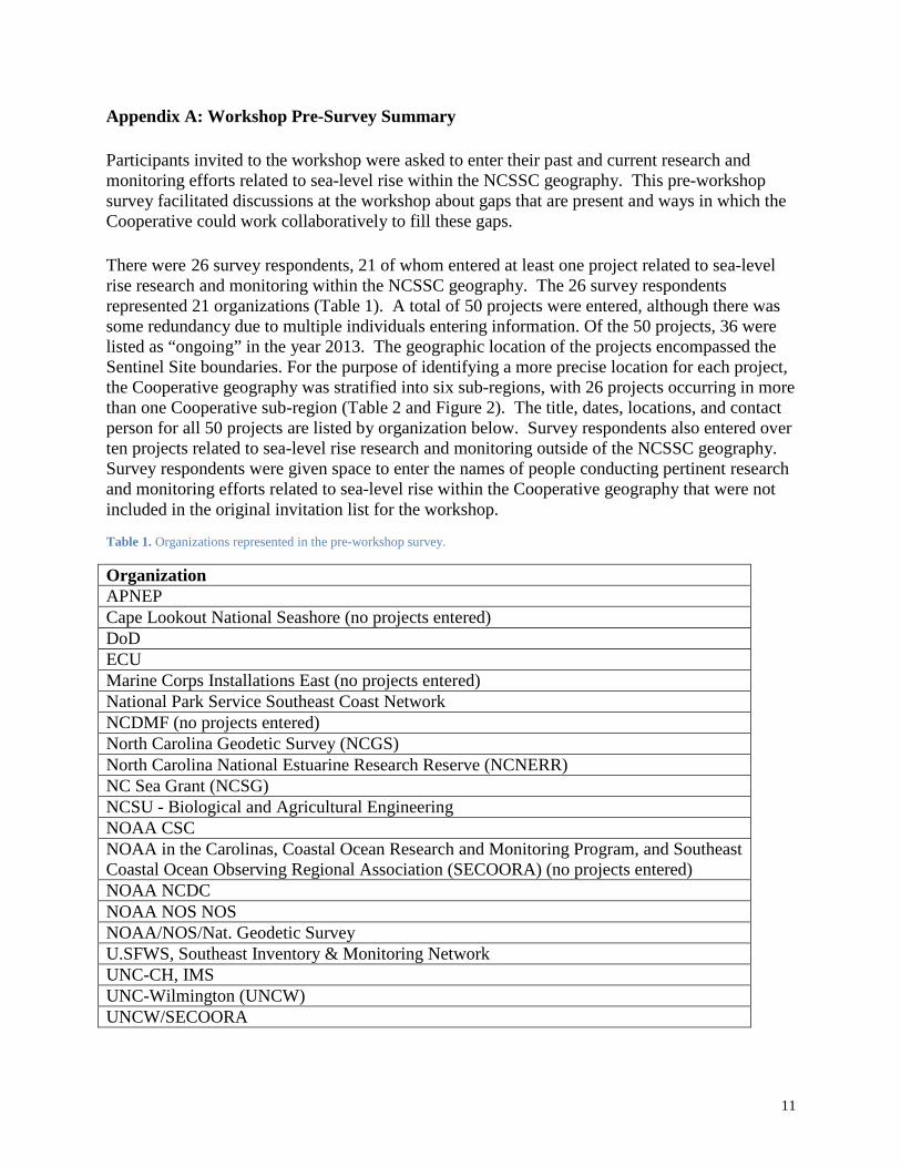
Appendix A: Workshop Pre-Survey Summary Participants invited to the workshop were asked to enter their past and current research and monitoring efforts related to sea-level rise within the NCSSC geography. This pre-workshop survey facilitated discussions at the workshop about gaps that are present and ways in which the Cooperative could work collaboratively to fill these gaps. There were 26 survey respondents, 21 of whom entered at least one project related to sea-level rise research and monitoring within the NCSSC geography. The 26 survey respondents represented 21 organizations (Table 1). A total of 50 projects were entered, although there was some redundancy due to multiple individuals entering information. Of the 50 projects, 36 were listed as “ongoing” in the year 2013. The geographic location of the projects encompassed the Sentinel Site boundaries. For the purpose of identifying a more precise location for each project, the Cooperative geography was stratified into six sub-regions, with 26 projects occurring in more than one Cooperative sub-region (Table 2 and Figure 2). The title, dates, locations, and contact person for all 50 projects are listed by organization below. Survey respondents also entered over ten projects related to sea-level rise research and monitoring outside of the NCSSC geography. Survey respondents were given space to enter the names of people conducting pertinent research and monitoring efforts related to sea-level rise within the Cooperative geography that were not included in the original invitation list for the workshop.
Table 1. Organizations represented in the pre-workshop survey.
Organization APNEP Cape Lookout National Seashore (no projects entered) DoD ECU Marine Corps Installations East (no projects entered) National Park Service Southeast Coast Network NCDMF (no projects entered) North Carolina Geodetic Survey (NCGS) North Carolina National Estuarine Research Reserve (NCNERR) NC Sea Grant (NCSG) NCSU - Biological and Agricultural Engineering NOAA CSC NOAA in the Carolinas, Coastal Ocean Research and Monitoring Program, and Southeast Coastal Ocean Observing Regional Association (SECOORA) (no projects entered) NOAA NCDC NOAA NOS NOS NOAA/NOS/Nat. Geodetic Survey U.SFWS, Southeast Inventory & Monitoring Network UNC-CH, IMS UNC-Wilmington (UNCW) UNCW/SECOORA
11
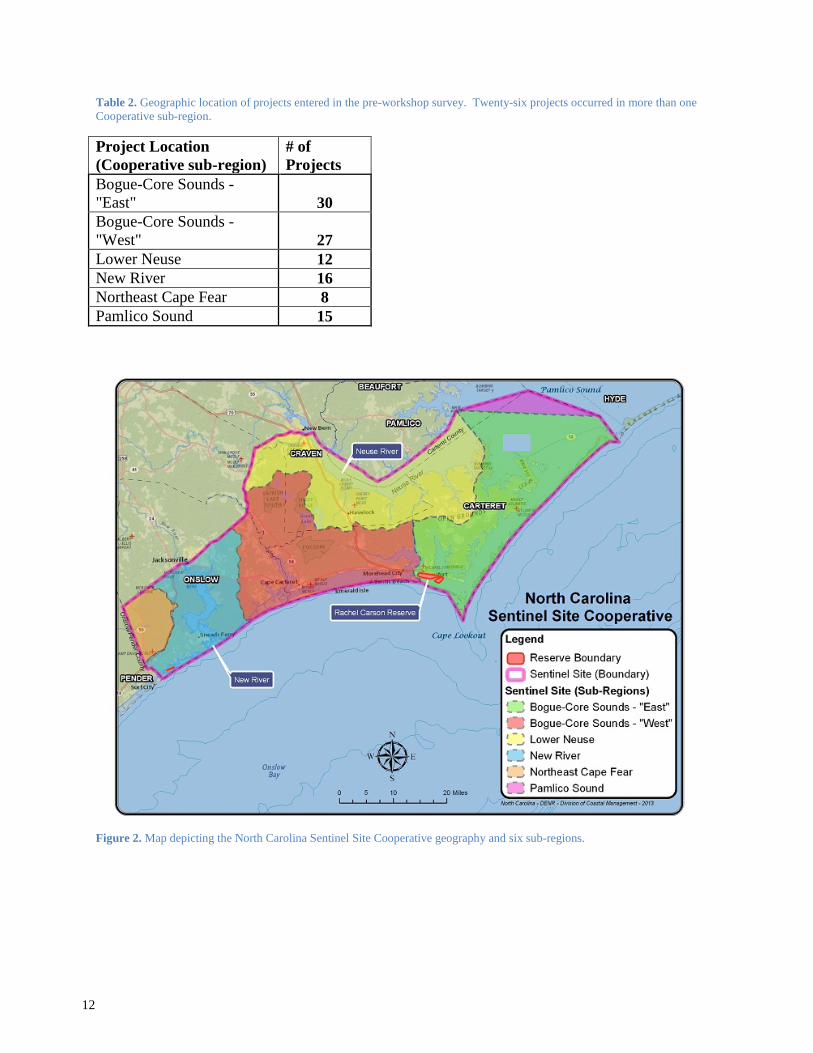
Table 2. Geographic location of projects entered in the pre-workshop survey. Twenty-six projects occurred in more than one Cooperative sub-region.
Project Location (Cooperative sub-region)
# of Projects
Bogue-Core Sounds - "East" 30 Bogue-Core Sounds - "West" 27 Lower Neuse 12 New River 16 Northeast Cape Fear 8 Pamlico Sound 15
Figure 2. Map depicting the North Carolina Sentinel Site Cooperative geography and six sub-regions.
12
Projects entered by survey respondents, listed by organization:
Albemarle-Pamlico National Estuary Partnership (APNEP) 1. Name of Project: Submerged Aquatic Vegetation (SAV) Monitoring via Aerial Imagery
Location: Bogue-Core Sounds - "East", Bogue-Core Sounds - "West", extends up the coast to Back Bay, Virginia Dates: 2002-present Contact: Dean Carpenter
2. Name of Project: Integrated Regional Ecosystem Monitoring Strategy Location: Bogue-Core Sounds - "East", Bogue-Core Sounds - "West", Lower Neuse, Pamlico Sound, extends up the coast to Back Bay, Virginia Dates: 2008-present Contact: Dean Carpenter
Department of Defense (DoD) 3. Name of Project: Nutrient–Driven Eutrophication and Carbon Flux Modulated by
Climate Change in the New River Estuary. Location: New River Dates: 2013-present Contact: Susan Cohen
4. Name of Project: Climate and Land Use Impacts on Exports of Carbon, Sediments, and Nutrients from Coastal Subwatersheds Location: New River Dates: 2013-present Contact: Susan Cohen
5. Name of Project: Improving Model Predictions for Marsh Response to Sea-Level Rise and Implications for Natural Resource Management Location: New River, Marsh work extends to Eglin Air Force Base Dates: 2013-present Contact: Susan Cohen
6. Name of Project: Forest Management, Species Habitat, and Implications for Carbon Flux and Storage Location: New River Dates: 2013-present Contact: Susan Cohen
East Carolina University (ECU) 7. Name of Project: Neuse River-Cedar Island
Location: Lower Neuse, Pamlico Sound Dates: 1990-present Contact: Stanley Riggs
8. Name of Project: Cape Lookout National Seashore Location: Bogue-Core Sounds - "East" Dates: 2000-present Contact: Stanley Riggs
13
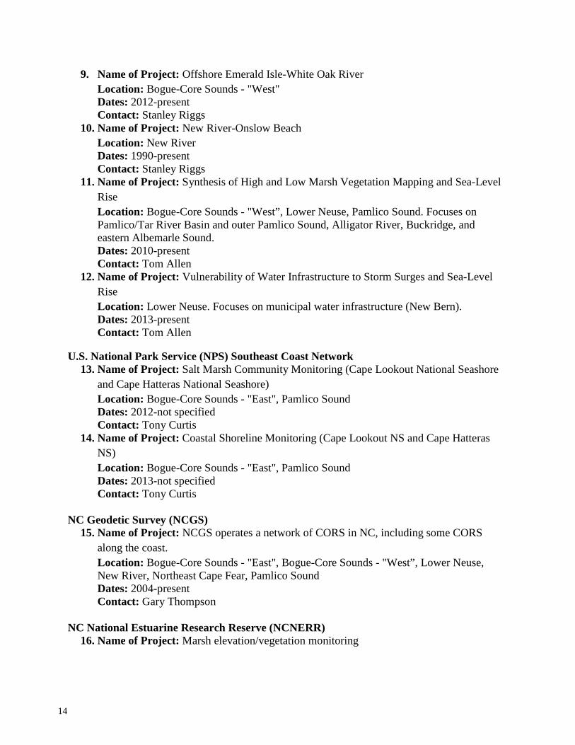
9. Name of Project: Offshore Emerald Isle-White Oak River Location: Bogue-Core Sounds - "West" Dates: 2012-present Contact: Stanley Riggs
10. Name of Project: New River-Onslow Beach Location: New River Dates: 1990-present Contact: Stanley Riggs
11. Name of Project: Synthesis of High and Low Marsh Vegetation Mapping and Sea-Level Rise Location: Bogue-Core Sounds - "West”, Lower Neuse, Pamlico Sound. Focuses on Pamlico/Tar River Basin and outer Pamlico Sound, Alligator River, Buckridge, and eastern Albemarle Sound. Dates: 2010-present Contact: Tom Allen
12. Name of Project: Vulnerability of Water Infrastructure to Storm Surges and Sea-Level Rise
Location: Lower Neuse. Focuses on municipal water infrastructure (New Bern). Dates: 2013-present Contact: Tom Allen
U.S. National Park Service (NPS) Southeast Coast Network 13. Name of Project: Salt Marsh Community Monitoring (Cape Lookout National Seashore
and Cape Hatteras National Seashore) Location: Bogue-Core Sounds - "East", Pamlico Sound Dates: 2012-not specified Contact: Tony Curtis
14. Name of Project: Coastal Shoreline Monitoring (Cape Lookout NS and Cape Hatteras NS) Location: Bogue-Core Sounds - "East", Pamlico Sound Dates: 2013-not specified Contact: Tony Curtis
NC Geodetic Survey (NCGS) 15. Name of Project: NCGS operates a network of CORS in NC, including some CORS
along the coast. Location: Bogue-Core Sounds - "East", Bogue-Core Sounds - "West”, Lower Neuse, New River, Northeast Cape Fear, Pamlico Sound Dates: 2004-present Contact: Gary Thompson
NC National Estuarine Research Reserve (NCNERR) 16. Name of Project: Marsh elevation/vegetation monitoring
14
Location: Bogue-Core Sounds - "East", Bogue-Core Sounds - "West” Dates: 2006-present Contact: John Fear
17. Name of Project: Water quality monitoring Location: Bogue-Core Sounds - "East" Dates: 1997-present Contact: John Fear
NC Sea Grant (NCSG) Please note that these projects are projects NCSG has funded. Our staff currently do not have any monitoring or research programs directly related to sea-level rise. We do have outreach and education efforts on sea-level rise and climate change.
18. Name of Project: Impacts of Sea-Level Rise and Land-Use Modifications on Fringing Marsh Sustainability Location: Bogue-Core Sounds - "East", Bogue-Core Sounds - "West", Dates: 2010-2012 Contact: Barbara Doll
19. Name of Project: Examining the Geospatial Linkage between Modern Erosional Hotspots and Holocene Progradation and the Implications for Predicting Future Shoreline Positions Location: Bogue-Core Sounds - "West" Dates: 2008-2011 Contact: Barbara Doll
20. Name of Project: Managing Intertidal Oyster Reefs in a Changing Climate: How Macroalgal Cover Affects Reef Dynamics within the Rachel Carson Reserve Location: Bogue-Core Sounds - "East" Dates: 2011-present Contact: Barbara Doll
North Carolina State University (NCSU) - Biological and Agricultural Engineering 21. Name of Project: North River Farms - Tidal Marsh Restoration. Studies include
hydrology, nutrient mitigation, greenhouse gas emissions, marsh adjustments to sea-level rise (Rod Surface Elevation Table (rSET) stations) Location: Bogue-Core Sounds - "East" Dates: 2007-not specified Contact: Dr. Michael R. Burchell II
NOAA Coastal Services Center (CSC) 22. Name of Project: Mapping of the following: sea-level rise inundation (including
uncertainty analyses), marsh migration due to sea-level rise, social and economic vulnerability to sea-level rise, and coastal flooding frequency Location: Bogue-Core Sounds - "East", Bogue-Core Sounds - "West”, Lower Neuse, New River, Northeast Cape Fear, Pamlico Sound Dates: 2013-present Contact: Doug Marcy
15
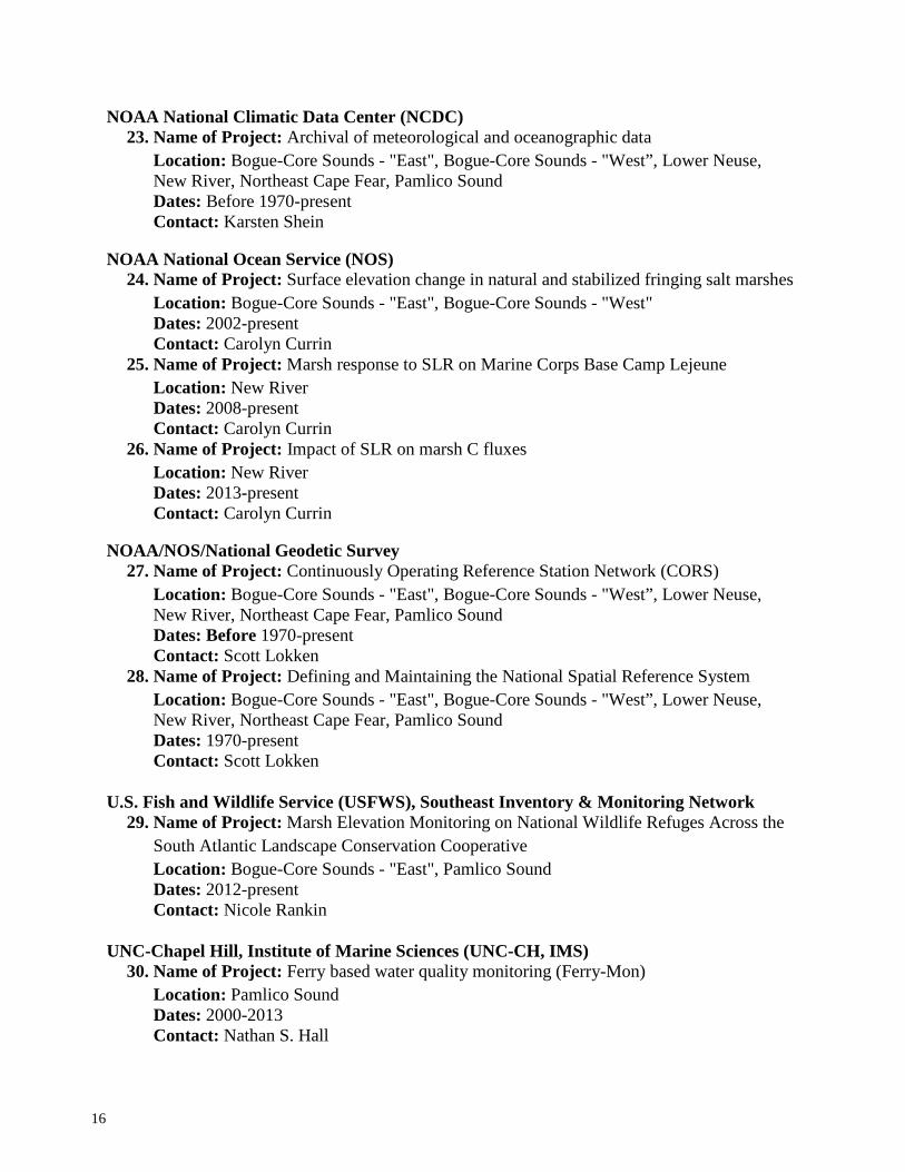
NOAA National Climatic Data Center (NCDC) 23. Name of Project: Archival of meteorological and oceanographic data
Location: Bogue-Core Sounds - "East", Bogue-Core Sounds - "West”, Lower Neuse, New River, Northeast Cape Fear, Pamlico Sound Dates: Before 1970-present Contact: Karsten Shein
NOAA National Ocean Service (NOS) 24. Name of Project: Surface elevation change in natural and stabilized fringing salt marshes
25. Name of Project: Marsh response to SLR on Marine Corps Base Camp Lejeune Location: New River Dates: 2008-present Contact: Carolyn Currin
26. Name of Project: Impact of SLR on marsh C fluxes Location: New River Dates: 2013-present Contact: Carolyn Currin
NOAA/NOS/National Geodetic Survey 27. Name of Project: Continuously Operating Reference Station Network (CORS)
Location: Bogue-Core Sounds - "East", Bogue-Core Sounds - "West”, Lower Neuse, New River, Northeast Cape Fear, Pamlico Sound Dates: Before 1970-present Contact: Scott Lokken
28. Name of Project: Defining and Maintaining the National Spatial Reference System
Location: Bogue-Core Sounds - "East", Bogue-Core Sounds - "West”, Lower Neuse, New River, Northeast Cape Fear, Pamlico Sound Dates: 1970-present Contact: Scott Lokken
U.S. Fish and Wildlife Service (USFWS), Southeast Inventory & Monitoring Network 29. Name of Project: Marsh Elevation Monitoring on National Wildlife Refuges Across the
UNC-Chapel Hill, Institute of Marine Sciences (UNC-CH, IMS) 30. Name of Project: Ferry based water quality monitoring (Ferry-Mon)
Location: Pamlico Sound Dates: 2000-2013 Contact: Nathan S. Hall
16
31. Name of Project: Development of a comprehensive, long-term salinity data base for coastal North Carolina Location: Bogue-Core Sounds - "East", Bogue-Core Sounds - "West”, Lower Neuse, New River, Northeast Cape Fear, Pamlico Sound Dates: 2012-present Contact: Niels Lindquist
32. Name of Project: Oyster habitat restoration
Location: Bogue-Core Sounds - "East", Bogue-Core Sounds - "West”, Lower Neuse, New River, Pamlico Sound Dates: 2010-present Contact: Niels Lindquist
33. Name of Project: Assessing the potential for estuarine nitrogen removal using ecosystem engineers Location: Bogue-Core Sounds - "East", Bogue-Core Sounds - "West", Pamlico Sound Dates: 2010-present Contact: Mike Piehler
34. Name of Project: Collaborative Research: Linking hydrogeomorphology and denitrification in tidal freshwater coastal streams
Location: Bogue-Core Sounds - "West",
Dates: 2008-2012 Contact: Mike Piehler
35. Name of Project: Sustainable Estuarine Shoreline Stabilization: Research, Education and Public Policy in NC Location: Bogue-Core Sounds - "West", Northeast Cape Fear
Dates: 2008-2012 Contact: Mike Piehler
36. Name of Project: SLR2005: Modeling estuarine habitat response to rising water level Location: Bogue-Core Sounds - "East", Bogue-Core Sounds - "West", Northeast Cape Fear
Dates: 2005-2009 Contact: Mike Piehler
37. Name of Project: Barrier Island evolution in response to sea-level rise and changes in storminess Location: Bogue-Core Sounds - "West", New River Dates: 2007-present Contact: Antonio B. Rodriguez
38. Name of Project: Saltmarsh response to sea-level rise and anthropogenic landscape modifications
Location: Bogue-Core Sounds - "East", Bogue-Core Sounds - "West", New River Dates: 2008-present Contact: Antonio B. Rodriguez
17
39. Name of Project: Can intertidal oyster reefs keep up with future rates of sea-level rise?
Location: Bogue-Core Sounds - "East" Dates: 2010-present Contact: Antonio B. Rodriguez
40. Name of Project: Estuarine formation and evolution over a complete sea-level cycle, what defines estuarine size?
Location: Bogue-Core Sounds - "East", Bogue-Core Sounds - "West", New River Dates: 2006-present Contact: Antonio B. Rodriguez
41. Name of Project: Investigated the response of two marsh macrophytes to a range of inundation levels Location: Bogue-Core Sounds - "East", Bogue-Core Sounds - "West" Dates: 2006-2007 Contact: Christine Voss
42. Name of Project: Maintain water-level stations at Pine Knoll Shores (aquarium) and Lola (USFWS ramp) from mid-2006 to present Location: Bogue-Core Sounds - "East", Bogue-Core Sounds - "West" Dates: 2006-present Contact: Christine Voss
43. Name of Project: Investigating competition between dominant marsh macrophytes in situ with and without disturbance and in mesocosms Location: Bogue-Core Sounds - "East", Bogue-Core Sounds - "West"
Dates: 2007-present Contact: Christine Voss
44. Name of Project: Investigating changes in vegetation community composition with and without disturbance Location: Bogue-Core Sounds - "East", Bogue-Core Sounds - "West"
Dates: 2007-present Contact: Christine Voss
45. Name of Project: Using Surface Elevation Tables (SETs) to monitor changes in marsh elevation with and without fertilization treatments Location: Bogue-Core Sounds - "East", Bogue-Core Sounds - "West" Dates: 2006-present Contact: Christine Voss
UNC-Wilmington (UNCW)/ Southeast Coastal Ocean Observing Regional Association (SECOORA)
46. Name of Project: Coastal Ocean Research and Monitoring Program (CORMP) offshore/nearshore weather and oceanographic moorings Location: New River (NOTE: project is in the coastal waters and not within the physical NC SSC boundary)
18
Dates: 1999-present Contact: Jennifer Dorton
47. Name of Project: Wetland depositional budget study - Camp Lejeune Location: New River
Dates: 2008-present Contact: Jennifer Dorton
UNC-Wilmington (UNCW) 48. Name of Project: Sustainable Estuarine Shoreline Stabilization: Research, Education, and
Public Policy in North Carolina (Duplicate of project #35 above) Location: not specified Dates: 2008-2011 Contact: Troy Alphin
49. Name of Project: (no title entered) Location: Restoration of Oyster Reefs for fisheries, habitat and erosion control in southeastern North Carolina Dates: 2009-2011 Contact: Troy Alphin
50. Name of Project: Ecosystem Function of Oyster Shoreline Stabilization Projects Location: not specified Dates: 2012-2013 Contact: Troy Alphin
Projects entered by survey respondents outside of the NCSSC geography:
• SAV Monitoring via Aerial Imagery and Integrated Regional Ecosystem Monitoring Strategy projects extend up the coast to Back Bay, Virginia. (APNEP)
• Monitoring Fort Pulaski National Monument, Fort Frederica National Monument, Cumberland Island National Seashore, Timucuan Ecological and Historic Preserve, Fort Matanzas National Monument/Guana Tolomato Matanzas National Estuarine Research Reserve, and Canaveral National Seashore. (National Park Service Southeast Coast Network)
• Plymouth - As part of an outreach program and planning assistance project for the Town of Plymouth, NC Sea Grant provided funding to Tom Allen with ECU to conduct GIS analysis of the Roanoke River to identify water levels and flooding associated with predicted sea-level rise. A resulting map shows the potential extent of inundation due to sea-level rise based on historical observations projected into the future at the levels forecast by the NC Coastal Resource Commission’s appointed Science Panel through 2100.The map also shows community infrastructure imperiled by inundation, which included the riverside location of water treatment facilities that are expected to
19
experience impact with only moderate sea-level rise. Continued extension and education work are on-going relative to this effort. (NCSG)
• R-CZS-33 – NC Sea Grant funded Margery Overton in 2008-2010 for the project Multi-Temporal, Three-Dimensional, Coastal State Indicators, to review LiDAR data from Hatteras Island. Her team found that coastal decision-makers need critical data to make decisions regarding erosion. First is development of tools to promote the use of high-density LiDAR data in light of advances such that the use of the data can be pushed down to the decision maker. Second is the importance of time-dependent processes or temporal variation in typical coastal datasets. (NCSG)
• In 2009-10, NCSG and the UNC Water Resources Research Institute funded Sankar Arumugam of NCSU for the project Vulnerability of NC Coastal Watersheds to Climate Change and Variability. His team’s findings reinforce the role and importance of groundwater data in determining the effects of the variability in climate. U.S. Geological Survey officials indicated interest in using generated information in updating its climate-groundwater response network. (NCSG)
• Mapping of entire coast of NC, as well as other coastal states except for Alaska. (NOAA CSC)
• Similar activities to listed marsh elevation/vegetation monitoring and water quality monitoring in other river basins in North Carolina. (NCNERR)
• Regional and global assessments related to the National Climate Assessment and U.S. Global Change Research Program efforts. (NOAA NCDC)
• National NOAA Sentinel Site Program. (Karstein Shein, NOAA NCDC) • Marsh Elevation Monitoring on National Wildlife Refuges Across the South Atlantic
Landscape Conservation Cooperative is being conducted on 18 National Wildlife Refuges within the South Atlantic Landscape Conservation Cooperative. (USFWS, Southeast Inventory & Monitoring Network)
• Salinity database project is for all of coastal North Carolina, and the data base will be useful for restoration and management of diverse estuarine ecosystem along the entire North Carolina coast. (UNC-CH, IMS)
• Beginning July 2013, we will establish water-level stations at several sites along western Pamlico Sound marshes. (UNC-CH, IMS)
• We are looking at the Roanoke bay-head delta and floodplain. I'm also involved in Gulf of Mexico coastal research. (Antonio B. Rodriguez, UNC-CH, IMS)
• Sea-level rise in the Cape Fear River basin. (UNCW/SECOORA)
Pre-Workshop Survey: pertinent research and monitoring efforts related to sea-level rise within the NCSSC boundary entered by survey not originally identified by the NCSSC.
• I have a new South Atlantic Landscape Conservation Cooperative funded marsh mapping project that aims to augment USFWS National Wetlands Inventory mapping with satellite
20
imagery and LiDAR. The project hopes to also classify Phragmites distribution. (Tom Allen, ECU)
• Is Ryan Boyles (NCSU; NCSU Climatologist) invited? Someone from the NOAA CSC? (Karstein Shein, NOAA NCDC)
• The National Park Service Southeast Coast Network is conducting marsh elevation and shoreline monitoring on parks in North Carolina. The contact for these will be Tony Curtis; he is listed as a participant. (Nicole Rankin, USFWS, Southeast Inventory & Monitoring Network)
• Joel Fodrie (UNC-CH, IMS) - working on rates of oyster reef accretion. (Niels Lindquist, UNC-CH, IMS)
• USFWS will be establishing SETs at Cedar Island National Wildlife Refuge in ~ 1 month. Don Cahoon established SETs at Cedar Island NWR in late 1980s. National Geodetic Survey has a historical and current record of elevation benchmarks for coastal North Carolina since ~ 1927. I assume that you are familiar with Carolyn Currin's work along the North Carolina coast. (Christine Voss, UNC-CH, IMS)
• Dr. Rick Leuttich (UNC-CH, IMS) has an ongoing sea-level rise modeling program and nearshore wave modeling. SECOORA has a large scale data management and data distribution center that meets federal requirements. Debra Hernandez, SECOORA Executive Director ([email protected]), can also provide information on SECOORA sponsored research occurring within this region. She would be a valuable NOAA partner to invite (SECOORA is U.S. Integrated Ocean Observing System funded). Dr. Dave Eggleston (NCSU-CMAST) studies coastal ecosystem dynamics, socio-economic development, and land-sea interface within the NC SSC boundary. (Jennifer Dorton , UNCW/SECOORA)
Survey respondents listed the following gaps in data in sea-level rise research and monitoring efforts within the NC SSC boundary prior to the workshop:
• Lack of NOAA-certified tidal gauge(s) to support sea-level rise monitoring. (APNEP) • Lack of marine and estuarine shore zone migration monitoring. (APNEP) • Lack of coastal wetland condition monitoring. (APNEP) • Water level monitoring and salinity data are sparse (extent up the tributaries, in
particular). (ECU) • Marsh erosion and sediment accretion rates are very limited (also especially the wind-
tide). (ECU) • Cape Lookout National Seashore, primarily North Core. Considering the work Carolyn
Currin is doing in South Core, we could focus our initial monitoring efforts on North Core, just south of Portsmouth. (NPS Southeast Coast Network)
• State-wide LIDAR data are now over ten years old. (NOAA CSC)
21
• How has dredging/spoil deposition influenced flow of sediment in the region? (NCNERR)
• High resolution climatologies over the NCSSC (e.g., downscaled), especially coastal and inland (basin) precipitation and storm impacts. (NOAA NCDC)
• Little to no monitoring of intertidal-upland border. Lack of local subsidence data. (NOAA NOS)
• One of the most likely observable effects of sea-level rise will be increasing estuarine salinity, which should be detectable provided there is an appropriate long-term historical baseline and future salinity monitoring designed to connect rising sea-levels with increasing salinity regimes (UNC-CH, IMS)
• Yes, several of these have been and will be submitted in research proposals. (UNC-CH, IMS)
• There are limited long-term data within the Pamlico Sound (e.g., water level stations) and river basins. (UNCW/SECOORA)
22
Appendix B: Agenda Tuesday, March 12 8:30am Registration & Coffee 9:00am Welcome & Introductions 9:10am Overview of NOAA’s Sentinel Site Program, the NC Sentinel Site Cooperative, & Workshop Purpose 9:40am Overview of Pre-Workshop Survey 9:55am Research & Monitoring Presentations
• 10:00am – John Fear, NC Coastal Reserve/National Estuarine Research Reserve
• 10:20am – Carolyn Currin, NOAA Center for Coastal Fisheries and Habitat Research
10:40am Break 10:55am Research & Monitoring Presentations Continued
• 10:55am – Doug Marcy, NOAA Coastal Services Center • 11:15am – Mike Burchell, NC State University • 11:35am – Reide Corbett, East Carolina University • 11:55am – Chris Voss, UNC-Chapel Hill, Institute of Marine Sciences
12:15pm Lunch – Provided 1:00pm Research & Monitoring Presentations Continued
• 1:00pm – Tony Rodriguez, UNC-Chapel Hill, Institute of Marine Sciences • 1:20pm – Niels Lindquist, UNC-Chapel Hill, Institute of Marine Sciences • 1:40pm – Nathan Hall, UNC-Chapel Hill, Institute of Marine Sciences • 2:00pm – Tom Allen, East Carolina University
2:20pm Research & Monitoring Presentation Discussion Time 2:30pm Break 2:45pm Sentinel Site Cooperative Implementation Plan – Overview & Feedback Breakout
Groups 5:00pm Adjourn Wednesday, March 13 8:30am Coffee 9:00am Welcome & Day One Recap 9:15am Identifying Gaps in Research & Monitoring Efforts – Breakout Groups (includes
morning break) 11:40am Growing the Sentinel Site Cooperative 11:50am Lunch – Provided 12:30pm Continue Growing the Sentinel Site Cooperative – Breakout Groups 2:05pm Next Steps 2:30pm Adjourn
23
Appendix C: Workshop Presentation Summaries Below are summaries of current research and monitoring efforts related to sea-level rise in the NCSSC geography that were presented at the workshop. John Fear, Ph.D. Research Coordinator North Carolina Coastal Reserve/National Estuarine Research Reserve North Carolina Division of Coastal Management Presentation will provide an overview of two monitoring projects that the Reserve is currently undertaking in the SSC geographic area. Project one is a long term water quality monitoring project. This project measures water quality parameters at 15 minute intervals at two locations in Back Sound. The parameters measured include: dissolved oxygen, pH, turbidity, temperature, and conductivity/salinity. Data are collected using YSI in-situ instruments that are serviced monthly. Data records cover the time periods 1997-2003, and 2007-present. The current data collection effort is being conducted through a partnership with the National Park Service, Southeast Coast Inventory & Monitoring Network. The second project is the Reserves emergent marsh monitoring program. This effort has been tracking the ability of Spartina alterniflora marshes to maintain themselves relative to inundation and erosion. Measured metrics includes marsh species present, stem counts, stem heights, percent cover, marsh elevation, and water levels. The marsh vegetation and elevation data are collected annually during the period of peak biomass. Water level data are collected quarterly throughout the year using in-situ aquatrolls. The data record for this project covers the time period 2006-present and is operated through a partnership with the Carolyn Currin lab at the NOAA Center for Coastal Fisheries and Habitat Research. Carolyn Currin, Ph.D. NOAA, National Ocean Service, Center for Coastal Fisheries and Habitat Research (CCFHR) Research and monitoring to assess salt marsh response to sea-level rise in North Carolina CCFHR has initiated several projects examining marsh response to SLR in eastern North Carolina. In Carteret County, we established 29 Surface Elevation Tables (SETs) in fringing salt marshes between 2004 and 2006. Measures of marsh surface elevation change were obtained in addition to measures of sediment accretion rate and aboveground vegetation from permanent plots. Four sites were established to examine the impact of stone sills on marsh surface elevation change, and included both stabilized and natural marshes. Approximately half of the SETs were established within 1 meter of the lower edge of Spartina alterniflora, and the other half near the upper edge of S. alterniflora distribution. Aboveground S. alterniflora biomass exhibited little interannual variation between 2006 and 2011, and peak biomass occurs at an elevation of 35 cm below MHW, or approximately 0.15 m MSL. Net surface elevation also showed little change in natural marshes during this time period, with SETs located near the lower edge of marshes showing a slight negative and SETs near the upper edge showing a slight positive change. Oyster reefs reduce marsh surface elevation loss at low SETs, while proximity to major boating activity increased marsh elevation loss. Stone sills significantly increased marsh surface elevation change, with stabilized sites showing an average increase of 4 mm/yr. Change analysis of site
24
digital elevation confirm patterns of elevation change measured with SETs. Sediment accretion rates, as measured by marker horizons, almost always exceeded net surface elevation change. CCFHR began a research and monitoring program on Marine Corps Base Camp Lejeune in 2007. Sixteen SETs were installed at six sites, which include both Spartina and Juncus-dominated marsh. In addition, temporary tide gauges were installed to monitor water level and obtain tidal datums, permanent vegetation plots were established, sediment accretion data was obtained, and shoreline habitat types and erosion rates were determined along the New River Estuary and Atlantic Intercoastal Waterway. Marsh surface elevation change was positive at Spartina-dominated sites, and increased as the elevation decreased, ranging from 1 to 9 mm/yr. Elevation change at brackish marsh sites ranged from 1 to 4 mm/yr, except at a site at the upper marsh-upland boundary which exhibited a loss in surface elevation. Sediment accretion exceeded marsh surface elevation change by a factor of 2 to 10. Aboveground marsh biomass exhibited a decline at all sites in 2012, which corresponded to an increase in mean water level during Summer 2012. Monitoring will continue through 2017, and new research projects addressing impacts of SLR and climate change on marsh C flux will be initiated in 2013. Doug Marcy, M.S. Coastal Hazards Specialist NOAA Coastal Services Center Mapping and Visualizing Sea-Level Rise and Coastal Flooding Impacts Being able to visualize potential impacts from sea-level rise and coastal flooding is a powerful teaching and planning tool, and the Sea-Level Rise and Coastal Flooding Impacts Viewer brings this capability to coastal communities. The purpose of this viewer is to provide coastal managers and scientists with a preliminary look at SLR and coastal flooding impacts. The viewer is a screening-level tool that uses nationally consistent data sets and analyses. Data and maps provided can be used at several scales to help gauge trends and prioritize actions for different scenarios. The tool is presented in a Web mapping application format and can be accessed here (www.csc.noaa.gov/slr). This presentation will provide a description of the tool’s input data sets and features, particularly the display of future flood frequency potential using historical water levels. Michael R. Burchell, Ph.D. Department of Biological and Agricultural Engineering North Carolina State University Salt marsh restoration in eastern North Carolina – A good idea in the face of sea-level rise? A case study at North River Farms Co-authors: Randall Etheridge, Yo-Jin Shiau, Steve Broome, and Kris Bass A salt marsh was constructed during 2006-2007 on prior converted wetlands at North River Farms. The partnership of NCSU, the NCCF, and the N.C. Ecosystem Enhancement Program resulted in the design and construction of this 14 hectares (35 acres) of tidal marsh and over 1500 meters (5000 feet) of tidal stream on a prior converted wetland in Carteret County, N.C. This restoration was strategically located between existing drained agricultural land and the North River, designated by the North Carolina Division of Water Quality as a shellfishing and primary fishery nursery area. Following construction, an intense research campaign was designed to
25
evaluate ecosystem services provided by the marsh, including nitrogen retention, greenhouse gas emissions, and the ability of the marsh platform to adjust to sea-level rise. This tidal marsh is only a small portion of the roughly 2500 hectares (6000 acres) that will ultimately be restored on the farm. The multiple restored wetland communities coupled with nearby existing wetland communities make the North River Farms site an ideal location to conduct more intense collaborative research and monitoring, including how these areas will adjust to sea-level rise. Reide Corbett, Ph.D. East Carolina University, Coastal Studies Institute Quantifying and Evaluating the Effects of Rising Sea-Level in North Carolina, USA Predicting geomorphic change in the coastal system as a result of sea-level rise is a complex challenge. Issues to be considered in modeling geomorphic response include the multiple complex interrelationships (both positive and negative feedbacks) between coastal hydrodynamics, the geological framework, geomorphology, sediment erosion, transport and deposition, and structural biological habitats. Research undertaken by our group provides some of the initial foundation for predicting coastal change in North Carolina and beyond. Our work includes the development of relative sea-level records for the last 2000 years in coastal North Carolina from salt marshes on Roanoke and Cedar Islands. These records complement existing tide gauge records and help to determine when recent rates of rapid sea‐level rise commenced. More recent data couples simulated tropical cyclone climatology output with storm surge models to provide inundation statistics and maps of the probability of tropical cyclone-induced storm surge inundation under various climate scenarios and changes in sea-level. This work can be used in conjunction with the modern digital shoreline we have developed in partnership with NCDCM. This digital database provides a basic understanding of the current state of the shoreline and is currently being used to assess areas of intense development and rates of shoreline change along North Carolina’s coast. Christine Voss, Ph.D. UNC-Chapel Hill, Institute of Marine Sciences Examining the effects of rising sea-levels and disturbances in North Carolina coastal marsh habitat We have recorded water levels and changes in marsh surface elevation at sites along Bogue Sound and the southern terminus of Pamlico Sound, where we have examined the response of dominant marsh macrophytes to inundation and to disturbance. Using experimental planters to manipulate inundation period, we exposed Spartina alterniflora and Juncus roemerianus to six different elevations spanning 0.75 m, resulting in seasonally averaged inundation treatments of 0.4 to 99%, thereby including conditions that anticipate higher sea-levels. Both species exhibited similar responses, with production in planters suggesting initial increases and then demonstrating subsequent steep declines with increasing inundation, conforming to a segment of the expected ecophysiological parabola. We observed this pattern in both the tidal and the irregularly flooded inundation regime. Projecting the inundation levels experienced by macrophytes in the planters to adjacent marsh platforms revealed that neither species occupied elevations at which an increase in inundation elicited an increase in production. As sea-levels continue to rise, the persistence of coastal marsh habitat in situ depends on whether macrophytes induce compensatory accretion of the marsh surface. Declining macrophyte production with rising sea-
26
levels reduces both bioaccumulation of roots below-ground and baffle-induced sedimentation as above-ground biomass decreases. By occupying only descending portions of the parabola, macrophytes in central North Carolina marshes are responding to rising water levels by progressive declines in production. Because in situ persistence of coastal marshes is thus unlikely in this region, transgression landward remains the mechanism required for these marshes to sustain provision of their valuable ecosystem services. Other data available include: (1) water level in Bogue Sound (Pine Knoll Shores Aquarium pier) and at the junction of Pamlico and Core Sounds (USFWS dock at Lola- Cedar Island National Wildlife Refuge) as per Center for Operational Oceanographic Products and Services specifications (mid-2006 to present); (2) above- and below-ground production and density of S. alterniflora and J. roemerianus across a range of elevations for PKS and Lola (2006-2008); and (3) Surface Elevation Table (SET) data for untreated and fertilized (~ 2 yrs treatment) plots of S. alterniflora and J. roemerianus at Pine Knoll Shores and Lola (2006-present); (4) responses of S. alterniflora and J. roemerianus co-planted in planters across a range of inundation treatments in tidal and non-tidal inundation regimes (2007); (5) changes in community composition along the S. alterniflora and J. roemerianus margin of marshes on platforms at Pine Knoll Shores and Lola, without and with an initial clipping and fire (Lola only) disturbance (2007-ongoing). Reference: Voss, C.M., R.R. Christian, and J.T. Morris. 2012. Marsh macrophyte responses to inundation anticipate impacts of sea-level rise and indicate ongoing drowning of North Carolina marshes. Marine Biology 160: 181-194. Antonio B. Rodriguez, Ph.D. UNC-Chapel Hill, Institute of Marine Sciences The morphology, distribution, and areal extent of coastal landscapes change primarily in response to fluctuations in sea-level, sediment supply, hydrodynamic processes, and land use. Shoreline dynamics in the upper parts of estuaries, where small lower coastal-plain rivers discharge, are tightly coupled to land-use modifications. Although sea-level rise is impacting many salt-marshes in North Carolina, the saltmarshes along the upper Newport River estuary are highly connected to the watershed and immediately expanded into the estuary after tree farming began and associated land-use changes doubled sedimentation rates in the upper estuary. In the lower high-salinity parts of estuaries in North Carolina, like Bogue and Back Sounds, salt marshes are less connected to river systems making them more sensitive to sea-level rise. The areal extent of salt marsh in these settings is strongly modulated by storminess, coastal development, and barrier-island overwash and aeolian processes. The estuarine shoreline of Bogue Banks, which is fringed by saltmarsh, experienced significant erosion around 1,100 years ago during a period of increased regional storminess and consistent sea-level rise. Intertidal oyster-reefs in high-salinity sounds are also sensitive to sea-level rise because growth is directly related to the duration of aerial exposure, which provides partial refuge from predation and disease. In this setting, if oyster-reef accretion rates are lower than the rate of sea-level rise, then the duration of aerial exposure will decrease and reef degradation will likely occur. Published estimates of oyster-reef vertical accretion rates suggest 5 mm/year is a likely value, but in reality, different parts of a reef accrete vertically at different rates and a reef grows both vertically and horizontally. We are using high-resolution survey methods and coring to better
27
quantify oyster-reef growth and preliminary results show that reefs positioned close to mean sea-level should be able to keep up with even the highest predicted rates of sea-level rise. The open-ocean shoreline of many barriers moved seaward (prograded) during most of the late Holocene when rates of sea-level rise were low, but today, these shorelines are moving landward in response to an increased rate of sea-level rise and decreased sediment supply. Although there are many examples of that general trajectory in barrier-island evolution, the response and sensitivity of transgressive barrier islands to the most recent increase in rate of sea-level rise is not well constrained. Onslow Beach responded immediately to an increase in the rate of sea-level rise from 1.0 mm/year to 3.2 mm/year at approximately 1860 AD. At that time the number and landward extent of washover fans increased sharply along the entire island, which also implies that the rate of island transgression increased. This does not correspond with a stormy period, rather, the increase in the rate of sea-level rise likely lowered the elevation of the island principally through dune erosion and made the island more vulnerable to overwash. This high vulnerability to overwash continues today. Nathan Hall, Ph.D. Hans Paerl’s Lab, UNC-Chapel Hill, Institute of Marine Sciences The few narrow inlets through the Outer Banks of North Carolina restrict exchange between Pamlico Sound and the coastal ocean which leads to long residence times of freshwater within the estuarine system. As a result of poor flushing and shallow depths, terrestrial nutrient inputs are efficiently assimilated by phytoplankton and tightly cycled within the estuary. This sustains a highly fertile food web base that fuels valuable fisheries resources. Restricted oceanic exchange also leads to mesohaline conditions necessary for estuarine-dependent finfishes. However, long residence times and elevated anthropogenic nutrient loads have also led to eutrophication related water quality problems including algal blooms and bottom water hypoxia that can lead to fish kills, altered food web structure, and sea grass losses. As sea-level rise and an increased frequency and intensity of storms threaten to drown the Outer Banks, an increased hydrological connectivity between the Sound and the Atlantic is predicted with potentially drastic alterations to the Sound’s productivity and ecosystem structure. North Carolina’s Ferry Monitoring Program (Ferry-Mon) was initiated in the spring of 2000 to understand and document how interacting climatic (e.g. storms, droughts, sea-level rise) and human activities (e.g. land use change) impact Pamlico Sound and one of its tributaries, the Neuse River Estuary. Using North Carolina Department of Transportation ferries to carry water quality instrumentation and sampling equipment, these ships of opportunity provide measurements that are critical for monitoring changes in the productivity, biogeochemical cycling, and habitat conditions of the Sound including temperature, salinity, chlorophyll a (a measure of algal biomass), dissolved nutrients, dissolved oxygen, pH, and turbidity. The vast spatial and temporal coverage of Ferry-Mon chlorophyll data have been used to develop algorithms for retrieval of chlorophyll concentrations from satellite imagery. This provides a means to monitor changes in primary productivity on an ecosystem-wide basis. As a key determinant of water clarity, phytoplankton biomass also plays an important role in habitat suitability for sea grasses. Recently, Ferry-Mon has added the ability to measure changes in net ecosystem carbon storage through measurements of surface water carbon dioxide concentrations. In fall 2003, Ferry-Mon captured the impacts of a new inlet formed by Hurricane Isabel. The
28
observed rapid increase in salinity within the Sound provided a glimpse of what a more hydrologically connected Pamlico Sound may look like. Spatially and temporally intensive data like those produced by Ferry-Mon will be critical for unraveling the complex ecosystem-level impacts of enhanced dilution by oligotrophic oceanic waters. Tom Allen, Ph.D. East Carolina University The North Carolina Coastal Atlas: Potential, Plans, and Partners The North Carolina Coastal Atlas is an evolving initiative to develop an online map portal providing static and interactive exploration and visual analysis of coastal resources, geospatial data, and scientific information for managers, scientists, teachers, and public users. This presentation introduces the purpose and prototype atlas incorporates scientific data on marshes, their vulnerability to sea-level rise, and highly dynamic shorelines. Coastal and marine thematic maps and traditional reference map functions provide a rich basis for geographic search, discovery, and decision-support to a wide breadth of users. The North Carolina Coastal Atlas is also developing linkages to research, archives, and literature in the ECU Joyner Library. The partnership and development plans for the future of the atlas are briefly described as well as roles for academic institutions and agencies.
29
Appendix D: Workshop Participants and Invitees
Workshop Participant List First Name Last Name Agency Phone Email Tom Allen East Carolina University 252-328-6624 [email protected] Troy Alphin UNC-Wilmington (910) 962-2395 [email protected] Richard Bandy National Weather Service 252-223-5122 x222 [email protected] Anna Braswell Duke University 404-372-0555 [email protected] Michael Burchell N.C. State University 919-513-7372 [email protected]
Dean Carpenter Albemarle-Pamlico National Estuary Partnership 919-707-8634 [email protected]
Rick Carraway N.C. Geodetic Survey 252-808-2808 x234 [email protected] Susan Cohen Marine Corps Base Camp Lejeune 910-451-7900 [email protected]
Reide Corbett East Carolina University, Coastal Studies Institute 252-328-1367 [email protected]
Michelle Covi East Carolina University 252-737-1772 [email protected] Carolyn Currin NOAA National Ocean Service [email protected] Jenny Davis NOAA Barbara Doll N.C. Sea Grant 919-515-5287 [email protected] Jennifer Dorton UNCW Center for Marine Science 910-962-2777 [email protected]
Rebecca Ellin
N.C. Division of Coastal Management, N.C. Coastal Reserve/N.C. National Estuarine Research Reserve 252-838-0880 [email protected]
Chris Ellis NOAA Coastal Services Center 843-740-1195 [email protected]
John Fear
N.C. Division of Coastal Management, N.C. Coastal Reserve/N.C. National Estuarine Research Reserve 252-838-0884 [email protected]
30
Margaret Garner East Carolina University 252-342-8763 [email protected]
Paula Gillikin
N.C. Division of Coastal Management, N.C. Coastal Reserve/N.C. National Estuarine Research Reserve 252-838-0886 [email protected]
Jessica Guilianelli U.S. Marine Corps – Marine Corps Air Station Cherry Point 252-466-4826 [email protected]
Nathan Hall UNC-CH, Institute of Marine Sciences (252) 726-6841 x228 [email protected]
Aleta Hohn NOAA National Marine Fisheries Service 252-728-8797 [email protected]
Whitney Jenkins
N.C. Division of Coastal Management, N.C. Coastal Reserve/N.C. National Estuarine Research Reserve 252-838-0882 [email protected]
Niels Lindquist UNC-CH, Institute of Marine Sciences 252.726.6841 x136 [email protected]
Scott Lokken National Geodetic Survey 919-948-7842 [email protected] Doug Marcy NOAA Coastal Services Center 843-740-1334 [email protected]
Dave Meyer NOAA National Marine Fisheries Service 252-7288743 [email protected]
Tancred Miller N.C. Division of Coastal Management 252-808-2808 [email protected]
Christine Voss UNC-CH, Institute of Marine Sciences 252.726.6841 x125 [email protected]
Lexia Weaver North Carolina Coastal Federation 252-393-8185 [email protected] Susan White N.C. Sea Grant 919/513-1145 [email protected] Invited to Workshop, Unable to Attend First Name Last Name Agency Email
John (Chris) Crew N.C. Division of Emergency Management [email protected]
Appendix E: Breakout Group Summaries Breakout Groups, Topics
• The first workshop breakout group discussion focused on providing feedback on the NCSSC Implementation Plan.
• The second breakout group discussion focused on the gaps present in current research and monitoring efforts related to sea-level rise within the NCSSC geography.
• The third breakout group discussion focused on ways to grow and expand the NCSSC.
34
Topic: Implementation Plan The first workshop breakout group discussion focused on providing feedback on the NCSSC Implementation Plan. Group #1 Facilitator, Paula Gillkin Recorder, Aleta Hohn Discussion about Geography
• Why include headwaters of Northeast Cape Fear sub-region (orange area)? In that upper area, there is a water flow issue, but it is not estuarine, but there are good long-term data; maybe move border to Camp Lejeune rather than at the County Line; what is rationale of stopping at the County Line unless there are socio-economic issues; what data are being gathered, what is rationale of including orange area outside of Camp Lejeune?
• Pamlico Sound sub-region “pink triangle” – led to a discussion about including more of Pamlico Sound; eventually resulted in outcome that it is too large an area with not a lot of research (lots of unstudied/unknown areas).
• Lots of good work in the Pamlico River that has a history of good data dating back to the 1960s and 70s – might be good to expand; could become intractable; it would be next step not immediate.
• Add Outer Banks as interesting area as the banks become breached due to sea-level rise. • Why stop at shoreline? Why not include nearshore because of coastal water mixing;
maybe include 3 mile distance from shore or 18 meter depth; impact of Gulf Stream or Labrador; effect of Gulf Stream (North Atlantic) current on sea-level rise is significant. What would be effects of sea-level rise on offshore areas – might change slope effects by eroding from land to the shelf (equilibrium profiles?). What are effects on disposal (dredge) sites? After discussion, it was decided that coastal would be good area for expansion as NCSSC grows.
Discussion about Goal 1 • Question of shared database, big project to bite off; there was discussion about what kind
of data, how to standardize data (there was no negative discussion about sharing data or having a shared database).
• Lots of gaps in database in tides data (deferred to tomorrow’s breakout group discussion). • Question about who are the stakeholders (Goal 1, Objective 4), how will it be determined
what info the stakeholders need? Need to ensure the scientists get that information. • Why fisheries and agriculture not included? How about forestry? • Need to downscale climate data. • Objective 5 – public outreach – is it to recommend what needs to be done? Not clear if
intent is to focus on sea-level rise education or best management practices or management recommendations.
35
• Engage Federal Emergency Management Agency, new sea-level rise tool is being developed to evaluate risk.
Discussion about Goal 2 • Are we including the human habitat? Do we isolate human habitat from fish habitat (as
an example)? What about other infrastructure? Phase in the human link – effect on community. Effect on cultural resources. Effect of ecosystem services. Bombing ranges. All included in vulnerability assessment.
• Ecosystem services are the draw for much of the humans. • Include coop extensive service as another possible partner. North Carolina Coastal
Federation. Birders – Audubon Society? The Nature Conservancy? • Is there a Council of Governments that includes the area covered by the Site? Objective
2 – talk to land-use council re: sea-level rise guidance. • Include sportsmen groups, especially recreational fishing, as a possible partner. Include
NC-20? • Why did we use management rather than adaptation strategies? Both terms used – need
to be consistent?
Discussion about Goal 3 • Important goal. • North Carolina Center for the Advancement of Teaching - perfect to weave into their
curriculum. • Earth Program – Monterrey Bay Aquarium Research Institute-sponsored, mini-programs,
target middle school and high school, good place to target.
Discussion about Citizen Science program • Example is King Tides initiatives – citizens take pictures of high tide events, post on
flicker site; scientists simulations using local landmarks so people can see effects. • Can there be a phone app? • Need to be sure to get Global Positioning System (GPS) location; after Tsunami, citizens
along Oregon coast took photos on phone and got GPS location and sent it in. • Role for collection of science – e.g., disaster damage assessment, map using Google
Earth and post; invasive species. • What citizen data can be collected for sea-level rise? Monitor tide gauges. Lots of
people with docks. Put Real Time Kinematic (RTK) satellite navigation on the docks and have them monitored. Programs in schools, e.g., tide gauges, and they check them throughout the year.
• Blueline project – map to sea-level rise like a chalk line. • Aleta notes that there was no negative discussion about citizen science program – the
emphasis was on whether we could rely on them for data collection or whether the program has larger value in educating the citizen scientists and having them be
36
emissaries. With current phone technology for imaging and getting GPS locations, there might be science that could be obtained. This issue needs full consideration and maybe its own workshop.
37
Topic: Implementation Plan The first workshop breakout group discussion focused on providing feedback on the NCSSC Implementation Plan. Group #2 Facilitator, Chris Ellis Recorder, Sarah Spiegler Discussion about Citizen Science program
• Troy Alphin (UNCW): happy to help with citizen science program, experience with very successful Oyster Spat Monitoring Project with UNCW.
• Types of Volunteers? Teachers are generally not good volunteers because they rarely send data in, they go on to collect the next datasets instead. Determining how to collect data from teachers is a challenge.
• About 5-10% of people will attend training and you will never receive data from them. • Create a network of interest. Front end load what you want volunteers to walk away
with. Don’t make them have to come back a second time to get the rest of the information, so even if they never collect data or send it back to you, they have still learned something.
• Requires high volume of communication. A successful citizen science program requires personal interaction and a small network of people. It has to be personal to get people motivated. It requires high connectivity with volunteers and regular follow-ups, e.g., email reminders.
• Volunteers need to feel that they are making a difference. A large percentage of volunteers are not local and/or are retirees; they need to feel that they are producing a good product.
• Data collection--need to determine what to collect. Examples are temperature, hydrometer readings, counts (e.g., oyster spat), data templates, environmental parameters, and boat wake data. Can include bonus data for volunteers to collect. Requires identification of a volunteer data collector (often family members/friends/community member help collect data). People may collect data differently (such as partly cloudy/sunny).
• Require a minimum commitment time, for example 6 months, 12 months, etc. Require volunteers to find their replacements before their time commitment is over.
• Community Groups are often good at citizen science data collection. Examples: gated communities, power squadrons, Scouts groups, home school groups, etc. Creates positive engagement.
• Training is critical. How well you train the volunteers and get them excited will determine how successful they will be.
• What is goal of the program? This should be well-stated.
38
• Must always be available for volunteers/give recognition. A volunteer network is like the mafia—once you are trained you are always in. Give them appreciation for volunteering. Newsletter twice a year. Leverage all resources possible, since there is no budget.
• Make data accessible. Data pushed straight to website for volunteers to see; http://www.ncoystermonitoring.org is an example.
• Timing of start for volunteers is important. Start new volunteers when data collection is not too overwhelming (e.g., in the fall for oyster spat because there are fewer to count than in the summer).
• Growing a network is important. Many volunteers do not know about environmental issues initially. Volunteers also rarely do things alone, they bring community members with them to do volunteer work, so network grows organically.
• Don’t make tasks too complex, or network won’t really grow. • Volunteers work independently. • Citizen science program is for both outreach/education and data collection. A citizen
science program involves both of these purposes; however, there are two different types of volunteers for each of these.
• Feasibility study initially before beginning program. NC Sea Grant funded this for oyster spat volunteer program.
• Is water level citizen science collection feasible? Water level is a top priority for the Cooperative.
• Volunteers are usually highly educated. If trying to reach out to different parts of population, maybe the highly educated are not the ones you want to target. Could we piggyback on already existing citizen science programs? Yes this is easy, as long as it is instantaneous data collection.
Discussion about Geography
• Geography uses County boundaries and HUC boundaries. • Rename sub regions of geography with something more useful/clear, less confusing. • No boundary that will make everyone happy. Goal is not to exclude, but to make a focal
point in a small area where we are already doing well, so we can be successful in the beginning.
Discussion about Goals/Objectives/Actions Is the Cooperative hitting mark? Is the Implementation Plan too broad, does it need to be more focused?
• What resources? Biological, cultural, built, social, economic. • How to prioritize? • Add goal to address built community? Look for studies/projects that are already
occurring in this area. Bring them into the fold rather than restart new projects. • Ecosystem based management: biological and social science. If we don’t address social
• Present versus future goals/actions. Prioritize what we can do now. • Communities versus resource managers.
Discussion about Communication
• Sentinel Sites Newsletter: facilitate communication within the cooperative. Publish quarterly technical publication of what’s happening in the cooperative. Assign editor/co-editor.
• Idea of a peer-reviewed journal article for publication involving NCSSC.
40
Topic: Implementation Plan The first workshop breakout group discussion focused on providing feedback on the NCSSC Implementation Plan. Group #3 Facilitator, Whitney Jenkins Recorder, Tancred Miller Discussion about Geography
• It’s never going to be fully inclusive. Having a boundary is a NOAA requirement but it can be moved and should not be thought of as limiting.
• It is limiting that Pamlico Sound is not included, i.e., it limits our understanding of the larger system. Maybe we should extend into the Pamlico as far as Bluff Shoal. Pamlico Sound itself is a monitoring gap, with the exception of some biological monitoring that N.C. Division of Marine Fisheries does. Water level and water quality monitoring is needed. There have been efforts in the past but they have not been continuous.
• Clarified that the north shore of the Neuse River is included. Might be better to extend that boundary northward to Hydrologic Unit Code boundary in order to pick up the tributaries of the Neuse.
Discussion about Goal 1 • Really broad, need to have limits and really define what to include in monitoring. Use
APNEP plan as a guide? It is strange to do the gap analysis before the needs assessment, but we did not want to limit potential NCSSC partners by pre-defining the needs. NOAA is talking about gaps now in order to consider funding needs, so we had to align with their timeline.
• We need to define the overall NCSSC goals. • There have been efforts in the past decade or so to try to collaborate on research and
monitoring, APNEP for example. Bob Christensen was involved. There is a database of monitoring efforts somewhere if we can find it; perhaps at the RENCI East Carolina Regional Engagement Center?
• NOAA’s Hydrometeorology Testbed-Southeast project (http://hmt.noaa.gov/field_programs/hmt-se/) might have some useful lessons for the NCSSC.
• A modeling effort focused on storm inundation might be a good opportunity to bring a lot of the NCSSC research together.
• NOAA’s Coastal and Inland Flooding Observation and Warning (CI-FLOW) project is a demonstration project that predicts the combined effects of coastal and inland floods for coastal North Carolina (http://www.nssl.noaa.gov/projects/ciflow/). Connect with them?
• U.S. Geological Survey used to have a good modeling program but not sure if it is still functioning.
• The NCSSC can be a convener to coordinate research and monitoring in the region.
Discussion about Goal 2 • Some coastal/resource managers are very interested but are constrained in dealing with
long-term issues like sea-level rise because of immediate concerns. Not sure that feeding them more information is going to make any difference.
• Visualizations can help but we have to be very careful about using bathtub inundation models because they are oversimplifications and can contain inaccuracies. We need to give people the science as honestly as we can and explain the limitations and uncertainties.
• Should we expand the goal to include groups that have influence over funding mechanisms, e.g., for infrastructure?
• We need to understand influence networks (conduct a network analysis) to find where decision makers get their information. That will help us with targeting.
• At a Climate Community of Practice meeting a few years ago coastal managers said that they were better off framing the problem as flooding rather than sea-level rise.
• Can we be more sophisticated in our messages? Go beyond bathtub models? We should give citizens more credit for what they can absorb, they are seeing more and understanding more.
• We should use economic arguments as well as environmental. • Economic models have to be based on physical models, so if the public rejects the
physical models they are not likely to accept the economic ones. • House Bill 819 requires the Coastal Resources Commission/NCDCM to conduct an
economic cost-benefit analysis of sea-level rise-related regulations.
Discussion about Goal 3 • We picked grades 4-8 because they match state school standards. • North Carolina Center for the Advancement of Teaching
(http://www.nccat.org/s/1099/start.aspx) holds events on Ocracoke once or twice a year; tie in with them?
• There is a national network of environmental educators; we can also look at connecting with them. Terri Kirby Hathaway is connected with them, talk to her for ideas. There may also be lessons we can learn from other states.
Discussion about Citizen Science Program • Sounds like an excellent engagement tool, but getting usable data from citizen science
programs is extremely difficult. Takes a full-time coordinator, but our goals are written with the assumption of no new funding.
• Community Collaborative Rain, Hail, and Snow Network (CoCoRaHS) (http://www.cocorahs.org/) and the National Weather Service’s citizen spotter program could be good models, or we could try to piggyback on their programs instead of building one from scratch. May be other citizen science programs and volunteer networks around as well that we could model or tap into (e.g., NCSG, APNEP, NCCF, Boy Scouts, Riverkeepers). Also check out the StormReporter program (http://stormreporter.stormsmart.org/).
• Water level monitoring and other technical monitoring will be difficult; we need to identify simpler things for volunteers to measure.
• People will stay more interested if they can “see” results, e.g. data on a website or in a report. Helps too if they see scientists validating their data and putting it to use.
• YouTube has been used in citizen science programs to share results, provide recognition, and promote interest.
• There are existing data management and display tools for citizen science programs, no need to re-create the wheel.
Discussion about Ecosystems vs. Built Environment • Need to focus on both and tackle head-on to get the public to be interested. • Built environment interests are often more vocal and influential than the scientific
community. • What are the questions we are asking about the built environment? • How are we framing long-term concerns about the built environment in relation to sea-
level rise? • Rather than looking at the entire NCSSC area, can we look at pilot areas? Can we use
Vulnerability and Consequences Adaptation Planning Scenarios (VCAPS) (http://www.cisa.sc.edu/VCAPS.html)?
• Any way to include the wind/renewable energy industry? As an industrial partner?
Topic: Gaps in Research and Monitoring The second breakout group discussion focused on the gaps present in current research and monitoring efforts related to sea-level rise within the NCSSC geography. Group #1 Facilitator, Chris Ellis Recorder, Sarah Spiegler
• Local subsidence: varies across the state, need more confidence in local subsidence. • Gravity Observations: planned for the future, by NGS, which will help with subsidence
questions. • More and better LIDAR data: not good in marsh areas, need more ground truthing, more
directed technique to conduct ground truthing, need to know elevations and benchmark the tides.
o Coastal LIDAR: plans to update next spring by North Carolina. o Mobile LIDAR: centimeter level accuracy.
• Intertidal elevation: collection methods. • Shallow water bathometry. • Tide gauges for local tidal datums.
o Real time water level data is needed. Document short-term flooding and equate to sea-level rise with gauges and surveys.
• Standard equipment for marsh measurements. Example: gauge cam is a low cost digital camera hooked up to internet, photographs wide picture every five minutes. Water level on back of stage gauge, algorithm on where this is. Low cost, can visually see stage and get a number. May be good for citizen science program or weather service.
• Sediment Dynamics o Suspended sediments coming into marsh habitats. o Sediment documentation/understanding. Sources, sinks, exchanges of sediments.
Data are needed to put into models, are there data out there that can be entered? o Understand sediments. o Better sediment transport models for inshore waters (estuaries, sounds). How do
you ground truth this? • Artificial changes in groundwater: need data layers to correct Digital Elevation Models,
useful for runoff modeling, inundation models. o Aquifer impacts.
• Ability to share data that are collected. o Collection of available data/studies. o Information Transfer (external). Receive information better and at a level that is
understandable. o Data sharing mechanism (internal).
44
• Scientific understanding/communication of water levels and elevations. Simplifying scientific terms, simplification for better understanding across disciplines.
• Communicating sea-level rise to general public. Community gets involved when you put a sign on beach closing the beach.
• Case studies in success stories. Successful community engagement that can be marketed to other communities.
• Sea-level rise vulnerability assessment. This assessment will inform, drive regional modeling sea-level-rise impact on ecosystem state. 1. Abiotic: physical, chemical. 2. Biological: pathogens, living habitats, inhabitants, invasives. 3. Built environment.
o Economic analysis of impacts on built environments/ecosystem services. o Sea-level rise impacts to community structure, coastal fisheries
o Should there be emphasis on restoration if there is not a lot of restoration occurring?
• Gaps versus long term goals. • Data collection, data analysis, data integration. • For Communication:
o General public o Scientists o Coastal managers
• Realigning resources of NOAA to meet priority needs.
45
Topic: Gaps in Research and Monitoring The second breakout group discussion focused on the gaps present in current research and monitoring efforts related to sea-level rise within the NCSSC geography. Group #2 Facilitator, Whitney Jenkins Recorder, Rebecca Ellin
• Inundation patterns throughout the region through water level measurements. • Water level in more locations within the sounds. • Mesh the water level needs with citizen science programs. • Economic impacts of sea-level rise. • Cultural impacts of sea-level rise. • Clearing house of descriptive information collected/research being conducted – perhaps
NOAA can play this role, consider how the Coastal Atlas can support this. o Including historical data and unpublished university/agency work. o Literature work.
• Data accessible through a portal so that users can download the data themselves – role for the Coastal Atlas?
• Identify local entities that we want to get this information to help make the desired change – use this to inform the needs assessment.
• Tailor the monitoring to meet the needs of the users – need to know the needs of the users first.
• Translate how changes in the ecosystem will affect things people care about such as ecosystem services.
• Educating the public, coastal decision makers, K-12 to prepare them for change and help them recognize that a problem is coming.
• Do education throughout the process and not just at the end of a project; measure understanding levels of the audience as progress is made.
• Need understanding of what type of education works in the region. • Translate existing work to target audiences now. • Capture the issue in the context of coastal hazards to help people more readily identify
with the issues and make the connections to their lives. • Work with non-traditional audiences/avenues such as tour operators to get information
out in different ways. • How to utilize protected areas as models. • Work with non-profits to establish conservation easements on vulnerable lands. • Lead by example through facilities, etc. • Need to better understand sediment inputs from the land and how land use changes are
impacting this system.
46
• Better understand all inputs from the land into water systems. • Establish baselines in tidal creeks for sediment load. • Map of what is where within the geography – population, habitats, shoreline,
socioeconomics – Digital Coast? • Bathymetry changes over time – how to tease out natural changes versus anthropogenic
changes; to inform models; need to include the land/water interface. • Data about how the fisheries are changing. • More information is needed about the monitoring that is conducted at the military bases –
contribute to the descriptive portal idea. • Connect with people who work with the land/water interface. • Better understanding of drainage, salt water intrusion. • Standardization in data collection to allow for integration of data sets – prioritize
parameters to standardize, both for future projects and historical projects. • Getting the information about the cooperative/projects/standardization to the
students/professors/agencies. • Establish baselines for ecosystem services, societal values so that we can measure change
over time. • Message for NOAA SSP – ensure NOAA includes points for proposals that address
Cooperatives’ needs. • How can business relationships be connected to the research – link fishermen, ports,
tourism to citizen science. • Prioritize audiences to target for messages. • Make connections to people to make them think differently using visual landmarks and
how they may be impacted. • Consider how messages may need to be tailored within the geography based on
differences within the geography. For example, different messages for Down-East North Carolina who may be more ready to accept what is happening because they live in very low-laying areas, versus others on Bogue Banks who might not experience effects of sea-level rise as quickly as Down-East.
47
Topic: Growing the NCSSC The third breakout group discussion focused on ways to grow and expand the NCSSC. Group #1 Facilitator, Paula Gillikin Recorder, Carol Price Discussion about Incentives for Participating in the Cooperative
• Funding and Collaboration • Student fellowships to pull data together with multi-institutional faculty • Awareness of who and what data are available • Access to contacts and research areas (DoD land for example) • Local government information • Interact with other researchers • Communication with managers and scientists and public • Human dimensions information to add to the science • Leverage to make proposals more competitive • Sharing documents • Speed up information flow
Discussion about Gaps in Sea-level Research and Monitoring
• Need to organize and synthesize information (needs assessment) • Inventory of research • Bibliography of research • Formalize partnerships (Memorandums of Understanding)
Discussion about Funding
• Look for external grants • Diversify funding sources • Pursue congressional, municipal support • Look for private entities for partnering (PCS Phosphate, Weyerhauser, Duke Power,
alternative energy interests, etc.) • DoD, Department of Transportation, EPA • Insurance industry? • University alumni donors • Golden Leaf – rural economic development • Need internal alignment (loan out scientific equipment, for example)
Discussion about Next Steps
• Need regular communication (email updates, newsletter) but keep it informal and low maintenance
• Needs Assessment Survey (Tom Allen can provide an example) • Integrate With Coastal Atlas? (ECU); develop reference guides • Look at the example of the United Nations GeoParks as an example of tie-ins to tourisms
48
Topic: Growing the NCSSC The third breakout group discussion focused on ways to grow and expand the NCSSC. Group #2 Facilitator, Chris Ellis Recorder, Sarah Spiegler Discussion about Incentives for Participating in the Cooperative
• Access to new information/people/data o Knowing who experts are in different fields, access to local experts o Access to new information, learning new things o Clearinghouse/access to data
• Institutional/interagency collaboration o Being part of a team to disseminate meaningful results
• Ability to affect different sites/landscapes/restoration/non-restoration o Add more sites
• Research results translated and put out for public consumption o Useful for National Science Foundation grants o Broader impacts, helpful in obtaining grants o Make research seem less like a lone wolf, part of a wider scientific community o Website where research can be located
• Site sharing/levering expertise o System of observatories
• New research opportunities • Education/outreach opportunities • Data sharing
o Cooperative can be useful for data users for feedback on existing products • Refine definition of sentinel site
o Good to have a collaborative group working on this • Ability to affect change related to sea-level rise
Discussion on How to Address Priorities of Cooperative
• Inventory of resources o Geospatial o Site prioritization based on some indicator
• Use collective approach to approach key partners/providers o Apply for funding for top priorities o NOAA Center for Operational Oceanographic Products and Services (CO-OPS),
non-profits can be partners • Cost-sharing • Minimize redundancy in studies/across agencies
49
• Articulate/develop priorities • Focus on large, National Science Foundation-type funding opportunities
o national/multiagency/multi-collaboration/multi-graduate type grants o interagency/multi-university collaborative type grants o leverage interagency efforts
• US Geological Survey (USGS), EPA, USFWS, USFS, USACE lacking in representation in this workshop
o Support from these agencies would strengthen proposals o SSP is a NOAA-initiated program, so what about other agencies (e.g. USFWS,
NPS, etc.). NOAA recognizes that bringing in other federal partners will be important, we will have to wait to see how this develops
o As a Cooperative, approaching different organizations/collaborations will be important
• Who takes the lead on proposals?
Discussion on How to Continue to Build on the Momentum of the Cooperative • Tasks to assign to people
o Quarterly update/newsletter o Email updates o Funding sources o Shared database: start with a meta-database/catalogue
• Establish niches for organizations/people in the cooperative o Or is this not collaborative enough? How does this advance the Cooperative? o People with similar expertise make connections: moves cooperative forward, and
helps individuals • Develop a database • Getting together with others in Cooperative, learn about latest research
o Data brought together and synthesized • How to involve relevant groups/stakeholders that are within the geography of the
Cooperative, but are unaware of Cooperative. How are ways that we can spread the word about the Cooperative?
o Word of mouth from those who attended workshop today • Still try to get unresponsive people to fill out survey about their research and monitoring
projects o Keep it simple, don’t require lots of information/abstract
• Post-workshop evaluation: o People that you have thought of now that you have attended the workshop that
should be involved in the cooperative? o Form topical sub-groups, ask people if they would like to be involved in one of
these groups
50
Topic: Growing the NCSSC The third breakout group discussion focused on ways to grow and expand the NCSSC. Group #3 Facilitator, Whitney Jenkins Recorder, Whitney Jenkins Discussion on Incentives to Participate in the NCSSC
• For the National Weather Service – participation is a way to get more water level data and expand our existing citizen science program on water level collection.
• If NCSSC is able to bring data in the region together; it will be an incentive for other researchers to participate. If they want to access the data they also have to provide their data.
• NCSSC could help support researchers and their proposals, letters of support. Importance of two-way communication and support.
Discussion on Addressing Gaps • NCSSC could provide education and outreach support for researchers, since there is a lot
of this expertise currently in the NCSSC. Also an incentive for researchers to participate. • Hope that NCSSC will broaden the climate change topics it focuses on and its geography
(comment from APNEP). Take a system-based approach, include storm impacts and ocean acidification.
• NCSSC could lobby NOAA for more water level monitoring. • NCSSC could create a holistic plan on water level monitoring, and include state, federal,
and citizen science efforts. • Funding is the biggest issues/gap for participation. • Emphasize coordination within NCSSC geography as a way to get things done.
Discussion on Funding Gaps • NC Sea Grant – there are regional Climate Change funds available to Sea Grant
programs. Jack Thigpen is putting in a proposal for these funds. Perhaps they could go to support NCSSC work.
• NCSSC gaps/priorities could be put in NCSG mini grant request for proposals and other funding calls.
• Apply for NCDMF Coastal Recreational Fishing License Grant Program funding – but has to tie back to recreational fishing.
• Tap into South Atlantic Governor’s Alliance for funding, support, participation. • Individuals may get funding for specific projects, but probably need dedicated NCSSC
funding to run the process.
51
Discussion on Building Momentum • White paper on NCSSC. • NCSSC needs a person or group to keep people in touch with each other. • Subcommittees to accomplish gap priorities, topical and more focused activities. • Expanding Core Management Team to be more diverse and have better perspective on
state issues. • Need early successes to entice participation. • Arrange some sort of field event, to engage diverse stakeholders (including teachers,
researcher, local government staff, etc.), to show and talk about where we are starting to see sea-level rise impacts.
o NC Sea Grant mini-grant to fund? • Present NCSSC to various groups – APNEP Science and Technical Advisory Committee
meeting. • Get topical subcommittee going sooner rather than later to build on work done at this
workshop.
Discussion on Expanding the Pre-workshop Survey Summary • The survey only captured proactive people who were interested and had the time to fill it
out, should be a living document we can add to. • Could be the start to the shared database/clearinghouse.
52
Appendix F: Post-Workshop Evaluation Twenty people completed the post-workshop evaluation (83% response rate) with the majority of respondents from universities and colleges (60%), followed by state (20%) and federal (20%) agency staff. Almost all respondents (95%) agreed or strongly agreed that the workshop was a good use of time. Most respondents (80%) learned a great deal or a lot more about the NCSSC, and more than half (65%) said they would apply what they learned at the workshop in future work and decisions. All of the respondents replied that they were satisfied, or very satisfied with the usefulness of the “networking opportunities” at the workshop. Evaluation respondents also listed the following as important next steps for the NCSSC:
• Potential partnerships and collaborations; • Collaboration with other agencies; • Future collaboration in funding proposals and research topics.
The survey questions, scores, and written comments are noted below.
1. What would best describe your current position (check the most appropriate)?
Response % Response Count a. State Agency Staff 20.0% 4 b. Federal Agency Staff 20.0% 4 c. University/College 60.0% 12 d. Non-profit Agency 0.0% 0 e. Other (please specify) 0.0% 0
2. Participating in this workshop was a good use of my time.
Response % Response Count
a. Strongly Agree 35.0% 7 b. Agree 60.0% 12 c. Neutral 5.0% 1 d. Disagree 0.0% 0 e. Strongly Disagree 0.0% 0
3. How much did this workshop increase your understanding of the North Carolina Sentinel
Site Cooperative's (SSC) purpose and goals; research and monitoring efforts occurring in the SSC geography; and ways in which you can participate in the Cooperative?
Response % Response Count a. A Great Deal 50.0% 10 b. A Lot 30.0% 6 c. Some 15.0% 3 d. A Little 5.0% 1
53
e. Not At All 0.0% 0
4. If you chose a ‘A Little’ or ‘Not at All’ in question 3, why did you make this choice?
Response % Response Count a. I already know a lot 50.0% 1
about these topics b. The workshop was too basic 0.0% 0 c. The workshop was too advanced 0.0% 0 d. The workshop was not effective 0.0% 0 e. Other (please specify): 50.0% 1
The geographic limitation of the SSC limits some of the groups that could participate effectively. (Troy Alphin, UNCW Center for Marine Science)
5. Did you learn something new at the workshop that you will apply in your work or future
decisions?
Response % Response Count a. Yes 65.0% 13 b. No 5.0% 1 c. Maybe 30.0% 6 d. Prefer not to answer/Not Applicable 0.0% 0
6. If you answered yes for the question above, where would we look in the future to see
evidence of that application?
• In future collaboration in funding proposals and research topics. • NCSG outreach programming. • Expansion of the National Weather Service Newport/Morehead City Volunteer
Water Level Observation Network. • Potential partnerships and collaborations. • Proposals for water level/citizen science related projects. • Our work on the NC Coastal Atlas. • Potential to direct future decision making regarding funding allocations within the
NCSSC area as possible. • Collaboration with other agencies. • Linking existing sea-level rise mapping efforts of NOAA to the NC Sentinel Site
Cooperative. • Increased coverage of tide stations in area, more effort to bring historical data up
to current datum. • In review letters of the North Carolina Coastal Area Management Act (CAMA)
applications or Public Notices. • Existence of several data sets and projects I was not previously aware. I would
like to see such information pooled in clearinghouse, atlas, or similar portal to enable sharing, for example.
54
7. Please rate the following aspects of this workshop on their overall quality and usefulness:
8. Please list any people who were not in attendance or invited to attend the workshop who would be valuable partners of the NCSSC.
• Lawrence Cahoon (UNCW Center for Marine Science) • Mike Mallin (UNCW Center for Marine Science) • Spencer Rogers (NCSG) • Robert Christian (retired) • Jim Heffernan • Scott Ensign • Brian Silliman (Duke University Marine Lab) • Gloria Putnam, Jack Thigpen and Spencer Rogers (NCSG) • Chad Thomas (NCWRC) • Kevin Dockendorf (NCWRC) • Stan Riggs (ECU) • Steve Broome • Francois Birgand • USACE, USGS, NCDC • Harvey Seim (UNC-CH) • Craig Landry
55
• Enrique Reyes • Tom Crawford (ECU) • Someone from regional military installations • Someone from regional USACE
9. In what capacity would you like to participate in the Cooperative?
Response % Response Count
Core Management Team 14.3% 2 Advisory Committee 35.7% 5 Topical Subcommittee 57.1% 8 Not interested in participating further 21.4% 3 Other (please specify)
• Not sure of the duties of each of these groups (Troy Alphin) • Others are Sea Grant listed above are more appropriate for this topic area (Barbara Doll) • Potentially Core, Advisory or Topical, but preferably not all three at once. It depends on
time commitment needed. (Richard Bandy) • Not able to participate at this time • Already participating • As desired by the NCSSC after further discussions regarding above categories • Not sure - maybe topical subcommittee and some involvement in advisory committee