96
Number 37, 2008 THE MINISTRY OF DEFENCE CONSERVATION MAGAZINE
Number 37, 2008
THE MINISTRY OF DEFENCE CONSERVATION MAGAZINE
Submissions: Guidelines for contributors can be obtained by e-mailing the editor at:[email protected]
Editorial proposals should be e-mailed to the editor.
The opinions expressed in the magazine are not necessarily those of the Ministryof Defence. Nothwithstanding Section 48 of the Copyright, Designs and PatentsAct 1988, the Ministry of Defence reserves the right to publish authors’ literary andphotographic contributions to Sanctuary in further and similar publications ownedby the Ministry of Defence. This is subject to contrary agreement, which must becommunicated to the editor in writing. Authors’ contributions will beacknowledged with each and every publication. Maps in this publication arereproduced from the Ordnance Survey map, by Defence Estates, with thepermission of the controller of Her Majesty’s Stationery Office, Crown Copyright.Unauthorised reproduction infringes Crown Copyright and may lead to prosecutionor civil proceedings. Licence Number GD3189G.
Editor: Wendy Sephton, Property Directorate, Defence Estates.
Designed by: bfcc
Printed by: Corporate Document Services (CDS)
Editorial Board: Alan Mayes (Chair)Keith MaddisonJulie CannellIan Barnes
Editorial Address: Sanctuary TeamProperty DirectorateDefence EstatesKingston RoadSutton ColdfieldB75 7RL
E-mail: [email protected]
Sanctuary is a free publication
For further copies please write to: Forms and Publications, Building C16, C Site, LowerArncott, Bicester OX25 1LP
E-mail: [email protected]
Sanctuary is an annual publication aboutconservation of the natural and historic environmenton the defence estate. It illustrates how the Ministryof Defence (MOD) is undertaking its responsibilityfor stewardship of the estate in the UK and overseasthrough its policies and their subsequentimplementation. It is designed for a wide audience,from the general public to the people who work forus or volunteer as members of the MODConservation Groups.
It is produced for the MOD by Defence Estates.
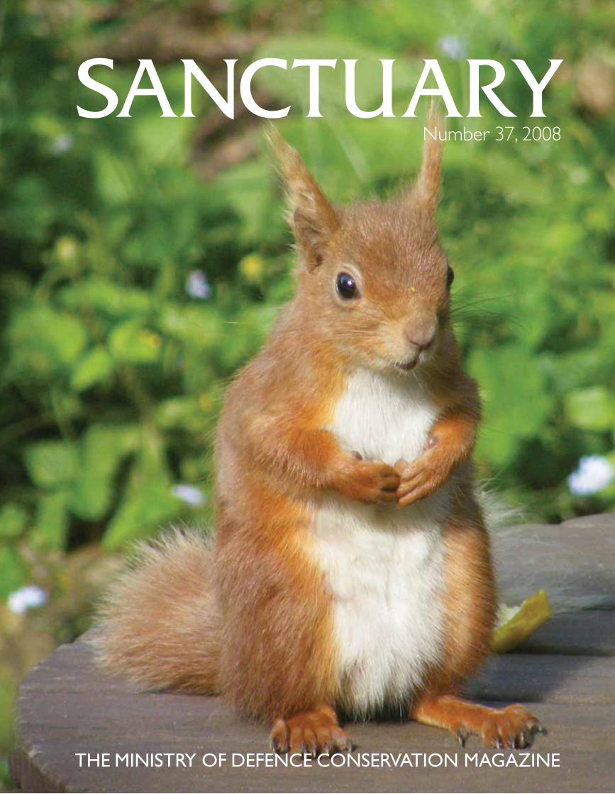
Cover image credit: Red squirrel at NewtownRanges. Photography: Barry Angell.
The Ministry of DefenceConservation Magazine
Number 37 - 2008
AS90 in hide. Photography: Keith Anderson.
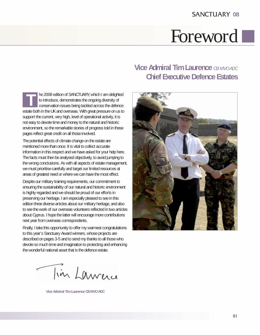
he 2008 edition of SANCTUARY, which I am delightedto introduce, demonstrates the ongoing diversity ofconservation issues being tackled across the defence
estate both in the UK and overseas. With great pressure on us tosupport the current, very high, level of operational activity, it isnot easy to devote time and money to the natural and historicenvironment, so the remarkable stories of progress told in thesepages reflect great credit on all those involved.
The potential effects of climate change on the estate arementioned more than once. It is vital to collect accurateinformation in this respect and we have asked for your help here.The facts must then be analysed objectively, to avoid jumping tothe wrong conclusions. As with all aspects of estate management,we must prioritise carefully and target our limited resources atareas of greatest need or where we can have the most effect.
Despite our military training requirements, our commitment toensuring the sustainability of our natural and historic environmentis highly regarded and we should be proud of our efforts inpreserving our heritage. I am especially pleased to see in thisedition three diverse articles about our military heritage, and alsoto see the work of our overseas volunteers reflected in two articlesabout Cyprus. I hope the latter will encourage more contributionsnext year from overseas correspondents.
Finally, I take this opportunity to offer my warmest congratulationsto this year’s Sanctuary Award winners, whose projects aredescribed on pages 3-5 and to send my thanks to all those whodevote so much time and imagination to protecting and enhancingthe wonderful national asset that is the defence estate.
08
Foreword
01
Vice Admiral Tim Laurence CB MVO ADC
Chief Executive Defence Estates
Vice Admiral Tim Laurence CB MVO ADC
T
RegularsForeword 01
The Sanctuary Awards 03
Access Opportunities on the Defence Estate 06
UpdateRatty Returns to Warcop 08
Rare Woodland Bats on the Isle of Wight 09
Great Bustard Reintroduction 10
FeaturesCastlemartin Ranges - Rocks and Landforms 12
Castlemartin Ranges - Limestone Mosses 16
Adapting to Climate Change 18
Flood Defences at RMB Chivenor 19
Butterflies at Locks Copse 22
Conserving a Rare & Delicate Treasure at the Otmoor Rifle Range 24
Militarised Landscapes in Twentieth Century Britain, France & the USA 26
From Ruins to Regeneration: Buildings at risk on the Defence Estate 30
Set in Stone - Monumentalising the Military 32
Body of Evidence - Archaeological Work at Royal Naval Hospital Haslar 34
Relocation, Relocation, Relocation 38
The Battle of Britain Memorial Flight “Lest we Forget” 40
The Wrecks of Jutland 42
Environmental and Sustainable Estate Management at MOD St Athan 46
Wittering Heath, RAF Wittering 50
InternationalGermany - Senne Training Camp 52
Cyprus - Conservation Group Update 53
Cyprus - Special Protection Areas for Birds in the Sovereign Base Areas of Cyprus 54
British Indian Ocean Territories - The Royal Navy Birdwatching Society Ornithological Survey of Diego Garcia. 58
Falkland Islands - Six Months Down South 60
Cyprus - The Ancient Maritime Landscape of Pyla 62
Around the RegionsA day in the life of the Newtown Ranges and Jersey Camp Conservation Group 65
Eskmeals Range, Cumbria 67
RAF Spadeadam, Cumbria 68
Warcop, Cumbria 69
Bovington, Dorset 70
Ministry of Defence Police and Guarding Agency, Wethersfield, Essex 71
Sea Mounting Centre, Marchwood, Hampshire 72
Newtown Ranges and Jersey Camp, Isle of Wight 73
Canterbury, Old Park Training Area, Kent 74
Yardley Chase, Northamptonshire 75
Pembrokeshire Ranges, Pembrokeshire 77
Leek and Upper Hulme Training Area, Staffordshire 78
RAF Lakenheath, Suffolk 79
Bulford, Wiltshire 81
Imber, Wiltshire 83
Porton Down, Wiltshire 85
Leconfield Carrs, East Yorkshire 87
Catterick, North Yorkshire 89
Ellington Banks, North Yorkshire 90
RAF Fylingdales, North Yorkshire 91
ContactsInside back cover
02
Contents
For details on public access to the Defence Estate go to
www.access.mod.uk
08
The Sanctuary Award BoardThe Sanctuary Award Board for 2008 were:for Defence Estates: Martin Coulson, Land andProperty Policy, Property Directorate; Ian Barnes,Head of the Environmental Support Team; TedCundall, Parliamentary Business and StakeholderManagement, Property Directorate and PippaMorrison, Biodiversity Adviser, PropertyDirectorate. Again we would like to pass on ourthanks to Marcus Yeo, Director of Resources andExternal Affairs, Joint Nature ConservationCommittee, for acting as external judge.
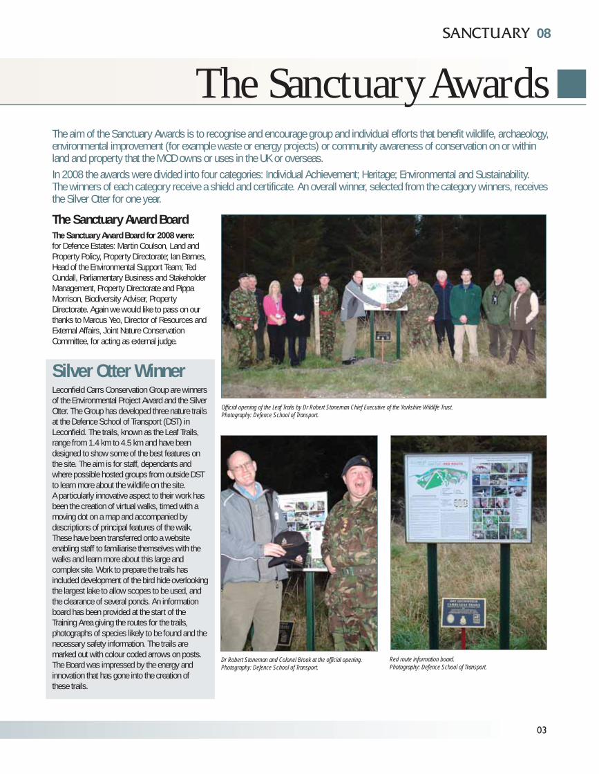
Silver Otter WinnerLeconfield Carrs Conservation Group are winnersof the Environmental Project Award and the SilverOtter. The Group has developed three nature trailsat the Defence School of Transport (DST) inLeconfield. The trails, known as the Leaf Trails,range from 1.4 km to 4.5 km and have beendesigned to show some of the best features onthe site. The aim is for staff, dependants andwhere possible hosted groups from outside DSTto learn more about the wildlife on the site. A particularly innovative aspect to their work hasbeen the creation of virtual walks, timed with amoving dot on a map and accompanied bydescriptions of principal features of the walk.These have been transferred onto a websiteenabling staff to familiarise themselves with thewalks and learn more about this large andcomplex site. Work to prepare the trails hasincluded development of the bird hide overlookingthe largest lake to allow scopes to be used, andthe clearance of several ponds. An informationboard has been provided at the start of theTraining Area giving the routes for the trails,photographs of species likely to be found and thenecessary safety information. The trails aremarked out with colour coded arrows on posts.The Board was impressed by the energy andinnovation that has gone into the creation ofthese trails.
The Sanctuary Awards
03
The aim of the Sanctuary Awards is to recognise and encourage group and individual efforts that benefit wildlife, archaeology,environmental improvement (for example waste or energy projects) or community awareness of conservation on or withinland and property that the MOD owns or uses in the UK or overseas. In 2008 the awards were divided into four categories: Individual Achievement; Heritage; Environmental and Sustainability.The winners of each category receive a shield and certificate. An overall winner, selected from the category winners, receivesthe Silver Otter for one year.
Red route information board.Photography: Defence School of Transport.
Dr Robert Stoneman and Colonel Brook at the official opening.Photography: Defence School of Transport.
Official opening of the Leaf Trails by Dr Robert Stoneman Chief Executive of the Yorkshire Wildlife Trust. Photography: Defence School of Transport.
04
The Sanctuary AwardsTHE SANCTUARY AWARDS
Jonathan Gasson. Photography: Defence Estates.
Environmental ProjectHighly Commended
The first certificate was awarded to RegionalPrime Contract (RPC) East and Babcock DynCorpfor the improvement works carried out on RAFBarnham Training Area Site of Special ScientificInterest (SSSI). The Board was pleased to seethat RPC East and Babcock DynCorp had workedclosely with the Defence Training Estate, NaturalEngland and the site Conservation Group to carryout the delicate task of tree and scrub removalthat will help deliver SSSI improvements andsafeguard the features necessary for successfulmilitary training.
RAF Barnham Training Area SSSI before the improvement works.Photography: Babcock DynCorp.
RAF Barnham Training Area SSSI after the improvement works.Photography: Babcock DynCorp.
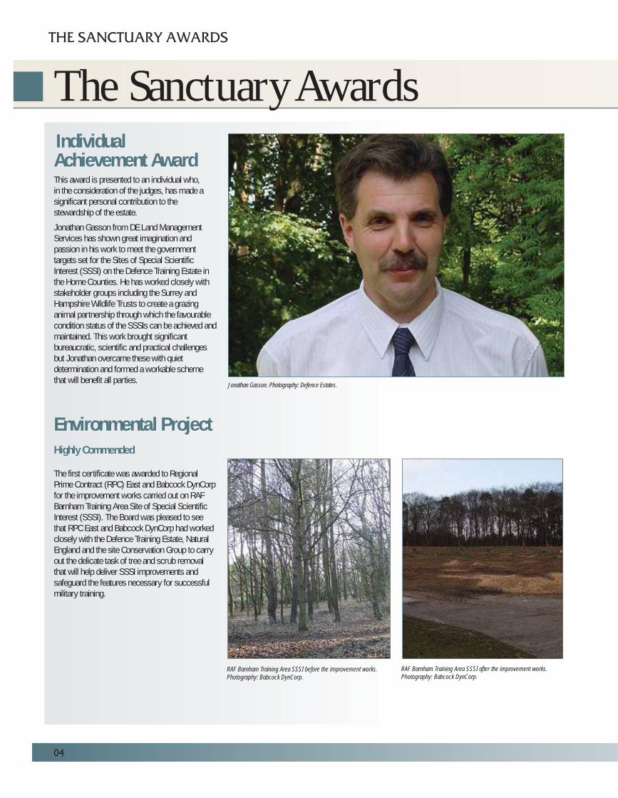
IndividualAchievement AwardThis award is presented to an individual who,in the consideration of the judges, has made asignificant personal contribution to thestewardship of the estate.
Jonathan Gasson from DE Land ManagementServices has shown great imagination andpassion in his work to meet the governmenttargets set for the Sites of Special ScientificInterest (SSSI) on the Defence Training Estate inthe Home Counties. He has worked closely withstakeholder groups including the Surrey andHampshire Wildlife Trusts to create a grazinganimal partnership through which the favourablecondition status of the SSSIs can be achieved andmaintained. This work brought significantbureaucratic, scientific and practical challengesbut Jonathan overcame these with quietdetermination and formed a workable schemethat will benefit all parties.

Environmental ProjectHighly CommendedThe second certificate goes to DTE Pembrokeshireand 14 Signal Regiment for the clean up ofFrainslake Beach and Bullslaughter Bay atCastlemartin Range. In 2004, 2007 and 2008,Lynne Ferrand, the coastal ranger for the MODestate in Pembrokeshire, organised troops from 14Signal Regiment to assist in cleaning up the manytons of rubbish that are washed up on to thesebeaches. In 2007, 24 soldiers working over thetwo beaches filled a total of 9 skips with rubbish.The task at Bullslaughter Bay is made harder asthe beach is located at the bottom of the cliffs,meaning that rubbish has to be hauled by handback up to the top. The latest clean up in May2008 saw 7 skips filled. This work has improvedthe amenity value of the beaches as well asbringing environmental benefits.
Sustainability ProjectWinnerThe MOD’s Police and Guarding Agency TrainingCollege “Green Team” have made outstandingefforts to deliver sustainability improvements inline with MOD’s Sustainable Development ActionPlan. An Environmental Policy for the site wasdrawn up and work began on reducing the amountof waste material sent to landfill each year. With support from Aramark, the site multi-activitycontractor, waste materials including used paper,plastic bottles and cups are collected, sorted andsent for recycling. Energy saving has beenencouraged through the promotion of simplemeasures such as switching off computers,monitors and lights. Funding was also appliedfor to fit thermostatic radiator valves throughoutthe Headquarters buildings. The Board felt thatthe “Green Team” has done a magnificent joband have created a model that similar groupsshould aspire to.
Runner upProject Redstart began at Warminster Garrisonwhere Aspire Defence Services Limited supplytimber waste from construction and demolitionprojects as a raw material for making nest boxes. Mr Geordie Ward and a team of volunteers makethe boxes in their spare time, working to BritishTrust for Ornithology standards. The boxes arethen sold on to staff in the Salisbury Plain areawith guidance on where they should be placed.Around £3000 has been raised so far through thesale of the boxes, with the proceeds being passedto local Conservation Groups. Following thesuccess of this initiative the team intend to branchout into making hedgehog and bat boxes.
Heritage AwardThe Bulford Chalk Kiwi Project is a worthy winnerof the Sanctuary Heritage Award. The projectundertook to repair, clean and protect the image ofa Kiwi created in 1918 by New Zealand soldiersbased at Sling Camp. (See Set in Stone -Monumentalising the Military on page 32 for moredetails on how chalk monuments are created andthe work carried out on the Kiwi).
Other AwardWinners Were:Environmental Project Runner-UpThe Sea Mounting Centre Conservation WorkingGroup at Marchwood carried out a renovationproject to enhance a small lake on the site.For details of this project see page 72.
Sustainability ProjectHighly CommendedThe St Athan Environmental Programme covers awide range of sustainability work being undertakenby the Defence Estate’s Site Management Team.The Board was very impressed by the breadth ofwork being undertaken at St Athan. For moredetails of this project see page 46.
08
Clean up of Bullslaughter Bay. Photography: Crown Copyright.
05
Geordie Ward with robin boxes. Photography: Project Allenby/Connaught.
MDPGA Green Team. Photography:Crown Copyright.
Clean up of Frainslake Beach. Photography: Crown Copyright.
06
RAF Fylingdales - Improving Public Access
ACCESS OPPORTUNITIES ON THE DEFENCE ESTATE
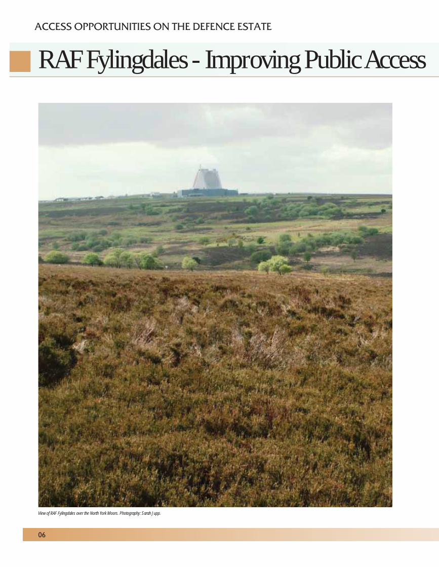
View of RAF Fylingdales over the North York Moors. Photography: Sarah Jupp.
During 2007 RAF Fylingdales, through closediscussion with the North York Moors NationalPark Authority, created a new permissivebridleway to improve access between existingpublic rights of way. The bridleway, which isaround 1.5 km long, crosses the moorland to linkthe Lyke Wake bridleway to bridleways leadingthrough Langdale Forest. It also crosses the areawhich once housed the classic ‘golf balls’.This improved access provision is close to populartourist sites such as Whitby and Goathland.
In addition to being a National Park, the North YorkMoors are designated as a Site of SpecialScientific Interest (SSSI), Special Area ofConservation (SAC) and Special Protection Area(SPA) for its nationally and internationallyimportant moorland habitats and fauna.The moorland around RAF Fylingdales is a mosaicof dry heather moor, wet heath, deep peat miresand scattered broadleaved scrub along streams.There are also internationally importantpopulations of upland breeding birds includingmerlin and golden plover. Considerable effort wasmade by staff from RAF Fylingdales, the NationalPark Authority, Natural England and DefenceEstates to ensure that the route chosen for thebridleway was practical, attractive to users butminimised impacts such as erosion ordisturbance to birds.
Peat mires, wet heath and the soft banks alongEller Beck are vulnerable to erosion from feet,hooves and mountain bike tyres, which can causea direct loss of vegetation or damage to the bankside burrows of water vole. Ground nesting birdssuch as lapwing, skylark, curlew, red grouse andmerlin are known to be using the immediatelocality and are particularly sensitive todisturbance from free roaming or ‘noisy’ dogs.The rights of way agreement signed betweenMOD and the National Park Authority covers theprovision of a permissive bridleway for 5 yearswith a condition that dogs are kept on a short lead,(meaning that walkers, horse riders and mountainbikers who are under close control from their dogsare welcome!). These terms are considered areasonable compromise to extend and improvepublic access across a lovely moorlandlandscape, whilst safeguarding the statutorydesignation features of the natural environmentand to ensure stock welfare for the tenantsheep farmer.
Providing a relatively easy route for horses andpeople to traverse over this challenging moorlandwas not an easy task. Once a route had beenagreed the RAF carried out an initial hazardassessment to assess its safety, as the area hasbeen used for military activities since World WarTwo. Additionally, a fair section of the identifiedroute was knee to thigh high in dense heather,which sounds romantically inspiring for a goodmoorland tramp, but I assure you, one is likely totrip up over thick and hidden heather stems to fallinelegantly in a heap! MOD’s commercial partner,Carillion Enterprise Ltd undertook considerablework to create and then maintain a 3m wide openpath. This work included cutting vegetation bytractor and flail and removing arisings. The steepbanks of small ditches were softened to give ashallower gradient or small timber sleeper bridgeswere installed. Two new timber bridle bridges havebeen installed across the larger ditches andparticularly wet ground, along with six new bridlegates. Minor adjustments have also been made tothe stock fences to give a better route alignment.
RAF Fylingdales Conservation Group memberswho have a wealth of experience and knowledgeabout the bird ecology on the moors, areundertaking monitoring surveys during the criticalbird breeding months to provide data regardingany interactions between users of the path andbirds and possible impacts. This will help theNational Park Authority and RAF Fylingdales toassess both the benefits of the new bridlewayand impacts on other land use interests.
Sarah Jupp MRICS CEnvEnvironmental Support TeamDefence Estates.
08
in the North York Moors National Park
07
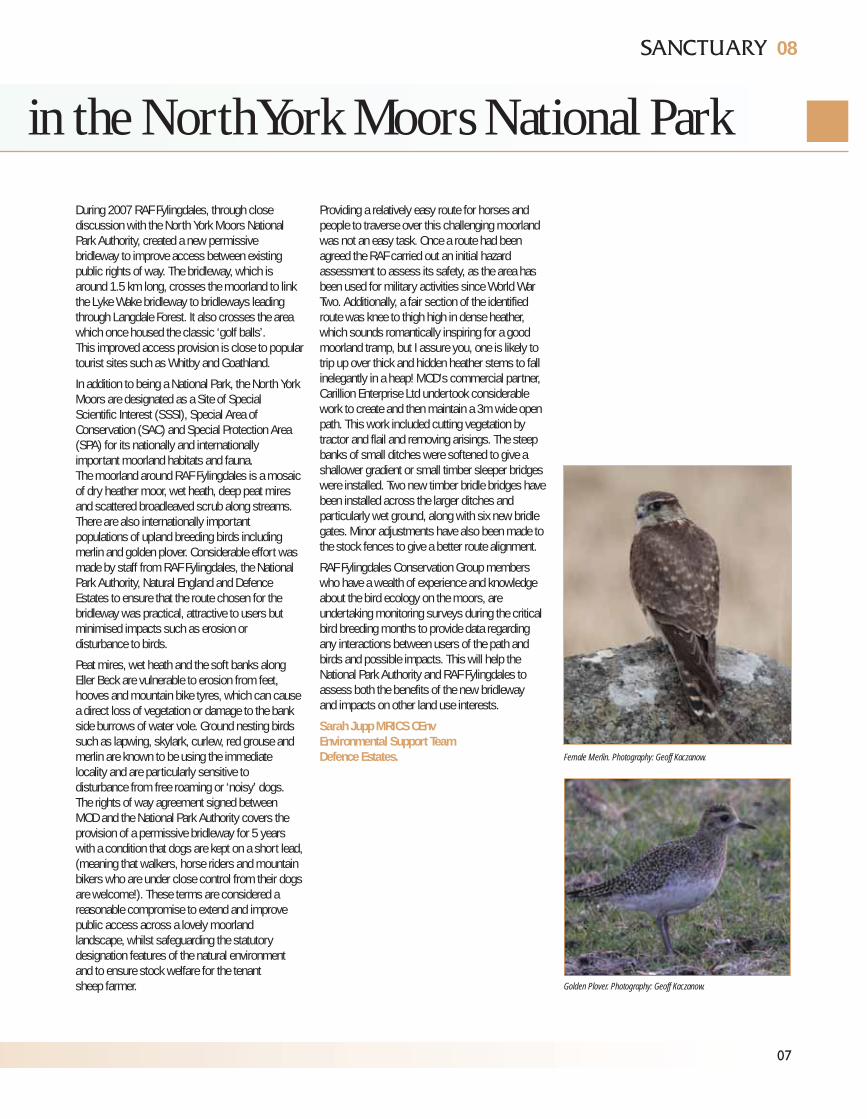
Female Merlin. Photography: Geoff Kaczanow.
Golden Plover. Photography: Geoff Kaczanow.
It is quite ironic that in Cumbria, one of the mostwatery counties in England, an animal such asthe water vole should be in such dire straits.The water vole has become Britain’s fastestdeclining mammal following pressure fromintensified agricultural methods, causing lossof habitat, and the arrival of the Americanmink which is now widespread throughoutour countryside.
Reintroducing a species is really a last ditchattempt to save it once it is clear that the animal isunlikely to be able to regain its former rangethrough habitat work and protection alone.These projects are complex and the intendedrelease sites are chosen with great care in orderto give the animals their best shot at survival.The Warcop reintroduction took two years ofplanning, habitat work and breeding water volesin captivity.
MOD staff set to work creating new lengths ofwaterway to provide more living space for thevoles. Water voles ideally like slow flowingwaterways with lush bank side vegetation to eatand earthy banks in which to dig their burrows.Though not very well adapted to a wateryenvironment, lacking either waterproof fur orwebbed feet to aid swimming, in Britain the watervole is very much associated with this type ofenvironment and uses water as an escape routewhen danger threatens. In days gone by, whenwater voles were extremely common, the “plop”of a disappearing vole was a familiar sound whenstrolling along the water’s edge.
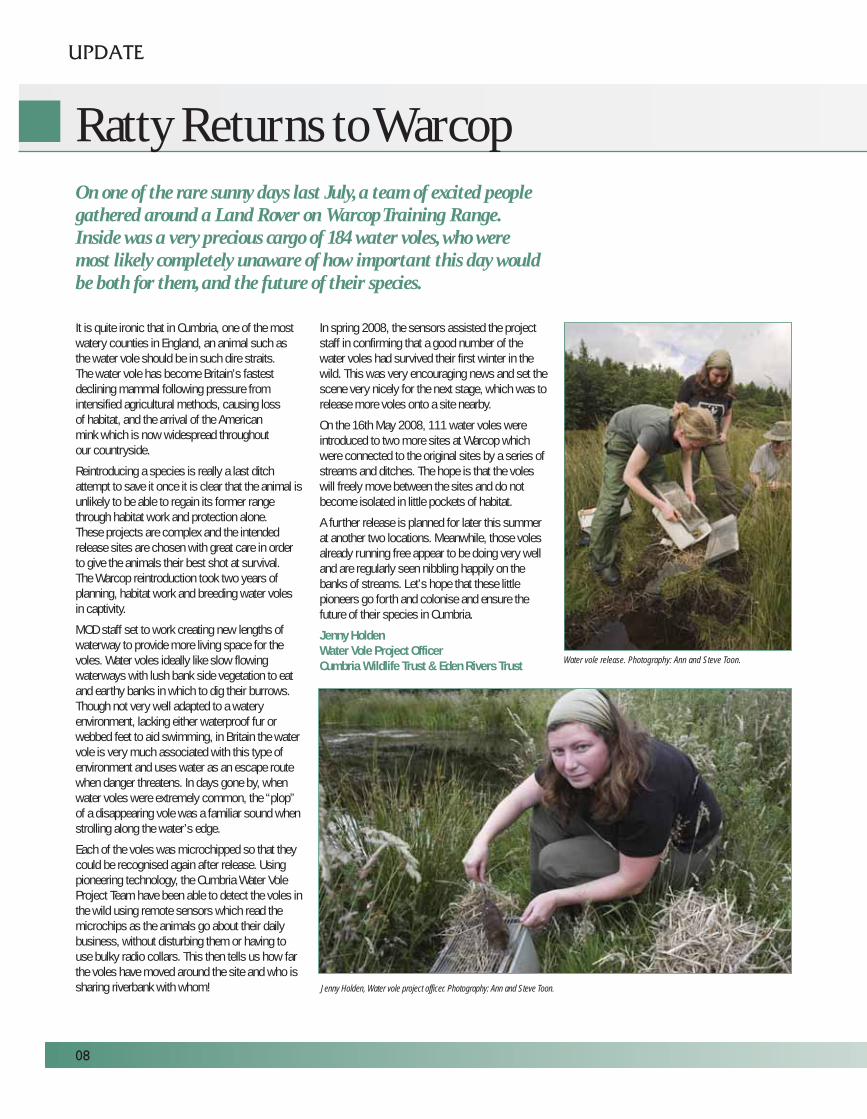
Each of the voles was microchipped so that theycould be recognised again after release. Usingpioneering technology, the Cumbria Water VoleProject Team have been able to detect the voles inthe wild using remote sensors which read themicrochips as the animals go about their dailybusiness, without disturbing them or having touse bulky radio collars. This then tells us how farthe voles have moved around the site and who issharing riverbank with whom!
In spring 2008, the sensors assisted the projectstaff in confirming that a good number of thewater voles had survived their first winter in thewild. This was very encouraging news and set thescene very nicely for the next stage, which was torelease more voles onto a site nearby.
On the 16th May 2008, 111 water voles wereintroduced to two more sites at Warcop whichwere connected to the original sites by a series ofstreams and ditches. The hope is that the voleswill freely move between the sites and do notbecome isolated in little pockets of habitat.
A further release is planned for later this summerat another two locations. Meanwhile, those volesalready running free appear to be doing very welland are regularly seen nibbling happily on thebanks of streams. Let’s hope that these littlepioneers go forth and colonise and ensure thefuture of their species in Cumbria.
Jenny HoldenWater Vole Project OfficerCumbria Wildlife Trust & Eden Rivers Trust
Ratty Returns to Warcop
UPDATE
08
On one of the rare sunny days last July, a team of excited peoplegathered around a Land Rover on Warcop Training Range.Inside was a very precious cargo of 184 water voles, who weremost likely completely unaware of how important this day wouldbe both for them, and the future of their species.
Jenny Holden, Water vole project officer. Photography: Ann and Steve Toon.
Water vole release. Photography: Ann and Steve Toon.
08
n the last edition, we reported on a projectthat was looking for rare bats on the Isle ofWight (IOW). The focus of the report was on
Newtown Ranges, MOD’s main site on the island,where the rare Bechstein’s bat was found tobreeding along with a range of other bat species.The wider project aimed to survey all of the IOW’ssignificant woodlands for rare woodlandbat species.
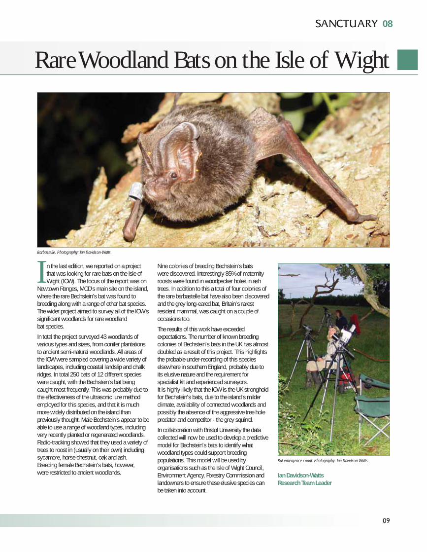
In total the project surveyed 43 woodlands ofvarious types and sizes, from conifer plantationsto ancient semi-natural woodlands. All areas ofthe IOW were sampled covering a wide variety oflandscapes, including coastal landslip and chalkridges. In total 250 bats of 12 different specieswere caught, with the Bechstein’s bat beingcaught most frequently. This was probably due tothe effectiveness of the ultrasonic lure methodemployed for this species, and that it is muchmore widely distributed on the island thanpreviously thought. Male Bechstein’s appear to beable to use a range of woodland types, includingvery recently planted or regenerated woodlands.Radio-tracking showed that they used a variety oftrees to roost in (usually on their own) includingsycamore, horse chestnut, oak and ash.Breeding female Bechstein’s bats, however,were restricted to ancient woodlands.
Nine colonies of breeding Bechstein’s batswere discovered. Interestingly 85% of maternityroosts were found in woodpecker holes in ashtrees. In addition to this a total of four colonies ofthe rare barbastelle bat have also been discoveredand the grey long-eared bat, Britain’s rarestresident mammal, was caught on a couple ofoccasions too.
The results of this work have exceededexpectations. The number of known breedingcolonies of Bechstein’s bats in the UK has almostdoubled as a result of this project. This highlightsthe probable under-recording of this specieselsewhere in southern England, probably due toits elusive nature and the requirement forspecialist kit and experienced surveyors.It is highly likely that the IOW is the UK strongholdfor Bechstein’s bats, due to the island’s milderclimate, availability of connected woodlands andpossibly the absence of the aggressive tree holepredator and competitor - the grey squirrel.
In collaboration with Bristol University the datacollected will now be used to develop a predictivemodel for Bechstein’s bats to identify whatwoodland types could support breedingpopulations. This model will be used byorganisations such as the Isle of Wight Council,Environment Agency, Forestry Commission andlandowners to ensure these elusive species canbe taken into account.
Ian Davidson-WattsResearch Team Leader
Rare Woodland Bats on the Isle of Wight
09
Barbastelle. Photography: Ian Davidson-Watts.
Bat emergence count. Photography: Ian Davidson-Watts.
I
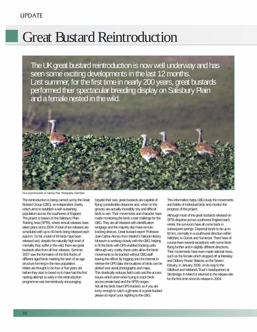
The reintroduction is being carried out by the GreatBustard Group (GBG), an independent charity,which aims to establish a self-sustainingpopulation across the southwest of England.The project is based on the Salisbury PlainTraining Area (SPTA), where annual releases havetaken place since 2004. A total of ten releases arescheduled with up to 40 birds being released eachautumn. So far, a total of 69 birds have beenreleased and, despite the naturally high level ofmortality they suffer in the wild, there are greatbustards alive from all four releases. Summer2007 saw the formation of the first flocks ofdifferent aged birds marking the start of an agestructure forming in the new population.Males are thought to be four or five years oldbefore they start to breed so to have had the firstnesting attempt so early in the reintroductionprogramme was tremendously encouraging.
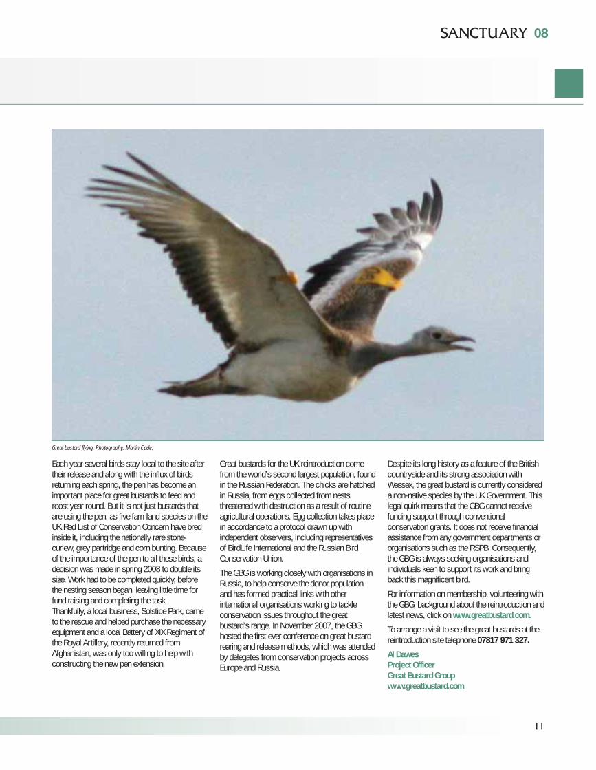
Despite their size, great bustards are capable offlying considerable distances and, when on theground, are actually incredibly shy and difficultbirds to see. Their movements and character havemade monitoring the birds a real challenge for theGBG. They are all released with identificationwingtags and the majority also have remotetracking devices. Great bustard expert ProfessorJuan Carlos Alonso from Madrid’s Natural HistoryMuseum is working closely with the GBG, helpingto fit the birds with GPS enabled tracking units.Although very costly, these units allow the birds’movements to be tracked without GBG staffleaving the office! By logging onto the internet toretrieve the GPS data, the locations of birds can beplotted over aerial photographs and maps. This drastically reduces field costs and the accessissues which arise when trying to track birdsacross private land and the SPTA ranges.Not all the birds have GPS trackers so if you arelucky enough to catch a glimpse of a great bustardplease do report your sighting to the GBG.
This information helps GBG study the movementsand habits of individual birds and monitor theprogress of the project.
Although most of the great bustards released onSPTA disperse across southwest England eachwinter, the survivors have all come back insubsequent springs. Dispersal tends to be up to60 km, normally in a south/west direction withinWiltshire, to Dorset and Somerset. There have ofcourse been several exceptions with some birdsflying further and in slightly different directions.Their movements have even made national news,such as the female which stopped off at Berkeleyand Oldbury Power Stations on the SevernEstuary, in January 2008, on its way to theWildfowl and Wetlands Trust’s headquarters atSlimbridge. In March it returned to the release sitefor the first time since its release in 2004.
UPDATE
10
Great Bustard Reintroduction
The UK great bustard reintroduction is now well underway and hasseen some exciting developments in the last 12 months.Last summer, for the first time in nearly 200 years, great bustardsperformed their spectacular breeding display on Salisbury Plainand a female nested in the wild.
Flock of great bustards on Salisbury Plain. Photography: David Kjaer.
08
Each year several birds stay local to the site aftertheir release and along with the influx of birdsreturning each spring, the pen has become animportant place for great bustards to feed androost year round. But it is not just bustards thatare using the pen, as five farmland species on theUK Red List of Conservation Concern have bredinside it, including the nationally rare stone-curlew, grey partridge and corn bunting. Becauseof the importance of the pen to all these birds, adecision was made in spring 2008 to double itssize. Work had to be completed quickly, beforethe nesting season began, leaving little time forfund raising and completing the task.Thankfully, a local business, Solstice Park, cameto the rescue and helped purchase the necessaryequipment and a local Battery of XIX Regiment ofthe Royal Artillery, recently returned fromAfghanistan, was only too willing to help withconstructing the new pen extension.
Great bustards for the UK reintroduction comefrom the world’s second largest population, foundin the Russian Federation. The chicks are hatchedin Russia, from eggs collected from neststhreatened with destruction as a result of routineagricultural operations. Egg collection takes placein accordance to a protocol drawn up withindependent observers, including representativesof BirdLife International and the Russian BirdConservation Union.
The GBG is working closely with organisations inRussia, to help conserve the donor populationand has formed practical links with otherinternational organisations working to tackleconservation issues throughout the greatbustard’s range. In November 2007, the GBGhosted the first ever conference on great bustardrearing and release methods, which was attendedby delegates from conservation projects acrossEurope and Russia.
Despite its long history as a feature of the Britishcountryside and its strong association withWessex, the great bustard is currently considereda non-native species by the UK Government. Thislegal quirk means that the GBG cannot receivefunding support through conventionalconservation grants. It does not receive financialassistance from any government departments ororganisations such as the RSPB. Consequently,the GBG is always seeking organisations andindividuals keen to support its work and bringback this magnificent bird.
For information on membership, volunteering withthe GBG, background about the reintroduction andlatest news, click on www.greatbustard.com.
To arrange a visit to see the great bustards at thereintroduction site telephone 07817 971 327.
Al DawesProject OfficerGreat Bustard Groupwww.greatbustard.com
11
Great bustard flying. Photography: Martin Cade.
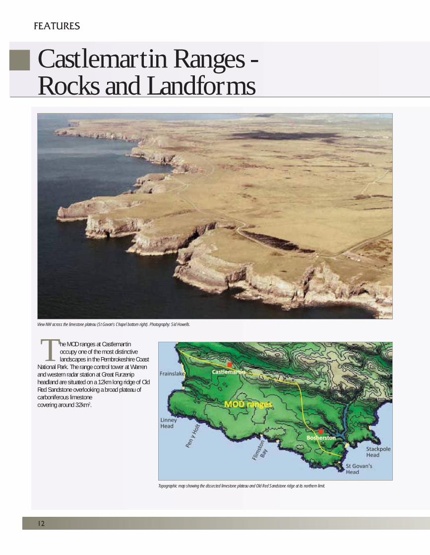
he MOD ranges at Castlemartinoccupy one of the most distinctivelandscapes in the Pembrokeshire Coast
National Park. The range control tower at Warrenand western radar station at Great Furzenipheadland are situated on a 12km long ridge of OldRed Sandstone overlooking a broad plateau ofcarboniferous limestonecovering around 32km2.
12
Castlemartin Ranges -Rocks and Landforms
FEATURES
Topographic map showing the dissected limestone plateau and Old Red Sandstone ridge at its northern limit.
View NW across the limestone plateau (St Govan’s Chapel bottom right). Photography: Sid Howells.
T
The military base is situated at the foot of the southern slope of the ridgenear its central point. Only the eastern extremity of the limestone plateau liesoutside the range.
The coastline of the range extends from Freshwater West to Broad Haven.Most of it has been identified by the Geological Conservation Review asbeing of UK or international importance to geological science, as well aspart of our heritage to be enjoyed by anyone with an appreciation of geologyand scenery. The coast path between Broad Haven and Stack Rocks is openwhenever military training activities are not in progress. Due to the presenceof unexploded shells and other ordnance, the section between Stack Rocksand Freshwater West is only accessible to visitors during supervised walks.
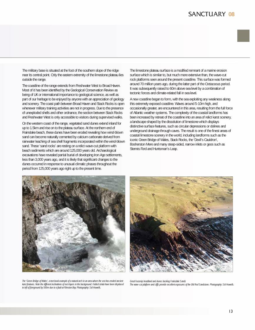
On the western coast of the range, vegetated sand dunes extend inland forup to 1.5km and rise on to the plateau surface. At the northern end ofFrainslake beach, these dunes have been eroded revealing how wind-blownsand can become naturally cemented by calcium carbonate derived fromrainwater leaching of sea shell fragments incorporated within the wind-blownsand. These ‘sand rocks’ are resting on a relict wave-cut platform withbeach sediments which are around 125,000 years old. Archaeologicalexcavations have revealed partial burial of developing Iron Age settlements,less than 3,000 years ago, and it is likely that significant changes to thedunes occurred in response to unusual climatic phases throughout theperiod from 125,000 years ago right up to the present time.
The limestone plateau surface is a modified remnant of a marine erosionsurface which is similar to, but much more extensive than, the wave-cutrock platforms seen around the present coastline. This surface was formedaround 70 million years ago, during the latter part of the Cretaceous period.It was subsequently raised to 60m above sea level by a combination oftectonic forces and climate-related fall in sea level.
A new coastline began to form, with the sea exploiting any weakness alongthis extremely exposed coastline. Waves around 5-10m high, andoccasionally greater, are encountered in this area, resulting from the full forceof Atlantic weather systems. The complexity of the coastal landforms hasbeen increased by retreat of the coastline into an area of relict karst scenery,a landscape shaped by the dissolution of limestone which displaysdistinctive surface features, such as circular depressions or dolines andunderground drainage through caves. The result is one of the finest areas ofcoastal limestone scenery in the world, including landforms such as theiconic Green Bridge of Wales, Stack Rocks, the ‘Devil’s Cauldron’,Bosherston Mere and many steep-sided, narrow inlets or geos such asStennis Ford and Huntsman’s Leap.
08
Great Furzenip headland and dunes backing Frainslake SandsThe wave-cut platform and cliffs provide excellent exposures of the Old Red Sandstone. Photography: Sid Howells.
13
The ‘Green Bridge of Wales’, a text book example of a natural arch in an area where the sea has eroded ancientkarst features. Note the different inclinations of rock layers in the background. Folded strata have been displacedto left of foreground by 500m due to a fault at Flimston Bay. Photography: Sid Howells.
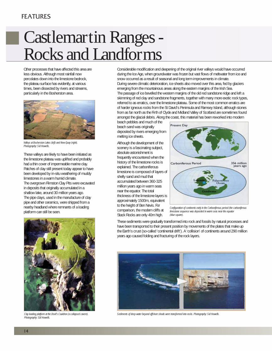
Other processes that have affected this area areless obvious. Although most rainfall nowpercolates down into the limestone bedrock, the plateau surface has evidently, at varioustimes, been dissected by rivers and streams,particularly in the Bosherston area.
These valleys are likely to have been initiated asthe limestone plateau was uplifted and probablyhad a thin cover of impermeable marine clay.Patches of clay still present today appear to havebeen developed by in-situ weathering of muddylimestones in a warm humid climate.The overgrown Flimston Clay Pits were excavatedin deposits that originally accumulated in ashallow lake, around 30 million years ago.The pipe clays, used in the manufacture of claypipe and other ceramics, were shipped from anearby headland where remnants of a loadingplatform can still be seen.
Considerable modification and deepening of the original river valleys would have occurredduring the Ice Age, when groundwater was frozen but vast flows of meltwater from ice andsnow occurred as a result of seasonal and long term improvements in climate.During severe climatic deterioration, ice sheets also moved over this area, fed by glaciersemerging from the mountainous areas along the eastern margins of the Irish Sea.The passage of ice bevelled the western margins of the old red sandstone ridge and left askimming of red clay and sandstone fragments, together with many more exotic rock types,referred to as erratics, over the limestone plateau. Some of the most common erratics areof harder igneous rocks from the St David’s Peninsula and Ramsey Island, although stonesfrom as far north as the Firth of Clyde and Midland Valley of Scotland are sometimes foundamongst the glacial debris. Along the coast, this material has been reworked into modernbeach pebbles and much of thebeach sand was originallydeposited by rivers emerging frommelting ice sheets.
Although the development of thescenery is a fascinating subject,absolute astonishment isfrequently encountered when thehistory of the limestone rocks isexplained. The carboniferouslimestone is composed of layers ofshelly sand and mud thataccumulated between 360-325million years ago in warm seasnear the equator. The totalthickness of the limestone layers isapproximately 1500m, equivalentto the height of Ben Nevis. Forcomparison, the modern cliffs at Stack Rocks are only 40m high.
These sediments were gradually transformed into rock and fossils by natural processes andhave been transported to their present position by movements of the plates that make upthe Earth’s crust (so-called ‘continental drift’). A ‘collision’ of continents around 290 millionyears ago caused folding and fracturing of the rock layers.
Valleys at Bosherston Lakes (left) and New Quay (right).Photography: Sid Howells.
Configuration of continents early in the Carboniferous period (the carboniferouslimestone sequence was deposited in warm seas near the equator(blue square).
Sediments of deep water beyond offshore shoals were transformed into rocks. Photography: Sid Howells.Clay loading platform at the Devil’s Cauldron (a collapsed cavern).Photography: SId Howells.
14
Castlemartin Ranges -Rocks and Landforms
FEATURES
The limestones become progressively younger from Frainslake to Flimston Bay.Thereafter, towards St Govan’s Head, the beds are repeated on the southern limb of asynclinal fold (downfold). A small outcrop of the lowest rock of the ‘millstone grit’ series liesto the east of Bullslaughter Bay along the axis of this fold (the Bullslaughter Bay Syncline).
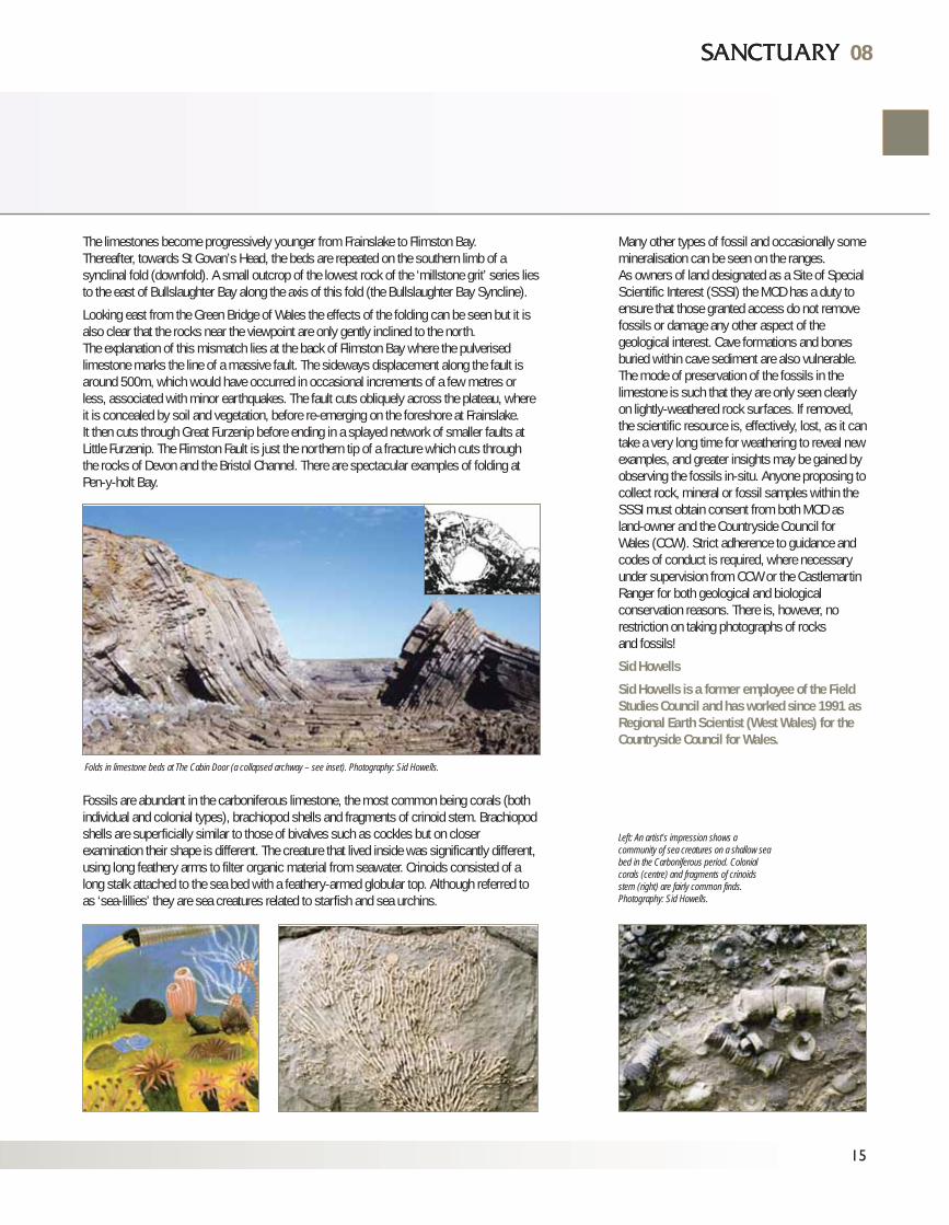
Looking east from the Green Bridge of Wales the effects of the folding can be seen but it isalso clear that the rocks near the viewpoint are only gently inclined to the north. The explanation of this mismatch lies at the back of Flimston Bay where the pulverisedlimestone marks the line of a massive fault. The sideways displacement along the fault isaround 500m, which would have occurred in occasional increments of a few metres orless, associated with minor earthquakes. The fault cuts obliquely across the plateau, whereit is concealed by soil and vegetation, before re-emerging on the foreshore at Frainslake.It then cuts through Great Furzenip before ending in a splayed network of smaller faults atLittle Furzenip. The Flimston Fault is just the northern tip of a fracture which cuts throughthe rocks of Devon and the Bristol Channel. There are spectacular examples of folding atPen-y-holt Bay.
Fossils are abundant in the carboniferous limestone, the most common being corals (bothindividual and colonial types), brachiopod shells and fragments of crinoid stem. Brachiopodshells are superficially similar to those of bivalves such as cockles but on closerexamination their shape is different. The creature that lived inside was significantly different,using long feathery arms to filter organic material from seawater. Crinoids consisted of along stalk attached to the sea bed with a feathery-armed globular top. Although referred toas ‘sea-lillies’ they are sea creatures related to starfish and sea urchins.
08
Many other types of fossil and occasionally somemineralisation can be seen on the ranges.As owners of land designated as a Site of SpecialScientific Interest (SSSI) the MOD has a duty toensure that those granted access do not removefossils or damage any other aspect of thegeological interest. Cave formations and bonesburied within cave sediment are also vulnerable.The mode of preservation of the fossils in thelimestone is such that they are only seen clearlyon lightly-weathered rock surfaces. If removed,the scientific resource is, effectively, lost, as it cantake a very long time for weathering to reveal newexamples, and greater insights may be gained byobserving the fossils in-situ. Anyone proposing tocollect rock, mineral or fossil samples within theSSSI must obtain consent from both MOD asland-owner and the Countryside Council forWales (CCW). Strict adherence to guidance andcodes of conduct is required, where necessaryunder supervision from CCW or the CastlemartinRanger for both geological and biologicalconservation reasons. There is, however, norestriction on taking photographs of rocksand fossils!
Sid Howells
Sid Howells is a former employee of the FieldStudies Council and has worked since 1991 asRegional Earth Scientist (West Wales) for theCountryside Council for Wales.
Left: An artist’s impression shows acommunity of sea creatures on a shallow seabed in the Carboniferous period. Colonialcorals (centre) and fragments of crinoidsstem (right) are fairly common finds.Photography: Sid Howells.
Folds in limestone beds at The Cabin Door (a collapsed archway – see inset). Photography: Sid Howells.
15
08
16
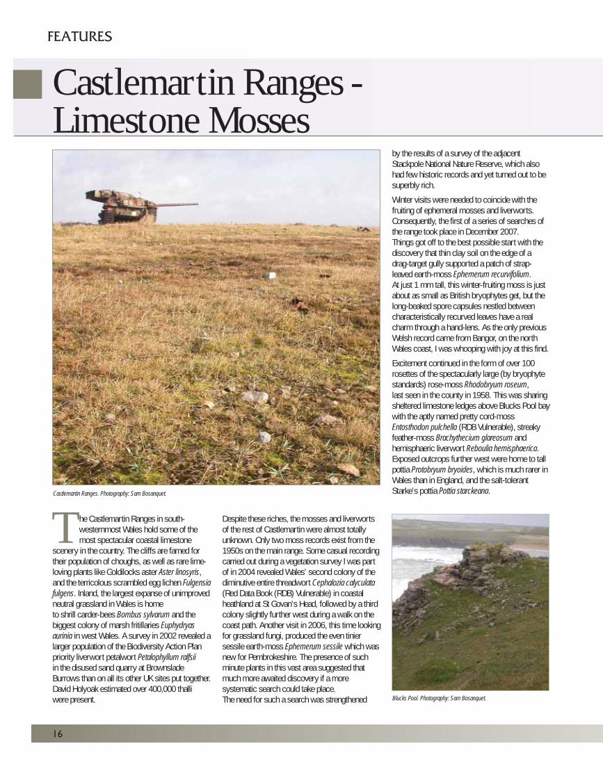
he Castlemartin Ranges in south-westernmost Wales hold some of themost spectacular coastal limestone
scenery in the country. The cliffs are famed fortheir population of choughs, as well as rare lime-loving plants like Goldilocks aster Aster linosyris,and the terricolous scrambled egg lichen Fulgensiafulgens. Inland, the largest expanse of unimprovedneutral grassland in Wales is hometo shrill carder-bees Bombus sylvarum and thebiggest colony of marsh fritillaries Euphydryasaurinia in west Wales. A survey in 2002 revealed alarger population of the Biodiversity Action Planpriority liverwort petalwort Petalophyllum ralfsiiin the disused sand quarry at BrownsladeBurrows than on all its other UK sites put together.David Holyoak estimated over 400,000 thalliwere present.
Despite these riches, the mosses and liverwortsof the rest of Castlemartin were almost totallyunknown. Only two moss records exist from the1950s on the main range. Some casual recordingcarried out during a vegetation survey I was partof in 2004 revealed Wales’ second colony of thediminutive entire threadwort Cephalozia calyculata(Red Data Book (RDB) Vulnerable) in coastalheathland at St Govan’s Head, followed by a thirdcolony slightly further west during a walk on thecoast path. Another visit in 2006, this time lookingfor grassland fungi, produced the even tiniersessile earth-moss Ephemerum sessile which wasnew for Pembrokeshire. The presence of suchminute plants in this vast area suggested thatmuch more awaited discovery if a moresystematic search could take place. The need for such a search was strengthened
by the results of a survey of the adjacentStackpole National Nature Reserve, which alsohad few historic records and yet turned out to besuperbly rich.
Winter visits were needed to coincide with thefruiting of ephemeral mosses and liverworts.Consequently, the first of a series of searches ofthe range took place in December 2007.Things got off to the best possible start with thediscovery that thin clay soil on the edge of adrag-target gully supported a patch of strap-leaved earth-moss Ephemerum recurvifolium.At just 1 mm tall, this winter-fruiting moss is justabout as small as British bryophytes get, but thelong-beaked spore capsules nestled betweencharacteristically recurved leaves have a realcharm through a hand-lens. As the only previousWelsh record came from Bangor, on the northWales coast, I was whooping with joy at this find.
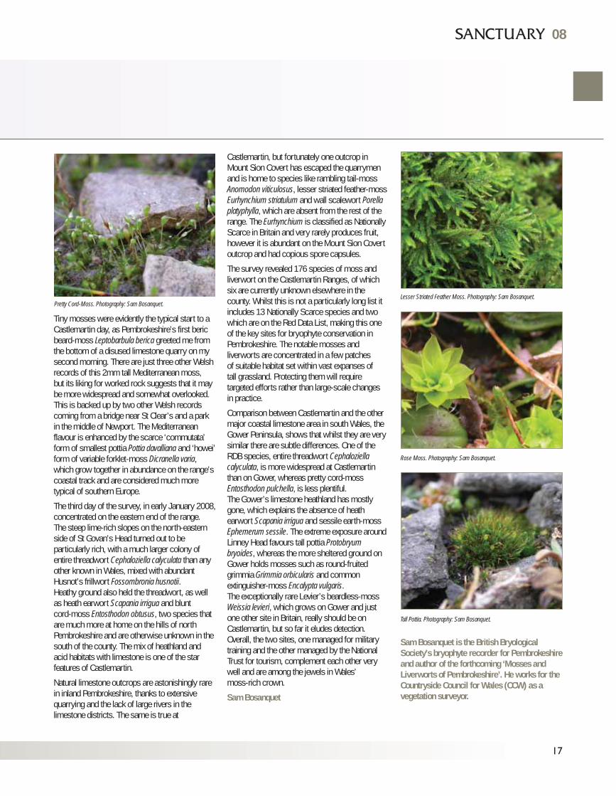
Excitement continued in the form of over 100rosettes of the spectacularly large (by bryophytestandards) rose-moss Rhodobryum roseum,last seen in the county in 1958. This was sharingsheltered limestone ledges above Blucks Pool baywith the aptly named pretty cord-mossEntosthodon pulchella (RDB Vulnerable), streakyfeather-moss Brachythecium glareosum andhemisphaeric liverwort Reboulia hemisphaerica.Exposed outcrops further west were home to tallpottia Protobryum bryoides, which is much rarer inWales than in England, and the salt-tolerantStarke’s pottia Pottia starckeana.
TCastlemartin Ranges. Photography: Sam Bosanquet.
Blucks Pool. Photography: Sam Bosanquet.
Castlemartin Ranges -Limestone Mosses
FEATURES
Tiny mosses were evidently the typical start to aCastlemartin day, as Pembrokeshire’s first bericbeard-moss Leptobarbula berica greeted me fromthe bottom of a disused limestone quarry on mysecond morning. There are just three other Welshrecords of this 2mm tall Mediterranean moss, but its liking for worked rock suggests that it maybe more widespread and somewhat overlooked.This is backed up by two other Welsh recordscoming from a bridge near St Clear’s and a parkin the middle of Newport. The Mediterraneanflavour is enhanced by the scarce ‘commutata’form of smallest pottia Pottia davalliana and ‘howei’form of variable forklet-moss Dicranella varia,which grow together in abundance on the range’scoastal track and are considered much moretypical of southern Europe.
The third day of the survey, in early January 2008,concentrated on the eastern end of the range.The steep lime-rich slopes on the north-easternside of St Govan’s Head turned out to beparticularly rich, with a much larger colony ofentire threadwort Cephaloziella calyculata than anyother known in Wales, mixed with abundantHusnot’s frillwort Fossombronia husnotii.Heathy ground also held the threadwort, as wellas heath earwort Scapania irrigua and bluntcord-moss Entosthodon obtusus, two species thatare much more at home on the hills of northPembrokeshire and are otherwise unknown in thesouth of the county. The mix of heathland andacid habitats with limestone is one of the starfeatures of Castlemartin.
Natural limestone outcrops are astonishingly rarein inland Pembrokeshire, thanks to extensivequarrying and the lack of large rivers in thelimestone districts. The same is true at
Castlemartin, but fortunately one outcrop inMount Sion Covert has escaped the quarrymenand is home to species like rambling tail-mossAnomodon viticulosus, lesser striated feather-mossEurhynchium striatulum and wall scalewort Porellaplatyphylla, which are absent from the rest of therange. The Eurhynchium is classified as NationallyScarce in Britain and very rarely produces fruit,however it is abundant on the Mount Sion Covertoutcrop and had copious spore capsules.
The survey revealed 176 species of moss andliverwort on the Castlemartin Ranges, of whichsix are currently unknown elsewhere in thecounty. Whilst this is not a particularly long list itincludes 13 Nationally Scarce species and twowhich are on the Red Data List, making this oneof the key sites for bryophyte conservation inPembrokeshire. The notable mosses andliverworts are concentrated in a few patchesof suitable habitat set within vast expanses oftall grassland. Protecting them will requiretargeted efforts rather than large-scale changesin practice.
Comparison between Castlemartin and the othermajor coastal limestone area in south Wales, theGower Peninsula, shows that whilst they are verysimilar there are subtle differences. One of theRDB species, entire threadwort Cephaloziellacalyculata, is more widespread at Castlemartinthan on Gower, whereas pretty cord-mossEntosthodon pulchella, is less plentiful.The Gower’s limestone heathland has mostlygone, which explains the absence of heathearwort Scapania irrigua and sessile earth-mossEphemerum sessile. The extreme exposure aroundLinney Head favours tall pottia Protobryumbryoides, whereas the more sheltered ground onGower holds mosses such as round-fruitedgrimmia Grimmia orbicularis and commonextinguisher-moss Encalypta vulgaris.The exceptionally rare Levier’s beardless-mossWeissia levieri, which grows on Gower and justone other site in Britain, really should be onCastlemartin, but so far it eludes detection.Overall, the two sites, one managed for militarytraining and the other managed by the NationalTrust for tourism, complement each other verywell and are among the jewels in Wales’moss-rich crown.
Sam Bosanquet
Sam Bosanquet is the British BryologicalSociety’s bryophyte recorder for Pembrokeshireand author of the forthcoming ‘Mosses andLiverworts of Pembrokeshire’. He works for theCountryside Council for Wales (CCW) as avegetation surveyor.
17
Lesser Striated Feather Moss. Photography: Sam Bosanquet.
Rose Moss. Photography: Sam Bosanquet.
Tall Pottia. Photography: Sam Bosanquet.
Pretty Cord-Moss. Photography: Sam Bosanquet.
08
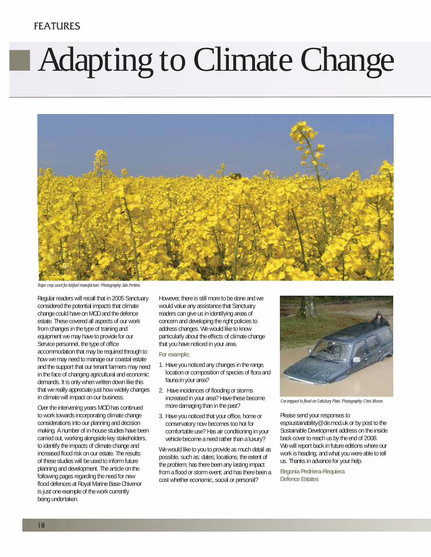
Regular readers will recall that in 2005 Sanctuaryconsidered the potential impacts that climatechange could have on MOD and the defenceestate. These covered all aspects of our workfrom changes in the type of training andequipment we may have to provide for ourService personnel, the type of officeaccommodation that may be required through tohow we may need to manage our coastal estateand the support that our tenant farmers may needin the face of changing agricultural and economicdemands. It is only when written down like thisthat we really appreciate just how widely changesin climate will impact on our business.
Over the intervening years MOD has continuedto work towards incorporating climate changeconsiderations into our planning and decisionmaking. A number of in-house studies have beencarried out, working alongside key stakeholders,to identify the impacts of climate change andincreased flood risk on our estate. The resultsof these studies will be used to inform futureplanning and development. The article on thefollowing pages regarding the need for newflood defences at Royal Marine Base Chivenoris just one example of the work currentlybeing undertaken.
However, there is still more to be done and wewould value any assistance that Sanctuaryreaders can give us in identifying areas ofconcern and developing the right policies toaddress changes. We would like to knowparticularly about the effects of climate changethat you have noticed in your area.
For example:
1. Have you noticed any changes in the range, location or composition of species of flora and fauna in your area?
2. Have incidences of flooding or storms increased in your area? Have these become more damaging than in the past?
3. Have you noticed that your office, home or conservatory now becomes too hot for comfortable use? Has air conditioning in your vehicle become a need rather than a luxury?
We would like to you to provide as much detail aspossible, such as: dates; locations; the extent ofthe problem; has there been any lasting impactfrom a flood or storm event; and has there been acost whether economic, social or personal?
Please send your responses [email protected] or by post to theSustainable Development address on the insideback cover to reach us by the end of 2008.We will report back in future editions where ourwork is heading, and what you were able to tellus. Thanks in advance for your help.
Begonia Pedriera-RequieraDefence Estates
18
FEATURES
Adapting to Climate Change
Car trapped in flood on Salisbury Plain. Photography: Chris Moore.
Rape crop used for biofuel manufacture. Photography: Iain Perkins.

08
19
08
Panoramic view of RMB Chivenor. Photography: Black & Veatch Ltd.
Flood Defences atRoyal Marine Base Chivenor
Flooding is fast becoming an important issue that must be tackled in order todevelop the defence estate. Consideration will have to be given to protectinglow-lying developed land near coasts and rivers, and areas with flood defences inplace may have to consider improvements to adapt to the effects of climate change.
20
In recent years, government legislation hasincorporated Planning Policy Statement 25:Development and Flood Risk (PPS25) and FloodRisk Assessments (FRAs) as a major part of theplanning process. Development of land isrestricted if it is at risk of flooding, unlessmeasures are taken to prevent or lessen thepotential effects of flooding. Having lost CrownImmunity to planning legislation in June 2006, allMOD sites are subject to FRAs. The result of onesuch assessment can be seen at Fleetestablishment Royal Marine Base (RMB)Chivenor and the subsequent flood defencecore works project.
RMB Chivenor Located near Barnstaple in North Devon, RMBChivenor is a low-lying former RAF airfield on thenorthern banks of the picturesque Taw Estuary.The site was handed over to the Royal Marines in1995 and is home to the Commando LogisticRegiment who deploy across the world in supportof 3 Commando Brigade. It also hosts a flight ofRAF Search and Rescue Sea King helicopters.
RMB Chivenor is of strategic importance to MODand the Royal Naval Estate Organisation (RNEO)has embarked on significant development of thesite to support its new role. Important projectsplanned for the future include major motortransport facilities and new accommodation.
As part of the core works procurement process,Defence Estates (DE) commissioned Debut tocarry out an Assessment Study, which included a Tidal Flood Risk Assessment (undertaken byBlack and Veatch, Ltd). It was found that RMBChivenor was at risk from an extreme tidal floodevent (a 1 in 200 year event) and improved flooddefences are required to protect the site.
The Department of Environment, Food and RuralAffairs (DEFRA) recommends that a ‘managedadaptive’ approach is taken towards floodprotection schemes, where multiple interventionsare carried out over time, following constantassessments of the flood risk. The currentobjective for RMB Chivenor is to constructdefences capable of protecting their facilitiesfor at least the next 25 years and which can beadapted thereafter.
FEATURES
The new motor transport facility. The embankment is to be constructed in the foreground of the picture. Photography: Helen Sosnowski.
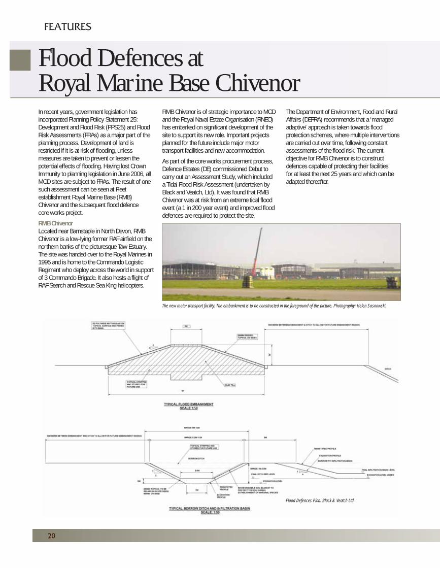
Flood Defences Plan. Black & Veatch Ltd.
Flood Defences atRoyal Marine Base Chivenor
08
21
Decisions on how to defend a flood risk area canbe difficult as the complexities of the area and itssurrounding environment must be considered inany scheme. RMB Chivenor is surrounded byland subject to significant conservationdesignations and environmentally sensitive areas.To the west of the site, the Braunton Burrows is aSpecial Area of Conservation (SAC) for its coastalsand dunes system and mud/sandflats, and is aUNESCO World Biosphere Reserve (BR) for itsterrestrial and coastal/marine ecosystems.The base falls into the BR buffer zone.
The Taw-Torridge Estuary is designated a Siteof Special Scientific Interest (SSSI) for itsestuarine habitats and littoral sediments and isan Important Bird Area for migratory wadingbirds and wildfowl. Isley March, south of the site,is an RSPB Reserve for the same type of birds.The South West Coastal Path (or Tarka Trail)runs to the north of the base and is popularwith visiting tourists and important to the localeconomy. The site also lies in the Braunton BatSustenance Zone, an area that the greaterhorseshoe bat Rhinolophus ferrumequinumuses for foraging.
Although RMB Chivenor itself is not particularlyrich in habitat value, it is home to species such asthe ground nesting skylark, golden plover, thecommon toad Bufo bufo, palmate newts Triturushelveticus, the common lizard Lacerta vivipara andgrass snake Natrix natrix. The potential biodiversityimpact of the flood project has been carefullyconsidered by the project team and mitigationworks carried out where appropriate.
Defence Mechanisms
Current flood defences at RMB Chivenor consistof a combination of a raised earth bank, floodwalls and natural ground. The 2-3m high earthbank along the site boundary, however, isconsidered to be insufficient protection against atidal flood event. Whilst the bank is protected byconcrete faced stone revetments, it is too narrowin some places (1m wide) and does not meetcurrent design standards.
Various improvement options were consideredand in December 2007 it was decided that a new2600 metre long earth embankment would beconstructed around the base’s main buildings anddevelopment area.
Although the airfield would be immersed if anextreme tidal flood event occurred, only 1000m ofrunway is required for helicopter takeoffs.A stretch of the runway between the two strips ofproposed embankment lies on naturally higherland and provides the required 1000m meaningthat additional defences are not required.Other structures located around the airfield willeither be moved or individually protected withmore raised earth banks.
The bulk of the embankment is made up of clay(alluvium), covered with a layer of polymidematting. This will be laid over with topsoil whichwill allow seeding, eventually making it lessvisually intrusive. Whilst the height will remainconstant the depth of the bank will vary to reflectthe topography of the land. To allow vehicularaccess the crest of the embankment will be 3metres wide with a hardened surface.Borrow pits that are dug out will be reinstatedas infiltration basins to manage any excess
surface runoff. These will be around 10 metresaway from the embankment to allow fordevelopment to deal with future flood predictions.
Extensive land quality testing has been carried outto check for unexploded Second World Warordnance. Great care will be taken duringexcavation to ensure that the clay layer is notpenetrated entirely, as the embankment may berendered useless if water could infiltrate under itand into the protected area.
The development is exceptionally sustainable asvery little imported material will be used toconstruct the embankment. The borrow pits andinfiltration basin will provide the clay, and thetopsoil for the top of the embankment will bestripped and stored from the land where it is to bebuilt. Any concrete that is disturbed will becrushed and re-used as foundation material orinfill for new developments at RMB Chivenor.
The flood defences will be built by Debut SouthWest, with construction beginning in September2008. The works should be completed byNovember 2009. However, completion is verymuch dependant upon the weather. Too much rainduring the excavation and earth moving periodmay lead to delays whilst the natural clay driesout! Preparations began at the end of February tomitigate the environmental impact of the project.Scrub clearing and grass cutting works werecompleted in mid-March to deter ground nestingbirds from inhabiting their usual nesting areasduring the construction works.
The Future
This project is an example of the benefits ofpartnering. RNEO, DE and Debut have worked incollaboration to achieve a successful outcome,which assures the future development of RMBChivenor. The team has worked hard to minimisethe environmental impact of the project andaccomplish a design solution that is compatiblewith the military use of the establishment.They have also readily accepted innovative ideasand promoted sustainability throughout.
Helen Sosnowski, Policy Support,RNEO, with input and support from EmilySimmons, Defence Estates.
08
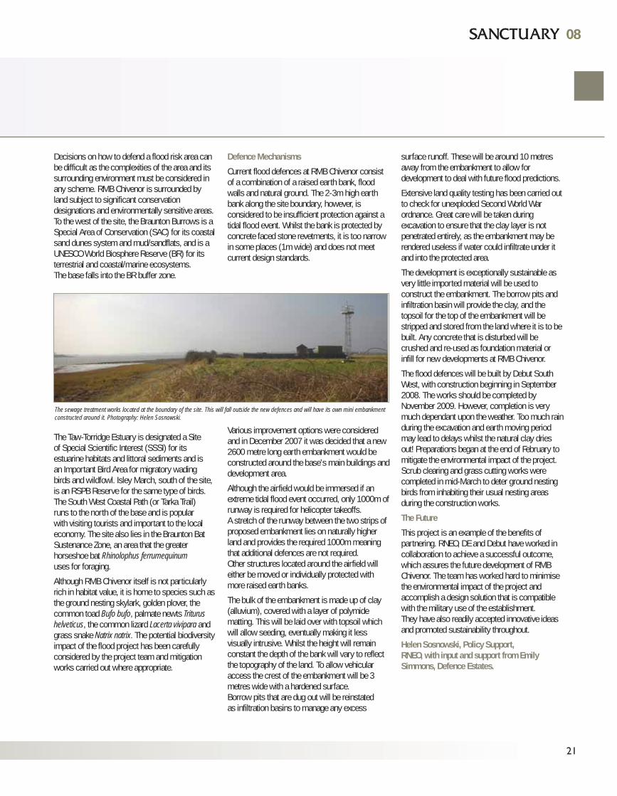
The sewage treatment works located at the boundary of the site. This will fall outside the new defences and will have its own mini embankmentconstructed around it. Photography: Helen Sosnowski.
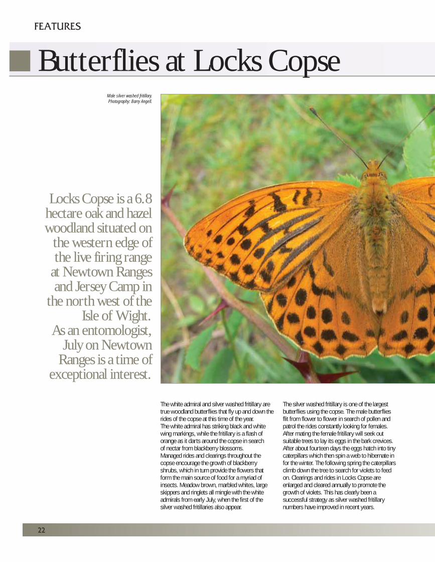
Butterflies at Locks Copse
The white admiral and silver washed fritillary aretrue woodland butterflies that fly up and down therides of the copse at this time of the year.The white admiral has striking black and whitewing markings, while the fritillary is a flash oforange as it darts around the copse in searchof nectar from blackberry blossoms. Managed rides and clearings throughout thecopse encourage the growth of blackberryshrubs, which in turn provide the flowers thatform the main source of food for a myriad ofinsects. Meadow brown, marbled whites, largeskippers and ringlets all mingle with the whiteadmirals from early July, when the first of thesilver washed fritillaries also appear.
The silver washed fritillary is one of the largestbutterflies using the copse. The male butterfliesflit from flower to flower in search of pollen andpatrol the rides constantly looking for females.After mating the female fritillary will seek outsuitable trees to lay its eggs in the bark crevices.After about fourteen days the eggs hatch into tinycaterpillars which then spin a web to hibernate infor the winter. The following spring the caterpillarsclimb down the tree to search for violets to feedon. Clearings and rides in Locks Copse areenlarged and cleared annually to promote thegrowth of violets. This has clearly been asuccessful strategy as silver washed fritillarynumbers have improved in recent years.
22
FEATURES
Locks Copse is a 6.8hectare oak and hazelwoodland situated on
the western edge ofthe live firing range
at Newtown Rangesand Jersey Camp in
the north west of theIsle of Wight.
As an entomologist,July on Newtown
Ranges is a time ofexceptional interest.
Male silver washed fritillary.Photography: Barry Angell.
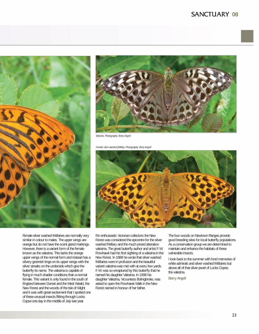
Female silver washed fritillaries are normally verysimilar in colour to males. The upper wings areorange but do not have the scent gland markings.However, there is a variant form of the femaleknown as the valezina. This lacks the orangeupper wings of the normal form and instead has asilvery greenish tinge on its upper wings with thesilver streaks on the underside which give thebutterfly its name. The valezina is capable offlying in much shadier conditions than a normalfemale. This variant is only found in the south ofEngland between Dorset and the West Weald, theNew Forest and the woods of the Isle of Wightand it was with great excitement that I spotted oneof these unusual insects flitting through LocksCopse one day in the middle of July last year.
For enthusiastic Victorian collectors the NewForest was considered the epicentre for the silverwashed fritillary and the much prized aberationvalezina. The great butterfly author and artist F. W.Frowhawk had his first sighting of a valezina in theNew Forest. In 1888 he wrote that silver washedfritillaries were in profusion and the beautifulvariant valezina was met with at every few yards.F. W. was so enraptured by this butterfly that henamed his daughter Valezina. In 1998 hisdaughter Valezina, Vicountess Bolingbroke, wasasked to open the Frowhawk Walk in the NewForest named in honour of her father.
The four woods on Newtown Ranges providegood breeding sites for local butterfly populations.As a conservation group we are determined tomaintain and enhance the habitats of thesevulnerable insects.
I look back to the summer with fond memories ofwhite admirals and silver washed fritillaries butabove all of that silver jewel of Locks Copse,the valezina.
Barry Angell
08
23
08
Female silver washed fritillary. Photography: Barry Angell.
Valezina. Photography: Barry Angell.
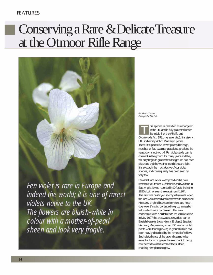
his species is classified as endangeredin the UK, and is fully protected underSchedule 8 of the Wildlife and
Countryside Act, 1981 (as amended). It is also aUK Biodiversity Action Plan Key Species.These little plants live in wet places like bogs,marshes or flat, swampy grassland, provided thevegetation is not too tall. Fen violet seeds can liedormant in the ground for many years and theywill only begin to grow when the ground has beendisturbed and the weather conditions are right.It is probably the most elusive of our violetspecies, and consequently has been seen byvery few.
Fen violet was never widespread and is nowrestricted to Otmoor, Oxfordshire and two fens inEast Anglia. It was recorded in Oxfordshire in the1820s but not seen there again until 1964.This site was destroyed shortly afterwards whenthe land was drained and converted to arable use.However, a hybrid between fen violet and heathdog violet V. canina continued to grow in nearbyfields which were not drained. This wasconsidered to be a suitable site for reintroduction.In May 1997 the area was surveyed as part ofEnglish Nature's (now Natural England) SpeciesRecovery Programme, around 30 true fen violetplants were found growing in ground which hadbeen heavily disturbed by the removal of willow.Such disturbance of the ground seems to beessential for turning over the seed bank to bringnew seeds to within reach of the surface,enabling new plants to grow.
24
FEATURES
Fen violet is rare in Europe andindeed the world; it is one of rarestviolets native to the UK.The flowers are bluish-white incolour with a mother-of-pearlsheen and look very fragile.
Fen Violet at Otmoor.
Photography: Phil Cutt.
Conserving a Rare & Delicate Treasureat the Otmoor Rifle Range
T
Habitat loss along with effects of drainage,ploughing and lack of management on many of itsformer sites have all had a major part to play inthe dramatic decline of this species. In someyears thriving populations can be seen at itsthree remaining sites, but its occurrence remainssporadic and unpredictable with Otmoor being theonly UK site to have reliable flowering in recentyears. Visits at many times reveal a disappointingshow; the plant being largely absent and survivingmainly by seed. It is the resilient nature of thisseed that has been the key to the fen violet’ssurvival. This explains, for example, why theplant was able to make a dramatic show atWicken Fen, Cambridgeshire, after an absenceof many years.
The Otmoor Conservation Committee has tobalance the needs of a huge variety of wildlifeincluding brown hairstreak butterflies andgrasshopper warblers. The MOD warden workswith the tenant farmer and the EnvironmentAgency to maintain suitable water levels, haycutting, harrowing and cattle grazing. It is alsohoped that, by removing willows along thehedgeline at intervals of perhaps 10-15 years,more seed will be brought to the surface togerminate. In this way a viable population of fenviolet can be maintained here.
Detailed ecological work aims to unravel some ofthe mysteries of the fen violet. This is being doneon the Otmoor range where the Rare Plants Groupof the Ashmolean Natural History Society ofOxfordshire has been monitoring the populationsince it appeared. Recently the population in thehay meadow has been declining and now onegroup of plants is being studied in detail to identifynew and recurring plants and the ratio in whichthey occur. One of the main questions is whetherplants are produced mostly by seed orvegetatively (where roots travel along and sendup a shoot several inches away). This mayallow us to explain the unpredictable nature of theplant, and help us understand how best tomanage it. We hope that the results will enable usto ensure that the fen violet becomes a lastingpart of the wetland scene, both in the short andthe long term.
Reference: Palmer M. 2006. Fen violet Violaperscicifolia Schreber: A review of conservationwork carried out under English Nature’sSpecies Recovery Programme: 1993-2005.English Nature Research Report 676.
By Rebecca Tibbetts,Camilla Lambrick and Phil Cutt
08
25
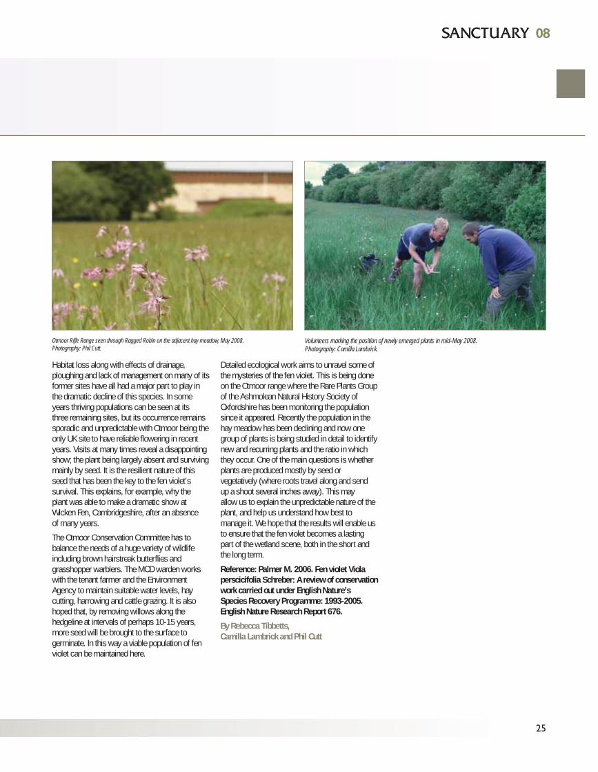
08
Otmoor Rifle Range seen through Ragged Robin on the adjacent hay meadow, May 2008.Photography: Phil Cutt.
Volunteers marking the position of newly emerged plants in mid-May 2008.Photography: Camilla Lambrick.
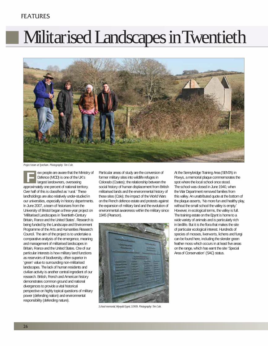
ew people are aware that the Ministry ofDefence (MOD) is one of the UK’slargest landowners, overseeing
approximately one percent of national territory.Over half of this is classified as ‘rural.’ Theselandholdings are also relatively under-studied inour universities, especially in history departments.In June 2007, a team of historians from theUniversity of Bristol began a three-year project on‘Militarised Landscapes in Twentieth-CenturyBritain, France and the United States’. Research isbeing funded by the Landscape and EnvironmentProgramme of the Arts and Humanities ResearchCouncil. The aim of the project is to undertake acomparative analysis of the emergence, meaningand management of militarised landscapes inBritain, France and the United States. One of ourparticular interests is how military land functionsas reservoirs of biodiversity, often superior in‘green’ value to surrounding non-militarisedlandscapes. The lack of human residents andcivilian activity is another central ingredient of ourresearch. British, French and American historydemonstrates common ground and nationaldivergences to provide a vital historicalperspective on highly topical questions of militarypower (defending nation) and environmentalresponsibility (defending nature).
Particular areas of study are the conversion offormer military sites into wildlife refuges inColorado (Coates); the relationship between thesocial history of human displacement from Britishmilitarised lands and the environmental history ofthese sites (Cole); the impact of the World Warson the French defence estate and protests againstthe expansion of military land and the evolution ofenvironmental awareness within the military since1945 (Pearson).
At the Sennybridge Training Area (SENTA) inPowys, a memorial plaque commemorates thespot where the local school once stood.The school was closed in June 1940, whenthe War Department removed families fromthis valley. An unattributed quote at the bottom ofthe plaque asserts, ‘No more fun and healthy play,without the small school the valley is empty.’However, in ecological terms, the valley is full.The training estate on the Epynt is home to awide variety of animals and is particularly richin birdlife. But it is the flora that makes the siteof particular ecological interest. Hundreds ofspecies of mosses, liverworts, lichens and fungican be found here, including the slender greenfeather moss which occurs in at least five areason the range, which has earnt the site ‘SpecialArea of Conservation’ (SAC) status.
26
FEATURES
Militarised Landscapes in Twentieth
Project team at Tyneham. Photography: Tim Cole.
F
School memorial, Mynydd Epynt, SENTA. Photography: Tim Cole.
There are two very different ways of looking atSENTA, either as a place emptied of its humanresidents to make way for military training or aplace teeming with biodiversity. What is moredifficult to assess is the connection between theremoval of human inhabitants and contemporarySAC status. While military training is potentiallyenvironmentally damaging, a case can be madethat the impact of intensive agriculture is just as,if not more, destructive. The Joint NatureConservation Committee saw ‘sporadic damagefrom trampling and the use of small explosivecharges’ to be less of a threat to the slender greenfeather moss than permitting ‘farmers to drain orfertilise more of the range.’
It is not simply the absence of intensiveagriculture in the present that is significant inwriting environmental histories of militarylandscapes. We also aim to consider the ways inwhich these landscapes may have developed ifthey had not been seized for military use.However military use has to be balanced withissues of public access and heritageresponsibilities that are particularly marked atsites like the Epynt, and the English villages ofImber and Tyneham.
Echoes of the histories of Imber and Tyneham canbe found in France, particularly in the Provencalvillage of Brovès which was requisitioned by theFrench army during the creation of Canjuers baseand training ground in the 1960s and 1970s. The case of Larzac, where sheep graze andproduce the milk for Roquefort cheese, is asignificant example of the history of protestsagainst the expansion of military land. The Frencharmy abandoned the Larzac camp extension in1981 after a decade of protests.
As in the UK, military ownership of land in Francehas created landscapes that are markedlydifferent to surrounding fields, forests, andinhabited spaces. For example, a section of Campde Bitche in North Eastern France forms part of aUNESCO biosphere reserve and a number ofcamps are now part of the European Union’s‘Natura 2000’ network. The French Ministry ofDefence has introduced environmental policiesand agreements, including protocols forcooperation with the Ministry for the Environmentand has recently established a centralised officeto oversee environmental issues. But there is not,as yet, a French equivalent of Sanctuary.
A quick flick through the pages of Sanctuarydemonstrates that British military lands are rich inwildlife. Whether by happy accident, such as thesuitability of water-filled ruts left by militaryvehicles as habitat for the protected fairy shrimpon Salisbury Plain, or through concerted effortsto protect and even assist in projects involving there-introduction of species such as the greatbustard, MOD is increasingly aware of theecological value of its estate, and itsresponsibilities as conservator.
Project student, Marianna Dudley is producing adoctoral thesis that will represent the firstenvironmental history of the UK defence estate.Although she will be investigating the ‘greening’process at an institutional level, the most fruitfulresearch to date has been conducted ‘from theground up.’ Visits to Salisbury Plain and LulworthRange have revealed visually stunning and variedlandscapes, free from intensive farming and othercustomary forms of human pressure. The factthat lands which are habitually shelled andtraversed by troops and heavy vehicles offer a‘sanctuary’ for often endangered flora and faunadoes not conform to the conventional perceptionof military practices as invariably destructive.
The time span covered by Dudley’s workencompasses the establishment of nationalparks, a growing sense of ecological crisis, andthe emergence of the environmental movement.The pages of this very magazine will bewell-thumbed, both as an example of MOD’sgrowing awareness of its environmental role,and of how it presents its custodial duties to thewider public. We hope that local wildlife andConservation Groups will also prove to beimportant sources of research material, and ifanyone feels they have any experiences orinformation to contribute, please contact her [email protected].
Her thesis will be grounded in case studiescovering five sites in southwestern England andWales: Salisbury Plain Training Area;Sennybridge; Lulworth Range on the Dorsetcoast, where the renowned ‘ghost’ village ofTyneham was requisitioned in 1943;Castlemartin gunnery range within thePembrokeshire Coast National Parkand Dartmoor.
08
27
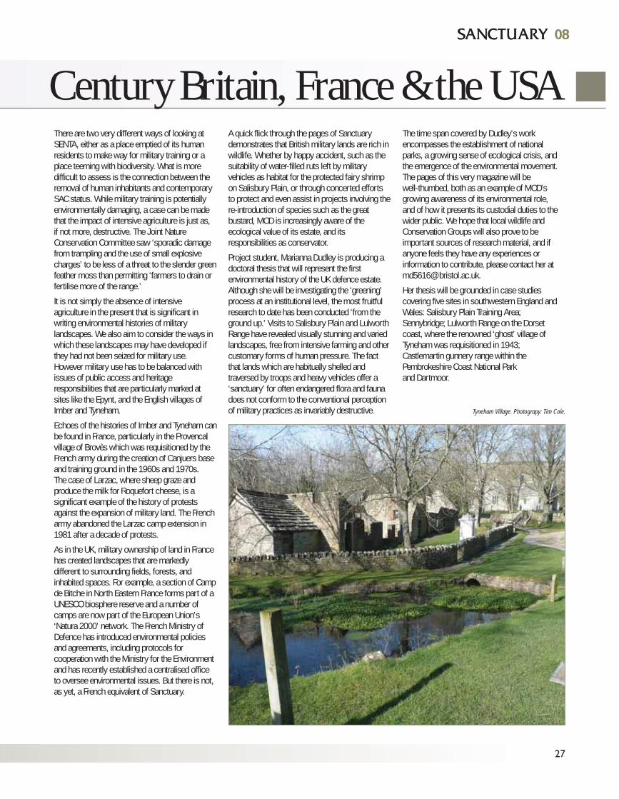
08
Century Britain, France & the USA
Tyneham Village. Photograpy: Tim Cole.
Two external partners are assisting our project.The Defence Estates Environmental Support Team(EST), based at Westdown Camp on SalisburyPlain, is helping with the practicalities of site visitswhich are indispensible; furnishing valuable adviceand making research materials available. One ofthe highlights of our project conference, to be heldin Bristol in September 2008, will be a field trip toSalisbury Plain facilitated by our EST projectpartner. Without this co-operation our researchwould be limited.
Our other partner is Icon Films, a small, award-winning, Bristol-based film making company.Since the Arts and Humanities Research Councillikes to see the findings of the projects it fundscommunicated beyond academia, one of ouroutputs will be a short documentary about thegreat bustard of the Salisbury Plain training estate,made together with Icon Films.
The bustard (featured in Sanctuary 34 (2005):14-17 and on pages 10-11 is one of the speciesincluded in a second series of four-minute filmsthat Icon is producing for BBC 1's 'The One Show– Back from the Brink.' The theme of the series ishow some UK species have been brought backfrom the brink by the dedicated efforts ofconservation workers. There is an importantelement of surprise in each feature. Theseremarkable wildlife success stories are oftensituated in unlikely places or, as the bustardillustrates, in environments where public access isrestricted. Salisbury Plain’s defence estate wasselected for the reintroduction project because itrepresents the closest surviving approximation tothe former habitat of a bird extinct in the UK sincethe 1830s.
By the time this article appears, the projectteam will have completed its round of British sitevisits, thereby advancing our understanding ofthe often enigmatic nature of militarisedlandscapes and discovering again that ecologicalhealth and environmental wealth can be found insurprising places.
28
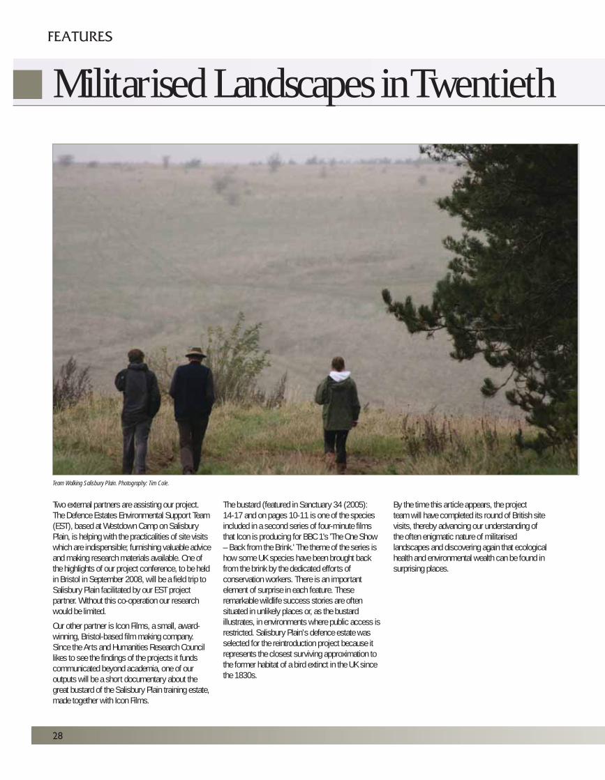
Team Walking Salisbury Plain. Photography: Tim Cole.
FEATURES
Militarised Landscapes in Twentieth
Peter Coates, Tim Cole, Chris Pearsonand Marianna Dudley.The team is based in the Department ofHistorical Studies (School of Humanities)at the University of Bristol. For furtherinformation about the project, visitwww.bristol.ac.uk/history/militarylandscapesor contact us by [email protected];[email protected];[email protected]:[email protected]
29
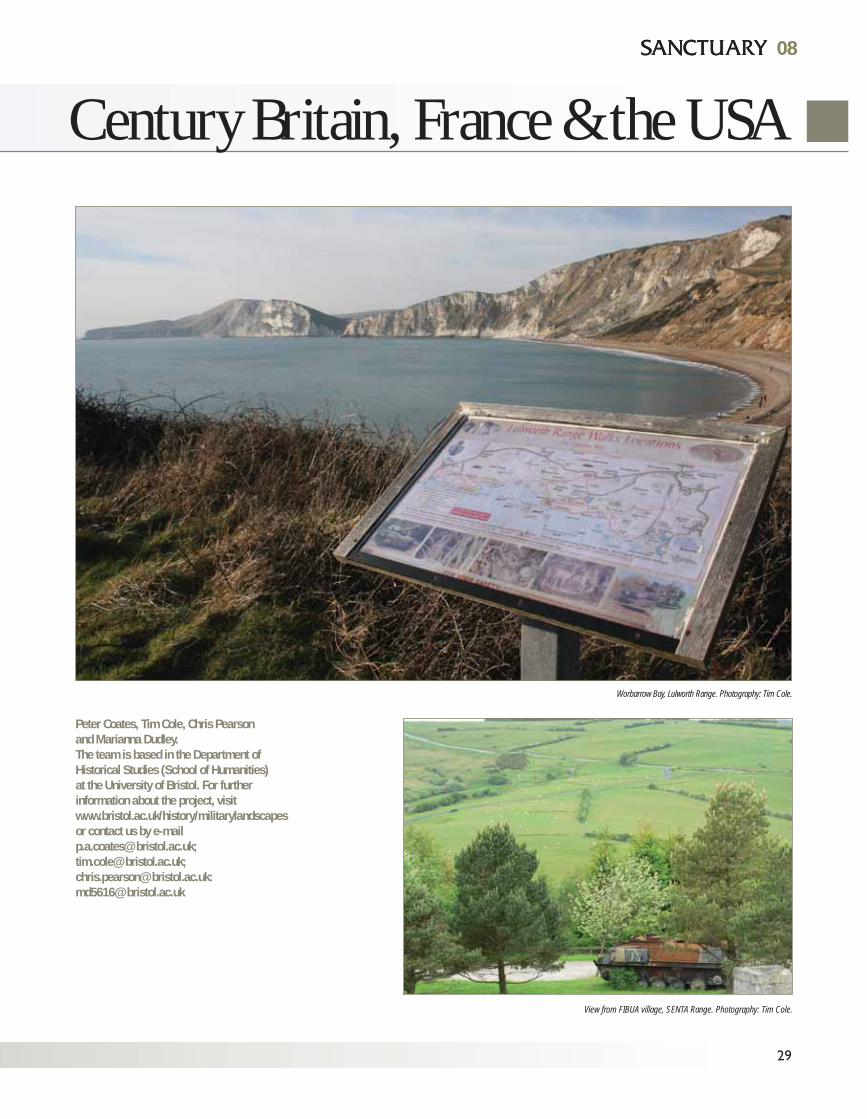
Worbarrow Bay, Lulworth Range. Photography: Tim Cole.
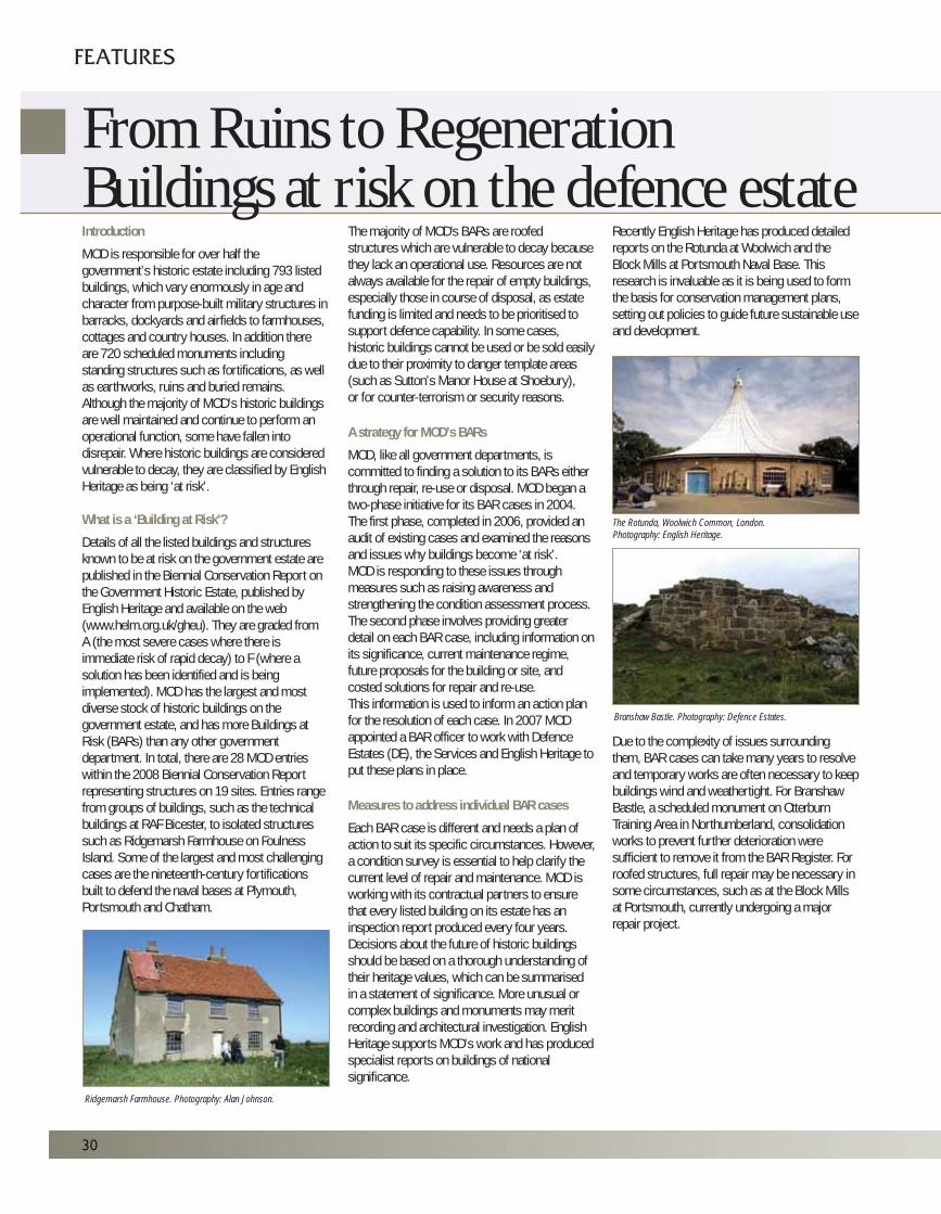
View from FIBUA village, SENTA Range. Photography: Tim Cole.
0808
Century Britain, France & the USA
Introduction
MOD is responsible for over half thegovernment’s historic estate including 793 listedbuildings, which vary enormously in age andcharacter from purpose-built military structures inbarracks, dockyards and airfields to farmhouses,cottages and country houses. In addition thereare 720 scheduled monuments includingstanding structures such as fortifications, as wellas earthworks, ruins and buried remains.Although the majority of MOD’s historic buildingsare well maintained and continue to perform anoperational function, some have fallen intodisrepair. Where historic buildings are consideredvulnerable to decay, they are classified by EnglishHeritage as being ‘at risk’.
What is a ‘Building at Risk’?
Details of all the listed buildings and structuresknown to be at risk on the government estate arepublished in the Biennial Conservation Report onthe Government Historic Estate, published byEnglish Heritage and available on the web(www.helm.org.uk/gheu). They are graded fromA (the most severe cases where there isimmediate risk of rapid decay) to F (where asolution has been identified and is beingimplemented). MOD has the largest and mostdiverse stock of historic buildings on thegovernment estate, and has more Buildings atRisk (BARs) than any other governmentdepartment. In total, there are 28 MOD entrieswithin the 2008 Biennial Conservation Reportrepresenting structures on 19 sites. Entries rangefrom groups of buildings, such as the technicalbuildings at RAF Bicester, to isolated structuressuch as Ridgemarsh Farmhouse on FoulnessIsland. Some of the largest and most challengingcases are the nineteenth-century fortificationsbuilt to defend the naval bases at Plymouth,Portsmouth and Chatham.
The majority of MOD's BARs are roofedstructures which are vulnerable to decay becausethey lack an operational use. Resources are notalways available for the repair of empty buildings,especially those in course of disposal, as estatefunding is limited and needs to be prioritised tosupport defence capability. In some cases,historic buildings cannot be used or be sold easilydue to their proximity to danger template areas(such as Sutton’s Manor House at Shoebury),or for counter-terrorism or security reasons.
A strategy for MOD’s BARs
MOD, like all government departments, iscommitted to finding a solution to its BARs eitherthrough repair, re-use or disposal. MOD began atwo-phase initiative for its BAR cases in 2004.The first phase, completed in 2006, provided anaudit of existing cases and examined the reasonsand issues why buildings become ‘at risk’.MOD is responding to these issues throughmeasures such as raising awareness andstrengthening the condition assessment process.The second phase involves providing greaterdetail on each BAR case, including information onits significance, current maintenance regime,future proposals for the building or site, andcosted solutions for repair and re-use. This information is used to inform an action planfor the resolution of each case. In 2007 MODappointed a BAR officer to work with DefenceEstates (DE), the Services and English Heritage toput these plans in place.
Measures to address individual BAR cases
Each BAR case is different and needs a plan ofaction to suit its specific circumstances. However,a condition survey is essential to help clarify thecurrent level of repair and maintenance. MOD isworking with its contractual partners to ensurethat every listed building on its estate has aninspection report produced every four years.Decisions about the future of historic buildingsshould be based on a thorough understanding oftheir heritage values, which can be summarisedin a statement of significance. More unusual orcomplex buildings and monuments may meritrecording and architectural investigation. EnglishHeritage supports MOD’s work and has producedspecialist reports on buildings of nationalsignificance.
Recently English Heritage has produced detailedreports on the Rotunda at Woolwich and theBlock Mills at Portsmouth Naval Base. Thisresearch is invaluable as it is being used to formthe basis for conservation management plans,setting out policies to guide future sustainable useand development.
Due to the complexity of issues surroundingthem, BAR cases can take many years to resolveand temporary works are often necessary to keepbuildings wind and weathertight. For BranshawBastle, a scheduled monument on OtterburnTraining Area in Northumberland, consolidationworks to prevent further deterioration weresufficient to remove it from the BAR Register. Forroofed structures, full repair may be necessary insome circumstances, such as at the Block Millsat Portsmouth, currently undergoing a majorrepair project.
30
FEATURES
From Ruins to RegenerationBuildings at risk on the defence estate
Ridgemarsh Farmhouse. Photography: Alan Johnson.
The Rotunda, Woolwich Common, London.Photography: English Heritage.
Branshaw Bastle. Photography: Defence Estates.
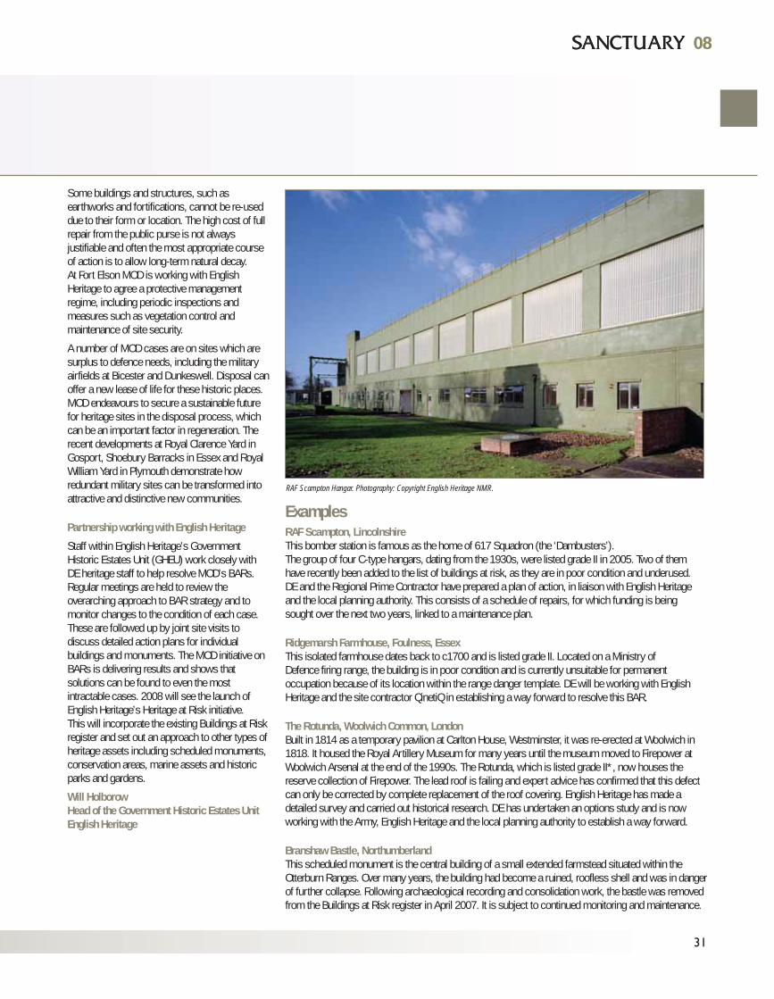
ExamplesRAF Scampton, LincolnshireThis bomber station is famous as the home of 617 Squadron (the ‘Dambusters’).The group of four C-type hangars, dating from the 1930s, were listed grade II in 2005. Two of themhave recently been added to the list of buildings at risk, as they are in poor condition and underused.DE and the Regional Prime Contractor have prepared a plan of action, in liaison with English Heritageand the local planning authority. This consists of a schedule of repairs, for which funding is beingsought over the next two years, linked to a maintenance plan.
Ridgemarsh Farmhouse, Foulness, EssexThis isolated farmhouse dates back to c1700 and is listed grade II. Located on a Ministry ofDefence firing range, the building is in poor condition and is currently unsuitable for permanentoccupation because of its location within the range danger template. DE will be working with EnglishHeritage and the site contractor QinetiQ in establishing a way forward to resolve this BAR.
The Rotunda, Woolwich Common, LondonBuilt in 1814 as a temporary pavilion at Carlton House, Westminster, it was re-erected at Woolwich in1818. It housed the Royal Artillery Museum for many years until the museum moved to Firepower atWoolwich Arsenal at the end of the 1990s. The Rotunda, which is listed grade II*, now houses thereserve collection of Firepower. The lead roof is failing and expert advice has confirmed that this defectcan only be corrected by complete replacement of the roof covering. English Heritage has made adetailed survey and carried out historical research. DE has undertaken an options study and is nowworking with the Army, English Heritage and the local planning authority to establish a way forward.
Branshaw Bastle, NorthumberlandThis scheduled monument is the central building of a small extended farmstead situated within theOtterburn Ranges. Over many years, the building had become a ruined, roofless shell and was in dangerof further collapse. Following archaeological recording and consolidation work, the bastle was removedfrom the Buildings at Risk register in April 2007. It is subject to continued monitoring and maintenance.
Some buildings and structures, such asearthworks and fortifications, cannot be re-useddue to their form or location. The high cost of fullrepair from the public purse is not alwaysjustifiable and often the most appropriate courseof action is to allow long-term natural decay.At Fort Elson MOD is working with EnglishHeritage to agree a protective managementregime, including periodic inspections andmeasures such as vegetation control andmaintenance of site security.
A number of MOD cases are on sites which aresurplus to defence needs, including the militaryairfields at Bicester and Dunkeswell. Disposal canoffer a new lease of life for these historic places.MOD endeavours to secure a sustainable futurefor heritage sites in the disposal process, whichcan be an important factor in regeneration. Therecent developments at Royal Clarence Yard inGosport, Shoebury Barracks in Essex and RoyalWilliam Yard in Plymouth demonstrate howredundant military sites can be transformed intoattractive and distinctive new communities.
Partnership working with English Heritage
Staff within English Heritage’s GovernmentHistoric Estates Unit (GHEU) work closely withDE heritage staff to help resolve MOD’s BARs.Regular meetings are held to review theoverarching approach to BAR strategy and tomonitor changes to the condition of each case.These are followed up by joint site visits todiscuss detailed action plans for individualbuildings and monuments. The MOD initiative onBARs is delivering results and shows thatsolutions can be found to even the mostintractable cases. 2008 will see the launch ofEnglish Heritage’s Heritage at Risk initiative. This will incorporate the existing Buildings at Riskregister and set out an approach to other types ofheritage assets including scheduled monuments,conservation areas, marine assets and historicparks and gardens.
Will HolborowHead of the Government Historic Estates UnitEnglish Heritage
08
31
08
RAF Scampton Hangar. Photography: Copyright English Heritage NMR.
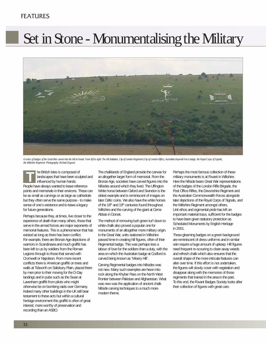
32
FEATURES
Set in Stone - Monumentalising the Military
he British Isles is composed oflandscapes that have been sculpted andinfluenced by human hands.
People have always wanted to leave referencepoints and memorials in their environs. These canbe as small as carvings or as large as cathedralsbut they often serve the same purpose - to makesense of one’s existence and to leave a legacyfor future generations.
Perhaps because they, at times, live closer to theexperience of death than many others, those thatserve in the armed forces are major exponents ofmemorial features. This is a phenomenon that hasexisted as long as there has been conflict.For example, there are Bronze Age depictions ofwarriors in Scandinavia and much graffiti hasbeen left to us by soldiers from the RomanLegions through to those that served withCromwell or Napoleon. From more recentconflicts there is American graffiti on trees andwalls at Tidworth on Salisbury Plain, placed thereby men prior to their moving for the D-Daylandings and in pubs such as the Swan atLavenham graffiti from pilots who mightotherwise be on bombing raids over Germany.Indeed many other buildings in the UK still beartestament to these acts but within a culturalheritage environment this graffiti is often of greatinterest; more worthy of preservation andrecording than an ASBO.
The chalklands of England provide the canvas foran altogether larger form of memorial. From theBronze Age, societies have carved figures into thehillsides around which they lived. The UffingtonWhite horse between Oxford and Swindon is theoldest example and is reminiscent of images onlater Celtic coins. We also have the white horsesof the 18th and 19th centuries found throughoutWiltshire and the carving of the giant at CerneAbbas in Dorset.
The method of removing lush green turf down towhite chalk also proved a popular one formonuments of an altogether more military origin.In the Great War, units stationed in Wiltshirepassed time in creating hill figures, often of theirRegimental badge. This was perhaps less alabour of love for the soldiers than a duty, with thearea on which the Australian badge at Codford iscarved being known as ‘Misery Hill’.
Carving Regimental badges into hillsides wasnot new. Many such examples are hewn intorock along the Khyber Pass on the North WestFrontier between Pakistan and Afghanistan. Whatwas new was the application of ancient chalkhillside carving techniques to a much moremodern theme.
Perhaps the most famous collection of thesemilitary monuments is at Fovant in Wiltshire.Here the hillside bears Great War representationsof the badges of the London Rifle Brigade, thePost Office Rifles, the Devonshire Regiment andthe Australian Commonwealth Forces alongsidelater depictions of the Royal Corps of Signals, andthe Wiltshire Regiment amongst others.Unit ethos and regimental pride has left animportant material trace, sufficient for the badgesto have been given statutory protection asScheduled Monuments by English Heritagein 2001.
These gleaming badges on a green backgroundare reminiscent of dress uniforms and in similarvein require a huge amount of upkeep. Hill figuresneed frequent re-scouring to clean away weedsand refresh chalk which also ensures that theoverall shape of the more intricate features canalter over time. If this effort is not undertaken,the figures will slowly cover with vegetation anddisappear along with the memories of thoseregiments that trained in the area in the past.To this end, the Fovant Badges Society looks aftertheir collection of figures with great care.
A series of badges of the Great War carved into the hill at Fovant. From left to right: The 6th Battalion, City of London Regiment (City of London Rifles), Australian Imperial Force badge, the Royal Corps of Signals,the Wiltshire Regiment. Photography: Richard Osgood.
T
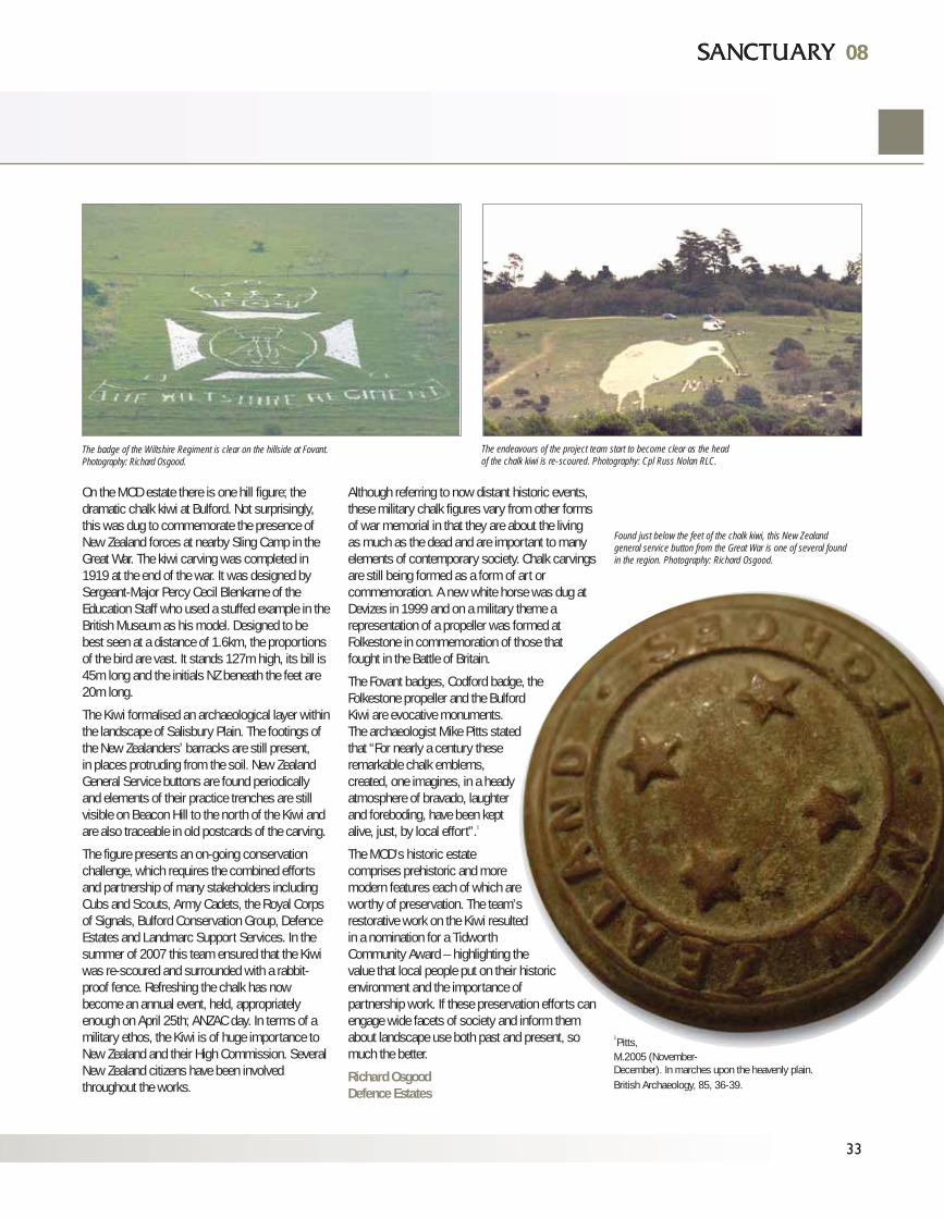
On the MOD estate there is one hill figure; thedramatic chalk kiwi at Bulford. Not surprisingly,this was dug to commemorate the presence ofNew Zealand forces at nearby Sling Camp in theGreat War. The kiwi carving was completed in1919 at the end of the war. It was designed bySergeant-Major Percy Cecil Blenkarne of theEducation Staff who used a stuffed example in theBritish Museum as his model. Designed to bebest seen at a distance of 1.6km, the proportionsof the bird are vast. It stands 127m high, its bill is45m long and the initials NZ beneath the feet are20m long.
The Kiwi formalised an archaeological layer withinthe landscape of Salisbury Plain. The footings ofthe New Zealanders’ barracks are still present, in places protruding from the soil. New ZealandGeneral Service buttons are found periodicallyand elements of their practice trenches are stillvisible on Beacon Hill to the north of the Kiwi andare also traceable in old postcards of the carving.
The figure presents an on-going conservationchallenge, which requires the combined effortsand partnership of many stakeholders includingCubs and Scouts, Army Cadets, the Royal Corpsof Signals, Bulford Conservation Group, DefenceEstates and Landmarc Support Services. In thesummer of 2007 this team ensured that the Kiwiwas re-scoured and surrounded with a rabbit-proof fence. Refreshing the chalk has nowbecome an annual event, held, appropriatelyenough on April 25th; ANZAC day. In terms of amilitary ethos, the Kiwi is of huge importance toNew Zealand and their High Commission. SeveralNew Zealand citizens have been involvedthroughout the works.
Although referring to now distant historic events,these military chalk figures vary from other formsof war memorial in that they are about the livingas much as the dead and are important to manyelements of contemporary society. Chalk carvingsare still being formed as a form of art orcommemoration. A new white horse was dug atDevizes in 1999 and on a military theme arepresentation of a propeller was formed atFolkestone in commemoration of those thatfought in the Battle of Britain.
The Fovant badges, Codford badge, theFolkestone propeller and the BulfordKiwi are evocative monuments.The archaeologist Mike Pitts statedthat “For nearly a century theseremarkable chalk emblems,created, one imagines, in a headyatmosphere of bravado, laughterand foreboding, have been keptalive, just, by local effort”.1
The MOD’s historic estatecomprises prehistoric and moremodern features each of which areworthy of preservation. The team’srestorative work on the Kiwi resultedin a nomination for a TidworthCommunity Award – highlighting thevalue that local people put on their historicenvironment and the importance ofpartnership work. If these preservation efforts canengage wide facets of society and inform themabout landscape use both past and present, somuch the better.
Richard OsgoodDefence Estates
1 Pitts,
M.2005 (November-December). In marches upon the heavenly plain.British Archaeology, 85, 36-39.
08
33
08
The badge of the Wiltshire Regiment is clear on the hillside at Fovant.Photography: Richard Osgood.
Found just below the feet of the chalk kiwi, this New Zealandgeneral service button from the Great War is one of several foundin the region. Photography: Richard Osgood.
The endeavours of the project team start to become clear as the headof the chalk kiwi is re-scoured. Photography: Cpl Russ Nolan RLC.
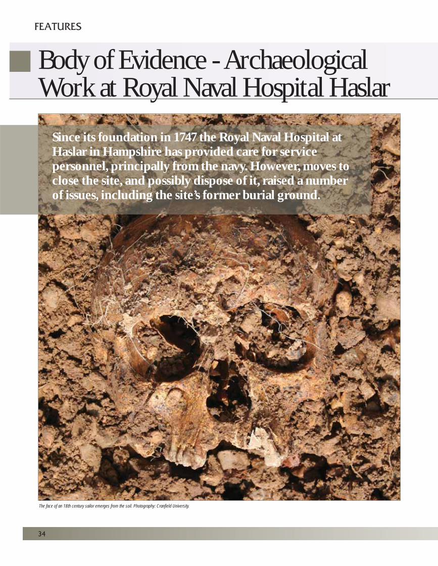
34
FEATURES
Since its foundation in 1747 the Royal Naval Hospital atHaslar in Hampshire has provided care for servicepersonnel, principally from the navy. However, moves toclose the site, and possibly dispose of it, raised a numberof issues, including the site’s former burial ground.
Body of Evidence - Archaeological Work at Royal Naval Hospital Haslar
The face of an 18th century sailor emerges from the soil. Photography: Cranfield University.
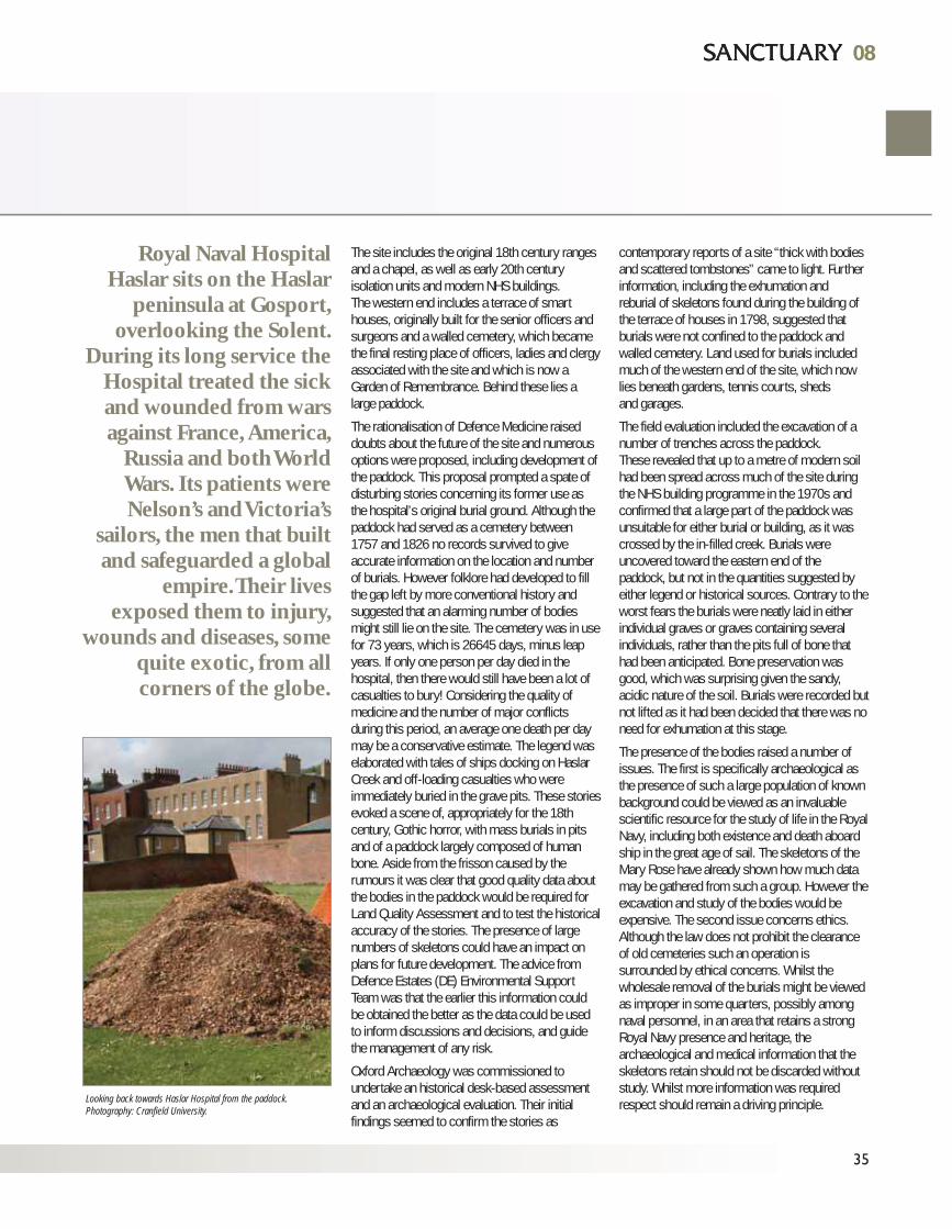
The site includes the original 18th century rangesand a chapel, as well as early 20th centuryisolation units and modern NHS buildings. The western end includes a terrace of smarthouses, originally built for the senior officers andsurgeons and a walled cemetery, which becamethe final resting place of officers, ladies and clergyassociated with the site and which is now aGarden of Remembrance. Behind these lies alarge paddock.
The rationalisation of Defence Medicine raiseddoubts about the future of the site and numerousoptions were proposed, including development ofthe paddock. This proposal prompted a spate ofdisturbing stories concerning its former use asthe hospital’s original burial ground. Although thepaddock had served as a cemetery between1757 and 1826 no records survived to giveaccurate information on the location and numberof burials. However folklore had developed to fillthe gap left by more conventional history andsuggested that an alarming number of bodiesmight still lie on the site. The cemetery was in usefor 73 years, which is 26645 days, minus leapyears. If only one person per day died in thehospital, then there would still have been a lot ofcasualties to bury! Considering the quality ofmedicine and the number of major conflictsduring this period, an average one death per daymay be a conservative estimate. The legend waselaborated with tales of ships docking on HaslarCreek and off-loading casualties who wereimmediately buried in the grave pits. These storiesevoked a scene of, appropriately for the 18thcentury, Gothic horror, with mass burials in pitsand of a paddock largely composed of humanbone. Aside from the frisson caused by therumours it was clear that good quality data aboutthe bodies in the paddock would be required forLand Quality Assessment and to test the historicalaccuracy of the stories. The presence of largenumbers of skeletons could have an impact onplans for future development. The advice fromDefence Estates (DE) Environmental SupportTeam was that the earlier this information couldbe obtained the better as the data could be usedto inform discussions and decisions, and guidethe management of any risk.
Oxford Archaeology was commissioned toundertake an historical desk-based assessmentand an archaeological evaluation. Their initialfindings seemed to confirm the stories as
contemporary reports of a site “thick with bodiesand scattered tombstones” came to light. Furtherinformation, including the exhumation and reburial of skeletons found during the building ofthe terrace of houses in 1798, suggested thatburials were not confined to the paddock andwalled cemetery. Land used for burials includedmuch of the western end of the site, which nowlies beneath gardens, tennis courts, sheds and garages.
The field evaluation included the excavation of anumber of trenches across the paddock. These revealed that up to a metre of modern soilhad been spread across much of the site duringthe NHS building programme in the 1970s andconfirmed that a large part of the paddock wasunsuitable for either burial or building, as it wascrossed by the in-filled creek. Burials wereuncovered toward the eastern end of thepaddock, but not in the quantities suggested byeither legend or historical sources. Contrary to theworst fears the burials were neatly laid in eitherindividual graves or graves containing severalindividuals, rather than the pits full of bone thathad been anticipated. Bone preservation wasgood, which was surprising given the sandy,acidic nature of the soil. Burials were recorded butnot lifted as it had been decided that there was noneed for exhumation at this stage.
The presence of the bodies raised a number ofissues. The first is specifically archaeological asthe presence of such a large population of knownbackground could be viewed as an invaluablescientific resource for the study of life in the RoyalNavy, including both existence and death aboardship in the great age of sail. The skeletons of theMary Rose have already shown how much datamay be gathered from such a group. However theexcavation and study of the bodies would beexpensive. The second issue concerns ethics.Although the law does not prohibit the clearanceof old cemeteries such an operation issurrounded by ethical concerns. Whilst thewholesale removal of the burials might be viewedas improper in some quarters, possibly amongnaval personnel, in an area that retains a strongRoyal Navy presence and heritage, thearchaeological and medical information that theskeletons retain should not be discarded withoutstudy. Whilst more information was requiredrespect should remain a driving principle.
08
35
08
Royal Naval HospitalHaslar sits on the Haslar
peninsula at Gosport,overlooking the Solent.
During its long service theHospital treated the sickand wounded from warsagainst France, America,
Russia and both WorldWars. Its patients wereNelson’s and Victoria’s
sailors, the men that builtand safeguarded a global
empire. Their livesexposed them to injury,
wounds and diseases, somequite exotic, from allcorners of the globe.
Looking back towards Haslar Hospital from the paddock.Photography: Cranfield University.
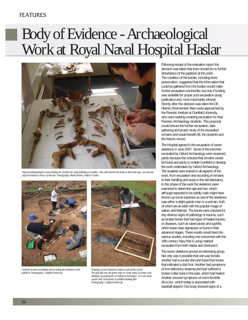
36
Students at work excavating and recording the skeletons in thepaddock. Photography: Cranfield University.
Drawings of each burial are made as part of the record.The grid laid over the grave helps to create rapid, accurate scaledrawings by guiding the recording archaeologist - it is one metresquare and corresponds to gridded drawing film.Photography: Cranfield University.
Physical anthropologists reassembling the skeleton for study following excavation. They will examine the body to determine age, sex and anyphysical trauma or traces of disease. Photography: Martin Brown, Defence Estates.
Fo Following receipt of the evaluation report thedecision was taken that there should be no furtherdisturbance of the paddock at this point.The condition of the burials, including bonepreservation, suggested that the information thatcould be gathered from the bodies would makefurther excavation worthwhile, but only if fundingwas available for proper post-excavation study,publication and, most importantly reburial.Shortly after this decision was taken the DEHistoric Environment Team were approached bythe Forensic Institute at Cranfield University, who were seeking a training excavation for theirForensic Archaeology students. This proposalwould ensure the further excavation, datagathering and proper study of the excavatedremains and would benefit DE, the students andthe historic record.
The Hospital agreed to the excavation of sevenskeletons in June 2007. Some of the trenchesexcavated by Oxford Archaeology were reopened,partly because this ensured that remains wouldbe found and partly to enable Cranfield to developthe work undertaken by Oxford Archaeology. The students were trained in all aspects of thework, from excavation and recording of remainsto their handling and study in the site laboratory.In this phase of the work the skeletons wereexamined to determine age and sex, whichalthough expected to be solidly male might havethrown up some surprises as one of the skeletonswas either a slight gracile man or a woman, bothof which are at odds with the popular image ofsailors and Marines. The bones were checked forany obvious signs of pathology or trauma, suchas broken bones that had signs of healed injuries, or diseases, such as tuberculosis and syphilis,which leave clear signatures on bone in theiradvanced stages. These results would feed intovarious studies, including one concerned with the18th century Navy that is using materialexcavated from both Haslar and Greenwich.
The seven skeletons proved an interesting group.Not only was it possible that one was female,another had a curved shin and fused foot bonesthat indicated a club foot. Another had symptomsof iron deficiency anaemia and had suffered abroken collar bone in the past, which had healed.Another showed symptoms of osteochondritisdissecans, which today is associated withbaseball players! One body showed signs of a
FEATURES
Body of Evidence - Archaeological Work at Royal Naval Hospital Haslar
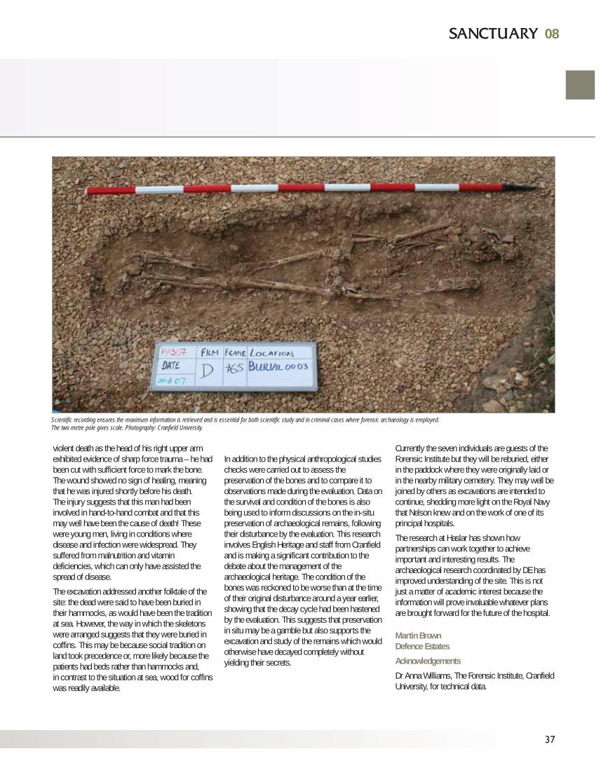
37
violent death as the head of his right upper armexhibited evidence of sharp force trauma – he hadbeen cut with sufficient force to mark the bone.The wound showed no sign of healing, meaningthat he was injured shortly before his death. The injury suggests that this man had beeninvolved in hand-to-hand combat and that thismay well have been the cause of death! Thesewere young men, living in conditions wheredisease and infection were widespread. Theysuffered from malnutrition and vitamindeficiencies, which can only have assisted thespread of disease.
The excavation addressed another folktale of thesite: the dead were said to have been buried intheir hammocks, as would have been the traditionat sea. However, the way in which the skeletonswere arranged suggests that they were buried incoffins. This may be because social tradition onland took precedence or, more likely because thepatients had beds rather than hammocks and, in contrast to the situation at sea, wood for coffinswas readily available.
In addition to the physical anthropological studieschecks were carried out to assess thepreservation of the bones and to compare it toobservations made during the evaluation. Data onthe survival and condition of the bones is alsobeing used to inform discussions on the in-situpreservation of archaeological remains, followingtheir disturbance by the evaluation. This researchinvolves English Heritage and staff from Cranfieldand is making a significant contribution to thedebate about the management of thearchaeological heritage. The condition of thebones was reckoned to be worse than at the timeof their original disturbance around a year earlier,showing that the decay cycle had been hastenedby the evaluation. This suggests that preservationin situ may be a gamble but also supports theexcavation and study of the remains which wouldotherwise have decayed completely withoutyielding their secrets.
Currently the seven individuals are guests of theForensic Institute but they will be reburied, eitherin the paddock where they were originally laid orin the nearby military cemetery. They may well bejoined by others as excavations are intended tocontinue, shedding more light on the Royal Navythat Nelson knew and on the work of one of itsprincipal hospitals.
The research at Haslar has shown howpartnerships can work together to achieveimportant and interesting results. Thearchaeological research coordinated by DE hasimproved understanding of the site. This is notjust a matter of academic interest because theinformation will prove invaluable whatever plansare brought forward for the future of the hospital.
Martin BrownDefence Estates
Acknowledgements
Dr Anna Williams, The Forensic Institute, CranfieldUniversity, for technical data.
Scientific recording ensures the maximum information is retrieved and is essential for both scientific study and in criminal cases where forensic archaeology is employed.The two metre pole gives scale. Photography: Cranfield University.
0808
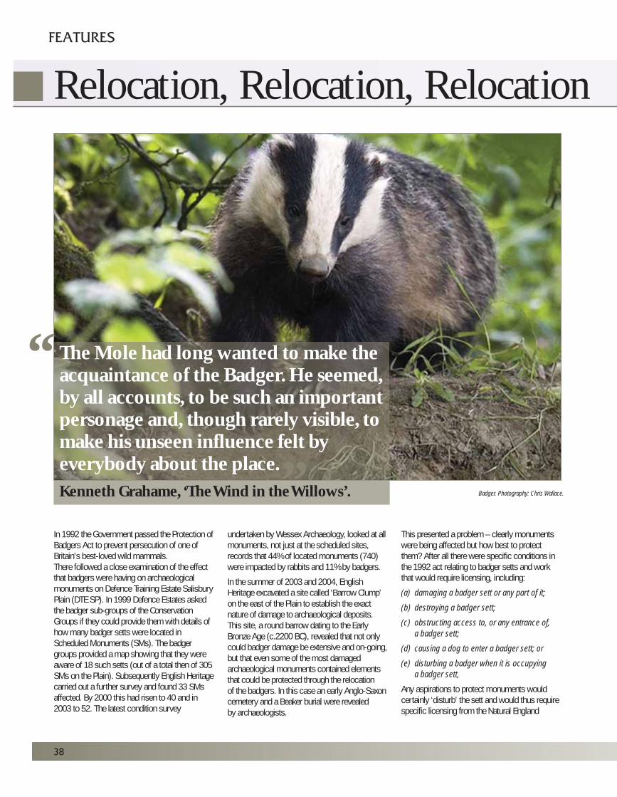
In 1992 the Government passed the Protection ofBadgers Act to prevent persecution of one ofBritain’s best-loved wild mammals. There followed a close examination of the effectthat badgers were having on archaeologicalmonuments on Defence Training Estate SalisburyPlain (DTE SP). In 1999 Defence Estates askedthe badger sub-groups of the ConservationGroups if they could provide them with details ofhow many badger setts were located inScheduled Monuments (SMs). The badgergroups provided a map showing that they wereaware of 18 such setts (out of a total then of 305SMs on the Plain). Subsequently English Heritagecarried out a further survey and found 33 SMsaffected. By 2000 this had risen to 40 and in2003 to 52. The latest condition survey
undertaken by Wessex Archaeology, looked at allmonuments, not just at the scheduled sites,records that 44% of located monuments (740)were impacted by rabbits and 11% by badgers.
In the summer of 2003 and 2004, EnglishHeritage excavated a site called ‘Barrow Clump’on the east of the Plain to establish the exactnature of damage to archaeological deposits. This site, a round barrow dating to the EarlyBronze Age (c.2200 BC), revealed that not onlycould badger damage be extensive and on-going,but that even some of the most damagedarchaeological monuments contained elementsthat could be protected through the relocation of the badgers. In this case an early Anglo-Saxoncemetery and a Beaker burial were revealed by archaeologists.
This presented a problem – clearly monumentswere being affected but how best to protectthem? After all there were specific conditions inthe 1992 act relating to badger setts and workthat would require licensing, including:
(a) damaging a badger sett or any part of it;
(b) destroying a badger sett;
(c) obstructing access to, or any entrance of,
a badger sett;
(d) causing a dog to enter a badger sett; or
(e) disturbing a badger when it is occupying
a badger sett,
Any aspirations to protect monuments wouldcertainly ‘disturb’ the sett and would thus requirespecific licensing from the Natural England
38
FEATURES
Relocation, Relocation, Relocation
The Mole had long wanted to make theacquaintance of the Badger. He seemed,by all accounts, to be such an importantpersonage and, though rarely visible, tomake his unseen influence felt byeverybody about the place.Kenneth Grahame, ‘The Wind in the Willows’.
““
Badger. Photography: Chris Wallace.
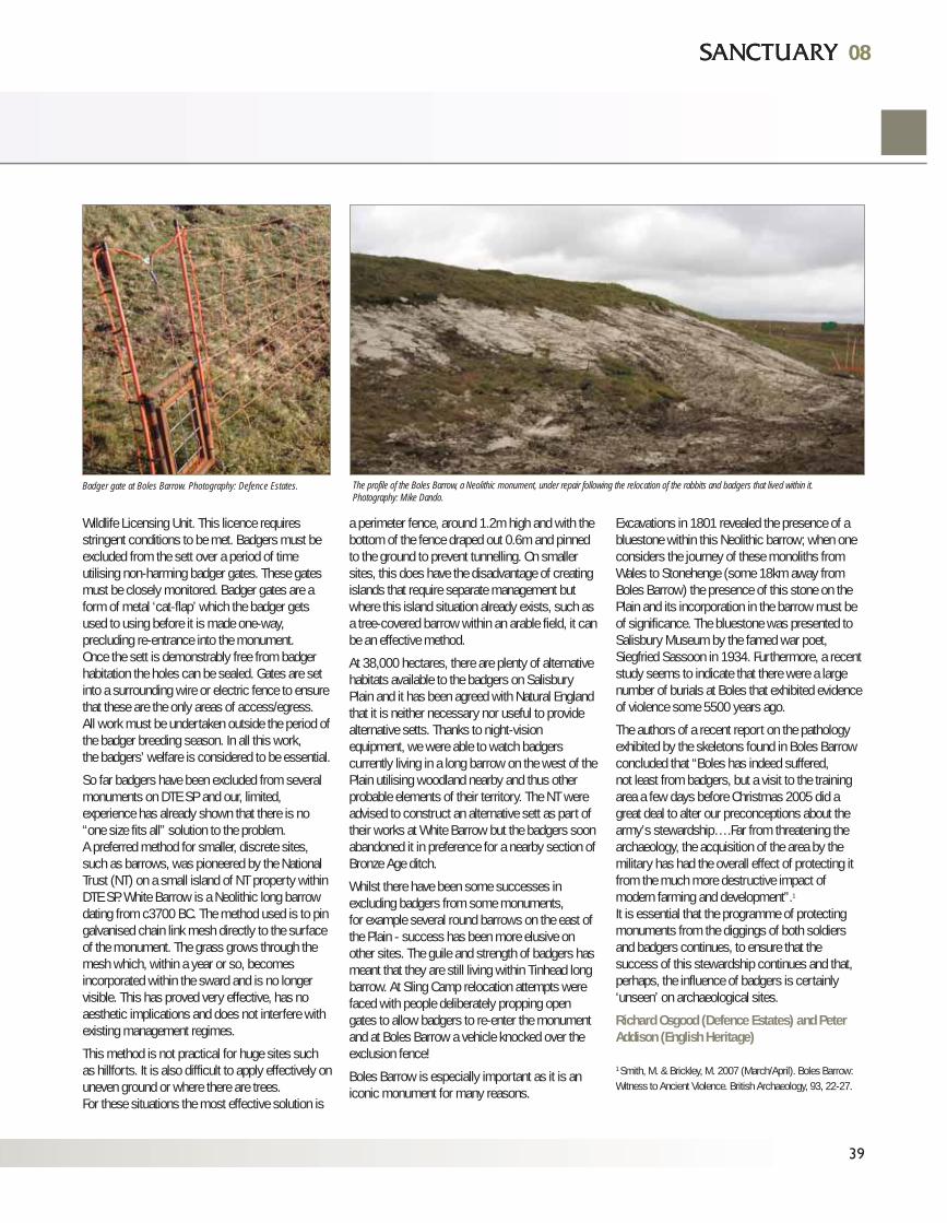
Wildlife Licensing Unit. This licence requiresstringent conditions to be met. Badgers must beexcluded from the sett over a period of timeutilising non-harming badger gates. These gatesmust be closely monitored. Badger gates are aform of metal ‘cat-flap’ which the badger getsused to using before it is made one-way,precluding re-entrance into the monument. Once the sett is demonstrably free from badgerhabitation the holes can be sealed. Gates are setinto a surrounding wire or electric fence to ensurethat these are the only areas of access/egress.All work must be undertaken outside the period ofthe badger breeding season. In all this work,the badgers’ welfare is considered to be essential.
So far badgers have been excluded from severalmonuments on DTE SP and our, limited,experience has already shown that there is no“one size fits all” solution to the problem. A preferred method for smaller, discrete sites,such as barrows, was pioneered by the NationalTrust (NT) on a small island of NT property withinDTE SP. White Barrow is a Neolithic long barrowdating from c3700 BC. The method used is to pingalvanised chain link mesh directly to the surfaceof the monument. The grass grows through themesh which, within a year or so, becomesincorporated within the sward and is no longervisible. This has proved very effective, has noaesthetic implications and does not interfere withexisting management regimes.
This method is not practical for huge sites suchas hillforts. It is also difficult to apply effectively onuneven ground or where there are trees.For these situations the most effective solution is
a perimeter fence, around 1.2m high and with thebottom of the fence draped out 0.6m and pinnedto the ground to prevent tunnelling. On smallersites, this does have the disadvantage of creatingislands that require separate management butwhere this island situation already exists, such asa tree-covered barrow within an arable field, it canbe an effective method.
At 38,000 hectares, there are plenty of alternativehabitats available to the badgers on SalisburyPlain and it has been agreed with Natural Englandthat it is neither necessary nor useful to providealternative setts. Thanks to night-visionequipment, we were able to watch badgerscurrently living in a long barrow on the west of thePlain utilising woodland nearby and thus otherprobable elements of their territory. The NT wereadvised to construct an alternative sett as part oftheir works at White Barrow but the badgers soonabandoned it in preference for a nearby section ofBronze Age ditch.
Whilst there have been some successes inexcluding badgers from some monuments, for example several round barrows on the east ofthe Plain - success has been more elusive onother sites. The guile and strength of badgers hasmeant that they are still living within Tinhead longbarrow. At Sling Camp relocation attempts werefaced with people deliberately propping opengates to allow badgers to re-enter the monumentand at Boles Barrow a vehicle knocked over theexclusion fence!
Boles Barrow is especially important as it is aniconic monument for many reasons.
Excavations in 1801 revealed the presence of abluestone within this Neolithic barrow; when oneconsiders the journey of these monoliths fromWales to Stonehenge (some 18km away fromBoles Barrow) the presence of this stone on thePlain and its incorporation in the barrow must beof significance. The bluestone was presented toSalisbury Museum by the famed war poet,Siegfried Sassoon in 1934. Furthermore, a recentstudy seems to indicate that there were a largenumber of burials at Boles that exhibited evidenceof violence some 5500 years ago.
The authors of a recent report on the pathologyexhibited by the skeletons found in Boles Barrowconcluded that “Boles has indeed suffered, not least from badgers, but a visit to the trainingarea a few days before Christmas 2005 did agreat deal to alter our preconceptions about thearmy’s stewardship….Far from threatening thearchaeology, the acquisition of the area by themilitary has had the overall effect of protecting itfrom the much more destructive impact ofmodern farming and development”.1
It is essential that the programme of protectingmonuments from the diggings of both soldiersand badgers continues, to ensure that thesuccess of this stewardship continues and that,perhaps, the influence of badgers is certainly‘unseen’ on archaeological sites.
Richard Osgood (Defence Estates) and PeterAddison (English Heritage)
1 Smith, M. & Brickley, M. 2007 (March/April). Boles Barrow:Witness to Ancient Violence. British Archaeology, 93, 22-27.
08
39
08
Badger gate at Boles Barrow. Photography: Defence Estates. The profile of the Boles Barrow, a Neolithic monument, under repair following the relocation of the rabbits and badgers that lived within it.Photography: Mike Dando.
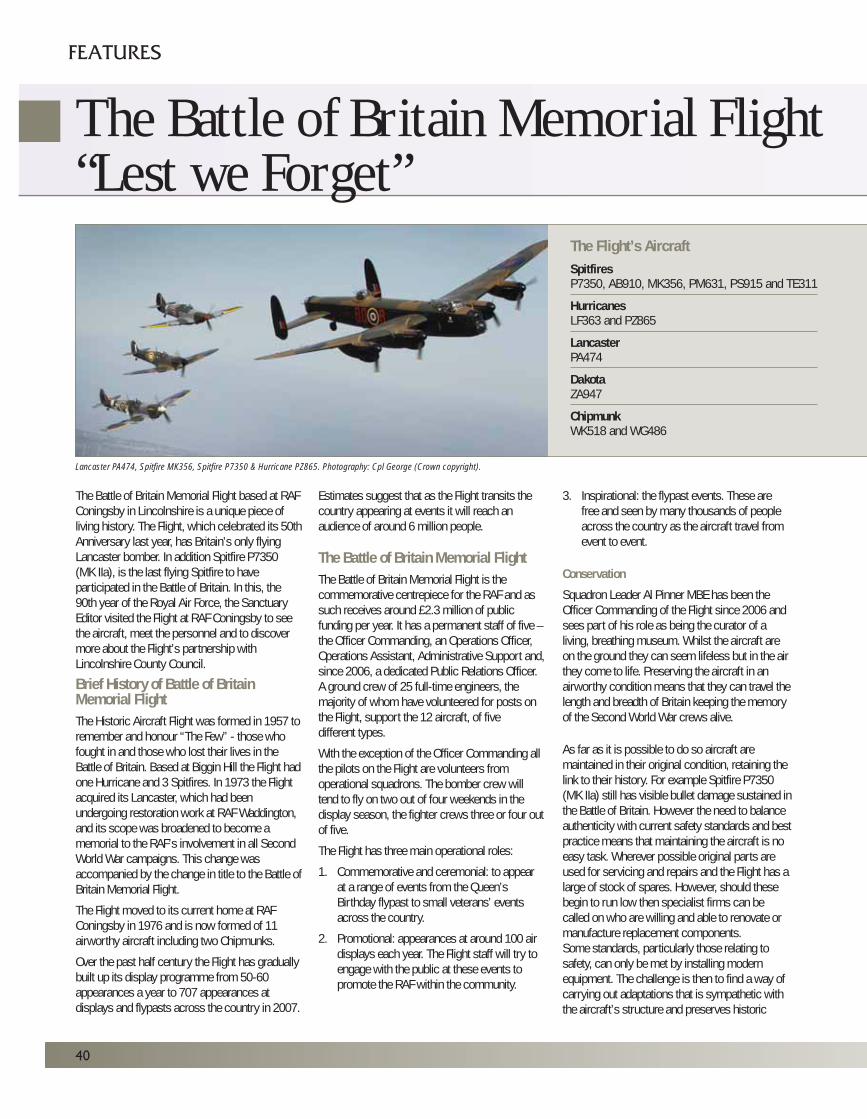
The Battle of Britain Memorial Flight based at RAFConingsby in Lincolnshire is a unique piece ofliving history. The Flight, which celebrated its 50thAnniversary last year, has Britain’s only flyingLancaster bomber. In addition Spitfire P7350(MK IIa), is the last flying Spitfire to haveparticipated in the Battle of Britain. In this, the90th year of the Royal Air Force, the SanctuaryEditor visited the Flight at RAF Coningsby to seethe aircraft, meet the personnel and to discovermore about the Flight’s partnership withLincolnshire County Council.
Brief History of Battle of BritainMemorial FlightThe Historic Aircraft Flight was formed in 1957 toremember and honour “The Few” - those whofought in and those who lost their lives in theBattle of Britain. Based at Biggin Hill the Flight hadone Hurricane and 3 Spitfires. In 1973 the Flightacquired its Lancaster, which had beenundergoing restoration work at RAF Waddington,and its scope was broadened to become amemorial to the RAF’s involvement in all SecondWorld War campaigns. This change wasaccompanied by the change in title to the Battle ofBritain Memorial Flight.
The Flight moved to its current home at RAFConingsby in 1976 and is now formed of 11airworthy aircraft including two Chipmunks.
Over the past half century the Flight has graduallybuilt up its display programme from 50-60appearances a year to 707 appearances atdisplays and flypasts across the country in 2007.
Estimates suggest that as the Flight transits thecountry appearing at events it will reach anaudience of around 6 million people.
The Battle of Britain Memorial FlightThe Battle of Britain Memorial Flight is thecommemorative centrepiece for the RAF and assuch receives around £2.3 million of publicfunding per year. It has a permanent staff of five –the Officer Commanding, an Operations Officer,Operations Assistant, Administrative Support and,since 2006, a dedicated Public Relations Officer.A ground crew of 25 full-time engineers, themajority of whom have volunteered for posts onthe Flight, support the 12 aircraft, of fivedifferent types.
With the exception of the Officer Commanding allthe pilots on the Flight are volunteers fromoperational squadrons. The bomber crew willtend to fly on two out of four weekends in thedisplay season, the fighter crews three or four outof five.
The Flight has three main operational roles:
1. Commemorative and ceremonial: to appear at a range of events from the Queen’s Birthday flypast to small veterans’ events across the country.
2. Promotional: appearances at around 100 air displays each year. The Flight staff will try to engage with the public at these events to promote the RAF within the community.
3. Inspirational: the flypast events. These are free and seen by many thousands of people across the country as the aircraft travel from event to event.
Conservation
Squadron Leader Al Pinner MBE has been theOfficer Commanding of the Flight since 2006 andsees part of his role as being the curator of aliving, breathing museum. Whilst the aircraft areon the ground they can seem lifeless but in the airthey come to life. Preserving the aircraft in anairworthy condition means that they can travel thelength and breadth of Britain keeping the memoryof the Second World War crews alive.
As far as it is possible to do so aircraft aremaintained in their original condition, retaining thelink to their history. For example Spitfire P7350(MK IIa) still has visible bullet damage sustained inthe Battle of Britain. However the need to balanceauthenticity with current safety standards and bestpractice means that maintaining the aircraft is noeasy task. Wherever possible original parts areused for servicing and repairs and the Flight has alarge of stock of spares. However, should thesebegin to run low then specialist firms can becalled on who are willing and able to renovate ormanufacture replacement components. Some standards, particularly those relating tosafety, can only be met by installing modernequipment. The challenge is then to find a way ofcarrying out adaptations that is sympathetic withthe aircraft’s structure and preserves historic
40
FEATURES
The Battle of Britain Memorial Flight“Lest we Forget”
Lancaster PA474, Spitfire MK356, Spitfire P7350 & Hurricane PZ865. Photography: Cpl George (Crown copyright).
The Flight’s AircraftSpitfiresP7350, AB910, MK356, PM631, PS915 and TE311
HurricanesLF363 and PZ865
LancasterPA474
DakotaZA947
ChipmunkWK518 and WG486
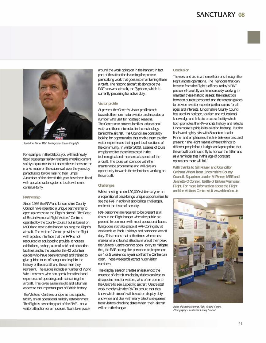
features.
For example, in the Dakota you will find newlyfitted passenger safety restraints meeting currentsafety requirements but above these there are themarks made on the cabin wall over the years byparachutists before making their jumps.A number of the aircraft this year have been fittedwith updated radar systems to allow them tocontinue to fly.
Partnership
Since 1986 the RAF and Lincolnshire CountyCouncil have operated a unique partnership toopen up access to the Flight’s aircraft. The Battleof Britain Memorial Flight Visitors’ Centre isoperated by the County Council but is based onMOD land next to the hangar housing the Flight’saircraft. The Visitors’ Centre provides the Flightwith a public interface that the RAF is notresourced or equipped to provide. It housesexhibitions, a shop, a small café and educationfacilities and is the base for the 40 volunteerguides who have been recruited and trained togive guided tours of hangar and explain thehistory of the aircraft and the airmen theyrepresent. The guides include a number of WorldWar II veterans who can speak from first handexperience of operating and maintaining theaircraft. This gives a rare insight and a humanaspect to this important part of British history.
The Visitors’ Centre is unique as it is a publicfacility on an operational military establishment.The Flight is a working part of the RAF – not avisitor attraction or a museum. Tours take place
around the work going on in the hangar; in factpart of the attraction is seeing the precise,painstaking work that goes into maintaining theseaircraft. The historic aircraft sit alongside theRAF’s newest aircraft, the Typhoon, which iscurrently preparing for active duty.
Visitor profile
At present the Centre’s visitor profile tendstowards the more mature visitor and includes anumber who visit for nostalgic reasons. The Centre also attracts families, educationalvisits and those interested in the technologybehind the aircraft. The Council are constantlylooking for opportunities that enable them to offervisitor experiences that appeal to all sections ofthe community. In winter 2008, a series of toursare planned for those interested in thetechnological and mechanical aspects of theaircraft. The tours will coincide with themaintenance programme and will give anopportunity to watch the technicians working onthe aircraft.
Challenges
Whilst hosting around 20,000 visitors a year onan operational base brings unique opportunities tosee the RAF in action it also brings challenges,not least the issue of security.
RAF personnel are required to be present at alltimes in the Flight hangar when the public arepresent. In common with most operational basesflying does not take place at RAF Coningsby atweekends or Bank Holidays and personnel are offduty. This means that at the times when mostmuseums and tourist attractions are at their peak,the Visitors’ Centre cannot open. To try to mitigatethis, the RAF arrange for personnel to be presenton 4 or 5 weekends a year so that the Centre canopen. These weekends attract huge visitornumbers.
The display season creates an issue too: theabsence of aircraft on display duties can lead todisappointment for visitors, who often come tothe Centre to see a specific aircraft. Centre staffwork closely with the RAF to ensure that theyknow which aircraft will be out on display dutyand when and deal with many telephone queriesfrom visitors checking dates when ‘their’ aircraftwill be in the hangar.
Conclusion
The new and old is a theme that runs through theFlight and its operations. The Typhoons that canbe seen from the Flight’s offices; today’s RAFpersonnel carefully and meticulously working tomaintain these historic assets; the interactionbetween current personnel and the veteran guidesto provide a visitor experience that caters for allages and interests. Lincolnshire County Councilhas used its heritage, tourism and educationalknowledge and links to create a facility whichboth promotes the RAF and its history and reflectsLincolnshire’s pride in its aviation heritage. But thefinal word rightly sits with Squadron LeaderPinner and emphasises this link between past andpresent: “The Flight means different things todifferent people but it is right and appropriate thatthe aircraft continue to fly to honour the fallen andas a reminder that in this age of constantoperations more will fall.”
With thanks to Gill Fraser and CouncillorGraham Wheat from Lincolnshire CountyCouncil. Squadron Leader Al Pinner, MBE andJeanette O’Connell, Battle of Britain MemorialFlight. For more information about the Flightand the Visitors Centre visit www.bbmf.co.uk
41
0808
Sqn Ldr Al Pinner MBE. Photography: Crown Copyright.
Battle of Britain Memorial Flight Visitors’ Centre.Photography: Lincolnshire County Council

42
FEATURES
The Wrecks of Jutland
2nd Battle Squadron in action at Jutland. Photography: Copyright Royal Naval Museum, Portsmouth.
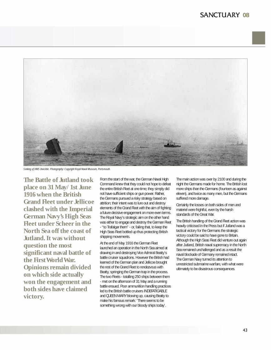
From the start of the war, the German Naval HighCommand knew that they could not hope to defeatthe entire British Fleet at one time; they simply didnot have sufficient ships or gun power. Rather, the Germans pursued a risky strategy based onattrition; their intent was to lure out and destroyelements of the Grand Fleet with the aim of fightinga future decisive engagement on more even terms.The Royal Navy’s strategic aim on the other handwas either to engage and destroy the German Fleet- “to Trafalgar them” - or, failing that, to keep theHigh Seas Fleet bottled up thus protecting Britishshipping movements.
At the end of May 1916 the German Fleetlaunched an operation in the North Sea aimed atdrawing in and destroying Vice Admiral Beatty’sbattle cruiser squadrons. However the British hadlearned of the German plan and Jellicoe broughtthe rest of the Grand Fleet to rendezvous withBeatty, springing the German trap in the process.The two Fleets - totalling 250 ships between them- met on the afternoon of 31 May and a runningbattle ensued. Poor ammunition handling practicesled to the British battle cruisers INDEFATIGABLEand QUEEN MARY blowing up, causing Beatty tomake his famous remark: ‘There seems to besomething wrong with our bloody ships today’.
The main action was over by 2100 and during thenight the Germans made for home. The British lostmore ships than the Germans (fourteen as againsteleven), and twice as many men, but the Germanssuffered more damage.
Certainly the losses on both sides of men andmateriel were frightful, even by the harshstandards of the Great War.
The British handling of the Grand Fleet action washeavily criticised in the Press but if Jutland was atactical victory for the Germans the strategicvictory could be said to have gone to Britain.Although the High Seas Fleet did venture out againafter Jutland, British naval supremacy in the NorthSea remained unchallenged and as a result thenaval blockade of Germany remained intact.The German Navy turned its attention tounrestricted submarine warfare, with what wereultimately to be disastrous consequences.
43
0808
The Battle of Jutland tookplace on 31 May/1st June1916 when the BritishGrand Fleet under Jellicoeclashed with the ImperialGerman Navy’s High SeasFleet under Scheer in theNorth Sea off the coast ofJutland. It was withoutquestion the mostsignificant naval battle ofthe First World War.Opinions remain dividedon which side actuallywon the engagement andboth sides have claimedvictory.
Sinking of HMS Invicible. Photography: Copyright Royal Naval Museum, Portsmouth.
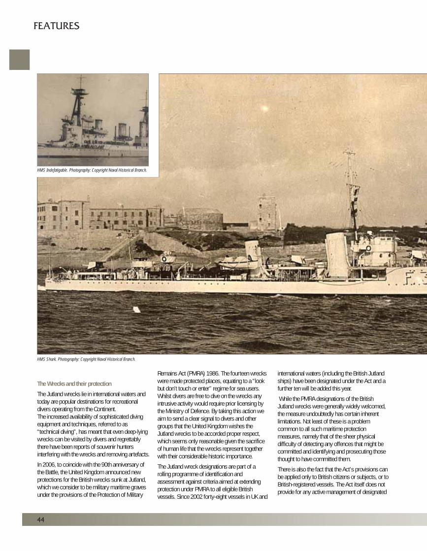
44
FEATURES
The Wrecks and their protection
The Jutland wrecks lie in international waters andtoday are popular destinations for recreationaldivers operating from the Continent.The increased availability of sophisticated divingequipment and techniques, referred to as“technical diving”, has meant that even deep-lyingwrecks can be visited by divers and regrettablythere have been reports of souvenir huntersinterfering with the wrecks and removing artefacts.
In 2006, to coincide with the 90th anniversary ofthe Battle, the United Kingdom announced newprotections for the British wrecks sunk at Jutland,which we consider to be military maritime gravesunder the provisions of the Protection of Military
Remains Act (PMRA) 1986. The fourteen wreckswere made protected places, equating to a “lookbut don’t touch or enter” regime for sea users.Whilst divers are free to dive on the wrecks anyintrusive activity would require prior licensing bythe Ministry of Defence. By taking this action weaim to send a clear signal to divers and othergroups that the United Kingdom wishes theJutland wrecks to be accorded proper respect,which seems only reasonable given the sacrificeof human life that the wrecks represent togetherwith their considerable historic importance.
The Jutland wreck designations are part of arolling programme of identification andassessment against criteria aimed at extendingprotection under PMRA to all eligible Britishvessels. Since 2002 forty-eight vessels in UK and
international waters (including the British Jutlandships) have been designated under the Act and afurther ten will be added this year.
While the PMRA designations of the BritishJutland wrecks were generally widely welcomed,the measure undoubtedly has certain inherentlimitations. Not least of these is a problemcommon to all such maritime protectionmeasures, namely that of the sheer physicaldifficulty of detecting any offences that might becommitted and identifying and prosecuting thosethought to have committed them.
There is also the fact that the Act’s provisions canbe applied only to British citizens or subjects, or toBritish-registered vessels. The Act itself does notprovide for any active management of designated
HMS Shark. Photography: Copyright Naval Historical Branch.
HMS Indefatigable. Photography: Copyright Naval Historical Branch.
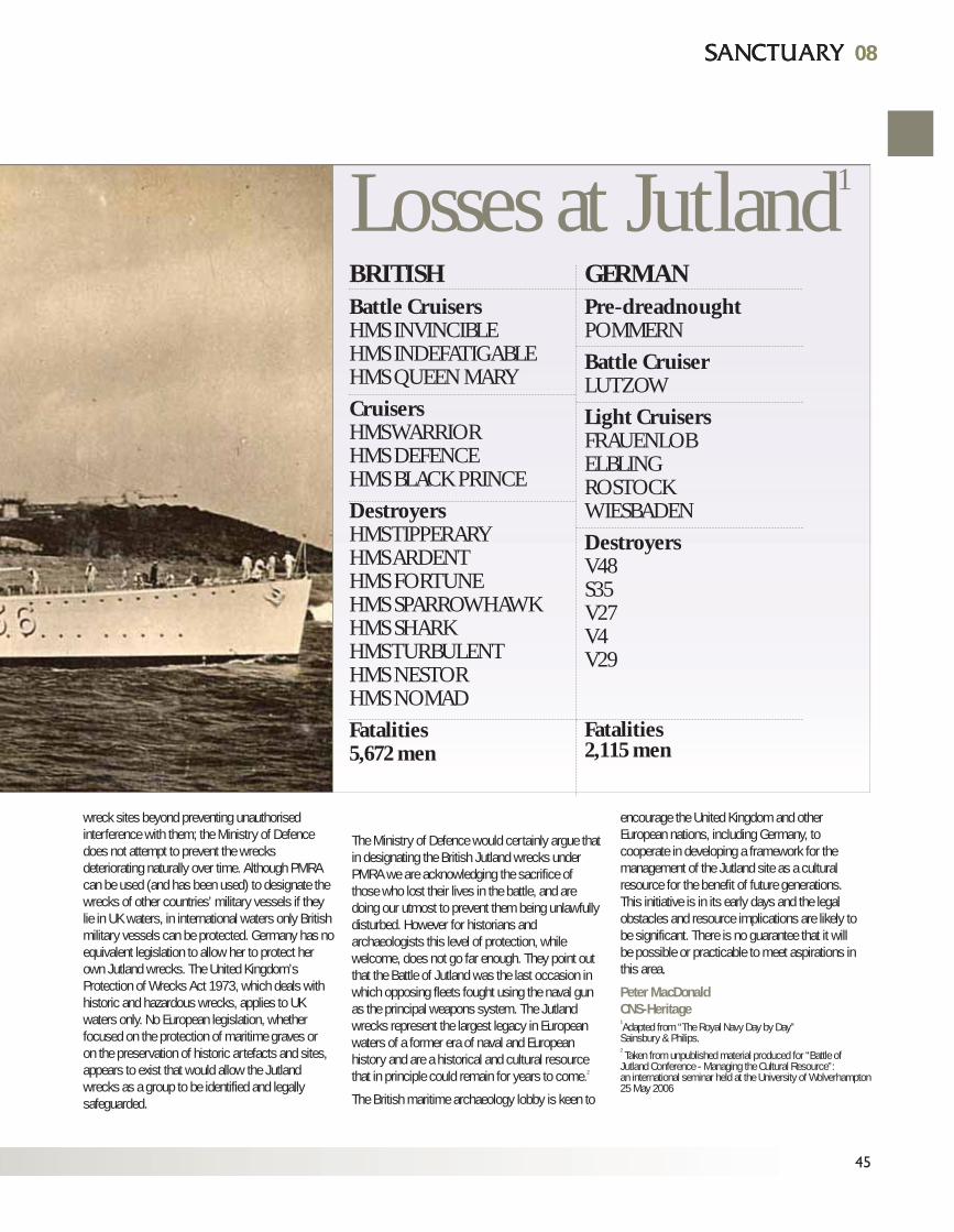
08
45
08
wreck sites beyond preventing unauthorisedinterference with them; the Ministry of Defencedoes not attempt to prevent the wrecksdeteriorating naturally over time. Although PMRAcan be used (and has been used) to designate thewrecks of other countries’ military vessels if theylie in UK waters, in international waters only Britishmilitary vessels can be protected. Germany has noequivalent legislation to allow her to protect herown Jutland wrecks. The United Kingdom’sProtection of Wrecks Act 1973, which deals withhistoric and hazardous wrecks, applies to UKwaters only. No European legislation, whetherfocused on the protection of maritime graves oron the preservation of historic artefacts and sites,appears to exist that would allow the Jutlandwrecks as a group to be identified and legallysafeguarded.
The Ministry of Defence would certainly argue thatin designating the British Jutland wrecks underPMRA we are acknowledging the sacrifice ofthose who lost their lives in the battle, and aredoing our utmost to prevent them being unlawfullydisturbed. However for historians andarchaeologists this level of protection, whilewelcome, does not go far enough. They point outthat the Battle of Jutland was the last occasion inwhich opposing fleets fought using the naval gunas the principal weapons system. The Jutlandwrecks represent the largest legacy in Europeanwaters of a former era of naval and Europeanhistory and are a historical and cultural resourcethat in principle could remain for years to come.2
The British maritime archaeology lobby is keen to
encourage the United Kingdom and otherEuropean nations, including Germany, tocooperate in developing a framework for themanagement of the Jutland site as a culturalresource for the benefit of future generations.This initiative is in its early days and the legalobstacles and resource implications are likely tobe significant. There is no guarantee that it willbe possible or practicable to meet aspirations inthis area.
Peter MacDonaldCNS-Heritage1Adapted from “The Royal Navy Day by Day” Sainsbury & Philips.2Taken from unpublished material produced for “Battle of
Jutland Conference - Managing the Cultural Resource”:an international seminar held at the University of Wolverhampton25 May 2006
Losses at Jutland1
BRITISHBattle CruisersHMS INVINCIBLEHMS INDEFATIGABLEHMS QUEEN MARY
CruisersHMS WARRIORHMS DEFENCEHMS BLACK PRINCE
DestroyersHMS TIPPERARYHMS ARDENTHMS FORTUNEHMS SPARROWHAWKHMS SHARKHMS TURBULENTHMS NESTORHMS NOMAD
Fatalities5,672 men
GERMANPre-dreadnoughtPOMMERN
Battle CruiserLUTZOW
Light CruisersFRAUENLOBELBLINGROSTOCKWIESBADEN
DestroyersV48S35V27V4V29
Fatalities2,115 men

46
FEATURES
Environmental and Sustainable EstateManagement at MOD St Athan
MOD St Athan is a 405 hectare site serving more than 2000 military, civilian andcommercial personnel. The site, 80% of which was sold to the Welsh AssemblyGovernment (WAG) in 2003, has evolved over the last 10 years from whole siteRAF engineering, repair and training operations to the current multi-stakeholderconfiguration. It is currently being prepared for redevelopment to encompass anenhanced Special Forces Support Group; the Defence Training Academy and a WAG sponsored Aerospace Business Park.
Sunrise over MOD St Athan. Lynn Wilkinson.
The Defence Estates Site Management Team (DE SMT) was establishedin July 2006 to work in partnership with WAG and offer them a range ofFacilities Management support services, such as delivering an estate andinfrastructure service to in situ military occupants and to align militaryoperations to future development.
Sustainable estate development and environmental compliance wereestablished as the cornerstones to the management of the Site'soperations and redevelopment. To ensure the delivery of such diversedaily operations and the development programme, DE SMT took theestate management and environmental lead to provide:
• A clear understanding, commitment to and evidence of environmental programme initiatives including reducing energy consumption and raising the profile of better ways to recycle waste
• An in-depth understanding of the site's ecology to inform the Environmental Impact Assessment required to support the planning application for a 283 hectare development
• Forums and communications to provide current specialist advice and information exchange to stakeholder and industry bodies, in areas which are subject to increasing legislative demands
The following paragraphs illustrate some ofthe steps DE SMT has taken towards achieving their aims.
Sunrise over MOD St Athan. Photography: Lynn Wilkinson.
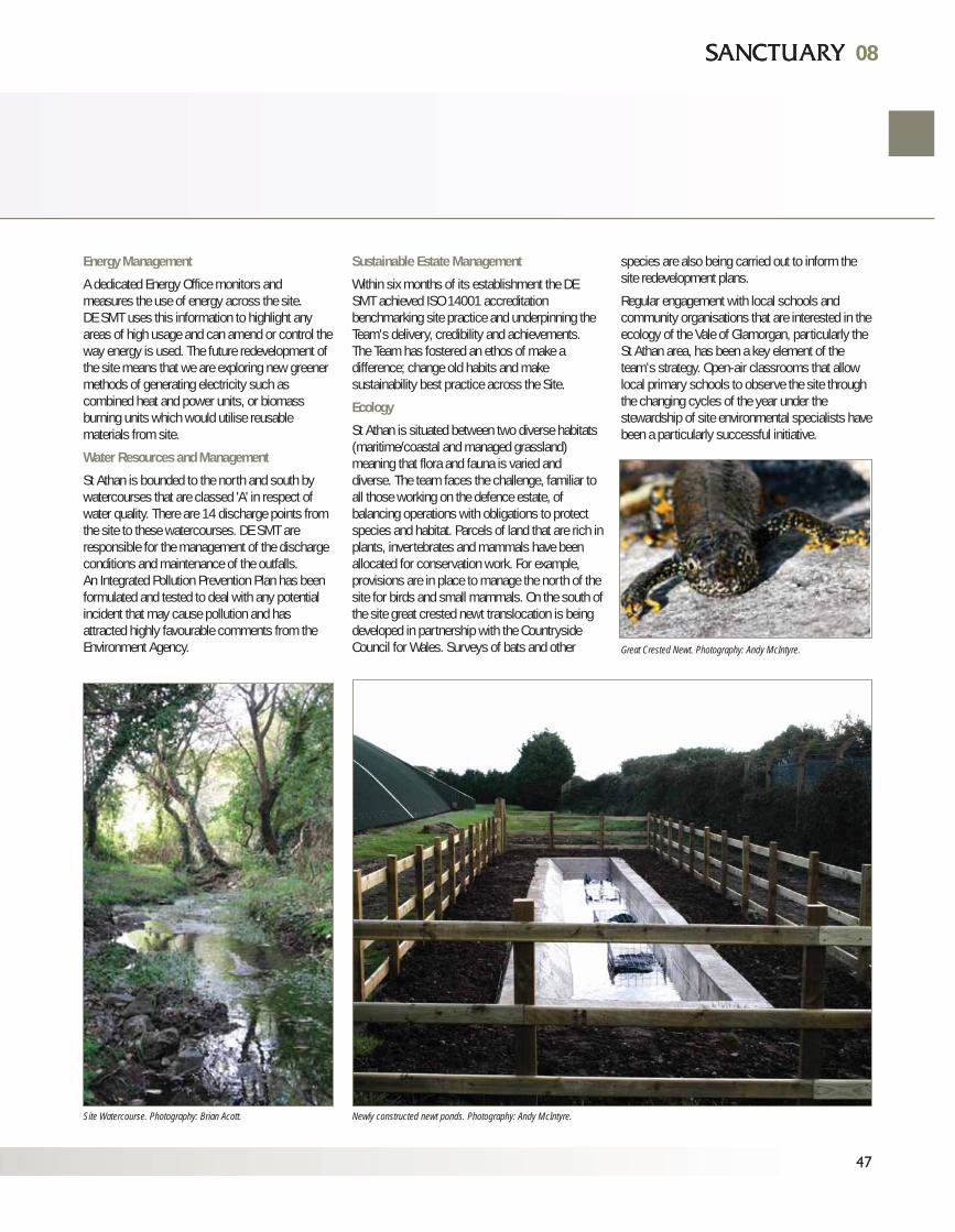
Energy Management
A dedicated Energy Office monitors andmeasures the use of energy across the site. DE SMT uses this information to highlight anyareas of high usage and can amend or control theway energy is used. The future redevelopment ofthe site means that we are exploring new greenermethods of generating electricity such ascombined heat and power units, or biomassburning units which would utilise reusablematerials from site.
Water Resources and Management
St Athan is bounded to the north and south bywatercourses that are classed 'A' in respect ofwater quality. There are 14 discharge points fromthe site to these watercourses. DE SMT areresponsible for the management of the dischargeconditions and maintenance of the outfalls. An Integrated Pollution Prevention Plan has beenformulated and tested to deal with any potentialincident that may cause pollution and hasattracted highly favourable comments from theEnvironment Agency.
Sustainable Estate Management
Within six months of its establishment the DESMT achieved ISO 14001 accreditationbenchmarking site practice and underpinning theTeam’s delivery, credibility and achievements. The Team has fostered an ethos of make adifference; change old habits and makesustainability best practice across the Site.
Ecology
St Athan is situated between two diverse habitats(maritime/coastal and managed grassland)meaning that flora and fauna is varied anddiverse. The team faces the challenge, familiar toall those working on the defence estate, ofbalancing operations with obligations to protectspecies and habitat. Parcels of land that are rich inplants, invertebrates and mammals have beenallocated for conservation work. For example,provisions are in place to manage the north of thesite for birds and small mammals. On the south ofthe site great crested newt translocation is beingdeveloped in partnership with the CountrysideCouncil for Wales. Surveys of bats and other
species are also being carried out to inform thesite redevelopment plans.
Regular engagement with local schools andcommunity organisations that are interested in theecology of the Vale of Glamorgan, particularly theSt Athan area, has been a key element of theteam’s strategy. Open-air classrooms that allowlocal primary schools to observe the site throughthe changing cycles of the year under thestewardship of site environmental specialists havebeen a particularly successful initiative.
47
0808
Site Watercourse. Photography: Brian Acott. Newly constructed newt ponds. Photography: Andy McIntyre.
Great Crested Newt. Photography: Andy McIntyre.
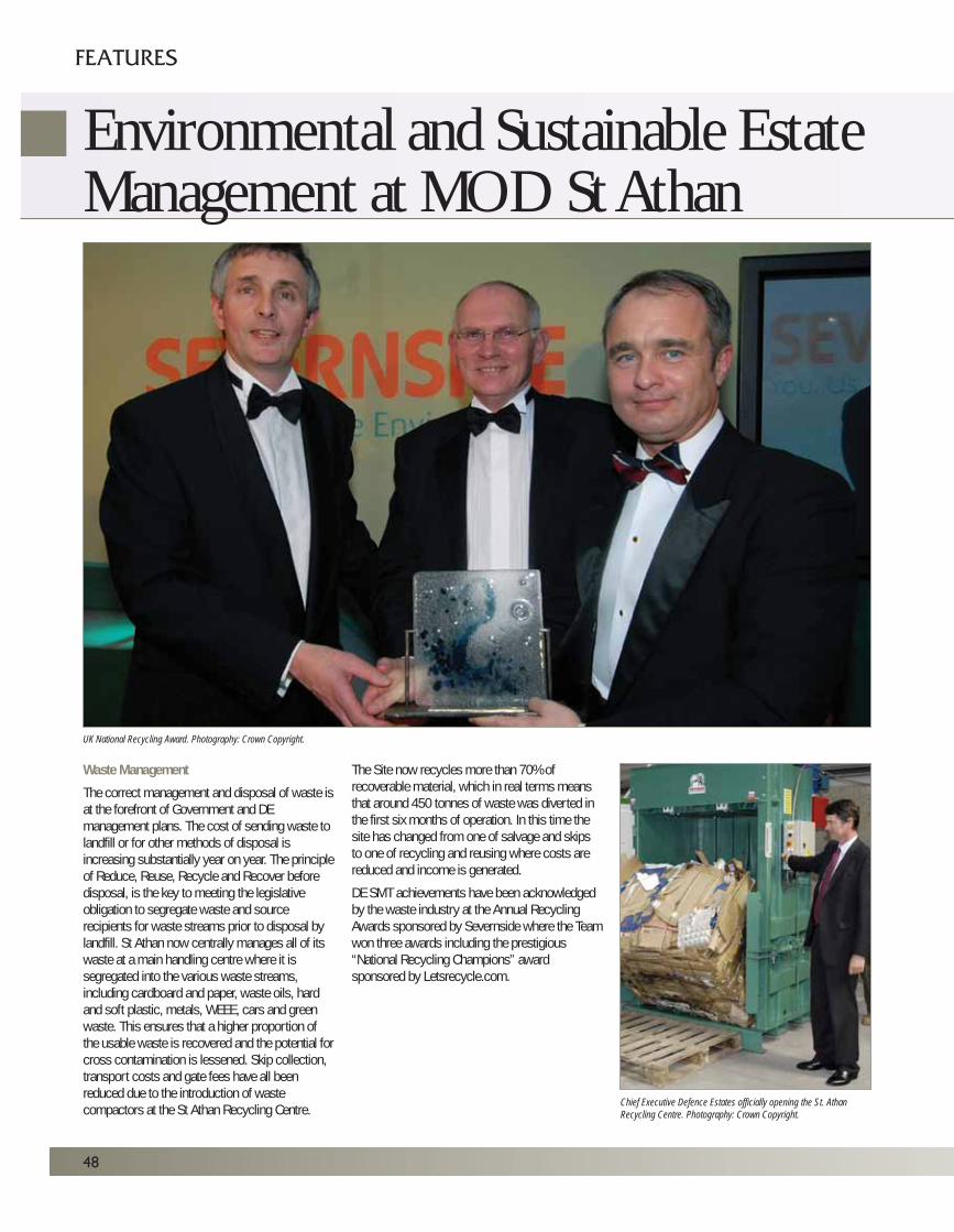
FEATURES
Environmental and Sustainable EstateManagement at MOD St Athan
48
Waste Management
The correct management and disposal of waste isat the forefront of Government and DEmanagement plans. The cost of sending waste tolandfill or for other methods of disposal isincreasing substantially year on year. The principleof Reduce, Reuse, Recycle and Recover beforedisposal, is the key to meeting the legislativeobligation to segregate waste and sourcerecipients for waste streams prior to disposal bylandfill. St Athan now centrally manages all of itswaste at a main handling centre where it issegregated into the various waste streams,including cardboard and paper, waste oils, hardand soft plastic, metals, WEEE, cars and greenwaste. This ensures that a higher proportion ofthe usable waste is recovered and the potential forcross contamination is lessened. Skip collection,transport costs and gate fees have all beenreduced due to the introduction of wastecompactors at the St Athan Recycling Centre.
The Site now recycles more than 70% ofrecoverable material, which in real terms meansthat around 450 tonnes of waste was diverted inthe first six months of operation. In this time thesite has changed from one of salvage and skipsto one of recycling and reusing where costs arereduced and income is generated.
DE SMT achievements have been acknowledgedby the waste industry at the Annual RecyclingAwards sponsored by Severnside where the Teamwon three awards including the prestigious“National Recycling Champions” awardsponsored by Letsrecycle.com.
UK National Recycling Award. Photography: Crown Copyright.
Chief Executive Defence Estates officially opening the St. AthanRecycling Centre. Photography: Crown Copyright.
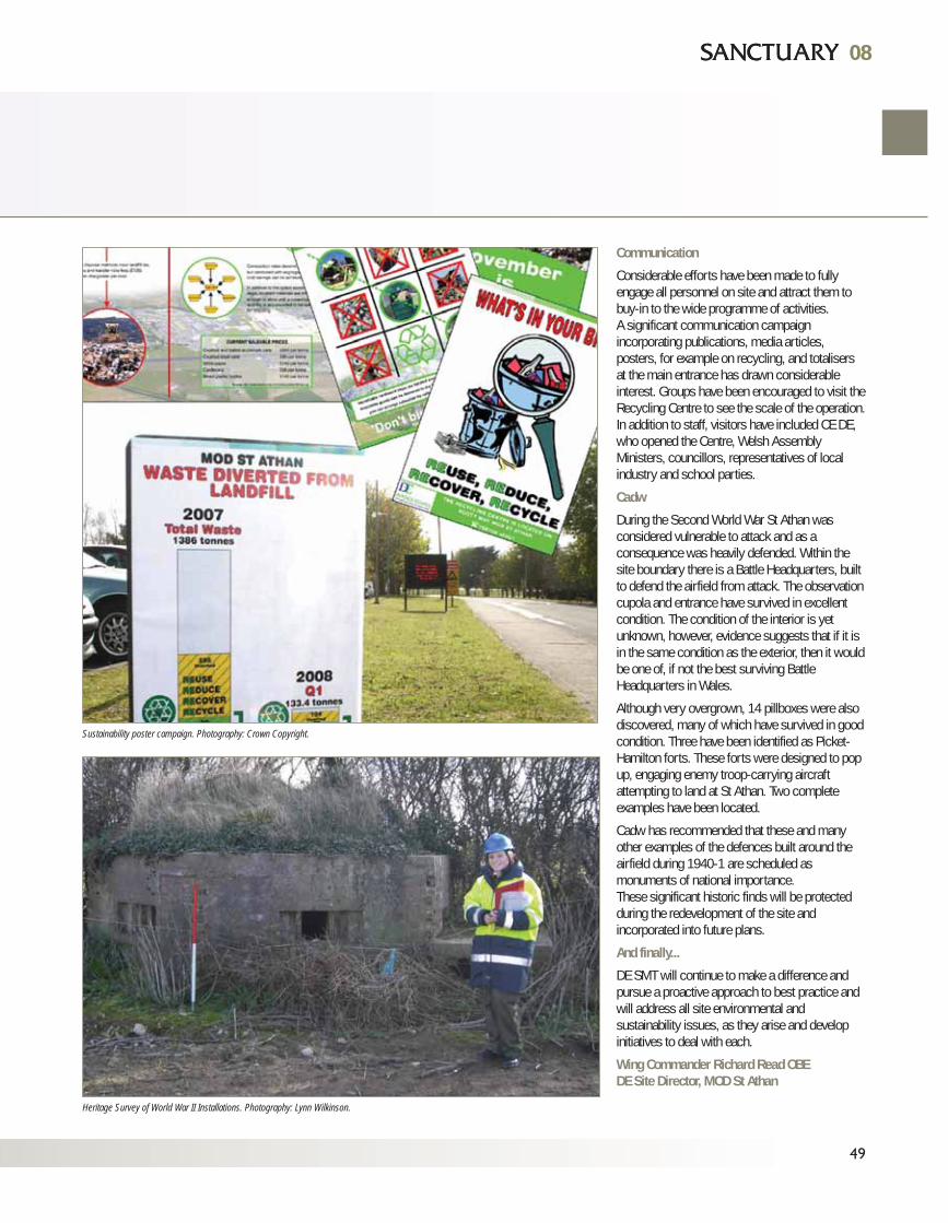
0808
49
Communication
Considerable efforts have been made to fullyengage all personnel on site and attract them tobuy-in to the wide programme of activities.A significant communication campaignincorporating publications, media articles,posters, for example on recycling, and totalisersat the main entrance has drawn considerableinterest. Groups have been encouraged to visit theRecycling Centre to see the scale of the operation.In addition to staff, visitors have included CE DE,who opened the Centre, Welsh AssemblyMinisters, councillors, representatives of localindustry and school parties.
Cadw
During the Second World War St Athan wasconsidered vulnerable to attack and as aconsequence was heavily defended. Within thesite boundary there is a Battle Headquarters, builtto defend the airfield from attack. The observationcupola and entrance have survived in excellentcondition. The condition of the interior is yetunknown, however, evidence suggests that if it isin the same condition as the exterior, then it wouldbe one of, if not the best surviving BattleHeadquarters in Wales.
Although very overgrown, 14 pillboxes were alsodiscovered, many of which have survived in goodcondition. Three have been identified as Picket-Hamilton forts. These forts were designed to popup, engaging enemy troop-carrying aircraftattempting to land at St Athan. Two completeexamples have been located.
Cadw has recommended that these and manyother examples of the defences built around theairfield during 1940-1 are scheduled asmonuments of national importance. These significant historic finds will be protectedduring the redevelopment of the site andincorporated into future plans.
And finally...
DE SMT will continue to make a difference andpursue a proactive approach to best practice andwill address all site environmental andsustainability issues, as they arise and developinitiatives to deal with each.
Wing Commander Richard Read OBEDE Site Director, MOD St Athan
Sustainability poster campaign. Photography: Crown Copyright.
Heritage Survey of World War II Installations. Photography: Lynn Wilkinson.
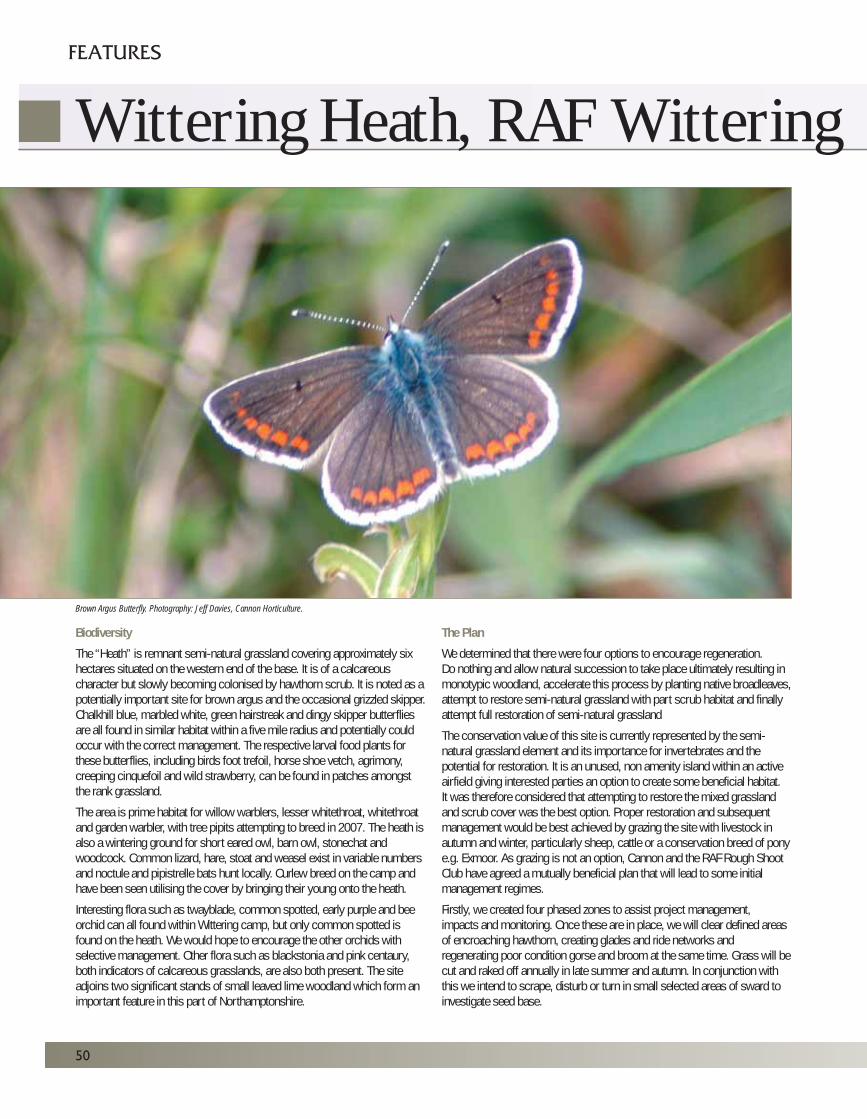
Biodiversity
The “Heath” is remnant semi-natural grassland covering approximately sixhectares situated on the western end of the base. It is of a calcareouscharacter but slowly becoming colonised by hawthorn scrub. It is noted as apotentially important site for brown argus and the occasional grizzled skipper.Chalkhill blue, marbled white, green hairstreak and dingy skipper butterfliesare all found in similar habitat within a five mile radius and potentially couldoccur with the correct management. The respective larval food plants forthese butterflies, including birds foot trefoil, horse shoe vetch, agrimony,creeping cinquefoil and wild strawberry, can be found in patches amongstthe rank grassland.
The area is prime habitat for willow warblers, lesser whitethroat, whitethroatand garden warbler, with tree pipits attempting to breed in 2007. The heath isalso a wintering ground for short eared owl, barn owl, stonechat andwoodcock. Common lizard, hare, stoat and weasel exist in variable numbersand noctule and pipistrelle bats hunt locally. Curlew breed on the camp andhave been seen utilising the cover by bringing their young onto the heath.
Interesting flora such as twayblade, common spotted, early purple and beeorchid can all found within Wittering camp, but only common spotted isfound on the heath. We would hope to encourage the other orchids withselective management. Other flora such as blackstonia and pink centaury,both indicators of calcareous grasslands, are also both present. The siteadjoins two significant stands of small leaved lime woodland which form animportant feature in this part of Northamptonshire.
The Plan
We determined that there were four options to encourage regeneration.Do nothing and allow natural succession to take place ultimately resulting inmonotypic woodland, accelerate this process by planting native broadleaves,attempt to restore semi-natural grassland with part scrub habitat and finallyattempt full restoration of semi-natural grassland
The conservation value of this site is currently represented by the semi-natural grassland element and its importance for invertebrates and thepotential for restoration. It is an unused, non amenity island within an activeairfield giving interested parties an option to create some beneficial habitat. It was therefore considered that attempting to restore the mixed grasslandand scrub cover was the best option. Proper restoration and subsequentmanagement would be best achieved by grazing the site with livestock inautumn and winter, particularly sheep, cattle or a conservation breed of ponye.g. Exmoor. As grazing is not an option, Cannon and the RAF Rough ShootClub have agreed a mutually beneficial plan that will lead to some initialmanagement regimes.
Firstly, we created four phased zones to assist project management, impacts and monitoring. Once these are in place, we will clear defined areasof encroaching hawthorn, creating glades and ride networks andregenerating poor condition gorse and broom at the same time. Grass will becut and raked off annually in late summer and autumn. In conjunction withthis we intend to scrape, disturb or turn in small selected areas of sward toinvestigate seed base.
50
FEATURES
Wittering Heath, RAF Wittering
Brown Argus Butterfly. Photography: Jeff Davies, Cannon Horticulture.
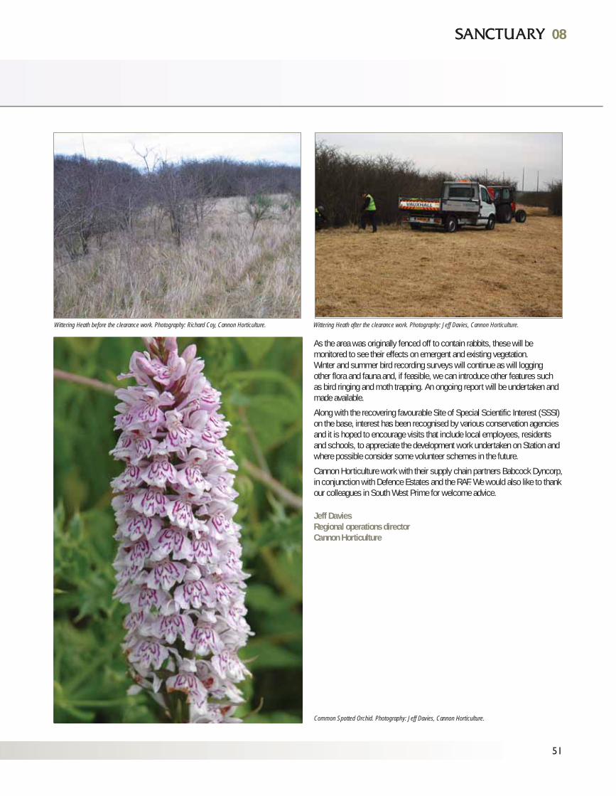
51
0808
Wittering Heath before the clearance work. Photography: Richard Coy, Cannon Horticulture. Wittering Heath after the clearance work. Photography: Jeff Davies, Cannon Horticulture.
Common Spotted Orchid. Photography: Jeff Davies, Cannon Horticulture.
As the area was originally fenced off to contain rabbits, these will bemonitored to see their effects on emergent and existing vegetation. Winter and summer bird recording surveys will continue as will logging other flora and fauna and, if feasible, we can introduce other features such as bird ringing and moth trapping. An ongoing report will be undertaken andmade available.
Along with the recovering favourable Site of Special Scientific Interest (SSSI)on the base, interest has been recognised by various conservation agenciesand it is hoped to encourage visits that include local employees, residentsand schools, to appreciate the development work undertaken on Station andwhere possible consider some volunteer schemes in the future.
Cannon Horticulture work with their supply chain partners Babcock Dyncorp,in conjunction with Defence Estates and the RAF. We would also like to thankour colleagues in South West Prime for welcome advice.
Jeff DaviesRegional operations directorCannon Horticulture
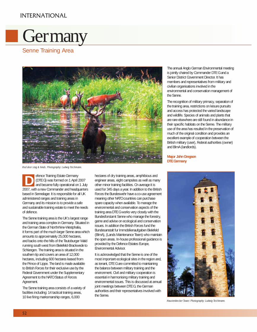
efence Training Estate Germany (DTE G) was formed on 1 April 2007and became fully operational on 1 July
2007, with a new Commander and headquartersbased in Sennelager. It is responsible for all UKadministered ranges and training areas inGermany and its mission is to provide a safe and sustainable training estate to meet the needsof defence.
The Senne training area is the UK’s largest rangeand training area complex in Germany. Situated inthe German State of Northrhine-Westphalia, it forms part of the much larger Senne area whichamounts to approximately 25,000 hectares, and backs onto the hills of the Teutoburger Waldrunning south west from Bielefeld-Brackwede toSchlangen. The training area is situated in thesouthern tip and covers an area of 12,000hectares, including 600 hectares leased from the Prince of Lippe. The land is made available to British Forces for their exclusive use by theFederal Government under the SupplementaryAgreement to the NATO Status of ForcesAgreement.
The Senne training area consists of a variety offacilities including: 14 tactical training areas, 10 live firing marksmanship ranges, 6,000
hectares of dry training areas, amphibious andengineer areas, eight campsites as well as manyother minor training facilities. On average it isused for 345 days a year. In addition to the BritishForces the Bundeswehr have a co-use agreementmeaning other NATO countries can purchasespare capacity when available. To manage theenvironmental and conservation aspects of thetraining area DTE G works very closely with theBundesforstamt Senne who manage the forestry,game and advise on ecological and conservationissues. In addition the British Forces fund theBundesanstalt fur Immobilienaufgaben Bielefeld(BlmA), (Lands Maintenance Team) who maintainthe open areas. In-house professional guidance isprovided by the Defence Estates Europe,Environmental Advisor.
It is acknowledged that the Senne is one of themost important ecological sites in the region and,as tenant, DTE G are committed to maintainingthe balance between military training and theenvironment. Civil and military cooperation isessential in harmonising military training andenvironmental issues. This is discussed at annualjoint meetings between DTE G, the Germanauthorities and their representatives involved withthe Senne.
The annual Anglo German Environmental meetingis jointly chaired by Commander DTE G and aSenior District Government Director. It hasmembers and representatives from military andcivilian organisations involved in theenvironmental and conservation management ofthe Senne.
The recognition of military primacy, separation ofthe training area, restrictions on leisure pursuitsand access has protected the varied landscapeand wildlife. Species of animals and plants thatare rare elsewhere are still found in abundance intheir specific habitats on the Senne. The militaryuse of the area has resulted in the preservation ofmuch of the original condition and provides anexcellent example of cooperation between theBritish military (user), Federal authorities (owner)and BlmA (landlords).
Major John GregsonDTE Germany
52
GermanySenne Training Area
INTERNATIONAL
DRed deer stag & hinds. Photography: Ludwig Teichmann.
Haustenbecker Tower. Photography: Ludwig Teichmann.
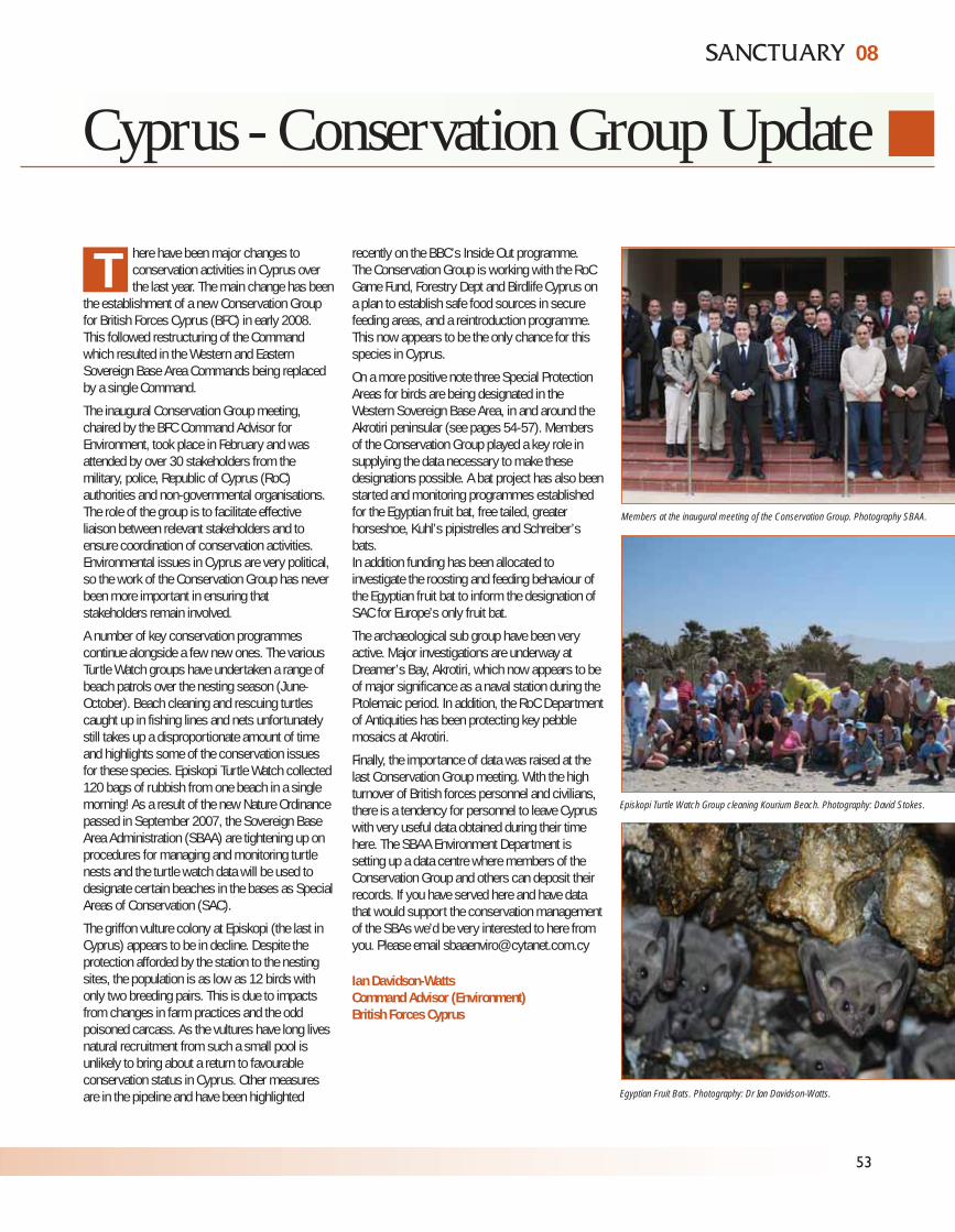
08
53
Cyprus - Conservation Group Update
here have been major changes toconservation activities in Cyprus overthe last year. The main change has been
the establishment of a new Conservation Groupfor British Forces Cyprus (BFC) in early 2008.This followed restructuring of the Commandwhich resulted in the Western and EasternSovereign Base Area Commands being replacedby a single Command.
The inaugural Conservation Group meeting,chaired by the BFC Command Advisor forEnvironment, took place in February and wasattended by over 30 stakeholders from themilitary, police, Republic of Cyprus (RoC)authorities and non-governmental organisations.The role of the group is to facilitate effectiveliaison between relevant stakeholders and toensure coordination of conservation activities.Environmental issues in Cyprus are very political,so the work of the Conservation Group has neverbeen more important in ensuring thatstakeholders remain involved.
A number of key conservation programmescontinue alongside a few new ones. The variousTurtle Watch groups have undertaken a range ofbeach patrols over the nesting season (June-October). Beach cleaning and rescuing turtlescaught up in fishing lines and nets unfortunatelystill takes up a disproportionate amount of timeand highlights some of the conservation issuesfor these species. Episkopi Turtle Watch collected120 bags of rubbish from one beach in a singlemorning! As a result of the new Nature Ordinancepassed in September 2007, the Sovereign BaseArea Administration (SBAA) are tightening up onprocedures for managing and monitoring turtlenests and the turtle watch data will be used todesignate certain beaches in the bases as SpecialAreas of Conservation (SAC).
The griffon vulture colony at Episkopi (the last inCyprus) appears to be in decline. Despite theprotection afforded by the station to the nestingsites, the population is as low as 12 birds withonly two breeding pairs. This is due to impactsfrom changes in farm practices and the oddpoisoned carcass. As the vultures have long livesnatural recruitment from such a small pool isunlikely to bring about a return to favourableconservation status in Cyprus. Other measuresare in the pipeline and have been highlighted
recently on the BBC’s Inside Out programme.The Conservation Group is working with the RoCGame Fund, Forestry Dept and Birdlife Cyprus ona plan to establish safe food sources in securefeeding areas, and a reintroduction programme.This now appears to be the only chance for thisspecies in Cyprus.
On a more positive note three Special ProtectionAreas for birds are being designated in theWestern Sovereign Base Area, in and around theAkrotiri peninsular (see pages 54-57). Membersof the Conservation Group played a key role insupplying the data necessary to make thesedesignations possible. A bat project has also beenstarted and monitoring programmes establishedfor the Egyptian fruit bat, free tailed, greaterhorseshoe, Kuhl’s pipistrelles and Schreiber’sbats. In addition funding has been allocated toinvestigate the roosting and feeding behaviour ofthe Egyptian fruit bat to inform the designation ofSAC for Europe’s only fruit bat.
The archaeological sub group have been veryactive. Major investigations are underway atDreamer’s Bay, Akrotiri, which now appears to beof major significance as a naval station during thePtolemaic period. In addition, the RoC Departmentof Antiquities has been protecting key pebblemosaics at Akrotiri.
Finally, the importance of data was raised at thelast Conservation Group meeting. With the highturnover of British forces personnel and civilians,there is a tendency for personnel to leave Cypruswith very useful data obtained during their timehere. The SBAA Environment Department issetting up a data centre where members of theConservation Group and others can deposit theirrecords. If you have served here and have datathat would support the conservation managementof the SBAs we’d be very interested to here fromyou. Please email [email protected]
Ian Davidson-WattsCommand Advisor (Environment)British Forces Cyprus
T
Members at the inaugural meeting of the Conservation Group. Photography SBAA.
Episkopi Turtle Watch Group cleaning Kourium Beach. Photography: David Stokes.
Egyptian Fruit Bats. Photography: Dr Ian Davidson-Watts.
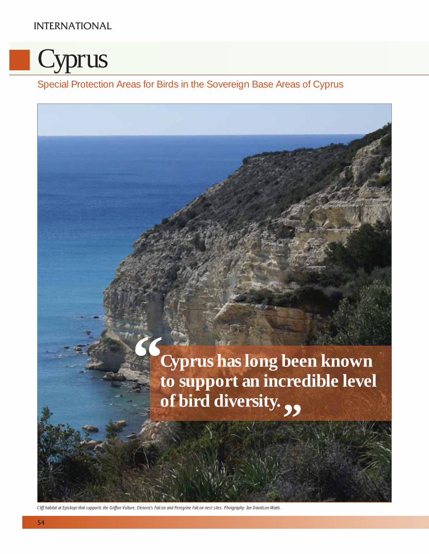
54
CyprusSpecial Protection Areas for Birds in the Sovereign Base Areas of Cyprus
INTERNATIONAL
Cliff habitat at Episkopi that supports the Griffon Vulture, Elenora’s Falcon and Peregrine Falcon nest sites. Photgraphy: Ian Davidson-Watts.
Cyprus has long been knownto support an incredible levelof bird diversity.
“ “
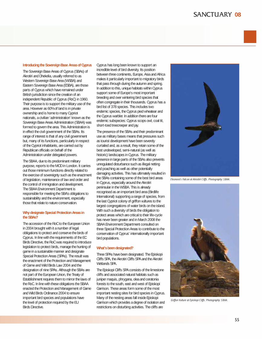
Introducing the Sovereign Base Areas of Cyprus
The Sovereign Base Areas of Cyprus (SBAs) ofAkrotiri and Dhekelia, usually referred to asWestern Sovereign Base Area (WSBA) andEastern Sovereign Base Area (ESBA), are thoseparts of Cyprus which have remained underBritish jurisdiction since the creation of anindependent Republic of Cyprus (RoC) in 1960.Their purpose is to support the military use of thearea. However as 60% of land is in privateownership and is home to many Cypriotnationals, a civilian ‘administration’ known as theSovereign Base Areas Administration (SBAA) wasformed to govern the area. This Administration isin effect the civil government of the SBAs. Itsrange of interest is that of any civil governmentbut, many of its functions, particularly in respectof the Cypriot inhabitants, are carried out byRepublican officials on behalf of theAdministration under delegated powers.
The SBAA, due to its predominant militarypurpose, reports to the MOD in London. It carriesout those minimum functions directly related tothe exercise of sovereignty such as the enactmentof legislation, maintenance of law and order andthe control of immigration and development.The SBAA Environment Department isresponsible for meeting the SBA’s obligations tosustainability and the environment, especiallythose that relate to nature conservation.
Why designate Special Protection Areas inthe SBAs?
The accession of the RoC to the European Unionin 2004 brought with it a number of legalobligations to protect and conserve the birds ofCyprus. In line with the requirements of the ECBirds Directive, the RoC was required to introducelegislation to protect birds, manage the hunting ofgame in a sustainable manner and designateSpecial Protection Areas (SPAs). The result wasthe enactment of the Protection and Managementof Game and Wild Birds Law 2004 and thedesignation of nine SPAs. Although the SBAs arenot part of the European Union, the Treaty ofEstablishment requires them to mirror the laws ofthe RoC. In line with these obligations the SBAAenacted the Protection and Management of Gameand Wild Birds Ordinance 2004 to ensureimportant bird species and populations have the level of protection required by the EU Birds Directive.
Cyprus has long been known to support anincredible level of bird diversity. Its positionbetween three continents, Europe, Asia and Africamakes it particularly important to migratory birdsthat pass through during the autumn and spring.In addition to this, unique habitats within Cyprussupport some of Europe’s most importantbreeding and over wintering bird species thatoften congregate in their thousands. Cyprus has abird list of 378 species. This includes twoendemic species, the Cyprus pied wheatear andthe Cyprus warbler. In addition there are fourendemic subspecies: Cyprus scops owl, coal tit,short-toed treecreeper and jay.
The presence of the SBAs and their predominantuse as military bases means that pressures suchas tourist development have been severelycurtailed and, as a result, they retain some of thebest undeveloped, semi-natural (as well ashistoric) landscapes in Cyprus. The militarypresence in large parts of the SBAs also preventsunregulated disturbance such as illegal nettingand poaching as well as other potentiallydamaging activities. This has ultimately resulted inthe SBAs containing some of the best bird areasin Cyprus, especially around the Akrotiripeninsular in the WSBA. This is alreadyrecognised as an important bird area (BirdlifeInternational) supporting a range of species, fromthe last Cypriot colony of griffon vultures to thelargest congregations of water birds on the island.With such a diversity of birds the obligation toprotect areas which are critical to their life-cyclehas never been greater and in March 2008 theSBAA Environment Department consulted onthree Special Protection Areas to contribute to theconservation of Cyprus’ internationally importantbird populations.
What’s been designated?
Three SPAs have been designated. The EpiskopiCliffs SPA, the Akrotiri Cliffs SPA and the AkrotiriWetlands SPA.
The Episkopi Cliffs SPA consists of the limestonecliffs and associated natural habitats such asjuniper maquis, phrygana, olea and ceratoniaforests to the south, east and west of EpiskopiGarrison. These areas form some of the mostimportant nesting sites for bird species in Cyprus.Many of the nesting areas fall inside EpiskopiGarrison which provides a degree of isolation andrestrictions on disturbing activities. The cliffs are
08
55
Eleonora’s Falcon at Akroitiri Cliffs. Photography: SBAA.
Griffon Vulture at Episkopi Cliffs. Photography: SBAA.
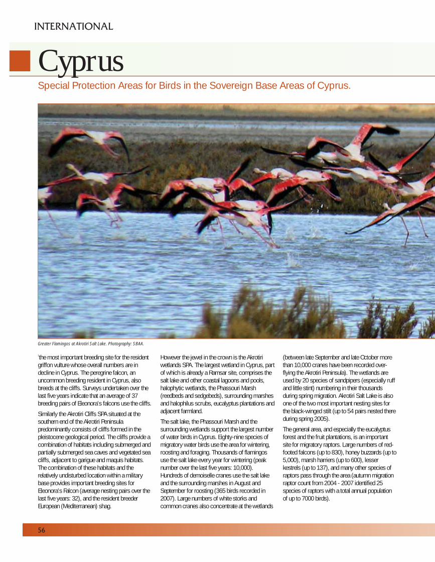
56
CyprusSpecial Protection Areas for Birds in the Sovereign Base Areas of Cyprus.
INTERNATIONAL
1the most important breeding site for the residentgriffon vulture whose overall numbers are indecline in Cyprus. The peregrine falcon, anuncommon breeding resident in Cyprus, alsobreeds at the cliffs. Surveys undertaken over thelast five years indicate that an average of 37breeding pairs of Eleonora’s falcons use the cliffs.
Similarly the Akrotiri Cliffs SPA situated at thesouthern end of the Akrotiri Peninsulapredominantly consists of cliffs formed in thepleistocene geological period. The cliffs provide acombination of habitats including submerged andpartially submerged sea caves and vegetated seacliffs, adjacent to garigue and maquis habitats.The combination of these habitats and therelatively undisturbed location within a militarybase provides important breeding sites forEleonora’s Falcon (average nesting pairs over thelast five years: 32), and the resident breederEuropean (Mediterranean) shag.
However the jewel in the crown is the Akrotiriwetlands SPA. The largest wetland in Cyprus, partof which is already a Ramsar site, comprises thesalt lake and other coastal lagoons and pools,halophytic wetlands, the Phassouri Marsh(reedbeds and sedgebeds), surrounding marshesand halophilus scrubs, eucalyptus plantations andadjacent farmland.
The salt lake, the Phassouri Marsh and thesurrounding wetlands support the largest numberof water birds in Cyprus. Eighty-nine species ofmigratory water birds use the area for wintering,roosting and foraging. Thousands of flamingosuse the salt lake every year for wintering (peaknumber over the last five years: 10,000).Hundreds of demoiselle cranes use the salt lakeand the surrounding marshes in August andSeptember for roosting (365 birds recorded in2007). Large numbers of white storks andcommon cranes also concentrate at the wetlands
(between late September and late October morethan 10,000 cranes have been recorded over-flying the Akrotiri Peninsula). The wetlands areused by 20 species of sandpipers (especially ruffand little stint) numbering in their thousandsduring spring migration. Akrotiri Salt Lake is alsoone of the two most important nesting sites forthe black-winged stilt (up to 54 pairs nested thereduring spring 2005).
The general area, and especially the eucalyptusforest and the fruit plantations, is an importantsite for migratory raptors. Large numbers of red-footed falcons (up to 830), honey buzzards (up to5,000), marsh harriers (up to 600), lesserkestrels (up to 137), and many other species ofraptors pass through the area (autumn migrationraptor count from 2004 - 2007 identified 25species of raptors with a total annual populationof up to 7000 birds).
Greater Flamingos at Akrotiri Salt Lake. Photography: SBAA.
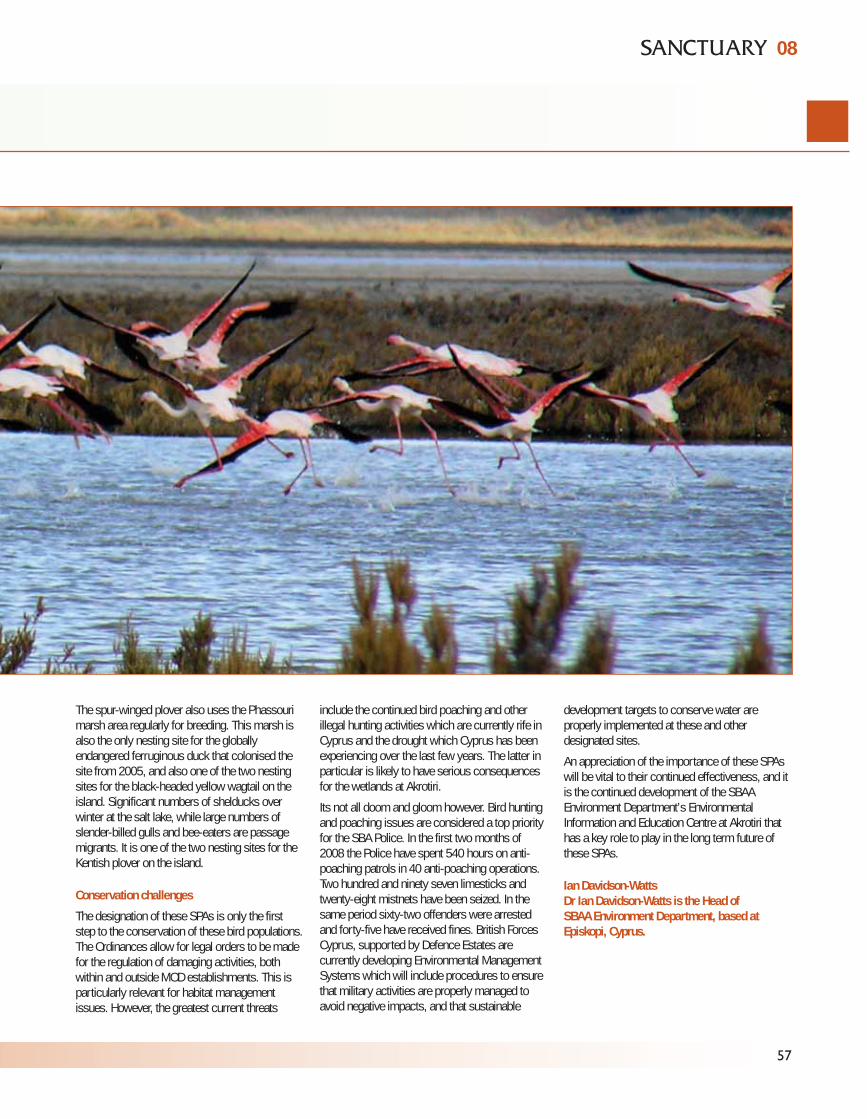
57
The spur-winged plover also uses the Phassourimarsh area regularly for breeding. This marsh isalso the only nesting site for the globallyendangered ferruginous duck that colonised thesite from 2005, and also one of the two nestingsites for the black-headed yellow wagtail on theisland. Significant numbers of shelducks overwinter at the salt lake, while large numbers ofslender-billed gulls and bee-eaters are passagemigrants. It is one of the two nesting sites for theKentish plover on the island.
Conservation challenges
The designation of these SPAs is only the firststep to the conservation of these bird populations.The Ordinances allow for legal orders to be madefor the regulation of damaging activities, bothwithin and outside MOD establishments. This isparticularly relevant for habitat managementissues. However, the greatest current threats
include the continued bird poaching and otherillegal hunting activities which are currently rife inCyprus and the drought which Cyprus has beenexperiencing over the last few years. The latter inparticular is likely to have serious consequencesfor the wetlands at Akrotiri.
Its not all doom and gloom however. Bird huntingand poaching issues are considered a top priorityfor the SBA Police. In the first two months of2008 the Police have spent 540 hours on anti-poaching patrols in 40 anti-poaching operations.Two hundred and ninety seven limesticks andtwenty-eight mistnets have been seized. In thesame period sixty-two offenders were arrestedand forty-five have received fines. British ForcesCyprus, supported by Defence Estates arecurrently developing Environmental ManagementSystems which will include procedures to ensurethat military activities are properly managed toavoid negative impacts, and that sustainable
development targets to conserve water areproperly implemented at these and otherdesignated sites.
An appreciation of the importance of these SPAswill be vital to their continued effectiveness, and itis the continued development of the SBAAEnvironment Department’s EnvironmentalInformation and Education Centre at Akrotiri thathas a key role to play in the long term future ofthese SPAs.
Ian Davidson-Watts Dr Ian Davidson-Watts is the Head of SBAA Environment Department, based atEpiskopi, Cyprus.
08
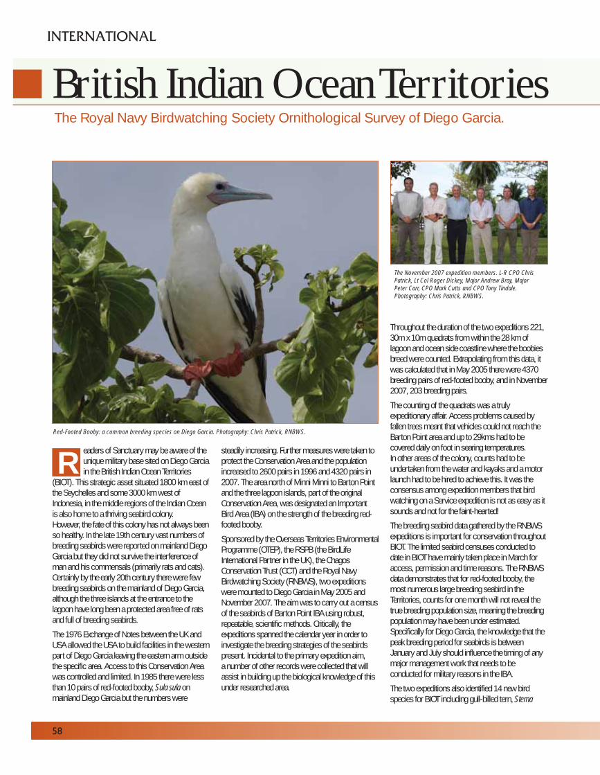
eaders of Sanctuary may be aware of theunique military base sited on Diego Garciain the British Indian Ocean Territories
(BIOT). This strategic asset situated 1800 km east ofthe Seychelles and some 3000 km west ofIndonesia, in the middle regions of the Indian Oceanis also home to a thriving seabird colony. However, the fate of this colony has not always beenso healthy. In the late 19th century vast numbers ofbreeding seabirds were reported on mainland DiegoGarcia but they did not survive the interference ofman and his commensals (primarily rats and cats).Certainly by the early 20th century there were fewbreeding seabirds on the mainland of Diego Garcia,although the three islands at the entrance to thelagoon have long been a protected area free of ratsand full of breeding seabirds.
The 1976 Exchange of Notes between the UK andUSA allowed the USA to build facilities in the westernpart of Diego Garcia leaving the eastern arm outsidethe specific area. Access to this Conservation Areawas controlled and limited. In 1985 there were lessthan 10 pairs of red-footed booby, Sula sula onmainland Diego Garcia but the numbers were
steadily increasing. Further measures were taken toprotect the Conservation Area and the populationincreased to 2600 pairs in 1996 and 4320 pairs in2007. The area north of Minni Minni to Barton Pointand the three lagoon islands, part of the originalConservation Area, was designated an ImportantBird Area (IBA) on the strength of the breeding red-footed booby.
Sponsored by the Overseas Territories EnvironmentalProgramme (OTEP), the RSPB (the BirdLifeInternational Partner in the UK), the ChagosConservation Trust (CCT) and the Royal NavyBirdwatching Society (RNBWS), two expeditionswere mounted to Diego Garcia in May 2005 andNovember 2007. The aim was to carry out a censusof the seabirds of Barton Point IBA using robust,repeatable, scientific methods. Critically, theexpeditions spanned the calendar year in order toinvestigate the breeding strategies of the seabirdspresent. Incidental to the primary expedition aim, a number of other records were collected that willassist in building up the biological knowledge of thisunder researched area.
Throughout the duration of the two expeditions 221,30m x 10m quadrats from within the 28 km oflagoon and ocean side coastline where the boobiesbreed were counted. Extrapolating from this data, itwas calculated that in May 2005 there were 4370breeding pairs of red-footed booby, and in November2007, 203 breeding pairs.
The counting of the quadrats was a trulyexpeditionary affair. Access problems caused byfallen trees meant that vehicles could not reach theBarton Point area and up to 29kms had to becovered daily on foot in searing temperatures.In other areas of the colony, counts had to beundertaken from the water and kayaks and a motorlaunch had to be hired to achieve this. It was theconsensus among expedition members that birdwatching on a Service expedition is not as easy as itsounds and not for the faint-hearted!
The breeding seabird data gathered by the RNBWSexpeditions is important for conservation throughoutBIOT. The limited seabird censuses conducted todate in BIOT have mainly taken place in March foraccess, permission and time reasons. The RNBWSdata demonstrates that for red-footed booby, themost numerous large breeding seabird in theTerritories, counts for one month will not reveal thetrue breeding population size, meaning the breedingpopulation may have been under estimated.Specifically for Diego Garcia, the knowledge that thepeak breeding period for seabirds is betweenJanuary and July should influence the timing of anymajor management work that needs to beconducted for military reasons in the IBA.
The two expeditions also identified 14 new birdspecies for BIOT including gull-billed tern, Sterna
The Royal Navy Birdwatching Society Ornithological Survey of Diego Garcia.
58
INTERNATIONAL
British Indian Ocean Territories
RRed-Footed Booby: a common breeding species on Diego Garcia. Photography: Chris Patrick, RNBWS.
The November 2007 expedition members. L-R CPO Chris
Patrick, Lt Col Roger Dickey, Major Andrew Bray, Major
Peter Carr, CPO Mark Cutts and CPO Tony Tindale.
Photography: Chris Patrick, RNBWS.
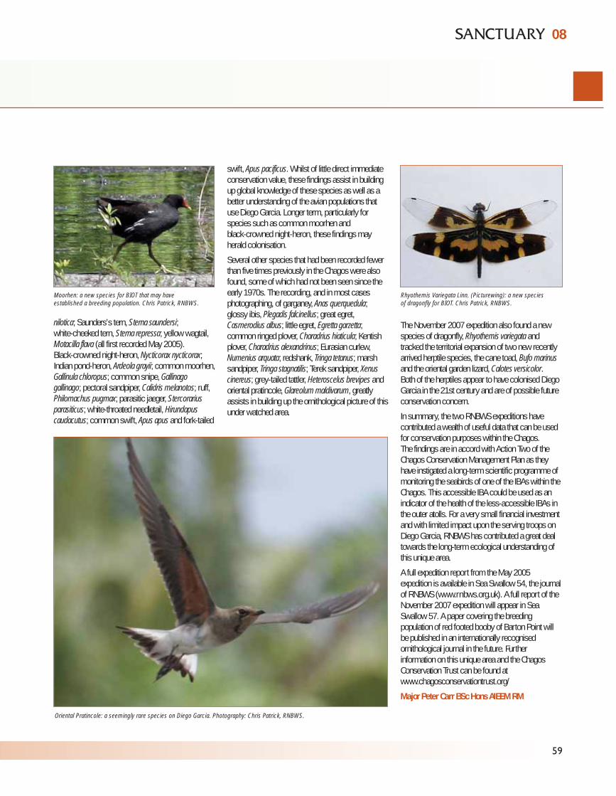
nilotica; Saunders’s tern, Sterna saundersi; white-cheeked tern, Sterna repressa; yellow wagtail,Motacilla flava (all first recorded May 2005). Black-crowned night-heron, Nycticorax nycticorax;Indian pond-heron, Ardeola grayii; common moorhen,Gallinula chloropus; common snipe, Gallinagogallinago; pectoral sandpiper, Calidris melanotos; ruff,Philomachus pugmax; parasitic jaeger, Stercorariusparasiticus; white-throated needletail, Hirundapuscaudacutus; common swift, Apus apus and fork-tailed
swift, Apus pacificus. Whilst of little direct immediateconservation value, these findings assist in buildingup global knowledge of these species as well as abetter understanding of the avian populations thatuse Diego Garcia. Longer term, particularly forspecies such as common moorhen and black-crowned night-heron, these findings mayherald colonisation.
Several other species that had been recorded fewerthan five times previously in the Chagos were alsofound, some of which had not been seen since theearly 1970s. The recording, and in most casesphotographing, of garganey, Anas querquedula;glossy ibis, Plegadis falcinellus; great egret,Casmerodius albus; little egret, Egretta garzetta;common ringed plover, Charadrius hiaticula; Kentishplover, Charadrius alexandrinus; Eurasian curlew,Numenius arquata; redshank, Tringa tetanus; marshsandpiper, Tringa stagnatilis; Terek sandpiper, Xenuscinereus; grey-tailed tattler, Heteroscelus brevipes andoriental pratincole, Glareolum maldivarum, greatlyassists in building up the ornithological picture of thisunder watched area.
The November 2007 expedition also found a newspecies of dragonfly, Rhyothemis variegata andtracked the territorial expansion of two new recentlyarrived herptile species, the cane toad, Bufo marinusand the oriental garden lizard, Calotes versicolor.Both of the herptiles appear to have colonised DiegoGarcia in the 21st century and are of possible futureconservation concern.
In summary, the two RNBWS expeditions havecontributed a wealth of useful data that can be usedfor conservation purposes within the Chagos.The findings are in accord with Action Two of theChagos Conservation Management Plan as theyhave instigated a long-term scientific programme ofmonitoring the seabirds of one of the IBAs within theChagos. This accessible IBA could be used as anindicator of the health of the less-accessible IBAs inthe outer atolls. For a very small financial investmentand with limited impact upon the serving troops onDiego Garcia, RNBWS has contributed a great dealtowards the long-term ecological understanding ofthis unique area.
A full expedition report from the May 2005expedition is available in Sea Swallow 54, the journalof RNBWS (www.rnbws.org.uk). A full report of theNovember 2007 expedition will appear in SeaSwallow 57. A paper covering the breedingpopulation of red footed booby of Barton Point willbe published in an internationally recognisedornithological journal in the future. Furtherinformation on this unique area and the ChagosConservation Trust can be found atwww.chagosconservationtrust.org/
Major Peter Carr BSc Hons AIEEM RM
59
08
Moorhen: a new species for BIOT that may have
established a breeding population. Chris Patrick, RNBWS.
Oriental Pratincole: a seemingly rare species on Diego Garcia. Photography: Chris Patrick, RNBWS.
Rhyothemis Variegata Linn. (Picturewing): a new species
of dragonfly for BIOT. Chris Patrick, RNBWS.
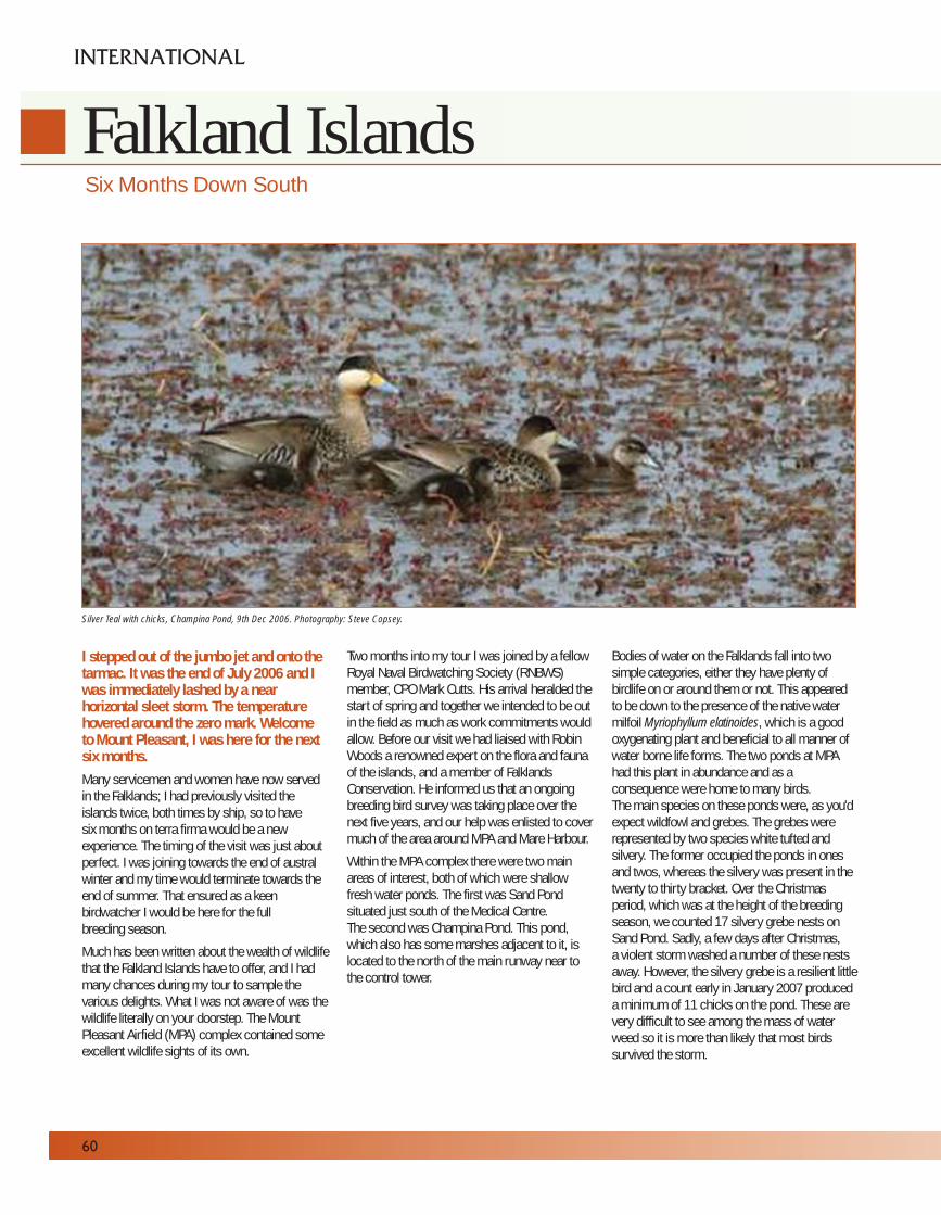
I stepped out of the jumbo jet and onto thetarmac. It was the end of July 2006 and Iwas immediately lashed by a nearhorizontal sleet storm. The temperaturehovered around the zero mark. Welcome to Mount Pleasant, I was here for the nextsix months.Many servicemen and women have now servedin the Falklands; I had previously visited theislands twice, both times by ship, so to have six months on terra firma would be a newexperience. The timing of the visit was just aboutperfect. I was joining towards the end of australwinter and my time would terminate towards theend of summer. That ensured as a keenbirdwatcher I would be here for the full breeding season.
Much has been written about the wealth of wildlifethat the Falkland Islands have to offer, and I hadmany chances during my tour to sample thevarious delights. What I was not aware of was thewildlife literally on your doorstep. The MountPleasant Airfield (MPA) complex contained someexcellent wildlife sights of its own.
Two months into my tour I was joined by a fellowRoyal Naval Birdwatching Society (RNBWS)member, CPO Mark Cutts. His arrival heralded thestart of spring and together we intended to be outin the field as much as work commitments wouldallow. Before our visit we had liaised with RobinWoods a renowned expert on the flora and faunaof the islands, and a member of FalklandsConservation. He informed us that an ongoingbreeding bird survey was taking place over thenext five years, and our help was enlisted to covermuch of the area around MPA and Mare Harbour.
Within the MPA complex there were two mainareas of interest, both of which were shallowfresh water ponds. The first was Sand Pondsituated just south of the Medical Centre. The second was Champina Pond. This pond,which also has some marshes adjacent to it, islocated to the north of the main runway near tothe control tower.
Bodies of water on the Falklands fall into twosimple categories, either they have plenty ofbirdlife on or around them or not. This appearedto be down to the presence of the native watermilfoil Myriophyllum elatinoides, which is a goodoxygenating plant and beneficial to all manner ofwater borne life forms. The two ponds at MPAhad this plant in abundance and as aconsequence were home to many birds.The main species on these ponds were, as you'dexpect wildfowl and grebes. The grebes wererepresented by two species white tufted andsilvery. The former occupied the ponds in onesand twos, whereas the silvery was present in thetwenty to thirty bracket. Over the Christmasperiod, which was at the height of the breedingseason, we counted 17 silvery grebe nests onSand Pond. Sadly, a few days after Christmas,a violent storm washed a number of these nestsaway. However, the silvery grebe is a resilient littlebird and a count early in January 2007 produceda minimum of 11 chicks on the pond. These arevery difficult to see among the mass of waterweed so it is more than likely that most birdssurvived the storm.
Six Months Down South
60
INTERNATIONAL
Falkland Islands
Silver Teal with chicks, Champina Pond, 9th Dec 2006. Photography: Steve Copsey.
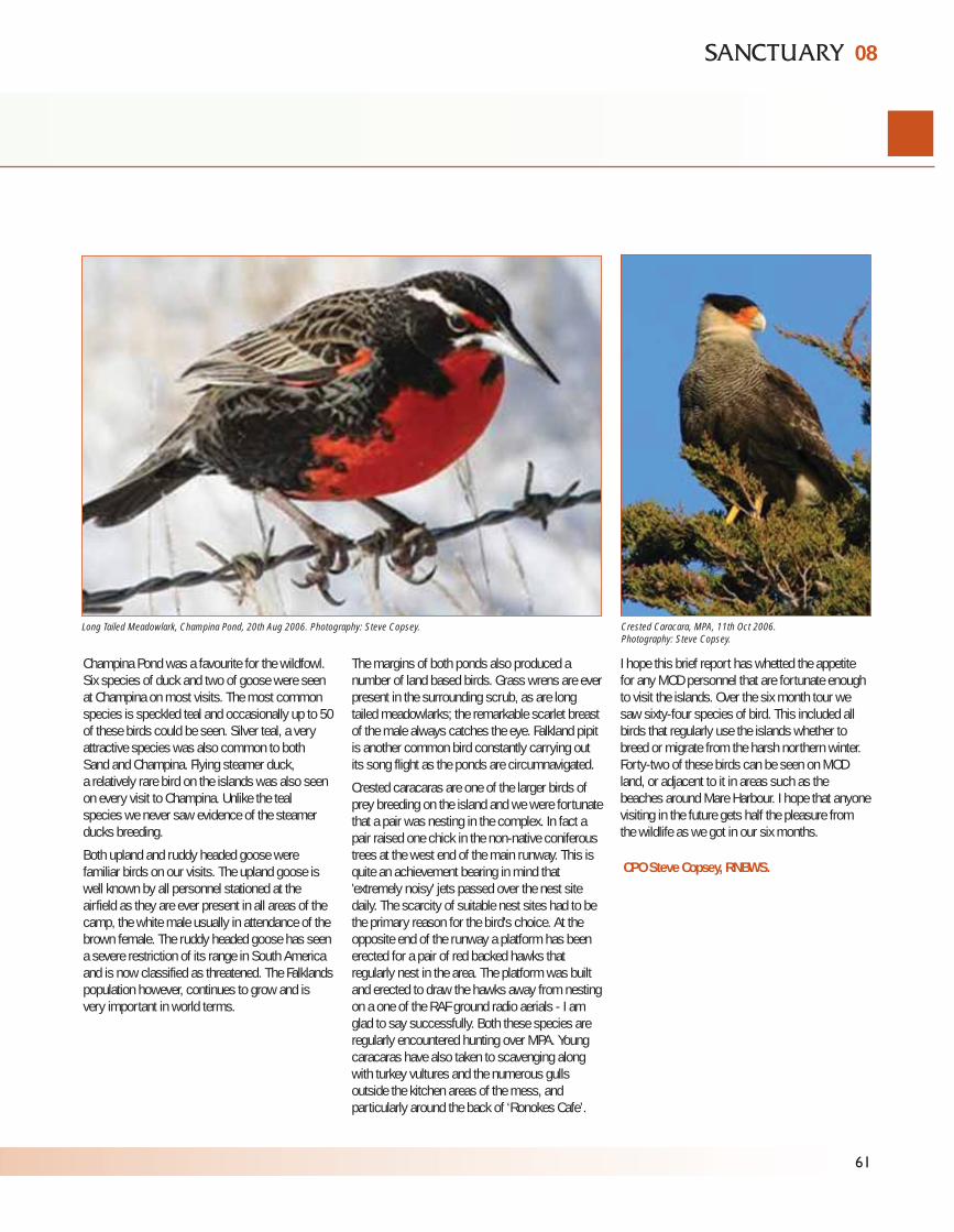
Champina Pond was a favourite for the wildfowl.Six species of duck and two of goose were seenat Champina on most visits. The most commonspecies is speckled teal and occasionally up to 50of these birds could be seen. Silver teal, a veryattractive species was also common to both Sand and Champina. Flying steamer duck, a relatively rare bird on the islands was also seenon every visit to Champina. Unlike the teal species we never saw evidence of the steamerducks breeding.
Both upland and ruddy headed goose werefamiliar birds on our visits. The upland goose iswell known by all personnel stationed at theairfield as they are ever present in all areas of thecamp, the white male usually in attendance of thebrown female. The ruddy headed goose has seena severe restriction of its range in South Americaand is now classified as threatened. The Falklandspopulation however, continues to grow and isvery important in world terms.
The margins of both ponds also produced anumber of land based birds. Grass wrens are everpresent in the surrounding scrub, as are longtailed meadowlarks; the remarkable scarlet breastof the male always catches the eye. Falkland pipitis another common bird constantly carrying outits song flight as the ponds are circumnavigated.
Crested caracaras are one of the larger birds ofprey breeding on the island and we were fortunatethat a pair was nesting in the complex. In fact apair raised one chick in the non-native coniferoustrees at the west end of the main runway. This isquite an achievement bearing in mind that'extremely noisy' jets passed over the nest sitedaily. The scarcity of suitable nest sites had to bethe primary reason for the bird's choice. At theopposite end of the runway a platform has beenerected for a pair of red backed hawks thatregularly nest in the area. The platform was builtand erected to draw the hawks away from nestingon a one of the RAF ground radio aerials - I amglad to say successfully. Both these species areregularly encountered hunting over MPA. Youngcaracaras have also taken to scavenging alongwith turkey vultures and the numerous gullsoutside the kitchen areas of the mess, andparticularly around the back of ‘Ronokes Cafe’.
I hope this brief report has whetted the appetitefor any MOD personnel that are fortunate enoughto visit the islands. Over the six month tour wesaw sixty-four species of bird. This included allbirds that regularly use the islands whether tobreed or migrate from the harsh northern winter.Forty-two of these birds can be seen on MODland, or adjacent to it in areas such as thebeaches around Mare Harbour. I hope that anyonevisiting in the future gets half the pleasure fromthe wildlife as we got in our six months.
CPO Steve Copsey, RNBWS.
61
08
Long Tailed Meadowlark, Champina Pond, 20th Aug 2006. Photography: Steve Copsey. Crested Caracara, MPA, 11th Oct 2006.
Photography: Steve Copsey.
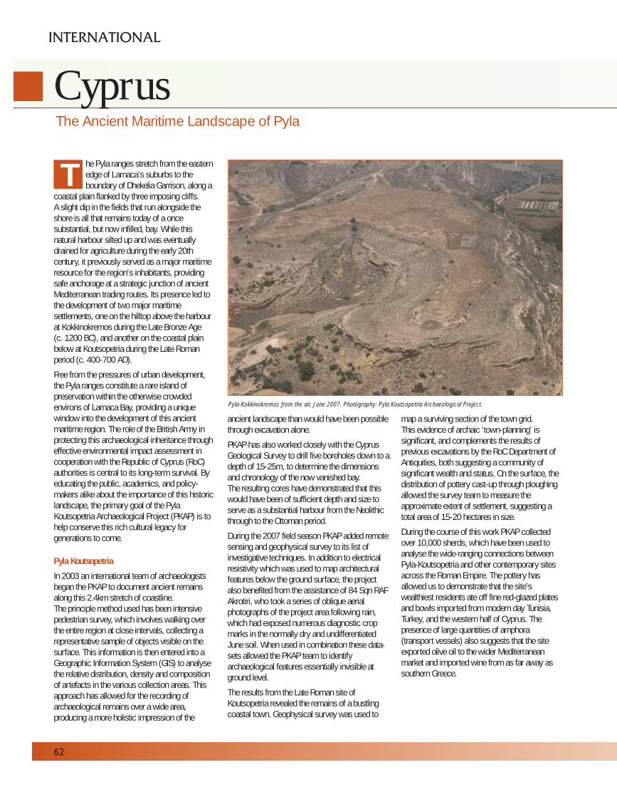
he Pyla ranges stretch from the easternedge of Larnaca’s suburbs to theboundary of Dhekelia Garrison, along a
coastal plain flanked by three imposing cliffs. A slight dip in the fields that run alongside theshore is all that remains today of a oncesubstantial, but now infilled, bay. While thisnatural harbour silted up and was eventuallydrained for agriculture during the early 20thcentury, it previously served as a major maritimeresource for the region’s inhabitants, providingsafe anchorage at a strategic junction of ancientMediterranean trading routes. Its presence led tothe development of two major maritimesettlements, one on the hilltop above the harbourat Kokkinokremos during the Late Bronze Age (c. 1200 BC), and another on the coastal plainbelow at Koutsopetria during the Late Romanperiod (c. 400-700 AD).
Free from the pressures of urban development,the Pyla ranges constitute a rare island ofpreservation within the otherwise crowdedenvirons of Larnaca Bay, providing a uniquewindow into the development of this ancientmaritime region. The role of the British Army inprotecting this archaeological inheritance througheffective environmental impact assessment incooperation with the Republic of Cyprus (RoC)authorities is central to its long-term survival. Byeducating the public, academics, and policy-makers alike about the importance of this historiclandscape, the primary goal of the PylaKoutsopetria Archaeological Project (PKAP) is tohelp conserve this rich cultural legacy forgenerations to come.
Pyla Koutsopetria
In 2003 an international team of archaeologistsbegan the PKAP to document ancient remainsalong this 2.4km stretch of coastline. The principle method used has been intensivepedestrian survey, which involves walking overthe entire region at close intervals, collecting arepresentative sample of objects visible on thesurface. This information is then entered into aGeographic Information System (GIS) to analysethe relative distribution, density and compositionof artefacts in the various collection areas. Thisapproach has allowed for the recording ofarchaeological remains over a wide area,producing a more holistic impression of the
ancient landscape than would have been possiblethrough excavation alone.
PKAP has also worked closely with the CyprusGeological Survey to drill five boreholes down to adepth of 15-25m, to determine the dimensionsand chronology of the now vanished bay. The resulting cores have demonstrated that thiswould have been of sufficient depth and size toserve as a substantial harbour from the Neolithicthrough to the Ottoman period.
During the 2007 field season PKAP added remotesensing and geophysical survey to its list ofinvestigative techniques. In addition to electricalresistivity which was used to map architecturalfeatures below the ground surface, the projectalso benefited from the assistance of 84 Sqn RAFAkrotiri, who took a series of oblique aerialphotographs of the project area following rain,which had exposed numerous diagnostic cropmarks in the normally dry and undifferentiatedJune soil. When used in combination these data-sets allowed the PKAP team to identifyarchaeological features essentially invisible atground level.
The results from the Late Roman site ofKoutsopetria revealed the remains of a bustlingcoastal town. Geophysical survey was used to
map a surviving section of the town grid.This evidence of archaic ‘town-planning’ issignificant, and complements the results ofprevious excavations by the RoC Department ofAntiquities, both suggesting a community ofsignificant wealth and status. On the surface, thedistribution of pottery cast-up through ploughingallowed the survey team to measure theapproximate extent of settlement, suggesting atotal area of 15-20 hectares in size.
During the course of this work PKAP collectedover 10,000 sherds, which have been used toanalyse the wide-ranging connections betweenPyla-Koutsopetria and other contemporary sitesacross the Roman Empire. The pottery hasallowed us to demonstrate that the site’swealthiest residents ate off fine red-glazed platesand bowls imported from modern day Tunisia,Turkey, and the western half of Cyprus. Thepresence of large quantities of amphora(transport vessels) also suggests that the siteexported olive oil to the wider Mediterraneanmarket and imported wine from as far away assouthern Greece.
The Ancient Maritime Landscape of Pyla
62
INTERNATIONAL
Cyprus
T
Pyla-Kokkinokremos from the air, June 2007. Photography: Pyla Koutsopetria Archaeological Project.

63
08
In 2007 geophysical survey on a prominentcoastal bluff overlooking the late Roman townalso revealed, with amazing clarity, the presenceof a large building which appears to be an EarlyChristian basilica around 40m in length completewith an apse, aisles, and an outlying annex.These results proved to be even more remarkablewhen they were correlated with the new aerialphotographs provided by the RAF, which revealedthe course of a monumental fortification wallencircling the hilltop, which was in turn separatedfrom the adjacent massif by an 18m widedry-moat.
Pyla Kokkinokremos
High above the site of the harbour andoverlooking the army rifle range, stands the LateBronze Age fortified settlement of Pyla-Kokkinokremos. Survey work at this Grade IIlisted ancient monument concentrated oncontextualizing the results of previous excavationswithin their broader landscape context. The RAFagain assisted with aerial photography of the sitewhich revealed a large subsurface feature visiblefrom the air as a pronounced linear crop mark.
Correlating these results with electrical resistivitydata has revealed the remains of an ancientterrace running beneath the surface of the nowlargely level field. In the summer of 2008, thismajor architectural feature will be investigatedfurther through a small, targeted excavation. Thiswill help to more accurately determine the urbancharacter and origins of the site, which wasabruptly abandoned c.1200 BC following apossible raid by the so-called ‘Sea-Peoples’, anenigmatic band of ancient pirates who wreakedhavoc throughout the eastern Mediterranean atthe close of the Bronze Age.
Conclusion
In addition to making an important academiccontribution to our knowledge of the island’shistory during the Late Bronze Age and LateRoman period, the results of the ongoing PKAPsurvey have a practical application in revealing theextent, wealth and significance of archaeologicalremains located within the Pyla ranges. By usingan integrated survey approach, this work has notonly led to new discoveries, but has also enabledus to better understand the artefacts and
monuments discovered by previous excavationsin the area over the last half a century.
Artefacts previously discovered in the Pylacoastal region can be seen on display at theLarnaca District Archaeological Museum.
More information about the Pyla KoutsopetriaArchaeological Project is available online at;www.pkap.org
Michael Brown, University of Edinburgh.William Caraher, University of North Dakota.
Acknowledgements
The Pyla Koutsopetria Archaeological Project would like tothank Defence Estates Cyprus and RoC Dept. of Antiquitiesfor their continuing support of the survey. Research at Pylaalso benefited on a daily basis from the logisticalassistance of range controller Costas Kouloumis and rangeWO Mick Delieu to whom the authors extend their sincerethanks. We also gratefully acknowledge the help of 84 SqnRAF Akrotiri for providing new aerial photography of thesurvey area, which significantly enhanced the results ofthe project.
Artefact recording at Larnaca Museum.
Photography: Pyla Koutsopetria Archaeological Project.Buried late Bronze Age storage vessel, scale 1m.
Photography: Pyla Koutsopetria Archaeological Project.
Planning on the fortification wall on Pyla-Vigla.
Photography: Pyla Koutsopetria Archaeological Project.
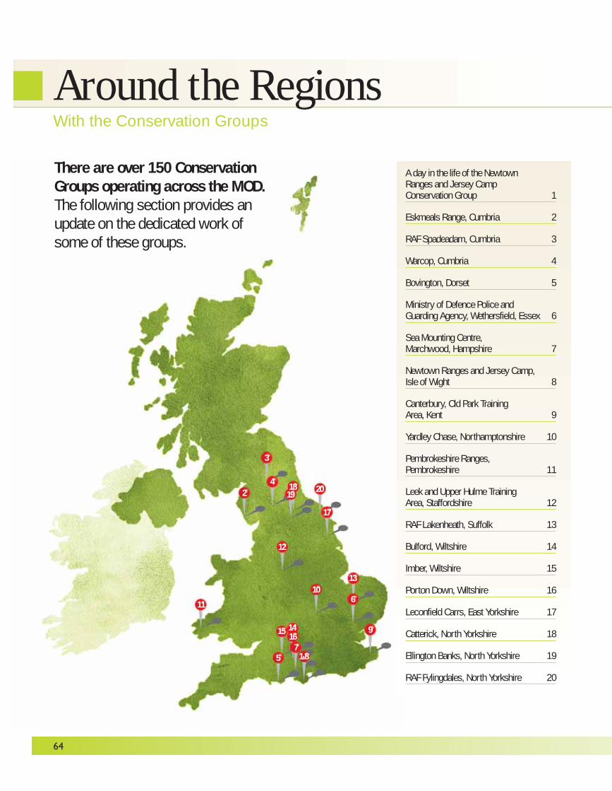
64
A day in the life of the NewtownRanges and Jersey Camp Conservation Group 1
Eskmeals Range, Cumbria 2
RAF Spadeadam, Cumbria 3
Warcop, Cumbria 4
Bovington, Dorset 5
Ministry of Defence Police and Guarding Agency, Wethersfield, Essex 6
Sea Mounting Centre, Marchwood, Hampshire 7
Newtown Ranges and Jersey Camp,Isle of Wight 8
Canterbury, Old Park Training Area, Kent 9
Yardley Chase, Northamptonshire 10
Pembrokeshire Ranges, Pembrokeshire 11
Leek and Upper Hulme Training Area, Staffordshire 12
RAF Lakenheath, Suffolk 13
Bulford, Wiltshire 14
Imber, Wiltshire 15
Porton Down, Wiltshire 16
Leconfield Carrs, East Yorkshire 17
Catterick, North Yorkshire 18
Ellington Banks, North Yorkshire 19
RAF Fylingdales, North Yorkshire 20
There are over 150 ConservationGroups operating across the MOD.The following section provides anupdate on the dedicated work ofsome of these groups.
Around the RegionsWith the Conservation Groups
1&8
2
3
4
5
6
7
9
10
11
12
13
1615
17
201819
14
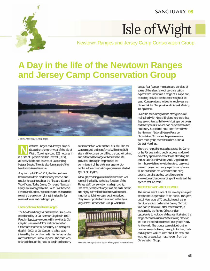
65
08
Newtown Ranges and Jersey Camp Conservation Group
Isle of Wight
ewtown Ranges and Jersey Camp issituated on the north west of the Isle ofWight. Covering around 328 hectares it
is a Site of Special Scientific Interest (SSSI), a RAMSAR site and an Area of OutstandingNatural Beauty. The site also forms part of theNewtown Nature Reserve.
Acquired by MOD in 1911, the Ranges havebeen used to train predominantly reserve andregular forces throughout the First and SecondWorld Wars. Today Jersey Camp and NewtownRange are managed by the South East ReserveForces and Cadets Association and its main roleremains the provision of a training facility forreserve forces and cadet groups.
Conservation at Newtown Ranges
The Newtown Ranges Conservation Group wasestablished by Lt Col Norman Clayden in 1977.Regular Sanctuary readers will know that Lt ColClayden was also MOD’s first ConservationOfficer and founder of Sanctuary. Following hisdeath in 2003, Lt Col Clayden’s ashes wereinterred by the pond named in his honour and amemorial bench is now in place. The pond wasenlarged through the need to obtain soil to carry
out remediation work on the SSSI site. The soilwas removed and transferred within the SSSIsite and the current pond filled the gap left behindand extended the range of habitats the siteprovides. This again emphasises thecommitment of the site’s management tocontinue the conservation programmes startedby Lt Col Clayden.
Although providing a well maintained and wellrun training facility is the key function of theRange staff, conservation is a high priority. The three permanent range staff are enthusiasticand highly committed to conservation work,much of which they carry out themselves.They are supported and assisted in this by avery active Conservation Group, which still
boasts four founder members and consists ofsome of the island’s leading conservationexperts who undertake a range of surveys andrecording activities on the site throughout theyear. Conservation priorities for each year areplanned at the Group’s Annual General Meetingin September.
Given the site’s designations strong links aremaintained with Natural England to ensure thatthey are content with the work being undertakenand that specialist advice can be obtained whennecessary. Close links have been formed withthe Newtown National Nature ReserveConsultative Committee. Representativesfrom each group attend the other’s AnnualGeneral Meetings.
There are no public footpaths across the Campor the Ranges and no public access is allowedexcept by application or for those attending theannual Orchid and Wildlife Walk. Applicationsfrom those wishing to visit the site to carry outresearch projects or study a particular speciesfound on the site are welcomed and bringpositive benefits as they contribute to theknowledge and understanding of the site and thespecies that live there.
THE ORCHID AND WILDLIFE WALK
This annual event is one of the few days in a yearthat the site is opened up to the public. This year,on 13 May, around 70 people, including theSanctuary editor, gathered at Jersey Camp totake part in this walk. After refreshments, awelcome by the Range Officer and anopportunity to look round displays illustrating therange of conservation activities taking place onthe site, the attendees divided into groups readyfor the walk. The groups were divided on thebasis of area of interest, botany, butterflies, birdsand a general walk to learn about the area, andwere led by a subject matter expert from theConservation Group.
N
A Day in the life of the Newtown Rangesand Jersey Camp Conservation Group
Sunset. Photography: Barry Angell.
Memorial Bench for Lt Col Clayden. Photography: Dave Maidment.
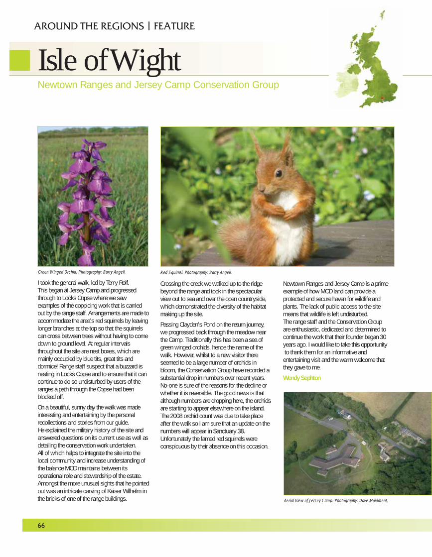
I took the general walk, led by Terry Rolf.This began at Jersey Camp and progressedthrough to Locks Copse where we sawexamples of the coppicing work that is carriedout by the range staff. Arrangements are made toaccommodate the area’s red squirrels by leavinglonger branches at the top so that the squirrelscan cross between trees without having to comedown to ground level. At regular intervalsthroughout the site are nest boxes, which aremainly occupied by blue tits, great tits anddormice! Range staff suspect that a buzzard isnesting in Locks Copse and to ensure that it cancontinue to do so undisturbed by users of theranges a path through the Copse had beenblocked off.
On a beautiful, sunny day the walk was madeinteresting and entertaining by the personalrecollections and stories from our guide. He explained the military history of the site andanswered questions on its current use as well asdetailing the conservation work undertaken.All of which helps to integrate the site into thelocal community and increase understanding ofthe balance MOD maintains between itsoperational role and stewardship of the estate.Amongst the more unusual sights that he pointedout was an intricate carving of Kaiser Wilhelm inthe bricks of one of the range buildings.
Crossing the creek we walked up to the ridgebeyond the range and took in the spectacularview out to sea and over the open countryside,which demonstrated the diversity of the habitatmaking up the site.
Passing Clayden’s Pond on the return journey,we progressed back through the meadow nearthe Camp. Traditionally this has been a sea ofgreen winged orchids, hence the name of thewalk. However, whilst to a new visitor thereseemed to be a large number of orchids inbloom, the Conservation Group have recorded asubstantial drop in numbers over recent years.No-one is sure of the reasons for the decline orwhether it is reversible. The good news is thatalthough numbers are dropping here, the orchidsare starting to appear elsewhere on the island.The 2008 orchid count was due to take placeafter the walk so I am sure that an update on thenumbers will appear in Sanctuary 38.Unfortunately the famed red squirrels wereconspicuous by their absence on this occasion.
Newtown Ranges and Jersey Camp is a primeexample of how MOD land can provide aprotected and secure haven for wildlife andplants. The lack of public access to the sitemeans that wildlife is left undisturbed. The range staff and the Conservation Group are enthusiastic, dedicated and determined tocontinue the work that their founder began 30years ago. I would like to take this opportunityto thank them for an informative andentertaining visit and the warm welcome thatthey gave to me.
Wendy Sephton
66
Isle of WightNewtown Ranges and Jersey Camp Conservation Group
AROUND THE REGIONS | FEATURE
Green Winged Orchid. Photography: Barry Angell. Red Squirrel. Photography: Barry Angell.
Aerial View of Jersey Camp. Photography: Dave Maidment.
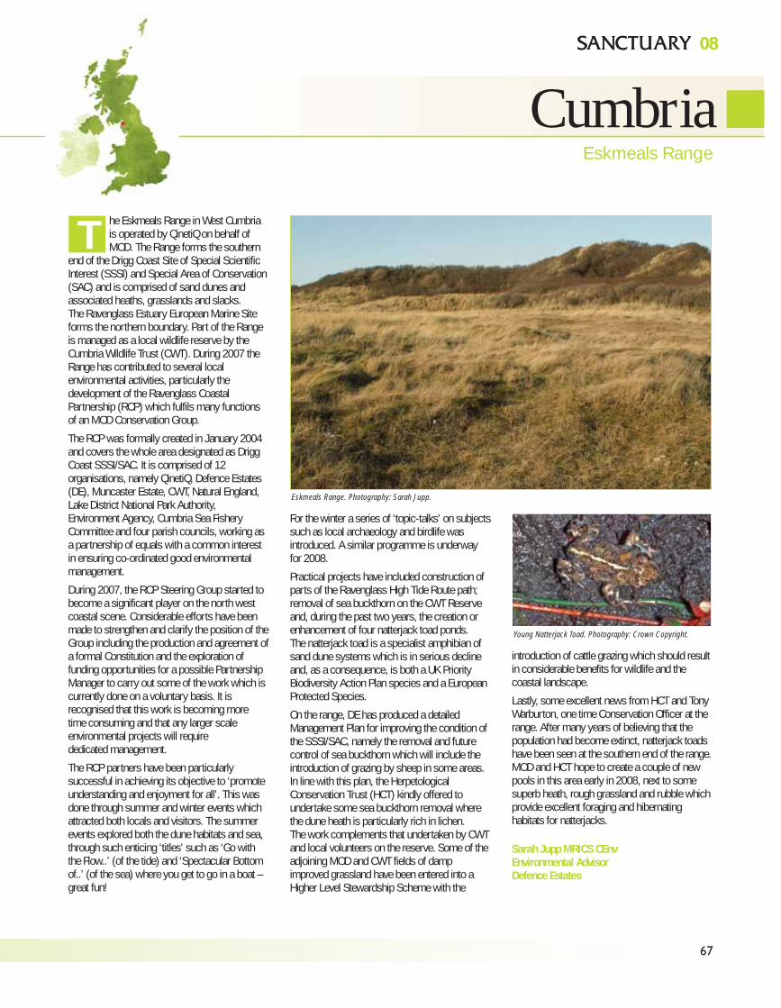
67
0808
CumbriaEskmeals Range
he Eskmeals Range in West Cumbriais operated by QinetiQ on behalf ofMOD. The Range forms the southern
end of the Drigg Coast Site of Special ScientificInterest (SSSI) and Special Area of Conservation(SAC) and is comprised of sand dunes andassociated heaths, grasslands and slacks.The Ravenglass Estuary European Marine Siteforms the northern boundary. Part of the Rangeis managed as a local wildlife reserve by theCumbria Wildlife Trust (CWT). During 2007 theRange has contributed to several localenvironmental activities, particularly thedevelopment of the Ravenglass CoastalPartnership (RCP) which fulfils many functionsof an MOD Conservation Group.
The RCP was formally created in January 2004and covers the whole area designated as DriggCoast SSSI/SAC. It is comprised of 12organisations, namely QinetiQ, Defence Estates(DE), Muncaster Estate, CWT, Natural England,Lake District National Park Authority,Environment Agency, Cumbria Sea FisheryCommittee and four parish councils, working asa partnership of equals with a common interestin ensuring co-ordinated good environmentalmanagement.
During 2007, the RCP Steering Group started tobecome a significant player on the north westcoastal scene. Considerable efforts have beenmade to strengthen and clarify the position of theGroup including the production and agreement ofa formal Constitution and the exploration offunding opportunities for a possible PartnershipManager to carry out some of the work which iscurrently done on a voluntary basis. It isrecognised that this work is becoming more time consuming and that any larger scaleenvironmental projects will require dedicated management.
The RCP partners have been particularlysuccessful in achieving its objective to ‘promoteunderstanding and enjoyment for all’. This wasdone through summer and winter events whichattracted both locals and visitors. The summerevents explored both the dune habitats and sea,through such enticing ‘titles’ such as ‘Go withthe Flow..’ (of the tide) and ‘Spectacular Bottomof..’ (of the sea) where you get to go in a boat –great fun!
For the winter a series of ‘topic-talks’ on subjectssuch as local archaeology and birdlife wasintroduced. A similar programme is underwayfor 2008.
Practical projects have included construction ofparts of the Ravenglass High Tide Route path;removal of sea buckthorn on the CWT Reserveand, during the past two years, the creation orenhancement of four natterjack toad ponds. The natterjack toad is a specialist amphibian ofsand dune systems which is in serious declineand, as a consequence, is both a UK PriorityBiodiversity Action Plan species and a EuropeanProtected Species.
On the range, DE has produced a detailedManagement Plan for improving the condition ofthe SSSI/SAC, namely the removal and futurecontrol of sea buckthorn which will include theintroduction of grazing by sheep in some areas.In line with this plan, the HerpetologicalConservation Trust (HCT) kindly offered toundertake some sea buckthorn removal wherethe dune heath is particularly rich in lichen.The work complements that undertaken by CWTand local volunteers on the reserve. Some of theadjoining MOD and CWT fields of dampimproved grassland have been entered into aHigher Level Stewardship Scheme with the
introduction of cattle grazing which should resultin considerable benefits for wildlife and thecoastal landscape.
Lastly, some excellent news from HCT and TonyWarburton, one time Conservation Officer at therange. After many years of believing that thepopulation had become extinct, natterjack toadshave been seen at the southern end of the range.MOD and HCT hope to create a couple of newpools in this area early in 2008, next to somesuperb heath, rough grassland and rubble whichprovide excellent foraging and hibernatinghabitats for natterjacks.
Sarah Jupp MRICS CEnvEnvironmental AdvisorDefence Estates
Young Natterjack Toad. Photography: Crown Copyright.
Eskmeals Range. Photography: Sarah Jupp.
T
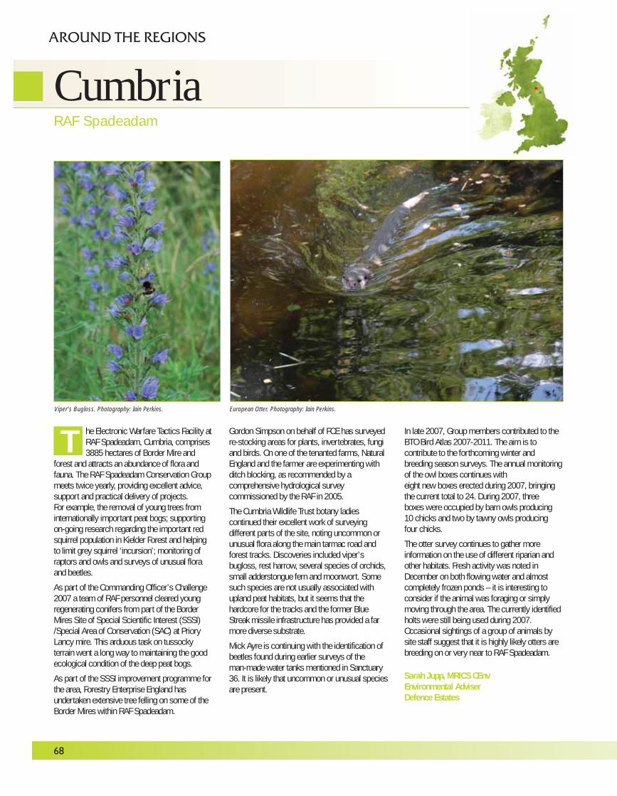
he Electronic Warfare Tactics Facility atRAF Spadeadam, Cumbria, comprises3885 hectares of Border Mire and
forest and attracts an abundance of flora andfauna. The RAF Spadeadam Conservation Groupmeets twice yearly, providing excellent advice,support and practical delivery of projects.For example, the removal of young trees frominternationally important peat bogs; supportingon-going research regarding the important redsquirrel population in Kielder Forest and helpingto limit grey squirrel ‘incursion’; monitoring ofraptors and owls and surveys of unusual floraand beetles.
As part of the Commanding Officer’s Challenge2007 a team of RAF personnel cleared youngregenerating conifers from part of the BorderMires Site of Special Scientific Interest (SSSI)/Special Area of Conservation (SAC) at PrioryLancy mire. This arduous task on tussockyterrain went a long way to maintaining the goodecological condition of the deep peat bogs.
As part of the SSSI improvement programme forthe area, Forestry Enterprise England hasundertaken extensive tree felling on some of theBorder Mires within RAF Spadeadam.
Gordon Simpson on behalf of FCE has surveyedre-stocking areas for plants, invertebrates, fungiand birds. On one of the tenanted farms, NaturalEngland and the farmer are experimenting withditch blocking, as recommended by acomprehensive hydrological surveycommissioned by the RAF in 2005.
The Cumbria Wildlife Trust botany ladiescontinued their excellent work of surveyingdifferent parts of the site, noting uncommon orunusual flora along the main tarmac road andforest tracks. Discoveries included viper’sbugloss, rest harrow, several species of orchids,small adderstongue fern and moonwort. Somesuch species are not usually associated withupland peat habitats, but it seems that thehardcore for the tracks and the former BlueStreak missile infrastructure has provided a farmore diverse substrate.
Mick Ayre is continuing with the identification ofbeetles found during earlier surveys of the man-made water tanks mentioned in Sanctuary36. It is likely that uncommon or unusual speciesare present.
In late 2007, Group members contributed to theBTO Bird Atlas 2007-2011. The aim is tocontribute to the forthcoming winter andbreeding season surveys. The annual monitoringof the owl boxes continues with eight new boxes erected during 2007, bringingthe current total to 24. During 2007, three boxes were occupied by barn owls producing 10 chicks and two by tawny owls producing four chicks.
The otter survey continues to gather moreinformation on the use of different riparian andother habitats. Fresh activity was noted inDecember on both flowing water and almostcompletely frozen ponds – it is interesting toconsider if the animal was foraging or simplymoving through the area. The currently identifiedholts were still being used during 2007.Occasional sightings of a group of animals bysite staff suggest that it is highly likely otters arebreeding on or very near to RAF Spadeadam.
Sarah Jupp, MRICS CEnvEnvironmental AdviserDefence Estates
68
T
CumbriaRAF Spadeadam
AROUND THE REGIONS
Viper’s Bugloss. Photography: Iain Perkins. European Otter. Photography: Iain Perkins.
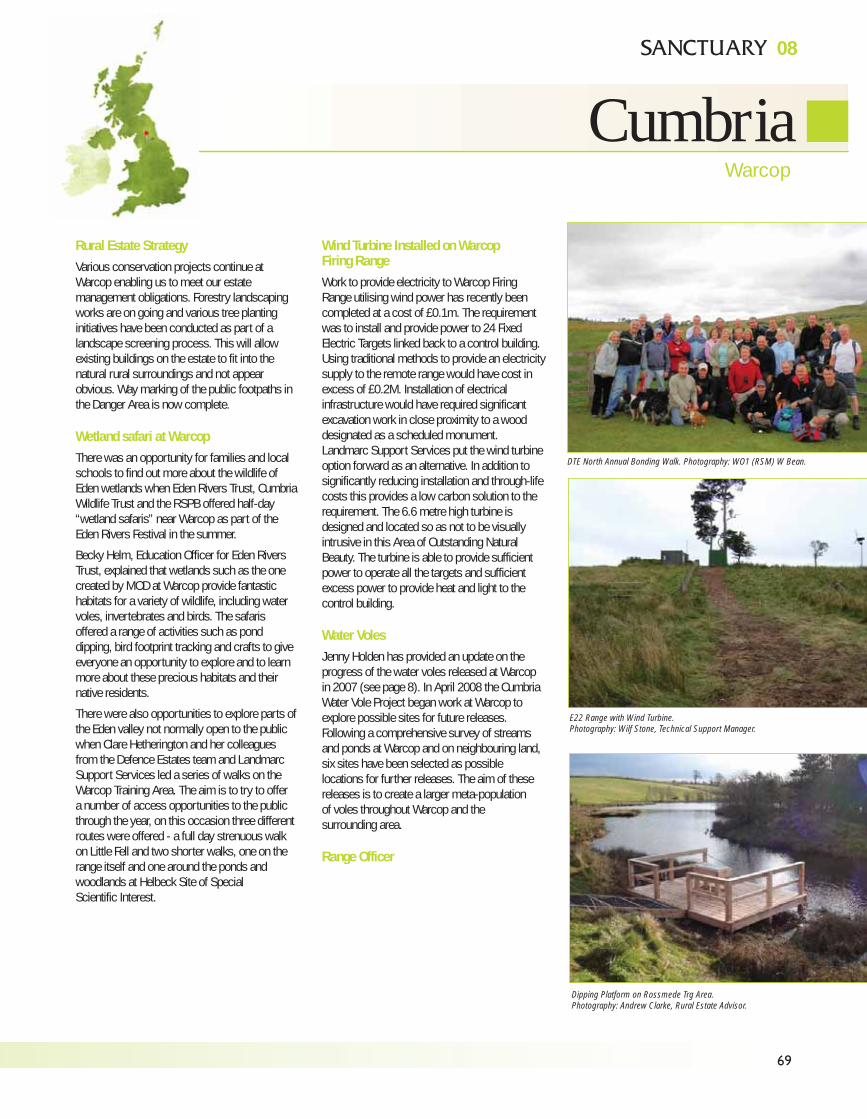
08
69
CumbriaWarcop
Rural Estate StrategyVarious conservation projects continue atWarcop enabling us to meet our estatemanagement obligations. Forestry landscapingworks are on going and various tree plantinginitiatives have been conducted as part of alandscape screening process. This will allowexisting buildings on the estate to fit into thenatural rural surroundings and not appearobvious. Way marking of the public footpaths inthe Danger Area is now complete.
Wetland safari at WarcopThere was an opportunity for families and localschools to find out more about the wildlife ofEden wetlands when Eden Rivers Trust, CumbriaWildlife Trust and the RSPB offered half-day“wetland safaris” near Warcop as part of theEden Rivers Festival in the summer.
Becky Helm, Education Officer for Eden RiversTrust, explained that wetlands such as the onecreated by MOD at Warcop provide fantastichabitats for a variety of wildlife, including watervoles, invertebrates and birds. The safarisoffered a range of activities such as ponddipping, bird footprint tracking and crafts to giveeveryone an opportunity to explore and to learnmore about these precious habitats and theirnative residents.
There were also opportunities to explore parts ofthe Eden valley not normally open to the publicwhen Clare Hetherington and her colleaguesfrom the Defence Estates team and LandmarcSupport Services led a series of walks on theWarcop Training Area. The aim is to try to offer a number of access opportunities to the publicthrough the year, on this occasion three differentroutes were offered - a full day strenuous walkon Little Fell and two shorter walks, one on therange itself and one around the ponds andwoodlands at Helbeck Site of Special Scientific Interest.
Wind Turbine Installed on Warcop Firing RangeWork to provide electricity to Warcop FiringRange utilising wind power has recently beencompleted at a cost of £0.1m. The requirementwas to install and provide power to 24 FixedElectric Targets linked back to a control building.Using traditional methods to provide an electricitysupply to the remote range would have cost inexcess of £0.2M. Installation of electricalinfrastructure would have required significantexcavation work in close proximity to a wooddesignated as a scheduled monument.Landmarc Support Services put the wind turbineoption forward as an alternative. In addition tosignificantly reducing installation and through-lifecosts this provides a low carbon solution to therequirement. The 6.6 metre high turbine isdesigned and located so as not to be visuallyintrusive in this Area of Outstanding NaturalBeauty. The turbine is able to provide sufficientpower to operate all the targets and sufficientexcess power to provide heat and light to thecontrol building.
Water VolesJenny Holden has provided an update on theprogress of the water voles released at Warcopin 2007 (see page 8). In April 2008 the CumbriaWater Vole Project began work at Warcop toexplore possible sites for future releases.Following a comprehensive survey of streamsand ponds at Warcop and on neighbouring land,six sites have been selected as possiblelocations for further releases. The aim of thesereleases is to create a larger meta-population of voles throughout Warcop and the surrounding area.
Range Officer
DTE North Annual Bonding Walk. Photography: WO1 (RSM) W Bean.
E22 Range with Wind Turbine.
Photography: Wilf Stone, Technical Support Manager.
Dipping Platform on Rossmede Trg Area.
Photography: Andrew Clarke, Rural Estate Advisor.
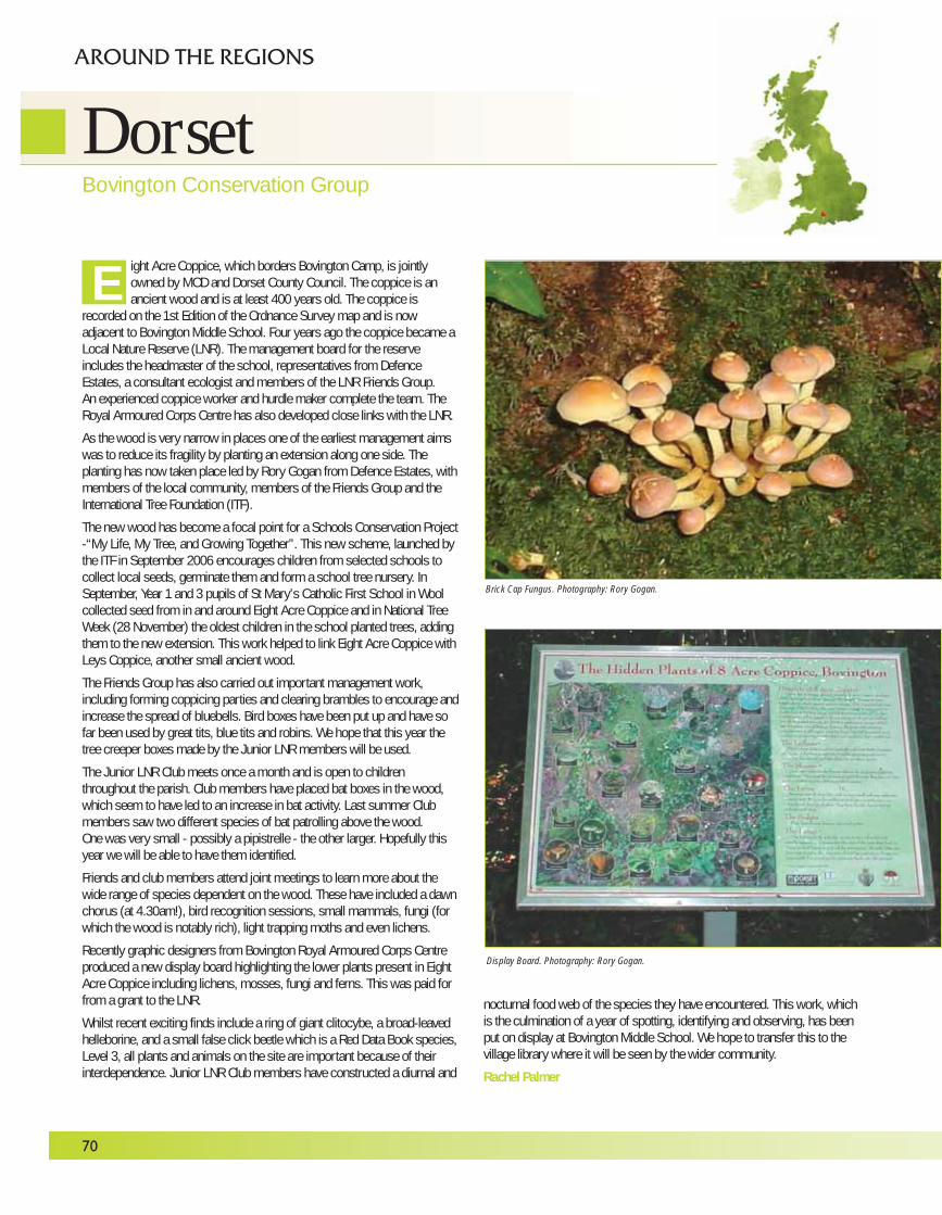
ight Acre Coppice, which borders Bovington Camp, is jointlyowned by MOD and Dorset County Council. The coppice is anancient wood and is at least 400 years old. The coppice is
recorded on the 1st Edition of the Ordnance Survey map and is nowadjacent to Bovington Middle School. Four years ago the coppice became aLocal Nature Reserve (LNR). The management board for the reserveincludes the headmaster of the school, representatives from DefenceEstates, a consultant ecologist and members of the LNR Friends Group. An experienced coppice worker and hurdle maker complete the team. TheRoyal Armoured Corps Centre has also developed close links with the LNR.
As the wood is very narrow in places one of the earliest management aimswas to reduce its fragility by planting an extension along one side. Theplanting has now taken place led by Rory Gogan from Defence Estates, withmembers of the local community, members of the Friends Group and theInternational Tree Foundation (ITF).
The new wood has become a focal point for a Schools Conservation Project-“My Life, My Tree, and Growing Together”. This new scheme, launched bythe ITF in September 2006 encourages children from selected schools tocollect local seeds, germinate them and form a school tree nursery. InSeptember, Year 1 and 3 pupils of St Mary’s Catholic First School in Woolcollected seed from in and around Eight Acre Coppice and in National TreeWeek (28 November) the oldest children in the school planted trees, addingthem to the new extension. This work helped to link Eight Acre Coppice withLeys Coppice, another small ancient wood.
The Friends Group has also carried out important management work,including forming coppicing parties and clearing brambles to encourage andincrease the spread of bluebells. Bird boxes have been put up and have sofar been used by great tits, blue tits and robins. We hope that this year thetree creeper boxes made by the Junior LNR members will be used.
The Junior LNR Club meets once a month and is open to childrenthroughout the parish. Club members have placed bat boxes in the wood,which seem to have led to an increase in bat activity. Last summer Clubmembers saw two different species of bat patrolling above the wood. One was very small - possibly a pipistrelle - the other larger. Hopefully thisyear we will be able to have them identified.
Friends and club members attend joint meetings to learn more about thewide range of species dependent on the wood. These have included a dawnchorus (at 4.30am!), bird recognition sessions, small mammals, fungi (forwhich the wood is notably rich), light trapping moths and even lichens.
Recently graphic designers from Bovington Royal Armoured Corps Centreproduced a new display board highlighting the lower plants present in EightAcre Coppice including lichens, mosses, fungi and ferns. This was paid forfrom a grant to the LNR.
Whilst recent exciting finds include a ring of giant clitocybe, a broad-leavedhelleborine, and a small false click beetle which is a Red Data Book species,Level 3, all plants and animals on the site are important because of theirinterdependence. Junior LNR Club members have constructed a diurnal and
nocturnal food web of the species they have encountered. This work, whichis the culmination of a year of spotting, identifying and observing, has beenput on display at Bovington Middle School. We hope to transfer this to thevillage library where it will be seen by the wider community.
Rachel Palmer
70
DorsetBovington Conservation Group
AROUND THE REGIONS
E
Brick Cap Fungus. Photography: Rory Gogan.
Display Board. Photography: Rory Gogan.
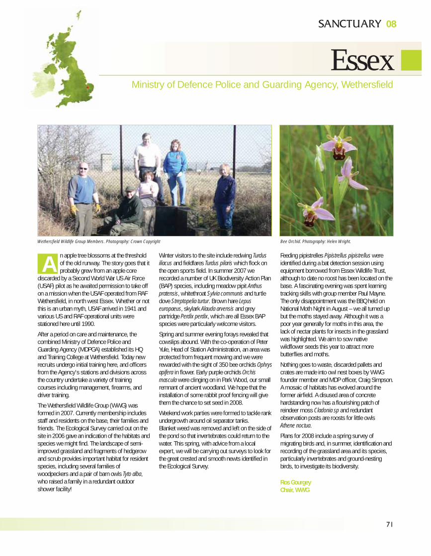
71
EssexMinistry of Defence Police and Guarding Agency, Wethersfield
08
n apple tree blossoms at the thresholdof the old runway. The story goes that itprobably grew from an apple core
discarded by a Second World War US Air Force(USAF) pilot as he awaited permission to take offon a mission when the USAF operated from RAFWethersfield, in north west Essex. Whether or notthis is an urban myth, USAF arrived in 1941 andvarious US and RAF operational units werestationed here until 1990.
After a period on care and maintenance, thecombined Ministry of Defence Police andGuarding Agency (MDPGA) established its HQand Training College at Wethersfield. Today newrecruits undergo initial training here, and officersfrom the Agency’s stations and divisions acrossthe country undertake a variety of trainingcourses including management, firearms, anddriver training.
The Wethersfield Wildlife Group (WWG) wasformed in 2007. Currently membership includesstaff and residents on the base, their families andfriends. The Ecological Survey carried out on thesite in 2006 gave an indication of the habitats andspecies we might find. The landscape of semi-improved grassland and fragments of hedgerowand scrub provides important habitat for residentspecies, including several families ofwoodpeckers and a pair of barn owls Tyto alba,who raised a family in a redundant outdoorshower facility!
Winter visitors to the site include redwing Turdusiliacus and fieldfares Turdus pilaris which flock onthe open sports field. In summer 2007 werecorded a number of UK Biodiversity Action Plan(BAP) species, including meadow pipit Anthuspratensis, whitethroat Sylvia communis and turtledove Streptopelia turtur. Brown hare Lepuseuropaeus, skylark Alauda arvensis and greypartridge Perdix perdix, which are all Essex BAPspecies were particularly welcome visitors.
Spring and summer evening forays revealed thatcowslips abound. With the co-operation of PeterYule, Head of Station Administration, an area wasprotected from frequent mowing and we wererewarded with the sight of 350 bee orchids Ophrysapifera in flower. Early purple orchids Orchismascula were clinging on in Park Wood, our smallremnant of ancient woodland. We hope that theinstallation of some rabbit proof fencing will givethem the chance to set seed in 2008.
Weekend work parties were formed to tackle rankundergrowth around oil separator tanks.Blanket weed was removed and left on the side ofthe pond so that invertebrates could return to thewater. This spring, with advice from a localexpert, we will be carrying out surveys to look forthe great crested and smooth newts identified inthe Ecological Survey.
Feeding pipistrelles Pipistrellus pipistrellus wereidentified during a bat detection session usingequipment borrowed from Essex Wildlife Trust,although to date no roost has been located on thebase. A fascinating evening was spent learningtracking skills with group member Paul Mayne.The only disappointment was the BBQ held onNational Moth Night in August – we all turned upbut the moths stayed away. Although it was apoor year generally for moths in this area, the lack of nectar plants for insects in the grasslandwas highlighted. We aim to sow native wildflower seeds this year to attract morebutterflies and moths.
Nothing goes to waste, discarded pallets andcrates are made into owl nest boxes by WWGfounder member and MDP officer, Craig Simpson.A mosaic of habitats has evolved around theformer airfield. A disused area of concretehardstanding now has a flourishing patch ofreindeer moss Cladonia sp and redundantobservation posts are roosts for little owls Athene noctua.
Plans for 2008 include a spring survey ofmigrating birds and, in summer, identification andrecording of the grassland area and its species,particularly invertebrates and ground-nestingbirds, to investigate its biodiversity.
Ros GourgeyChair, WWG
AWethersfield Wildlife Group Members. Photography: Crown Copyright Bee Orchid. Photography: Helen Wright.
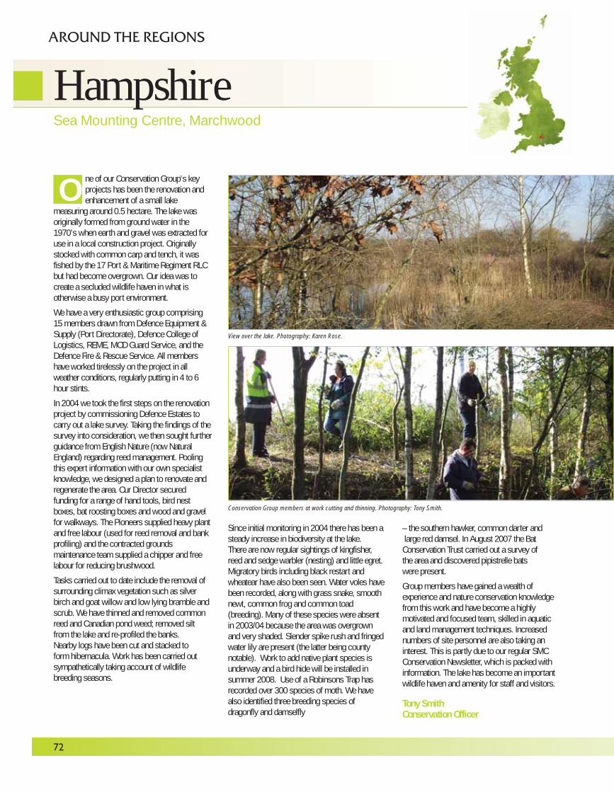
72
ne of our Conservation Group’s keyprojects has been the renovation andenhancement of a small lake
measuring around 0.5 hectare. The lake wasoriginally formed from ground water in the1970’s when earth and gravel was extracted foruse in a local construction project. Originallystocked with common carp and tench, it wasfished by the 17 Port & Maritime Regiment RLCbut had become overgrown. Our idea was tocreate a secluded wildlife haven in what isotherwise a busy port environment.
We have a very enthusiastic group comprising15 members drawn from Defence Equipment &Supply (Port Directorate), Defence College ofLogistics, REME, MOD Guard Service, and theDefence Fire & Rescue Service. All membershave worked tirelessly on the project in allweather conditions, regularly putting in 4 to 6 hour stints.
In 2004 we took the first steps on the renovationproject by commissioning Defence Estates tocarry out a lake survey. Taking the findings of thesurvey into consideration, we then sought furtherguidance from English Nature (now NaturalEngland) regarding reed management. Poolingthis expert information with our own specialistknowledge, we designed a plan to renovate andregenerate the area. Our Director securedfunding for a range of hand tools, bird nestboxes, bat roosting boxes and wood and gravelfor walkways. The Pioneers supplied heavy plantand free labour (used for reed removal and bankprofiling) and the contracted groundsmaintenance team supplied a chipper and freelabour for reducing brushwood.
Tasks carried out to date include the removal ofsurrounding climax vegetation such as silverbirch and goat willow and low lying bramble andscrub. We have thinned and removed commonreed and Canadian pond weed; removed siltfrom the lake and re-profiled the banks.Nearby logs have been cut and stacked toform hibernacula. Work has been carried outsympathetically taking account of wildlifebreeding seasons.
Since initial monitoring in 2004 there has been asteady increase in biodiversity at the lake. There are now regular sightings of kingfisher,reed and sedge warbler (nesting) and little egret.Migratory birds including black restart andwheatear have also been seen. Water voles havebeen recorded, along with grass snake, smoothnewt, common frog and common toad(breeding). Many of these species were absentin 2003/04 because the area was overgrownand very shaded. Slender spike rush and fringedwater lily are present (the latter being countynotable). Work to add native plant species isunderway and a bird hide will be installed insummer 2008. Use of a Robinsons Trap hasrecorded over 300 species of moth. We havealso identified three breeding species ofdragonfly and damselfly
– the southern hawker, common darter andlarge red damsel. In August 2007 the BatConservation Trust carried out a survey of the area and discovered pipistrelle bats were present.
Group members have gained a wealth ofexperience and nature conservation knowledgefrom this work and have become a highlymotivated and focused team, skilled in aquaticand land management techniques. Increasednumbers of site personnel are also taking aninterest. This is partly due to our regular SMCConservation Newsletter, which is packed withinformation. The lake has become an importantwildlife haven and amenity for staff and visitors.
Tony SmithConservation Officer
O
HampshireSea Mounting Centre, Marchwood
AROUND THE REGIONS
View over the lake. Photography: Karen Rose.
Conservation Group members at work cutting and thinning. Photography: Tony Smith.
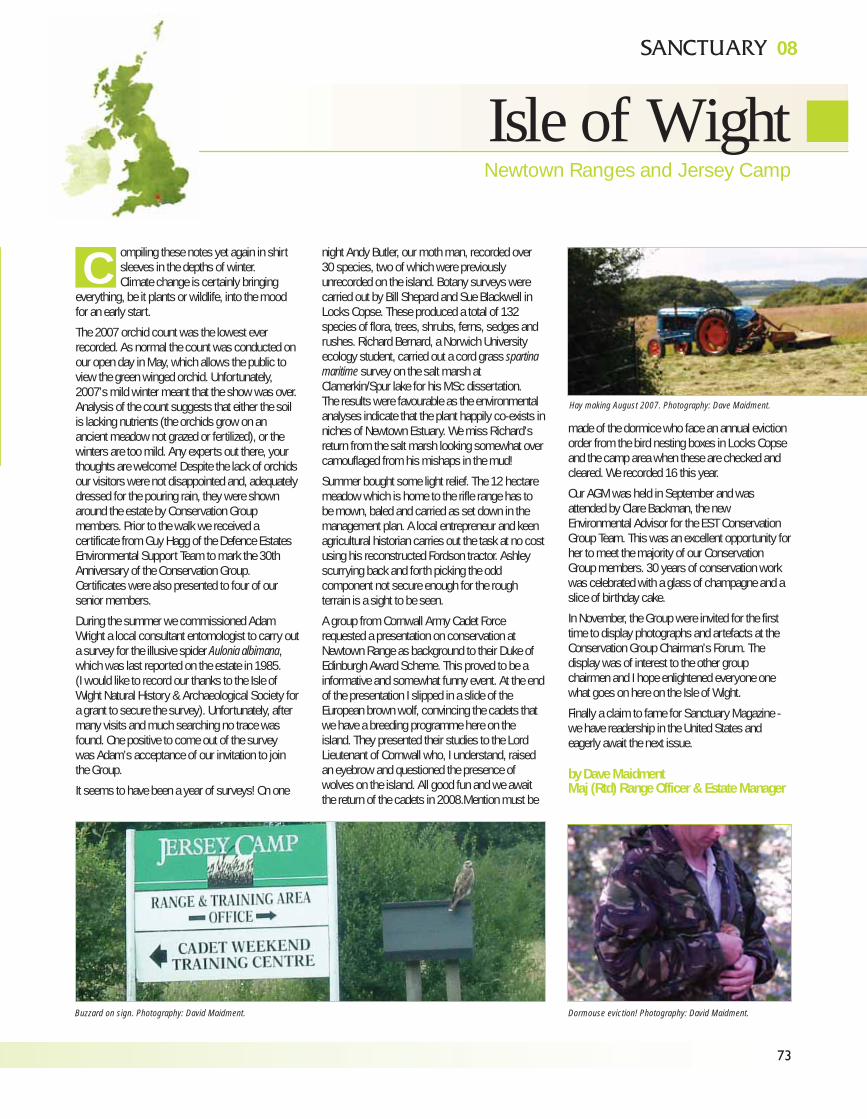
73
Isle of WightNewtown Ranges and Jersey Camp
08
ompiling these notes yet again in shirtsleeves in the depths of winter. Climate change is certainly bringing
everything, be it plants or wildlife, into the moodfor an early start.
The 2007 orchid count was the lowest everrecorded. As normal the count was conducted onour open day in May, which allows the public toview the green winged orchid. Unfortunately,2007’s mild winter meant that the show was over.Analysis of the count suggests that either the soilis lacking nutrients (the orchids grow on anancient meadow not grazed or fertilized), or thewinters are too mild. Any experts out there, yourthoughts are welcome! Despite the lack of orchidsour visitors were not disappointed and, adequatelydressed for the pouring rain, they were shownaround the estate by Conservation Groupmembers. Prior to the walk we received acertificate from Guy Hagg of the Defence EstatesEnvironmental Support Team to mark the 30thAnniversary of the Conservation Group.Certificates were also presented to four of oursenior members.
During the summer we commissioned AdamWright a local consultant entomologist to carry outa survey for the illusive spider Aulonia albimana,which was last reported on the estate in 1985. (I would like to record our thanks to the Isle ofWight Natural History & Archaeological Society fora grant to secure the survey). Unfortunately, aftermany visits and much searching no trace wasfound. One positive to come out of the survey was Adam’s acceptance of our invitation to jointhe Group.
It seems to have been a year of surveys! On one
night Andy Butler, our moth man, recorded over30 species, two of which were previouslyunrecorded on the island. Botany surveys werecarried out by Bill Shepard and Sue Blackwell inLocks Copse. These produced a total of 132species of flora, trees, shrubs, ferns, sedges andrushes. Richard Bernard, a Norwich Universityecology student, carried out a cord grass spartinamaritime survey on the salt marsh atClamerkin/Spur lake for his MSc dissertation.The results were favourable as the environmentalanalyses indicate that the plant happily co-exists inniches of Newtown Estuary. We miss Richard’sreturn from the salt marsh looking somewhat overcamouflaged from his mishaps in the mud!
Summer bought some light relief. The 12 hectaremeadow which is home to the rifle range has tobe mown, baled and carried as set down in themanagement plan. A local entrepreneur and keenagricultural historian carries out the task at no costusing his reconstructed Fordson tractor. Ashleyscurrying back and forth picking the oddcomponent not secure enough for the roughterrain is a sight to be seen.
A group from Cornwall Army Cadet Forcerequested a presentation on conservation atNewtown Range as background to their Duke ofEdinburgh Award Scheme. This proved to be ainformative and somewhat funny event. At the endof the presentation I slipped in a slide of theEuropean brown wolf, convincing the cadets thatwe have a breeding programme here on theisland. They presented their studies to the LordLieutenant of Cornwall who, I understand, raisedan eyebrow and questioned the presence ofwolves on the island. All good fun and we awaitthe return of the cadets in 2008.Mention must be
made of the dormice who face an annual evictionorder from the bird nesting boxes in Locks Copseand the camp area when these are checked andcleared. We recorded 16 this year.
Our AGM was held in September and wasattended by Clare Backman, the newEnvironmental Advisor for the EST ConservationGroup Team. This was an excellent opportunity forher to meet the majority of our ConservationGroup members. 30 years of conservation workwas celebrated with a glass of champagne and aslice of birthday cake.
In November, the Group were invited for the firsttime to display photographs and artefacts at theConservation Group Chairman’s Forum. Thedisplay was of interest to the other groupchairmen and I hope enlightened everyone onewhat goes on here on the Isle of Wight.
Finally a claim to fame for Sanctuary Magazine -we have readership in the United States andeagerly await the next issue.
by Dave MaidmentMaj (Rtd) Range Officer & Estate Manager
C
Buzzard on sign. Photography: David Maidment. Dormouse eviction! Photography: David Maidment.
Hay making August 2007. Photography: Dave Maidment.
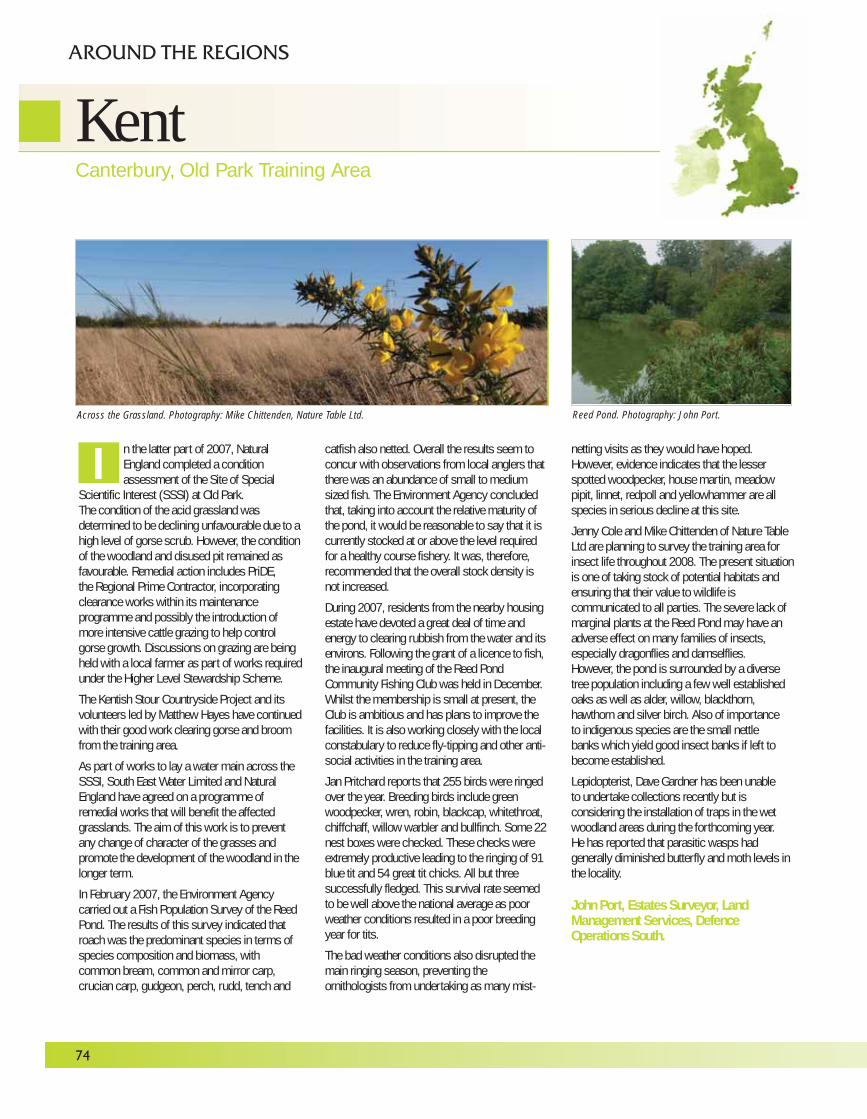
74
KentCanterbury, Old Park Training Area
AROUND THE REGIONS
n the latter part of 2007, NaturalEngland completed a conditionassessment of the Site of Special
Scientific Interest (SSSI) at Old Park. The condition of the acid grassland wasdetermined to be declining unfavourable due to ahigh level of gorse scrub. However, the conditionof the woodland and disused pit remained asfavourable. Remedial action includes PriDE, the Regional Prime Contractor, incorporatingclearance works within its maintenanceprogramme and possibly the introduction ofmore intensive cattle grazing to help controlgorse growth. Discussions on grazing are beingheld with a local farmer as part of works requiredunder the Higher Level Stewardship Scheme.
The Kentish Stour Countryside Project and itsvolunteers led by Matthew Hayes have continuedwith their good work clearing gorse and broomfrom the training area.
As part of works to lay a water main across theSSSI, South East Water Limited and NaturalEngland have agreed on a programme ofremedial works that will benefit the affectedgrasslands. The aim of this work is to preventany change of character of the grasses andpromote the development of the woodland in thelonger term.
In February 2007, the Environment Agencycarried out a Fish Population Survey of the ReedPond. The results of this survey indicated thatroach was the predominant species in terms ofspecies composition and biomass, withcommon bream, common and mirror carp,crucian carp, gudgeon, perch, rudd, tench and
catfish also netted. Overall the results seem toconcur with observations from local anglers thatthere was an abundance of small to mediumsized fish. The Environment Agency concludedthat, taking into account the relative maturity ofthe pond, it would be reasonable to say that it iscurrently stocked at or above the level requiredfor a healthy course fishery. It was, therefore,recommended that the overall stock density isnot increased.
During 2007, residents from the nearby housingestate have devoted a great deal of time andenergy to clearing rubbish from the water and itsenvirons. Following the grant of a licence to fish,the inaugural meeting of the Reed PondCommunity Fishing Club was held in December.Whilst the membership is small at present, theClub is ambitious and has plans to improve thefacilities. It is also working closely with the localconstabulary to reduce fly-tipping and other anti-social activities in the training area.
Jan Pritchard reports that 255 birds were ringedover the year. Breeding birds include greenwoodpecker, wren, robin, blackcap, whitethroat,chiffchaff, willow warbler and bullfinch. Some 22nest boxes were checked. These checks wereextremely productive leading to the ringing of 91blue tit and 54 great tit chicks. All but threesuccessfully fledged. This survival rate seemedto be well above the national average as poorweather conditions resulted in a poor breedingyear for tits.
The bad weather conditions also disrupted themain ringing season, preventing theornithologists from undertaking as many mist-
netting visits as they would have hoped.However, evidence indicates that the lesserspotted woodpecker, house martin, meadowpipit, linnet, redpoll and yellowhammer are allspecies in serious decline at this site.
Jenny Cole and Mike Chittenden of Nature TableLtd are planning to survey the training area forinsect life throughout 2008. The present situationis one of taking stock of potential habitats andensuring that their value to wildlife iscommunicated to all parties. The severe lack ofmarginal plants at the Reed Pond may have anadverse effect on many families of insects,especially dragonflies and damselflies.However, the pond is surrounded by a diversetree population including a few well establishedoaks as well as alder, willow, blackthorn,hawthorn and silver birch. Also of importanceto indigenous species are the small nettlebanks which yield good insect banks if left tobecome established.
Lepidopterist, Dave Gardner has been unable to undertake collections recently but isconsidering the installation of traps in the wetwoodland areas during the forthcoming year. He has reported that parasitic wasps hadgenerally diminished butterfly and moth levels inthe locality.
John Port, Estates Surveyor, LandManagement Services, DefenceOperations South.
IAcross the Grassland. Photography: Mike Chittenden, Nature Table Ltd. Reed Pond. Photography: John Port.
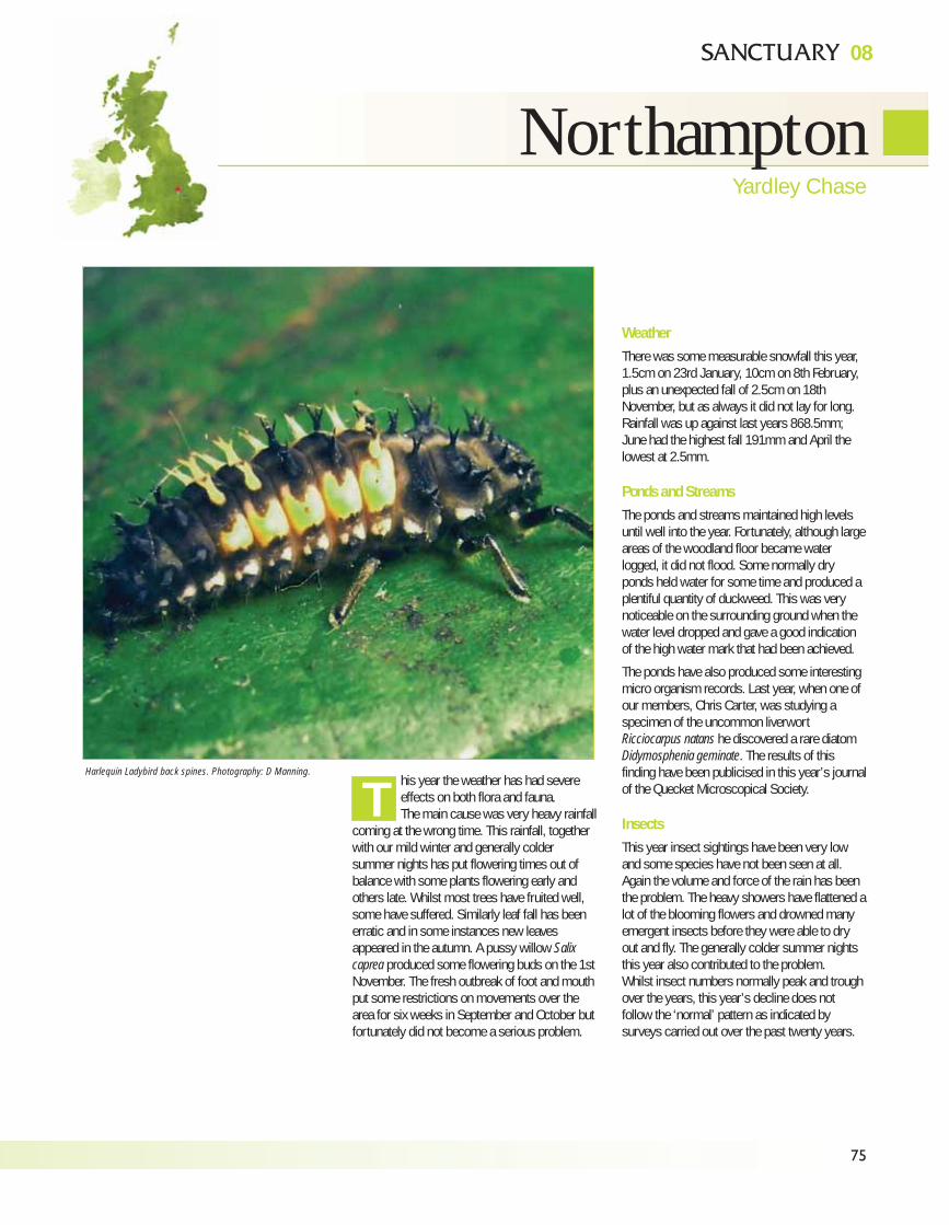
75
08
NorthamptonYardley Chase
his year the weather has had severeeffects on both flora and fauna.The main cause was very heavy rainfall
coming at the wrong time. This rainfall, togetherwith our mild winter and generally coldersummer nights has put flowering times out ofbalance with some plants flowering early andothers late. Whilst most trees have fruited well,some have suffered. Similarly leaf fall has beenerratic and in some instances new leavesappeared in the autumn. A pussy willow Salixcaprea produced some flowering buds on the 1stNovember. The fresh outbreak of foot and mouthput some restrictions on movements over thearea for six weeks in September and October butfortunately did not become a serious problem.
WeatherThere was some measurable snowfall this year,1.5cm on 23rd January, 10cm on 8th February,plus an unexpected fall of 2.5cm on 18thNovember, but as always it did not lay for long.Rainfall was up against last years 868.5mm;June had the highest fall 191mm and April thelowest at 2.5mm.
Ponds and StreamsThe ponds and streams maintained high levelsuntil well into the year. Fortunately, although largeareas of the woodland floor became waterlogged, it did not flood. Some normally dryponds held water for some time and produced aplentiful quantity of duckweed. This was verynoticeable on the surrounding ground when thewater level dropped and gave a good indicationof the high water mark that had been achieved.
The ponds have also produced some interestingmicro organism records. Last year, when one ofour members, Chris Carter, was studying aspecimen of the uncommon liverwortRicciocarpus natans he discovered a rare diatomDidymosphenia geminate. The results of thisfinding have been publicised in this year’s journalof the Quecket Microscopical Society.
InsectsThis year insect sightings have been very lowand some species have not been seen at all.Again the volume and force of the rain has beenthe problem. The heavy showers have flattened alot of the blooming flowers and drowned manyemergent insects before they were able to dryout and fly. The generally colder summer nightsthis year also contributed to the problem.Whilst insect numbers normally peak and troughover the years, this year’s decline does notfollow the ‘normal’ pattern as indicated bysurveys carried out over the past twenty years.
Harlequin Ladybird back spines. Photography: D Manning.
T
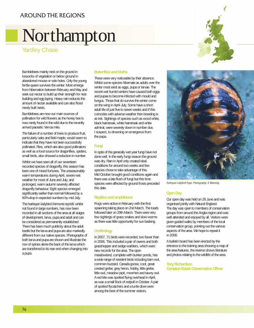
76
Bumblebees mainly nest on the ground intussocks of vegetation or below ground inabandoned mouse or vole holes. Only the youngfertile queen survives the winter. Most emergefrom hibernation between February and May andseek out nectar to build up their strength for nestbuilding and egg laying. Heavy rain reduces theamount of nectar available and can also floodnewly built nests.
Bumblebees are now our main sources ofpollination for wild flowers as the honey bee isnow rarely found in the wild due to the recentlyarrived parasitic Verroa mite.
The failure of a number of trees to produce fruit,particularly oaks and field maple, would seem toindicate that they have not been successfullypollinated. Flies, which are also good pollinatorsas well as a food source for dragonflies, spiders,small birds, also showed a reduction in number.
Whilst we have seen all of our seventeenrecorded species of dragonfly, this season hasbeen one of mixed fortunes. The unseasonablywarm temperatures during April, severe wetweather for most of June and July, andprolonged, warm autumn severely affecteddragonfly behaviour. Eight species emergedsignificantly earlier than normal followed by a60% drop in expected numbers by mid July.
The harlequin ladybird Harmonia axyridis whilstnot found in large numbers, has now beenrecorded in all sections of the area at all stagesof development, larva, pupa and adult and canbe considered as permanently established.There has been much publicity about the adultbeetle but the larva and pupa are also markedlydifferent from our native species. Photographs ofboth larva and pupa are shown and illustrate therow of spines alone the back of the larva whichare transferred to its rear end when changing intoa pupa.
Butterflies and MothsThese were very noticeable by their absence.Whilst some species hibernate as adults over thewinter most exist as eggs, pupa or larvae. Therecent wet humid winters have caused both eggsand pupae to become infected with mould andfungus. Those that do survive the winter comeon the wing in April-July. Some have a shortadult life of just five to seven weeks and if thiscoincides with adverse weather then breeding isat risk. Sightings of species such as wood white,black hairstreak, white hairstreak and whiteadmiral, were severely down in number due,I suspect, to drowning on emergence fromthe pupa.
FungiIn spite of the generally wet year fungi have notdone well. In the early fungi season the groundwas dry. Rain in April only created idealconditions for around two weeks and fewspecies chose to take advantage of this.Mid October brought good conditions again andthere was a late flush of fungi but this timespecies were affected by ground frosts precededthis date.
Reptiles and amphibiansFrogs were active in February with the firstspawning taking place on 2nd March. The toadsfollowed later on 29th March. There were veryfew sightings of grass snakes and slow wormsas there was little opportunity for sun basking.
OrnithologyIn 2007, 71 birds were recorded, two fewer thanin 2006. This included a pair of ravens and bothgrasshopper and sedge warblers, which werenew records for the area. The openmeadowland, complete with bunker ponds, hasa wide range of resident birds including barn owl,common buzzard, Canada goose, coot, greatcrested grebe, grey heron, hobby, little grebe,little owl, meadow pipit, moorhen and tawny owl.A red kite was spotted flying overhead in April,as was a small flock of redpoll in October. A pairof spotted flycatchers and a turtle dove wereamong the best of the summer visitors.
Open DayOur open day was held on 28 June and wasorganised jointly with Natural England. The day was open to members of conservationgroups from around the Anglia region and waswell attended and enjoyed by all. Visitors weregiven guided walks by members of the localconservation group, pointing out the variousaspects of the area. We hope to repeat it in 2008.
A bulletin board has been erected by theentrance to the training area showing a map ofthe area features, the reverse shows literatureand photos relating to the wildlife of the area.
Tony RichardsonCompton Estate Conservation Officer
NorthamptonYardley Chase
AROUND THE REGIONS
Harlequin Ladybird Pupa. Photography: D Manning.
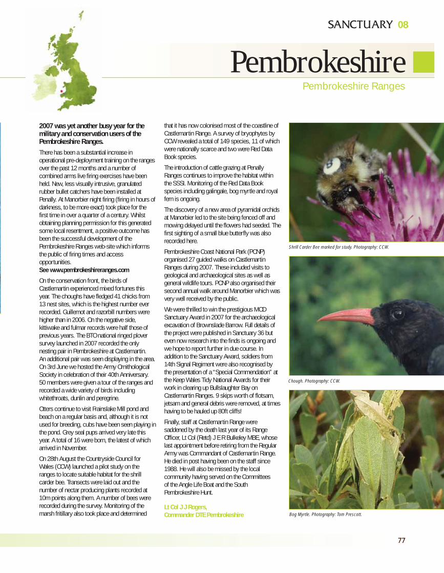
08
77
PembrokeshirePembrokeshire Ranges
2007 was yet another busy year for themilitary and conservation users of thePembrokeshire Ranges.There has been a substantial increase inoperational pre-deployment training on the rangesover the past 12 months and a number ofcombined arms live firing exercises have beenheld. New, less visually intrusive, granulatedrubber bullet catchers have been installed atPenally. At Manorbier night firing (firing in hours ofdarkness, to be more exact) took place for thefirst time in over a quarter of a century. Whilstobtaining planning permission for this generatedsome local resentment, a positive outcome hasbeen the successful development of thePembrokeshire Ranges web-site which informsthe public of firing times and accessopportunities.See www.pembrokeshireranges.com
On the conservation front, the birds ofCastlemartin experienced mixed fortunes thisyear. The choughs have fledged 41 chicks from13 nest sites, which is the highest number everrecorded. Guillemot and razorbill numbers werehigher than in 2006. On the negative side,kittiwake and fulmar records were half those ofprevious years. The BTO national ringed ploversurvey launched in 2007 recorded the onlynesting pair in Pembrokeshire at Castlemartin.An additional pair was seen displaying in the area.On 3rd June we hosted the Army OrnithologicalSociety in celebration of their 40th Anniversary.50 members were given a tour of the ranges andrecorded a wide variety of birds includingwhitethroats, dunlin and peregrine.
Otters continue to visit Frainslake Mill pond andbeach on a regular basis and, although it is notused for breeding, cubs have been seen playing inthe pond. Grey seal pups arrived very late thisyear. A total of 16 were born, the latest of whicharrived in November.
On 28th August the Countryside Council forWales (CCW) launched a pilot study on theranges to locate suitable habitat for the shrillcarder bee. Transects were laid out and thenumber of nectar producing plants recorded at10m points along them. A number of bees wererecorded during the survey. Monitoring of themarsh fritillary also took place and determined
that it has now colonised most of the coastline ofCastlemartin Range. A survey of bryophytes byCCW revealed a total of 149 species, 11 of whichwere nationally scarce and two were Red DataBook species.
The introduction of cattle grazing at PenallyRanges continues to improve the habitat withinthe SSSI. Monitoring of the Red Data Bookspecies including galingale, bog myrtle and royalfern is ongoing.
The discovery of a new area of pyramidal orchidsat Manorbier led to the site being fenced off andmowing delayed until the flowers had seeded. Thefirst sighting of a small blue butterfly was alsorecorded here.
Pembrokeshire Coast National Park (PCNP)organised 27 guided walks on CastlemartinRanges during 2007. These included visits togeological and archaeological sites as well asgeneral wildlife tours. PCNP also organised theirsecond annual walk around Manorbier which wasvery well received by the public.
We were thrilled to win the prestigious MODSanctuary Award in 2007 for the archaeologicalexcavation of Brownslade Barrow. Full details ofthe project were published in Sanctuary 36 buteven now research into the finds is ongoing andwe hope to report further in due course. Inaddition to the Sanctuary Award, soldiers from14th Signal Regiment were also recognised bythe presentation of a “Special Commendation” atthe Keep Wales Tidy National Awards for theirwork in clearing up Bullslaughter Bay onCastlemartin Ranges. 9 skips worth of flotsam,jetsam and general debris were removed, at timeshaving to be hauled up 80ft cliffs!
Finally, staff at Castlemartin Range weresaddened by the death last year of its RangeOfficer, Lt Col (Retd) J E R Bulkeley MBE, whoselast appointment before retiring from the RegularArmy was Commandant of Castlemartin Range.He died in post having been on the staff since1988. He will also be missed by the localcommunity having served on the Committees of the Angle Life Boat and the SouthPembrokeshire Hunt.
Lt Col J J Rogers,Commander DTE Pembrokeshire
Shrill Carder Bee marked for study. Photography: CCW.
Chough. Photography: CCW.
Bog Myrtle. Photography: Tom Prescott.
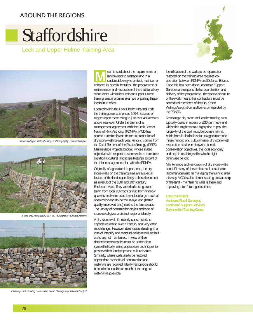
78
uch is said about the requirements onlandowners to manage land in asustainable way to protect, maintain or
enhance its special features. The programme ofmaintenance and restoration of the traditional drystone walls within the Leek and Upper Hulmetraining area is a prime example of putting theseideals in to effect.
Located within the Peak District National Park,the training area comprises 1094 hectares ofrugged open moor rising to just over 488 metresabove sea-level. Under the terms of amanagement agreement with the Peak DistrictNational Park Authority (PDNPA), MOD hasagreed to maintain and restore a proportion ofdry stone walling each year. Funding comes fromthe Rural Element of the Estate Strategy (REES)Maintenance Projects budget, whose statedobjective with respect to stone walls is to restoresignificant cultural landscape features as part ofthe joint management plan with the PDNPA.
Originally of agricultural importance, the drystone walls on the training area are a specialfeature of the landscape, likely to have been builtas a result of the 18th and 19th centuryEnclosure Acts. They were built using stonetaken from local outcrops or dug from shallowquarries and were used to enclose large tracts ofopen moor and divide the in-bye land (betterquality improved land) next to the farmsteads.The variety of construction styles and type ofstone used gives a distinct regional identity.
A dry stone wall, if properly constructed, iscapable of lasting over a century and very oftenmuch longer. However, deterioration leading to aloss of integrity and eventual collapse will set in ifwalls are not maintained. In view of theirdistinctiveness repairs must be undertakensympathetically, using appropriate techniques topreserve their landscape and cultural value.Similarly, where walls are to be restored,appropriate methods of construction andmaterials are required. Ideally restoration shouldbe carried out using as much of the originalmaterial as possible.
Identification of the walls to be repaired orrestored on the training area requires co-operation between PDNPA and Defence Estates.Once this has been done Landmarc SupportServices are responsible for coordination anddelivery of the programme. The specialist natureof the work means that contractors must beaccredited members of the Dry Stone Walling Association and be recommended by the PDNPA.
Restoring a dry stone wall on the training areatypically costs in excess of £30 per metre andwhilst this might seem a high price to pay, thelongevity of the wall must be borne in mind.Aside from its intrinsic value to agriculture andinnate historic and cultural value, dry stone wallrestoration has been shown to benefitconservation objectives, the local economy and help in retaining skills which might otherwise be lost.
Maintenance and restoration of dry stone wallscan fulfil many of the attributes of sustainableland management. In managing the training areathis way MOD is also demonstrating stewardshipof the land - maintaining what is there andimproving it for future generations.
Edward PomfretAssistant Rural Surveyor,Landmarc Support ServicesSwynnerton Training Camp
M
StaffordshireLeek and Upper Hulme Training Area
AROUND THE REGIONS
Stone walling in state of collapse. Photography: Edward Pomfret.
Stone wall completed 2007-08. Photography: Edward Pomfret.
Close-up shot showing consruction detail. Photography: Edward Pomfret.
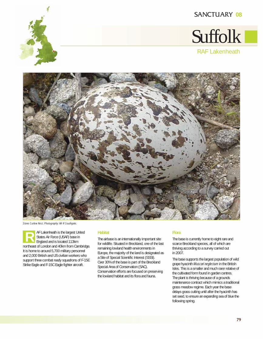
79
08
SuffolkRAF Lakenheath
AF Lakenheath is the largest UnitedStates Air Force (USAF) base inEngland and is located 113km
northeast of London and 40km from Cambridge.It is home to around 5,700 military personneland 2,000 British and US civilian workers whosupport three combat ready squadrons of F-15EStrike Eagle and F-15C Eagle fighter aircraft.
HabitatThe airbase is an internationally important sitefor wildlife. Situated in Breckland, one of the lastremaining lowland health environments inEurope, the majority of the land is designated asa Site of Special Scientific Interest (SSSI).Over 30% of the base is part of the BrecklandSpecial Area of Conservation (SAC).Conservation efforts are focused on preservingthe lowland habitat and its flora and fauna.
FloraThe base is currently home to eight rare andscarce Breckland species, all of which arethriving according to a survey carried outin 2007.
The base supports the largest population of wildgrape hyacinth Muscari neglectum in the BritishIsles. This is a smaller and much rarer relative ofthe cultivated form found in garden centres.The plant is thriving because of a groundsmaintenance contract which mimics a traditionalgrass meadow regime. Each year the basedelays grass cutting until after the hyacinth hasset seed, to ensure an expanding sea of blue thefollowing spring.
RStone Curlew Nest. Photography: Mr R Southgate.
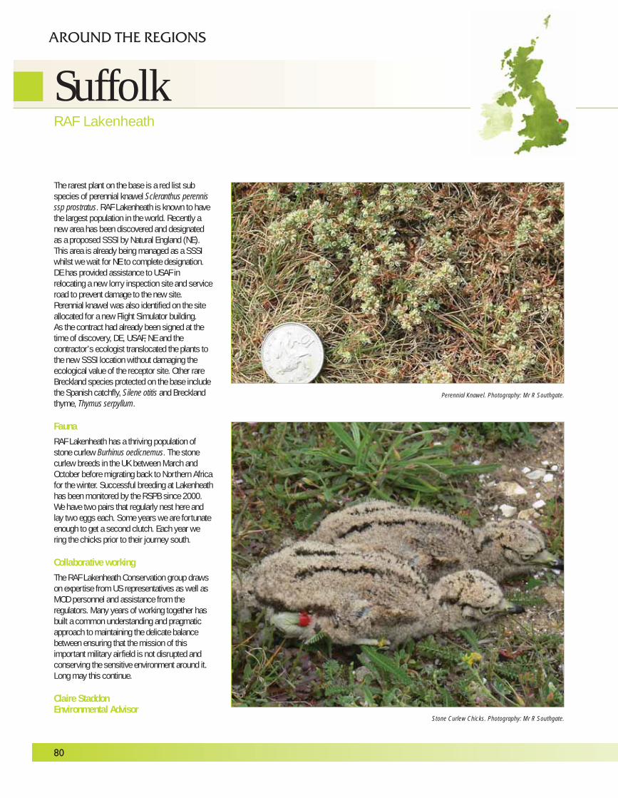
The rarest plant on the base is a red list subspecies of perennial knawel Scleranthus perennisssp prostratus. RAF Lakenheath is known to havethe largest population in the world. Recently anew area has been discovered and designatedas a proposed SSSI by Natural England (NE).This area is already being managed as a SSSIwhilst we wait for NE to complete designation.DE has provided assistance to USAF inrelocating a new lorry inspection site and serviceroad to prevent damage to the new site.Perennial knawel was also identified on the siteallocated for a new Flight Simulator building.As the contract had already been signed at thetime of discovery, DE, USAF, NE and thecontractor’s ecologist translocated the plants tothe new SSSI location without damaging theecological value of the receptor site. Other rareBreckland species protected on the base includethe Spanish catchfly, Silene otitis and Brecklandthyme, Thymus serpyllum.
FaunaRAF Lakenheath has a thriving population ofstone curlew Burhinus oedicnemus. The stonecurlew breeds in the UK between March andOctober before migrating back to Northern Africafor the winter. Successful breeding at Lakenheathhas been monitored by the RSPB since 2000.We have two pairs that regularly nest here andlay two eggs each. Some years we are fortunateenough to get a second clutch. Each year wering the chicks prior to their journey south.
Collaborative workingThe RAF Lakenheath Conservation group drawson expertise from US representatives as well asMOD personnel and assistance from theregulators. Many years of working together hasbuilt a common understanding and pragmaticapproach to maintaining the delicate balancebetween ensuring that the mission of thisimportant military airfield is not disrupted andconserving the sensitive environment around it.Long may this continue.
Claire StaddonEnvironmental Advisor
80
SuffolkRAF Lakenheath
AROUND THE REGIONS
Stone Curlew Chicks. Photography: Mr R Southgate.
Perennial Knawel. Photography: Mr R Southgate.
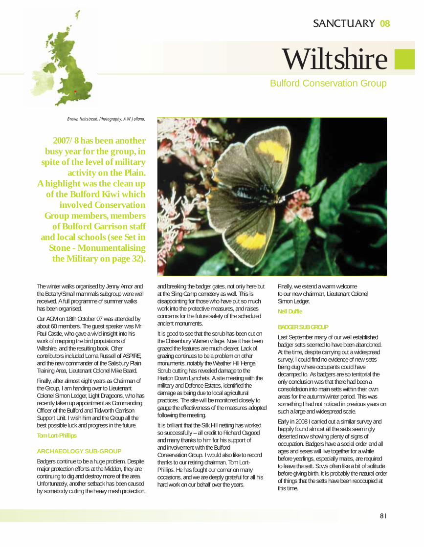
81
08
WiltshireBulford Conservation Group
The winter walks organised by Jenny Amor andthe Botany/Small mammals subgroup were wellreceived. A full programme of summer walkshas been organised.
Our AGM on 18th October 07 was attended byabout 60 members. The guest speaker was MrPaul Castle, who gave a vivid insight into hiswork of mapping the bird populations ofWiltshire, and the resulting book. Othercontributors included Lorna Russell of ASPIRE,and the new commander of the Salisbury PlainTraining Area, Lieutenant Colonel Mike Beard.
Finally, after almost eight years as Chairman ofthe Group, I am handing over to LieutenantColonel Simon Ledger, Light Dragoons, who hasrecently taken up appointment as CommandingOfficer of the Bulford and Tidworth GarrisonSupport Unit. I wish him and the Group all thebest possible luck and progress in the future.
Tom Lort-Phillips
ARCHAEOLOGY SUB-GROUP
Badgers continue to be a huge problem. Despitemajor protection efforts at the Midden, they arecontinuing to dig and destroy more of the area.Unfortunately, another setback has been causedby somebody cutting the heavy mesh protection,
and breaking the badger gates, not only here butat the Sling Camp cemetery as well. This isdisappointing for those who have put so muchwork into the protective measures, and raisesconcerns for the future safety of the scheduledancient monuments.
It is good to see that the scrub has been cut onthe Chisenbury Warren village. Now it has beengrazed the features are much clearer. Lack ofgrazing continues to be a problem on othermonuments, notably the Weather Hill Henge.Scrub cutting has revealed damage to theHaxton Down Lynchets. A site meeting with themilitary and Defence Estates, identified thedamage as being due to local agriculturalpractices. The site will be monitored closely togauge the effectiveness of the measures adoptedfollowing the meeting.
It is brilliant that the Silk Hill netting has workedso successfully – all credit to Richard Osgoodand many thanks to him for his support of and involvement with the Bulford Conservation Group. I would also like to recordthanks to our retiring chairman, Tom Lort-Phillips. He has fought our corner on manyoccasions, and we are deeply grateful for all hishard work on our behalf over the years.
Finally, we extend a warm welcome to our new chairman, Lieutenant Colonel Simon Ledger.
Nell Duffie
BADGER SUB GROUP
Last September many of our well establishedbadger setts seemed to have been abandoned.At the time, despite carrying out a widespreadsurvey, I could find no evidence of new settsbeing dug where occupants could havedecamped to. As badgers are so territorial theonly conclusion was that there had been aconsolidation into main setts within their ownareas for the autumn/winter period. This wassomething I had not noticed in previous years onsuch a large and widespread scale.
Early in 2008 I carried out a similar survey andhappily found almost all the setts seeminglydeserted now showing plenty of signs ofoccupation. Badgers have a social order and allages and sexes will live together for a whilebefore yearlings, especially males, are requiredto leave the sett. Sows often like a bit of solitudebefore giving birth. It is probably the natural orderof things that the setts have been reoccupied atthis time.
Brown Hairstreak. Photography: A W Jolland.
2007/8 has been anotherbusy year for the group, in
spite of the level of militaryactivity on the Plain.
A highlight was the clean upof the Bulford Kiwi which
involved ConservationGroup members, members
of Bulford Garrison staffand local schools (see Set in
Stone - Monumentalisingthe Military on page 32).
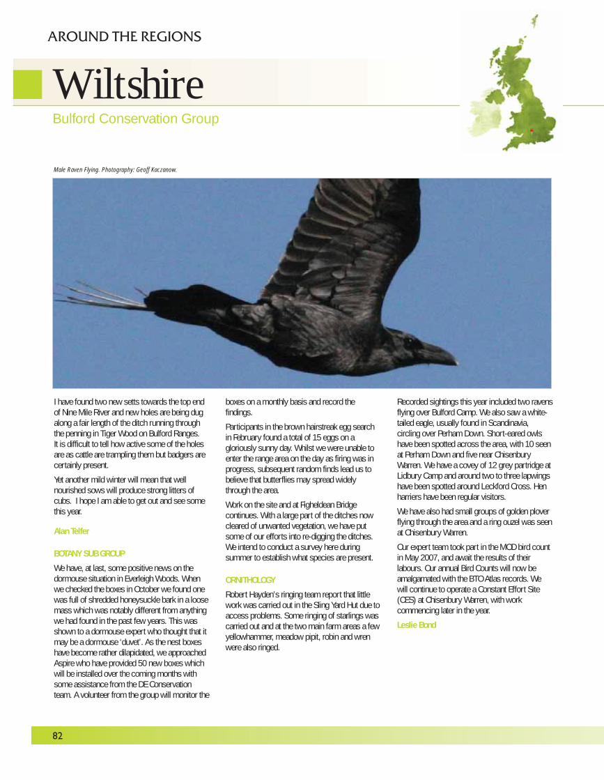
I have found two new setts towards the top endof Nine Mile River and new holes are being dugalong a fair length of the ditch running throughthe penning in Tiger Wood on Bulford Ranges.It is difficult to tell how active some of the holesare as cattle are trampling them but badgers arecertainly present.
Yet another mild winter will mean that wellnourished sows will produce strong litters ofcubs. I hope I am able to get out and see somethis year.
Alan Telfer
BOTANY SUB GROUP
We have, at last, some positive news on thedormouse situation in Everleigh Woods. Whenwe checked the boxes in October we found onewas full of shredded honeysuckle bark in a loosemass which was notably different from anythingwe had found in the past few years. This wasshown to a dormouse expert who thought that itmay be a dormouse ‘duvet’. As the nest boxeshave become rather dilapidated, we approachedAspire who have provided 50 new boxes whichwill be installed over the coming months withsome assistance from the DE Conservationteam. A volunteer from the group will monitor the
boxes on a monthly basis and record thefindings.
Participants in the brown hairstreak egg searchin February found a total of 15 eggs on agloriously sunny day. Whilst we were unable toenter the range area on the day as firing was inprogress, subsequent random finds lead us tobelieve that butterflies may spread widelythrough the area.
Work on the site and at Figheldean Bridgecontinues. With a large part of the ditches nowcleared of unwanted vegetation, we have putsome of our efforts into re-digging the ditches.We intend to conduct a survey here duringsummer to establish what species are present.
ORNITHOLOGY
Robert Hayden’s ringing team report that littlework was carried out in the Sling Yard Hut due toaccess problems. Some ringing of starlings wascarried out and at the two main farm areas a fewyellowhammer, meadow pipit, robin and wrenwere also ringed.
Recorded sightings this year included two ravensflying over Bulford Camp. We also saw a white-tailed eagle, usually found in Scandinavia,circling over Perham Down. Short-eared owlshave been spotted across the area, with 10 seenat Perham Down and five near ChisenburyWarren. We have a covey of 12 grey partridge atLidbury Camp and around two to three lapwingshave been spotted around Leckford Cross. Henharriers have been regular visitors.
We have also had small groups of golden ploverflying through the area and a ring ouzel was seenat Chisenbury Warren.
Our expert team took part in the MOD bird countin May 2007, and await the results of theirlabours. Our annual Bird Counts will now beamalgamated with the BTO Atlas records. Wewill continue to operate a Constant Effort Site(CES) at Chisenbury Warren, with workcommencing later in the year.
Leslie Bond
82
WiltshireBulford Conservation Group
AROUND THE REGIONS
Male Raven Flying. Photography: Geoff Kaczanow.
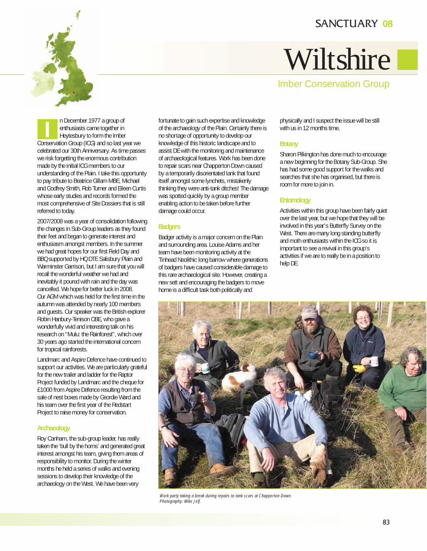
83
08
WiltshireImber Conservation Group
n December 1977 a group ofenthusiasts came together inHeytesbury to form the Imber
Conservation Group (ICG) and so last year wecelebrated our 30th Anniversary. As time passeswe risk forgetting the enormous contributionmade by the initial lCG members to ourunderstanding of the Plain. I take this opportunityto pay tribute to Beatrice Gillam MBE, Michaeland Godfrey Smith, Rob Turner and Eileen Curtiswhose early studies and records formed themost comprehensive of Site Dossiers that is stillreferred to today.
2007/2008 was a year of consolidation followingthe changes in Sub-Group leaders as they foundtheir feet and began to generate interest andenthusiasm amongst members. In the summerwe had great hopes for our first Field Day andBBQ supported by HQ DTE Salisbury Plain andWarminster Garrison, but I am sure that you willrecall the wonderful weather we had andinevitably it poured with rain and the day wascancelled. We hope for better luck in 2008.Our AGM which was held for the first time in theautumn was attended by nearly 100 membersand guests. Our speaker was the British explorerRobin Hanbury-Tenison OBE, who gave awonderfully vivid and interesting talk on hisresearch on “Mulu: the Rainforest”, which over30 years ago started the international concernfor tropical rainforests.
Landmarc and Aspire Defence have continued tosupport our activities. We are particularly gratefulfor the new trailer and ladder for the RaptorProject funded by Landmarc and the cheque for£1000 from Aspire Defence resulting from thesale of nest boxes made by Geordie Ward andhis team over the first year of the RedstartProject to raise money for conservation.
ArchaeologyRoy Canham, the sub-group leader, has reallytaken the ‘bull by the horns’ and generated greatinterest amongst his team, giving them areas ofresponsibility to monitor. During the wintermonths he held a series of walks and eveningsessions to develop their knowledge of thearchaeology on the West. We have been very
fortunate to gain such expertise and knowledgeof the archaeology of the Plain. Certainly there isno shortage of opportunity to develop ourknowledge of this historic landscape and toassist DE with the monitoring and maintenanceof archaeological features. Work has been doneto repair scars near Chapperton Down causedby a temporarily disorientated tank that founditself amongst some lynchets, mistakenlythinking they were anti-tank ditches! The damagewas spotted quickly by a group memberenabling action to be taken before furtherdamage could occur.
BadgersBadger activity is a major concern on the Plainand surrounding area. Louise Adams and herteam have been monitoring activity at theTinhead Neolithic long barrow where generationsof badgers have caused considerable damage tothis rare archaeological site. However, creating anew sett and encouraging the badgers to movehome is a difficult task both politically and
physically and I suspect the issue will be stillwith us in 12 months time.
BotanySharon Pilkington has done much to encouragea new beginning for the Botany Sub-Group. Shehas had some good support for the walks andsearches that she has organised, but there isroom for more to join in.
EntomologyActivities within this group have been fairly quietover the last year, but we hope that they will beinvolved in this year’s Butterfly Survey on theWest. There are many long standing butterflyand moth enthusiasts within the ICG so it isimportant to see a revival in this group’sactivities if we are to really be in a position tohelp DE.
I
Work party taking a break during repairs to tank scars at Chapperton Down.
Photography: Mike Jelf.
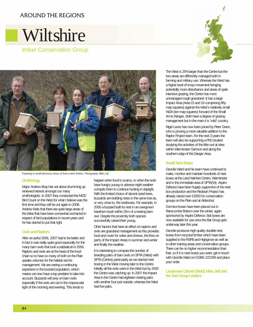
OrnithologyMajor Andrew Bray has set about drumming uprenewed interest amongst our manyornithologists. In 2007 they conducted the MODBird Count on the West for what I believe was thefirst time and they will be out again in 2008.Andrew feels that there are quite large areas ofthe West that have been somewhat uncharted inrespect of bird populations in recent years andhe has started to put that right.
Owls and RaptorsAfter an awful 2006, 2007 had to be better andin fact it was really quite good especially for themany barn owls that took a sabbatical in 2006.Raptors and owls are at the head of the food-chain so to have so many of both on the Plainspeaks volumes for the habitat and itsmanagement. We are seeing a continuingexpansion in the buzzard population, whichmeans we now have a top predator to take intoaccount. Buzzards will prey on barn owlsespecially if the owls are out in the crepuscularlight of the morning and evening. This tends to
happen when food is scarce, or when the owlshave hungry young or adverse night weathercompels them to continue hunting in daylight.With the limited choice of decent sized trees,buzzards are building nests in the same tree as,or very close to, the nestboxes. For example, in2006 a buzzard built its nest in an overgrownhawthorn bush within 25m of a nesting barnowl. Despite the proximity both speciessuccessfully raised their young.
Other factors that have an effect on raptors andowls are grassland management as this providesfood and cover for voles and shrews, the fires onparts of the Impact Areas in summer and winterand finally the weather.
It is interesting to compare the number ofbreeding pairs of barn owls on SPTA (West) withSPTA (Centre) particularly as we started nestboxing in the West moving later to the Centre.Initially all the owls were in the West but by 2000the Centre was catching up. In 2007 the ImpactArea in the Centre had eighteen nesting pairswith another four just outside, whereas the Westhad five pairs.
The West is 25% larger than the Centre but thetwo areas are differently managed both infarming and military use. Whereas the West hasa higher level of troop movement bringingpotentially more disturbance and areas of quiteintensive grazing, the Centre has moreunmanaged rough grassland. It has a largeImpact Area (Area 15 and 16 comprising fiftymap squares) against the West’s relatively smallWDA (ten map squares) forward of the SmallArms Ranges. Both have a degree of grazingmanagement but in the main it is ‘wild’ country.
Nigel Lewis has now been joined by Peter Green,who is proving a most valuable addition to theRaptor Project team. For the next 3 years theteam will also be supporting a PhD studentstudying the activities of the little owl at siteswithin Warminster Garrison and along thesouthern edge of the Danger Area.
Small Nest BoxesGeordie Ward and his team have continued tomake, monitor and maintain hundreds of nestboxes at the Land Warfare Centre, Warminsterand in the immediate area of SPTA(W). AspireDefence have been hugely supportive of the nestbox production and the Redstart Project hasalready raised over £3000 for conservationgroups on the Plain and at Aldershot.
Dormice boxes have been placed out inRanscombe Bottom over the winter, againsponsored by Aspire Defence. Bat boxes arenow available for use once the Bat Group getsunderway later this year.
Geordie produces high quality durable nestboxes from recycled timber which have beensupplied to the RSPB and Highgrove as well asto other training areas and conservation groups.There can be no higher recommendation thanthat, so if it is nest boxes you want, get in touchwith Geordie Ward on 01985-222299 and placeyour order.
Lieutenant Colonel (Retd) Mike JeIf andthe Sub-Group Leaders
84
WiltshireImber Conservation Group
AROUND THE REGIONS
Preparing to install dormouse boxes at Ranscombe Bottom. Photography: Mike Jelf.
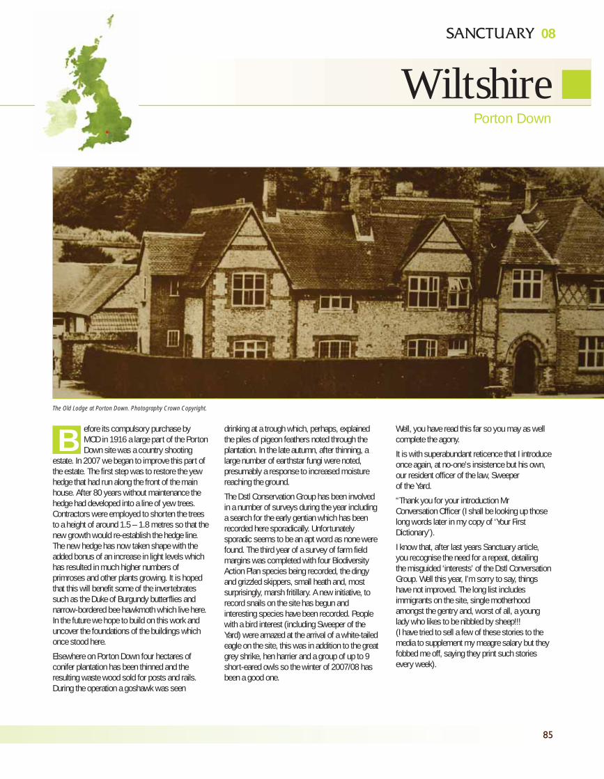
85
08
WiltshirePorton Down
efore its compulsory purchase byMOD in 1916 a large part of the PortonDown site was a country shooting
estate. In 2007 we began to improve this part ofthe estate. The first step was to restore the yewhedge that had run along the front of the mainhouse. After 80 years without maintenance thehedge had developed into a line of yew trees.Contractors were employed to shorten the treesto a height of around 1.5 – 1.8 metres so that thenew growth would re-establish the hedge line.The new hedge has now taken shape with theadded bonus of an increase in light levels whichhas resulted in much higher numbers ofprimroses and other plants growing. It is hopedthat this will benefit some of the invertebratessuch as the Duke of Burgundy butterflies andnarrow-bordered bee hawkmoth which live here.In the future we hope to build on this work anduncover the foundations of the buildings whichonce stood here.
Elsewhere on Porton Down four hectares ofconifer plantation has been thinned and theresulting waste wood sold for posts and rails.During the operation a goshawk was seen
drinking at a trough which, perhaps, explainedthe piles of pigeon feathers noted through theplantation. In the late autumn, after thinning, alarge number of earthstar fungi were noted,presumably a response to increased moisturereaching the ground.
The Dstl Conservation Group has been involvedin a number of surveys during the year includinga search for the early gentian which has beenrecorded here sporadically. Unfortunatelysporadic seems to be an apt word as none werefound. The third year of a survey of farm fieldmargins was completed with four BiodiversityAction Plan species being recorded, the dingyand grizzled skippers, small heath and, mostsurprisingly, marsh fritillary. A new initiative, torecord snails on the site has begun andinteresting species have been recorded. Peoplewith a bird interest (including Sweeper of theYard) were amazed at the arrival of a white-tailedeagle on the site, this was in addition to the greatgrey shrike, hen harrier and a group of up to 9short-eared owls so the winter of 2007/08 hasbeen a good one.
Well, you have read this far so you may as wellcomplete the agony.
It is with superabundant reticence that I introduceonce again, at no-one’s insistence but his own,our resident officer of the law, Sweeperof the Yard.
“Thank you for your introduction MrConversation Officer (I shall be looking up thoselong words later in my copy of ‘Your FirstDictionary’).
I know that, after last years Sanctuary article,you recognise the need for a repeat, detailingthe misguided ‘interests’ of the Dstl ConversationGroup. Well this year, I’m sorry to say, thingshave not improved. The long list includesimmigrants on the site, single motherhoodamongst the gentry and, worst of all, a younglady who likes to be nibbled by sheep!!!(I have tried to sell a few of these stories to themedia to supplement my meagre salary but theyfobbed me off, saying they print such storiesevery week).
BThe Old Lodge at Porton Down. Photography Crown Copyright.
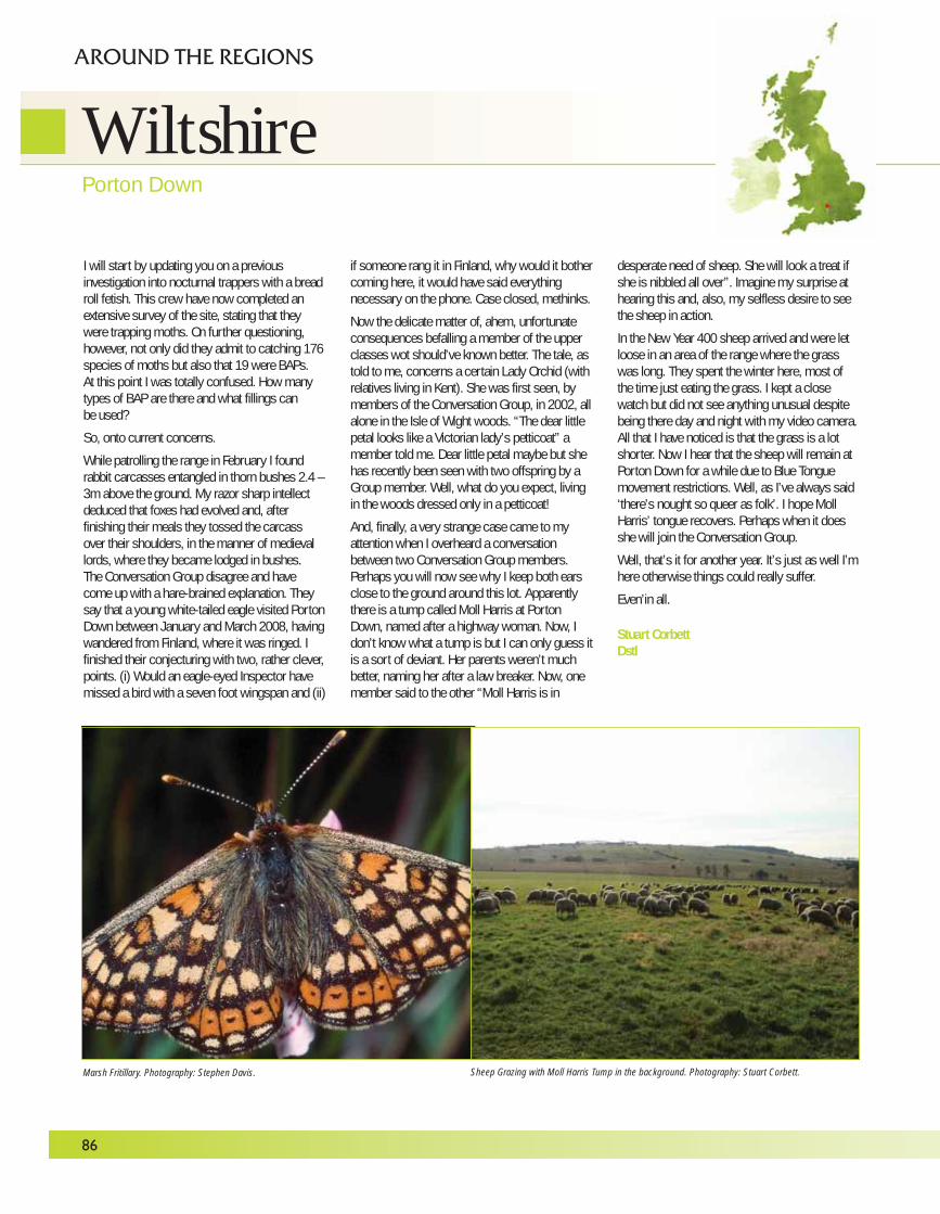
I will start by updating you on a previousinvestigation into nocturnal trappers with a breadroll fetish. This crew have now completed anextensive survey of the site, stating that theywere trapping moths. On further questioning,however, not only did they admit to catching 176species of moths but also that 19 were BAPs. At this point I was totally confused. How manytypes of BAP are there and what fillings canbe used?
So, onto current concerns.
While patrolling the range in February I foundrabbit carcasses entangled in thorn bushes 2.4 –3m above the ground. My razor sharp intellectdeduced that foxes had evolved and, afterfinishing their meals they tossed the carcassover their shoulders, in the manner of medievallords, where they became lodged in bushes.The Conversation Group disagree and havecome up with a hare-brained explanation. Theysay that a young white-tailed eagle visited PortonDown between January and March 2008, havingwandered from Finland, where it was ringed. Ifinished their conjecturing with two, rather clever,points. (i) Would an eagle-eyed Inspector havemissed a bird with a seven foot wingspan and (ii)
if someone rang it in Finland, why would it bothercoming here, it would have said everythingnecessary on the phone. Case closed, methinks.
Now the delicate matter of, ahem, unfortunateconsequences befalling a member of the upperclasses wot should’ve known better. The tale, astold to me, concerns a certain Lady Orchid (withrelatives living in Kent). She was first seen, bymembers of the Conversation Group, in 2002, allalone in the Isle of Wight woods. “The dear littlepetal looks like a Victorian lady’s petticoat” amember told me. Dear little petal maybe but shehas recently been seen with two offspring by aGroup member. Well, what do you expect, livingin the woods dressed only in a petticoat!
And, finally, a very strange case came to myattention when I overheard a conversationbetween two Conversation Group members.Perhaps you will now see why I keep both earsclose to the ground around this lot. Apparentlythere is a tump called Moll Harris at PortonDown, named after a highway woman. Now, Idon’t know what a tump is but I can only guess itis a sort of deviant. Her parents weren’t muchbetter, naming her after a law breaker. Now, onemember said to the other “Moll Harris is in
desperate need of sheep. She will look a treat ifshe is nibbled all over”. Imagine my surprise athearing this and, also, my selfless desire to seethe sheep in action.
In the New Year 400 sheep arrived and were letloose in an area of the range where the grasswas long. They spent the winter here, most ofthe time just eating the grass. I kept a closewatch but did not see anything unusual despitebeing there day and night with my video camera.All that I have noticed is that the grass is a lotshorter. Now I hear that the sheep will remain atPorton Down for a while due to Blue Tonguemovement restrictions. Well, as I’ve always said‘there’s nought so queer as folk’. I hope MollHarris’ tongue recovers. Perhaps when it doesshe will join the Conversation Group.
Well, that’s it for another year. It’s just as well I’mhere otherwise things could really suffer.
Even’in all.
Stuart CorbettDstl
86
WiltshirePorton Down
AROUND THE REGIONS
Sheep Grazing with Moll Harris Tump in the background. Photography: Stuart Corbett.Marsh Fritillary. Photography: Stephen Davis.
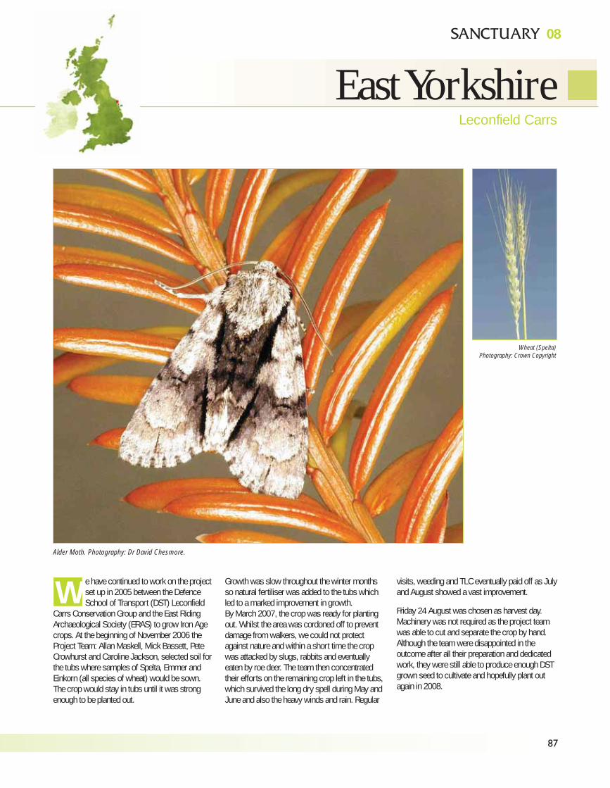
87
08
East YorkshireLeconfield Carrs
e have continued to work on the projectset up in 2005 between the DefenceSchool of Transport (DST) Leconfield
Carrs Conservation Group and the East RidingArchaeological Society (ERAS) to grow Iron Agecrops. At the beginning of November 2006 theProject Team: Allan Maskell, Mick Bassett, PeteCrowhurst and Caroline Jackson, selected soil forthe tubs where samples of Spelta, Emmer andEinkorn (all species of wheat) would be sown.The crop would stay in tubs until it was strongenough to be planted out.
Growth was slow throughout the winter monthsso natural fertiliser was added to the tubs whichled to a marked improvement in growth.By March 2007, the crop was ready for plantingout. Whilst the area was cordoned off to preventdamage from walkers, we could not protectagainst nature and within a short time the cropwas attacked by slugs, rabbits and eventuallyeaten by roe deer. The team then concentratedtheir efforts on the remaining crop left in the tubs,which survived the long dry spell during May andJune and also the heavy winds and rain. Regular
visits, weeding and TLC eventually paid off as Julyand August showed a vast improvement.
Friday 24 August was chosen as harvest day.Machinery was not required as the project teamwas able to cut and separate the crop by hand.Although the team were disappointed in theoutcome after all their preparation and dedicatedwork, they were still able to produce enough DSTgrown seed to cultivate and hopefully plant outagain in 2008.
W
Alder Moth. Photography: Dr David Chesmore.
Wheat (Spelta)
Photography: Crown Copyright
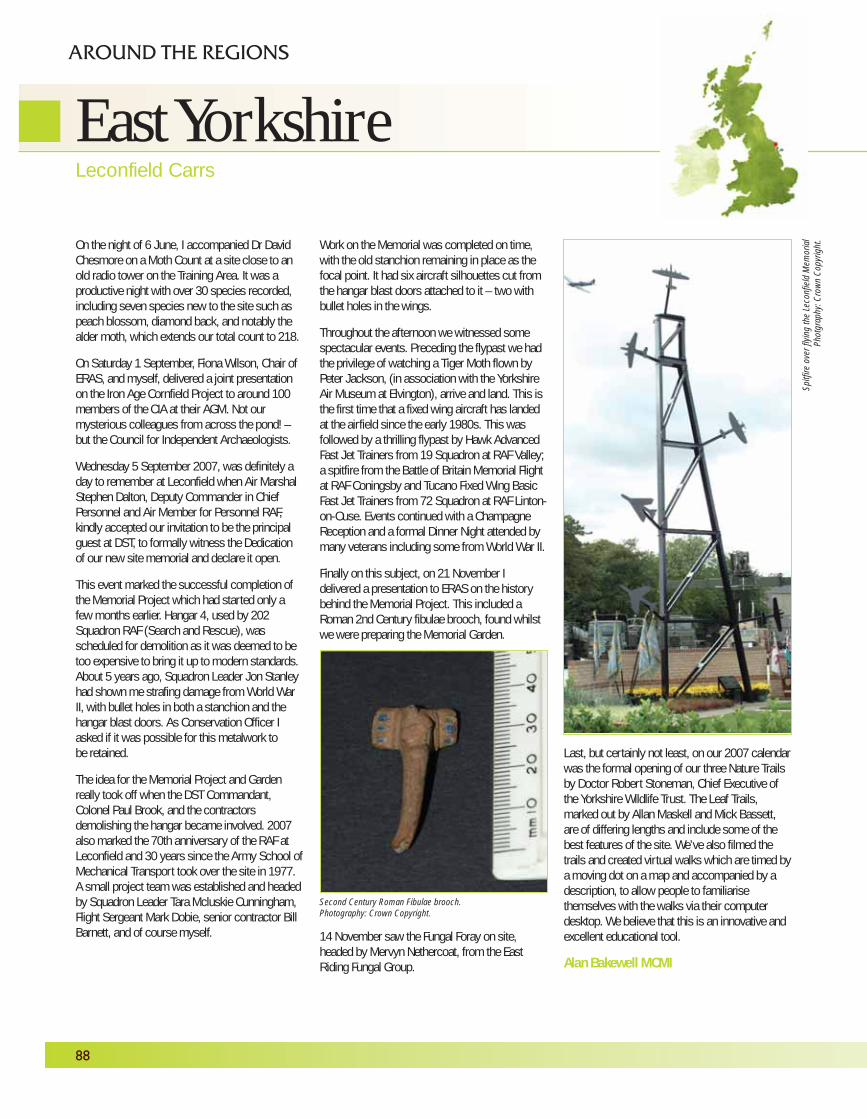
On the night of 6 June, I accompanied Dr DavidChesmore on a Moth Count at a site close to anold radio tower on the Training Area. It was aproductive night with over 30 species recorded,including seven species new to the site such aspeach blossom, diamond back, and notably thealder moth, which extends our total count to 218.
On Saturday 1 September, Fiona Wilson, Chair ofERAS, and myself, delivered a joint presentationon the Iron Age Cornfield Project to around 100members of the CIA at their AGM. Not ourmysterious colleagues from across the pond! –but the Council for Independent Archaeologists.
Wednesday 5 September 2007, was definitely aday to remember at Leconfield when Air MarshalStephen Dalton, Deputy Commander in ChiefPersonnel and Air Member for Personnel RAF,kindly accepted our invitation to be the principalguest at DST, to formally witness the Dedicationof our new site memorial and declare it open.
This event marked the successful completion ofthe Memorial Project which had started only afew months earlier. Hangar 4, used by 202Squadron RAF (Search and Rescue), wasscheduled for demolition as it was deemed to betoo expensive to bring it up to modern standards.About 5 years ago, Squadron Leader Jon Stanleyhad shown me strafing damage from World WarII, with bullet holes in both a stanchion and thehangar blast doors. As Conservation Officer Iasked if it was possible for this metalwork tobe retained.
The idea for the Memorial Project and Gardenreally took off when the DST Commandant,Colonel Paul Brook, and the contractorsdemolishing the hangar became involved. 2007also marked the 70th anniversary of the RAF atLeconfield and 30 years since the Army School ofMechanical Transport took over the site in 1977.A small project team was established and headedby Squadron Leader Tara Mcluskie Cunningham,Flight Sergeant Mark Dobie, senior contractor BillBarnett, and of course myself.
Work on the Memorial was completed on time,with the old stanchion remaining in place as thefocal point. It had six aircraft silhouettes cut fromthe hangar blast doors attached to it – two withbullet holes in the wings.
Throughout the afternoon we witnessed somespectacular events. Preceding the flypast we hadthe privilege of watching a Tiger Moth flown byPeter Jackson, (in association with the YorkshireAir Museum at Elvington), arrive and land. This isthe first time that a fixed wing aircraft has landedat the airfield since the early 1980s. This wasfollowed by a thrilling flypast by Hawk AdvancedFast Jet Trainers from 19 Squadron at RAF Valley;a spitfire from the Battle of Britain Memorial Flightat RAF Coningsby and Tucano Fixed Wing BasicFast Jet Trainers from 72 Squadron at RAF Linton-on-Ouse. Events continued with a ChampagneReception and a formal Dinner Night attended bymany veterans including some from World War II.
Finally on this subject, on 21 November Idelivered a presentation to ERAS on the historybehind the Memorial Project. This included aRoman 2nd Century fibulae brooch, found whilstwe were preparing the Memorial Garden.
14 November saw the Fungal Foray on site,headed by Mervyn Nethercoat, from the EastRiding Fungal Group.
Last, but certainly not least, on our 2007 calendarwas the formal opening of our three Nature Trailsby Doctor Robert Stoneman, Chief Executive ofthe Yorkshire Wildlife Trust. The Leaf Trails,marked out by Allan Maskell and Mick Bassett,are of differing lengths and include some of thebest features of the site. We’ve also filmed thetrails and created virtual walks which are timed bya moving dot on a map and accompanied by adescription, to allow people to familiarisethemselves with the walks via their computerdesktop. We believe that this is an innovative andexcellent educational tool.
Alan Bakewell MCMI
88
AROUND THE REGIONS
Spitf
ire
ove
r fly
ing t
he L
econf
ield
Mem
ori
al
Pho
tgra
phy
: C
row
n C
opyr
ight
.
Second Century Roman Fibulae brooch.
Photography: Crown Copyright.
East YorkshireLeconfield Carrs
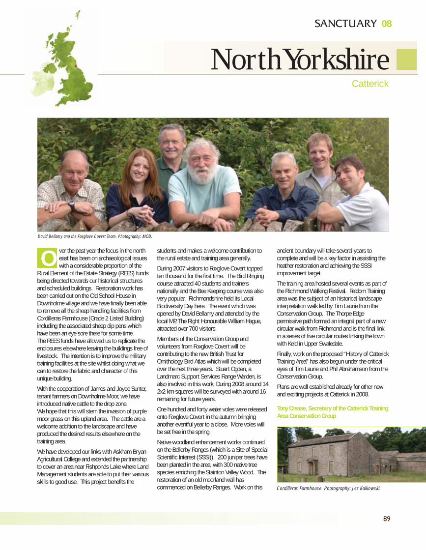
89
08
North YorkshireCatterick
ver the past year the focus in the northeast has been on archaeological issueswith a considerable proportion of the
Rural Element of the Estate Strategy (REES) fundsbeing directed towards our historical structuresand scheduled buildings. Restoration work hasbeen carried out on the Old School House inDownholme village and we have finally been ableto remove all the sheep handling facilities fromCordilleras Farmhouse (Grade 2 Listed Building)including the associated sheep dip pens whichhave been an eye sore there for some time.The REES funds have allowed us to replicate theenclosures elsewhere leaving the buildings free oflivestock. The intention is to improve the militarytraining facilities at the site whilst doing what wecan to restore the fabric and character of thisunique building.
With the cooperation of James and Joyce Sunter,tenant farmers on Downholme Moor, we haveintroduced native cattle to the drop zone. We hope that this will stem the invasion of purplemoor grass on this upland area. The cattle are awelcome addition to the landscape and haveproduced the desired results elsewhere on thetraining area.
We have developed our links with Askham BryanAgricultural College and extended the partnershipto cover an area near Fishponds Lake where LandManagement students are able to put their variousskills to good use. This project benefits the
students and makes a welcome contribution tothe rural estate and training area generally.
During 2007 visitors to Foxglove Covert toppedten thousand for the first time. The Bird Ringingcourse attracted 40 students and trainersnationally and the Bee Keeping course was alsovery popular. Richmondshire held its LocalBiodiversity Day here. The event which wasopened by David Bellamy and attended by thelocal MP, The Right Honourable William Hague,attracted over 700 visitors.
Members of the Conservation Group andvolunteers from Foxglove Covert will becontributing to the new British Trust forOrnithology Bird Atlas which will be completedover the next three years. Stuart Ogden, aLandmarc Support Services Range Warden, isalso involved in this work. During 2008 around 142x2 km squares will be surveyed with around 16remaining for future years.
One hundred and forty water voles were releasedonto Foxglove Covert in the autumn bringinganother eventful year to a close. More voles willbe set free in the spring.
Native woodland enhancement works continuedon the Bellerby Ranges (which is a Site of SpecialScientific Interest (SSSI)). 200 juniper trees havebeen planted in the area, with 300 native treespecies enriching the Stainton Valley Wood. Therestoration of an old moorland wall hascommenced on Bellerby Ranges. Work on this
ancient boundary will take several years tocomplete and will be a key factor in assisting theheather restoration and achieving the SSSIimprovement target.
The training area hosted several events as part ofthe Richmond Walking Festival. Feldom Trainingarea was the subject of an historical landscapeinterpretation walk led by Tim Laurie from theConservation Group. The Thorpe Edgepermissive path formed an integral part of a newcircular walk from Richmond and is the final linkin a series of five circular routes linking the townwith Keld in Upper Swaledale.
Finally, work on the proposed “History of CatterickTraining Area” has also begun under the criticaleyes of Tim Laurie and Phil Abrahamson from theConservation Group.
Plans are well established already for other newand exciting projects at Catterick in 2008.
Tony Crease, Secretary of the Catterick TrainingArea Conservation Group
ODavid Bellamy and the Foxglove Covert Team. Photography: MOD.
Cordilleras Farmhouse. Photography: Jez Kalkowski.
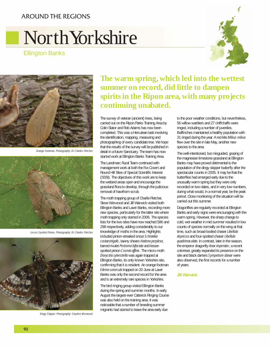
The survey of veteran (ancient) trees, beingcarried out on the Ripon Parks Training Area byColin Slator and Rob Adams has now beencompleted. This was a Herculean task involvingthe identification, mapping, measuring andphotographing of every candidate tree. We hopethat the results of the survey will be published indetail in a future Sanctuary. The team has nowstarted work at Ellington Banks Training Area.
The Landmarc Rural Team continued withmanagement work at both the Fox Covert andRound Hill Sites of Special Scientific Interest(SSSI). The objectives of this work are to keepthe wetland areas open and encourage thegrassland flora to develop, through the judiciousremoval of hawthorn scrub.
The moth trapping group of Charlie Fletcher,Steve Worwood and Jill Warwick visited bothEllington Banks and Laver Banks, recording morenew species, particularly for the latter site wheremoth trapping only started in 2006. The specieslists for the two sites have now reached 586 and298 respectively, adding considerably to ourknowledge of moths in the area. Highlightsincluded pinion-streaked snout Schrankiacostaestrigalis, tawny shears Hadena perplexa,barred rivulet Perizoma bifaciata and lesser-spotted pinion Cosmia affinis. The micro-mothDioryctria sylvestrella was again trapped atEllington Banks, its only known Yorkshire site,confirming that it is resident. An orange footmanEilema sororcula trapped on 20 June at LaverBanks was only the second record for the areaand is an extremely rare species in Yorkshire.
The bird ringing group visited Ellington Banksduring the spring and summer months. In earlyAugust the largest-ever Catterick Ringing Coursewas also held on the training area. It wasnoticeable that a number of breeding summermigrants had started to leave the area early due
to the poor weather conditions, but nevertheless,56 willow warblers and 27 chiffchaffs wereringed, including a number of juveniles.Bullfinches maintained a healthy population with31 ringed during the year. A red kite Milvus milvusflew over the site in late May, another newspecies to the area.
The well-intentioned, but misguided, grazing ofthe magnesian limestone grassland at EllingtonBanks may have proved detrimental to thepopulation of the dingy skipper butterfly after thespectacular counts in 2005. It may be that thebutterflies had emerged early due to theunusually warm spring but they were onlyrecorded on two dates, and in very low numbers,during what would, in a normal year, be the peakperiod. Close monitoring of the situation will becarried out this summer.
Dragonflies are regularly recorded at EllingtonBanks and early signs were encouraging with thewarm spring. However, the sharp change tocold, wet weather in mid summer resulted in lowcounts of species normally on the wing at thattime, such as broad-bodied chaser Libelluladepressa and four-spotted chaser Libellulaquadrimaculata. In contrast, later in the season,the emperor dragonfly Anax imperator, a recentcoloniser, greatly expanded its presence on thesite and black darters Sympetrum danae werealso observed, the first records for a numberof years.
Jill Warwick
90
AROUND THE REGIONS
The warm spring, which led into the wettestsummer on record, did little to dampenspirits in the Ripon area, with many projectscontinuing unabated.
Orange Footman. Photography: Dr Charles Fletcher.
Lesser Spotted Pinion. Photography: Dr Charles Fletcher.
Dingy Skipper. Photography: Stephen Worwood.
North YorkshireEllington Banks
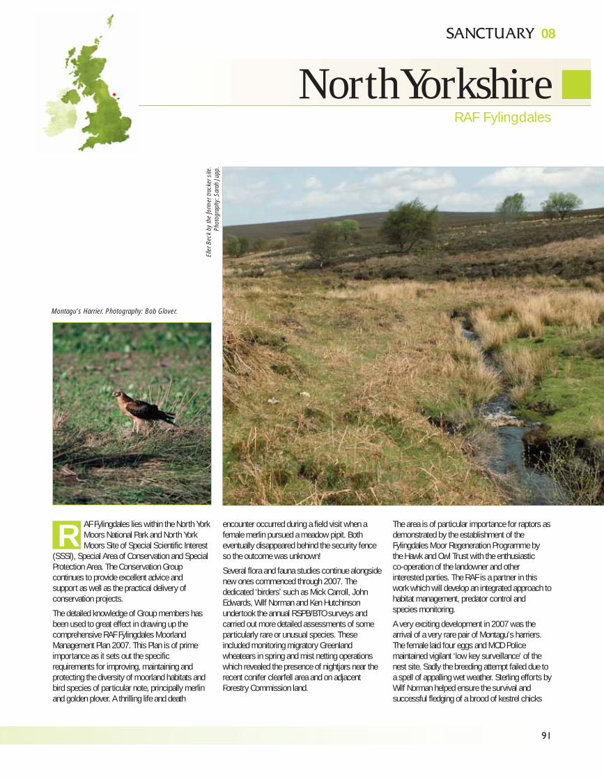
91
08
North Yorkshire
AF Fylingdales lies within the North YorkMoors National Park and North YorkMoors Site of Special Scientific Interest
(SSSI), Special Area of Conservation and SpecialProtection Area. The Conservation Groupcontinues to provide excellent advice andsupport as well as the practical delivery ofconservation projects.
The detailed knowledge of Group members hasbeen used to great effect in drawing up thecomprehensive RAF Fylingdales MoorlandManagement Plan 2007. This Plan is of primeimportance as it sets out the specificrequirements for improving, maintaining andprotecting the diversity of moorland habitats andbird species of particular note, principally merlinand golden plover. A thrilling life and death
encounter occurred during a field visit when afemale merlin pursued a meadow pipit. Botheventually disappeared behind the security fenceso the outcome was unknown!
Several flora and fauna studies continue alongsidenew ones commenced through 2007. Thededicated ‘birders’ such as Mick Carroll, JohnEdwards, Wilf Norman and Ken Hutchinsonundertook the annual RSPB/BTO surveys andcarried out more detailed assessments of someparticularly rare or unusual species. Theseincluded monitoring migratory Greenlandwheatears in spring and mist netting operationswhich revealed the presence of nightjars near therecent conifer clearfell area and on adjacentForestry Commission land.
The area is of particular importance for raptors asdemonstrated by the establishment of theFylingdales Moor Regeneration Programme bythe Hawk and Owl Trust with the enthusiasticco-operation of the landowner and otherinterested parties. The RAF is a partner in thiswork which will develop an integrated approach tohabitat management, predator control andspecies monitoring.
A very exciting development in 2007 was thearrival of a very rare pair of Montagu’s harriers.The female laid four eggs and MOD Policemaintained vigilant ‘low key surveillance’ of thenest site. Sadly the breeding attempt failed due toa spell of appalling wet weather. Sterling efforts byWilf Norman helped ensure the survival andsuccessful fledging of a brood of kestrel chicks
R
Elle
r B
eck
by
the
form
er t
rack
er s
ite.
Pho
togra
phy
: S
arah
Jup
p.
Montagu’s Harrier. Photography: Bob Glover.
RAF Fylingdales
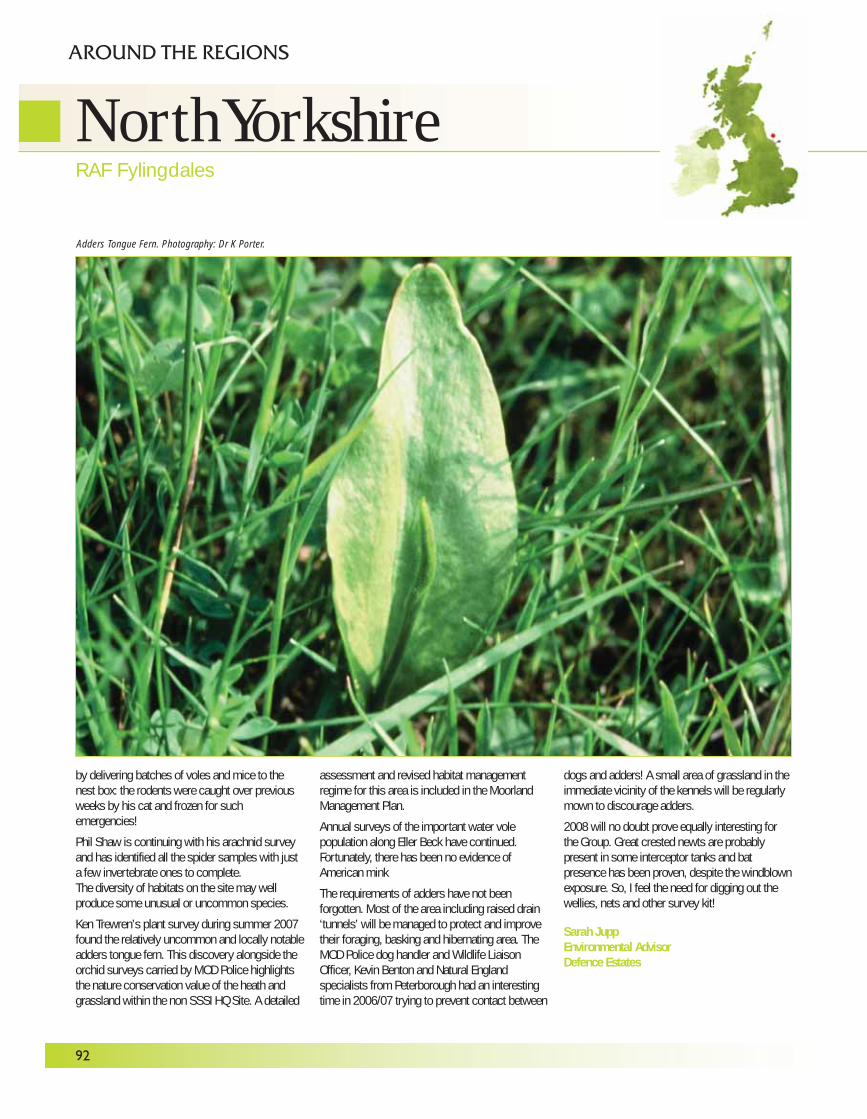
92
by delivering batches of voles and mice to thenest box: the rodents were caught over previousweeks by his cat and frozen for suchemergencies!
Phil Shaw is continuing with his arachnid surveyand has identified all the spider samples with justa few invertebrate ones to complete.The diversity of habitats on the site may wellproduce some unusual or uncommon species.
Ken Trewren’s plant survey during summer 2007found the relatively uncommon and locally notableadders tongue fern. This discovery alongside theorchid surveys carried by MOD Police highlightsthe nature conservation value of the heath andgrassland within the non SSSI HQ Site. A detailed
assessment and revised habitat managementregime for this area is included in the MoorlandManagement Plan.
Annual surveys of the important water volepopulation along Eller Beck have continued.Fortunately, there has been no evidence ofAmerican mink
The requirements of adders have not beenforgotten. Most of the area including raised drain‘tunnels’ will be managed to protect and improvetheir foraging, basking and hibernating area. TheMOD Police dog handler and Wildlife LiaisonOfficer, Kevin Benton and Natural Englandspecialists from Peterborough had an interestingtime in 2006/07 trying to prevent contact between
dogs and adders! A small area of grassland in theimmediate vicinity of the kennels will be regularlymown to discourage adders.
2008 will no doubt prove equally interesting forthe Group. Great crested newts are probablypresent in some interceptor tanks and batpresence has been proven, despite the windblownexposure. So, I feel the need for digging out thewellies, nets and other survey kit!
Sarah JuppEnvironmental AdvisorDefence Estates
RAF Fylingdales
AROUND THE REGIONS
Adders Tongue Fern. Photography: Dr K Porter.
North Yorkshire
PROPERTY DIRECTORATEThe Property Directorate maintains the long-termstrategy for the estate and developsbest practice guidance on estate managementissues. It is the policy lead for sustainabledevelopment, health and safety andenvironmental protection. The Directorateis responsible for Sanctuary Magazine andthe annual Stewardship Report on theDefence Estate.
Defence Estates Property DirectorateKingston RoadSutton Coldfield, West Midlands B75 7RLTel: 0121 311 3734
Land & Property Policy(land management, including agriculture andforestry, public access, byelaws, and Town &Country Planning)Sutton ColdfieldTel: 0121 311 2127
Sustainable Development(nature conservation, historic environment,environmental assessment processes)Room 14, K Block, MOD Foxhill, Bath BA1 5ABTel: 01225 883523Email: [email protected]
Environmental Policy(energy policy & land quality)Sutton ColdfieldTel: 0121 311 2018
ENVIRONMENTAL SUPPORT TEAMThe Defence Estates Environmental SupportTeam provides advice to the Services andMinistry of Defence Agencies on the deliveryof a wide range of land-based environmentalissues.
DE Environmental Support Team Building 21, Westdown CampTilshead, Salisbury SP3 4RS01980 674704Email (Head of EST): [email protected]
EST Conservation Group & EnvironmentalPR OfficeBuilding 21, Westdown Camp, TilsheadSalisbury SP3 4RSTel: 01980 674807Email: [email protected]
EST Natural Environment TeamWestdown CampTel: 01980 674820
EST Historic Environment TeamWestdown CampTel: 01980 674718
EST Sustainability Advisory TeamWestdown CampTel: 01980 674866
EST Access and Recreation TeamWarminsterTel: 01985 222913
EST Environmental Planning TeamWarminsterTel: 01985 222909
DEFENCE TRAINING ESTATE DIRECTORATEThe Defence Training Estate Directorate isresponsible for the provision of safe andsustainable facilities for the delivery of militarytraining across the United Kingdom. This nowincludes most of the ranges and training areasformerly managed by the Royal Air Force andRoyal Navy.Headquarters Defence Training Estate, Defence Estates, Land Warfare CentreWarminster BA12 0DJTel: 01985 222839Email: [email protected]
08
Defence Estates Contacts
Bar
n O
wl.
Pho
togra
phy
: B
arry
Ang
ell

MINISTR Y OF DEFENCE


