74
Obstacles on footpaths in the CBD Problem statement & survey design City of Melbourne 4 December, 2018

1
Obstacles on footpaths in the CBDProblem statement & survey design
City of Melbourne 4 December, 2018

2
CONTENTS
Problem statement 3Survey design 11Categories used in the survey 19
Flow along blocks 20Flow across intersections 26People as obstacles 33Temporary objects that are obstacles 38Lightly-fixed objects that are obstacles 52Major fixed objects that are obstacles 64Obstacles that were not evaluated 69

3
PROBLEM STATEMENT

4
People can be observed overflowing the footpaths in the CBD
In some parts of the CBD, at some times of day, people are walking on the road
Bourke Street at Spencer Street William Street at LaTrobe Street Spring Street at Collins Street
5
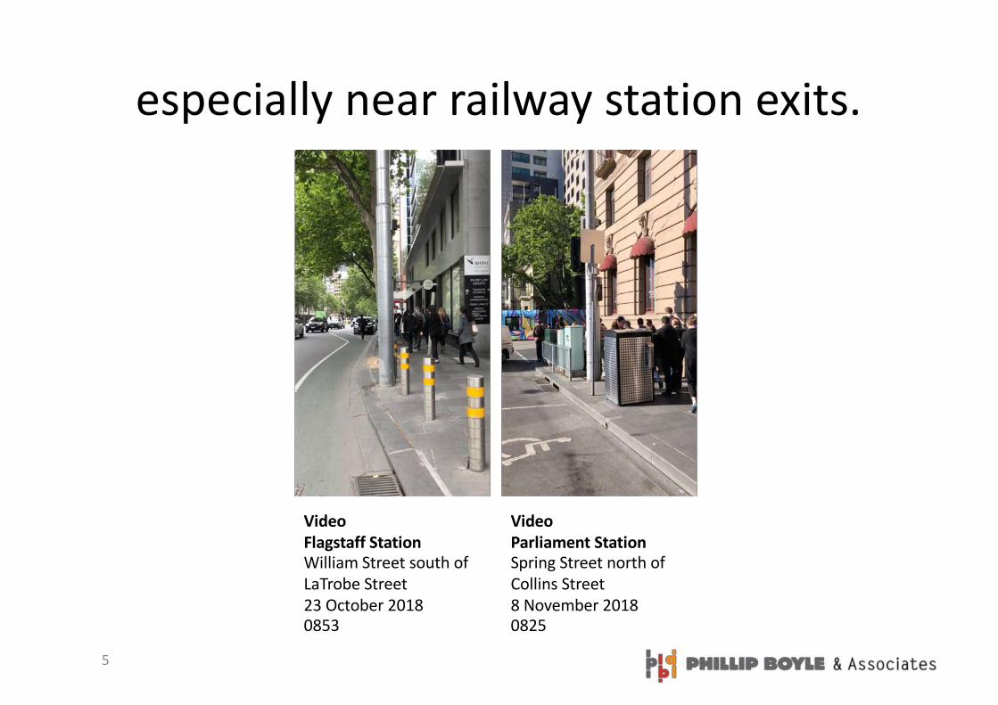
especially near railway station exits.
VideoFlagstaff StationWilliam Street south of LaTrobe Street23 October 20180853
VideoParliament StationSpring Street north of Collins Street8 November 20180825
6
This means the footpaths will have to be made wider
• People walking on the road is significant problem. – The immediate risks include road
trauma– The longer term risks include
constraints on the City economy, liveability and equity
• Overflow in some locations suggests that other sites are congested – just not to the level that means people walk on the road. – Congested footpaths bring other risks
such as compromising access for people with wheels (DDA, small children) and time lost in delay
• These problem are likely to get worse as the number of people in the CBD increases.
• Responding to increasing population in a fixed space is a ‘macro’ problem that requires a strategic response.
• One obvious strategic response is to widen the footpaths to cope with the increased flow.
• Widening the footpaths in the CBD will be a costly, slow and incremental process.– Footpath widening projects will cost
millions of dollars. – The designs will take time. Plans will
require cross disciplinary consensus and public consultation will need to be extensive.
– Although templates can be developed, effective and appropriate solutions will need to be tailored to each block or precinct.
– Although the solutions will provide immediate local relief they will have no impact on other areas.

7
What can be done in the meantime with smaller amounts of money (and effort)?
• As the strategic response will be slow, a tactical response is needed in the short term.
• Effective tactical responses require a diagnosis.
• This project aimed to identify the immediate and local causes of footpath congestion
• This will enable the Council to design policies and interventions that maximise the effective capacity of the existing footpaths where flows are high
8
to remove (or reduce) obstacles on the footpaths
• Other cities are concerned about similar issues. In London the problem is discussed using the term ‘clutter’
• This term combines concepts of:– Untidy, poorly organised, dis-orderly– Unwanted or unnecessary– Too many– Occupying space for little return– Redundant/obsolete
• The term ‘clutter’ is problematic:– It is a collective term (uncountable
noun) which is hard to apply to a specific object. (This object is a clutter, this one is not).
– The word contains competing meanings. (Objects could be ‘tidied’ to reduce clutter when ‘removal’ is more appropriate.)
– The word is used in two domains ‘visual clutter’ and ‘physical clutter’.
• Rather than refer to ‘clutter’ this investigation looked for ‘obstacles’.
• Obstacle is:– A countable noun– ‘An obstacle is an object that makes
it difficult for you to go where you want to go, because it is in your way.’
• Nothing is intrinsically ‘an obstacle’ it depends on its location.– Redundant, unnecessary obstacles can
be removed– Necessary items that are also obstacles
can be consolidated, redesigned or relocated
– Positive items can also be obstacles. ‘This tree is an obstacle’.
• People can be obstacles for example when they are waiting for a bus
9
The nature of the problem is not well defined
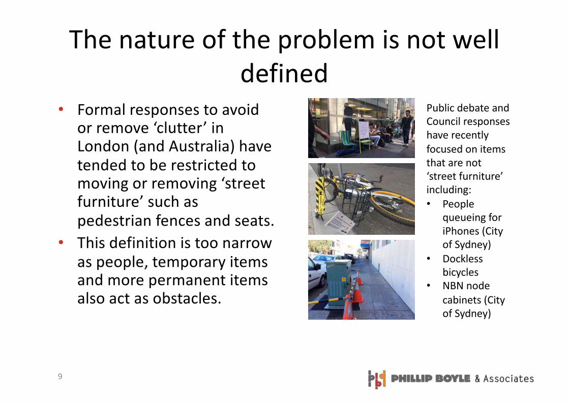
• Formal responses to avoid or remove ‘clutter’ in London (and Australia) have tended to be restricted to moving or removing ‘street furniture’ such as pedestrian fences and seats.
• This definition is too narrow as people, temporary items and more permanent items also act as obstacles.
Public debate and Council responses have recently focused on items that are not ‘street furniture’ including:• People
queueing for iPhones (City of Sydney)
• Dockless bicycles
• NBN node cabinets (City of Sydney)

10
This makes it difficult to develop and implement policies & interventions
Recommendations in the City Space Discussion Paper for the Transport Strategy Refresh include:• Relocating all bicycle parking (privately-
owned and shared services) and motorbike parking from the footpath
• Limiting:– The use of portable advertising boards– Busking– Counter style shop fronts to avoid queues
• Removing redundant items such as street furniture
• Rationalising signage and other objects• Establishing controls based on:
– Day of week– Time of day– Location– Number of pedestrians– Width of footpath
In January, Mr Keegan said the city council intended to address the issue of unlicensed street clutter. The Restaurants Association of Ireland at the time accused him of going on an “anti-tourism rampage”.

11
SURVEY DESIGN
12
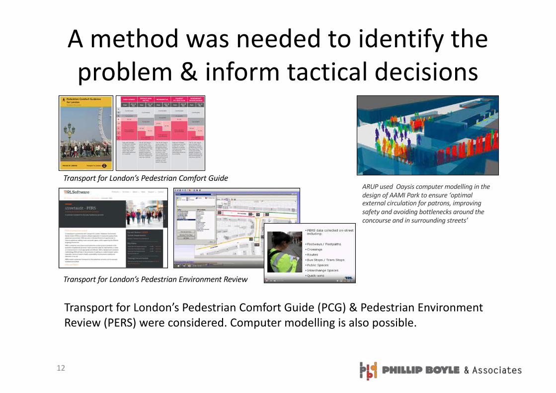
A method was needed to identify the problem & inform tactical decisions
Transport for London’s Pedestrian Comfort Guide (PCG) & Pedestrian Environment Review (PERS) were considered. Computer modelling is also possible.
Transport for London’s Pedestrian Comfort Guide
Transport for London’s Pedestrian Environment Review
ARUP used Oaysis computer modelling in the design of AAMI Park to ensure ‘optimal external circulation for patrons, improving safety and avoiding bottlenecks around the concourse and in surrounding streets’
13
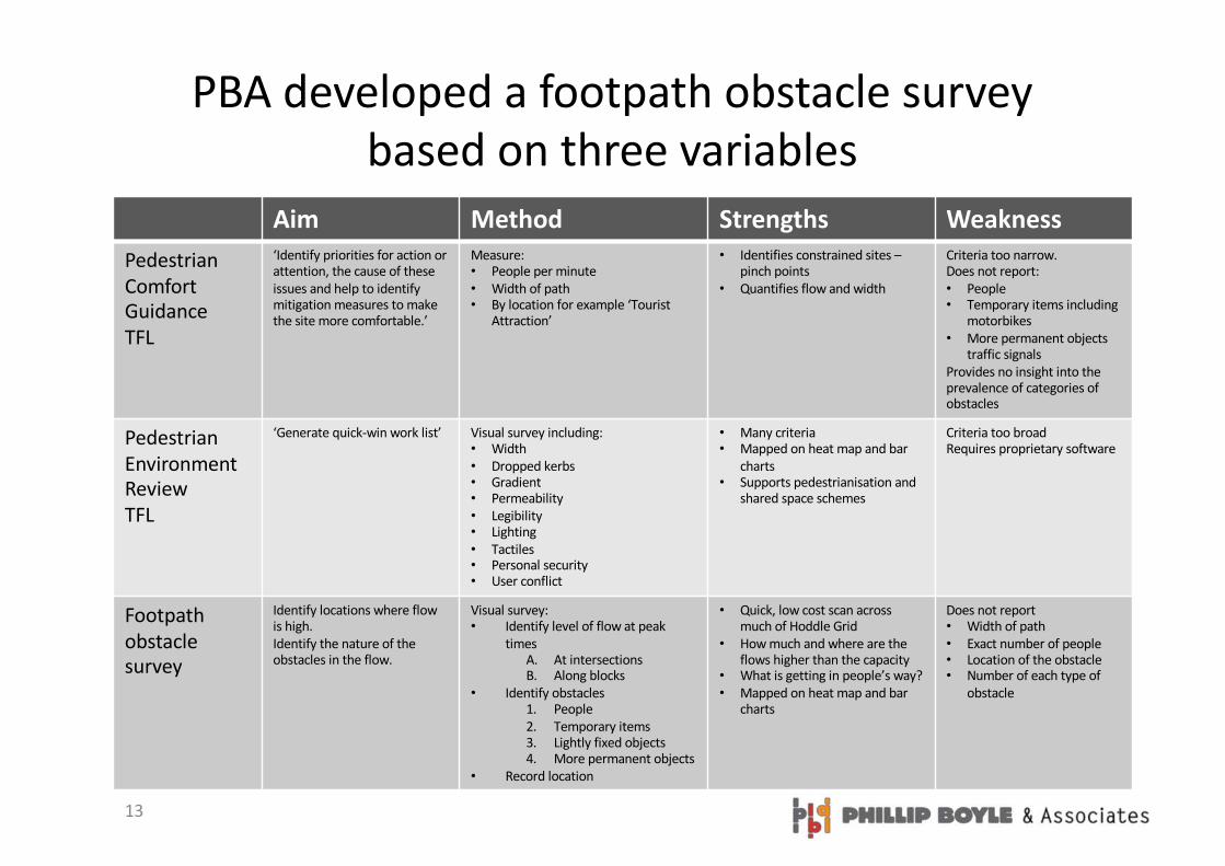
PBA developed a footpath obstacle survey based on three variables
Aim Method Strengths WeaknessPedestrian Comfort GuidanceTFL
‘Identify priorities for action or attention, the cause of these issues and help to identify mitigation measures to make the site more comfortable.’
Measure:• People per minute• Width of path • By location for example ‘Tourist
Attraction’
• Identifies constrained sites –pinch points
• Quantifies flow and width
Criteria too narrow. Does not report:• People• Temporary items including
motorbikes• More permanent objects
traffic signalsProvides no insight into the prevalence of categories of obstacles
Pedestrian Environment ReviewTFL
‘Generate quick-win work list’ Visual survey including:• Width• Dropped kerbs• Gradient• Permeability• Legibility• Lighting• Tactiles• Personal security• User conflict
• Many criteria• Mapped on heat map and bar
charts• Supports pedestrianisation and
shared space schemes
Criteria too broad Requires proprietary software
Footpath obstacle survey
Identify locations where flow is high. Identify the nature of the obstacles in the flow.
Visual survey:• Identify level of flow at peak
timesA. At intersectionsB. Along blocks
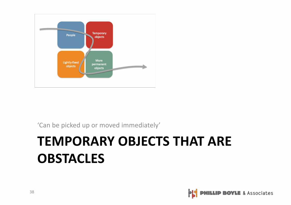
• Identify obstacles1. People2. Temporary items3. Lightly fixed objects4. More permanent objects
• Record location
• Quick, low cost scan across much of Hoddle Grid
• How much and where are the flows higher than the capacity
• What is getting in people’s way?• Mapped on heat map and bar
charts
Does not report • Width of path • Exact number of people• Location of the obstacle• Number of each type of
obstacle
14
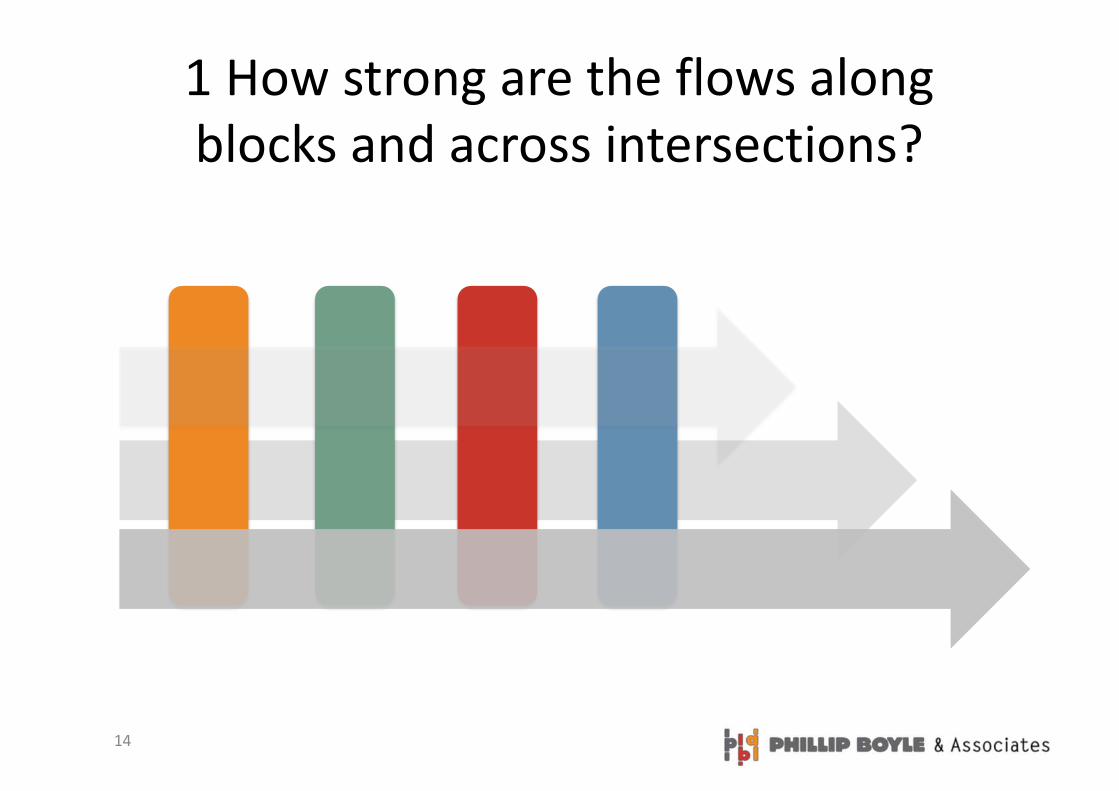
1 How strong are the flows along blocks and across intersections?
15
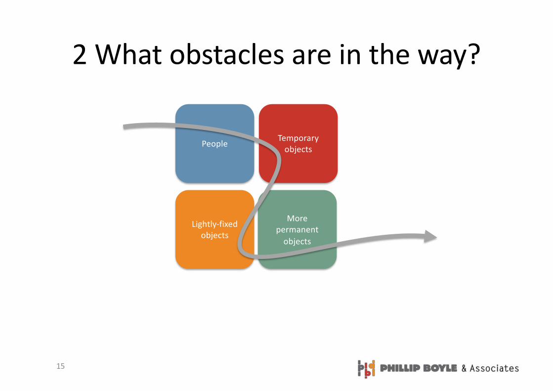
2 What obstacles are in the way?
People
Lightly-fixed objects
Temporary objects
More permanent
objects
16
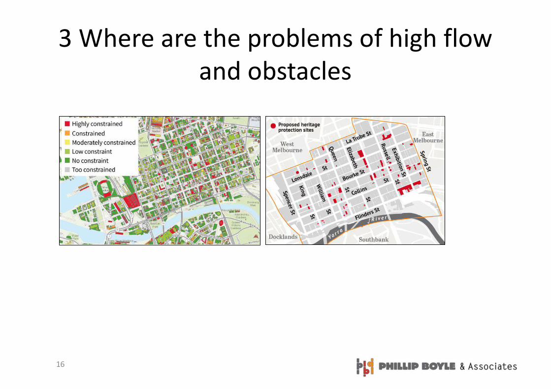
3 Where are the problems of high flow and obstacles
17
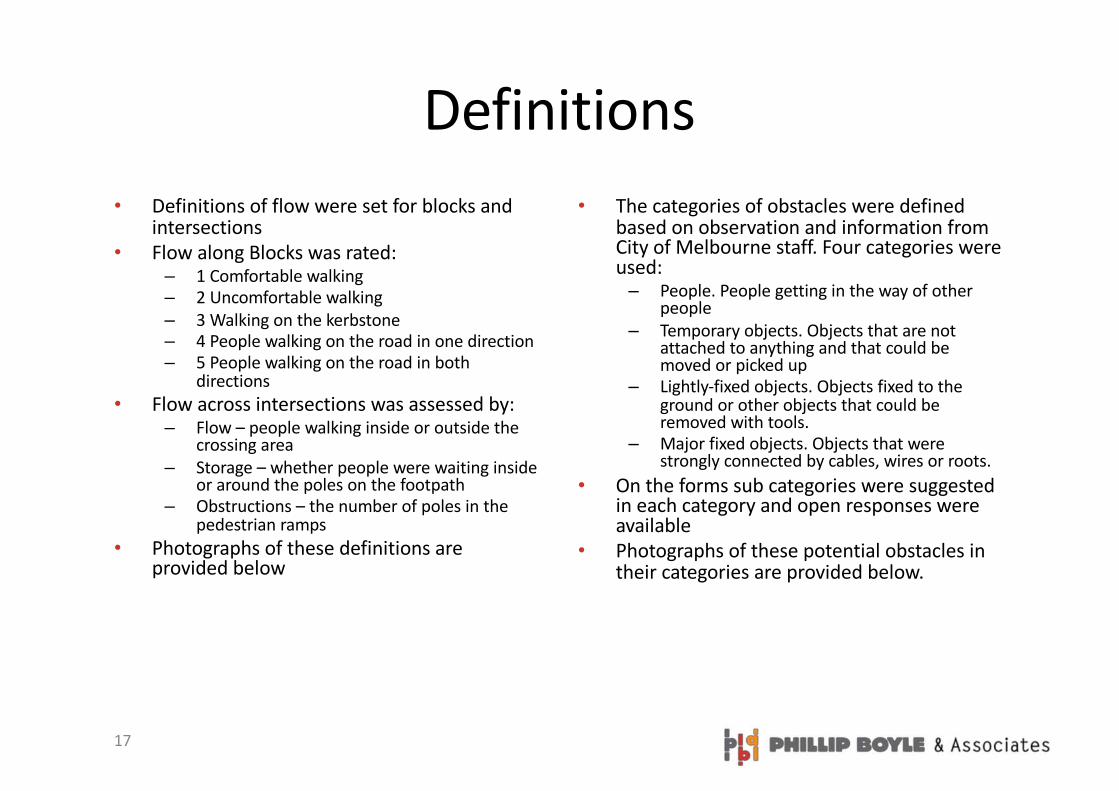
Definitions
• Definitions of flow were set for blocks and intersections
• Flow along Blocks was rated:– 1 Comfortable walking– 2 Uncomfortable walking
– 3 Walking on the kerbstone– 4 People walking on the road in one direction– 5 People walking on the road in both
directions
• Flow across intersections was assessed by:– Flow – people walking inside or outside the
crossing area
– Storage – whether people were waiting inside or around the poles on the footpath
– Obstructions – the number of poles in the pedestrian ramps
• Photographs of these definitions are provided below
• The categories of obstacles were defined based on observation and information from City of Melbourne staff. Four categories were used:– People. People getting in the way of other
people
– Temporary objects. Objects that are not attached to anything and that could be moved or picked up
– Lightly-fixed objects. Objects fixed to the ground or other objects that could be removed with tools.
– Major fixed objects. Objects that were strongly connected by cables, wires or roots.
• On the forms sub categories were suggested in each category and open responses were available
• Photographs of these potential obstacles in their categories are provided below.
18
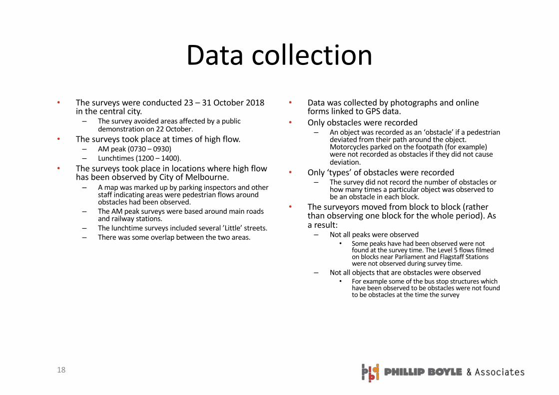
Data collection• The surveys were conducted 23 – 31 October 2018
in the central city. – The survey avoided areas affected by a public
demonstration on 22 October.• The surveys took place at times of high flow.
– AM peak (0730 – 0930) – Lunchtimes (1200 – 1400).
• The surveys took place in locations where high flow has been observed by City of Melbourne. – A map was marked up by parking inspectors and other
staff indicating areas were pedestrian flows around obstacles had been observed.
– The AM peak surveys were based around main roads and railway stations.
– The lunchtime surveys included several ’Little’ streets.– There was some overlap between the two areas.
• Data was collected by photographs and online forms linked to GPS data.
• Only obstacles were recorded– An object was recorded as an ‘obstacle’ if a pedestrian
deviated from their path around the object. Motorcycles parked on the footpath (for example) were not recorded as obstacles if they did not cause deviation.
• Only ‘types’ of obstacles were recorded– The survey did not record the number of obstacles or
how many times a particular object was observed to be an obstacle in each block.
• The surveyors moved from block to block (rather than observing one block for the whole period). As a result:– Not all peaks were observed
• Some peaks have had been observed were not found at the survey time. The Level 5 flows filmed on blocks near Parliament and Flagstaff Stations were not observed during survey time.
– Not all objects that are obstacles were observed• For example some of the bus stop structures which
have been observed to be obstacles were not found to be obstacles at the time the survey

19
CATEGORIES USED IN THE SURVEY

20
FLOW ALONG BLOCKS WAS RATED FROM 1 - 5
Measuring flow

21
1 Comfortable
walking –some
movement, plenty of
room

22
2 Uncomfortable
walking
23
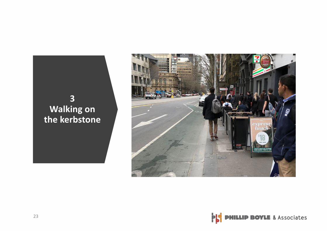
3 Walking on
the kerbstone

24
4 Walking on the road –one way

25
5 Walking on the road –
both directions

26
INTERSECTIONS WERE RATED FOROBSTRUCTIONS, STORAGE & FLOW
Measuring flow

27
Low flow: People are
walking inside the
crossing area

28
High flow: People are
walking outside the
crossing area

29
Unobstructed pedestrian
ramp:No pole in
ramp
30
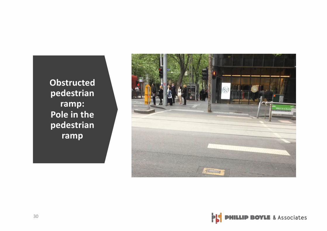
Obstructed pedestrian
ramp: Pole in the pedestrian
ramp

31
Low storage:No people
waiting outside poles
and other objects

32
High storage:People waiting
outside poles and other
objects

33
PEOPLE AS OBSTACLES

34
Walking area narrowed by people – collection money

35
Walking area narrowed by people collecting money
36
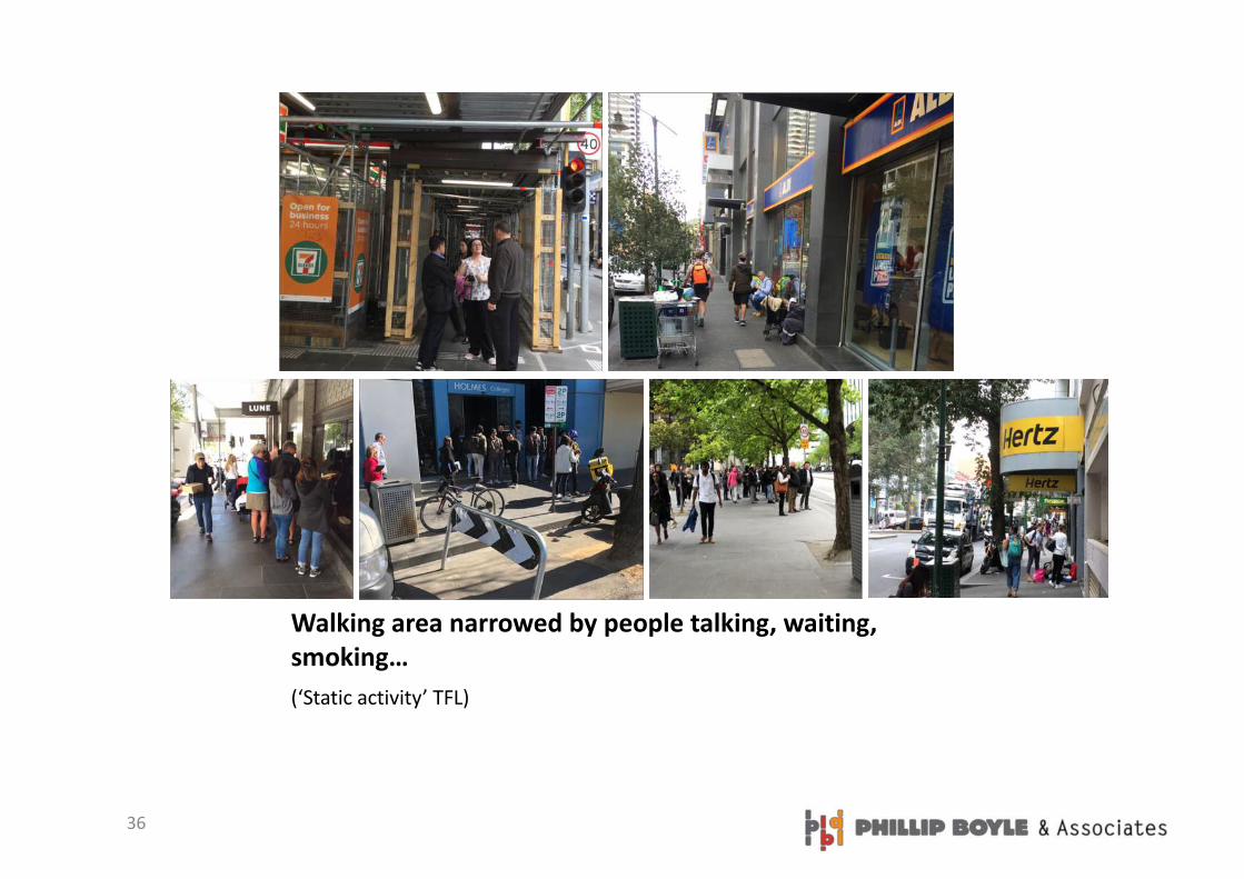
Walking area narrowed by people talking, waiting, smoking…(‘Static activity’ TFL)

37
Walking area narrowed by people wheeling things
38
TEMPORARY OBJECTS THAT ARE OBSTACLES
‘Can be picked up or moved immediately’

39
Walking area narrowed by loose rubbish
40
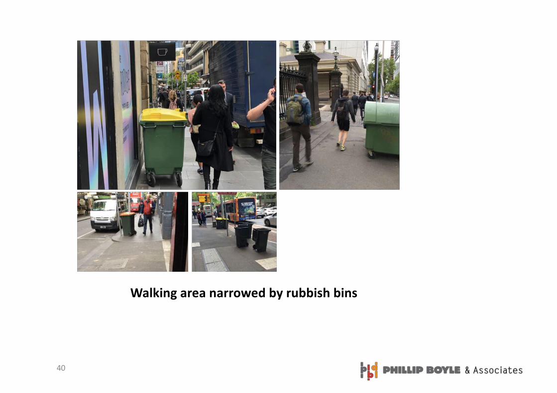
Walking area narrowed by rubbish bins

41
Walking area narrowed by tradingCafé screen (no café), Café chairs and table (no people), Café chairs and tables with people

42
Walking area narrowed by café tables

43
Walking area narrowed by A-boards

44
Walking area narrowed by messages to motorists

45
Walking area narrowed by risk alerts or water barriers
46
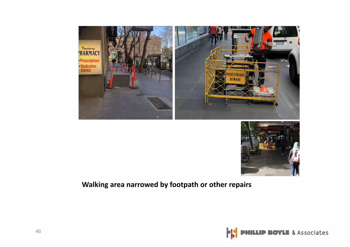
Walking area narrowed by footpath or other repairs

47
Walking area narrowed by freight
48
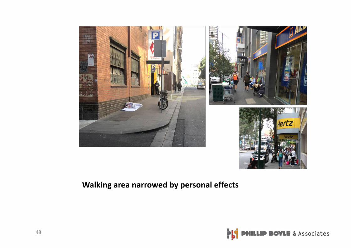
Walking area narrowed by personal effects

49
Walking area narrowed by parked motorbikes

50
Walking area narrowed by four-wheel vehicles
51
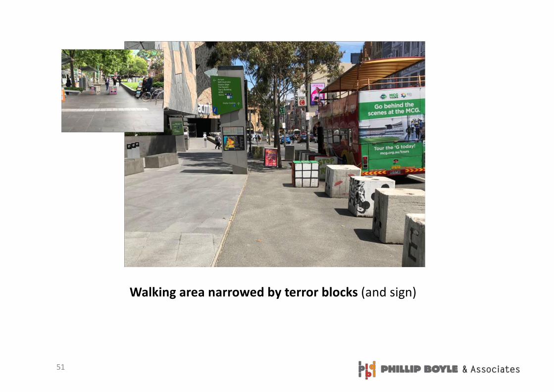
Walking area narrowed by terror blocks (and sign)
52
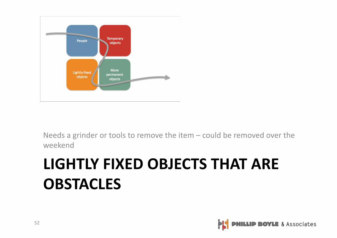
LIGHTLY FIXED OBJECTS THAT ARE OBSTACLES
Needs a grinder or tools to remove the item – could be removed over the weekend

53
Walking area narrowed by rubbish bins

54
Walking area narrowed by post box or telephone

55
Walking area narrowed by bus shelters
56
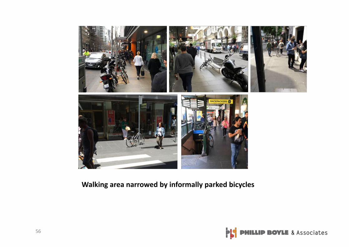
Walking area narrowed by informally parked bicycles
57
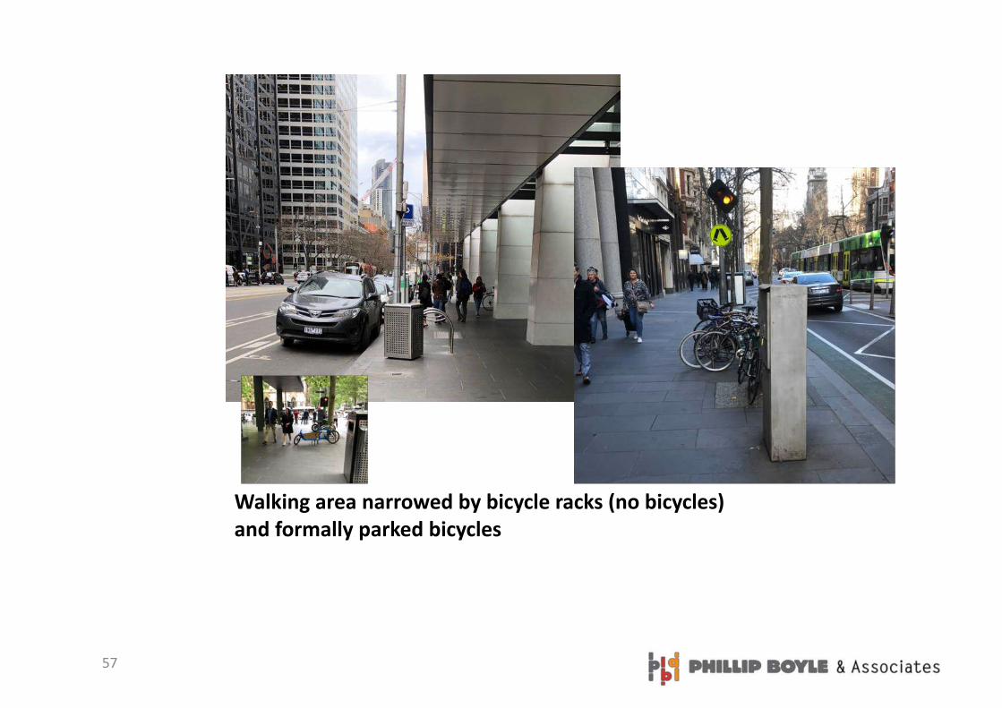
Walking area narrowed by bicycle racks (no bicycles) and formally parked bicycles

58
Walking area narrowed by signs

59
Walking area narrowed by bollards

60
Walking area narrowed by moveable planters

61
Walking area narrowed by poles

62
Walking area narrowed by kiosks (in use & disused)

63
Walking area narrowed by seats

64
MAJOR FIXED OBJECTS THAT ARE OBSTACLES
Difficult to move due to cables or roots – would take a month to move it
65
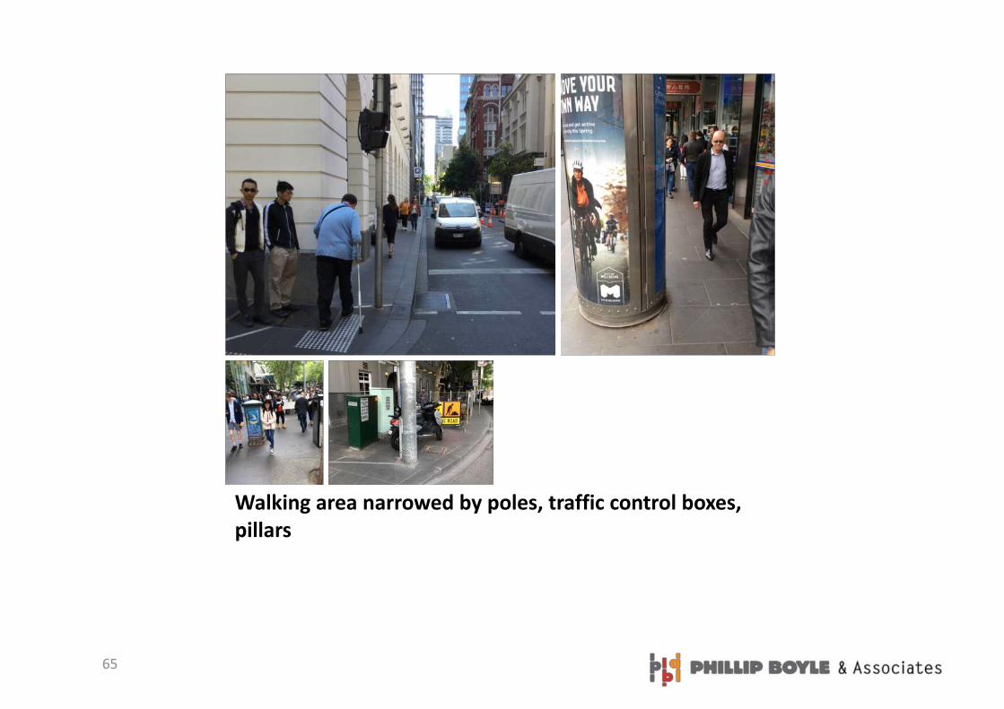
Walking area narrowed by poles, traffic control boxes, pillars

66
Walking area narrowed by Art

67
Walking area narrowed by trees
68
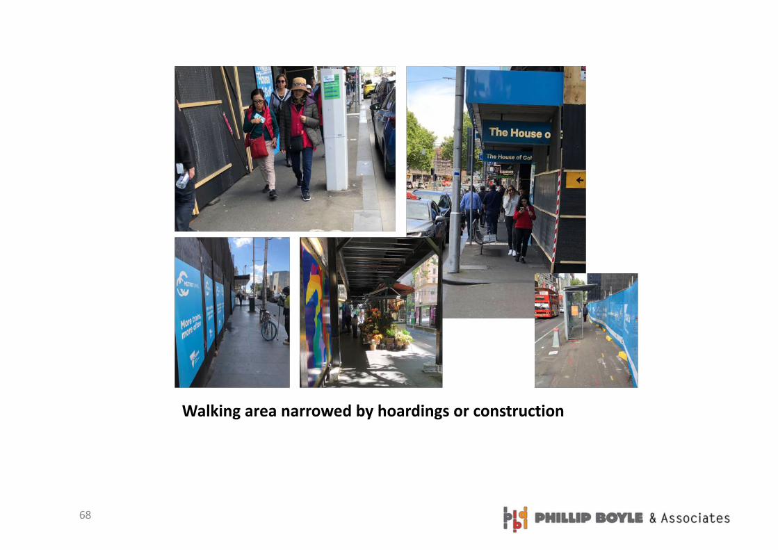
Walking area narrowed by hoardings or construction

69
OBSTACLES THAT WERE OBSERVED DURING THE SURVEY BUT NOT EVALUATED

70
Walking area narrowed by setbacks

71
Walking area narrowed by unnecessary fences

72
Walking area narrowed by vehicles across intersections

73
Obstacles in combination
• Truck parked in garage entrance• VMS board• Ute parked mostly on private land• Plastic bollard• Road work alert
• Motorcycle• Phone box• Rubbish bin• Bicycle• Poles

74
Walking area narrowed by lack of footpath


